Storm Tracker - Tygart Media

Category: Storm Tracker

  • Storm Updates: Upper Midwest Slight Risk, Texas Panhandle Hail and Wind Overnight — Friday, September 11, 2026 (Morning)

    This is a live Friday morning snapshot of local storm-type events across the United States as of the early hours of Friday, September 11, 2026. Overnight into this morning the organized severe pulse was limited and mostly High Plains–oriented. No convective watches are currently valid. The Storm Prediction Center has elevated a Slight Risk of severe thunderstorms for parts of the Upper Midwest later today, with a broader Marginal Risk covering the central Plains into the Mid-South, Tennessee Valley, Carolinas, and Virginia. The Weather Prediction Center holds a Slight Risk of excessive rainfall in far southern Arizona and northern Minnesota, with localized flash-flood potential still lingering from overnight activity in the Ohio Valley and central Appalachians.

    These remain county- and ZIP-scale thunderstorms, not a mainland hurricane landfall. Tropical Storm Norbert is active in the Eastern Pacific well offshore and poses no threat to U.S. land. Restoration exposure today centers on residual wind and hail damage from the Texas Panhandle overnight, lingering water in West Virginia and Ohio counties, and the new Slight Risk corridor from far northeast South Dakota into western and northern Minnesota this afternoon and evening. Conditions change fast. Verify with the National Weather Service for the specific county or ZIP before you roll.

    What is live this morning

    No severe thunderstorm or tornado watches are in effect as of the 1300 UTC Day 1 outlook. The most recent watch was Watch 665 from Wednesday evening. Overnight Local Storm Reports show a concentrated hail and wind event across the Texas Panhandle and nearby High Plains counties, with measured gusts to 87 mph near Colby, Kansas, and hail up to 2.25 inches near Lake Tanglewood in Randall County, Texas. Flash Flood Warnings and Flood Warnings were issued overnight for portions of eastern Arkansas, north-central West Virginia, southeastern Ohio, and the Virginia Eastern Shore; most of those products have expired or are in their final hours this morning.

    SPC’s 1300 UTC Day 1 Convective Outlook highlights a Slight Risk across parts of the Upper Midwest—primarily far northeast South Dakota into western and northern Minnesota—for large hail (isolated 2+ inches possible), damaging winds, and a couple of tornadoes late this afternoon into tonight. A broader Marginal Risk extends south into the central Plains and eastward across the Mid-South into the Tennessee Valley, Carolinas, and Virginia for more disorganized pulse-type storms capable of occasional damaging gusts.

    Hotspot 1 — Upper Midwest Slight Risk (northeast SD into western/northern MN)

    This is the primary organized severe corridor for today. A mid-level shortwave trough ejecting across the northern Plains will support a surface low and cold front. Moderate destabilization and 35–45 kt deep-layer shear favor initial supercells capable of large hail, with a transition to clusters and bowing segments producing damaging winds this evening. A low-end tornado threat exists if any cells remain discrete into the early evening when low-level shear increases. Confidence is higher in the far northeast SD–western MN axis than farther south into the central Plains, where initiation remains more conditional.

    Cities and counties to watch: Aberdeen and Watertown areas in South Dakota; St. Cloud, Willmar, Duluth, Superior, Hibbing, and the Minnesota Arrowhead. Restoration read: stage for hail and wind. Large hail can produce concentrated roof and vehicle damage; clustering storms raise the tree-and-wire risk after dark. Photograph in remaining daylight only if safe.

    Hotspot 2 — Texas Panhandle and High Plains overnight hits

    Thursday evening into early Friday produced the most significant Local Storm Reports of the overnight window. Hail reports included 2.25-inch stones near Lake Tanglewood (Randall County, TX), 2.00-inch at Timbercreek Canyon, and multiple 1.00–1.75-inch reports around Pantex and Lake Tanglewood. Wind reports included an 87 mph gust 1 SE of Colby (Thomas County, KS), 67 mph near Pantex, 65 mph near Plainview (Hale County, TX) with snapped power poles and overturned vehicles, and additional 60–62 mph gusts across the Texas South Plains. Construction trailers and fences were damaged in the Plainview area.

    Restoration read: this is already a just-hit desk. Hail-damaged roofs and vehicles in Randall, Carson, and Hale counties, plus wind-driven tree and pole work around Colby and Plainview, will generate same-day claims. Coordinate with local emergency management for access if power poles are down.

    Hotspot 3 — Residual flood pulse (Ohio Valley, central Appalachians, eastern Arkansas)

    WPC’s Day 1 Excessive Rainfall Outlook carries a Slight Risk for far southern Arizona (Santa Cruz County area) and northern Minnesota. Overnight, Flash Flood Warnings were active across Randolph County, Arkansas; multiple north-central West Virginia counties (Braxton, Gilmer, Upshur, Lewis, Roane, Calhoun, Ritchie, Wirt, Jackson, Wood); southeastern Ohio (Gallia, Jackson, Meigs, Vinton); and southern Accomack County, Virginia. Several of those products noted observed flooding, including impassable sections of US 33 near Glenville, West Virginia, and residual high water into Friday morning.

    Restoration read: water extraction and drying are already on the books in the warned West Virginia and Ohio counties. Northern Minnesota joins the slight-risk language later today as the same system that supports the severe threat also produces 1–2 inch (locally 3 inch) rainfall amounts with rates approaching 1.5 inches per hour. Southern Arizona remains a monsoon-style flash-flood pocket.

    Just hit

    Wednesday’s Ohio–Pennsylvania–western New York Slight Risk and Watch 665 produced residual tree and wind damage that carried into Thursday. Thursday’s Marginal Risk corridor from the southern Plains to the Mid-Atlantic generated the Texas Panhandle hail/wind event detailed above and scattered overnight flood warnings. Iowa river flooding from earlier in the week continues to recede in places. No new U.S. mainland tropical cyclone is present; Tropical Storm Norbert remains well out in the Eastern Pacific.

    Pulse table

    RegionMain threatsSPC / NWS / WPC levelStatus this morning
    NE SD / western & northern MNLarge hail (2+” possible), damaging wind, couple tornadoesSPC SlightLate afternoon–tonight
    TX Panhandle / High PlainsHail to 2.25″, 60–87 mph gusts, pole/vehicle damageOvernight LSRsJust-hit / recovery
    Central WV / SE OH / E ARFlash flooding, residual high waterExpired/expiring FFWs + Flood WarningsAftermath / still draining
    Far southern AZFlash flood ratesWPC SlightAfternoon cells
    Mid-South / TN Valley / Carolinas / VAOccasional damaging gusts, pulse stormsSPC MarginalAfternoon–evening
    Atlantic / Gulf vs. U.S. mainlandNo landfalling tropical cycloneQuiet on the mainland coastQuiet

    What this means for restoration teams

    Overnight hail and wind in the Texas Panhandle is already producing roof, vehicle, and pole claims. Residual flash flooding in West Virginia and southeastern Ohio is extraction-and-dry work with a 24–48 hour mold clock on any wet drywall. Today’s new Slight Risk in the Upper Midwest is a classic late-afternoon to evening supercell-to-cluster transition: large hail first, then damaging wind as storms grow upscale. Stage tarps, generators, and tree crews for the Minnesota corridor before the evening transition. Property owners should photograph damage in daylight if it is safe, call the carrier, and start extraction the same night if water is inside.

    What this is not

    This is not a regional derecho and not a U.S. mainland hurricane landfall. The work today, if it verifies, will be scattered: a hail swath through a Minnesota or South Dakota county, residual high water in a West Virginia hollow, or a wind-damaged construction site in the Texas South Plains. That is the local-storm pattern this desk should staff.

    Looking ahead

    Saturday the convective outlook drops to Marginal. Critical fire-weather conditions are also noted by SPC for today over parts of the West. Watch the next Storm Tracker update rather than assuming the Upper Midwest Slight Risk is the last line of the week.

    Sources and how to verify

    Primary sources: NOAA Storm Prediction Center Day 1 Convective Outlook issued 1226Z Friday, September 11, 2026; SPC Local Storm Reports for the 10 September period; Weather Prediction Center Day 1 Excessive Rainfall Outlook updated 0832Z; National Weather Service warning text for Amarillo, Lubbock, Charleston WV, Little Rock, Wakefield, and neighboring offices. No active convective watches as of 1205Z.

    Check weather.gov for the county warning, spc.noaa.gov for the outlook and LSRs, and WPC excessive rainfall for the flood overlay. Prior desk: Thursday afternoon Storm Updates.

    Informational only — not an official weather warning. Follow local authorities and the National Weather Service. Turn around, don’t drown.
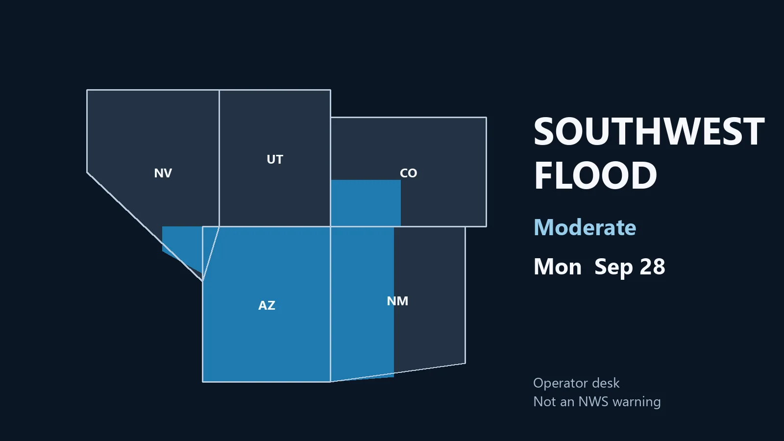

  • Storm Updates: Southern Plains to Mid-Atlantic Marginal Risk, Ohio Valley Flood Pulse — Thursday, September 10, 2026

    This is a live Thursday afternoon snapshot of local storm-type events across the United States as of the afternoon of Thursday, September 10, 2026. The organized severe corridor has broadened and weakened relative to Wednesday’s Slight Risk and Watch 665. The Storm Prediction Center holds a Marginal Risk of severe thunderstorms from the southern High Plains to the southern Mid-Atlantic coast, valid through early Friday morning. The Weather Prediction Center maintains a Slight Risk of excessive rainfall over the upper Ohio Valley into the central Appalachians, with Marginal flood risk farther west and southwest.

    These remain county- and ZIP-scale thunderstorms, not a mainland hurricane landfall. Restoration exposure this afternoon and evening is primarily sporadic damaging wind (roof, siding, trees on service drops), isolated large hail on the High Plains, and flash-flood water where cells train over the Ohio Valley–Appalachians corridor. Conditions change fast. Verify with the National Weather Service for the specific county or ZIP before you roll.

    What is live this afternoon

    No convective watches are currently valid. The most recent watch (Severe Thunderstorm Watch 665) expired overnight. SPC’s 2000 UTC Day 1 outlook (issued 2:40 p.m. CDT) highlights sporadic damaging wind gusts from the southern Plains to the southern Mid-Atlantic this afternoon and evening, plus isolated large hail over south-central Colorado into northeast New Mexico and possibly the Oklahoma and Texas Panhandles. Mesoscale Discussion 2279 (issued ~2:15 p.m. CDT) covers northeast Arkansas into parts of Tennessee and Kentucky: widely scattered storms capable of locally damaging winds, watch unlikely.

    WPC’s Day 1 Excessive Rainfall Outlook (updated 1554 UTC) keeps a Slight Risk over the upper Ohio Valley into the central Appalachians—eastern Kentucky and West Virginia remain the core area of highest QPF and training potential. Marginal Risk areas cover parts of the Mid-Atlantic, south-central Plains/Mid-Mississippi Valley, and the Southwest (Arizona–New Mexico into southern California higher terrain).

    Hotspot 1 — Northeast Arkansas into Kentucky and Tennessee

    MD 2279 flags the live severe potential. Storms developing along and south of a surface boundary in a hot, humid air mass (upper 80s to mid-90s, PWAT near 2 inches, MLCAPE over 1,500 J/kg). Mid-level flow of 25–30 kt may support a few organized multicell clusters. Primary hazard is locally damaging wind gusts (most probable peak 55–70 mph). Coverage of severe is expected to stay limited; no watch is anticipated.

    Cities and counties to watch: Jonesboro and northeast Arkansas counties; western and central Kentucky (including areas near the Ohio River); western and middle Tennessee.

    Restoration read: Wind first—stage tarps, generators, and tree crews for late afternoon into evening. If a cell trains or produces heavy rain on the WPC slight-risk overlay, treat the same ZIP as a water job by morning.

    Hotspot 2 — Upper Ohio Valley and central Appalachians (flood)

    WPC Slight Risk of excessive rainfall centers on eastern Kentucky and West Virginia, with a minor eastward expansion into east-central West Virginia on the latest update. Anomalous precipitable water (near 99th percentile), MUCAPE >1,000 J/kg, and potential for training along a front parallel to the mid-level flow support 2–3 inch per hour rates. Soils have been drier of late, but 1-hour flash-flood guidance around 2 inches still leaves room for scattered flash flooding on urban streets, small streams, and low-lying areas.

    Some storms are expected to spill east across northern Virginia, northern Maryland, and the Mid-Atlantic I-95 corridor this evening—progressive but still moisture-laden.

    Restoration read: Water is the ticket tonight if cells train. Extraction and drying clocks start the same night water enters a structure. Photograph damage in remaining daylight only if safe.

    Hotspot 3 — Southern High Plains and residual Kansas–Missouri wind damage

    Isolated large hail remains possible over the Raton Mesa vicinity (south-central Colorado into northeast New Mexico) and portions of the Oklahoma/Texas Panhandles under the Marginal Risk. Farther east, residual tree and wire damage from Wednesday evening’s line across parts of Kansas, Missouri, Ohio, and Pennsylvania is already on the books. Local Storm Reports from the overnight period include multiple 60–70+ mph gusts and tree/wire damage across southeast Kansas into west-central Missouri and scattered Ohio counties.

    Restoration read: High Plains is today’s new hail/wind cells; Kansas–Missouri–Ohio is yesterday’s wind swath still generating claims. Do not send the same crew to both stories without checking which county actually has active warnings now.

    Just hit

    Wednesday’s Severe Thunderstorm Watch 665 (northern Ohio, northwest Pennsylvania, western New York) produced multiple wind reports—trees and utility lines down across Erie, Stark, Coshocton, and neighboring counties, plus scattered Kansas and Missouri damage. Those are already tickets. Today’s new work, if it verifies, is the AR–KY–TN wind corridor plus localized flash flooding under the WPC Slight Risk.

    Pulse table

    RegionMain threatsSPC / NWS levelStatus this afternoon
    NE AR / KY / TNDamaging wind, lightningMarginal + MD 2279Live cells, watch unlikely
    Upper OH Valley / central AppalachiansFlash flood, training heavy rainWPC Slight excessive rainfallTonight into Friday morning
    Southern High Plains / Raton MesaIsolated large hail, gusty windMarginalAfternoon–evening cells
    KS / MO / OH residualTree/wire damage from WednesdayAftermathClaims already open
    Mid-Atlantic spilloverHeavy rain, localized floodWPC MarginalEvening progressive storms
    Atlantic / Gulf vs. U.S. mainlandNo landfalling hurricaneQuiet on the mainland coastQuiet

    What this means for restoration teams

    Marginal-risk wind is still roof, siding, gutter, and tree-on-structure work when a cell organizes. Hail on the High Plains is vehicle and roof dents. The Ohio Valley–Appalachians flood risk is wet drywall and a 24–48 hour mold clock if water enters. Residual Wednesday damage is already generating calls across the Ohio–Pennsylvania corridor and the Kansas–Missouri line.

    For teams near the MD 2279 area or the WPC Slight Risk: stage before the densest afternoon heating, not after the first warning. Property owners should photograph damage in daylight if safe, call the carrier, and start extraction the same night if water is inside.

    What this is not

    This is not a regional derecho and not a U.S. mainland hurricane landfall. The work this afternoon and evening, if it comes, will be scattered: a wind swath through an Arkansas or Kentucky county, a flooded intersection where eastern Kentucky or West Virginia cells train, leftover tree damage from Wednesday’s Ohio–PA activity. That is the local-storm pattern this desk should staff.

    Looking ahead

    Friday (Day 2) the SPC has a Slight Risk of severe thunderstorms from central Nebraska into the Upper Midwest late afternoon into Friday night—damaging wind, large hail, and a couple of tornadoes possible as an upper shortwave and surface front organize. Later in the period a Marginal Risk appears on Day 3. Watch the next Storm Tracker update rather than assuming today’s Marginal is the last line of the week.

    Sources and how to verify

    Primary sources: NOAA Storm Prediction Center Day 1 Convective Outlook (2000 UTC, September 10, 2026) and Mesoscale Discussion 2279; Weather Prediction Center Day 1 Excessive Rainfall Outlook (updated 1554 UTC); SPC Local Storm Reports for the overnight and early-day period; National Weather Service warning text. Related desk: Thursday morning Storm Updates and Wednesday afternoon Storm Updates.

    Check weather.gov for the county warning, spc.noaa.gov for the outlook, watches, MDs, and LSRs, and WPC excessive rainfall for the flood overlay.

    Informational only — not an official weather warning. Follow local authorities and the National Weather Service. Turn around, don’t drown.

  • Storm Updates: Southern Plains to Mid-Atlantic Marginal Risk, Kansas–Missouri Flood Pulse — Thursday, September 10, 2026 (Morning)

    This is a live Thursday morning snapshot of local storm-type events across the United States as of the early hours of Thursday, September 10, 2026. Overnight the organized severe pulse from Wednesday’s Slight Risk and Severe Thunderstorm Watch 665 across northern Ohio, northwest Pennsylvania, and western New York has largely expired. The Storm Prediction Center’s Day 1 outlook has settled into a broad Marginal Risk of severe thunderstorms stretching from the southern High Plains to the southern Mid-Atlantic coast. The primary threat language is sporadic damaging wind gusts this afternoon and evening, with isolated large hail possible over south-central Colorado into northeast New Mexico and the Oklahoma–Texas Panhandles.

    These remain county- and ZIP-scale thunderstorms. No named tropical cyclone currently threatens U.S. land. Restoration exposure today is residual wind and tree work from last night’s Ohio–Pennsylvania corridor, plus fresh flood and wind potential where the cold front and residual moisture continue to fire cells from the southern Plains eastward. Conditions change fast. Verify with the National Weather Service for the specific county or ZIP before you roll.

    What is live this morning

    No convective watches are currently valid. Watch 665, the last active severe thunderstorm watch covering the Upper Ohio Valley and Lake Erie counties, has expired. SPC’s 1300 UTC Day 1 Convective Outlook places a Marginal Risk across a long corridor from the southern High Plains through the lower Mississippi Valley and into the Mid-Atlantic. Strong daytime heating is expected south of residual cloud and overnight storms, with temperatures into the 90s to near 100°F over the southern Plains and upper 80s to mid-90s farther east. That buoyancy, coupled with the residual cold front and outflow boundaries, supports thunderstorms that can produce isolated severe gusts.

    The Weather Prediction Center’s updated Day 1 Excessive Rainfall Outlook (valid 12Z Thursday–12Z Friday) carries a Slight Risk of rainfall exceeding flash-flood guidance over a focused area from roughly southeast Ohio into central Kentucky and adjacent portions of West Virginia and Indiana. Broader Marginal Risk areas cover parts of the southern Plains, the lower Ohio Valley into the Mid-Atlantic, the Southwest monsoon corridor, and a pocket in the Gulf coastal states.

    Hotspot 1 — Residual Ohio–Pennsylvania–western New York wind corridor

    Wednesday evening’s Slight Risk and Watch 665 produced a series of severe thunderstorm warnings and local storm reports of tree and power-line damage across northern and central Ohio, northwest Pennsylvania, and adjacent counties. Preliminary LSRs include tree and utility damage near Huron and Hartville, Ohio; Edinboro, Pennsylvania; and Chester, West Virginia, among others. The organized severe threat has moved on, but the restoration desk for those counties is still active: downed trees, service drops, and isolated roof or siding work from 50–70 mph gusts.

    Cities and counties still in the aftermath window: Cleveland, Akron, Canton, Mansfield, and surrounding northern Ohio counties; Erie, Crawford, and northwest Pennsylvania; the northern West Virginia panhandle. Stage remaining tree and tarp crews for daylight surveys and carrier documentation.

    Hotspot 2 — Southeast Kansas into south-central Missouri flood pulse

    Overnight and early this morning, training storms along and south of the cold front have produced locally heavy rainfall across southeast Kansas into portions of western and central Missouri. National Weather Service offices have issued Flood Warnings and Advisories for Allen, Labette, and Montgomery Counties in Kansas (into midday) and adjacent Missouri counties. Radar-estimated amounts of 1–4 inches, with rates of 1–3 inches per hour in stronger cores, have already produced flooding of low-lying roads, creeks, and poor-drainage areas. WPC’s Slight Risk of excessive rainfall for the day is focused farther east into the Ohio Valley, but the Kansas–Missouri corridor remains the live water desk this morning.

    Restoration read: extraction and drying work where water entered structures overnight. Photograph damage in daylight, document water lines, and treat any interior water as a same-day priority before the mold clock advances.

    Hotspot 3 — Southern Plains to Mid-Atlantic Marginal Risk this afternoon–evening

    SPC expects the Marginal Risk corridor to re-fire with daytime heating. The primary hazard is sporadic damaging wind gusts from multicell clusters and short line segments along the residual front and outflow boundaries. Isolated large hail is possible over the higher terrain of south-central Colorado into northeast New Mexico and the Panhandles. Vertical shear is modest overall but sufficient for organized bowing segments farther east where buoyancy is lower but mid-level flow is stronger.

    Key population centers under the Marginal Risk umbrella include parts of the Dallas–Fort Worth metroplex, Memphis, Nashville, and the Washington, D.C., corridor, though the risk is scattered rather than continuous. Local Severe Thunderstorm Warnings and Special Weather Statements are the expected mode of action rather than new watches.

    Just hit — overnight LSRs

    Preliminary Local Storm Reports from the 1200 UTC September 9 – 1159 UTC September 10 window include:

    • 1.75-inch hail 8 SE of Colorado City, Huerfano County, Colorado (0600 UTC).
    • Wind gusts of 72 mph near Booker, Lipscomb County, Texas; 70 mph SSE of Mayfield, Sumner County, Kansas; 73 mph near Patagonia, Arizona; and multiple 58–78 mph readings in the Arizona–New Mexico border country and western Kansas overnight.
    • Numerous tree, limb, and power-line damage reports across northern and central Ohio, northwest Pennsylvania, western West Virginia, and a long swath of eastern Kansas into western Missouri (Baldwin City, Wellington, Clinton, Holden, and surrounding towns).

    No tornado reports were received in the preliminary data for this period. All reports remain preliminary and subject to verification.

    Pulse table

    RegionMain threatsSPC / NWS / WPC levelStatus this morning
    Northern OH / NW PA / western NYResidual wind / tree / power damageWatch 665 expiredAftermath / just-hit
    SE Kansas / south-central MissouriFlash flood, training heavy rainFlood Warnings / Advisories activeLive water desk
    Southern Plains to Mid-AtlanticDamaging wind, isolated hailSPC Marginal RiskAfternoon–evening re-fire
    SE Colorado / NE New Mexico / PanhandlesIsolated large hail, strong windSPC Marginal (hail-focused)Afternoon terrain storms
    Ohio Valley / central KY (WPC)Excessive rainfall / flash floodWPC Slight RiskDay 1 outlook
    Atlantic / Gulf vs. U.S. mainlandNo landfalling tropical cycloneQuietQuiet

    What this means for restoration teams

    Wind damage from Wednesday night is already on the books in the Ohio–Pennsylvania corridor—tree removal, roof tarps, and service restoration. Kansas–Missouri flood work is the fresh ticket this morning: extract standing water, document, and start drying before temperatures climb. This afternoon’s Marginal Risk is scattered; the expected mode is isolated warnings rather than a continuous line. Stage for wind and isolated hail in the southern Plains and for additional water if cells train over already-wet ground in the Ohio Valley.

    Property owners in just-hit counties should photograph damage in remaining daylight if safe, contact the carrier, and begin extraction the same day if water is inside. Teams working the Kansas–Missouri flood pulse should treat every interior water job as time-sensitive.

    What this is not

    This is not a regional derecho and not a U.S. mainland hurricane landfall. National Hurricane Center products show no tropical cyclones in the Atlantic basin threatening U.S. land; Tropical Storms Lowell and Norbert remain well offshore in the Pacific. The work today is local: residual wind swaths from Wednesday night, flash-flood pockets in southeast Kansas and western Missouri, and scattered severe gusts under a broad Marginal Risk this afternoon and evening.

    Looking ahead

    SPC’s Day 2 outlook already carries a Slight Risk of severe thunderstorms for portions of Nebraska into the Upper Midwest on Friday. The cold front will continue to shift east and south, keeping a wet and occasionally strong storm pattern across the Ohio Valley and Mid-Atlantic into the weekend. Watch the next Storm Tracker update rather than assuming today’s Marginal Risk is the end of the corridor.

    Sources and how to verify

    Primary sources: NOAA Storm Prediction Center Day 1 Convective Outlook issued 1300 UTC Thursday, September 10, 2026; SPC Local Storm Reports for the 1200 UTC September 9–1159 UTC September 10 period; SPC Current Watches page (no watches valid as of early Thursday); Weather Prediction Center Day 1 Excessive Rainfall Outlook and 94e points text; National Weather Service warning and flood-statement text from Wichita, Springfield, and neighboring offices; National Hurricane Center tropical weather outlooks confirming no Atlantic threats to U.S. land.

    Check weather.gov for the county warning, spc.noaa.gov for the outlook, watches, and LSRs, and WPC excessive rainfall for the flood overlay. Prior desk: Wednesday, September 9 storm updates — Ohio–Pennsylvania–western New York Slight Risk.

    Informational only — not an official weather warning. Follow local authorities and the National Weather Service. Turn around, don’t drown.

  • Storm Updates: Ohio–Pennsylvania–Western New York Slight Risk, Kansas–Missouri Flood Pulse — Wednesday, September 9, 2026

    This is a live Wednesday snapshot of local storm-type events across the United States as of the afternoon of Wednesday, September 9, 2026. The organized pulse is east of yesterday’s Iowa–Nebraska corridor. A Storm Prediction Center Slight Risk of severe thunderstorms covers central Ohio into northwest Pennsylvania and western New York, and Severe Thunderstorm Watch 665 is in effect until 11:00 p.m. EDT. Farther west, the Weather Prediction Center holds a Slight Risk of excessive rainfall from southeast Kansas into south-central Missouri, with smaller flood-risk pockets in southeast Colorado and the Arizona–New Mexico border country.

    These are county- and ZIP-scale thunderstorms, not a mainland hurricane landfall. Restoration exposure tonight is wind-driven roof and siding work, trees on service drops, isolated hail, and interior water where cells train. Conditions change fast. Verify with the National Weather Service for the specific county or ZIP before you roll.

    What is live this afternoon

    Watch 665 covers western New York, northern Ohio, northwest Pennsylvania, the northern panhandle of West Virginia, and adjacent Lake Erie waters. Primary threat language is scattered damaging wind gusts to about 65 mph. SPC and NWS discussion also leaves room for a brief tornado, especially if a storm anchors on the surface boundary near the Ohio–Pennsylvania–New York border. Hail is secondary.

    A cold front still stretches on the order of a thousand miles from the Central Plains through the Great Lakes toward western New York. That is the same family of storms that wet Iowa and eastern Nebraska on Tuesday. Today the better-organized severe corridor is the eastern Great Lakes. Isolated strong-to-severe cells remain possible from the central Plains into the Ohio Valley, with a more disorganized, outflow-dominant mode west of the watch.

    Hotspot 1 — Northern Ohio, northwest Pennsylvania, western New York

    This is the live watch. Storms are expected to increase through late afternoon and evening in a warm, humid boundary layer with enough shear for organized multicells, short line segments, and transient supercells. Mesoscale discussion language from mid-afternoon: a few damaging gusts over the next few hours, brief tornado not ruled out.

    Cities and counties to watch: Cleveland, Akron, Canton, Parma, Mansfield, Lorain and Medina counties in Ohio; Erie, Crawford, Warren, Mercer, and neighboring northwest Pennsylvania counties; Chautauqua, Cattaraugus, and Allegany in western New York; the northern West Virginia panhandle.

    Restoration read: wind first. Stage tarps, generators, and tree crews before dark. If a cell trains or a warning includes heavy rain, treat the same ZIP as a water job by morning. Photograph roofs in remaining daylight only if it is safe.

    Hotspot 2 — Southeast Kansas into south-central Missouri, plus leftover Iowa water

    WPC’s Day 1 excessive-rainfall outlook keeps a Slight Risk from southeast Kansas into south-central Missouri. Guidance still supports training west-to-east overnight and 1-inch-per-hour rates in the better cores. Urban streets, low water crossings, and small streams are the first failures. A smaller slight-risk pocket sits over southeast Colorado early Thursday. Southeast Arizona into far southwest New Mexico stays in the same excessive-rainfall slight-risk language on monsoon-style cells.

    Iowa is not the new Slight Risk today, but it is still a just-hit desk. Flood warnings remain on pieces of the Des Moines system, including the Raccoon River at Des Moines and Walnut Creek. Tuesday’s rain is still in the channel. That is extraction and drying work already on the books, not a new watch.

    Restoration read: Kansas–Missouri is tonight’s flood ticket if cells stall. Iowa is yesterday’s water still moving through town. Do not send the same crew to both stories without checking which county actually has a warning now.

    Hotspot 3 — Central Plains and Southwest scatter

    Widely scattered slow-moving storms over hot, humid air in parts of Texas, Oklahoma, and Kansas can still throw damaging gusts even when they stay below watch criteria. Local Severe Thunderstorm Warnings and Special Weather Statements have already fired in the Texas Panhandle and other High Plains counties this afternoon. Southern Arizona and New Mexico higher terrain can produce heavy rain and strong outflow on the same moisture axis as the WPC slight risk.

    Southwest Florida holds a marginal heavy-rain pocket in tropical moisture. That is a local urban-flood and lightning desk, not the national headline.

    Just hit

    Tuesday’s Iowa–Nebraska Slight Risk and the Kauai flood-and-outage work after Hurricane Lowell are yesterday’s tickets. Lowell continues to move away from the islands; there is no new U.S. mainland tropical landfall in the current National Hurricane Center outlook. Today’s new work, if it verifies, is the Ohio–Erie–western New York wind corridor plus localized flash flooding in the Kansas–Missouri slight-risk area.

    Pulse table

    RegionMain threatsSPC / NWS levelStatus this afternoon
    Northern OH / NW PA / western NYDamaging wind, lightning, brief tornado possibleSlight + Watch 665 to 11 p.m. EDTLive watch
    SE Kansas / south-central MissouriFlash flood, training heavy rainWPC Slight excessive rainfallTonight into Thursday morning
    Des Moines / central Iowa riversMinor river flooding from Tuesday rainFlood warningsAftermath / still in channel
    TX / OK / KS scatter + High PlainsGusty damaging wind, isolated warningsLocal SVR / SPSScattered
    SE AZ / SW NM / SE ColoradoHeavy rain, strong outflowWPC Slight (local)Afternoon–overnight cells
    Atlantic / Gulf vs. U.S. mainlandNo landfalling hurricaneQuiet on the mainland coastQuiet

    What this means for restoration teams

    Wind at 58–65 mph is roof, siding, gutter, and tree-on-structure work. A brief tornado, if one occurs, is a narrow swath — staff it as a local damage survey, not a regional event. Heavy rain on the Kansas–Missouri slight risk is wet drywall and a 24–48 hour mold clock. Iowa water is already inside some buildings from Tuesday.

    For teams in or near Watch 665: stage before 5 p.m. local, not after the first warning. Property owners should photograph damage in daylight if it is safe, call the carrier, and start extraction the same night if water is inside.

    What this is not

    This is not a regional derecho and not a U.S. mainland hurricane landfall. The work tonight, if it comes, will be scattered: a wind swath through an Ohio or Pennsylvania county, a flooded intersection where Kansas or Missouri cells train, leftover river water in Des Moines. That is the local-storm pattern this desk should staff.

    Looking ahead

    Thursday the front slides toward the Mid-Atlantic, central Appalachians, and Ohio Valley with more wet weather and a continued flood watch in some of the same counties that take storms tonight. Later in the week, SPC language still flags another slight-risk window over parts of the Upper Mississippi Valley. Watch the next Storm Tracker update rather than assuming Watch 665 is the last line of the week.

    Sources and how to verify

    Primary sources: NOAA Storm Prediction Center Day 1 Convective Outlook and Severe Thunderstorm Watch 665 for Wednesday, September 9, 2026; SPC Mesoscale Discussion covering northern Ohio into northwest Pennsylvania and far western New York; Weather Prediction Center Day 1 Excessive Rainfall Outlook; National Weather Service warning and flood-statement text for Cleveland, State College, Buffalo, Des Moines, Amarillo, and neighboring offices.

    Check weather.gov for the county warning, spc.noaa.gov for the outlook, watch, and LSRs, and WPC excessive rainfall for the flood overlay. Related desk: Tuesday, September 8 storm updates.

    Informational only — not an official weather warning. Follow local authorities and the National Weather Service. Turn around, don’t drown.

  • Storm Updates: Iowa–Nebraska Slight Risk, Kauai Flood Aftermath, Heat-Plus-Wind Cells — Tuesday, September 8, 2026

    This is a live Tuesday snapshot of local storm-type events across the United States as of the afternoon of Tuesday, September 8, 2026. The mainland pulse is convective: a Storm Prediction Center Slight Risk of severe thunderstorms from southeast Nebraska across parts of Iowa, mainly damaging wind, plus scattered high-based wind cells on the High Plains. The tropical story is not a U.S. Gulf or Atlantic landfall. It is residual water and outage work on Kauai after Hurricane Lowell passed west of the islands.

    These are the events that generate the restoration work crews actually see: wind-driven roof and siding failures, isolated hail, downed trees on service lines, interior flooding from stalling cells, and — in Hawaii — wind plus flash-flood cleanup after a close hurricane pass. Conditions change fast. Verify with the National Weather Service for the specific county or ZIP before you roll.

    What is live this afternoon

    The SPC Day 1 convective outlook holds a Slight Risk of severe thunderstorms this afternoon and evening from southeast Nebraska across parts of Iowa, including the Omaha–Council Bluffs–Des Moines corridor toward Ames and Waterloo. The headline threat is severe wind gusts. Isolated large hail and a low-end tornado chance remain in the language. A broader Marginal Risk covers parts of the upper Midwest and central Plains. High-based storms over eastern Colorado into western and central Kansas can also produce gusty, occasionally damaging wind.

    Heat is part of the same setup. Heat Advisories cover portions of southeastern Nebraska and southwestern Iowa, with heat-index values near or above 100–108°F. That matters for crew stamina and for how fast wet interiors go to mold if extraction waits overnight.

    No widespread convective watches were in effect at this writing. Expect local Severe Thunderstorm Warnings and Special Weather Statements if cells organize along the front after mid-afternoon.

    Hotspot 1 — Iowa and eastern Nebraska

    A baroclinic zone from southern Nebraska into central Iowa is the focus. Differential heating sharpens it through the day. Storms are expected to initiate along or just north of that boundary late afternoon into evening, with enough shear for supercell and then bowing structures. Damaging wind is the primary restoration exposure. Weak mid-level lapse rates should limit the hail problem compared with a classic Plains supercell day, but quarter-size hail is still in local Hazardous Weather Outlooks.

    NWS offices in the corridor are also flagging locally heavy rain and flash-flood potential tonight where storms train. That is interior water on the same streets that take the wind.

    Cities and counties to watch: Omaha, Council Bluffs, Lincoln fringe, Des Moines, Ames, Waterloo, and counties along and south of I-80 in eastern Nebraska and western/central Iowa.

    Restoration read: wind first — roofs, siding, trees, service drops — then water in the same ZIP if the line slows. Stage dehumidifiers and tarps before the front, not after the first LSR.

    Hotspot 2 — Hawaii: Hurricane Lowell aftermath on Kauai and Niihau

    Hurricane Lowell passed just west of Kauai and Niihau overnight into this morning. Coastal hurricane and tropical-storm warnings have been discontinued as the core moved north. Latest public advisories had the center well north-northwest of Lihue and weakening, with residual flash-flood risk still on the islands from additional heavy rain.

    Impacts already on the ground: widespread power outages at the peak (on the order of 90 percent of Kauai customers in some tallies), damaging wind gusts near 80 mph on Kauai, high surf and coastal flooding, and mountain rainfall measured in the teens of inches in favored terrain. Hawaii issued a tornado watch for Kauai — the first of its kind for the state — during the closest approach.

    Restoration read: this is wind-plus-water cleanup, not a new landfall tonight. Priorities are tarps, wet interiors, electrical safety on outage blocks, and roads still closed by flood or debris. Confirm current county emergency status before treating yesterday’s warning as today’s ticket.

    Hotspot 3 — High Plains wind cells and scattered South-Central storms

    Hot, deeply mixed boundary-layer air over eastern Colorado into western and central Kansas favors high-based storms with gusty to damaging wind this afternoon and evening. Coverage should stay scattered. That is still enough for isolated roof and tree jobs.

    Farther south, Special Weather Statements and strong cells have been firing in parts of east Texas, Louisiana, and Mississippi with 40 mph-class gusts and lightning — below severe criteria in most cases, but enough for local tree-limb and urban-flood work where a cell sits.

    Just hit — Monday into early Tuesday reports

    Preliminary SPC and NWS storm reports from September 7 into early September 8 included brief tornadoes near Hammond, Louisiana; south of Strawberry Lake in McLean County, North Dakota; and east-northeast of Spencer, Nebraska. Hail and wind reports ran through the northern and central Plains. Those are yesterday’s tickets. Today’s new work, if it comes, is the Iowa–Nebraska corridor plus residual Kauai flood and outage jobs.

    Pulse table

    RegionMain threatsSPC / NWS levelStatus this afternoon
    SE Nebraska / central-eastern IowaDamaging wind, isolated hail, low-end tornado, heavy rainSlightDeveloping afternoon–evening
    Eastern CO / western-central KSHigh-based damaging windMarginalPossible late day
    Kauai / Niihau / Hawaiian IslandsFlash flood residual, outages, surfWarnings dropped; flood risk remainsAftermath
    East TX / LA / MS cellsGusty wind, lightning, local heavy rainLocal SPS / strong stormsScattered
    Atlantic / Gulf vs. U.S. mainlandNo landfalling hurricaneQuiet on the mainland coastQuiet

    What this means for restoration teams

    Wind at 58–70 mph is roof, siding, gutter, and tree-on-structure work. Isolated hail is vehicle lots, skylights, and soft metal. Heavy rain on the same front is wet drywall and a 24–48 hour mold clock. Kauai is already in the outage-and-water phase.

    For teams in or near the Slight Risk: stage equipment before 5 p.m. local, not after the first warning. Property owners should photograph damage in daylight if it is safe, call the carrier, and get extraction started the same night if water is inside.

    What this is not

    This is not a regional derecho and not a U.S. mainland hurricane landfall. Lowell is moving away from Hawaii. The work tonight, if it comes on the Plains, will be scattered: a wind swath through an Iowa or Nebraska county, a flooded intersection where cells train, a hail report or two. That is the local-storm pattern this desk should staff.

    Looking ahead

    Wednesday’s Day 2 outlook shifts the better-organized severe threat east toward eastern Ohio into western New York. Later in the week, another system may support severe chances again on the central Plains. Watch the next Storm Tracker update rather than assuming today’s Slight Risk stays parked on I-80.

    Sources and how to verify

    Primary sources: NOAA Storm Prediction Center Day 1 Convective Outlook for Tuesday, September 8, 2026; SPC and NWS Local Storm Reports for September 7–8; National Weather Service Hazardous Weather Outlooks for Omaha, Des Moines, and neighboring offices; Central Pacific Hurricane Center / National Hurricane Center public advisories on Hurricane Lowell; and local NWS warning text.

    Check weather.gov for the county warning, spc.noaa.gov for the outlook and LSRs, and nhc.noaa.gov for Lowell. This desk will update when the evening reports close.

    Informational only — not an official weather warning. Follow local authorities and the National Weather Service. Turn around, don’t drown.

  • Storm Updates: Slight Risk in the Dakotas, Gulf Coast Wind Cells, Florida Flood Pulses — Monday, September 7, 2026

    Storm Updates: Slight Risk in the Dakotas, Gulf Coast Wind Cells, Florida Flood Pulses — Monday, September 7, 2026

    This is a live Labor Day Monday snapshot of local storm-type events across the United States as of the afternoon of Monday, September 7, 2026. These are county- and ZIP-scale thunderstorms — hail, damaging wind, and short-fuse heavy rain — not a landfalling tropical cyclone.

    There is no active Atlantic tropical cyclone threatening the U.S. mainland. The 2026 season has produced named tropical storms only; no hurricane has formed yet. The pulse today is convective: a Slight Risk of severe storms in the Dakotas, damaging-wind cells on the central Gulf Coast, and slow-moving heavy rain across Florida into coastal Georgia and South Carolina.

    National Weather Service CONUS radar mosaic showing current precipitation across the United States
    NWS CONUS radar mosaic. Public domain.

    These are the events that generate the restoration work crews actually see: wind-driven roof and siding failures, hail-pocked windows and vehicles, downed trees on service lines, and interior flooding from 2–3 inches in an hour on poorly drained streets. Conditions change fast. Verify with the National Weather Service for the specific county or ZIP before you roll.

    What is live this afternoon

    The Storm Prediction Center 2000 UTC Day 1 outlook holds a Slight Risk of severe thunderstorms across parts of central North Dakota and southeast South Dakota into northeast Nebraska. The headline threat is large hail. A tornado or two is possible in southeast South Dakota. Isolated damaging wind is possible across a broader Marginal Risk from the northern and central Plains into the upper Mississippi Valley. Locally damaging wind gusts remain possible over the central Gulf Coast states.

    No convective watches are in effect as of this writing. Warnings are local Severe Thunderstorm Warnings and Special Weather Statements, plus flood advisories where storms stall.

    Hotspot 1 — Northern Plains: North Dakota, South Dakota, eastern Montana

    A shortwave coming off the northern Rockies is the organizer. SPC expects widely scattered severe storms capable of mainly large hail over northwest into central North Dakota and southeast South Dakota this afternoon into evening. Forecast soundings east of a sharpening dryline in central ND support supercell modes. Large hail is the primary restoration exposure. Isolated tornado risk is highest in southeast South Dakota.

    Official Local Storm Reports already on the board today include 62 mph near Midland, South Dakota; 73 mph west-southwest of Fort Pierre; 59 mph near Forestgrove, Montana; and 63 mph near Winnett, Montana. Overnight and early-morning reports from eastern Montana included estimated 2-inch hail near Shepherd in Yellowstone County, with broken windows and siding damage from wind-driven hail.

    Recent Severe Thunderstorm Warnings from NWS Glasgow have covered Garfield, McCone, Prairie, and Petroleum counties in northeastern Montana for radar-indicated 60 mph gusts. Weather Prediction Center Day 1 also carries a Slight Risk of excessive rainfall for a portion of northwestern Montana.

    Restoration read: hail and wind first. Check roofs, skylights, west- and south-facing windows, and vehicle lots. Trees and service drops follow the 60-plus mph cores.

    Hotspot 2 — Central Gulf Coast: Louisiana, Mississippi, Alabama, Florida Panhandle, far southeast Texas

    Hot, very moist air with MLCAPE in the 2500–3500 J/kg range is supporting scattered afternoon and evening storms. Shear is weak, so this is not a supercell outbreak. The threat is intense downdrafts and slow storm motion. WPC added a Marginal Risk of excessive rainfall from far southeastern Texas into southwestern Alabama and the western Florida Panhandle. Rainfall rates of 2–3 inches in an hour are possible where cells stall near the Texas–Louisiana border.

    Active and recent Severe Thunderstorm Warnings this afternoon have included St. Helena, Livingston, Tangipahoa, and West/East Feliciana parishes in southeast Louisiana (near Hammond, Natalbany, Zachary, Slaughter) and south-central Alabama into northwest Florida (Escambia, Santa Rosa, Conecuh — Brewton, Flomaton, Evergreen, Pollard). Hazard language has been 60 mph gusts and penny-size hail.

    Yesterday’s LSRs already showed the damage type: trees and power lines down near Philadelphia and Greenville, Mississippi, including a microburst with building damage in the Greenville area.

    Restoration read: wind and water, not a hurricane surge. Urban flooding and tree-on-roof jobs in the same zip codes as the warning polygons.

    Hotspot 3 — Florida and the coastal Southeast

    Southeast Florida has been firing strong storms through Labor Day afternoon. NWS and local offices have carried a Severe Thunderstorm Warning for southeastern Martin County with radar-indicated 60 mph gusts and penny hail, plus a Flood Advisory in east-central Palm Beach County after 2–3 inches of rain. Steering is weak; cells can dump on the same neighborhoods twice.

    Northeast Florida into coastal Georgia and southern South Carolina sits under an above-average precipitable-water axis. NWS Jacksonville has been issuing Special Weather Statements for Baker, Columbia, Alachua, Suwannee, and adjacent Georgia counties with 40 mph gusts. WPC notes high neighborhood probabilities for 2- and 3-inch rainfall totals along that coastal moisture axis.

    Restoration read: interior water and urban flooding first, then wind to trees and fascia. Metro Broward/Miami-Dade and the I-10 / I-75 corridors in north Florida are the places to watch hour by hour.

    Pulse table

    RegionMain threatsSPC / WPC levelStatus this afternoon
    Central ND / SE SD / NE NELarge hail, damaging wind, isolated tornadoSlightDeveloping afternoon–evening
    Eastern MT / northern PlainsDamaging wind, hailMarginal + local SVR warningsActive
    Gulf Coast LA–AL–FL PanhandleDamaging wind, flash flood pulsesMarginal + local SVR warningsActive
    SE / NE Florida + coastal GA/SCHeavy rain, gusty wind, urban floodingLocal severe / flood advisoriesActive
    Atlantic tropics vs. U.S. coastNoneNo tropical cycloneQuiet

    What this is not

    This is not a regional derecho and not a hurricane landfall. No watches are up. The work, if it comes, will be scattered: a hail swath through a Dakota county, a microburst block in Louisiana or Alabama, a flooded intersection in Palm Beach or Jacksonville. That is the local-storm pattern restoration desks should staff for tonight.

    Sources and how to verify

    Primary sources: NOAA Storm Prediction Center Day 1 Convective Outlook issued 0259 PM CDT Monday, September 7, 2026; SPC today’s storm reports; Weather Prediction Center Day 1 Excessive Rainfall Outlook; National Hurricane Center Atlantic Tropical Weather Outlook (no tropical cyclone formation expected in the next 7 days); and active NWS warning text from Glasgow MT, New Orleans LA, Mobile AL, Jacksonville FL, and West Palm Beach-area offices.

    Check weather.gov for the county warning, spc.noaa.gov for the outlook and LSRs, and local radar before you treat any polygon as a job ticket. This desk will update when the evening reports close.

  • Storm Updates: Carolinas Slight Risk, Detroit Tornado Aftermath, Labor Day Weekend Outages — Saturday, September 5, 2026

    Storm Updates: Carolinas Slight Risk, Detroit Tornado Aftermath, Labor Day Weekend Outages — Saturday, September 5, 2026

    The Storm Prediction Center has a Slight Risk of severe thunderstorms this afternoon and evening across parts of the Carolinas into southeastern Virginia. Damaging wind is the primary hazard. Isolated hail is possible. Behind that corridor, restoration crews are still working the multi-day Midwest and Mid-Atlantic wind event that produced Detroit’s first confirmed city tornado since 1997 and left tens of thousands without power heading into Labor Day weekend.

    This is a live snapshot for Saturday, September 5, 2026, built from NOAA/NWS Storm Prediction Center products, National Weather Service watches and warnings, and public outage reports. Conditions change fast — always verify with the National Weather Service for your county or ZIP.

    Current hotspots

    Carolinas into southeastern Virginia — Slight Risk (damaging wind primary)

    SPC’s 2000 UTC Day 1 outlook holds a Slight Risk from parts of the Carolinas into southeastern Virginia. Severe Thunderstorm Watches #656 and #657 have been in effect into the evening for large parts of central and eastern North Carolina and portions of South Carolina. Warnings have already gone out on individual cells in the Charlotte region, the Triangle, Forsyth and Nash counties, and nearby South Carolina counties.

    Main threats: scattered damaging gusts (60 mph tagged on several warnings; locally higher possible) and isolated hail near 1 to 1.5 inches. Clusters are spreading east-southeast toward the coast this evening. Isolated redevelopment behind the main band cannot be ruled out.

    Cities and metros in the risk area: Charlotte, Raleigh, Durham, Greensboro, Winston-Salem, Norfolk / Virginia Beach / Chesapeake, and upstate South Carolina communities under Watch 656.

    Southeast Michigan — just hit (tornado + wind recovery)

    Multiple rounds of severe weather hit Southeast Michigan on September 2–3. NWS Detroit confirmed an EF-0 in Lincoln Park and an EF-2 on the east side of Detroit — the first confirmed tornado in the city since July 2, 1997. A brief EF-0 also occurred in Marysville (St. Clair County) on the 2nd. Widespread straight-line wind damage, downed trees and lines, and heavy rain followed.

    Peak outages in the metro ran into the hundreds of thousands earlier in the week. As of Saturday afternoon, tens of thousands remain without power in Michigan (DTE still reporting a large remaining outage total). Restoration of service is underway through the weekend.

    Ohio Valley to Mid-Atlantic — residual wind and flood damage

    The same multi-day pattern produced a long damage swath from Michigan through Ohio, Indiana, Kentucky, Pennsylvania, and into the Mid-Atlantic. Reports included 80+ mph winds (gusts near 99 mph were cited in the Gary, Indiana area), tornadoes, flash flooding, and tree-and-wire losses. Outage totals at the peak of the event exceeded 500,000 customers across the corridor. Saturday still shows elevated outages in Ohio, Pennsylvania, Virginia, and North Carolina on top of the new Carolina convection.

    Recent 24-hour damage reports include trees on homes and lines in Tennessee, North Carolina, Virginia, and Ohio counties — the tail of the same system now feeding the Carolina risk.

    Southwest — flash flood threat into Sunday

    Monsoon moisture continues to support a flash-flood threat across parts of Arizona and Utah, including terrain around Grand Canyon, Zion, and Bryce Canyon. Those parks already saw significant flash flooding in recent days. Sunday remains the day to watch for park visitors and desert-wash travel. This is not a classic wind/hail CAT pulse; it is short-duration runoff in burns scars, slot canyons, and dry washes.

    Tropics

    No Atlantic hurricane is currently threatening the U.S. mainland. The 2026 Atlantic season remains below normal through early September, with no landfalling tropical cyclone driving this weekend’s restoration load. Pacific moisture (including remnants associated with eastern Pacific systems) is a contributor to the Southwest rain threat, not a Gulf or East Coast landfall.

    What this means for restoration operators

    • Carolinas / SE Virginia today: Stage for wind, tree, and envelope failures plus isolated hail. Commercial roofs, storefront glazing, and wet interiors behind failed soffits are the first walk after dark.
    • Detroit / SE Michigan: Tornado and straight-line wind claims are already open. Photo roofs, HVAC, and contents before the next rain. Power-off buildings delay drying — treat standing interior water as a clock, not a wait-for-power problem.
    • Ohio–PA–VA swath: Tree/wire/water day. Wind-driven rain through failed envelope. Treat overland flash-flood water as Category 3 until you prove otherwise.
    • Southwest parks and desert metros Sunday: Rapid-onset wash and canyon flooding, not a wide hail swath. Board-up and water extraction on structures in low washes; do not send crews into active slot canyons.

    Sunday look

    The Slight Risk shifts south into parts of Georgia and South Carolina (Savannah, Columbia, Charleston, Augusta in the broader envelope). Flash flooding remains possible in the Southwest. Cooler air follows the front into the Northeast and Mid-Atlantic behind this weekend’s storms.

    Sources

    This is a public-data summary for restoration professionals’ situational awareness only. It is not an official forecast. Always verify with the National Weather Service, local NWS offices, and official watches/warnings. Preliminary storm reports and outage totals can change. Do not make operational decisions solely on this brief.

    Related on Tygart Media: Sept 2 storm updates · Aug 29 storm alerts. Full Daily Storm Pulse archive lives on Restoration Intel — Storm Damage.

  • Storm Updates: 2.00″ Hail in Michigan, 83 MPH Gusts in Montana, Enhanced Risk — Wednesday, September 2, 2026

    Current Hotspots & Active Risk Zones

    For Wednesday, September 2, 2026, the NOAA Storm Prediction Center (SPC) indicates a peak convective risk level of Enhanced Risk (ENH). Primary convective threats include localized damaging straight-line winds, isolated severe hail cores, and convective storm clusters across active sectors.

    There are currently 35 active severe weather watches and warnings tracked nationwide across the National Weather Service network.

    Recent Impact & Local Storm Reports (Past 12–24 Hours)

    Preliminary Local Storm Reports (LSR) compiled by NOAA/SPC indicate 227 notable severe hail, wind, or tornado events over the preceding 24-hour cycle:

    • Tornado (3 ENE Serenada, TX): UNK — [Landspout] Pictures and videos of a landspout with a weak shower in the vicinity between SH 195 and I-35 to the north of Georgetown. Estimated time based on reports a (EWX)
    • Severe Wind (3 WNW Warren, PA): Damaging Gusts — Corrects previous tstm wnd dmg report from 3 WNW Warren. Multiple trees down around the 1900 block of Follett Run Road. (CTP)
    • Severe Wind (Oakfield, NY): Damaging Gusts — Trees down in Elba. (BUF)
    • Severe Wind (8 NNE Tionesta, PA): Damaging Gusts — Trees and wires down. (PBZ)
    • Severe Wind (Harmonsburg, PA): Damaging Gusts — Tree down on a residence on Kendra Lane. (CLE)
    • Severe Wind (3 SSW Grand Valley, PA): Damaging Gusts — Multiple trees down along Selkirk Road. (CTP)
    • Severe Wind (Ceresco, NE): Damaging Gusts — Multiple tree branches down and on houses in Ceresco. Also some windows blown out of a business. Time estimated from radar. (OAX)
    • Severe Wind (3 WNW Warren, PA): Damaging Gusts — Multiple trees down around the 1900 block of Follett Run Road. (CTP)
    • Severe Wind (Batavia, NY): Damaging Gusts — Several hundred power outages in and around Batavia caused by tree limbs and/or damage to electrical lines. (BUF)
    • Severe Wind (Leicester, NY): Damaging Gusts — Trees down. (BUF)
    • Severe Wind (6 WNW Brockway, PA): Damaging Gusts — Trees down. (PBZ)
    • Severe Wind (Livonia, NY): Damaging Gusts — Trees down. (BUF)
    • Severe Wind (5 E Brandy Camp, PA): Damaging Gusts — Tree down over road at the block of 6100. (CTP)
    • Severe Wind (2 NNE Rockton, PA): Damaging Gusts — Corrects previous tstm wnd dmg report from 2 NNE Rockton. Tree and wires down across roadway at intersection of Winterburn Road and Anderson Creek Road. (CTP)
    • Severe Wind (2 NNW Falls Creek, PA): Damaging Gusts — Trees down. (PBZ)

    24–48 Hour Near-Term Outlook

    The Day 2 convective outlook highlights a peak risk level of Slight Risk (SLGT). Mitigation contractors and commercial property maintenance directors should maintain situational awareness as frontal boundaries advance across central and eastern sectors.

    Restoration Operator Notes & Tactical Recommendations

    • Mitigation Fleet Staging: Ensure industrial LGR dehumidifiers, HEPA air scrubbers, and high-velocity axial air movers are tested and loaded for rapid deployment in active convective sectors.
    • Commercial Moisture Audits: Proactively reach out to commercial property accounts, facility managers, and healthcare operators in zip codes impacted by ≥1.25″ hail or ≥60 mph gusts to evaluate roof membrane integrity and rooftop HVAC condenser coils.
    • Emergency Board-Up & Tarping: Prepare roll stock poly, 2×4 lumber, and sandbags for immediate emergency envelope stabilization following severe wind gusts.
    • Field Safety Protocol: Remind field mitigation crews that flash flood waters are classified as Category 3 (black water) bio-hazard contamination requiring full PPE and specialized containment.

    Official Sources & Attribution

    Data compiled from official public datasets provided by the NOAA Storm Prediction Center (SPC) Convective Outlooks, National Weather Service (NWS) Active Alerts API, and preliminary Local Forecast Office Storm Reports.

    Operational Disclaimer: This is a public-data summary for restoration professionals’ situational awareness only. It is not an official weather forecast. Always verify with the National Weather Service, local NWS forecast offices, and official watches/warnings. Preliminary storm reports are unfiltered and subject to change. Do not make critical life-safety or structural dispatch decisions solely based on this brief.

  • Storm Updates: 2.00″ Hail in Michigan, 83 MPH Gusts in Montana, Enhanced Risk in Western New York — September 2, 2026

    Storm Updates: 2.00″ Hail in Michigan, 83 MPH Gusts in Montana, Enhanced Risk in Western New York — September 2, 2026

    The Storm Prediction Center has an Enhanced Risk of severe thunderstorms across western New York this afternoon and evening, with a Slight Risk over parts of Montana. Official Local Storm Reports already show 2.00″ hail in Michigan, 83 mph gusts at Great Falls, and a long tree-and-wire damage swath from western New York through Pennsylvania into Maryland and Virginia.

    This is a live snapshot for Wednesday, September 2, 2026, built from NOAA/NWS Storm Prediction Center products and preliminary LSRs. Conditions change fast — always verify with the National Weather Service for your county.

    Current hotspots

    Western New York — Enhanced Risk (damaging wind primary)

    SPC’s 2000 UTC Day 1 outlook expanded the Enhanced Risk slightly east across western New York, with 45% wind probabilities. Storms are expected along and ahead of a cold front from southeast Lower Michigan into the lower Great Lakes, with 50+ kt of deep-layer shear supporting a mix of supercells and clusters. Damaging winds are the main threat. Large hail and a few tornadoes are also in the outlook, including some chance of a stronger tornado if a supercell mode holds this evening.

    Already reported:

    • Trees down in Oakfield, Elba, Batavia, Leicester, Livonia, and Wolcott, NY.
    • Several hundred power outages in and around Batavia from tree limbs and line damage.
    • Additional trees and wires down later in Wyoming County (Castile / Portageville).

    Montana / northern Rockies — Slight Risk (severe gusts)

    High-based storms moving northeast across Montana have already produced hurricane-force gusts. SPC flagged occasional 75+ mph gusts even with weaker instability.

    Measured gusts (preliminary LSRs):

    • 83 mph — Great Falls Airport (KGTF), Cascade County, MT
    • 80 mph — Warm Springs, Deer Lodge County, MT
    • 80 mph — Highwood Bench, Chouteau County, MT
    • 77 mph — south-southwest of Choteau, Teton County, MT
    • 74 mph — Bert Mooney Airport, Silver Bow County, MT
    • 73 mph — Helena and 11 W Helena, Lewis and Clark County, MT
    • 71 mph — Helena Airport and west of Bynum

    Great Lakes to Mid-Atlantic — wind, hail, and tree damage

    An earlier cluster with a well-established cold pool produced damaging winds across western and central Pennsylvania and continued southeast into Maryland, D.C., and northern Virginia. Behind that, a second round is the western New York / Lower Michigan threat.

    Notable hail:

    • 2.00″ hail — Birch Run, Saginaw County, MI (multiple spotter/public reports with photos)
    • 1.25″ hail — 3 E Meadville, Crawford County, PA
    • 1.00″ hail — north of Cochranton, Crawford County, PA

    Wind damage corridor (trees, wires, road closures): Warren, Forest, Crawford, Jefferson, Elk, Clearfield, Huntingdon, Blair, Perry, Juniata, Cumberland, York, and Lancaster counties in Pennsylvania; Baltimore, Frederick, Washington, Montgomery, and Caroline counties in Maryland; Loudoun, Alexandria, Rappahannock, Culpeper, King George, Orange, Madison, Clarke, Buckingham, and Dinwiddie counties in Virginia. One tree fell on a residence in Harmonsburg, Crawford County, PA. In Ceresco, Saunders County, NE, branches hit houses and windows were blown out of a business.

    Texas — isolated landspout

    A landspout was reported 3 ENE of Serenada in Williamson County, TX (north of Georgetown, between SH 195 and I-35), associated with a weak shower. Preliminary — not a confirmed tornado path.

    What this means for restoration operators

    • Saginaw County, MI (Birch Run): 2.00″ hail is hen-egg size — enough to puncture asphalt shingles, bruise commercial TPO/EPDM, and collapse rooftop HVAC condenser fins. Photo the roof and RTUs before the next rain cycle.
    • Western NY / Lower MI: Stage for wind, tree, and power-line losses plus possible hail. Commercial roofs and storefront glazing along the Enhanced Risk corridor are the first walk.
    • PA–MD–VA swath: This is a tree/wire/water day. Wind-driven rain through failed envelope, wet interiors, and delayed drying if power is out. Treat overland flash-flood water as Category 3 until you prove otherwise.
    • Montana (Great Falls / Helena / Choteau corridor): 70–83 mph gusts are hurricane-force. Expect loose membrane, HVAC displacement, metal cladding, and broken glass on commercial buildings even without large hail.
    Flooded residential basement with standing water and damaged belongings
    Wind-driven rain and tree damage produce interior water losses like this — saturated drywall, damaged contents, and mold risk inside 48 hours if extraction is delayed.

    Sources

    This is a public-data summary for restoration professionals’ situational awareness only. It is not an official forecast. Always verify with the National Weather Service, local NWS offices, and official watches/warnings. Preliminary storm reports can change. Do not make operational decisions solely on this brief.

    Related on Tygart Media: Aug 29 storm alerts · Starlink on a water job. Full Daily Storm Pulse archive lives on Restoration Intel — Storm Damage.

  • Active Storm Alerts Today: Severe Thunderstorms & Flash Floods Hit Florida, Utah & Arizona — Restoration Hotspots

    Severe thunderstorm warnings and life-threatening flash flood warnings are active right now across parts of Florida, Utah, and Arizona. These are the kinds of localized, high-intensity events that produce the exact damage restoration teams see most: wind-driven roof and siding failures, hail-pocked vehicles and windows, and sudden interior flooding from heavy rain or flash runoff.

    This is a live snapshot of the alerts as of the afternoon of Saturday, August 29, 2026. Conditions change fast — always verify with the National Weather Service for your specific county or ZIP code.

    Florida — Severe Thunderstorms & Flood Advisories

    The National Weather Service Tampa Bay (Ruskin) office has issued multiple severe thunderstorm warnings this afternoon for west-central and southwest Florida. Hazards include 60 mph wind gusts capable of damaging roofs, siding, and trees, plus urban and small-stream flooding from heavy rain.

    Active / recent warnings include:

    • Central Pasco County (near Hudson, Moon Lake, Shady Hills) — severe thunderstorm, 60 mph gusts, nearly stationary.
    • Northeastern Manatee County / southeastern Hillsborough County (near Parrish) — severe thunderstorm warning.
    • Northwestern Charlotte County / south-central Sarasota County (North Port, Venice, Osprey, Nokomis, Englewood area) — 60 mph gusts.
    • Southeastern Charlotte / northeastern Lee County (near LaBelle, North Fort Myers) — 60 mph gusts.
    • Flood advisories for urban/small-stream flooding in parts of Lee, Highlands, and surrounding counties.

    A lingering front is keeping daily rounds of showers and storms over the Southeast through the weekend, with flash-flood potential shifting toward Louisiana, Alabama, Mississippi, Florida, and southwest Georgia on Sunday. Expected rainfall totals of 1–3+ inches in many areas by Monday.

    Local emergency contacts:

    Utah — Severe Thunderstorms & Life-Threatening Flash Floods

    The Storm Prediction Center has a Slight Risk of severe thunderstorms from eastern Nevada across northern Utah into far southwest Wyoming, with the main threat being severe wind gusts and isolated large hail. The National Weather Service Salt Lake City office has active warnings in central Utah.

    Active warnings:

    Flooded residential basement with standing water and damaged belongings
    Flash flooding and heavy rain produce exactly this kind of interior water damage — saturated drywall, damaged belongings, and mold risk within 48 hours.
    • Severe Thunderstorm Warning — northwestern Emery County and southwestern Carbon County (Huntington, Wellington, Castle Dale, Orangeville, Cleveland, Elmo, Hiawatha). 60 mph winds + quarter-size hail. Storm located 9 miles north of Clawson, moving northeast at 30 mph.
    • Flash Flood Warning — southern Emery County and north-central Wayne County. Life-threatening flash flooding from heavy rain; Doppler radar indicated ongoing or imminent flooding.

    Local emergency contacts:

    • Emery County Sheriff’s Office / Emergency Management: 435-381-2404 | emery.utah.gov
    • Utah Division of Emergency Management: dem.utah.gov

    Arizona — Flash Flood Warning & Monsoon Storms

    A Flash Flood Warning is active for the Havasu Creek basin in Coconino County (near Supai, northward to the Colorado River). Between 0.5 and 0.75 inches of rain have already fallen, with additional amounts possible. Life-threatening flash flooding is ongoing or expected shortly. Campers and hikers are advised to move to higher ground immediately.

    Flood watches cover broader areas including parts of the Phoenix metro, Pima, Pinal, Gila, Apache, Navajo, and Yavapai counties for heavy rain potential through Sunday and Monday. Scattered thunderstorms with strong or severe wind gusts remain possible.

    Local emergency contacts:

    What These Storms Mean for Restoration Teams

    These alerts map directly to the damage categories restoration companies handle every day:

    • Wind damage (60 mph gusts): roof shingles, siding, gutters, tree limbs on structures, broken windows.
    • Hail (quarter-size in Utah): vehicle dents, skylights, soft metals, landscaping.
    • Flash flooding & heavy rain: interior water intrusion, saturated drywall and insulation, mold risk within 24–48 hours, sewage backup in low-lying areas.
    • Urban flooding in Florida: parking lots, first-floor commercial spaces, HVAC units, electrical hazards.

    For teams in or near these hotspots, the play is simple: stage equipment, pre-position drying assets, and be ready to respond the moment the warnings lift. Property owners should document damage with photos and contact their insurer quickly — and if they need immediate water extraction or board-up, a local restoration pro is the fastest path to limiting secondary damage.

    Restoration worker using a tablet to document water damage cleanup in a flooded basement
    Rapid documentation and extraction limit secondary damage after wind and flood events.

    FEMA & Federal Assistance

    If a storm produces damage beyond what insurance covers, residents can apply for federal disaster assistance. The FEMA Helpline is 1-800-621-3362 (open 7 a.m. to 10 p.m. local time, 7 days a week). Applications can also be started at DisasterAssistance.gov or through the free FEMA app. Find a nearby Disaster Recovery Center at fema.gov/drc.

    Basic eligibility generally requires U.S. citizenship or qualified status, identity verification, proof of occupancy or ownership, and unmet needs not covered by insurance. Don’t wait — apply as soon as it’s safe.

    This post is for informational purposes and is not an official weather warning. Always follow instructions from local authorities and the National Weather Service. Stay weather-aware, especially around flash flooding — turn around, don’t drown.