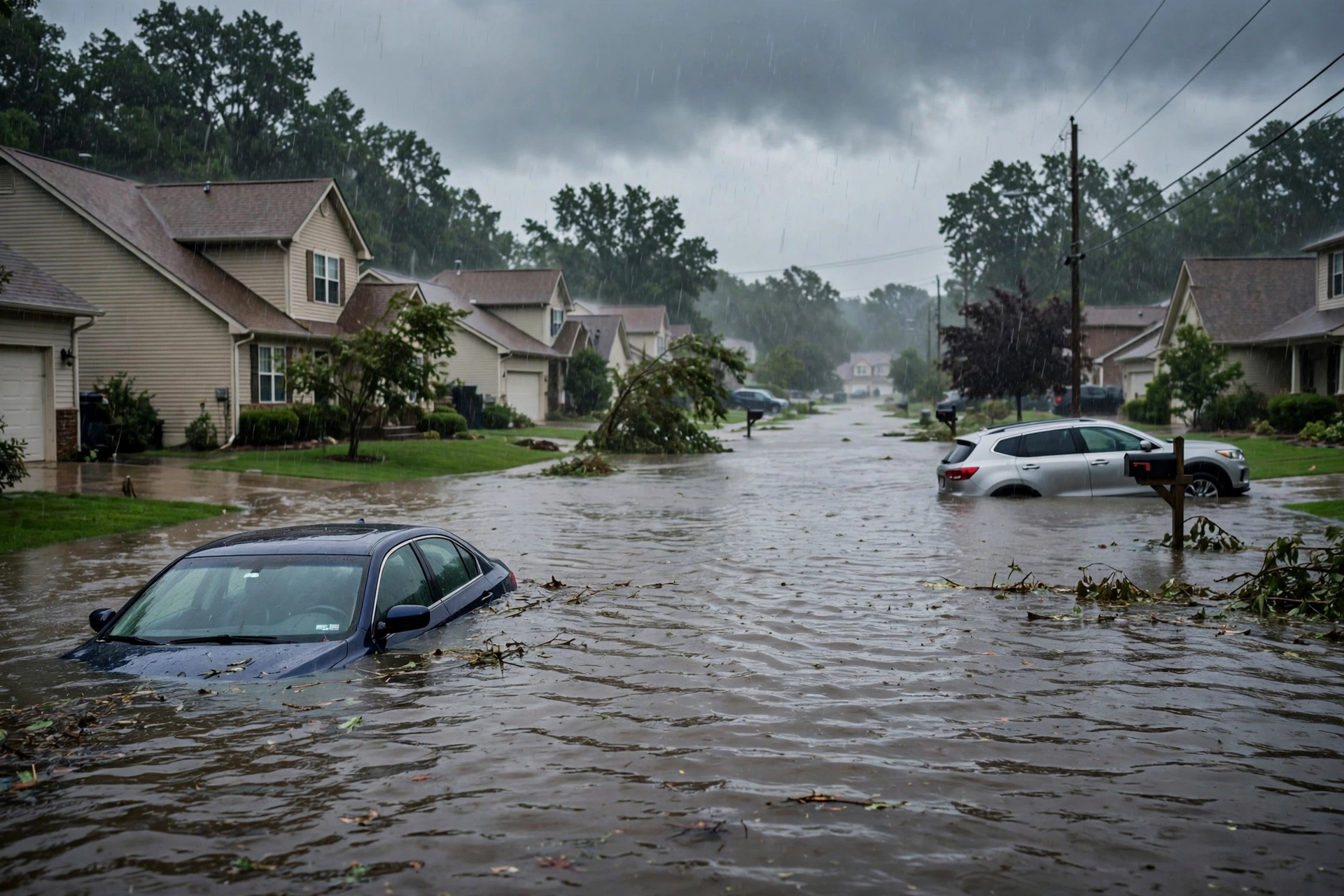
Tag: severe weather

  • Storm Updates: Quiet Pulse — Oct 18

    Storm Updates: Quiet Pulse — Oct 18

    Tropical: None · Severe: Quiet · Flood: Quiet

    What Changed

    • Compared with this morning’s quiet-pulse-2026-10-18-morning desk: SPC Day 1 Convective Outlook (latest 0100Z / 7:44 PM CDT Sunday, October 18, 2026, valid 190100Z–191200Z) continues NO SEVERE THUNDERSTORM AREAS FORECAST. Severe thunderstorms are not expected across the U.S. through tonight. No convective watches or Mesoscale Discussions valid.
    • WPC Day 1 Excessive Rainfall Outlook (issued ~0100 UTC / 8:57 PM EDT Sunday, October 18, 2026, valid 01Z Mon Oct 19–12Z Mon Oct 19) shows the probability of rainfall exceeding flash flood guidance less than 5 percent. Prior Marginal Risk over southeast Florida has dropped off the Day 1 outlook.
    • Developing storm-force non-tropical low off the southeast U.S. coast continues. NHC Tropical Weather Outlook gives near 0% chance of subtropical development through 48 hours and ~40% through 7 days. High winds, coastal flooding, and dangerous surf expected along portions of the East Coast. No tropical storm or hurricane watch or warning on the U.S. coast or Gulf of America.
    • No overnight or daytime local storm reports of severe weather (hail, damaging wind, tornado). Residual coastal and marine products remain. Quiet Pulse holds.

    Live Status

    As of this Sunday afternoon desk, October 18, 2026 (approximately 8:16 PM PDT / 11:16 PM EDT / 0316Z October 19), the national severe picture remains closed. SPC confirms no severe thunderstorm areas through tonight. An upper-level ridge advances into the southern Appalachians while high pressure stays entrenched from the Gulf Coast states to the Northeast, maintaining dry and cool conditions over much of the continental U.S. Isolated thunderstorms remain possible over south Florida and parts of the Desert Southwest, but no severe threat is forecast.

    Water concerns are residual and coastal only. WPC Day 1 probability sits below 5%. River Flood Warnings linger in Florida and Georgia from prior rains. Coastal Flood Warnings and high surf continue along the Outer Banks and adjacent East Coast as the non-tropical low maintains elevated seas and onshore flow. No named tropical cyclone threatens U.S. land. Eastern Pacific Hurricane Trudy remains offshore Mexico with no U.S. impact.

    Hotspots

    • Outer Banks / coastal North Carolina and Virginia: Coastal Flood Warnings, high surf, and rip current risk persist under the developing non-tropical low. Onshore flow and elevated seas continue; no inland severe or flash-flood threat.
    • Southeast Florida residual: Prior Marginal ERO has dropped. Isolated thunderstorms possible but no severe. Residual standing water and urban ponding from earlier rain; river Flood Warnings on St. Johns and Satilla remain.
    • Desert Southwest: Isolated thunderstorms possible ahead of a weak upper impulse. Limited moisture and instability preclude severe weather. No flood products active.

    Just-Hit

    No severe weather reports overnight or today. Preliminary LSRs show marine wind gusts near the Florida Keys and residual flood video in Puerto Rico; nothing convective or severe on the mainland. Prior Mid-Atlantic Slight Risk closed days ago.

    Pulse Table

    LaneStatusNotes (as of ~8:16 PM PDT / 11:16 PM EDT / 0316Z 19 Oct 2026)
    TropicalNoneNo named systems threatening U.S. land or Gulf. Non-tropical low off SE coast may acquire subtropical traits (~40% chance later). Pacific Hurricane Trudy offshore Mexico only. No U.S. tropical watches/warnings.
    SevereQuietSPC Day 1 (0100Z Oct 19): NO SEVERE THUNDERSTORM AREAS FORECAST. No watches or MDs valid. Thunder limited to southern FL and Southwest.
    FloodQuietWPC Day 1 probability <5%. Residual river Flood Warnings (St. Johns near Astor FL, Satilla Atkinson GA). Coastal Flood Warnings NC Outer Banks. No Moderate or higher.

    Restoration Read

    Primary residual ticket is coastal: high surf, beach erosion, and minor coastal flooding along the Outer Banks and adjacent Mid-Atlantic under the non-tropical low. Inland water is limited to lingering river Flood Warnings in north Florida and southeast Georgia from earlier rains. No convective severe restoration window is open. Verify county-level Coastal Flood and High Surf products before any coastal deployment. Turn around, don’t drown on any residual flooded roads.

    What This Is Not

    This is a Quiet Pulse. No SPC Slight or higher severe risk, no WPC Moderate or higher excessive rainfall, and no tropical storm or hurricane watch or warning on the U.S. coast or Gulf. The non-tropical low keeps lower-threshold coastal and marine lanes open only.

    Looking Ahead One Day

    SPC Day 2 (valid Monday) continues no severe thunderstorm areas. WPC Day 2 probability of excessive rainfall remains low. The non-tropical low is expected to meander off the Southeast and Mid-Atlantic coast, maintaining high surf, rip currents, and coastal flooding potential through mid-week. No named storm development is expected in the short term.

    Rising Queries

    Trends unreachable.

    Sources

    Morning desk: quiet-pulse-2026-10-18-morning. Official products: SPC Day 1 Outlook (spc.noaa.gov), WPC Day 1 Excessive Rainfall Outlook (wpc.ncep.noaa.gov), NWS watches/warnings (weather.gov), NHC Tropical Weather Discussion and Outlook (nhc.noaa.gov). All claims date-stamped to October 18–19, 2026 products.

    Disclaimer: This is an informational desk summary of official NWS/SPC/WPC/NHC products. Always confirm with local NWS offices and weather.gov for site-specific decisions. Not a forecast or warning.

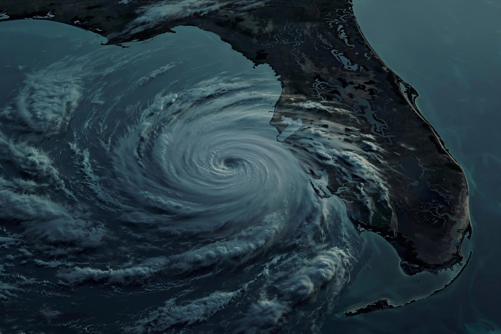
  • Storm Updates: Quiet Pulse — Oct 18

    Storm Updates: Quiet Pulse — Oct 18

    Tropical: None · Severe: Quiet · Flood: Quiet

    What Changed

    • Compared with this morning’s quiet-pulse-2026-10-18-morning desk: SPC Day 1 Convective Outlook (latest 0100Z / 7:44 PM CDT Sunday, October 18, 2026, valid 190100Z–191200Z) continues NO SEVERE THUNDERSTORM AREAS FORECAST. Severe thunderstorms are not expected across the U.S. through tonight. No convective watches or Mesoscale Discussions valid.
    • WPC Day 1 Excessive Rainfall Outlook (issued ~0100 UTC / 8:57 PM EDT Sunday, October 18, 2026, valid 01Z Mon Oct 19–12Z Mon Oct 19) shows the probability of rainfall exceeding flash flood guidance less than 5 percent. Prior Marginal Risk over southeast Florida has dropped off the Day 1 outlook.
    • Developing storm-force non-tropical low off the southeast U.S. coast continues. NHC Tropical Weather Outlook gives near 0% chance of subtropical development through 48 hours and ~40% through 7 days. High winds, coastal flooding, and dangerous surf expected along portions of the East Coast. No tropical storm or hurricane watch or warning on the U.S. coast or Gulf of America.
    • No overnight or daytime local storm reports of severe weather (hail, damaging wind, tornado). Residual coastal and marine products remain. Quiet Pulse holds.

    Live Status

    As of this Sunday afternoon desk, October 18, 2026 (approximately 8:16 PM PDT / 11:16 PM EDT / 0316Z October 19), the national severe picture remains closed. SPC confirms no severe thunderstorm areas through tonight. An upper-level ridge advances into the southern Appalachians while high pressure stays entrenched from the Gulf Coast states to the Northeast, maintaining dry and cool conditions over much of the continental U.S. Isolated thunderstorms remain possible over south Florida and parts of the Desert Southwest, but no severe threat is forecast.

    Water concerns are residual and coastal only. WPC Day 1 probability sits below 5%. River Flood Warnings linger in Florida and Georgia from prior rains. Coastal Flood Warnings and high surf continue along the Outer Banks and adjacent East Coast as the non-tropical low maintains elevated seas and onshore flow. No named tropical cyclone threatens U.S. land. Eastern Pacific Hurricane Trudy remains offshore Mexico with no U.S. impact.

    Hotspots

    • Outer Banks / coastal North Carolina and Virginia: Coastal Flood Warnings, high surf, and rip current risk persist under the developing non-tropical low. Onshore flow and elevated seas continue; no inland severe or flash-flood threat.
    • Southeast Florida residual: Prior Marginal ERO has dropped. Isolated thunderstorms possible but no severe. Residual standing water and urban ponding from earlier rain; river Flood Warnings on St. Johns and Satilla remain.
    • Desert Southwest: Isolated thunderstorms possible ahead of a weak upper impulse. Limited moisture and instability preclude severe weather. No flood products active.

    Just-Hit

    No severe weather reports overnight or today. Preliminary LSRs show marine wind gusts near the Florida Keys and residual flood video in Puerto Rico; nothing convective or severe on the mainland. Prior Mid-Atlantic Slight Risk closed days ago.

    Pulse Table

    LaneStatusNotes (as of ~8:16 PM PDT / 11:16 PM EDT / 0316Z 19 Oct 2026)
    TropicalNoneNo named systems threatening U.S. land or Gulf. Non-tropical low off SE coast may acquire subtropical traits (~40% chance later). Pacific Hurricane Trudy offshore Mexico only. No U.S. tropical watches/warnings.
    SevereQuietSPC Day 1 (0100Z Oct 19): NO SEVERE THUNDERSTORM AREAS FORECAST. No watches or MDs valid. Thunder limited to southern FL and Southwest.
    FloodQuietWPC Day 1 probability <5%. Residual river Flood Warnings (St. Johns near Astor FL, Satilla Atkinson GA). Coastal Flood Warnings NC Outer Banks. No Moderate or higher.

    Restoration Read

    Primary residual ticket is coastal: high surf, beach erosion, and minor coastal flooding along the Outer Banks and adjacent Mid-Atlantic under the non-tropical low. Inland water is limited to lingering river Flood Warnings in north Florida and southeast Georgia from earlier rains. No convective severe restoration window is open. Verify county-level Coastal Flood and High Surf products before any coastal deployment. Turn around, don’t drown on any residual flooded roads.

    What This Is Not

    This is a Quiet Pulse. No SPC Slight or higher severe risk, no WPC Moderate or higher excessive rainfall, and no tropical storm or hurricane watch or warning on the U.S. coast or Gulf. The non-tropical low keeps lower-threshold coastal and marine lanes open only.

    Looking Ahead One Day

    SPC Day 2 (valid Monday) continues no severe thunderstorm areas. WPC Day 2 probability of excessive rainfall remains low. The non-tropical low is expected to meander off the Southeast and Mid-Atlantic coast, maintaining high surf, rip currents, and coastal flooding potential through mid-week. No named storm development is expected in the short term.

    Rising Queries

    Trends unreachable.

    Sources

    Morning desk: quiet-pulse-2026-10-18-morning. Official products: SPC Day 1 Outlook (spc.noaa.gov), WPC Day 1 Excessive Rainfall Outlook (wpc.ncep.noaa.gov), NWS watches/warnings (weather.gov), NHC Tropical Weather Discussion and Outlook (nhc.noaa.gov). All claims date-stamped to October 18–19, 2026 products.

    Disclaimer: This is an informational desk summary of official NWS/SPC/WPC/NHC products. Always confirm with local NWS offices and weather.gov for site-specific decisions. Not a forecast or warning.

  • Storm Updates: Quiet Pulse — Oct 18 Morning

    Storm Updates: Quiet Pulse — Oct 18 Morning

    Tropical: None · Severe: Quiet · Flood: Quiet

    What Changed

    • Compared with the October 17 afternoon pulse and earlier versions of this October 18 morning desk: SPC Day 1 Convective Outlook (latest 0100Z / 7:44 PM CDT Sunday, October 18, 2026, valid 190100Z–191200Z) continues NO SEVERE THUNDERSTORM AREAS FORECAST. Severe thunderstorms are not expected across the U.S. through tonight. No convective watches or Mesoscale Discussions valid as of latest check.
    • WPC Day 1 Excessive Rainfall Outlook (updated 0100 UTC Monday, October 19, 2026 / 8:57 PM EDT Sunday, valid 01Z Mon Oct 19–12Z Mon Oct 19) shows the probability of rainfall exceeding flash flood guidance less than 5 percent. Prior Marginal Risk over southeast Florida has fully dropped off the Day 1 outlook.
    • Developing storm-force non-tropical low off the southeast U.S. coast continues. NHC Tropical Weather Outlook (800 PM EDT Sunday, October 18, 2026) gives near 0% chance of subtropical development through 48 hours and 40% through 7 days. High winds, coastal flooding, and dangerous surf expected along portions of the East Coast regardless. No tropical storm or hurricane watch or warning on the U.S. coast or Gulf of America.
    • Residual NWS Flood Warnings remain on the St. Johns River (near Astor, FL; minor occurring, moderate forecast) and Satilla River (Atkinson, GA; minor). Coastal Flood Warnings and High Surf Advisories continue for Ocracoke Island and portions of coastal North Carolina through Tuesday.
    • No overnight or recent local storm reports of severe weather. Quiet Pulse holds; water concerns remain residual river and coastal only.

    Live Status

    As of this Sunday evening update to the morning desk, October 18, 2026 (approximately 8:14 PM PDT / 11:14 PM EDT / 0314Z October 19), the national severe picture remains closed. SPC confirms no severe thunderstorm areas through tonight. An upper-level ridge moves into the southern Appalachians while high pressure remains entrenched from the Gulf Coast states to the Northeast, keeping dry and cool conditions over much of the continental U.S. Isolated thunderstorms possible over south Florida and parts of the Desert Southwest, but no severe threat.

    Excessive rainfall risk has cleared from the Day 1 WPC outlook. Residual river Flood Warnings linger in north-central Florida and southeast Georgia from prior rains. Coastal Flood Warnings, High Surf Advisories, and beach hazards persist along the Outer Banks as the developing non-tropical low offshore maintains elevated seas and onshore flow. No named tropical cyclone threatens U.S. land. Eastern Pacific Hurricane Trudy remains offshore Mexico with all coastal warnings discontinued; no U.S. impact.

    Pulse Table

    LaneStatusNotes (as of ~8:14 PM PDT / 11:14 PM EDT / 0314Z 19 Oct 2026)
    TropicalNoneNo named systems threatening U.S. land or Gulf. Non-tropical low off SE coast may acquire subtropical traits (40% chance later this week). Pacific Hurricane Trudy offshore Mexico only. No U.S. tropical watches/warnings.
    SevereQuietSPC Day 1 (0100Z Oct 19): NO SEVERE THUNDERSTORM AREAS FORECAST. No watches valid. Thunder limited to southern FL and Southwest. Prior Mid-Atlantic Slight closed.
    FloodQuietWPC Day 1 probability <5%. Residual river Flood Warnings (St. Johns near Astor FL, Satilla Atkinson GA). Coastal Flood Warnings NC Outer Banks. No Moderate or higher ERO.

    Rising Queries

    Trends unreachable.

    Restoration Read

    Residual river flooding in north-central Florida and southeast Georgia remains a near-term water concern. Coastal flooding, high surf, and beach erosion will continue along the Outer Banks and portions of the East Coast with the developing offshore low into early next week. Wind damage potential (trees, power lines) possible with gusty onshore flow along coastal Florida and the Carolinas. No widespread severe or higher-end flood event is underway. Standard quiet-day posture: monitor residual water and coastal hazards; no new severe or high-end flood tickets expected.

    What This Is Not

    This is a Quiet Pulse. No SPC Slight or higher severe risk, no WPC Moderate or higher excessive rainfall, and no tropical storm or hurricane watch or warning on the U.S. coast or Gulf.

    Informational only — not an official warning. Always confirm with the latest official forecasts from weather.gov, spc.noaa.gov, wpc.ncep.noaa.gov, and nhc.noaa.gov.

  • Storm Updates: Quiet Pulse — Oct 17

    Storm Updates: Quiet Pulse — Oct 17

    Tropical: None · Severe: Quiet · Flood: Slight

    What Changed

    • Compared with this morning’s quiet-pulse-2026-10-17-morning desk: SPC Day 1 Convective Outlook (latest ~0100Z October 18 / 6 PM PDT Saturday, October 17, 2026, valid 180100Z–181200Z) continues NO SEVERE THUNDERSTORM AREAS FORECAST. Severe thunderstorms are not expected across the U.S. through tonight. No convective watches or mesoscale discussions are currently valid.
    • WPC Day 1 Excessive Rainfall Outlook (updated 0758 UTC Saturday, October 17, 2026, valid 12Z Oct 17–12Z Oct 18) holds the Slight Risk (level 2/4) of excessive rainfall along portions of the Florida East Coast / Gold Coast. Earlier Flash Flood Warnings and residual Flood Advisories (northern Broward / southeast Palm Beach) have expired as of ~6:45 PM EDT. Deep moisture, diurnal heating, and onshore convergence ahead of the cold front still support 2–3 inch-per-hour rates and localized urban flooding potential as cells progress south through tonight.
    • The developing non-tropical low / Nor’easter off the Carolina coast remains the multi-day story. NHC Tropical Weather Outlook rates formation chance near 0 percent through 48 hours and low (~30 percent) through 7 days. No tropical storm or hurricane watch or warning is in effect for the U.S. coast or Gulf. High winds, coastal flooding, and dangerous surf are expected along portions of the East Coast regardless.
    • NWS High Wind Warnings and Wind Advisories remain active in Southern California mountains and passes (easterly gusts 45–60 mph through this evening) and along the Outer Banks / coastal North Carolina (north winds 25–40 mph, gusts 45–55 mph through Monday). No new organized severe or Moderate-or-higher flood thresholds have opened.
    • Nothing material has moved on the severe lane. The picture remains Quiet Pulse.

    Live Status

    As of the Saturday afternoon desk, October 17, 2026 (approximately 8:14 PM PDT / 11:14 PM EDT / 0314Z October 18), the national severe picture stays closed. SPC confirms no severe thunderstorm areas through tonight and lists no valid convective watches. High pressure dominates much of the CONUS outside residual frontal and coastal activity.

    Water remains the primary residual concern. The WPC Slight Risk holds on the Florida East Coast where the cold front is progressing south. Scattered thunderstorms capable of heavy rates and localized urban flash flooding continue through tonight into early Sunday, particularly southeast Florida metro areas from Port St. Lucie through Miami. Earlier short-fuse products have expired; residual drainage continues in poor-drainage urban areas.

    The developing coastal low off the Carolinas is building the multi-day wind and coastal flood story. Onshore flow will drive periods of rain, gusty winds (locally 45–55+ mph on the Outer Banks), high surf, rip currents, and beach erosion along the Mid-Atlantic and Outer Banks into early next week. NHC is monitoring possible subtropical development but rates the near-term chance near zero.

    Hotspots

    Florida East Coast: WPC Slight ERO. Localized flash flooding possible with slow-moving thunderstorms ahead of the cold front. Urban streets, roads, and small streams most vulnerable through tonight.

    Outer Banks and coastal North Carolina: NWS Wind Advisories (gusts 45–55 mph) through Monday. Developing Nor’easter brings coastal flooding, high surf, and beach erosion potential.

    Southern California: Residual High Wind Warnings and Wind Advisories for easterly/Santa Ana regime in mountains and passes (gusts 45–60 mph) through this evening.

    Pulse Table

    LaneStatusNotes (as of ~8:14 PM PDT / 11:14 PM EDT / 0314Z 18 Oct 2026)
    TropicalNoneNo named systems threatening U.S. land or Gulf. Non-tropical low off SE coast may acquire subtropical traits (low chance). Pacific Hurricane Trudy offshore Mexico only. No U.S. tropical watches/warnings.
    SevereQuietSPC Day 1 (0100Z Oct 18): NO SEVERE THUNDERSTORM AREAS FORECAST. No watches valid. Thunder limited to southern FL and Baja moisture plume. Prior Mid-Atlantic Slight closed.
    FloodSlightWPC Day 1 Slight Risk Florida East Coast / Gold Coast. 2–3″/hr rates possible; localized urban flash flooding. No Moderate or higher. Earlier FFWs/Advisories expired.

    Rising Queries

    Trends unreachable.

    Restoration Read

    Localized urban flooding on the Florida East Coast and wind damage potential (trees, power lines, unsecured objects) on the Outer Banks and Southern California mountains remain the near-term concerns. Coastal flooding and beach erosion will build with the Nor’easter into early next week. No widespread severe or higher-end flood event is underway.

    What This Is Not

    This is a Quiet Pulse. No SPC Slight or higher severe risk, no WPC Moderate or higher excessive rainfall, and no tropical storm or hurricane watch or warning on the U.S. coast or Gulf. The Slight ERO on the Florida East Coast and the developing Nor’easter keep flood and coastal lanes open at lower thresholds only.

    Looking Ahead One Day

    Sunday holds no severe thunderstorm areas on SPC Day 2. WPC Day 2 carries a Marginal Risk of excessive rainfall over a portion of south Florida. The coastal low continues to influence East Coast winds, surf, and potential flooding into early next week. No tropical development indicated for the U.S. coast or Gulf in the near term.

    Sources

    • Morning desk: quiet-pulse-2026-10-17-morning
    • SPC Day 1 Convective Outlook: https://www.spc.noaa.gov/
    • WPC Day 1 Excessive Rainfall Outlook: https://www.wpc.ncep.noaa.gov/qpf/ero.php
    • NHC Tropical Weather Outlook: https://www.nhc.noaa.gov/
    • NWS watches and warnings summary: https://www.weather.gov/wwamap/wwatxtget.php?cwa=usa&wwa=all

    Informational only — not an official warning. This is an afternoon desk summary of public National Weather Service, Storm Prediction Center, Weather Prediction Center, and National Hurricane Center products as of approximately 8:14 PM PDT on October 17, 2026. Always confirm with the latest official forecasts and local authorities. Turn around, don’t drown.

  • Storm Updates: Quiet Pulse — Oct 17 Morning

    Storm Updates: Quiet Pulse — Oct 17 Morning

    Tropical: None · Severe: Quiet · Flood: Slight

    What Changed

    • Compared with the October 16 afternoon desk and earlier versions of this morning desk: SPC Day 1 Convective Outlook (latest 0754 PM CDT Saturday, October 17, 2026 / 0100Z October 18, valid 180100Z–181200Z) continues NO SEVERE THUNDERSTORM AREAS FORECAST. Severe thunderstorms are not expected across the U.S. through tonight. No convective watches or mesoscale discussions are currently valid.
    • WPC Day 1 Excessive Rainfall Outlook (updated 0758 UTC Saturday, October 17, 2026, valid 12Z Oct 17–12Z Oct 18) holds the Slight Risk (level 2/4) of excessive rainfall along portions of the Florida East Coast / Gold Coast. Deep moisture, diurnal heating, and onshore convergence ahead of the cold front continue to support 2–3 inch-per-hour rates. Localized urban flash flooding remains possible through tonight; residual Flood Advisories may linger as cells progress south.
    • The developing non-tropical low / Nor’easter off the southeast U.S. coast remains the multi-day story. NHC Tropical Weather Outlook rates formation chance near 0 percent through 48 hours and low through 7 days. No tropical storm or hurricane watch or warning is in effect for the U.S. coast or Gulf of America. High winds, coastal flooding, and dangerous surf expected along portions of the East Coast regardless of development.
    • NWS High Wind Warnings continue in Southern California (Santa Ana / easterly gusts to 50–60 mph in mountains and passes through this evening). Wind Advisories and coastal flood potential persist for Outer Banks / coastal North Carolina. Nothing material has moved on the severe lane. Quiet Pulse holds.

    Live Status

    As of this Saturday evening update to the October 17, 2026 morning desk (approximately 8:13 PM PDT / 11:13 PM EDT / 0313Z October 18), the national severe picture stays closed. SPC confirms no severe thunderstorm areas through tonight and lists no valid convective watches. High pressure dominates much of the CONUS outside residual frontal and coastal activity.

    Water remains the primary residual concern. The WPC Slight Risk holds on the Florida East Coast where the cold front is progressing south. Scattered thunderstorms capable of heavy rates continue through tonight into early Sunday, with localized urban and street flooding possible especially in southeast Florida metro areas. Overnight LSRs show no significant severe reports.

    The multi-day story is the developing coastal low / Nor’easter off the Carolinas. Potential coastal flooding, beach erosion, gusty winds, high surf, and rip currents along the Mid-Atlantic into early next week. NHC monitors for possible subtropical traits at low odds; no U.S. tropical warnings in effect.

    Pulse Table

    LaneStatusNotes (as of ~8:13 PM PDT / 11:13 PM EDT / 0313Z 18 Oct 2026)
    TropicalNoneNo named systems threatening U.S. land or Gulf. Non-tropical low off SE coast may acquire subtropical traits (low chance). Pacific Hurricane Trudy offshore Mexico only. No U.S. tropical watches/warnings.
    SevereQuietSPC Day 1 (0100Z Oct 18): NO SEVERE THUNDERSTORM AREAS FORECAST. No watches valid. Thunder limited to southern FL and Baja moisture plume. Prior Mid-Atlantic Slight closed.
    FloodSlightWPC Day 1 Slight Risk Florida East Coast / Gold Coast. 2–3″/hr rates possible; localized urban flash flooding. No Moderate or higher. Residual Advisories after earlier FFWs.

    Hotspots

    Florida East Coast: WPC Slight ERO. Heavy rain rates from slow-moving thunderstorms ahead of the cold front. Localized urban flooding possible through tonight, especially coastal metro areas from Port St. Lucie south through Miami.

    Carolina / Mid-Atlantic coast: Developing Nor’easter. Wind Advisories, coastal flood potential, high surf, beach erosion into early next week. Outer Banks strongest winds.

    Southern California: Ongoing High Wind Warnings (Santa Ana regime). Non-convective tree and power impacts possible in mountains and passes through this evening.

    Rising Queries

    Trends unreachable.

    What This Is Not

    This is a Quiet Pulse. No SPC Slight or higher severe risk, no WPC Moderate or higher excessive rainfall, and no tropical storm or hurricane watch or warning on the U.S. coast or Gulf. The Slight ERO on the Florida East Coast and developing Nor’easter keep lower-threshold flood and coastal lanes open only.

    Looking Ahead One Day

    Sunday holds no severe thunderstorm areas on SPC Day 2. WPC Day 2 carries Marginal Risk of excessive rainfall over a portion of south Florida. The coastal low continues to influence East Coast winds, surf, and potential flooding into early next week. No tropical development indicated for the U.S. coast or Gulf in the near term.

    Sources

    Sources: SPC Day 1 Outlook (No Severe), NWS watches/warnings, WPC Day 1 Excessive Rainfall Outlook (Slight FL East Coast), NHC Tropical Weather Outlook. Prior desk: Storm Updates: Quiet Pulse — Oct 16.

    Informational only — not an official warning. This is a morning desk summary of public National Weather Service, Storm Prediction Center, Weather Prediction Center, and National Hurricane Center products as of approximately 8:13 PM PDT on October 17, 2026. Always confirm with the latest official forecasts and local authorities. Turn around, don’t drown.

  • Storm Updates: Quiet Pulse — Oct 16

    Storm Updates: Quiet Pulse — Oct 16

    Tropical: None · Severe: Quiet · Flood: Marginal

    What Changed

    • Compared with the morning desk (quiet-pulse-2026-10-16-morning) and the earlier afternoon snapshot: SPC Day 1 Convective Outlook issued 0750 PM CDT Friday, October 16, 2026 (0100Z October 17, valid 170100Z–171200Z) shows NO SEVERE THUNDERSTORM AREAS FORECAST. The prior Slight Risk over the Mid-Atlantic into southern New England has ended as the strong cold front progressed offshore and associated convection weakened or moved offshore.
    • Severe Thunderstorm Watches 686 and 687 expired earlier. As of ~0215Z October 17, SPC lists no convective watches currently valid. No mesoscale discussions are in effect for severe potential.
    • Preliminary local storm reports from the earlier convective day logged numerous wind damage reports (trees, wires, power lines) primarily across Pennsylvania and into New Jersey, Massachusetts, and Connecticut. No tornado or hail reports. Severe potential is now low.
    • WPC Day 1 Excessive Rainfall Outlook (updated 0059Z October 17 / 8:59 PM EDT) maintains Marginal Risk only across portions of southeast Florida. Convection peaked; heavy rainfall coverage declining overnight. Localized urban flash-flood risk may continue a few hours where slow-moving cells drop 2–3 inches in an hour. No Moderate or higher. Prior West Texas Moderate closed.
    • Tropical lane unchanged: no tropical storm or hurricane watches or warnings on the U.S. coast or Gulf of America. NHC: no tropical cyclones in the Atlantic, Caribbean, or Gulf; formation not expected next 7 days. Eastern Pacific Hurricane Trudy (approaching Mexico) and remnants of Simon remain offshore Mexico only.

    Live Status

    As of this Friday evening update to the October 16, 2026 afternoon desk (approximately 8:15 PM PDT / 11:15 PM EDT / 0315Z October 17), the severe weather lane has closed. The SPC 0100Z Day 1 outlook confirms no severe thunderstorm areas are forecast through the remainder of the night. A strong cold front has swept the Mid-Atlantic and southern New England, with the low-topped convective line having weakened or moved offshore. Isolated thunderstorms may linger, but post-frontal conditions limit any severe risk.

    Flood remains the only open lane at Marginal over southeast Florida, where high moisture supported earlier heavy rain rates. Coverage is declining overnight. No higher-end excessive rainfall risk is in effect. Non-convective High Wind Warnings continue in parts of southern California and Arizona for gusts to 65–75 mph in mountain passes and foothills, separate from convective threats. No tropical systems threaten U.S. land or the Gulf of America.

    Hotspots

    Southeast Florida residual: WPC Marginal Risk of excessive rainfall. Localized urban flash flooding possible for a few more hours from slow-moving cells. Convection has peaked and is weakening.

    Mid-Atlantic / southern New England just-hit: Earlier Slight Risk and Watches 686/687 produced scattered damaging winds. Multiple tree and wire reports across Pennsylvania into New Jersey and southern New England. Line has exited; residual cleanup only.

    Southern California high winds: Ongoing High Wind Warnings in mountain and valley areas with gusts 50–75 mph. Non-convective; potential for tree and power impacts.

    Just Hit

    The organized Mid-Atlantic Slight Risk window closed this evening. SPC preliminary reports confirm wind damage (trees and wires down) across central and eastern Pennsylvania counties, Hunterdon County NJ, and portions of Massachusetts and Connecticut. No tornado or hail reports. Short-fuse warnings expired with the watches. Prior West Texas Moderate ERO and Midwest residual remain closed.

    Pulse Table

    LaneStatusNotes (as of ~8:15 PM PDT / 11:15 PM EDT / 0315Z 17 Oct 2026)
    TropicalNoneNo named systems threatening U.S. land or Gulf. Atlantic, Caribbean, and Gulf of America quiet; formation not expected next 7 days. Pacific systems offshore Mexico only. Hurricane Warnings limited to Mexican waters.
    SevereQuietSPC Day 1 (0100Z Oct 17): NO SEVERE THUNDERSTORM AREAS FORECAST. Prior Slight Risk and Watches 686/687 closed. Line exited or weakened. Numerous earlier wind LSRs (trees/wires) in PA, NJ, MA, CT. No current watches.
    FloodMarginalWPC Day 1 Marginal Risk southeast Florida only. Convection peaked; declining overnight. Localized urban risk possible briefly. No Moderate or higher. Prior West Texas Moderate closed.

    Restoration Read

    Quiet Pulse on the severe side. Residual work is tree and wire cleanup from the earlier Mid-Atlantic wind event across Pennsylvania into New Jersey and southern New England. Flood remains Marginal only in southeast Florida and does not drive a national water ticket. No tropical claims. Non-convective High Wind Warnings in California and Arizona are separate events. Standard quiet-day posture: check local NWS for any lingering Flood Advisories in Florida and assess residual damage reports. Turn around, don’t drown remains the standing public message.

    Rising Queries

    Trends unreachable.

    What This Is Not

    This is a Quiet Pulse. The SPC Day 1 outlook holds no severe thunderstorm areas. Flood is Marginal only over southeast Florida. No tropical storm or hurricane watch or warning affects the U.S. coast or Gulf of America. The earlier Mid-Atlantic Slight Risk and associated watches have closed.

    Looking Ahead One Day

    Saturday holds no severe thunderstorm areas on SPC Day 2. WPC Day 2 carries a Marginal Risk of excessive rainfall along portions of the Florida east coast. Colder air filters in behind the front, with frost and freeze potential in parts of the Mid-Atlantic and Northeast overnight into Sunday. No tropical development indicated for the U.S. coast or Gulf.

    Sources

    Sources: SPC Day 1 Outlook (0100Z No Severe), expired watches 686/687, LSRs, NWS watches/warnings, WPC Day 1 Excessive Rainfall Outlook, NHC. Morning desk: Storm Updates: Mid-Atlantic Slight — Oct 16 Morning.

    Informational only — not an official warning. This is an afternoon desk summary of public National Weather Service, Storm Prediction Center, Weather Prediction Center, and National Hurricane Center products as of approximately 8:15 PM PDT on October 16, 2026. Always confirm with the latest official forecasts and local authorities. Turn around, don’t drown.

  • Storm Updates: Quiet Pulse — Oct 16 Morning

    Storm Updates: Quiet Pulse — Oct 16 Morning

    Tropical: None · Severe: Quiet · Flood: Marginal

    What Changed

    • Compared with the afternoon desk (quiet-pulse-2026-10-16-afternoon): Severe Thunderstorm Watches 686 and 687 have fully expired. SPC current watches page (updated ~0213Z October 17) lists no convective watches valid. The low-topped convective line has moved offshore; associated convection weakened.
    • SPC Day 1 Convective Outlook issued 0750 PM CDT Friday, October 16, 2026 (0100Z October 17, valid 170100Z–171200Z) shows NO SEVERE THUNDERSTORM AREAS FORECAST. The prior Slight Risk over the Mid-Atlantic into southern New England has ended with cold-front passage.
    • WPC Day 1 Excessive Rainfall Outlook (updated 0059 UTC October 17 / ~8:58 PM EDT Friday, valid 01Z–12Z October 17) holds only a Marginal Risk across portions of southeast Florida. Heavy rainfall coverage is declining overnight; localized urban flash-flood risk may linger a few hours. No Moderate or higher.
    • Tropical lane remains closed for the United States. NHC: no tropical cyclones in the Atlantic, Caribbean, or Gulf of America; formation not expected during the next 7 days. Eastern Pacific Hurricane Trudy (90 mph, approaching southwestern Mexico) and remnants of Simon are offshore Mexico only. No U.S. land or Gulf threat.
    • Preliminary local storm reports from the convective day logged numerous wind damage reports (trees, wires, power lines) primarily across Pennsylvania and into New Jersey, Massachusetts, and Connecticut. No tornado or hail reports. Severe potential is now low.

    Live Status

    As of this late evening update to the October 16, 2026 morning desk (approximately 8:12 PM PDT / 11:12 PM EDT / 0312Z October 17), the severe weather lane is closed. The SPC 0100Z Day 1 outlook confirms no severe thunderstorm areas are forecast through the remainder of the night. A strong cold front has swept the Mid-Atlantic and southern New England; the low-topped convection that produced damaging winds earlier under the Slight Risk and Watches 686/687 has weakened or moved offshore. Sporadic thunderstorm activity may linger briefly in residual areas, but post-frontal conditions limit any further severe potential. Ongoing storms over the Florida Peninsula are generally weakening, with some residual activity possible overnight near the Keys and near-coastal areas.

    The flood lane stays at Marginal only over southeast Florida, where seasonably high moisture supported earlier heavy downpours. Coverage is on the decline, though isolated urban flooding remains possible for a few more hours where slow-moving cells drop 2–3 inches in an hour. The progressive nature of the front limited Mid-Atlantic rainfall to minor ponding. No higher-end excessive rainfall risk is in effect. No tropical storm or hurricane watches or warnings affect the U.S. coast or Gulf of America. Separate non-convective High Wind Warnings remain in effect in parts of southern California and Arizona through Saturday.

    Pulse Table

    LaneStatusNotes (as of ~8:12 PM PDT / 11:12 PM EDT / 0312Z 17 Oct 2026)
    TropicalNoneNo named systems threatening U.S. land or Gulf. Atlantic, Caribbean, and Gulf of America quiet; formation not expected next 7 days. Pacific systems (Hurricane Trudy) offshore Mexico only.
    SevereQuietSPC Day 1: NO SEVERE THUNDERSTORM AREAS FORECAST (0100Z outlook). Prior Mid-Atlantic/southern New England Slight Risk ended with front passage. No convective watches valid. Earlier wind LSRs (trees/wires) mainly PA into NJ/MA/CT; potential now low.
    FloodMarginalWPC Day 1 Marginal Risk southeast Florida only. Heavy rain coverage declining overnight; localized urban risk possible a few more hours. No Moderate or higher.

    Restoration Read

    With the severe lane closed, the dominant restoration ticket from earlier in the day (Mid-Atlantic into southern New England wind damage under the Slight Risk and Watches 686/687) is now residual. Teams covering the I-95 corridor from the Washington DC metro through Philadelphia, New Jersey, the New York City area, and into southern New England should assess any remaining tree, wire, and power-line damage from the progressive low-topped line. Standard verification of any lingering local warnings applies, but organized severe potential has ended. Flood remains Marginal only in southeast Florida and does not drive a national water response. No tropical surge or coastal claims. Separate non-convective High Wind Warnings in southern California and Arizona are outside the convective scope. Turn around, don’t drown remains the standing message on any flooded roads.

    Rising Queries

    Trends unreachable.

    Informational only — not an official warning. This is a morning desk summary of public National Weather Service, Storm Prediction Center, Weather Prediction Center, and National Hurricane Center products as of approximately 8:12 PM PDT on October 16, 2026. Always confirm with the latest official forecasts and local authorities. Turn around, don’t drown.

    Sources: SPC Day 1 Outlook and watches, WPC Day 1 ERO, NWS WWA summary, NHC. Previous desk: Storm Updates: Mid-Atlantic Slight — Oct 16.

  • Isaias by the Numbers: Four Estimates, Four Different Storms

    Isaias by the Numbers: Four Estimates, Four Different Storms

    From the Risk Coverage Hub desk — Tygart Media’s storm and claims desk, where the loss numbers get read the way operators have to read them.

    Hurricane Isaias made landfall near Destin, Florida, on October 9 as a Category 2 storm with maximum sustained winds of 105 mph. It had peaked at Category 3 strength offshore before wind shear tore at its center, and it was the first hurricane to make landfall on the US mainland since Milton in 2024. The damage is done. Now the estimates are landing, and they do not agree — because they are not measuring the same thing.

    Here is each one, on its own terms.

    Verisk: $1 billion to $2 billion. Verisk’s Catastrophe and Risk Solutions business puts insured industry losses to onshore property at $1–2 billion. Wind is expected to account for the vast majority of it — fallen trees, damaged roofs, fencing, debris. The estimate covers building, contents, and time-element coverage on residential, commercial, and industrial property, plus automobiles. Reported by Reinsurance News, October 14.

    Cotality: $2 billion to $3 billion. Cotality (formerly CoreLogic) estimates $2–3 billion for wind and surge losses — a broader water component than Verisk’s wind-led read, which is part of why the number sits higher.

    KCC: $3 billion. Karen Clark & Company expects the private insurance market loss from wind and storm surge to total $3 billion, based on its high-resolution US Hurricane Model. That includes residential, commercial, and industrial property, automobiles, and business interruption. It excludes boats, offshore property, and NFIP flood policy losses — the federal flood book is not in this number.

    Euler ILS Partners: $2 billion to $4 billion. The widest range of the four, published as an initial industry estimate in the first days after landfall.

    Why the spread is the story

    A restorer reading these headlines could reasonably ask which one is right. The honest answer is that each is a different slice. Verisk counts onshore property. KCC counts the private market, business interruption in, federal flood out. Gallagher Re, folding the anticipated NFIP loss in, expects the total to settle at the lower end of the low-to-mid single-digit billions — a fifth figure, built on a fifth definition.

    Two numbers making the rounds are not insured-loss estimates at all, and should not be quoted as if they were. AccuWeather’s $16–20 billion is total damage and economic loss across the Gulf and eastern US. Moody’s $1–2 billion is a reduction in economic output. Both describe the storm’s footprint on the economy, not what insurers will pay.

    Even the surge tells two stories. KCC put peak storm surge at about 8 feet. Gallagher Re’s measured maximum was 5.57 feet at the Panama City Beach gauge — the second-highest reading there since 1995, behind only Hurricane Opal. A modeled peak and a gauge reading are different instruments. Neither is lying; they are answering different questions.

    What it means at the desk

    Gallagher Re’s read, published October 14, is that Isaias is “unlikely to influence upcoming 1 January reinsurance renewal discussions.” Their reasoning: the loss size is manageable, the storm struck a less populated stretch of Florida’s western Panhandle with a relatively small radius of maximum winds, and the market is carrying record levels of traditional and alternative capacity. AM Best said much the same — insured losses in the low single-digit billions, reinsurance capacity and pricing “not expected to be dramatically impacted.”

    For operators, the practical translation: a $1–4 billion event, depending on whose slice you take, in a market with deep capacity. Claims will be worked, carriers are not blinking, and the wind-versus-flood split — Verisk’s wind-led picture against everything the NFIP book absorbs separately — is where individual files will be won and lost. That split, and the clocks that run on it, are covered in our companion piece, After Isaias: The Claims Clock, the Wind/Flood Split, and the Paperwork That Decides.

    The estimates will converge as claims close. Until they do, quote each one with its owner and its definition attached — or do not quote it at all.

    SOURCES

    • Artemis: “KCC estimates hurricane Isaias wind and surge insured losses at $3bn” (artemis.bm)
    • Reinsurance News: “KCC estimates insured losses from Hurricane Isaias at $3bn”; “Verisk estimates Isaias insured losses at $1-2bn, driven largely by wind damage” (Oct 14, 2026); “Hurricane Isaias unlikely to affect Jan 1 reinsurance renewals, says Gallagher Re” (Oct 14, 2026)

    Related reading

  • Storm Updates: West Texas Moderate Flood — Oct 15

    Storm Updates: West Texas Moderate Flood — Oct 15

    Tropical: None · Severe: Marginal · Flood: Moderate

    What Changed

    • Compared with the morning desk (quiet-pulse-2026-10-15-morning), WPC Day 1 Excessive Rainfall Outlook (updated 0644 UTC / 2:44 AM EDT Thursday, October 15, 2026, valid 12Z Thu–12Z Fri) continues the Moderate Risk of excessive rainfall across portions of west Texas (Big Bend / Stockton Plateau / Lower Pecos / Concho Valley). No category change. Focus remains on the southwest shift from the prior central Oklahoma Moderate.
    • Active Flash Flood Warnings issued this morning by NWS Norman for parts of northern Texas (southeastern Wichita County including Wichita Falls/Sheppard AFB, and central Foard / southeastern Hardeman / northwestern Wilbarger counties) with 1–4 inches already fallen and additional heavy rain possible until late morning. Flood Watches continue through Friday morning for west-central Texas (including San Angelo, Abilene, Tom Green, Taylor and surrounding counties) and residual across much of Oklahoma.
    • SPC Day 1 Convective Outlook (1300 UTC / 7:52 AM CDT Thursday, October 15, 2026, valid 151300Z–161200Z) holds only a Marginal Risk of severe thunderstorms across portions of the mid Mississippi and Ohio Valleys (isolated damaging gusts and perhaps a brief tornado). No Slight or higher. No convective watches currently valid; Watch 685 expired overnight. No change in severe category from the morning desk.
    • High Wind Warnings remain in effect across southern California (Inland Empire, San Diego County mountains and valleys, Santa Ana Mountains and foothills) with northeast gusts to 65–70 mph possible through Saturday, and in New Mexico (Albuquerque metro and southern valleys). Red Flag Warnings continue for portions of the Sierra Nevada and central/northern California. These are non-convective wind and fire-weather products.
    • No tropical storm or hurricane watches or warnings on the U.S. coast or Gulf. Atlantic basin quiet. Eastern Pacific Hurricane Trudy (rapidly intensifying, Tropical Storm Watch for Mexican coast) and Tropical Storm Simon remain offshore Mexico with no U.S. land threat.

    Live Status

    As of the Thursday afternoon desk, October 15, 2026 (approximately 8:20 AM PDT / 10:20 AM CDT / 1520Z), the dominant threat remains the Moderate Risk excessive rainfall over west Texas under anomalous October moisture (PWATs near record) and a slowing cold front. Active Flash Flood Warnings are live this morning over northern Texas near Wichita Falls. SPC Day 1 is Marginal only over the Ohio Valley with no watches. Flood Watches cover residual saturated ground across Oklahoma and expanding west-central Texas. High Wind Warnings are in force across parts of southern California and New Mexico but are non-severe.

    Hotspots

    West Texas Moderate ERO: WPC Day 1 maintains Moderate Risk from just east of Big Bend along the Rio Grande across the Stockton Plateau to the Pecos River Valley and north past the I-10 corridor into the Concho Valley. Areal averages 3–5 inches with local maxima higher possible along and south of I-10 east of the Davis Mountains. Highest concern for flash flooding in poor drainage, low-water crossings, and urban areas of the Permian Basin and Trans-Pecos. Flood Watches through Friday morning cover much of this corridor including San Angelo and Abilene areas.

    Northern Texas active Flash Flood Warnings: NWS Norman issued Flash Flood Warnings this morning for southeastern Wichita County (Wichita Falls, Sheppard AFB) until ~10:45 AM CDT with 2–4 inches already fallen, and for portions of Foard, Hardeman, and Wilbarger counties until noon CDT with 1–2 inches observed and up to 2 inches additional possible. Radar-indicated heavy rain ongoing. Turn around, don’t drown remains the immediate message.

    Ohio Valley Marginal severe: SPC Day 1 Marginal Risk covers portions of the mid Mississippi and Ohio Valleys including Indianapolis, Columbus, St. Louis, Cincinnati, and Akron. Isolated severe wind gusts and perhaps a brief tornado possible this afternoon and evening near the warm front under modest buoyancy and strong shear. No watches. Overnight LSRs included scattered tree damage in Ohio and West Virginia.

    Just Hit

    Overnight into early Thursday, LSRs through approximately 0418 UTC documented damaging wind gusts of 60–75 mph across northwest Texas and southwest Oklahoma (power lines, sheet metal, trees). Residual flooding and saturated soils persist across central and southwestern Oklahoma from prior training convection under the previous Moderate ERO. No new convective watches issued this morning.

    Pulse Table

    LaneStatusNotes (as of ~8:20 AM PDT / 10:20 AM CDT / 1520Z 15 Oct 2026)
    TropicalNoneNo named systems threatening U.S. land or Gulf. Atlantic quiet. Pacific: Hurricane Trudy and TS Simon offshore Mexico, no U.S. impact.
    SevereMarginalSPC Day 1 Marginal Risk Ohio Valley (isolated wind / brief tornado). No watches. Overnight LSRs mainly wind damage TX/OK and trees OH/WV. Slight Risk closed overnight.
    FloodModerateWPC Day 1 Moderate Risk west Texas (Big Bend / Stockton Plateau / Pecos / Concho). Active FFWs northern TX (Wichita Falls area). Flood Watches ongoing OK and west-central TX.
    OtherWind / FireHigh Wind Warnings southern CA and NM. Red Flag Warnings Sierra and central/northern CA. Non-severe wind and fire weather.

    Restoration Read

    Primary ticket is water over west Texas under the continuing Moderate ERO, with active Flash Flood Warnings this morning near Wichita Falls and expanding Flood Watches into west-central Texas. Residual flooding and saturated ground across central and southwestern Oklahoma from overnight training convection support additional extraction and drying claims. Wind damage claims possible from overnight gusts in northwest Texas and southwest Oklahoma (power lines, sheet metal, trees). Ohio Valley Marginal supports only isolated tree or minor wind claims if storms organize this afternoon. No tropical surge or coastal claims. Standard Plains posture: verify county-level Flood Warnings and Watches before deploying; Turn around, don’t drown on flooded roads. Southwest High Wind and Red Flag products are separate from convective restoration.

    What This Is Not

    This is not a Quiet Pulse. The Moderate ERO over west Texas and active Flash Flood Warnings in northern Texas keep the flood lane open. Severe remains Marginal only with no watches. No U.S. tropical threat.

    Rising queries

    Trends unreachable.

    Looking Ahead One Day

    SPC Day 2 outlook places a Slight Risk of severe thunderstorms over a portion of the Mid-Atlantic for Friday afternoon and evening (damaging wind gusts and perhaps a brief tornado). WPC Day 2 carries a Moderate Risk of excessive rainfall across portions of west Texas continuing the front’s slower progression. No tropical development indicated for the U.S. coast or Gulf.

    Sources

    SPC Day 1 Outlook and watches (spc.noaa.gov), WPC Day 1 ERO (wpc.ncep.noaa.gov), NWS WWA summary and Flash Flood Warnings (weather.gov). Morning desk: Storm Updates: West Texas Moderate Flood — Oct 15 Morning.

    Informational only — not an official warning. This is an afternoon desk summary of public National Weather Service, Storm Prediction Center, Weather Prediction Center, and National Hurricane Center products as of approximately 8:20 AM PDT on October 15, 2026. Always confirm with the latest official forecasts. Turn around, don’t drown.

  • Storm Updates: West TX Flood & Midwest Marginal — Oct 15

    Storm Updates: West TX Flood & Midwest Marginal — Oct 15

    Tropical: None · Severe: Marginal · Flood: Moderate

    What Changed

    • SPC Day 1 Convective Outlook (0100 UTC / 7:49 PM CDT Thursday, October 15, 2026, valid 160100Z–161200Z) holds a Marginal Risk for parts of southern Indiana into Ohio. A small storm cluster continues across southern IN near the surface trough and warm front; locally damaging wind and a brief tornado remain possible this evening before increasing low-level stability diminishes the threat. No category change from the morning desk; prior Slight Risk has closed.
    • WPC Day 1 Excessive Rainfall Outlook continues the Moderate Risk of excessive rainfall across portions of West Texas (Big Bend / Lower Trans-Pecos / Stockton Plateau into Concho Valley, along and south of I-10 east of the Davis Mountains). High neighborhood probabilities above 70 percent for amounts exceeding 5 inches remain centered in the Moderate area. Category unchanged; strongest overnight signal persists.
    • Residual Tornado Warning and Severe Thunderstorm Warnings for southwestern Indiana and residual Severe Thunderstorm Warning near Fort Worth TX have expired. Flash Flood Warning for Nolan/Taylor Counties TX expired. Flood Watches continue through Friday morning for much of west-central and western Texas. No new convective watches issued. No mesoscale discussions in effect.
    • No tropical storm or hurricane watches or warnings on the U.S. coast or Gulf of America. Atlantic basin remains quiet with no named systems and no formation expected in the next 7 days. Eastern Pacific Hurricane Trudy (intensifying toward Mexico) and Tropical Storm Simon remain offshore Mexico with no U.S. land or Gulf threat. Tropical lane unchanged.
    • Nothing else material shifted since the morning pulse. Severe residual is diminishing as expected; flood Moderate holds as the primary overnight driver.

    Live Status

    As of the Thursday afternoon desk, October 15, 2026 (approximately 9:15 PM PDT / 11:15 PM CDT / 0415Z October 16), the dominant restoration ticket remains the WPC Moderate Risk of excessive rainfall over West Texas. Anomalous October moisture (PWATs near record seasonal values, +2 to +3 standard deviations) and a southward-progressing cold front continue to support heavy convective rainfall this evening into the overnight, with the strongest signal for areal averages of 3–5 inches (local higher, pockets of >5 inches) along and south of I-10 east of the Davis Mountains into the Lower Pecos River basin (Sanderson to north of Del Rio) and northward into the Concho Valley. Flood Watches remain in effect through Friday morning across west-central and western Texas.

    SPC Day 1 holds a Marginal Risk over parts of southern Indiana into Ohio for the remainder of the period. The small storm cluster near the surface trough and warm front continues to support localized strong/damaging gusts and a possible brief tornado this evening. Surface-based buoyancy becomes increasingly scant with time and northeastward extent; the threat is expected to diminish as convection becomes elevated and low-level stability increases later this evening. Residual Tornado and Severe Thunderstorm Warnings that were live earlier have expired. Limited residual severe potential along the outflow-augmented cold front in northwest Texas has also diminished. No mesoscale discussions currently in effect. Overall intensity is waning.

    Hotspots

    West Texas (Big Bend / Stockton Plateau / Lower Pecos / Concho Valley including San Angelo vicinity): Primary Moderate Risk zone. Focused heavy rainfall expected this evening into tonight as the front progresses and nocturnal low-level jet enhances convergence. Flash flooding of creeks, low-water crossings, arroyos, and urban poor-drainage areas is the main concern. HREF/REFS neighborhood probabilities remain high (above 70 percent) for amounts exceeding 5 inches centered within the Moderate area. Areal averages 3–5″ with locally higher possible. Flood Watches continue.

    Southwest Indiana (Knox / Daviess Counties) into southern Ohio: Residual Marginal Risk. Small storm cluster near surface trough/warm front with modest buoyancy and favorable low-level shear supported brief tornado or damaging wind potential this evening. Threat is diminishing as convection elevates and stability increases. Residual Tornado and Severe Thunderstorm Warnings that confirmed radar-indicated rotation and 60 mph gusts have expired. No watches.

    Northwest and residual northern Texas (Fort Worth area, residual northern counties): Residual Severe Thunderstorm Warning for 60 mph wind gusts has expired. Limited organized severe potential along the outflow-augmented cold front has diminished. Preliminary LSRs include tree and roof damage near Millsap and power lines down near Weatherford in Parker County TX this evening. Flood Watches continue through Friday morning across west-central Texas with saturated soils elevating residual flash flood risk for any additional cells.

    Just-Hit

    Overnight and early-morning convection across the southern Plains produced damaging wind reports (gusts 60–75 mph, power lines down, sheet metal and tree damage) in northwest Texas and southwest Oklahoma, plus scattered tree damage in Ohio and West Virginia. Flash flooding occurred or was radar-indicated in multiple northern Texas and southwestern Oklahoma counties this morning, with 1–4+ inches fallen in warned areas. Residual river rises possible on smaller basins. Preliminary tornado report earlier near Fort Stockton TX remains under survey. Residual Tornado and Severe Thunderstorm Warnings confirmed radar-indicated threats over southwestern Indiana and residual Texas this evening; those warnings have expired. No new confirmed tornadoes reported in the latest window. Slight Risk closed overnight and reopened farther northeast before reducing to Marginal this evening.

    Pulse Table

    LaneStatusNotes (as of ~9:15 PM PDT / 11:15 PM CDT / 0415Z 16 Oct 2026)
    TropicalNoneNo named systems threatening U.S. land or Gulf. Atlantic quiet; no formation expected next 7 days. Pacific: Hurricane Trudy (intensifying toward Mexico) and TS Simon offshore, no U.S. impact. Hurricane Warnings in Mexican offshore waters only.
    SevereMarginalSPC Day 1 Marginal Risk southern IN into OH (localized strong/damaging gusts and possible brief tornado this evening). Prior Slight reduced. Residual Tornado and Severe Thunderstorm Warnings expired. No watches valid. Threat diminishing after late evening. No current MDs.
    FloodModerateWPC Day 1 Moderate Risk West Texas (Big Bend / Stockton / Lower Pecos / Concho). Slight broader TX into southern OK. Residual FFW Nolan/Taylor expired. Flood Watches through Friday morning west-central TX and residual OK. Overnight heavy rain signal remains strong.
    OtherWind / FireHigh Wind Warnings AZ/NM/TX mountains and CA (gusts 50–70 mph). Red Flag Warnings Sierra and central/northern CA. Non-severe products. Separate from convective restoration.

    Restoration Read

    Primary restoration ticket is water and flash flooding over West Texas under the Moderate ERO, with potential for considerable flash flooding on complex terrain, low-water crossings, arroyos, and urban poor drainage where training occurs under elevated PWATs and frontal convergence. Residual saturated ground and Flood Watches continue across Oklahoma and northern Texas from the prior Moderate axis. Overnight and residual wind damage claims remain possible from earlier 60 mph gusts in northwest Texas and residual Severe Thunderstorm Warnings. The Midwest Marginal supports only isolated tree, power line, or minor structural wind claims as residual storms continue this evening near the warm front; any tornado claims would be brief and localized. No tropical surge or coastal claims. Standard posture: verify county-level Flood Warnings and Watches before deploying; Turn around, don’t drown on flooded roads. Southwest High Wind and Red Flag products are separate non-convective events and do not drive the same restoration response.

    Rising queries

    Trends unreachable.

    What This Is Not

    This is not a Quiet Pulse. WPC Moderate Risk remains live over West Texas and SPC holds a Marginal Risk over the Midwest with residual threats diminishing. Not a higher-end severe day. Not a tropical threat to the U.S. coast or Gulf. Not a named-storm hub update (no U.S.-threatening cyclone).

    Looking Ahead One Day

    SPC Day 2 outlook carries a Slight Risk of severe thunderstorms over portions of the Mid-Atlantic into southern New England for Friday afternoon and evening (scattered damaging gusts and perhaps a brief tornado accompanying a squall line). WPC Day 2 continues a Moderate Risk of excessive rainfall across portions of West Texas as the front progresses, with the heavy rain threat lingering into early Friday. No tropical development indicated for the U.S. coast or Gulf.

    Sources: SPC Day 1 Outlook (spc.noaa.gov, 0100 UTC update), WPC Day 1 ERO discussion (wpc.ncep.noaa.gov), NWS WWA summary (weather.gov/wwamap). Morning desk: Storm Updates: West TX Flood — Oct 15 Morning.

    Informational only — not an official warning. This is an afternoon desk summary of public National Weather Service, Storm Prediction Center, Weather Prediction Center, and National Hurricane Center products as of approximately 9:15 PM PDT on October 15, 2026. Always confirm with the latest official forecasts and local authorities. Turn around, don’t drown.