Tag: Water Damage Restoration

  • Your Customers Search Symptoms, Not Services: A GBP Playbook for Restoration Contractors

    Your Customers Search Symptoms, Not Services: A GBP Playbook for Restoration Contractors

    Inspired by a September 13 carousel from Matteo Barletta’s local-SEO account @gmbcrush, walking foundation repair contractors through Google Business Profile optimization. The playbook ports straight to restoration. Here is the translation.

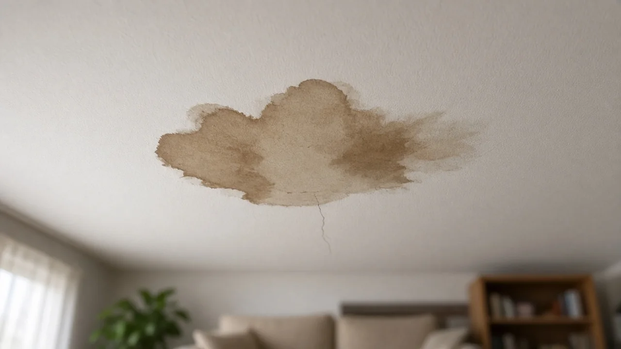
    Your customer’s ceiling has a brown stain shaped like Texas. They don’t search “structural drying.” They search “brown stain on ceiling” or “ceiling stain from leak.”

    That gap, between what homeowners type and what contractors write on their Google Business Profile, is the whole game. Barletta’s insight for foundation repair was symptom language: homeowners search for doors that won’t latch and cracks in brick, while most profiles answer in “piering” and “underpinning” that nobody types. Restoration has the same disease, and ours might be worse.

    The restoration symptom dictionary

    Every estimate you’ve ever written started with what the homeowner noticed, not what you did about it. That’s your keyword list. It’s already in your head:

    They searchYou want to writeWrite this instead
    musty smell in basementmicrobial remediationmusty basement smell, where it comes from and what fixes it
    brown stain on ceilingstructural dryingceiling water stain repair
    floor feels spongypsychrometric drying chamberwarped or buckling floor from water damage
    black spots on wallHEPA-filtered containmentblack spots on drywall after a leak
    house smells after rainbuilding envelope failuremusty house smell when it rains
    Hardwood floor buckled and warped after a water leak
    They search "floor feels spongy." The profile should say warped floor from water damage.

    Nobody has ever typed “psychrometry” into Google looking for help. Your GBP should read like the conversation at the kitchen table, not the invoice.

    Where symptom language lives on your profile

    Business description. Lead with the problems you solve, in the words customers use. “We find where the water’s coming from, dry it out, and put it back together” beats a list of certifications. Certifications still belong on the profile. They just don’t belong in the first sentence.

    Services. Google gives you service entries with descriptions. Most contractors list “Water Damage Restoration” with an empty description. That’s a wasted ranking asset. Each service description is a place to put two or three symptom phrases: “Ceiling stains, warped flooring, and musty smells after leaks or flooding. We locate the source, dry the structure, and restore the room.”

    Posts. Barletta’s other sharp point: post against moisture cycles, not calendar dates. Restoration demand follows water, not months. When the spring rains start, post about basement seepage. When freeze season hits, post about burst pipes. A post titled “What that brown ceiling stain is telling you” published the week after a storm will outperform a generic “Call us for water damage!” post every time.

    Q&A. Seed your own Q&A with the questions customers actually ask on the phone: “Do you handle the insurance claim?” “How long does drying take?” “Will I have to leave the house?” Every one of those is a search query wearing a question mark.

    Review responses. When you reply to reviews, echo the symptom: “Glad we got that musty basement dried out for you.” You’re writing ad copy that ranks, disguised as good manners.

    Pick your primary category by revenue

    Barletta’s rule, and it’s the one most contractors get wrong: your primary category should be the thing that makes you the most money, not the thing you do the most of. If water mitigation pays the bills, “Water damage restoration service” is your primary category even if you also do mold, fire, and carpet cleaning. The primary category carries the most ranking weight. Spend it on revenue.

    The operator's edge

    Here’s why this playbook favors actual contractors over marketers: you already know the symptoms. You’ve stood in a thousand living rooms and heard a thousand versions of “there’s this smell.” No keyword tool knows what your customers say at the kitchen table. You do. Write it down the way they said it, put it on the profile, and you’ve done the thing most agencies charge for.

    This is a living playbook. As we audit client profiles and learn what moves, the internal version grows. The GBP Audit Kit scores every listing against the same 40-point standard we hold our own clients to.

  • Teach What You Know, Sell What You Do

    Teach What You Know, Sell What You Do

    “The best marketing a contractor can do is a lesson.”

    It’s 11pm. There’s water where it shouldn’t be, and a homeowner is searching “is this mold dangerous” with one thumb while the other holds a flashlight. Whoever taught that lesson — in plain words, on a page that reads like a human wrote it — is getting the call in the morning.

    Not the contractor with the biggest ad budget. The one who taught.

    The 11pm search

    Every job starts as a question. Not “who should I hire” — that’s the last question. The first ones are fear questions: is this dangerous, is this urgent, did I cause this, what happens if I wait until Monday.

    The contractor who answers those questions in public owns the beginning of the job. By the time the homeowner is comparing bids, the teacher is already the trusted one — the others are strangers with prices. Trust compounds faster than discounts ever will.

    Teaching doesn’t give away the trade

    The objection is always the same: “if I teach them, they’ll do it themselves.”

    They won’t. Nobody reads a post about flood cuts and then goes and does their own mitigation. What the lesson actually does is the opposite — it shows how much there is to know. The homeowner reads three paragraphs about moisture mapping and thinks “I had no idea it was this involved,” and that thought is worth more than any ad. The lesson doesn’t create DIYers. It creates respect for the trade, and respect books jobs.

    You can’t give away what takes ten thousand hours to learn. You can only prove you learned it.

    An open notebook of hand-drawn sketches on a workbench surrounded by tools

    The job site is the classroom

    Here’s the part nobody believes until they try it: every single job has three lessons in it.

    The moisture meter photo — what the number means and why the wall that looks dry isn’t. The flood cut — why it stops exactly there, and what happens when it doesn’t. The thing the homeowner did that made it worse — the fan pointed at the wrong wall, the bleach on the porous surface, the week of waiting. Each one is a lesson someone is searching for tonight.

    You don’t need a content calendar. You need a habit: finish the job, teach one thing. The classroom is wherever the work happened.

    The cadence

    One job, one lesson. That’s the whole system.

    Not three posts a week — that’s a marketing department, and you don’t have one. One lesson per job, written the way you’d explain it leaning on the tailgate. A photo from the site, a few plain paragraphs, the thing you wish every homeowner knew before they called. Fifteen minutes, while the job is still fresh enough to teach honestly.

    Miss a week and nothing breaks. The lessons don’t expire — a flood cut works the same in 2029. The only cadence that matters is: never let a good lesson die in the truck.

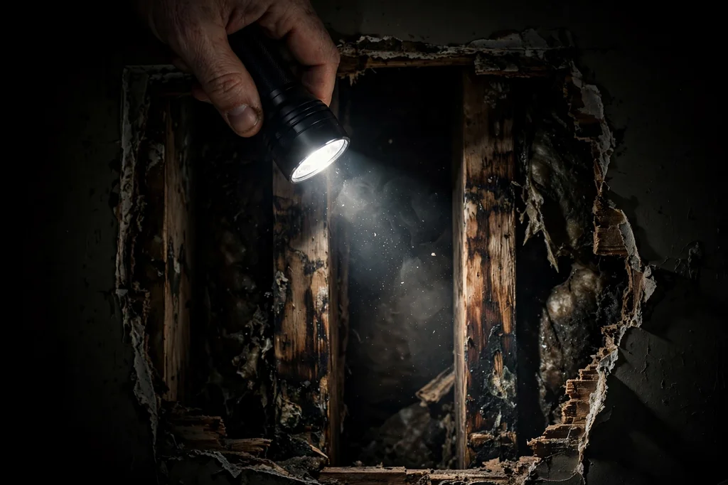
    A flashlight beam revealing water-stained framing inside an opened wall cavity

    The compound

    Lessons stack. That’s the whole game.

    Ten lessons is a resource. Fifty is a library. A hundred is the site homeowners find at 11pm, the one the search engines cite, the one the AI answers quote when someone asks what’s happening inside their wall. Teachers get cited. Teachers get called. Teachers get trusted before the bid ever goes out.

    And every lesson is a neuron in the knowledge base — yours first. The contractor who teaches for a year doesn’t just have better marketing. He has a better-organized head: the trade, distilled, searchable, in his own words.

    The close

    Teach what you know. Sell what you do.

    The lesson is the marketing; the job is the product. Every job site is a classroom, every fearful 11pm search is a student, and the contractor who teaches is the one who gets the call in the morning.

    Nobody ever hired the ad. They hired the teacher.

  • The Answer Is the New Homepage

    The Answer Is the New Homepage

    Your website used to be the front door. A homeowner with a problem found you, walked in, looked around.

    Now the front door is an answer. And the answer lives somewhere else.

    What changed

    Picture the homeowner with water on the kitchen floor. Five years ago she Googled “water damage restoration Tacoma,” opened six tabs, and compared websites. Your homepage mattered. Your design mattered. Your “welcome to our family-owned business” paragraph mattered.

    Today she asks her phone who to call. She gets one name — maybe two — spoken back with confidence, plus a number. She calls. She never sees your homepage. She never sees anyone’s homepage.

    The website didn’t die. It got demoted. It’s not the destination anymore; it’s the reference library the answer reads before it speaks.

    The library, not the lobby

    That’s not bad news. Libraries get cited. Lobbies get walked through.

    But it changes what the building is for. A lobby is designed to impress visitors. A library is designed to be read by something that isn’t you — quickly, accurately, and with enough trust to repeat what it found.

    Every page on your site is now a candidate for exactly one job: being the page an AI pulls when somebody asks the question that page answers. If a page can’t do that job, it’s not underperforming — it’s unemployed.

    A grand library with one book glowing as it slides out from the shelf

    What the answer reads

    The pages that get cited aren’t the prettiest. They’re the most answerable. After watching this for a year, the pattern is consistent:

    1. One question, one answer. The page that wins “who do I call for a flooded kitchen in Tacoma” is the page that answers exactly that — not the page that also covers mold, fire, and the company’s founding story.
    2. Proof you can’t fake. Real job photos. Real street names. Real before-and-afters from real houses in the towns you serve. An AI cross-checks everything against the rest of the web; verifiable detail is the whole game.
    3. The same story everywhere. Business name, service area, phone number — identical on your site, your Google profile, and every directory that matters. Trust is a pattern. Patterns need repetition.

    Notice the theme: nothing here is about design. The answer doesn’t care what your homepage looks like. It cares whether it can trust your emergency page at 2 AM when a pipe bursts.

    Your Monday-morning playbook

    Five moves. No agency required for the first four.

    1. Own your Google Business Profile like it’s your storefront — because it is. Correct hours, correct service area, real photos of real work, reviews answered. The answer checks here first.
    2. One money page per service, per city. Not one “services” page with a dropdown. “Kitchen flood cleanup in Tacoma” gets its own page. “Mold remediation in Puyallup” gets its own page. Each one answers one question completely.
    3. Put the phone question on the page. Write the question your customer actually asks — “who do I call when my water heater floods the garage” — and answer it in the first paragraph. Plain words. Their words, not industry words.
    4. Real proof on every page. A photo from a job in that city. The street, the outcome, what it took. Stock photos are invisible to trust.
    5. Say the same thing everywhere. Pick one business name, one service-area list, one phone number. Put them identically on every surface you control. Boring. Essential.

    Do those five and you’ve done more for your AI visibility than a redesign, a blog schedule, and a keyword report combined.

    What not to do

    Don’t chase traffic. Traffic was the metric of the lobby era — how many people walked in. The library era has a different metric: how often you’re cited as the answer. A page with forty visitors a month that gets cited weekly is worth more than a page with four thousand visitors nobody quotes.

    Don’t blog for Google. The weekly “5 Tips for Preventing Water Damage” post was written for an algorithm that ranked pages. The new reader doesn’t rank — it answers. One true answer beats fifty tips.

    Don’t redesign for visitors who aren’t coming. If your homepage gets a tenth of the eyeballs it used to, that’s not a design problem. That’s the era. Spend the redesign money on proof: more job photos, more real answers, more pages that each do one job.

    The judgment call you can’t outsource

    Here’s the part no tool does for you: deciding which questions are yours to win.

    “Water damage restoration” is everyone’s question. “Who do I call when the crawlspace floods in Fircrest” might be yours — if you’re the company with three Fircrest crawlspace jobs photographed, documented, and answered in plain English. The riches are in the specific. The specific is a decision, not a tactic.

    Ask yourself: what are the ten questions your best customers asked right before they hired you? Those are your ten pages. Everything else is optional.

    A front door standing open at dusk with warm light pouring out, a phone on the doorstep

    The close

    The homepage isn’t dead. It’s just not the front door anymore.

    The front door is the moment somebody asks — out loud, to a machine, water on the floor — and your name comes out of its mouth. Every page you publish, every photo you post, every review you answer is either earning you that moment or it isn’t.

    Build for the answer. The visitors will follow.

  • Flash Flood Warning: Lawrence, OH Until 2:00 PM EDT

    Flash Flood Warning: Lawrence, OH Until 2:00 PM EDT

    Flash Flood Warning issued September 23 at 11:05AM EDT until September 23 at 2:00PM EDT by NWS Charleston WV The National Weather Service in Charleston WV has issued a Flash Flood Warning for Lawrence, OH; Wayne, WV until 2:00 PM EDT. This is a live snapshot as of 8:16 AM PDT. Conditions change fast — always verify with the National Weather Service for your specific county or ZIP code.

    For restoration teams, a flash flood warning is the interior water-intrusion call window: saturated drywall and insulation, flooded basements and crawl spaces, sewer backups in low-lying neighborhoods, and vehicles ruined in submerged underpasses — the exact jobs mitigation crews see most.

    Lawrence, OH — Flash Flood Warning

    Issuing office: NWS Charleston WV. Issued: 11:05 AM EDT. Expires: 2:00 PM EDT.

    FFWRLX

    The National Weather Service in Charleston has issued a

    * Flash Flood Warning for…
    South Central Lawrence County in southeastern Ohio…
    North Central Wayne County in western West Virginia…

    * Until 200 PM EDT.

    * At 1105 AM EDT, Doppler radar indicated thunderstorms producing
    heavy rain across the warned area. Flash flooding is ongoing or
    expected to begin shortly.

    HAZARD…Flash flooding caused by thunderstorms.

    SOURCE…Radar indicated.

    IMPACT…Flash flooding of small creeks and streams, urban areas,
    highways, streets and underpasses as well as other poor
    drainage and low-lying areas.

    * Some locations that will experience flash flooding include…
    Huntington, Chesapeake, Kenova, Catlettsburg, Ceredo, South Point
    and Burlington.

    This includes Interstate 64 in West Virginia between mile markers 1
    and 5.

    Named locations in the warning path: Huntington, Chesapeake, Kenova, Catlettsburg, Ceredo, South Point and Burlington.

    Source: the NWS active alerts feed.

    Stay safe tonight

    Turn around, don’t drown. Most flood deaths occur in vehicles — never drive through flooded roadways or around barricades. Six inches of moving water can knock an adult down; a foot can sweep a car away.

    If water enters your home: stay out of standing water where electricity may be present, avoid the basement until the water recedes and the power is confirmed off, and photograph everything before cleanup begins — documentation matters for insurance. Then call a local restoration contractor. Water left sitting starts a second wave of damage (mold, swelling, odor) within a day.

    NWS instruction: Turn around, don't drown when encountering flooded roads. Most flood deaths occur in vehicles. Report flooding to the National Weather Service by calling toll free, 800 401 9535, when you can do so safely.

    What this means for restoration teams

    Flash flood warnings translate into a predictable damage profile: interior water intrusion at doorways and foundation walls, saturated drywall and insulation requiring flood cuts, flooring loss, sewage backup in low-lying areas, and soaked vehicles and outbuildings. Mold risk starts at 24–48 hours on wet porous materials.

    The play: stage equipment now — air movers, dehumidifiers, extraction units — pre-position drying assets near the warned corridor, and keep an on-call rotation through the morning. Capture the address, the water source (clean rainwater vs. contaminated floodwater), and every affected room on the first call; it determines the mitigation category and the estimate.

    Field discipline: photo-document before mitigation starts, moisture-map every affected room (not just the visibly wet ones), and keep the homeowner’s payment responsibility clear in writing before work begins. Floodwater is almost always Category 3 — treat it as contaminated and do not let homeowners wade through it to “save” belongings.

    FEMA & federal assistance

    FEMA Helpline 1-800-621-3362 (7 a.m.–10 p.m. local, 7 days). DisasterAssistance.gov, the FEMA app, and fema.gov/drc for recovery centers. Basic eligibility: citizenship or qualified status, identity verification, proof of occupancy or ownership, and unmet needs not covered by insurance. Apply as soon as it is safe to do so.

    Looking ahead

    When this warning expires at 2:00 PM EDT, the danger does not necessarily end. Flooded creeks can crest after the heaviest rain has passed, downed lines and weakened trees keep roads dangerous, and additional storm rounds may follow. Watch for updated NWS alerts before heading out.

    Demand window note: damage-discovery calls typically start within hours and keep coming for days as people find what the storm left behind — wicking drywall, buckling floors, musty odors, and hail marks show up 24–72 hours later. Restoration teams should expect the intake line to stay busy well past the warning’s expiration.

    Sources & how to verify

    • NWS active alerts feed
    • National Weather Service in Charleston WV office page
    • Check weather.gov for your county or ZIP code.

    This post is for informational purposes and is not an official weather warning. Always follow instructions from local authorities and the National Weather Service.

  • Flash Flood Warning: Otero, NM Until 11:00 AM MDT

    Flash Flood Warning: Otero, NM Until 11:00 AM MDT

    Flash Flood Warning issued September 23 at 9:07AM MDT until September 23 at 11:00AM MDT by NWS El Paso Tx/Santa Teresa NM The National Weather Service in El Paso Tx/Santa Teresa NM has issued a Flash Flood Warning for Otero, NM until 11:00 AM MDT. This is a live snapshot as of 8:16 AM PDT. Conditions change fast — always verify with the National Weather Service for your specific county or ZIP code.

    For restoration teams, a flash flood warning is the interior water-intrusion call window: saturated drywall and insulation, flooded basements and crawl spaces, sewer backups in low-lying neighborhoods, and vehicles ruined in submerged underpasses — the exact jobs mitigation crews see most.

    Otero, NM — Flash Flood Warning

    Issuing office: NWS El Paso Tx/Santa Teresa NM. Issued: 9:07 AM MDT. Expires: 11:00 AM MDT.

    FFWEPZ

    The National Weather Service in El Paso Tx/Santa Teresa has issued a

    * Flash Flood Warning for…
    The Salt Fire Burn Scar in…
    Northern Otero County in south central New Mexico…

    * Until 1100 AM MDT.

    * At 907 AM MDT, Emergency management reported thunderstorms
    producing heavy rain over the Salt Fire Burn Scar. Between 0.5 and
    1 inch of rain has fallen. Additional rainfall amounts up to 0.5
    inches are possible in the warned area. Flash flooding is ongoing
    or expected to begin shortly. Excessive rainfall over the burn scar
    will result in debris flow moving through the Salt Fire Burn Scar,
    into canyons flowing north towards Cherokee Bill Canyon and US
    Highway 70. These side canyons include Bear, Snow, and Fence
    Canyons. Portions of Highway 70 between Apache Summit and the
    Lincoln County line may be impacted. The debris flow can consist of
    rock, mud, vegetation and other loose materials.

    HAZARD…Flash flooding caused by thunderstorms in and around the
    Salt Fire Burn Scar.

    SOURCE…Emergency management reported.

    IMPACT…Flooding of areas in and around the Salt Fire Burn Scar.

    * Some locations that will experience flash flooding include…
    Snow Canyon, Bear Canyon, Fence Canyon and Portions of US Highway
    70 between Apache Summit and the Otero-Lincoln County Line.

    Named locations in the warning path: Snow Canyon, Bear Canyon, Fence Canyon and Portions of US Highway 70 between Apache Summit and the Otero-Lincoln County Line.

    Source: the NWS active alerts feed.

    Stay safe tonight

    Turn around, don’t drown. Most flood deaths occur in vehicles — never drive through flooded roadways or around barricades. Six inches of moving water can knock an adult down; a foot can sweep a car away.

    If water enters your home: stay out of standing water where electricity may be present, avoid the basement until the water recedes and the power is confirmed off, and photograph everything before cleanup begins — documentation matters for insurance. Then call a local restoration contractor. Water left sitting starts a second wave of damage (mold, swelling, odor) within a day.

    NWS instruction: Heavy rainfall will cause extensive and severe flash flooding of creeks…streams…and ditches in the Salt Fire Burn Scar. Severe debris flows can also be anticipated across roads. Roads and driveways may be washed away in places. If you encounter flood waters…climb to safety.

    What this means for restoration teams

    Flash flood warnings translate into a predictable damage profile: interior water intrusion at doorways and foundation walls, saturated drywall and insulation requiring flood cuts, flooring loss, sewage backup in low-lying areas, and soaked vehicles and outbuildings. Mold risk starts at 24–48 hours on wet porous materials.

    The play: stage equipment now — air movers, dehumidifiers, extraction units — pre-position drying assets near the warned corridor, and keep an on-call rotation through the morning. Capture the address, the water source (clean rainwater vs. contaminated floodwater), and every affected room on the first call; it determines the mitigation category and the estimate.

    Field discipline: photo-document before mitigation starts, moisture-map every affected room (not just the visibly wet ones), and keep the homeowner’s payment responsibility clear in writing before work begins. Floodwater is almost always Category 3 — treat it as contaminated and do not let homeowners wade through it to “save” belongings.

    FEMA & federal assistance

    FEMA Helpline 1-800-621-3362 (7 a.m.–10 p.m. local, 7 days). DisasterAssistance.gov, the FEMA app, and fema.gov/drc for recovery centers. Basic eligibility: citizenship or qualified status, identity verification, proof of occupancy or ownership, and unmet needs not covered by insurance. Apply as soon as it is safe to do so.

    Looking ahead

    When this warning expires at 11:00 AM MDT, the danger does not necessarily end. Flooded creeks can crest after the heaviest rain has passed, downed lines and weakened trees keep roads dangerous, and additional storm rounds may follow. Watch for updated NWS alerts before heading out.

    Demand window note: damage-discovery calls typically start within hours and keep coming for days as people find what the storm left behind — wicking drywall, buckling floors, musty odors, and hail marks show up 24–72 hours later. Restoration teams should expect the intake line to stay busy well past the warning’s expiration.

    Sources & how to verify

    • NWS active alerts feed
    • National Weather Service in El Paso Tx/Santa Teresa NM office page
    • Check weather.gov for your county or ZIP code.

    This post is for informational purposes and is not an official weather warning. Always follow instructions from local authorities and the National Weather Service.

  • Flash Flood Warning: Lincoln, NM Until 12:15 PM MDT

    Flash Flood Warning: Lincoln, NM Until 12:15 PM MDT

    Flash Flood Warning issued September 23 at 9:08AM MDT until September 23 at 12:15PM MDT by NWS Albuquerque NM The National Weather Service in Albuquerque NM has issued a Flash Flood Warning for Lincoln, NM until 12:15 PM MDT. This is a live snapshot as of 8:16 AM PDT. Conditions change fast — always verify with the National Weather Service for your specific county or ZIP code.

    For restoration teams, a flash flood warning is the interior water-intrusion call window: saturated drywall and insulation, flooded basements and crawl spaces, sewer backups in low-lying neighborhoods, and vehicles ruined in submerged underpasses — the exact jobs mitigation crews see most.

    Lincoln, NM — Flash Flood Warning

    Issuing office: NWS Albuquerque NM. Issued: 9:08 AM MDT. Expires: 12:15 PM MDT.

    FFWABQ

    The National Weather Service in Albuquerque has issued a

    * Flash Flood Warning for…
    The South Fork burn scar in…
    South Central Lincoln County in central New Mexico…

    * Until 1215 PM MDT.

    * At 908 AM MDT, Doppler radar and automated rain gauges indicated
    thunderstorms producing heavy rain over the South Fork Burn Scar.
    Between 0.5 and 1.25 inches of rain have fallen. The expected
    rainfall rate is 0.25 to 0.75 inches in 1 hour. Additional rainfall
    amounts of 0.25 to 0.75 inches are possible in the warned area.
    Flash flooding is ongoing or expected to begin shortly. Higher
    flows have been observed in Brady Canyon and Bear Canyon impacting
    roads and low lying areas.

    Excessive rainfall over the burn scar will impact Upper Canyon, Brady
    Canyon, and Perk Canyon as well as the Cedar Creek, Eagle Creek and
    Rio Ruidoso drainages. Impacts will include but are not limited to
    all nearby reservoirs, bridges, culverts and roadways. Impacts to
    areas along the Rio Ruidoso may extend downstream of Ruidoso Downs.
    The debris flow can consist of rock, mud, vegetation and other loose
    materials.

    HAZARD…Flash flooding caused by thunderstorms in and around the
    South Fork Burn Scar.

    SOURCE…Radar and automated gauges.

    IMPACT…Flooding of areas in and around the South Fork Burn Scar.

    * Some locations that will experience flash flooding include…
    Ruidoso, Ruidoso Downs, Alto, Glencoe and Hollywood.

    Named locations in the warning path: Ruidoso, Ruidoso Downs, Alto, Glencoe and Hollywood.

    Source: the NWS active alerts feed.

    Stay safe tonight

    Turn around, don’t drown. Most flood deaths occur in vehicles — never drive through flooded roadways or around barricades. Six inches of moving water can knock an adult down; a foot can sweep a car away.

    If water enters your home: stay out of standing water where electricity may be present, avoid the basement until the water recedes and the power is confirmed off, and photograph everything before cleanup begins — documentation matters for insurance. Then call a local restoration contractor. Water left sitting starts a second wave of damage (mold, swelling, odor) within a day.

    NWS instruction: This is a life threatening situation. Heavy rainfall will cause extensive and severe flash flooding of creeks, streams and ditches in the South Fork Burn Scar. Severe debris flows can also be anticipated across roads. Roads and driveways may be washed away in places. If you encounter flood waters, climb to safety.

    What this means for restoration teams

    Flash flood warnings translate into a predictable damage profile: interior water intrusion at doorways and foundation walls, saturated drywall and insulation requiring flood cuts, flooring loss, sewage backup in low-lying areas, and soaked vehicles and outbuildings. Mold risk starts at 24–48 hours on wet porous materials.

    The play: stage equipment now — air movers, dehumidifiers, extraction units — pre-position drying assets near the warned corridor, and keep an on-call rotation through the morning. Capture the address, the water source (clean rainwater vs. contaminated floodwater), and every affected room on the first call; it determines the mitigation category and the estimate.

    Field discipline: photo-document before mitigation starts, moisture-map every affected room (not just the visibly wet ones), and keep the homeowner’s payment responsibility clear in writing before work begins. Floodwater is almost always Category 3 — treat it as contaminated and do not let homeowners wade through it to “save” belongings.

    FEMA & federal assistance

    FEMA Helpline 1-800-621-3362 (7 a.m.–10 p.m. local, 7 days). DisasterAssistance.gov, the FEMA app, and fema.gov/drc for recovery centers. Basic eligibility: citizenship or qualified status, identity verification, proof of occupancy or ownership, and unmet needs not covered by insurance. Apply as soon as it is safe to do so.

    Looking ahead

    When this warning expires at 12:15 PM MDT, the danger does not necessarily end. Flooded creeks can crest after the heaviest rain has passed, downed lines and weakened trees keep roads dangerous, and additional storm rounds may follow. Watch for updated NWS alerts before heading out.

    Demand window note: damage-discovery calls typically start within hours and keep coming for days as people find what the storm left behind — wicking drywall, buckling floors, musty odors, and hail marks show up 24–72 hours later. Restoration teams should expect the intake line to stay busy well past the warning’s expiration.

    Sources & how to verify

    • NWS active alerts feed
    • National Weather Service in Albuquerque NM office page
    • Check weather.gov for your county or ZIP code.

    This post is for informational purposes and is not an official weather warning. Always follow instructions from local authorities and the National Weather Service.

  • Flash Flood Warning: Gallia, OH Until 2:15 PM EDT

    Flash Flood Warning: Gallia, OH Until 2:15 PM EDT

    Flash Flood Warning issued September 23 at 11:15AM EDT until September 23 at 2:15PM EDT by NWS Charleston WV The National Weather Service in Charleston WV has issued a Flash Flood Warning for Gallia, OH; Mason, WV until 2:15 PM EDT. This is a live snapshot as of 8:16 AM PDT. Conditions change fast — always verify with the National Weather Service for your specific county or ZIP code.

    For restoration teams, a flash flood warning is the interior water-intrusion call window: saturated drywall and insulation, flooded basements and crawl spaces, sewer backups in low-lying neighborhoods, and vehicles ruined in submerged underpasses — the exact jobs mitigation crews see most.

    Gallia, OH — Flash Flood Warning

    Issuing office: NWS Charleston WV. Issued: 11:15 AM EDT. Expires: 2:15 PM EDT.

    FFWRLX

    The National Weather Service in Charleston has issued a

    * Flash Flood Warning for…
    Southeastern Gallia County in southeastern Ohio…
    Southwestern Mason County in western West Virginia…

    * Until 215 PM EDT.

    * At 1115 AM EDT, Doppler radar indicated thunderstorms producing
    heavy rain across the warned area. Flash flooding is ongoing or
    expected to begin shortly.

    HAZARD…Flash flooding caused by thunderstorms.

    SOURCE…Radar indicated.

    IMPACT…Flash flooding of small creeks and streams, urban areas,
    highways, streets and underpasses as well as other poor
    drainage and low-lying areas.

    * Some locations that will experience flash flooding include…
    Crown City and Ashton.

    Named locations in the warning path: Crown City and Ashton.

    Source: the NWS active alerts feed.

    Stay safe tonight

    Turn around, don’t drown. Most flood deaths occur in vehicles — never drive through flooded roadways or around barricades. Six inches of moving water can knock an adult down; a foot can sweep a car away.

    If water enters your home: stay out of standing water where electricity may be present, avoid the basement until the water recedes and the power is confirmed off, and photograph everything before cleanup begins — documentation matters for insurance. Then call a local restoration contractor. Water left sitting starts a second wave of damage (mold, swelling, odor) within a day.

    NWS instruction: Turn around, don't drown when encountering flooded roads. Most flood deaths occur in vehicles. Report flooding to the National Weather Service by calling toll free, 800 401 9535, when you can do so safely.

    What this means for restoration teams

    Flash flood warnings translate into a predictable damage profile: interior water intrusion at doorways and foundation walls, saturated drywall and insulation requiring flood cuts, flooring loss, sewage backup in low-lying areas, and soaked vehicles and outbuildings. Mold risk starts at 24–48 hours on wet porous materials.

    The play: stage equipment now — air movers, dehumidifiers, extraction units — pre-position drying assets near the warned corridor, and keep an on-call rotation through the morning. Capture the address, the water source (clean rainwater vs. contaminated floodwater), and every affected room on the first call; it determines the mitigation category and the estimate.

    Field discipline: photo-document before mitigation starts, moisture-map every affected room (not just the visibly wet ones), and keep the homeowner’s payment responsibility clear in writing before work begins. Floodwater is almost always Category 3 — treat it as contaminated and do not let homeowners wade through it to “save” belongings.

    FEMA & federal assistance

    FEMA Helpline 1-800-621-3362 (7 a.m.–10 p.m. local, 7 days). DisasterAssistance.gov, the FEMA app, and fema.gov/drc for recovery centers. Basic eligibility: citizenship or qualified status, identity verification, proof of occupancy or ownership, and unmet needs not covered by insurance. Apply as soon as it is safe to do so.

    Looking ahead

    When this warning expires at 2:15 PM EDT, the danger does not necessarily end. Flooded creeks can crest after the heaviest rain has passed, downed lines and weakened trees keep roads dangerous, and additional storm rounds may follow. Watch for updated NWS alerts before heading out.

    Demand window note: damage-discovery calls typically start within hours and keep coming for days as people find what the storm left behind — wicking drywall, buckling floors, musty odors, and hail marks show up 24–72 hours later. Restoration teams should expect the intake line to stay busy well past the warning’s expiration.

    Sources & how to verify

    • NWS active alerts feed
    • National Weather Service in Charleston WV office page
    • Check weather.gov for your county or ZIP code.

    This post is for informational purposes and is not an official weather warning. Always follow instructions from local authorities and the National Weather Service.

  • Flash Flood Warning: Lincoln, WV Until 1:00 PM EDT

    Flash Flood Warning: Lincoln, WV Until 1:00 PM EDT

    Flash Flood Warning issued September 23 at 10:03AM EDT until September 23 at 1:00PM EDT by NWS Charleston WV The National Weather Service in Charleston WV has issued a Flash Flood Warning for Lincoln, WV; Putnam, WV until 1:00 PM EDT. This is a live snapshot as of 7:16 AM PDT. Conditions change fast — always verify with the National Weather Service for your specific county or ZIP code.

    For restoration teams, a flash flood warning is the interior water-intrusion call window: saturated drywall and insulation, flooded basements and crawl spaces, sewer backups in low-lying neighborhoods, and vehicles ruined in submerged underpasses — the exact jobs mitigation crews see most.

    Lincoln, WV — Flash Flood Warning

    Issuing office: NWS Charleston WV. Issued: 10:03 AM EDT. Expires: 1:00 PM EDT.

    FFWRLX

    The National Weather Service in Charleston has issued a

    * Flash Flood Warning for…
    Northeastern Lincoln County in central West Virginia…
    South Central Putnam County in western West Virginia…

    * Until 100 PM EDT.

    * At 1003 AM EDT, Doppler radar indicated a nearly stationary
    thunderstorm producing heavy rain across the warned area. Between
    1.2 and 1.8 inches of rain have fallen. Flash flooding is ongoing
    or expected to begin shortly.

    HAZARD…Flash flooding caused by thunderstorms.

    SOURCE…Radar indicated.

    IMPACT…Flash flooding of small creeks and streams, urban areas,
    highways, streets and underpasses as well as other poor
    drainage and low-lying areas.

    * Some locations that will experience flash flooding include…
    Alum Creek.

    Named locations in the warning path: Alum Creek.

    Source: the NWS active alerts feed.

    Stay safe tonight

    Turn around, don’t drown. Most flood deaths occur in vehicles — never drive through flooded roadways or around barricades. Six inches of moving water can knock an adult down; a foot can sweep a car away.

    If water enters your home: stay out of standing water where electricity may be present, avoid the basement until the water recedes and the power is confirmed off, and photograph everything before cleanup begins — documentation matters for insurance. Then call a local restoration contractor. Water left sitting starts a second wave of damage (mold, swelling, odor) within a day.

    NWS instruction: Turn around, don't drown when encountering flooded roads. Most flood deaths occur in vehicles. Be aware of your surroundings and do not drive on flooded roads. In hilly terrain there are hundreds of low water crossings which are potentially dangerous in heavy rain. Do not attempt to cross flooded roads. Find an alternate route. Report flooding to the National Weather Service by calling toll free, 800 401 9535, when you can do so safely.

    What this means for restoration teams

    Flash flood warnings translate into a predictable damage profile: interior water intrusion at doorways and foundation walls, saturated drywall and insulation requiring flood cuts, flooring loss, sewage backup in low-lying areas, and soaked vehicles and outbuildings. Mold risk starts at 24–48 hours on wet porous materials.

    The play: stage equipment now — air movers, dehumidifiers, extraction units — pre-position drying assets near the warned corridor, and keep an on-call rotation through the morning. Capture the address, the water source (clean rainwater vs. contaminated floodwater), and every affected room on the first call; it determines the mitigation category and the estimate.

    Field discipline: photo-document before mitigation starts, moisture-map every affected room (not just the visibly wet ones), and keep the homeowner’s payment responsibility clear in writing before work begins. Floodwater is almost always Category 3 — treat it as contaminated and do not let homeowners wade through it to “save” belongings.

    FEMA & federal assistance

    FEMA Helpline 1-800-621-3362 (7 a.m.–10 p.m. local, 7 days). DisasterAssistance.gov, the FEMA app, and fema.gov/drc for recovery centers. Basic eligibility: citizenship or qualified status, identity verification, proof of occupancy or ownership, and unmet needs not covered by insurance. Apply as soon as it is safe to do so.

    Looking ahead

    When this warning expires at 1:00 PM EDT, the danger does not necessarily end. Flooded creeks can crest after the heaviest rain has passed, downed lines and weakened trees keep roads dangerous, and additional storm rounds may follow. Watch for updated NWS alerts before heading out.

    Demand window note: damage-discovery calls typically start within hours and keep coming for days as people find what the storm left behind — wicking drywall, buckling floors, musty odors, and hail marks show up 24–72 hours later. Restoration teams should expect the intake line to stay busy well past the warning’s expiration.

    Sources & how to verify

    • NWS active alerts feed
    • National Weather Service in Charleston WV office page
    • Check weather.gov for your county or ZIP code.

    This post is for informational purposes and is not an official weather warning. Always follow instructions from local authorities and the National Weather Service.

  • Flash Flood Warning: Dona Ana Area Until 12:00 PM UTC

    Flash Flood Warning: Dona Ana Area Until 12:00 PM UTC

    What is happening

    Flash Flood Warning issued September 23 at 3:02AM MDT until September 23 at 6:00AM MDT by NWS El Paso Tx/Santa Teresa NM

    The National Weather Service NWS El Paso Tx/Santa Teresa NM issued this warning at September 23 at 9:02AM UTC. It remains in effect until 12:00 PM UTC for the following areas: Dona Ana, NM; El Paso, TX.

    This is a live snapshot as of 9:16 AM Pacific. Conditions change fast — always verify with the National Weather Service for your specific county or ZIP code.

    Dona Ana, NM; El Paso, TX — Flash Flood Warning

    Issuing office: NWS El Paso Tx/Santa Teresa NM. Issued: September 23 at 9:02AM UTC. Expires: 12:00 PM UTC. Severity: Severe.

    What the NWS says:

    FFWEPZ

    The National Weather Service in El Paso Tx/Santa Teresa has issued a

    * Flash Flood Warning for…
    Southeastern Dona Ana County in south central New Mexico…
    Central El Paso County in western Texas…

    * Until 600 AM MDT.

    * At 302 AM MDT, Doppler radar indicated thunderstorms producing
    heavy rain across the warned area. Between 1 and 1.5 inches of rain
    have fallen. Additional rainfall amounts of 0.5 to 1.5 inches are
    possible in the warned area. Flash flooding is ongoing or expected
    to begin shortly.

    HAZARD…Flash flooding caused by thunderstorms.

    SOURCE…Radar indicated.

    IMPACT…Flash flooding of small creeks and streams, urban areas,
    highways, streets and underpasses as well as other poor
    drainage and low-lying areas.

    * Some locations that will experience flash flooding include…
    West El Paso, Central El Paso, Northeast El Paso, East El Paso, Far
    East El Paso, Mission Valley, Horizon City, Clint, Anthony, Santa
    Teresa, Sunland Park, Canutillo, Anthony Gap and San Elizario.

    Named in the warning: * Until 600 AM MDT.

    Stay safe tonight

    Turn around, don’t drown: most flood deaths happen in vehicles. Never drive through flooded roadways — six inches of moving water can knock you down, a foot can sweep a car.

    If water gets into the home: stay out of standing water where electricity may be present, avoid the basement until water recedes and power is confirmed off, photograph everything before cleanup (documentation matters for insurance), then call a local restoration contractor — water left sitting starts a second wave of damage within a day.

    What this means for restoration teams

    This is the exact interior-flooding job mix restoration teams see most: water intrusion through doors and foundation cracks, saturated drywall and insulation in finished lower levels, and sewage backup in low-lying areas. Mold risk starts climbing within 24–48 hours if drying doesn’t start.

    The play: stage equipment now, pre-position drying assets, keep an on-call rotation through the morning, and capture address + water source + affected areas on the first call. Field discipline: photo-document before mitigation, moisture-map every affected room, and keep the homeowner’s payment responsibility clear in writing before work starts.

    FEMA & federal assistance

    FEMA Helpline 1-800-621-3362 (7 a.m.–10 p.m. local, 7 days a week). Apply at DisasterAssistance.gov, through the FEMA app, or find a recovery center at fema.gov/drc. Basic eligibility: citizenship or qualified status, identity verification, proof of occupancy or ownership, and unmet needs not covered by insurance. Apply as soon as it is safe to do so.

    Looking ahead

    When this warning expires at 12:00 PM UTC, watch for additional rounds — storms often train over the same area, and creeks and streams can crest after the rain stops. The next NWS update lands with the next warning product or the area forecast discussion. Water-intrusion calls typically start within hours of water receding and keep coming for days as people discover damage.

    Sources & how to verify

    Source: the National Weather Service alert (api.weather.gov) via NWS El Paso Tx/Santa Teresa NM. Verify for your county or ZIP at weather.gov or your local NWS office page.

    This post is for informational purposes and is not an official weather warning. Always follow instructions from local authorities and the National Weather Service.

  • Flash Flood Warning: Dona Ana, NM Until 4:30 AM MDT

    Flash Flood Warning: Dona Ana, NM Until 4:30 AM MDT

    Flash Flood Warning issued September 23 at 2:23AM MDT until September 23 at 4:30AM MDT by NWS El Paso Tx/Santa Teresa NM The National Weather Service in El Paso Tx/Santa Teresa NM has issued a Flash Flood Warning for Dona Ana, NM; El Paso, TX until 4:30 AM MDT. This is a live snapshot as of 1:31 AM PDT. Conditions change fast — always verify with the National Weather Service for your specific county or ZIP code.

    For restoration teams, a flash flood warning is the interior water-intrusion call window: saturated drywall and insulation, flooded basements and crawl spaces, sewer backups in low-lying neighborhoods, and vehicles ruined in submerged underpasses — the exact jobs mitigation crews see most.

    Dona Ana, NM — Flash Flood Warning

    Issuing office: NWS El Paso Tx/Santa Teresa NM. Issued: 2:23 AM MDT. Expires: 4:30 AM MDT.

    FFWEPZ

    The National Weather Service in El Paso Tx/Santa Teresa has issued a

    * Flash Flood Warning for…
    South Central Dona Ana County in south central New Mexico…
    Western El Paso County in western Texas…

    * Until 430 AM MDT.

    * At 223 AM MDT, Doppler radar indicated thunderstorms producing
    heavy rain across the warned area. Between 0.5 and 1 inch of rain
    has fallen. Additional rainfall amounts up to 0.5 inches are
    possible in the warned area. Flash flooding is ongoing or expected
    to begin shortly.

    HAZARD…Flash flooding caused by thunderstorms.

    SOURCE…Radar indicated.

    IMPACT…Flash flooding of small creeks and streams, urban areas,
    highways, streets and underpasses as well as other poor
    drainage and low-lying areas.

    * Some locations that will experience flash flooding include…
    Santa Teresa, Canutillo, Chamberino, La Union, La Mesa, Union
    Pacific Intermodal Terminal and Afton Generating Plant.

    Named locations in the warning path: Santa Teresa, Canutillo, Chamberino, La Union, La Mesa, Union Pacific Intermodal Terminal and Afton Generating Plant.

    Source: the NWS active alerts feed.

    Stay safe tonight

    Turn around, don’t drown. Most flood deaths occur in vehicles — never drive through flooded roadways or around barricades. Six inches of moving water can knock an adult down; a foot can sweep a car away.

    If water enters your home: stay out of standing water where electricity may be present, avoid the basement until the water recedes and the power is confirmed off, and photograph everything before cleanup begins — documentation matters for insurance. Then call a local restoration contractor. Water left sitting starts a second wave of damage (mold, swelling, odor) within a day.

    NWS instruction: Turn around, don't drown when encountering flooded roads. Most flood deaths occur in vehicles. Be especially cautious at night when it is harder to recognize the dangers of flooding. Be aware of your surroundings and do not drive on flooded roads.

    What this means for restoration teams

    Flash flood warnings translate into a predictable damage profile: interior water intrusion at doorways and foundation walls, saturated drywall and insulation requiring flood cuts, flooring loss, sewage backup in low-lying areas, and soaked vehicles and outbuildings. Mold risk starts at 24–48 hours on wet porous materials.

    The play: stage equipment now — air movers, dehumidifiers, extraction units — pre-position drying assets near the warned corridor, and keep an on-call rotation through the morning. Capture the address, the water source (clean rainwater vs. contaminated floodwater), and every affected room on the first call; it determines the mitigation category and the estimate.

    Field discipline: photo-document before mitigation starts, moisture-map every affected room (not just the visibly wet ones), and keep the homeowner’s payment responsibility clear in writing before work begins. Floodwater is almost always Category 3 — treat it as contaminated and do not let homeowners wade through it to “save” belongings.

    FEMA & federal assistance

    FEMA Helpline 1-800-621-3362 (7 a.m.–10 p.m. local, 7 days). DisasterAssistance.gov, the FEMA app, and fema.gov/drc for recovery centers. Basic eligibility: citizenship or qualified status, identity verification, proof of occupancy or ownership, and unmet needs not covered by insurance. Apply as soon as it is safe to do so.

    Looking ahead

    When this warning expires at 4:30 AM MDT, the danger does not necessarily end. Flooded creeks can crest after the heaviest rain has passed, downed lines and weakened trees keep roads dangerous, and additional storm rounds may follow. Watch for updated NWS alerts before heading out.

    Demand window note: damage-discovery calls typically start within hours and keep coming for days as people find what the storm left behind — wicking drywall, buckling floors, musty odors, and hail marks show up 24–72 hours later. Restoration teams should expect the intake line to stay busy well past the warning’s expiration.

    Sources & how to verify

    • NWS active alerts feed
    • National Weather Service in El Paso Tx/Santa Teresa NM office page
    • Check weather.gov for your county or ZIP code.

    This post is for informational purposes and is not an official weather warning. Always follow instructions from local authorities and the National Weather Service.