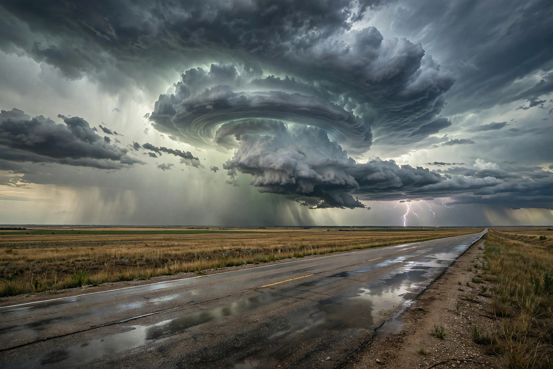
Tag: Storm Updates

Real-time severe weather tracking, storm pulses, and meteorological incident reporting.

  • Storm Updates: Plains Severe — Nov 2

    Storm Updates: Plains Severe — Nov 2

    Tropical: None · Severe: Slight · Flood: Slight

    What Changed

    • Compared with this morning’s pulse table (quiet-pulse-2026-11-02-morning: Tropical: None · Severe: Enhanced · Flood: Slight): SPC Day 1 has been updated. Earlier cycles (including 1300 UTC and 1630 UTC) carried an Enhanced Risk across north-central Oklahoma and south-central Kansas. The latest 0100 UTC November 3 outlook (issued 0700 PM CST November 2 / 0100Z November 3, valid 030100Z–031200Z) holds a Slight Risk of severe thunderstorms across parts of the southern and central Plains. A line of strong to severe storms is ongoing from far southern Kansas into southwest Oklahoma, with QLCS tornado potential and damaging winds. Tornado Watches 701, 702, and 703 remain active covering portions of Kansas, Oklahoma, and Texas.
    • WPC Day 1 Excessive Rainfall Outlook (updated 0100 UTC November 3, discussion 802 PM EST November 2) maintains a Slight Risk for portions of central and southern Florida, focused along the east coast. The prior Moderate Risk over the Four Corners / Southwest has been removed; Plains flash-flood risk was lowered and the Slight removed with this update as storm mode is progressive.
    • Tropical lane remains closed. National Hurricane Center confirms no tropical cyclones in the Atlantic, Caribbean, or Gulf of America. A western Atlantic disturbance has a 30 percent chance of subtropical development over the next 7 days but no U.S. coastal or Gulf watches or warnings.
    • Active Tornado Watches 701 (expires 0400 UTC Nov 3), 702 (expires 0500 UTC), and 703 (expires 0900 UTC) plus mesoscale discussions confirm ongoing severe potential with embedded rotating elements and possible gusts above 70 mph. Preliminary LSRs include hail reports near Norman, Moore, and Kingfisher, Oklahoma, and wind gusts to 59–61 mph near Hobart, Oklahoma, and Elkhart, Kansas. No confirmed tornado reports in the latest summary.
    • Nothing material upgraded beyond Slight on the severe or flood lanes. The Enhanced window has closed; the overnight progression into Missouri and Arkansas continues under the Slight.

    Live Status

    As of the afternoon desk on Monday, November 2, 2026 (approximately 8:16 PM PST / 04:16 UTC November 3), the national picture centers on the southern and central Plains. The Storm Prediction Center’s latest Day 1 Convective Outlook (0100 UTC November 3 cycle) states: “THERE IS A SLIGHT RISK OF SEVERE THUNDERSTORMS ACROSS PARTS OF THE SOUTHERN AND CENTRAL PLAINS.” Severe thunderstorms with damaging wind gusts, hail, and a few tornadoes are expected this evening into tonight, with the threat impacting western Missouri and northwest Arkansas overnight. A line of storms is tracking east-northeast across central Oklahoma into south-central Kansas under 65–70 knots of deep-layer shear and mid-level jet support. Discrete cells near the Red River carry supercell potential. The Weather Prediction Center Day 1 Excessive Rainfall Outlook holds a Slight Risk across central and southern Florida. No tropical storm or hurricane watch or warning is in effect on the U.S. coast or Gulf of America.

    Hotspots

    • Southern and central Plains (Oklahoma, Kansas, northwest Texas): Primary focus under SPC Slight Risk and active Tornado Watches 701–703. Ongoing linear mode with embedded mesovortices capable of QLCS tornadoes and damaging winds to 70+ mph. Further south near the Red River, discrete supercells possible with hail, wind, and tornado risk as the low-level jet ramps up. Expect the severe threat to progress eastward into western Missouri and northwest Arkansas overnight.
    • Central and southern Florida: WPC Slight Risk of excessive rainfall, focused along the east coast. Low-level easterly flow and coastal convergence support localized extreme rainfall potential overnight despite decreasing coverage. Residual Flash Flood Warnings noted earlier in Broward and Palm Beach counties.
    • Residual Southwest: Prior Moderate excessive rainfall and Flash Flood Warnings across Arizona (including burn scars and river gauges) have largely wound down. Isolated residual flooding possible on saturated soils, but not the dominant lane today.

    Just-Hit

    Preliminary SPC local storm reports for the current period include hail near Norman, Moore, and Kingfisher, Oklahoma (up to 1.25 inches), and measured wind gusts to 59–61 mph near Hobart, Oklahoma, and Elkhart, Kansas. Tree limbs and a trampoline reported damaged in Rooks County, Kansas. No confirmed tornado reports in the latest filtered summary reviewed. Tornado Watch 701 issued at 1925 UTC November 2; additional watches 702 and 703 issued later. Downstream considerations remain for eastern Oklahoma into Missouri and Arkansas.

    Pulse Table

    LaneStatusNotes (as of ~8:16 PM PST / 04:16 UTC Nov 3 2026)
    TropicalNoneNo tropical cyclones in the Atlantic, Caribbean, or Gulf. NHC: 30% chance of subtropical development for a western Atlantic disturbance over 7 days; no U.S. coastal or Gulf watches or warnings.
    SevereSlightSPC Day 1 (0100Z Nov 3): SLIGHT RISK southern and central Plains (~134k sq mi). Earlier Enhanced over N-central OK / S-central KS closed. Tornado Watches 701, 702, 703 active KS/OK/TX. Ongoing line with QLCS tornado and damaging wind threat. MDs including 2435/2437.
    FloodSlightWPC Day 1 ERO Slight Risk central and southern Florida (east coast focus). Prior Southwest Moderate closed. Plains Slight removed. Residual FFWs possible in FL and AZ.

    Restoration Read

    Primary short-term ticket is wind and possible tornado damage (roofs, siding, trees, power lines, outbuildings) across central Oklahoma into southern Kansas under the active watches and ongoing line. Secondary is localized flash flooding and urban ponding in central and southern Florida under the Slight ERO. Residual Southwest water extraction possible but lower priority. No named tropical restoration file. Stage for overnight progression into Missouri and Arkansas.

    What This Is Not

    This is not a Quiet Pulse. SPC Slight Risk and active Tornado Watches are open. WPC holds Slight, not Moderate or higher. No tropical storm or hurricane watch or warning on the U.S. coast or Gulf of America. This desk summarizes public products from the SPC, WPC, NWS, and NHC. Informational only — not an official warning.

    Looking Ahead One Day

    SPC Day 2 outlook (valid 031200Z–041200Z) holds a Marginal Risk of severe thunderstorms from east Texas and the Ark-La-Miss to the Mid Mississippi Valley. Scattered storms may produce damaging gusts and a couple of tornadoes, primarily with embedded line segments and limited buoyancy. WPC Day 2 points to continued localized heavy rain potential. The Plains severe window should diminish overnight into Tuesday as the system progresses east. Monitor for residual flooding on already wet ground.

    Rising Queries

    Trends unreachable.

    Sources

    Official products: Storm Prediction Center (Day 1 Outlook 0100Z November 3 / 0700 PM CST November 2, Tornado Watches 701–703, Mesoscale Discussions, today’s LSRs), Weather Prediction Center (Day 1 Excessive Rainfall Outlook and discussion 802 PM EST November 2), National Weather Service (watches, warnings, and advisories), National Hurricane Center (Atlantic quiet, Tropical Weather Outlook 700 PM EST November 2). Morning desk: quiet-pulse-2026-11-02-morning.

    Informational only — not an official weather warning. Follow local authorities and the National Weather Service. Turn around, don’t drown.
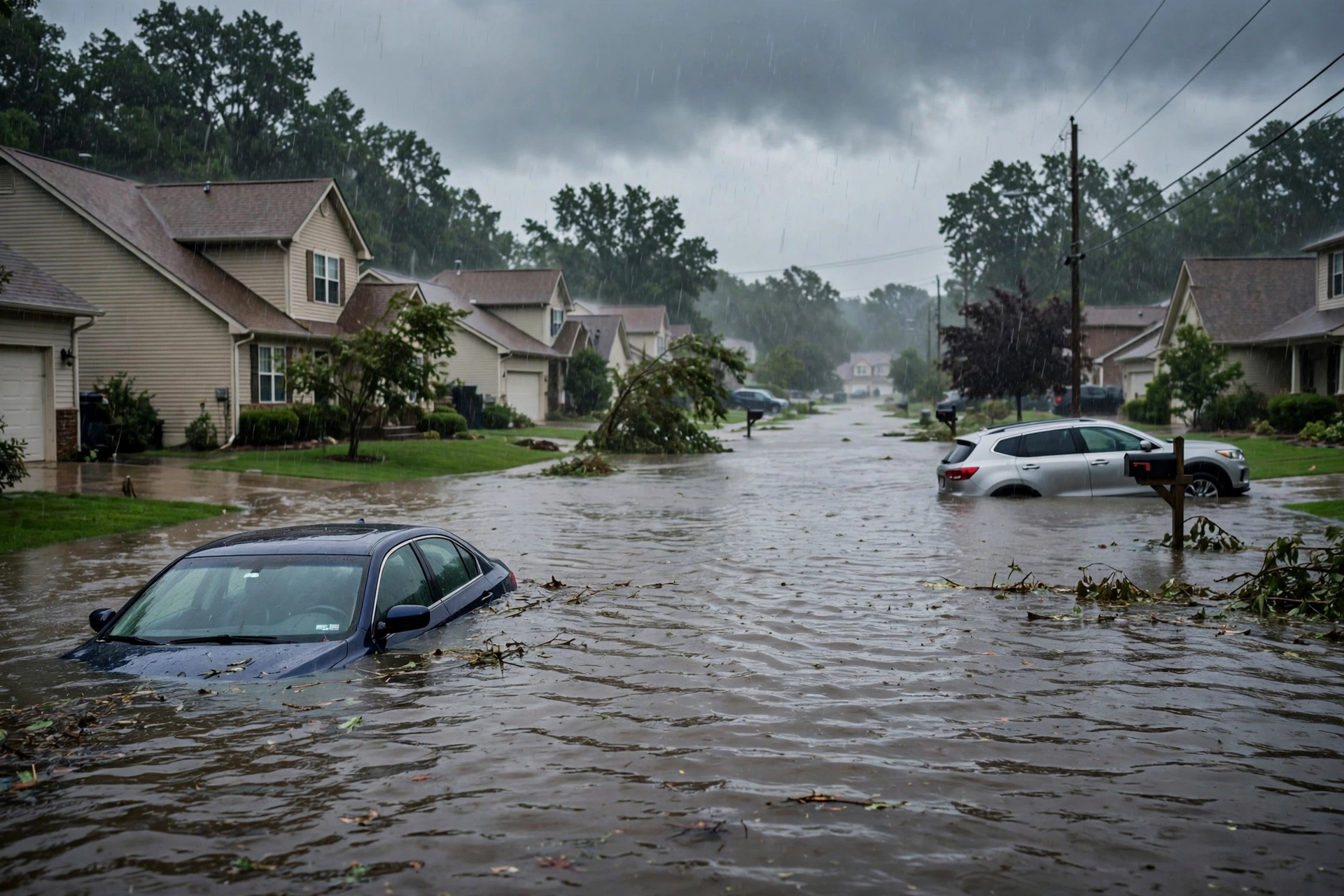
  • Storm Updates: Plains Slight — Nov 2 Morning

    Storm Updates: Plains Slight — Nov 2 Morning

    Tropical: None · Severe: Slight · Flood: Slight

    What Changed

    • Compared with the November 1 afternoon desk pulse table (quiet-pulse-2026-11-01-afternoon: Tropical: None · Severe: Slight · Flood: Moderate): SPC Day 1 has evolved. Earlier cycles on November 2 carried an Enhanced Risk across north-central Oklahoma and south-central Kansas. The latest 0100 UTC November 3 outlook (issued 0700 PM CST November 2, valid 030100Z–031200Z) holds a Slight Risk of severe thunderstorms across parts of the southern and central Plains.
    • A line of strong to severe storms is ongoing from far southern Kansas into southwest Oklahoma, with QLCS-type tornado potential maximized in embedded rotating elements and damaging winds, including possible gusts above 70 mph with bowing segments. Tornado Watch 701 remains in effect for portions of central and southern Kansas, western and central Oklahoma, and northwest Texas.
    • WPC Day 1 Excessive Rainfall Outlook (updated 0100 UTC November 3) maintains a Slight Risk for portions of central and southern Florida, focused along the east coast. The prior Moderate Risk over the Four Corners / Southwest has been removed; Plains flash-flood risk was lowered as storm mode is progressive.
    • No named tropical cyclones. NHC reports no tropical cyclones in the Atlantic, Caribbean, or Gulf of America. A western Atlantic disturbance has a near-zero percent chance of development in 48 hours and 30 percent over 7 days, well offshore, with no U.S. land threat or watches/warnings.
    • Active Tornado Watches and Severe Thunderstorm Warnings live in the Plains corridor. Flash Flood Warnings active in parts of Florida. High Wind Warnings remain in effect for portions of South Dakota and New Mexico.

    Live Status

    As of the morning desk on Monday, November 2, 2026 (updated late evening PST / early November 3 UTC), the national picture centers on the southern and central Plains. The Storm Prediction Center’s latest Day 1 Convective Outlook (0100 UTC November 3 cycle) states: “THERE IS A SLIGHT RISK OF SEVERE THUNDERSTORMS ACROSS PARTS OF THE SOUTHERN AND CENTRAL PLAINS.” Severe thunderstorms with damaging wind gusts, hail, and a few tornadoes are expected this evening into tonight. Severe storms will also affect western Missouri and northwest Arkansas overnight.

    On water vapor imagery, an upper-level trough is evident in the southern High Plains with cyclonically curved southwest flow in place over the southern and central Plains. A 60 to 80 knot mid-level jet is analyzed from southern New Mexico extending northeastward into western Oklahoma. A line of strong to severe storms is ongoing to the east of the mid-level jet from far southern Kansas into southwest Oklahoma. Ahead of this line, surface dewpoints are mostly in the lower to mid 60s F with MLCAPE in the 1000 to 1500 J/kg range. Strong deep-layer shear of 65 to 70 knots at Oklahoma City supports continued severe potential as the line segment organizes and moves eastward.

    So far across Oklahoma, the dominant storm mode has been linear, and discrete supercell development has failed to materialize. Within the ongoing line, tornado potential is maximized with embedded rotating elements. A few QLCS-type tornadoes still appear possible as this line moves eastward across central/northern Oklahoma and southeast Kansas this evening. A wind-damage threat accompanies the line. Further south into southwest Oklahoma and northwest Texas, cells have been more discrete, with a couple of supercells ongoing near the Red River. Severe wind gusts, hail and potentially a few tornadoes remain possible. In west-central and north-central Texas, a band of strong thunderstorms is developing near a surface trough with MLCAPE 2000 to 2500 J/kg; primary threats are severe wind gusts and hail.

    Tornado Watches remain active covering portions of Kansas, Oklahoma, and Texas. Mesoscale discussions note the ongoing line with potential for embedded intensification. Severe Thunderstorm Warnings have been issued, including for Montague County in north central Texas. Overnight local storm reports are expected as the system progresses eastward into Missouri and Arkansas.

    Flood risk has moderated. WPC maintains a Slight Risk of excessive rainfall for portions of central and southern Florida, with the main focus along the east coast. Overall coverage and magnitude of heavy rainfall should be lower overnight, though low-level easterly flow and instability continue to support localized extreme rainfall potential on saturated soils. Localized flash flooding is possible overnight from portions of Texas into Iowa, but primarily rate-driven and urban as the convective line is progressive. Flash Flood Warnings remain active in parts of Florida (including Brevard, Indian River, and Broward Counties) and residual in Arizona from earlier activity. High Wind Warnings continue across portions of the South Dakota foothills and southern New Mexico mountains through early Tuesday.

    Pulse Table

    LaneStatusNotes (as of late evening PST / early Nov 3 UTC 2026)
    TropicalNoneNo tropical cyclones in the Atlantic, Caribbean, or Gulf. NHC: near 0% / 30% formation chance for western Atlantic disturbance over 48h / 7 days; no U.S. coastal or Gulf watches or warnings.
    SevereSlightSPC Day 1 (0100Z Nov 3): SLIGHT RISK southern and central Plains (~134k sq mi). Earlier Enhanced closed. Tornado Watches active KS/OK/TX. Damaging winds, hail, few QLCS tornadoes possible into tonight. Active warnings.
    FloodSlightWPC Day 1 Slight residual central/southern FL east coast. Prior Four Corners Moderate removed. Isolated progressive rain risk TX-IA. Active Flash Flood Warnings FL residual AZ. High Wind Warnings SD/NM.

    Rising Queries

    Trends unreachable.

    Restoration Read

    Dominant ticket is severe weather damage across the southern and central Plains under the Slight Risk, with potential for tornadoes (QLCS type), damaging winds to 70+ mph, and hail as the line progresses overnight into Missouri and Arkansas. Secondary is residual flash flooding in Florida and high wind impacts in South Dakota and New Mexico. No widespread catastrophic flooding expected. No named storm hub. Informational only — not an official warning. Follow local NWS offices and official products.

    Informational only — not an official weather warning. Sources: SPC Day 1 Outlook, NWS watches/warnings, WPC Excessive Rainfall Outlook, NHC.

  • Storm Updates: Southwest Moderate Flood — Nov 1

    Storm Updates: Southwest Moderate Flood — Nov 1

    Tropical: None · Severe: Slight · Flood: Moderate

    What Changed

    • Compared with the October 31 afternoon pulse (quiet-pulse-2026-10-31-afternoon: Tropical: None · Severe: None · Flood: Slight): SPC Day 1 Convective Outlook (latest 0100 UTC November 2 / 6:41 PM CST November 1, 2026, valid 020100Z–021200Z) has opened a Slight Risk of severe thunderstorms across parts of New Mexico into the Texas and Oklahoma Panhandles. Threat of severe wind gusts and a few tornadoes this evening into the overnight. Active Severe Thunderstorm Warnings already issued for portions of central New Mexico including the Albuquerque area.
    • WPC Day 1 Excessive Rainfall Outlook (discussion 733 PM EST November 1, valid 01Z November 2–12Z November 2) holds a Moderate Risk of excessive rainfall for portions of the Four Corners region, including high-end Moderate across the Mogollon Rim and San Juan Mountains, with widespread Moderate through canyon areas of northwest Arizona into southwestern Utah. Upgrade from the prior Slight. Atmospheric river / pineapple express on saturated soils. Active Flash Flood Warnings across Arizona (Tucson, Flagstaff, Paria River, etc.).
    • Tropical lane remains None. National Hurricane Center Tropical Weather Outlook (700 PM EST November 1) states tropical cyclone formation is not expected during the next 7 days. No named tropical cyclones. No tropical storm or hurricane watch or warning on the U.S. coast or Gulf of America.
    • Flood Watches remain widespread across Arizona, portions of Utah, Colorado, New Mexico, Nevada, and Florida (Treasure Coast / Palm Beaches). Residual river and flash flooding impacts continue on already saturated Southwest soils from recent multi-week wet pattern.
    • Severe lane opened to Slight and Flood upgraded to Moderate. Dominant ticket is the Moderate excessive rainfall and live flash flooding across the Four Corners / Arizona. Severe wind and tornado potential secondary but live in New Mexico this evening.

    Live Status

    As of the afternoon desk on Sunday, November 1, 2026 (approximately 7:14 PM PDT / 03:14 UTC November 2), the national picture centers on the Southwest. The Storm Prediction Center’s latest Day 1 Convective Outlook confirms a Slight Risk of severe thunderstorms from New Mexico into the southern and central High Plains. Thunderstorms capable of producing severe wind gusts and a few tornadoes are expected this evening into the overnight from parts of New Mexico into the Texas and Oklahoma Panhandles. Water vapor shows a mid-level trough with strong southwesterly flow; storms developing in higher terrain of north-central New Mexico and a line expected to organize and move east-northeastward. Surface dewpoints into the lower to mid 60s F support moderate instability. 0-3 km storm-relative helicity near 350 m²/s² supports tornado potential with embedded supercells. Faster bowing segments may produce gusts above 70 mph. Mesoscale Discussion 2424 noted. No watches currently listed as valid in the latest public products reviewed, but warnings are live.

    The Weather Prediction Center maintains a Moderate Risk of excessive rainfall for portions of the Four Corners. An anomalously strong atmospheric river is driving highly anomalous moisture (PWATs 4-6 sigma above normal) into the Southwest on already saturated soils from a multi-week wet period. High-end Moderate across the Mogollon Rim and San Juan Mountains; widespread Moderate into canyon areas of northwest Arizona into southwestern Utah. Neighborhood probabilities for locally 5 inches or greater remain elevated. Dry washes, arroyos, slot canyons, and burn scars are most susceptible. Flash Flood Warnings active and extended in multiple Arizona counties, including life-threatening flooding on the Paria River and urban/stream flooding near Tucson and Flagstaff. Flood Watches cover large portions of Arizona and adjacent states through early Monday.

    Hotspots

    Four Corners / central and northern Arizona (flood primary): Moderate Risk excessive rainfall with active Flash Flood Warnings. Atmospheric river producing heavy rain rates on saturated ground. Impacts to creeks, washes, urban areas, and low-water crossings. Evacuations reported in areas such as Sedona / Oak Creek. Restoration exposure is water extraction, drying, and infrastructure from runoff.

    New Mexico into Texas and Oklahoma Panhandles (severe): Slight Risk for severe wind and isolated tornadoes this evening through overnight. Line of storms organizing and moving east-northeast. Active Severe Thunderstorm Warnings already covering Albuquerque metro and surrounding counties with 60 mph gust potential. Possible 70+ mph gusts and line-embedded tornadoes farther east.

    East-central Florida (residual flood): Flood Watch in effect for Treasure Coast and Palm Beach County through Monday afternoon. Widespread 1-3 inches possible, isolated 5-7 inches where bands train. Saturated soils from recent rain. Slight Risk residual on WPC for portions of the Florida Peninsula.

    Just-Hit

    Multiple Flash Flood Warnings active or recently extended across Arizona (Tucson area, Flagstaff / Paria River, Graham/Greenlee, etc.) with radar and gauge indications of 1-2 inches already fallen and additional runoff on saturated soils. Severe Thunderstorm Warning issued for Bernalillo, Santa Fe, and adjacent counties in central New Mexico with 60 mph wind gusts indicated by radar. Residual Flood Warnings and watches from prior rainfall continue in the Southwest. Florida coastal and inland flood concerns building with the ongoing disturbance.

    Pulse Table

    LaneStatusNotes (as of ~7:14 PM PDT / 03:14 UTC Nov 2 2026)
    TropicalNoneNo tropical cyclones in the Atlantic, Caribbean, or Gulf. NHC: formation not expected next 7 days. No U.S. coastal or Gulf watches or warnings.
    SevereSlightSPC Day 1 Slight Risk New Mexico into TX/OK Panhandles. Severe wind gusts and few tornadoes expected evening into overnight. Active SVR warnings in NM. No watches listed in latest products reviewed.
    FloodModerateWPC Day 1 ERO Moderate Risk Four Corners (Mogollon Rim, San Juans, NW AZ into SW UT). Active FFWs in AZ. Flood Watches widespread Southwest and FL. Atmospheric river on saturated soils.

    Restoration Read

    Primary ticket is water across Arizona and the Four Corners. Stage for flash flooding, stream rises, and urban ponding on already wet ground. Secondary is wind damage (roofs, siding, trees, power) from the New Mexico severe line this evening into the Panhandles overnight. No tropical restoration file. Florida residual water possible but lower priority than the Southwest Moderate.

    What This Is Not

    Not a named tropical cyclone landfall or coastal surge event. Not an Enhanced or higher severe risk. Not a High excessive rainfall risk (Moderate is the top open lane). Not a quiet day.

    Looking Ahead One Day

    SPC Day 2 outlook shows no severe risk areas for Monday. WPC Day 2 holds a Slight Risk of excessive rainfall for the east coast of Florida. Southwest flood threat should wind down as the atmospheric river shifts, but residual sensitivity remains on saturated soils. Monitor local NWS for lingering warnings.

    Rising Queries

    flood watch, flash flood warning, atmospheric river Arizona, Four Corners flooding, New Mexico thunderstorms.

    Sources

    Official products: Storm Prediction Center (Day 1 Outlook 0100Z November 2), Weather Prediction Center (Day 1 Excessive Rainfall Outlook and discussion 733 PM EST November 1), National Weather Service (watches, warnings, and advisories), National Hurricane Center (Atlantic quiet). Previous desk: quiet-pulse-2026-10-31-afternoon. No morning desk published for November 1.

    Disclaimer: This is a summary of official public products from the Storm Prediction Center, Weather Prediction Center, National Weather Service, and National Hurricane Center. Always consult the latest official forecasts and warnings for your location. This desk does not issue warnings. Turn around, don’t drown.

  • Storm Updates: Southwest Flood & NM Severe — Nov 1

    Storm Updates: Southwest Flood & NM Severe — Nov 1

    As of the afternoon desk on Sunday, November 1, 2026 (approximately 8:16 PM PDT / 04:16 UTC November 2), the national picture centers on the Southwest. The Storm Prediction Center’s latest Day 1 Convective Outlook (0100 UTC update issued 0641 PM CST November 1, valid 020100Z–021200Z) carries a Slight Risk of severe thunderstorms across parts of New Mexico into the Texas and Oklahoma Panhandles. The Weather Prediction Center Day 1 Excessive Rainfall Outlook (issued 0027Z November 2, valid 0100Z–1200Z November 2) maintains a Moderate Risk of excessive rainfall for portions of the Four Corners region. No tropical storm or hurricane watch or warning is in effect on the U.S. coast or Gulf of America.

    Tropical: None · Severe: Slight · Flood: Moderate

    What Changed

    • Compared with this morning’s pulse table (quiet-pulse-2026-11-01-morning: Tropical: None · Severe: Slight · Flood: Moderate): SPC Day 1 (0100 UTC November 2 cycle) holds the Slight Risk. Storms have developed in north-central New Mexico and are organizing into a line expected to move east-northeast into the Panhandles this evening into overnight, with severe wind gusts and a few tornadoes possible. Severe Thunderstorm Watch 699 remains in effect for portions of New Mexico.
    • WPC Day 1 ERO continues the Moderate Risk covering approximately 64,281 square miles and 3.7 million people on already saturated soils. Multiple Flash Flood Warnings remain active across Arizona.
    • Active Severe Thunderstorm Warnings have been issued for portions of central New Mexico, including the Albuquerque metro area. Mesoscale Discussion 2424 addresses severe potential with a watch likely in the High Plains corridor.
    • Tropical lane remains None. National Hurricane Center confirms no tropical cyclones and formation is not expected during the next 7 days. No U.S. coastal or Gulf watches or warnings.
    • Risk levels unchanged from morning, but the severe threat is now actively unfolding. Dominant restoration ticket remains the Moderate excessive rainfall and flash flooding on saturated soils across the Southwest, compounded by the active severe wind and tornado threat in New Mexico and the Panhandles.

    Live Status

    SPC Day 1 lists a Slight Risk of severe thunderstorms across parts of New Mexico into the Texas and Oklahoma Panhandles (area approximately 61,898 square miles, population approximately 673,000). Thunderstorms capable of producing severe wind gusts and a few tornadoes are expected this evening into the overnight. Storms have developed in the higher terrain of north-central New Mexico and will move east-northeastward. A band of strong storms is expected over central New Mexico, organizing into a line moving into the Texas Panhandle. Faster bowing segments may produce gusts above 70 mph. Supercells possible within the line; Amarillo VWP shows 0-3 km storm-relative helicity near 350 m²/s², supporting tornado potential (see MCD 2424). The threat is expected to persist into the overnight into northwestern Oklahoma and south-central Kansas with isolated severe gusts.

    WPC Day 1 ERO places a Moderate Risk of excessive rainfall covering 64,281 square miles and 3,656,961 people. A high-end Moderate remains in effect for portions of the Mogollon Rim and San Juan Mountains. An anomalously strong atmospheric river is driving highly anomalous moisture into the Southwest on already saturated soils. Widespread 3-5 inches of rain are expected in core areas, with efficient runoff converting nearly all rainfall to flooding of dry washes, arroyos, slot canyons, and burn scars. Flood Watches remain widespread. Active Flash Flood Warnings continue in Arizona, including the Paria River in Coconino County (considerable threat) and the Tucson metro area.

    Hotspots

    • Southwest / Four Corners (Arizona, New Mexico, southern Utah, southwestern Colorado): Primary focus under WPC Moderate Risk. Saturated soils from multi-week wet period. Active Flash Flood Warnings in northern and southeastern Arizona (Paria River/Lees Ferry with rapid rise reported, Tucson area, Graham and Greenlee counties). Expect life-threatening flash flooding of dry washes, arroyos, slot canyons, urban areas, and burn scars. Heavy rain rates capable of producing considerable impacts in core areas of the Mogollon Rim and San Juans.
    • Southern High Plains / eastern New Mexico into Texas and Oklahoma Panhandles: SPC Slight Risk. Severe Thunderstorm Watch 699 active for New Mexico. Line of storms developing across central and eastern New Mexico, moving east-northeast into the Panhandles overnight. Primary threats: damaging wind gusts (isolated above 70 mph possible) and a few line-embedded tornadoes. Active Severe Thunderstorm Warnings already issued for central New Mexico including Albuquerque metro.
    • East coast of Florida: Residual Slight Risk of excessive rainfall. Flood Watch in effect for parts of the Treasure Coast and Palm Beach County through Monday afternoon. Additional rain continues into Monday on saturated soils. No organized severe threat.

    Just-Hit

    Heavy rainfall from the atmospheric river continued into Sunday afternoon and evening, producing and extending Flash Flood Warnings across Arizona, including a rapid rise on the Paria River and persistent threats in the Tucson area. Severe thunderstorms developed in central New Mexico by late afternoon, prompting Severe Thunderstorm Warnings for the Albuquerque metro and surrounding counties with radar-indicated 60 mph wind gusts. Preliminary local storm reports include 60 mph gusts in Clark County, Nevada, earlier in the convective day. No widespread tornado reports logged yet, but the threat is increasing as the line organizes and moves east.

    Pulse Table

    LaneStatusNotes (as of ~8:16 PM PDT / 04:16 UTC Nov 2 2026)
    TropicalNoneNo tropical cyclones in the Atlantic, Caribbean, or Gulf. NHC: formation not expected next 7 days. No U.S. coastal or Gulf watches or warnings.
    SevereSlightSPC Day 1 (0100Z Nov 2): SLIGHT RISK NM into TX/OK Panhandles. Severe Thunderstorm Watch 699 active for NM. Damaging winds primary, few tornadoes possible with line. Storms developing; MCD 2424.
    FloodModerateWPC Day 1 ERO Moderate Risk Four Corners (~64k sq mi, ~3.7M people). Active Flash Flood Warnings AZ. Flood Watches AZ/NM/UT/CO and residual FL. Saturated soils from recent events.

    Restoration Read

    Moderate flood lane remains the primary driver on already saturated soils across the Southwest and Four Corners. Expect flash flooding of washes, arroyos, slot canyons, urban corridors, and burn scars, with potential for considerable impacts in core areas of the Mogollon Rim. Active severe threat in New Mexico and the High Plains brings risk of damaging winds (isolated 70+ mph) and a few tornadoes with the evening and overnight line of storms. Florida residual flash flood risk under Slight ERO. Monitor for water intrusion, debris, high water on roads, roof/siding/tree damage from winds, and residual coastal flooding. Turn around, don’t drown. No tropical component.

    What This Is Not

    This is not a Quiet Pulse. SPC Slight Risk and WPC Moderate Risk are both open. No tropical storm or hurricane watch or warning on the U.S. coast or Gulf of America. This desk summarizes public products from the SPC, WPC, NWS, and NHC. It is not an official warning.

    Looking Ahead One Day

    Monday: SPC Day 2 outlook shows a Slight Risk shifting eastward across North Texas, Oklahoma, Kansas, and into Missouri for late Monday afternoon into evening, with damaging winds and a few tornadoes. WPC Day 2 holds residual Slight Risk of excessive rainfall for parts of the east coast of Florida. Southwest flood threat begins to wind down as the moisture plume moves through, but residual runoff on saturated soils continues into Monday. No tropical development expected.

    Rising Queries

    Rising queries tied to the Southwest flood and New Mexico severe hotspot include “flood watch,” “flash flood warning,” and related searches for Arizona and New Mexico flooding.

    Sources

    Disclaimer: Informational only — not an official warning. This is a summary of official public products from the Storm Prediction Center, Weather Prediction Center, National Weather Service, and National Hurricane Center. Always consult the latest official forecasts and warnings for your location. Turn around, don’t drown.

  • Storm Updates: High Plains Severe — Nov 01 Morning

    Storm Updates: High Plains Severe — Nov 01 Morning

    As of the morning desk on Sunday, November 1, 2026 (approximately 8:15 PM PST / 04:15 UTC November 2), the national picture has both severe and flood lanes open. The Storm Prediction Center’s latest Day 1 Convective Outlook (0100 UTC update issued 0641 PM CST November 1, valid 020100Z–021200Z) states: “THERE IS A SLIGHT RISK OF SEVERE THUNDERSTORMS ACROSS PARTS OF NEW MEXICO INTO THE TEXAS AND OKLAHOMA PANHANDLES.” The Weather Prediction Center Day 1 Excessive Rainfall Outlook (issued 0027Z November 2, valid 0100Z–1200Z November 2) places a Moderate Risk of excessive rainfall for portions of the Southwest. No tropical storm or hurricane watch or warning is in effect on the U.S. coast or Gulf of America.

    Tropical: None · Severe: Slight · Flood: Moderate

    What Changed

    • Compared with the earlier morning desk pulse table (this slug, prior version ~6:14 PM PST): SPC Day 1 has been updated to the 0100 UTC November 2 cycle. Slight Risk remains in place across parts of New Mexico into the Texas and Oklahoma Panhandles. Thunderstorms have developed in the higher terrain of north-central New Mexico and are expected to organize into a line moving east-northeast into the Panhandles this evening into overnight, with severe wind gusts and a few tornadoes possible. Severe Thunderstorm Watch 699 remains in effect until 0400 UTC November 2 for portions of New Mexico.
    • WPC Day 1 ERO continues a Moderate Risk, now valid 0100Z–1200Z November 2, covering ~64,000 square miles and ~3.7 million people. Flood Watches and multiple Flash Flood Warnings remain active across Arizona, New Mexico, and surrounding areas on saturated soils.
    • Tropical lane remains None. National Hurricane Center Tropical Weather Outlook confirms tropical cyclone formation is not expected during the next 7 days. No named cyclone threatens or has just hit the U.S. coast or Gulf.
    • NWS products show ongoing Severe Thunderstorm Warnings in central New Mexico (including Albuquerque metro), Flash Flood Warnings in Arizona (Paria River, Tucson area, Graham/Greenlee), High Wind Warnings in New Mexico and Texas, and Tornado Watches noted in local reports for parts of the South Plains/Texas Panhandle.
    • No major shift in overall risk levels since the prior update this morning, but the severe threat is now actively unfolding with storms moving into the Slight Risk area. Dominant restoration ticket remains the Moderate excessive rainfall and flash flooding on saturated soils across the Southwest, compounded by the active severe wind/tornado threat in New Mexico and the Panhandles.

    Live Status

    SPC Day 1 (0100 UTC November 2, 2026 / 0641 PM CST November 1) lists a Slight Risk of severe thunderstorms across parts of New Mexico into the Texas and Oklahoma Panhandles (area ~61,900 sq mi, population ~673,000). Thunderstorms capable of producing severe wind gusts and a few tornadoes are expected this evening into the overnight from parts of New Mexico into the southern and central High Plains. Ahead of a lead shortwave, storms have developed in north-central New Mexico and will move east-northeast with potential for severe wind gusts. Further east, a band of strong storms is expected over central New Mexico, organizing into a line moving into the Texas Panhandle. Faster bowing segments may produce gusts above 70 mph. Supercells possible within the line; Amarillo VWP shows 0-3 km SRH near 350 m²/s², supporting tornado potential (see MCD 2424). Threat persists into overnight into northwestern Oklahoma and south-central Kansas with isolated severe gusts.

    WPC Day 1 ERO (valid 0100Z Mon Nov 02 through 1200Z Mon Nov 02, issued 0027Z) places a Moderate Risk of excessive rainfall (at least 40% probability) covering 64,281 square miles and 3,656,961 people. Slight Risk covers larger areas. Primary focus remains the Southwest/Four Corners on already saturated soils from recent heavy rainfall. Active Flash Flood Warnings continue in Arizona, including extensions for the Paria River and Tucson metro areas. Flood Watches remain widespread across Arizona, New Mexico, Colorado, Utah, and parts of California, Nevada, and Florida.

    Hotspots

    • Southwest / Four Corners and Southern High Plains (AZ, NM, TX Panhandle, OK Panhandle): Primary focus under WPC Moderate Risk and SPC Slight Risk. Severe Thunderstorm Watch 699 active for New Mexico until 0400 UTC. Line of storms developing across central/eastern NM moving into the Panhandles overnight, with damaging winds (isolated 70+ mph) and line-embedded tornadoes possible. Flash Flood Warnings active in northern and southeastern Arizona (Paria River/Lees Ferry, Tucson metro including Pima/Santa Cruz, Graham/Greenlee). Flood Watches cover much of the region. Expect efficient runoff on saturated soils leading to flash flooding of dry washes, arroyos, slot canyons, and burn scars. Heavy rain rates up to 2 inches per hour possible in stronger cells.
    • East coast of Florida: Residual Slight Risk of excessive rainfall. Flood Watch in effect for parts of the Treasure Coast and Palm Beach County through Monday. Soils sensitive from multi-day rainfall. No organized severe threat.
    • Scattered local alerts: High Wind Warning for Sacramento Mountains and other areas in New Mexico/Texas (gusts 65+ mph). Winter Storm Warnings in portions of Colorado and Nevada. Beach Hazards Statements on California coast.

    Just-Hit

    Heavy rainfall from the atmospheric river continued into Sunday afternoon and evening, producing and extending Flash Flood Warnings across Arizona, including rapid rises on the Paria River and persistent threats in the Tucson area on saturated soils. Severe thunderstorms developed in central New Mexico by late afternoon, prompting Severe Thunderstorm Warnings for the Albuquerque metro and surrounding counties with 60 mph wind gusts indicated. No widespread tornado reports logged yet as of the 0100 UTC outlook, but the threat is increasing as the line organizes and moves east into better moisture and shear.

    Pulse Table

    LaneStatusNotes (as of ~8:15 PM PST / 04:15 UTC Nov 2 2026)
    TropicalNoneNo tropical cyclones in the Atlantic. NHC: formation not expected next 7 days. No coastal or Gulf watches or warnings.
    SevereSlightSPC Day 1 (0100Z Nov 2): SLIGHT RISK NM into TX/OK Panhandles. Severe Thunderstorm Watch 699 active for NM until 0400Z Nov 2. Damaging winds primary, few tornadoes possible with line. Storms developing.
    FloodModerateWPC Day 1 ERO Moderate Risk Southwest (~64k sq mi, ~3.7M people). Active Flash Flood Warnings AZ. Flood Watches AZ/NM/UT/CO and others. Saturated soils from recent events.

    Restoration Read

    Moderate flood lane remains the primary driver on already saturated soils across the Southwest. Expect flash flooding of washes, arroyos, slot canyons, urban areas, and burn scars, with potential for considerable impacts in core areas of the Mogollon Rim and surrounding terrain. Active severe threat in New Mexico and the High Plains brings risk of damaging winds (isolated 70+ mph) and a few tornadoes with the evening/overnight line of storms, plus ongoing severe thunderstorm warnings. Florida residual flash flood risk under Slight ERO. Monitor for water intrusion, debris, high water on roads, roof/siding/tree damage from winds, and residual coastal flooding. Turn around, don’t drown. No tropical component.

    What This Is Not

    This is not a Quiet Pulse. SPC Slight Risk and WPC Moderate Risk are both open. No tropical storm or hurricane watch or warning on the U.S. coast or Gulf of America. This desk summarizes public products from the SPC, WPC, NWS, and NHC. It is not an official warning.

    Looking Ahead One Day

    Monday: SPC Day 2 outlook shows a Slight Risk shifting eastward across North Texas, Oklahoma, Kansas, and into Missouri for late Monday afternoon into evening, with damaging winds and a few tornadoes. WPC Day 2 holds residual Slight Risk of excessive rainfall for parts of Florida. Southwest flood threat begins to wind down as the plume moves through, but residual runoff on saturated soils continues into Monday. No tropical development expected.

    Rising Queries

    Trends unreachable.

    Sources

    • SPC Day 1 Convective Outlook (0100 UTC Nov 2 2026 / 0641 PM CST Nov 1): spc.noaa.gov
    • WPC Day 1 Excessive Rainfall Outlook (issued 0027Z Nov 2, valid 0100Z–1200Z Nov 2): wpc.ncep.noaa.gov
    • SPC Current Watches (Severe Thunderstorm Watch 699): spc.noaa.gov
    • NHC Atlantic Tropical Weather Outlook: nhc.noaa.gov
    • NWS Watches, Warnings & Advisories: weather.gov
    • Prior desk on this slug: updated in place from earlier November 1 morning version.

    Disclaimer: Informational only — not an official warning. This is a summary of official public products from the Storm Prediction Center, Weather Prediction Center, National Weather Service, and National Hurricane Center. Always consult the latest official forecasts and warnings for your location.

  • Storm Updates: Quiet Pulse — Oct 31

    Storm Updates: Quiet Pulse — Oct 31

    As of the afternoon desk on Saturday, October 31, 2026 (approximately 9:15 PM PDT / 04:15 UTC November 1), the national picture remains a Quiet Pulse. The Storm Prediction Center’s latest Day 1 Convective Outlook (0100 UTC update issued 0752 PM CDT October 31, valid 010100Z–011200Z) states: “NO SEVERE THUNDERSTORM AREAS FORECAST.” No severe threat is forecast across the U.S. through tonight. The Weather Prediction Center Day 1 Excessive Rainfall Outlook (updated 0003 UTC November 1) maintains a Slight Risk of excessive rainfall for portions of central Arizona. No tropical storm or hurricane watch or warning is in effect on the U.S. coast or Gulf of America.

    Tropical: None · Severe: None · Flood: Slight

    What Changed

    • Compared with this morning’s pulse table (quiet-pulse-2026-10-31-morning: Tropical: None · Severe: None · Flood: Slight): SPC Day 1 continues with no severe thunderstorm areas forecast. The 0100 UTC November 1 update confirms organized severe potential remains closed through tonight. No convective watches or mesoscale discussions are valid.
    • WPC Day 1 Excessive Rainfall Outlook holds the Slight Risk for portions of central Arizona, with adjustments expanding it slightly southward based on observational trends. Active Flood and Flash Flood Warnings continue in Maricopa and Gila Counties, Arizona, on saturated soils from recent heavy rain. No upgrade to Moderate or higher.
    • NHC Atlantic outlook (800 PM EDT October 31): no tropical cyclones; formation not expected during the next 7 days. No U.S. coastal or Gulf watches or warnings.
    • Additional local alerts include Coastal Flood Warnings in the Florida Keys and eastern Putnam County, residual Flash Flood Warnings in portions of Louisiana, Mississippi, Nevada, and Hawaii, a High Wind Watch for the Guadalupe Mountains (NM/TX), and Winter Storm Warnings in Alaska. None open a national Slight/Moderate or tropical lane.
    • Nothing moved to SPC Slight or above, WPC Moderate or above, or opened a U.S. tropical watch/warning. Quiet Pulse criteria hold. Dominant residual ticket remains the Slight excessive rainfall risk and localized flash flooding in central Arizona.

    Live Status

    SPC Day 1 (0100Z November 1) confirms no severe thunderstorm areas forecast through 12Z November 1. Isolated to scattered thunderstorms remain possible across parts of the lower Mississippi Valley into Florida and isolated convection across the western CONUS including southern Arizona and southern Nevada. Limited instability and shear preclude organized severe storms. No watches or MDs in effect.

    WPC Day 1 ERO places a Slight Risk of excessive rainfall for portions of central Arizona associated with the start of a brief atmospheric river (pineapple express) event overnight into Sunday. Soils remain saturated from recent heavy rainfall. No Moderate or higher risk nationally.

    Hotspots

    • Central Arizona: Primary focus under the WPC Slight Risk. Flood Warnings remain in effect for Maricopa and Gila Counties from excessive rainfall and ongoing runoff. Additional heavy rainfall tonight into Sunday will exacerbate flash flooding on saturated soils, low-water crossings, and urban areas including the Phoenix metro.
    • Lower Mississippi Valley and Florida: Isolated to scattered thunderstorms possible through tonight. No severe threat. Residual Coastal Flood Warnings continue in the Florida Keys and eastern Putnam County.
    • Scattered local alerts: Residual Flash Flood Warnings in parts of Louisiana, Mississippi, Nevada, and Hawaii; High Wind Watch for the Guadalupe Mountains of New Mexico and west Texas; Winter Storm Warning for the Klondike Highway area in Alaska.

    Just-Hit

    Earlier Friday evening into Saturday morning, flash flooding in the Phoenix metro produced multiple water rescues of occupants from vehicles stalled in washes and flooded streets (including near Stanford Drive). Flood Warnings continue for ongoing runoff. No widespread tornado or significant severe wind/hail reports logged for the current Day 1 period.

    Pulse Table

    LaneStatusNotes (as of ~9:15 PM PDT / 04:15 UTC Nov 1 2026)
    TropicalNoneNo tropical cyclones in the Atlantic. NHC: formation not expected next 7 days. No coastal or Gulf watches or warnings.
    SevereNoneSPC Day 1 (0100Z Nov 1): NO SEVERE THUNDERSTORM AREAS FORECAST. Isolated storms possible SW and lower MS Valley/FL. No active watches or MDs.
    FloodSlightWPC Day 1 ERO Slight Risk central Arizona. Active Flood/Flash Flood Warnings in Maricopa and Gila Counties AZ. Residual coastal Flood Warnings in FL. No Moderate or higher.

    Restoration Read

    Quiet Pulse with an elevated flood lane. Primary short-term ticket is flash flooding and rapid runoff in central Arizona (especially Maricopa County / Phoenix metro and Gila County) under the Slight Risk and active warnings, on already saturated soils. Additional rainfall tonight into Sunday will prolong the threat. No organized severe damage expected. Residual coastal flooding in Florida. Monitor for water intrusion, debris, and high water on roads. Turn around, don’t drown.

    What This Is Not

    This is a Quiet Pulse. No SPC Slight or higher severe risk on the latest Day 1 outlook. No WPC Moderate or higher excessive rainfall. No tropical storm or hurricane watch or warning on the U.S. coast or Gulf of America. This desk summarizes public products from the SPC, WPC, NWS, and NHC.

    Looking Ahead One Day

    Sunday: SPC Day 2 holds a Marginal Risk of severe thunderstorms from southern Arizona across New Mexico to the western Texas Panhandle for isolated damaging gusts and a couple of tornadoes possible. WPC outlooks point to continued heavy rain potential across the Southwest from the atmospheric river. Flood risk remains elevated in Arizona. No tropical development expected.

    Rising Queries

    Trends unreachable.

    Sources

    Disclaimer: This is a summary of official public products from the Storm Prediction Center, Weather Prediction Center, National Weather Service, and National Hurricane Center. Always consult the latest official forecasts and warnings for your location. This desk does not issue warnings.

  • Storm Updates: Quiet Pulse — Oct 31 Morning

    Storm Updates: Quiet Pulse — Oct 31 Morning

    Tropical: None · Severe: None · Flood: Slight

    What Changed

    • Compared with the previous afternoon desk pulse table (quiet-pulse-2026-10-30-afternoon: Tropical: None · Severe: Marginal · Flood: Slight): SPC Day 1 Convective Outlook (0100 UTC November 1, 2026 update, issued 0752 PM CDT October 31, valid 010100Z–011200Z) continues NO SEVERE THUNDERSTORM AREAS FORECAST. The prior Marginal Risk over southern and central Arizona remains closed. No convective watches currently valid.
    • WPC Day 1 Excessive Rainfall Outlook (updated 0003 UTC November 1, valid 01 UTC Nov 01 – 12 UTC Nov 01) holds a Slight Risk of excessive rainfall for portions of central Arizona, expanded slightly to the international border based on observational trends. Surrounding Marginal areas trimmed in places.
    • Tropical lane remains None. National Hurricane Center Tropical Weather Outlook (800 PM EDT October 31) states tropical cyclone formation is not expected during the next 7 days for the North Atlantic, Caribbean Sea, and Gulf of America. No tropical storm or hurricane watch or warning on the U.S. coast or Gulf.
    • Residual Flood Warnings continue in Maricopa and Gila Counties, Arizona, from prior rainfall on saturated soils. Coastal Flood Warnings remain for the Florida Keys and eastern Putnam County. Flash Flood Warnings active in parts of southern Mississippi. Winter Storm Warnings in portions of Alaska, Colorado, and Nevada. No upgrade to Moderate or higher on the current Day 1 ERO.
    • Nothing moved to SPC Slight or above, WPC Moderate or above, or opened a U.S. tropical watch/warning. Quiet Pulse criteria hold. Dominant residual ticket remains the Slight excessive rainfall risk and localized flash flooding in central Arizona.

    Live Status

    As of the morning desk on Saturday, October 31, 2026 (approximately 8:13 PM PDT / 03:13 UTC November 1), the national picture is a Quiet Pulse. The Storm Prediction Center’s latest Day 1 Convective Outlook (0100 UTC November 1 update) confirms no severe threat is forecast across the U.S. through tonight. Isolated thunderstorms remain possible this evening in parts of the lower to mid Mississippi Valley, over the southern half of Florida, in southeast Arizona, and across parts of the Intermountain West, but no severe threat is expected over the continental U.S.

    The Weather Prediction Center Day 1 Excessive Rainfall Outlook maintains a Slight Risk focused on portions of central Arizona, where antecedent saturation from recent rains and an ongoing atmospheric river setup elevate flash-flood potential. Adjustments expanded the Slight Risk across southern Arizona to the international border. Surrounding Marginal Risk areas were pared in northern/western Nevada, interior California, and eastern Florida. No Moderate or higher risk is indicated on the current Day 1 product.

    National Weather Service products show residual Flood Warnings in effect for Maricopa County (including Indian Bend Wash and Salt River impacts) and Gila County in Arizona. Coastal Flood Warnings remain for the Upper and Middle Florida Keys and eastern Putnam County. A Flash Flood Warning remains in effect for portions of Pearl River County, Mississippi. Winter Storm Warnings continue for higher elevations in Colorado, Alaska, and Nevada. No convective watches are currently valid.

    Pulse Table

    LaneStatusNotes (as of ~03:13 UTC Nov 1 2026 / ~8:13 PM PDT Oct 31)
    TropicalNoneNo tropical cyclones in the Atlantic, Caribbean, or Gulf. NHC: formation not expected next 7 days. No U.S. coastal or Gulf watches or warnings.
    SevereNoneSPC Day 1: NO SEVERE THUNDERSTORM AREAS FORECAST. Prior Arizona Marginal closed. Isolated non-severe storms possible in SW and Gulf Coast regions. No watches.
    FloodSlightWPC Day 1 ERO Slight Risk central Arizona. Residual Flood Warnings AZ (Maricopa, Gila). Coastal Flood Warnings FL Keys/Putnam. Flash Flood Warning MS. No Moderate or higher on Day 1.

    Rising Queries

    Trends unreachable.

    Restoration Read

    Primary residual ticket is localized flash flooding and runoff impacts across central Arizona on already saturated soils under the Slight ERO, plus ongoing river and wash flooding in Maricopa and Gila Counties. Secondary residual is coastal flooding in portions of Florida and isolated flash flooding in southern Mississippi. No widespread organized severe damage expected. Monitor low-water crossings, urban drainage, and burn scars. Turn around, don’t drown.

    What This Is Not

    This is a Quiet Pulse. No SPC Slight or higher severe risk on the latest Day 1 outlook. No WPC Moderate or higher excessive rainfall on Day 1. No tropical storm or hurricane watch or warning on the U.S. coast or Gulf. This desk summarizes public products from the SPC, WPC, NWS, and NHC. Informational only — not an official warning.

    Looking Ahead

    Day 2 SPC holds a Marginal Risk of severe thunderstorms. WPC Day 2 indicates elevated excessive rainfall risks for portions of the Southwest. Monitor for potential escalation overnight into Sunday. No named tropical systems active.

    Informational only — not an official warning. Always check weather.gov for local forecasts and warnings. Turn around, don’t drown.

  • Storm Updates: Quiet Pulse — Oct 30

    Storm Updates: Quiet Pulse — Oct 30

    As of the afternoon desk on Friday, October 30, 2026 (approximately 9:15 PM PDT / 04:15 UTC October 31), the national picture remains a Quiet Pulse. The Storm Prediction Center’s latest Day 1 Convective Outlook (0100 UTC update issued 0733 PM CDT October 30, valid 310100Z–311200Z) holds a Marginal Risk of severe thunderstorms across parts of southern and central Arizona. The Weather Prediction Center Day 1 Excessive Rainfall Outlook (updated 0051 UTC October 31) maintains a Slight Risk for portions of Arizona, southern Utah, and southwestern New Mexico. No tropical storm or hurricane watch or warning is in effect on the U.S. coast or Gulf.

    Tropical: None · Severe: Marginal · Flood: Slight

    What Changed

    • Compared with this morning’s pulse table (quiet-pulse-2026-10-30-morning: Tropical: None · Severe: Marginal · Flood: Slight): SPC Day 1 Marginal Risk remains focused on southern and central Arizona (~40,612 sq mi, ~5.5 million people including Phoenix, Tucson, Mesa, Glendale, Chandler). Primary threats stay isolated severe wind gusts and hail this evening. No convective watches currently valid. Geographic shift from earlier Kansas/Texas noted in morning has held.
    • WPC Day 1 ERO latest update (discussion 853 PM EDT) centers the Slight Risk on portions of Arizona, southern Utah, and southwestern New Mexico. Southwest remains the main focus with additional 1+ inch possible overnight before instability fades. Residual activity noted in the Plains but primary lane is the Southwest. Active Flash Flood Warnings continue in Maricopa County, Arizona (Phoenix metro area), with law enforcement reporting multiple water rescues and 0.75–2.25 inches already fallen.
    • No named tropical cyclone threatens or has just hit U.S. land. Atlantic basin remains quiet with no formation expected in the next 7 days. Remnants of Vance have dissipated; residual moisture supports the Southwest rainfall threat. No coastal or Gulf watches or warnings.
    • Active Flash Flood Warnings issued and remaining in effect for Maricopa County, Arizona (into the late evening MST), with radar-indicated heavy rain and streamflow gauges above alarm stage. Residual High Wind and Winter Storm Warnings continue in Alaska. Special Marine Warnings earlier along the Texas coast. These do not alter the national Slight flood or Marginal severe lanes.
    • Severe lane holds at Marginal. Flood lane remains Slight with verified ongoing flash flooding now centered in the Phoenix area. Quiet Pulse criteria hold: nothing at SPC Slight or above, no WPC ERO Moderate or above, no U.S. tropical watch or warning.

    Live Status

    SPC Day 1 (issued 0733 PM CDT October 30, 2026) lists a Marginal Risk (Level 1 of 5) of severe thunderstorms across parts of southern and central Arizona. A shortwave trough over the Desert Southwest is supporting convective development along a surface trough, with MLCAPE estimated at 1000–1200 J/kg and 0–6 km shear around 30 knots. Isolated severe wind gusts and hail are the primary threats over the next few hours. No current watches or mesoscale discussions active as of the latest scan.

    WPC Day 1 ERO (updated 0051 UTC October 31, discussion 853 PM EDT) places a Slight Risk of excessive rainfall for portions of Arizona, southern Utah, and southwestern New Mexico. The Southwest remains the main focus; additional 1+ inch is possible before available instability is exhausted. HREF probabilities of flash flood guidance exceedance decrease rapidly after 06Z. Earlier Slight coverage over west Texas has shifted or residualized as the primary threat moves west.

    NWS has issued multiple Flash Flood Warnings for Maricopa County, Arizona (including Scottsdale, Paradise Valley, New River, Cave Creek, and Anthem areas), valid into the late evening. Law enforcement reported multiple water rescues. Residual Flood Warnings exist on some river systems from prior rainfall (e.g., Florida). High Wind Warnings and Winter Storm Warnings continue in Alaska. Special Marine Warnings were issued earlier for Texas coastal waters capable of producing waterspouts. SPC today’s storm reports show a delayed tornado report near Marion KS and hail reports in Las Vegas NV; no widespread significant severe reports for the Arizona Marginal area.

    Hotspots

    • Southern and central Arizona (Phoenix metro): Marginal Risk for isolated severe wind gusts and hail this evening. Active Flash Flood Warnings in Maricopa County with 0.75–2.25 inches already fallen, streamflow gauges above alarm, and multiple water rescues reported by law enforcement. Primary short-term focus for both severe and flood lanes. Population centers include Phoenix, Scottsdale, Tucson.
    • Southern Utah and southwestern New Mexico: Included in the WPC Day 1 Slight Risk excessive rainfall. Sensitive terrain, burn scars, and slot canyons most vulnerable to flash flooding. Expansion noted in earlier discussions.
    • Residual river flooding and Alaska: Ongoing Flood Warnings on residual river systems in Florida. High Wind Warnings (gusts to 70–80 mph) and Winter Storm Warning (7–15 inches snow) in Alaska. Not drivers of the national Slight or Marginal lanes.

    Just-Hit / Local Storm Reports

    Active Flash Flood Warnings in Maricopa County, Arizona confirm ongoing heavy rainfall and flooding impacts as of late evening MST. Radar-indicated thunderstorms have produced 0.75–2.25 inches with additional amounts possible in some areas; law enforcement reported multiple water rescues. SPC today’s reports include a delayed tornado near Marion, KS, and hail (quarter to half-dollar size) in the Las Vegas, NV area. No widespread significant severe reports (tornado, large hail, or widespread damaging wind) logged for the current Arizona Marginal area as of this desk. SPC storm reports page continues to update.

    Pulse Table

    LaneStatusNotes (as of ~9:15 PM PDT / 04:15 UTC Oct 31 2026)
    TropicalNoneNo tropical cyclones in the Atlantic. Remnants of Vance dissipated; no U.S. land threat. No coastal or Gulf watches or warnings.
    SevereMarginalSPC Day 1 Marginal Risk (~40.6k sq mi, ~5.5M people) for southern/central Arizona (isolated wind/hail). No active watches.
    FloodSlightWPC Day 1 ERO Slight Risk AZ, southern UT, SW NM. Active FFWs in Maricopa County AZ with water rescues. Residual river Flood Warnings continue.

    Restoration Read

    Quiet Pulse with an elevated flood lane. Primary short-term ticket is flash flooding and rapid runoff in southern and central Arizona (especially Maricopa County / Phoenix metro) under the Slight Risk and active warnings, with verified ongoing impacts including water rescues. Isolated severe wind and hail potential in the same area this evening. Sensitive terrain in southern Utah and southwestern New Mexico also at risk. Residual river stage concerns elsewhere. No organized widespread damage expected. Monitor for water intrusion, debris, and road closures. Turn around, don’t drown.

    What This Is Not

    This is a Quiet Pulse. No SPC Slight or higher severe risk on the latest Day 1 outlook. No WPC Moderate or higher excessive rainfall. No tropical storm or hurricane watch or warning on the U.S. coast or Gulf of America. This desk summarizes public products from the SPC, WPC, NWS, and NHC.

    Looking Ahead

    SPC Day 2 outlook shows no severe areas forecast. Residual moisture continues to support showers and thunderstorms across the Southwest into the weekend. Halloween weekend looks unsettled with additional rainfall possible across Arizona, with Flood Watches extending into Saturday night–Sunday. No elevated severe or flood lanes open beyond current products yet. Monitor for any overnight updates to Flash Flood Warnings in Arizona.

    Rising Queries

    • Arizona storms Halloween weekend
    • Phoenix flash flood warning
    • Maricopa County flooding
    • severe thunderstorm Arizona
    • Southwest excessive rainfall

    Sources

    • Storm Prediction Center (Day 1 Outlook 0100Z Oct 31, issued 0733 PM CDT Oct 30; today’s storm reports)
    • Weather Prediction Center (Day 1 ERO updated 0051 UTC Oct 31, Slight Risk AZ/southern UT/SW NM)
    • National Weather Service (Flash Flood Warnings in Maricopa AZ including water rescues, residual Flood Warnings, Alaska warnings)
    • National Hurricane Center (Atlantic quiet; no U.S. land threat)
    • Previous desk: quiet-pulse-2026-10-30-morning

    Informational only — not an official weather warning. Always check weather.gov for local forecasts and warnings. Turn around, don’t drown.

  • Storm Updates: Quiet Pulse — Oct 30 Morning

    Storm Updates: Quiet Pulse — Oct 30 Morning

    As of the morning desk on Friday, October 30, 2026 (updated approximately 7:15 PM PDT / 02:15 UTC October 31), the national picture remains a Quiet Pulse. The Storm Prediction Center’s latest Day 1 Convective Outlook (0100 UTC update issued 0733 PM CDT October 30, valid 310100Z–311200Z) holds a Marginal Risk of severe thunderstorms across parts of southern and central Arizona. The Weather Prediction Center Day 1 Excessive Rainfall Outlook maintains a Slight Risk for portions of west and central Texas and southeastern New Mexico. No tropical storm or hurricane watch or warning is in effect on the U.S. coast or Gulf.

    Tropical: None · Severe: Marginal · Flood: Slight

    What Changed

    • Compared with the previous desk pulse table (quiet-pulse-2026-10-29-afternoon: Tropical: None · Severe: Marginal · Flood: Slight): SPC Day 1 Marginal Risk has shifted from central and northeast Kansas (~19,351 sq mi) and southwest Texas to southern and central Arizona (~40,612 sq mi, ~5.5 million people including Phoenix, Tucson, Mesa, Glendale, Chandler). Primary threats are isolated severe wind gusts and hail this evening. No convective watches currently valid.
    • WPC Day 1 ERO continues a Slight Risk for west and central Texas and southeastern New Mexico from residual Vance moisture. Active Flash Flood Warnings remain in effect for portions of west Texas (Howard, Mitchell, Scurry, Dawson, Gaines Counties), with 1–2 inches already fallen and flooding ongoing. Marginal Risk persists near the MO/KS/IA/NE border. Flood lane remains Slight.
    • No named tropical cyclone threatens or has just hit U.S. land. Atlantic basin remains quiet with no formation expected in the next 7 days. Remnants of Vance have dissipated; residual moisture supports the Southwest rainfall threat. No coastal or Gulf watches or warnings.
    • Residual High Wind Warnings and Winter Storm Warnings remain active in portions of Alaska. Special Marine Warnings were issued along the Texas coast for waterspouts. Flash Flood Warnings also noted in Maricopa County, Arizona. These do not alter the national Slight flood or Marginal severe lanes.
    • Severe lane holds at Marginal with a geographic shift to Arizona. Flood lane remains Slight with verified ongoing flash flooding in west Texas. Quiet Pulse criteria hold: nothing at SPC Slight or above, no WPC ERO Moderate or above, no U.S. tropical watch or warning.

    Live Status

    SPC Day 1 (issued 0733 PM CDT October 30, 2026) lists a Marginal Risk (Level 1 of 5) of severe thunderstorms across parts of southern and central Arizona. A shortwave trough over the Desert Southwest is supporting convective development along a surface trough, with MLCAPE estimated at 1000–1200 J/kg and 0–6 km shear around 30 knots. Isolated severe wind gusts and hail are the primary threats over the next few hours. No current watches or mesoscale discussions active as of the latest scan.

    WPC Day 1 ERO places a Slight Risk of excessive rainfall for portions of west and central Texas and southeastern New Mexico. Hourly rain amounts of up to 2 inches are possible with cell mergers or training, and local totals of 5 inches near the TX/MX border. Elevated PWATs of 1.5–2 inches from residual Vance moisture support the threat. Active Flash Flood Warnings confirm ongoing impacts in west Texas counties. Flood Watches have been in effect for central Arizona.

    NWS has residual Flood Warnings on some river systems from prior rainfall and localized coastal flood advisories (e.g., Florida Keys). High Wind Warnings and Winter Storm Warnings continue in Alaska. Special Marine Warnings have been issued for waters along the Texas coast capable of producing waterspouts and gusts to 40 knots. Flash Flood Warnings active in Maricopa, AZ.

    Hotspots

    • West and central Texas / southeastern New Mexico: Slight Risk excessive rainfall continuing into the evening. Active Flash Flood Warnings in Howard, Mitchell, Scurry, Dawson, and Gaines Counties with 1–2 inches already observed and flooding ongoing. Dominant flood lane. Urban areas, highways, and low-lying terrain most vulnerable.
    • Southern and central Arizona: Marginal Risk for isolated severe wind gusts and hail this evening. Population centers include Phoenix and Tucson. Shortwave trough and surface trough providing lift and shear. Primary short-term severe focus. Flood Watches earlier in the day for central Arizona.
    • Residual river and coastal flooding plus Alaska: Ongoing Flood Warnings on residual river systems in Florida and New Mexico. High Wind Warnings (gusts to 70–80 mph) and Winter Storm Warning (7–15 inches snow) in Alaska. Not drivers of the national Slight or Marginal lanes.

    Pulse Table

    LaneStatusNotes (as of ~7:15 PM PDT / 02:15 UTC Oct 31 2026)
    TropicalNoneNo tropical cyclones in the Atlantic. Remnants of Vance dissipated; no U.S. land threat. No coastal or Gulf watches or warnings.
    SevereMarginalSPC Day 1 Marginal Risk (~40.6k sq mi, ~5.5M people) for southern/central Arizona (isolated wind/hail). No active watches.
    FloodSlightWPC Day 1 ERO Slight Risk west/central TX and SE NM. Active FFWs in west Texas counties. Residual river Flood Warnings continue. Flood Watches in AZ earlier.

    Restoration Read

    Quiet Pulse with an elevated flood lane. Primary short-term ticket is flash flooding and rapid runoff in west and central Texas and southeastern New Mexico under the Slight Risk, with verified ongoing impacts in multiple west Texas counties. Isolated severe wind and hail potential in southern and central Arizona this evening. Residual river stage concerns on Flood Warnings in Florida and New Mexico. No organized widespread damage expected. Monitor for water intrusion, debris, and road closures. Turn around, don’t drown.

    What This Is Not

    This is a Quiet Pulse. No SPC Slight or higher severe risk on the latest Day 1 outlook. No WPC Moderate or higher excessive rainfall. No tropical storm or hurricane watch or warning on the U.S. coast or Gulf of America. This desk summarizes public products from the SPC, WPC, NWS, and NHC.

    Looking Ahead

    SPC Day 2 outlook shows no severe areas forecast. Residual moisture from Vance continues to support showers and thunderstorms across the Southwest into the weekend. Halloween weekend looks unsettled with additional rainfall possible across Arizona and the southern Plains, but no elevated severe or flood lanes open beyond current products yet. Monitor for any overnight updates to Flash Flood Warnings in Texas and Arizona.

    Rising Queries

    Trends unreachable.

    Sources

    • Storm Prediction Center (Day 1 Outlook 0100Z Oct 31, issued 0733 PM CDT Oct 30)
    • Weather Prediction Center (Day 1 ERO, Slight Risk TX/NM)
    • National Weather Service (watches, warnings, Flash Flood Warnings in west Texas and Maricopa AZ, residual Flood Warnings)
    • National Hurricane Center (Atlantic quiet; remnants of Vance)
    • Previous desk: quiet-pulse-2026-10-29-afternoon

    Informational only — not an official weather warning. Always check weather.gov for local forecasts and warnings. Turn around, don’t drown.

  • Storm Updates: Quiet Pulse — Oct 29

    Storm Updates: Quiet Pulse — Oct 29

    As of the afternoon desk on Thursday, October 29, 2026 (approximately 9:16 PM PDT / 04:16 UTC October 30), the national picture remains a Quiet Pulse. The Storm Prediction Center’s latest Day 1 Convective Outlook (0100 UTC update issued 0728 PM CDT October 29, valid 300100Z–301200Z) holds only a Marginal Risk of severe thunderstorms across parts of central and northeast Kansas and locally in southwest Texas. The Weather Prediction Center Day 1 Excessive Rainfall Outlook (special update 0132 UTC October 30) includes a Slight Risk for portions of west and central Texas and southeastern New Mexico. No tropical storm or hurricane watch or warning is in effect on the U.S. coast or Gulf.

    Tropical: None · Severe: Marginal · Flood: Slight

    What Changed

    • Compared with this morning’s pulse table (quiet-pulse-2026-10-29-morning: Tropical: None · Severe: Marginal · Flood: Quiet) and the earlier afternoon desk (~8:14 PM PDT): SPC Day 1 Marginal Risk holds for central and northeast Kansas (~19,351 sq mi, ~592,000 people including Topeka, Salina, Manhattan, Hutchinson, Junction City) for isolated hail this evening, and locally in southwest Texas for a possible brief tornado. No convective watches currently valid. Prior MDs 2418/2419 have expired; no MDs in effect.
    • WPC Day 1 Excessive Rainfall Outlook (special issuance 0132 UTC Oct 30) maintains a Slight Risk for west and central Texas and southeastern New Mexico, driven by moisture from the remnants of Vance and ongoing convection. Marginal Risk also noted near the MO/KS/IA/NE border. Flood lane remains Slight. Active Flash Flood Warnings now in effect in northeastern Kansas (Marshall and Nemaha counties, with 3–3.5 inches already fallen) and portions of New Mexico.
    • No named tropical cyclone threatens or has just hit U.S. land. Atlantic basin quiet with no formation expected in the next 7 days. Remnants of Vance (EPAC, final advisory issued; no longer a well-defined center) pose no U.S. land threat; moisture is spreading into the south-central and southwestern United States. No coastal or Gulf watches or warnings.
    • A Severe Thunderstorm Warning remains in effect for northeastern Nemaha County, Kansas (60 mph gusts and quarter-size hail possible). Residual Flood Warnings continue on river systems from prior rainfall (St. Johns River near Deland and Astor in Florida; portions of New Mexico), plus localized Flash Flood Warnings and Flood Watches in Arizona, New Mexico, Texas, and Hawaii.
    • Severe lane holds at Marginal. Flood lane remains Slight. No SPC Slight or higher, no WPC Moderate or higher, no U.S. tropical watch/warning. Quiet Pulse criteria hold. Short-term focus is isolated severe and flash flooding in Kansas plus the TX/NM Slight Risk area.

    Live Status

    SPC Day 1 (issued 0728 PM CDT October 29, 2026, valid through 12Z October 30) lists a Marginal Risk (Level 1 of 5) of severe thunderstorms across parts of central and northeast Kansas and locally in southwest Texas. In Kansas, widely scattered thunderstorms are developing near a stalled front in a moderately unstable airmass (MLCAPE around 2000 J/kg) with sufficient shear for cell rotation, supporting an isolated hail threat as storms move northeastward. In southwest Texas, weak instability and elevated low-level shear/helicity support a brief tornado possibility with low-topped cells early this evening. No current watches.

    WPC Day 1 ERO (updated 0132 UTC Fri Oct 30) places a Slight Risk of excessive rainfall for portions of west and central Texas and southeastern New Mexico, with hourly rain amounts potentially reaching 2 inches from cell mergers or training, and local totals of 5 inches possible near the TX/MX border. A Marginal Risk is also indicated near the Missouri/Kansas/Iowa/Nebraska border junction. Confidence is high in a heavy rainfall event through tonight into Friday morning from moisture associated with the remnants of Vance. PWATs elevated to 1.5–2 inches across much of Texas.

    NWS has issued Flash Flood Warnings for west central Marshall County and northern Nemaha County in northeastern Kansas until approximately 2:45 AM CDT, based on 3–3.5 inches of rain with additional amounts possible. A Severe Thunderstorm Warning remains for northeastern Nemaha County. Residual Flood Warnings on some river systems from prior rainfall and localized coastal flood advisories (e.g., parts of Florida) continue. High Wind Warnings and Winter Storm Warnings are active in portions of Alaska. Additional Flash Flood Warnings and Flood Watches are in effect in parts of Arizona, New Mexico, Texas, and Hawaii.

    Hotspots

    • West and central Texas / southeastern New Mexico: Slight Risk excessive rainfall this evening into Friday morning. Highest totals near the border; flash flooding possible from training storms and elevated PWATs (1.5–2 inches). Urban and low-lying areas most vulnerable. Dominant flood lane.
    • Central and northeast Kansas: Isolated hail threat this evening with storms along the stalled front. Active Severe Thunderstorm Warning and Flash Flood Warnings in Nemaha and Marshall counties (3–3.5 inches already fallen near Bern and Marysville). Primary short-term severe and flood focus. Population centers include Topeka, Salina, Manhattan.
    • Residual river and coastal flooding: Ongoing Flood Warnings on the St. Johns River system in Florida and portions of New Mexico, plus minor coastal flood advisories and active Flash Flood Warnings in the Southwest and Hawaii. Not the driver of the new Slight Risk.

    Just-Hit / Local Storm Reports

    Active Severe Thunderstorm Warning for northeastern Nemaha County, Kansas (radar-indicated 60 mph gusts and quarter-size hail near Bern). Flash Flood Warnings in Marshall and Nemaha counties with gauge-indicated 3–3.5 inches of rain. SPC storm reports page previously showed no tornado, hail, or wind reports received for the day; local warnings indicate ongoing activity. No widespread significant reports beyond the active warnings.

    Pulse Table

    LaneStatusNotes (as of ~9:16 PM PDT / 04:16 UTC Oct 30 2026)
    TropicalNoneNo tropical cyclones in the Atlantic. Remnants of Vance (EPAC, final advisory, no well-defined center) pose no U.S. land threat; moisture spreading into SW U.S. No coastal or Gulf watches or warnings.
    SevereMarginalSPC Day 1 Marginal Risk (~19k sq mi, ~592k people) for central/NE Kansas (isolated hail) and locally SW Texas (brief tornado possible). No active watches. SVR Warning in Nemaha County KS.
    FloodSlightWPC Day 1 ERO Slight Risk west/central TX and SE NM (special update). Marginal near KS/MO/IA/NE. Active FFWs in NE KS (Marshall/Nemaha) and NM. Residual river Flood Warnings continue.

    Restoration Read

    Quiet Pulse with an elevated flood lane. Primary residual and short-term ticket is flash flooding and rapid runoff in west and central Texas, southeastern New Mexico, and now northeastern Kansas under active warnings (3+ inches already in Marshall/Nemaha). Isolated hail potential in central and northeast Kansas with an active Severe Thunderstorm Warning. Limited brief tornado possibility in southwest Texas. Ongoing river stage concerns on residual Flood Warnings in Florida and New Mexico. No organized widespread damage expected. Monitor for water intrusion, debris, and road closures. Turn around, don’t drown.

    What This Is Not

    This is a Quiet Pulse. No SPC Slight or higher severe risk on the latest Day 1 outlook. No WPC Moderate or higher excessive rainfall. No tropical storm or hurricane watch or warning on the U.S. coast or Gulf of America. This desk summarizes public products from the SPC, WPC, NWS, and NHC.

    Looking Ahead

    SPC Day 2 holds a Marginal Risk of severe thunderstorms in parts of southern and central Arizona for Friday (isolated damaging winds and large hail possible). Day 3 shows no severe areas. WPC Day 1 Slight Risk for TX/NM continues into early Friday; residual moisture from Vance contributes to Southwest showers. Halloween weekend looks unsettled with rain possible across the Plains, but no elevated severe or flood lanes open beyond current products yet.

    Rising Queries

    • flood watch
    • Texas flood
    • Kansas storms
    • severe thunderstorm warning
    • flash flood

    Sources

    • Storm Prediction Center (Day 1 Outlook 0100Z Oct 30, issued 0728 PM CDT Oct 29)
    • Weather Prediction Center (Day 1 ERO special update 0132 UTC Oct 30, Slight Risk TX/NM)
    • National Weather Service (watches, warnings, residual Flood Warnings, active FFWs and SVR Warning in KS)
    • National Hurricane Center (Atlantic quiet; remnants of Vance EPAC)
    • Morning desk: quiet-pulse-2026-10-29-morning

    Informational only — not an official weather warning. Always check weather.gov for local forecasts and warnings. Turn around, don’t drown.