The National Weather Service in Fort Worth has issued a Flash Flood Warning for East Central Grayson County in north central Texas, in effect until 8:00 PM CDT tonight (Sunday, September 20). At 6:27 PM CDT, emergency management reported multiple un-passable roads and potential water rescues ongoing in Denison — flash flooding is happening now or will begin shortly.
For restoration teams in the Sherman–Denison corridor, this is the exact scenario that turns into interior flooding jobs: life-threatening flash flooding of urban areas, highways, streets, and underpasses. This is a live snapshot as of 6:40 PM CDT. Conditions change fast — always verify with the National Weather Service for your specific county or ZIP code.
East Central Grayson County — Flash Flood Warning
Issuing office: NWS Fort Worth TX · Issued: 6:27 PM CDT, September 20, 2026 · Expires: 8:00 PM CDT, September 20, 2026
Hazard, verbatim from the alert: Life threatening flash flooding.
Source: Emergency management reported.
At 6:27 PM CDT, emergency management reported multiple un-passable roads and potential water rescues ongoing in Denison. Flash flooding is ongoing or expected to begin shortly. Residents are told to stay off the roads unless absolutely necessary.
Expected impact: Life threatening flash flooding of creeks and streams, urban areas, highways, streets and underpasses.
Locations that will experience flash flooding include: Sherman, Denison, Knollwood and Randell Lake.
The alert is a public-safety trigger, not a forecast refinement — this is radar-plus-ground-truth: emergency managers on the ground in Denison are reporting water over roads and rescues underway. Follow the Fort Worth office page (weather.gov/fwd) for updates; the authoritative alert source is the NWS API record for this warning (alert link).
Stay safe tonight
Turn around, don’t drown. The NWS warning states it plainly, and it’s worth repeating: when encountering flooded roads, turn around — most flood deaths occur in vehicles. Be aware of your surroundings and do not drive on flooded roads.
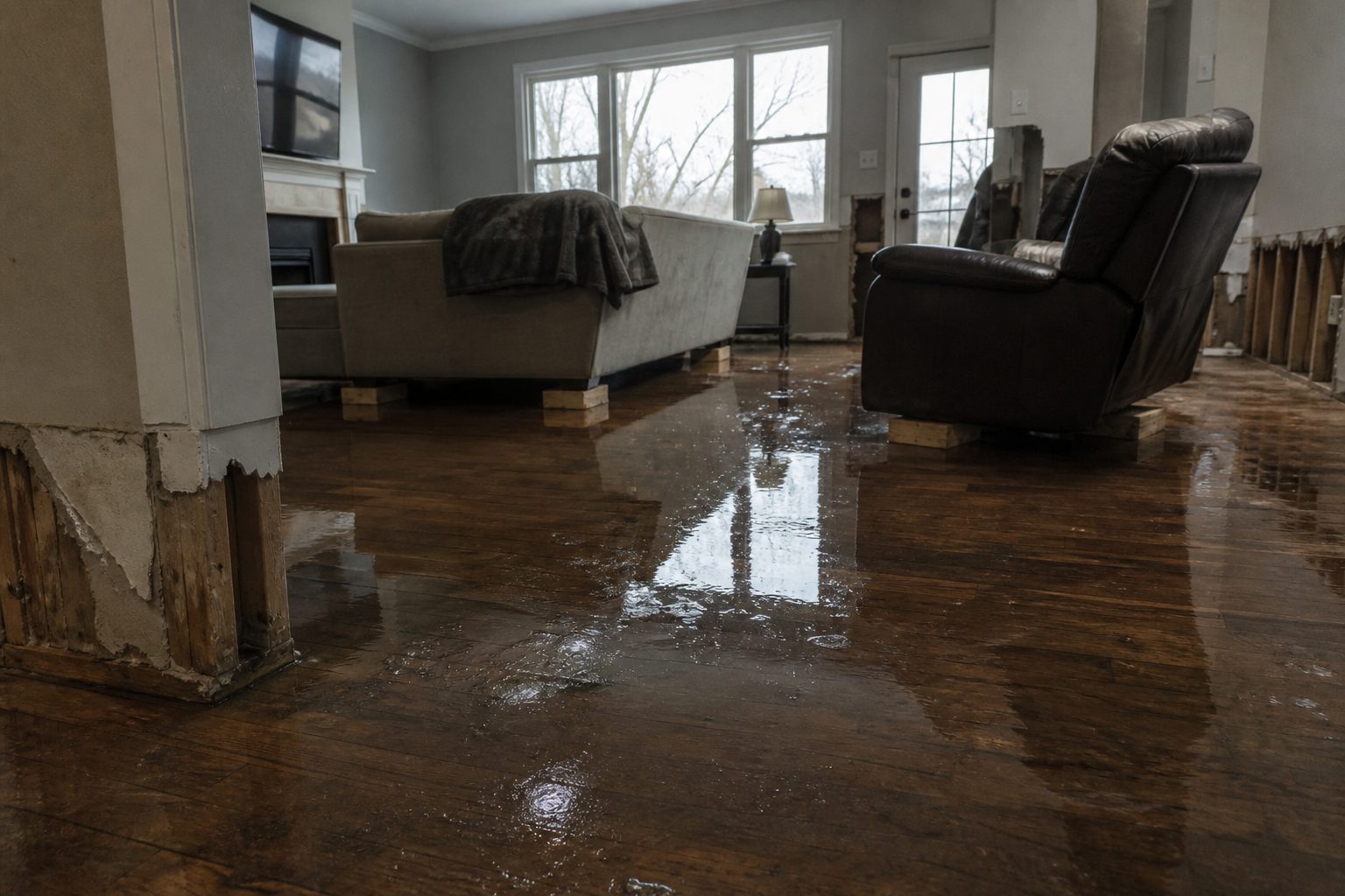
If water gets into your home: stay out of standing water anywhere electricity may be present, and avoid the basement until the water recedes and power is confirmed off. Before any cleanup begins, photograph everything — documentation is what the insurance conversation stands on. Then call a local restoration contractor. Water left sitting starts a second wave of damage within a day: saturated drywall, swollen subfloors, and microbial growth that a fan and a mop cannot stop.
If you are in Denison, Sherman, Knollwood, or near Randell Lake tonight, stay off the roads unless it is absolutely necessary. Water over a road hides washouts; six inches of moving water can knock you off your feet, and twelve inches can carry a car.
What this means for restoration teams
When emergency management is reporting water rescues in Denison during the warning window, water is already where it shouldn’t be — and that includes structures. For Grayson County contractors, tonight’s damage categories are the familiar ones:
- Interior water intrusion in low-lying homes and businesses along creeks, streams, and poor-drainage streets in the Denison–Sherman urban core.
- Saturated drywall and insulation — floodwater wicks upward fast; anything within the waterline footprint needs a moisture check, not a visual guess.
- Mold risk within 24–48 hours in any space that stays damp overnight.
- Sewage backup in low-lying areas, where overwhelmed drainage pushes wastewater back into ground-floor plumbing.
- Underpass and street-adjacent commercial damage — water pushed across highways and parking lots finds every slab joint and door threshold.
The play: stage equipment now. Pre-position air movers, dehumidifiers, and extraction units so the first call doesn’t burn an hour on logistics. Keep an on-call rotation through the night — water-intrusion calls don’t respect the warning’s expiry. On the first call, capture address, water source (rising exterior water vs. plumbing vs. seepage), and affected areas before you roll: the triage call is the claim’s foundation.
Field discipline: photo-document before mitigation starts, moisture-map every affected room (walls, subfloor, insulation cavities), and keep the homeowner’s payment responsibility clear in writing before work begins. The documentation habit you build tonight is what keeps the adjuster conversation clean next week.
FEMA & federal assistance
If the flooding damages your home and you need federal help, the standard channels apply: the FEMA Helpline is 1-800-621-3362 (7 a.m.–10 p.m. local time, 7 days a week). You can also apply at DisasterAssistance.gov, through the FEMA app, or find recovery centers at fema.gov/drc.
Basic eligibility: U.S. citizenship or qualified immigration status, identity verification, proof of occupancy or ownership, and unmet needs not covered by insurance. Apply as soon as it is safe to do so — federal assistance can cover what insurance doesn’t, but the documentation (photos, receipts, contractor invoices) starts the moment the water is out.
Looking ahead
This warning runs until 8:00 PM CDT tonight. When it expires, the danger doesn’t necessarily clock out with it — creeks and streams can crest after the rain stops, and saturated ground means any additional round tonight floods faster than the first.
Watch for the NWS Fort Worth office’s next update cycle and any new warnings for adjacent areas (a separate Flash Flood Warning is already active for Central Grayson County until 8:45 PM CDT — the same storm complex is working both zones). For contractors, the demand window note holds: water-intrusion calls typically start within hours of the water receding and keep coming for days as people discover damage behind walls and under floors. A Denison homeowner who thinks the carpet “feels dry” on Monday is a mold job by Wednesday if the pad underneath stayed wet.
Sources & how to verify
- NWS alert (this warning): Flash Flood Warning, East Central Grayson County
- NWS Fort Worth office: weather.gov/fwd
To verify for your own county or ZIP: go to weather.gov and enter your location, or check the Fort Worth office page for the latest active warnings across north central Texas.
This post is for informational purposes and is not an official weather warning. Always follow instructions from local authorities and the National Weather Service.
Leave a Reply