Flash Flood Warning — Socorro, Valencia and Cibola Counties, NM
The National Weather Service office in Albuquerque, New Mexico, issued a Flash Flood Warning at 5:47 PM MDT on Saturday, September 19, 2026, for north central Socorro County, southwestern Valencia County, and southeastern Cibola County. The warning is in effect until 7:45 PM MDT this evening.
At 5:47 PM MDT, Doppler radar indicated thunderstorms producing heavy rain across the warned area. Between 1 and 1.5 inches of rain have already fallen, and additional rainfall amounts of 0.25 to 0.5 inches are possible in the warned area. Flash flooding is ongoing or expected to begin shortly.
The hazard is flash flooding caused by thunderstorms. The source is radar indicated.
Impacts expected: flash flooding of small creeks and streams, urban areas, highways, streets and underpasses, as well as other poor drainage and low-lying areas.
This is a live snapshot as of 5:01 PM PDT Saturday, September 19, 2026. Conditions change fast — always verify with the National Weather Service for your specific county or ZIP code.
The warning, per area: Socorro, Valencia and Cibola Counties
Issuing office: NWS Albuquerque NM. Issued: 5:47 PM MDT, September 19, 2026. Expires: 7:45 PM MDT, September 19, 2026. Coverage: north central Socorro County in central New Mexico, southwestern Valencia County in central New Mexico, southeastern Cibola County in west central New Mexico.
Hazard detail, verbatim from the alert: at 5:47 PM MDT, Doppler radar indicated thunderstorms producing heavy rain across the warned area. Between 1 and 1.5 inches of rain have fallen. Additional rainfall amounts of 0.25 to 0.5 inches are possible. Flash flooding is ongoing or expected to begin shortly.
Locations that will experience flash flooding, per the alert: San Acacia, La Joya, Bernardo, Veguita, Chamizal, Contreras, Abeytas, Sabinal and Las Nutrias.
Highways affected, per the alert: Highway 60 between mile markers 166 and 168, and Interstate 25 between mile markers 160 and 184. If you are on I-25 through this corridor tonight, slow down and never attempt to cross water over the roadway.
Expected impacts: flash flooding of small creeks and streams, urban areas, highways, streets and underpasses as well as other poor drainage and low-lying areas.
Source: National Weather Service alert (WMO identifier WGUS55 KABQ 192347; AWIPS identifier FFWABQ). Verify current status at weather.gov or the NWS Albuquerque office page at https://www.weather.gov/abq/.
Stay safe tonight
Turn around, don’t drown when encountering flooded roads. Most flood deaths occur in vehicles — never drive through flooded roadways, including the I-25 and Highway 60 stretches named in this warning.
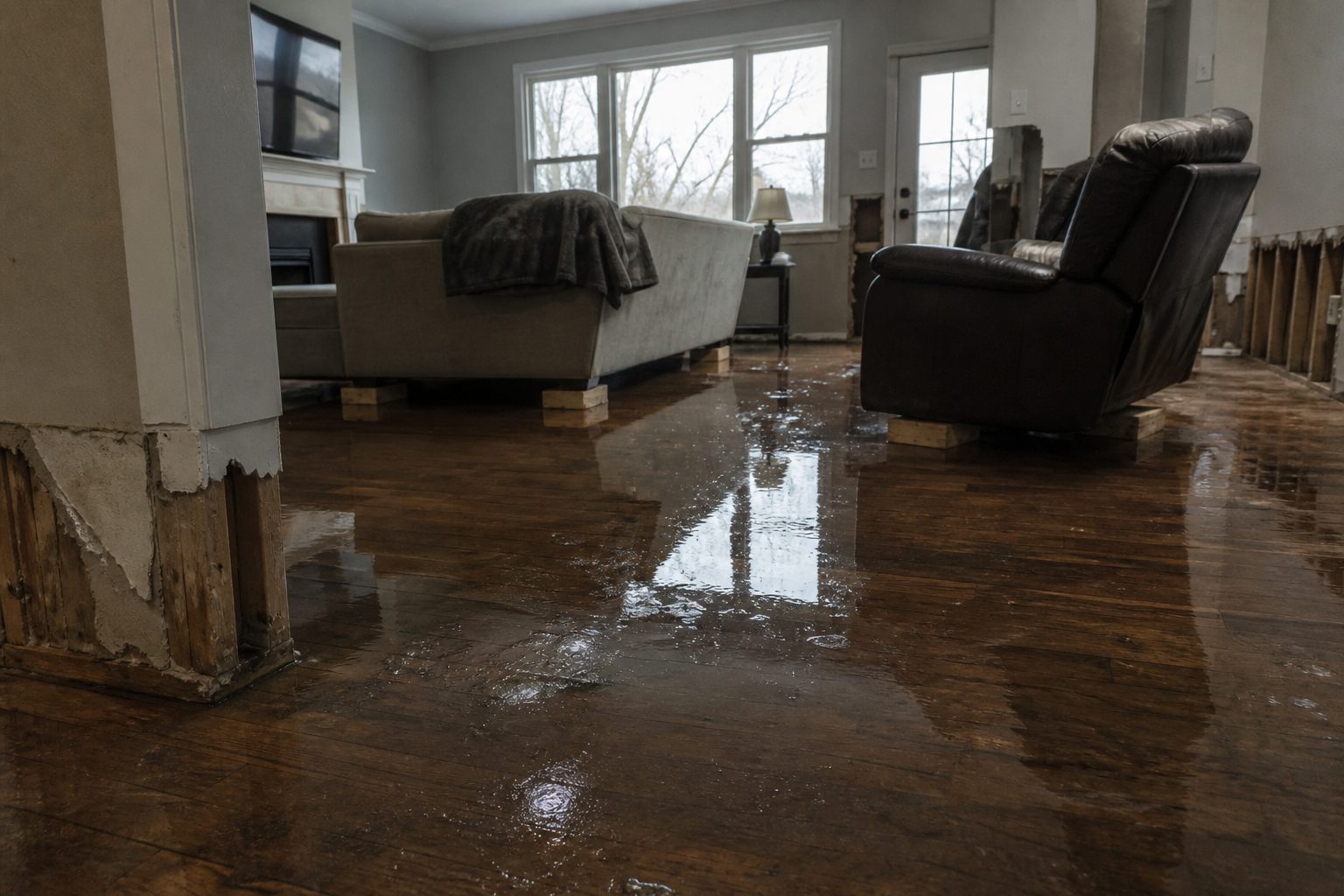
If water enters your home: stay out of standing water where electricity may be present, avoid the basement until water recedes and power is confirmed off, and photograph everything before any cleanup begins. Documentation matters for insurance. Then call a local restoration contractor — water left sitting starts a second wave of damage within a day.
What this means for restoration teams
A flash flood warning covering the I-25 corridor communities between Albuquerque and Socorro — San Acacia, Bernardo, Sabinal, and the surrounding villages — puts restoration teams on alert for the classic corridor pattern: sheet flow off the mesas into low-lying neighborhoods, flooded underpasses, and water through the slab in older homes with poor drainage.
Damage categories to expect in the call queue: interior water intrusion at ground level, saturated carpet, drywall and insulation wicking moisture upward, and mud/silt carry-in that raises the tear-out scope. In low-lying areas, watch for sewage backup where systems are overwhelmed by infiltration.
The play: stage water extraction and drying equipment now, pre-position drying assets on the south side of the metro for fast response to the corridor, keep an on-call rotation through the night, and capture address, water source, and affected areas on the first call. Field discipline: photo-document before mitigation, moisture-map every affected room, and keep the homeowner’s payment responsibility clear in writing before work begins.
FEMA & federal assistance
If this storm damages your home, federal help may be available once it is safe to apply:
- FEMA Helpline: 1-800-621-3362 (7 a.m. to 10 p.m. local time, 7 days a week).
- DisasterAssistance.gov and the FEMA mobile app for online applications.
- fema.gov/drc to find Disaster Recovery Centers near you once they open.
Basic eligibility: U.S. citizenship or qualified immigration status, identity verification, proof of occupancy or ownership of the damaged property, and needs not covered by insurance. Apply as soon as it is safe — you do not need to wait for cleanup to finish.
Looking ahead
The warning expires at 7:45 PM MDT. Small creeks and streams can keep rising after the heaviest rain passes, and poor-drainage spots along I-25 and Highway 60 may hold water into the evening even as skies clear.
Water-intrusion calls typically start within hours of water receding and keep coming for days as people discover damage. If you found water tonight, act tonight: photograph, shut off power to wet areas, and call a restoration contractor before the mold clock runs out — 24 to 48 hours in warm conditions.
Sources & how to verify
Sources: National Weather Service Albuquerque flash flood warning (issued 5:47 PM MDT, September 19, 2026; expires 7:45 PM MDT), WMO identifier WGUS55 KABQ 192347; NWS office page https://www.weather.gov/abq/.
To verify for your county or ZIP: enter it at weather.gov, or check the NWS Albuquerque office page for the latest alerts.
This post is for informational purposes and is not an official weather warning. Always follow instructions from local authorities and the National Weather Service.
Leave a Reply