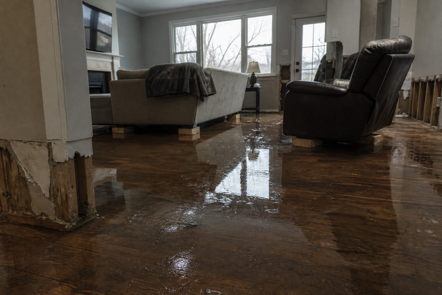
ACTIVE as of 7:05 PM MDT Saturday, September 19. The National Weather Service in Albuquerque has a Flash Flood Warning in effect right now for parts of central New Mexico — north-central Socorro County, southwestern Torrance County, and southeastern Valencia County, including Mountainair and Abo along the Highway 60 corridor. Doppler radar indicated thunderstorms producing heavy rain across the warned area, with 1 to 2 inches already fallen. This is the exact water-intrusion scenario that turns into interior-damage calls for restoration contractors within hours of the water receding. This is a live snapshot as of 7:05 PM MDT. Conditions change fast — always verify with the National Weather Service for your specific county or ZIP code.
The warning, per area
Mountainair–Abo corridor — Flash Flood Warning
The National Weather Service in Albuquerque issued this warning at 6:50 PM MDT Saturday, September 19, and it remains in effect until 8:45 PM MDT.
Coverage: North Central Socorro County in central New Mexico; Southwestern Torrance County in central New Mexico; Southeastern Valencia County in central New Mexico.
Hazard detail (NWS wording): Doppler radar indicated thunderstorms producing heavy rain across the warned area at 6:50 PM MDT. Between 1 and 2 inches of rain have fallen. Additional rainfall amounts of 0.25 to 0.75 inches are possible in the warned area. Flash flooding is ongoing or expected to begin shortly.
Source: Radar indicated. Certainty: Likely. Urgency: Immediate. Severity: Severe.
Named locations in the warning path: Mountainair and Abo. The warning also includes Highway 60 between Mile Markers 169 and 211 — a long rural stretch where water over the roadway can strand drivers far from help.
Expected impacts: Flash flooding of small creeks and streams, urban areas, highways, streets and underpasses, as well as other poor-drainage and low-lying areas.
Issuing office: NWS Albuquerque. Alert source: NWS alert (read September 19, 2026).
Stay safe tonight
Turn around, don’t drown when encountering flooded roads. Most flood deaths occur in vehicles. Be aware of your surroundings and do not drive on flooded roads — and this warning puts that instruction front and center for a reason: Highway 60 across the Manzano foothills and the Estancia Valley low ground can pond or run over quickly, and at night it is harder to recognize how deep water on a rural highway really is.
If water enters the home: stay out of standing water where electricity may be present. Avoid the basement or lower rooms until water recedes and power is confirmed off. Photograph everything before cleanup begins — documentation matters for insurance — and then call a local restoration contractor. Water left sitting starts a second wave of damage within a day.
What this means for restoration teams
This is the seat-by-seat call pattern for a three-county central New Mexico warning: the work won’t concentrate in one town — it lands along the Mountainair–Abo corridor and the Highway 60 strip, which means longer windshield time between jobs and triage that favors the most affected addresses first.
Expect the classic flash-flood damage categories: interior water intrusion through door thresholds and slab edges, saturated drywall and insulation in low-lying homes, sewage backup where septic and sewer systems sit in poor-drainage ground, and debris-blocked drainage pushing water where it was never designed to go. Mold risk starts its 24–48 hour clock the moment water touches organic building material.
The play: stage extraction and drying assets tonight, not in the morning. Keep an on-call rotation through the night — the warning expires at 8:45 PM MDT, but the calls arrive after residents get home, see the water, and call someone. Capture address, water source, and affected areas on the first call. Field discipline: photo-document before mitigation, moisture-map every affected room, and keep the homeowner’s payment responsibility clear in writing before work starts.
FEMA & federal assistance
FEMA Helpline 1-800-621-3362 (7 a.m.–10 p.m. local time, 7 days a week). DisasterAssistance.gov, the FEMA app, and fema.gov/drc for recovery centers. Basic eligibility: U.S. citizenship or qualified status, identity verification, proof of occupancy or ownership, and unmet needs not covered by insurance. Apply as soon as it’s safe.
Looking ahead
The warning runs through 8:45 PM MDT tonight. Additional rainfall amounts of 0.25 to 0.75 inches are possible in the warned area — and even after the rain stops, small creeks and streams in the warned counties can crest later. The next NWS update lands when this warning expires, is extended, or is cancelled.
Demand window note: water-intrusion calls typically start within hours of water receding and keep coming for days as people discover damage — in a rural corridor like this, some homeowners won’t find the water until the next morning.
Sources & how to verify
- NWS Albuquerque Flash Flood Warning — alert text (read September 19, 2026)
- NWS Albuquerque office page — weather.gov/abq (read September 19, 2026)
To verify for your own county or ZIP: go to weather.gov and enter your location, or check the NWS Albuquerque page for central New Mexico. A companion operator brief for restoration teams is queued in our review queue — Restoration Intel companions publish only after review.
This post is for informational purposes and is not an official weather warning. Always follow instructions from local authorities and the National Weather Service.
Leave a Reply