Emergency Response - Tygart Media

Category: Emergency Response

  • Storm Updates: Arizona + Southeastern Utah Flash Flood Outbreak — Tuesday, September 16, 2026

    This is a live storm update and search-demand pulse for Tuesday, September 16, 2026. A monsoon outbreak produced two flash-flood clusters: eight NWS Flash Flood Warnings across Arizona (issued 10:27–11:51 AM MST) covering Maricopa County (Phoenix metro), Pinal County, Pima County (Tucson area), Gila County, and Coconino County (Labyrinth/Face Canyon watersheds), plus two warnings for southeastern Utah’s San Juan County drainages south of Lake Powell (issued 12:01 and 12:34 PM MDT). Several Arizona warnings were tagged life-threatening, with 0.5–1.5 inches already fallen and rates up to 2 inches per hour.

    Flash flooding in desert washes and slot-canyon country moves fast. Verify local conditions with the National Weather Service before travel. Turn around, don’t drown.

    Cluster 1 — Arizona

    Warnings spanned Phoenix metro through Tucson and north into Coconino watersheds. Heavy monsoon cells dumped short-duration, high-rate rain onto urban pavement and desert soils that shed runoff into washes and underpasses.

    Arizona Search Demand (measured live)

    Google Trends pulls (live browser, no CAPTCHA) show East Valley hire-intent leading the state:

    SignalWindowReading
    water damage restoration mesa az7d+850%
    water damage restoration mesa7d+450%
    Mesa (city topic)7d+400%
    Glendale (city topic)7d+250%
    Cost (topic, seed: flood damage repair)7d+250%
    flood damage restoration30d+170%
    water damage restoration phoenix az7d / 30dBreakout
    flood damage restoration near me / flood restoration near me / flood restoration companies30dBreakout

    Trending Now (Arizona, past 7d): “flood watch” 20K+ searches / +1,000% (active); “flash flood warning” 500+ / +1,000% and 200+ / +800%. Hottest metros: Phoenix AZ 100 · Yuma AZ–El Centro CA 81 · Tucson (Sierra Vista) AZ 67. City-level breakout query language also hit Tempe, Scottsdale, Tucson, and Phoenix AZ.

    Cluster 2 — Southeastern Utah

    Two warnings covered San Juan County drainages south of Lake Powell, including Labyrinth Canyon — life-threatening flash flooding of slot canyons and dry washes.

    Utah Search Demand (measured live)

    SignalWindowReading
    emergency water damage restoration30d+4,350%
    water damage restoration services30d+1,400%
    water damage restoration services near me30d+1,100%
    water damage restoration near me30d+750%
    water damage restoration service near me30dBreakout
    flood damage restoration near me / flood damage restoration7dBreakout
    flood restoration salt lake city30dBreakout
    water mitigation company30dBreakout

    What Homeowners Should Do in the First Hours

    • Stop the source if safe: Do not enter flowing washes or standing water near electrical panels.
    • Document high-water marks before cleanup for insurance.
    • Extract before you dry: Mud and silt first; air movers over wet sediment spread contamination.
    • Vet “near me” companies: Ask for IICRC certification, Category 3 blackwater protocol, and written moisture maps — East Valley and Utah “near me” breakouts show hire-intent, not DIY research.
    • Ask the cost question early: Arizona Cost topic +250% on flood damage repair means carriers and deductibles will dominate the next conversation.

    Sources and Verification

    Official data verified against National Weather Service Flash Flood Warnings for Arizona and southeastern Utah (10 warnings, new to the day’s watermark); Google Trends Arizona and Utah regional datasets (7-day and 30-day windows), measured live via browser with no CAPTCHA blocks.

    Informational brief only — not an official warning broadcast. Monitor NOAA Weather Radio and local county emergency management for evacuation and shelter orders.

  • Storm Updates: Rio Blanco County Colorado Flash Flood Warning — Sunday, September 13, 2026

    This is a live storm update and search demand pulse for Sunday night, September 13, 2026. The National Weather Service in Grand Junction, Colorado, issued a severe Flash Flood Warning for Rio Blanco County at 8:25 PM MDT, valid through 11:30 PM MDT. While localized runoff, wash flooding, and steep-terrain drainage pose immediate hazards across northwest Colorado’s Grand Junction–Montrose designated market area (DMA), search behavior across the wider state indicates a tightening baseline for water mitigation and flood repair demand.

    Flash flooding in high-desert and mountainous terrain moves fast and creates sudden structural washouts. Property owners and municipal managers must verify local conditions with the National Weather Service before traveling. Turn around, don’t drown.

    The Warning: Rio Blanco County, CO

    The Grand Junction weather forecast office issued the severe Flash Flood Warning following heavy rainfall over saturated soils and drainage basins in Rio Blanco County. Flash flooding in this geography typically impacts low-water crossings, county access roads, oil and gas pad infrastructure, and residential basements situated along creekbeds and alluvial fans.

    Official NWS Alert identifier: urn:oid:2.49.0.1.840.0.8acebba0f7c98d0a6a7482a49c065131956af988.001.1. The active warning contour spans uninhabited ranch land as well as municipal corridors, requiring local operators to track specific drainage axes rather than treating the county as a single uniform polygon.

    Colorado Search Demand & Trend Signal

    Search trend monitoring captured live query volume across Colorado within 40 minutes of warning issuance. Because hyper-local search volume for sudden events requires a 24- to 72-hour window to register on 7-day rising metrics, demand analysis looks at the broader 30-day baseline across Colorado to measure the demand basin pulling into regional contractor rosters.

    Breakout search terms across the state show intense user focus on contractor vetting and direct proximity queries:

    Breakout Search Query (Past 30d)Seed TopicDemand Context
    flood restoration companiesflood restorationHigh commercial & residential intent
    flood restoration company near meflood restorationImmediate emergency lookup
    flood damage restoration serviceflood restorationFull-scope service inquiry
    water damage restoration aurorawater damage restorationFront Range demand corridor
    water damage restoration aurora cowater damage restorationGeo-specific contractor intent
    water damage restoration company near mewater damage restorationMobile emergency conversion query
    water mitigation companieswater mitigationEarly-stage carrier / extraction focus

    By growth percentage, high-velocity queries across Colorado include water damage restoration service near me (+70%), restoration water damage company (+70%), and water damage restoration denver (+60%). Subregional activity highlights Denver, Colorado Springs–Pueblo, and Grand Junction–Montrose as the three most active DMAs in the state.

    What This Means for Restoration Teams

    Flash flood events in western Colorado create rapid silt, sediment, and Category 3 blackwater contamination when surface runoff penetrates crawlspaces, basements, and foundation slabs. Even if localized rainfall totals appear moderate, runoff volume through desert washes can breach grade rapidly.

    Key operational takeaways:

    • Immediate Containment: Mud and silt must be extracted before drying equipment is placed; running air movers over sediment aerosolizes particulate and bio-contaminants.
    • Moisture Mapping: Test perimeter subflooring and framing immediately. In dry climates like western Colorado, rapid surface evaporation frequently hides deep structural saturation behind baseboards and insulation.
    • Proximity Positioning: The breakout surge in “near me” search terms demonstrates that consumers call the first local verified provider they can reach. Verified phone lines and dispatch triage are critical.

    Sources and Verification

    Official data verified against: National Weather Service Grand Junction (weather.gov/gjt); NOAA National Weather Service Alerts API; Google Trends Colorado Regional Dataset (Past 7d and Past 30d windows).

    Informational brief only — not an official warning broadcast. Monitor NOAA Weather Radio and local county emergency management for evacuation and shelter orders.

  • Storm Updates: Carolinas Slight Risk, Detroit Tornado Aftermath, Labor Day Weekend Outages — Saturday, September 5, 2026

    Storm Updates: Carolinas Slight Risk, Detroit Tornado Aftermath, Labor Day Weekend Outages — Saturday, September 5, 2026

    The Storm Prediction Center has a Slight Risk of severe thunderstorms this afternoon and evening across parts of the Carolinas into southeastern Virginia. Damaging wind is the primary hazard. Isolated hail is possible. Behind that corridor, restoration crews are still working the multi-day Midwest and Mid-Atlantic wind event that produced Detroit’s first confirmed city tornado since 1997 and left tens of thousands without power heading into Labor Day weekend.

    This is a live snapshot for Saturday, September 5, 2026, built from NOAA/NWS Storm Prediction Center products, National Weather Service watches and warnings, and public outage reports. Conditions change fast — always verify with the National Weather Service for your county or ZIP.

    Current hotspots

    Carolinas into southeastern Virginia — Slight Risk (damaging wind primary)

    SPC’s 2000 UTC Day 1 outlook holds a Slight Risk from parts of the Carolinas into southeastern Virginia. Severe Thunderstorm Watches #656 and #657 have been in effect into the evening for large parts of central and eastern North Carolina and portions of South Carolina. Warnings have already gone out on individual cells in the Charlotte region, the Triangle, Forsyth and Nash counties, and nearby South Carolina counties.

    Main threats: scattered damaging gusts (60 mph tagged on several warnings; locally higher possible) and isolated hail near 1 to 1.5 inches. Clusters are spreading east-southeast toward the coast this evening. Isolated redevelopment behind the main band cannot be ruled out.

    Cities and metros in the risk area: Charlotte, Raleigh, Durham, Greensboro, Winston-Salem, Norfolk / Virginia Beach / Chesapeake, and upstate South Carolina communities under Watch 656.

    Southeast Michigan — just hit (tornado + wind recovery)

    Multiple rounds of severe weather hit Southeast Michigan on September 2–3. NWS Detroit confirmed an EF-0 in Lincoln Park and an EF-2 on the east side of Detroit — the first confirmed tornado in the city since July 2, 1997. A brief EF-0 also occurred in Marysville (St. Clair County) on the 2nd. Widespread straight-line wind damage, downed trees and lines, and heavy rain followed.

    Peak outages in the metro ran into the hundreds of thousands earlier in the week. As of Saturday afternoon, tens of thousands remain without power in Michigan (DTE still reporting a large remaining outage total). Restoration of service is underway through the weekend.

    Ohio Valley to Mid-Atlantic — residual wind and flood damage

    The same multi-day pattern produced a long damage swath from Michigan through Ohio, Indiana, Kentucky, Pennsylvania, and into the Mid-Atlantic. Reports included 80+ mph winds (gusts near 99 mph were cited in the Gary, Indiana area), tornadoes, flash flooding, and tree-and-wire losses. Outage totals at the peak of the event exceeded 500,000 customers across the corridor. Saturday still shows elevated outages in Ohio, Pennsylvania, Virginia, and North Carolina on top of the new Carolina convection.

    Recent 24-hour damage reports include trees on homes and lines in Tennessee, North Carolina, Virginia, and Ohio counties — the tail of the same system now feeding the Carolina risk.

    Southwest — flash flood threat into Sunday

    Monsoon moisture continues to support a flash-flood threat across parts of Arizona and Utah, including terrain around Grand Canyon, Zion, and Bryce Canyon. Those parks already saw significant flash flooding in recent days. Sunday remains the day to watch for park visitors and desert-wash travel. This is not a classic wind/hail CAT pulse; it is short-duration runoff in burns scars, slot canyons, and dry washes.

    Tropics

    No Atlantic hurricane is currently threatening the U.S. mainland. The 2026 Atlantic season remains below normal through early September, with no landfalling tropical cyclone driving this weekend’s restoration load. Pacific moisture (including remnants associated with eastern Pacific systems) is a contributor to the Southwest rain threat, not a Gulf or East Coast landfall.

    What this means for restoration operators

    • Carolinas / SE Virginia today: Stage for wind, tree, and envelope failures plus isolated hail. Commercial roofs, storefront glazing, and wet interiors behind failed soffits are the first walk after dark.
    • Detroit / SE Michigan: Tornado and straight-line wind claims are already open. Photo roofs, HVAC, and contents before the next rain. Power-off buildings delay drying — treat standing interior water as a clock, not a wait-for-power problem.
    • Ohio–PA–VA swath: Tree/wire/water day. Wind-driven rain through failed envelope. Treat overland flash-flood water as Category 3 until you prove otherwise.
    • Southwest parks and desert metros Sunday: Rapid-onset wash and canyon flooding, not a wide hail swath. Board-up and water extraction on structures in low washes; do not send crews into active slot canyons.

    Sunday look

    The Slight Risk shifts south into parts of Georgia and South Carolina (Savannah, Columbia, Charleston, Augusta in the broader envelope). Flash flooding remains possible in the Southwest. Cooler air follows the front into the Northeast and Mid-Atlantic behind this weekend’s storms.

    Sources

    This is a public-data summary for restoration professionals’ situational awareness only. It is not an official forecast. Always verify with the National Weather Service, local NWS offices, and official watches/warnings. Preliminary storm reports and outage totals can change. Do not make operational decisions solely on this brief.

    Related on Tygart Media: Sept 2 storm updates · Aug 29 storm alerts. Full Daily Storm Pulse archive lives on Restoration Intel — Storm Damage.

  • Storm Updates: 2.00″ Hail in Michigan, 83 MPH Gusts in Montana, Enhanced Risk — Wednesday, September 2, 2026

    Current Hotspots & Active Risk Zones

    For Wednesday, September 2, 2026, the NOAA Storm Prediction Center (SPC) indicates a peak convective risk level of Enhanced Risk (ENH). Primary convective threats include localized damaging straight-line winds, isolated severe hail cores, and convective storm clusters across active sectors.

    There are currently 35 active severe weather watches and warnings tracked nationwide across the National Weather Service network.

    Recent Impact & Local Storm Reports (Past 12–24 Hours)

    Preliminary Local Storm Reports (LSR) compiled by NOAA/SPC indicate 227 notable severe hail, wind, or tornado events over the preceding 24-hour cycle:

    • Tornado (3 ENE Serenada, TX): UNK — [Landspout] Pictures and videos of a landspout with a weak shower in the vicinity between SH 195 and I-35 to the north of Georgetown. Estimated time based on reports a (EWX)
    • Severe Wind (3 WNW Warren, PA): Damaging Gusts — Corrects previous tstm wnd dmg report from 3 WNW Warren. Multiple trees down around the 1900 block of Follett Run Road. (CTP)
    • Severe Wind (Oakfield, NY): Damaging Gusts — Trees down in Elba. (BUF)
    • Severe Wind (8 NNE Tionesta, PA): Damaging Gusts — Trees and wires down. (PBZ)
    • Severe Wind (Harmonsburg, PA): Damaging Gusts — Tree down on a residence on Kendra Lane. (CLE)
    • Severe Wind (3 SSW Grand Valley, PA): Damaging Gusts — Multiple trees down along Selkirk Road. (CTP)
    • Severe Wind (Ceresco, NE): Damaging Gusts — Multiple tree branches down and on houses in Ceresco. Also some windows blown out of a business. Time estimated from radar. (OAX)
    • Severe Wind (3 WNW Warren, PA): Damaging Gusts — Multiple trees down around the 1900 block of Follett Run Road. (CTP)
    • Severe Wind (Batavia, NY): Damaging Gusts — Several hundred power outages in and around Batavia caused by tree limbs and/or damage to electrical lines. (BUF)
    • Severe Wind (Leicester, NY): Damaging Gusts — Trees down. (BUF)
    • Severe Wind (6 WNW Brockway, PA): Damaging Gusts — Trees down. (PBZ)
    • Severe Wind (Livonia, NY): Damaging Gusts — Trees down. (BUF)
    • Severe Wind (5 E Brandy Camp, PA): Damaging Gusts — Tree down over road at the block of 6100. (CTP)
    • Severe Wind (2 NNE Rockton, PA): Damaging Gusts — Corrects previous tstm wnd dmg report from 2 NNE Rockton. Tree and wires down across roadway at intersection of Winterburn Road and Anderson Creek Road. (CTP)
    • Severe Wind (2 NNW Falls Creek, PA): Damaging Gusts — Trees down. (PBZ)

    24–48 Hour Near-Term Outlook

    The Day 2 convective outlook highlights a peak risk level of Slight Risk (SLGT). Mitigation contractors and commercial property maintenance directors should maintain situational awareness as frontal boundaries advance across central and eastern sectors.

    Restoration Operator Notes & Tactical Recommendations

    • Mitigation Fleet Staging: Ensure industrial LGR dehumidifiers, HEPA air scrubbers, and high-velocity axial air movers are tested and loaded for rapid deployment in active convective sectors.
    • Commercial Moisture Audits: Proactively reach out to commercial property accounts, facility managers, and healthcare operators in zip codes impacted by ≥1.25″ hail or ≥60 mph gusts to evaluate roof membrane integrity and rooftop HVAC condenser coils.
    • Emergency Board-Up & Tarping: Prepare roll stock poly, 2×4 lumber, and sandbags for immediate emergency envelope stabilization following severe wind gusts.
    • Field Safety Protocol: Remind field mitigation crews that flash flood waters are classified as Category 3 (black water) bio-hazard contamination requiring full PPE and specialized containment.

    Official Sources & Attribution

    Data compiled from official public datasets provided by the NOAA Storm Prediction Center (SPC) Convective Outlooks, National Weather Service (NWS) Active Alerts API, and preliminary Local Forecast Office Storm Reports.

    Operational Disclaimer: This is a public-data summary for restoration professionals’ situational awareness only. It is not an official weather forecast. Always verify with the National Weather Service, local NWS forecast offices, and official watches/warnings. Preliminary storm reports are unfiltered and subject to change. Do not make critical life-safety or structural dispatch decisions solely based on this brief.

  • Storm Updates: 2.00″ Hail in Michigan, 83 MPH Gusts in Montana, Enhanced Risk in Western New York — September 2, 2026

    Storm Updates: 2.00″ Hail in Michigan, 83 MPH Gusts in Montana, Enhanced Risk in Western New York — September 2, 2026

    The Storm Prediction Center has an Enhanced Risk of severe thunderstorms across western New York this afternoon and evening, with a Slight Risk over parts of Montana. Official Local Storm Reports already show 2.00″ hail in Michigan, 83 mph gusts at Great Falls, and a long tree-and-wire damage swath from western New York through Pennsylvania into Maryland and Virginia.

    This is a live snapshot for Wednesday, September 2, 2026, built from NOAA/NWS Storm Prediction Center products and preliminary LSRs. Conditions change fast — always verify with the National Weather Service for your county.

    Current hotspots

    Western New York — Enhanced Risk (damaging wind primary)

    SPC’s 2000 UTC Day 1 outlook expanded the Enhanced Risk slightly east across western New York, with 45% wind probabilities. Storms are expected along and ahead of a cold front from southeast Lower Michigan into the lower Great Lakes, with 50+ kt of deep-layer shear supporting a mix of supercells and clusters. Damaging winds are the main threat. Large hail and a few tornadoes are also in the outlook, including some chance of a stronger tornado if a supercell mode holds this evening.

    Already reported:

    • Trees down in Oakfield, Elba, Batavia, Leicester, Livonia, and Wolcott, NY.
    • Several hundred power outages in and around Batavia from tree limbs and line damage.
    • Additional trees and wires down later in Wyoming County (Castile / Portageville).

    Montana / northern Rockies — Slight Risk (severe gusts)

    High-based storms moving northeast across Montana have already produced hurricane-force gusts. SPC flagged occasional 75+ mph gusts even with weaker instability.

    Measured gusts (preliminary LSRs):

    • 83 mph — Great Falls Airport (KGTF), Cascade County, MT
    • 80 mph — Warm Springs, Deer Lodge County, MT
    • 80 mph — Highwood Bench, Chouteau County, MT
    • 77 mph — south-southwest of Choteau, Teton County, MT
    • 74 mph — Bert Mooney Airport, Silver Bow County, MT
    • 73 mph — Helena and 11 W Helena, Lewis and Clark County, MT
    • 71 mph — Helena Airport and west of Bynum

    Great Lakes to Mid-Atlantic — wind, hail, and tree damage

    An earlier cluster with a well-established cold pool produced damaging winds across western and central Pennsylvania and continued southeast into Maryland, D.C., and northern Virginia. Behind that, a second round is the western New York / Lower Michigan threat.

    Notable hail:

    • 2.00″ hail — Birch Run, Saginaw County, MI (multiple spotter/public reports with photos)
    • 1.25″ hail — 3 E Meadville, Crawford County, PA
    • 1.00″ hail — north of Cochranton, Crawford County, PA

    Wind damage corridor (trees, wires, road closures): Warren, Forest, Crawford, Jefferson, Elk, Clearfield, Huntingdon, Blair, Perry, Juniata, Cumberland, York, and Lancaster counties in Pennsylvania; Baltimore, Frederick, Washington, Montgomery, and Caroline counties in Maryland; Loudoun, Alexandria, Rappahannock, Culpeper, King George, Orange, Madison, Clarke, Buckingham, and Dinwiddie counties in Virginia. One tree fell on a residence in Harmonsburg, Crawford County, PA. In Ceresco, Saunders County, NE, branches hit houses and windows were blown out of a business.

    Texas — isolated landspout

    A landspout was reported 3 ENE of Serenada in Williamson County, TX (north of Georgetown, between SH 195 and I-35), associated with a weak shower. Preliminary — not a confirmed tornado path.

    What this means for restoration operators

    • Saginaw County, MI (Birch Run): 2.00″ hail is hen-egg size — enough to puncture asphalt shingles, bruise commercial TPO/EPDM, and collapse rooftop HVAC condenser fins. Photo the roof and RTUs before the next rain cycle.
    • Western NY / Lower MI: Stage for wind, tree, and power-line losses plus possible hail. Commercial roofs and storefront glazing along the Enhanced Risk corridor are the first walk.
    • PA–MD–VA swath: This is a tree/wire/water day. Wind-driven rain through failed envelope, wet interiors, and delayed drying if power is out. Treat overland flash-flood water as Category 3 until you prove otherwise.
    • Montana (Great Falls / Helena / Choteau corridor): 70–83 mph gusts are hurricane-force. Expect loose membrane, HVAC displacement, metal cladding, and broken glass on commercial buildings even without large hail.
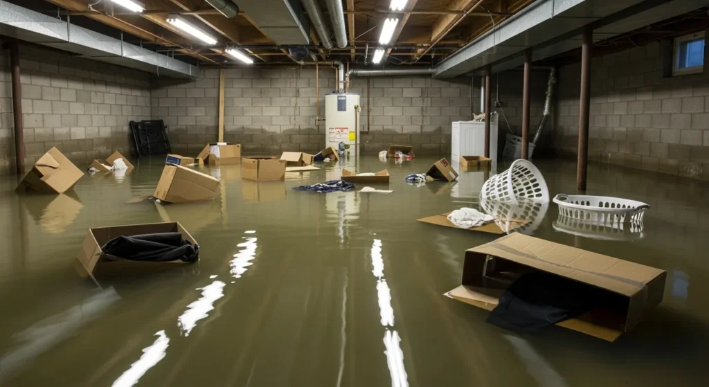
    Flooded residential basement with standing water and damaged belongings
    Wind-driven rain and tree damage produce interior water losses like this — saturated drywall, damaged contents, and mold risk inside 48 hours if extraction is delayed.

    Sources

    This is a public-data summary for restoration professionals’ situational awareness only. It is not an official forecast. Always verify with the National Weather Service, local NWS offices, and official watches/warnings. Preliminary storm reports can change. Do not make operational decisions solely on this brief.

    Related on Tygart Media: Aug 29 storm alerts · Starlink on a water job. Full Daily Storm Pulse archive lives on Restoration Intel — Storm Damage.

  • Active Storm Alerts Today: Severe Thunderstorms & Flash Floods Hit Florida, Utah & Arizona — Restoration Hotspots

    Severe thunderstorm warnings and life-threatening flash flood warnings are active right now across parts of Florida, Utah, and Arizona. These are the kinds of localized, high-intensity events that produce the exact damage restoration teams see most: wind-driven roof and siding failures, hail-pocked vehicles and windows, and sudden interior flooding from heavy rain or flash runoff.

    This is a live snapshot of the alerts as of the afternoon of Saturday, August 29, 2026. Conditions change fast — always verify with the National Weather Service for your specific county or ZIP code.

    Florida — Severe Thunderstorms & Flood Advisories

    The National Weather Service Tampa Bay (Ruskin) office has issued multiple severe thunderstorm warnings this afternoon for west-central and southwest Florida. Hazards include 60 mph wind gusts capable of damaging roofs, siding, and trees, plus urban and small-stream flooding from heavy rain.

    Active / recent warnings include:

    • Central Pasco County (near Hudson, Moon Lake, Shady Hills) — severe thunderstorm, 60 mph gusts, nearly stationary.
    • Northeastern Manatee County / southeastern Hillsborough County (near Parrish) — severe thunderstorm warning.
    • Northwestern Charlotte County / south-central Sarasota County (North Port, Venice, Osprey, Nokomis, Englewood area) — 60 mph gusts.
    • Southeastern Charlotte / northeastern Lee County (near LaBelle, North Fort Myers) — 60 mph gusts.
    • Flood advisories for urban/small-stream flooding in parts of Lee, Highlands, and surrounding counties.

    A lingering front is keeping daily rounds of showers and storms over the Southeast through the weekend, with flash-flood potential shifting toward Louisiana, Alabama, Mississippi, Florida, and southwest Georgia on Sunday. Expected rainfall totals of 1–3+ inches in many areas by Monday.

    Local emergency contacts:

    Utah — Severe Thunderstorms & Life-Threatening Flash Floods

    The Storm Prediction Center has a Slight Risk of severe thunderstorms from eastern Nevada across northern Utah into far southwest Wyoming, with the main threat being severe wind gusts and isolated large hail. The National Weather Service Salt Lake City office has active warnings in central Utah.

    Active warnings:

    Flooded residential basement with standing water and damaged belongings
    Flash flooding and heavy rain produce exactly this kind of interior water damage — saturated drywall, damaged belongings, and mold risk within 48 hours.
    • Severe Thunderstorm Warning — northwestern Emery County and southwestern Carbon County (Huntington, Wellington, Castle Dale, Orangeville, Cleveland, Elmo, Hiawatha). 60 mph winds + quarter-size hail. Storm located 9 miles north of Clawson, moving northeast at 30 mph.
    • Flash Flood Warning — southern Emery County and north-central Wayne County. Life-threatening flash flooding from heavy rain; Doppler radar indicated ongoing or imminent flooding.

    Local emergency contacts:

    • Emery County Sheriff’s Office / Emergency Management: 435-381-2404 | emery.utah.gov
    • Utah Division of Emergency Management: dem.utah.gov

    Arizona — Flash Flood Warning & Monsoon Storms

    A Flash Flood Warning is active for the Havasu Creek basin in Coconino County (near Supai, northward to the Colorado River). Between 0.5 and 0.75 inches of rain have already fallen, with additional amounts possible. Life-threatening flash flooding is ongoing or expected shortly. Campers and hikers are advised to move to higher ground immediately.

    Flood watches cover broader areas including parts of the Phoenix metro, Pima, Pinal, Gila, Apache, Navajo, and Yavapai counties for heavy rain potential through Sunday and Monday. Scattered thunderstorms with strong or severe wind gusts remain possible.

    Local emergency contacts:

    What These Storms Mean for Restoration Teams

    These alerts map directly to the damage categories restoration companies handle every day:

    • Wind damage (60 mph gusts): roof shingles, siding, gutters, tree limbs on structures, broken windows.
    • Hail (quarter-size in Utah): vehicle dents, skylights, soft metals, landscaping.
    • Flash flooding & heavy rain: interior water intrusion, saturated drywall and insulation, mold risk within 24–48 hours, sewage backup in low-lying areas.
    • Urban flooding in Florida: parking lots, first-floor commercial spaces, HVAC units, electrical hazards.

    For teams in or near these hotspots, the play is simple: stage equipment, pre-position drying assets, and be ready to respond the moment the warnings lift. Property owners should document damage with photos and contact their insurer quickly — and if they need immediate water extraction or board-up, a local restoration pro is the fastest path to limiting secondary damage.

    Restoration worker using a tablet to document water damage cleanup in a flooded basement
    Rapid documentation and extraction limit secondary damage after wind and flood events.

    FEMA & Federal Assistance

    If a storm produces damage beyond what insurance covers, residents can apply for federal disaster assistance. The FEMA Helpline is 1-800-621-3362 (open 7 a.m. to 10 p.m. local time, 7 days a week). Applications can also be started at DisasterAssistance.gov or through the free FEMA app. Find a nearby Disaster Recovery Center at fema.gov/drc.

    Basic eligibility generally requires U.S. citizenship or qualified status, identity verification, proof of occupancy or ownership, and unmet needs not covered by insurance. Don’t wait — apply as soon as it’s safe.

    This post is for informational purposes and is not an official weather warning. Always follow instructions from local authorities and the National Weather Service. Stay weather-aware, especially around flash flooding — turn around, don’t drown.