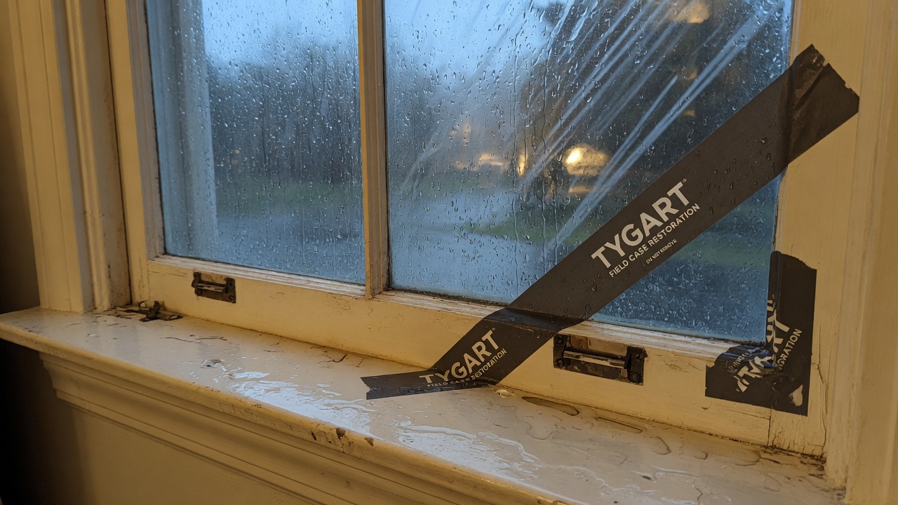
A Flash Flood Warning is active right now for southwestern Muskingum County in east central Ohio, issued by the National Weather Service in Pittsburgh at 1:54 AM EDT on Sunday, September 21, 2026, and running until 5:00 AM EDT. Doppler radar shows thunderstorms producing heavy rain across the warned area — between half an inch and an inch of rain has already fallen, with up to another half inch possible — and flash flooding is ongoing or expected to begin shortly. For restoration contractors, this is the overnight call-driver: interior water intrusion, saturated basements, and the low-lying-area jobs that follow every hard rain over small creeks and urban drainage.
This is a live snapshot as of about 2:05 AM EDT on September 21, 2026. Conditions change fast — always verify with the National Weather Service for your specific county or ZIP code.
Muskingum County — Flash Flood Warning
The National Weather Service in Pittsburgh (KPBZ) issued Flash Flood Warning FFWPBZ at 1:54 AM EDT, Sunday, September 21, 2026, valid until 5:00 AM EDT. The warning covers southwestern Muskingum County in east central Ohio.
Hazard, verbatim from the alert: “Flash flooding caused by thunderstorms.” Detection is radar indicated. At 1:54 AM EDT, Doppler radar indicated thunderstorms producing heavy rain across the warned area, with between 0.5 and 1 inch of rain already fallen. Additional rainfall amounts up to 0.5 inches are possible in the warned area. Flash flooding is ongoing or expected to begin shortly.
Expected impacts, verbatim: “Flash flooding of small creeks and streams, urban areas, highways, streets and underpasses as well as other poor drainage and low-lying areas.”
Locations that will experience flash flooding, per the alert:
- Zanesville
- South Zanesville
- Philo
- Fultonham
- Cannelville
- East Fultonham
- Duncan Falls
- Blue Rock State Park
The warning area runs along the I-70 and US-22 corridors through the Zanesville area, where urban drainage and low-lying creek bottoms are the first to go under. The alert is rated Severe severity, Likely certainty, Immediate urgency.
Sources: NWS Pittsburgh office page · the active NWS alert (VTEC: /O.NEW.KPBZ.FF.W.0153.260921T0554Z-260921T0900Z/).
Stay safe tonight
The National Weather Service instruction for this warning is direct: “Turn around, don’t drown when encountering flooded roads. Most flood deaths occur in vehicles.” The alert adds a specific caution: be especially cautious at night, when it is harder to recognize the dangers of flooding.
If water gets into your home: stay out of standing water where electricity may be present — a flooded panel, outlet, or appliance turns the water itself into the hazard. Avoid the basement until the water recedes and power is confirmed off. Photograph everything before you touch a thing: water lines on the wall, soaked flooring, damaged contents — documentation matters for insurance. Then call a local restoration contractor; water left sitting starts a second wave of damage within a day as moisture wicks into drywall, subfloor, and framing.
What this means for restoration teams
This is the signature overnight water event for the Zanesville market: radar-indicated heavy rain, up to an inch and a half of total rainfall possible by morning, flash flooding across small creeks, urban areas, and low-lying drainage. Translate that into the damage categories local contractors handle:
- Interior water intrusion — ground-level rooms, finished basements, and slab-on-grade entries where runoff finds the low point.
- Saturated drywall and insulation — water wicking up from the floor line, especially in basements and lower walls.
- Mold risk within 24–48 hours — anything that stays wet through tomorrow becomes a mold job by midweek; the clock starts when the water arrives, not when the crew does.
- Sewage backup in low-lying areas — overwhelmed municipal and septic systems push back through floor drains and lower fixtures.
The play: stage equipment now — extractors, air movers, dehumidifiers — and pre-position drying assets so the first daylight call gets a same-morning response. Keep an on-call rotation through the morning, because the discovery wave hits when people wake up and walk downstairs. On the first call, capture the three things that matter: the address, the water source (rain intrusion, creek overflow, backup), and the affected areas.
Field discipline: photo-document before mitigation begins, moisture-map every affected room (not just the one that looks wet), and keep the homeowner’s payment responsibility clear in writing before work starts. Overnight water jobs are where scope arguments are born — the documentation is the contract’s best friend.
FEMA & federal assistance
If the damage turns out to be significant, federal help exists once it is safe to apply. The FEMA Helpline is 1-800-621-3362 (7 a.m.–10 p.m. local time, 7 days a week). You can also apply at DisasterAssistance.gov, through the FEMA mobile app, or find a recovery center at fema.gov/drc.
Basic eligibility: U.S. citizenship or qualified status, identity verification, proof of occupancy or ownership of the damaged home, and unmet needs not covered by insurance. Apply as soon as it is safe to do so — but mitigation and documentation come first.
Looking ahead
The warning expires at 5:00 AM EDT Sunday. What to watch after that: additional rounds of thunderstorms are the usual overnight pattern in this setup, and small creeks and streams can crest after the rain stops, so low-lying areas may stay threatened into the morning even if the warning is allowed to expire. The next NWS update lands when this warning expires or is extended — check the Pittsburgh office page for the latest.
Demand-window note for operators: water-intrusion calls typically start within hours of water receding and keep coming for days as people discover damage — the Sunday-morning discovery wave is real, and the slow-drip calls continue through the week as hidden saturation shows up as odor, staining, and buckling.
Sources & how to verify
- NWS Flash Flood Warning — Muskingum County, OH (active alert)
- National Weather Service — Pittsburgh, PA (KPBZ)
To verify for your own county or ZIP: go to weather.gov, enter your ZIP code, and check the active alerts banner — or open your local NWS office page directly.
This post is for informational purposes and is not an official weather warning. Always follow instructions from local authorities and the National Weather Service.
Leave a Reply