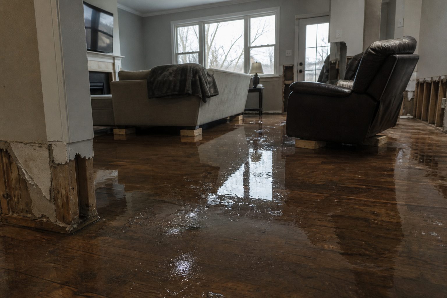
The National Weather Service in Midland/Odessa has issued a Flash Flood Warning for northwestern Brewster County in southwestern Texas, in effect until 7:15 PM CDT. Doppler radar indicated thunderstorms producing heavy rain across the warned area, with between 1 and 2 inches of rain already fallen and an expected rainfall rate of 1 to 2 inches in 1 hour. Flash flooding is ongoing or expected to begin shortly — exactly the kind of water event that puts interior flooding on restoration crews’ schedules by nightfall.
This is a live snapshot as of 5:15 PM PDT on Saturday, September 19, 2026. Conditions change fast — always verify with the National Weather Service for your specific county or ZIP code.
Northwestern Brewster County — Flash Flood Warning
Issuing office: NWS Midland/Odessa TX. Issue time: 5:09 PM CDT. Expiry: 7:15 PM CDT.
- Hazard: Flash flooding caused by thunderstorms.
- Source: Doppler radar indicated.
- Rainfall: Between 1 and 2 inches of rain have fallen. The expected rainfall rate is 1 to 2 inches in 1 hour.
- Status: Flash flooding is ongoing or expected to begin shortly.
- Impacts: Flash flooding of small creeks and streams, urban areas, highways, streets and underpasses, as well as other poor drainage and low-lying areas.
- Locations that will experience flash flooding include: Mainly rural areas of northwestern Brewster County — including the streams and drainages of Antelope Draw, Moss Creek, Maravillas Canyon, and Dugout Creek.
Brewster County is the largest county in Texas by area — bigger than some states — and its northwest corner is remote, rugged country. In that terrain, one to two inches of rain in an hour does not spread out; it concentrates in draws and canyons. Antelope Draw, Moss Creek, Maravillas Canyon, and Dugout Creek are exactly the kind of normally dry desert drainages that turn into walls of water with little warning, and rural low-water crossings can go from passable to impassable between one trip and the next.
The full alert is published on the NWS site: Flash Flood Warning for Brewster County TX (alert ID 0c664247d34eb980f992713af6627068d5c4a8bd).
Stay safe tonight
- Turn around, don’t drown. Most flood deaths occur in vehicles. Never drive through flooded roadways — in desert-canyon country, water over a road can be far deeper and faster than it looks, and the roadbed itself may be gone underneath.
- Do not attempt to cross flooded low-water crossings. Find an alternate route or wait it out.
- If water enters your home: stay out of standing water where electricity may be present; do not go into flooded rooms until water has receded and power is confirmed off.
- Photograph everything before cleanup begins. Documentation matters for insurance — damage that is torn out before it is photographed is damage that is hard to get paid for.
- Then call a local restoration contractor. Water left sitting starts a second wave of damage — saturated materials, wicking, and microbial growth — within a day.
- If you observe flooding, report it to local emergency services or law enforcement and ask them to pass the information to the National Weather Service when you can do so safely.
What this means for restoration teams
This is a rural-territory warning, and rural-territory warnings behave differently than city ones. Calls come from ranch houses, vacation properties, and small-town homes spread across enormous drive times — the triage question is not just what the job is, but whether you can reach it safely and whether it is worth rolling a truck before the water recedes. Capture on the first call: the caller’s exact location, the water source (creek overflow, road runoff, or water entering the structure itself), and which areas of the property are affected. A flooded outbuilding is a very different job than water through the living room.
The damage categories this warning maps to:
- Interior water intrusion: where draws and drainage paths meet structures — floors, lower walls, and the contents that sit on them.
- Saturated drywall and insulation: with rainfall rates of 1 to 2 inches in an hour, wall cavities take water fast; plan for moisture-mapping every affected room rather than spot-checking one wall.
- Mold risk within 24–48 hours: September heat in West Texas is a mold accelerant. The clock on microbial growth starts the moment the warning area’s structures get wet, not when the water leaves.
- Debris and sediment in the structure: desert-runoff events carry mud, sand, and vegetation into buildings — contamination that raises the scope beyond a simple water extraction.
- Road-access complications: washed-out rural roads and flooded low-water crossings can delay both the homeowner and your crew. Stage equipment on the safe side of known crossings when you can.
The play: pre-position drying assets tonight so the first dry call goes out as soon as the warning lifts and roads are passable. Keep an on-call rotation through the evening, not just the morning — in remote counties, people often discover the damage when they get home at dusk. Photo-document everything before mitigation starts, moisture-map every affected room, and keep the homeowner’s payment responsibility clear in writing before work starts — rural jobs have long drive times and thin margins, and a handshake scope does not survive a surprise invoice.
FEMA & federal assistance
If the damage is beyond what insurance covers, federal help may be available:
- FEMA Helpline: 1-800-621-3362, open 7 a.m.–10 p.m. local time, 7 days a week.
- Apply online: DisasterAssistance.gov — or through the FEMA app.
- In-person help: fema.gov/drc lists Disaster Recovery Centers.
- Basic eligibility: U.S. citizenship or qualified status, identity verification, proof of occupancy or ownership, and unmet needs not covered by insurance. Apply as soon as it is safe to do so.
Looking ahead
The warning expires at 7:15 PM CDT. Watch for the next NWS update from Midland/Odessa around expiry — warnings in training-thunderstorm setups are frequently extended or reissued for adjacent counties, and today has already seen active flash flood warnings across West Texas, including Jeff Davis, Reeves, and Pecos counties. Even after this warning lifts, the named drainages — Antelope Draw, Moss Creek, Maravillas Canyon, Dugout Creek — can run high for hours after the rain stops, and desert soils shed water long after the radar goes quiet.
The demand window: water-intrusion calls typically start within hours of water receding and keep coming for days as people discover damage — especially in rural areas where a ranch house may sit unchecked until someone drives out to look at it. For crews, the weekend timing means staffing the phone through Sunday morning, not just tonight.
Sources & how to verify
To verify for your own county or ZIP code: enter your location at weather.gov, or check the Midland/Odessa NWS office page for the latest warnings.
This post is for informational purposes and is not an official weather warning. Always follow instructions from local authorities and the National Weather Service.
Leave a Reply