Tropical: None · Severe: Marginal · Flood: High
What Changed
- SPC Day 1 Convective Outlook (2000 UTC Nov 20 2026 by Leitman, valid 202000Z–211200Z) maintains a Marginal Risk of severe thunderstorms across parts of coastal northeast Florida (approx. 2,600 sq mi, population ~1.16 million including Jacksonville, Daytona Beach, Port Orange). Isolated strong to severe thunderstorms may occur through tonight with occasional damaging winds and perhaps a brief tornado possible. Upgrade from earlier NO SEVERE cycles holds. No watches valid as of desk time. Severe lane open at Marginal.
- WPC Day 1 Excessive Rainfall Outlook (updated 1540 UTC / ~10:40 AM EST Fri Nov 20 2026 by Hurley, valid 16Z Nov 20–12Z Nov 21) maintains a High Risk of excessive rainfall for a small portion of the east coast of Florida, including Daytona Beach. Southern portions south of Daytona (Cape/Titusville, Melbourne) trimmed; High expanded to coastal Flagler County; Moderate expanded northward to include Jacksonville and Camden County, SE Georgia. High Risk continues on already saturated ground with prior multi-day totals of 6–12+ inches. Significant to locally catastrophic flash flooding possible. Status unchanged at High.
- NHC Atlantic Tropical Weather Outlook (latest ~1 PM EST Nov 20 2026): No tropical cyclones in the Atlantic, Caribbean, or Gulf of America. Broad low pressure area located near the east coast of central Florida producing disorganized showers and thunderstorms. Formation chance through 48 hours remains low (30 percent); through 7 days medium (~40–50 percent) for acquiring subtropical or tropical characteristics while moving generally northward to north-northeastward near or just offshore the southeastern United States coast through the weekend. No tropical storm or hurricane watch or warning on the U.S. coast or Gulf. Next name if named: Kyle. Probability language stable.
- NWS WWA products show active Flash Flood Warnings for northeastern Volusia County, northern Brevard County, northeastern Seminole County, and southeastern Volusia County, with radar-indicated heavy rain (additional 2–4 inches possible) and ongoing or imminent flash flooding in Daytona Beach, Port Orange, Ormond Beach, and surrounding areas. Residual Winter Storm Warnings continue for portions of the Sierra Nevada (CA/NV) until mid-morning PST and northern Rockies elevations. Special Marine Warnings active offshore NE Florida. No other products elevate national categories beyond the open lanes.
- Severe lane opened from None to Marginal on coastal northeast Florida. Flood remains High on the Florida east coast with active warnings and northward expansion of risk categories. Tropical remains None; monitored low near central Florida coast carries no U.S. coastal or Gulf watches or warnings. Primary flood ticket continues.
Live Status
As of the morning desk update on Friday, November 20, 2026 (approximately 3:24 PM PST / 6:24 PM EST / 2324Z), the national picture centers on a High flood risk for Florida’s east coast with a Marginal severe risk for coastal northeast Florida. Quiet criteria do not hold: WPC ERO High (above Moderate) is in effect. SPC holds a Marginal Risk (below Slight). No tropical storm or hurricane watch or warning on the U.S. coast or Gulf of America.
The Storm Prediction Center’s 2000 UTC Day 1 Outlook places a Marginal Risk across parts of coastal northeast Florida. A weak surface low along/near the FL Space Coast is attempting to develop inland/northward, with modestly enhanced low-level flow (25–35 kt) supporting some updraft organization. Weak instability and poor mid-level lapse rates limit the threat, but occasional damaging winds and a brief tornado/waterspout risk exist along/very near the coast through tonight. Inland severe potential remains limited. Isolated non-severe thunderstorms remain possible elsewhere under the western trough.
WPC maintains a High Risk for excessive rainfall along a focused portion of Florida’s east coast near Daytona Beach and coastal Flagler, with Moderate Risk extending northward toward Jacksonville and southeast Georgia. Prior 36-hour totals of 6–12+ inches across Brevard and adjacent counties, plus a badly swollen St. Johns River at record levels near Cocoa, aggravate additional rainfall. Rates may exceed 3 inches per hour; additional 4–8 inch totals possible through Saturday morning. Significant flash flooding continues regardless of exact placement.
Hotspots
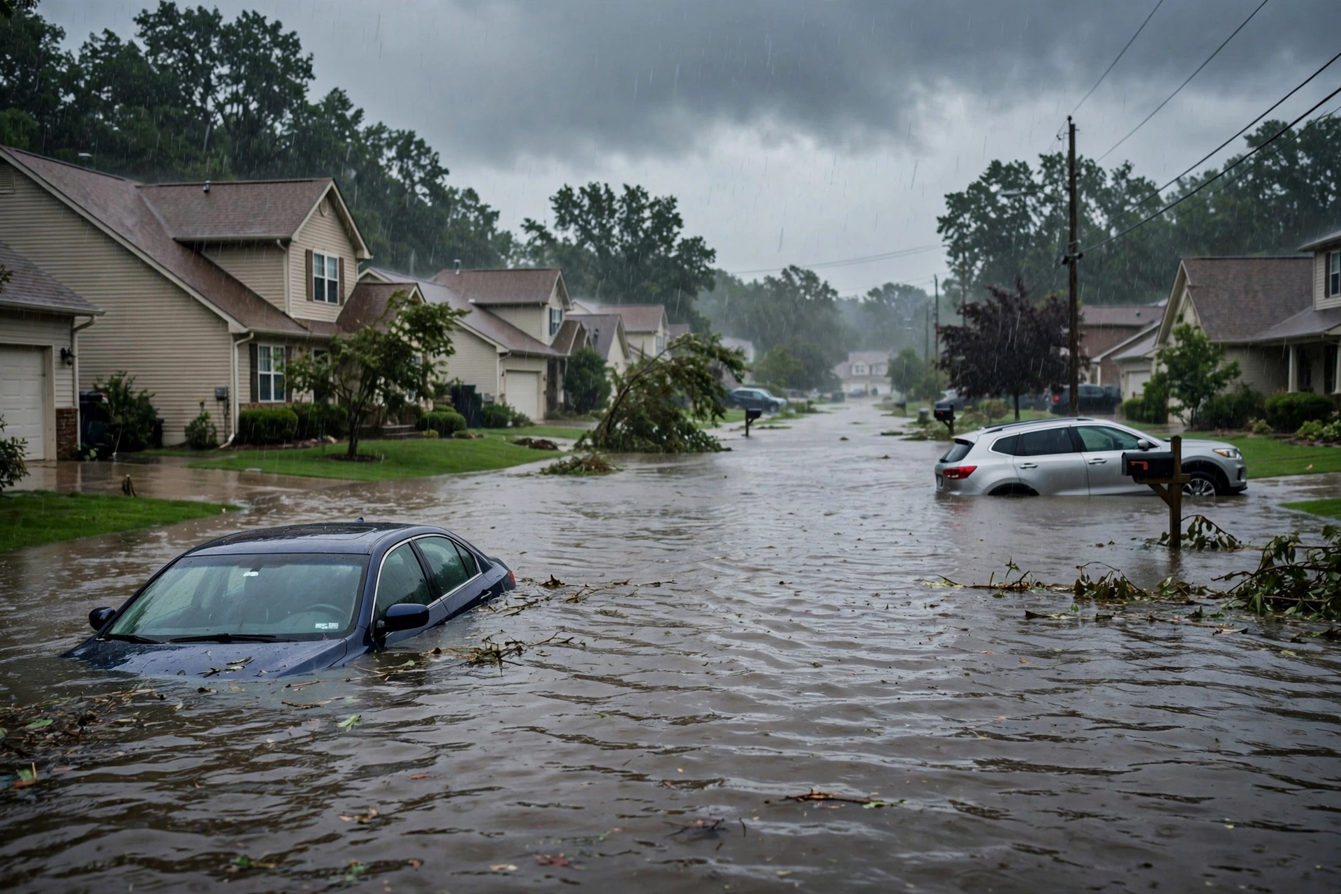
Primary hotspot remains Florida’s Atlantic coast, especially east-central sections (Brevard, Volusia, Seminole, Flagler and adjacent areas along the Space Coast and First Coast). Active Flash Flood Warnings cover northeastern Volusia (Daytona Beach, Port Orange, Ormond Beach), northern Brevard, northeastern Seminole, and southeastern Volusia. Multi-day rainfall has produced record or near-record November and seasonal totals. The St. Johns River near Cocoa has exceeded the 1953 historical crest (now near or above 18.7 feet). Water rescues, road closures, urban flooding, and structural water entry continue. Schools closed in multiple counties. The High Risk and northward shift support continued impacts through Friday into early Saturday.
Secondary residual hotspot is the Sierra Nevada under residual Winter Storm Warnings (until ~10 AM PST). Additional snow accumulations of 2–6 inches (locally higher on the crest) above 4,000 feet continue to impact mountain routes. Isolated non-severe thunderstorms possible as the western trough progresses. Northern Rockies hold similar residual winter products.
Get The Signal
What we actually ran, what it measured, and what it means for a restoration shop — every week, including the flops.
Tertiary interest is the monitored broad low pressure area near the east coast of central Florida. It could acquire subtropical or tropical characteristics while tracking generally northward to north-northeastward near or just offshore the southeastern U.S. coast through the weekend. Regardless of development, strong gusty winds, dangerous surf, rip currents, and coastal flooding are expected along portions of the southeast and mid-Atlantic coasts into early next week. Heavy rainfall and flash flood threat may spread northward toward coastal portions of the Carolinas and mid-Atlantic over the weekend.
Just-Hit
As of the desk update, Flash Flood Warnings remain active across portions of east-central Florida with radar-indicated thunderstorms producing heavy rain and additional 2–4 inches possible in warned areas (Daytona Beach vicinity, Port Orange, New Smyrna Beach, Edgewater). Multi-day accumulations have reached or exceeded 10–17+ inches in parts of Brevard and adjacent counties; Cape Canaveral area totals approached 27 inches in 48 hours in some reports. The St. Johns River has surpassed its 1953 record near Cocoa and continues rising. California holds residual winter products with additional snow this morning. No widespread severe reports elevating beyond the Marginal. No tropical watches or warnings issued.
Pulse Table
| Lane | Status | Notes (as of morning desk update Nov 20 2026 ~2324Z) |
|---|---|---|
| Tropical | None | No TC in Atlantic, Caribbean, Gulf of America, EPAC, or CPAC. NHC: broad low near east coast of central Florida; 30% chance 48h / ~40-50% 7-day of becoming subtropical or tropical near or offshore SE U.S. coast. No U.S. coastal or Gulf watches or warnings. Next name Kyle if develops. |
| Severe | Marginal | SPC Day 1 (2000Z Nov 20): Marginal Risk coastal NE Florida (~2,600 sq mi, Jacksonville/Daytona area) for isolated damaging winds and brief tornado through tonight. No watches. Upgrade from prior None. |
| Flood | High | WPC Day 1 ERO: High Risk small portion FL east coast (Daytona/Flagler); Moderate northward to Jacksonville/SE GA. Active Flash Flood Warnings Volusia/Brevard/Seminole. Ongoing multi-day record flooding, water rescues, St. Johns River major flood. Day 2 High continues. |
Restoration Read
Flood lane remains at High on Florida’s east coast with active Flash Flood Warnings and reported impacts including roadway flooding and water intrusion on already saturated ground. Primary short-term ticket is continued urban and flash flooding, road closures, and structural water entry through Friday into early Saturday. St. Johns River flooding continues at record or near-record levels. Newly opened Marginal severe risk adds isolated wind and brief tornado potential along the immediate northeast Florida coast. Secondary residual ticket is mountain snow and rain in the Sierra under Winter Storm Warnings. Tropical development remains a weekend concern with no current watches. Restoration volume driven by the multi-day Florida flood event.
What This Is Not
This is not a Quiet Pulse. WPC High excessive rainfall risk is active. Not an official warning. SPC holds a Marginal Risk (below Slight) for coastal northeast Florida. No tropical storm or hurricane watch or warning on the U.S. coast or Gulf. Residual winter and marine products do not elevate the national desk beyond the Florida flood threat and the focused severe risk.
Looking Ahead One Day
WPC Day 2 continues a High Risk of excessive rainfall for portions of Florida with the focus shifting somewhat northward. The monitored broad low near the central Florida coast may acquire subtropical or tropical characteristics while tracking near or just offshore the Southeast U.S. coast over the weekend, bringing additional rain, wind, and coastal flooding potential northward toward the Carolinas. SPC Day 2 holds limited or no organized severe potential beyond residual. California AR shifts inland and weakens. Severe lane remains open only at Marginal through tonight.
Rising Queries
Florida flooding, Daytona Beach flood, St. Johns River flood, Space Coast flood risk, Brevard County flooding.
Sources
- SPC Day 1 Convective Outlook: https://www.spc.noaa.gov/products/outlook/day1otlk.html
- WPC Excessive Rainfall Outlook and Discussion: https://www.wpc.ncep.noaa.gov/qpf/ero.php
- NWS WWA Summary: https://www.weather.gov/wwamap/wwatxtget.php?cwa=usa&wwa=all
- NHC Tropical Weather Outlook: https://www.nhc.noaa.gov/gtwo.php?basin=atlc&fdays=7
- Previous version of this desk: https://tygartmedia.com/quiet-pulse-2026-11-20-morning/
Disclaimer
This is an independent summary of publicly available official products from the Storm Prediction Center, Weather Prediction Center, National Hurricane Center, and National Weather Service. It is not an official forecast or warning. Always consult the latest NWS products for your location. Conditions can change rapidly. Tygart Media Storm Tracker is for situational awareness only. Informational only — not an official warning.
Get The Signal
What we actually ran, what it measured, and what it means for a restoration shop — every week, including the flops.
Leave a Reply