Update: observed flooding in Kalona — 4:43 AM CDT
Issued 4:43 AM CDT, still until 6:15 AM CDT by the National Weather Service in Quad Cities, IA/IL. The warned area is unchanged: Cedar, Iowa, Johnson, Keokuk, Louisa, Muscatine, and Washington counties. This update is observed flooding, not a forecast — spotters are reporting it on the ground right now.
Trained weather spotters reported flash flooding in Kalona. Between 2 and 4 inches of rain have fallen across portions of the warned area. Rain has tapered off to mainly light to at times moderate rain, with the heaviest rain already over — but flash flooding is ongoing. The English River is out of its banks: Washington County deputies reported around a foot of water covering the intersection of 133rd Street and Nutmeg Street in Kalona. Be alert for rapid rises and flooding on area streams and creeks and along the English River.
Drivers should know the highway exposure in this warning: Interstate 80 between mile markers 205 and 277 and Interstate 380 between mile markers 1 and 7 are inside the warned area. Turn around, don’t drown — most flood deaths happen in vehicles, and it is much harder to recognize flooded roadways at night.
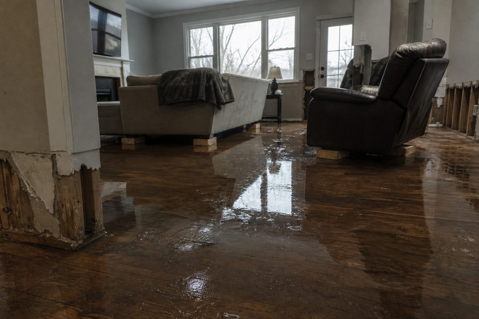
What this means for restoration teams: observed, on-the-ground flooding in Kalona and along the English River means this event is already producing water-intrusion work, not just risk. First calls typically land within hours of water receding and keep coming for days as damage is discovered — saturated drywall and insulation, contents in flooded basements, and septic/sewer backup in low-lying areas. If you’re covering the Iowa City–Muscatine–Washington corridor this morning, keep an on-call rotation through daylight and capture address, water source, and affected areas on the first call.
Update published as a live snapshot as of 4:43 AM CDT. Conditions change fast — verify with the National Weather Service for your specific county or ZIP code.
East Central and Southeast Iowa — Flash Flood Warning
The National Weather Service in the Quad Cities has issued a Flash Flood Warning for seven eastern Iowa counties, in effect until 6:15 AM CDT on Sunday, September 20. The warning, issued at 12:16 AM CDT, covers southern Cedar County, Iowa County, Johnson County, Muscatine County, Keokuk County, northwestern Louisa County, and Washington County.
For restoration teams, this is a wide-area overnight water event: between 1 and 2 inches of rain have already fallen, with another 2 to 3 inches possible before sunrise. Urban areas, small creeks, highways, and underpasses across east central and southeastern Iowa are in the impact zone — the exact interior flooding and stormwater-damage jobs restoration contractors see most.
UPDATE 1:45 AM CDT: this warning continues (same counties, same 6:15 AM CDT expiry), and flooding is now observed — trained weather spotters report the creek in Kalona, Iowa is out of its banks and still rising. This is a live snapshot as of 1:55 AM CDT. Conditions change fast — always verify with the National Weather Service for your specific county or ZIP code.
Southern Cedar, Iowa, Johnson & Muscatine Counties — Flash Flood Warning
Issued by NWS Quad Cities IA IL at 12:16 AM CDT, expiring 6:15 AM CDT. At 12:16 AM CDT, Doppler radar indicated thunderstorms producing heavy rain across the warned area; at 1:45 AM CDT trained weather spotters reported the creek in Kalona is out of its banks and still rising (flash flood detection now OBSERVED). Between 1 and 2 inches of rain have fallen, with additional rainfall amounts of 2 to 3 inches possible. Flash flooding is ongoing or expected to begin shortly.
Locations that will experience flash flooding include: Iowa City, Muscatine, Tipton, West Branch, Durant, Coralville, North Liberty, West Liberty, Wilton, Tiffin, and University Heights.
Expected impacts: flash flooding of small creeks and streams, urban areas, highways, streets and underpasses, as well as other poor drainage and low-lying areas.
Highway impacts: Interstate 80 in Iowa between mile markers 205 and 277, and Interstate 380 between mile markers 1 and 7. Do not drive flooded roadways — underpasses on these corridors are especially dangerous overnight.
Sources: the NWS Quad Cities office page and the official NWS alert (alert ID urn:oid:2.49.0.1.840.0.b1647530b5db10f8acc8cbf7b275d41d896a364b.001.1).
Keokuk, Northwestern Louisa & Washington Counties — Flash Flood Warning
Same warning, same timing: issued by NWS Quad Cities IA IL at 12:16 AM CDT, expiring 6:15 AM CDT. Radar-indicated thunderstorms producing heavy rain, with 1 to 2 inches already fallen and up to 3 inches more possible. Flash flooding is ongoing or expected to begin shortly. Severity: Severe; certainty: Likely; urgency: Immediate.
Locations that will experience flash flooding include: Washington, Marengo, Sigourney, Columbus Junction, Williamsburg, Kalona, Wellman, and Lone Tree.
Expected impacts: small creeks and streams, urban areas, highways, streets and underpasses, and other poor drainage and low-lying areas.
Stay safe tonight
Turn around, don’t drown when encountering flooded roads. Most flood deaths occur in vehicles — never drive through flooded roadways.
Be especially cautious at night, when it is harder to recognize the dangers of flooding. This warning covers the full overnight window across the Iowa City–Muscatine corridor and surrounding rural counties, where rural roads and low-water crossings are hardest to read in the dark.
Be aware of your surroundings and do not drive on flooded roads.
If water enters the home: stay out of standing water where electricity may be present, avoid the basement until water recedes and power is confirmed off, photograph everything before cleanup (documentation matters for insurance), then call a local restoration contractor — water left sitting starts a second wave of damage within a day.
What this means for restoration teams
This is a water-intrusion event across a broad service area, from the Iowa City metro to rural southeastern Iowa. Expect:
- Interior water intrusion — basements, crawlspaces, and ground-floor commercial spaces in low-lying areas and along creeks and the Iowa/Cedar river tributaries.
- Saturated drywall and insulation — water wicks upward fast; what looks like a wet floor line is often a two-foot wall cut.
- Mold risk within 24–48 hours — drying starts now, not Monday.
- Sewage backup in low-lying urban and rural areas where stormwater overwhelms the system — treat as Category 3 until verified otherwise.
- Stormwater damage to commercial properties along the I-80 corridor — loading docks, storage areas, and below-grade parking.
The play: stage equipment tonight, pre-position drying assets across the seven-county area, keep an on-call rotation through Sunday morning, and capture address, water source, and affected areas on the first call. Field discipline: photo-document before mitigation, moisture-map every affected room, and keep the homeowner’s payment responsibility clear in writing before work starts.
FEMA & federal assistance
FEMA Helpline: 1-800-621-3362 (7 a.m.–10 p.m. local time, 7 days a week). You can also apply at DisasterAssistance.gov, through the FEMA mobile app, or find in-person recovery centers at fema.gov/drc.
Basic eligibility: U.S. citizenship or qualified non-citizen status, identity verification, proof of occupancy or ownership, and unmet needs not covered by insurance. Apply as soon as it is safe to do so — do not wait for insurance to settle first.
Looking ahead
The warning expires at 6:15 AM CDT. What to watch through the rest of the night: additional thunderstorm rounds can drop rain on ground that is already saturated, and small creeks and streams often crest after the rain stops. With up to 2–3 inches more possible, a reissue or extension is likely if flooding is still ongoing at expiry.
Demand window note: water-intrusion calls typically start within hours of water receding and keep coming for days as homeowners discover damage — especially in basements that weren’t checked overnight.
Sources & how to verify
- Official warning: National Weather Service Quad Cities IA IL, Flash Flood Warning issued 12:16 AM CDT Sept 20 (alert ID
urn:oid:2.49.0.1.840.0.b1647530b5db10f8acc8cbf7b275d41d896a364b.001.1) - NWS Quad Cities office page
To verify for your own county or ZIP code, check weather.gov or the NWS Quad Cities office page — alerts update continuously.
This post is for informational purposes and is not an official weather warning. Always follow instructions from local authorities and the National Weather Service.
Leave a Reply