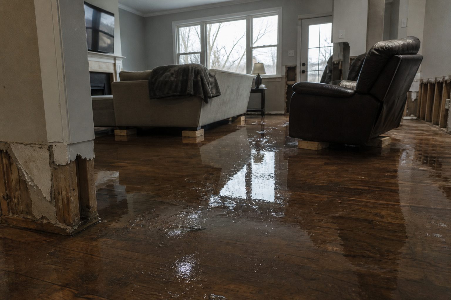
A Flash Flood Warning is active right now for the Idaho Falls area. The National Weather Service in Pocatello issued it at 10:00 PM MDT on Thursday, September 17, and it runs until 2:00 AM MDT on Friday, September 18. Doppler radar is showing thunderstorms producing heavy rain across north central Bonneville County and south central Jefferson County, and flash flooding is ongoing or expected to begin shortly. These are exactly the storms that produce the interior water-intrusion jobs restoration teams see most — water finding its way into living spaces in the middle of the night. This is a live snapshot as of 12:06 AM MDT on Friday, September 18. Conditions change fast — always verify with the National Weather Service for your specific county or ZIP code.
Idaho Falls area — Flash Flood Warning
Issued by: National Weather Service, Pocatello, Idaho — 10:00 PM MDT Thursday, September 17.
Expires: 2:00 AM MDT Friday, September 18.
Covers: North central Bonneville County and south central Jefferson County in southeastern Idaho.
At 10:00 PM MDT, Doppler radar indicated thunderstorms producing heavy rain across the warned area. The National Weather Service says flash flooding is ongoing or expected to begin shortly.
Hazard: Flash flooding caused by thunderstorms.
Source: Radar indicated.
Expected impacts: Flash flooding of small creeks and streams, urban areas, highways, streets and underpasses, as well as other poor-drainage and low-lying areas. In practical terms: the underpasses and low dips around Idaho Falls, ponding on streets in Rigby and the smaller towns, and any creek or drainage running high after this rain.
Locations in the warning path: Idaho Falls, Rigby, Lorenzo, Ucon, Menan and Lewisville.
Also active nearby — Big Rock burn scar warning: At 10:25 PM MDT, NWS Pocatello issued a separate Flash Flood Warning for the Big Rock burn scar in southeastern Jefferson County and south central Madison County, running until 2:30 AM MDT. Thunderstorms are producing heavy rain over the burn scar, and the Weather Service warns of life-threatening flash flooding with debris flow — rock, mud, vegetation and other loose materials — moving through the scar. Some locations affected include Heise. Roads and driveways may be washed away in places. If you are anywhere near the burn scar area and encounter flood waters, climb to safety immediately. This one is the more dangerous of the two warnings tonight.
Stay safe tonight
Turn around, don’t drown. Most flood deaths occur in vehicles — never drive through flooded roadways, and never try to guess the depth of water over a road at night. The National Weather Service’s rule of thumb: six inches of moving water can knock an adult off their feet, and twelve inches can carry a car.
If water gets into your home: stay out of standing water anywhere electricity may be present, and stay out of the basement until the water recedes and the power is confirmed off. Photograph everything before you touch anything — documentation matters for insurance. Then call a local restoration contractor. Water left sitting starts a second wave of damage within a day, and the clock on that starts the moment the rain stops, not the moment you discover it.
What this means for restoration teams
This is the signature southeastern Idaho night for water work: radar-indicated storms, urban and small-stream flooding, and a warning window that runs past 2:00 AM. Expect the calls to start as water recedes and keep coming for days as people discover what happened overnight. The damage categories to plan for: interior water intrusion through foundations, window wells and door thresholds; saturated drywall and insulation in finished basements; mold risk inside 24 to 48 hours on anything that stays wet; and sewage backup in low-lying areas where storm drains surcharge.
The play tonight: stage equipment now rather than at first call. Pre-position drying assets — air movers, dehumidifiers, extraction — so the first truck rolls complete. Keep an on-call rotation through the morning, because the discovery curve on overnight flooding peaks after sunrise. On the first call, capture the address, the water source, and every affected area before you quote anything.
Field discipline, same as always: photo-document before mitigation begins, moisture-map every affected room (not just the visibly wet one — water travels inside wall cavities), and keep the homeowner’s payment responsibility clear in writing before work starts. Night jobs with stressed homeowners are where scope misunderstandings are born.
Local emergency contacts
Bonneville County Emergency Management: (208) 529-1220 — bonnevillecountyidaho.gov/county-departments/emergency-management
Life-threatening emergency: 911
Bonneville County non-emergency dispatch: (208) 529-1200
Idaho Office of Emergency Management: ioem.idaho.gov
FEMA and federal assistance
If the flooding damages your home and you need help beyond what insurance covers, the FEMA Helpline is 1-800-621-3362, open 7 a.m. to 10 p.m. local time, seven days a week. You can also apply at DisasterAssistance.gov, through the FEMA app, or find a recovery center at fema.gov/drc.
Basic eligibility: U.S. citizenship or qualified status, identity verification, proof of occupancy or ownership, and unmet needs not covered by insurance. Don’t wait — apply as soon as it’s safe.
Looking ahead
The Idaho Falls warning expires at 2:00 AM MDT, and the neighboring burn scar warning at 2:30 AM MDT. When a warning expires, that doesn’t mean the water is gone — small creeks and streams often crest after the rain ends, and saturated ground means any additional round of storms overnight floods faster than the first. Storms can arrive in multiple rounds overnight, so watch the NWS Pocatello page for extensions or new warnings.
For contractors: the demand window on this kind of event opens within hours of water receding and stays open for days. Homeowners discover basement water in the morning, call around midday, and the serious mitigation decisions land over the weekend. Be reachable, be first with the moisture map, and be the contractor who documented everything.
Sources and how to verify
NWS Pocatello office page — warnings, updates and extensions post here first.
weather.gov — enter your ZIP code for the warnings covering exactly where you are.
Alert data via the National Weather Service API (api.weather.gov), warnings active as of 12:06 AM MDT Friday, September 18.
To verify for your own county or ZIP: open weather.gov, enter your ZIP, and read the active alerts banner at the top of the page. If Bonneville or Jefferson County is listed, this warning covers you.
This post is for informational purposes and is not an official weather warning. Always follow instructions from local authorities and the National Weather Service. Stay weather-aware around flash flooding — turn around, don’t drown.
Leave a Reply