
Author: William Tygart

  • Storm Updates: Quiet Pulse — Oct 28 Morning

    Storm Updates: Quiet Pulse — Oct 28 Morning

    As of the morning desk on Wednesday, October 28, 2026 (late evening update, approximately 9:15 PM PDT / 04:15 UTC October 29), the national picture is a Quiet Pulse. The Storm Prediction Center’s latest Day 1 Convective Outlook (0100 UTC update) holds only a Marginal Risk of severe thunderstorms across parts of the Upper Mississippi Valley. The Weather Prediction Center Day 1 Excessive Rainfall Outlook shows probability of exceeding flash flood guidance less than 5 percent nationally. No tropical storm or hurricane watch or warning is in effect on the U.S. coast or Gulf.

    Tropical: None · Severe: Marginal · Flood: Quiet

    What Changed

    • Compared with the previous desk pulse table (quiet-pulse-2026-10-27-afternoon: Tropical: None · Severe: Marginal · Flood: Quiet): SPC Day 1 evolved during the day. Morning and midday updates (1300 UTC and 1630 UTC) introduced a Slight Risk over eastern Minnesota into northwest Wisconsin for isolated tornadoes, hail, and damaging winds. Tornado Watch 698 was issued at 3:40 PM CDT for eastern MN and northwest WI, valid until 9 PM CDT. By the 0100 UTC October 29 outlook the risk was downgraded to Marginal for the Upper Mississippi Valley; mode transitioned to mostly linear. Watch 698 has expired; no watches or Mesoscale Discussions currently valid.
    • Preliminary Local Storm Reports for October 28 include multiple hail reports in central and eastern Minnesota (dime to quarter-plus, including one 3.00-inch spikey near Grove City), isolated wind damage in Dakota County MN, and one weak tornado report (brief rotation, no damage) near Danbury, Burnett County WI around 5:40 PM CDT.
    • WPC Day 1 Excessive Rainfall Outlook continues to show probability of rainfall exceeding flash flood guidance less than 5 percent. No risk areas.
    • No named tropical cyclone threatens or has just hit U.S. land. Atlantic basin quiet; Tropical Depression Vance in the Eastern Pacific poses no U.S. threat.
    • Severe lane opened temporarily to Slight then closed back to Marginal. Flood remains Quiet. Quiet Pulse criteria hold on the latest products.

    Live Status

    SPC Day 1 (valid through 12Z October 29) lists a Marginal Risk (Level 1 of 5) of severe thunderstorms from parts of southeast Minnesota into western and northern Wisconsin. A subtle shortwave and cold front support isolated thunderstorms with a localized severe threat early this evening; deep-layer shear is strong but instability limited. Threat expected to diminish overnight. No convective watches or active MDs.

    WPC Day 1 ERO shows no organized excessive rainfall risk; probability of exceeding flash flood guidance is less than 5 percent. Residual Flood Warnings persist on rivers in Florida, Colorado, and New Mexico from prior rainfall.

    NWS has scattered Flood Warnings, Coastal Flood Advisories/Warnings, Wind Advisories, and a Winter Storm Warning in Alaska. No widespread severe thunderstorm or flash flood warnings dominating the national map. Hawaii High Wind Warning on summits.

    Hotspots

    • Upper Mississippi Valley (MN/WI): Residual Marginal severe risk. Isolated hail and gusts possible early evening along the front. Population exposure limited; threat winding down after Watch 698. Multiple hail LSRs and one weak tornado already logged.
    • Residual river flooding zones (FL, Southwest): Ongoing Flood Warnings from prior events. Saturated soils elevate risk for rapid runoff in low-lying areas and arroyos.
    • Alaska: Winter Storm Warning continues for heavy snow on south slopes of the Western Brooks Range and Noatak Valley through Thursday. Travel impacts possible.

    Just Hit

    Hail reports from central Minnesota this afternoon (Blomkest, Granite Falls, Grove City areas) with sizes up to 3 inches in spots. One weak tornado reported near Danbury WI (brief, no damage). Isolated wind damage in eastern Minnesota. Residual river flooding continues on systems in Florida and the Southwest from prior events.

    Pulse Table

    LaneStatusNotes (as of ~04:15 UTC Oct 29 2026)
    TropicalNoneNo tropical cyclones in the Atlantic. TD Vance (EPAC) far offshore, no U.S. threat. No coastal or Gulf watches or warnings.
    SevereMarginalSPC Day 1 (0100Z Oct 29) Marginal Risk Upper MS Valley. Temporary Slight and Tornado Watch 698 earlier; both closed. Isolated LSRs logged. No active watches.
    FloodQuietWPC Day 1 ERO <5% (no risk). Residual Flood Warnings on rivers. No Moderate or higher.

    Restoration Read

    Primary residual concerns are localized river and coastal flooding in Florida and the Southwest, plus any minor hail impacts in Minnesota. No organized severe or excessive rain event for broad restoration volume today. Alaska snow may produce isolated travel and structural issues in remote areas.

    What This Is Not

    Not a Slight or higher severe day on the latest outlook. Not a Moderate or higher flood risk day. Not a tropical landfall or coastal watch/warning day. Organized severe window for the Upper Midwest (Slight Risk and Tornado Watch 698) has closed for the evening.

    Looking Ahead One Day

    Thursday: SPC Day 2 holds no severe thunderstorm areas forecast. WPC outlooks point to increasing heavy rain potential across the Southern High Plains and Southwest as moisture and a trough approach. Florida rain risk diminishes. Quiet nationally for severe and tropical.

    Rising Queries

    Trends unreachable.

    Sources

    Informational only — not an official weather warning. Always check weather.gov for local forecasts and warnings. Turn around, don’t drown.
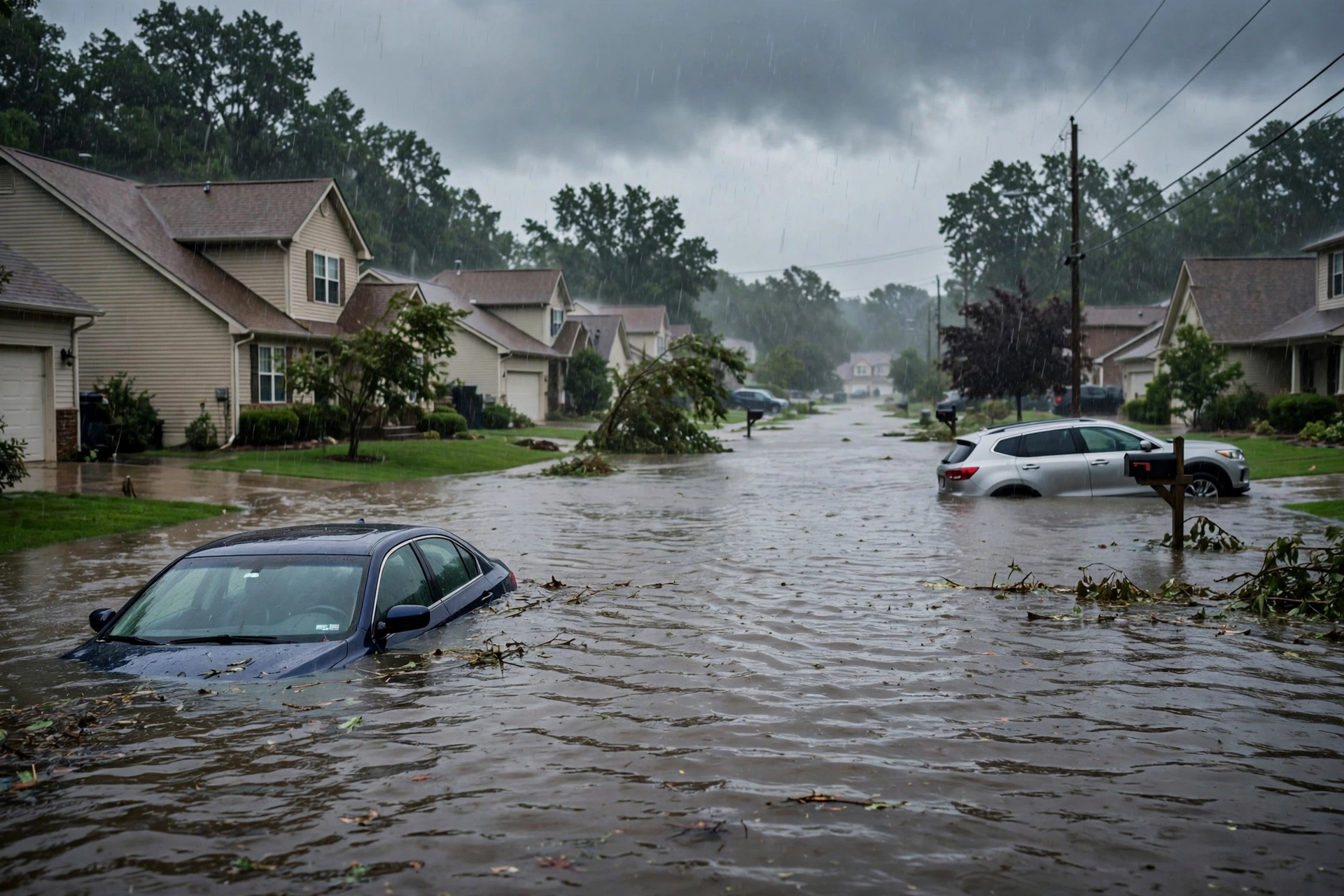

  • Storm Updates: Quiet Pulse — Oct 29 Morning

    Storm Updates: Quiet Pulse — Oct 29 Morning

    As of the morning desk on Thursday, October 29, 2026 (updated late evening PDT / early October 30 UTC), the national picture remains a Quiet Pulse. The Storm Prediction Center’s latest Day 1 Convective Outlook (0100 UTC update issued 0728 PM CDT October 29, valid 300100Z–301200Z) holds only a Marginal Risk of severe thunderstorms across parts of central and northeast Kansas and locally in southwest Texas. The Weather Prediction Center Day 1 Excessive Rainfall Outlook (updated 0132 UTC October 30) shows a Slight Risk for portions of west and central Texas and southeastern New Mexico. No tropical storm or hurricane watch or warning is in effect on the U.S. coast or Gulf.

    Tropical: None · Severe: Marginal · Flood: Slight

    What Changed

    • Compared with the afternoon desk pulse table (quiet-pulse-2026-10-29-afternoon: Tropical: None · Severe: Marginal · Flood: Quiet): SPC Day 1 Marginal Risk holds for central and northeast Kansas (~19,351 sq mi, ~592,000 people including Topeka, Salina, Manhattan, Hutchinson, Junction City) for isolated hail this evening, and locally in southwest Texas for a possible brief tornado early this evening. No convective watches currently valid. Prior MDs 2418/2419 have expired; no MDs in effect.
    • WPC Day 1 Excessive Rainfall Outlook holds a Slight Risk (level 2 of 4) for portions of west and central Texas and southeastern New Mexico, tied to moisture from the remnants of Vance. A Marginal Risk area is noted near the MO/KS/IA/NE border. No Moderate or higher. Flood Watches remain in effect across portions of West Texas and SE New Mexico through Friday evening.
    • Remnants of Vance (Eastern Pacific): NHC issued the final advisory (Advisory 35, 800 PM MST October 29). The system no longer has a well-defined center. Moisture continues to spread into the south-central and southwestern United States, but no U.S. land threat and no coastal or Gulf watches or warnings. Atlantic remains free of tropical cyclones with no formation expected in the next 7 days.
    • Residual Flood Warnings continue on the St. Johns River system in Florida (near Deland and Astor) and portions of New Mexico from prior rainfall, plus localized coastal flood advisories (California, Florida Keys). Winter Storm Warnings active in Alaska. These do not alter the national ERO lane beyond the Slight in the Southwest.
    • Nothing moved severe to Slight or above, flood to Moderate or above, or opened a tropical watch/warning on the U.S. coast or Gulf. Quiet Pulse criteria hold. Dominant residual ticket is the Slight excessive rainfall risk in West TX / SE NM from Vance moisture.

    Live Status

    SPC Day 1 (issued 0728 PM CDT October 29, 2026, valid through 12Z October 30) lists a Marginal Risk (Level 1 of 5) of severe thunderstorms across parts of central and northeast Kansas and locally in southwest Texas. In Kansas, widely scattered thunderstorms are developing near a stalled front in a moderately unstable airmass (MLCAPE around 2000 J/kg) with sufficient shear for cell rotation, supporting an isolated hail threat as storms move northeastward. In southwest Texas, weak instability and elevated low-level shear/helicity support a brief tornado possibility with low-topped cells early this evening. No current watches or active Mesoscale Discussions. Threat expected to diminish overnight with loss of instability.

    WPC Day 1 ERO (updated 0132 UTC October 30, 2026) shows a Slight Risk of excessive rainfall for portions of west and central Texas and southeastern New Mexico. High confidence in a heavy rainfall event through tonight as a mid-level disturbance associated with the remnants of Vance moves into the region. Southeasterly flow elevates PWATs to 1.5-2 inches. Hourly amounts to 2 inches possible with training or cell mergers; local totals to 5 inches near the TX/MX border. Marginal Risk near the KS/MO/NE/IA junction. No Moderate or higher. Flood Watches cover much of the Slight Risk area through Friday evening.

    NWS has residual Flood Warnings on some river systems from prior rainfall and localized coastal flood advisories (e.g., parts of Florida, California). High Wind Warnings and Winter Storm Warnings are active in portions of Alaska. No tropical storm or hurricane watches or warnings on the U.S. coast or Gulf. Overnight LSRs may include isolated hail in Kansas; no widespread damaging reports noted on latest scan.

    Hotspots

    • West and central Texas / southeastern New Mexico: Slight Risk excessive rainfall tonight into Friday morning from Vance remnant moisture. Training storms and elevated PWATs support localized flash flooding, especially urban areas, roads, low-lying spots, and burn scars. Dominant residual restoration ticket. Flood Watches in effect.
    • Central and northeast Kansas: Isolated hail threat this evening with storms along the stalled front. Primary short-term severe focus. Population centers include Topeka, Salina, Manhattan, Hutchinson.
    • Southwest Texas: Localized brief tornado possible early this evening with low-topped cells in a moist airmass. Short-lived.
    • Residual river and coastal flooding: Ongoing Flood Warnings on the St. Johns River system in Florida and portions of New Mexico, plus minor coastal flood advisories. Not tied to the new ERO Slight.

    Pulse Table

    LaneStatusNotes (as of ~03Z Oct 30 2026 / ~8 PM PDT Oct 29)
    TropicalNoneNo tropical cyclones in the Atlantic. Remnants of Vance (EPAC, final advisory issued) pose no U.S. land threat; moisture spreading into SW U.S. No coastal or Gulf watches or warnings.
    SevereMarginalSPC Day 1 Marginal Risk (~19k sq mi, ~592k people) for central/NE Kansas (isolated hail) and locally SW Texas (brief tornado possible). No active watches or MDs.
    FloodSlightWPC Day 1 Slight Risk for west/central Texas and SE New Mexico (Vance moisture). Marginal near KS/MO/NE/IA. Residual river Flood Warnings (FL St. Johns, NM) and coastal advisories continue. No Moderate or higher. Flood Watches active in TX/NM.

    Rising Queries

    • flood watch
    • Texas flood
    • New Mexico rain
    • Vance moisture
    • Kansas hail

    Restoration Read

    Quiet Pulse. Dominant residual ticket is localized flash flooding potential in west and central Texas and southeastern New Mexico from Vance remnant moisture tonight into Friday, plus isolated hail in central/northeast Kansas and a very limited brief tornado possibility in southwest Texas. Residual river stage concerns on Flood Warnings in Florida and New Mexico. No organized widespread damage expected. Monitor for water intrusion, debris, and high water on roads. Turn around, don’t drown.

    What This Is Not

    This is a Quiet Pulse. No SPC Slight or higher severe risk on the latest Day 1 outlook. No WPC Moderate or higher excessive rainfall. No tropical storm or hurricane watch or warning on the U.S. coast or Gulf of America. This desk summarizes public products from the SPC, WPC, NWS, and NHC.

    Sources: Storm Prediction Center (Day 1 Outlook 0100Z Oct 30, issued 0728 PM CDT Oct 29), Weather Prediction Center (Day 1 ERO Slight Risk, updated 0132 UTC Oct 30), National Weather Service (watches, warnings, residual Flood Warnings, Flood Watches in TX/NM), National Hurricane Center (Atlantic quiet; Remnants of Vance EPAC final advisory). Afternoon desk: quiet-pulse-2026-10-29-afternoon.

    Informational only — not an official weather warning. Always check weather.gov for local forecasts and warnings. Turn around, don’t drown.

  • Storm Updates: Quiet Pulse — Oct 28

    Storm Updates: Quiet Pulse — Oct 28

    As of the afternoon desk on Wednesday, October 28, 2026 (approximately 9:14 PM PDT / 04:14 UTC October 29), the national picture is a Quiet Pulse. The Storm Prediction Center’s latest Day 1 Convective Outlook (0100 UTC update) holds only a Marginal Risk of severe thunderstorms across parts of the Upper Mississippi Valley. The Weather Prediction Center Day 1 Excessive Rainfall Outlook shows probability of exceeding flash flood guidance less than 5 percent nationally. No tropical storm or hurricane watch or warning is in effect on the U.S. coast or Gulf.

    Tropical: None · Severe: Marginal · Flood: Quiet

    What Changed

    • Compared with this morning’s pulse table (quiet-pulse-2026-10-28-morning: Tropical: None · Severe: Marginal · Flood: Quiet): SPC Day 1 evolved during the day. Midday updates (1300 UTC and 1630 UTC) introduced a Slight Risk over eastern Minnesota into northwest Wisconsin for isolated tornadoes, hail, and damaging winds. Tornado Watch 698 was issued at 3:40 PM CDT for eastern MN and northwest WI, valid until 9 PM CDT. By the 0100 UTC October 29 outlook the risk was downgraded to Marginal for the Upper Mississippi Valley (~20,009 sq mi, population ~688,477 including Eau Claire WI); mode transitioned to mostly linear. Watch 698 has expired; no watches or Mesoscale Discussions currently valid.
    • Preliminary Local Storm Reports for October 28 include multiple hail reports in central and eastern Minnesota (dime to quarter-plus, including one 3.00-inch spikey near Grove City MN), isolated wind damage in Dakota County MN, and one weak tornado report (brief rotation, no damage) near Danbury, Burnett County WI around 5:40 PM CDT.
    • WPC Day 1 Excessive Rainfall Outlook continues to show probability of rainfall exceeding flash flood guidance less than 5 percent. No risk areas.
    • No named tropical cyclone threatens or has just hit U.S. land. Atlantic basin quiet; Tropical Depression Vance in the Eastern Pacific poses no U.S. threat.
    • Severe lane opened temporarily to Slight then closed back to Marginal. Flood remains Quiet. Quiet Pulse criteria hold on the latest products.

    Live Status

    SPC Day 1 (valid through 12Z October 29) lists a Marginal Risk (Level 1 of 5) of severe thunderstorms from parts of southeast Minnesota into western and northern Wisconsin. A subtle shortwave and cold front support isolated thunderstorms with a localized severe threat early this evening; deep-layer shear is strong but instability limited. Threat expected to diminish overnight. No convective watches or active MDs.

    WPC Day 1 ERO shows no organized excessive rainfall risk; probability of exceeding flash flood guidance is less than 5 percent. Residual Flood Warnings persist on rivers in Florida, Colorado, and New Mexico from prior rainfall.

    NWS has scattered Flood Warnings, Coastal Flood Advisories/Warnings, Wind Advisories, and a Winter Storm Warning in Alaska. No widespread severe thunderstorm or flash flood warnings dominating the national map. Hawaii High Wind Warning on summits.

    Hotspots

    • Upper Mississippi Valley (MN/WI): Residual Marginal severe risk. Isolated hail and gusts possible early evening along the front. Population exposure limited; threat winding down after Watch 698. Multiple hail LSRs and one weak tornado already logged.
    • Residual river flooding zones (FL, Southwest): Ongoing Flood Warnings from prior events. Saturated soils elevate risk for rapid runoff in low-lying areas and arroyos.
    • Alaska: Winter Storm Warning continues for heavy snow on south slopes of the Western Brooks Range and Noatak Valley through Thursday. Travel impacts possible.

    Just Hit

    Hail reports from central Minnesota this afternoon (Blomkest, Granite Falls, Grove City areas) with sizes up to 3 inches in spots. One weak tornado reported near Danbury WI (brief, no damage). Isolated wind damage in eastern Minnesota. Residual river flooding continues on systems in Florida and the Southwest from prior events.

    Pulse Table

    Tropical: None | Severe: Marginal (Upper MS Valley) | Flood: Quiet | Other: Winter Storm Warning AK; scattered local Flood Warnings.

    Restoration Read

    Primary residual concerns are localized river and coastal flooding in Florida and the Southwest, plus any minor hail impacts in Minnesota. No organized severe or excessive rain event for broad restoration volume today. Alaska snow may produce isolated travel and structural issues in remote areas.

    What This Is Not

    Not a Slight or higher severe day on the latest outlook. Not a Moderate or higher flood risk day. Not a tropical landfall or coastal watch/warning day. Organized severe window for the Upper Midwest (Slight Risk and Tornado Watch 698) has closed for the evening.

    Looking Ahead One Day

    Thursday: SPC Day 2 holds no severe thunderstorm areas forecast. WPC outlooks point to increasing heavy rain potential across the Southern High Plains and Southwest as moisture and a trough approach. Florida rain risk diminishes. Quiet nationally for severe and tropical.

    Rising Queries

    Minnesota tornado watch, Wisconsin severe weather, Twin Cities storms, late October tornado, SPC Slight Risk Minnesota. (Tied to the daytime Upper Midwest severe window.)

    Sources

    This is a factual pulse of official products only. Conditions change; check local NWS offices for the latest. Not a forecast product.

  • Free Until You’re the Store: What Muse Spark Open’s License Actually Says

    Free Until You’re the Store: What Muse Spark Open’s License Actually Says

    I read licenses the way I read scopes of work: looking for the one line that changes the price later. Muse Spark Open’s license has two of those lines, and the internet is already getting both of them slightly wrong.

    So here’s the plain version, from the license itself — the Muse Model License Meta published with the Muse Spark Open weights on October 15, 2026.

    First, what the license gives you. It grants the model free of charge, and the list of rights is long: use it, copy it, modify it, fine-tune it, distill it, merge it, publish it, distribute it, sublicense it, and sell copies of it. That is a real grant. Most developers, including commercial ones, can build on this model for free.

    Now the famous line: twenty million dollars. Read it carefully, because it does not say what the headlines say it says.

    The clause does not trigger when a company gets big. It triggers when two things are true at the same time. One: you or your affiliates are in the business of giving third parties access to AI models as a product or service, through an API or something like one — the license calls that “Model as a Service.” Two: your whole group’s gross revenue passes twenty million dollars in some consecutive twelve-month stretch. If both are true, you have to notify Meta and sign a separate written agreement before you offer this model, or anything derived from it, through that service.

    In plain terms: the line is not drawn around companies. It’s drawn around a kind of store. If you’re selling raw access to the model by the API call, and you’re doing it at real scale, Meta wants a signature. Everybody else keeps walking.

    The license says so itself, in the same paragraph. The clause does not apply to internal use. It does not apply to research. It does not apply to any commercial activity that isn’t model-as-a-service. And it does not apply to using the model as a component that powers features of your own product. A fifty-million-dollar company running this model inside its own software owes Meta nothing under that clause. A company half its size reselling API access owes a phone call.

    I run Tygart Media. We are nowhere near twenty million in revenue, and we are not in the business of selling anybody API access to anything. So the clause doesn’t bind us — on either prong. I’m building an open-source shared-brain system on Meta’s models for the hackathon: a book and a tool any small company can take, plug into a folder of its own files, and run. Nothing in that is a model-as-a-service. The twenty-million line is a fence around a field I’m not standing in.

    What would change if I ever were? Two things would have to happen, not one. We’d have to start selling access to the model itself — our own hosted API that other people pay to call — and the whole company’s gross revenue would have to cross twenty million in a rolling twelve months. Then, before offering Muse Spark Open through that service, we’d notify Meta and sign their separate agreement. Growth alone never trips it. Reselling access alone, at small scale, doesn’t trip it either. It takes the store and the size together.

    The second line is smaller, and it’s the one that actually applies to small builders: the credit. Any product or service that uses the open weights — or a derivative of them — has to prominently display the words “Built with Muse Spark Open.” In the interface, or in the documentation, or on the website, or in the settings menu. Exact words. No revenue threshold on this one. A one-person shop owes the same line as everyone else.

    And “derivative” is defined broadly enough to deserve a second read. It covers any model created, trained, fine-tuned, distilled, or otherwise improved using the model — or using its outputs. Train a smaller model on what Spark Open wrote, and that smaller model is a derivative. The credit travels with it, and so does the usage policy. That’s not a trap; it’s just a term you should know before you distill anything.

    One more clause worth knowing, because it settles a question every builder asks: Meta claims no ownership of outputs generated by the model. What it writes for you is not Meta’s property under this license. The words are yours to publish, sell, or give away.

    Now the honest fine print about my own build, because this is where people will get sloppy. The license I’ve been quoting governs the downloadable open weights — the Software, in its words. My shared-brain build doesn’t ship those weights. It calls muse-spark-1.3 through Meta’s hosted API, which runs under Meta’s API terms, a different document. So the notice and the twenty-million clause don’t legally attach to my repo through this license at all. I’m putting the credit line in the README anyway, because the build stands on Meta’s models and saying so costs me nothing — but I’m labeling it as what it is: a credit I chose, not a term I tripped.

    That’s the whole shape of it. Free to use, free to build on, free to sell what you build — with a credit line on anything built from the weights, a usage policy that travels with every copy, and one revenue clause aimed squarely at the people reselling the model itself at scale. For a small shop, this license is not a catch. It’s a receipt that says the big door is open, and the only door with a lock on it is the one where you become the store.

    Read the license before you build. Then build.

    — Will Tygart, Tygart Media

    Built with Muse Spark Open — a credit we carry by choice for this build; see the license map for what the term itself requires and of whom.


    Sources: Muse Model License (version: Muse Spark Open, October 15, 2026), published on Meta’s model repo: https://huggingface.co/meta-models/Muse-Spark-Open-816B-A42B — opening grant; §1 (license travels with copies); §2 (notice + Derivatives definition); §3 (Model as a Service / $20M); §4 (no ownership of outputs); Exhibit A (Usage Policy).

  • Storm Updates: Quiet Pulse — Oct 27

    Storm Updates: Quiet Pulse — Oct 27

    Tropical: None · Severe: Marginal · Flood: Quiet

    What Changed

    • Compared with this morning’s pulse table (quiet-pulse-2026-10-27-morning: Tropical: None · Severe: Marginal · Flood: Quiet): SPC Day 1 Outlook updated at 0100 UTC Oct 28 (7:59 PM CDT Oct 27, valid 280100Z–281200Z) maintains a Marginal Risk of severe thunderstorms but contracts it to portions of Far West Texas only (approx. 7,958 sq mi, population ~15,706 including Pecos TX). Previously included southeast New Mexico. Isolated large hail possible for a few more hours this evening before the threat becomes minimal overnight with loss of heating.
    • WPC Day 1 Excessive Rainfall Outlook (updated 0000 UTC Wed Oct 28, valid 01Z–12Z Wed Oct 28) continues to show the probability of rainfall exceeding flash flood guidance less than 5 percent. No risk areas.
    • No convective watches or current Mesoscale Discussions are valid. Earlier activity near the Guadalupe and Davis Mountains has diminished. No new severe local storm reports elevating the day.
    • No tropical storm or hurricane watch or warning on the U.S. coast or Gulf of America. Atlantic remains free of tropical cyclones. Tropical Storm Vance (Eastern Pacific, ~40 mph, moving northwest offshore southwestern Mexico) poses no U.S. land threat.
    • Lanes unchanged overall. Severe remains Marginal (footprint reduced and short-term). Flood remains Quiet. Residual river Flood Warnings on the Rio Grande system and tributaries continue as the primary lingering concern.

    Live Status

    As of this Tuesday evening afternoon desk scan (approx. 04:14 UTC Oct 28 / 9:14 PM PDT Oct 27), the national picture remains a Quiet Pulse. The latest SPC Day 1 places a Level 1 Marginal Risk over a small portion of Far West Texas for isolated severe thunderstorms for the next few hours this evening. A remaining storm or two could produce large hail before weakening with the loss of daytime heating. Coverage stays low and population exposure is limited. No watches are in effect, and the overnight severe threat is minimal.

    WPC holds no Day 1 Excessive Rainfall Outlook risk areas. Residual Flood Warnings persist on elevated rivers from prior multi-day rainfall across the Four Corners and Rio Grande basin, including segments of the Rio Grande, Rio Chama, and related tributaries in New Mexico, Colorado, and Texas. Saturated soils maintain localized sensitivity for runoff even without new heavy rain. Coastal Flood Warnings remain active in the Florida Keys and portions of the Florida east coast and southern California from tides and onshore flow, outside the main convective/ERO lanes.

    Hotspots

    • Far West Texas: SPC Marginal (contracted). Isolated thunderstorms with large hail possible near Pecos for a few more hours this evening. Low population exposure and sparse coverage limit impacts. No elevated tornado risk. Threat minimal overnight.
    • Residual Rio Grande and tributary river flooding (NM, CO, TX): Ongoing Flood Warnings from prior heavy rain. Saturated soils elevate risk for rapid runoff in arroyos, low-water crossings, and low-lying areas.
    • Coastal Florida and southern California: Coastal Flood Warnings and high rip current risks continue from onshore flow and high tides. Secondary concern only.

    Just-Hit

    Minor to moderate river flooding continues on Rio Grande system segments and related tributaries. Earlier convective activity in far West Texas and southeast New Mexico has largely diminished. No widespread damage reports. Localized water intrusion and road impacts remain possible on saturated ground. Turn around, don’t drown.

    Pulse Table

    LaneStatusNotes (as of ~04Z Oct 28 2026)
    TropicalNoneNo tropical cyclones in the Atlantic. TS Vance (EPAC, ~40 mph, NW) far offshore SW Mexico, no U.S. threat. No coastal/Gulf watches or warnings.
    SevereMarginalSPC Day 1 (0100Z Oct 28) Marginal Risk Far West TX only (~8k sq mi). Isolated large hail possible a few more hours this evening. No watches or MDs. Threat minimal overnight.
    FloodQuietWPC Day 1 ERO <5% (no risk). Residual Flood Warnings on Rio Grande system. No Moderate or higher.

    Restoration Read

    Primary residual ticket remains localized river flooding and saturated-soil runoff impacts across the Four Corners and Rio Grande basin. Isolated large hail in the short-term Marginal severe area of Far West Texas could cause limited roof, vehicle, or window damage, but low coverage keeps effects sparse. No organized severe or excessive rainfall expected tonight. Coastal flooding is tide-driven and secondary. Monitor previously warned zones for lingering water intrusion and road closures.

    What This Is Not

    This is a Quiet Pulse. SPC is only Marginal (not Slight or above). No WPC Moderate or higher excessive rainfall. No tropical storm or hurricane watch or warning on the U.S. coast or Gulf of America. This desk summarizes public products from the SPC, WPC, NWS, and NHC. It is not an official warning. Always verify with weather.gov for your local area.

    Looking Ahead

    Wednesday Day 2: SPC Marginal severe risk over the Upper Mississippi Valley (conditional isolated hail/wind if heating occurs). WPC Day 2 Marginal excessive rainfall for east-central and southeast Florida. Day 3 holds a Slight Risk of excessive rainfall for portions of West and Central Texas as remnant moisture from TS Vance is drawn northward—monitor closely, as organized convection on sensitive ground could elevate flash flood potential. Residual flood sensitivity lingers in the Southwest.

    Rising Queries

    Trends unreachable.

    Sources

    Official products: Storm Prediction Center (Day 1 Outlook 0100Z Oct 28), Weather Prediction Center (Day 1 ERO <5%, issued ~0000 UTC Oct 28), National Weather Service (watches, warnings, residual Flood Warnings), National Hurricane Center (Atlantic quiet; TS Vance EPAC). Morning desk: quiet-pulse-2026-10-27-morning.

    Informational only — not an official weather warning. Always check weather.gov for local forecasts and warnings. Turn around, don’t drown.

  • Storm Updates: Quiet Pulse — Oct 27 Morning

    Storm Updates: Quiet Pulse — Oct 27 Morning

    Tropical: None · Severe: Marginal · Flood: Quiet

    What Changed

    • Compared with the prior afternoon desk pulse (quiet-pulse-2026-10-26-afternoon: Tropical: None · Severe: Quiet · Flood: Marginal): SPC Day 1 Outlook introduced then held a Marginal Risk. The 0100 UTC Oct 28 update (7:59 PM CDT) contracts the Marginal to a small portion of Far West Texas (~7,958 sq mi, population ~15,706 including Pecos TX). Previously broader SE NM into Far West TX. Isolated severe possible for a few more hours this evening before minimal overnight.
    • WPC Day 1 Excessive Rainfall Outlook (updated 0000 UTC Wed Oct 28, valid 01Z–12Z Wed Oct 28) remains probability of rainfall exceeding flash flood guidance less than 5 percent. No risk areas. Prior Marginal Risks have ended.
    • Residual Flood Warnings continue on the Rio Grande system and tributaries in New Mexico, Colorado, Utah, and Texas from prior multi-day rainfall. Saturated soils persist. Some earlier Severe Thunderstorm Warnings (e.g., Reeves and Jeff Davis Counties TX) verified isolated hail/wind but no widespread reports.
    • No tropical storm or hurricane watch or warning on the U.S. coast or Gulf. Atlantic free of tropical cyclones. Tropical Storm Vance (Eastern Pacific, ~40 mph, moving NW well offshore southwestern Mexico) poses no U.S. land threat.
    • Severe lane holds at Marginal with contraction and short-term focus; Flood remains Quiet. Residual river flooding is the primary lingering concern. Nothing material upgraded beyond Marginal.

    Live Status

    As of the Tuesday evening scan for the October 27 morning desk (approx. 04:12 UTC Oct 28 / 9:12 PM PDT Oct 27), the national picture is a Quiet Pulse. SPC places a Level 1 Marginal Risk over a small portion of Far West Texas for isolated severe thunderstorms for a few more hours this evening. A remaining storm or two could pose an isolated large hail threat before weakening with the loss of daytime heating. Coverage is low. No convective watches or active Mesoscale Discussions. The severe threat becomes minimal for the remainder of the overnight period.

    WPC confirms no Day 1 Excessive Rainfall Risk (probability <5%). Residual river Flood Warnings continue on the Rio Grande, Rio Puerco, Rio Chama, San Juan River, and related segments across NM, CO, UT, and TX due to prior multi-day rainfall and saturated soils. Coastal Flood Warnings exist in limited coastal areas (Florida Keys, northeast Florida, San Diego/Orange County) driven by onshore flow and high tides but fall outside main lanes. Isolated Severe Thunderstorm Warnings earlier this evening (Midland/Odessa for Reeves/Jeff Davis Counties) indicated hail to 1.5" and gusts to 60 mph, but no widespread LSRs.

    Hotspots

    • Far West Texas: SPC Marginal (contracted). Isolated thunderstorms with large hail possible this evening near Pecos. Low population exposure and sparse coverage limit impacts. Threat winds down overnight.
    • Residual river flooding zones: Ongoing Flood Warnings from prior events on the Rio Grande system and tributaries. Saturated soils elevate sensitivity for runoff in arroyos and low-lying areas.

    Just-Hit

    Minor to moderate river flooding continues on segments of the Rio Grande and tributaries. Earlier flash flood concerns have largely expired. Isolated severe thunderstorm activity produced localized hail and wind reports in Far West Texas this evening but nothing widespread. Localized water intrusion and road impacts remain possible on saturated ground. Turn around, don’t drown.

    Pulse Table

    LaneStatusNotes (as of ~04Z Oct 28 2026)
    TropicalNoneNo tropical cyclones in the Atlantic. TS Vance (EPAC, ~40 mph, NW) far offshore SW Mexico, no U.S. threat. No coastal/Gulf watches or warnings.
    SevereMarginalSPC Day 1 Marginal Risk Far West TX (~8k sq mi). Isolated large hail possible for a few more hours this evening. No watches. Threat minimal overnight.
    FloodQuietWPC Day 1 ERO <5% (no risk). Residual Flood Warnings on Rio Grande system. No Moderate or higher.

    Restoration Read

    Primary residual ticket is localized river flooding impacts from prior heavy rain across the Four Corners and Rio Grande basin, with saturated soils. Isolated large hail possible in the Marginal severe area of Far West TX could produce localized roof, vehicle, or window damage, but low coverage limits effects. No organized severe or excessive rainfall expected tonight. Monitor for lingering water intrusion and road closures in previously warned zones. Coastal flooding is tide-driven and secondary.

    What This Is Not

    This is a Quiet Pulse. SPC is only Marginal (not Slight or above). No WPC Moderate or higher excessive rainfall. No tropical storm or hurricane watch or warning on the U.S. coast or Gulf of America. This desk summarizes public products from the SPC, WPC, NWS, and NHC. It is not an official warning. Always verify with weather.gov for your local area.

    Looking Ahead

    Wednesday Day 2: SPC Marginal severe risk potential over the Upper Mississippi Valley. WPC Day 2 Marginal excessive rainfall for east-central/southeast Florida. Day 3 may bring elevated rainfall risks into portions of Texas as remnant moisture interacts with shortwave features. Residual flood sensitivity lingers in the Southwest where soils remain wet.

    Rising Queries

    Trends unreachable.

    Sources

    Official products: Storm Prediction Center (Day 1 Outlook 0100 UTC Oct 28; prior 2000Z), Weather Prediction Center (Day 1 ERO <5%), National Weather Service (watches, warnings, residual Flood Warnings, isolated SVRs), National Hurricane Center (Atlantic quiet). Previous desk: quiet-pulse-2026-10-26-afternoon.

    Informational only — not an official weather warning. Always check weather.gov for local forecasts and warnings. Turn around, don’t drown.

  • Storm Updates: Quiet Pulse — Oct 26

    Storm Updates: Quiet Pulse — Oct 26

    Tropical: None · Severe: Quiet · Flood: Marginal

    What Changed

    • Compared with this morning’s pulse table (quiet-pulse-2026-10-26-morning: Tropical: None · Severe: None · Flood: Marginal): SPC Day 1 Convective Outlook (2000 UTC / 2:54 PM CDT Monday, October 26, 2026, valid 262000Z–271200Z) continues NO SEVERE THUNDERSTORM AREAS FORECAST. Isolated strong thunderstorms remain possible across far west Texas into southeast New Mexico, but organized severe potential is low. No convective watches or Mesoscale Discussions are currently valid.
    • WPC Day 1 Excessive Rainfall Outlook (updated 0051 UTC Tuesday, October 27 / ~8:51 PM EDT Monday, October 26, valid 01Z–12Z October 27) holds a MARGINAL RISK for portions of the central and southern High Plains (footprint reduced) and the mid to lower Texas Coast from Matagorda Bay to near Baffin Bay. No Slight or higher.
    • Active Flash Flood Warnings continue in west-central Chaves County, New Mexico, and portions of far west Texas / Texas Panhandle. Minor flooding on the Rio Grande near Castolon, Texas.
    • No tropical storm or hurricane watch or warning on the U.S. coast or Gulf of America. Atlantic basin free of tropical cyclones. Tropical Storm Vance (Eastern Pacific, weakening, moving west well south of Mexico) and Post-Tropical Olana (Central Pacific) pose no U.S. land threat.
    • Nothing material moved to open a Slight or higher lane. Severe remains Quiet; flood remains Marginal. Quiet Pulse holds.

    Live Status

    As of this Monday afternoon desk, October 26, 2026 (approximately 9:14 PM PDT / 12:14 AM EDT / 0414Z October 27), the national picture is a Quiet Pulse. SPC confirms no severe thunderstorm areas through the remainder of the Day 1 period. Isolated thunderstorms continue along the Sacramento Mountains in southeastern New Mexico and the Davis Mountains in West Texas under modest instability (around 1000-1500 J/kg MLCAPE) but limited effective shear (≤30 kt), keeping the severe threat isolated. No watches or MDs are in effect.

    WPC holds only Marginal Risks. On the High Plains, scattered storms associated with a shortwave may produce localized heavy rain, especially near terrain or on already wet soils. Along the mid to lower Texas Coast, increasing precipitable water and southerly flow support potential for localized heavy amounts near the immediate coast, with isolated flooding possible in urbanized areas. No Moderate or higher ERO.

    Hotspots

    • Southeast New Mexico and far west Texas (Sacramento / Davis Mountains corridor): Residual isolated strong storms and active Flash Flood Warnings on sensitive terrain and saturated soils.
    • Central and southern High Plains (Texas Panhandle into adjacent New Mexico/Kansas): WPC Marginal. Isolated training storms possible with localized 1–2 inches; flash-flood risk mainly on sensitive soils.
    • Mid to lower Texas Coast (Matagorda Bay to near Baffin Bay): Marginal ERO. Localized heavy rain possible near the immediate coast with potential for isolated urban flooding.

    Just-Hit

    Flash Flood Warning remains in effect for west-central Chaves County, New Mexico. Additional Flash Flood Warnings for portions of far west Texas and the Texas Panhandle. Minor river flooding on the Rio Grande near Castolon, Texas. No widespread severe local storm reports confirmed today beyond isolated strong cells. Localized road and low-lying flooding continues in the warned areas.

    Pulse Table

    LaneStatusNotes (as of ~9:14 PM PDT / 0414Z Oct 27 2026)
    TropicalNoneNo tropical cyclones in the Atlantic. TS Vance (EPAC) and Post-Tropical Olana (CPAC) far from U.S. land. No coastal/Gulf watches or warnings.
    SevereQuietSPC Day 1 (2000Z Oct 26): NO SEVERE THUNDERSTORM AREAS FORECAST. Isolated storms possible far west TX/SE NM. No watches or MDs.
    FloodMarginalWPC Day 1 Marginal Risk High Plains (reduced) + mid/lower Texas Coast. Active FFWs in NM/TX. No Moderate or higher.

    Restoration Read

    Residual ticket is localized flash flooding and rapid runoff on saturated soils, arroyos, small streams, urban corridors, and burn scars across southeast New Mexico and far west Texas. Isolated strong storms may produce brief hail or gusty winds but no organized severe damage expected. Texas Coast carries a secondary urban flash-flood ticket under the Marginal. No widespread catastrophic damage. Monitor for lingering water intrusion, debris, and road closures. Turn around, don’t drown.

    What This Is Not

    This is a Quiet Pulse. No SPC Slight or higher severe risk. No WPC Moderate or higher excessive rainfall. No tropical storm or hurricane watch or warning on the U.S. coast or Gulf of America. This desk summarizes public products from the SPC, WPC, NWS, and NHC. It is not an official warning.

    Looking Ahead

    Tuesday (Day 2): SPC shows no severe thunderstorm areas forecast. Residual flash-flood sensitivity may linger where soils remain saturated on the High Plains and Texas Coast, but the overall threat winds down overnight into early Tuesday. Monitor local NWS offices for any lingering warnings.

    Rising Queries

    Trends unreachable.

    Sources

    Official products: Storm Prediction Center (Day 1 Outlook 2000Z Oct 26), Weather Prediction Center (Day 1 Excessive Rainfall Outlook, 01Z update), National Weather Service (watches, warnings, flood statements), National Hurricane Center (Atlantic quiet; TS Vance / Post-Tropical Olana). Morning desk: quiet-pulse-2026-10-26-morning.

    Informational only — not an official weather warning. Always check weather.gov for local forecasts and warnings. Turn around, don’t drown.

  • Cited First, Chosen Second

    Cited First, Chosen Second

    Ninety-four percent of the brands AI cited while people were researching a category were also named when people asked which company to choose. For brands AI never cited at the research stage, the number was 50 percent. That is the headline finding of Victorious’s Q3 2026 Search Report, and it is the cleanest outside measurement yet of something operators have suspected for a year: the recommendation is decided earlier than the recommendation question.

    Instant Research & Tracking Downloads

    Track Your Research Citations Through to Recommendation

    Field quick-reference cards, fillable 8-page tracking packs, and AI-run citation audit routines built directly from the Victorious Q3 2026 Search Report findings.

    Field Quick Card
    FREE

    Three-Tier Quick Card

    2-page field card: Mentioned vs Cited vs Recommended defined in one line each, why they are not the same job, and the page’s measured thresholds (94% vs 50%, 81% vs 21%, 24k–28k mentions) on one card.

    Download Free PDF

    Direct download • No email gate

    Working Tracking Pack
    $7

    Tracking Pack

    Printable/fillable 8-page working pack: Three-Tier Tracker Log, Question-Before-Question Map, Citation-Ready Explainer Checklist, Trusted Placement Worksheet, Monthly Drift Log, and Shelf-Defense Schedule.

    Get Tracking Pack ($7) →

    Instant checkout • Square verified

    AI Intensive
    Book for Bots
    $17

    Research Citation Auditor

    Feed to ChatGPT or Claude: Question-Before-Question Interview, Tier-Split Audit, Explainer Auditor (numbers, dates, sources, zero fluff), Placement Generator, Drift Planner, and Shelf-Defense Diagnostic with embedded router.

    Get Citation Auditor ($17) →

    Software made of words • Instant delivery

    Three tiers, and they are not the same job

    AI visibility comes in three tiers. At the bottom, a brand is mentioned — its name exists somewhere in the answer’s world. In the middle, a brand is cited — its own content is used as a source while someone is learning how a category works. At the top, a brand is recommended — named when the buyer asks who to choose. Most reporting lumps the three together. The Victorious data says they behave like a ladder: the middle rung predicts the top one.

    A citation is not a compliment. It is the platform treating your page as evidence. When a model answers “what should I check before choosing an insurance provider?” and builds that answer on your content, it has filed your company under sources I trust on this subject. The study suggests that filing decision carries forward into the next conversation, where the question is no longer “how does this work” but “who should I hire.”

    What was actually measured

    Victorious followed 161 brands across five industries — ecommerce and retail, financial services and insurance, healthcare, legal services, and SaaS — and collected about 16,500 AI answers at the end of September 2026. For the research-to-recommendation test, it used Ahrefs Brand Radar data: real questions people in the US asked AI platforms, sorted into research questions (“how something works or what to look for”) and consideration questions (“who to choose”). Six platforms that search the web supplied the citation data.

    Read the finding the way Victorious itself reads it: as a correlation, not a cause. Bigger brands get cited more and named more, so the researchers checked whether size alone explained the gap. It explained part of it. After accounting for how often AI mentions each brand overall, cited brands were still more likely to be named. Victorious is now running a weekly panel through December to test whether research citations show up before the recommendations they predict. Until that lands, the honest statement is: citation and recommendation travel together, and the citation is the one you can work on directly.

    Operator Measurement Toolkit

    Put the Q3 2026 Citation Findings to Work on Your Own Site

    Don’t wait for consideration answers to leave your brand out. The middle rung predicts the top rung: brands cited during category research achieve a 4:1 breakthrough advantage in recommendation answers (81% vs 21%). Track your three visibility tiers separately, map upstream research queries, and audit explainers before models file your competitors as trusted sources.

    📊

    What’s In The Toolkit:

    • Three-Tier Tracker Log: Mentioned vs Cited vs Recommended separate counts.
    • Question-Before-Question Map: 2–3 research questions per buying query.
    • Explainer Checklist: Numbers, dates, named sources, zero sales fluff.
    • Trusted Placement Map: Association guides (9.8%) & directories (11.7%).
    • Monthly Drift Log: Tracks 25%–74% immediate and 6%–16% quarterly decay.
    • Bot Routines ($17): 6 AI-run citation audit routines with embedded router.
    Secure 1-Click Square Checkout

    The second number is the one to plan around

    On July 1, forty brands in the study had never been named on a single consideration question. By October, 81 percent of the ones already cited on research questions had broken through and been named at least once. In the group with no research citation, 21 percent had. The groups were small — 21 brands against 19 — so treat the exact percentages as a direction, not a promise. The direction is not subtle: brands entered the recommendation tier through the research tier, at roughly four times the rate of brands that tried to arrive unnamed and uncited.

    Meanwhile the room got smaller. AI named 42 of the study’s brands in the second quarter and 29 in the third — 15 dropped out, 2 came in. The amount of third-party web presence a brand needs for an even chance of being named rose from about 20,000 mentions to somewhere between 24,000 and 28,000. Visibility at the top tier is not a possession. It is a lease, and the rent went up.

    The research shelf itself is being rearranged

    Brands are also losing ground inside the research answers. Across the twenty research questions Victorious tracks, brand sites’ share of citations fell from 65.2 percent in Q2 to 55.5 percent in Q3, while government sites climbed from 4.2 to 11.7 percent and association sites from 3.9 to 9.8 percent. And in every industry, the ten most-cited websites took a bigger share of all citations — in legal services, about half. Your research content no longer competes mainly with other companies’ research content. It competes with the regulator, the trade association, and a short list of incumbents the platforms already trust.

    That rearrangement is why “publish more explainers” is not a strategy. An explainer that reads like a brochure loses the citation to the association page that reads like a reference. The research answer that gets cited is the one a careful professional could rely on: specific numbers, current dates, named sources, no sales language. Write the page you would want quoted back to you in someone else’s answer.

    What we do differently knowing this

    • Track the questions before the question. For every “who should I choose” query you care about, name the two or three research questions a buyer asks first, and measure whether your content is cited in those answers — not only whether your name appears in the buying answer.
    • Report the tiers separately. Mentioned, cited, and recommended are three different numbers with three different fixes. A dashboard that blends them hides the one that predicts the others.
    • Earn placement inside trusted sources, not just on your own site. Association guides, trade publications, and directories are taking citation share. A contribution there puts your name inside a source the platform already relies on.
    • Measure on a rhythm, because citations drift. Victorious found that asking one platform the same question twice reuses only 25 to 74 percent of its sources, and three months apart the overlap falls to 6 to 16 percent. A single screenshot of an AI answer is an anecdote. A monthly reading is a measurement.
    • Defend the research shelf you already hold. Fifteen brands fell out of the named set in one quarter. If AI cites your explainer today, that page is an asset with a maintenance schedule, not a finished job.

    Choose Your Research-to-Recommendation Toolkit Tier

    Select the analytical depth that matches your category research, content auditing, and recommendation tracking needs:

    Field Reference
    FREE

    Quick Card

    2-page field card: Mentioned vs Cited vs Recommended defined in one line each, why they are not the same job, and measured thresholds on one card.

    • Three visibility tiers defined in one line each
    • Why middle rung predicts top rung (94% vs 50%)
    • 4:1 breakthrough gap (81% vs 21%)
    • Measured thresholds: 42→29 shrinkage, 24k–28k mentions
    Download Free PDF

    Direct download • No email gate

    Working Pack
    $7.00

    Tracking Pack

    Printable/fillable 8-page working pack: logs, worksheets, checklists, drift trackers, and shelf-defense maintenance schedules.

    • Three-Tier Tracker Log: separate M, C, R counts
    • Question-Before-Question Map (2–3 research gates)
    • Citation-Ready Explainer Checklist (4 reference gates)
    • Trusted-Source Placement Worksheet (associations & directories)
    • Monthly Citation Drift Log (25%–74% / 6%–16% baselines)
    • Research Shelf Defense Maintenance Schedule
    • Thresholds Quick-Reference Sheet (full study figures)
    Get Tracking Pack ($7) →

    Instant Square checkout • Direct download

    AI Intensive
    Book for Bots
    $17.00

    Citation Auditor

    Feed to ChatGPT or Claude: executable AI instruction set running 6 interactive citation audit and generation routines with embedded router.

    • Routine 1: Question-Before-Question Interview
    • Routine 2: Tier-Split Analytics Audit Routine
    • Routine 3: Citation-Ready Explainer Auditor (/100 score)
    • Routine 4: Trusted-Source Placement Generator
    • Routine 5: Drift-Proof Measurement Cadence Planner
    • Routine 6: Research Shelf Defense Diagnostic
    • Embedded Output Router (“software made of words”)
    Get Citation Auditor ($17) →

    Instant Square checkout • Direct delivery

    Where Tygart Media sits in this

    We run our own fleet on the same logic this study measures. Tygart Media is an AI-first agency and publishing house working out of Tacoma and Puyallup, and our sites are measured on Bing and Copilot citations the way other shops measure rankings. Our October map of tygartmedia.com counted 3,229 published posts, and our most-cited page — a pricing explainer — carried about 96,000 citations in a September Bing export. That is research-tier weight, built on purpose: explainers written to be used as evidence. The Victorious numbers say that weight is exactly what the recommendation tier is drawn from. We wrote earlier this year that cited is not chosen. This study sharpens the point: cited is not chosen — but it is the qualifying round, and almost nobody gets chosen without running it.

    The practical takeaway fits in one line. If you want an AI platform to say your name when a buyer asks who to choose, first give it a reason to cite your work when that buyer was still asking how the job works. The explanation is the audition. The recommendation is the callback.

    Updated Nov 1, 2026 — added the free three-tier quick card, research-to-recommendation tracking pack, and research citation auditor downloads to this guide.

  • Storm Updates: Quiet Pulse — Oct 25

    Storm Updates: Quiet Pulse — Oct 25

    As of this Sunday afternoon desk, October 25, 2026 (approximately 8:15 PM PDT / 03:15 UTC October 26), the national picture remains a Quiet Pulse. The Storm Prediction Center holds a Marginal Risk of severe thunderstorms from New Mexico into far west Texas and the western Texas Panhandle on the Day 1 Convective Outlook (2000 UTC update, valid through 1200Z October 26). Isolated large hail, damaging wind gusts, and a tornado or two remain possible this evening. No convective watches are currently valid. The Weather Prediction Center holds a Slight Risk of excessive rainfall over portions of the central and southern High Plains and southeast Florida. No tropical storm or hurricane watch or warning is in effect on the U.S. coast or Gulf of America.

    Tropical: None · Severe: Marginal · Flood: Slight

    What Changed

    • Compared with this morning’s pulse table (quiet-pulse-2026-10-25-morning: Severe: Marginal · Flood: Slight · Tropical: None): SPC Day 1 (2000Z October 25 / 2:55 PM CDT) continues a MARGINAL RISK of severe thunderstorms from New Mexico into far west Texas and the western Texas Panhandle (roughly 92,000 sq mi, 2.6 million people including Albuquerque, Santa Fe, Rio Rancho, Roswell). Isolated large hail, damaging gusts, and a tornado or two possible this afternoon/evening. No active Severe Thunderstorm Watches. Threat remains isolated.
    • WPC Day 1 Excessive Rainfall Outlook holds a SLIGHT RISK for portions of the central and southern High Plains (West Texas, New Mexico, Colorado) and southeast Florida. Highest rainfall rates 1–1.5 inches per hour possible over already saturated soils in the Southwest. No Moderate or above.
    • Local NWS offices continue to issue Severe Thunderstorm Warnings (e.g., near Roswell in Chaves County) and residual Flash Flood concerns. Flood Watches remain on saturated soils in New Mexico. No elevation of any lane.
    • No tropical storm or hurricane watch or warning on the U.S. coast or Gulf of America. Atlantic basin remains quiet. Tropical Storm Vance (Eastern Pacific) and Tropical Storm Olana (Central Pacific) pose no U.S. land threat.
    • Nothing moved beyond Quiet Pulse criteria. Severe remains Marginal, flood remains Slight, tropical remains None. Primary residual ticket is isolated hail/wind and flash-flood runoff across New Mexico and far west Texas.

    Live Status

    SPC Day 1 lists a Marginal Risk (Level 1 of 5) of severe thunderstorms for New Mexico into far west Texas and the western Texas Panhandle. Isolated strong to severe thunderstorms remain possible this evening. Primary threats are large hail and damaging wind gusts, with a tornado or two possible. Greater buoyancy exists across southeastern New Mexico and far west Texas where MLCAPE values support stronger cells under 30–40+ kt effective shear. No changes were made to the existing outlook in the 2000Z update. No convective watches are active.

    NWS Albuquerque has issued recent Severe Thunderstorm Warnings for areas near Roswell (central Chaves County) with 60 mph gusts and half-dollar size hail possible. Flood Watches cover portions of central and eastern New Mexico on saturated soils from multi-day rainfall. Residual flash-flood risk persists in urban corridors and small streams.

    WPC maintains the Slight Risk of excessive rainfall over the central and southern High Plains and southeast Florida. In the High Plains, PWAT values support rainfall rates up to 1–1.5 inches per hour. In southeast Florida, onshore flow supports 1–2 inches with urban flash-flood potential along the I-95 corridor. No Moderate or higher ERO.

    Hotspots

    • Central and eastern New Mexico (Albuquerque, Santa Fe, Roswell corridor): Marginal severe residual and WPC Slight. Isolated hail, wind, and brief tornado possible. Active or recent Severe Thunderstorm Warnings. Flood Watches on saturated soils.
    • Far west Texas and western Texas Panhandle: Marginal severe overlap. Isolated damaging wind and hail possible. Residual urban runoff risk under the Slight ERO.
    • Southeast Florida: WPC Slight Risk for excessive rainfall. Onshore flow and coastal convergence support 1–2 inches with locally higher totals. Urban flash-flood potential along the I-95 corridor.

    Just-Hit

    Recent Severe Thunderstorm Warnings near Roswell (Chaves County) for 60 mph gusts and hail. Residual Flash Flood concerns on saturated soils. No confirmed significant tornado reports this evening. Localized flooding and isolated severe impacts continue in the Southwest.

    Pulse Table

    LaneStatusNotes (as of ~03:15 UTC Oct 26 2026 / 8:15 PM PDT Oct 25)
    TropicalNoneNo tropical cyclones in the Atlantic. TS Vance (EPAC) and TS Olana (CPAC) pose no U.S. land threat. No coastal or Gulf watches or warnings.
    SevereMarginalSPC Day 1 Marginal Risk over NM into far west TX and western TX Panhandle. No active watches. Isolated hail/wind/tornado possible this evening.
    FloodSlightWPC Day 1 Slight Risk for central/southern High Plains and SE Florida. Residual FF concerns and Flood Watches in NM. Saturated soils. No Moderate or higher.

    Restoration Read

    Residual restoration ticket is isolated hail and wind damage to roofs, vehicles, siding, and trees across New Mexico and far west Texas under the Marginal Risk. Secondary ticket is localized flash flooding and rapid runoff in urban corridors (Albuquerque, Roswell, El Paso), small streams, and burn scars on already saturated soils. Southeast Florida carries an urban flash-flood ticket under the Slight ERO. No widespread catastrophic damage expected.

    What This Is Not

    This is a Quiet Pulse. No SPC Slight or higher severe risk on the latest Day 1 outlook. No WPC Moderate or higher excessive rainfall. No tropical storm or hurricane watch or warning on the U.S. coast or Gulf of America. This desk summarizes public products from the SPC, WPC, NWS, and NHC. It is not an official warning.

    Looking Ahead

    Monday (Day 2): SPC shows no severe risk area. WPC Day 1 threat winds down overnight into early Monday. Residual flash-flood sensitivity remains where soils are saturated. Monitor local NWS offices for any lingering warnings.

    Rising Queries

    Trends unreachable.

    Sources

    Official products: Storm Prediction Center (Day 1 Outlook 2000Z Oct 25), Weather Prediction Center (Day 1 Excessive Rainfall Outlook), National Weather Service (watches, warnings, flood statements), National Hurricane Center (Atlantic quiet; TS Vance and TS Olana). Morning desk: quiet-pulse-2026-10-25-morning.

    Informational only — not an official weather warning. Always check weather.gov for local forecasts and warnings. Turn around, don’t drown.

  • Storm Updates: Quiet Pulse — Oct 26 Morning

    Storm Updates: Quiet Pulse — Oct 26 Morning

    As of this late Monday evening update for the October 26 morning desk (approximately 9:12 PM PDT / 04:12 UTC October 27, 2026), the national picture remains a Quiet Pulse. The Storm Prediction Center Day 1 Convective Outlook (2000 UTC October 26 update, valid through 1200Z October 27) lists no severe thunderstorm areas forecast. The Weather Prediction Center Day 1 Excessive Rainfall Outlook (updated 0051 UTC October 27) maintains a Marginal Risk for portions of the central and southern High Plains and the mid to lower Texas coast. No tropical storm or hurricane watch or warning is in effect on the U.S. coast or Gulf of America.

    Tropical: None · Severe: None · Flood: Marginal

    What Changed

    • Compared with the earlier pulse on this same slug (published ~10:16 PM PDT October 25 and updated through the afternoon): SPC Day 1 remains at No Severe thunderstorm areas forecast. The prior Marginal Risk over New Mexico into far west Texas closed with the eastward shift of the shortwave and loss of stronger shear.
    • WPC Day 1 Excessive Rainfall Outlook holds a Marginal Risk from southeastern New Mexico and West Texas to central Kansas, plus the mid to lower Texas coast (Matagorda Bay to near Baffin Bay). No Moderate or above. Footprint reduced from earlier Slight.
    • NWS continues isolated Flash Flood Warnings in portions of West Texas (Jeff Davis, Reeves, Pecos) and New Mexico (Chaves), plus a Flood Warning for the Rio Grande near Castolon, Texas (minor flooding). No active convective watches or mesoscale discussions. Overnight LSRs show limited verification of organized severe.
    • No tropical storm or hurricane watch or warning on the U.S. coast or Gulf. Atlantic basin quiet with no tropical cyclones. Tropical Storm Vance (Eastern Pacific, weakening) and Post-Tropical Cyclone Olana (Central Pacific) pose no U.S. land threat.
    • Severe lane closed. Flood lane at Marginal. Quiet Pulse criteria fully met. Residual ticket is localized flash-flood runoff on sensitive terrain and the Texas coast.

    Live Status

    SPC Day 1 (2000Z October 26, issued 2:54 PM CDT, with later confirmation) states: “NO SEVERE THUNDERSTORM AREAS FORECAST.” Isolated thunderstorm development occurred earlier along the Sacramento Mountains in southeastern New Mexico and the Davis Mountains in West Texas under 1000–1500 J/kg MLCAPE, but stronger mid/upper-level flow shifted eastward, limiting effective shear to generally 30 kts or less. Organized severe potential remains low. No convective watches are active. Day 2 and Day 3 outlooks also show no severe areas.

    WPC Day 1 ERO (850 PM EDT October 26, valid 01Z–12Z October 27) maintains a Marginal Risk from southeastern New Mexico and West Texas to central Kansas, plus the mid to lower Texas coast. Isolated heavy amounts over 3 inches possible near the immediate coast where slow-moving storms may develop under increasing PWAT; rates limited elsewhere by modest instability. No Moderate or higher risk.

    NWS offices hold Flash Flood Warnings for portions of Jeff Davis, Reeves, and Pecos Counties in Texas and Chaves County in New Mexico. A Flood Warning continues for the Rio Grande near Castolon, Texas (minor flooding, stage near 15.1 feet earlier). Coastal Flood Warnings and Wind Advisories remain active in the Florida Keys and southeast Florida under northeast flow (non-convective). Alaska carries Winter Storm Warnings and High Wind Warnings, outside CONUS severe/flood thresholds for this desk.

    Hotspots

    • Southeastern New Mexico and West Texas (High Plains): Residual Marginal ERO. Isolated flash flooding possible on saturated soils, arroyos, and urban areas. Severe threat closed.
    • Mid to lower Texas coast (Matagorda Bay to Baffin Bay): Marginal Risk for localized heavy rain under increasing PWAT and slow-moving coastal storms. Urban flash flooding possible.

    Just-Hit

    Recent Flash Flood Warnings for East Central Jeff Davis County and adjacent areas in southwestern Texas (radar-indicated). River Flood Warning for the Rio Grande near Castolon affecting Brewster County (minor flooding of lowlands and park roads). No widespread severe reports in the latest cycle. Residual runoff continues where soils remain sensitive from prior days.

    Pulse Table

    LaneStatusNotes (as of ~9:12 PM PDT / 04:12 UTC Oct 27 2026)
    TropicalNoneNo tropical cyclones in the Atlantic. TS Vance (EPAC, weakening) and Post-Tropical Olana (CPAC) pose no U.S. land threat. No coastal or Gulf watches or warnings.
    SevereNoneSPC Day 1: No Severe Thunderstorm Areas Forecast (2000Z Oct 26). Prior Marginal over NM/TX closed. No active watches. Day 2–3 quiet.
    FloodMarginalWPC Day 1 Marginal Risk for High Plains and mid/lower Texas coast. Isolated FFWs in TX/NM. No Moderate or higher.

    Restoration Read

    Quiet Pulse. Residual restoration ticket is localized flash flooding and rapid runoff on sensitive terrain, burn scars, arroyos, and urban corridors across southeastern New Mexico, West Texas, and the mid to lower Texas coast under the Marginal ERO. Isolated water intrusion and debris possible. No organized severe (hail, wind, tornado) ticket remains open. Monitor for lingering river stages on the Rio Grande and any coastal heavy rain cells.

    What This Is Not

    This is a Quiet Pulse. No SPC Slight or higher severe risk. No WPC Moderate or higher excessive rainfall. No tropical storm or hurricane watch or warning on the U.S. coast or Gulf of America. This desk summarizes public products from the SPC, WPC, NWS, and NHC. It is not an official warning.

    Looking Ahead

    Tuesday Day 2: SPC shows no severe thunderstorm areas forecast. The upper trough continues to eject. Residual flash-flood sensitivity remains localized where soils are saturated or under any coastal convection. WPC Day 1 threat winds down overnight. Monitor local NWS offices for any lingering warnings.

    Rising Queries

    Trends unreachable.

    Sources

    Official products: Storm Prediction Center (Day 1 Outlook 2000Z Oct 26), Weather Prediction Center (Day 1 Excessive Rainfall Outlook 0051 UTC Oct 27), National Weather Service (watches, warnings, flood statements), National Hurricane Center (Atlantic quiet). Updated in place from earlier morning desk.

    Informational only — not an official weather warning. Always check weather.gov for local forecasts and warnings. Turn around, don’t drown.