NWS Nashville TN issued this Flash Flood Warning at September 21 at 10:23PM CDT. It runs until 12:00 AM UTC-05:00 and covers 1 counties: Cumberland, TN. Doppler radar indicated thunderstorms producing heavy rain across the warned area. Flash flooding is ongoing or expected to begin shortly.
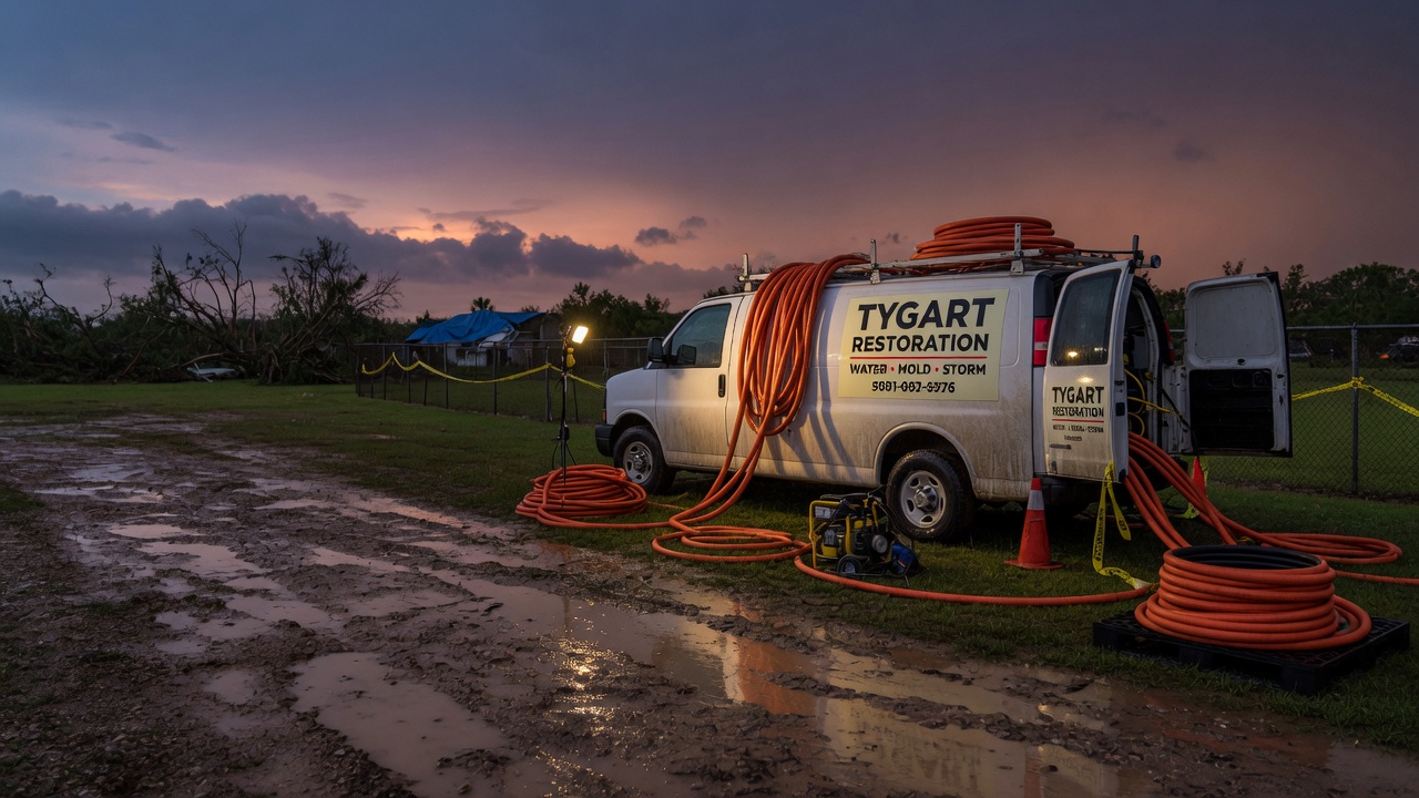
This is the exact interior-flooding scenario restoration contractors see most: water coming in fast, from streets and creeks into homes and businesses, with no time to sandbag. This is a live snapshot as of 8:41 PM PDT. Conditions change fast — always verify with the National Weather Service for your specific county or ZIP code.
Cumberland, TN — Flash Flood Warning
Issued by: NWS Nashville TN, September 21 at 10:23PM CDT In effect until: 12:00 AM UTC-05:00 Detection: Radar indicated Certainty: Likely — Urgency: Immediate
The alert reads, in part:
* Flash Flood Warning for…
* Until September 22 at 12:00AM CDT.
HAZARD…Flash flooding caused by thunderstorms.
SOURCE…Radar indicated.
IMPACT…Flash flooding of small creeks and streams, urban areas, highways, streets and underpasses as well as other poor drainage and low-lying areas.
Locations that will experience flash flooding include: Crossville, Crab Orchard, Cumberland Mountain State Park and Lake Tansi..
The National Weather Service instruction for this warning is direct: turn around, don’t drown when encountering flooded roads. Most flood deaths occur in vehicles. Be especially cautious at night, when it is harder to recognize the dangers of flooding. Be aware of your surroundings and do not drive on flooded roads.
If water enters your home: stay out of standing water where electricity may be present, avoid the basement until the water recedes and the power is confirmed off, and photograph everything before cleanup — documentation matters for insurance — then call a local restoration contractor. Water left sitting starts a second wave of damage within a day.
You can report flooding to the National Weather Service toll free at 800-401-9535 when you can do so safely.
What this means for restoration teams
This is the signature call type for this kind of night: interior water intrusion from flash flooding — water through doors and garage bays, seepage up through slabs, saturated drywall and insulation on ground floors, and in low-lying areas, sewage backup riding in with the floodwater. Mold risk starts ticking within 24–48 hours on anything that stays wet.
The play: stage equipment now — air movers, dehumidifiers, and extraction units ready to roll toward Cumberland, TN before first light. Keep an on-call rotation through the morning, because the first calls land within hours of the water receding and keep coming for days as people discover damage.
Field discipline on the first call: capture the address, the water source, and every affected area before you dispatch. Photo-document everything before mitigation starts, moisture-map every affected room (walls, baseboards, subfloor), and keep the homeowner’s payment responsibility clear in writing before work begins. Clean water from rain-driven flooding can still carry contaminants once it crosses streets and yards — treat category classification as a field decision, not an assumption.
FEMA & federal assistance
If the flooding damages your home or business beyond what insurance covers, federal help may be available. The FEMA Helpline is 1-800-621-3362 (7 a.m.–10 p.m. local, 7 days a week). You can also apply at DisasterAssistance.gov, through the FEMA mobile app, or find a recovery center at fema.gov/drc.
Basic eligibility: U.S. citizenship or qualified status, identity verification, proof of occupancy or ownership, and unmet needs not covered by insurance. Apply as soon as it is safe to do so — you do not need to wait for an official disaster declaration to start documenting your losses.
Looking ahead
This warning expires at 12:00 AM UTC-05:00. When it does, the danger does not necessarily end: small creeks and streams can crest after the rain stops, and additional rounds of thunderstorms can re-trigger flooding on already-saturated ground. Watch the NWS Nashville TN page and weather.gov for the next update through the overnight hours.
Demand window note for contractors: water-intrusion calls typically start within hours of water receding and keep coming for days as people discover damage. The homes that took tonight’s heavy rain are your call list for the next 72 hours — especially finished basements, ground-floor living space, and any property near the creeks and low-lying drainage the alert names.
weather.gov — enter your county or ZIP for the warning active over your exact location
To verify for your own county or ZIP: go to weather.gov, type the location in the search box, and read the active alerts banner at the top of the forecast page — or check your local NWS office page directly.
This post is for informational purposes and is not an official weather warning. Always follow instructions from local authorities and the National Weather Service.
NWS Charleston WV issued this Flash Flood Warning at September 21 at 11:25PM EDT. It runs until 4:30 AM UTC-04:00 and covers 2 counties: Buchanan, VA, Dickenson, VA. Doppler radar indicated thunderstorms producing heavy rain across the warned area. Between 1 and 1.5 inches of rain have fallen. Flash flooding is ongoing or expected to begin shortly.
This is the exact interior-flooding scenario restoration contractors see most: water coming in fast, from streets and creeks into homes and businesses, with no time to sandbag. This is a live snapshot as of 8:41 PM PDT. Conditions change fast — always verify with the National Weather Service for your specific county or ZIP code.
Buchanan, VA, Dickenson, VA — Flash Flood Warning
Issued by: NWS Charleston WV, September 21 at 11:25PM EDT In effect until: 4:30 AM UTC-04:00 Detection: Radar indicated Certainty: Likely — Urgency: Immediate
The alert reads, in part:
* Flash Flood Warning for… Northwestern Buchanan County in southwestern Virginia… North Central Dickenson County in southwestern Virginia…
* Until September 22 at 4:30AM EDT.
HAZARD…Flash flooding caused by thunderstorms.
SOURCE…Radar indicated.
IMPACT…Flash flooding of small creeks and streams, urban areas, highways, streets and underpasses as well as other poor drainage and low-lying areas.
Locations that will experience flash flooding include: Grundy, Haysi, Breaks Interstate, John Flannagan Lake, Big Rock, Roseann and Hurley..
The National Weather Service instruction for this warning is direct: turn around, don’t drown when encountering flooded roads. Most flood deaths occur in vehicles. Be especially cautious at night, when it is harder to recognize the dangers of flooding. Be aware of your surroundings and do not drive on flooded roads.
If water enters your home: stay out of standing water where electricity may be present, avoid the basement until the water recedes and the power is confirmed off, and photograph everything before cleanup — documentation matters for insurance — then call a local restoration contractor. Water left sitting starts a second wave of damage within a day.
You can report flooding to the National Weather Service toll free at 800-401-9535 when you can do so safely.
What this means for restoration teams
This is the signature call type for this kind of night: interior water intrusion from flash flooding — water through doors and garage bays, seepage up through slabs, saturated drywall and insulation on ground floors, and in low-lying areas, sewage backup riding in with the floodwater. Between 1 and 1.5 inches of rain have fallen. Mold risk starts ticking within 24–48 hours on anything that stays wet.
The play: stage equipment now — air movers, dehumidifiers, and extraction units ready to roll toward Buchanan, VA, Dickenson, VA before first light. Keep an on-call rotation through the morning, because the first calls land within hours of the water receding and keep coming for days as people discover damage.
Field discipline on the first call: capture the address, the water source, and every affected area before you dispatch. Photo-document everything before mitigation starts, moisture-map every affected room (walls, baseboards, subfloor), and keep the homeowner’s payment responsibility clear in writing before work begins. Clean water from rain-driven flooding can still carry contaminants once it crosses streets and yards — treat category classification as a field decision, not an assumption.
FEMA & federal assistance
If the flooding damages your home or business beyond what insurance covers, federal help may be available. The FEMA Helpline is 1-800-621-3362 (7 a.m.–10 p.m. local, 7 days a week). You can also apply at DisasterAssistance.gov, through the FEMA mobile app, or find a recovery center at fema.gov/drc.
Basic eligibility: U.S. citizenship or qualified status, identity verification, proof of occupancy or ownership, and unmet needs not covered by insurance. Apply as soon as it is safe to do so — you do not need to wait for an official disaster declaration to start documenting your losses.
Looking ahead
This warning expires at 4:30 AM UTC-04:00. When it does, the danger does not necessarily end: small creeks and streams can crest after the rain stops, and additional rounds of thunderstorms can re-trigger flooding on already-saturated ground. Watch the NWS Charleston WV page and weather.gov for the next update through the overnight hours.
Demand window note for contractors: water-intrusion calls typically start within hours of water receding and keep coming for days as people discover damage. The homes that took between 1 and 1.5 inches of rain have fallen. are your call list for the next 72 hours — especially finished basements, ground-floor living space, and any property near the creeks and low-lying drainage the alert names.
weather.gov — enter your county or ZIP for the warning active over your exact location
To verify for your own county or ZIP: go to weather.gov, type the location in the search box, and read the active alerts banner at the top of the forecast page — or check your local NWS office page directly.
This post is for informational purposes and is not an official weather warning. Always follow instructions from local authorities and the National Weather Service.
A Flash Flood Warning is active for South Central Pike County in southeastern Kentucky right now. The National Weather Service in Jackson, Kentucky issued the warning at 10:59 PM EDT Monday, September 21, and it runs until 2:00 AM EDT Tuesday, September 22. Doppler radar is showing thunderstorms dumping heavy rain over the warned area, and between 2 and 4 inches of rain have already fallen in the last 12 hours.
For restoration teams, this is the exact setup that produces the interior-flooding jobs seen most after these events: creeks out of their banks, urban streets and underpasses under water, and water finding its way into homes and businesses in low-lying and poor-drainage areas.
This is a live snapshot as of 8:05 PM PDT Monday, September 21 (11:05 PM EDT). Conditions change fast — always verify with the National Weather Service for your specific county or ZIP code.
South Central Pike County, KY — Flash Flood Warning
Issuing office: NWS Jackson KY (Jackson, Kentucky). Issued: 10:59 PM EDT Monday, September 21. Expires: 2:00 AM EDT Tuesday, September 22.
What the alert says, verbatim: At 10:59 PM EDT, Doppler radar indicated thunderstorms producing heavy rain across the warned area. Between 2 and 4 inches of rain have fallen in the last 12 hours. Additional rainfall amounts up to 1 inch are possible in the warned area. Flash flooding is ongoing or expected to begin shortly.
Hazard: Flash flooding caused by thunderstorms. Source: Radar indicated.
Expected impacts: Flash flooding of small creeks and streams, urban areas, highways, streets and underpasses as well as other poor drainage and low-lying areas.
Locations in the path: Elkhorn City, Cedarville, Belcher, Mouthcard and Toonerville.
Turn around, don’t drown when encountering flooded roads. Most flood deaths occur in vehicles — that is the National Weather Service’s standing instruction in this warning, and it bears repeating.
Be especially cautious at night, when it is harder to recognize the dangers of flooding. Flooded roadways at night hide depth, current, and washed-out pavement.
If water gets into your home: stay out of standing water where electricity may be present, and avoid the basement until the water recedes and power is confirmed off. Photograph everything before you start cleanup — documentation matters for insurance. Then call a local restoration contractor. Water left sitting starts a second wave of damage within a day.
Please report observed flooding to local emergency services or law enforcement, and ask them to pass the information to the National Weather Service, when you can do so safely.
What this means for restoration teams
This warning translates into a specific damage profile for Pike County: interior water intrusion in homes and businesses near Elkhorn City, Cedarville, Belcher, Mouthcard and Toonerville; saturated drywall and insulation wherever creek water or urban runoff reached floor level; mold risk opening within 24–48 hours anywhere materials stay wet; and sewage backup in low-lying areas and poor-drainage spots — the warning names those zones explicitly.
The play: stage equipment now, before the water recedes. Pre-position drying assets (air movers, dehumidifiers) within reach of the warned corridor. Keep an on-call rotation through the morning — with 2 to 4 inches already down and up to 1 inch more possible, calls will start as soon as daylight lets homeowners see the damage. On the first call, capture address, water source (creek, street runoff, sewer backup, roof), and every affected area before dispatching.
Field discipline: photo-document before mitigation begins, moisture-map every affected room (water travels behind baseboards and under flooring), and keep the homeowner’s payment responsibility clear in writing before work starts. Nighttime flood events make for tired, stressed homeowners — clarity on paper protects both sides.
FEMA & federal assistance
If damage is widespread, federal assistance may become available. FEMA Helpline: 1-800-621-3362 (7 a.m.–10 p.m. local time, 7 days a week). You can also apply at DisasterAssistance.gov, through the FEMA app, or find recovery centers at fema.gov/drc.
Basic eligibility: U.S. citizenship or qualified status, identity verification, proof of occupancy or ownership, and unmet needs not covered by insurance. Apply as soon as it is safe to do so — do not wait for damage to fully reveal itself.
Looking ahead
The warning expires at 2:00 AM EDT Tuesday. After that, watch for additional rounds of storms overnight — the ground is saturated after 2 to 4 inches, so much smaller amounts of rain can re-trigger flooding. Small creeks and streams often crest after the heaviest rain has passed, so water levels near waterways can rise even as rainfall eases.
The next NWS updates land as conditions evolve; keep the Jackson KY office page open through the night. Demand window note: water-intrusion calls typically start within hours of water receding and keep coming for days as people discover damage in basements, crawlspaces, and outbuildings.
To verify for your own county or ZIP code: go to weather.gov, enter your ZIP, or open your local NWS office page and check the alerts box at the top.
This post is for informational purposes and is not an official weather warning. Always follow instructions from local authorities and the National Weather Service.
NWS Nashville TN issued this Flash Flood Warning at September 21 at 9:42PM CDT. It runs until 12:30 AM UTC-05:00 and covers 2 counties: Jackson, TN, Overton, TN. Doppler radar indicated thunderstorms producing heavy rain across the warned area. Between 1 and 2 inches of rain have fallen. Flash flooding is ongoing or expected to begin shortly.
This is the exact interior-flooding scenario restoration contractors see most: water coming in fast, from streets and creeks into homes and businesses, with no time to sandbag. This is a live snapshot as of 7:52 PM PDT. Conditions change fast — always verify with the National Weather Service for your specific county or ZIP code.
Jackson, TN, Overton, TN — Flash Flood Warning
Issued by: NWS Nashville TN, September 21 at 9:42PM CDT In effect until: 12:30 AM UTC-05:00 Detection: Radar indicated Certainty: Likely — Urgency: Immediate
The alert reads, in part:
* Flash Flood Warning for… Southeastern Jackson County in Middle Tennessee… Central Overton County in Middle Tennessee…
* Until September 22 at 12:30AM CDT.
HAZARD…Flash flooding caused by thunderstorms.
SOURCE…Radar indicated.
IMPACT…Flash flooding of small creeks and streams, urban areas, highways, streets and underpasses as well as other poor drainage and low-lying areas.
Locations that will experience flash flooding include: Livingston and Cummins Falls State Park..
The National Weather Service instruction for this warning is direct: turn around, don’t drown when encountering flooded roads. Most flood deaths occur in vehicles. Be especially cautious at night, when it is harder to recognize the dangers of flooding. Be aware of your surroundings and do not drive on flooded roads.
If water enters your home: stay out of standing water where electricity may be present, avoid the basement until the water recedes and the power is confirmed off, and photograph everything before cleanup — documentation matters for insurance — then call a local restoration contractor. Water left sitting starts a second wave of damage within a day.
You can report flooding to the National Weather Service toll free at 800-401-9535 when you can do so safely.
What this means for restoration teams
This is the signature call type for this kind of night: interior water intrusion from flash flooding — water through doors and garage bays, seepage up through slabs, saturated drywall and insulation on ground floors, and in low-lying areas, sewage backup riding in with the floodwater. Between 1 and 2 inches of rain have fallen. Mold risk starts ticking within 24–48 hours on anything that stays wet.
The play: stage equipment now — air movers, dehumidifiers, and extraction units ready to roll toward Jackson, TN, Overton, TN before first light. Keep an on-call rotation through the morning, because the first calls land within hours of the water receding and keep coming for days as people discover damage.
Field discipline on the first call: capture the address, the water source, and every affected area before you dispatch. Photo-document everything before mitigation starts, moisture-map every affected room (walls, baseboards, subfloor), and keep the homeowner’s payment responsibility clear in writing before work begins. Clean water from rain-driven flooding can still carry contaminants once it crosses streets and yards — treat category classification as a field decision, not an assumption.
FEMA & federal assistance
If the flooding damages your home or business beyond what insurance covers, federal help may be available. The FEMA Helpline is 1-800-621-3362 (7 a.m.–10 p.m. local, 7 days a week). You can also apply at DisasterAssistance.gov, through the FEMA mobile app, or find a recovery center at fema.gov/drc.
Basic eligibility: U.S. citizenship or qualified status, identity verification, proof of occupancy or ownership, and unmet needs not covered by insurance. Apply as soon as it is safe to do so — you do not need to wait for an official disaster declaration to start documenting your losses.
Looking ahead
This warning expires at 12:30 AM UTC-05:00. When it does, the danger does not necessarily end: small creeks and streams can crest after the rain stops, and additional rounds of thunderstorms can re-trigger flooding on already-saturated ground. Watch the NWS Nashville TN page and weather.gov for the next update through the overnight hours.
Demand window note for contractors: water-intrusion calls typically start within hours of water receding and keep coming for days as people discover damage. The homes that took between 1 and 2 inches of rain have fallen. are your call list for the next 72 hours — especially finished basements, ground-floor living space, and any property near the creeks and low-lying drainage the alert names.
weather.gov — enter your county or ZIP for the warning active over your exact location
To verify for your own county or ZIP: go to weather.gov, type the location in the search box, and read the active alerts banner at the top of the forecast page — or check your local NWS office page directly.
This post is for informational purposes and is not an official weather warning. Always follow instructions from local authorities and the National Weather Service.
NWS Charleston WV issued this Flash Flood Warning at September 21 at 10:24PM EDT. It runs until 1:30 AM UTC-04:00 and covers 3 counties: Buchanan, VA, McDowell, WV, Wyoming, WV. Doppler radar indicated thunderstorms producing heavy rain across the warned area. Between 1 and 3 inches of rain have fallen. Flash flooding is ongoing or expected to begin shortly.
This is the exact interior-flooding scenario restoration contractors see most: water coming in fast, from streets and creeks into homes and businesses, with no time to sandbag. This is a live snapshot as of 7:38 PM PDT. Conditions change fast — always verify with the National Weather Service for your specific county or ZIP code.
Buchanan, VA, McDowell, WV, Wyoming, WV — Flash Flood Warning
Issued by: NWS Charleston WV, September 21 at 10:24PM EDT In effect until: 1:30 AM UTC-04:00 Detection: Radar indicated Certainty: Likely — Urgency: Immediate
The alert reads, in part:
* Flash Flood Warning for… North Central Buchanan County in southwestern Virginia… Northern McDowell County in southern West Virginia… Southwestern Wyoming County in southern West Virginia…
* Until September 22 at 1:30AM EDT.
HAZARD…Flash flooding caused by thunderstorms.
SOURCE…Radar indicated.
IMPACT…Flash flooding of small creeks and streams, urban areas, highways, streets and underpasses as well as other poor drainage and low-lying areas.
Locations that will experience flash flooding include: Welch, Pineville, Gilbert Creek, Davy, Bradshaw, Iaeger, Kimball, Baileysville, Wolf Pen, Coalwood, Avondale and Panther..
The National Weather Service instruction for this warning is direct: turn around, don’t drown when encountering flooded roads. Most flood deaths occur in vehicles. Be especially cautious at night, when it is harder to recognize the dangers of flooding. Be aware of your surroundings and do not drive on flooded roads.
If water enters your home: stay out of standing water where electricity may be present, avoid the basement until the water recedes and the power is confirmed off, and photograph everything before cleanup — documentation matters for insurance — then call a local restoration contractor. Water left sitting starts a second wave of damage within a day.
You can report flooding to the National Weather Service toll free at 800-401-9535 when you can do so safely.
What this means for restoration teams
This is the signature call type for this kind of night: interior water intrusion from flash flooding — water through doors and garage bays, seepage up through slabs, saturated drywall and insulation on ground floors, and in low-lying areas, sewage backup riding in with the floodwater. Between 1 and 3 inches of rain have fallen. Mold risk starts ticking within 24–48 hours on anything that stays wet.
The play: stage equipment now — air movers, dehumidifiers, and extraction units ready to roll toward Buchanan, VA, McDowell, WV, Wyoming, WV before first light. Keep an on-call rotation through the morning, because the first calls land within hours of the water receding and keep coming for days as people discover damage.
Field discipline on the first call: capture the address, the water source, and every affected area before you dispatch. Photo-document everything before mitigation starts, moisture-map every affected room (walls, baseboards, subfloor), and keep the homeowner’s payment responsibility clear in writing before work begins. Clean water from rain-driven flooding can still carry contaminants once it crosses streets and yards — treat category classification as a field decision, not an assumption.
FEMA & federal assistance
If the flooding damages your home or business beyond what insurance covers, federal help may be available. The FEMA Helpline is 1-800-621-3362 (7 a.m.–10 p.m. local, 7 days a week). You can also apply at DisasterAssistance.gov, through the FEMA mobile app, or find a recovery center at fema.gov/drc.
Basic eligibility: U.S. citizenship or qualified status, identity verification, proof of occupancy or ownership, and unmet needs not covered by insurance. Apply as soon as it is safe to do so — you do not need to wait for an official disaster declaration to start documenting your losses.
Looking ahead
This warning expires at 1:30 AM UTC-04:00. When it does, the danger does not necessarily end: small creeks and streams can crest after the rain stops, and additional rounds of thunderstorms can re-trigger flooding on already-saturated ground. Watch the NWS Charleston WV page and weather.gov for the next update through the overnight hours.
Demand window note for contractors: water-intrusion calls typically start within hours of water receding and keep coming for days as people discover damage. The homes that took between 1 and 3 inches of rain have fallen. are your call list for the next 72 hours — especially finished basements, ground-floor living space, and any property near the creeks and low-lying drainage the alert names.
weather.gov — enter your county or ZIP for the warning active over your exact location
To verify for your own county or ZIP: go to weather.gov, type the location in the search box, and read the active alerts banner at the top of the forecast page — or check your local NWS office page directly.
This post is for informational purposes and is not an official weather warning. Always follow instructions from local authorities and the National Weather Service.
NWS Charleston WV issued this Flash Flood Warning at September 21 at 10:28PM EDT. It runs until 1:30 AM UTC-04:00 and covers 5 counties: Barbour, WV, Braxton, WV, Gilmer, WV, Lewis, WV, Upshur, WV. Doppler radar indicated thunderstorms producing heavy rain across the warned area. Between 1 and 3 inches of rain have fallen. Flash flooding is ongoing or expected to begin shortly.
This is the exact interior-flooding scenario restoration contractors see most: water coming in fast, from streets and creeks into homes and businesses, with no time to sandbag. This is a live snapshot as of 7:38 PM PDT. Conditions change fast — always verify with the National Weather Service for your specific county or ZIP code.
Issued by: NWS Charleston WV, September 21 at 10:28PM EDT In effect until: 1:30 AM UTC-04:00 Detection: Radar indicated Certainty: Likely — Urgency: Immediate
The alert reads, in part:
* Flash Flood Warning for… Northeastern Braxton County in north central West Virginia… East Central Gilmer County in north central West Virginia… Southwestern Barbour County in northeastern West Virginia… Northern Upshur County in northeastern West Virginia… Central Lewis County in northern West Virginia…
* Until September 22 at 1:30AM EDT.
HAZARD…Flash flooding caused by thunderstorms.
SOURCE…Radar indicated.
IMPACT…Flash flooding of small creeks and streams, urban areas, highways, streets and underpasses as well as other poor drainage and low-lying areas.
Locations that will experience flash flooding include: Buckhannon, Weston, Audra State Park, Stonewall Jackson, Burnsville, Sand Fork, Horner, Lorentz, Walkersville, French Creek, Sand Run, Hodgesville, Overhill, Century, Volga and Stouts Mills..
Highways in the warned area: Interstate 79 between mile markers 74 and 101. Route 33 between mile markers 1 and 7…and between mile markers 15 and 17.
The National Weather Service instruction for this warning is direct: turn around, don’t drown when encountering flooded roads. Most flood deaths occur in vehicles. Be especially cautious at night, when it is harder to recognize the dangers of flooding. Be aware of your surroundings and do not drive on flooded roads.
If water enters your home: stay out of standing water where electricity may be present, avoid the basement until the water recedes and the power is confirmed off, and photograph everything before cleanup — documentation matters for insurance — then call a local restoration contractor. Water left sitting starts a second wave of damage within a day.
You can report flooding to the National Weather Service toll free at 800-401-9535 when you can do so safely.
What this means for restoration teams
This is the signature call type for this kind of night: interior water intrusion from flash flooding — water through doors and garage bays, seepage up through slabs, saturated drywall and insulation on ground floors, and in low-lying areas, sewage backup riding in with the floodwater. Between 1 and 3 inches of rain have fallen. Mold risk starts ticking within 24–48 hours on anything that stays wet.
The play: stage equipment now — air movers, dehumidifiers, and extraction units ready to roll toward Barbour, WV, Braxton, WV, Gilmer, WV, Lewis, WV, Upshur, WV before first light. Keep an on-call rotation through the morning, because the first calls land within hours of the water receding and keep coming for days as people discover damage.
Field discipline on the first call: capture the address, the water source, and every affected area before you dispatch. Photo-document everything before mitigation starts, moisture-map every affected room (walls, baseboards, subfloor), and keep the homeowner’s payment responsibility clear in writing before work begins. Clean water from rain-driven flooding can still carry contaminants once it crosses streets and yards — treat category classification as a field decision, not an assumption.
FEMA & federal assistance
If the flooding damages your home or business beyond what insurance covers, federal help may be available. The FEMA Helpline is 1-800-621-3362 (7 a.m.–10 p.m. local, 7 days a week). You can also apply at DisasterAssistance.gov, through the FEMA mobile app, or find a recovery center at fema.gov/drc.
Basic eligibility: U.S. citizenship or qualified status, identity verification, proof of occupancy or ownership, and unmet needs not covered by insurance. Apply as soon as it is safe to do so — you do not need to wait for an official disaster declaration to start documenting your losses.
Looking ahead
This warning expires at 1:30 AM UTC-04:00. When it does, the danger does not necessarily end: small creeks and streams can crest after the rain stops, and additional rounds of thunderstorms can re-trigger flooding on already-saturated ground. Watch the NWS Charleston WV page and weather.gov for the next update through the overnight hours.
Demand window note for contractors: water-intrusion calls typically start within hours of water receding and keep coming for days as people discover damage. The homes that took between 1 and 3 inches of rain have fallen. are your call list for the next 72 hours — especially finished basements, ground-floor living space, and any property near the creeks and low-lying drainage the alert names.
weather.gov — enter your county or ZIP for the warning active over your exact location
To verify for your own county or ZIP: go to weather.gov, type the location in the search box, and read the active alerts banner at the top of the forecast page — or check your local NWS office page directly.
This post is for informational purposes and is not an official weather warning. Always follow instructions from local authorities and the National Weather Service.
This is a live snapshot as of 9:19 PM CDT Monday, September 21. Conditions change fast — always verify with the National Weather Service for your specific county or ZIP code.
Cumberland, TN — Flash Flood Warning
Flash Flood Warning issued September 21 at 9:19PM CDT until September 22 at 12:00AM CDT by NWS Nashville TN
Issued by NWS Nashville TN. Issue time: 9:19 PM CDT Monday, September 21. Expires: 12:00 AM CDT Tuesday, September 22.
FFWOHX The National Weather Service in Nashville has issued a * Flash Flood Warning for… Central Cumberland County in Middle Tennessee… * Until midnight CDT. * At 919 PM CDT, Doppler radar indicated thunderstorms producing heavy rain across the warned area. Between 1 and 2 inches of rain have fallen. The expected rainfall rate is 1 to 2 inches in 1 hour. Additional rainfall amounts up to 1 inch are possible in the warned area. Flash flooding is ongoing or expected to begin shortly. HAZARD…Flash flooding caused by thunderstorms. SOURCE…Radar indicated. IMPACT…Flash flooding of small creeks and streams, urban areas, highways, streets and underpasses as well as other poor drainage and low-lying areas. * Some locations that will experience flash flooding include… Crossville, Crab Orchard, Cumberland Mountain State Park and Lake Tansi. This includes Interstate 40 between mile markers 320 and 328.
Hail size (NWS parameters): not specified in parameters. Wind gust (NWS parameters): not specified in parameters.
Locations in the warning path, as listed by NWS:
Flash Flood Warning for…
Until midnight CDT.
At 919 PM CDT, Doppler radar indicated thunderstorms producing
Some locations that will experience flash flooding include…
Turn around, don’t drown when encountering flooded roads. Most flood deaths occur in vehicles.
Be especially cautious at night when it is harder to recognize the dangers of flooding.
Stay safe tonight
Turn around, don’t drown. Most flood deaths happen in vehicles — never drive through flooded roadways; six inches of moving water can knock you down, twelve inches can carry a car.
If water enters the home: stay out of standing water where electricity may be present, avoid the basement until water recedes and power is confirmed off, photograph everything before cleanup (documentation matters for insurance), then call a local restoration contractor — water left sitting starts a second wave of damage within a day.
What this means for restoration teams
Translate this warning into job tickets: interior water intrusion through doors, windows, and foundation seepage; saturated carpet and pad; drywall wicking that shows up as a waterline hours later; and mold risk within 24–48 hours wherever porous materials stayed wet. Low-lying areas and urban drainage failures also bring sewage backup calls — the highest-margin, highest-urgency work.
The play: stage extraction and drying equipment now, pre-position dehumidifiers and air movers, keep an on-call rotation through the morning, and capture address, water source, and affected areas on the first call. Field discipline: photo-document before mitigation, moisture-map every affected room, and get the homeowner’s payment responsibility clear in writing before work starts.
FEMA & federal assistance
If the damage is severe, the FEMA Helpline is 1-800-621-3362 (7 a.m.–10 p.m. local, 7 days). Apply at DisasterAssistance.gov, through the FEMA app, or find a recovery center at fema.gov/drc. Basic eligibility: citizenship or qualified status, identity verification, proof of occupancy or ownership, and unmet needs not covered by insurance. Apply as soon as it’s safe.
Looking ahead
When this warning expires, the danger is not automatically over. Creeks and small streams can crest hours after the rain stops, and additional rounds of storms can re-trigger warnings. Watch for NWS updates overnight. For restoration contractors: water-intrusion calls typically start within hours of water receding and keep coming for days as homeowners discover damage behind walls and under flooring.
Verify for your own county or ZIP at weather.gov or your local NWS office page.
This post is for informational purposes and is not an official weather warning. Always follow instructions from local authorities and the National Weather Service.
The National Weather Service in Jackson, Kentucky, has issued a Flash Flood Warning for southeastern Pulaski County in south central Kentucky, active until 12:30 AM EDT on September 22, 2026. Doppler radar at 9:26 PM EDT was showing thunderstorms producing heavy rain across the warned area, with between 1 and 2.5 inches of rain already fallen — and flash flooding either ongoing or expected to begin shortly. For restoration crews, this is the classic interior water-intrusion setup: a radar-indicated overnight event where the calls start before dawn. This is a live snapshot as of 6:35 PM PDT (9:35 PM EDT) on September 21. Conditions change fast — always verify with the National Weather Service for your specific county or ZIP code.
Southeastern Pulaski County — Flash Flood Warning
Issuing office: NWS Jackson, Kentucky (AWIPS identifier FFWJKL). Issued: 9:26 PM EDT, September 21, 2026. Expires: 12:30 AM EDT, September 22, 2026. (VTEC: /O.NEW.KJKL.FF.W.0068.260922T0126Z-260922T0430Z.)
Hazard, verbatim from the alert: “Flash flooding caused by thunderstorms.” Source: Doppler radar indicated — the flooding has not been directly observed, but radar is showing thunderstorms producing heavy rain across the warned area. Between 1 and 2.5 inches of rain have fallen. Flash flooding is ongoing or expected to begin shortly.
Named locations that will experience flash flooding include: Burnside, Sloans Valley, Alpine, Tateville, Dykes, General Burnside State Park, Mount Victory, Bronston, and Quinton.
Expected impacts, verbatim: “Flash flooding of small creeks and streams, urban areas, highways, streets and underpasses as well as other poor drainage and low-lying areas.”
This is a new warning (VTEC “NEW”), not an extension of an earlier one — the first issuance for this event in this county. Because it is radar-indicated rather than law-enforcement-reported, ground truth may lag the warning: water may be rising in the warned creeks and low-lying spots even where no one has called it in yet. The instruction from the alert asks the public to report observed flooding to local emergency services or law enforcement, and to ask that the information be passed to the National Weather Service — when it can be done safely.
Turn around, don’t drown. The alert’s instruction is blunt because it has to be: most flood deaths occur in vehicles. Never drive through flooded roadways — six inches of moving water can knock you down, and twelve inches can carry a car. Be especially cautious at night, when it is harder to recognize the dangers of flooding; water on the road hides depth, current, and washed-out pavement.
If water gets into the home tonight: stay out of standing water where electricity may be present. Avoid the basement until water recedes and power is confirmed off. Photograph everything before cleanup — the soaked baseboards, the waterline on the drywall, the sump area, the floors. That documentation is what the insurance adjuster and the restoration contractor will work from; once cleanup starts, the evidence is gone. Then call a local restoration contractor. Water left sitting starts a second wave of damage within a day — materials that only got wet begin growing mold within 24 to 48 hours, and what could have been a dry-out becomes a tear-out.
Never walk through moving water, and keep children and pets away from flooded areas entirely. If you are told to evacuate, leave immediately — flash flooding can escalate between one check and the next.
What this means for restoration teams
This is the exact job profile southern-Kentucky restoration teams see most: overnight, radar-indicated, 1 to 2.5 inches down before the warning even ends, creeks and low-lying drainage carrying the first of it into finished basements and ground-level living space. The calls won’t all come tonight. They come in waves — first the ones who are awake and hear water, then the morning-after discoveries when people wake to wet carpet and musty basements, then the second wave days later when someone pulls a baseboard and finds the wall cavity black.
The play for tonight: stage equipment now, not at the first call. Pre-position drying assets — air movers, dehumidifiers, extractors — and keep an on-call rotation through the morning. Radar-indicated means the water source is still an open question on each call; capture the address, the water source if the caller knows it, and the affected areas on the first call, before the truck rolls. If the source is still unknown when you arrive, treat it as potentially contaminated until you’ve confirmed otherwise — overland flooding through yards and streets is not clean water.
Field discipline: photo-document before mitigation on every job — the adjuster pays for what you can prove, and the homeowner remembers what you can show. Moisture-map every affected room, not just the visibly wet ones; water migrates under flooring and wicks up drywall far past the obvious line. Keep the homeowner’s payment responsibility clear in writing before work starts, especially on a night like this when the caller’s stress is high and the details are fuzzy. And remember the named low-lying spots — Sloans Valley, Alpine, the roads around General Burnside State Park — when triaging which calls to reach first: the places the alert names are where the water shows up first.
FEMA & federal assistance
If tonight’s flooding causes damage, federal help is available through the standard channels. FEMA Helpline: 1-800-621-3362 (7 a.m. to 10 p.m. local time, 7 days a week). Apply at DisasterAssistance.gov, through the FEMA app, or find a recovery center at fema.gov/drc. Basic eligibility requires citizenship or qualified status, identity verification, proof of occupancy or ownership, and unmet needs not covered by insurance. Apply as soon as it is safe to do so — you do not need to wait for a disaster declaration to begin documenting your damage and your expenses.
Looking ahead
The warning expires at 12:30 AM EDT. Expiry does not mean the water is gone — creeks and streams can crest hours after the rain stops, and low-lying areas can stay ponded well into the morning. Watch overnight for additional rounds of storms: the atmosphere that produced tonight’s 1 to 2.5 inches may not be done, and any further rain falls on already-saturated ground, which runs off faster and floods harder. The next NWS update will land if the warning is extended, upgraded, or cancelled — check the NWS Jackson office page or weather.gov for Pulaski County after midnight EDT.
The demand window: water-intrusion calls typically start within hours of water receding and keep coming for days as people discover damage. Teams that stage equipment tonight and keep the on-call rotation through the morning catch the first wave — the ones who wake to wet basements call the first company that answers, and they remember who showed up fast.
To verify for your own county or ZIP code: go to weather.gov, enter your location, or check your local NWS office page directly. Flash flood warnings are county- and polygon-specific — your neighbor’s county being unwarned does not mean your street is safe.
This post is for informational purposes and is not an official weather warning. Always follow instructions from local authorities and the National Weather Service.
In AI search, a page does not just compete to rank. It competes to become evidence. Evidence needs identity, provenance and a track record.
A perfect replica of a Nike shoe can use the same shape, the same colors and maybe even the same materials. But if nobody can authenticate it, it is not worth what the authenticated shoe is worth. The difference is not leather and rubber. The difference is trust.
I think content is moving into the same market.
For years, search optimization rewarded publishers for making pages easy to find and easy to understand. Those things still matter. But AI search adds another question: is this page safe to use as evidence?
That is different from asking whether a page includes the right keywords, follows a familiar structure or has enough links pointing to it. Two pages can make the same claim in nearly identical language. One comes from a named person with a visible history, primary sources, a stable URL and a record of correcting mistakes. The other could have come from anyone, anywhere, yesterday. To a system assembling an answer, those are not the same asset.
The goal is not simply to get cited. The goal is to become the kind of source an answer system keeps choosing.
This is not an argument for one new certification, one blockchain, one schema or one vendor. The mechanism will change. The durable need is simpler: somebody has to be able to prove who produced the material, what it was based on and whether it changed.
That is the next layer of search. Not more content. More accountable content.
Commodity content has a provenance problem
The web is about to have more competent, well-structured copy than any person could read. That does not mean all of it is equally useful. It means surface quality becomes cheaper.
A model can produce a clear definition, a tidy comparison and a convincing list in seconds. Competitors can publish versions of the same answer all day. When the words themselves become easy to manufacture, the value moves to what is harder to manufacture: first-hand experience, original evidence, accountable authorship and a history that can be checked.
Google’s own guidance now uses the language of unique, non-commodity content. It tells publishers to bring a point of view grounded in what they actually know, rather than recycling what is already on the web or what a generative model could produce for anyone. That is not a formatting tip. It is a source-quality test.
In the same way, Microsoft’s Bing Webmaster Tools now exposes citation activity by page and the grounding queries that caused pages to be retrieved. That creates a visibility layer beyond rankings and clicks. A page can influence an answer even when the reader never visits the site.
Once a page is used that way, the publisher is no longer just writing for a reader. The publisher is supplying an ingredient to another system. The ingredient needs a label.
The guarantee matters more than the mechanism
We have always built ways to authenticate valuable things. A wax seal worked because the recipient recognized the mark and could detect that the letter had been opened. A jeweler signs an appraisal. A dealer checks a vehicle history. A pawn shop does not accept the story attached to an object; it checks the object against a chain of evidence.
Digital content will use newer tools, but the job is the same. The Coalition for Content Provenance and Authenticity (C2PA) has created Content Credentials: cryptographically signed, tamper-evident records that can travel with media and describe its origin and edits. C2PA also makes an important limitation explicit: provenance does not prove that a claim is true. It proves something about where the asset came from and whether its recorded history was altered.
That distinction matters. Authentication is not truth. It is the beginning of accountability.
Working principle: Do not bet the strategy on a particular seal. Build a chain of evidence strong enough that the seal can change without the trust disappearing.
Identity changes the work
BigID’s new AgentIQ product is not an SEO tool. But its design points at the same underlying problem. BigID says agents inherit the requesting user’s permissions at the API and Model Context Protocol (MCP) layers, reach data through associated identities, and leave actions that are logged and attributable to a person.
The product is selling a mechanism for governed agent access. The larger idea is that identity and attribution change the work. If an investigation begins with verified identity, the investigator can spend time on what happened instead of first rebuilding who everyone is. If an AI answer begins with sources that carry clear provenance, it can spend less effort deciding whether the evidence belongs to who it claims to belong to.
Identity — who is responsible for the claim?
Evidence — what primary material supports it?
Integrity — has the asset changed since publication?
History — how has this source performed over time?
That is what I mean by pre-authenticated content. Not content that declares itself correct. Content that arrives with enough evidence for a person or machine to evaluate it without starting from zero.
The first citation is an audition, not a win
Most of the AI-search conversation stops at citation acquisition: how do I get a model to quote my page? I think that is only the first wave.
The harder question is what happens after a source is used. Did the answer satisfy the person? Did they have to ask the same question another way? Did later evidence contradict the answer? Did the source stay current? Did a better source replace it?
I do not know that today’s major answer systems use every one of those signals, and none publishes a complete source-grading loop. That part is a hypothesis, not a platform claim. But the economic pressure is obvious. An answer system that repeatedly relies on sources producing unsatisfying or incorrect answers has to improve its source selection. Retrieval quality cannot end at retrieval.
So a citation should be treated like an audition. It proves that a page was eligible and useful at one moment. It does not prove that the page has earned a permanent place in the answer.
Raw citation totals hide the most important movement
This changes what publishers should measure. A total citation count is useful, but it can lie by omission.
If five pages are cited today and five different pages are cited next month, the total may look flat. Underneath, the source set churned completely. If the same five pages remain cited and five more join them, that is durable growth. Those two outcomes should not share a dashboard line.
257,898 citations / 1,522 clicks. One 30-day Tygart Media export from Bing Webmaster Tools in September 2026 — roughly 169 AI citations for every search click. First-party observation, not an industry benchmark.
That ratio showed us that citation visibility and website traffic are already different systems. It did not tell us whether the same pages kept their place, whether citations migrated to newer pages, or whether one strong month was followed by replacement.
We started tracking page identity over time for that reason. The working name is the bait board: every page is bait on a hook, but the useful signal is not how many bites the pond produced. It is which bait kept working, which topic kept producing, which page lost its place and what replaced it.
A better AI-search scorecard should separate at least four things:
New citation wins: pages cited for the first time.
Retained citations: pages that remain visible across comparable periods.
Source churn: pages that disappear while the sitewide total stays steady.
Replacement: the page, domain or evidence type that takes the old source’s place.
The fourth measure is currently the hardest. Publisher tools show more of their own citation activity than the competitive source set around each answer. But even incomplete data can support a better discipline: track cohorts of pages, not just a single aggregate number.
Citation count measures selection. Citation retention starts to measure trust.
Build pages a future auditor can trust
The practical work is not mysterious. It is the publishing discipline good operators already understand, applied with more rigor.
Make authorship legible. Use a real person or accountable organization. Give the name enough context that a reader can understand why this source is speaking.
Publish original, traceable material. First-hand observations, field data, documents, photographs, interviews and reproducible methods are harder to commoditize than summaries.
Put primary evidence close to the claim. Do not make an evaluator search through three layers of summaries to find the source of a number.
Show dates, updates and corrections. A correction log is not an admission of weakness. It is evidence that somebody is maintaining the record.
Protect page identity. Keep stable URLs, clear canonical signals and consistent entity names. When a page must move, preserve the chain instead of casually erasing it.
Keep claims consistent with the public record. A crisp sentence does not help if the author’s profile, company page, structured data and cited evidence contradict one another.
Use signed provenance where it is meaningful. Content Credentials can help establish the origin and edit history of media. They should support editorial evidence, not replace it.
Measure retention, not only volume. Save page-level citation snapshots and compare the identity of the cited set over time.
None of this guarantees citation. It does make a page cheaper to verify, easier to investigate and safer to reuse. Those are useful properties whether the evaluator is a journalist, a customer, a regulator or an AI system.
It also changes the publishing mindset. The point is not to manufacture another asset for the content calendar. The point is to leave proof of work for a future auditor.
That auditor may arrive tomorrow as a person. It may arrive six months from now as a crawler assembling an answer. Either way, the page should be able to explain who made it, what it knows, how it knows and what changed.
The test: If the brand name disappeared, would the evidence still reveal a trustworthy source — or would the page become indistinguishable from every other competent summary?
Can the source survive the next answer?
I do not think the future belongs to the publisher who finds one trick for getting cited. Tricks get copied. Interfaces change. Models change. Authentication methods change.
The durable advantage belongs to the publisher who can keep producing records that survive scrutiny. Every article adds to or subtracts from that record. Every unsupported claim creates investigative work for the next evaluator. Every transparent correction, primary document and stable identity reduces it.
That is why I keep coming back to the Nike shoe. The words on two pages can be functionally identical, just as two pairs of shoes can look identical. But the page that can prove who made it, show where its claims came from and carry its history forward is a different product.
The mechanism is a commodity. The guarantee is the product.
For SEO and digital teams, the immediate move is not to wait for a perfect standard. Start building the public record now. Track the identity of cited pages. Preserve evidence. Make authors accountable. Show your corrections. Watch what stays cited, not just what appears once.
Then compare notes. If you manage a site with meaningful AI-citation data, I want to know what you are seeing: Do the same pages keep winning? Does a citation disappear after a rewrite or redirect? Do older pages regain visibility when their evidence improves? Which sources replace them?
Getting cited is the first test. Staying cited is where we may finally learn what an answer system trusts.
About the author: William Tygart is the founder of Tygart Media. He works with restoration contractors on search, publishing and AI-assisted operating systems.