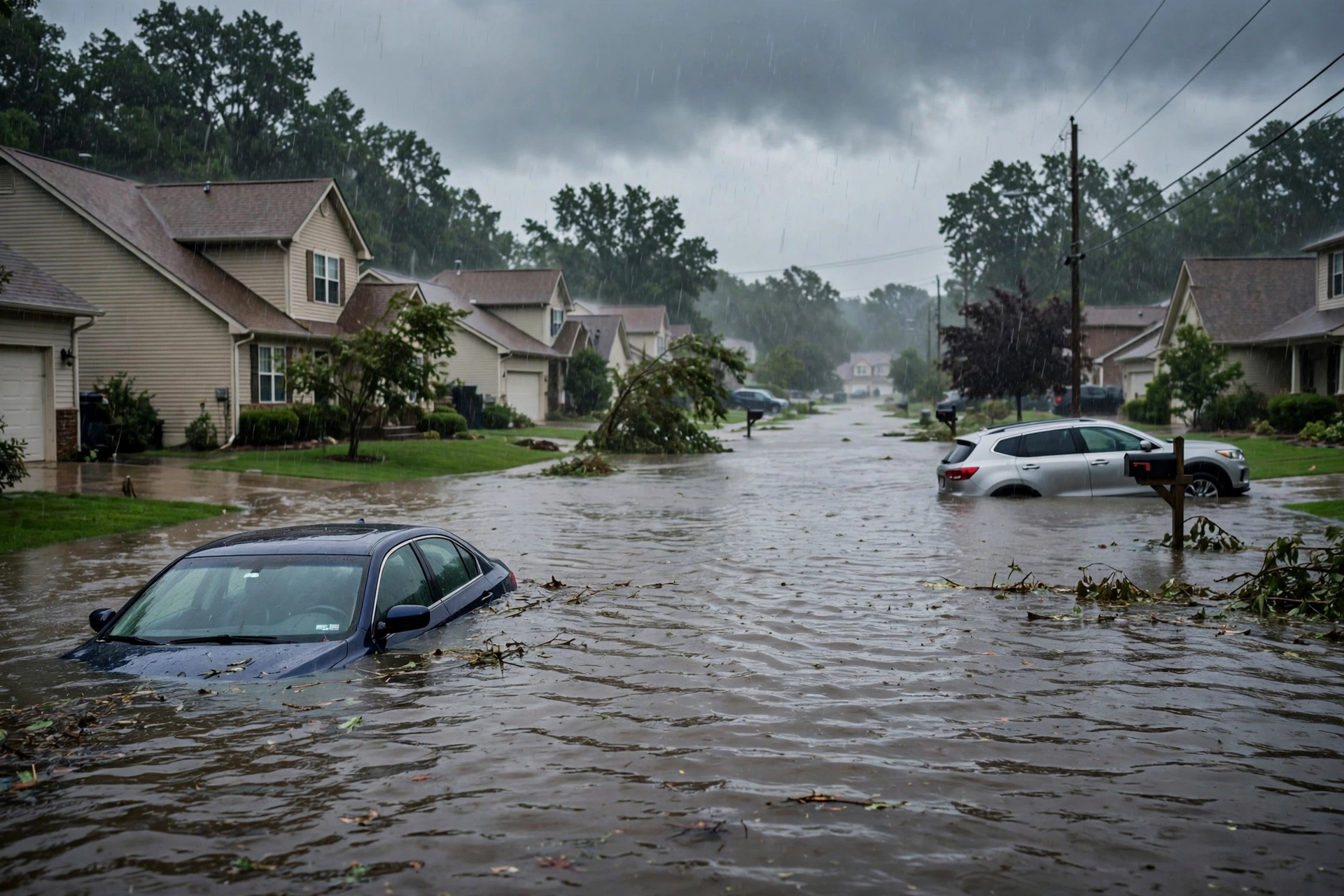
Tag: flood

  • Storm Updates: Quiet Pulse — Nov 03 Morning

    Storm Updates: Quiet Pulse — Nov 03 Morning

    Tropical: None · Severe: Marginal · Flood: Slight

    What Changed

    • Compared with the November 2 afternoon desk pulse table (quiet-pulse-2026-11-02-afternoon: Tropical: None · Severe: Slight · Flood: Slight): SPC Day 1 has dropped from Slight Risk across the southern and central Plains to a Marginal Risk from the Lower Mississippi/Tennessee Valleys into the Mid Mississippi Valley. Overnight tornado watches over KS/OK/TX expired. No current convective watches as of late evening UTC November 3 / early November 4.
    • WPC Day 1 Excessive Rainfall Outlook (latest discussion 808 PM EST Tue Nov 3 / ~0058 UTC Wed Nov 4) maintains a Slight Risk from portions of central Mississippi into central Tennessee and over parts of Southeast Florida. Residual flood warnings continue in Florida and Arizona.
    • Tropical lane remains None. National Hurricane Center confirms no tropical cyclones in the Atlantic, Caribbean, or Gulf. A western Atlantic disturbance has low (10% in 48 hours, 30% in 7 days) chance of subtropical development; no U.S. coastal or Gulf watches or warnings. No named storm.
    • Active Flash Flood Warning remains for northern Broward County, Florida (issued 857 PM EST Nov 3), and Flash Flood Warning extended for Havasu Creek basin, Arizona. No Slight or higher SPC risk, no Moderate or higher WPC ERO. Quiet Pulse criteria hold.
    • Nothing moved into Slight or higher on SPC or Moderate or higher on WPC ERO. Isolated severe potential remains marginal this evening and tonight.

    Live Status

    As of the morning desk on Tuesday, November 3, 2026 (evening confirmation ~9:14 PM PST / 05:14 UTC November 4), the national picture is a Quiet Pulse. The Storm Prediction Center’s latest Day 1 Convective Outlook (0100 UTC November 4 cycle, issued 0637 PM CST Tue Nov 3) states: “THERE IS A MARGINAL RISK OF SEVERE THUNDERSTORMS ACROSS PARTS OF THE LOWER TO MID MISSISSIPPI VALLEY.” Thunderstorms with potential for isolated severe wind gusts and perhaps a brief tornado remain possible this evening and tonight across the lower to mid Mississippi Valley. Prior Plains Slight Risk has closed.

    The Weather Prediction Center Day 1 Excessive Rainfall Outlook maintains a Slight Risk of excessive rainfall across portions of Mississippi and Tennessee and over parts of Southeast Florida. Convection is generally progressive, but low-level jet and moisture transport may support some training overnight over central MS into central TN, keeping a lower-end Slight risk. Southeast Florida has a conditional flash flood risk along the urban corridor. No Moderate or higher risk.

    National Weather Service watches and warnings include an active Flash Flood Warning for northern Broward County in southeastern Florida until 1100 PM EST (radar-indicated heavy rain, 2-3 inches already fallen, additional 1-2 inches possible), and an extended Flash Flood Warning for the Havasu Creek basin in Coconino County, Arizona (river gauge rise). Additional Flood Warnings persist across Florida, Iowa, Kansas, Louisiana, Missouri, Nebraska, New Mexico, and Utah. No severe thunderstorm or tornado watches are currently in effect. No tropical cyclone products threaten the U.S. coast or Gulf of America.

    Pulse Table

    LaneStatusNotes (as of ~9:14 PM PST / 05:14 UTC Nov 4 2026)
    TropicalNoneNo tropical cyclones in the Atlantic, Caribbean, or Gulf. NHC: low chance (10% 48h / 30% 7d) of subtropical development for western Atlantic disturbance south of Bermuda; no U.S. coastal or Gulf watches or warnings.
    SevereMarginalSPC Day 1 (0100Z Nov 4): MARGINAL RISK Lower to Mid MS Valley. Isolated severe wind and brief tornado potential this evening/tonight. No active watches. Prior Plains Slight closed.
    FloodSlightWPC Day 1 ERO Slight Risk portions of MS/TN and SE Florida. Active FFW northern Broward FL and Havasu Creek AZ. Residual river flooding continues. No Moderate or higher.

    Rising Queries

    Trends unreachable this run. Related interest centers on Florida flooding, Election Day weather, Mississippi Valley storms, and flash flood Florida.

    Restoration Read

    Quiet Pulse with an elevated residual flood lane. Primary short-term ticket is localized flash flooding and rapid runoff in northern Broward County, Florida, and residual water over the Lower Mississippi to Tennessee Valleys under the Slight Risk, on already saturated soils especially along the Florida east coast. Isolated severe wind and brief tornado potential under the Marginal Risk over the Mississippi Valley through tonight. Overnight Plains severe reports have closed. No tropical restoration drivers.

    Disclaimer: Informational only — not an official warning. This is a summary of official public products from the Storm Prediction Center, Weather Prediction Center, National Weather Service, and National Hurricane Center. Always consult the latest official forecasts and warnings for your location. Turn around, don’t drown.

  • Storm Updates: Quiet Pulse — Oct 31

    Storm Updates: Quiet Pulse — Oct 31

    As of the afternoon desk on Saturday, October 31, 2026 (approximately 9:15 PM PDT / 04:15 UTC November 1), the national picture remains a Quiet Pulse. The Storm Prediction Center’s latest Day 1 Convective Outlook (0100 UTC update issued 0752 PM CDT October 31, valid 010100Z–011200Z) states: “NO SEVERE THUNDERSTORM AREAS FORECAST.” No severe threat is forecast across the U.S. through tonight. The Weather Prediction Center Day 1 Excessive Rainfall Outlook (updated 0003 UTC November 1) maintains a Slight Risk of excessive rainfall for portions of central Arizona. No tropical storm or hurricane watch or warning is in effect on the U.S. coast or Gulf of America.

    Tropical: None · Severe: None · Flood: Slight

    What Changed

    • Compared with this morning’s pulse table (quiet-pulse-2026-10-31-morning: Tropical: None · Severe: None · Flood: Slight): SPC Day 1 continues with no severe thunderstorm areas forecast. The 0100 UTC November 1 update confirms organized severe potential remains closed through tonight. No convective watches or mesoscale discussions are valid.
    • WPC Day 1 Excessive Rainfall Outlook holds the Slight Risk for portions of central Arizona, with adjustments expanding it slightly southward based on observational trends. Active Flood and Flash Flood Warnings continue in Maricopa and Gila Counties, Arizona, on saturated soils from recent heavy rain. No upgrade to Moderate or higher.
    • NHC Atlantic outlook (800 PM EDT October 31): no tropical cyclones; formation not expected during the next 7 days. No U.S. coastal or Gulf watches or warnings.
    • Additional local alerts include Coastal Flood Warnings in the Florida Keys and eastern Putnam County, residual Flash Flood Warnings in portions of Louisiana, Mississippi, Nevada, and Hawaii, a High Wind Watch for the Guadalupe Mountains (NM/TX), and Winter Storm Warnings in Alaska. None open a national Slight/Moderate or tropical lane.
    • Nothing moved to SPC Slight or above, WPC Moderate or above, or opened a U.S. tropical watch/warning. Quiet Pulse criteria hold. Dominant residual ticket remains the Slight excessive rainfall risk and localized flash flooding in central Arizona.

    Live Status

    SPC Day 1 (0100Z November 1) confirms no severe thunderstorm areas forecast through 12Z November 1. Isolated to scattered thunderstorms remain possible across parts of the lower Mississippi Valley into Florida and isolated convection across the western CONUS including southern Arizona and southern Nevada. Limited instability and shear preclude organized severe storms. No watches or MDs in effect.

    WPC Day 1 ERO places a Slight Risk of excessive rainfall for portions of central Arizona associated with the start of a brief atmospheric river (pineapple express) event overnight into Sunday. Soils remain saturated from recent heavy rainfall. No Moderate or higher risk nationally.

    Hotspots

    • Central Arizona: Primary focus under the WPC Slight Risk. Flood Warnings remain in effect for Maricopa and Gila Counties from excessive rainfall and ongoing runoff. Additional heavy rainfall tonight into Sunday will exacerbate flash flooding on saturated soils, low-water crossings, and urban areas including the Phoenix metro.
    • Lower Mississippi Valley and Florida: Isolated to scattered thunderstorms possible through tonight. No severe threat. Residual Coastal Flood Warnings continue in the Florida Keys and eastern Putnam County.
    • Scattered local alerts: Residual Flash Flood Warnings in parts of Louisiana, Mississippi, Nevada, and Hawaii; High Wind Watch for the Guadalupe Mountains of New Mexico and west Texas; Winter Storm Warning for the Klondike Highway area in Alaska.

    Just-Hit

    Earlier Friday evening into Saturday morning, flash flooding in the Phoenix metro produced multiple water rescues of occupants from vehicles stalled in washes and flooded streets (including near Stanford Drive). Flood Warnings continue for ongoing runoff. No widespread tornado or significant severe wind/hail reports logged for the current Day 1 period.

    Pulse Table

    LaneStatusNotes (as of ~9:15 PM PDT / 04:15 UTC Nov 1 2026)
    TropicalNoneNo tropical cyclones in the Atlantic. NHC: formation not expected next 7 days. No coastal or Gulf watches or warnings.
    SevereNoneSPC Day 1 (0100Z Nov 1): NO SEVERE THUNDERSTORM AREAS FORECAST. Isolated storms possible SW and lower MS Valley/FL. No active watches or MDs.
    FloodSlightWPC Day 1 ERO Slight Risk central Arizona. Active Flood/Flash Flood Warnings in Maricopa and Gila Counties AZ. Residual coastal Flood Warnings in FL. No Moderate or higher.

    Restoration Read

    Quiet Pulse with an elevated flood lane. Primary short-term ticket is flash flooding and rapid runoff in central Arizona (especially Maricopa County / Phoenix metro and Gila County) under the Slight Risk and active warnings, on already saturated soils. Additional rainfall tonight into Sunday will prolong the threat. No organized severe damage expected. Residual coastal flooding in Florida. Monitor for water intrusion, debris, and high water on roads. Turn around, don’t drown.

    What This Is Not

    This is a Quiet Pulse. No SPC Slight or higher severe risk on the latest Day 1 outlook. No WPC Moderate or higher excessive rainfall. No tropical storm or hurricane watch or warning on the U.S. coast or Gulf of America. This desk summarizes public products from the SPC, WPC, NWS, and NHC.

    Looking Ahead One Day

    Sunday: SPC Day 2 holds a Marginal Risk of severe thunderstorms from southern Arizona across New Mexico to the western Texas Panhandle for isolated damaging gusts and a couple of tornadoes possible. WPC outlooks point to continued heavy rain potential across the Southwest from the atmospheric river. Flood risk remains elevated in Arizona. No tropical development expected.

    Rising Queries

    Trends unreachable.

    Sources

    Disclaimer: This is a summary of official public products from the Storm Prediction Center, Weather Prediction Center, National Weather Service, and National Hurricane Center. Always consult the latest official forecasts and warnings for your location. This desk does not issue warnings.

  • Storm Updates: West TX Flood & Midwest Marginal — Oct 15

    Storm Updates: West TX Flood & Midwest Marginal — Oct 15

    Tropical: None · Severe: Marginal · Flood: Moderate

    What Changed

    • SPC Day 1 Convective Outlook (0100 UTC / 7:49 PM CDT Thursday, October 15, 2026, valid 160100Z–161200Z) holds a Marginal Risk for parts of southern Indiana into Ohio. A small storm cluster continues across southern IN near the surface trough and warm front; locally damaging wind and a brief tornado remain possible this evening before increasing low-level stability diminishes the threat. No category change from the morning desk; prior Slight Risk has closed.
    • WPC Day 1 Excessive Rainfall Outlook continues the Moderate Risk of excessive rainfall across portions of West Texas (Big Bend / Lower Trans-Pecos / Stockton Plateau into Concho Valley, along and south of I-10 east of the Davis Mountains). High neighborhood probabilities above 70 percent for amounts exceeding 5 inches remain centered in the Moderate area. Category unchanged; strongest overnight signal persists.
    • Residual Tornado Warning and Severe Thunderstorm Warnings for southwestern Indiana and residual Severe Thunderstorm Warning near Fort Worth TX have expired. Flash Flood Warning for Nolan/Taylor Counties TX expired. Flood Watches continue through Friday morning for much of west-central and western Texas. No new convective watches issued. No mesoscale discussions in effect.
    • No tropical storm or hurricane watches or warnings on the U.S. coast or Gulf of America. Atlantic basin remains quiet with no named systems and no formation expected in the next 7 days. Eastern Pacific Hurricane Trudy (intensifying toward Mexico) and Tropical Storm Simon remain offshore Mexico with no U.S. land or Gulf threat. Tropical lane unchanged.
    • Nothing else material shifted since the morning pulse. Severe residual is diminishing as expected; flood Moderate holds as the primary overnight driver.

    Live Status

    As of the Thursday afternoon desk, October 15, 2026 (approximately 9:15 PM PDT / 11:15 PM CDT / 0415Z October 16), the dominant restoration ticket remains the WPC Moderate Risk of excessive rainfall over West Texas. Anomalous October moisture (PWATs near record seasonal values, +2 to +3 standard deviations) and a southward-progressing cold front continue to support heavy convective rainfall this evening into the overnight, with the strongest signal for areal averages of 3–5 inches (local higher, pockets of >5 inches) along and south of I-10 east of the Davis Mountains into the Lower Pecos River basin (Sanderson to north of Del Rio) and northward into the Concho Valley. Flood Watches remain in effect through Friday morning across west-central and western Texas.

    SPC Day 1 holds a Marginal Risk over parts of southern Indiana into Ohio for the remainder of the period. The small storm cluster near the surface trough and warm front continues to support localized strong/damaging gusts and a possible brief tornado this evening. Surface-based buoyancy becomes increasingly scant with time and northeastward extent; the threat is expected to diminish as convection becomes elevated and low-level stability increases later this evening. Residual Tornado and Severe Thunderstorm Warnings that were live earlier have expired. Limited residual severe potential along the outflow-augmented cold front in northwest Texas has also diminished. No mesoscale discussions currently in effect. Overall intensity is waning.

    Hotspots

    West Texas (Big Bend / Stockton Plateau / Lower Pecos / Concho Valley including San Angelo vicinity): Primary Moderate Risk zone. Focused heavy rainfall expected this evening into tonight as the front progresses and nocturnal low-level jet enhances convergence. Flash flooding of creeks, low-water crossings, arroyos, and urban poor-drainage areas is the main concern. HREF/REFS neighborhood probabilities remain high (above 70 percent) for amounts exceeding 5 inches centered within the Moderate area. Areal averages 3–5″ with locally higher possible. Flood Watches continue.

    Southwest Indiana (Knox / Daviess Counties) into southern Ohio: Residual Marginal Risk. Small storm cluster near surface trough/warm front with modest buoyancy and favorable low-level shear supported brief tornado or damaging wind potential this evening. Threat is diminishing as convection elevates and stability increases. Residual Tornado and Severe Thunderstorm Warnings that confirmed radar-indicated rotation and 60 mph gusts have expired. No watches.

    Northwest and residual northern Texas (Fort Worth area, residual northern counties): Residual Severe Thunderstorm Warning for 60 mph wind gusts has expired. Limited organized severe potential along the outflow-augmented cold front has diminished. Preliminary LSRs include tree and roof damage near Millsap and power lines down near Weatherford in Parker County TX this evening. Flood Watches continue through Friday morning across west-central Texas with saturated soils elevating residual flash flood risk for any additional cells.

    Just-Hit

    Overnight and early-morning convection across the southern Plains produced damaging wind reports (gusts 60–75 mph, power lines down, sheet metal and tree damage) in northwest Texas and southwest Oklahoma, plus scattered tree damage in Ohio and West Virginia. Flash flooding occurred or was radar-indicated in multiple northern Texas and southwestern Oklahoma counties this morning, with 1–4+ inches fallen in warned areas. Residual river rises possible on smaller basins. Preliminary tornado report earlier near Fort Stockton TX remains under survey. Residual Tornado and Severe Thunderstorm Warnings confirmed radar-indicated threats over southwestern Indiana and residual Texas this evening; those warnings have expired. No new confirmed tornadoes reported in the latest window. Slight Risk closed overnight and reopened farther northeast before reducing to Marginal this evening.

    Pulse Table

    LaneStatusNotes (as of ~9:15 PM PDT / 11:15 PM CDT / 0415Z 16 Oct 2026)
    TropicalNoneNo named systems threatening U.S. land or Gulf. Atlantic quiet; no formation expected next 7 days. Pacific: Hurricane Trudy (intensifying toward Mexico) and TS Simon offshore, no U.S. impact. Hurricane Warnings in Mexican offshore waters only.
    SevereMarginalSPC Day 1 Marginal Risk southern IN into OH (localized strong/damaging gusts and possible brief tornado this evening). Prior Slight reduced. Residual Tornado and Severe Thunderstorm Warnings expired. No watches valid. Threat diminishing after late evening. No current MDs.
    FloodModerateWPC Day 1 Moderate Risk West Texas (Big Bend / Stockton / Lower Pecos / Concho). Slight broader TX into southern OK. Residual FFW Nolan/Taylor expired. Flood Watches through Friday morning west-central TX and residual OK. Overnight heavy rain signal remains strong.
    OtherWind / FireHigh Wind Warnings AZ/NM/TX mountains and CA (gusts 50–70 mph). Red Flag Warnings Sierra and central/northern CA. Non-severe products. Separate from convective restoration.

    Restoration Read

    Primary restoration ticket is water and flash flooding over West Texas under the Moderate ERO, with potential for considerable flash flooding on complex terrain, low-water crossings, arroyos, and urban poor drainage where training occurs under elevated PWATs and frontal convergence. Residual saturated ground and Flood Watches continue across Oklahoma and northern Texas from the prior Moderate axis. Overnight and residual wind damage claims remain possible from earlier 60 mph gusts in northwest Texas and residual Severe Thunderstorm Warnings. The Midwest Marginal supports only isolated tree, power line, or minor structural wind claims as residual storms continue this evening near the warm front; any tornado claims would be brief and localized. No tropical surge or coastal claims. Standard posture: verify county-level Flood Warnings and Watches before deploying; Turn around, don’t drown on flooded roads. Southwest High Wind and Red Flag products are separate non-convective events and do not drive the same restoration response.

    Rising queries

    Trends unreachable.

    What This Is Not

    This is not a Quiet Pulse. WPC Moderate Risk remains live over West Texas and SPC holds a Marginal Risk over the Midwest with residual threats diminishing. Not a higher-end severe day. Not a tropical threat to the U.S. coast or Gulf. Not a named-storm hub update (no U.S.-threatening cyclone).

    Looking Ahead One Day

    SPC Day 2 outlook carries a Slight Risk of severe thunderstorms over portions of the Mid-Atlantic into southern New England for Friday afternoon and evening (scattered damaging gusts and perhaps a brief tornado accompanying a squall line). WPC Day 2 continues a Moderate Risk of excessive rainfall across portions of West Texas as the front progresses, with the heavy rain threat lingering into early Friday. No tropical development indicated for the U.S. coast or Gulf.

    Sources: SPC Day 1 Outlook (spc.noaa.gov, 0100 UTC update), WPC Day 1 ERO discussion (wpc.ncep.noaa.gov), NWS WWA summary (weather.gov/wwamap). Morning desk: Storm Updates: West TX Flood — Oct 15 Morning.

    Informational only — not an official warning. This is an afternoon desk summary of public National Weather Service, Storm Prediction Center, Weather Prediction Center, and National Hurricane Center products as of approximately 9:15 PM PDT on October 15, 2026. Always confirm with the latest official forecasts and local authorities. Turn around, don’t drown.

  • Storm Updates: West TX Flood — Oct 15 Morning

    Storm Updates: West TX Flood — Oct 15 Morning

    Tropical: None · Severe: Marginal · Flood: Moderate

    What Changed

    • SPC Day 1 Convective Outlook (0100 UTC / 7:49 PM CDT Thursday, October 15, 2026, valid 160100Z–161200Z) holds a Marginal Risk for parts of southern Indiana into Ohio. A small storm cluster continues across southern IN near the surface trough and warm front; locally damaging wind and a brief tornado remain possible this evening before increasing low-level stability diminishes the threat. No category change from the prior version of this morning desk; prior Slight Risk has closed.
    • WPC Day 1 Excessive Rainfall Outlook (updated 1601 UTC / 12:01 PM EDT Thursday, October 15, 2026, valid 16Z Thu–12Z Fri) continues the Moderate Risk of excessive rainfall across portions of West Texas (Big Bend / Lower Trans-Pecos / Stockton Plateau into Concho Valley, along and south of I-10 east of the Davis Mountains). High neighborhood probabilities above 70 percent for amounts exceeding 5 inches remain centered in the Moderate area. Slight Risk covers broader southwest Texas into southern Oklahoma. Category unchanged.
    • NWS residual activity: Tornado Warning earlier for east central Knox and central Daviess Counties in southwestern Indiana (radar-indicated). Severe Thunderstorm Warnings residual for portions of northwestern Johnson, southeastern Parker, southwestern Tarrant and northeastern Hood Counties in Texas (near Fort Worth) and for central Knox and Daviess Counties in Indiana. Flash Flood Warning residual for southeastern Nolan and southwestern Taylor Counties in west central Texas. Flood Watches continue through Friday morning for much of west-central and western Texas. No convective watches currently valid (most recent was Watch 685, expired).
    • No tropical storm or hurricane watches or warnings on the U.S. coast or Gulf of America. Atlantic basin remains quiet with no named systems and no formation expected in the next 7 days. Eastern Pacific Hurricane Trudy (intensifying, Hurricane Warnings for Mexican offshore waters) and Tropical Storm Simon remain offshore Mexico with no U.S. land or Gulf threat. Tropical lane unchanged.
    • Severe lane holds Marginal as residual warnings confirm the earlier threat over southwestern Indiana and residual Texas activity near Fort Worth. Flood lane remains Moderate with residual Flash Flood Warning in west central Texas and ongoing Flood Watches. No new watches issued.

    Live Status

    As of the Thursday morning desk update, October 15, 2026 (approximately 8:13 PM PDT / 10:13 PM CDT / 0313Z October 16), two open lanes remain active. The dominant restoration ticket remains the WPC Moderate Risk of excessive rainfall over West Texas. Anomalous October moisture (PWATs near record seasonal values, +2 to +3 standard deviations) and a southward-progressing cold front continue to support heavy convective rainfall, with the strongest signal for areal averages of 3–5 inches (local higher, pockets of >5 inches) along and south of I-10 east of the Davis Mountains into the Lower Pecos River basin (Sanderson to north of Del Rio) and northward into the Concho Valley. Residual Flash Flood Warning activity and active Flood Watches cover west-central and western Texas. A more immediate high-end Slight threat exists in northwest Texas where soils are saturated and FFGs are low.

    SPC Day 1 now holds only a Marginal Risk over parts of southern Indiana into Ohio for the remainder of the period. A small storm cluster has been ongoing across southern IN near the intersection of a surface trough and warm front. As a vigorous mid/upper-level shortwave trough and deepening surface low move across the Great Lakes this evening, the warm front continues northward. Modest buoyancy allows maintenance of convection through parts of OH into the Lower Great Lakes, though surface-based buoyancy becomes increasingly scant. In the short term, locally damaging wind was possible with the strongest storms, and favorable low-level shear supported a brief-tornado threat that is diminishing as convection becomes elevated. Residual Tornado Warning and Severe Thunderstorm Warnings confirmed the threat over southwestern Indiana earlier. North/West Texas has a more limited severe potential along the outflow-augmented cold front with mainly stronger wind gusts possible but organized severe expected to remain limited; residual Severe Thunderstorm Warning near Fort Worth. Overall storm intensity is expected to wane with increasing low-level stability later this evening. No watches are currently valid.

    Pulse Table

    LaneStatusNotes (as of ~8:13 PM PDT / 10:13 PM CDT / 0313Z 16 Oct 2026)
    TropicalNoneNo named systems threatening U.S. land or Gulf. Atlantic quiet; no formation expected next 7 days. Pacific: Hurricane Trudy (intensifying toward Mexico) and TS Simon offshore, no U.S. impact. Hurricane Warnings in Mexican offshore waters only.
    SevereMarginalSPC Day 1 Marginal Risk southern IN into OH (localized strong/damaging gusts and possible brief tornado this evening). Prior Slight reduced. Residual Tornado Warning Knox/Daviess IN; Severe Thunderstorm Warnings IN and residual TX (Fort Worth area). No watches valid. Threat diminishing after sunset.
    FloodModerateWPC Day 1 Moderate Risk West Texas (Big Bend / Stockton / Lower Pecos / Concho). Slight broader TX into southern OK. Residual FFW Nolan/Taylor Counties TX. Flood Watches through Friday morning west-central TX and residual OK. Near-term high-end Slight northwest TX.
    OtherWind / FireHigh Wind Warnings AZ/NM/TX mountains and CA (gusts 50–70 mph). Red Flag Warnings Sierra and central/northern CA. Non-severe products. Separate from convective restoration.

    Restoration Read

    Primary restoration ticket is water and flash flooding over West Texas under the Moderate ERO, with potential for considerable flash flooding on complex terrain, low-water crossings, arroyos, and urban poor drainage where training occurs under elevated PWATs and frontal convergence. Residual saturated ground and Flood Watches continue across Oklahoma from the prior Moderate axis. Overnight and ongoing wind damage claims remain possible from 60 mph gusts in northwest Texas and residual Severe Thunderstorm Warnings. The Midwest Marginal supports isolated tree, power line, or minor structural wind claims as storms continue this evening near the warm front; tornado claims would be brief and localized if they materialize, with residual Tornado Warning confirming the radar-indicated threat over southwestern Indiana. No tropical surge or coastal claims. Standard posture: verify county-level Flood Warnings and Watches before deploying; Turn around, don’t drown on flooded roads. Southwest High Wind and Red Flag products are separate non-convective events and do not drive the same restoration response.

    Rising queries

    Trends unreachable.

    Looking Ahead One Day

    SPC Day 2 outlook places a Slight Risk of severe thunderstorms over a portion of the Mid-Atlantic for Friday afternoon and evening (scattered damaging gusts and perhaps a brief tornado). WPC Day 2 continues a Moderate Risk of excessive rainfall across portions of West Texas as the front progresses, with the heavy rain threat lingering into early Friday. No tropical development indicated for the U.S. coast or Gulf.

    Sources: SPC Day 1 Outlook (spc.noaa.gov, 0100 UTC update), WPC Day 1 ERO discussion (wpc.ncep.noaa.gov, 1601 UTC update), NWS WWA summary including residual Tornado Warning, Severe Thunderstorm Warnings and Flash Flood Warning (weather.gov/wwamap), SPC current watches page (no watches valid). Previous desk: prior version of this morning pulse. Updated in place on slug quiet-pulse-2026-10-15-morning.

    Informational only — not an official warning. This is a morning desk summary of public National Weather Service, Storm Prediction Center, Weather Prediction Center, and National Hurricane Center products as of approximately 8:13 PM PDT on October 15, 2026. Always confirm with the latest official forecasts and local authorities. Turn around, don’t drown.

  • Storm Updates: Southern Plains to Mid-Atlantic Marginal Risk, Kansas–Missouri Flood Pulse — Thursday, September 10, 2026 (Morning)

    This is a live Thursday morning snapshot of local storm-type events across the United States as of the early hours of Thursday, September 10, 2026. Overnight the organized severe pulse from Wednesday’s Slight Risk and Severe Thunderstorm Watch 665 across northern Ohio, northwest Pennsylvania, and western New York has largely expired. The Storm Prediction Center’s Day 1 outlook has settled into a broad Marginal Risk of severe thunderstorms stretching from the southern High Plains to the southern Mid-Atlantic coast. The primary threat language is sporadic damaging wind gusts this afternoon and evening, with isolated large hail possible over south-central Colorado into northeast New Mexico and the Oklahoma–Texas Panhandles.

    These remain county- and ZIP-scale thunderstorms. No named tropical cyclone currently threatens U.S. land. Restoration exposure today is residual wind and tree work from last night’s Ohio–Pennsylvania corridor, plus fresh flood and wind potential where the cold front and residual moisture continue to fire cells from the southern Plains eastward. Conditions change fast. Verify with the National Weather Service for the specific county or ZIP before you roll.

    What is live this morning

    No convective watches are currently valid. Watch 665, the last active severe thunderstorm watch covering the Upper Ohio Valley and Lake Erie counties, has expired. SPC’s 1300 UTC Day 1 Convective Outlook places a Marginal Risk across a long corridor from the southern High Plains through the lower Mississippi Valley and into the Mid-Atlantic. Strong daytime heating is expected south of residual cloud and overnight storms, with temperatures into the 90s to near 100°F over the southern Plains and upper 80s to mid-90s farther east. That buoyancy, coupled with the residual cold front and outflow boundaries, supports thunderstorms that can produce isolated severe gusts.

    The Weather Prediction Center’s updated Day 1 Excessive Rainfall Outlook (valid 12Z Thursday–12Z Friday) carries a Slight Risk of rainfall exceeding flash-flood guidance over a focused area from roughly southeast Ohio into central Kentucky and adjacent portions of West Virginia and Indiana. Broader Marginal Risk areas cover parts of the southern Plains, the lower Ohio Valley into the Mid-Atlantic, the Southwest monsoon corridor, and a pocket in the Gulf coastal states.

    Hotspot 1 — Residual Ohio–Pennsylvania–western New York wind corridor

    Wednesday evening’s Slight Risk and Watch 665 produced a series of severe thunderstorm warnings and local storm reports of tree and power-line damage across northern and central Ohio, northwest Pennsylvania, and adjacent counties. Preliminary LSRs include tree and utility damage near Huron and Hartville, Ohio; Edinboro, Pennsylvania; and Chester, West Virginia, among others. The organized severe threat has moved on, but the restoration desk for those counties is still active: downed trees, service drops, and isolated roof or siding work from 50–70 mph gusts.

    Cities and counties still in the aftermath window: Cleveland, Akron, Canton, Mansfield, and surrounding northern Ohio counties; Erie, Crawford, and northwest Pennsylvania; the northern West Virginia panhandle. Stage remaining tree and tarp crews for daylight surveys and carrier documentation.

    Hotspot 2 — Southeast Kansas into south-central Missouri flood pulse

    Overnight and early this morning, training storms along and south of the cold front have produced locally heavy rainfall across southeast Kansas into portions of western and central Missouri. National Weather Service offices have issued Flood Warnings and Advisories for Allen, Labette, and Montgomery Counties in Kansas (into midday) and adjacent Missouri counties. Radar-estimated amounts of 1–4 inches, with rates of 1–3 inches per hour in stronger cores, have already produced flooding of low-lying roads, creeks, and poor-drainage areas. WPC’s Slight Risk of excessive rainfall for the day is focused farther east into the Ohio Valley, but the Kansas–Missouri corridor remains the live water desk this morning.

    Restoration read: extraction and drying work where water entered structures overnight. Photograph damage in daylight, document water lines, and treat any interior water as a same-day priority before the mold clock advances.

    Hotspot 3 — Southern Plains to Mid-Atlantic Marginal Risk this afternoon–evening

    SPC expects the Marginal Risk corridor to re-fire with daytime heating. The primary hazard is sporadic damaging wind gusts from multicell clusters and short line segments along the residual front and outflow boundaries. Isolated large hail is possible over the higher terrain of south-central Colorado into northeast New Mexico and the Panhandles. Vertical shear is modest overall but sufficient for organized bowing segments farther east where buoyancy is lower but mid-level flow is stronger.

    Key population centers under the Marginal Risk umbrella include parts of the Dallas–Fort Worth metroplex, Memphis, Nashville, and the Washington, D.C., corridor, though the risk is scattered rather than continuous. Local Severe Thunderstorm Warnings and Special Weather Statements are the expected mode of action rather than new watches.

    Just hit — overnight LSRs

    Preliminary Local Storm Reports from the 1200 UTC September 9 – 1159 UTC September 10 window include:

    • 1.75-inch hail 8 SE of Colorado City, Huerfano County, Colorado (0600 UTC).
    • Wind gusts of 72 mph near Booker, Lipscomb County, Texas; 70 mph SSE of Mayfield, Sumner County, Kansas; 73 mph near Patagonia, Arizona; and multiple 58–78 mph readings in the Arizona–New Mexico border country and western Kansas overnight.
    • Numerous tree, limb, and power-line damage reports across northern and central Ohio, northwest Pennsylvania, western West Virginia, and a long swath of eastern Kansas into western Missouri (Baldwin City, Wellington, Clinton, Holden, and surrounding towns).

    No tornado reports were received in the preliminary data for this period. All reports remain preliminary and subject to verification.

    Pulse table

    RegionMain threatsSPC / NWS / WPC levelStatus this morning
    Northern OH / NW PA / western NYResidual wind / tree / power damageWatch 665 expiredAftermath / just-hit
    SE Kansas / south-central MissouriFlash flood, training heavy rainFlood Warnings / Advisories activeLive water desk
    Southern Plains to Mid-AtlanticDamaging wind, isolated hailSPC Marginal RiskAfternoon–evening re-fire
    SE Colorado / NE New Mexico / PanhandlesIsolated large hail, strong windSPC Marginal (hail-focused)Afternoon terrain storms
    Ohio Valley / central KY (WPC)Excessive rainfall / flash floodWPC Slight RiskDay 1 outlook
    Atlantic / Gulf vs. U.S. mainlandNo landfalling tropical cycloneQuietQuiet

    What this means for restoration teams

    Wind damage from Wednesday night is already on the books in the Ohio–Pennsylvania corridor—tree removal, roof tarps, and service restoration. Kansas–Missouri flood work is the fresh ticket this morning: extract standing water, document, and start drying before temperatures climb. This afternoon’s Marginal Risk is scattered; the expected mode is isolated warnings rather than a continuous line. Stage for wind and isolated hail in the southern Plains and for additional water if cells train over already-wet ground in the Ohio Valley.

    Property owners in just-hit counties should photograph damage in remaining daylight if safe, contact the carrier, and begin extraction the same day if water is inside. Teams working the Kansas–Missouri flood pulse should treat every interior water job as time-sensitive.

    What this is not

    This is not a regional derecho and not a U.S. mainland hurricane landfall. National Hurricane Center products show no tropical cyclones in the Atlantic basin threatening U.S. land; Tropical Storms Lowell and Norbert remain well offshore in the Pacific. The work today is local: residual wind swaths from Wednesday night, flash-flood pockets in southeast Kansas and western Missouri, and scattered severe gusts under a broad Marginal Risk this afternoon and evening.

    Looking ahead

    SPC’s Day 2 outlook already carries a Slight Risk of severe thunderstorms for portions of Nebraska into the Upper Midwest on Friday. The cold front will continue to shift east and south, keeping a wet and occasionally strong storm pattern across the Ohio Valley and Mid-Atlantic into the weekend. Watch the next Storm Tracker update rather than assuming today’s Marginal Risk is the end of the corridor.

    Sources and how to verify

    Primary sources: NOAA Storm Prediction Center Day 1 Convective Outlook issued 1300 UTC Thursday, September 10, 2026; SPC Local Storm Reports for the 1200 UTC September 9–1159 UTC September 10 period; SPC Current Watches page (no watches valid as of early Thursday); Weather Prediction Center Day 1 Excessive Rainfall Outlook and 94e points text; National Weather Service warning and flood-statement text from Wichita, Springfield, and neighboring offices; National Hurricane Center tropical weather outlooks confirming no Atlantic threats to U.S. land.

    Check weather.gov for the county warning, spc.noaa.gov for the outlook, watches, and LSRs, and WPC excessive rainfall for the flood overlay. Prior desk: Wednesday, September 9 storm updates — Ohio–Pennsylvania–western New York Slight Risk.

    Informational only — not an official weather warning. Follow local authorities and the National Weather Service. Turn around, don’t drown.