Everett Waterfront - Tygart Media

Category: Everett Waterfront

Port of Everett, $1B waterfront redevelopment, marina life, and waterfront news.

  • Port of Everett Pier 3: $11.25M Grant & Rebuild Guide

    Port of Everett Pier 3: $11.25M Grant & Rebuild Guide

    On April 27, 2026, MARAD announced the Port of Everett had won an $11.25 million competitive federal grant to rebuild Pier 3 — the port’s longest berth, built in 1973, and now operating at a fraction of its original structural capacity. The grant comes from MARAD’s Port Infrastructure Development Program, awarded nationally on a competitive basis to ports that can demonstrate clear benefits to freight movement and national defense. Here is the complete guide to what Pier 3 is, why it needs this work, and what the rebuild means for Everett’s supply chain.

    What Pier 3 Is and What’s Wrong With It

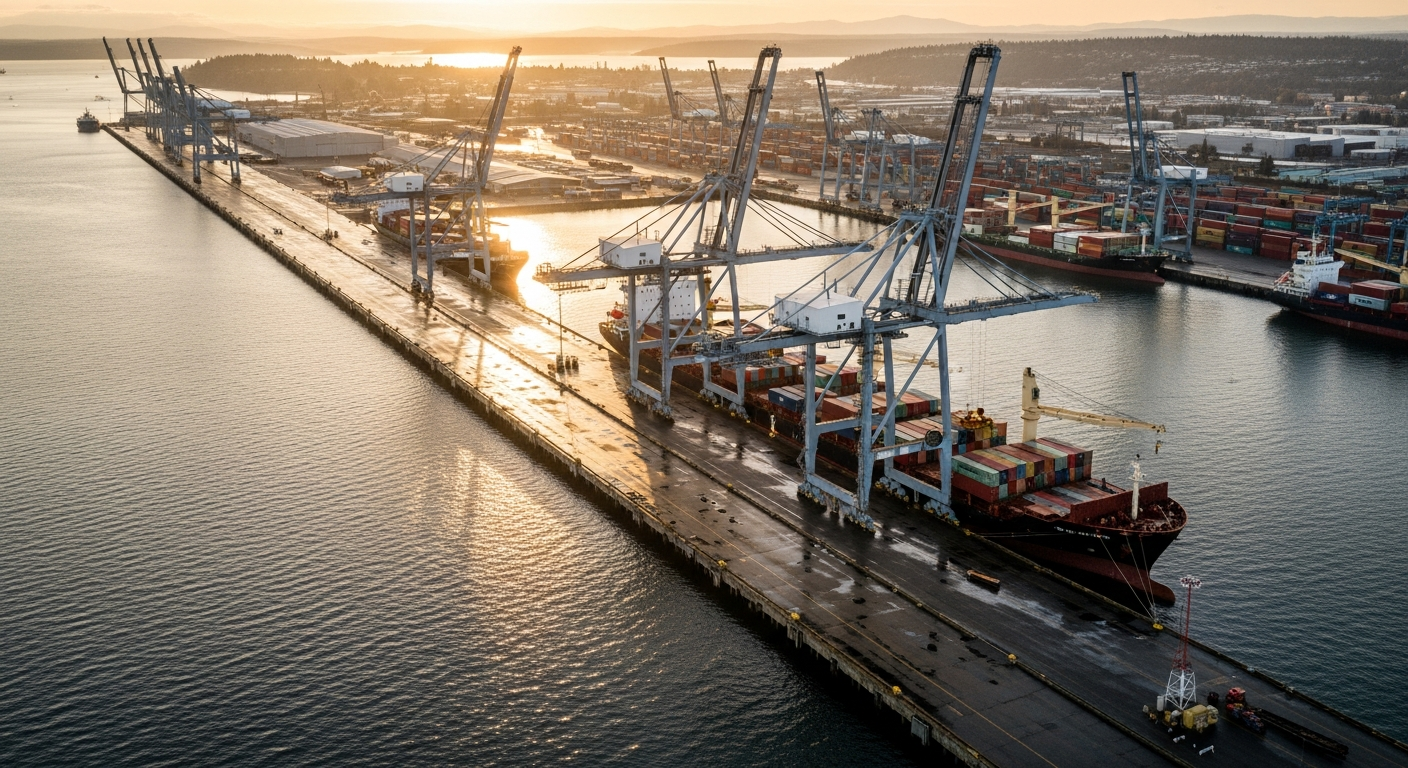
    Pier 3 is the longest berth at the Port of Everett Seaport — 730 feet long with a 120-foot-wide concrete deck, constructed in 1973. For over five decades it has been the backbone of the Port’s cargo operations, handling bulk alumina ore, cement, general cargo, and forest products moving through Puget Sound.

    The problem is structural. Pier 3 was originally engineered for a uniform live load of 800 pounds per square foot. Over the years, degradation has required the pier to be derated. The south side now carries a maximum of 600 lbs/sqft. The north side is rated at 400 lbs/sqft. Some sections are derated further. In practical terms, this means the heavy cargo-handling equipment that would otherwise run on the pier cannot be permitted on the structure — limiting the Port’s operational flexibility and the types of cargo it can process.

    “The Port is grateful to the U.S. Department of Transportation for this critical maritime infrastructure investment that will ensure the Port of Everett Seaport continues to safely support 40,000-plus local jobs, regional economic development, and the Washington state economy,” said Port CEO and Executive Director Lisa Lefeber at the time of the announcement.

    What the $11.25 Million Grant Funds

    The PIDP grant covers the full scope of the Pier 3 Strengthening Safety and Commerce project: planning and engineering, environmental review, permitting, and construction. The core construction work is installing new vertical piles beneath the pier and restoring other damaged structural elements — the work that will return Pier 3 to its full live-load capacity and allow heavy equipment to operate on the deck again.

    The grant was part of a broader $22 million federal investment in Northwest Washington port infrastructure announced by Rep. Rick Larsen. The Swinomish Indian Tribal Community received the remaining funds for a separate project. PIDP grants are awarded nationally on a competitive basis — ports must demonstrate clear benefits to the safety, efficiency, or reliability of freight movement to qualify.

    Why the Port of Everett Is One of 18

    The Port of Everett holds a MARAD Strategic Commercial Seaport designation — one of only 18 ports in the United States to carry that status. The designation is based on the port’s importance to Department of Defense cargo movements. Strategic Commercial Seaports are the civilian maritime infrastructure the military counts on for logistics during mobilizations and sustained operations.

    That designation is part of why the Port of Everett consistently wins federal investment. It’s not just about commerce — it’s about defense supply chain resilience. A degraded Pier 3 is a gap in that chain. Restoring it to full capacity makes Everett’s role in the national maritime network more secure.

    The Broader Waterfront Context

    The Pier 3 grant arrives alongside ongoing investment across Everett’s waterfront. The $6.75 million wharf rebuild on West Marine View is nearing completion. The Millwright District is under construction. Waterfront Place Restaurant Row has new tenants operating. The Edgewater Bridge — which improves access to the waterfront corridor — opened April 29, 2026.

    The Pier 3 rebuild is the seaport side of that same story. While the marina-facing development attracts restaurants and housing, the industrial seaport is quietly receiving federal infrastructure investment that underpins the economic base all that development rests on. The Waterfront Place complete guide covers the marina and restaurant district in detail.

    Frequently Asked Questions

    What is the Port of Everett Pier 3 federal grant?
    An $11.25 million MARAD PIDP grant to rebuild Pier 3 — installing new piles and restoring structural capacity on the port’s 730-foot longest berth, originally built in 1973.

    Why does Pier 3 need to be rebuilt?
    Structural degradation has derated the pier from 800 lbs/sqft original capacity to 600 lbs/sqft (south) and 400 lbs/sqft (north), preventing full-capacity cargo operations and heavy equipment use.

    What cargo does Pier 3 handle?
    Historically: bulk alumina ore, cement, general cargo, and forest products. Full structural restoration would allow a more diverse cargo mix and heavier equipment.

    How many jobs does the Port of Everett support?
    Port CEO Lisa Lefeber cited 40,000-plus local jobs supported by the Port of Everett Seaport’s operations.

    What is the MARAD Strategic Commercial Seaport designation?
    A federal designation held by only 18 U.S. ports, based on importance to Department of Defense cargo movements. The Port of Everett holds this designation.

    Who announced the grant?
    Rep. Rick Larsen announced the $22 million Northwest Washington port infrastructure package. MARAD’s formal announcement came April 27, 2026.

    When will the Pier 3 rebuild be completed?
    No specific date has been announced. The grant covers planning through construction — a multi-year process for marine infrastructure of this scale.
  • Snohomish County Warehouse Space: Q1 2026 Everett Market

    Snohomish County Warehouse Space: Q1 2026 Everett Market

    Q: How much does warehouse space cost in Snohomish County in 2026?
    A: Snohomish County warehouse rents in 2026 are running approximately $0.70 to $1.00 per square foot monthly on a triple-net basis — the most affordable warehouse market in the Puget Sound region. The broader Seattle metro ranges from $0.70 to $1.60/SF monthly, making Snohomish County the value end of the market by a significant margin.

    The Number That Matters: $0.70 to $1.00 per Square Foot

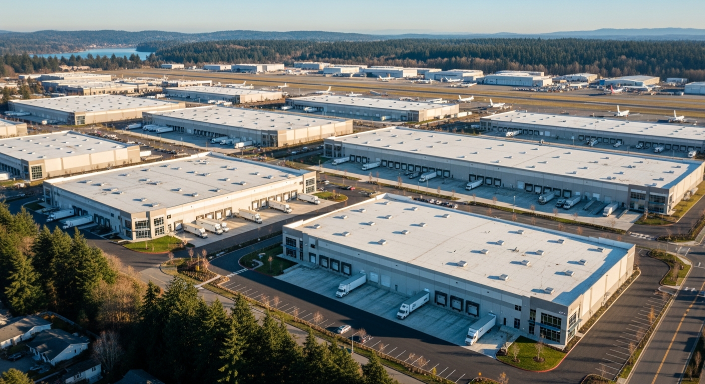
    If you’re an Everett-area business looking for industrial or warehouse space in 2026, the market conditions haven’t been this favorable in over a decade. Snohomish County’s warehouse and industrial rents are running $0.70 to $1.00 per square foot monthly (NNN), making it the most affordable industrial submarket in the entire Puget Sound region, according to WareCRE’s 2026 Seattle Warehouse Market Report. That’s below Southend markets like Kent and Renton, below Pierce County, and well below the Seattle in-city markets at the top of the range.

    To put that in annual terms: $0.70 to $1.00/SF monthly is $8.40 to $12.00/SF annually on a triple-net lease. For a 20,000-square-foot distribution or manufacturing facility, that’s $168,000 to $240,000 per year in base rent — before operating expenses that you’re responsible for as a tenant under NNN terms, but still well below what comparable space costs in King County.

    And those asking rents are the ceiling right now, not the floor. Kidder Mathews’ Q1 2026 Seattle Industrial Market Report shows vacancy at 10.39 percent across the Seattle metro industrial market, up from 9.74 percent at year-end 2025. At that vacancy level, with net absorption running negative (-130,751 square feet absorbed in Q1 2026) and only two speculative projects totaling 478,740 square feet under construction across the entire market, landlords are dealing. Effective rents — after concessions like free rent periods and tenant improvement allowances — are running below the published asking rates across the region.

    The Market Context: Why It’s the Best Tenant Window in a Decade

    The Puget Sound industrial market is correcting from a 2021-2022 boom cycle that pushed vacancy to historic lows. Speculative development that was planned during that peak is now delivering into a softened demand environment. The result is the most tenant-friendly industrial market the region has seen in more than ten years.

    Cushman & Wakefield’s April 2026 Industrial MarketBeat report describes the national picture this way: “Peak industrial vacancy likely in rearview mirror as demand holds and supply slows.” The national vacancy rate ended Q1 2026 at 7.0 percent — flat with year-end 2025, and 10 basis points below the Q3 2025 peak. The West region runs hotter than the national average at 7.9 percent, and Seattle specifically came in at 9.7 percent for Q1 2026.

    That 9.7 percent Seattle metro figure blends markets with very different profiles — Southend logistics hubs, South Seattle last-mile space, and Eastside flex. Snohomish County’s position within that range reflects its role as the region’s industrial value market: strong fundamentals, affordable rents, and proximity to the Port and to Paine Field’s aerospace manufacturing cluster without the price premium of South King County.

    Tariffs have added a wrinkle to the demand picture. Container volume growth at the Northwest Seaport Alliance reversed from 16 percent year-over-year to 0.2 percent, according to WareCRE’s 2026 report — a direct effect of tariff uncertainty on import volumes. For Everett specifically, which handles breakbulk and project cargo rather than containerized imports, this tariff impact is less acute than it is for the container-focused markets south of Seattle. But it’s part of the broader softening that has tilted conditions toward tenants.

    What This Means for Everett Businesses Specifically

    For businesses in the Everett corridor — manufacturing, distribution, aerospace supply chain, construction materials — Q1 2026 is the moment to renegotiate or explore. A few specific scenarios:

    If you’re renewing a lease: Don’t auto-renew. Take this market to your landlord and negotiate. Vacancy is up, absorption is negative, and landlords are offering concessions that weren’t available 18 months ago. Free rent periods, tenant improvement allowances, and rate reductions are all on the table in a 10-percent-vacancy market.

    If you’re looking for your first industrial space: Snohomish County’s $0.70 to $1.00/SF range gives you significant square footage for your budget. The Port of Everett’s bonded warehouse space, Norton Terminal cargo yard, and on-dock rail connection make this a particularly attractive location for businesses with freight-intensive operations.

    If you’re an aerospace or defense supplier: The Port of Everett Seaport — which just landed an $11.25 million federal grant to rebuild Pier 3 — is actively expanding its cargo-handling capacity. Industrial space near the Port and near Paine Field puts you in the middle of that ecosystem at the market’s most affordable price point.

    The Port’s Industrial Footprint: What’s Already There

    The Port of Everett is not just a transshipment point — it’s an industrial anchor. The Seaport campus includes Norton Terminal (40 acres, paved, lit, and secured), bonded warehouse space, a 15-acre secondary cargo yard, 40-foot MLLW deep-water access, and on-dock rail. That infrastructure supports freight-intensive tenants at a scale that most Puget Sound industrial parks can’t replicate.

    The Port’s broader economic footprint — $21 billion in U.S. exports annually, 40,000-plus jobs supported, $433 million in state and local tax revenues — makes Snohomish County’s industrial corridor one of the most economically active in the Pacific Northwest, despite not getting the same press as South King County’s distribution hubs.

    The Snohomish County office market also showed improvement in Q1 2026, with vacancy ticking down to 10.7 percent and posting a third consecutive quarter of positive net absorption. The industrial and office markets are telling a consistent story: Snohomish County is a market with more space available than King County, at lower prices, and with occupiers slowly returning.

    What Comes Next

    With only two industrial construction projects totaling 478,740 square feet active across the Seattle metro, new supply isn’t going to flood the Snohomish County market in the next 12 to 18 months. Cushman & Wakefield’s assessment — that peak vacancy may be behind us — suggests the window of maximum tenant leverage may be closing at the national level, even if local conditions lag that trend by a quarter or two.

    For Everett: the Pier 3 rebuild will take multiple years from planning through construction, but when it’s done, the Port will have a pier capable of handling more diverse and heavier freight. That means more industrial activity flowing through the waterfront corridor, more demand for warehouse and staging space near the Seaport, and a strengthened case for industrial site selection decisions that prioritize proximity to the Port.

    Right now, $0.70 to $1.00/SF is the entry price. That’s the Snohomish County advantage — and in this market, it’s also the moment to use it.

    Frequently Asked Questions

    What is the average warehouse rent in Snohomish County in 2026?

    Snohomish County warehouse rents are approximately $0.70 to $1.00 per square foot monthly (NNN) in 2026, making it the most affordable industrial submarket in the Puget Sound region. The broader Seattle metro ranges from $0.70 to $1.60/SF monthly.

    Is the Seattle industrial real estate market a buyer’s or tenant’s market right now?

    As of Q1 2026, it is the most tenant-friendly industrial market in over a decade. Vacancy is at 10.39 percent across the Seattle metro, net absorption was negative in Q1 2026, and landlords are offering concessions including free rent and TI allowances.

    How does tariff uncertainty affect the Snohomish County industrial market?

    Tariffs reversed container volume growth at the Northwest Seaport Alliance from 16 percent year-over-year to 0.2 percent, softening demand in logistics-heavy submarkets. Snohomish County and the Port of Everett, which focus on breakbulk and project cargo rather than containerized imports, are somewhat insulated from this trend.

    Where is industrial space available near the Port of Everett?

    The Port of Everett Seaport campus includes Norton Terminal (40 acres), bonded warehouse space, a 15-acre secondary cargo yard, and on-dock rail. Additional industrial space in the Everett corridor is available through commercial brokers; the Port’s business development team can also connect businesses with Port-adjacent space options.

    Is now a good time to lease industrial space in Everett?

    Q1 2026 represents favorable conditions for tenants: vacancy is elevated, new supply is limited, and landlords are offering concessions. Cushman & Wakefield’s April 2026 report suggests peak industrial vacancy may be in the rearview nationally, which means the current window of maximum tenant leverage may be narrowing.

  • Port of Everett Pier 3 Secures $11.2M Federal Grant

    Port of Everett Pier 3 Secures $11.2M Federal Grant

    Q: What is the Port of Everett Pier 3 federal grant?
    A: In April 2026, the Port of Everett was awarded an $11.25 million grant from the federal Port Infrastructure Development Program (PIDP) to modernize and strengthen Pier 3, the seaport’s longest berth. The project will install new vertical piles, restore damaged structural elements, and restore the pier to its full cargo-handling capacity — unlocking more diverse freight operations at one of the West Coast’s 18 federally designated Strategic Commercial Seaports.

    The Grant: $11.25 Million to Fix the Pier That Holds Up Everett’s Supply Chain

    The U.S. Department of Transportation’s Maritime Administration (MARAD) announced on April 27, 2026, that the Port of Everett had been selected for an $11.25 million competitive grant under the Port Infrastructure Development Program (PIDP). The award came as part of a broader $22 million federal investment in Northwest Washington port infrastructure, with the Swinomish Indian Tribal Community receiving the remaining funds for a separate project.

    PIDP grants are awarded nationally on a competitive basis. To qualify, projects must demonstrably improve the safety, efficiency, or reliability of freight movement into, out of, or within a port. The Port of Everett’s Pier 3 project cleared that bar — and it’s not hard to see why when you understand what Pier 3 actually does and what’s been happening to it structurally.

    Port of Everett CEO and Executive Director Lisa Lefeber didn’t undersell the significance: “The Port is grateful to the U.S. Department of Transportation for this critical maritime infrastructure investment that will ensure the Port of Everett Seaport continues to safely support 40,000-plus local jobs, regional economic development, and the Washington state economy.”

    What Pier 3 Is — and Why It Needs This Work

    Pier 3 is the longest berth at the Port of Everett Seaport, measuring 730 feet long with a 120-foot-wide concrete deck. It was constructed in 1973 and has facilitated global and regional trade for over five decades — handling bulk alumina ore, cement, general cargo, and forest products across those years.

    But Pier 3 has a structural problem. The pier was originally engineered to carry a uniform live load of 800 pounds per square foot. In recent years, that rating had to be derated — the south side dropped to 600 pounds per square foot, the north side to 400 pounds per square foot, and some sections were derated even further. In practical terms, that means the pier cannot be used to its full operational potential. Cargo-handling equipment that would otherwise operate on the pier isn’t permitted because the structure can’t safely carry the load.

    That’s the problem the $11.25 million fixes. The Pier 3 Strengthening Safety and Commerce project will install new vertical piles beneath the pier and restore other damaged piles, adding new structural life to a facility that Washington’s construction industry, the U.S. military, and global maritime commerce all rely on.

    What Pier 3 Does Today — and What It Will Be Able to Do After

    Right now, despite its compromised load rating, Pier 3 is doing a lot. Its primary use is bulk cement operations. That’s because Pier 3 sits directly adjacent to a 55,000-ton dry bulk cement storage dome at Hewitt Terminal — one of the largest cement storage facilities in the Pacific Northwest. The cement stored and moved through this terminal is a critical supply chain asset for Washington state’s construction industry. Every major building project from Seattle to Bellingham that uses concrete is connected, at some point, to freight moving through this pier.

    The north side of Pier 3 serves a different critical function: ship repair. A Seaport tenant uses that berth for maintenance and repair work on vessels serving the U.S. Navy, Department of Defense, U.S. Coast Guard, Washington State Ferries, and the commercial fishing fleet. That’s not a minor side operation — it’s a direct service line to the military and to the state’s ferry system, the largest in the country.

    After the strengthening project is complete, the pier’s operational envelope expands significantly. The restored load ratings will allow cargo-handling equipment to operate across the full deck, which means the Port can diversify the types of freight Pier 3 can handle — moving beyond its current cement-primary profile to take on breakbulk cargo, project cargo, and other freight categories where the Port already has a strong reputation.

    Pier 3’s Position in the Larger Port Complex

    What makes this grant especially significant is Pier 3’s location within the Seaport’s freight network. The pier sits close to Norton Terminal — the Port’s award-winning, 40-acre, paved, lit, and fully secured cargo yard — as well as adjacent bonded warehouse space, an additional 15-acre cargo yard, 40-foot mean lower low water (MLLW) depth, and on-dock rail access. That combination of deep-water berth, secured yard, and rail connectivity is rare on the West Coast and is a primary reason why the Port has built a reputation for handling oversized and high-value cargo.

    Pier 3 is also part of the reason why the Port of Everett can make a claim that would sound improbable on paper: the Port handles 100 percent of the oversized aerospace parts for Boeing’s 767, 777, 777X, and KC-46 Tanker programs. Those parts — too large to move by truck — come down the Snohomish River from the Paine Field manufacturing campus and load out at the Seaport. Restoring Pier 3’s full operational capacity directly supports that aerospace export pipeline.

    Strategic Commercial Seaport Status: What That Actually Means

    Tim Ryker, the Port of Everett’s Chief of Seaport Operations, highlighted a dimension of the project that goes beyond commercial freight: “It will also allow us to better serve in our role as a Strategic Commercial Seaport in support of our national defense and our military partners.”

    That’s not boilerplate language. The Port of Everett is one of just five Strategic Commercial Seaports on the West Coast and one of only 18 nationwide. That federal designation — from MARAD, the same agency that awarded this grant — means the Port must maintain military-readiness capability and be prepared to support Department of Defense cargo movements on short notice. With Pier 3 operating below its designed capacity, that readiness posture is constrained. The strengthening project restores it.

    The Economic Numbers Behind the Pier

    The Port of Everett Seaport sits 25 miles north of Seattle in naturally deep water. It ranks as the second largest export customs district in Washington state and the fifth on the West Coast. The port supports nearly $21 billion worth of U.S. exports annually, or roughly $30 billion when both imports and exports are counted together. The regional transportation network tied to those operations supports more than 40,000 jobs and $433 million in state and local tax revenues.

    With more than 60 percent of jobs in Snohomish County tied to trade, the Port’s infrastructure isn’t a footnote to Everett’s economy — it is a primary driver of it. An $11.25 million investment in the structural integrity of the port’s longest berth is, in that context, exactly the kind of infrastructure maintenance that holds the whole system together.

    The funding covers the full scope of the Pier 3 project: planning and engineering, environmental review, permitting, and construction. Representative Rick Larsen, who shared news of the award with Port representatives, has been a consistent advocate for Pacific Northwest port infrastructure funding in Congress.

    What We’re Watching Next

    The PIDP grant covers the complete project lifecycle, so the next step is the planning and engineering phase — the environmental review and permitting work that will precede construction. Given the Port’s track record on infrastructure projects like the Segment E bulkhead rebuild on West Marine View Drive (which is wrapping up final-phase construction right now after 20 years), we expect planning to move efficiently. What we’ll be watching: the environmental review timeline, the contractor selection process, and whether the project schedule aligns with the Port’s broader 2026 capital plan outlined in its $70 million 2026 budget.

    For a deep look at what the Port’s working waterfront actually handles on a daily basis, the Hat Island Ferry harbor tour remains the best public window into that operation.

    Frequently Asked Questions

    What is the Port Infrastructure Development Program (PIDP)?

    PIDP is a federal competitive grant program administered by MARAD (U.S. Department of Transportation Maritime Administration). Grants go to port infrastructure projects that improve the safety, efficiency, or reliability of freight movement. Awards are competitive and national in scope.

    Why was Pier 3 derated?

    Pier 3 was originally designed to carry 800 pounds per square foot but has experienced structural deterioration over its 53-year life. Damaged piles and structural elements required engineers to reduce the allowable load rating — to 600 PSF on the south side, 400 PSF on the north side, with some areas lower. The $11.25 million project will install new piles and restore the structure.

    How many jobs does the Port of Everett support?

    The Port of Everett’s regional transportation network supports more than 40,000 jobs and $433 million in state and local tax revenues. More than 60 percent of Snohomish County jobs are tied to trade.

    What cargo goes through Pier 3 today?

    Pier 3 currently handles bulk cement operations (adjacent to a 55,000-ton cement storage dome) and ship repair work for the U.S. Navy, Coast Guard, Washington State Ferries, and the commercial fishing fleet. After strengthening, it will be able to handle a broader range of cargo types including breakbulk and project cargo.

    What is a Strategic Commercial Seaport?

    A MARAD-designated Strategic Commercial Seaport must maintain readiness to support Department of Defense cargo movements on short notice while minimizing disruption to commercial operations. The Port of Everett is one of 5 on the West Coast and 18 nationwide with this designation.

  • Active Everett Construction Projects: April 2026 Update

    Active Everett Construction Projects: April 2026 Update

    Q: What major construction projects are active in Everett, WA right now?
    A: As of late April 2026, Everett’s active construction landscape includes: the Millwright District Phase 2 residential build-out (300+ apartments, LPC West), the Eclipse Mill Riverfront Park two-phase build (City Phase 1 underway July–November 2026), the Lenora Stormwater Treatment Facility (broke ground April 2026, $8.73M), the $113M West Marine View Drive pipeline, and the downtown stadium design process — plus two projects that just wrapped: the $34M Edgewater Bridge and the Port of Everett’s Segment E bulkhead.

    Everett is a construction site right now — and we mean that as a compliment. From waterfront infrastructure to riverfront parks to transit-adjacent housing, more physical transformation is underway in this city simultaneously than at almost any other point in its history. Here’s where every major project stands as of late April 2026.

    Just Completed

    Edgewater Bridge — $34M Seismic Replacement (Opened April 28, 2026)

    The most visible construction closure in Everett this year ended this week. The new Edgewater Bridge opened to vehicle traffic on April 28, concluding an 18-month replacement of the 1946 span connecting Everett and Mukilteo on SR-529. Contractor: Granite Construction Company ($25.4M contract). Total budget: $34M ($28M federal grants, $6M local). The replacement is 366 feet, seismically sound, and features 6.5-foot sidewalks and 5-foot bike lanes on both sides — a genuine upgrade in every dimension. Sidewalk and bike lane finishing work continues for approximately 2–3 more weeks.

    Port of Everett Segment E Bulkhead — $6.75M Final Phase (Completion: May 2026)

    The Port’s Segment E bulkhead rebuild on West Marine View Drive is at the end of its final phase. The $6.75M project, contracted to Bergerson Construction, replaces 165 linear feet of aging wood piling along the Port Gardner Landing area with modern steel — the final chapter of a 20-year, multi-segment bulkhead replacement program. When complete in May 2026, the entire Port of Everett marina-side wharf will have been systematically rebuilt. The work also stabilizes the SR-529 embankment above the marina and ties into ADA-compliant esplanade trail connections.

    Under Construction Now

    Millwright District Phase 2 — 300+ Waterfront Apartments (Under Construction, 2026–2028)

    LPC West (Lincoln Property Company) broke ground on the residential component of Millwright District Phase 2 in 2026. The development calls for 300+ apartments on the 10-acre district, which sits adjacent to the Central Marina esplanade. This is the first housing to be built on the Port of Everett’s waterfront in the project’s history. The full Millwright build-out over the coming five to seven years will also add 60,000+ square feet of retail and restaurants, 120,000+ square feet of pre-leasing Class-A office, and additional parking. Tenants should be able to move into housing within approximately two years of the groundbreaking. The Millwright Loop road infrastructure, which broke ground in August 2023, is already in place.

    Lenora Stormwater Treatment Facility — $8.73M Snohomish River Cleanup (Broke Ground April 2026)

    One of Everett’s newest active construction sites is the Lenora Regional Stormwater Treatment Facility at South 1st and Lenora in the Lowell neighborhood. The $8.73M project — funded by Washington State WQC grant WQC-2025-EverPW-00177 — will treat stormwater from 146 acres of drainage subbasins (LW-9, LW-10, LW-11) before discharge into the Marshland Canal and Snohomish River. The facility uses a five-cell Filterra Bioscape bioretention system. Expected construction timeline: approximately 8 months from the April 2026 groundbreaking, putting substantial completion around December 2026. This is one of the few significant environmental infrastructure projects currently active in the city.

    Eclipse Mill Riverfront Park — Two-Phase Build (Phase 1: July–November 2026)

    The Eclipse Mill Park on the Snohomish River is moving through its two-phase build. Phase 1 — the City of Everett’s portion, covering public infrastructure, riverbank work, and initial park improvements — is scheduled from July through November 2026. Phase 2, which covers the signature park structures and shelter elements, is under development by Shelter Holdings and is targeted for completion between Fall 2026 and Spring 2028. This is Everett’s most significant new riverfront public space in a generation, and it’s actively under pre-construction planning and permitting heading into the summer 2026 construction season.

    Approved and Starting Soon

    West Marine View Drive Pipeline — $113M Combined Sewer and Water Main Replacement (Summer 2026)

    The City Council approved the $113M West Marine View Drive pipeline project on April 2, 2026. The project replaces the combined sewer and stormwater pipe plus a 48-inch water main from Grand Ave Bridge to Hewitt Avenue along the waterfront corridor — a state-mandated CSO reduction project under order from the Washington Department of Ecology. The related Pacific Avenue Pipeline segment (1,000 linear feet, 42-inch pipe) is also funded and expected to begin construction summer 2026. The broader project feeds into the $200M+ Port Gardner Storage Facility program. Funded from restricted water/sewer utility funds — no new taxes required.

    Port of Everett Mukilteo Waterfront District — RFQ Expected Spring 2026

    The Port of Everett is assembling a second waterfront district in Mukilteo. In February 2026, the Port completed a quitclaim acquisition of 1.1 acres at 710 Front Street (former NOAA parcel), and the $closing for the adjacent Ivar’s Mukilteo Landing (0.55 acres, 9,637 sq ft building) is targeted for July 2026, with Ivar’s remaining as a long-term tenant. NBBJ Architecture is the design firm carried forward from prior planning. A Request for Qualifications (RFQ) for development partners is expected in spring 2026 — which means this site could enter serious pre-development this year, with the newly reopened Edgewater Bridge now providing restored road access between the two waterfronts.

    In Design / Pre-Construction

    Downtown Stadium — Design Phase (Vote April 29, 2026)

    The Everett City Council is expected to vote April 29 on the $10.6M design funding package — an interfund loan plus a $7.4M state Department of Commerce grant — that would allow DLR Group to proceed with final design of the downtown multi-sport stadium. The project is intended to eventually host the Everett AquaSox (baseball) and new USL men’s and women’s soccer teams. From a construction perspective, design completion is the prerequisite before any competitive contractor selection process. If the April 29 vote passes, detailed schematic and design development work begins. Actual construction groundbreaking is still multiple years away.

    Broadway Pedestrian Bridge — $3.1M Design Contract (Design Through 2028)

    The City Council approved a $3.1M contract with Kimley-Horn in late April to design a grade-separated pedestrian crossing over Broadway that connects Everett Community College’s main campus to its Learning Resource Center and WSU Everett. The likely location is north of 10th Street. Design is expected to take through end of 2028. Construction funding is a separate future vote. This is a design-only phase right now, but it fits Everett’s pattern of investing in pedestrian infrastructure along the transit corridor as Sound Transit Everett Link planning continues.

    What’s Done Since the Last Tracker

    Since our last full construction tracker in early April, several notable milestones have landed. The Segment E bulkhead moved into final phase and is nearly wrapped. The Edgewater Bridge — which appeared in the April tracker as a late-2025 project still pending — opened 18 months after its October 2024 closure. The $113M pipeline got council approval. The Lenora stormwater facility broke ground. And the Broadway bridge design contract was signed. That’s five significant project milestones in one month.

    Everett’s construction calendar for May through December 2026 is genuinely busy: pipeline work starts, Eclipse Mill Phase 1 starts in July, Lenora wraps around December, and Millwright’s residential frame continues going up. For a city that spent much of the last decade talking about what it wanted to become, the evidence of that becoming is now visible in the ground-level activity on almost every side of town.

    Frequently Asked Questions

    How many major construction projects are active in Everett in 2026?

    At least 6-8 significant projects are under active construction or in funded design in Everett as of late April 2026: Millwright District Phase 2 apartments, Lenora Stormwater Facility, Eclipse Mill Park, West Marine View pipeline, Broadway pedestrian bridge design, and the downtown stadium design process — plus recently completed projects including the Edgewater Bridge and Port Segment E bulkhead.

    When will Millwright District Phase 2 apartments be ready?

    LPC West (Lincoln Property Company) is the developer. The residential units — 300+ apartments — are expected to be move-in ready within approximately two years of the 2026 groundbreaking, targeting 2027–2028 occupancy. The full Millwright buildout of retail, restaurants, and office space is a 5–7 year program.

    What is the Eclipse Mill Park and when does it open?

    Eclipse Mill Park is Everett’s new riverfront signature park on the Snohomish River. Phase 1 (city infrastructure work) is scheduled July–November 2026. Phase 2 (Shelter Holdings, park structures and amenities) targets completion between Fall 2026 and Spring 2028. The full park opening is expected Spring 2028.

    What’s the status of the Everett downtown stadium construction?

    The stadium is in the design funding phase. A City Council vote on $10.6M in design funding is expected April 29, 2026. If approved, DLR Group proceeds with final design. Physical construction groundbreaking is still several years away — design and permitting come first.

    What is the $113M pipeline project on West Marine View Drive?

    The $113M project replaces the combined sewer/stormwater pipe and a 48-inch water main along the waterfront corridor from Grand Ave Bridge to Hewitt Avenue. It’s a state-mandated CSO (Combined Sewer Overflow) reduction project required by the Washington Department of Ecology, funded from restricted water/sewer utility reserves. Construction is expected to begin summer 2026.

  • Edgewater Bridge Everett Reopens: Inside the $34M Project

    Edgewater Bridge Everett Reopens: Inside the $34M Project

    Q: What is the Edgewater Bridge and why did it close?
    A: The Edgewater Bridge is a 366-foot span on SR-529 connecting Everett and Mukilteo, WA. Built in 1946, it closed October 30, 2024, for an $34 million full replacement needed to fix seismic vulnerabilities, deteriorating structure, and narrow lanes that no longer met modern safety standards. It reopened to vehicle traffic April 28, 2026.

    After 18 Months, the Bridge Is Back

    The Edgewater Bridge opened to vehicle traffic on April 28, 2026 — exactly 18 months after crews closed the span on October 30, 2024, to begin demolition. Nearly 300 people gathered the day before at a community celebration on April 27 to walk across the new structure before any cars touched it. By Tuesday evening, the lane striping was dry and Everett’s western connector to Mukilteo was carrying traffic again for the first time since fall 2024.

    For residents who commute between the two cities, use the Mukilteo ferry terminal, or work along SR-529, the 18-month detour was a real disruption. Transit routes rerouted. School buses took longer paths. Emergency response times to the western waterfront fringe lengthened. The bridge itself carried an estimated several thousand daily crossings before closure. Now all of that is restored — and then some, because what opened Tuesday is significantly better than what closed last fall.

    What Replaced a 1946 Bridge That Had Served 80 Years

    The bridge that came down was built in 1946. By the time Everett moved to replace it, the structure had served the community for 80 years — well past the typical 50-year design life for bridges of that era. Engineers determined it was seismically vulnerable: a major earthquake could have caused failure. The lanes were narrow, the sidewalks undersized, and the aging deck and piling needed either massive rehabilitation or outright replacement. The city chose replacement.

    The new bridge is 366 feet long — the same crossing, rebuilt from scratch. What’s different is everything else:

    • 12-foot travel lanes in each direction (wider than the old span)
    • 6.5-foot sidewalks on both sides of the bridge
    • 5-foot bike lanes buffered between the roadway and the sidewalks
    • Modern seismic design built to withstand a major Cascadia-scale earthquake
    • Improved lighting across the full span

    The sidewalk and bike lane combination is notable. The old bridge had minimal pedestrian accommodation. The new one has a genuine multi-use path system on both sides — connecting Everett’s western waterfront edge to Mukilteo’s waterfront district on foot or by bike. That’s a different kind of crossing than what existed before.

    A note for walkers: the sidewalks won’t be fully open immediately. Finishing work — permanent striping, barriers, and paint — is expected to take about two to three weeks after the vehicle lanes opened. Pedestrians should expect some temporary accommodation during that window.

    The Contractor, the Cost, and Where the Money Came From

    The City of Everett awarded the construction contract to Granite Construction Company — a firm with local Everett operations — at a bid price of $25,409,890.65. The total programmed project budget came to $34 million, with the difference covering design, environmental review, right-of-way, project management, and contingency.

    The funding breakdown: approximately $28 million came from federal grants, with $6 million supplied through local matching dollars from the city. This is a common structure for bridge replacement projects of this type — federal highway funds require a local match, and the grant process is what drove much of the pre-construction timeline.

    The total price works out to roughly $93,000 per linear foot of bridge — consistent with what comparable urban bridge replacements with seismic, bike-ped, and full utility upgrades have cost in the Pacific Northwest in recent years.

    Why It Took Longer Than Expected

    The Edgewater Bridge replacement was years in the making before a shovel touched the ground in October 2024. The city had initially aimed to start construction earlier — around 2022 — but a sequence of delays pushed the timeline back significantly:

    • COVID-19 disrupted the procurement schedule during the pandemic years
    • Environmental review took longer than projected, given the bridge’s position near the waterfront and tidal areas
    • A bidding error in an early procurement round required the process to restart from scratch

    Once construction finally started in fall 2024, the crew from Granite Construction ran into a challenge that doesn’t show up in the plans: the ground beneath the old bridge was full of debris from the previous bridge structure — old timber piling and concrete obstructions left behind from earlier bridge generations. Installing the new steel piling required working around and through material that simply wasn’t mapped. That slowed the foundation phase and contributed to the project finishing in late April 2026 rather than the original late 2025 target.

    What This Means for the Everett-Mukilteo Development Corridor

    The Edgewater Bridge isn’t just a commuter route. It’s the western land connection between Everett’s waterfront district and Mukilteo’s waterfront — two areas both undergoing significant investment right now.

    On the Everett side, the SR-529 corridor runs along the Port of Everett’s working waterfront — past the marina, past Waterfront Place, and toward the western edge of the Millwright District buildout. Restoring this connection matters for freight movement, marine service access, and visitor circulation from Mukilteo into Everett’s waterfront destination district.

    On the Mukilteo side, the Port of Everett is in the early stages of assembling a Mukilteo waterfront district of its own — having acquired the former NOAA parcel and the Ivar’s Mukilteo Landing site earlier this year, with an NBBJ architecture team already attached. The spring 2026 RFQ for that project is expected soon. The restored bridge connection is part of the context for how Everett and Mukilteo’s adjacent waterfronts function as a connected regional amenity, not just two separate city edges.

    Mukilteo officials made the point themselves at Monday’s ceremony: they see the bridge as a connector that should bring visitors in both directions, not just commuters. With the Everett waterfront’s restaurant row, marina, and Waterfront Place complex on one end and Mukilteo’s ferry landing, lighthouse, and forthcoming waterfront redevelopment on the other, the case for the bridge as a destination corridor — not just a traffic route — is real.

    How the Bridge Fits Everett’s Broader Infrastructure Moment

    The Edgewater Bridge opening is one piece of a larger infrastructure push Everett is moving through in 2026. In the past month alone:

    • The City Council approved the $113 million West Marine View Drive pipeline project — the biggest utility infrastructure move in years, replacing the combined sewer and water main along the waterfront corridor from Grand Ave Bridge to Hewitt Ave
    • The Port of Everett completed its Segment E bulkhead rebuild — a $6.75M project that ended a 20-year phased replacement program and stabilized the SR-529 embankment above the marina
    • The City approved a $3.1 million design contract for a new pedestrian bridge over Broadway connecting EvCC to WSU Everett

    The Edgewater Bridge is the project that’s been in the queue longest and now it’s done. It’s the kind of infrastructure that doesn’t get the attention of a stadium vote or a waterfront restaurant opening, but the 80 years of daily crossings — and the 18 months of inconvenience — say something about what it actually means to the people who depend on it.

    Frequently Asked Questions About the New Edgewater Bridge

    When did the Edgewater Bridge reopen?

    The new Edgewater Bridge opened to vehicle traffic on Tuesday, April 28, 2026. A community ceremony was held April 27, the day before vehicle traffic began.

    How much did the new Edgewater Bridge cost?

    The total project budget was $34 million. The construction contract was awarded to Granite Construction Company for $25,409,890.65. Funding came from approximately $28 million in federal grants and $6 million in local matching dollars.

    What is the Edgewater Bridge made of and how long is it?

    The new bridge is 366 feet long. It was built with steel piling (replacing the original structure) and features modern seismic design. The 1946 original used older structural materials that engineers determined were earthquake-vulnerable.

    Can you bike or walk across the new Edgewater Bridge?

    Yes — the new bridge has 6.5-foot sidewalks on both sides and 5-foot bike lanes between the roadway and the sidewalks. Finishing work on the pedestrian infrastructure is expected to take about 2-3 weeks after the vehicle lanes opened on April 28.

    Why did the Edgewater Bridge take so long to build?

    The project was delayed by COVID-19 disruptions, extended environmental review near the waterfront, and a bidding error that required a restart. Once construction began in October 2024, crews also encountered old timber and concrete obstructions underground from previous bridge generations, slowing the foundation work.

    Who built the new Edgewater Bridge?

    Granite Construction Company, which has local operations in Everett, won the construction contract at $25,409,890.65.

    What cities does the Edgewater Bridge connect?

    The Edgewater Bridge connects the cities of Everett and Mukilteo along SR-529 (West Mukilteo Boulevard). It serves commuters, school buses, transit routes, freight traffic, and emergency responders in both cities.

  • Snohomish County Office Vacancy Drops to 10.7% in Q1 2026

    Snohomish County Office Vacancy Drops to 10.7% in Q1 2026

    Quick Answer: Snohomish County’s office market just posted its third straight quarter of positive net absorption, ending Q1 2026 at 10.7% vacancy with asking rents at $31.20 per square foot — a small but real signal that the office side of the Everett story is firming up while the housing side cools. The numbers come from Kidder Mathews’ Q1 2026 Seattle Office Market Report, and they matter because the Port of Everett’s Waterfront Place build-out is planning 447,500 square feet of office on top of an apartment market that just turned soft. Office is the harder leasing story right now. The Q1 numbers say it is starting to turn.

    Most of the housing-market coverage in Everett right now is about the same story told three different ways: the rental market is down 2% year over year, the new-construction market closed exactly one home above list this month, and the condo market is actually outperforming single-family. Those are three pieces of one residential picture.

    The office market is a separate picture. And Kidder Mathews — the commercial brokerage that publishes the most-cited Seattle Office Market Report — just released its Q1 2026 numbers for Snohomish County. The headline is unflashy and important: vacancy ended the quarter at 10.7%, asking rents nudged up to $31.20 PSF, and the county posted its third straight quarter of positive net absorption. None of those numbers will trend on social media. All of them will show up in the leasing decisions that determine whether the next phase of Waterfront Place is a building full of offices or a building waiting for tenants.

    The Q1 2026 Numbers, Plain

    From Kidder Mathews’ Q1 2026 Seattle Office Market Report, here is the Snohomish County row:

    • Overall vacancy: 10.7% at the end of Q1 2026, down slightly from the prior quarter and a touch below the 10.8% rate at the close of Q1 2025.
    • Net absorption: Positive 37,931 square feet — the third straight positive quarter. Net absorption is leasing brokers’ favorite single number because it captures whether more space got filled than emptied during the period.
    • Total leasing activity: Slowed to 59,395 square feet during Q1 2026, including renewals.
    • Asking rent: $31.20 per square foot, a 0.8% improvement on the prior quarter’s $30.96 PSF.

    That is a market that is not setting records and is not falling apart. It is grinding up. For office, that is a normal story. For Snohomish County office in 2026, after a few years of soft national office demand, it is a meaningful story.

    Why 10.7% Is the Right Number to Watch

    Vacancy alone is a noisy number. A market can have 10% vacancy because nobody wants the space, or because half the inventory is old and the other half is brand new and leasing fast. What changes the read is the trend.

    Snohomish County office vacancy ended Q1 2025 at 10.8%, ended Q4 2025 a hair higher, and ended Q1 2026 at 10.7%. That is a four-quarter window in which vacancy has effectively moved sideways with a slight downward bias. Pair that with three straight quarters of positive net absorption and a 0.8% bump in asking rents, and you have the soft outline of a market floor. Not a recovery. Not a boom. A floor.

    That distinction matters for anyone watching Waterfront Place and the Millwright District. A floor is what you need to start signing leases on new product. A floor is what makes pre-leasing offices in a downtown waterfront development work as a financial pro forma.

    What This Means for Waterfront Place’s 447,500 SF of Office

    The Port of Everett’s master plan for Waterfront Place includes 447,500 square feet of office at full build-out, alongside the 660 housing units, the two hotels, and the 63,000 square feet of retail and restaurant space. The first major office product on the waterfront is the Millwright District Phase 2 office — covered earlier this month when we wrote about what 120,000 square feet of waterfront office space means for Everett.

    The Q1 numbers are the leasing context for that 120,000 square feet. If county-wide office had ended Q1 at 13% with three straight quarters of negative absorption, the Millwright pre-leasing pitch would be a hard one. Tenants would have leverage, asking rents would be soft, and the calendar from groundbreaking to stabilized occupancy would be longer than the financing model assumed.

    At 10.7% with a positive absorption trend and rents nudging up, the pitch is different. Waterfront-view office at $31-plus-PSF is a defensible play in a market where vacancy is not bleeding out. It does not guarantee anything. It just removes one of the legitimate reasons to be skeptical.

    What This Means for Downtown Office

    The other pressure point in Snohomish County office is the existing downtown Everett inventory — older Class B and Class C buildings along Colby, Hewitt, and Wetmore that have been competing with the move to remote and hybrid work for half a decade. Those buildings do not benefit from the same waterfront-view pitch.

    What they do benefit from is the absorption trend. If the county is filling 38,000 square feet net per quarter, some of that is going into existing downtown space. A market with positive net absorption broadly is a market in which downtown landlords have a chance to lease, even if the asking rents are well below the $31.20 county average and the deals require concessions that would have been unthinkable in 2019. The signal here is permission to underwrite, not a green light to raise rents.

    The Broader Puget Sound Comparison

    Snohomish County’s 10.7% vacancy compares to the broader Seattle/Puget Sound regional office vacancy, which ended Q3 2025 at 22.7% per the same Kidder Mathews series. That gap — 12 percentage points between the county and the regional average — is the structural advantage Snohomish County has been quietly building. Office demand drains out of the urban core when work-from-home becomes permanent. It does not drain out of the suburban Class A market in the same way, especially in a corridor with Boeing’s commercial aerospace anchor, the Naval Station Everett anchor, and a residential population that does not commute south to Seattle.

    The Waterfront Place office product is being designed to sit inside that gap. Class A finishes, water views, walking-distance restaurants, dedicated parking, and a corridor that has not been hollowed out by the urban-flight pattern that hit downtown Seattle. The Q1 2026 absorption number is a small piece of evidence that the gap is real and that the leasing thesis has a floor under it.

    What to Watch in Q2

    The next Kidder Mathews report will land in mid-July, capturing Q2 2026 absorption. Three things to watch:

    1. Whether net absorption stays positive. A fourth straight positive quarter would convert the floor read into a recovery read.
    2. Whether asking rents push past $31.50 PSF. That is the threshold above which Class A new product can be priced confidently.
    3. Whether leasing activity recovers from the 59,395 SF Q1 figure. Q1 leasing was slow. Q2 is the test of whether decision-makers are sitting on the sidelines or actually backing out of the market.

    What This Doesn’t Say

    It does not say office is back. It does not say the rest of 2026 is a guaranteed recovery. It does not address the suburban-to-suburban moves that are powering most of the absorption (companies giving up old space for newer space — net-positive county-wide, net-zero or worse for individual landlords). It does not isolate Everett from Bothell, Lynnwood, or Mill Creek inside the county number. And it does not predict whether tariffs, interest rates, or the broader macroeconomic story will rewrite the leasing calendar.

    What it does say, in the most boring possible language: the floor is holding, the absorption is positive, and the rents are nudging up. That is the leasing context the next phase of Waterfront Place is going to be pitched into. The Port has been building toward this moment for a decade. The Q1 numbers say the moment is plausible.

    Frequently Asked Questions

    What is the Snohomish County office vacancy rate in Q1 2026?

    10.7% per Kidder Mathews’ Q1 2026 Seattle Office Market Report, a slight decrease from 10.8% in Q1 2025 and a small improvement from the prior quarter.

    What were Snohomish County’s Q1 2026 office asking rents?

    $31.20 per square foot, up 0.8% from the prior quarter’s $30.96 PSF.

    What is net absorption?

    Net absorption is the change in occupied office space during a period — total square feet leased and moved into, minus total square feet vacated. Positive net absorption means more space got filled than emptied. Snohomish County posted 37,931 SF of positive net absorption in Q1 2026, its third straight positive quarter.

    How much office space is planned at Waterfront Place?

    The Port of Everett’s master plan calls for 447,500 square feet of office at full build-out. Millwright District Phase 2 includes 120,000 square feet of waterfront office in pre-leasing.

    How does Snohomish County compare to the broader Seattle office market?

    Snohomish County’s 10.7% vacancy is significantly tighter than the broader Seattle/Puget Sound regional vacancy, which Kidder Mathews reported at 22.7% in Q3 2025. Suburban Class A markets in Snohomish County have held up better than the urban Seattle core through the work-from-home shift.

    When is the next Kidder Mathews report?

    Q2 2026 data typically lands in mid-July.

    Is this a good time to lease office space in Everett?

    Tenants still hold meaningful leverage at 10.7% vacancy, especially in older Class B and Class C downtown product. Asking rents are firming but concessions remain available. The trend favors landlords gradually but has not flipped to a clear landlord market.

  • Port of Everett Bulkhead: $6.75M Wharf Rebuild Ends 2026

    Port of Everett Bulkhead: $6.75M Wharf Rebuild Ends 2026

    Quick Answer: The Port of Everett’s $6.75 million final-phase bulkhead and wharf rebuild — the project running along West Marine View Drive at Port Gardner Landing — is on track to wrap by May 2026 after starting in early September 2025. Bergerson Construction is replacing roughly 165 lineal feet of aging wooden bulkhead with steel piles to stabilize State Route 529 above it, and the wharf overhead is getting fresh decking, ADA-compliant trail connection, and new landscaping. It is the last piece of a 20-year bulkhead replacement effort that has quietly been holding the marina in place for two decades.

    If you’ve driven southbound on West Marine View Drive any time since last September and wondered why one lane has been closed near Port Gardner Landing and the Grand Avenue Park Bridge, the answer is the most quietly important construction project on the Everett waterfront. The Port of Everett’s final phase of marina bulkhead replacement and wharf rebuild — a $6.75 million contract awarded to Oregon-based Bergerson Construction — is on schedule to complete in May 2026. After 20 years of bulkhead work, segment by segment, this is the piece that finishes the system.

    It is not the splashiest project on the waterfront. It does not come with a ribbon cutting and a brewery opening. But it is the structural reason the road above it stays put, and the reason the marina behind it does not slowly slide into Port Gardner Bay. So we walked the project, read the contracts, and figured out what May actually means.

    What’s Actually Being Replaced

    The project is doing two things in one footprint:

    Segment E bulkhead. The Port is pulling out approximately 165 lineal feet of aging wooden bulkhead and driving steel piles in its place. That bulkhead is the engineered wall that separates the marina from the highway above it. It is the reason State Route 529 — better known locally as West Marine View Drive — has not subsided into the water. The original wooden structure is decades old. Steel piles will hold the same line with significantly more long-term stability and capacity to support the corridor above.

    Wharf reconstruction. Directly above the bulkhead, the section of overwater wharf is being torn out and replaced with new decking. New landscaping is going in alongside it, and the rebuilt wharf will tie into the Port’s waterfront trail system with an ADA-compliant connection — closing a long-standing accessibility gap on the trail. Pedestrian separation from the busy roadway is part of the design, which matters on a corridor that carries commuter, freight, and military traffic in and out of Naval Station Everett.

    Why SR 529 Is the Real Story

    The official name of the project — “Segment E Wharf and State Highway 529 Stability Improvements” — buries the lead. This is a stability project for a state highway as much as it is a marina project. SR 529 / West Marine View Drive is the spine of the Everett waterfront. It connects downtown to the Port, to NAVSTA Everett, and to the freight and military supply chain that runs through the seaport. The wooden bulkhead that has been holding it up was placed before most of the apartments at Waterfront Place were even drawings. It earned its retirement.

    The Washington State Department of Transportation is a stakeholder in the project for the same reason. Anything that happens to the bulkhead happens to the roadway. Replacing 165 LF of aging wood with engineered steel piles is the kind of unsexy infrastructure investment that quietly extends the design life of a critical regional corridor by decades.

    Why This Is the End of a 20-Year Project

    The Port has been replacing bulkhead segments along this stretch of waterfront in phases for two decades. Each segment has been a distinct contract, a distinct construction window, and a distinct round of permitting with state and federal regulators. Segment E is the final phase. When Bergerson hands the keys back to the Port in May, the bulkhead replacement program — the one that has been running quietly underneath every photo of the marina since the early 2000s — is structurally complete.

    That matters because the next 20 years of waterfront development at Waterfront Place — the 660 housing units at full build-out, the 447,500 square feet of office, the two hotels, the 63,000 square feet of retail and restaurants — all sit on top of, or directly behind, a marina that is now backed by modern bulkhead the entire length of Segment A through E.

    The Lane Closure Story

    The construction has required southbound lane closures on West Marine View Drive in the work zone, with traffic reduced to one lane in the affected section. Public access to the trail in that area has also been re-routed during the work window. If you have been driving north-south through the Port and noticing the cone line near Grand Avenue Park Bridge, that is the project. The lane closures end when the project ends — May 2026 is the target.

    How the Project Connects to the Port’s $70M 2026 Budget

    The Segment E work is being delivered out of the Port’s preservation and maintenance budget rather than its capital expansion budget. The Port Commission’s adopted $70 million 2026 budget — covered in our breakdown of what Everett’s waterfront is actually getting this year — sets aside $7.1 million for maintenance and preservation, including pier strengthening, marina bulkhead work, boat launch updates, and dredging. The Bergerson contract was awarded in May 2025, so Segment E is largely a 2025-funded project crossing into 2026, but the maintenance posture that allowed it sits squarely in the 2026 budget posture as well.

    That posture matters for residents and tenants. The Port is funding both the new buildings — $2.6 million in the 2026 budget for new public infrastructure and Waterfront Place retail and restaurant buildings — and the unglamorous work of keeping the existing marina structurally sound. Segment E is the second category.

    What Changes for Trail Users in May

    For everyday waterfront users, the most visible change in May will be the trail itself. The new ADA-compliant connection through the rebuilt wharf section closes a gap that has frustrated wheelchair users, stroller pushers, and anyone using the waterfront trail for the full distance. New landscaping, new decking, and a designed pedestrian separation from the roadway will turn what is currently a construction zone into a finished section of trail. The kind of walk that has been awkward for two decades — past wood pilings, narrow paths, and an unfinished feel — gets rebuilt to the standard the rest of the waterfront has been moving toward.

    What Comes Next

    With the bulkhead done, the next major Port construction milestone in the pipeline is the Jetty Landing renovation, which is anticipated to begin in 2027 per the Port’s 2026 budget plan. The Eclipse Mill Park Riverfront work — covered in our piece on why Everett’s riverfront signature park is now a spring 2028 opening — runs on its own timeline, with Phase 1 (City) running July to November 2026 and Phase 2 (Shelter Holdings) running fall 2026 through spring 2028. And the West Marine View Drive pipeline project — the $113 million combined sewer, stormwater, and water-main replacement we covered when council approved it April 2 — kicks off later this year just a few hundred feet north of where Bergerson is finishing up. The order of operations is intentional: stabilize the bulkhead, then dig the pipeline, then build the buildings.

    Frequently Asked Questions

    What is the Segment E bulkhead and wharf project?

    It is a $6.75 million Port of Everett construction project replacing approximately 165 lineal feet of aging wooden bulkhead with steel piles along West Marine View Drive at Port Gardner Landing, near the Grand Avenue Park Bridge. The overwater wharf above it is also being rebuilt with new decking, an ADA-compliant trail connection, and new landscaping. Bergerson Construction is the contractor.

    When does the project finish?

    Construction began in early September 2025 and is targeted for completion in May 2026.

    Why does this affect State Route 529?

    The bulkhead structurally supports the embankment that holds State Route 529 / West Marine View Drive in place. Replacing the aging wooden structure with steel piles stabilizes the highway corridor above the marina for the long term.

    Will the lane closures end when the project ends?

    Yes. The southbound single-lane configuration on West Marine View Drive in the work zone is in place for the duration of construction and ends when Bergerson completes the project in May 2026.

    Is this part of Waterfront Place?

    Geographically yes — the work site is along the same waterfront corridor — but the project is funded out of the Port’s preservation and maintenance budget, not the Waterfront Place capital build-out. It is the unglamorous structural work that keeps the marina in place while the new buildings go up around it.

    Does the rebuilt wharf improve the waterfront trail?

    Yes. The new wharf section will include an ADA-compliant connection to the Port’s waterfront trail system, closing a long-standing accessibility gap, plus new landscaping and pedestrian separation from the roadway.

    Is this the last bulkhead replacement project?

    Yes. Segment E is the final phase of a roughly 20-year, segment-by-segment bulkhead replacement program along this stretch of the marina. When Bergerson finishes in May, the program is structurally complete.

  • West Marine View Pipeline: Everett Waterfront Business Guide

    West Marine View Pipeline: Everett Waterfront Business Guide

    How will the $113 million West Marine View pipeline project affect waterfront businesses? Two business-relevant headlines: (1) sustained corridor disruption from approximately June 2026 through the end of 2027 along the only direct route between the north end and the downtown waterfront, marina, and Port; and (2) longer-term water-quality improvement of Port Gardner Bay — engineers project a 95% reduction in combined sewer overflows — that meaningfully strengthens the waterfront’s commercial value over the next decade.

    This is the business and developer read of the $113 million pipeline core guide. The core walks through the engineering and the funding mechanism. This one walks through the operational impact for waterfront restaurants, marina-adjacent businesses, hotel and tourism operators, and developers with active or planned projects in the corridor.

    Map your exposure to the corridor

    Three operational variables to model right now:

    1. Customer access. If your customers reach you via West Marine View Drive between Grand Avenue Bridge and Hewitt Avenue, plan for sustained lane impacts during pipe-trench excavation phases. Phased lane closures with traffic-control management are the standard pattern for projects of this scope; full corridor closure is unlikely but not impossible during specific phases.
    2. Delivery and supplier access. Suppliers accessing waterfront tenants need realistic delivery-window assumptions. Construction corridors compress the time bands when heavy delivery vehicles can move efficiently. Renegotiating delivery windows with suppliers in advance is cheaper than fixing missed loads in real time.
    3. Staff commute patterns. Waterfront staff arrival and departure timing should be reviewed. Shift starts and ends that pre-construction tracked one corridor pattern will need to track a different one once active work begins.

    The marina, port, and Waterfront Place tenants

    The Port of Everett’s marina and the active commercial development at Waterfront Place sit at the southern end of the affected corridor. The boater experience and the dine-and-dock pattern that the Port has been building (covered in our Waterfront Place complete guide) keeps functioning during construction, but operational planning should assume that visiting boaters and waterfront visitors arrive having navigated more friction than usual on the way in.

    The honest customer-experience read: the businesses that win during the construction window are the ones who actively help customers navigate to them — clear directions in marketing materials, real-time updates on access status, and partnerships with the city’s project communication team to push closure information to mailing lists.

    Hotels, tourism, and event venues

    Waterfront hotel and short-term rental operators should price the corridor reality into 2026-2027 reservation marketing. Visitors arriving by car for a downtown stay will encounter the construction corridor; visitors arriving for a marina-side or waterfront event will encounter it more directly.

    For event venues with logistics tied to the corridor — load-in, parking, shuttle routes — build a 2026-2027 logistics playbook that assumes corridor congestion. The lift on event ops is real but manageable with planning; the operators who get blindsided are the ones who run a 2024 playbook against 2026 conditions.

    Developers with active or planned projects in the corridor

    Three considerations:

    Permitting interactions. Site-specific permits along West Marine View Drive will reference the active construction corridor. Coordinate with the city on staging, deliveries, and traffic control to avoid conflicts with the public project’s phasing schedule.

    Long-horizon valuation. The combined sewer overflow program is the foundation that lets future shoreline development continue. A waterfront with chronic CSO events constrains shoreline use; a waterfront with a 95% overflow reduction expands the development envelope. The $113 million is the unglamorous infrastructure that protects the value thesis of every shoreline development project on the books.

    Connection to the broader $200M+ storage facility procurement. The pipeline construction is the first half of a two-part program. Watch the Port Gardner Storage Facility procurement milestones — they signal the second half of the construction window and the ultimate compliance schedule the city is operating against.

    Utility rate context for commercial ratepayers

    The $113 million pipeline funding comes from the city’s water and sewer utility fund. Commercial ratepayers carry a portion of that fund’s revenue base alongside residential ratepayers. As the city absorbs the broader cost of the Port Gardner Storage Facility program, the pressure on the rate-setting calculus increases.

    For commercial operators with high water and sewer consumption — restaurants, hotels, food production, laundries — the medium-term outlook should assume continued upward pressure on utility costs. The exact rate impact depends on bond structure, federal and state grant offsets, and procurement timing on the larger storage facility. The broader budget context is in our complete 2027 budget deficit guide.

    The 24-month operational checklist

    • Update customer-facing wayfinding for corridor access
    • Renegotiate supplier delivery windows in advance
    • Review staff commute patterns and shift-start logistics
    • Subscribe to city project communications for West Marine View Drive
    • For events: build a 2026-2027 logistics playbook that assumes corridor congestion
    • For developers: coordinate permits with the public project’s phasing schedule
    • For high-consumption commercial ratepayers: model continued utility rate pressure into 2026-2028 budgets

    The longer view

    The combined sewer overflow program is one of the largest infrastructure investments the city has made in years. It is unglamorous and will not get a ribbon cutting that draws a crowd. But its downstream effect — a meaningfully cleaner Port Gardner Bay over the next decade — strengthens the waterfront’s commercial fundamentals in a way that no marketing campaign can match. For waterfront businesses and developers willing to absorb the construction window, the post-construction waterfront is a stronger commercial environment than the pre-construction one.

    Frequently Asked Questions

    When does construction start?

    Construction could begin as early as June 2026 and is expected to continue through the end of 2027.

    Will the corridor close completely?

    Full corridor closures are unlikely as the standard pattern for projects of this scope. Phased lane closures with traffic-control management are typical. Watch the city’s project page for phase-by-phase closure schedules; the lane configuration in place today is not what will be in place for much of 2026-2027.

    How will customer access be affected?

    Customers reaching waterfront businesses via West Marine View Drive should plan for sustained lane impacts during active pipe-trench excavation phases. Operators who push real-time access information to their mailing lists and social channels typically maintain customer flow better than those who do not.

    How does this affect Waterfront Place?

    Waterfront Place tenants and Port marina users continue operating during construction; the corridor congestion is the variable. The post-construction waterfront — with reduced overflow events and a meaningfully cleaner bay — is a commercially stronger environment than the pre-construction one.

    Will commercial water rates go up?

    The $113 million is funded out of the utility fund, and the broader Port Gardner Storage Facility program is estimated at more than $200 million total. As the city carries those costs, upward pressure on rates is realistic. Exact impact moves with bond structure, grants, and rate-setting decisions; commercial operators with high consumption should model continued pressure into 2026-2028 budgets.

    What’s the upside for waterfront businesses?

    Engineers project a 95% reduction in combined sewer overflow events into Port Gardner Bay once the system is operational. Cleaner bay water compounds the commercial value of the working waterfront — for restaurants, hotels, marina operators, and developers — over the next decade.


  • Everett Pipeline Project: Construction & Water Bills

    Everett Pipeline Project: Construction & Water Bills

    What does Everett’s $113 million pipeline project mean for me as a resident? Three things to plan for: (1) sustained construction along West Marine View Drive from approximately June 2026 through the end of 2027, (2) eventual upward pressure on water and sewer rates as the city absorbs the cost of the broader Port Gardner Storage Facility program, and (3) measurably cleaner Port Gardner Bay water once the system is operational — engineers project a 95% reduction in combined sewer overflows.

    This is the resident-side read of the $113 million pipeline core guide. The core walks through the engineering and the funding mechanism. This one walks through what it actually means for your driving, your bills, and your relationship with the bay.

    Your driving: assume the corridor changes

    West Marine View Drive between the Grand Avenue Bridge and Hewitt Avenue is going to be an active construction corridor for most of 2026 and 2027. That stretch is one of the most-driven roads in the city — it is the route between the north end and the downtown waterfront, the marina, and the port.

    The realistic posture: assume sustained lane impacts during pipe-trench excavation phases, plan an alternate route for any time-sensitive trips, and check the city’s project communication channels before driving the corridor at peak hours during construction windows. The lane configuration in place today is not the configuration that will be in place for much of the next 18 months.

    If you commute to the waterfront for work, watch for early communication on staging and night-work windows. The most disruptive phases of pipe replacement projects tend to be lifted into night and weekend windows when feasible, but the corridor is long enough that not every phase will fit that pattern.

    Your water bill: pressure, but not a single line item

    The $113 million for the pipeline is funded out of the city’s water and sewer utility fund. That money cannot legally be redirected to parks, police, or the general fund — utility infrastructure dollars stay with utility infrastructure. So the question is not “is this taking money from city services I use.” The question is “does this push my monthly utility bill higher.”

    The directionally honest answer: yes, projects of this scale put pressure on the utility rate-setting conversation. The $113 million pipeline is part of the broader Port Gardner Storage Facility program estimated at more than $200 million total. As the city carries the cost through bond issuances and ratepayer revenue, the rate calculus tightens.

    The exact monthly impact depends on bond structure, federal and state grant offsets, and the timing of the larger storage facility procurement. Watch for utility billing notifications and the public rate-setting meetings — those are where the line items become specific. The broader budget context for this rate pressure is in our complete 2027 budget deficit guide.

    Your bay: the actual win

    Combined sewer overflows are the reason Port Gardner Bay water quality has historically not been what it could be. When heavy rains overwhelm the city’s combined stormwater-and-sewer pipes, the system overflows at designated discharge points — sending a mix of rainwater and untreated wastewater into the nearest body of water. Port Gardner Bay and the Snohomish River have been the destinations.

    The Port Gardner Storage Facility, once built, will hold approximately 7 million gallons of excess flow during heavy rain events, then meter that flow through the treatment plant in the hours and days after the storm. Engineers expect approximately a 95% reduction in combined sewer overflow events.

    That is a measurable, tangible benefit that compounds over time — for shellfish health, recreational water use, ecological function, and the Port’s working waterfront character. If you have ever wondered why the city pours this much money into infrastructure no one will ever see, the bay is the answer.

    Your waterfront, in context

    The pipeline and storage facility are happening alongside a lot of other waterfront work. Read these as one connected story:

    • Waterfront Place at the Port of Everett — the restaurant row and tenant development
    • The Millwright District Phase 2 — apartments and commercial space
    • The Edgewater Bridge reopening
    • The broader Imagine Everett vision

    The combined sewer overflow infrastructure is the unglamorous foundation that lets the waterfront keep developing. Without it, future shoreline development gets harder.

    The practical resident calendar

    • Now through May 2026: Pre-construction planning, design finalization, watch for staging communications.
    • June 2026: Construction could begin. Watch for the first lane closure notices.
    • 2026-2027: Active construction along the corridor. Plan alternate routes for any peak-hour driving along West Marine View Drive.
    • End of 2027: Pipeline construction wraps. The Port Gardner Storage Facility’s separate construction timeline carries forward.
    • Multi-year: Combined sewer overflow events drop sharply once the full system is operational.

    What you can actually do

    • Subscribe to the city’s project notifications for West Marine View Drive (the city’s CSO program page is the master source)
    • Show up to the rate-setting public meetings — that is where utility bill impacts get decided
    • Plan an alternate route for waterfront-bound trips during 2026-2027 construction windows
    • Ask candidates running for council about utility rate strategy — the bills that come out of these projects are a council-level decision

    Frequently Asked Questions

    Will my water bill go up immediately?

    Not as a direct line item tomorrow. Utility rate impacts from infrastructure projects this large move through bond structures, grant offsets, and rate-setting meetings over time. Watch for utility billing notifications and the public rate-setting hearings for specifics.

    Will West Marine View Drive be closed during construction?

    Multi-month lane impacts are realistic for a project of this scope and corridor length. Full closures of the corridor are unlikely; phased lane closures with traffic-control management are the standard pattern. Watch the city’s project page for phase-by-phase closure schedules.

    What if I use the marina or the Port?

    Plan extra travel time during peak construction windows. Port and marina access remains; the corridor congestion is the variable. Marina users with shift-sensitive boat work should build a 15-minute buffer into trips during active construction phases.

    How clean will the bay actually get?

    Engineers project approximately a 95% reduction in combined sewer overflow events once the full system is operational. The bay will not become a different body of water overnight, but the cumulative water-quality, shellfish-health, and ecological improvements compound year over year.

    Could the project be cancelled or delayed?

    The Washington Department of Ecology has ordered the broader combined sewer overflow reduction program. The schedule is enforceable — material delays carry compliance risk. Funding can shift between bond and grant sources, but the project itself is not optional.

    Where does the money come from if not from my taxes?

    The $113 million is funded out of the city’s water and sewer utility fund, which is fed by utility ratepayer revenue and bond issuances. That fund is legally restricted to utility infrastructure and cannot be redirected to general government services like parks or police.


  • Everett Pipeline Project: Port Gardner Storage Guide

    Everett Pipeline Project: Port Gardner Storage Guide

    What is the $113 million Everett pipeline project? On April 2, 2026, the Everett City Council approved $113 million for the construction phase of new combined stormwater and sewer pipes plus a 48-inch water main replacement along West Marine View Drive — from the Grand Avenue Bridge in the north down to Hewitt Avenue in the south. The pipes feed the planned Port Gardner Storage Facility, a state-mandated combined sewer overflow project budgeted at more than $200 million that will hold approximately 7 million gallons of excess stormwater so it can be treated rather than discharged into Port Gardner Bay or the Snohomish River. Construction could begin as early as June 2026 and continue through the end of 2027. Engineers expect the facility to reduce combined sewer overflows by approximately 95%.

    The two projects, and how they work together

    What got approved on April 2 is the connective tissue. The $113 million pays for the pipes that carry the flow. Those pipes feed the Port Gardner Storage Facility — a separate, much larger project currently estimated at more than $200 million. The storage facility is the catchment basin; the pipes are the route. Without the pipes, the storage facility is a giant tank with no way to fill it. Without the storage facility, the pipes are oversized infrastructure with nowhere to send the flow.

    That is why the council is treating the funding as a single decision tree even though the dollar figures are split. The April 2 vote authorized the construction phase of the pipe component. The storage facility funding sits in its own approval and procurement track. Both have to land for the system to function.

    What the $113 million buys

    The ordinance allocates the construction-phase funding for three concurrent scopes inside the West Marine View Drive corridor:

    • A new combined stormwater-and-sewer pipe sized to carry significantly more flow than the existing system
    • Replacement of the existing 48-inch water main running along the same corridor
    • Connections that tie the new pipes into the upstream Port Gardner Storage Facility

    The corridor runs from the Grand Avenue Bridge at the north end of the waterfront down to Hewitt Avenue at the southern downtown waterfront — the entire length of the road that connects the north end of the city to the marina, the port, and the downtown waterfront.

    Why the state is making Everett build this

    Combined sewer systems are a 19th- and early-20th-century engineering pattern. In a combined system, stormwater and sanitary sewer share the same underground pipe. On a normal day that works fine. During a heavy rain, the system gets overwhelmed and the pipes do what they were designed to do as a safety valve — they overflow at designated points, sending a mix of rainwater and untreated wastewater into the nearest body of water.

    In Everett, the nearest bodies of water are Port Gardner Bay and the Snohomish River.

    The Washington Department of Ecology has been requiring cities with combined sewer systems to reduce overflow events for decades. Everett’s combined sewer overflow reduction program has been ratcheting down the number of allowed overflow events year by year. The Port Gardner Storage Facility — and the $113 million pipes that feed it — is the city’s response to the most recent compliance requirements. This is not an optional project. The state has ordered it. The schedule is enforceable. The $113 million is the price of compliance.

    The 7-million-gallon answer

    The Port Gardner Storage Facility, once built, will hold approximately 7 million gallons of excess stormwater during heavy rain events. Instead of overflowing into the bay, that flow gets metered out through the treatment plant in the hours and days after the storm. Engineers expect the facility to reduce combined sewer overflows by approximately 95%.

    The downstream effect is significant. Port Gardner Bay is the working waterfront, the marina, and an active recreational and ecological zone. Reducing overflow events there has water-quality, shellfish-safety, and habitat implications that compound year over year.

    Where the money comes from

    This is the part that often gets lost in the headline. The $113 million pipeline funding comes from the city’s water and sewer utility fund, not the general fund. That money cannot be redirected to parks, police, libraries, or general government. Utility fund revenue comes from utility ratepayers, and it is restricted to utility infrastructure spending.

    What that means in practice: the project is not a tradeoff against other city services. It does, however, sit inside the broader rate-setting conversation that determines water and sewer bills going forward. As the city carries the cost of large combined-sewer-overflow compliance projects, the pressure on ratepayer bills increases. That conversation runs in parallel with the budget deficit story already covered in our complete 2027 budget deficit guide.

    The construction footprint

    Construction could begin as early as June 2026 and continue through the end of 2027. The corridor — Grand Avenue Bridge to Hewitt Avenue along West Marine View Drive — is one of the most-driven roads in the city. It connects the north end of Everett to the downtown waterfront and the Port. Multi-month lane impacts are realistic for a project of this scope and length, particularly during pipe-trench excavation phases.

    For commuters, marina users, and waterfront business operators, the practical advice is to assume sustained corridor disruption and watch the city’s project page for phase-by-phase closure schedules. The lane configuration that exists today is not the lane configuration that will exist for much of 2026 and 2027.

    How this fits with the rest of the waterfront story

    The pipeline and storage facility are not happening in isolation. The waterfront is in active redevelopment — see the Waterfront Place complete guide, the Millwright District Phase 2, the Edgewater Bridge reopening, and the broader Imagine Everett vision. The combined sewer overflow infrastructure is the unglamorous foundation that makes everything above ground possible. Without compliance, future shoreline development gets harder. With it, the bay water quality story moves in the right direction over the next decade.

    What to watch next

    • June 2026 construction start signal — confirms the ramp into the heavy work
    • Port Gardner Storage Facility procurement milestones — the $200M-plus parent project
    • Department of Ecology compliance reporting on overflow events
    • Water and sewer rate notifications — the pass-through to ratepayers
    • Lane closure communications from the city — the operational impact

    Frequently Asked Questions

    What does the $113 million pay for?

    The $113 million funds the construction phase of new combined stormwater and sewer pipes plus replacement of an existing 48-inch water main along West Marine View Drive, from the Grand Avenue Bridge to Hewitt Avenue. The pipes feed the planned Port Gardner Storage Facility.

    What is the Port Gardner Storage Facility?

    The Port Gardner Storage Facility is a state-mandated combined sewer overflow project, currently estimated at more than $200 million, that will hold approximately 7 million gallons of excess stormwater during heavy rain events. Instead of overflowing into Port Gardner Bay or the Snohomish River, the stormwater is held until it can be treated.

    Why did the state require this project?

    The Washington Department of Ecology requires cities with combined sewer systems — older systems where stormwater and sanitary sewer share one pipe — to reduce overflow events. Everett has been ratcheting down its allowed overflow count for decades; this facility is the city’s response to the most recent compliance requirements.

    When does construction start?

    Construction could begin as early as June 2026. Work is expected to continue through the end of 2027.

    Where does the money come from?

    Funding comes from the city’s water and sewer utility fund. That money is restricted to utility infrastructure and cannot be redirected to general government services like parks or police.

    How much will combined sewer overflows be reduced?

    Engineers expect the Port Gardner Storage Facility, once operational, to reduce combined sewer overflows by approximately 95%.

    Will my water bill go up because of this?

    Utility infrastructure spending of this scale puts pressure on the rate-setting conversation that determines water and sewer bills. The exact rate impact moves with the broader utility fund and bond pictures; watch city utility billing notifications and the rate-setting public meetings for specifics.

    Will West Marine View Drive be closed?

    Multi-month lane impacts are realistic for a project of this scope and corridor length. Watch the city’s project page for phase-by-phase closure schedules; the lane configuration in place today is not the configuration that will be in place for much of 2026 and 2027.