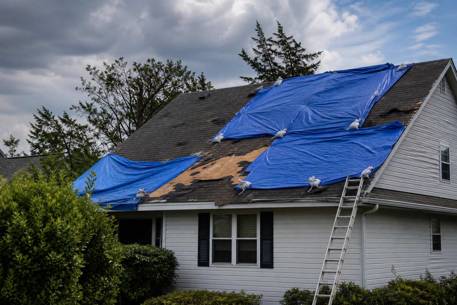
Tag: Water Damage Restoration

  • Flash Flood Warning: Hamilton County FL Until 6:45 PM EDT

    Flash Flood Warning: Hamilton County FL Until 6:45 PM EDT

    The National Weather Service in Jacksonville has issued a Flash Flood Warning for northwestern Hamilton County in northern Florida, in effect until 6:45 PM EDT this evening. At 3:43 PM EDT, Doppler radar indicated thunderstorms producing heavy rain across the warned area — between 2.5 and 3.5 inches of rain have already fallen, with an additional 1 to 3 inches possible. Flash flooding is ongoing or expected to begin shortly.

    This is the exact interior-flooding scenario restoration teams see most: fast, radar-indicated rainfall over a rural area where water finds its way into living spaces long before anyone thinks to check. This is a live snapshot as of 3:47 PM EDT. Conditions change fast — always verify with the National Weather Service for your specific county or ZIP code.

    Northwestern Hamilton County — Flash Flood Warning

    Issuing office: NWS Jacksonville, FL (weather.gov/jax)
    Issued: 3:43 PM EDT, Sunday, September 20
    Expires: 6:45 PM EDT, Sunday, September 20
    VTEC: /O.NEW.KJAX.FF.W.0026

    Hazard detail, verbatim from the alert: At 3:43 PM EDT, Doppler radar indicated thunderstorms producing heavy rain across the warned area. Between 2.5 and 3.5 inches of rain have fallen. Additional rainfall amounts of 1 to 3 inches are possible in the warned area. Flash flooding is ongoing or expected to begin shortly.

    Hazard: Flash flooding caused by thunderstorms.
    Source: Radar indicated.
    Impact: Flash flooding of small creeks and streams, urban areas, highways, streets and underpasses as well as other poor drainage and low-lying areas.

    Locations in the warning path: Mainly rural areas of northwestern Hamilton County.

    The radar-indicated wording matters here: no spotter or gauge confirmation is cited, which means this is a Doppler-derived rainfall estimate — the water is falling faster than the ground can absorb it, and the heaviest cores may be sitting over ground nobody is watching. In rural north Florida, that combination is how a quiet Sunday afternoon turns into flooded low-water crossings and water in crawlspaces before dark.

    Stay safe tonight

    Turn around, don’t drown when encountering flooded roads. Most flood deaths occur in vehicles — and in rural counties, the flooded road is often a two-lane farm-to-market road with no alternate route signed. Six inches of moving water can knock an adult down; twelve inches can carry a car.

    If water enters the home: stay out of standing water where electricity may be present, avoid the basement or crawlspace until the water recedes and the power is confirmed off, and photograph everything before any cleanup begins — documentation matters for insurance. Then call a local restoration contractor. Water left sitting starts a second wave of damage within a day: saturated drywall, wicking insulation, and the beginning of mold colonization.

    What this means for restoration teams

    A radar-indicated flash flood warning over rural Hamilton County translates into a specific call profile: interior water intrusion through low-lying entries and slab edges, saturated drywall and insulation in rooms that sat in two to four inches of water, and crawlspace flooding that homeowners often don’t discover until the musty smell starts days later. With 2.5 to 3.5 inches already down and up to 3 more possible, this is not a nuisance-rainfall event — it’s a structural-drying event.

    The mold clock starts ticking the moment water sits. Mold risk rises sharply within 24 to 48 hours of sustained wetting, which means the contractor who gets called Sunday evening versus Monday afternoon is the difference between a dry-out and a tear-out. Sewage backup is a real secondary hazard in low-lying rural areas where septic systems and lift stations get overwhelmed — treat any standing water as potentially contaminated until proven otherwise.

    The play: stage equipment now, not after the first call. Pre-position dehumidifiers, air movers, and extraction units so a Sunday-evening dispatch doesn’t turn into a Monday-morning scramble. Keep an on-call rotation through the night — rural flash-flood calls cluster in the hours after the rain stops, when people come home and find water. On the first call, capture the address, the water source, and every affected area before quoting anything.

    Field discipline: photo-document before mitigation starts — every room, every waterline, every piece of affected contents. Moisture-map every affected room, not just the visibly wet ones; water migrates under flooring and behind baseboards. And keep the homeowner’s payment responsibility clear in writing before work starts — storm events bring out the “insurance will cover everything” assumption, and ambiguity there costs more than the drying does.

    FEMA & federal assistance

    If the damage is significant, the FEMA Helpline is 1-800-621-3362 (7 a.m. to 10 p.m. local time, 7 days a week). You can also apply at DisasterAssistance.gov, through the FEMA app, or by finding a recovery center at fema.gov/drc.

    Basic eligibility generally requires citizenship or qualified status, identity verification, proof of occupancy or ownership, and unmet needs not covered by insurance. Apply as soon as it’s safe to do so — you don’t need to wait for an adjuster to start the process.

    Looking ahead

    The warning expires at 6:45 PM EDT. Even after expiration, watch the small creeks and streams in northwestern Hamilton County — they can crest after the rain stops, and additional rounds of thunderstorms remain possible through the evening as the same unstable airmass sits over the region. The next NWS update will land as conditions evolve; check the Jacksonville office page for the latest.

    For contractors: water-intrusion calls typically start within hours of water receding and keep coming for days as people discover damage — the Sunday-night callers are the visible ones, and the Tuesday callers are the crawlspaces and the slow wicks. The demand window for this event runs through at least midweek.

    Sources & how to verify

    This post is for informational purposes and is not an official weather warning. Always follow instructions from local authorities and the National Weather Service.

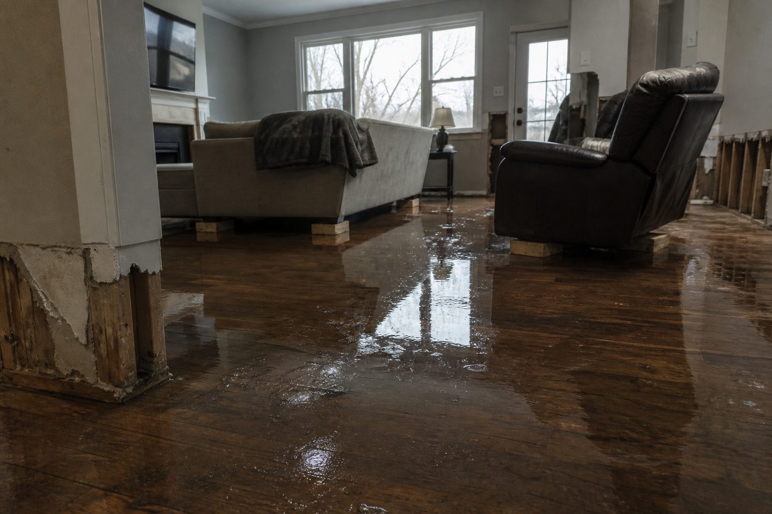
  • Flash Flood Warning: Washington, PA Area Until 1:30 PM EDT

    Flash Flood Warning: Washington, PA Area Until 1:30 PM EDT

    A Flash Flood Warning is active right now for the Washington, Pennsylvania area, issued by the National Weather Service office in Pittsburgh at 11:42 AM EDT on Sunday, September 20, 2026, and running until 1:30 PM EDT. Flash flooding is already occurring across the warned area after 1.5 to 2.5 inches of rain fell this morning — the exact kind of sudden interior water-intrusion event that turns into restoration work within hours. This is a live snapshot as of 11:50 AM EDT Sunday, September 20, 2026. Conditions change fast — always verify with the National Weather Service for your specific county or ZIP code.

    Washington, PA — Flash Flood Warning

    Issuing office: NWS Pittsburgh, PA
    Issued: 11:42 AM EDT, Sunday September 20, 2026
    Expires: 1:30 PM EDT, Sunday September 20, 2026
    Severity: Severe | Certainty: Likely | Urgency: Immediate

    Per the National Weather Service: at 11:42 AM EDT, Doppler radar indicated that rain was ending across the warned area. Earlier, emergency management reported several instances of flash flooding across the warned area. Between 1.5 and 2.5 inches of rain have fallen. Additional rainfall amounts up to 1.0 inch are possible in the warned area. Flash flooding is already occurring.

    Hazard: Flash flooding caused by heavy rain.
    Source: Emergency management reported.
    Impact: Flash flooding of small creeks and streams, urban areas, highways, streets and underpasses, as well as other poor drainage and low-lying areas.

    Locations that will experience flash flooding include: Washington, Canonsburg, Avella, Wolfdale, McGovern, Bentleyville, East Washington, New Eagle, Baidland, Houston, Ellsworth, Claysville, Deemston, Eighty Four, Cokeburg, Hickory, Beallsville and West Alexander.

    Sources: the NWS alert for this warning and the NWS Pittsburgh office page.

    Stay safe this afternoon

    Turn around, don’t drown when encountering flooded roads. Most flood deaths occur in vehicles — never drive through flooded roadways, and never drive around barricades. Six inches of fast-moving water can knock a person down; twelve inches can sweep a car away.

    If water enters the home: stay out of standing water where electricity may be present, and avoid the basement until water recedes and the power is confirmed off. Photograph everything before cleanup — documentation matters for insurance claims. Then call a local restoration contractor. Water left sitting starts a second wave of damage within a day, and flash-flood water can carry contaminants that make it more than a simple dry-out.

    What this means for restoration teams

    This is the signature pattern for flash-flood water-intrusion calls: 1.5 to 2.5 inches of rain in a short window across small municipalities with creeks, low-lying streets, and older housing stock. Expect the call types that dominate this work — saturated carpet and padding, wicking drywall, soaked insulation, and sewage backup in low-lying areas where stormwater overwhelmed drains.

    The play: stage equipment now, not after the calls start. Pre-position drying assets, air movers, and dehumidifiers for dispatch across Washington and the surrounding towns. Keep an on-call rotation through the afternoon and into the evening — this warning expires at 1:30 PM EDT, but the damage discovery window runs for days. On the first call, capture the address, the water source (overland flow, creek, street backup, foundation seepage), and the affected areas before rolling a truck.

    Field discipline: photo-document everything before mitigation begins. Moisture-map every affected room, not just the visibly wet one — flash-flood events push water through wall cavities and under flooring in ways that don’t show on the surface. Keep the homeowner’s payment responsibility clear in writing before work starts, and flag potential coverage questions early: flood-sourced water intrusion often lands on a different coverage track than a burst pipe.

    Mold risk begins within 24–48 hours of saturation, so the jobs dispatched today set the shape of next week’s backlog.

    FEMA & federal assistance

    FEMA Helpline: 1-800-621-3362 (7 a.m.–10 p.m. local time, 7 days a week). Apply at DisasterAssistance.gov, through the FEMA app, or find recovery centers at fema.gov/drc.

    Basic eligibility: U.S. citizenship or qualified status, identity verification, proof of occupancy or ownership, and unmet needs not covered by insurance. Apply as soon as it is safe to do so.

    Looking ahead

    This warning expires at 1:30 PM EDT today. Rain was ending across the warned area as of the 11:42 AM update, but up to an additional inch of rain remains possible, and creeks and streams can crest after the rain stops — low-lying areas should stay alert through the afternoon. The next NWS update will land if conditions warrant, and any new or extended warning will be picked up in Storm Tracker coverage.

    Demand window note: water-intrusion calls typically start within hours of water receding and keep coming for days as homeowners discover damage — soaked flooring discovered that evening, wicking drywall the next morning, musty odors by midweek. Contractors in the Washington, PA area should expect a call curve that peaks over the next 24–72 hours.

    Sources & how to verify

    To verify for your own county or ZIP code, check weather.gov or your local NWS office page.

    This post is for informational purposes and is not an official weather warning. Always follow instructions from local authorities and the National Weather Service.

  • Flash Flood Warning: Washington County PA Area Until 1:30 PM EDT

    Flash Flood Warning: Washington County PA Area Until 1:30 PM EDT

    Live snapshot as of 10:50 AM EDT, Sunday, September 20, 2026. Conditions change fast — always verify with the National Weather Service for your specific county or ZIP code.

    The National Weather Service in Pittsburgh has issued a Flash Flood Warning for central Washington County in southwestern Pennsylvania, in effect until 1:30 PM EDT. This is an observed flash-flood event: emergency management reported thunderstorms producing heavy rain across the warned area, and the NWS states flash flooding is already occurring.

    This is the kind of warning that translates directly into interior water-intrusion calls for restoration teams — basement flooding, water in low-lying commercial spaces, and saturated living areas in towns across central Washington County. If you are in the warned area, treat every flooded roadway as a life-threatening hazard right now.

    Washington County, PA — Flash Flood Warning

    Issued by: National Weather Service Pittsburgh, PA (WFO Pittsburgh)
    Issued: 10:37 AM EDT, Sunday, September 20, 2026
    Expires: 1:30 PM EDT, Sunday, September 20, 2026
    Severity / Certainty / Urgency: Severe / Likely / Immediate
    Alert identifier: FFWPBZ (WGUS51 KPBZ 201437)

    Hazard detail, per the NWS alert: Flash flooding caused by thunderstorms. At 10:37 AM EDT, emergency management reported thunderstorms producing heavy rain across the warned area. Between 1 and 2 inches of rain have already fallen, and additional rainfall amounts of up to 1 inch are possible in the warned area. Flash flooding is already occurring.

    Source: Emergency management reported (observed flash-flood detection).

    Locations in the warning path: Washington, Canonsburg, Avella, Wolfdale, McGovern, Bentleyville, East Washington, New Eagle, Baidland, Houston, Ellsworth, Claysville, Deemston, Eighty Four, Cokeburg, Hickory, Beallsville and West Alexander.

    Expected impacts, per the NWS: Flash flooding of small creeks and streams, urban areas, highways, streets and underpasses, as well as other poor-drainage and low-lying areas.

    Issuing office page: NWS Pittsburgh, PA. Alert source: the NWS alert feed (api.weather.gov), issued by NWS Pittsburgh at 10:37 AM EDT.

    Stay safe this morning

    The NWS instruction for this warning is direct: turn around, don’t drown when encountering flooded roads. Most flood deaths occur in vehicles — never drive through flooded roadways, and never assume you know how deep the water is or how strong the current underneath is running.

    If water is entering your home:

    • Stay out of standing water where electricity may be present. If water reaches outlets, appliances, or the breaker panel, treat the room as an electrical hazard.
    • Avoid the basement until water recedes and power is confirmed off.
    • Photograph everything before cleanup begins. Documentation matters for insurance — shoot the waterline, the affected rooms, damaged contents, and the source of the water.
    • Then call a local restoration contractor. Water left sitting starts a second wave of damage within a day — saturated drywall and insulation become a mold risk within 24–48 hours.

    What this means for restoration teams

    An observed flash flood warning — not radar-indicated, but reported by emergency management with flooding already occurring — is the strongest demand signal this lane publishes. Here is the operator read for contractors in central Washington County:

    Damage categories to expect: interior water intrusion (basements, slab-on-grade living areas), saturated drywall and insulation, sewage backup in low-lying and poor-drainage areas, and commercial water losses in storefronts and strip-center spaces in towns like Washington and Canonsburg. With 1–2 inches already down and up to another inch possible, expect repeat-call addresses where drainage backs up again before the warning expires.

    The play this morning:

    • Stage equipment now — extraction, air movers, and dehumidifiers, before the calls land. Water-intrusion calls typically start within hours of water receding and keep coming for days as people discover damage.
    • Pre-position drying assets along the Washington–Canonsburg–Houston corridor, where the heaviest reported rain fell.
    • Keep an on-call rotation through the afternoon — the warning runs to 1:30 PM EDT, but discovery calls run long past that.
    • Capture on the first call: address, water source, and affected areas. Ask specifically about sewage odor and standing water depth — it changes the response category.

    Field discipline: photo-document before mitigation, moisture-map every affected room, and keep the homeowner’s payment responsibility clear in writing before work starts. Observed flash floods generate disputed coverage quickly — the documentation you collect in the first hour is what the adjuster reviews.

    FEMA & federal assistance

    If your home or business is damaged by flooding, federal assistance may be available if a disaster declaration follows this event:

    • FEMA Helpline: 1-800-621-3362 (7 a.m.–10 p.m. local time, 7 days a week).
    • Apply at DisasterAssistance.gov, through the FEMA app, or find recovery centers at fema.gov/drc.
    • Basic eligibility: U.S. citizenship or qualified status, identity verification, proof of occupancy or ownership, and unmet needs not covered by insurance.
    • Apply as soon as it is safe to do so — documentation of the damage is essential.

    Looking ahead

    The warning expires at 1:30 PM EDT. Even after it expires, creeks and streams can crest later in the day, and low-lying drainage areas can hold water well into the afternoon. If additional rounds of thunderstorms develop over ground already saturated with 1–3 inches of rain, the NWS can extend or reissue the warning — watch the NWS Pittsburgh page for updates.

    Demand window note: water-intrusion calls typically start within hours of water receding and keep coming for days as people discover damage. Contractors should expect the call curve to begin this afternoon and run through at least mid-week — secondary losses (mold, odor, warping) surface 24–72 hours after the water is gone.

    Sources & how to verify

    • NWS Pittsburgh, PA — issuing office.
    • NWS active alerts feed (api.weather.gov) — Flash Flood Warning FFWPBZ, issued 10:37 AM EDT September 20, 2026.

    To verify for your own county or ZIP code: go to weather.gov and enter your ZIP, or visit the NWS Pittsburgh page for southwestern Pennsylvania.

    This post is for informational purposes and is not an official weather warning. Always follow instructions from local authorities and the National Weather Service.
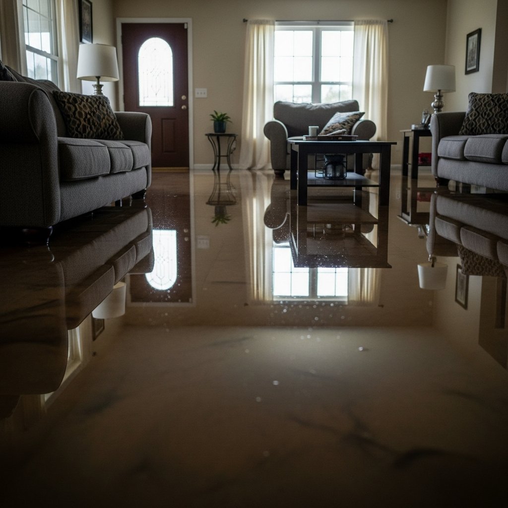
  • Flash Flood Warning: Eastern Ohio Until 12 PM EDT

    Flash Flood Warning: Eastern Ohio Until 12 PM EDT

    A Flash Flood Warning is active right now across five eastern Ohio counties, issued by the National Weather Service office in Pittsburgh, PA at 9:50 AM EDT and in effect until 12:00 PM EDT today. Doppler radar shows heavy rain continuing over the warned area, with 2 to 3 inches already on the ground and another half inch to an inch still possible — flash flooding is ongoing or expected to begin shortly. This is the exact interior-flooding scenario that keeps restoration teams busy for days: saturated basements, overwhelmed drains, and water finding every low point in older housing stock.

    This is a live snapshot as of 10:00 AM EDT on Sunday, September 20. Conditions change fast — always verify with the National Weather Service for your specific county or ZIP code.

    Eastern Ohio — Flash Flood Warning

    The warning covers northern Belmont, northeastern Guernsey, southern Harrison, southwestern Jefferson, and southern Tuscarawas counties in Ohio, from 9:50 AM to 12:00 PM EDT. It was issued by NWS Pittsburgh PA as a radar-indicated event — meaning Doppler radar is tracking the heavy rain directly, even if gauges haven’t caught it all.

    The NWS alert details:

    • Hazard: Flash flooding caused by heavy rain.
    • Source: Radar indicated — heavy rain continues across the warned area, mainly in Harrison and Belmont Counties.
    • Rainfall so far: 2 to 3 inches have fallen. Additional amounts of 0.5 to 1 inch are possible.
    • Impact: Flash flooding of small creeks and streams, urban areas, highways, streets and underpasses, as well as other poor-drainage and low-lying areas.

    Locations that will experience flash flooding, per the NWS, include Martins Ferry, St. Clairsville, Freeport, Newcomerstown, Bridgeport, Antrim, Flushing, Adena, Dillonvale, Brookside, Port Washington, Mount Pleasant, Holloway, New Athens, Harrisville, Piedmont, Tippecanoe, and Gilmore.

    You can follow the warning directly through the NWS Pittsburgh office page and the NWS alert source.

    Stay safe

    Turn around, don’t drown. When you encounter a flooded road, do not drive through it — most flood deaths occur in vehicles, and it takes shockingly little water to carry a car away. This is a Sunday morning; roads you drive every day can be under water in minutes.

    If water is entering your home:

    • Stay out of standing water where electricity may be present — one energized outlet turns a flooded basement into a hazard zone.
    • Avoid the basement until water recedes and the power is confirmed off.
    • Photograph everything before cleanup. Documentation matters for insurance — adjusters need to see the damage before you start moving things around.
    • Call a local restoration contractor. Water left sitting starts a second wave of damage within a day — drywall wicks it upward, and mold gets a foothold within 24 to 48 hours.

    What this means for restoration teams

    A radar-indicated flash flood warning on a Sunday morning is a specific kind of call volume: homeowners discovering water when they wake up, walk downstairs, or get back from errands. Two to three inches of rain falling fast means the damage profile leans toward interior water intrusion — basement seepage through foundation cracks, window-well overflow, overwhelmed sump pumps, and sheet flow across lots that pools against foundations.

    In this corridor of eastern Ohio, a lot of the housing stock is older, which raises the odds on the expensive categories: saturated drywall and insulation, flooring damage that spreads as water migrates, and sewage backup in low-lying neighborhoods where combined systems surcharge. Mold risk clocks in at the standard 24–48 hour window — and the fact that many homeowners will wait until Monday to call means Sunday intake discipline is what separates a clean job from a callback.

    The play for crews today:

    • Stage equipment now — dehumidifiers, air movers, and extraction gear ready to roll, not still in the shop.
    • Pre-position drying assets and keep an on-call rotation through the morning and into the afternoon; the water-intrusion calls typically start within hours of water receding and keep coming for days as people discover damage.
    • Capture address, water source, and affected areas on the first call — that triage decides whether a truck rolls today or a ticket lands on Monday’s board.
    • Field discipline: photo-document before mitigation starts, moisture-map every affected room, and keep the homeowner’s payment responsibility clear in writing before work begins.

    FEMA & federal assistance

    If flooding damages your home, help may be available through FEMA: the FEMA Helpline is 1-800-621-3362 (7 a.m.–10 p.m. local, 7 days a week), or apply at DisasterAssistance.gov and through the FEMA app. Recovery centers can be found at fema.gov/drc.

    Basic eligibility: U.S. citizenship or qualified non-citizen status, identity verification, proof of occupancy or ownership, and unmet needs not covered by insurance. Apply as soon as it is safe to do so — don’t wait for the water to be gone before starting the paperwork.

    Looking ahead

    The warning expires at noon EDT today. What to watch after it lifts: creeks and streams in the warned counties can keep rising for hours after the rain stops — flooding downstream of the heaviest rain is the classic after-effect. Keep an eye on additional rounds; NWS Pittsburgh updates its outlooks regularly, and a follow-up warning is always possible if another cell trains over the same counties.

    For restoration operators, the demand window is the real story: calls start within hours of water receding and stretch for days as homeowners find damage they missed on the first walkthrough. Basements checked “fine” on Sunday can show mold smell by Tuesday — a check-back call is cheap and often turns into work.

    Sources & how to verify

    To verify for your own county or ZIP code, go to weather.gov, enter your location, and check the active alerts for your area.

    This post is for informational purposes and is not an official weather warning. Always follow instructions from local authorities and the National Weather Service.

  • Flash Flood Warning: Eastern Ohio Until Noon EDT

    Flash Flood Warning: Eastern Ohio Until Noon EDT

    Active as of 9:10 AM EDT, September 20, 2026. The National Weather Service in Pittsburgh, Pennsylvania, has issued a Flash Flood Warning for parts of east-central Ohio — including portions of Belmont, Guernsey, Harrison, Jefferson, and Tuscarawas counties — in effect until noon EDT.

    Between 1.5 and 2.5 inches of rain have already fallen across the warned area, with another half inch to an inch possible as the morning progresses. Flash flooding is ongoing or expected to begin shortly — the exact basement-water, saturated-drywall jobs that restoration teams in the Ohio Valley know as the classic Sunday-morning cloudburst pattern.

    This is a live snapshot as of 9:10 AM EDT. Conditions change fast — always verify with the National Weather Service for your specific county or ZIP code.

    Eastern Ohio — Flash Flood Warning

    Issued by: NWS Pittsburgh, Pennsylvania, at 9:02 AM EDT, September 20, 2026.
    Expires: 12:00 PM EDT.
    Counties: Northern Belmont County; Northeastern Guernsey County; Southern Harrison County; Southwestern Jefferson County; Southern Tuscarawas County, Ohio.

    Hazard, verbatim from the alert: “Flash flooding caused by heavy rain.” Source: “Radar indicated” — Doppler radar indicated heavy rain across the warned area at 9:02 AM EDT. Impact, verbatim: “Flash flooding of small creeks and streams, urban areas, highways, streets and underpasses as well as other poor drainage and low-lying areas.”

    The National Weather Service expects rainfall totals in the warned area to keep climbing through the morning commute. Creeks and streams in east-central Ohio can rise fast on this kind of already-saturated ground — a gauge jump from nuisance to destructive can happen in well under an hour on small tributaries.

    Locations that will experience flash flooding include: Martins Ferry, St. Clairsville, Freeport, Newcomerstown, Bridgeport, Antrim, Flushing, Adena, Dillonvale, Brookside, Port Washington, Mount Pleasant, Holloway, New Athens, Harrisville, Piedmont, Tippecanoe and Gilmore.

    NWS Pittsburgh’s office page is weather.gov/pbz. This warning was issued through the National Weather Service alert system (AWIPS identifier FFWPBZ, WMO WGUS51 KPBZ) as VTEC event /O.NEW.KPBZ.FF.W.0151 — valid 9:02 AM to 12:00 PM EDT, September 20.

    Stay safe this morning

    Turn around, don’t drown when encountering flooded roads. Most flood deaths occur in vehicles. Never drive through flooded roadways — water as shallow as six inches can reach the bottom of most cars, and moving water can sweep a vehicle off the road at depths far lower than most drivers expect. A flooded roadway can also hide a washed-out surface or a collapsed culvert underneath.

    If water enters your home: stay out of standing water where electricity may be present, and stay out of the basement until water recedes and power is confirmed off. Photograph everything before any cleanup — documentation is what makes an insurance claim move. Then call a local restoration contractor: water left sitting starts a second wave of damage — mold, swelling, delamination — within a day.

    What this means for restoration teams

    This is the signature eastern-Ohio spring-and-fall pattern: 1.5 to 2.5 inches of rain in a few hours on rolling terrain, with creeks feeding into the Ohio River corridor around Martins Ferry and Bridgeport. Expect the damage mix that follows flash flooding in these counties — interior water intrusion from overwhelmed storm drainage, saturated drywall and insulation in finished basements, mold risk within 24 to 48 hours where water sits against organic material, and sewage backup in low-lying areas where combined systems overflow.

    The play: stage equipment now, not after the warning expires. Pre-position dehumidifiers and air movers for east-central Ohio response, keep an on-call rotation through the morning, and when the calls start coming, capture address, water source, and affected areas on the very first call. The first call intake is what determines whether a job is profitable — vague intake becomes unpaid detective work on site.

    Field discipline: photo-document everything before mitigation starts. Moisture-map every affected room, not just the visibly wet ones — water wicks behind baseboards and under flooring well beyond the obvious line. And keep the homeowner’s payment responsibility clear in writing before work starts; emergency-morning jobs signed in a hurry are the ones that turn into collection headaches later.

    FEMA & federal assistance

    If your property is damaged, the FEMA Helpline is 1-800-621-3362 (7 a.m.–10 p.m. local time, 7 days a week). You can also apply at DisasterAssistance.gov or through the FEMA app, and find in-person recovery centers at fema.gov/drc.

    Basic eligibility: U.S. citizenship or qualified status, identity verification, proof of occupancy or ownership, and unmet needs not covered by insurance. Apply as soon as it is safe to do so — you do not need to wait for every contractor estimate before starting the application.

    Looking ahead

    This warning runs until noon EDT. When it expires, that does not mean the water is gone — small creeks and streams in east-central Ohio can stay elevated or crest later in the day as upstream runoff collects. Watch for additional rounds of showers through the afternoon, and treat any low-water crossing or underpass as suspect until you can see the road surface.

    Demand window: water-intrusion calls typically start within hours of water receding and keep coming for days as people discover damage — the musty smell shows up Monday, the buckled flooring shows up Tuesday. The next NWS update for this event will be the expiration or extension at noon; the watch for new alerts continues through the rest of the morning.

    Sources & how to verify

    To verify for your own county or ZIP code, go to weather.gov and enter your location, or check the NWS Pittsburgh page directly. The National Weather Service is the authoritative source; this post is a working snapshot only.

    This post is for informational purposes and is not an official weather warning. Always follow instructions from local authorities and the National Weather Service.

  • Flash Flood Warning: Charleston–Huntington Area Until 10:15 AM EDT

    Flash Flood Warning: Charleston–Huntington Area Until 10:15 AM EDT

    Active as of 9:05 AM EDT, September 20, 2026. The National Weather Service in Charleston, West Virginia, has issued a Flash Flood Warning for portions of southwestern and west-central West Virginia, including the Charleston and Huntington metro areas, in effect until 10:15 AM EDT.

    Between 1.5 and 2.5 inches of rain have already fallen across the warned area, with another 0.5 to 1.5 inches possible as thunderstorms continue. Flash flooding is ongoing or expected to begin shortly — the exact interior flooding jobs that restoration teams across the Kanawha Valley see most after these morning cloudbursts.

    This is a live snapshot as of 9:05 AM EDT. Conditions change fast — always verify with the National Weather Service for your specific county or ZIP code.

    Charleston–Huntington Area — Flash Flood Warning

    Issued by: NWS Charleston, West Virginia, at 8:51 AM EDT, September 20, 2026.
    Expires: 10:15 AM EDT.
    Counties: Boone, Cabell, Clay, Kanawha, Lincoln, Putnam, and Wayne, West Virginia.

    Hazard, verbatim from the alert: “Flash flooding caused by thunderstorms.” Source: “Radar and automated gauges” — Doppler radar and automated rain gauges indicated thunderstorms producing heavy rain across the warned area. Impact, verbatim: “Flash flooding of small creeks and streams, urban areas, highways, streets and underpasses as well as other poor drainage and low-lying areas.”

    Locations that will experience flash flooding include: Charleston, Huntington, Nitro, Wayne, Hamlin, Beech Fork State Park, Jefferson, South Charleston, St. Albans, Dunbar, Barboursville, Chesapeake, Marmet, Ceredo, Belle, Clendenin, Cedar Grove, East Bank, Glasgow, and Alum Creek.

    Highway impacts include: Interstate 77 in West Virginia between mile markers 96 and 109; Route 119 between mile markers 58 and 80; Interstate 64 between mile markers 9 and 11 and between mile markers 46 and 57; the West Virginia Turnpike between mile markers 85 and 95; and Interstate 79 between mile markers 1 and 10.

    NWS Charleston’s office page is weather.gov/rlx. The alert was issued through the National Weather Service alert system under NWS Charleston WV.

    Stay safe this morning

    Turn around, don’t drown when encountering flooded roads. Most flood deaths occur in vehicles. Be aware of your surroundings and do not drive on flooded roads — a roadway covered by water can hide a washed-out surface or a missing bridge deck.

    If water enters your home or business: stay out of standing water where electricity may be present, and avoid the basement until water recedes and power is confirmed off. Photograph everything before you start cleanup — documentation matters for insurance. Then call a local restoration contractor. Water left sitting starts a second wave of damage within a day: soaked drywall wicks upward, carpet pad delaminates, and microbial growth follows fast.

    Report flooding to the National Weather Service by calling toll free 800-401-9535, when you can do so safely. Your report helps the office verify and extend warnings downstream.

    What this means for restoration teams

    This is the signature call pattern for the Kanawha Valley: an early-morning flash flood round over the Charleston–Huntington corridor. Teams should expect the damage categories these events always produce: interior water intrusion in finished basements and ground-floor commercial space, saturated drywall and insulation wicking upward from the slab line, sewage backup in low-lying neighborhoods, and moisture trapped in wall cavities along the highways that flooded during the morning commute.

    The play this morning: stage extraction equipment and drying assets now, while the warning is still active — water-intrusion calls typically start within hours of water receding and keep coming for days as people discover damage. Keep an on-call rotation through the afternoon for the second wave of discovery calls. On the first call, capture the address, the water source (rainfall intrusion vs. storm sewer backup), and every affected area — source classification decides what the job is worth before a truck rolls.

    Field discipline: photo-document everything before mitigation starts, moisture-map every affected room (not just the visibly wet ones), and keep the homeowner’s payment responsibility clear in writing before work begins. Morning flood jobs skew toward panic-approvals that turn into collection headaches — get the paperwork tight while the crew is en route.

    FEMA & federal assistance

    If you sustain serious damage: the FEMA Helpline is 1-800-621-3362 (7 a.m.–10 p.m. local time, 7 days a week). You can also apply at DisasterAssistance.gov, through the FEMA app, or find a recovery center at fema.gov/drc.

    Basic eligibility: U.S. citizenship or qualified status, identity verification, proof of occupancy or ownership, and unmet needs not covered by insurance. Apply as soon as it is safe to do so — and keep the photo documentation you took before cleanup.

    Looking ahead

    The warning expires at 10:15 AM EDT. When it lifts, do not read that as all-clear for water problems: small creeks and streams can crest after the rain stops, and low-lying drainage areas stay compromised well into the afternoon. Watch for follow-up statements from NWS Charleston for updated river and stream guidance, and keep an eye on additional thunderstorm rounds through the day.

    For restoration demand, this is a day-one event: the first calls start within hours of water receding, and discovery-driven calls keep coming for days as people return home, open basements, and find what the morning’s water did. Teams positioned now work the whole week.

    Sources & how to verify

    • National Weather Service Flash Flood Warning — issued by NWS Charleston, WV, 8:51 AM EDT September 20, 2026, expires 10:15 AM EDT. (This post, published during the active warning window.)
    • NWS Charleston office page: https://www.weather.gov/rlx/ (read September 20, 2026)
    • Alert source: National Weather Service alert feed, alerts.weather.gov (read September 20, 2026)

    To verify for your own county or ZIP: go to weather.gov, enter your ZIP code, and read the active alerts for your area — or go directly to your local NWS office page.

    This post is for informational purposes and is not an official weather warning. Always follow instructions from local authorities and the National Weather Service.

  • Flash Flood Warning: Central West Virginia Until 10 AM EDT

    Flash Flood Warning: Central West Virginia Until 10 AM EDT

    Live snapshot as of 8:35 AM EDT on Sunday, September 20, 2026. The warning below is active now.

    The National Weather Service in Charleston, West Virginia, has extended a Flash Flood Warning for parts of central and north-central West Virginia. The warning is in effect until 10:00 AM EDT today and covers portions of Braxton, Calhoun, Clay, Gilmer, Lewis, Nicholas, Roane, and Webster counties. This is exactly the kind of interior-flooding scenario that produces the water-intrusion jobs restoration teams see most — saturated ground, small creeks rising fast, and roadways that go under before anyone expects it.

    This is a live snapshot as of 8:35 AM EDT on September 20, 2026. Conditions change fast — always verify with the National Weather Service for your specific county or ZIP code.

    Central West Virginia — Flash Flood Warning

    Issued by: NWS Charleston, WV
    Issued: 8:25 AM EDT, Sunday, September 20, 2026
    Expires: 10:00 AM EDT, Sunday, September 20, 2026
    Message type: Update / extension of an earlier warning

    The warning covers: southeastern Roane County in central West Virginia; Braxton County in north central West Virginia; southeastern Calhoun County in north central West Virginia; central Clay County in north central West Virginia; southern Gilmer County in north central West Virginia; northwestern Webster County in northeastern West Virginia; south central Lewis County in northern West Virginia; and north central Nicholas County in southeastern West Virginia.

    Per the National Weather Service alert, at 8:25 AM EDT Doppler radar indicated thunderstorms producing heavy rain across the warned area. Between 1.5 and 2.5 inches of rain have already fallen, and additional rainfall amounts of 0.5 to 1 inch are possible in the warned area. Flash flooding is ongoing or expected to begin shortly.

    Hazard: Flash flooding caused by thunderstorms.
    Source: Radar indicated.

    Some locations that will experience flash flooding include Sutton, Gassaway, Birch River, Big Otter, Wallback, Holly River State Park, Harrison, Burnsville, Flatwoods, Frametown, Little Birch, Wilsie, Exchange, Strange Creek, Servia, Rosedale, Widen, Heaters, Cedarville, and Centralia.

    Expected impacts, per the NWS: flash flooding of small creeks and streams, urban areas, highways, streets and underpasses, as well as other poor drainage and low-lying areas.

    Highway exposure: This includes Route 19 between mile markers 47 and 61, between mile markers 64 and 66, and near mile marker 68 — plus Interstate 79 between mile markers 34 and 80. Drivers on I-79 through the corridor should expect rapidly changing conditions at underpasses and low spots.

    NWS Charleston office page: weather.gov/rlx. Source alert issued by NWS Charleston WV at 8:25 AM EDT, September 20, 2026 (AWIPS identifier FFWRLX).

    Stay safe this morning

    Turn around, don’t drown when encountering flooded roads. Most flood deaths occur in vehicles. Be aware of your surroundings and do not drive on flooded roads.

    If water enters your home: stay out of standing water where electricity may be present, avoid the basement until water recedes and power is confirmed off, and photograph everything before cleanup — documentation matters for insurance. Then call a local restoration contractor. Water left sitting starts a second wave of damage within a day.

    You can report flooding to the National Weather Service by calling toll free 800-401-9535, when you can do so safely. Your report helps forecasters track what’s happening on the ground.

    What this means for restoration teams

    This is the signature central-West-Virginia flood pattern: radar-indicated training thunderstorms dropping 1.5 to 2.5 inches onto already-saturated ground, with small creeks and streams as the first failure points. For contractors across the warned counties, expect the call types that follow this kind of event:

    • Interior water intrusion — seepage through foundation walls and basement entry points in low-lying homes, especially in Sutton, Gassaway, Flatwoods, and along the I-79 corridor communities.
    • Saturated drywall and insulation — crawl spaces and lower wall cavities in homes near small creeks, where water rises from below rather than entering through openings.
    • Mold risk within 24–48 hours — organic materials that stay wet through the day will start microbial growth; drywall in affected rooms needs moisture mapping and likely removal.
    • Underpass and roadway splash damage — commercial buildings adjacent to flooded sections of Route 19 and I-79 can take on water through grade-level doors and loading areas.
    • Holly River State Park area exposure — campgrounds, cabins, and recreation facilities in the warned zone face both flash-flood and access-road washout issues.

    The play: stage extraction equipment now — the warning expires at 10:00 AM EDT but water-intrusion calls typically start within hours of water receding and keep coming for days as people discover damage. Pre-position drying assets, keep an on-call rotation through the evening, and capture address, water source, and affected areas on the first call. Field discipline: photo-document before mitigation, moisture-map every affected room, and keep the homeowner’s payment responsibility clear in writing before work starts.

    The National Weather Service notes flash flooding is ongoing or expected to begin shortly — treat the 0.5 to 1 inch of additional possible rainfall as still to come on top of the 1.5 to 2.5 inches already on the ground.

    FEMA & federal assistance

    If your home or business sustains flood damage, help may be available through FEMA. The FEMA Helpline is 1-800-621-3362 (7 a.m. to 10 p.m. local time, 7 days a week). You can also apply at DisasterAssistance.gov, through the FEMA app, or visit fema.gov/drc to find a disaster recovery center near you.

    Basic eligibility generally includes citizenship or qualified immigration status, identity verification, proof of occupancy or ownership, and unmet needs not covered by insurance. Apply as soon as it is safe to do so.

    Looking ahead

    The Flash Flood Warning is set to expire at 10:00 AM EDT this morning. When it expires, the immediate threat window closes — but that does not mean the water is gone. Small creeks and streams can crest later in the morning as runoff works downstream, and saturated ground means any additional round of rain would produce flooding much faster. Watch for follow-up statements from NWS Charleston, which issued this warning as an extension and may adjust as conditions evolve.

    Demand window note: water-intrusion calls typically start within hours of water receding and keep coming for days as people discover damage. Contractors in the warned counties should plan for a multi-day intake wave, not a single-day spike.

    Sources & how to verify

    • NWS Charleston WV Flash Flood Warning (AWIPS FFWRLX), issued 8:25 AM EDT September 20, 2026, expiring 10:00 AM EDT — weather.gov/rlx
    • NWS office page for Charleston, WV: weather.gov/rlx

    To verify the warning for your own county or ZIP code, go to weather.gov and enter your location, or check the NWS Charleston office page directly. Read dates: all data above is from the alert issued September 20, 2026 at 8:25 AM EDT, captured 8:35 AM EDT.

    This post is for informational purposes and is not an official weather warning. Always follow instructions from local authorities and the National Weather Service.

  • Flash Flood Warning: Tri-State Corridor (KY-OH-WV) Until 9:30 AM EDT

    Flash Flood Warning: Tri-State Corridor (KY-OH-WV) Until 9:30 AM EDT

    A Flash Flood Warning is active right now across the tri-state corridor where Kentucky, Ohio, and West Virginia meet — covering Boyd and Greenup counties in Kentucky, Gallia and Lawrence counties in Ohio, and Cabell, Jackson, Kanawha, Mason, Putnam, Roane, and Wayne counties in West Virginia. The National Weather Service office in Charleston, WV reports Doppler radar and automated gauges showing thunderstorms have dropped 1.5 to 2.5 inches of rain, with flash flooding ongoing or expected to begin shortly — including along stretches of Interstates 64, 77, and 79.

    This is a live snapshot as of 5:08 AM PDT (8:08 AM EDT), Sunday, September 20, 2026. Conditions change fast — always verify with the National Weather Service for your specific county or ZIP code.

    Tri-State Corridor (KY / OH / WV) — Flash Flood Warning

    The National Weather Service in Charleston, WV has continued a Flash Flood Warning in effect until 9:30 AM EDT this morning. The warning was issued at 7:52 AM EDT and covers northern Boyd and southeastern Greenup counties in Kentucky; southwestern Gallia and Lawrence counties in Ohio; and northern Cabell, northern Kanawha, southwestern Roane, Jackson, southern Mason, Putnam, and northern Wayne counties in West Virginia.

    Detection is radar and gauge indicated: at 7:52 AM EDT, Doppler radar and automated rain gauges indicated thunderstorms producing heavy rain across the warned area. Between 1.5 and 2.5 inches of rain have fallen, with an additional 0.5 to 1 inch possible in the warned area. The hazard, per the NWS: flash flooding caused by thunderstorms.

    Expected impacts, from the alert: flash flooding of small creeks and streams, urban areas, highways, streets and underpasses, as well as other poor-drainage and low-lying areas.

    This warning names specific highways that will experience flash flooding:

    • Interstate 77 in West Virginia between mile markers 109 and 148
    • Interstate 64 in West Virginia between mile markers 1 and 8, and again between mile markers 10 and 46
    • Interstate 79 between mile markers 11 and 30

    That highway detail is the operational warning inside the warning: this is an urban and transportation-corridor flood event, not just creeks and hollers. Low-water underpasses, interchange ramps, and drainage-poor frontage roads along those stretches are the spots that go under first.

    Source: NWS Charleston WV office page and the full NWS alert text.

    Stay safe: flooding on the roads this morning

    The NWS instruction is the one that matters most, and it is blunt: turn around, don’t drown when encountering flooded roads — most flood deaths occur in vehicles. With named interstate stretches under the warning, treat every underpass and low interchange on I-64, I-77, and I-79 through the corridor as suspect until the water is gone. Be aware of your surroundings and do not drive on flooded roads.

    If water reaches your home:

    • Stay out of standing water where electricity may be present. Treat every wet room as live until you know otherwise.
    • Stay out of the basement until the water recedes and power is confirmed off.
    • Photograph everything before you touch anything. Wide shots of every room, close-ups of waterlines and damaged contents — documentation is the difference between a clean claim and a disputed one.
    • Then call a local restoration contractor. Water left sitting doesn’t wait: saturated drywall, subflooring, and insulation start a second wave of damage within a day, and mold risk rises sharply within 24 to 48 hours.

    Report flooding to the National Weather Service at the toll-free number 800-401-9535, when you can do so safely — it helps forecasters keep warnings accurate for your neighbors.

    What this means for restoration teams

    An eleven-county radar-and-gauge-indicated flash flood warning spanning three states, with 1.5 to 2.5 inches already down and another half inch to an inch possible, is a multi-market water-intrusion event. The damage profile across Boyd, Greenup, Gallia, Lawrence, Cabell, Jackson, Kanawha, Mason, Putnam, Roane, and Wayne counties: flash flooding of small creeks and streams into finished basements and crawlspaces; urban flooding through floor drains, egress wells, and ground-level entries; and — the signature of this particular alert — highway-corridor flooding along I-64, I-77, and I-79, which puts commercial frontage, warehouses, and light-industrial buildings in the impact zone alongside homes.

    Expect the call mix to skew toward interior water intrusion, saturated drywall and insulation, standing water in basements and mechanical rooms, and sewage backup in low-lying areas. In the urbanized parts of Kanawha and Cabell counties especially, watch for commercial calls: flooded parking structures, ground-floor retail, and building mechanical rooms sit low and flood first when storm drains overwhelm.

    The play for contractors across the tri-state area:

    • Stage equipment now, in more than one market. Extraction units, dehumidifiers, and air movers pre-positioned before the 9:30 AM EDT expiry — this warning’s footprint is too wide for a single warehouse to serve without planning.
    • Keep an on-call rotation through the morning and beyond. Water-intrusion calls typically start within hours of water receding and keep coming for days as people discover damage.
    • Watch the interstates on dispatch. Flooded stretches of I-64, I-77, and I-79 can turn a 20-minute drive into an hour — route crews around the named mile-marker stretches and confirm clearance before committing a crew to the far side.
    • Capture address, water source, and affected areas on the first call. Ask: where did the water enter, how deep, and is the power on or off?
    • Field discipline: photo-document before mitigation, moisture-map every affected room. Keep the homeowner’s (or property manager’s) payment responsibility clear in writing before work starts — commercial clients in the corridor will want paper trails as much as homeowners do.

    Local emergency contacts

    Verified from the NWS alert itself: report flooding to the National Weather Service toll-free at 800-401-9535, when you can do so safely. For county-level emergency management, check your county’s emergency management page or dial 911 for life-threatening emergencies. This post does not list unverified county numbers — when seconds matter, 911 and the NWS line above are the two numbers that always work.

    FEMA & federal assistance

    If this morning’s flooding damages your home or business, federal help may be available. The FEMA Helpline is 1-800-621-3362 (7 a.m. to 10 p.m. local time, 7 days a week). You can also apply at DisasterAssistance.gov or through the FEMA mobile app, and find recovery centers at fema.gov/drc.

    Basic eligibility generally requires U.S. citizenship or qualified status, identity verification, proof of occupancy or ownership, and unmet needs not covered by insurance. Apply as soon as it’s safe to do so — and remember that FEMA assistance is a bridge, not a replacement for insurance. Photograph everything before cleanup begins.

    Looking ahead

    When this warning expires at 9:30 AM EDT, watch the water, not the clock. Flash-flood events across this terrain keep creeks rising after the rain stops, and ponding in urban and low-lying areas can linger through the morning. The named interstate stretches merit a re-check before midday travel — standing water in underpasses doesn’t need a warning to be dangerous. The NWS will update the warning picture as conditions change; if flooding persists along the corridor, expect extensions rather than an all-clear.

    For restoration contractors, the demand window opens as water recedes and stays open for days: calls begin within hours and keep coming as property owners discover damage in rooms and buildings they don’t check daily. An eleven-county, three-state footprint means a long tail — the contractors who document first, extract fast, and communicate clearly will be busy through the week.

    Sources & how to verify

    To verify for your own county or ZIP code: enter it at weather.gov, or check your nearest NWS office page for active alerts. Warning polygons update faster than news articles — the NWS page is the source of truth.

    This post is for informational purposes and is not an official weather warning. Always follow instructions from local authorities and the National Weather Service.

  • Flash Flood Warning: West Central West Virginia Until 9:45 AM EDT

    Flash Flood Warning: West Central West Virginia Until 9:45 AM EDT

    A Flash Flood Warning is active right now for five West Virginia counties — Clay, Nicholas, Pocahontas, Randolph, and Webster — issued by the National Weather Service office in Charleston, WV. Radar and automated rain gauges show thunderstorms have already dropped 1.5 to 2.5 inches of rain across the warned area, and flash flooding is ongoing or expected to begin shortly. This is the exact interior-flooding scenario restoration teams see most: creeks and low-lying roads giving way under heavy rain, and water finding basements and ground floors within the hour.

    This is a live snapshot as of 5:05 AM PDT (8:05 AM EDT), Sunday, September 20, 2026. Conditions change fast — always verify with the National Weather Service for your specific county or ZIP code.

    West Central West Virginia — Flash Flood Warning

    The National Weather Service in Charleston, WV has continued a Flash Flood Warning in effect until 9:45 AM EDT this morning. The warning was issued at 7:54 AM EDT and covers southwestern Clay, Pocahontas, southwestern Randolph, Webster, and Nicholas counties.

    Detection is radar and gauge indicated: at 7:54 AM EDT, Doppler radar and automated rain gauges indicated thunderstorms producing heavy rain across the warned area. Between 1.5 and 2.5 inches of rain have fallen, with an additional 0.5 to 1 inch possible in the warned area. The hazard, per the NWS: flash flooding caused by thunderstorms.

    Expected impacts, from the alert: flash flooding of small creeks and streams, urban areas, highways, streets and underpasses, as well as other poor-drainage and low-lying areas.

    Locations that will experience flash flooding, per the NWS, include Summersville, Richwood, Marlinton, Clay, Webster Springs, Cass Scenic Railroad, Green Bank, Addison (Webster Springs), Camden-On-Gauley, Craigsville, Snowshoe, Glen, Mingo, Cowen, Durbin, Hillsboro, Bergoo, Upper Glade, and Waneta. The warning also includes Route 19 between mile markers 34 and 49.

    Source: NWS Charleston WV office page and the full NWS alert text.

    Stay safe: flooding this morning

    The NWS instruction is the one that matters most, and it is blunt: turn around, don’t drown when encountering flooded roads — most flood deaths occur in vehicles. Be aware of your surroundings and do not drive on flooded roads.

    If water reaches your home:

    • Stay out of standing water where electricity may be present. Treat every wet room as live until you know otherwise.
    • Stay out of the basement until the water recedes and power is confirmed off.
    • Photograph everything before you touch anything. Wide shots of every room, close-ups of waterlines and damaged contents — documentation is the difference between a clean claim and a disputed one.
    • Then call a local restoration contractor. Water left sitting doesn’t wait: saturated drywall, subflooring, and insulation start a second wave of damage within a day, and mold risk rises sharply within 24 to 48 hours.

    Report flooding to the National Weather Service at the toll-free number 800-401-9535, when you can do so safely — it helps forecasters keep warnings accurate for your neighbors.

    What this means for restoration teams

    A radar-and-gauge-indicated flash flood warning with 1.5 to 2.5 inches already on the ground and another half inch to an inch possible is a water-intrusion workload trigger for the five-county area. The damage profile writes itself: flash flooding of small creeks and streams pushes water into finished basements and crawlspaces; urban and low-lying flooding backs up through floor drains and egress points; and saturated ground plus blocked drainage finds the lowest point in every structure it touches.

    Expect the call mix to skew toward interior water intrusion, saturated drywall and insulation, standing water in basements and mechanical rooms, and sewage backup in low-lying areas — the classic flash-flood job set. Mold risk within 24–48 hours means today’s emergency response window decides next week’s mitigation scope: fast extraction and drying now is a smaller job than a mold remediation next week.

    The play for contractors in Clay, Nicholas, Pocahontas, Randolph, and Webster counties:

    • Stage equipment now — extraction units, dehumidifiers, and air movers pre-positioned before the warning expires at 9:45 AM EDT, so the first calls don’t wait on loading trucks.
    • Keep an on-call rotation through the morning. Water-intrusion calls typically start within hours of water receding and keep coming for days as people discover damage — this is not a 9 AM-to-5 PM situation.
    • Capture address, water source, and affected areas on the first call. Ask: where did the water enter, how deep, and is the power on or off? That triage decides crew size and equipment before you roll.
    • Field discipline: photo-document before mitigation, moisture-map every affected room. The insurance documentation habits that protect the homeowner protect your invoice too — keep the homeowner’s payment responsibility clear in writing before work starts.

    Local emergency contacts

    Verified from the NWS alert itself: report flooding to the National Weather Service toll-free at 800-401-9535, when you can do so safely. For county-level emergency management, check your county’s emergency management page or dial 911 for life-threatening emergencies. This post does not list unverified county numbers — when seconds matter, 911 and the NWS line above are the two numbers that always work.

    FEMA & federal assistance

    If this morning’s flooding damages your home or business, federal help may be available. The FEMA Helpline is 1-800-621-3362 (7 a.m. to 10 p.m. local time, 7 days a week). You can also apply at DisasterAssistance.gov or through the FEMA mobile app, and find recovery centers at fema.gov/drc.

    Basic eligibility generally requires U.S. citizenship or qualified status, identity verification, proof of occupancy or ownership, and unmet needs not covered by insurance. Apply as soon as it’s safe to do so — and remember that FEMA assistance is a bridge, not a replacement for insurance. Photograph everything before cleanup begins.

    Looking ahead

    When this warning expires at 9:45 AM EDT, the rain may stop but the water won’t be done moving. Flash-flood events in this terrain push creeks and small streams to their peaks after the rain ends — watch for rivers and creeks cresting later this morning, ponding in low-lying areas, and additional rounds of thunderstorms later in the day. The NWS will update the warning picture as conditions change; if flooding persists, expect extensions rather than an all-clear.

    For restoration contractors, the demand window opens the moment water starts receding and stays open for days: calls typically begin within hours and keep coming as homeowners discover damage in rooms they don’t check daily. The contractors who document first, extract fast, and communicate clearly win these cycles — and this morning’s five counties are the ground to cover.

    Sources & how to verify

    To verify for your own county or ZIP code: enter it at weather.gov, or check your nearest NWS office page for active alerts. Warning polygons update faster than news articles — the NWS page is the source of truth.

    This post is for informational purposes and is not an official weather warning. Always follow instructions from local authorities and the National Weather Service.

  • Flash Flood Warning: Charleston Area Until 10:15 AM EDT

    Flash Flood Warning: Charleston Area Until 10:15 AM EDT

    The warning, as of now

    The National Weather Service office in Charleston, West Virginia has issued a Flash Flood Warning for parts of central and western West Virginia, effective until 10:15 AM EDT on Sunday, September 20, 2026. At 7:20 AM EDT, Doppler radar and automated rain gauges indicated thunderstorms producing heavy rain across the warned area — between 1 and 1.5 inches of rain had already fallen, with additional rainfall amounts of up to 1.5 inches possible. Flash flooding is ongoing or expected to begin shortly.

    This is the exact kind of event that turns into the interior flooding jobs restoration teams see most: water through finished basements, saturated drywall, overwhelmed sump systems. This is a live snapshot as of 7:35 AM EDT — conditions change fast, so always verify with the National Weather Service for your specific county or ZIP code.

    Central West Virginia — Flash Flood Warning

    Issued by: NWS Charleston WV (7:20 AM EDT, September 20, 2026)
    Expires: 10:15 AM EDT, September 20, 2026
    Severity: Severe • Certainty: Likely • Urgency: Immediate
    Hazard: Flash flooding caused by thunderstorms
    Source: Radar and automated rain gauges

    Counties and areas covered

    The warning covers northwestern Boone County, southern Cabell County, southwestern Clay County, Kanawha County, Lincoln County, southwestern Putnam County, and northeastern Wayne County in West Virginia.

    Locations in the warning path

    The National Weather Service names the following locations that will experience flash flooding: Charleston, Huntington, Nitro, Wayne, Hamlin, Beech Fork State Park, Jefferson, South Charleston, St. Albans, Dunbar, Barboursville, Chesapeake, Marmet, Ceredo, Belle, Clendenin, Cedar Grove, East Bank, Glasgow, and Alum Creek.

    Highways affected

    Drivers should watch for flooding on:

    • Interstate 77 in West Virginia, mile markers 96 to 109
    • Route 119, mile markers 58 to 80
    • Interstate 64 in West Virginia, mile markers 9 to 11 and 46 to 57
    • West Virginia Turnpike, mile markers 85 to 95
    • Interstate 79, mile markers 1 to 10

    Expected impacts

    Flash flooding of small creeks and streams, urban areas, highways, streets and underpasses, as well as other poor drainage and low-lying areas.

    NWS Charleston WV office page • Alert issued at 7:20 AM EDT via the National Weather Service.

    Stay safe tonight

    Turn around, don’t drown when encountering flooded roads. Most flood deaths occur in vehicles — never drive through flooded roadways, and never attempt to cross a flooded underpass. Be especially cautious at night, when it is harder to recognize the dangers of flooding.

    If water is entering your home: stay out of standing water where electricity may be present, avoid the basement until the water recedes and power is confirmed off, and photograph everything before cleanup begins — that documentation matters for insurance. Then call a local restoration contractor. Water left sitting starts a second wave of damage within a day.

    If you can do so safely, report flooding to the National Weather Service toll-free at 800-401-9535 — those reports help forecasters update the warning.

    What this means for restoration teams

    This is a textbook water-intrusion setup for central West Virginia contractors. Charleston, Huntington, South Charleston, St. Albans, Dunbar, Nitro, and Barboursville all sit in the warned area — dense housing stock, finished basements, and river-adjacent commercial properties. Expect:

    • Interior water intrusion from overwhelmed drainage, backed-up sewers in low-lying areas, and seepage through foundation walls as the additional 1.5 inches lands on already-saturated ground.
    • Saturated drywall and insulation — wicking up walls within the first hours.
    • Mold risk within 24–48 hours if drying doesn’t start promptly — warm late-summer air is a mold accelerator.
    • Commercial hits along the highway corridors — flooded underpasses and low spots on I-64, I-77, and the Turnpike mean commercial properties near those interchanges take water first.

    The play: stage equipment now, pre-position drying assets where they can reach Charleston and Huntington quickly, and keep an on-call rotation through the morning. On the first call, capture address, water source, and affected areas before you roll — dispatch is only as good as intake. Field discipline stays the same: photo-document before mitigation, moisture-map every affected room, and keep the homeowner’s payment responsibility clear in writing before work starts.

    Water-intrusion calls typically start within hours of the water receding and keep coming for days as people discover damage — the demand tail on this one runs well into next week.

    Local emergency contacts

    The National Weather Service asks anyone who can do so safely to report flooding toll-free at 800-401-9535. For life-threatening emergencies, call 911. We are not listing county emergency-management numbers we cannot verify in real time — if you need them, start with your county’s emergency-management office via the state’s official site.

    FEMA & federal assistance

    If this event causes damage beyond what insurance covers, help is available through the Federal Emergency Management Agency:

    • FEMA Helpline: 1-800-621-3362 (7 a.m.–10 p.m. local time, 7 days a week)
    • Apply online at DisasterAssistance.gov, through the FEMA app, or find a recovery center at fema.gov/drc.
    • Basic eligibility: U.S. citizenship or qualified status, identity verification, proof of occupancy or ownership, and unmet needs not covered by insurance. Apply as soon as it’s safe to do so.

    Looking ahead

    The warning runs until 10:15 AM EDT, but the hazard doesn’t end on the clock. With 1–1.5 inches already down and another 1.5 possible, creeks and streams can crest later than the warning window, and additional rounds of thunderstorms can re-trigger flooding in the same drainage areas. Watch for NWS updates as the 10:15 AM expiry approaches — Charleston’s forecasters will extend or let it expire based on gauge readings.

    For restoration teams, the real demand window opens as water recedes and homeowners find the damage: Sunday afternoon through midweek. The contractors who are already staged will be the ones answering those first calls.

    Sources & how to verify

    • National Weather Service Charleston WV Flash Flood Warning, issued 7:20 AM EDT September 20, 2026 — NWS Charleston office (weather.gov/rlx)
    • Report flooding to the NWS toll-free at 800-401-9535 when you can do so safely

    To verify for your own county or ZIP: check weather.gov and the NWS Charleston WV office page for the latest active warnings.

    This post is for informational purposes and is not an official weather warning. Always follow instructions from local authorities and the National Weather Service.