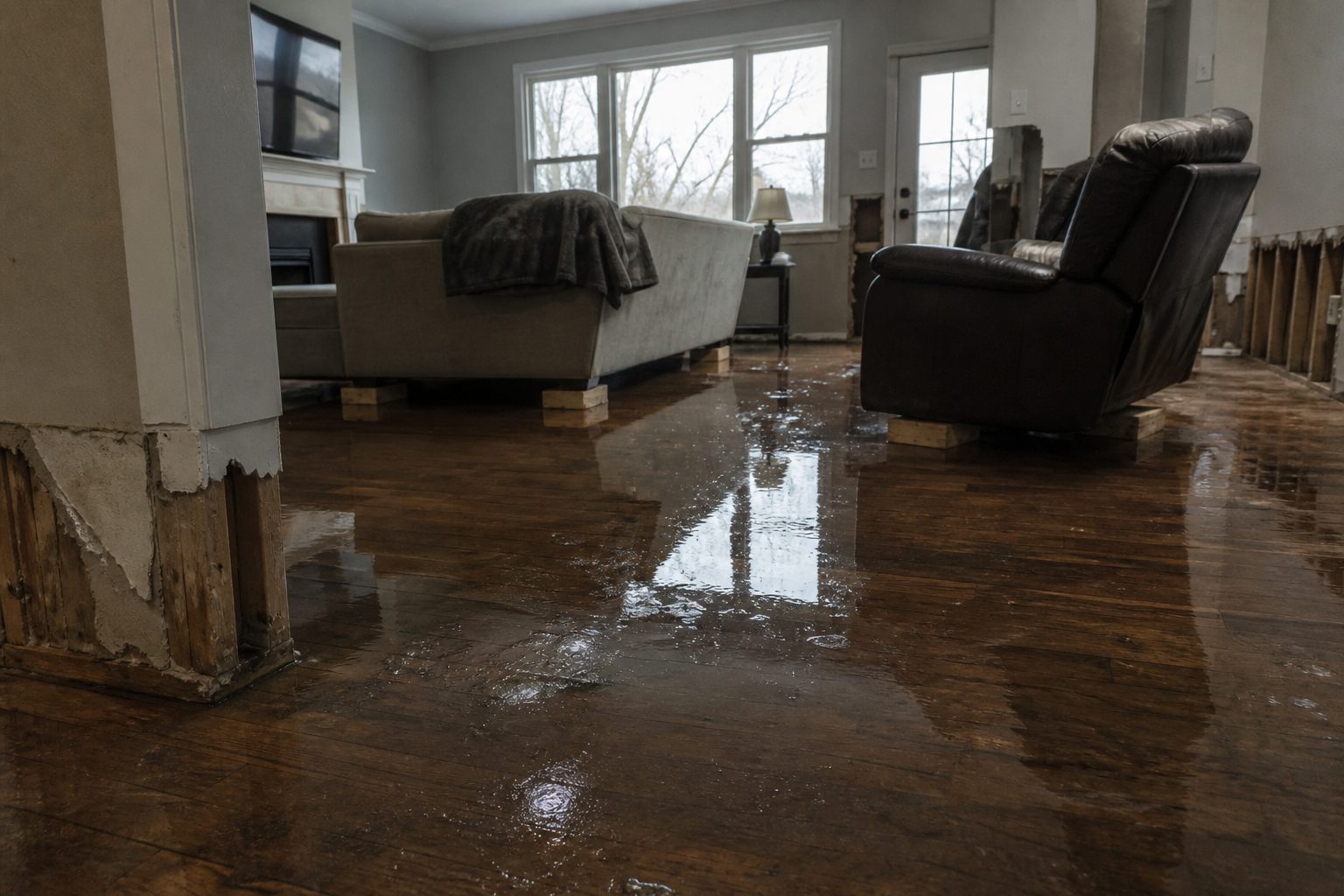
This is a live snapshot as of 3:58 PM CDT Monday, September 21. Conditions change fast — always verify with the National Weather Service for your specific county or ZIP code.
Hale, TX — Flash Flood Warning
Flash Flood Warning issued September 21 at 3:58PM CDT until September 21 at 5:30PM CDT by NWS Lubbock TX
Issued by NWS Lubbock TX. Issue time: 3:58 PM CDT Monday, September 21. Expires: 5:30 PM CDT Monday, September 21.
FFWLUB The National Weather Service in Lubbock has issued a * Flash Flood Warning for… Southwestern Hale County in northwestern Texas… Northeastern Hockley County in northwestern Texas… Southeastern Lamb County in northwestern Texas… Northwestern Lubbock County in northwestern Texas… * Until 530 PM CDT. * At 358 PM CDT, Doppler radar indicated thunderstorms producing heavy rain across the warned area. Between 2 and 3 inches of rain have fallen. Additional rainfall amounts of 1 to 2 inches are possible in the warned area. Flash flooding is ongoing or expected to begin shortly. HAZARD…Flash flooding caused by thunderstorms. SOURCE…Radar indicated. IMPACT…Flash flooding of small creeks and streams, urban areas, highways, streets and underpasses as well as other poor drainage and low-lying areas. * Some locations that will experience flash flooding include… Anton and Spade.
Hail size (NWS parameters): not specified in parameters. Wind gust (NWS parameters): not specified in parameters.
Locations in the warning path, as listed by NWS:
Flash Flood Warning for…
Until 530 PM CDT.
At 358 PM CDT, Doppler radar indicated thunderstorms producing
Some locations that will experience flash flooding include…
Turn around, don’t drown when encountering flooded roads. Most flood deaths occur in vehicles.
Be aware of your surroundings and do not drive on flooded roads.
Stay safe tonight
Turn around, don’t drown. Most flood deaths happen in vehicles — never drive through flooded roadways; six inches of moving water can knock you down, twelve inches can carry a car.
If water enters the home: stay out of standing water where electricity may be present, avoid the basement until water recedes and power is confirmed off, photograph everything before cleanup (documentation matters for insurance), then call a local restoration contractor — water left sitting starts a second wave of damage within a day.
What this means for restoration teams
Translate this warning into job tickets: interior water intrusion through doors, windows, and foundation seepage; saturated carpet and pad; drywall wicking that shows up as a waterline hours later; and mold risk within 24–48 hours wherever porous materials stayed wet. Low-lying areas and urban drainage failures also bring sewage backup calls — the highest-margin, highest-urgency work.
The play: stage extraction and drying equipment now, pre-position dehumidifiers and air movers, keep an on-call rotation through the morning, and capture address, water source, and affected areas on the first call. Field discipline: photo-document before mitigation, moisture-map every affected room, and get the homeowner’s payment responsibility clear in writing before work starts.
FEMA & federal assistance
If the damage is severe, the FEMA Helpline is 1-800-621-3362 (7 a.m.–10 p.m. local, 7 days). Apply at DisasterAssistance.gov, through the FEMA app, or find a recovery center at fema.gov/drc. Basic eligibility: citizenship or qualified status, identity verification, proof of occupancy or ownership, and unmet needs not covered by insurance. Apply as soon as it’s safe.
Looking ahead
When this warning expires, the danger is not automatically over. Creeks and small streams can crest hours after the rain stops, and additional rounds of storms can re-trigger warnings. Watch for NWS updates overnight. For restoration contractors: water-intrusion calls typically start within hours of water receding and keep coming for days as homeowners discover damage behind walls and under flooring.
Verify for your own county or ZIP at weather.gov or your local NWS office page.
This post is for informational purposes and is not an official weather warning. Always follow instructions from local authorities and the National Weather Service.
This is a live snapshot as of 4:01 PM CDT Monday, September 21. Conditions change fast — always verify with the National Weather Service for your specific county or ZIP code.
Hale, TX — Severe Thunderstorm Warning
Severe Thunderstorm Warning issued September 21 at 4:01PM CDT until September 21 at 5:00PM CDT by NWS Lubbock TX
Issued by NWS Lubbock TX. Issue time: 4:01 PM CDT Monday, September 21. Expires: 5:00 PM CDT Monday, September 21.
At 401 PM CDT, a severe thunderstorm was located 4 miles southeast of Spade, or 13 miles east of Littlefield, moving south at 5 mph. HAZARD…Two inch hail and 70 mph wind gusts. SOURCE…Radar indicated. IMPACT…People and animals outdoors will be injured. Expect hail damage to roofs, siding, windows, and vehicles. Expect considerable tree damage. Wind damage is also likely to mobile homes, roofs, and outbuildings. Locations impacted include… Shallowater, Anton, Spade, and New Deal.
Torrential rainfall is occurring with this storm, and will lead to flash flooding. Do not drive your vehicle through flooded roadways. For your protection move to an interior room on the lowest floor of a building.
Stay safe during the storm
Get inside a sturdy building and stay away from windows. Large hail can shatter glass and injure anyone caught outside; damaging winds can bring down trees and power lines with little warning.
If hail damages your home: photograph every slope of the roof, siding, gutters, and windows before anything is repaired — documentation matters for insurance. Then call a local roofing or restoration contractor for an inspection; hail bruising is not always visible from the ground.
What this means for restoration teams
Translate this warning into job tickets: hail-punched roofing (bruised shingles that fail months later if missed), cracked siding, shattered windows and skylights, dented gutters and downspouts, and damaged outdoor HVAC condensers. Water intrusion follows where hail compromised the envelope — the roofer’s repair and the restorer’s dry-out land on the same houses.
The play: coordinate with local roofers on inspection routes — hail jobs pair naturally with restoration drying work when water got in. Stage drying equipment for the intrusion calls, keep an on-call rotation, and capture address, hail size reported, and visible exterior damage on the first call. Field discipline: photo-document the roof from the ground and up close before repairs, and get payment responsibility in writing before work starts.
FEMA & federal assistance
If the damage is severe, the FEMA Helpline is 1-800-621-3362 (7 a.m.–10 p.m. local, 7 days). Apply at DisasterAssistance.gov, through the FEMA app, or find a recovery center at fema.gov/drc. Basic eligibility: citizenship or qualified status, identity verification, proof of occupancy or ownership, and unmet needs not covered by insurance. Apply as soon as it’s safe.
Looking ahead
Once the warning expires, survey your property for hail and wind damage — check the roof, siding, gutters, and outdoor HVAC units. For contractors: hail events produce a long tail of roofing claims; roofers and restoration teams often work the same neighborhoods in the days after a destructive hailstorm, so coordinate early on jobs that need both trades.
Verify for your own county or ZIP at weather.gov or your local NWS office page.
This post is for informational purposes and is not an official weather warning. Always follow instructions from local authorities and the National Weather Service.
Live snapshot as of 1:35 PM PDT (3:35 PM CDT) — the National Weather Service in Lubbock, Texas, has a destructive severe thunderstorm warning in effect for southeastern Lamb County until 4:00 PM CDT. This is one of the dangerous categories of summer storm on the South Plains: 70 mph wind gusts paired with ping pong ball size hail, radar indicated, with the NWS damage threat flagged at considerable. That is the hail-and-wind combination that puts holes in roofs, siding, windows, and vehicles — the exact interior and exterior repair work restoration and roofing crews across the region spend the next week answering calls about.
This is a live snapshot as of 1:35 PM PDT. Conditions change fast — always verify with the National Weather Service for your specific county or ZIP code.
Littlefield / Spade — Severe Thunderstorm Warning
Issuing office: NWS Lubbock TX (weather.gov/lub) Issued: 3:23 PM CDT, Monday, September 21, 2026 Expires: 4:00 PM CDT, Monday, September 21, 2026 Coverage: southeastern Lamb County, TX Source of hazard: Radar indicated Damage threat (NWS): CONSIDERABLE
At 3:23 PM CDT, the severe thunderstorm was located over Spade, about 8 miles east of Littlefield, and was nearly stationary. The official NWS alert headline reads: “A SEVERE THUNDERSTORM WARNING REMAINS IN EFFECT UNTIL 400 PM CDT FOR SOUTHEASTERN LAMB COUNTY.”
Verbatim hazard detail from the warning: “HAZARD…70 mph wind gusts and ping pong ball size hail.” The alert’s parameter block lists max wind gust at 70 MPH and max hail size at 1.50 inches — radar-indicated hail consistent with ping pong ball size.
Locations impacted include: Littlefield and Spade.
Expected impacts, in the NWS’s own words: “People and animals outdoors will be injured. Expect hail damage to roofs, siding, windows, and vehicles. Expect considerable tree damage. Wind damage is also likely to mobile homes, roofs, and outbuildings.”
NWS instruction: “Torrential rainfall is occurring with this storm, and may lead to flash flooding. Do not drive your vehicle through flooded roadways. For your protection move to an interior room on the lowest floor of a building.” Alert source: the NWS alert record via api.weather.gov (VTEC /O.CON.KLUB.SV.W.0262/).
Stay safe right now
A storm that is nearly stationary is one that keeps dropping hail and rain on the same place. If you are in southeastern Lamb County:
Get indoors and away from windows. Ping pong ball size hail shatters windows and dents vehicles — the NWS explicitly warns people and animals outdoors will be injured.
Move to an interior room on the lowest floor of a building. With 70 mph gusts, interior rooms protect you from wind-borne debris and broken glass.
Never drive through flooded roadways. Torrential rainfall is occurring with this storm and may lead to flash flooding. Most flood deaths occur in vehicles — turn around, don’t drown.
Mobile homes need extra respect at 70 mph. The NWS flags wind damage as “also likely” to mobile homes, roofs, and outbuildings. If you are in a mobile home, shelter in a sturdier structure nearby if one is safely reachable.
After it passes: if hail or water breached the roof or windows, photograph everything before cleanup or tarping. Documentation matters for insurance — and water left sitting starts a second wave of damage within a day.
What this means for restoration teams
This is the signature hail/wind event of the South Plains storm season, and it reads like a demand forecast for the week ahead.
Hail first: 1.5-inch hail at near-stationary dwell time over Littlefield and Spade is the profile for roof membrane damage, dented metal roofing, cracked siding, shattered skylights and windows, and body damage on vehicles. The NWS’s own impact line — “Expect hail damage to roofs, siding, windows, and vehicles” — is about as explicit as these warnings get. Expect the call volume for hail inspection and tarping to start within hours of the storm’s passage and run for days as homeowners discover damage.
Wind second: 70 mph gusts on trees and structures, with “considerable tree damage” expected, means downed limbs on roofs, lifted shingles, torn flashing, and damaged mobile homes and outbuildings. Wind-lifted roofing plus the torrential rainfall the NWS notes means water intrusion under the envelope even where the roof wasn’t destroyed.
Water third: “Torrential rainfall is occurring with this storm, and may lead to flash flooding.” A nearly stationary storm trains rain over the same drainage — low-lying areas, underpasses, and poor drainage around foundations take the first hits. Flash-flood intrusions in a storm like this are typically the fast, dirty water that saturates drywall and insulation quickly and starts the 24–48 hour mold clock.
The play: stage equipment now — a storm that parks over a town at 3:30 in the afternoon generates calls before dinner. Pre-position drying assets, keep an on-call rotation through the evening, and capture address, water source, and affected areas on the first call. Photo-document before mitigation, moisture-map every affected room, and keep the homeowner’s payment responsibility clear in writing before work starts.
FEMA & federal assistance
If your property is damaged, the FEMA Helpline is 1-800-621-3362 (7 a.m.–10 p.m. local, 7 days). You can also apply at DisasterAssistance.gov or through the FEMA app, and find recovery centers at fema.gov/drc.
Basic eligibility: citizenship or qualified status, identity verification, proof of occupancy or ownership, and unmet needs not covered by insurance. Apply as soon as it’s safe — you don’t need to wait for an inspector to document the damage first, but keep every photo and receipt.
Looking ahead
The warning expires at 4:00 PM CDT — and with the storm nearly stationary over Spade at issue time, the back edge of the warned area needs to watch for the warning to be extended or renewed rather than cleanly expiring. The NWS updates these products continuously; treat the next NWS statement as the real all-clear, not the clock alone.
Watch overnight: nearly stationary severe storms are exactly the setup that produces additional rounds on the same corridor, and creeks and low-lying drainage in southeastern Lamb County can respond to torrential rainfall well after the hail stops. If you live near low ground, keep an eye on it through the evening.
Demand window note: hail-inspection and water-intrusion calls typically start within hours of the storm passing and keep coming for days as people discover damage — first the tarping and board-up work, then the interior drying once ceilings and windows show their wounds.
Active alerts for your area: weather.gov — enter your ZIP for county-specific warnings.
To verify for your own county or ZIP: go to weather.gov, enter your ZIP code, and check active watches and warnings from the local NWS office page.
This post is for informational purposes and is not an official weather warning. Always follow instructions from local authorities and the National Weather Service.
STATUS: ACTIVE — FLASH FLOOD WARNING
Live snapshot as of 1:23 PM PDT, Monday September 21, 2026. This warning expires at 6 PM EDT. Conditions change fast — always verify with the National Weather Service for your specific county or ZIP code.
NWS Jackson, KY has a flash flood warning in effect for Pike, KY, in effect until 6 PM EDT. Flash Flood Warning issued September 21 at 4:19PM EDT until September 21 at 6:00PM EDT by NWS Jackson KY. For restoration teams, this is the exact interior-flooding jobs restoration teams see most — basements, low-lying first floors, and overwhelmed drainage.
Pike, KY — Flash Flood Warning
Issuing office: NWS Jackson, KY Issued: September 21 at 4:19PM EDT Expires: 6 PM EDT Severity: Severe | Certainty: Likely | Urgency: Immediate
The NWS warning, verbatim: At 419 PM EDT, Doppler radar indicated thunderstorms producing heavy
rain across the warned area. Between 2 and 2.5 inches of rain have
fallen since 2:30 PM in the hardest hit areas. Additional rainfall
amounts of 0.5 to 1 inch are possible in the warned area. Flash
flooding is ongoing or expected to begin shortly.
HAZARD…Flash flooding caused by thunderstorms.
SOURCE…Radar indicated.
IMPACT…Flash flooding of small creeks and streams, urban areas,
highways, streets and underpasses as well as other poor
drainage and low-lying areas.
Some locations that will experience flash flooding include…
Elkhorn City, Cedarville and Belcher.
NWS instruction: Turn around, don’t drown when encountering flooded roads. Most flood
Turn around, don’t drown when encountering flooded roads. Most flood deaths occur in vehicles. Never drive through flooded roadways — it takes only a few inches of moving water to sweep a vehicle. Be especially careful at night, when it is harder to recognize the dangers of flooding. If water enters the home: stay out of standing water where electricity may be present, avoid the basement until water recedes and power is confirmed off, photograph everything before cleanup (documentation matters for insurance), then call a local restoration contractor — water left sitting starts a second wave of damage within a day.
What this means for restoration teams
Overnight flash flooding is a water-mitigation classic: basement flooding, first-floor intrusion in low-lying neighborhoods, overwhelmed sump systems, and sewage backup where drainage systems surcharge. Rainfall totals in flash flood warnings routinely land squarely in the range that produces interior water jobs, not just yard flooding. Saturated drywall, soaked insulation, and flooring exposure follow within hours; the mold clock starts at 24 to 48 hours.
The play: stage extraction and drying equipment now and keep an on-call rotation through the morning — the demand window for flash-flood water intrusion starts within hours of water receding and keeps coming for days as people discover damage. On the first call, capture the address, the water source (rising creek vs. overwhelmed drainage vs. sump failure — the category determines the protocol), and the affected areas. Sewage backup calls need Category 3 handling from the first minute.
Field discipline: photo-document before mitigation; moisture-map every affected room, not just the visibly wet ones; keep the homeowner’s payment responsibility clear in writing before work starts. Schedule the drying plan, not just the extraction.
FEMA & federal assistance
FEMA Helpline: 1-800-621-3362 (7 a.m. to 10 p.m. local time, 7 days a week). You can also apply at DisasterAssistance.gov, through the FEMA app, or find a recovery center at fema.gov/drc. Basic eligibility: U.S. citizenship or qualified status, identity verification, proof of occupancy or ownership, and unmet needs not covered by insurance. Apply as soon as it’s safe to do so.
Looking ahead
This warning expires at 6 PM EDT. Rivers and creeks in the watershed can crest hours after the rain stops — water levels may keep rising even after the warning expires. Watch for additional thunderstorm rounds overnight; saturated ground means even modest additional rain can renew flooding. The restoration demand window is days long: water-intrusion calls typically start within hours of water receding and keep coming as basements get checked, carpet pulled, and musty odors get noticed mid-week.
Verify for your own county or ZIP at weather.gov or the NWS Jackson, KY office page above.
This post is for informational purposes and is not an official weather warning. Always follow instructions from local authorities and the National Weather Service.
Flash Flood Warning issued September 21 at 3:52 PM EDT until September 21 at 6:45 PM EDT by NWS Charleston WV. The National Weather Service in Charleston has issued a Flash Flood Warning covering parts of southwestern Virginia and southern West Virginia: Central Buchanan County and North Central Dickenson County in southwestern Virginia, and Northwestern McDowell County and Southwestern Wyoming County in southern West Virginia.
This is the kind of warning restoration teams know by heart — slow-moving thunderstorms stacking rainfall over small watersheds, with flash flooding of creeks, streets, and low-lying property either ongoing or expected to begin shortly. This is a live snapshot as of 1:05 PM PDT (4:05 PM EDT). Conditions change fast — always verify with the National Weather Service for your specific county or ZIP code.
Per the alert, at 3:52 PM EDT Doppler radar indicated thunderstorms producing heavy rain across the warned area. Between 1 and 2.5 inches of rain have fallen across the warned area. Flash flooding is ongoing or expected to begin shortly.
HAZARD — Flash flooding caused by thunderstorms.
SOURCE — Radar indicated.
IMPACT — Flash flooding of small creeks and streams, urban areas, highways, streets and underpasses, as well as other poor-drainage and low-lying areas.
Some locations that will experience flash flooding include: Grundy, Breaks Interstate, John Flannagan Lake, Big Rock, Bradshaw, Iaeger, Stacy, Roseann, Hurley, Panther, Jolo, Vansant, and Avondale.
The alert is designated AWIPS identifier FFWRLX (VTEC /O.NEW.KRLX.FF.W.0238.260921T1952Z-260921T2245Z/). The original alert can be referenced through the NWS alert feed for the Charleston WV office.
Stay safe
Turn around, don’t drown when encountering flooded roads. Most flood deaths occur in vehicles — never drive through flooded roadways, no matter how shallow the water looks.
Be aware of your surroundings and do not drive on flooded roads. If water enters your home, stay out of standing water where electricity may be present, avoid the basement until the water recedes and the power is confirmed off, and photograph everything before cleanup begins — documentation matters for insurance. Then call a local restoration contractor, because water left sitting starts a second wave of damage within a day.
You can report flooding to the National Weather Service at 800-401-9535, toll free, when you can do so safely.
What this means for restoration teams
This is the signature interior-flooding signature restoration contractors see most: flash flooding of small creeks and streams, urban areas, highways, streets, underpasses, and poor-drainage low-lying areas. Expect the damage mix that follows: interior water intrusion in low-lying structures, saturated drywall and insulation, mold risk beginning within 24–48 hours, and possible sewage backup in the lowest-lying areas where storm systems surcharge.
The play: stage equipment now, pre-position drying assets, and keep an on-call rotation through the evening. Capture address, water source, and affected areas on the first call — flash-flood jobs move fast, and intake discipline on night one is what separates a clean claim from a disputed one.
Field discipline: photo-document everything before mitigation begins, moisture-map every affected room (not just the ones that look wet), and keep the homeowner’s payment responsibility clear in writing before work starts. Flood-impacted properties in areas like Grundy, Bradshaw, and Iaeger may involve basements and crawlspaces — verify power is off before anyone enters standing water.
FEMA and federal assistance
If the damage is significant, the FEMA Helpline is 1-800-621-3362, open 7 a.m. to 10 p.m. local time, 7 days a week. You can also apply at DisasterAssistance.gov, through the FEMA app, or find a recovery center at fema.gov/drc.
Basic eligibility generally includes citizenship or qualified status, identity verification, proof of occupancy or ownership, and unmet needs not covered by insurance. Apply as soon as it is safe to do so — you do not need to wait for the water to recede to start the paperwork.
Looking ahead
This warning expires at 6:45 PM EDT. When it expires, watch for additional rounds of thunderstorms overnight and for creeks and streams to keep rising after the rain stops — flash flooding can arrive downstream even after the warned area dries out.
The next NWS update will land as conditions warrant through the Charleston WV office. For restoration teams, the demand window on flash-flood events typically opens within hours of water receding and keeps coming for days as property owners discover damage that wasn’t visible in the dark.
To verify for your own county or ZIP code, check weather.gov or your local NWS office page — warnings can be extended, upgraded, or cancelled as conditions change.
This post is for informational purposes and is not an official weather warning. Always follow instructions from local authorities and the National Weather Service.
Severe Thunderstorm Warning issued September 21 at 1:54PM CDT until September 21 at 2:45PM CDT by NWS Fort Worth TX The National Weather Service has issued a Severe Thunderstorm Warning for Freestone, TX; Navarro, TX.
At 153 PM CDT, a severe thunderstorm was located near Navarro, or 12 miles southeast of Corsicana, moving southeast at 5 mph.
HAZARD…60 mph wind gusts and quarter size hail.
SOURCE…Emergency management. At 142 PM CDT…nickel to quarter size hail was reported 2 miles south of Navarro with this storm.
IMPACT…Hail damage to vehicles is expected. Expect wind damage to roofs, siding, and trees.
Locations impacted include… Angus, Navarro, Fairfield Lake State Park, Richland-Chambers Reservoir, Fairfield Lake, Mildred, Eureka, Richland, Streetman, and Stewards Mill.
For your protection stay inside a sturdy structure and keep away from windows.
Expected Impacts
Follow official guidance from the National Weather Service and local emergency management. Conditions can change quickly — re-check the forecast before traveling through the affected area.
How This Compares
This is a National Weather Service warning-level alert, one step above a watch — it means the hazardous condition is occurring or imminent in the listed areas.
What Contractors Should Know
Warnings of this type can generate mitigation and recovery demand in the affected area once conditions pass. Document conditions, keep communication lines open with customers, and be ready to respond after the warning expires.
How We Track It
Tygart Media Storm Tracker monitors active National Weather Service warnings around the clock. This pulse was generated automatically from official NWS alert data; all facts above come straight from the alert.
Sources
National Weather Service alert data via api.weather.gov.
Severe Thunderstorm Warning issued September 21 at 1:59PM CDT until September 21 at 3:00PM CDT by NWS Fort Worth TX The National Weather Service has issued a Severe Thunderstorm Warning for Anderson, TX; Freestone, TX; Leon, TX.
SVRFWD
The National Weather Service in Fort Worth has issued a
* Severe Thunderstorm Warning for… Southeastern Freestone County in central Texas… Northeastern Leon County in central Texas… Southwestern Anderson County in central Texas…
* Until 300 PM CDT.
* At 159 PM CDT, a severe thunderstorm was located 7 miles east of Fairfield Lake, or 13 miles east of Fairfield, and is nearly stationary.
HAZARD…60 mph wind gusts and quarter size hail.
SOURCE…Radar indicated.
IMPACT…Hail damage to vehicles is expected. Expect wind damage to roofs, siding, and trees.
* Locations impacted include… Palestine, Elkhart, Montalba, Fairfield Lake State Park, Fairfield Lake, Oakwood, Tucker, Johnson, Cedar Creek, Massey Lake, Red Lake, and Tennessee Colony.
For your protection get inside a sturdy structure and stay away from windows.
Continuous cloud to ground lightning is occurring with this storm. Move indoors immediately. Lightning can kill.
Expected Impacts
Follow official guidance from the National Weather Service and local emergency management. Conditions can change quickly — re-check the forecast before traveling through the affected area.
How This Compares
This is a National Weather Service warning-level alert, one step above a watch — it means the hazardous condition is occurring or imminent in the listed areas.
What Contractors Should Know
Warnings of this type can generate mitigation and recovery demand in the affected area once conditions pass. Document conditions, keep communication lines open with customers, and be ready to respond after the warning expires.
How We Track It
Tygart Media Storm Tracker monitors active National Weather Service warnings around the clock. This pulse was generated automatically from official NWS alert data; all facts above come straight from the alert.
Sources
National Weather Service alert data via api.weather.gov.
Severe Thunderstorm Warning issued September 21 at 3:02PM EDT until September 21 at 3:45PM EDT by NWS Morristown TN The National Weather Service has issued a Severe Thunderstorm Warning for Campbell, TN; Claiborne, TN.
SVRMRX
The National Weather Service in Morristown has issued a
* Severe Thunderstorm Warning for… Northwestern Claiborne County in east Tennessee… Northeastern Campbell County in east Tennessee…
* Until 345 PM EDT.
* At 302 PM EDT, a severe thunderstorm was located near Lot, or 11 miles northeast of La Follette, moving southeast at 5 mph.
HAZARD…60 mph wind gusts and quarter size hail.
SOURCE…Radar indicated.
IMPACT…Hail damage to vehicles is expected. Expect wind damage to roofs, siding, and trees.
* Locations impacted include… Jellico, Fincastle, White Oak, and Clairfield.
For your protection move to an interior room on the lowest floor of a building.
Expected Impacts
Follow official guidance from the National Weather Service and local emergency management. Conditions can change quickly — re-check the forecast before traveling through the affected area.
How This Compares
This is a National Weather Service warning-level alert, one step above a watch — it means the hazardous condition is occurring or imminent in the listed areas.
What Contractors Should Know
Warnings of this type can generate mitigation and recovery demand in the affected area once conditions pass. Document conditions, keep communication lines open with customers, and be ready to respond after the warning expires.
How We Track It
Tygart Media Storm Tracker monitors active National Weather Service warnings around the clock. This pulse was generated automatically from official NWS alert data; all facts above come straight from the alert.
Sources
National Weather Service alert data via api.weather.gov.
Severe Thunderstorm Warning issued September 21 at 2:41PM EDT until September 21 at 3:30PM EDT by NWS Blacksburg VA
This is a live snapshot as of September 21, 2026 at 11:52 AM. Carroll is under an active severe thunderstorm warning right now — issued by NWS Blacksburg VA, set to expire around 3:30 PM EDT. This is the wind- and roof-damage category that fills contractor schedules within hours. Conditions change fast — always verify with the National Weather Service for your specific county or ZIP code.
Issued by the National Weather Service.
Carroll — Severe Thunderstorm Warning
The warning covers: Carroll, VA; Floyd, VA; Patrick, VA
The National Weather Service in BLACKSBURG has issued a
* Severe Thunderstorm Warning for…
Floyd County in southwestern Virginia…
Eastern Carroll County in southwestern Virginia…
Western Patrick County in southwestern Virginia…
* Until 330 PM EDT.
* At 241 PM EDT, a severe thunderstorm was located over Willis,
moving east at 25 mph.
HAZARD…60 mph wind gusts. Heavy Rain.
SOURCE…Radar indicated.
IMPACT…Expect damage to roofs, siding, and trees.
* Locations impacted include…
Floyd…
Indian Valley…
Fancy Gap…
Copper Hill…
Ararat…
Cana…
and Willis.
Locations named in the warning path:
* Locations impacted include…
Safety and response instructions from the alert:
Prepare immediately for damaging winds, as well as deadly cloud to
ground lightning. For your safety, move to an interior room on the
lowest floor of a sturdy building. Stay away from windows.
Locally heavy rain will quickly reduce visibility and result in
ponding of water on roadways, standing water in low lying areas, and
minor flooding of creeks, streams, and areas of poor drainage.
Drivers are urged to slow down and use extra caution to avoid
hydroplaning.
When it is safe to do so, please send your reports of hail of any
size, as well as reports of any wind damage, including downed trees
or large limbs, to the National Weather Service by calling toll free
at 1…8 6 6…2 1 5…4 3 2 4. Reports and pictures can also be
shared on the National Weather Service Blacksburg Facebook page and
on X.
Get inside a sturdy building and away from windows. Hail and wind gusts can turn debris into projectiles in seconds; treat the storm like it’s already on top of you.
After it passes, inspect the roof, siding, and windows from the ground first — photograph any damage before touching anything, then call a local restoration contractor. Hail bruising and lifted shingles let water in long after the storm ends.
What this means for restoration teams
Severe thunderstorm damage at this level means roof and siding hits from large hail, window breakage, and wind-driven water intrusion through damaged envelopes. Hail bruising often isn’t visible from the ground — free inspections are the honest door-opener.
The play: stage ladders, tarps, and inspection crews; pre-position for the morning after. Capture the address, hail/wind damage observed, and roof access notes on the first call.
Field discipline: photo-document before mitigation, moisture-map every affected room, and keep the homeowner’s payment responsibility clear in writing before work starts.
FEMA & federal assistance
FEMA Helpline: 1-800-621-3362 (7 a.m.–10 p.m. local time, 7 days a week). You can also apply at DisasterAssistance.gov, through the FEMA app, or find a recovery center at fema.gov/drc.
Basic eligibility: U.S. citizenship or qualified status, identity verification, proof of occupancy or ownership, and unmet needs not covered by insurance. Apply as soon as it’s safe — you don’t have to wait for a disaster declaration for your county to start documenting.
Looking ahead
When this warning expires, the risk doesn’t end: damaged roofs keep letting water in with every follow-up shower — the repair clock starts now.
Watch the National Weather Service for follow-up statements or new warnings overnight. The demand window for restoration work opens within hours and stays open for days.
To verify for your own county or ZIP: go to weather.gov, enter your location, and check active alerts — or find your local NWS office page and read its current warnings directly.
This post is for informational purposes and is not an official weather warning. Always follow instructions from local authorities and the National Weather Service.
This is a live Monday morning snapshot of U.S. local-storm activity as of early Monday, September 21, 2026. The Storm Prediction Center 1300 UTC Day 1 Convective Outlook holds a Marginal Risk of severe thunderstorms from parts of the Southeast into the central Appalachians, and a second Marginal Risk over the Texas South Plains. Isolated damaging wind gusts of 50 to 60 mph are the main threat along the front this afternoon. Isolated large hail and severe gusts are possible later today on the Caprock. No convective watches are currently valid. Severe Thunderstorm Watch 674, last night’s eastern Colorado and extreme western Kansas box, has expired.
These are county-scale thunderstorms, not a U.S. mainland tropical landfall. Tropical Storm Fay is several hundred miles southwest of the Azores and is not a U.S. land threat. Restoration exposure today is leftover tree and roof work from last night’s Ohio Valley and High Plains cells, plus a new wind-damage pulse if the front fires this afternoon from Kentucky into West Virginia and Virginia. Conditions change fast. Verify with the National Weather Service for the specific county or ZIP before you roll.
Overnight into this morning
Radar this morning shows a parade of three mesoscale convective vortices moving east over the Ohio Valley into the central Appalachians, mostly on the cool side of a cold front. That is leftover organization from Sunday night, not a new watch. Local storm reports on the SPC day that closed at 12 UTC Monday include no tornadoes. The hail corridor was eastern Colorado: golf-ball to baseball-size stones around Holyoke, Alvin, Genoa, Boyero, Wild Horse, Kit Carson, Eads, and south of Brandon in Phillips, Yuma, Lincoln, Cheyenne, and Kiowa counties. One social-media measurement near Brandon was 3.10 inches. A spotter windshield was damaged near Wild Horse. A separate 2.00-inch hail report came from Liberty in Union County, Indiana.
Wind reports overnight were the restoration ticket east of the High Plains. Trees and lines came down across Christian, Greene, Jasper, and Lawrence counties in southwest Missouri, including a tree on a house in Pierce City. Illinois reports included a shed roof in Jasper County, 64 mph at Olney-Noble Airport, and power-line damage near Witt, Ramsey, and Noble. Southwestern Ohio logged trees in Kettering, Bellbrook, and Greene County after midnight. After 3 UTC, NWS Charleston territory picked up trees and blocked roads in Vinton and Meigs counties, Ohio, and in Wirt, Calhoun, and Gilmer counties, West Virginia, including more than 1,200 customers without power along Highway 7 north-northeast of Syracuse. Separate tree-down reports ran through Anderson and Laurens counties in South Carolina, Walton County, Georgia, and a string of Alabama, Georgia, and Florida Panhandle counties from Taylor and Iron City to De Funiak Springs and I-10 mile marker 70.
Flash flood warning posts already on this desk overnight covered pieces of Muskingum, Washington, Morgan, and Gallia counties in Ohio and Braxton plus north-central West Virginia. Those warnings were timed to expire in the early morning hours. Treat them as just-hit water, not a new outlook. Confirm county status on weather.gov before you treat a warning as still live.
What is live this morning
No SPC watches are valid as of 1136 UTC Monday. The Day 1 outlook valid 1300 UTC Monday through 1200 UTC Tuesday is Marginal only. The front this afternoon is forecast from northern Mississippi northeast to western Virginia. Dewpoints ahead of it run upper 60s to lower 70s from the lower Mississippi Valley into West Virginia. SPC expects scattered to numerous single-cell and multicell storms after peak heating, with the better flow on the northern edge of the risk — Kentucky, West Virginia, and Virginia. Stronger downdrafts can produce 50 to 60 mph gusts and pockets of wind damage before cells weaken in the early evening.
The Texas South Plains Marginal is a separate, isolated pulse. A front and residual outflow drape the Caprock this afternoon. Guidance supports scattered storms in a moist plume during peak heating, with a couple of stronger cells capable of large hail and severe gusts before they die in the evening.
The Weather Prediction Center Day 1 Excessive Rainfall Outlook page still carried Sunday’s discussion into the 12 UTC Monday valid end, with Slight Risk language over portions of the Midwest and Ohio Valley plus the northern High Plains from the prior period. That is the moisture that already produced last night’s Ohio–West Virginia flood warnings. Use the live WPC graphic and local NWS flash-flood products for today’s water overlay rather than treating Sunday’s Slight as a new box.
Hotspot 1 — Kentucky, West Virginia, Virginia, and the central Appalachians
This is the northern edge of today’s Marginal Risk and the part of the front with slightly stronger flow. Cities and counties to watch: Lexington and eastern Kentucky; Charleston, Huntington, Parkersburg, and the central West Virginia counties that already took trees overnight; western and northern Virginia including the Shenandoah and the Richmond-to-Charlottesville fringe of the outlook line. SPC maps the Marginal from near Greenville, Mississippi, northeast through Kentucky to near Parkersburg, then east toward Elkins, Charlottesville, and Richmond before dropping south through Raleigh and Athens toward Montgomery and Jackson.
Restoration read: wind first, water second. Last night already put trees on roads and lines in Meigs, Wirt, Calhoun, and Gilmer. Another round of 50–60 mph gusts this afternoon is more of the same — roof, siding, service drops — not a regional derecho. If a cell trains on ground that flooded overnight, treat that ZIP as a water job by evening.
Hotspot 2 — Southeast ahead of the front
The same Marginal Risk covers central Mississippi, Alabama, northern Georgia, and the western Carolinas. Instability can peak in the 2000 to 3000 J/kg range from central Mississippi into western North Carolina, but deep-layer shear is weak. Mode is single cells and disorganized multicells. Sunday evening already produced trees in Anderson and Laurens, South Carolina; Monroe and Walton, Georgia; and the Florida–Alabama line. Today is a repeat isolated-wind desk, not a watch.
Restoration read: stage locally if your county is on the warm side of the front. Do not move a regional crew on a Marginal that SPC itself frames as isolated 50–60 mph gusts.
Hotspot 3 — Texas South Plains, plus leftover High Plains hail
The second Marginal sits from near Clovis and Hobbs across the Caprock toward Childress and Big Spring. Isolated large hail and severe gusts later today are the threat. That is not last night’s Colorado supercell corridor. Last night’s work is already on the books in Cheyenne, Kiowa, Lincoln, Yuma, and Phillips counties — baseball hail, damaged glass, and agricultural hits. Do not send the same crew to Lubbock this afternoon and Eads this morning without checking which county actually has a warning now.
Just hit
Sunday afternoon’s High Plains Slight Risk and Watch 674 are closed. The verified story there is large hail, not a tornado. Southwest Missouri trees, Illinois wind, Ohio–West Virginia overnight trees and flash-flood warnings, and scattered Southeast wind reports are the other closed tickets. Tropical Storm Fay is not a U.S. land story.
Pulse table
Region
Main threats
SPC / NWS level
Status this morning
KY / WV / VA / central Appalachians
Isolated damaging wind 50–60 mph, lightning
SPC Marginal
Afternoon pulse; no watch
MS / AL / GA / western Carolinas
Isolated wind, wet microbursts
SPC Marginal
Diurnal; no watch
Texas South Plains / Caprock
Isolated large hail, severe gusts
SPC Marginal
Late afternoon–evening
Eastern Colorado High Plains
Baseball hail, glass, crop
Watch 674 expired
Just-hit / aftermath
SW Missouri / Illinois / SW Ohio
Trees, lines, isolated structural
LSRs overnight
Just-hit
SE Ohio / north-central WV
Trees, flash flood leftover
Overnight FFWs expired or expiring
Aftermath / check county
Atlantic vs. U.S. mainland
Fay near the Azores; no U.S. formation
NHC TWO
Quiet on the mainland
What this means for restoration teams
Fifty to sixty miles an hour is roof, siding, gutter, and tree-on-structure work. Last night’s Colorado hail is a glass and roof-inspection desk in a handful of High Plains counties, not a regional CAT. Ohio and West Virginia water from overnight flash-flood warnings is extraction and a 24–48 hour mold clock where water entered. Do not staff today’s Marginal as if Watch 674 were still up.
Property owners should photograph damage in daylight if it is safe, call the carrier, and start extraction the same day if water is inside. Turn around, don’t drown on leftover high water in southeast Ohio and north-central West Virginia.
What this is not
This is not a Slight Risk day, not a live watch, and not a U.S. mainland hurricane landfall. The work today, if it verifies, will be scattered: a wind swath through a Kentucky or West Virginia county, a hailer on the Caprock, leftover trees from Sunday night. That is the local-storm pattern this desk should staff.
Looking ahead
The next Day 1 outlook is scheduled by 1630 UTC. SPC Day 2 is also Marginal. Day 3 is currently no severe thunderstorms. Watch the afternoon Storm Tracker update rather than assuming this morning’s Marginal is the last line of the week.
Sources and how to verify
Primary sources: NOAA Storm Prediction Center Sep 21, 2026 1300 UTC Day 1 Convective Outlook (Smith/Mead, 0733 AM CDT); SPC current watches page updated 1136 UTC Monday with no valid watches and most recently issued Watch 674; SPC preliminary local storm reports for 20260920 1200 UTC through 20260921 1159 UTC; Weather Prediction Center Day 1 Excessive Rainfall Outlook page; National Hurricane Center Atlantic Tropical Weather Outlook 800 AM EDT Monday; National Weather Service warning text already logged on this desk for southeast Ohio and north-central West Virginia.