
Tag: storm tracker 2026

  • Severe Thunderstorm Warning: Washington County, AL Until 8 PM CDT

    Severe Thunderstorm Warning: Washington County, AL Until 8 PM CDT

    A Severe Thunderstorm Warning is in effect for Washington County, Alabama until 8:00 PM CDT, issued by the National Weather Service in Mobile, Alabama at 7:08 PM CDT on Monday, September 21, 2026. This is a radar-indicated severe thunderstorm carrying 70 mph wind gusts and ping pong ball size hail across northwestern Washington County — including Chatom and Fruitdale.

    For restoration contractors in southwest Alabama, this is the call type that keeps coming for days: roof and siding damage from wind-driven hail, shattered windows, downed trees punching into roofs, and mobile homes taking the hardest hits. This is a live snapshot as of 7:15 PM CDT. Conditions change fast — always verify with the National Weather Service for your specific county or ZIP code.

    Northwestern Washington County — Severe Thunderstorm Warning

    The National Weather Service in Mobile issued this warning at 7:08 PM CDT, effective immediately, expiring at 8:00 PM CDT Monday. The warning covers northwestern Washington County, Alabama.

    Per the NWS alert, at 7:07 PM CDT a severe thunderstorm was located 6 miles north of Chatom, moving southwest at 20 mph. The threat is radar indicated. The NWS hazard line reads: “70 mph wind gusts and ping pong ball size hail.” The thunderstorm damage threat is rated CONSIDERABLE.

    Locations impacted include: Chatom and Fruitdale.

    Expected impacts, verbatim from the NWS: “People and animals outdoors will be injured. Expect hail damage to roofs, siding, windows, and vehicles. Expect considerable tree damage. Wind damage is also likely to mobile homes, roofs, and outbuildings.”

    Ping pong ball size hail is 1.50 inches — at that size, every exposed roof face, vinyl siding panel, window, and vehicle in the storm’s path is a potential damage point. The 70 mph gusts cross the destructive threshold: at that speed, wind damage stops being about debris and starts being about the structure itself. The storm’s southwest movement at 20 mph keeps the damage corridor aimed along the Chatom–Fruitdale axis through the remainder of the warning window.

    Verify live: the issuing office is NWS Mobile, Alabama; the alert source is api.weather.gov.

    Stay safe tonight

    The NWS instruction for this warning: “For your protection move to an interior room on the lowest floor of a building. Prepare immediately for large hail and damaging winds. People outside should move to a shelter, inside a strong building and away from windows.”

    Hail is a projectile hazard — get inside and stay there. A 70 mph gust can turn patio furniture, grills, trampolines, and unsecured outdoor equipment into missiles; if you are in a vehicle, pull off the road and away from trees and power lines. Never take shelter under highway overpasses — traffic risk and wind-tunnel effects make them worse, not safer. If you are in a mobile home, leave it for a sturdier structure now: mobile homes are specifically called out in this warning’s damage expectation.

    After the storm passes, treat everything with suspicion: stay clear of downed power lines (report them to the utility, never approach), check the roof from the ground before climbing anything, and photograph everything before you touch it — broken shingles, hail dents on gutters and vents, cracked windows, fallen limbs. That documentation is the backbone of the insurance file.

    What this means for restoration teams

    This is the signature damage cocktail for this lane: hail + high wind on residential roofing stock. Wind-driven hail at 70 mph doesn’t just dent — it cracks composition shingles, knocks granules off at scale (functional damage even where the shingle still lies flat), punctures soft metals (gutters, downspouts, vents), and breaks window glazing on the windward faces. Trees coming down add the second damage class: puncture wounds through roof decks, crushed outbuildings, and crushed vehicles.

    The play: stage tarps, ridge-vent patches, and temporary window board-up materials now — not after the first call comes in. Keep an on-call rotation through the morning, because hail-roof calls do not all land tonight; homeowners discover the damage tomorrow and the day after, when the light is better and the contractor they Googled first gets the job. Pre-position one crew with drying equipment anyway — wind-torn roof decks plus any overnight rain behind this system means interior water intrusion shows up fast.

    Field discipline: photo-document every elevation before mitigation — hail claims live or die on the “before” record. Map granule loss per roof plane, note dent diameter on soft metals (adjusters key to the 1.50-inch hail tag in this warning, so measure and photograph your reference), moisture-map any interior rooms under a breached deck, and keep the homeowner’s payment responsibility clear in writing before the tarp goes up.

    The roofer overlap: hail this size is the trigger for roofer outreach. The roofing claim volume in Chatom and Fruitdale will be real within 48 hours. Any contractor with a roofing network should be moving on it tonight — not as a sales blast, but as the first-call partner roofers actually need when the queue forms.

    Local emergency contacts

    Washington County EMA in Alabama is the local emergency management point of contact. I did not have verified current phone numbers from the NWS alert, so I am not listing them here — contact details pulled from memory go stale fast, and an emergency post is no place for a wrong number. Check the NWS Mobile page and the Washington County, Alabama official website for current emergency contacts.

    FEMA & federal assistance

    If the damage is severe, the FEMA Helpline is 1-800-621-3362 (7 a.m.–10 p.m. local, 7 days). Apply at DisasterAssistance.gov, through the FEMA mobile app, or find a recovery center at fema.gov/drc.

    Basic eligibility: U.S. citizenship or qualified non-citizen status, identity verification, proof of occupancy or ownership, and unmet needs not covered by insurance. Document the damage first, then apply as soon as it is safe — the application does not require waiting for the insurance process to finish.

    Looking ahead

    The warning expires at 8:00 PM CDT. When it expires, watch for two things: (1) additional rounds behind this storm — the Gulf Coast air mass in mid-September keeps re-firing evening cells, and a second warning can drop on a different set of towns before midnight; (2) any rain that falls through wind-torn roof decks overnight, which is the classic way a “roof claim” becomes a “roof plus interior water claim” by morning.

    Demand window note: hail and wind claims start within hours and keep coming for days. The first wave tonight is the tarping and emergency-board-up calls; the second wave over the next 48 hours is the roofing estimates; the third wave, sometimes a week out, is the interior water and mold callbacks from roofs that were breached but never dried. Capture address, hail exposure face, and affected areas on the first call — the contractors who capture clean data tonight win the follow-up work.

    Sources & how to verify

    To verify for your own county or ZIP: go to weather.gov, enter your location, and check the active alerts — or follow the NWS Mobile office page directly.

    This post is for informational purposes and is not an official weather warning. Always follow instructions from local authorities and the National Weather Service.

  • Flash Flood Warning: Washington County, Virginia Area Until 10:30 PM EDT

    Flash Flood Warning: Washington County, Virginia Area Until 10:30 PM EDT

    Published Monday, September 21, 2026 — this is a live snapshot of an active National Weather Service warning. Conditions change fast; always verify with the National Weather Service for your specific county or ZIP code.

    The National Weather Service in Morristown, Tennessee issued a Flash Flood Warning at 7:37 PM EDT on September 21, 2026, for southeastern Washington County in southwestern Virginia, including the town of Damascus. The warning runs until 10:30 PM EDT. Doppler radar indicated thunderstorms producing heavy rain across the warned area, and flash flooding is ongoing or expected to begin shortly. For restoration teams, a flash flood warning over a defined mountain-valley town like Damascus is the classic small-footprint, high-urgency call profile — fewer calls, but each one severe.

    Southeastern Washington County, Virginia — Flash Flood Warning

    Issuing office: National Weather Service Morristown, TN
    Issued: 7:37 PM EDT, September 21, 2026
    Expires: 10:30 PM EDT, September 21, 2026

    Hazard detail (per NWS, verbatim): HAZARD… Flash flooding caused by thunderstorms. SOURCE… Radar indicated. At 7:37 PM EDT, Doppler radar indicated thunderstorms producing heavy rain across the warned area. Flash flooding is ongoing or expected to begin shortly.

    Warned area: Southeastern Washington County in southwestern Virginia.

    Locations that will experience flash flooding include: Damascus.

    Expected impacts: Flash flooding of small creeks and streams, urban areas, highways, streets and underpasses, as well as other poor drainage and low-lying areas.

    Damascus sits along the upper Tennessee River headwaters near the Virginia–Tennessee state line, and the small creeks feeding the town can rise fast on heavy rain over steep terrain. Track the alert directly from the issuing office: NWS Morristown, TN.

    Stay safe tonight

    Turn around, don’t drown when encountering flooded roads. Most flood deaths occur in vehicles. Be especially cautious at night, when it is harder to recognize the dangers of flooding — and mountain roads near Damascus offer very few escape routes once water is over the pavement.

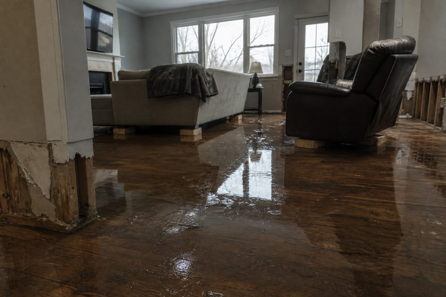
    If water enters your home: stay out of standing water where electricity may be present. Avoid the basement until water recedes and power is confirmed off. Photograph everything before cleanup — documentation matters for insurance. Then call a local restoration contractor; water left sitting starts a second wave of damage within a day.

    What this means for restoration teams

    This is a single-town warning — Damascus and its immediate surroundings — which means the call volume will be small but the severity high. Mountain-valley flash floods move fast and hit hard: expect basement flooding, foundation seepage under hydrostatic pressure, washed-out crawlspaces, and saturated drywall on ground floors. In steep terrain, runoff carries mud and debris, so interiors may need full contamination-crew protocols, not just drying.

    The play: stage equipment for a short, sharp response. One crew on standby through the evening is enough for a warning this tight — but keep them loaded: extractors, air movers, dehumidifiers, and antimicrobial for mud-carrying intrusions. On the first call, capture the address, the water source (creek overflow, hillside runoff, road drainage), and every affected area. Mountain-road flooding can also cut access — plan your route to Damascus before rolling.

    Field discipline: photo-document before mitigation starts. Moisture-map every affected room, including upper floors where wind-driven rain may have entered alongside the flooding. Keep the homeowner’s payment responsibility clear in writing before work starts — small-town storm calls often arrive from people who have never hired a restoration company.

    FEMA & federal assistance

    If the flooding causes serious damage: FEMA Helpline 1-800-621-3362 (7 a.m.–10 p.m. local time, 7 days a week), or apply at DisasterAssistance.gov and through the FEMA app. Find local recovery centers at fema.gov/drc. Basic eligibility: citizenship or qualified status, identity verification, proof of occupancy or ownership, and unmet needs not covered by insurance. Apply as soon as it is safe to do so.

    Looking ahead

    The warning expires at 10:30 PM EDT, but mountain streams often peak after the rain ends — watch for flood statements from the Morristown office if creeks around Damascus stay high. Saturated hillsides also raise the landslide and debris-flow risk on the roads in and out of town overnight.

    For contractors, the demand window is short and immediate: water-intrusion calls typically start within hours of water receding and keep coming for days as people discover damage. In a town this size, expect the full call volume inside 24 hours — be ready to say yes or no quickly, because the second wave of discovery calls will find whoever answered the first.

    Sources & how to verify

    • NWS Morristown, TN — issuing office; alert id tracked via api.weather.gov
    • weather.gov — enter your county or ZIP code to verify current warnings for your area

    This post is for informational purposes and is not an official weather warning. Always follow instructions from local authorities and the National Weather Service.

  • Flash Flood Warning: Central West Virginia Area Until 10:45 PM EDT

    Flash Flood Warning: Central West Virginia Area Until 10:45 PM EDT

    Published Monday, September 21, 2026 — this is a live snapshot of an active National Weather Service warning. Conditions change fast; always verify with the National Weather Service for your specific county or ZIP code.

    The National Weather Service in Charleston, West Virginia issued a Flash Flood Warning at 7:38 PM EDT on September 21, 2026, covering parts of five counties across central and southeastern West Virginia. The warning runs until 10:45 PM EDT. Doppler radar indicated thunderstorms producing heavy rain — between 1 and 2.5 inches of rain had already fallen at issue time, with an additional 1 to 2 inches possible. Flash flooding is ongoing or expected to begin shortly. For restoration teams, this is the exact interior-flooding profile that generates their most urgent residential and commercial jobs.

    Northeastern Boone, Southeastern Kanawha, Southwestern Clay, Northwestern Fayette & West Central Nicholas — Flash Flood Warning

    Issuing office: National Weather Service Charleston, WV
    Issued: 7:38 PM EDT, September 21, 2026
    Expires: 10:45 PM EDT, September 21, 2026

    Hazard detail (per NWS, verbatim): HAZARD… Flash flooding caused by thunderstorms. SOURCE… Radar indicated. At 7:38 PM EDT, Doppler radar indicated thunderstorms producing heavy rain across the warned area. Between 1 and 2.5 inches of rain have fallen. Additional rainfall amounts of 1 to 2 inches are possible in the warned area. Flash flooding is ongoing or expected to begin shortly.

    Warned areas: Northeastern Boone County in central West Virginia, Southeastern Kanawha County in central West Virginia, Southwestern Clay County in north central West Virginia, Northwestern Fayette County in southeastern West Virginia, and West Central Nicholas County in southeastern West Virginia.

    Locations that will experience flash flooding include: Montgomery, Chesapeake, Marmet, Belle, Cedar Grove, East Bank, Glasgow, Smithers, Gauley Bridge, Pratt, Powellton, Handley, Pond Gap, Sharon, Dawes, Bentree, Eskdale, Swiss, Indore and Bickmore. This also includes the West Virginia Turnpike between mile markers 73 and 90.

    Expected impacts: Flash flooding of small creeks and streams, urban areas, highways, streets and underpasses, as well as other poor drainage and low-lying areas.

    Track the alert directly from the issuing office: NWS Charleston, WV.

    Stay safe tonight

    Turn around, don’t drown when encountering flooded roads. Most flood deaths occur in vehicles. Be especially cautious at night, when it is harder to recognize the dangers of flooding.

    If water enters your home: stay out of standing water where electricity may be present. Avoid the basement until water recedes and power is confirmed off. Photograph everything before cleanup — documentation matters for insurance. Then call a local restoration contractor; water left sitting starts a second wave of damage within a day.

    Report flooding to the National Weather Service by calling toll free 800-401-9535, when you can do so safely.

    What this means for restoration teams

    A multi-county flash flood warning across the Kanawha Valley corridor is the signature night for water-damage work. Expect calls from Montgomery, Marmet, Belle, Cedar Grove, and the towns along the WV Turnpike corridor. This is interior water intrusion: saturated drywall and insulation, basement flooding, and mold risk within 24 to 48 hours if drying doesn’t start immediately. Low-lying areas along small creeks and streams are also candidates for sewage backup — treat every gray-water intrusion accordingly until the water source is confirmed.

    The play: stage equipment now. Pre-position drying assets — air movers, dehumidifiers, extractors — so a crew can roll the moment the water recedes. Keep an on-call rotation through the morning, because flash-flood calls rarely arrive during the warning itself; they arrive when homeowners come home, wake up, or discover the basement hours later. Capture three things on the first call: the address, the water source (rising creek, street runoff, sewer backup), and every affected area. That triage decides your dispatch order.

    Field discipline: photo-document before mitigation starts. Moisture-map every affected room, not just the obviously wet ones — water wicks into drywall and under flooring beyond what the eye sees. Keep the homeowner’s payment responsibility clear in writing before work starts. With 1 to 2.5 inches already on the ground and more possible, this is a multi-call evening; triage the occupied homes with standing water first.

    FEMA & federal assistance

    If the flooding causes serious damage: FEMA Helpline 1-800-621-3362 (7 a.m.–10 p.m. local time, 7 days a week), or apply at DisasterAssistance.gov and through the FEMA app. Find local recovery centers at fema.gov/drc. Basic eligibility: citizenship or qualified status, identity verification, proof of occupancy or ownership, and unmet needs not covered by insurance. Apply as soon as it is safe to do so.

    Looking ahead

    The warning expires at 10:45 PM EDT, but the water story doesn’t end there. Small creeks and streams in the Kanawha, Coal, and Elk River watersheds can crest hours after the rain stops, and saturated ground means any additional round of storms overnight re-floods faster than the first. Watch for NWS updates from the Charleston office through the night — flash flood warnings can be extended or replaced with flood warnings as rivers respond.

    For contractors, the demand window is just opening: water-intrusion calls typically start within hours of water receding and keep coming for days as people discover damage — the slow basement leak behind the furnace, the carpet that smells wrong on Tuesday. Stay staffed through mid-week on this one.

    Sources & how to verify

    • NWS Charleston, WV — issuing office; alert id tracked via api.weather.gov
    • weather.gov — enter your county or ZIP code to verify current warnings for your area

    This post is for informational purposes and is not an official weather warning. Always follow instructions from local authorities and the National Weather Service.
  • Flash Flood Warning: Bertie County Area Until 9:45 PM EDT

    Flash Flood Warning: Bertie County Area Until 9:45 PM EDT

    Flash Flood Warning — Bertie County, North Carolina, until 9:45 PM EDT. The National Weather Service in Wakefield issued the warning at 6:47 PM EDT on Monday, September 21, after Doppler radar indicated thunderstorms producing heavy rain across the county. Between 1 and 3 inches have already fallen, the expected rainfall rate is 2 inches in 30 minutes, and up to 2 additional inches are possible. Flash flooding is ongoing or expected to begin shortly. A 2-inch-in-30-minutes rate is the number that matters here — it overwhelms ditches, culverts, and low-lying roads long before the totals look dramatic, and it is exactly the profile behind the interior-flooding jobs restoration teams see most. This is a live snapshot as of 7:05 PM EDT. Conditions change fast — always verify with the National Weather Service for your specific county or ZIP code.

    Bertie County — Flash Flood Warning

    Issuing office: NWS Wakefield (KAKQ). Issued: 6:47 PM EDT, Monday, September 21. Expires: 9:45 PM EDT, Monday, September 21. VTEC: /O.NEW.KAKQ.FF.W.0093 — a brand-new warning, not a continuation.

    The hazard, in the alert’s own words: “Flash flooding caused by thunderstorms.” Source: Doppler radar indicated. The details: “At 647 PM EDT, Doppler radar indicated thunderstorms producing heavy rain across the warned area. Between 1 and 3 inches of rain have fallen. The expected rainfall rate is 2 inches in 30 minutes. Additional rainfall amounts up to 2 inches are possible in the warned area. Flash flooding is ongoing or expected to begin shortly.”

    Locations that will experience flash flooding include: Windsor and Quitsna.

    Expected impacts, per the alert: flash flooding of small creeks and streams, urban areas, highways, streets and underpasses, as well as other poor drainage and low-lying areas.

    Northeastern North Carolina’s coastal-plain drainage was built for steady rain, not cloudburst rates. When 2 inches falls in half an hour, roadside ditches overtop, low-water crossings on rural routes go under, and water finds the lowest finished floor in the neighborhood. Windsor sits in the warned polygon’s named path — the town’s low-lying streets and underpasses are the first to pond.

    Report flooding: the alert asks residents to call 757-899-2415, post to the NWS Wakefield Facebook page, or use X @NWSWAKEFIELDVA.

    Alert source: NWS alert (api.weather.gov) · Issuing office: NWS Wakefield

    Stay safe tonight

    Turn around, don’t drown. Most flood deaths occur in vehicles — never drive through a flooded roadway, and be especially cautious after dark when it is harder to recognize the dangers of flooding. Rural routes around Windsor and Quitsna have low-water crossings that can go from passable to deadly between one trip and the next.

    If water gets into your home: stay out of standing water where electricity may be present, avoid the basement until the water recedes and the power is confirmed off, and photograph everything before cleanup begins — documentation is what turns a chaotic night into a payable claim. Then call a local restoration contractor. Water left sitting starts a second wave of damage within a day as drywall wicks moisture upward and the mold clock starts.

    What this means for restoration teams

    This is a rate event, not a totals event — and the operator read follows the rate. When rainfall hits 2 inches in 30 minutes, the call mix runs:

    • Crawlspace and slab intrusion in low-lying homes — hydrostatic pressure pushes water through foundation walls and slab joints even in houses that have never flooded. Bertie County’s older housing stock around Windsor is especially exposed.
    • Saturated drywall at the base of walls — capillary wicking starts within hours; expect a 12-to-24-inch cut line in finished spaces by morning.
    • Mold risk inside 24–48 hours in any space that stayed wet overnight without airflow — and in a warm September coastal plain, the clock runs fast.
    • Sewage backup in low-lying areas — overwhelmed storm systems push back through floor drains. Category 3 water changes the job (and the price) entirely; confirm the water source on the first call.
    • Roadway and underpass flooding that strands vehicles — contents and vehicle-interior jobs follow stranded-car calls.

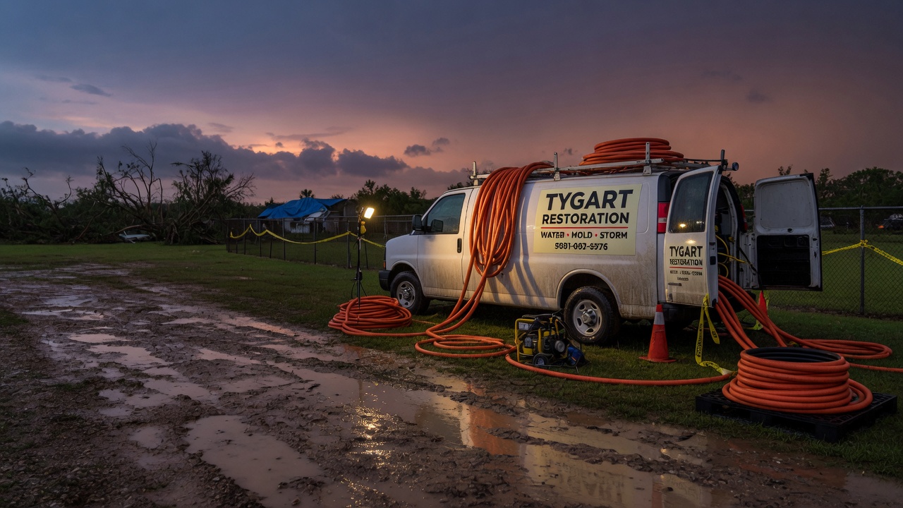
    The play: stage extraction equipment and dehus now, keep an on-call rotation through the 9:45 PM EDT expiry and past it — the first calls land as water recedes, not while it is falling. Capture address, water source, and every affected area on the first call; photograph and moisture-map every room before mitigation starts; and keep the homeowner’s payment responsibility clear in writing before work starts.

    FEMA & federal assistance

    If the damage turns out to be widespread, help exists beyond insurance. The FEMA Helpline is 1-800-621-3362 (7 a.m.–10 p.m. local time, 7 days a week). You can also apply at DisasterAssistance.gov, through the FEMA app, or find a recovery center at fema.gov/drc. Basic eligibility: U.S. citizenship or qualified status, identity verification, proof of occupancy or ownership, and unmet needs not covered by insurance. Apply as soon as it is safe to do so — FEMA cannot duplicate insurance benefits, but it can cover what insurance does not.

    Looking ahead

    The warning expires at 9:45 PM EDT. Watch for additional rounds: the alert allows up to 2 more inches, and at a 2-inches-per-30-minutes rate, one more cell is all it takes to re-flood every low spot that just drained. Creeks and low-water crossings often crest after the rain stops. The next NWS update lands if the polygon is extended or upgraded; a fresh warning would carry a new VTEC line.

    Demand window: water-intrusion calls typically start within hours of water receding and keep coming for days as people discover damage — wet carpet found Tuesday morning, a musty crawlspace found Thursday. Contractors who answer the phone tonight book the week.

    Sources & how to verify

    To verify for your own county or ZIP: start at weather.gov, enter your ZIP, or open your local NWS office page and check active alerts. Warnings are polygon-based — “Bertie County” in a headline may not include your side of the county.

    This post is for informational purposes and is not an official weather warning. Always follow instructions from local authorities and the National Weather Service.

  • Tornado Warning: Lincoln, WV Area Until 7:15 PM EDT

    Tornado Warning: Lincoln, WV Area Until 7:15 PM EDT

    Active now

    A Tornado Warning is active for the Lincoln, WV area right now, issued by NWS Charleston WV. It runs until 7:15 PM EDT. Tornado Warning issued September 21 at 6:40PM EDT until September 21 at 7:15PM EDT by NWS Charleston WV

    A tornado warning means a tornado has been sighted or indicated by weather radar — this is the structural-damage scenario: roofs, windows, and anything the wind can pick up. Take shelter now; the restoration read comes after.

    <em>This is a live snapshot as of 3:42 PM PDT Monday, September 21. Conditions change fast — always verify with the National Weather Service for your specific county or ZIP code.</em>

    Lincoln, WV — Tornado Warning

    <strong>Issuing office:</strong> NWS Charleston WV

    <strong>Issued:</strong> September 21 at 6:40PM EDT

    <strong>Expires:</strong> 7:15 PM EDT

    <strong>Warned area:</strong> Lincoln, WV; Logan, WV; Mingo, WV; Wayne, WV

    <strong>Severity / urgency / certainty:</strong> Extreme/Immediate/Observed

    Hazard detail, verbatim from the National Weather Service

    TORRLX

    The National Weather Service in Charleston West Virginia has issued a

    * Tornado Warning for…
    North central Mingo County in southern West Virginia…
    Southwestern Lincoln County in central West Virginia…
    Northwestern Logan County in southern West Virginia…
    Southeastern Wayne County in western West Virginia…

    * Until 715 PM EDT.

    * At 640 PM EDT, a severe thunderstorm capable of producing a tornado
    was located near Dunlow, or 13 miles northeast of Inez, moving
    southeast at 30 mph.

    HAZARD…Tornado and golf ball size hail.

    SOURCE…Radar indicated rotation.

    IMPACT…Flying debris will be dangerous to those caught without
    shelter. Mobile homes will be damaged or destroyed.
    Damage to roofs, windows, and vehicles will occur. Tree
    damage is likely.

    * This dangerous storm will be near…
    Harts around 645 PM EDT.
    Mount Gay-Shamrock around 655 PM EDT.
    Holden around 700 PM EDT.

    Other locations impacted by this tornadic thunderstorm include
    Dingess, Breeden, and Wilsondale.

    NWS safety instruction

    TAKE COVER NOW! Move to a basement or an interior room on the lowest
    floor of a sturdy building. Avoid windows. If you are outdoors, in a
    mobile home, or in a vehicle, move to the closest substantial shelter
    and protect yourself from flying debris.

    Torrential rainfall is occurring with this storm, and may lead to
    flash flooding. Do not drive your vehicle through flooded roadways.

    Alert source: <a href="https://api.weather.gov/alerts/urn:oid:2.49.0.1.840.0.a2fd7e77be1a89e6c3d832373feb236e240ab419.001.1">https://api.weather.gov/alerts/urn:oid:2.49.0.1.840.0.a2fd7e77be1a89e6c3d832373feb236e240ab419.001.1</a> — verify for your own county or ZIP at <a href="https://www.weather.gov/">weather.gov</a>.

    Stay safe

    Take shelter immediately in a basement, storm cellar, or an interior room on the lowest floor of a sturdy building. Stay away from windows. If you are outside or in a vehicle, there is no safe option — get to the lowest ground available and cover your head.

    After the storm: watch for downed power lines, do not enter structurally damaged buildings, and photograph all damage before any cleanup — documentation matters for insurance.

    What this means for restoration teams

    The restoration read on a tornado warning is structural: roof and window damage, debris impact, and the power-outage aftermath that follows. Expect the first calls to be tarping and board-up, then water intrusion where the envelope opened up.

    The play: have tarping crews and emergency board-up on standby, pre-position generators and drying assets, and keep the on-call rotation tight through the expiry window — tornado-path jobs cluster hard along the track and the first contractor on scene usually keeps the mitigation.

    Field discipline: photo-document before any mitigation, separate wind damage from water damage in the notes — adjusters read them differently — and keep the homeowner's payment responsibility clear in writing before work starts.

    Demand window: water-intrusion calls typically start within hours of water receding and keep coming for days as people discover damage.

    FEMA & federal assistance

    If the damage is major, the FEMA Helpline is 1-800-621-3362 (7 a.m.–10 p.m. local time, 7 days a week). You can also apply at DisasterAssistance.gov, use the FEMA app, or find a recovery center at fema.gov/drc.

    Basic eligibility generally requires citizenship or qualified status, identity verification, proof of occupancy or ownership, and unmet needs not covered by insurance. Apply as soon as it's safe to do so.

    Looking ahead

    When this warning expires at 7:15 PM EDT, the hazard doesn't necessarily end with it: creeks and streams can crest later, additional rounds of storms can re-trigger warnings, and the NWS may extend, upgrade, or cancel as conditions evolve.

    Sources & how to verify

    Verify for your own county or ZIP: enter it at weather.gov or open your local NWS office page. Never rely on a single post for a live warning.

    <small>This post is for informational purposes and is not an official weather warning. Always follow instructions from local authorities and the National Weather Service.</small>

  • Severe Thunderstorm Warning: Alamance, NC Area Until 7:30 PM EDT

    Severe Thunderstorm Warning: Alamance, NC Area Until 7:30 PM EDT

    Active now

    A Severe Thunderstorm Warning is active for the Alamance, NC area right now, issued by NWS Raleigh NC. It runs until 7:30 PM EDT. Severe Thunderstorm Warning issued September 21 at 6:26PM EDT until September 21 at 7:30PM EDT by NWS Raleigh NC

    This is a destructive severe thunderstorm warning — hail and wind at levels that break building envelopes. Roof, siding, and window damage is the direct trigger for the water-intrusion jobs restoration crews run for weeks afterward.

    <em>This is a live snapshot as of 3:37 PM PDT Monday, September 21. Conditions change fast — always verify with the National Weather Service for your specific county or ZIP code.</em>

    Alamance, NC — Severe Thunderstorm Warning

    <strong>Issuing office:</strong> NWS Raleigh NC

    <strong>Issued:</strong> September 21 at 6:26PM EDT

    <strong>Expires:</strong> 7:30 PM EDT

    <strong>Warned area:</strong> Alamance, NC; Durham, NC; Orange, NC; Person, NC

    <strong>Severity / urgency / certainty:</strong> Severe/Immediate/Observed

    Hazard detail, verbatim from the National Weather Service

    SVRRAH

    The National Weather Service in Raleigh has issued a

    * Severe Thunderstorm Warning for…
    Alamance County in central North Carolina…
    Person County in central North Carolina…
    Orange County in central North Carolina…
    Northwestern Durham County in central North Carolina…

    * Until 730 PM EDT.

    * At 625 PM EDT, a severe thunderstorm was located over Burlington,
    moving east at 10 mph.

    HAZARD…60 mph wind gusts.

    SOURCE…Radar indicated.

    IMPACT…Expect damage to roofs, siding, and trees.

    * Locations impacted include…
    Durham, Burlington, Graham, Roxboro, Hillsborough, Mebane, Elon,
    Rougemont, Concord, and Gibsonville.

    This includes the following highways…
    Interstate 85 between Mile Markers 163 and 174.
    Interstate 40 between Mile Markers 140 and 162, and between Mile
    Markers 259 and 266.
    the Durham Freeway near Mile Marker 17.

    NWS safety instruction

    For your protection move to an interior room on the lowest floor of a
    building.

    Alert source: <a href="https://api.weather.gov/alerts/urn:oid:2.49.0.1.840.0.f87f88cf9b2ca96ca8039b1576f4e048948b3a85.001.1">https://api.weather.gov/alerts/urn:oid:2.49.0.1.840.0.f87f88cf9b2ca96ca8039b1576f4e048948b3a85.001.1</a> — verify for your own county or ZIP at <a href="https://www.weather.gov/">weather.gov</a>.

    Stay safe

    Get inside a sturdy building and away from windows. Hail at destructive sizes breaks glass and punches through roofing; winds at this level throw debris and topple trees.

    After the storm: inspect the roof, siding, and windows from the ground first, photograph any damage before repairs, and call a restoration contractor if water is getting in — a compromised envelope turns one storm into weeks of interior damage.

    What this means for restoration teams

    Destructive hail and wind is the roof-and-envelope event: punctured roofing, cracked siding, broken windows — and then the water that follows through every opening. The restoration jobs trail the storm by hours to weeks as owners discover the intrusion.

    The play: stage tarping and temporary dry-in materials now, pre-position drying assets near the warned polygon, and keep an on-call rotation through the morning. Capture roof age, hail size reported at the address, and where water is entering on the first call — it sets the scope before you roll.

    Field discipline: photo-document before mitigation, moisture-map every room under a compromised roofline, and keep the homeowner's payment responsibility clear in writing before work starts.

    Demand window: water-intrusion calls typically start within hours of water receding and keep coming for days as people discover damage.

    FEMA & federal assistance

    If the damage is major, the FEMA Helpline is 1-800-621-3362 (7 a.m.–10 p.m. local time, 7 days a week). You can also apply at DisasterAssistance.gov, use the FEMA app, or find a recovery center at fema.gov/drc.

    Basic eligibility generally requires citizenship or qualified status, identity verification, proof of occupancy or ownership, and unmet needs not covered by insurance. Apply as soon as it's safe to do so.

    Looking ahead

    When this warning expires at 7:30 PM EDT, the hazard doesn't necessarily end with it: creeks and streams can crest later, additional rounds of storms can re-trigger warnings, and the NWS may extend, upgrade, or cancel as conditions evolve.

    Sources & how to verify

    Verify for your own county or ZIP: enter it at weather.gov or open your local NWS office page. Never rely on a single post for a live warning.

    <small>This post is for informational purposes and is not an official weather warning. Always follow instructions from local authorities and the National Weather Service.</small>

  • Flash Flood Warning: Broward, FL Area Until 6:45PM EDT

    Flash Flood Warning: Broward, FL Area Until 6:45PM EDT

    Flash Flood Warning is active for Broward, FL and surrounding areas right now, issued by NWS Miami FL. This is interior-flooding territory — the exact water-intrusion calls local restoration teams see most: saturated drywall, ruined insulation, and the mold clock starting the moment water sits.

    This is a live snapshot as of 9:27 PM PT on September 21, 2026. Conditions change fast — always verify with the National Weather Service for your specific county or ZIP code.

    Broward, FL — Flash Flood Warning

    Issuing office: NWS Miami FL. Issued: 2026-09-21T17:12:00-04:00. Expires: 2026-09-21T18:45:00-04:00 (about 6:45PM EDT).

    Hazard detail (NWS verbatim):

    FFWMFL

    The National Weather Service in Miami has issued a

    * Flash Flood Warning for…
    Central Broward County in southeastern Florida…

    * Until 645 PM EDT.

    * At 512 PM EDT, Doppler radar indicated thunderstorms producing
    heavy rain across the warned area. Between 3 and 5 inches of rain
    have fallen. Additional rainfall amounts of 2 to 4 inches are
    possible in the warned area. Flash flooding is ongoing or expected
    to begin shortly.

    HAZARD…Flash flooding caused by thunderstorms.

    SOURCE…Radar indicated.

    IMPACT…Flash flooding of small creeks and streams, urban areas,
    highways, streets and underpasses as well as other poor
    drainage and low-lying areas.

    * Some locations that will experience flash flooding include…
    Sunrise, Tamarac, Margate, Lauderhill, Oakland Park, North
    Lauderdale, Lauderdale Lakes, Broadview-Pompano Park, Village Park,
    Palm Aire and Rock Island.

    Expected impacts: creeks and streams, urban areas, highways, underpasses, and other poor-drainage, low-lying areas are at risk, per the NWS alert.

    What the NWS is telling residents

    Turn around, don't drown when encountering flooded roads. Most flood
    deaths occur in vehicles.

    Be aware of your surroundings and do not drive on flooded roads.

    Stay safe tonight

    Turn around, don’t drown — most flood deaths occur in vehicles. Never drive through flooded roadways; it takes only a few inches of fast-moving water to sweep a car off the road.

    If water enters your home: stay out of standing water where electricity may be present, avoid the basement until the water recedes and power is confirmed off, and photograph everything before any cleanup — documentation matters for insurance. Then call a local restoration contractor. Water left sitting starts a second wave of damage within a day.

    What this means for restoration teams

    A warning like this is a demand signal. For local restoration contractors, the play is the same one that has worked through every season: stage equipment now, pre-position drying assets, and keep an on-call rotation through the morning. The first calls land within hours of the water receding — and they keep coming for days as homeowners discover damage that wasn’t visible in the dark.

    The damage categories track the hazard: interior water intrusion and saturated drywall and insulation where water gets in, mold risk inside 24–48 hours once materials stay wet, sewage backup in low-lying areas where drainage is overwhelmed, and roof, siding, and window damage wherever wind or hail hits the building envelope.

    Field discipline matters as much as speed: photo-document before mitigation starts, moisture-map every affected room, capture the address, the water source, and the affected areas on the first call, and keep the homeowner’s payment responsibility clear in writing before work begins. The contractor who documents first argues last with the adjuster.

    Watch the full warned area — not just your home zip. Water moves across the landscape, and crews that cover the whole warning footprint catch the work before it goes to whoever answered the phone first.

    FEMA & federal assistance

    FEMA Helpline 1-800-621-3362 (7 a.m.–10 p.m. local time, 7 days a week). Apply at DisasterAssistance.gov, through the FEMA app, or find a recovery center at fema.gov/drc. Basic eligibility generally includes citizenship or qualified status, identity verification, proof of occupancy or ownership, and unmet needs not covered by insurance. Apply as soon as it is safe to do so.

    Looking ahead

    When this warning expires, the danger is not automatically over: additional rounds can follow, and creeks and rivers often crest later than the heaviest rain. Watch the next NWS update for your county, and treat any water in or around structures as an active damage clock.

    Demand-window note for contractors: water-intrusion calls typically start within hours of water receding and keep coming for days as people discover damage — tonight’s warning is tomorrow’s job list.

    Sources & how to verify

    To verify for your own location: go to weather.gov and enter your county or ZIP code, or check your local NWS office page for the latest warnings.

    This post is for informational purposes and is not an official weather warning. Always follow instructions from local authorities and the National Weather Service.

  • Storm Updates: Appalachians–Southeast Marginal + Central Appalachians Flood Slight — Monday, September 21, 2026

    This is a live Monday afternoon snapshot of U.S. local-storm activity as of Monday, September 21, 2026. The Storm Prediction Center 2000 UTC Day 1 Convective Outlook holds a Marginal Risk of severe thunderstorms from parts of the Southeast into the central Appalachians and over the Texas South Plains. No convective watches are currently valid. The Weather Prediction Center maintains a Slight Risk of excessive rainfall over portions of the central Appalachians. Scattered severe thunderstorm warnings and flash-flood warnings remain active this afternoon across portions of the Tennessee Valley, Carolinas, Alabama, and West Virginia.

    These are county- and ZIP-scale thunderstorms and localized heavy-rain pulses, not a mainland hurricane landfall or organized derecho. Restoration exposure this afternoon and evening is wind-driven tree and roof work, isolated hail, and interior water where cells train or flash-flood warnings verify. Conditions change fast. Verify with the National Weather Service for the specific county or ZIP before you roll.

    What is live this afternoon

    SPC’s Marginal Risk covers the Southeast into the southern and central Appalachians, with isolated damaging wind gusts of 50–60 mph the primary threat. A second Marginal area sits over the Texas South Plains where isolated large hail and severe gusts remain possible later today. Mesoscale Discussion 2323 (issued 1938 UTC) covers the Texas South Plains into the Permian Basin and notes watch issuance is unlikely; strongest storms may briefly produce large hail up to 1.25 inches and marginally severe wind.

    WPC’s Day 1 Excessive Rainfall Outlook keeps a Slight Risk over the central Appalachians (expanded earlier to include more of West Virginia and southwest Virginia). Guidance supports 1–3 inches with locally higher amounts where cells train near a backdoor cold front and shortwave energy. Flash Flood Warnings and Flood Warnings remain active or recently expired across portions of West Virginia, Ohio, and adjacent counties from overnight and early-morning convection.

    Hotspot 1 — Central Appalachians and Mid-Atlantic fringe (WPC Slight + SPC Marginal)

    This is the dual-threat corridor. Scattered thunderstorms continue along and south of a cold front stretching from southern Virginia west-northwest into northern Kentucky and southwestward. Highest coverage expected from southeast Tennessee and northwest Georgia through northern Alabama into central/southern Mississippi and eastern Louisiana, with additional activity into southwest Virginia and West Virginia. Vertical shear is weak; storm mode is largely multicellular and outflow-dominant, but ample moisture (PW values over 2 inches) supports strong to locally severe gusts and flash flooding on saturated soils.

    Cities and counties to watch: Charleston, Parkersburg, and surrounding West Virginia counties; southwest Virginia counties including Giles, Mercer, and Summers; portions of eastern Kentucky and southern Ohio; Chattanooga and Knoxville metro fringes in Tennessee; northern Alabama counties including Madison and Marshall.

    Restoration read: wind and water both in play. Stage tarps, generators, and tree crews. Flash-flood warnings mean extraction and drying work may already be on the books by evening. Photograph roofs in remaining daylight only if it is safe.

    Hotspot 2 — Texas South Plains and northeast Texas

    Isolated to widely scattered storms continue near the intersection of a weak surface trough and cold front across the Texas South Plains into the Permian Basin. MD 2323 flags the potential for brief severe storms capable of large hail and marginally severe wind before dissipation this evening. A secondary area of higher thunderstorm coverage is expected over northeast Texas this afternoon and evening, where water-loaded downbursts capable of damaging wind gusts are possible.

    Cities and counties to watch: Lubbock, Midland, and surrounding South Plains counties; portions of northeast Texas near the Red River. Local Severe Thunderstorm Warnings have already fired this afternoon in the region.

    Restoration read: hail and wind first. Check vehicle and roof damage reports quickly; these are short-lived cells but can produce ticket-scale damage in a single ZIP.

    Hotspot 3 — Southeast scatter (Carolinas, Georgia, Alabama, Mississippi)

    Ongoing multicell storms continue to produce local Severe Thunderstorm Warnings with 60 mph wind and small to quarter-size hail. Coverage is highest from southeast Tennessee and northwest Georgia through northern Alabama into central/southern Mississippi and eastern Louisiana. Storms are moving relatively slowly or nearly stationary in places, increasing the local flash-flood and wind-damage potential.

    Cities and counties to watch: Chattanooga, Huntsville, Birmingham metro areas; portions of the Carolinas and northern Georgia where warnings have been active this afternoon.

    Restoration read: scattered wind and tree damage plus isolated water jobs. Treat each warning county as its own ticket rather than a regional event.

    Just hit

    Overnight and early-morning convection produced Flash Flood Warnings across portions of West Virginia and southeast Ohio, with residual river and stream rises still ongoing in some gauges. Yesterday’s High Plains activity (eastern Colorado into western Kansas) produced large hail reports up to baseball size and is already in the ticket pipeline for those counties. Local wind damage reports from trees and power lines continue to filter in from the Ohio Valley, Illinois, Missouri, Georgia, Alabama, and the Carolinas. No new U.S. mainland tropical cyclone threat is in the National Hurricane Center outlook at this hour.

    Pulse table

    RegionMain threatsSPC / NWS levelStatus this afternoon
    Central Appalachians / WV–SW VAFlash flood, damaging wind, treesWPC Slight + SPC MarginalLive warnings + overnight residual
    Southeast / TN–AL–GA–MS–CarolinasDamaging wind, isolated hail, lightningSPC Marginal + local SVRScattered warnings active
    Texas South Plains / NE TXLarge hail, severe gustsSPC Marginal + MD 2323Isolated cells, watch unlikely
    Ohio Valley residualFlooding from earlier rainLocal Flood WarningsAftermath / still in channel
    Atlantic / Gulf vs. U.S. mainlandNo landfalling tropical cycloneQuiet on the mainland coastQuiet

    What this means for restoration teams

    Wind at 50–60 mph is roof, siding, gutter, and tree-on-structure work. Hail on the South Plains is vehicle and roof impact. Heavy rain on the central Appalachians Slight Risk is wet drywall and a 24–48 hour mold clock where flash flooding verifies. Overnight West Virginia and Ohio water is already inside some buildings.

    For teams near active warnings: stage before the next cell arrives, not after the first report. Property owners should photograph damage in daylight if it is safe, call the carrier, and start extraction the same night if water is inside.

    What this is not

    This is not a regional derecho and not a U.S. mainland hurricane landfall. The work this afternoon and evening, if it verifies, will be scattered: a wind swath through a Tennessee or West Virginia county, a flooded intersection where Appalachian cells train, isolated hail on the South Plains. That is the local-storm pattern this desk should staff.

    Looking ahead

    Tuesday the front continues to push south and east with another Marginal Risk possible over portions of the Southeast. Residual flooding in the central Appalachians may linger into Tuesday morning. Watch the next Storm Tracker update rather than assuming today’s Marginal and Slight Risk areas are the last line of the week.

    Sources and how to verify

    Primary sources: NOAA Storm Prediction Center Day 1 Convective Outlook (2000 UTC, September 21, 2026) and Mesoscale Discussion 2323; Weather Prediction Center Day 1 Excessive Rainfall Outlook; National Weather Service warning text for Charleston WV, Blacksburg VA, Huntsville AL, Morristown TN, Lubbock TX, and neighboring offices; SPC Local Storm Reports.

    Check weather.gov for the county warning, spc.noaa.gov for the outlook, watches, MDs, and LSRs, and WPC excessive rainfall for the flood overlay. Related desk: Monday morning Storm Updates.

    Informational only — not an official weather warning. Follow local authorities and the National Weather Service. Turn around, don’t drown.

  • Severe Thunderstorm Warning: Carter, OK Area Until 5:00PM CDT

    Severe Thunderstorm Warning: Carter, OK Area Until 5:00PM CDT

    CORRECTION (September 21, 2026, ~3:00 PM PDT): An earlier version of this post described this storm’s hail as destructive. A parser misread the NWS text “Up to .75 inch” as 75 inches. The National Weather Service actually reported 60-mph wind gusts and hail up to three-quarters of an inch — a garden-variety severe thunderstorm that would normally not have been posted here. The post is corrected and kept on its original URL so anyone who saw the earlier version can find the correction.

    Severe Thunderstorm Warning is active for Carter, OK and surrounding areas right now, issued by NWS Norman OK. 60-mph wind gusts and hail up to three-quarters of an inch — a garden-variety severe thunderstorm. The National Weather Service did not designate this storm destructive.

    This is a live snapshot as of 2:27 PM PT on September 21, 2026. Conditions change fast — always verify with the National Weather Service for your specific county or ZIP code.

    Carter, OK — Severe Thunderstorm Warning

    Issuing office: NWS Norman OK. Issued: 2026-09-21T16:21:00-05:00. Expires: 2026-09-21T17:00:00-05:00 (about 5:00PM CDT).

    Hazard detail (NWS verbatim):

    SVROUN

    The National Weather Service in Norman has issued a

    * Severe Thunderstorm Warning for…
    Northeastern Love County in southern Oklahoma…
    Southwestern Carter County in southern Oklahoma…

    * Until 500 PM CDT.

    * At 421 PM CDT, a severe thunderstorm was located 4 miles southwest
    of Lone Grove, moving southeast at 15 mph.

    HAZARD…60 mph wind gusts.

    SOURCE…Radar indicated.

    IMPACT…Expect damage to roofs, siding, and trees.

    * Locations impacted include…
    Ardmore, Lone Grove, Wilson, Overbrook, and southwestern Lake
    Murray.

    Expected impacts: creeks and streams, urban areas, highways, underpasses, and other poor-drainage, low-lying areas are at risk, per the NWS alert.

    Love, OK — Severe Thunderstorm Warning

    Issuing office: NWS Norman OK. Issued: 2026-09-21T16:21:00-05:00. Expires: 2026-09-21T17:00:00-05:00 (about 5:00PM CDT).

    Hazard detail (NWS verbatim):

    SVROUN

    The National Weather Service in Norman has issued a

    * Severe Thunderstorm Warning for…
    Northeastern Love County in southern Oklahoma…
    Southwestern Carter County in southern Oklahoma…

    * Until 500 PM CDT.

    * At 421 PM CDT, a severe thunderstorm was located 4 miles southwest
    of Lone Grove, moving southeast at 15 mph.

    HAZARD…60 mph wind gusts.

    SOURCE…Radar indicated.

    IMPACT…Expect damage to roofs, siding, and trees.

    * Locations impacted include…
    Ardmore, Lone Grove, Wilson, Overbrook, and southwestern Lake
    Murray.

    Expected impacts: creeks and streams, urban areas, highways, underpasses, and other poor-drainage, low-lying areas are at risk, per the NWS alert.

    What the NWS is telling residents

    For your protection move to an interior room on the lowest floor of a
    building.

    Torrential rainfall is occurring with this storm, and may lead to
    flash flooding. Do not drive your vehicle through flooded roadways.

    Stay safe tonight

    Move indoors away from windows before the storm arrives — hail this size breaks glass and injures people caught outside. Park vehicles under cover if you can do so safely before the storm hits; do not drive into the storm.

    After it passes: inspect your roof, siding, and windows from the ground first, photograph visible damage before any repairs, and call a local restoration contractor and roofer — hail damage opens roofs to water, and water left sitting starts a second wave of damage within a day.

    What this means for restoration teams

    A warning like this is a demand signal. For local restoration contractors, the play is the same one that has worked through every season: stage equipment now, pre-position drying assets, and keep an on-call rotation through the morning. The first calls land within hours of the water receding — and they keep coming for days as homeowners discover damage that wasn’t visible in the dark.

    The damage categories track the hazard: interior water intrusion and saturated drywall and insulation where water gets in, mold risk inside 24–48 hours once materials stay wet, sewage backup in low-lying areas where drainage is overwhelmed, and roof, siding, and window damage wherever wind or hail hits the building envelope.

    Field discipline matters as much as speed: photo-document before mitigation starts, moisture-map every affected room, capture the address, the water source, and the affected areas on the first call, and keep the homeowner’s payment responsibility clear in writing before work begins. The contractor who documents first argues last with the adjuster.

    Watch the full warned area — not just your home zip. Water moves across the landscape, and crews that cover the whole warning footprint catch the work before it goes to whoever answered the phone first.

    FEMA & federal assistance

    FEMA Helpline 1-800-621-3362 (7 a.m.–10 p.m. local time, 7 days a week). Apply at DisasterAssistance.gov, through the FEMA app, or find a recovery center at fema.gov/drc. Basic eligibility generally includes citizenship or qualified status, identity verification, proof of occupancy or ownership, and unmet needs not covered by insurance. Apply as soon as it is safe to do so.

    Looking ahead

    When this warning expires, the danger is not automatically over: additional rounds can follow, and creeks and rivers often crest later than the heaviest rain. Watch the next NWS update for your county, and treat any water in or around structures as an active damage clock.

    Demand-window note for contractors: water-intrusion calls typically start within hours of water receding and keep coming for days as people discover damage — tonight’s warning is tomorrow’s job list.

    Sources & how to verify

    To verify for your own location: go to weather.gov and enter your county or ZIP code, or check your local NWS office page for the latest warnings.

    This post is for informational purposes and is not an official weather warning. Always follow instructions from local authorities and the National Weather Service.

  • Flash Flood Warning: Lamb, TX Area Until 5:30PM CDT

    Flash Flood Warning: Lamb, TX Area Until 5:30PM CDT

    Flash Flood Warning is active for Lamb, TX and surrounding areas right now, issued by NWS Lubbock TX. This is interior-flooding territory — the exact water-intrusion calls local restoration teams see most: saturated drywall, ruined insulation, and the mold clock starting the moment water sits.

    This is a live snapshot as of 9:27 PM PT on September 21, 2026. Conditions change fast — always verify with the National Weather Service for your specific county or ZIP code.

    Lamb, TX — Flash Flood Warning

    Issuing office: NWS Lubbock TX. Issued: 2026-09-21T16:27:00-05:00. Expires: 2026-09-21T17:30:00-05:00 (about 5:30PM CDT).

    Hazard detail (NWS verbatim):

    FFWLUB

    The National Weather Service in Lubbock has issued a

    * Flash Flood Warning for…
    Northwestern Lamb County in northwestern Texas…

    * Until 530 PM CDT.

    * At 427 PM CDT, Doppler radar indicated thunderstorms producing
    heavy rain across the warned area. Between 1 and 2 inches of rain
    have fallen. Additional rainfall amounts of 1 to 2 inches are
    possible in the warned area. Flash flooding is ongoing or expected
    to begin shortly.

    HAZARD…Flash flooding caused by thunderstorms.

    SOURCE…Radar indicated.

    IMPACT…Flash flooding of small creeks and streams, urban areas,
    highways, streets and underpasses as well as other poor
    drainage and low-lying areas.

    * Some locations that will experience flash flooding include…
    Sudan.

    This includes the following streams and drainages…
    Blackwater Draw.

    Expected impacts: creeks and streams, urban areas, highways, underpasses, and other poor-drainage, low-lying areas are at risk, per the NWS alert.

    What the NWS is telling residents

    Turn around, don't drown when encountering flooded roads. Most flood
    deaths occur in vehicles.

    Be aware of your surroundings and do not drive on flooded roads.

    Stay safe tonight

    Turn around, don’t drown — most flood deaths occur in vehicles. Never drive through flooded roadways; it takes only a few inches of fast-moving water to sweep a car off the road.

    If water enters your home: stay out of standing water where electricity may be present, avoid the basement until the water recedes and power is confirmed off, and photograph everything before any cleanup — documentation matters for insurance. Then call a local restoration contractor. Water left sitting starts a second wave of damage within a day.

    What this means for restoration teams

    A warning like this is a demand signal. For local restoration contractors, the play is the same one that has worked through every season: stage equipment now, pre-position drying assets, and keep an on-call rotation through the morning. The first calls land within hours of the water receding — and they keep coming for days as homeowners discover damage that wasn’t visible in the dark.

    The damage categories track the hazard: interior water intrusion and saturated drywall and insulation where water gets in, mold risk inside 24–48 hours once materials stay wet, sewage backup in low-lying areas where drainage is overwhelmed, and roof, siding, and window damage wherever wind or hail hits the building envelope.

    Field discipline matters as much as speed: photo-document before mitigation starts, moisture-map every affected room, capture the address, the water source, and the affected areas on the first call, and keep the homeowner’s payment responsibility clear in writing before work begins. The contractor who documents first argues last with the adjuster.

    Watch the full warned area — not just your home zip. Water moves across the landscape, and crews that cover the whole warning footprint catch the work before it goes to whoever answered the phone first.

    FEMA & federal assistance

    FEMA Helpline 1-800-621-3362 (7 a.m.–10 p.m. local time, 7 days a week). Apply at DisasterAssistance.gov, through the FEMA app, or find a recovery center at fema.gov/drc. Basic eligibility generally includes citizenship or qualified status, identity verification, proof of occupancy or ownership, and unmet needs not covered by insurance. Apply as soon as it is safe to do so.

    Looking ahead

    When this warning expires, the danger is not automatically over: additional rounds can follow, and creeks and rivers often crest later than the heaviest rain. Watch the next NWS update for your county, and treat any water in or around structures as an active damage clock.

    Demand-window note for contractors: water-intrusion calls typically start within hours of water receding and keep coming for days as people discover damage — tonight’s warning is tomorrow’s job list.

    Sources & how to verify

    To verify for your own location: go to weather.gov and enter your county or ZIP code, or check your local NWS office page for the latest warnings.

    This post is for informational purposes and is not an official weather warning. Always follow instructions from local authorities and the National Weather Service.