Tag: Storm Damage

  • Storm Updates: Iowa–Nebraska Slight Risk, Kauai Flood Aftermath, Heat-Plus-Wind Cells — Tuesday, September 8, 2026

    This is a live Tuesday snapshot of local storm-type events across the United States as of the afternoon of Tuesday, September 8, 2026. The mainland pulse is convective: a Storm Prediction Center Slight Risk of severe thunderstorms from southeast Nebraska across parts of Iowa, mainly damaging wind, plus scattered high-based wind cells on the High Plains. The tropical story is not a U.S. Gulf or Atlantic landfall. It is residual water and outage work on Kauai after Hurricane Lowell passed west of the islands.

    These are the events that generate the restoration work crews actually see: wind-driven roof and siding failures, isolated hail, downed trees on service lines, interior flooding from stalling cells, and — in Hawaii — wind plus flash-flood cleanup after a close hurricane pass. Conditions change fast. Verify with the National Weather Service for the specific county or ZIP before you roll.

    What is live this afternoon

    The SPC Day 1 convective outlook holds a Slight Risk of severe thunderstorms this afternoon and evening from southeast Nebraska across parts of Iowa, including the Omaha–Council Bluffs–Des Moines corridor toward Ames and Waterloo. The headline threat is severe wind gusts. Isolated large hail and a low-end tornado chance remain in the language. A broader Marginal Risk covers parts of the upper Midwest and central Plains. High-based storms over eastern Colorado into western and central Kansas can also produce gusty, occasionally damaging wind.

    Heat is part of the same setup. Heat Advisories cover portions of southeastern Nebraska and southwestern Iowa, with heat-index values near or above 100–108°F. That matters for crew stamina and for how fast wet interiors go to mold if extraction waits overnight.

    No widespread convective watches were in effect at this writing. Expect local Severe Thunderstorm Warnings and Special Weather Statements if cells organize along the front after mid-afternoon.

    Hotspot 1 — Iowa and eastern Nebraska

    A baroclinic zone from southern Nebraska into central Iowa is the focus. Differential heating sharpens it through the day. Storms are expected to initiate along or just north of that boundary late afternoon into evening, with enough shear for supercell and then bowing structures. Damaging wind is the primary restoration exposure. Weak mid-level lapse rates should limit the hail problem compared with a classic Plains supercell day, but quarter-size hail is still in local Hazardous Weather Outlooks.

    NWS offices in the corridor are also flagging locally heavy rain and flash-flood potential tonight where storms train. That is interior water on the same streets that take the wind.

    Cities and counties to watch: Omaha, Council Bluffs, Lincoln fringe, Des Moines, Ames, Waterloo, and counties along and south of I-80 in eastern Nebraska and western/central Iowa.

    Restoration read: wind first — roofs, siding, trees, service drops — then water in the same ZIP if the line slows. Stage dehumidifiers and tarps before the front, not after the first LSR.

    Hotspot 2 — Hawaii: Hurricane Lowell aftermath on Kauai and Niihau

    Hurricane Lowell passed just west of Kauai and Niihau overnight into this morning. Coastal hurricane and tropical-storm warnings have been discontinued as the core moved north. Latest public advisories had the center well north-northwest of Lihue and weakening, with residual flash-flood risk still on the islands from additional heavy rain.

    Impacts already on the ground: widespread power outages at the peak (on the order of 90 percent of Kauai customers in some tallies), damaging wind gusts near 80 mph on Kauai, high surf and coastal flooding, and mountain rainfall measured in the teens of inches in favored terrain. Hawaii issued a tornado watch for Kauai — the first of its kind for the state — during the closest approach.

    Restoration read: this is wind-plus-water cleanup, not a new landfall tonight. Priorities are tarps, wet interiors, electrical safety on outage blocks, and roads still closed by flood or debris. Confirm current county emergency status before treating yesterday’s warning as today’s ticket.

    Hotspot 3 — High Plains wind cells and scattered South-Central storms

    Hot, deeply mixed boundary-layer air over eastern Colorado into western and central Kansas favors high-based storms with gusty to damaging wind this afternoon and evening. Coverage should stay scattered. That is still enough for isolated roof and tree jobs.

    Farther south, Special Weather Statements and strong cells have been firing in parts of east Texas, Louisiana, and Mississippi with 40 mph-class gusts and lightning — below severe criteria in most cases, but enough for local tree-limb and urban-flood work where a cell sits.

    Just hit — Monday into early Tuesday reports

    Preliminary SPC and NWS storm reports from September 7 into early September 8 included brief tornadoes near Hammond, Louisiana; south of Strawberry Lake in McLean County, North Dakota; and east-northeast of Spencer, Nebraska. Hail and wind reports ran through the northern and central Plains. Those are yesterday’s tickets. Today’s new work, if it comes, is the Iowa–Nebraska corridor plus residual Kauai flood and outage jobs.

    Pulse table

    RegionMain threatsSPC / NWS levelStatus this afternoon
    SE Nebraska / central-eastern IowaDamaging wind, isolated hail, low-end tornado, heavy rainSlightDeveloping afternoon–evening
    Eastern CO / western-central KSHigh-based damaging windMarginalPossible late day
    Kauai / Niihau / Hawaiian IslandsFlash flood residual, outages, surfWarnings dropped; flood risk remainsAftermath
    East TX / LA / MS cellsGusty wind, lightning, local heavy rainLocal SPS / strong stormsScattered
    Atlantic / Gulf vs. U.S. mainlandNo landfalling hurricaneQuiet on the mainland coastQuiet

    What this means for restoration teams

    Wind at 58–70 mph is roof, siding, gutter, and tree-on-structure work. Isolated hail is vehicle lots, skylights, and soft metal. Heavy rain on the same front is wet drywall and a 24–48 hour mold clock. Kauai is already in the outage-and-water phase.

    For teams in or near the Slight Risk: stage equipment before 5 p.m. local, not after the first warning. Property owners should photograph damage in daylight if it is safe, call the carrier, and get extraction started the same night if water is inside.

    What this is not

    This is not a regional derecho and not a U.S. mainland hurricane landfall. Lowell is moving away from Hawaii. The work tonight, if it comes on the Plains, will be scattered: a wind swath through an Iowa or Nebraska county, a flooded intersection where cells train, a hail report or two. That is the local-storm pattern this desk should staff.

    Looking ahead

    Wednesday’s Day 2 outlook shifts the better-organized severe threat east toward eastern Ohio into western New York. Later in the week, another system may support severe chances again on the central Plains. Watch the next Storm Tracker update rather than assuming today’s Slight Risk stays parked on I-80.

    Sources and how to verify

    Primary sources: NOAA Storm Prediction Center Day 1 Convective Outlook for Tuesday, September 8, 2026; SPC and NWS Local Storm Reports for September 7–8; National Weather Service Hazardous Weather Outlooks for Omaha, Des Moines, and neighboring offices; Central Pacific Hurricane Center / National Hurricane Center public advisories on Hurricane Lowell; and local NWS warning text.

    Check weather.gov for the county warning, spc.noaa.gov for the outlook and LSRs, and nhc.noaa.gov for Lowell. This desk will update when the evening reports close.

    Informational only — not an official weather warning. Follow local authorities and the National Weather Service. Turn around, don’t drown.

  • Storm Updates: Slight Risk in the Dakotas, Gulf Coast Wind Cells, Florida Flood Pulses — Monday, September 7, 2026

    Storm Updates: Slight Risk in the Dakotas, Gulf Coast Wind Cells, Florida Flood Pulses — Monday, September 7, 2026

    This is a live Labor Day Monday snapshot of local storm-type events across the United States as of the afternoon of Monday, September 7, 2026. These are county- and ZIP-scale thunderstorms — hail, damaging wind, and short-fuse heavy rain — not a landfalling tropical cyclone.

    There is no active Atlantic tropical cyclone threatening the U.S. mainland. The 2026 season has produced named tropical storms only; no hurricane has formed yet. The pulse today is convective: a Slight Risk of severe storms in the Dakotas, damaging-wind cells on the central Gulf Coast, and slow-moving heavy rain across Florida into coastal Georgia and South Carolina.

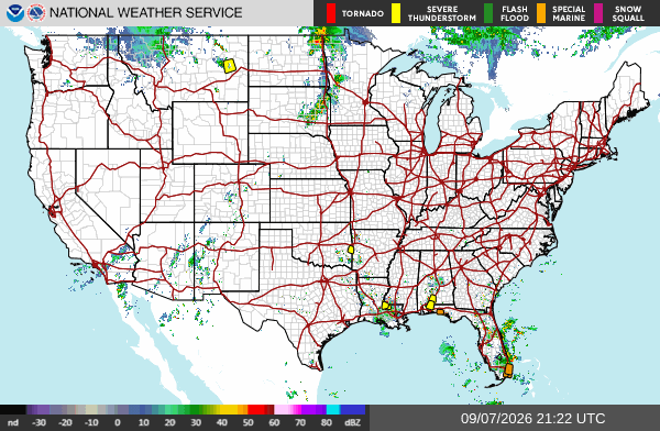
    National Weather Service CONUS radar mosaic showing current precipitation across the United States
    NWS CONUS radar mosaic. Public domain.

    These are the events that generate the restoration work crews actually see: wind-driven roof and siding failures, hail-pocked windows and vehicles, downed trees on service lines, and interior flooding from 2–3 inches in an hour on poorly drained streets. Conditions change fast. Verify with the National Weather Service for the specific county or ZIP before you roll.

    What is live this afternoon

    The Storm Prediction Center 2000 UTC Day 1 outlook holds a Slight Risk of severe thunderstorms across parts of central North Dakota and southeast South Dakota into northeast Nebraska. The headline threat is large hail. A tornado or two is possible in southeast South Dakota. Isolated damaging wind is possible across a broader Marginal Risk from the northern and central Plains into the upper Mississippi Valley. Locally damaging wind gusts remain possible over the central Gulf Coast states.

    No convective watches are in effect as of this writing. Warnings are local Severe Thunderstorm Warnings and Special Weather Statements, plus flood advisories where storms stall.

    Hotspot 1 — Northern Plains: North Dakota, South Dakota, eastern Montana

    A shortwave coming off the northern Rockies is the organizer. SPC expects widely scattered severe storms capable of mainly large hail over northwest into central North Dakota and southeast South Dakota this afternoon into evening. Forecast soundings east of a sharpening dryline in central ND support supercell modes. Large hail is the primary restoration exposure. Isolated tornado risk is highest in southeast South Dakota.

    Official Local Storm Reports already on the board today include 62 mph near Midland, South Dakota; 73 mph west-southwest of Fort Pierre; 59 mph near Forestgrove, Montana; and 63 mph near Winnett, Montana. Overnight and early-morning reports from eastern Montana included estimated 2-inch hail near Shepherd in Yellowstone County, with broken windows and siding damage from wind-driven hail.

    Recent Severe Thunderstorm Warnings from NWS Glasgow have covered Garfield, McCone, Prairie, and Petroleum counties in northeastern Montana for radar-indicated 60 mph gusts. Weather Prediction Center Day 1 also carries a Slight Risk of excessive rainfall for a portion of northwestern Montana.

    Restoration read: hail and wind first. Check roofs, skylights, west- and south-facing windows, and vehicle lots. Trees and service drops follow the 60-plus mph cores.

    Hotspot 2 — Central Gulf Coast: Louisiana, Mississippi, Alabama, Florida Panhandle, far southeast Texas

    Hot, very moist air with MLCAPE in the 2500–3500 J/kg range is supporting scattered afternoon and evening storms. Shear is weak, so this is not a supercell outbreak. The threat is intense downdrafts and slow storm motion. WPC added a Marginal Risk of excessive rainfall from far southeastern Texas into southwestern Alabama and the western Florida Panhandle. Rainfall rates of 2–3 inches in an hour are possible where cells stall near the Texas–Louisiana border.

    Active and recent Severe Thunderstorm Warnings this afternoon have included St. Helena, Livingston, Tangipahoa, and West/East Feliciana parishes in southeast Louisiana (near Hammond, Natalbany, Zachary, Slaughter) and south-central Alabama into northwest Florida (Escambia, Santa Rosa, Conecuh — Brewton, Flomaton, Evergreen, Pollard). Hazard language has been 60 mph gusts and penny-size hail.

    Yesterday’s LSRs already showed the damage type: trees and power lines down near Philadelphia and Greenville, Mississippi, including a microburst with building damage in the Greenville area.

    Restoration read: wind and water, not a hurricane surge. Urban flooding and tree-on-roof jobs in the same zip codes as the warning polygons.

    Hotspot 3 — Florida and the coastal Southeast

    Southeast Florida has been firing strong storms through Labor Day afternoon. NWS and local offices have carried a Severe Thunderstorm Warning for southeastern Martin County with radar-indicated 60 mph gusts and penny hail, plus a Flood Advisory in east-central Palm Beach County after 2–3 inches of rain. Steering is weak; cells can dump on the same neighborhoods twice.

    Northeast Florida into coastal Georgia and southern South Carolina sits under an above-average precipitable-water axis. NWS Jacksonville has been issuing Special Weather Statements for Baker, Columbia, Alachua, Suwannee, and adjacent Georgia counties with 40 mph gusts. WPC notes high neighborhood probabilities for 2- and 3-inch rainfall totals along that coastal moisture axis.

    Restoration read: interior water and urban flooding first, then wind to trees and fascia. Metro Broward/Miami-Dade and the I-10 / I-75 corridors in north Florida are the places to watch hour by hour.

    Pulse table

    RegionMain threatsSPC / WPC levelStatus this afternoon
    Central ND / SE SD / NE NELarge hail, damaging wind, isolated tornadoSlightDeveloping afternoon–evening
    Eastern MT / northern PlainsDamaging wind, hailMarginal + local SVR warningsActive
    Gulf Coast LA–AL–FL PanhandleDamaging wind, flash flood pulsesMarginal + local SVR warningsActive
    SE / NE Florida + coastal GA/SCHeavy rain, gusty wind, urban floodingLocal severe / flood advisoriesActive
    Atlantic tropics vs. U.S. coastNoneNo tropical cycloneQuiet

    What this is not

    This is not a regional derecho and not a hurricane landfall. No watches are up. The work, if it comes, will be scattered: a hail swath through a Dakota county, a microburst block in Louisiana or Alabama, a flooded intersection in Palm Beach or Jacksonville. That is the local-storm pattern restoration desks should staff for tonight.

    Sources and how to verify

    Primary sources: NOAA Storm Prediction Center Day 1 Convective Outlook issued 0259 PM CDT Monday, September 7, 2026; SPC today’s storm reports; Weather Prediction Center Day 1 Excessive Rainfall Outlook; National Hurricane Center Atlantic Tropical Weather Outlook (no tropical cyclone formation expected in the next 7 days); and active NWS warning text from Glasgow MT, New Orleans LA, Mobile AL, Jacksonville FL, and West Palm Beach-area offices.

    Check weather.gov for the county warning, spc.noaa.gov for the outlook and LSRs, and local radar before you treat any polygon as a job ticket. This desk will update when the evening reports close.

  • Skokomish Valley Road Closed Due to Flooding at the Dips

    Skokomish Valley Road Closed Due to Flooding at the Dips

    Last refreshed: October 23, 2026 (Pacific).

    October 2026 update: This April 2026 closure is no longer in effect. As of October 23, 2026, Mason County Public Works reports no road closures in the county. The Dips floods in most heavy-rain winters, so check the county’s road closure page (linked below) for current status before traveling.

    In April 2026, Skokomish Valley Road was closed to all through traffic. Mason County Public Works shut down the road at approximately milepost 3.749 — the intersection with Eells Hill Road, in the area known locally as the Dips — due to active flooding. The closure was in effect until further notice at the time.

    Residents in the Skokomish Valley, agricultural operations along the valley floor, and anyone who uses Skokomish Valley Road as a through route to or from U.S. Highway 101 were advised to plan alternate routes. Mason County Public Works monitored the road and the Skokomish River throughout the day.

    Why the Dips Flood

    The section of Skokomish Valley Road near Eells Hill Road sits at low elevation in the Skokomish River floodplain. The Skokomish River is one of the more flood-prone rivers in western Washington — its drainage basin covers a large portion of the Olympics, and during periods of heavy or sustained rainfall, the river can rise rapidly. At moderate flood stage (around 17.5 feet), the Skokomish Valley Road begins to take water, along with Bourgault Road West, Purdy Cutoff Road, and portions of Highway 106.

    This is not an unusual occurrence. The Dips has flooded during high rain events regularly over the years, and Mason County Public Works has an established protocol: monitor conditions, close the road when flooding at the closure point is confirmed, and reopen once waters recede and the road surface is safe for travel.

    Risk at the Time: Heavy Rainfall and Debris Flow

    In addition to roadway flooding, Mason County Public Works issued a broader advisory: ongoing heavy rainfall was raising the risk of rapid river rises and debris flows in steep or saturated areas throughout the Skokomish Valley. Residents in low-lying locations, along the river, or near hillside slopes should stay alert to changing conditions.

    Debris flows — a mix of water, soil, rocks, and vegetation that can move down slopes rapidly — are a secondary hazard when soil saturation reaches critical levels after extended rain. This risk is concentrated in steep terrain adjacent to the valley floor and along drainages feeding into the Skokomish River system.

    What to Do During a Closure

    For travel: Plan alternate routes. Highway 106 along Hood Canal and U.S. 101 through Shelton provide access to North Mason communities via routes that avoid the Skokomish Valley floor.

    For residents along the Skokomish River or in known low-lying areas: Monitor the Mason County Public Works road closure page at masoncountywa.gov for current status. The USGS stream gauge data for the Skokomish River near Potlatch is publicly accessible and updates in real time — useful for tracking whether river levels are rising or falling.

    For emergency information, Mason County Emergency Management coordinates through the county’s official channels. MasonWebTV.com regularly posts updated road closure notices for the Skokomish Valley area.

    Related: Infrastructure and services beat roundup — April 9, 2026 (the original roundup is no longer live).

    Related: SR-3 Belfair Bypass Gets $48.3M & Mason County News

    Frequently Asked Questions

    Where exactly is Skokomish Valley Road closed?

    The April 2026 closure was at approximately milepost 3.749, at the intersection of Skokomish Valley Road and Eells Hill Road — the area known as the Dips. That point was closed to all through traffic until further notice per Mason County Public Works at the time.

    What is causing the Skokomish Valley Road flooding?

    Heavy rainfall was raising the Skokomish River and saturating the valley floor. The Dips area sits in the river’s floodplain at low elevation. At moderate flood stage on the Skokomish River, this section of road typically takes water. Mason County Public Works was monitoring conditions, and the closure remained in effect until flooding receded and road conditions were safe.

    What alternate routes can I use to get through the Skokomish Valley?

    Highway 106 along the south shore of Hood Canal provides an alternate east-west route through North Mason communities. U.S. Highway 101 north and south of Shelton connects to the Highway 106 corridor. Avoid using Skokomish Valley Road through the Dips area until Mason County Public Works confirms the road has reopened.

    How do I check if Skokomish Valley Road has reopened?

    Check the Mason County Public Works road closure page directly at masoncountywa.gov/departments/public_works/road_closures.php. MasonWebTV.com also posts road closure updates for the Skokomish Valley area. These are the most reliable real-time sources for closure status.

    Is there a flood risk to homes in the Skokomish Valley?

    Mason County Public Works issued an advisory noting that ongoing heavy rainfall was increasing the risk of rapid river rises and debris flows in steep or saturated areas. Residents in low-lying locations, along the river, or near hillside slopes should monitor conditions closely. FEMA has previously conducted acquisition and elevation projects in the Skokomish Valley specifically because of the area’s chronic flood risk. If you are in a known flood zone, review your emergency preparedness plans and monitor official advisories.

  • Restoration SEO in 2026: The $78B Digital Land Grab

    Restoration SEO in 2026: The $78B Digital Land Grab

    Tygart Media / Content Strategy
    The Practitioner JournalField Notes
    By Will Tygart
    · Practitioner-grade
    · From the workbench


    The 23 Billion-Dollar Disaster Year: Why Restoration SEO in 2026 Is a Land Grab

    2025 had 23 billion-dollar disasters. Ninety billion-three hundred million in total damage. The restoration market is $78 billion and growing at 5.28% CAGR. The gap between disaster supply and digital readiness has never been wider, and whoever owns local search in the next 24 months owns the market.

    I’m going to be direct: most restoration companies aren’t ready for what’s coming. They’re still running 2022 SEO playbooks in a 2026 market. Meanwhile, catastrophes are accelerating. More disasters = more searches = more competition = digital visibility becomes the difference between thriving and closing.

    The Data That Changes Everything

    GEO versus SEO comparison cards
    The data that changes restoration SEO.

    The 2025 disaster count tells the whole story. Twenty-three billion-dollar events. That’s not volatility—that’s the new baseline. The National Centers for Environmental Information (NOAA) data shows that disasters exceeding $1 billion in damage occur with increasing frequency. In 1980, we saw zero billion-dollar disasters annually on average. By 2015, that number climbed to 5.1 per year. By 2024, it was 18. In 2025, it was 23.

    $115 billion in total economic loss. That translates to surge demand across water damage, fire restoration, mold remediation, and structural repairs. The American Restoration Council reports 2.4 million property damage claims in 2025 alone—up 16% from 2024.

    The $78 billion restoration market is fragmented. No single national player dominates. Regional and local restoration companies handle 73% of the market. That means the competitive advantage isn’t scale—it’s visibility. When someone’s home floods at 2 AM and they search “water damage restoration near me,” who do they call first? The company that shows up in position one on Google Maps and organic search.

    The Search Intent Explosion

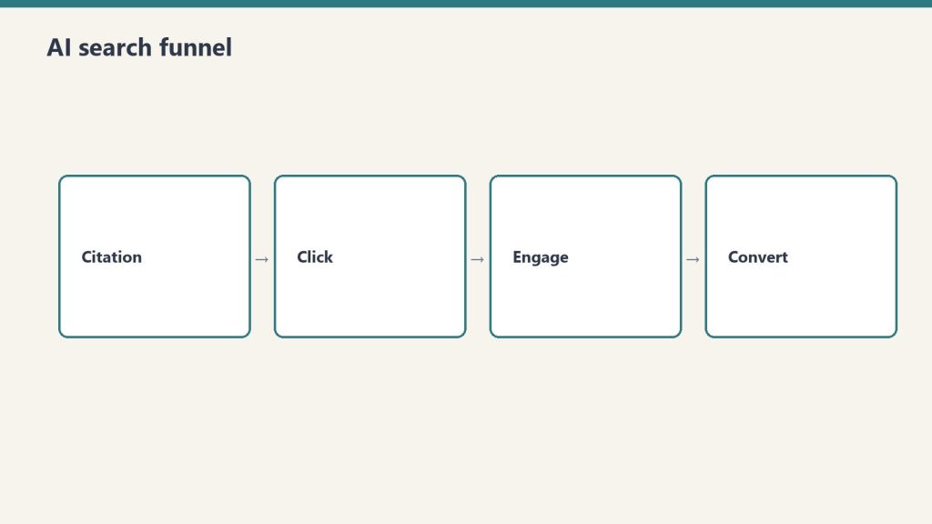
    Four-stage funnel: citation, click, engage, convert
    Search-intent explosion for restoration queries.

    Disaster-driven search behavior is predictable and measurable. After major events, specific keywords spike:

    • “water damage restoration [city]” +240% in search volume within 48 hours of flooding
    • “fire damage repair near me” +320% after fire events
    • “mold testing [zip code]” +180% post-moisture events
    • “emergency remediation [location]” trending 6 months after hurricanes

    The companies that rank for these keywords during surge periods capture market share permanently. Why? Because homeowners who get results from you save your contact. Insurance adjusters who work with you recommend you. That’s how local market dominance builds.

    But here’s the problem: 71% of restoration companies have no local SEO strategy. 64% haven’t updated their GMB (Google Business Profile) in 6+ months. 58% have no schema markup. The door is open, and it won’t stay open long.

    The Competitive Reality

    What’s changing rapidly is the competitive density. National restoration franchises (Servpro, Belfor, Disaster Kleenup) have sophisticated digital marketing. But they’re not omnipresent locally. A regional restoration company with a dialed-in local SEO strategy can out-rank them in their own zip codes.

    LSA (Local Services Ads) costs for restoration keywords climbed 40% from 2023 to 2026. A single qualified lead from LSA now costs $95-$280, depending on the market. Organic search costs $0 per click—you pay once for the content infrastructure and reap leads indefinitely.

    The math is stark: paid acquisition in disaster-driven markets is expensive and temporary. Organic visibility is free and permanent. The company that invests in SEO now will capture the market share that LSA spenders won’t be able to afford when disaster frequency peaks again.

    What Ownership Looks Like in 2026

    Three cards for LSA, search ads, and SEO/AI authority channels
    What ownership looks like in 2026.

    Local market dominance in restoration SEO means:

    • Ranking in top 3 organic for 40+ location-specific keywords
    • Consistent 4.8+ Google reviews with response time under 24 hours
    • GBP posts updated weekly with storm preparation, mitigation tips, and case studies
    • Content that actually teaches—not fluff about why you’re “family-owned”
    • Schema markup that tells Google and AI systems exactly what you do, where, and how well

    This isn’t theoretical. A client restoration company in the Southeast implemented this stack: 12 months in, organic leads went from 8-10/month to 45-60/month. Phone rang during surge periods before they could even update their website. Revenue tripled.

    The window to build this advantage is now. Competition will catch up. It always does. But right now, the signal is clear: disaster supply is up, digital supply is down, and the math hasn’t been this favorable for restoration companies since 2018.

    The Quarterly Shift Ahead

    2026 will bring 16-18 more billion-dollar disasters (based on trend acceleration). Each one creates a regional search spike. Each spike rewards the companies that ranked before the disaster hit.

    The companies doing SEO right now will own their markets by Q4. The ones waiting for next year will be fighting for scraps.


    Illustration for article: Restoration SEO in 2026: The $78B Digital Land Grab

    Visual summary

    Editorial illustration for The 23 Billion-Dollar Disaster Year: Why Restoration SEO in 2026 Is a Land Grab - Tygart Media AI-generated visual
    AI-generated editorial illustration — Vertex AI Imagen 4 Standard

    About this image. This image was generated by Google’s Vertex AI Imagen 4 model as the featured visual for The 23 Billion-Dollar Disaster Year: Why Restoration SEO in 2026 Is a Land Grab. Every image in the Tygart Media visual library is AI-generated, converted to WebP for optimal performance, and enriched with IPTC/XMP metadata for search engine discoverability.

    • Model: Vertex AI Imagen 4 Standard (imagen-4.0-generate-001)
    • Format: WebP (quality 90)
    • Aspect Ratio: 16:9
    • Metadata: IPTC/XMP injected (title, description, creator, rights, location)
    • Creator: Tygart Media — tygartmedia.com

    Part of The Studio collection — AI-generated visuals powering the Tygart Media content engine.