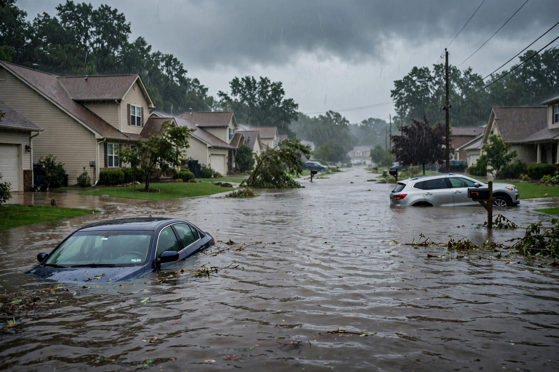
Tag: Rhode Island

  • Storm Updates: Quiet Pulse — Nov 6 Morning

    Storm Updates: Quiet Pulse — Nov 6 Morning

    Tropical: None · Severe: None · Flood: Quiet

    What Changed

    • Compared with the November 5 afternoon desk pulse table (quiet-pulse-2026-11-05-afternoon: Tropical: None · Severe: None · Flood: Quiet) and this morning’s earlier version: SPC Day 1 Convective Outlook (0100 UTC November 6 / 0700 PM CST Thursday November 5 2026 by Lyons, valid 060100Z–061200Z) continues “NO SEVERE THUNDERSTORM AREAS FORECAST.” Severe storms remain unlikely tonight. No upgrade to Slight or higher. No convective watches or mesoscale discussions valid.
    • WPC Day 1 Excessive Rainfall Outlook (updated 0020 UTC November 6 / discussion 725 PM EST November 5 by Bann, valid 01 UTC Nov 06–12 UTC Nov 06) continues to show the probability of rainfall exceeding flash flood guidance less than 5 percent nationally. Prior Marginal areas closed. No Moderate or higher.
    • National Weather Service Flood Watch remains in effect for portions of southeastern Massachusetts and Rhode Island from late tonight through Saturday morning for potential 2–4 inches of rain with isolated higher amounts. Residual river Flood Warnings continue elsewhere (e.g., Missouri). High Wind and Freezing Spray Warnings in Alaska. No active flash flood warnings elevating the national Day 1 lane. Prior Georgia FFW remains expired.
    • Tropical lane remains None. National Hurricane Center confirms no tropical cyclones in the Atlantic, Caribbean, or Gulf of America as of 100 AM EST Friday November 6. No tropical storm or hurricane watch or warning on the U.S. coast or Gulf. A non-tropical low south of Bermuda continues with low-to-medium chance of acquiring subtropical characteristics while moving east; no U.S. land threat.
    • Nothing moved into Slight or higher on SPC Day 1 or Moderate or higher on WPC ERO. Quiet Pulse criteria hold. Day 2 Outlook (1730 UTC November 5) holds Marginal Risk for eastern Carolinas and southeast Virginia Friday, outside this Day 1 window. Isolated non-severe thunderstorms possible overnight from Mid-Atlantic into southern New England and Carolinas with the front, but no severe probabilities.

    Live Status

    As of the morning desk on Friday, November 6, 2026 (evening confirmation approximately 9:15 PM PST November 5 / 05:15 UTC November 6), the national picture remains a Quiet Pulse. The Storm Prediction Center’s latest Day 1 Convective Outlook states: “NO SEVERE THUNDERSTORM AREAS FORECAST. Severe storms remain unlikely tonight.” Isolated thunderstorms are possible later tonight from the Mid-Atlantic region northward into southern New England and southward into the Carolinas ahead of a weak front, with strong winds aloft but limited near-surface buoyancy. No severe risk areas drawn. No watches currently valid. Homepage confirms Day 1 No Severe; Day 2 Marginal for eastern Carolinas and southeast Virginia.

    WPC Day 1 ERO confirms no excessive rainfall areas of note. Probability of exceeding flash flood guidance is under 5 percent nationally. Residual showers and thunderstorms may occur along the eastern front, but no organized flood threat on Day 1. NWS national products include the Flood Watch for MA/RI and routine marine and winter advisories elsewhere. None elevate the national severe or flood lanes above Quiet.

    Pulse Table

    LaneStatusNotes (as of ~9:15 PM PST Nov 5 / 05:15 UTC Nov 6 2026)
    TropicalNoneNo tropical cyclones in the Atlantic, Caribbean, or Gulf. NHC: no active systems. Non-tropical low south of Bermuda low/medium chance subtropical characteristics, moving east; no U.S. coastal or Gulf watches or warnings.
    SevereNoneSPC Day 1 (0100Z Nov 6): NO SEVERE THUNDERSTORM AREAS FORECAST. Severe storms unlikely tonight. No watches valid. Isolated non-severe storms possible Mid-Atlantic to Carolinas. Day 2 Marginal eastern Carolinas/SE VA.
    FloodQuietWPC Day 1 ERO: probability of exceeding flash flood guidance <5%. Prior Marginals closed. Flood Watch MA/RI for Friday into Saturday. Residual local Flood Warnings do not elevate national Day 1 lane.

    Rising Queries

    Trends unreachable this run. No invented queries.

    Restoration Read

    No open restoration ticket. No organized severe wind, tornado, or widespread flooding indicated on current Day 1 products. Prior Southeast Marginal and north Georgia flash flood warning remain closed. Residual isolated thunderstorms may produce brief gusty winds or localized heavy rain overnight along the eastern front, but nothing at the level that drives a damage claim under Quiet Pulse criteria. Flood Watch for southeastern New England signals a Day 2 concern. Monitor routine weather.gov updates for any local evolution.

    What This Is Not

    This is a Quiet Pulse. Nothing at SPC Slight or above. No WPC ERO Moderate or above. No tropical storm or hurricane watch or warning on the U.S. coast or Gulf. This desk summarizes public products from the Storm Prediction Center, Weather Prediction Center, National Weather Service, and National Hurricane Center.

    Informational only — not an official warning. Always check weather.gov for local forecasts and warnings. Turn around, don’t drown.

  • Storm Updates: Quiet Pulse — Nov 5

    Storm Updates: Quiet Pulse — Nov 5

    Tropical: None · Severe: None · Flood: Quiet

    What Changed

    • Compared with this morning’s pulse table (quiet-pulse-2026-11-05-morning: Tropical: None · Severe: None · Flood: Quiet): SPC Day 1 Convective Outlook (0100 UTC November 6 / 0700 PM CST Thursday November 5 2026 by Lyons, valid 060100Z–061200Z) continues “NO SEVERE THUNDERSTORM AREAS FORECAST.” Severe storms remain unlikely tonight. Prior Southeast Marginal remains closed. No convective watches or mesoscale discussions valid.
    • WPC Day 1 Excessive Rainfall Outlook (updated 0020 UTC November 6 / discussion 725 PM EST November 5 by Bann, valid 01 UTC Nov 06–12 UTC Nov 06) continues to show the probability of rainfall exceeding flash flood guidance less than 5 percent nationally. Prior Marginal areas closed. No Moderate or higher.
    • National Weather Service Flash Flood Warning for Fannin, Gilmer, northwestern Union, and Murray Counties in north-central Georgia remains expired. No active flash flood warnings of note on the CONUS severe or flood lanes. A Flood Watch remains in effect for parts of Massachusetts and Rhode Island. Residual Flood Warnings persist on some western rivers.
    • No tropical storm or hurricane watch or warning on the U.S. coast or Gulf. NHC confirms no tropical cyclones in the Atlantic, Caribbean, or Gulf of America. A broad non-tropical low a few hundred miles south of Bermuda holds a low (30%) chance through 48 hours and medium (40%) through 7 days of acquiring subtropical characteristics while moving slowly eastward; no U.S. land threat.
    • Nothing moved into Slight or higher on SPC or Moderate or higher on WPC ERO. Quiet Pulse criteria hold. Isolated stronger wind gusts possible overnight in DelMarVa into southern NY/NJ with fast-moving storms, but no severe probabilities.

    Live Status

    As of the afternoon desk on Thursday, November 5, 2026 (approximately 9:17 PM PST / 05:17 UTC November 6), the national picture remains a Quiet Pulse. The Storm Prediction Center’s latest Day 1 Convective Outlook states: “NO SEVERE THUNDERSTORM AREAS FORECAST. Severe storms remain unlikely tonight.” Isolated thunderstorms remain possible this evening and overnight from the Mid-Atlantic into southern New England and the Carolinas ahead of a weak front. Strong winds aloft will produce fast-moving storms, but near-surface buoyancy remains limited; the surface-based threat and risk of damaging winds is low. Occasional stronger gust possible overnight across DelMarVa into southern NY/NJ. No organized severe threat. No mesoscale discussions in effect.

    WPC Day 1 holds no excessive rainfall risk areas. The overnight Flash Flood Warning in north Georgia has expired. Residual runoff or minor urban ponding is possible where earlier heavy rain fell, but no widespread flash flood threat remains on Day 1. No tropical component.

    Hotspots

    Mid-Atlantic into southern New England and Carolinas: Isolated thunderstorms possible this evening into overnight along and ahead of the front. Fast-moving cells under strong winds aloft, limited surface-based threat after dark. Occasional gusty winds possible; no severe area. Flood Watch active for portions of MA/RI. Day 2 WPC carries a Slight Risk of excessive rainfall across parts of southeastern New England.

    Southern Kansas / northern Oklahoma residual: Scattered elevated thunderstorms earlier under a mid-level shortwave. Elevated nature limited surface severe potential. No risk area remains.

    North-central Georgia residual: Prior Flash Flood Warning expired. Ocoee River and surrounding terrain saw heavy overnight rain; monitor for lingering high water on roads and small streams. No active warning.

    Just Hit

    Overnight into early Thursday: Flash Flood Warning and localized flooding in north-central Georgia (Fannin, Gilmer, Union, Murray Counties) from thunderstorms producing 1–2 inches per hour. Some reports of high water and impacts along the Georgia-Tennessee line. Activity has ended; warning expired. Local wind reports (trees, wires) in the Mid-Atlantic with the frontal passage.

    Pulse Table

    LaneStatusNotes (as of ~9:17 PM PST / 05:17 UTC Nov 6 2026)
    TropicalNoneNo tropical cyclones in the Atlantic, Caribbean, or Gulf. NHC: low (30% 48h) to medium (40% 7d) chance for western/central Atlantic non-tropical low to acquire subtropical characteristics, moving east; no U.S. coastal or Gulf watches or warnings.
    SevereNoneSPC Day 1 (0100Z Nov 6): NO SEVERE THUNDERSTORM AREAS FORECAST. Prior Southeast Marginal closed. Isolated storms possible Mid-Atlantic/New England. No watches or MDs valid. Occasional stronger gust possible overnight DelMarVa/NY/NJ only.
    FloodQuietWPC Day 1 ERO: probability of exceeding FFG less than 5 percent. Prior Marginal areas closed. Georgia FFW expired. Flood Watch MA/RI. No active CONUS flash flood warnings of note. Residual minor runoff possible. Day 2 Slight Risk SE New England.

    Rising Queries

    Trends unreachable this run. No invented queries.

    Restoration Read

    Quiet Pulse. Primary residual ticket is minor water intrusion or high water on roads from the expired north Georgia Flash Flood Warning and earlier Southeast rainfall, plus isolated tree/wire work from frontal winds in the Mid-Atlantic. No organized severe damage expected. No tropical component. Monitor local NWS for any lingering advisories and the Day 2 Slight flood risk in southeastern New England. Turn around, don’t drown.

    What This Is Not

    This is a Quiet Pulse. No SPC Slight or higher severe risk on the latest Day 1 outlook. No WPC Moderate or higher excessive rainfall on Day 1. No tropical storm or hurricane watch or warning on the U.S. coast or Gulf. This desk summarizes public products from the SPC, WPC, NWS, and NHC.

    Looking Ahead

    Day 2 WPC Excessive Rainfall Outlook carries a Slight Risk across parts of southeastern New England (Rhode Island into southeastern Massachusetts). Rain continues from the Northeast to the Southeast into Friday. No severe areas expected on Day 1. Monitor for potential flood concerns in New England overnight into Friday.

    Sources

    Official products: Storm Prediction Center (Day 1 Outlook 0100 UTC November 6), Weather Prediction Center (Day 1 Excessive Rainfall Outlook and discussion ~725 PM EST November 5), National Weather Service (watches, warnings, and advisories), National Hurricane Center (Atlantic quiet). Previous desk: quiet-pulse-2026-11-05-morning.

    Disclaimer: This is a summary of official public products from the Storm Prediction Center, Weather Prediction Center, National Weather Service, and National Hurricane Center. Always consult the latest official forecasts and warnings for your location. This desk does not issue warnings. Turn around, don’t drown.

  • Storm Updates: Mid-Atlantic High Wind, Southern Plains Marginal — Saturday, September 26, 2026 (Morning)

    Storm Updates: Mid-Atlantic High Wind, Southern Plains Marginal — Saturday, September 26, 2026 (Morning)

    This is a live Saturday morning snapshot of U.S. local-storm activity as of Saturday, September 26, 2026. Overnight into this morning, the organized severe desk stayed quiet: no Storm Prediction Center convective watches are valid. The 1300 UTC Day 1 Convective Outlook draws a Marginal Risk of isolated hail and strong outflow winds for western Oklahoma into northwest Texas late this afternoon into early evening. The Weather Prediction Center Day 1 Excessive Rainfall Outlook holds Slight Risk pockets from southwest Iowa into northern Missouri and along the Mid-Atlantic and southern New England coast, with a broader Marginal overlay from the southern Plains into the central Plains.

    The live work this morning is not a watch box. It is High Wind Warnings on the Mid-Atlantic and southern New England coast from a strengthening coastal low, leftover water in north-central Kansas where a flash-flood warning was replaced by a flood advisory, and a few overnight local storm reports. These are county-scale thunderstorms and coastal wind, not a U.S. mainland hurricane landfall. Restoration exposure today is wind-driven trees and service drops on the coast, isolated hail and outflow later on the southern Plains, and interior water where yesterday’s High Plains rain is still in the channel. Conditions change fast. Verify with the National Weather Service for the specific county or ZIP before you roll.

    What is live this morning

    SPC current watches: none. Most recently issued watch was 0674, already expired. The 0655 AM CDT Day 1 discussion (Smith/Bentley) is explicit: morning showers and thunderstorms over the southern High Plains should dissipate, with new storm development around 21–23 UTC (4–6 p.m. CDT). Isolated large hail and severe gusts are possible mainly 22z–02z. Elsewhere, SPC calls the severe environment quiescent.

    WPC valid 12Z Saturday through 12Z Sunday: Slight Risk of rainfall exceeding flash-flood guidance from roughly southwest Iowa into northern Missouri, and a second Slight along the Mid-Atlantic and southern New England coast from the Delmarva through Cape Cod and adjacent waters. A Marginal Risk covers a large southern-to-central Plains corridor plus a coastal Mid-Atlantic/Northeast swath.

    National Hurricane Center: Tropical Depression Fay and Tropical Storm Gonzalo are well out in the open Atlantic and are not a U.S. land threat this morning. Hurricane Nolo remains nearly stationary well south of the Big Island of Hawaii and is forecast to stay south of the islands; that is a Hawaii flood-and-wind desk, not a mainland landfall. Eastern Pacific Hurricanes Odalys and Polo are Mexico-waters storms, not CONUS landfalls.

    Hotspot 1 — Mid-Atlantic and southern New England high wind

    This is the live warning desk. National Weather Service Mount Holly holds a High Wind Warning until 6:00 a.m. EDT Sunday for Delaware beaches and coastal New Jersey counties including Eastern Monmouth, Atlantic Coastal Cape May, Coastal Atlantic, and Coastal Ocean. Language: north winds 30 to 40 mph with gusts up to 60 mph; trees and power lines; widespread outages possible. Boston/Norton holds High Wind Warnings until 8:00 a.m. EDT Sunday for eastern and southeastern Massachusetts and Rhode Island, with northeast gusts 50–60 mph on the exposed coast and 50 mph inland over Kent and Providence counties. WPC’s coastal Slight excessive-rainfall risk sits under the same system: heaviest totals preferred offshore, but localized heavy rain can still reach the Jersey Shore through southern New England.

    Cities and counties to watch: Atlantic City, Long Beach Island, Ocean City, Rehoboth Beach, Sandy Hook; Boston, Quincy, Plymouth, New Bedford, Cape Cod, Nantucket, Martha’s Vineyard; Providence, Warwick, Newport, Westerly.

    Restoration read: wind first. Stage tree crews, generators, and tarp kits before the next peak gust period tonight. Treat coastal ZIPs as possible interior-water jobs if the Slight rain overlay verifies on already-wet ground. Photograph roofs in remaining daylight only if it is safe.

    Hotspot 2 — Western Oklahoma into northwest Texas (afternoon Marginal)

    SPC’s only categorical severe area today. A High Plains upper trough and a smaller-scale jet over the Texas Panhandle into Oklahoma maintain a lee trough and dewpoints in the lower to mid 60s. Morning convection is expected to die. New storms 21–23 UTC from south-central Kansas through western Oklahoma and west/northwest Texas. Adequately strong deep-layer shear supports a few organized cells capable of isolated large hail and severe outflow, mainly 22z–02z. Lubbock’s hazardous-weather outlook already flags isolated afternoon and evening storms off the Caprock with gusts to 65 mph and hail to quarter size.

    Restoration read: this is a late-day hail and wind ticket, not a morning watch. Do not pre-position as if a Slight or Enhanced is up. Staff local warnings if they fire after 4 p.m. CDT.

    Hotspot 3 — Leftover High Plains water and central Plains flood overlay

    NWS Hastings replaced a flash-flood warning with a Flood Advisory through 1:00 p.m. CDT for parts of Jewell, Mitchell, Osborne, and Smith Counties in north-central Kansas. That is yesterday’s rain still in the ditch, not a new MCS. WPC keeps a Slight excessive-rainfall risk over southwest Iowa into northern Missouri and a Marginal from Oklahoma and West Texas north across Kansas toward the eastern Dakotas. Friday afternoon’s New Mexico flood pulse is no longer the national Slight; treat Cibola and Santa Fe as aftermath unless a new warning posts.

    Great Falls holds a High Wind Warning until noon MDT for Glacier, Toole, and Pondera High Plains zones — westerly 30–50 mph, gusts to 70. That is a plains wind event, not the SPC Marginal.

    Just hit

    Overnight and Friday evening local storm reports, all preliminary: landspout near Wilmore in Comanche County, Kansas; one-inch hail that cracked windshields at Tecolote and near Romeroville in San Miguel County, New Mexico; 59–61 mph measured gusts in Liberty and Pondera Counties, Montana. Earlier Friday into last night on the Texas side of the same High Plains corridor: 60 mph at Memphis in Hall County, an estimated 60 mph north of Study Butte, and a roof section blown onto a road in Terlingua, Brewster County. No tornado watch fired. No convective watch is live this morning.

    Pulse table

    RegionMain threatsSPC / NWS / WPC levelStatus this morning
    Coastal NJ / DE / southern New EnglandDamaging wind, trees, outages, localized heavy rainHigh Wind Warning + WPC Slight (coast)Live warnings through Sunday morning
    Western OK / northwest TX / south-central KSIsolated hail, severe outflowSPC Marginal 22z–02zAfternoon–evening development
    SW Iowa / northern MissouriTraining rain, flash floodWPC SlightToday into tonight
    North-central Kansas (Jewell–Smith)Residual floodingFlood Advisory to 1 p.m. CDTAftermath / still in channel
    Northern MT High PlainsHigh wind gusts to 70 mphHigh Wind Warning to noon MDTLive, expires midday
    Hawaii (Nolo)Flood watch Big Island / Maui CountyNHC hurricane well south of islandsHawaii desk only
    U.S. mainland tropicalNo landfalling hurricaneFay / Gonzalo open AtlanticQuiet on the mainland coast

    What this means for restoration teams

    Coastal gusts of 50–60 mph are tree-on-structure, siding, gutter, and service-drop work. Stage before dark on the Jersey Shore and southern New England, not after the first outage ticket. The Oklahoma–Texas Marginal is a late-day hail and wind desk: a few cells, not a regional outbreak. Kansas flood-advisory counties are already wet — extraction and drying, not a new watch. Hawaii Nolo stays off the mainland board.

    Property owners: photograph damage in daylight if it is safe, call the carrier, and start extraction the same night if water is inside. Turn around, don’t drown at low-water crossings in the WPC Slight counties.

    What this is not

    This is not a regional derecho and not a U.S. mainland hurricane landfall. No convective watch is up. The work today, if it comes, will be scattered: a coastal wind swath through a New Jersey or Massachusetts county, a late-day hail core in western Oklahoma, leftover water in a Kansas creek. That is the local-storm pattern this desk should staff.

    Looking ahead

    Coastal High Wind Warnings run through early Sunday. The southern Plains Marginal is a same-day afternoon problem, not an overnight watch. SPC Day 2 language on the hazard matrix is No Severe for Sunday. Watch the next Storm Tracker update rather than assuming this morning’s High Wind Warning is the last line of the weekend.

    Sources and how to verify

    Primary sources: NOAA Storm Prediction Center Sep 26, 2026 1300 UTC Day 1 Convective Outlook; SPC current watches (none valid); SPC local storm reports for 1200 UTC Sep 25–1159 UTC Sep 26; Weather Prediction Center Day 1 Excessive Rainfall Outlook valid 12Z Sep 26–12Z Sep 27; National Weather Service warning text from Mount Holly, Boston/Norton, Great Falls, Hastings, and Lubbock; National Hurricane Center public advisories for Nolo, Fay, and Gonzalo. Check weather.gov for the county warning, spc.noaa.gov for the outlook, watches, and LSRs, and WPC excessive rainfall for the flood overlay. Prior desk: Friday, September 25 afternoon Storm Updates.

    Informational only — not an official weather warning. Follow local authorities and the National Weather Service. Turn around, don’t drown.