
Tag: Water Damage

  • Flash Flood Warning: Dubuque Area Until 11:15 AM CDT

    Flash Flood Warning: Dubuque Area Until 11:15 AM CDT

    The National Weather Service in Quad Cities has issued a Flash Flood Warning for Dubuque County, eastern Delaware County, northern Jones County, and northwestern Jackson County in northeastern Iowa, plus western Jo Daviess County in northwestern Illinois. The warning runs until 11:15 AM CDT Sunday — and with 1 to 2.5 inches of rain already on the ground and more falling, this is exactly the kind of overnight-to-morning setup that sends water into finished basements, slab-on-grade homes, and low commercial buildings across the Dubuque area.

    This is a live snapshot as of 5:20 AM Central (3:20 AM Pacific) on Sunday, September 20, 2026. Conditions change fast — always verify with the National Weather Service for your specific county or ZIP code.

    Dubuque County, IA — Flash Flood Warning

    Issued by: NWS Quad Cities (Iowa/Illinois), 5:12 AM CDT. Expires: 11:15 AM CDT Sunday.

    The hazard, in NWS wording: At 5:12 AM CDT, Doppler radar indicated thunderstorms producing heavy rain across the warned area. Between 1 and 2.5 inches of rain have fallen, and additional rainfall amounts of 0.5 to 1 inch are possible in the warned area. Flash flooding is ongoing or expected to begin shortly. Source: radar indicated.

    Expected impacts: Flash flooding of small creeks and streams, urban areas, highways, streets and underpasses, as well as other poor drainage and low-lying areas.

    Communities in the warning path include Dubuque, Asbury, Dyersville, Epworth, Farley, Peosta, Cascade, New Vienna, Holy Cross, Luxemburg, and Rickardsville.

    Eastern Delaware & Northern Jones Counties, IA — Flash Flood Warning

    Same warning, same timing: issued 5:12 AM CDT, in effect until 11:15 AM CDT Sunday, radar-indicated heavy rain with 1 to 2.5 inches already down and up to another inch possible.

    Communities: Monticello, Hopkinton, Earlville, Colesburg, and Worthington sit inside the warned portions of these counties.

    The concern here is the classic small-watershed setup: an inch or two of rain on ground that may already be saturated, and water that funnels into the small creeks and low crossings that thread through these counties. In hilly terrain there are hundreds of low water crossings that turn dangerous in heavy rain — the NWS specifically warns against attempting to cross flooded roads.

    Northwestern Jackson County, IA — Flash Flood Warning

    Same warning window (until 11:15 AM CDT). Communities: Bellevue and La Motte are the named locations in the warned portion of the county.

    River-adjacent low spots and underpasses along the highway corridors are the places to watch here. Overnight flooding at low crossings is the hardest kind to spot — it is dark, the road surface looks continuous, and the water only needs to be six inches deep to knock a person off their feet or stall a car.

    Western Jo Daviess County, IL — Flash Flood Warning

    The warning crosses the Mississippi into Illinois: western Jo Daviess County is warned until 11:15 AM CDT under the same radar-indicated heavy-rain signature.

    Communities: East Dubuque is the named location in the warned area.

    Hilly terrain and bluff-country drainage mean water arrives fast and concentrates in the draws. Do not attempt to cross flooded roads — find an alternate route.

    Stay safe tonight

    Turn around, don’t drown when encountering flooded roads. Most flood deaths occur in vehicles. Be especially cautious at night, when it is harder to recognize the dangers of flooding — and at 5:20 in the morning, that warning is as literal as it gets.

    If water enters your home: stay out of standing water where electricity may be present. Avoid the basement until water recedes and power is confirmed off. Photograph everything before cleanup — that documentation is what your insurance claim runs on. Then call a local restoration contractor: water left sitting starts a second wave of damage (wicking, swelling, microbial growth) within a day.

    Report observed flooding to local emergency services or law enforcement, and ask them to pass the information to the National Weather Service when you can do so safely.

    What this means for restoration teams

    This is the signature scenario for the interior water-intrusion job: not a named hurricane, just 1 to 2.5 inches of fast rain in the dark, followed by another half inch to an inch before noon. The jobs that come out of this are saturated carpet and pad in finished basements, water wicking up drywall in walkouts, sump systems overwhelmed or without battery backup, and window-well and foundation-seepage calls that get discovered after sunrise when people walk downstairs.

    Mold risk clocks start the moment materials stay wet: 24 to 48 hours on saturated drywall and insulation. Sewage backup is the wildcard in low-lying urban blocks — ask on the first call whether the water has an odor or discoloration, because that changes the job category entirely.

    The play for Quad Cities-area contractors this morning: stage extraction equipment and dehumidifiers now, keep an on-call rotation through at least noon (the warning runs to 11:15 AM CDT, and calls keep coming for hours after water recedes), and capture address, water source, and affected areas on the first call. Photo-document before mitigation, moisture-map every affected room — not just the one with standing water — and keep the homeowner’s payment responsibility clear in writing before work starts.

    FEMA & federal assistance

    If the flooding turns into a declared disaster, the FEMA Helpline is 1-800-621-3362 (7 a.m.–10 p.m. local, 7 days a week). You can also apply at DisasterAssistance.gov, through the FEMA app, or find recovery centers at fema.gov/drc. Basic eligibility: U.S. citizenship or qualified status, identity verification, proof of occupancy or ownership, and unmet needs not covered by insurance. Apply as soon as it is safe to do so.

    Looking ahead

    The warning expires at 11:15 AM CDT. Watch for two things after that: whether the NWS extends or re-issues (another 0.5 to 1 inch is explicitly possible, and a fresh cell on saturated ground can restart this fast), and creeks and small streams cresting later in the day — the water keeps moving downstream after the rain stops. The next NWS update lands with any extension or the expiration itself; check the Quad Cities office page for the latest.

    Demand window note for contractors: water-intrusion calls typically start within hours of water receding and keep coming for days as people discover damage — the slow wick behind baseboards is tomorrow’s job.

    Sources & how to verify

    This post is for informational purposes and is not an official weather warning. Always follow instructions from local authorities and the National Weather Service.


  • Flash Flood Warning: Quad Cities Area Until 7:30 AM CDT

    Flash Flood Warning: Quad Cities Area Until 7:30 AM CDT

    A Flash Flood Warning remains in effect until 7:30 AM CDT this morning (Sunday, September 20) for the Quad Cities region — covering Scott, Muscatine, and southwestern Clinton counties in Iowa, plus Rock Island, Henry, Mercer, and southern Whiteside counties and northwestern Bureau County in Illinois. The warning was issued by NWS Quad Cities (KDVN) at 5:00 AM CDT.

    Why this one matters beyond the roads: this is the exact setup that drives the interior flooding jobs restoration contractors see most — steady rain on already-saturated ground, water pushing into basements, crawlspaces, and ground-floor units across Davenport, Moline, Bettendorf, and Muscatine while most of the area is still asleep. This is a live snapshot as of roughly 3:05 AM Pacific (5:05 AM CDT). Conditions change fast — always verify with the National Weather Service for your specific county or ZIP code.

    Quad Cities — Flash Flood Warning

    Issuing office: NWS Quad Cities IA IL (KDVN), Des Moines-coverage Quad Cities region.
    Issued: 5:00 AM CDT Sunday, September 20, 2026.
    Expires: 7:30 AM CDT Sunday, September 20, 2026.
    Severity: Severe · Certainty: Likely · Urgency: Immediate.
    Alert source: NWS alert (api.weather.gov) · Office page: weather.gov/dvn

    The NWS headline reads: “Flash flood warning remains in effect until 7:30 AM CDT this morning for southwestern Clinton, eastern Muscatine, Scott, northwestern Bureau, Henry IL, Mercer, Rock Island and southern Whiteside counties.”

    Hazard detail, verbatim from the alert: At 5:00 AM CDT, Doppler radar indicated a large area of light to moderate rain across the warned area. Earlier storms dropped 1 to 3.5 inches of rain across the area, and flash flooding is either ongoing or expected to begin shortly as runoff from the earlier heavy rain combines with the continuing steady rain. Hazard: flash flooding caused by thunderstorms. Source: radar indicated.

    Expected impacts: flash flooding of small creeks and streams, urban areas, highways, streets and underpasses, as well as other poor-drainage and low-lying areas.

    Locations in the path named in the warning: Davenport, Moline, Rock Island, Bettendorf, Muscatine, East Moline, Kewanee, Aledo, Cambridge, Silvis, Geneseo, Eldridge, Colona, Milan, Le Claire, Coal Valley, and Galva.

    State parks included: Big Bend Fish and Wildlife Area, Johnson-Sauk Trail State Recreation Area, and Prophetstown State Park.

    Highways affected (from the alert): Interstate 74 in Iowa between mile markers 1 and 5; Interstate 280 between mile markers 1 and 18; Interstate 80 in Iowa between mile markers 279 and 306; Interstate 80 in Illinois between mile markers 1 and 43; Interstate 74 in Illinois between mile markers 1 and 33; Interstate 88 between mile markers 1 and 32, and between mile markers 36 and 43. If your commute touches I-74, I-80, I-88, or I-280 through the Quad Cities corridor this morning, expect flooded low spots and slow to closed lanes.

    Stay safe this morning

    Turn around, don’t drown when encountering flooded roads — most flood deaths occur in vehicles. Be especially cautious at night and in the pre-dawn hours, when it is harder to recognize the dangers of flooding, and do not drive on flooded roads.

    If water is entering your home: stay out of standing water where electricity may be present, avoid the basement until water recedes and power is confirmed off, photograph everything before cleanup begins — documentation matters for insurance — then call a local restoration contractor. Water left sitting starts a second wave of damage within a day. Please report observed flooding to local emergency services or law enforcement and request they pass the information to the National Weather Service when you can do so safely.

    What this means for restoration teams

    This is the signature scenario for early-morning water-intrusion calls: 1 to 3.5 inches on saturated ground, continued steady rain, and urban low spots across a metro area that woke up to water. Expect the call mix to skew toward interior water intrusion in basements and ground-floor units, saturated drywall and insulation where runoff ponded against foundations, and sewage backup in low-lying neighborhoods and older combined-sewer blocks in Davenport and Moline. Mold risk starts the clock within 24–48 hours wherever water sits.

    The play: stage extraction and drying equipment now, pre-position dehumidifiers and air movers for a mid-morning deployment wave, and keep an on-call rotation through at least the afternoon — water-intrusion discovery calls typically lag the event by several hours as people wake up and check basements. On the first call, capture the address, the water source (seepage vs. backup vs. surface water), and every affected room before the crew rolls.

    Field discipline: photo-document before any mitigation begins, moisture-map every affected room (not just the visibly wet ones), and keep the homeowner’s payment responsibility clear in writing before work starts — flood-source gray water carries a different conversation than a clean supply-line break, and it needs to be set up front.

    FEMA & federal assistance

    If your home or business takes damage: FEMA Helpline 1-800-621-3362 (7 a.m.–10 p.m. local, 7 days). You can also apply at DisasterAssistance.gov, through the FEMA app, or find a recovery center at fema.gov/drc. Basic eligibility: citizenship or qualified status, identity verification, proof of occupancy or ownership, and unmet needs not covered by insurance. Apply as soon as it’s safe — and keep your insurance documentation and the contractor’s photo log together from day one.

    Looking ahead

    The warning expires at 7:30 AM CDT, but the risk doesn’t end on the clock. Watch for additional rounds of rain redeveloping over the same saturated counties, and remember that small creeks and streams can crest after the rain stops — Rock River and Mississippi tributary lowlands stay vulnerable into the afternoon. The next NWS update will land as conditions evolve; check weather.gov/dvn or weather.gov for your county.

    Demand window note: water-intrusion calls typically start within hours of water receding and keep coming for days as people discover damage in basements, crawlspaces, and storage areas they didn’t check on day one.

    Sources & how to verify

    To verify for your own county or ZIP: go to weather.gov, enter your location, and check the active alerts banner — or follow the NWS Quad Cities office page for the latest updates.

    This post is for informational purposes and is not an official weather warning. Always follow instructions from local authorities and the National Weather Service.
  • Flash Flood Warning: Central West Virginia Area Until 9:45 AM EDT

    Flash Flood Warning: Central West Virginia Area Until 9:45 AM EDT

    Update: warning extended to 9:45 AM EDT — new 5:43 AM EDT warning

    Issued 5:43 AM EDT by the National Weather Service in Charleston, WV, until 9:45 AM EDT. The earlier 4:40 AM warning for central West Virginia (until 8:45 AM EDT) has been superseded by this updated warning for a reshaped polygon: southwestern Clay, Pocahontas, southwestern Randolph, Webster, and Nicholas counties. The flood threat is carrying forward into the morning commute.

    Doppler radar indicated thunderstorms producing heavy rain across the warned area. Between 0.5 and 1.5 inches of rain have fallen, with additional rainfall amounts of 1 to 1.5 inches possible. Flash flooding is ongoing or expected to begin shortly. Hazard: flash flooding caused by thunderstorms. Impact per the alert: flash flooding of small creeks and streams, urban areas, highways, streets and underpasses, and other poor-drainage and low-lying areas. This includes Route 19 between mile markers 35 and 49.

    Turn around, don’t drown when encountering flooded roads — most flood deaths occur in vehicles. If you see flooding, report it to the National Weather Service when you can do so safely: 1-800-401-9535 (toll-free).

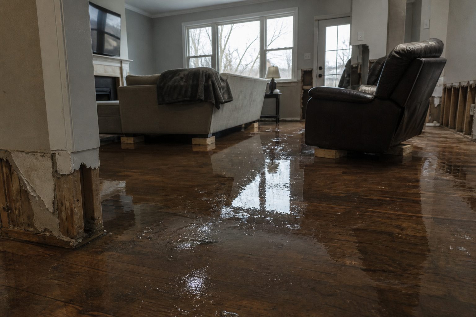
    What this means for restoration teams: the mountain-county polygon (Pocahontas, Webster, Randolph, Nicholas) means remote, limited-access communities along Route 19 and the small-creek drainages — the jobs will be interior water intrusion in homes with limited cell reach and longer dry-out equipment runs. Urban-underpass and street flooding means commercial water-intrusion work too. With up to 3 inches total possible before 9:45 AM EDT, calls will start as water recedes this morning and continue for days. Stage drying assets before the first call and moisture-map every affected room.

    Update published as a live snapshot as of 5:43 AM EDT. Conditions change fast — verify with the National Weather Service for your specific county or ZIP code.

    The National Weather Service in Charleston, WV has issued a Flash Flood Warning for central West Virginia — Braxton, Calhoun, Clay, Gilmer, Lewis, Nicholas, Roane, and Webster counties — effective until 8:45 AM EDT, Sunday, September 20, 2026. Doppler radar indicated thunderstorms producing heavy rain across the warned area, with between 0.5 and 1.5 inches already fallen and another 1 to 1.5 inches possible. Flash flooding is ongoing or expected to begin shortly.

    For restoration teams, this is the exact interior-flooding scenario you see most often: water pushing into homes through low-lying entry points, saturated drywall and insulation, and the first wave of water-intrusion calls once the rain lets up. This is a live snapshot as of 5:00 AM EDT. Conditions change fast — always verify with the National Weather Service for your specific county or ZIP code.

    Central West Virginia — Flash Flood Warning

    Issuing office: National Weather Service, Charleston, WV (weather.gov/rlx)
    Issued: 4:40 AM EDT, September 20, 2026
    Expires: 8:45 AM EDT, September 20, 2026
    Severity: Severe · Certainty: Likely · Urgency: Immediate

    The warning covers southeastern Roane County, Braxton County, southeastern Calhoun County, central Clay County, southern Gilmer County, northwestern Webster County, south central Lewis County, and north central Nicholas County — all in north central to northeastern West Virginia.

    At 4:40 AM EDT, Doppler radar indicated thunderstorms producing heavy rain across the warned area. Between 0.5 and 1.5 inches of rain have fallen. Additional rainfall amounts of 1 to 1.5 inches are possible in the warned area. Flash flooding is ongoing or expected to begin shortly.

    Hazard: Flash flooding caused by thunderstorms. Source: Radar indicated.

    Expected impacts (per the NWS alert): Flash flooding of small creeks and streams, urban areas, highways, streets and underpasses, as well as other poor-drainage and low-lying areas.

    Locations that will experience flash flooding include: Sutton, Gassaway, Birch River, Wallback, Holly River State Park, Flatwoods, and Centralia.

    Highways in the warning: Route 19 between mile markers 47 and 61, between mile markers 64 and 66, and near mile marker 68; Interstate 79 between mile markers 34 and 80.

    Source: NWS alert (api.weather.gov)

    Stay Safe This Morning

    Turn around, don’t drown. When you encounter a flooded road, turn around and find another route. Most flood deaths occur in vehicles — it takes very little moving water to sweep a car off the road. Never drive through flooded roadways, and never walk through moving water.

    If water enters your home:

    • Stay out of standing water where electricity may be present — assume any water in the home could be energized until power is confirmed off.
    • Avoid the basement until water recedes and the power is confirmed off.
    • Photograph everything before cleanup begins — room by room, wide shots and close-ups. Documentation matters for insurance.
    • Call a local restoration contractor early — water left sitting starts a second wave of damage (mold, warping, bacterial growth) within a day or two.

    What This Means for Restoration Teams

    This is the bread-and-butter water-intrusion call: flash flooding of small creeks and streams and poor-drainage areas pushes water into basements, crawl spaces, and slab foundations across Sutton, Gassaway, Flatwoods, and the surrounding towns. Expect the call pattern contractors in central WV know well:

    • Interior water intrusion — ground-level entry through doors, window wells, and foundation cracks, plus water backing up through floor drains in low-lying streets.
    • Saturated drywall and insulation — anything wet past the paper backing is a tear-out, not a dry-out.
    • Mold risk within 24–48 hours — with temperatures mild and humidity high after a morning storm, microbial growth starts fast. Drying equipment needs to be on-site same-day.
    • Low-lying commercial along Route 19 and I-79 corridors — watch for retail and storage facilities near mile markers 47–61 and 64–68 that sit in drainage paths.

    The play: stage equipment now, not when the phone rings. Pre-position air movers and dehumidifiers, keep an on-call rotation through the morning, and capture address + water source + affected areas on the first call — it decides the whole job scope. On-site: photo-document before mitigation, moisture-map every affected room, and keep the homeowner’s payment responsibility clear in writing before work starts.

    FEMA & Federal Assistance

    If flooding damages your home or business, the FEMA Helpline is 1-800-621-3362 (7 a.m.–10 p.m. local time, 7 days a week). You can also apply at DisasterAssistance.gov, through the FEMA app, or find a recovery center at fema.gov/drc.

    Basic eligibility: U.S. citizenship or qualified status, identity verification, proof of occupancy or ownership, and unmet needs not covered by insurance. Apply as soon as it is safe to do so — documentation you capture today (photos, receipts, the warning itself) supports your claim.

    Looking Ahead

    This warning runs until 8:45 AM EDT Sunday. When it expires, that does not mean the water is gone — small creeks and streams in these counties can crest after the rain stops, and a second round of storms over already-saturated ground would re-trigger flooding fast. Watch NWS Charleston (weather.gov/rlx) for extensions or new warnings through the morning.

    Demand window note for contractors: water-intrusion calls typically start within hours of water receding and keep coming for days as people discover damage — warped flooring, musty odors, wicking up drywall. Today’s Sutton/Gassaway/Flatwoods corridor is the call map for the next 72 hours.

    Sources & How to Verify

    To verify for your own county or ZIP code: go to weather.gov, enter your ZIP in the search box, and check the active alerts for your area. Your county emergency management office carries local closure and evacuation information.

    This post is for informational purposes and is not an official weather warning. Always follow instructions from local authorities and the National Weather Service.

  • Flash Flood Warning: Cedar Rapids Area Until 8:00 AM CDT

    Flash Flood Warning: Cedar Rapids Area Until 8:00 AM CDT

    ACTIVE: A Flash Flood Warning is in effect for the Cedar Rapids and eastern Iowa area, issued by the National Weather Service Quad Cities IA/IL at 3:08 AM CDT, expiring 8:00 AM CDT.

    Between 1 and 2 inches have already fallen with 1 to 3 more inches possible — a multi-county setup across Benton, Cedar, Iowa, Johnson, Jones, and Linn counties, running right through Cedar Rapids on I-380.

    This is a live snapshot as of 3:18 AM CDT. Conditions change fast — always verify with the National Weather Service for your specific county or ZIP code.

    Benton, Cedar, Iowa, Johnson, Jones & Linn Counties, Iowa — Flash Flood Warning

    Issuing office: NWS Quad Cities IA/IL
    Issued: 3:08 AM CDT
    Expires: 8:00 AM CDT

    Hazard: Flash flooding caused by thunderstorms.

    Source: Radar indicated.

    Locations expected to experience flash flooding include: Cedar Rapids, Marion, Hiawatha, Robins, Anamosa, Vinton, Marengo, Mount Vernon, Lisbon, Solon, Ely, Fairfax, Walford, Mechanicsville, Stanwood, Palo, Belle Plaine, Center Point, Springville, Atkins.

    Expected impacts: Flash flooding of small creeks and streams, urban areas, highways, streets and underpasses as well as other poor drainage and low-lying areas. Between 1 and 2 inches of rain have fallen, with additional rainfall of 1 to 3 inches possible. This includes Interstate 380 between mile markers 8 and 36 — expect flooded stretches on the main north-south corridor through the warned area.

    Sources: NWS alert | NWS Quad Cities IA/IL office page

    Stay Safe Tonight

    Turn around, don’t drown. Most flood deaths occur in vehicles — never drive through flooded roadways, and be especially cautious at night when it is harder to recognize the dangers of flooding.

    Be aware of your surroundings and do not drive on flooded roads. Remain alert for flooding even in locations not receiving rain — arroyos, streams, and rivers can become raging killer currents in a matter of minutes, even from distant rainfall.

    If water enters your home: stay out of standing water where electricity may be present, avoid the basement until water recedes and power is confirmed off, and photograph everything before cleanup — that documentation matters for insurance. Then call a local restoration contractor: water left sitting starts a second wave of damage within a day.

    Report what you see: the NWS asks residents to report observed flooding to local emergency services or law enforcement and request they pass it to the National Weather Service — but only when it can be done safely.

    What This Means for Restoration Teams

    A warning like this one is the contractor’s early warning system for the next several days of inbound work. Six counties and the Cedar Rapids metro in one polygon — this is the scale of warning that generates a multi-day call queue: basements along the Cedar River corridor, saturated commercial ground floors, and low-lying subdivisions in Hiawatha and Robins.

    • Basement and crawlspace flooding across the Cedar Rapids/Marion/Hiawatha metro — the classic Category 1–2 residential jobs that start the moment water recedes.
    • Stormwater backup in low-lying urban streets and underpasses — sewage cross-contamination risk where combined systems are overwhelmed.
    • Saturated drywall, carpet, and insulation with mold risk within 24–48 hours — crews that start drying same-day get the job, not the callback.
    • I-380 corridor flooding (mile markers 8–36) — commercial and fleet clients along the interstate should be on the call list.

    The play: pre-position drying assets across the metro now, keep an on-call rotation through the 8:00 AM expiry and into the morning commute, and capture address + water source + affected areas on the first call — with 3 more inches possible, crews should expect the call volume to build through sunrise.

    Field discipline holds: photo-document before mitigation, moisture-map every affected room, and keep the homeowner’s payment responsibility clear in writing before work starts.

    FEMA & Federal Assistance

    If flooding damages your home and you need federal help, the FEMA Helpline is 1-800-621-3362 (7 a.m. to 10 p.m. local time, 7 days a week). You can also apply at DisasterAssistance.gov, through the FEMA app, or by finding a recovery center at fema.gov/drc.

    Basic eligibility: U.S. citizenship or qualified immigration status, identity verification, proof of occupancy or ownership, and unmet needs not covered by insurance. Apply as soon as it’s safe to do so — you do not have to wait for an official disaster declaration to start the process.

    Looking Ahead

    This warning runs until 8:00 AM CDT, and with up to 3 additional inches possible, watch for reissues or extensions from NWS Quad Cities through the morning. Small creeks and streams can crest after the rain stops, and urban underpasses stay flooded into the commute window.

    Water-intrusion calls typically start within hours of water receding and keep coming for days as people discover damage — saturated drywall, buckling floors, and musty odors that show up after the water is gone.

    Sources & How to Verify

    To verify for your own county or ZIP: go to weather.gov and enter your ZIP code, or check the issuing NWS office page for the latest updates and any reissues.

    This post is for informational purposes and is not an official weather warning. Always follow instructions from local authorities and the National Weather Service.
  • Flash Flood Warning: Northern Clermont County, Ohio Until 6:45 AM EDT

    Flash Flood Warning: Northern Clermont County, Ohio Until 6:45 AM EDT

    A life-threatening flash flood warning is active for northern Clermont County, Ohio, right now

    The National Weather Service office in Wilmington, Ohio, issued a Flash Flood Warning for northern Clermont County in southwestern Ohio at 3:39 AM EDT on Sunday, September 20, 2026, and it runs until 6:45 AM EDT. The alert carries a CONSIDERABLE damage threat tag — NWS language for a warning it expects to produce real, destructive flooding, not just street ponding. Radar indicated thunderstorms have already dropped 2 to 3.5 inches of rain across the warned area, with another 0.5 to 1 inch possible, and the service warns that flash flooding is ongoing or expected to begin shortly.

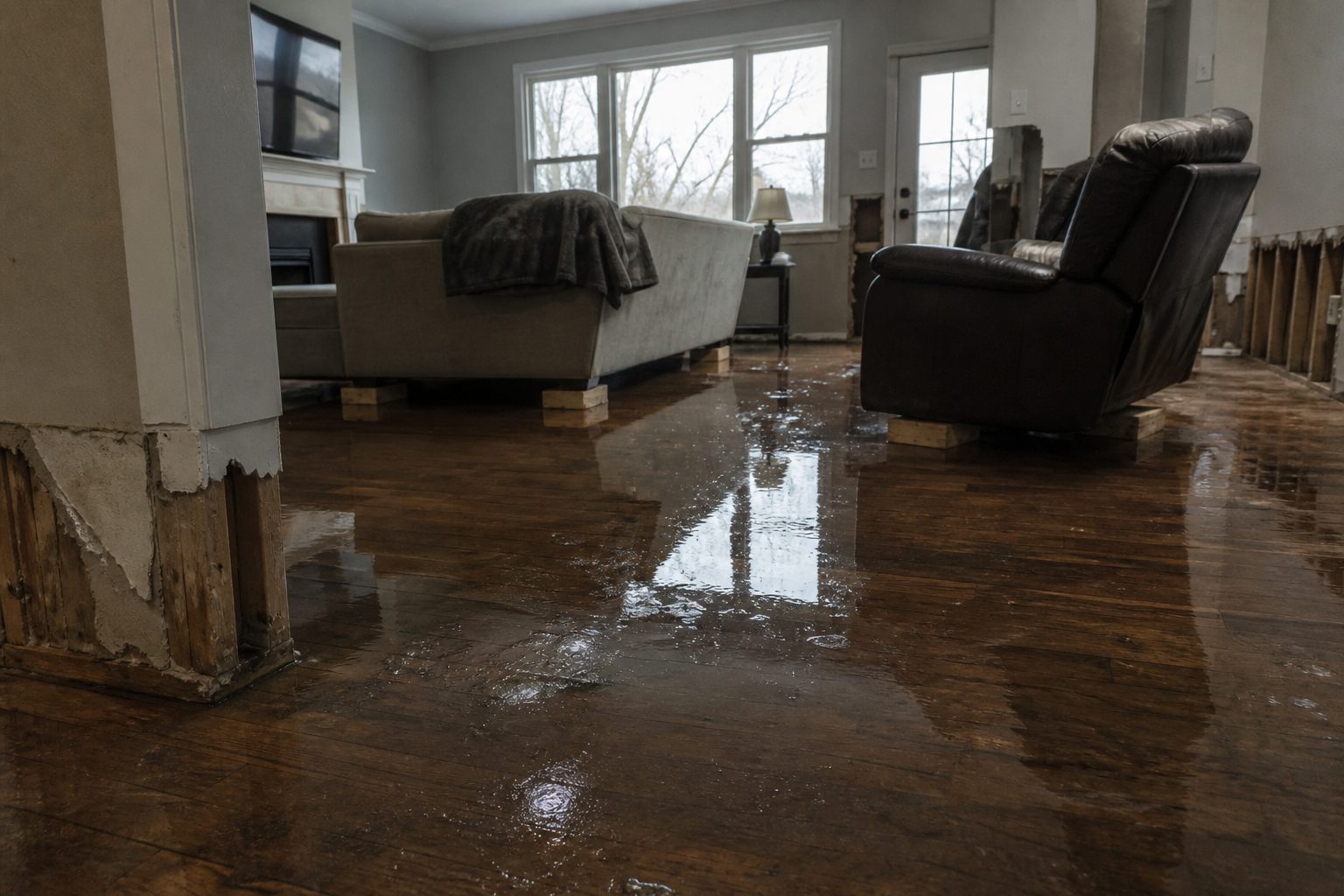
    For restoration teams in the Cincinnati Eastside corridor, this is the exact water-intrusion profile that turns into basement jobs by morning: saturated ground, overwhelmed drainage, and water finding its way into foundations, window wells, and low-lying finished basements across Loveland, Goshen, Newtonsville, and the surrounding communities.

    This is a live snapshot as of roughly 12:55 AM PDT (3:55 AM EDT). Conditions change fast — always verify with the National Weather Service for your specific county or ZIP code.

    Northern Clermont County — Flash Flood Warning

    Issuing office: NWS Wilmington OH (weather.gov/iln) · Issued: September 20, 2026 at 3:39 AM EDT · Expires: September 20, 2026 at 6:45 AM EDT · Severity: Severe · Certainty: Likely · Urgency: Immediate · VTEC: /O.NEW.KILN.FF.W.0093.260920T0739Z-260920T1045Z/

    Warning wording, verbatim from the alert:

    • Hazard: Life threatening flash flooding. Thunderstorms producing flash flooding.
    • Source: Radar indicated.
    • Impact: Life threatening flash flooding of creeks and streams, urban areas, highways, streets and underpasses.
    • Flash flood damage threat: CONSIDERABLE.

    Locations that may experience flash flooding include: Loveland, Remington, Goshen, Newtonsville, Springvale, Mount Repose, Day Heights, Mulberry, Edenton, and Miamiville.

    Rainfall detail: Between 2 and 3.5 inches of rain have already fallen across the warned area. Additional rainfall amounts of 0.5 to 1 inch are possible. That matters because the ground in northern Clermont County is now saturated — every additional half inch is runoff, not absorption. With radar-indicated detection (as opposed to observed), the flooding pattern is being inferred from rainfall rates rather than confirmed by spotters, but at 2 to 3.5 inches the threat is real either way. This is a radar-indicated, imminent-threat warning — NWS is treating flooding as already underway or about to be.

    Alert source: the NWS Wilmington office page at weather.gov/iln.

    Stay safe through the night

    Turn around, don’t drown. When you encounter a flooded road, turn around — most flood deaths occur in vehicles. NWS specifically urges extra caution at night, when it is harder to recognize the dangers of flooding. A few inches of fast-moving water can knock you off your feet; a foot of it can float a car.

    If water is entering your home:

    • Stay out of standing water where electricity may be present. If water is near outlets, appliances, or the electrical panel, do not touch anything — get out and call for help.
    • Avoid the basement until the water recedes and power is confirmed off.
    • Photograph everything before cleanup. Water lines on drywall, soaked carpet, damaged belongings — documentation matters for insurance, and you can never recreate it after mitigation starts.
    • Then call a local restoration contractor. Water left sitting starts a second wave of damage within a day — microbial growth begins in 24 to 48 hours on saturated drywall, insulation, and carpet.

    What this means for restoration teams

    This warning is a textbook overnight water-intrusion trigger for the northern Clermont County market. The signature damage categories to expect:

    • Interior water intrusion: basement seepage and foundation inflow where 2 to 3.5 inches of rain overwhelm drainage. Walkout basements and window wells in Loveland and Goshen-area homes are first in line.
    • Saturated drywall and insulation: finished basements with water at the baseboard level need tear-out of the bottom 12–24 inches of drywall and any wet insulation — drying in place does not work on saturated cellulose or fiberglass behind a water line.
    • Mold risk within 24–48 hours: an overnight flood means materials sit wet through Sunday. Calls about musty odors and visible growth will land Monday and Tuesday from homes that “seemed fine” Sunday morning.
    • Sewage backup in low-lying areas: when storm systems are overwhelmed, sanitary backups follow in the lowest elevations — treat any sewage intrusion as Category 3 water with full PPE and hard-line containment.
    • Urban and highway flooding: the alert specifically flags highways, streets, and underpasses — expect commercial properties along flooded corridors with water through doors and loading areas.

    The play: stage equipment now, pre-position drying assets before the 6:45 AM expiry, and keep an on-call rotation through the morning. First-light Sunday is when discovery calls start — homeowners wake up to wet basements — and they keep coming for days as people find damage. On every first call, capture the address, the water source, and the affected areas before anything else; it drives the whole scoping call.

    Field discipline: photo-document before any mitigation begins, moisture-map every affected room (not just the visibly wet ones — water migrates behind baseboards and into wall cavities), and keep the homeowner’s payment responsibility clear in writing before work starts. Overnight flood calls are chaotic; the teams that document win the insurance fight later.

    FEMA & federal assistance

    If flooding damages your home and local resources are overwhelmed, federal assistance may become available once a disaster is declared:

    • FEMA Helpline: 1-800-621-3362 (7 a.m.–10 p.m. local, 7 days a week).
    • Apply online at DisasterAssistance.gov, through the FEMA app, or find a recovery center at fema.gov/drc.
    • Basic eligibility: U.S. citizenship or qualified status, identity verification, proof of occupancy or ownership, and unmet needs not covered by insurance.
    • Apply as soon as it is safe to do so — early registration puts you first in line once a declaration is made.

    Looking ahead

    The warning expires at 6:45 AM EDT, right around sunrise. What to watch: additional rounds of thunderstorms behind this system, and creeks and streams in northern Clermont County cresting later Sunday morning even after the rain stops — flash flooding is about rainfall rate, but the downstream effects keep running. The next NWS update lands with the warning’s expiry or a reissue if the threat continues.

    Demand window: water-intrusion calls typically start within hours of water receding and keep coming for days as people discover damage. For this event, expect the first calls at first light Sunday and a second wave Monday–Tuesday as hidden moisture becomes visible growth and odor. Stage crews and drying capacity accordingly.

    Sources & how to verify

    • NWS Flash Flood Warning, NWS Wilmington OH — issued 3:39 AM EDT, expires 6:45 AM EDT, September 20, 2026 (AWIPS identifier FFWILN; VTEC /O.NEW.KILN.FF.W.0093.260920T0739Z-260920T1045Z/).
    • NWS Wilmington office page: weather.gov/iln — report flash flooding via the office website’s social-media submission, when it is safe to do so.

    To verify for your own county or ZIP code: go to weather.gov, enter your ZIP, and check the active alerts from your local NWS office.

    This post is for informational purposes and is not an official weather warning. Always follow instructions from local authorities and the National Weather Service.

  • Flash Flood Warning: De Kalb, La Salle & Lee Counties (IL) Until 8 AM CDT

    Flash Flood Warning: De Kalb, La Salle & Lee Counties (IL) Until 8 AM CDT

    The situation right now

    The National Weather Service in Chicago has issued a Flash Flood Warning for southern De Kalb County, northern La Salle County, and Lee County in north central Illinois, effective 2:12 AM CDT Sunday, September 20, and running until 8:00 AM CDT. Doppler radar shows thunderstorms producing heavy rain across the warned area — up to 3 inches have already fallen, with rainfall rates of 1.5 to 2.5 inches per hour and another 1 to 3 inches possible. Flash flooding is ongoing or expected to begin shortly. This is the exact interior-flooding profile restoration teams see most: fast water in homes, not rising rivers. This is a live snapshot as of early Sunday morning. Conditions change fast — always verify with the National Weather Service for your specific county or ZIP code.

    De Kalb, La Salle & Lee Counties, IL — Flash Flood Warning

    Issued by NWS Chicago at 2:12 AM CDT; expires 8:00 AM CDT. Hazard, verbatim from the alert: flash flooding caused by thunderstorms, radar-indicated. At 2:12 AM CDT, Doppler radar indicated thunderstorms producing heavy rain; up to 3 inches of rain have fallen, expected rainfall rates of 1.5 to 2.5 inches per hour, with additional amounts of 1 to 3 inches possible in the warned area.

    Locations in the warning path, per NWS: Sandwich, Mendota, Amboy, Sheridan, Shabbona, Lake Holiday, Hinckley, Somonauk, Earlville, Waterman, Serena, Leland, Paw Paw, Sublette, Woodhaven Lakes, Millington, Lee, Compton, Troy Grove, Nelson, West Brooklyn, Harmon, Triumph, Prairie Center, and Lee Center.

    Expected impacts, verbatim: rapid-onset flooding of creeks, streams, drainage ditches, streets, underpasses, low-lying areas, and other poor drainage areas. Persons along creeks, drainage ditches, and other waterways should take immediate precautions to protect life and property.

    Sources: NWS Chicago, weather.gov.

    Stay safe tonight

    Turn around, don’t drown when encountering flooded roads — most flood deaths occur in vehicles. Never drive through flooded roadways; 6 inches of moving water can knock you down, 12 inches can carry away a car. It is harder to recognize the dangers of flooding at night — be especially cautious. If water enters your home: stay out of standing water where electricity may be present, avoid the basement until water recedes and power is confirmed off, and photograph everything before any cleanup — documentation matters for insurance. Then call a local restoration contractor; water left sitting starts a second wave of damage within a day.

    What this means for restoration teams

    Rates of 1.5 to 2.5 inches per hour on already-saturated ground mean rapid-onset interior flooding: water intrusion through doors and window wells, saturated drywall and insulation, and sewage backup in low-lying pockets of the warned area. With flash flooding ongoing at 2 AM, first water-intrusion calls typically start within hours of water receding and keep coming for days as people discover damage. Mold risk begins within 24 to 48 hours — the drying play starts now.

    The play: stage equipment now — air movers, dehumidifiers, extraction units — and pre-position drying assets across the De Kalb / La Salle / Lee triangle before first light. Keep an on-call rotation through the morning; Sunday-morning water events generate calls all day as residents wake to standing water. Capture address, water source, and affected areas on the very first call. Field discipline: photo-document before mitigation, moisture-map every affected room, and keep the homeowner’s payment responsibility clear in writing before work starts.

    FEMA & federal assistance

    If the flooding damages your home, the FEMA Helpline is 1-800-621-3362 (7 a.m.–10 p.m. local time, 7 days a week). You can also apply at DisasterAssistance.gov, through the FEMA mobile app, or find a recovery center at fema.gov/drc. Basic eligibility generally requires citizenship or qualified status, identity verification, proof of occupancy or ownership, and unmet needs not covered by insurance. Apply as soon as it is safe to do so.

    Looking ahead

    This warning runs until 8:00 AM CDT. Overnight, watch for additional rounds of thunderstorms training over the same counties, and creeks and drainage ditches that crest later even after rain stops. The NWS will update or extend the warning if conditions warrant; check the NWS Chicago page for the latest. For restoration operators, the demand window is Sunday: calls start as water recedes and run for days as damage is discovered.

    Sources & how to verify

    NWS Chicago alert (issued 2:12 AM CDT Sept 20, 2026): weather.gov — NWS Chicago office: weather.gov/lot/. To verify for your county or ZIP, go to weather.gov and enter your ZIP, or check your local NWS office page.

    This post is for informational purposes and is not an official weather warning. Always follow instructions from local authorities and the National Weather Service.

  • Flash Flood Warning: Hocking and Pickaway Counties Area Until 9:00 AM EDT

    Flash Flood Warning: Hocking and Pickaway Counties Area Until 9:00 AM EDT

    Flash flood warning extended through 9 AM in central Ohio

    The National Weather Service office in Wilmington, Ohio has extended a Flash Flood Warning for southern Hocking County and southeastern Pickaway County in central Ohio, now in effect until 9:00 AM EDT Sunday, September 20, 2026. This is an extension of the earlier warning — and it is not routine: law enforcement reported flash flooding across the warned area at 2:48 AM EDT, with 3 to 4 inches of rain already fallen.

    Flash flooding at this scale is exactly the interior-water damage that restoration teams spend the busiest days of their year on — saturated basements, flooded roadways, and water moving through homes and businesses before daylight. This is a live snapshot as of 3:10 AM EDT, Sunday, September 20, 2026. Conditions change fast — always verify with the National Weather Service for your specific county or ZIP code.

    Southern Hocking County — Flash Flood Warning

    Issuing office: National Weather Service Wilmington, Ohio (weather.gov/iln)
    Issued: 2:48 AM EDT Sunday, September 20, 2026
    Expires: 9:00 AM EDT Sunday, September 20, 2026
    Severity: Severe

    Hazard detail, per the alert: At 2:48 AM EDT, local law enforcement reported flash flooding across the warned area. Between 3 and 4 inches of rain have fallen. Additional rainfall amounts of 0.5 to 1 inch are possible in the warned area. The hazard is described as life threatening flash flooding, with thunderstorms producing flash flooding. Source: law enforcement reported.

    Locations in the warned area include:

    • Hocking Hills State Park
    • Starr
    • Laurelville
    • Tarlton
    • Gibisonville
    • South Bloomingville
    • Buena Vista (Hocking County)
    • Ilesboro
    • Union Furnace
    • Whisler

    This also includes Salt Creek and Laurel Run. Expected impacts, verbatim from the alert: life threatening flash flooding of creeks and streams, urban areas, highways, streets and underpasses.

    Southeastern Pickaway County — Flash Flood Warning

    The same warning covers southeastern Pickaway County in central Ohio, issued and expiring on the same timeline: 2:48 AM EDT through 9:00 AM EDT Sunday, September 20, 2026, from NWS Wilmington (weather.gov/iln). The same conditions apply — observed flash flooding reported by law enforcement, 3 to 4 inches of rain fallen, and another 0.5 to 1 inch possible. Because this warning is an extension rather than a new issuance, the ground in the warned area is already saturated, and even the additional half-inch to inch of rain can convert quickly into renewed flooding on small creeks, low-lying roads, and poor-drainage areas.

    Stay safe overnight

    Turn around, don’t drown when encountering flooded roads. Most flood deaths occur in vehicles. Be especially cautious at night when it is harder to recognize the dangers of flooding — a road that looks merely wet can be under feet of moving water. Never drive around barricades, and never attempt to cross a flooded underpass or low-water crossing.

    If water enters your home: stay out of standing water where electricity may be present, and avoid the basement until the water recedes and the power is confirmed off. Photograph everything before cleanup begins — documentation matters for insurance. Then call a local restoration contractor. Water left sitting starts a second wave of damage within a day, as drywall, insulation, and flooring begin to break down and mold takes hold.

    To report flash flooding, go to weather.gov/iln and submit your report via social media, when you can do so safely.

    What this means for restoration teams

    An observed, law-enforcement-confirmed flash flood warning with 3 to 4 inches down and more possible is the profile that produces the densest cluster of water-mitigation calls: interior water intrusion through foundations and below-grade entries, saturated drywall and insulation in basements and first floors, and mold risk within 24 to 48 hours anywhere water sits. The named impacts — creeks and streams, urban areas, highways, streets and underpasses — translate directly to flooded homes near low-lying drainage, commercial buildings with overwhelmed storm drainage, and water pushing into finished basements around Salt Creek and Laurel Run.

    The play for operators in the Hocking Hills and Pickaway area:

    • Stage equipment now — extractors, dehumidifiers, air movers — because the calls typically start within hours of water receding and keep coming for days as people discover damage.
    • Pre-position drying assets and keep an on-call rotation through the morning, since the warning runs through 9 AM and saturated soils mean even the extra half-inch to inch of rain can restart flooding.
    • Capture the essentials on the first call: address, water source, and affected areas. After an overnight event, homeowners describe things loosely — pin down where the water came from and which rooms are wet.
    • Field discipline: photo-document everything before mitigation begins, moisture-map every affected room even where the water “looked minor,” and keep the homeowner’s payment responsibility clear in writing before work starts. After a chaotic night event, scope creep and disputed authorizations are the expensive part of the job.
    • Expect secondary damage claims: sewage backup in low-lying areas is common in this kind of event, and saturation around foundations shows up as delayed intrusion days later.

    Local emergency contacts

    For life-threatening emergencies, always dial 911 first. County emergency management contacts, verified against county sources:

    FEMA & federal assistance

    If this flooding damages your home or property, federal assistance may be available through the Federal Emergency Management Agency. Call the FEMA Helpline at 1-800-621-3362 (7 a.m. to 10 p.m. local time, 7 days a week), apply online at DisasterAssistance.gov, use the FEMA app, or find a recovery center at fema.gov/drc.

    Basic eligibility generally requires citizenship or qualified status, identity verification, proof of occupancy or ownership, and unmet needs not covered by insurance. Apply as soon as it is safe to do so — and document the damage thoroughly before cleanup, since that documentation supports both insurance and FEMA claims.

    Looking ahead

    The warning expires at 9:00 AM EDT Sunday. Between now and then, the additional 0.5 to 1 inch of rain possible over already-saturated ground is the thing to watch — small creeks and streams, including Salt Creek and Laurel Run, can crest after the rain stops, so water levels may keep rising even as conditions look like they’re improving. Watch for the next update from NWS Wilmington at weather.gov/iln, and note that a warning can be extended again if flooding persists.

    For restoration operators, the demand window on events like this runs long: the first wave of calls comes within hours of water receding, and a second wave arrives over the following days as homeowners discover intrusion in basements, crawlspaces, and finished areas they didn’t check overnight. Plan staffing accordingly, and treat the morning after expiry as the start of the intake window, not the end of the event.

    Sources & how to verify

    To verify conditions for your own county or ZIP code, visit weather.gov and enter your location, or go directly to your local NWS office page.

    This post is for informational purposes and is not an official weather warning. Always follow instructions from local authorities and the National Weather Service.

  • Flash Flood Warning: Quad Cities Area Until 7:30 AM CDT

    Flash Flood Warning: Quad Cities Area Until 7:30 AM CDT

    ACTIVE — Flash Flood Warning. The National Weather Service in Quad Cities has issued a Flash Flood Warning for parts of eastern Iowa and northwestern Illinois, in effect until 7:30 AM CDT on Sunday, September 20. This is a live snapshot as of 1:52 AM CDT. Conditions change fast — always verify with the National Weather Service for your specific county or ZIP code.

    Doppler radar at 1:38 AM CDT showed thunderstorms producing heavy rain moving across the southern and eastern portions of the warned area, and flash flooding is ongoing or expected to begin shortly. Between 1 and 2 inches of rain have already fallen across much of the warned area, with another 1 to 3 inches likely over the next few hours as more heavy-rain-producing storms move back across the area. For restoration teams, this is the classic overnight water event: the rain falls while everyone sleeps, and the interior flooding jobs get discovered at dawn — the exact water-intrusion calls contractors see most.

    Quad Cities and Northwest Illinois — Flash Flood Warning

    Issuing office: NWS Quad Cities IA IL. Issued: 1:38 AM CDT Sunday, September 20. Expires: 7:30 AM CDT. Severity: Severe. Certainty: Likely. Urgency: Immediate.

    Covered areas: Southwestern Clinton County and Scott County in east central Iowa; eastern Muscatine County in east central Iowa; northwestern Bureau County, Henry County, Mercer County, Rock Island County, and southern Whiteside County in northwestern Illinois.

    Hazard detail, verbatim from the alert: Flash flooding caused by thunderstorms. Source: radar indicated. At 1:38 AM CDT, Doppler radar indicated thunderstorms producing heavy rain moving across southern and eastern portions of the warned area. Between 1 and 2 inches of rain have fallen across much of the warned area with these storms. More heavy rain producing storms will move back across the area over the next few hours with additional rainfall amounts of 1 to 3 inches likely in the warned area.

    Expected impacts, verbatim: Flash flooding of small creeks and streams, urban areas, highways, streets and underpasses as well as other poor drainage and low-lying areas.

    Locations in the warning path: Davenport, Moline, Rock Island, Bettendorf, Muscatine, East Moline, Kewanee, Aledo, Cambridge, Silvis, Geneseo, Eldridge, Colona, Milan, Le Claire, Coal Valley, and Galva. The warned area also includes Big Bend Fish and Wildlife Area, Johnson-Sauk Trail State Recreation Area, and Prophetstown State Park — if you camped or parked near water in those areas overnight, move to higher ground now.

    Highways in the warned area: Interstate 74 in Iowa between mile markers 1 and 5; Interstate 280 between mile markers 1 and 18; Interstate 80 in Iowa between mile markers 279 and 306; Interstate 80 in Illinois between mile markers 1 and 43; Interstate 74 in Illinois between mile markers 1 and 33; Interstate 88 between mile markers 1 and 32, and between mile markers 36 and 43. Never drive through flooded roadways — water over the road is the single most dangerous thing in this warning.

    Source: NWS active alert | NWS Quad Cities office page

    Stay safe tonight

    Turn around, don’t drown when encountering flooded roads — most flood deaths occur in vehicles. Be especially cautious at night, when it is harder to recognize the dangers of flooding. Be aware of your surroundings and do not drive on flooded roads.

    If water gets into your home: stay out of standing water where electricity may be present; do not enter the basement until water has receded and power is confirmed off. Photograph everything before you move or clean anything — documentation matters for insurance. Then call a local restoration contractor: water left sitting starts a second wave of damage within a day, and mold can begin within 24 to 48 hours.

    If you can do so safely, please report observed flooding to local emergency services or law enforcement and ask that they pass the information to the National Weather Service — spotter reports are what upgrade these warnings from radar-indicated to observed.

    What this means for restoration teams

    This is a metro-area overnight event covering the Quad Cities corridor (Davenport–Bettendorf–Moline–Rock Island) plus Muscatine, Kewanee, Geneseo, and surrounding communities on both sides of the Mississippi. Damage categories to expect: interior water intrusion through foundations and slab-on-grade entries, saturated drywall and insulation in finished basements, stormwater backing up through floor drains in low-lying areas, and surface water pooling in urban poor-drainage zones. The call pattern will skew residential first light, then commercial — parking structures, below-grade storage, and loading docks along the I-74/I-80/I-280 corridors.

    The play: stage equipment tonight and keep an on-call rotation through the morning. Pre-position dehumidifiers, air movers, and extraction units before the 7:30 AM CDT expiry so the first response window isn’t lost to loading the truck. Capture the address, water source, and affected areas on the first call — with 1 to 3 additional inches possible before the warning expires, distinguish active intrusion from post-recession wicking. Field discipline: photo-document before mitigation, moisture-map every affected room (not just the visibly wet ones), and keep the homeowner’s payment responsibility clear in writing before work starts.

    FEMA & federal assistance

    FEMA Helpline: 1-800-621-3362 (7 a.m.–10 p.m. local, 7 days). You can also apply at DisasterAssistance.gov, through the FEMA app, or find recovery centers at fema.gov/drc. Basic eligibility: citizenship or qualified status, identity verification, proof of occupancy or ownership, and unmet needs not covered by insurance. Apply as soon as it is safe — do not wait for everything to be resolved first.

    Looking ahead

    The warning runs until 7:30 AM CDT, but the danger doesn’t end at expiry. The alert explicitly notes that additional heavy-rain-producing storms will move back across the area over the next few hours — with another 1 to 3 inches likely on top of the 1 to 2 inches already down, creeks and streams may crest well after the warning lifts, and urban ponding can linger into the morning commute. Watch for the next NWS update around the 7:30 AM CDT mark.

    Demand window note: water-intrusion calls typically start within hours of water receding and keep coming for days as people discover damage — the second-day calls (musty odor, buckling flooring, wicking up drywall) often exceed the first-morning wave. Contractors who staff the full 48-hour window after a radar-indicated overnight event capture the jobs others miss.

    Sources & how to verify

    To verify for your own county or ZIP: go to weather.gov and enter your ZIP code, or check the NWS Quad Cities office page linked above.

    This post is for informational purposes and is not an official weather warning. Always follow instructions from local authorities and the National Weather Service.

  • Flash Flood Warning: Athens and Vinton Counties, Ohio Until 6:30 AM EDT

    Flash Flood Warning: Athens and Vinton Counties, Ohio Until 6:30 AM EDT

    The National Weather Service office in Charleston, West Virginia, has extended a Flash Flood Warning for central Athens County and northeastern Vinton County in southeastern Ohio, effective until 6:30 AM EDT on Sunday, September 20. Doppler radar and automated rain gauges indicate thunderstorms producing heavy rain across the warned area, with between 0.5 and 2 inches already fallen and an additional 1 to 1.5 inches possible. Flash flooding is ongoing or expected to begin shortly.

    For restoration teams in Athens and Vinton counties, this is the classic interior-water-intrusion profile: the exact flood jobs restoration contractors see most. This is a live snapshot as of late Saturday night (PDT); conditions change fast — always verify with the National Weather Service for your specific county or ZIP code.

    Athens & Vinton Counties — Flash Flood Warning

    Issuing office: NWS Charleston, WV (RLX) · Issued: 2:16 AM EDT, Sunday, September 20, 2026 · Expires: 6:30 AM EDT, Sunday, September 20, 2026 · Warning type: Flash Flood Warning

    Hazard, verbatim from the alert: Flash flooding caused by thunderstorms. Source: radar and automated gauges. Detection: Doppler radar and automated rain gauges indicated. Between 0.5 and 2 inches of rain have fallen; additional rainfall amounts of 1 to 1.5 inches are possible in the warned area. Flash flooding is ongoing or expected to begin shortly.

    Expected impacts, per the alert: Flash flooding of small creeks and streams, urban areas, highways, streets and underpasses as well as other poor drainage and low-lying areas.

    Locations that will experience flash flooding include: Athens, Nelsonville, Lake Hope State Park, Chauncey, Buchtel, Amesville, The Plains and Stroud Run State Park.

    The warning covers central Athens County and northeastern Vinton County in southeastern Ohio. This is an extension of an earlier warning — rain has already been falling on ground that is now saturated, which is exactly when creeks, streams, and urban drainage start to outpace themselves. Source: the NWS alert for this warning, issued by NWS Charleston WV.

    Stay safe overnight

    Turn around, don’t drown when encountering flooded roads. Most flood deaths occur in vehicles. Be especially cautious at night, when it is harder to recognize the dangers of flooding — a road that looks passable in headlights can be covering a washed-out culvert or a foot of fast-moving water.

    If water enters the home: stay out of standing water where electricity may be present, avoid the basement until water recedes and power is confirmed off, and photograph everything before cleanup — documentation matters for insurance. Then call a local restoration contractor: water left sitting starts a second wave of damage within a day.

    You can report flooding to the National Weather Service by calling toll-free 800-401-9535, when you can do so safely.

    What this means for restoration teams

    A radar-and-gauge-indicated flash flood warning that has already been extended is the setup restoration teams know well: 0.5 to 2 inches already down with up to 1.5 more on the way, falling on ground that is now saturated overnight. Expect the calls to be interior water intrusion — water at door thresholds and garage entries, saturated lower drywall and insulation in finished basements, carpet and pad saturation in living areas, and standing water in crawl spaces. In college-town Athens and the small communities of northeastern Vinton County, watch for overwhelmed low-lying rentals and older housing stock with marginal drainage.

    The damage categories to be ready for: interior water intrusion through low entries and below-grade walls, saturated drywall and insulation that wicks upward from the floor line, mold risk inside 24–48 hours on any organic material that stays wet, sewage backup where low-lying laterals get overwhelmed, and water-damaged flooring in garages and finished rooms.

    The play overnight: stage extraction and drying equipment now so it rolls at first light; keep an on-call rotation through the 6:30 AM expiry and the hours after, because discovery calls lag the water — people wake up to wet carpet, not to the warning itself. On every first call capture the address, the water source, and the affected areas before dispatching. Field discipline stays the same even at speed: photo-document before mitigation, moisture-map every affected room, and keep the homeowner’s payment responsibility clear in writing before work starts.

    Athens is home to Ohio University and a dense rental market; landlords and property managers often discover damage a full day after tenants do. If your shop does property-management accounts, a proactive heads-up to those clients tonight can turn into a scheduled first-look tomorrow instead of an emergency call Monday.

    FEMA & federal assistance

    If damage is significant, the FEMA Helpline is 1-800-621-3362 (7 a.m.–10 p.m. local, 7 days a week). You can also apply at DisasterAssistance.gov or through the FEMA app, and find local recovery centers at fema.gov/drc. Basic eligibility: U.S. citizenship or qualified status, identity verification, proof of occupancy or ownership, and unmet needs not covered by insurance. Apply as soon as it is safe to do so — do not wait for cleanup to finish.

    Looking ahead

    The warning runs until 6:30 AM EDT, after which the immediate alert expires — but that does not mean the water is done. Small creeks and streams can crest after the rain stops, and urban poor-drainage spots hold standing water into the morning. Watch for additional rounds of storms overnight: this warning is already an extension, so the pattern is active, not clearing.

    The demand window: water-intrusion calls typically start within hours of water receding and keep coming for days as people discover damage — first the homeowners who are awake and watching, then the ones who find it Sunday afternoon, then the rental-property discoveries Monday. Staff your phone line through at least midday Sunday and have your first site visits scheduled by mid-morning.

    Sources & how to verify

    To verify for your own county or ZIP: go to weather.gov, enter the ZIP, and read the current alerts tab — or open your local NWS office page directly.

    This post is for informational purposes and is not an official weather warning. Always follow instructions from local authorities and the National Weather Service.

  • Flash Flood Warning: Eastern Iowa Area Until 6:15 AM CDT

    Flash Flood Warning: Eastern Iowa Area Until 6:15 AM CDT

    Update: observed flooding in Kalona — 4:43 AM CDT

    Issued 4:43 AM CDT, still until 6:15 AM CDT by the National Weather Service in Quad Cities, IA/IL. The warned area is unchanged: Cedar, Iowa, Johnson, Keokuk, Louisa, Muscatine, and Washington counties. This update is observed flooding, not a forecast — spotters are reporting it on the ground right now.

    Trained weather spotters reported flash flooding in Kalona. Between 2 and 4 inches of rain have fallen across portions of the warned area. Rain has tapered off to mainly light to at times moderate rain, with the heaviest rain already over — but flash flooding is ongoing. The English River is out of its banks: Washington County deputies reported around a foot of water covering the intersection of 133rd Street and Nutmeg Street in Kalona. Be alert for rapid rises and flooding on area streams and creeks and along the English River.

    Drivers should know the highway exposure in this warning: Interstate 80 between mile markers 205 and 277 and Interstate 380 between mile markers 1 and 7 are inside the warned area. Turn around, don’t drown — most flood deaths happen in vehicles, and it is much harder to recognize flooded roadways at night.

    What this means for restoration teams: observed, on-the-ground flooding in Kalona and along the English River means this event is already producing water-intrusion work, not just risk. First calls typically land within hours of water receding and keep coming for days as damage is discovered — saturated drywall and insulation, contents in flooded basements, and septic/sewer backup in low-lying areas. If you’re covering the Iowa City–Muscatine–Washington corridor this morning, keep an on-call rotation through daylight and capture address, water source, and affected areas on the first call.

    Update published as a live snapshot as of 4:43 AM CDT. Conditions change fast — verify with the National Weather Service for your specific county or ZIP code.

    East Central and Southeast Iowa — Flash Flood Warning

    The National Weather Service in the Quad Cities has issued a Flash Flood Warning for seven eastern Iowa counties, in effect until 6:15 AM CDT on Sunday, September 20. The warning, issued at 12:16 AM CDT, covers southern Cedar County, Iowa County, Johnson County, Muscatine County, Keokuk County, northwestern Louisa County, and Washington County.

    For restoration teams, this is a wide-area overnight water event: between 1 and 2 inches of rain have already fallen, with another 2 to 3 inches possible before sunrise. Urban areas, small creeks, highways, and underpasses across east central and southeastern Iowa are in the impact zone — the exact interior flooding and stormwater-damage jobs restoration contractors see most.

    UPDATE 1:45 AM CDT: this warning continues (same counties, same 6:15 AM CDT expiry), and flooding is now observed — trained weather spotters report the creek in Kalona, Iowa is out of its banks and still rising. This is a live snapshot as of 1:55 AM CDT. Conditions change fast — always verify with the National Weather Service for your specific county or ZIP code.

    Southern Cedar, Iowa, Johnson & Muscatine Counties — Flash Flood Warning

    Issued by NWS Quad Cities IA IL at 12:16 AM CDT, expiring 6:15 AM CDT. At 12:16 AM CDT, Doppler radar indicated thunderstorms producing heavy rain across the warned area; at 1:45 AM CDT trained weather spotters reported the creek in Kalona is out of its banks and still rising (flash flood detection now OBSERVED). Between 1 and 2 inches of rain have fallen, with additional rainfall amounts of 2 to 3 inches possible. Flash flooding is ongoing or expected to begin shortly.

    Locations that will experience flash flooding include: Iowa City, Muscatine, Tipton, West Branch, Durant, Coralville, North Liberty, West Liberty, Wilton, Tiffin, and University Heights.

    Expected impacts: flash flooding of small creeks and streams, urban areas, highways, streets and underpasses, as well as other poor drainage and low-lying areas.

    Highway impacts: Interstate 80 in Iowa between mile markers 205 and 277, and Interstate 380 between mile markers 1 and 7. Do not drive flooded roadways — underpasses on these corridors are especially dangerous overnight.

    Sources: the NWS Quad Cities office page and the official NWS alert (alert ID urn:oid:2.49.0.1.840.0.b1647530b5db10f8acc8cbf7b275d41d896a364b.001.1).

    Keokuk, Northwestern Louisa & Washington Counties — Flash Flood Warning

    Same warning, same timing: issued by NWS Quad Cities IA IL at 12:16 AM CDT, expiring 6:15 AM CDT. Radar-indicated thunderstorms producing heavy rain, with 1 to 2 inches already fallen and up to 3 inches more possible. Flash flooding is ongoing or expected to begin shortly. Severity: Severe; certainty: Likely; urgency: Immediate.

    Locations that will experience flash flooding include: Washington, Marengo, Sigourney, Columbus Junction, Williamsburg, Kalona, Wellman, and Lone Tree.

    Expected impacts: small creeks and streams, urban areas, highways, streets and underpasses, and other poor drainage and low-lying areas.

    Stay safe tonight

    Turn around, don’t drown when encountering flooded roads. Most flood deaths occur in vehicles — never drive through flooded roadways.

    Be especially cautious at night, when it is harder to recognize the dangers of flooding. This warning covers the full overnight window across the Iowa City–Muscatine corridor and surrounding rural counties, where rural roads and low-water crossings are hardest to read in the dark.

    Be aware of your surroundings and do not drive on flooded roads.

    If water enters the home: stay out of standing water where electricity may be present, avoid the basement until water recedes and power is confirmed off, photograph everything before cleanup (documentation matters for insurance), then call a local restoration contractor — water left sitting starts a second wave of damage within a day.

    What this means for restoration teams

    This is a water-intrusion event across a broad service area, from the Iowa City metro to rural southeastern Iowa. Expect:

    • Interior water intrusion — basements, crawlspaces, and ground-floor commercial spaces in low-lying areas and along creeks and the Iowa/Cedar river tributaries.
    • Saturated drywall and insulation — water wicks upward fast; what looks like a wet floor line is often a two-foot wall cut.
    • Mold risk within 24–48 hours — drying starts now, not Monday.
    • Sewage backup in low-lying urban and rural areas where stormwater overwhelms the system — treat as Category 3 until verified otherwise.
    • Stormwater damage to commercial properties along the I-80 corridor — loading docks, storage areas, and below-grade parking.

    The play: stage equipment tonight, pre-position drying assets across the seven-county area, keep an on-call rotation through Sunday morning, and capture address, water source, and affected areas on the first call. Field discipline: photo-document before mitigation, moisture-map every affected room, and keep the homeowner’s payment responsibility clear in writing before work starts.

    FEMA & federal assistance

    FEMA Helpline: 1-800-621-3362 (7 a.m.–10 p.m. local time, 7 days a week). You can also apply at DisasterAssistance.gov, through the FEMA mobile app, or find in-person recovery centers at fema.gov/drc.

    Basic eligibility: U.S. citizenship or qualified non-citizen status, identity verification, proof of occupancy or ownership, and unmet needs not covered by insurance. Apply as soon as it is safe to do so — do not wait for insurance to settle first.

    Looking ahead

    The warning expires at 6:15 AM CDT. What to watch through the rest of the night: additional thunderstorm rounds can drop rain on ground that is already saturated, and small creeks and streams often crest after the rain stops. With up to 2–3 inches more possible, a reissue or extension is likely if flooding is still ongoing at expiry.

    Demand window note: water-intrusion calls typically start within hours of water receding and keep coming for days as homeowners discover damage — especially in basements that weren’t checked overnight.

    Sources & how to verify

    • Official warning: National Weather Service Quad Cities IA IL, Flash Flood Warning issued 12:16 AM CDT Sept 20 (alert ID urn:oid:2.49.0.1.840.0.b1647530b5db10f8acc8cbf7b275d41d896a364b.001.1)
    • NWS Quad Cities office page

    To verify for your own county or ZIP code, check weather.gov or the NWS Quad Cities office page — alerts update continuously.

    This post is for informational purposes and is not an official weather warning. Always follow instructions from local authorities and the National Weather Service.