Tag: storm tracker 2026

  • Flash Flood Warning: Gallia, OH Until 5:30 AM EDT Monday, September 21

    Flash Flood Warning: Gallia, OH Until 5:30 AM EDT Monday, September 21

    This is a live snapshot as of 11:25 PM EDT Sunday, September 20. Conditions change fast — always verify with the National Weather Service for your specific county or ZIP code.

    Gallia, OH — Flash Flood Warning

    Flash Flood Warning issued September 20 at 11:25PM EDT until September 21 at 5:30AM EDT by NWS Charleston WV

    Issued by NWS Charleston WV. Issue time: 11:25 PM EDT Sunday, September 20. Expires: 5:30 AM EDT Monday, September 21.

    FFWRLX
    The National Weather Service in Charleston has issued a
    * Flash Flood Warning for…
    North Central Gallia County in southeastern Ohio…
    Jackson County in southeastern Ohio…
    Southeastern Vinton County in southeastern Ohio…
    * Until 530 AM EDT Monday.
    * At 1125 PM EDT, Doppler radar indicated thunderstorms producing
    heavy rain across the warned area. Between 1 and 2.5 inches of rain
    have fallen. Additional rainfall amounts of 1 to 2 inches are
    possible in the warned area. Flash flooding is ongoing or expected
    to begin shortly.
    HAZARD…Flash flooding caused by thunderstorms.
    SOURCE…Radar indicated.
    IMPACT…Flash flooding of small creeks and streams, urban areas,
    highways, streets and underpasses as well as other poor
    drainage and low-lying areas.
    * Some locations that will experience flash flooding include…
    Jackson, Wellston, Coalton, Vinton, Wilkesville and Petersburg.

    Hail size (NWS parameters): not specified in parameters. Wind gust (NWS parameters): not specified in parameters.

    Locations in the warning path, as listed by NWS:

    • Flash Flood Warning for…
    • Until 530 AM EDT Monday.
    • At 1125 PM EDT, Doppler radar indicated thunderstorms producing
    • Some locations that will experience flash flooding include…

    Warned area: Gallia, OH; Jackson, OH; Vinton, OH

    NWS office page: NWS Charleston WV · Official NWS alert

    Official NWS instructions

    Turn around, don’t drown when encountering flooded roads. Most flood
    deaths occur in vehicles.

    Be especially cautious at night when it is harder to recognize the
    dangers of flooding.

    Be aware of your surroundings and do not drive on flooded roads.

    Report flooding to the National Weather Service by calling toll free,
    800 401 9535, when you can do so safely.

    Stay safe tonight

    Turn around, don’t drown. Most flood deaths happen in vehicles — never drive through flooded roadways; six inches of moving water can knock you down, twelve inches can carry a car.

    If water enters the home: stay out of standing water where electricity may be present, avoid the basement until water recedes and power is confirmed off, photograph everything before cleanup (documentation matters for insurance), then call a local restoration contractor — water left sitting starts a second wave of damage within a day.

    What this means for restoration teams

    Translate this warning into job tickets: interior water intrusion through doors, windows, and foundation seepage; saturated carpet and pad; drywall wicking that shows up as a waterline hours later; and mold risk within 24–48 hours wherever porous materials stayed wet. Low-lying areas and urban drainage failures also bring sewage backup calls — the highest-margin, highest-urgency work.

    The play: stage extraction and drying equipment now, pre-position dehumidifiers and air movers, keep an on-call rotation through the morning, and capture address, water source, and affected areas on the first call. Field discipline: photo-document before mitigation, moisture-map every affected room, and get the homeowner’s payment responsibility clear in writing before work starts.

    FEMA & federal assistance

    FEMA & federal assistance

    If the damage is severe, the FEMA Helpline is 1-800-621-3362 (7 a.m.–10 p.m. local, 7 days). Apply at DisasterAssistance.gov, through the FEMA app, or find a recovery center at fema.gov/drc. Basic eligibility: citizenship or qualified status, identity verification, proof of occupancy or ownership, and unmet needs not covered by insurance. Apply as soon as it’s safe.

    Looking ahead

    When this warning expires, the danger is not automatically over. Creeks and small streams can crest hours after the rain stops, and additional rounds of storms can re-trigger warnings. Watch for NWS updates overnight. For restoration contractors: water-intrusion calls typically start within hours of water receding and keep coming for days as homeowners discover damage behind walls and under flooring.

    Sources & how to verify

    Verify for your own county or ZIP at weather.gov or your local NWS office page.

    This post is for informational purposes and is not an official weather warning. Always follow instructions from local authorities and the National Weather Service.


  • Severe Thunderstorm Warning: El Paso, CO Until 10:00 PM MDT Sunday, September 20

    Severe Thunderstorm Warning: El Paso, CO Until 10:00 PM MDT Sunday, September 20

    This is a live snapshot as of 9:29 PM MDT Sunday, September 20. Conditions change fast — always verify with the National Weather Service for your specific county or ZIP code.

    El Paso, CO — Severe Thunderstorm Warning

    Severe Thunderstorm Warning issued September 20 at 9:29PM MDT until September 20 at 10:00PM MDT by NWS Pueblo CO

    Issued by NWS Pueblo CO. Issue time: 9:29 PM MDT Sunday, September 20. Expires: 10:00 PM MDT Sunday, September 20.

    SVRPUB
    The National Weather Service in Pueblo has issued a
    * Severe Thunderstorm Warning for…
    South central El Paso County in east central Colorado…
    North central Pueblo County in southeastern Colorado…
    * Until 1000 PM MDT.
    * At 929 PM MDT, a severe thunderstorm was located 7 miles north of
    Pinon, or 18 miles north of Pueblo Airport, moving southeast at 20
    mph.
    HAZARD…Tennis ball size hail and 70 mph wind gusts.
    SOURCE…Radar indicated.
    IMPACT…People and animals outdoors will be injured. Expect hail
    damage to roofs, siding, windows, and vehicles. Expect
    considerable tree damage. Wind damage is also likely to
    mobile homes, roofs, and outbuildings.
    * Locations impacted include…
    Fountain and Hanover.

    Hail size (NWS parameters): 2.50. Wind gust (NWS parameters): 70 MPH.

    Locations in the warning path, as listed by NWS:

    • Severe Thunderstorm Warning for…
    • Until 1000 PM MDT.
    • At 929 PM MDT, a severe thunderstorm was located 7 miles north of
    • Locations impacted include…

    Warned area: El Paso, CO; Pueblo, CO

    NWS office page: NWS Pueblo CO · Official NWS alert

    Official NWS instructions

    Remain alert for a possible tornado! Tornadoes can develop quickly
    from severe thunderstorms. If you spot a tornado go at once into the
    basement or small central room in a sturdy structure.

    For your protection move to an interior room on the lowest floor of a
    building.

    Stay safe during the storm

    Get inside a sturdy building and stay away from windows. Large hail can shatter glass and injure anyone caught outside; damaging winds can bring down trees and power lines with little warning.

    If hail damages your home: photograph every slope of the roof, siding, gutters, and windows before anything is repaired — documentation matters for insurance. Then call a local roofing or restoration contractor for an inspection; hail bruising is not always visible from the ground.

    What this means for restoration teams

    Translate this warning into job tickets: hail-punched roofing (bruised shingles that fail months later if missed), cracked siding, shattered windows and skylights, dented gutters and downspouts, and damaged outdoor HVAC condensers. Water intrusion follows where hail compromised the envelope — the roofer’s repair and the restorer’s dry-out land on the same houses.

    The play: coordinate with local roofers on inspection routes — hail jobs pair naturally with restoration drying work when water got in. Stage drying equipment for the intrusion calls, keep an on-call rotation, and capture address, hail size reported, and visible exterior damage on the first call. Field discipline: photo-document the roof from the ground and up close before repairs, and get payment responsibility in writing before work starts.

    FEMA & federal assistance

    FEMA & federal assistance

    If the damage is severe, the FEMA Helpline is 1-800-621-3362 (7 a.m.–10 p.m. local, 7 days). Apply at DisasterAssistance.gov, through the FEMA app, or find a recovery center at fema.gov/drc. Basic eligibility: citizenship or qualified status, identity verification, proof of occupancy or ownership, and unmet needs not covered by insurance. Apply as soon as it’s safe.

    Looking ahead

    Once the warning expires, survey your property for hail and wind damage — check the roof, siding, gutters, and outdoor HVAC units. For contractors: hail events produce a long tail of roofing claims; roofers and restoration teams often work the same neighborhoods in the days after a destructive hailstorm, so coordinate early on jobs that need both trades.

    Sources & how to verify

    Verify for your own county or ZIP at weather.gov or your local NWS office page.

    This post is for informational purposes and is not an official weather warning. Always follow instructions from local authorities and the National Weather Service.
  • Tornado Warning: Vinton, OH Until 11:30 PM EDT

    Tornado Warning: Vinton, OH Until 11:30 PM EDT

    Tornado Warning issued September 20 at 10:55PM EDT until September 20 at 11:30PM EDT by NWS Charleston WV

    A Tornado Warning is active for the Vinton, OH area right now, issued by NWS Charleston WV — the structural and water-intrusion jobs restoration teams mobilize for. This is a live snapshot as of Sunday, September 20, 8:01 PM PDT. Conditions change fast — always verify with the National Weather Service for your specific county or ZIP code.

    Vinton, OH — Tornado Warning

    Issuing office: NWS Charleston WV
    Issued: September 20 at 10:55 PM EDT
    Expires: 11:30 PM EDT
    Severity: Extreme

    Hazard detail, per the National Weather Service:

    tornado was located over Mcarthur, moving east at 15 mph.
    HAZARD…Tornado.
    SOURCE…Radar indicated rotation.
    IMPACT…Flying debris will be dangerous to those caught without
    shelter. Mobile homes will be damaged or destroyed.
    Damage to roofs, windows, and vehicles will occur. Tree
    damage is likely.

    NWS instruction: TAKE COVER NOW! Move to a basement or an interior room on the lowest

    Track this warning at weather.gov and your local NWS office page.

    Stay safe tonight

    Get to the lowest floor of a sturdy building, away from windows — an interior room or closet on the ground floor is best. Mobile homes offer no protection: get to a sturdy shelter or lie flat in a low spot, covering your head.

    After the storm passes, watch for downed power lines and gas leaks, stay out of damaged buildings, and photograph all damage before cleanup — documentation matters for insurance. Then call a local restoration contractor for structural and water damage.

    What this means for restoration teams

    A tornado warning over Vinton, OH means potential structural damage, roof loss, broken windows, and water intrusion where the building envelope is breached. Even a near-miss brings debris impacts and wind-driven rain into attics and wall cavities.

    The play: stage tarping and board-up crews alongside drying equipment, pre-position generators and dehumidifiers, keep an on-call rotation through the morning, and capture address, damage type, and affected areas on the first call. Field discipline: photo-document before mitigation, moisture-map every affected room, and keep the homeowner’s payment responsibility clear in writing before work starts.

    FEMA & federal assistance

    If the storm damages your home, the FEMA Helpline is 1-800-621-3362 (7 a.m.–10 p.m. local time, 7 days a week). You can also apply at DisasterAssistance.gov, through the FEMA app, or find a recovery center at fema.gov/drc.

    Basic eligibility: U.S. citizenship or qualified status, identity verification, proof of occupancy or ownership, and unmet needs not covered by insurance. Apply as soon as it’s safe to do so.

    Looking ahead

    When this warning expires at 11:30 PM EDT, the risk doesn’t necessarily end: additional rounds of storms can follow the same corridor, and creeks and low-lying drainage can crest after the rain stops. Watch the next NWS update for your county before standing down.

    Demand window note: water-intrusion calls typically start within hours of water receding and keep coming for days as people discover damage — the calls that matter most arrive after the sky clears.

    Sources & how to verify

    To verify for your own county or ZIP: go to weather.gov, enter your location, and check the active alerts banner — or find your local NWS office page from the weather.gov office map.

    This post is for informational purposes and is not an official weather warning. Always follow instructions from local authorities and the National Weather Service.

  • Flash Flood Warning: Jackson, OH Until 6:30 AM EDT

    Flash Flood Warning: Jackson, OH Until 6:30 AM EDT

    Flash Flood Warning issued September 20 at 10:35PM EDT until September 21 at 6:30AM EDT by NWS Charleston WV

    A Flash Flood Warning is active for the Jackson, OH area right now, issued by NWS Charleston WV — the exact interior flooding jobs restoration teams see most. This is a live snapshot as of Sunday, September 20, 7:48 PM PDT. Conditions change fast — always verify with the National Weather Service for your specific county or ZIP code.

    Jackson, OH — Flash Flood Warning

    Issuing office: NWS Charleston WV
    Issued: September 20 at 10:35 PM EDT
    Expires: 6:30 AM EDT
    Severity: Severe

    Hazard detail, per the National Weather Service:

    * At 1035 PM EDT, Doppler radar and automated rain gauges indicated
    2.5 and 3.5 inches of rain have fallen. Additional rainfall amounts
    of 1 to 3 inches are possible in the warned area. Flash flooding is
    HAZARD…Flash flooding caused by thunderstorms.
    SOURCE…Radar and automated gauges.
    IMPACT…Flash flooding of small creeks and streams, urban areas,

    NWS instruction: Turn around, don't drown when encountering flooded roads. Most flood

    Track this warning at weather.gov and your local NWS office page.

    Stay safe tonight

    Turn around, don’t drown. Most flood deaths happen in vehicles — never drive through flooded roadways, and never walk through moving water; six inches of fast water can knock an adult down.

    If water gets into your home: stay out of standing water where electricity may be present, avoid the basement until water recedes and power is confirmed off, and photograph everything before cleanup begins — documentation matters for insurance. Then call a local restoration contractor: water left sitting starts a second wave of damage within a day.

    What this means for restoration teams

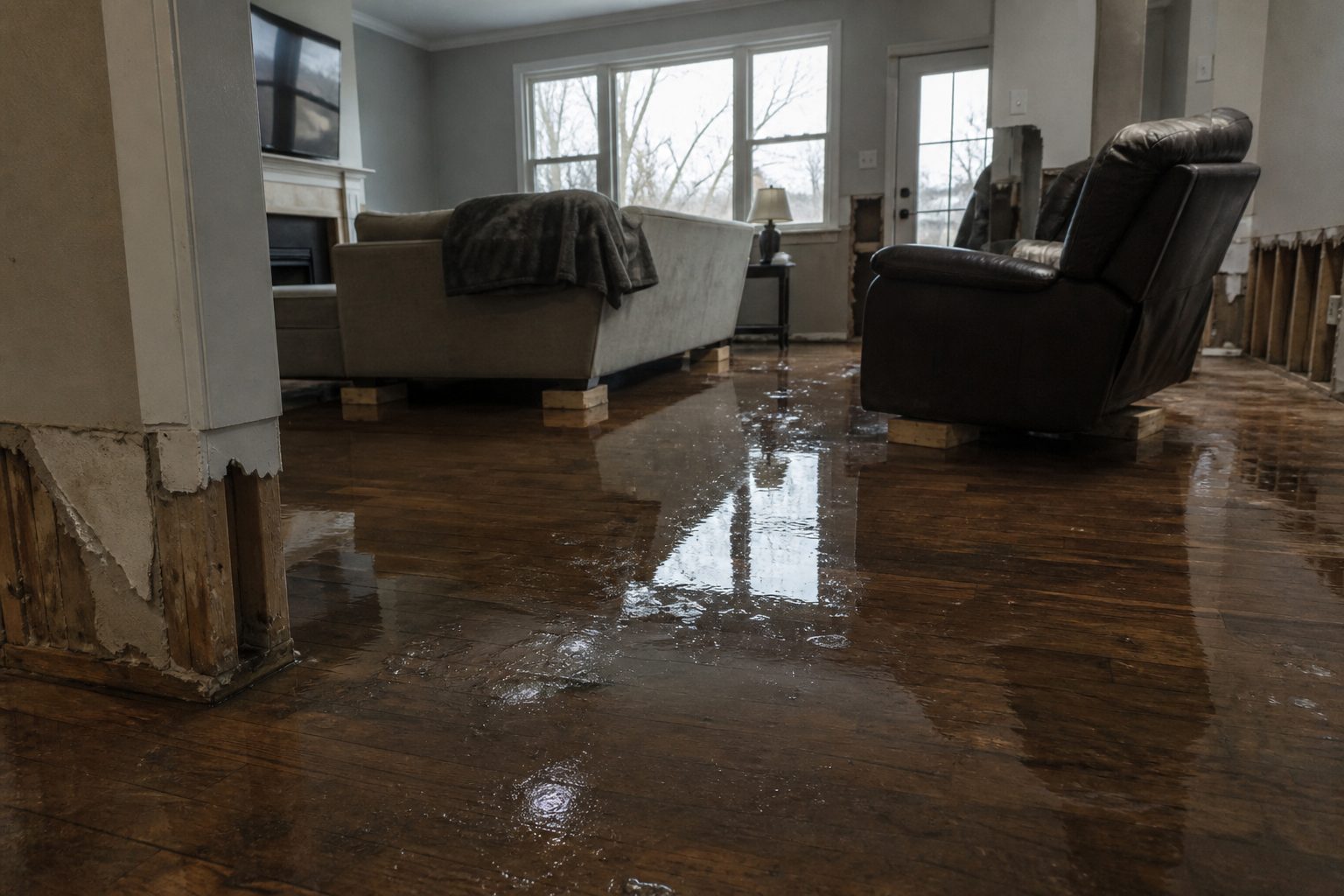
    Flash flooding around Jackson, OH is the exact interior-flooding work restoration teams see most: water intrusion through doors and foundation seepage, saturated drywall and insulation, and sewage backup in low-lying areas where storm drains surcharge. Mold risk starts within 24–48 hours on wet porous materials.

    The play: stage extraction and drying equipment now, pre-position air movers and dehumidifiers, keep an on-call rotation through the morning, and capture address, water source, and affected areas on the first call. Field discipline: photo-document before mitigation, moisture-map every affected room, and keep the homeowner’s payment responsibility clear in writing before work starts.

    FEMA & federal assistance

    If the storm damages your home, the FEMA Helpline is 1-800-621-3362 (7 a.m.–10 p.m. local time, 7 days a week). You can also apply at DisasterAssistance.gov, through the FEMA app, or find a recovery center at fema.gov/drc.

    Basic eligibility: U.S. citizenship or qualified status, identity verification, proof of occupancy or ownership, and unmet needs not covered by insurance. Apply as soon as it’s safe to do so.

    Looking ahead

    When this warning expires at 6:30 AM EDT, the risk doesn’t necessarily end: additional rounds of storms can follow the same corridor, and creeks and low-lying drainage can crest after the rain stops. Watch the next NWS update for your county before standing down.

    Demand window note: water-intrusion calls typically start within hours of water receding and keep coming for days as people discover damage — the calls that matter most arrive after the sky clears.

    Sources & how to verify

    To verify for your own county or ZIP: go to weather.gov, enter your location, and check the active alerts banner — or find your local NWS office page from the weather.gov office map.

    This post is for informational purposes and is not an official weather warning. Always follow instructions from local authorities and the National Weather Service.

  • Flash Flood Warning: Fairfield, OH Until 4:30 AM EDT

    Flash Flood Warning: Fairfield, OH Until 4:30 AM EDT

    Flash Flood Warning issued September 20 at 10:37PM EDT until September 21 at 4:30AM EDT by NWS Wilmington OH

    A Flash Flood Warning is active for the Fairfield, OH area right now, issued by NWS Wilmington OH — the exact interior flooding jobs restoration teams see most. This is a live snapshot as of Sunday, September 20, 7:48 PM PDT. Conditions change fast — always verify with the National Weather Service for your specific county or ZIP code.

    Fairfield, OH — Flash Flood Warning

    Issuing office: NWS Wilmington OH
    Issued: September 20 at 10:37 PM EDT
    Expires: 4:30 AM EDT
    Severity: Severe

    Hazard detail, per the National Weather Service:

    * At 1037 PM EDT, radar indicated thunderstorms producing heavy rain
    moving into the warned area. Rainfall amounts of 1 to 2.5 inches
    HAZARD…Flash flooding caused by thunderstorms.
    SOURCE…Radar indicated.
    IMPACT…Flash flooding of small creeks and streams, urban areas,

    NWS instruction: Turn around, don't drown when encountering flooded roads. Most flood

    Track this warning at weather.gov and your local NWS office page.

    Stay safe tonight

    Turn around, don’t drown. Most flood deaths happen in vehicles — never drive through flooded roadways, and never walk through moving water; six inches of fast water can knock an adult down.

    If water gets into your home: stay out of standing water where electricity may be present, avoid the basement until water recedes and power is confirmed off, and photograph everything before cleanup begins — documentation matters for insurance. Then call a local restoration contractor: water left sitting starts a second wave of damage within a day.

    What this means for restoration teams

    Flash flooding around Fairfield, OH is the exact interior-flooding work restoration teams see most: water intrusion through doors and foundation seepage, saturated drywall and insulation, and sewage backup in low-lying areas where storm drains surcharge. Mold risk starts within 24–48 hours on wet porous materials.

    The play: stage extraction and drying equipment now, pre-position air movers and dehumidifiers, keep an on-call rotation through the morning, and capture address, water source, and affected areas on the first call. Field discipline: photo-document before mitigation, moisture-map every affected room, and keep the homeowner’s payment responsibility clear in writing before work starts.

    FEMA & federal assistance

    If the storm damages your home, the FEMA Helpline is 1-800-621-3362 (7 a.m.–10 p.m. local time, 7 days a week). You can also apply at DisasterAssistance.gov, through the FEMA app, or find a recovery center at fema.gov/drc.

    Basic eligibility: U.S. citizenship or qualified status, identity verification, proof of occupancy or ownership, and unmet needs not covered by insurance. Apply as soon as it’s safe to do so.

    Looking ahead

    When this warning expires at 4:30 AM EDT, the risk doesn’t necessarily end: additional rounds of storms can follow the same corridor, and creeks and low-lying drainage can crest after the rain stops. Watch the next NWS update for your county before standing down.

    Demand window note: water-intrusion calls typically start within hours of water receding and keep coming for days as people discover damage — the calls that matter most arrive after the sky clears.

    Sources & how to verify

    To verify for your own county or ZIP: go to weather.gov, enter your location, and check the active alerts banner — or find your local NWS office page from the weather.gov office map.

    This post is for informational purposes and is not an official weather warning. Always follow instructions from local authorities and the National Weather Service.

  • Flash Flood Warning: Athens, OH Until 6:30 AM EDT

    Flash Flood Warning: Athens, OH Until 6:30 AM EDT

    Flash Flood Warning issued September 20 at 10:38PM EDT until September 21 at 6:30AM EDT by NWS Charleston WV

    A Flash Flood Warning is active for the Athens, OH area right now, issued by NWS Charleston WV — the exact interior flooding jobs restoration teams see most. This is a live snapshot as of Sunday, September 20, 7:48 PM PDT. Conditions change fast — always verify with the National Weather Service for your specific county or ZIP code.

    Athens, OH — Flash Flood Warning

    Issuing office: NWS Charleston WV
    Issued: September 20 at 10:38 PM EDT
    Expires: 6:30 AM EDT
    Severity: Severe

    Hazard detail, per the National Weather Service:

    * At 1038 PM EDT, Doppler radar and automated rain gauges indicated
    2.5 and 3.5 inches of rain have fallen. Additional rainfall amounts
    of 1 to 3 inches are possible in the warned area. Flash flooding is
    HAZARD…Flash flooding caused by thunderstorms.
    SOURCE…Radar and automated gauges.
    IMPACT…Flash flooding of small creeks and streams, urban areas,

    NWS instruction: Turn around, don't drown when encountering flooded roads. Most flood

    Track this warning at weather.gov and your local NWS office page.

    Stay safe tonight

    Turn around, don’t drown. Most flood deaths happen in vehicles — never drive through flooded roadways, and never walk through moving water; six inches of fast water can knock an adult down.

    If water gets into your home: stay out of standing water where electricity may be present, avoid the basement until water recedes and power is confirmed off, and photograph everything before cleanup begins — documentation matters for insurance. Then call a local restoration contractor: water left sitting starts a second wave of damage within a day.

    What this means for restoration teams

    Flash flooding around Athens, OH is the exact interior-flooding work restoration teams see most: water intrusion through doors and foundation seepage, saturated drywall and insulation, and sewage backup in low-lying areas where storm drains surcharge. Mold risk starts within 24–48 hours on wet porous materials.

    The play: stage extraction and drying equipment now, pre-position air movers and dehumidifiers, keep an on-call rotation through the morning, and capture address, water source, and affected areas on the first call. Field discipline: photo-document before mitigation, moisture-map every affected room, and keep the homeowner’s payment responsibility clear in writing before work starts.

    FEMA & federal assistance

    If the storm damages your home, the FEMA Helpline is 1-800-621-3362 (7 a.m.–10 p.m. local time, 7 days a week). You can also apply at DisasterAssistance.gov, through the FEMA app, or find a recovery center at fema.gov/drc.

    Basic eligibility: U.S. citizenship or qualified status, identity verification, proof of occupancy or ownership, and unmet needs not covered by insurance. Apply as soon as it’s safe to do so.

    Looking ahead

    When this warning expires at 6:30 AM EDT, the risk doesn’t necessarily end: additional rounds of storms can follow the same corridor, and creeks and low-lying drainage can crest after the rain stops. Watch the next NWS update for your county before standing down.

    Demand window note: water-intrusion calls typically start within hours of water receding and keep coming for days as people discover damage — the calls that matter most arrive after the sky clears.

    Sources & how to verify

    To verify for your own county or ZIP: go to weather.gov, enter your location, and check the active alerts banner — or find your local NWS office page from the weather.gov office map.

    This post is for informational purposes and is not an official weather warning. Always follow instructions from local authorities and the National Weather Service.

  • Flash Flood Warning: Athens, OH Until 4:45 AM EDT

    Flash Flood Warning: Athens, OH Until 4:45 AM EDT

    Flash Flood Warning issued September 20 at 10:45PM EDT until September 21 at 4:45AM EDT by NWS Charleston WV

    A Flash Flood Warning is active for the Athens, OH area right now, issued by NWS Charleston WV — the exact interior flooding jobs restoration teams see most. This is a live snapshot as of Sunday, September 20, 7:48 PM PDT. Conditions change fast — always verify with the National Weather Service for your specific county or ZIP code.

    Athens, OH — Flash Flood Warning

    Issuing office: NWS Charleston WV
    Issued: September 20 at 10:45 PM EDT
    Expires: 4:45 AM EDT
    Severity: Severe

    Hazard detail, per the National Weather Service:

    * At 1045 PM EDT, Doppler radar and automated rain gauges indicated
    1.5 and 2.5 inches of rain have fallen. Additional rainfall amounts
    of 1 to 3 inches are possible in the warned area. Flash flooding is
    HAZARD…Flash flooding caused by thunderstorms.
    SOURCE…Radar and automated gauges.
    IMPACT…Flash flooding of small creeks and streams, urban areas,

    NWS instruction: Turn around, don't drown when encountering flooded roads. Most flood

    Track this warning at weather.gov and your local NWS office page.

    Stay safe tonight

    Turn around, don’t drown. Most flood deaths happen in vehicles — never drive through flooded roadways, and never walk through moving water; six inches of fast water can knock an adult down.

    If water gets into your home: stay out of standing water where electricity may be present, avoid the basement until water recedes and power is confirmed off, and photograph everything before cleanup begins — documentation matters for insurance. Then call a local restoration contractor: water left sitting starts a second wave of damage within a day.

    What this means for restoration teams

    Flash flooding around Athens, OH is the exact interior-flooding work restoration teams see most: water intrusion through doors and foundation seepage, saturated drywall and insulation, and sewage backup in low-lying areas where storm drains surcharge. Mold risk starts within 24–48 hours on wet porous materials.

    The play: stage extraction and drying equipment now, pre-position air movers and dehumidifiers, keep an on-call rotation through the morning, and capture address, water source, and affected areas on the first call. Field discipline: photo-document before mitigation, moisture-map every affected room, and keep the homeowner’s payment responsibility clear in writing before work starts.

    FEMA & federal assistance

    If the storm damages your home, the FEMA Helpline is 1-800-621-3362 (7 a.m.–10 p.m. local time, 7 days a week). You can also apply at DisasterAssistance.gov, through the FEMA app, or find a recovery center at fema.gov/drc.

    Basic eligibility: U.S. citizenship or qualified status, identity verification, proof of occupancy or ownership, and unmet needs not covered by insurance. Apply as soon as it’s safe to do so.

    Looking ahead

    When this warning expires at 4:45 AM EDT, the risk doesn’t necessarily end: additional rounds of storms can follow the same corridor, and creeks and low-lying drainage can crest after the rain stops. Watch the next NWS update for your county before standing down.

    Demand window note: water-intrusion calls typically start within hours of water receding and keep coming for days as people discover damage — the calls that matter most arrive after the sky clears.

    Sources & how to verify

    To verify for your own county or ZIP: go to weather.gov, enter your location, and check the active alerts banner — or find your local NWS office page from the weather.gov office map.

    This post is for informational purposes and is not an official weather warning. Always follow instructions from local authorities and the National Weather Service.

  • Flash Flood Warning: Fayette and Greene Counties, Ohio Until 11:30 PM EDT

    Flash Flood Warning: Fayette and Greene Counties, Ohio Until 11:30 PM EDT

    Live snapshot as of 9:20 PM EDT, Sunday, September 20, 2026. The National Weather Service in Wilmington, Ohio has issued a Flash Flood Warning for northwestern Fayette County and Greene County — including Xenia, Beavercreek, Bellbrook, and Cedarville — in effect until 11:30 PM EDT. Radar indicates thunderstorms that have dropped between 1.5 and 2.5 inches of rain across the warned area, with flash flooding ongoing or expected to begin shortly. Be especially cautious tonight: the NWS flags that it is harder to recognize flooding dangers after dark.

    This is a live snapshot as of 9:20 PM EDT. Conditions change fast — always verify with the National Weather Service for your specific county or ZIP code.

    Fayette and Greene Counties — Flash Flood Warning

    • Issuing office: National Weather Service Wilmington, Ohio (weather.gov/iln)
    • Issued: 9:06 PM EDT, Sunday, September 20, 2026
    • Expires: 11:30 PM EDT, Sunday, September 20, 2026
    • Area: Northwestern Fayette County in central Ohio; Greene County in west central Ohio
    • Hazard: Flash flooding caused by thunderstorms
    • Source: Radar indicated

    At 9:06 PM EDT, radar indicated thunderstorms producing heavy rain across the warned area. Between 1.5 and 2.5 inches of rain have fallen, with additional rainfall amounts of 0.5 to 1 inch possible in the warned area. The NWS states flash flooding is ongoing or expected to begin shortly.

    Impacts per the alert: Flash flooding of small creeks and streams, urban areas, highways, streets and underpasses, as well as other poor drainage and low-lying areas.

    Locations that may experience flash flooding include: Beavercreek, Xenia, Bellbrook, Cedarville, Jamestown, Wilberforce, New Jasper, Spring Valley, Bowersville, Paintersville, Oldtown, Trebein, Greene County Airport, Bell Center, and Rosemoor. This includes I-71 in Ohio between mile markers 60 and 63.

    The NWS instructions: turn around, don’t drown when encountering flooded roads — most flood deaths occur in vehicles. Be especially cautious at night, when it is harder to recognize the dangers of flooding. To report flash flooding, go to weather.gov/iln and submit a report via social media when it can be done safely.

    Stay safe tonight

    Turn around, don’t drown. Most flood deaths occur in vehicles — never drive through flooded roadways or around barricades. The NWS specifically warns that flooding is harder to recognize at night: headlights don’t reveal depth, and a road that looks merely wet can be washed out underneath. Six inches of moving water can knock you down; twelve inches can carry away a car.

    If water is entering your home: stay out of standing water where electricity may be present, avoid the basement until the water recedes and power is confirmed off, and photograph everything before cleanup begins — documentation matters for insurance. Then call a local restoration contractor. Water left sitting doesn’t dry on its own — it starts a second wave of damage within a day.

    Rural routes through Fayette County are the highest risk after dark: low-water crossings over small creeks flood first and have no lighting. Stay put unless travel is essential.

    What this means for restoration teams

    This warning sits over the Xenia–Beavercreek–Bellbrook corridor with up to 2.5 inches of rain already down — a classic interior water intrusion profile. Expect finished-basement flooding in newer subdivisions where sump systems get overwhelmed, saturated drywall and insulation wicking upward, and sewage backup calls in low-lying areas as stormwater surcharges sanitary lines.

    The nighttime timing is a double edge: homeowners asleep won’t discover intrusion until morning — and FEMA and the EPA note mold can begin growing within 24–48 hours on wet organic material. Damage discovered in the morning will have been sitting for hours.

    The play tonight: stage equipment now — extraction, dehumidification, air movement — and keep an on-call rotation through the morning. Capture address, water source, and affected areas on the first call.

    Field discipline: photo-document before any mitigation begins, moisture-map every affected room (not just the standing-water room), and keep the homeowner’s payment responsibility clear in writing before work starts. Triage actively-wetting jobs first, and separate suspected sewage backups at intake — different category, different protocol.

    FEMA & federal assistance

    If the flooding turns out to be widespread, residents may eventually have access to federal assistance. The FEMA Helpline is 1-800-621-3362 (7 a.m.–10 p.m. local, 7 days a week). You can also apply at DisasterAssistance.gov, through the FEMA app, or visit fema.gov/drc for recovery centers if one is stood up in the area.

    Basic eligibility: citizenship or qualified immigration status, identity verification, proof of occupancy or ownership, and unmet needs not covered by insurance. Apply as soon as it’s safe — but first, file with your insurer and document everything.

    Looking ahead

    The warning expires at 11:30 PM EDT. The alert notes up to another inch of rain is possible in the warned area, and creeks and streams can crest hours after the rain stops. Low-water crossings in rural Fayette County may stay dangerous well into the morning.

    The next NWS update will land if the warning is extended, upgraded, or replaced — check weather.gov/iln before driving in the morning.

    Sources & how to verify

    To verify for your own county or ZIP code: go to weather.gov and enter your location, or pull the active alerts for Ohio from the NWS alerts page for the Wilmington office.

    This post is for informational purposes and is not an official weather warning. Always follow instructions from local authorities and the National Weather Service.

  • Flash Flood Warning: Dayton Area Until 11:45 PM EDT

    Flash Flood Warning: Dayton Area Until 11:45 PM EDT

    Live snapshot as of 9:20 PM EDT, Sunday, September 20, 2026. The National Weather Service in Wilmington, Ohio has issued a Flash Flood Warning for west central Greene County and southern Montgomery County — including Dayton, Kettering, and Beavercreek — in effect until 11:45 PM EDT. Radar indicates thunderstorms that have already dropped between 2 and 3 inches of rain across the warned area, and flash flooding is ongoing or expected to begin shortly. In a metro the size of Dayton, this rainfall rate turns streets into rivers and basements into reservoirs.

    This is a live snapshot as of 9:20 PM EDT. Conditions change fast — always verify with the National Weather Service for your specific county or ZIP code.

    Dayton Area — Flash Flood Warning

    • Issuing office: National Weather Service Wilmington, Ohio (weather.gov/iln)
    • Issued: 9:10 PM EDT, Sunday, September 20, 2026
    • Expires: 11:45 PM EDT, Sunday, September 20, 2026
    • Area: West central Greene County in west central Ohio; Southern Montgomery County in west central Ohio
    • Hazard: Flash flooding caused by thunderstorms
    • Source: Radar indicated

    At 9:10 PM EDT, radar indicated thunderstorms producing heavy rain across the warned area. Between 2 and 3 inches of rain have fallen, with additional rainfall amounts up to 0.5 inches possible in the warned area. The NWS states flash flooding is ongoing or expected to begin shortly.

    Impacts per the alert: Flash flooding of small creeks and streams, urban areas, highways, streets and underpasses, as well as other poor drainage and low-lying areas.

    Locations that may experience flash flooding include: Dayton, Kettering, Beavercreek, Trotwood, Miamisburg, Bellbrook, Moraine, Oakwood, West Carrollton, Riverside, Germantown, New Lebanon, Farmersville, Centerville, Drexel, Woodbourne-Hyde Park, and Overlook-Page Mano. This includes I-75 in Ohio between mile markers 43 and 54.

    The NWS instruction: turn around, don’t drown when encountering flooded roads — most flood deaths occur in vehicles. To report flash flooding, go to weather.gov/iln and submit a report via social media when it can be done safely.

    Stay safe tonight

    Turn around, don’t drown. Most flood deaths occur in vehicles — never drive through flooded roadways or around barricades. In an urban grid like Dayton’s, underpasses and low-lying intersections flood first and deepest. Six inches of moving water can knock you down; twelve inches can carry away a car.

    If water is entering your home: stay out of standing water where electricity may be present, avoid the basement until the water recedes and power is confirmed off, and photograph everything before cleanup begins — documentation matters for insurance. Then call a local restoration contractor. Water left sitting doesn’t dry on its own — it starts a second wave of damage within a day.

    It is dark out, and flooded roads are nearly impossible to judge at night. If you don’t need to be on the road, stay put until morning.

    What this means for restoration teams

    Three inches of rain on the Dayton metro is a volume play for water damage contractors. The call profile from this event: interior water intrusion in finished basements across Kettering, Beavercreek, and Centerville; saturated drywall and insulation wicking up from slab level; sewage backup in low-lying neighborhoods where stormwater overwhelms sanitary systems — the most urgent and most unpleasant jobs of the night.

    Mold risk anywhere water sat on organic material — FEMA and the EPA note mold can begin growing within 24–48 hours on wet organic material. The alert notes up to 0.5 inches of additional rain possible as the warning runs to 11:45 PM.

    The play tonight: stage equipment now — extraction units, dehumidifiers, air movers — and keep an on-call rotation through the morning. Capture address, water source, and affected areas on the first call; separate clean-water intrusions from suspected sewage backups at intake, because the mitigation protocol is completely different.

    Field discipline: photo-document before any mitigation begins, moisture-map every affected room (water travels along slab and behind baseboards), and keep the homeowner’s payment responsibility clear in writing before work starts. In a metro-wide event, triage the actively-wetting and sewage-category jobs first.

    FEMA & federal assistance

    If the flooding turns out to be widespread, residents may eventually have access to federal assistance. The FEMA Helpline is 1-800-621-3362 (7 a.m.–10 p.m. local, 7 days a week). You can also apply at DisasterAssistance.gov, through the FEMA app, or visit fema.gov/drc for recovery centers if one is stood up in the area.

    Basic eligibility: citizenship or qualified immigration status, identity verification, proof of occupancy or ownership, and unmet needs not covered by insurance. Apply as soon as it’s safe — but first, file with your insurer and document everything.

    Looking ahead

    The warning expires at 11:45 PM EDT. Creeks and streams can crest hours after the rain stops, and Low-water crossings and underpasses may stay dangerous well into the morning.

    The next NWS update will land if the warning is extended, upgraded, or replaced — check weather.gov/iln before driving in the morning.

    Sources & how to verify

    To verify for your own county or ZIP code: go to weather.gov and enter your location, or pull the active alerts for Ohio from the NWS alerts page for the Wilmington office.

    This post is for informational purposes and is not an official weather warning. Always follow instructions from local authorities and the National Weather Service.

  • Flash Flood Warning: Clinton and Warren Counties, Ohio Until 12:15 AM EDT

    Flash Flood Warning: Clinton and Warren Counties, Ohio Until 12:15 AM EDT

    Live snapshot as of 9:20 PM EDT, Sunday, September 20, 2026. The National Weather Service in Wilmington, Ohio has issued a Flash Flood Warning for northwestern Clinton County and northeastern Warren County, in effect until 12:15 AM EDT. Radar shows thunderstorms dumping heavy rain across the warned area — between 1.5 and 2 inches have already fallen, and flash flooding is ongoing or expected to begin shortly. This is the water-intrusion profile that keeps restoration contractors up at night: slow, invisible damage that often doesn’t surface for days.

    This is a live snapshot as of 9:20 PM EDT. Conditions change fast — always verify with the National Weather Service for your specific county or ZIP code.

    Clinton and Warren Counties — Flash Flood Warning

    • Issuing office: National Weather Service Wilmington, Ohio (weather.gov/iln)
    • Issued: 9:13 PM EDT, Sunday, September 20, 2026
    • Expires: 12:15 AM EDT, Monday, September 21, 2026
    • Area: Northwestern Clinton County in southwestern Ohio; Northeastern Warren County in southwestern Ohio
    • Hazard: Flash flooding caused by thunderstorms
    • Source: Radar indicated

    At 9:13 PM EDT, radar indicated thunderstorms producing heavy rain across the warned area. Between 1.5 and 2 inches of rain have fallen, with additional rainfall amounts of 0.5 to 1 inch possible in the warned area. The NWS states flash flooding is ongoing or expected to begin shortly.

    Impacts per the alert: Flash flooding of small creeks and streams, urban areas, highways, streets and underpasses, as well as other poor drainage and low-lying areas.

    Locations that may experience flash flooding include: Wilmington, Waynesville, Clarksville, Harveysburg, Corwin, Kingman, Oakland, Ogden, State Route 350 at US Route 22, Caesar Creek State Park, Cowan Lake State Park, Interstate 71 at US Route 68, Burtonville, Oregonia, and Fort Ancient. This includes I-71 in Ohio between mile markers 33 and 56.

    The NWS instruction: turn around, don’t drown when encountering flooded roads — most flood deaths occur in vehicles. To report flash flooding, go to weather.gov/iln and submit a report via social media when it can be done safely.

    Stay safe tonight

    Turn around, don’t drown. Most flood deaths occur in vehicles — never drive through flooded roadways or around barricades. Six inches of moving water can knock you down; twelve inches can carry away a car.

    If water is entering your home: stay out of standing water where electricity may be present, avoid the basement until the water recedes and power is confirmed off, and photograph everything before cleanup begins — documentation matters for insurance. Then call a local restoration contractor. Water left sitting doesn’t dry on its own — it starts a second wave of damage within a day.

    It is dark out, and flooded roads are nearly impossible to judge at night. If you don’t need to be on the road, stay put until morning.

    What this means for restoration teams

    This is the signature flash-flood damage profile: interior water intrusion from poor drainage and overwhelmed storm systems. The warned area includes dense suburban and exurban corridors along I-71 — Waynesville, Harveysburg, Clarksville — where finished basements, sump-pump overwhelm, and hydrostatic pressure through foundation walls are the classic calls.

    What to expect from this rain profile: saturated drywall and insulation in below-grade rooms, wicking up finished walls; mold risk anywhere water sat on organic material (FEMA and the EPA note mold can begin growing within 24–48 hours on wet organic material); sewage backup in low-lying areas where stormwater overwhelms combined systems. With 1.5 to 2 inches already down and more coming, grading failures and window-well flooding will show up alongside the basement calls.

    The play tonight: stage equipment now — dehumidifiers, air movers, extraction units — and keep an on-call rotation through the morning. Capture address, water source, and affected areas on the first call.

    Field discipline: photo-document before any mitigation begins, moisture-map every affected room (not just the obvious one — water travels), and keep the homeowner’s payment responsibility clear in writing before work starts. In a multi-storm night like this one, triage the actively-wetting jobs first.

    FEMA & federal assistance

    If the flooding turns out to be widespread, residents may eventually have access to federal assistance. The FEMA Helpline is 1-800-621-3362 (7 a.m.–10 p.m. local, 7 days a week). You can also apply at DisasterAssistance.gov, through the FEMA app, or visit fema.gov/drc for recovery centers if one is stood up in the area.

    Basic eligibility: citizenship or qualified immigration status, identity verification, proof of occupancy or ownership, and unmet needs not covered by insurance. Apply as soon as it’s safe — but first, file with your insurer and document everything.

    Looking ahead

    The warning expires at 12:15 AM EDT. Creeks and streams can crest hours after the rain stops, so low-water crossings may stay dangerous well into the morning.

    The next NWS update will land if the warning is extended, upgraded, or replaced — check weather.gov/iln before driving in the morning.

    Sources & how to verify

    To verify for your own county or ZIP code: go to weather.gov and enter your location, or pull the active alerts for Ohio from the NWS alerts page for the Wilmington office.

    This post is for informational purposes and is not an official weather warning. Always follow instructions from local authorities and the National Weather Service.