
Author: William Tygart

  • Flash Flood Warning: West Central Pecos County Until 6:15 PM CDT

    Flash Flood Warning: West Central Pecos County Until 6:15 PM CDT

    Status: Active as of 1:47 PM PDT (3:47 PM CDT), Saturday, September 19, 2026. The National Weather Service office in Midland/Odessa has updated its Flash Flood Warning for west central Pecos County, Texas — the warning is in effect until 6:15 PM CDT. This is a live snapshot: conditions change fast, so always verify with the National Weather Service for your specific county or ZIP code before making decisions.

    This is an update to the warning NWS issued at 3:22 PM CDT. The warned polygon is unchanged — west central Pecos County — but the update adds detail that matters: Doppler radar now estimates an expected rainfall rate of 2 to 3 inches in 1 hour on top of the 1 to 2 inches that have already fallen, and the warning names the specific drainages in the path of the water — Barrilla Draw and Coyanosa Draw.

    West Central Pecos County — Flash Flood Warning

    Issuing office: NWS Midland/Odessa, Texas (weather.gov/maf)
    Updated: Saturday, September 19 at 3:41 PM CDT
    Expires: Saturday, September 19 at 6:15 PM CDT
    Certainty: Likely · Urgency: Immediate · Severity: Severe

    Per the NWS alert, verbatim:

    At 341 PM CDT, Doppler radar indicated thunderstorms producing heavy rain across the warned area. Between 1 and 2 inches of rain have fallen. The expected rainfall rate is 2 to 3 inches in 1 hour. Flash flooding is ongoing or expected to begin shortly.

    HAZARD…Flash flooding caused by thunderstorms.

    SOURCE…Radar indicated.

    IMPACT…Flash flooding of small creeks and streams, urban areas, highways, streets and underpasses as well as other poor drainage and low-lying areas.

    Some locations that will experience flash flooding include… Mainly rural areas of West Central Pecos County.

    This includes the following streams and drainages… Barrilla Draw and Coyanosa Draw.

    Read that rainfall line carefully: 1 to 2 inches already down, with an expected rate of 2 to 3 inches per hour where the storms are hitting hardest. In West Texas draw country, that kind of rate on saturated draws like Barrilla and Coyanosa means water rising in places that were dry an hour ago. This is mainly rural territory — ranch roads, low-water crossings, oilfield access routes — where flooding shows up as a washed-out crossing rather than a city street closing.

    The NWS instruction for this warning: “Turn around, don’t drown when encountering flooded roads. Most flood deaths occur in vehicles.” The update also adds a reporting request: “Please report observed flooding to local emergency services or law enforcement and request they pass this information to the National Weather Service when you can do so safely.”

    Stay safe tonight

    Flash flooding in rural West Texas kills at low-water crossings. Never drive through flooded roadways — even a few inches of fast water can move a vehicle, and draw crossings hide washouts underneath. At night the risk compounds: water over a ranch or county road is nearly invisible under headlights until you are in it.

    If water enters your home: stay out of standing water where electricity may be present, avoid the basement until water recedes and power is confirmed off, and photograph everything before you touch anything — documentation matters for insurance. Then call a local restoration contractor promptly: water left sitting starts a second wave of damage within a day, and desert-calcite well water mixed with storm runoff is not the clean water you can air-dry.

    If you are traveling: reroute around the warned draws. The warning runs until 6:15 PM CDT, but creeks and draws stay dangerous after the rain stops — give the water time to drain before trusting a crossing.

    What this means for restoration teams

    This is the signature section, and for this event it has a specific shape: a rural West Texas flash flood with an extreme short-term rainfall rate. Here’s the operator read:

    • Damage categories to expect: Interior water intrusion in low-lying homes and ranch houses, saturated drywall and insulation in ground-floor rooms, well/pump contamination, and — where draws jump their banks — mud and sediment deposits inside structures. That sediment changes the job: silt-laden water is a contamination step up from clear rainwater intrusion, which means more tear-out and more documentation for the file.
    • The demand window: Water-intrusion calls typically start within hours of water receding and keep coming for days as people discover damage. In rural Pecos County, discovery lags — a flooded ranch house may sit hours before anyone sees it — so the call curve here stretches longer than an urban event of the same size.
    • Stage now: With an expected rate of 2 to 3 inches per hour inside a warning running to 6:15 PM CDT, pre-position drying assets toward the I-10 / Fort Stockton corridor before dark. Keep an on-call rotation through the morning: Saturday-evening calls from this event land overnight.
    • First-call capture: Get the address, the water source (draw overflow? low-water crossing washout? direct intrusion?), and the affected areas on the first call. Ask whether the structure took sediment — if it did, flag the job for a contamination-scope estimate from the start.
    • Field discipline: Photo-document before mitigation, moisture-map every affected room, and keep the homeowner’s payment responsibility clear in writing before work starts. Ranch properties sometimes carry thin or lapsed coverage — confirm before equipment rolls.

    FEMA & federal assistance

    If your home or business took flood damage and your needs aren’t covered by insurance, FEMA assistance may apply once a disaster is declared. The FEMA Helpline is 1-800-621-3362 (7 a.m.–10 p.m. local time, 7 days a week). You can also apply at DisasterAssistance.gov, through the FEMA app, or find in-person help at fema.gov/drc.

    Basic eligibility: U.S. citizenship or qualified status, identity verification, proof of occupancy or ownership of the damaged property, and unmet needs not covered by insurance. Apply as soon as it’s safe — document everything first.

    Looking ahead

    The warning expires at 6:15 PM CDT tonight. Watch for one thing after that: Barrilla Draw and Coyanosa Draw drain slowly, and downstream water can arrive well after the rain ends — a cleared crossing at sunset is not proof it stays cleared at dark. If additional storms fire behind this line, NWS Midland/Odessa would issue new warnings; check the Midland/Odessa office page or weather.gov for your county.

    For restoration operators: tonight’s 2-to-3-inch-per-hour rates on a mainly rural county are exactly the profile that produces a multi-day call tail. Expect the first calls this evening and a second wave early next week as secondary damage (swollen door frames, cupping floors, musty HVAC returns) surfaces.

    Sources & how to verify

    To verify for your own county or ZIP: enter it at weather.gov or go straight to the Midland/Odessa office page for the latest warnings in the region.

    This post is for informational purposes and is not an official weather warning. Always follow instructions from local authorities and the National Weather Service.
  • Flash Flood Warning: Jeff Davis and Reeves Counties, TX Until 6:00 PM CDT

    Flash Flood Warning: Jeff Davis and Reeves Counties, TX Until 6:00 PM CDT

    Flash Flood Warning reissued — life-threatening flooding in Jeff Davis and Reeves Counties, TX until 6:00 PM CDT

    The National Weather Service in Midland/Odessa reissued a Flash Flood Warning at 3:15 PM CDT on Saturday, September 19, 2026, for mainly rural areas of North Central Jeff Davis and Southwestern Reeves Counties in West Texas. The warning carries life-threatening wording and runs until 6:00 PM CDT. This is a live snapshot as of 1:35 PM PDT (3:35 PM CDT), Saturday, September 19, 2026. Conditions change fast — always verify with the National Weather Service for your specific county or ZIP code.

    For restoration teams, this is the pattern that produces the interior water-intrusion jobs they see most: confirmed heavy rain on top of already-falling water, with drainage draws and canyons as the damage corridors.

    Jeff Davis and Reeves Counties — Flash Flood Warning

    Issuing office: NWS Midland/Odessa. Reissued: 3:15 PM CDT, Saturday, September 19, 2026. Expires: 6:00 PM CDT. Alert ID: urn:oid:2.49.0.1.840.0.bbb4aa9725e78cbe5f33bb1733e0db8d9371c357.001.1. Severity: Severe. Certainty: Likely. Urgency: Immediate.

    Warned area: “Mainly rural areas of North Central Jeff Davis and Southwestern Reeves Counties.” The named streams and drainages in the warning path are Ninemile Draw, Cherry Creek, Canyon Creek, and Madera Canyon — these draws and canyons are the damage corridors in this warning.

    Hazard detail, verbatim from the alert: “At 315 PM CDT, Doppler radar and automated rain gauges indicated thunderstorms producing heavy rain across the warned area.” Between 1 and 2 inches of rain have fallen. The expected rainfall rate is 2 to 3 inches in 1 hour. Additional rainfall amounts of 1 to 2 inches are possible in the warned area. Flash flooding is ongoing or expected to begin shortly.

    Hazard: Life threatening flash flooding. Thunderstorms producing flash flooding. Source: Radar and automated gauges.

    Impact: Life threatening flash flooding of creeks and streams, urban areas, highways, streets and underpasses.

    Why this warning matters more than usual: the NWS reissued this warning rather than letting it ride, and the reissue carries life-threatening wording backed by gauge confirmation — this is observed/radar-and-gauge-indicated rain, not a speculative forecast. It is also part of afternoon stacking in Jeff Davis County, with multiple warnings in effect across the area today. That means water is falling on already-saturated ground and already-running draws, and the expected 2 to 3 inches per hour could hit drainage corridors that are already full.

    Sources: NWS Midland/Odessa.

    Stay safe this afternoon

    Turn around, don’t drown when encountering flooded roads. Most flood deaths occur in vehicles. Never drive through flooded roadways — you cannot see the road surface under the water, and low-water crossings on rural county roads in this area can become impassable in minutes at 2 to 3 inches per hour.

    Report observed flooding to local emergency services or law enforcement. For life-threatening emergencies, call 911.

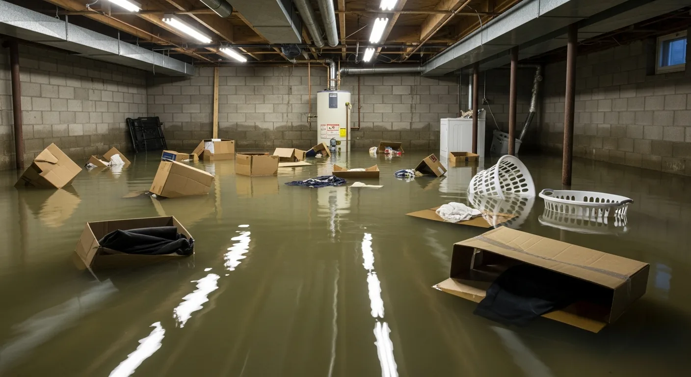
    If water enters the home: stay out of standing water where electricity may be present, avoid the basement until water recedes and power is confirmed off, and photograph everything before cleanup — documentation matters for insurance. Then call a local restoration contractor: water left sitting starts a second wave of damage within a day.

    What this means for restoration teams

    Life-threatening canyon and draw flooding in rural West Texas, on a Saturday afternoon — this one is about remote response windows and long drive times. The warned area is mainly rural; Ninemile Draw, Cherry Creek, Canyon Creek, and Madera Canyon sit well outside Fort Davis and Pecos. Calls will trickle in, but getting to them takes time — so the staging decision has to happen now, not when the phone rings.

    The play: stage equipment now. Pre-position drying assets and truck-mounted extractors so you’re rolling toward Jeff Davis and Reeves Counties, not away from them, when calls come. Keep the on-call rotation through the evening — the warning runs to 6:00 PM CDT, but water-intrusion calls typically start within hours of water receding and keep coming for days as people discover damage. Run Saturday-afternoon call triage: capture the address, the water source, and the affected areas on the first call — half the information is lost if the intake sheet is thin.

    Field discipline: photo-document before mitigation, moisture-map every affected room (draw-fed flooding soaks walls, not just floors), and keep the homeowner’s payment responsibility clear in writing before work starts. The mold clock is 24–48 hours in Texas heat — extraction and dehumidification on the first visit, not the second, is what keeps a Category 1 intrusion from becoming a Category 2 mold job.

    One more thing for remote areas: verify your teams know where the county roads dip through draws. Your trucks are no help to anyone if they’re the ones stuck in Ninemile Draw.

    FEMA & federal assistance

    FEMA Helpline 1-800-621-3362 (7 a.m.–10 p.m. local, 7 days). DisasterAssistance.gov, the FEMA app, and fema.gov/drc for recovery centers. Basic eligibility: citizenship or qualified status, identity verification, proof of occupancy or ownership, and unmet needs not covered by insurance. Apply as soon as it is safe.

    Looking ahead

    The warning expires at 6:00 PM CDT, but that is not the end of the hazard — it is the end of the NWS’s formal warning period. Watch for additional rounds of storms moving through this evening and for creeks and draws cresting later — runoff keeps arriving after the rain stops, and Ninemile Draw, Cherry Creek, Canyon Creek, and Madera Canyon can run high well past the expiry. The next NWS update lands as conditions warrant; check the NWS Midland/Odessa page for the latest.

    Demand window for contractors: water-intrusion calls typically start within hours of water receding and keep coming for days as people discover damage. For rural homeowners, that discovery often happens Sunday when they’re back on the property — the Sunday/Monday call board is the one to staff.

    Sources & how to verify

    All hazard facts, times, and rainfall figures above come verbatim from the NWS Flash Flood Warning issued by NWS Midland/Odessa, reissued 3:15 PM CDT Saturday, September 19, 2026, expiring 6:00 PM CDT (alert ID urn:oid:2.49.0.1.840.0.bbb4aa9725e78cbe5f33bb1733e0db8d9371c357.001.1), read September 19, 2026. Issuing office: weather.gov/maf.

    To verify for your own county or ZIP code, go to weather.gov and enter your ZIP, or open the NWS Midland/Odessa office page directly. Could not verify: a direct phone number for Jeff Davis County or Reeves County emergency management — in a life-threatening situation, call 911 and report observed flooding to local law enforcement.

    This post is for informational purposes and is not an official weather warning. Always follow instructions from local authorities and the National Weather Service.

  • Flash Flood Warning: Cibola County (Grants Area), NM Until 4:00 PM MDT

    Flash Flood Warning: Cibola County (Grants Area), NM Until 4:00 PM MDT

    The Flash Flood Warning for Cibola County (Grants Area), New Mexico — issued by the National Weather Service in Albuquerque — is reissued and continues until 4:00 PM MDT on Saturday, September 19, 2026. Here is the key development: the heavy rain has ended south of Grants, but flooding impacts continue across the warned area, including the I-40 corridor and surrounding communities. For local restoration teams, this is the handoff moment — the storm is done, and the water-intrusion calls typically start within hours.

    This is a live snapshot as of 1:35 PM PDT, Saturday, September 19, 2026. Conditions change fast — always verify with the National Weather Service for your specific county or ZIP code before making decisions.

    Grants Area — Flash Flood Warning

    Issuing office: National Weather Service, Albuquerque, NM. Reissued: 2:18 PM MDT, Saturday, September 19, 2026. Warning continues until: 4:00 PM MDT. NWS alert identifier: urn:oid:2.49.0.1.840.0.d798cc2a81b401fe5777bc01de2fcffcf2e783b3.001.1

    The update: “At 218 PM MDT, Doppler radar indicated that the thunderstorms producing heavy rain south of Grants had ended.” Between 1.5 and 2 inches of rain have fallen. “Flooding impacts will continue, but no additional rainfall is expected.” Flash flooding is ongoing or expected to begin shortly.

    Hazard: Flash flooding caused by thunderstorms. Source: Radar indicated. Severity: Severe. Certainty: Likely. Urgency: Immediate.

    Named locations in the warning path: McCartys, Skyline-Ganipa, San Fidel, Cubero, Acomita Lake, Acomita, North Acomita Village, Seama, and Paraje. This includes Interstate 40 between Mile Markers 87 and 107, and the El Malpais Ranger Station recreation area.

    Expected impacts: Flash flooding of small creeks and streams, urban areas, highways, streets and underpasses as well as other poor drainage and low-lying areas.

    Source links: NWS Albuquerque office page. Reissue reference: alert id urn:oid:2.49.0.1.840.0.d798cc2a81b401fe5777bc01de2fcffcf2e783b3.001.1 — verify current status anytime at weather.gov/abq.

    Stay safe through the evening

    • Turn around, don’t drown when encountering flooded roads. Most flood deaths occur in vehicles — never drive through flooded roadways, no matter how familiar the road. Interstate 40 drivers between Mile Markers 87 and 107 should be especially cautious: flash flooding on highways and underpasses is an expected impact of this warning.
    • If water enters your home, stay out of standing water where electricity may be present. Avoid the basement until the water recedes and power is confirmed off.
    • Photograph everything before cleanup begins. Documentation matters for insurance — water left sitting starts a second wave of damage within a day, and the photos you take now are what protect your claim later.
    • Then call a local restoration contractor. With the heavy rain ended but flooding still ongoing, the cleanup clock starts the moment the water recedes.

    What this means for restoration teams

    This warning is the classic post-rainfall response phase for New Mexico contractors: the rain south of Grants has stopped, but flash flooding is still ongoing across Cibola County, which means water-intrusion jobs are about to land. Between 1.5 and 2 inches of rain fell in a short window — enough to push water into low-lying homes, underpasses, and poor-drainage neighborhoods around Grants, Acomita, Seama, Paraje, Cubero, San Fidel, Skyline-Ganipa, and McCartys. Expect the damage categories local teams handle most: interior water intrusion, saturated drywall and insulation, and — where groundwater and creeks overflow — potential sewage backup in low-lying areas.

    The play: Stage drying assets now and keep an on-call rotation through tonight and into Sunday. The mold clock runs 24 to 48 hours from the time materials get wet, and with water still standing, every hour of delay shrinks your margin.

    First-call discipline: Capture address + water source + affected areas on the first call, before anything else. Photo-document before mitigation begins, moisture-map every affected room, and keep the homeowner’s payment responsibility clear in writing before work starts. Calls on the I-40 corridor (Mile Markers 87–107) may include stranded-motorist and vehicle-exposure work in addition to structures — water-intrusion calls typically start within hours of the water receding and keep coming for days as people discover damage, so tonight’s intake sets the tone for the whole week.

    Local emergency contacts

    • Cibola County Office of Emergency Management — (505) 285-2558, 2001 Clif Lear Ave., Grants, NM 87020. Website: cibolacountynm.com/departments/emergency_management. (Verified via the official Cibola County website and the New Mexico Department of Homeland Security and Emergency Management county contact list.)
    • Non-emergency dispatch: (505) 287-9476. Emergencies: dial 911.
    • Local emergency alerts (Hyper-Reach): text “alerts” to 505-209-8309 or say “Alexa, enable Hyper-Reach” to get county emergency notifications — the county’s system for weather hazards, evacuations, and public-health alerts.

    FEMA & federal assistance

    FEMA Helpline: 1-800-621-3362 (7 a.m.–10 p.m. local time, 7 days a week). Apply for assistance at DisasterAssistance.gov, through the FEMA app, or find recovery centers at fema.gov/drc.

    Basic eligibility: U.S. citizenship or qualified status, identity verification, proof of occupancy or ownership, and unmet needs not covered by insurance. Apply as soon as it is safe to do so — you do not need to wait for a federal disaster declaration for your county to register and be in the system.

    Looking ahead

    The warning runs until 4:00 PM MDT. After it expires, the hazard does not vanish with the headline: flooded creeks and streams drain on their own schedule, and water already standing in low-lying areas and poor-drainage neighborhoods will take time to recede — especially with saturated ground from 1.5 to 2 inches of rain in a short window. No additional rainfall is expected, which means conditions should steadily improve through this evening, but any renewed thunderstorm activity nearby would hit ground that can absorb very little more.

    Demand window: Water-intrusion calls typically start within hours of water receding and keep coming for days as people discover damage. Homeowners in the named communities — McCartys, Skyline-Ganipa, San Fidel, Cubero, Acomita Lake, Acomita, North Acomita Village, Seama, and Paraje — often find the worst of it Sunday and Monday: soaked carpet pads, swelling baseboards, and crawlspaces that never fully drained. For contractors, the next 24–48 hours are the intake window — the mold clock is already running on every wet structure.

    No live search-demand measurement was taken for this update post; the demand note above reflects the standing house pattern for post-flash-flood call volume, not a measured Trends reading.

    Sources & how to verify

    • NWS Albuquerque reissued Flash Flood Warning, September 19, 2026, 2:18 PM MDT — alert id urn:oid:2.49.0.1.840.0.d798cc2a81b401fe5777bc01de2fcffcf2e783b3.001.1; warning continues until 4:00 PM MDT.
    • NWS Albuquerque office page (weather.gov/abq) — the authoritative source for this warning’s current status.
    • Cibola County Office of Emergency Management — cibolacountynm.com; contact numbers verified against the New Mexico DHSEM county emergency managers list.

    To verify for your own county or ZIP: go to weather.gov/abq and check active warnings for your location, or enter your ZIP at weather.gov.

    This post is for informational purposes and is not an official weather warning. Always follow instructions from local authorities and the National Weather Service.

  • Flash Flood Warning: West Central Pecos County, TX Until 6:15 PM CDT

    Flash Flood Warning: West Central Pecos County, TX Until 6:15 PM CDT

    Flash Flood Warning active now — West Central Pecos County

    A Flash Flood Warning is in effect for West Central Pecos County in southwestern Texas, issued by the National Weather Service in Midland/Odessa at 3:22 PM CDT on Saturday, September 19, 2026, and running until 6:15 PM CDT. This is a live snapshot as of 1:35 PM PDT, Saturday, September 19, 2026. Conditions change fast — always verify with the National Weather Service for your specific county or ZIP code.

    For restoration contractors, this is the kind of warning that converts into the exact interior water-intrusion jobs local teams see most: draw-country flooding that fills low-water crossings, sends runoff racing down county and oil-lease roads, and backs water into structures sitting near normally dry drainages. If you serve West Texas, this is your evening to get ready.

    West Central Pecos County — Flash Flood Warning

    The National Weather Service in Midland/Odessa issued this Flash Flood Warning at 3:22 PM CDT, Saturday, September 19, 2026, for West Central Pecos County in southwestern Texas. The warning expires at 6:15 PM CDT. The NWS rated the event Severe severity, with Likely certainty and Immediate urgency.

    The hazard, in the alert’s own words: flash flooding caused by thunderstorms. The source is radar indicated — Doppler radar has indicated thunderstorms producing heavy rain across the warned area, and flash flooding is ongoing or expected to begin shortly.

    Rainfall facts, verbatim from the alert: between 0.5 and 1.5 inches of rain have fallen, and the expected rainfall rate is 2 to 3 inches in 1 hour. Additional heavy rainfall is expected across the warned area.

    Locations in the warning path: the alert specifies mainly rural areas of West Central Pecos County, with the named streams and drainages of concern being Barrilla Draw and Coyanosa Draw. This is ranch and oil-field country — scattered structures, long stretches of unpaved county roads, and low-water crossings that go from dry to dangerous in minutes.

    Expected impacts, per the alert: flash flooding of small creeks and streams, urban areas, highways, streets and underpasses, as well as other poor drainage and low-lying areas.

    The issuing office is the NWS Midland/Odessa forecast office — track this warning and any follow-up statements on the office page at weather.gov/maf. The official instruction inside the alert is direct: “Turn around, don’t drown when encountering flooded roads. Most flood deaths occur in vehicles.” Residents are asked to report observed flooding to local emergency services or law enforcement.

    Stay safe tonight

    The single most important flood rule, and the one the National Weather Service repeats in this very alert: turn around, don’t drown. Never drive through flooded roadways. Most flood deaths occur in vehicles, and it takes only a few inches of fast-moving water to sweep a car off a low-water crossing. On rural Pecos County roads and oil-lease roads — where many crossings have no guardrails and water depth is impossible to judge in fading light — the safe move is always to find another route or wait it out.

    If water is rising around your property: stay out of standing water where electricity may be present. Avoid the basement or any below-grade room until the water recedes and power is confirmed off. Do not walk through flowing water. If you can do so safely, photograph everything before cleanup begins — documentation matters for insurance, and once water is removed the evidence of what it reached is gone.

    Water left sitting starts a second wave of damage within a day — soaked drywall wicks moisture upward, insulation holds it, and microbial growth follows. Get water out and air moving as soon as it is safe to do so, then call a local restoration contractor. After a draw-country flood, watch for damage you can’t see from the driveway: water that came in through a door or foundation seep can travel inside walls and under flooring.

    What this means for restoration teams

    This is a Saturday-dusk warning in rural draw country, and that timing matters operationally. Flash flooding is expected to be ongoing into the evening, with the warning expiring at 6:15 PM CDT — but the calls rarely come during the storm. They surface Sunday morning, when people walk their property in daylight and find the shop floor wet, the back rooms of a ranch house soaked, or a tenant’s unit sitting on damp carpet.

    The damage categories to expect: interior water intrusion at low points — doors, garage aprons, foundation seep lines — saturated drywall and insulation in structures near Barrilla Draw and Coyanosa Draw, and sewage backup where low-lying septic systems and laterals take on floodwater. Rural properties also mean outbuildings, equipment sheds, and well houses: water in a well house or electrical panel area is a no-entry situation until power is confirmed off.

    The play tonight: stage equipment now and pre-position drying assets — air movers, dehumidifiers, and extraction gear — so Sunday-morning calls turn into same-day starts instead of same-day quotes. Keep an on-call rotation through Sunday morning and capture address + water source + affected areas on the first call. In draw-country floods the water source matters for the scope: clear rainwater runoff versus water that ran across a pasture or oil-field road changes the contamination category and the tear-out decision.

    Field discipline: photo-document before mitigation, moisture-map every affected room — not just the ones with standing water — and keep the homeowner’s or property manager’s payment responsibility clear in writing before work starts. And remember the mold clock: 24 to 48 hours. A job that sits from a Sunday discovery to a Monday start is already inside the window where microbial growth begins, which is exactly why pre-positioning tonight beats scrambling tomorrow.

    FEMA & federal assistance

    If this storm leaves you with damage that exceeds what insurance covers, federal help is available once it’s safe to apply. The FEMA Helpline is 1-800-621-3362, open 7 a.m. to 10 p.m. local time, 7 days a week. You can also apply at DisasterAssistance.gov, through the FEMA app, or find in-person help at a disaster recovery center via fema.gov/drc.

    Basic eligibility covers citizenship or qualified status, identity verification, proof of occupancy or ownership, and unmet needs not covered by insurance. Apply as soon as it’s safe to do so — don’t wait for repairs to be finished. Document damage with photos now; you can apply before the full scope is known.

    Looking ahead

    The warning expires at 6:15 PM CDT Saturday evening. What to watch overnight: additional rounds of thunderstorms can re-flood the same draws even after the warning ends, and creeks and drainages can keep rising — cresting later — as runoff moves down from higher ground. Monitor the NWS Midland/Odessa office page for updated warnings or statements.

    For restoration teams, the demand window is the real story: water-intrusion calls typically start within hours of water receding and keep coming for days as people discover damage. A Saturday-evening flood in a rural county means discovery spreads across Sunday — one property at a time, as owners check fences, pumps, and buildings. Keep the rotation light Sunday night too; the second wave of calls often comes from people who tried to dry it themselves first.

    A companion Restoration Intel operator brief for this event — the demand signals, seat-by-seat implications, and the rural draw-country play — is queued and ships with additional operator intel, not as a fast echo of this post.

    Sources & how to verify

    • NWS alert: Flash Flood Warning, West Central Pecos County TX — issued by NWS Midland/Odessa, 3:22 PM CDT Saturday, September 19, 2026; expires 6:15 PM CDT. Alert ID: urn:oid:2.49.0.1.840.0.534ff19646863351a97cfa3a5c0e7f584159944f.001.1. As-of timestamp for this post: 1:35 PM PDT, Saturday, September 19, 2026.
    • Issuing office page: weather.gov/maf (NWS Midland/Odessa).
    • How to verify for your own county or ZIP: go to weather.gov, enter your ZIP code, and read the active alerts panel — or open the NWS office page for your region directly.
    • Could not verify: a single consistent phone number for Pecos County emergency management — one official county document and a directory listing gave conflicting numbers, so no number is listed here rather than risk printing a wrong one. For immediate danger, dial 911; for non-emergency county business, use co.pecos.tx.us.

    This post is for informational purposes and is not an official weather warning. Always follow instructions from local authorities and the National Weather Service.

  • Flash Flood Warning: Acomita / Northeastern Cibola County Area Until 4:00 PM MDT

    Active Flash Flood Warning for Northeastern Cibola County, NM — issued by NWS Albuquerque NM at 1:01 PM MDT, in effect until 4:00 PM MDT (3:00 PM PDT).

    Doppler radar indicated thunderstorms producing heavy rain across the warned area. Between 1 and 2 inches of rain have fallen. Additional rainfall amounts of 0.25 to 0.75 inches are possible in the warned area. This is exactly the profile that produces the interior-flooding jobs restoration teams see most: water finding its way into homes and businesses through every low point, drainage systems overwhelmed, and saturated ground that keeps feeding the damage long after the rain stops.

    This is a live snapshot as of 1:16 PM PDT. Conditions change fast — always verify with the National Weather Service for your specific county or ZIP code.

    Northeastern Cibola County, NM — Flash Flood Warning

    The NWS Albuquerque NM issued this Flash Flood Warning at 1:01 PM MDT, in effect until 4:00 PM MDT. Coverage: northeastern Cibola County in west central New Mexico.

    What the radar shows: Doppler radar indicated thunderstorms producing heavy rain across the warned area. Between 1 and 2 inches of rain have fallen. Additional rainfall amounts of 0.25 to 0.75 inches are possible in the warned area. Flash flooding is ongoing or expected to begin shortly.

    HAZARD: Flash flooding caused by thunderstorms.

    SOURCE: Radar indicated.

    IMPACT: Flash flooding of small creeks and streams, urban areas, highways, streets and underpasses as well as other poor drainage and low-lying areas.

    Locations that will experience flash flooding: McCartys, Skyline-Ganipa, San Fidel, Cubero, Acomita Lake, Acomita, North Acomita Village, Seama and Paraje — including Interstate 40 between Mile Markers 87 and 107.

    The warning names a long list of pueblo communities plus Interstate 40 between Mile Markers 87 and 107 — a 20-mile stretch of interstate in the warned area.

    Primary sources: the NWS alert and the NWS Albuquerque NM forecast office page.

    Stay safe right now

    Turn around, don’t drown. Most flood deaths occur in vehicles — never drive through flooded roadways. Six inches of fast-moving water can knock an adult down; a foot of water can float most cars; two feet can carry away a truck. If you encounter a flooded road, find another route.

    If water enters your home: stay out of standing water where electricity may be present; avoid the basement until the water recedes and the power is confirmed off; photograph everything before any cleanup — that documentation is what an insurance claim runs on — then call a local restoration contractor. Water left sitting starts a second wave of damage within a day: saturated materials breed mold, warp finishes, and wick up walls far beyond the visible waterline.

    Heed the warning’s own instructions: Turn around, don't drown when encountering flooded roads. Most flood deaths occur in vehicles. Be aware of your surroundings and do not drive on flooded roads.

    What this means for restoration teams

    The first of the day’s three Cibola County warnings, and the busiest named-location list of the set: McCartys, Skyline-Ganipa, San Fidel, Cubero, Acomita Lake, Acomita, North Acomita Village, Seama, and Paraje — pueblo communities strung along the Rio San Jose corridor — plus a 20-mile stretch of Interstate 40 (Mile Markers 87–107). In a pueblo corridor like this, flash flooding means water in low-lying homes and businesses, impacts to the interstate, and a call pattern that favors local contractors who can reach multiple communities fast.

    The damage profile of a flash flood warning like this is the bread and butter of water-mitigation work: interior water intrusion through doors, vents, and low walls; saturated drywall and insulation that won’t dry on its own; mold risk inside 24–48 hours if wet materials sit; sewage or stormwater backup where drainage is overwhelmed; and in hilly country, undermined driveways, culverts, and access roads that turn a simple extraction call into a logistics problem.

    The play: stage equipment now rather than after the first call. Pre-position air movers, dehumidifiers, and extraction gear toward the warned corridor; keep an on-call rotation through the evening because water-intrusion calls typically start within hours of the water receding and keep coming for days as people discover damage — the tenant who finds a soaked closet, the vacation-rental manager doing post-weekend checks, the homeowner who thought the carpet would dry on its own.

    Field discipline: photo-document everything before mitigation starts; moisture-map every affected room (water migrates farther than the eye line suggests); capture the address, the water source, and the affected areas on the very first call; and keep the homeowner’s payment responsibility clear in writing before work starts. In a fast-moving multi-call afternoon, the first-call notes are what keep a clean job clean.

    FEMA & federal assistance

    If your home or business takes water damage, federal help may be available once the immediate danger passes. The FEMA Helpline is 1-800-621-3362 (7 a.m.–10 p.m. local time, 7 days a week). You can also apply at DisasterAssistance.gov, through the FEMA mobile app, or find a local Disaster Recovery Center at fema.gov/drc.

    Basic eligibility generally requires U.S. citizenship or qualified non-citizen status, identity verification, proof of occupancy or ownership of the damaged property, and unmet needs not covered by insurance. Apply as soon as it’s safe to do so — federal assistance timelines move faster when applications are in early.

    Looking ahead

    The warning is scheduled to expire at 4:00 PM MDT (3:00 PM PDT), but expiring warnings don’t mean the water disappears on schedule. In flash-flood terrain, creeks and low crossings can crest after the warning lifts, and a second round of storms can re-trigger flooding over ground that’s already saturated — the later Texas and New Mexico warnings today show exactly how one afternoon can stack multiple rounds.

    Watch the NWS Albuquerque NM office page through the evening for updates, extensions, or a new warning polygon, and keep an eye on radar for training storms over the same area. For restoration teams, the demand window opens as the water recedes: the first calls come from people standing in it, the longer tail comes from people who discover it — and the second wave of calls after a flash flood can run for days.

    Sources & how to verify

    To verify for your own county or ZIP: go to weather.gov, enter your ZIP, or open the forecast-office page for your area and check the current watches, warnings, and advisories.

    This post is for informational purposes and is not an official weather warning. Always follow instructions from local authorities and the National Weather Service.

  • Flash Flood Warning: Acomita / Northeastern Cibola County Area Until 4:00 PM MDT

    Flash Flood Warning: Acomita / Northeastern Cibola County Area Until 4:00 PM MDT

    Active Flash Flood Warning for Northeastern Cibola County, NM — issued by NWS Albuquerque NM at 1:01 PM MDT, in effect until 4:00 PM MDT (3:00 PM PDT).

    Doppler radar indicated thunderstorms producing heavy rain across the warned area. Between 1 and 2 inches of rain have fallen. Additional rainfall amounts of 0.25 to 0.75 inches are possible in the warned area. This is exactly the profile that produces the interior-flooding jobs restoration teams see most: water finding its way into homes and businesses through every low point, drainage systems overwhelmed, and saturated ground that keeps feeding the damage long after the rain stops.

    This is a live snapshot as of 1:16 PM PDT. Conditions change fast — always verify with the National Weather Service for your specific county or ZIP code.

    Northeastern Cibola County, NM — Flash Flood Warning

    The NWS Albuquerque NM issued this Flash Flood Warning at 1:01 PM MDT, in effect until 4:00 PM MDT. Coverage: northeastern Cibola County in west central New Mexico.

    What the radar shows: Doppler radar indicated thunderstorms producing heavy rain across the warned area. Between 1 and 2 inches of rain have fallen. Additional rainfall amounts of 0.25 to 0.75 inches are possible in the warned area. Flash flooding is ongoing or expected to begin shortly.

    HAZARD: Flash flooding caused by thunderstorms.

    SOURCE: Radar indicated.

    IMPACT: Flash flooding of small creeks and streams, urban areas, highways, streets and underpasses as well as other poor drainage and low-lying areas.

    Locations that will experience flash flooding: McCartys, Skyline-Ganipa, San Fidel, Cubero, Acomita Lake, Acomita, North Acomita Village, Seama and Paraje — including Interstate 40 between Mile Markers 87 and 107.

    The warning names a long list of pueblo communities plus Interstate 40 between Mile Markers 87 and 107 — a 20-mile stretch of interstate in the warned area.

    Primary sources: the NWS alert and the NWS Albuquerque NM forecast office page.

    Stay safe right now

    Turn around, don’t drown. Most flood deaths occur in vehicles — never drive through flooded roadways. Six inches of fast-moving water can knock an adult down; a foot of water can float most cars; two feet can carry away a truck. If you encounter a flooded road, find another route.

    If water enters your home: stay out of standing water where electricity may be present; avoid the basement until the water recedes and the power is confirmed off; photograph everything before any cleanup — that documentation is what an insurance claim runs on — then call a local restoration contractor. Water left sitting starts a second wave of damage within a day: saturated materials breed mold, warp finishes, and wick up walls far beyond the visible waterline.

    Heed the warning’s own instructions: Turn around, don't drown when encountering flooded roads. Most flood deaths occur in vehicles. Be aware of your surroundings and do not drive on flooded roads.

    What this means for restoration teams

    The first of the day’s three Cibola County warnings, and the busiest named-location list of the set: McCartys, Skyline-Ganipa, San Fidel, Cubero, Acomita Lake, Acomita, North Acomita Village, Seama, and Paraje — pueblo communities strung along the Rio San Jose corridor — plus a 20-mile stretch of Interstate 40 (Mile Markers 87–107). In a pueblo corridor like this, flash flooding means water in low-lying homes and businesses, impacts to the interstate, and a call pattern that favors local contractors who can reach multiple communities fast.

    The damage profile of a flash flood warning like this is the bread and butter of water-mitigation work: interior water intrusion through doors, vents, and low walls; saturated drywall and insulation that won’t dry on its own; mold risk inside 24–48 hours if wet materials sit; sewage or stormwater backup where drainage is overwhelmed; and in hilly country, undermined driveways, culverts, and access roads that turn a simple extraction call into a logistics problem.

    The play: stage equipment now rather than after the first call. Pre-position air movers, dehumidifiers, and extraction gear toward the warned corridor; keep an on-call rotation through the evening because water-intrusion calls typically start within hours of the water receding and keep coming for days as people discover damage — the tenant who finds a soaked closet, the vacation-rental manager doing post-weekend checks, the homeowner who thought the carpet would dry on its own.

    Field discipline: photo-document everything before mitigation starts; moisture-map every affected room (water migrates farther than the eye line suggests); capture the address, the water source, and the affected areas on the very first call; and keep the homeowner’s payment responsibility clear in writing before work starts. In a fast-moving multi-call afternoon, the first-call notes are what keep a clean job clean.

    FEMA & federal assistance

    If your home or business takes water damage, federal help may be available once the immediate danger passes. The FEMA Helpline is 1-800-621-3362 (7 a.m.–10 p.m. local time, 7 days a week). You can also apply at DisasterAssistance.gov, through the FEMA mobile app, or find a local Disaster Recovery Center at fema.gov/drc.

    Basic eligibility generally requires U.S. citizenship or qualified non-citizen status, identity verification, proof of occupancy or ownership of the damaged property, and unmet needs not covered by insurance. Apply as soon as it’s safe to do so — federal assistance timelines move faster when applications are in early.

    Looking ahead

    The warning is scheduled to expire at 4:00 PM MDT (3:00 PM PDT), but expiring warnings don’t mean the water disappears on schedule. In flash-flood terrain, creeks and low crossings can crest after the warning lifts, and a second round of storms can re-trigger flooding over ground that’s already saturated — the later Texas and New Mexico warnings today show exactly how one afternoon can stack multiple rounds.

    Watch the NWS Albuquerque NM office page through the evening for updates, extensions, or a new warning polygon, and keep an eye on radar for training storms over the same area. For restoration teams, the demand window opens as the water recedes: the first calls come from people standing in it, the longer tail comes from people who discover it — and the second wave of calls after a flash flood can run for days.

    Sources & how to verify

    To verify for your own county or ZIP: go to weather.gov, enter your ZIP, or open the forecast-office page for your area and check the current watches, warnings, and advisories.

    This post is for informational purposes and is not an official weather warning. Always follow instructions from local authorities and the National Weather Service.

  • Flash Flood Warning: Southeastern Cumberland County Area Until 4:00 PM CDT

    Active Flash Flood Warning for Southeastern Cumberland County, TN — issued by NWS Nashville TN at 2:01 PM CDT, in effect until 4:00 PM CDT (2:00 PM PDT).

    Doppler radar indicated thunderstorms producing heavy rain across the warned area. Between 2 and 3 inches of rain have fallen. Additional rainfall amounts of 0.5 to 1 inch are possible in the warned area. This is exactly the profile that produces the interior-flooding jobs restoration teams see most: water finding its way into homes and businesses through every low point, drainage systems overwhelmed, and saturated ground that keeps feeding the damage long after the rain stops.

    This is a live snapshot as of 1:16 PM PDT. Conditions change fast — always verify with the National Weather Service for your specific county or ZIP code.

    Southeastern Cumberland County, TN — Flash Flood Warning

    The NWS Nashville TN issued this Flash Flood Warning at 2:01 PM CDT, in effect until 4:00 PM CDT. Coverage: southeastern Cumberland County in Middle Tennessee.

    What the radar shows: Doppler radar indicated thunderstorms producing heavy rain across the warned area. Between 2 and 3 inches of rain have fallen. Additional rainfall amounts of 0.5 to 1 inch are possible in the warned area. Flash flooding is ongoing or expected to begin shortly.

    HAZARD: Flash flooding caused by thunderstorms.

    SOURCE: Radar indicated.

    IMPACT: Flash flooding of small creeks and streams, urban areas, highways, streets and underpasses as well as other poor drainage and low-lying areas.

    Locations that will experience flash flooding: Crab Orchard, Cumberland Mountain State Park and Lake Tansi.

    2–3 inches already fallen makes this the heaviest rainfall total of the day's warnings — and the locations include a state park and a large lake community.

    Primary sources: the NWS alert and the NWS Nashville TN forecast office page.

    Stay safe right now

    Turn around, don’t drown. Most flood deaths occur in vehicles — never drive through flooded roadways. Six inches of fast-moving water can knock an adult down; a foot of water can float most cars; two feet can carry away a truck. If you encounter a flooded road, find another route.

    If water enters your home: stay out of standing water where electricity may be present; avoid the basement until the water recedes and the power is confirmed off; photograph everything before any cleanup — that documentation is what an insurance claim runs on — then call a local restoration contractor. Water left sitting starts a second wave of damage within a day: saturated materials breed mold, warp finishes, and wick up walls far beyond the visible waterline.

    Heed the warning’s own instructions: Turn around, don't drown when encountering flooded roads. Most flood deaths occur in vehicles.

    What this means for restoration teams

    This is the day’s heaviest-totals warning: 2 to 3 inches of rain already on the ground in southeastern Cumberland County, with up to another inch possible. The named locations tell a story a restoration operator reads instantly — Crab Orchard, Cumberland Mountain State Park, and Lake Tansi. State parks mean campgrounds, cabins, and park structures; Lake Tansi means a large vacation-home and resort community. Both mean transient occupants who may not know the local low spots, and rental properties where damage gets discovered days later by the next guest or the property manager.

    The damage profile of a flash flood warning like this is the bread and butter of water-mitigation work: interior water intrusion through doors, vents, and low walls; saturated drywall and insulation that won’t dry on its own; mold risk inside 24–48 hours if wet materials sit; sewage or stormwater backup where drainage is overwhelmed; and in hilly country, undermined driveways, culverts, and access roads that turn a simple extraction call into a logistics problem.

    The play: stage equipment now rather than after the first call. Pre-position air movers, dehumidifiers, and extraction gear toward the warned corridor; keep an on-call rotation through the evening because water-intrusion calls typically start within hours of the water receding and keep coming for days as people discover damage — the tenant who finds a soaked closet, the vacation-rental manager doing post-weekend checks, the homeowner who thought the carpet would dry on its own.

    Field discipline: photo-document everything before mitigation starts; moisture-map every affected room (water migrates farther than the eye line suggests); capture the address, the water source, and the affected areas on the very first call; and keep the homeowner’s payment responsibility clear in writing before work starts. In a fast-moving multi-call afternoon, the first-call notes are what keep a clean job clean.

    FEMA & federal assistance

    If your home or business takes water damage, federal help may be available once the immediate danger passes. The FEMA Helpline is 1-800-621-3362 (7 a.m.–10 p.m. local time, 7 days a week). You can also apply at DisasterAssistance.gov, through the FEMA mobile app, or find a local Disaster Recovery Center at fema.gov/drc.

    Basic eligibility generally requires U.S. citizenship or qualified non-citizen status, identity verification, proof of occupancy or ownership of the damaged property, and unmet needs not covered by insurance. Apply as soon as it’s safe to do so — federal assistance timelines move faster when applications are in early.

    Looking ahead

    The warning is scheduled to expire at 4:00 PM CDT (2:00 PM PDT), but expiring warnings don’t mean the water disappears on schedule. In flash-flood terrain, creeks and low crossings can crest after the warning lifts, and a second round of storms can re-trigger flooding over ground that’s already saturated — the later Texas and New Mexico warnings today show exactly how one afternoon can stack multiple rounds.

    Watch the NWS Nashville TN office page through the evening for updates, extensions, or a new warning polygon, and keep an eye on radar for training storms over the same area. For restoration teams, the demand window opens as the water recedes: the first calls come from people standing in it, the longer tail comes from people who discover it — and the second wave of calls after a flash flood can run for days.

    Sources & how to verify

    • NWS alert (issued 2:01 PM CDT, expires 4:00 PM CDT) — read 1:16 PM PDT
    • NWS Nashville TN forecast office — read 1:16 PM PDT

    To verify for your own county or ZIP: go to weather.gov, enter your ZIP, or open the forecast-office page for your area and check the current watches, warnings, and advisories.

    This post is for informational purposes and is not an official weather warning. Always follow instructions from local authorities and the National Weather Service.

  • Flash Flood Warning: Southeastern Cumberland County Area Until 4:00 PM CDT

    Flash Flood Warning: Southeastern Cumberland County Area Until 4:00 PM CDT

    Active Flash Flood Warning for Southeastern Cumberland County, TN — issued by NWS Nashville TN at 2:01 PM CDT, in effect until 4:00 PM CDT (2:00 PM PDT).

    Doppler radar indicated thunderstorms producing heavy rain across the warned area. Between 2 and 3 inches of rain have fallen. Additional rainfall amounts of 0.5 to 1 inch are possible in the warned area. This is exactly the profile that produces the interior-flooding jobs restoration teams see most: water finding its way into homes and businesses through every low point, drainage systems overwhelmed, and saturated ground that keeps feeding the damage long after the rain stops.

    This is a live snapshot as of 1:16 PM PDT. Conditions change fast — always verify with the National Weather Service for your specific county or ZIP code.

    Southeastern Cumberland County, TN — Flash Flood Warning

    The NWS Nashville TN issued this Flash Flood Warning at 2:01 PM CDT, in effect until 4:00 PM CDT. Coverage: southeastern Cumberland County in Middle Tennessee.

    What the radar shows: Doppler radar indicated thunderstorms producing heavy rain across the warned area. Between 2 and 3 inches of rain have fallen. Additional rainfall amounts of 0.5 to 1 inch are possible in the warned area. Flash flooding is ongoing or expected to begin shortly.

    HAZARD: Flash flooding caused by thunderstorms.

    SOURCE: Radar indicated.

    IMPACT: Flash flooding of small creeks and streams, urban areas, highways, streets and underpasses as well as other poor drainage and low-lying areas.

    Locations that will experience flash flooding: Crab Orchard, Cumberland Mountain State Park and Lake Tansi.

    2–3 inches already fallen makes this the heaviest rainfall total of the day's warnings — and the locations include a state park and a large lake community.

    Primary sources: the NWS alert and the NWS Nashville TN forecast office page.

    Stay safe right now

    Turn around, don’t drown. Most flood deaths occur in vehicles — never drive through flooded roadways. Six inches of fast-moving water can knock an adult down; a foot of water can float most cars; two feet can carry away a truck. If you encounter a flooded road, find another route.

    If water enters your home: stay out of standing water where electricity may be present; avoid the basement until the water recedes and the power is confirmed off; photograph everything before any cleanup — that documentation is what an insurance claim runs on — then call a local restoration contractor. Water left sitting starts a second wave of damage within a day: saturated materials breed mold, warp finishes, and wick up walls far beyond the visible waterline.

    Heed the warning’s own instructions: Turn around, don't drown when encountering flooded roads. Most flood deaths occur in vehicles.

    What this means for restoration teams

    This is the day’s heaviest-totals warning: 2 to 3 inches of rain already on the ground in southeastern Cumberland County, with up to another inch possible. The named locations tell a story a restoration operator reads instantly — Crab Orchard, Cumberland Mountain State Park, and Lake Tansi. State parks mean campgrounds, cabins, and park structures; Lake Tansi means a large vacation-home and resort community. Both mean transient occupants who may not know the local low spots, and rental properties where damage gets discovered days later by the next guest or the property manager.

    The damage profile of a flash flood warning like this is the bread and butter of water-mitigation work: interior water intrusion through doors, vents, and low walls; saturated drywall and insulation that won’t dry on its own; mold risk inside 24–48 hours if wet materials sit; sewage or stormwater backup where drainage is overwhelmed; and in hilly country, undermined driveways, culverts, and access roads that turn a simple extraction call into a logistics problem.

    The play: stage equipment now rather than after the first call. Pre-position air movers, dehumidifiers, and extraction gear toward the warned corridor; keep an on-call rotation through the evening because water-intrusion calls typically start within hours of the water receding and keep coming for days as people discover damage — the tenant who finds a soaked closet, the vacation-rental manager doing post-weekend checks, the homeowner who thought the carpet would dry on its own.

    Field discipline: photo-document everything before mitigation starts; moisture-map every affected room (water migrates farther than the eye line suggests); capture the address, the water source, and the affected areas on the very first call; and keep the homeowner’s payment responsibility clear in writing before work starts. In a fast-moving multi-call afternoon, the first-call notes are what keep a clean job clean.

    FEMA & federal assistance

    If your home or business takes water damage, federal help may be available once the immediate danger passes. The FEMA Helpline is 1-800-621-3362 (7 a.m.–10 p.m. local time, 7 days a week). You can also apply at DisasterAssistance.gov, through the FEMA mobile app, or find a local Disaster Recovery Center at fema.gov/drc.

    Basic eligibility generally requires U.S. citizenship or qualified non-citizen status, identity verification, proof of occupancy or ownership of the damaged property, and unmet needs not covered by insurance. Apply as soon as it’s safe to do so — federal assistance timelines move faster when applications are in early.

    Looking ahead

    The warning is scheduled to expire at 4:00 PM CDT (2:00 PM PDT), but expiring warnings don’t mean the water disappears on schedule. In flash-flood terrain, creeks and low crossings can crest after the warning lifts, and a second round of storms can re-trigger flooding over ground that’s already saturated — the later Texas and New Mexico warnings today show exactly how one afternoon can stack multiple rounds.

    Watch the NWS Nashville TN office page through the evening for updates, extensions, or a new warning polygon, and keep an eye on radar for training storms over the same area. For restoration teams, the demand window opens as the water recedes: the first calls come from people standing in it, the longer tail comes from people who discover it — and the second wave of calls after a flash flood can run for days.

    Sources & how to verify

    • NWS alert (issued 2:01 PM CDT, expires 4:00 PM CDT) — read 1:16 PM PDT
    • NWS Nashville TN forecast office — read 1:16 PM PDT

    To verify for your own county or ZIP: go to weather.gov, enter your ZIP, or open the forecast-office page for your area and check the current watches, warnings, and advisories.

    This post is for informational purposes and is not an official weather warning. Always follow instructions from local authorities and the National Weather Service.

  • Flash Flood Warning: Lee Burn Scar / Northeastern Rio Blanco County Area Until 4:30 PM MDT

    Active Flash Flood Warning for The Lee Burn Scar, Northeastern Rio Blanco County, CO — issued by NWS Grand Junction CO at 1:29 PM MDT, in effect until 4:30 PM MDT (3:30 PM PDT).

    Doppler radar indicated thunderstorms producing heavy rain over the Lee Burn Scar. Between 0.25 and 0.75 inches of rain have fallen. The expected rainfall rate is 1 to 3 inches in 1 hour; additional rainfall amounts of 0.25 to 0.5 inches are possible in the warned area. This is exactly the profile that produces the interior-flooding jobs restoration teams see most: water finding its way into homes and businesses through every low point, drainage systems overwhelmed, and saturated ground that keeps feeding the damage long after the rain stops.

    This is a live snapshot as of 1:16 PM PDT. Conditions change fast — always verify with the National Weather Service for your specific county or ZIP code.

    The Lee Burn Scar, Northeastern Rio Blanco County, CO — Flash Flood Warning

    The NWS Grand Junction CO issued this Flash Flood Warning at 1:29 PM MDT, in effect until 4:30 PM MDT. Coverage: northeastern Rio Blanco County in northwestern Colorado, in and around the Lee Burn Scar.

    What the radar shows: Doppler radar indicated thunderstorms producing heavy rain over the Lee Burn Scar. Between 0.25 and 0.75 inches of rain have fallen. The expected rainfall rate is 1 to 3 inches in 1 hour; additional rainfall amounts of 0.25 to 0.5 inches are possible in the warned area. Flash flooding is ongoing or expected to begin shortly.

    HAZARD: Life threatening flash flooding. Thunderstorms producing flash flooding in and around the Lee Burn Scar.

    SOURCE: Radar indicated.

    IMPACT: Life threatening flash flooding of areas in and around the Lee Burn Scar.

    Locations that will experience flash flooding: Mainly rural areas of northeastern Rio Blanco County, in and around the Lee Burn Scar.

    The alert calls out debris flows explicitly: excessive rainfall over the warning area will cause mud slides near steep terrain — mud slides can consist of rock, mud, vegetation and other loose materials. CONSIDERABLE damage threat, Imminent Threat WEA push.

    Primary sources: the NWS alert and the NWS Grand Junction CO forecast office page.

    Stay safe right now

    Turn around, don’t drown. Most flood deaths occur in vehicles — never drive through flooded roadways. Six inches of fast-moving water can knock an adult down; a foot of water can float most cars; two feet can carry away a truck. If you encounter a flooded road, find another route.

    If water enters your home: stay out of standing water where electricity may be present; avoid the basement until the water recedes and the power is confirmed off; photograph everything before any cleanup — that documentation is what an insurance claim runs on — then call a local restoration contractor. Water left sitting starts a second wave of damage within a day: saturated materials breed mold, warp finishes, and wick up walls far beyond the visible waterline.

    Heed the warning’s own instructions: This is a life threatening situation. Heavy rainfall will cause extensive and severe flash flooding of creeks, streams and ditches in the Lee Burn Scar. Severe debris flows can also be anticipated across roads. Roads and driveways may be washed away in places. If you encounter flood waters — climb to safety. Turn around, don't drown.

    What this means for restoration teams

    The most dangerous warning of the day: a burn scar under an expected 1-to-3-inches-per-hour rainfall rate, with the warning explicitly calling out debris flows — mud slides of rock, mud, vegetation and loose material that can wash away roads and driveways. Debris-laden water changes the restoration calculus: ash, mud, and vegetation in the water mean contamination, which means more tear-out, not less. Anyone downstream of the Lee Burn Scar is in the life-threatening zone until this expires.

    The damage profile of a flash flood warning like this is the bread and butter of water-mitigation work: interior water intrusion through doors, vents, and low walls; saturated drywall and insulation that won’t dry on its own; mold risk inside 24–48 hours if wet materials sit; sewage or stormwater backup where drainage is overwhelmed; and in hilly country, undermined driveways, culverts, and access roads that turn a simple extraction call into a logistics problem.

    The play: stage equipment now rather than after the first call. Pre-position air movers, dehumidifiers, and extraction gear toward the warned corridor; keep an on-call rotation through the evening because water-intrusion calls typically start within hours of the water receding and keep coming for days as people discover damage — the tenant who finds a soaked closet, the vacation-rental manager doing post-weekend checks, the homeowner who thought the carpet would dry on its own.

    Field discipline: photo-document everything before mitigation starts; moisture-map every affected room (water migrates farther than the eye line suggests); capture the address, the water source, and the affected areas on the very first call; and keep the homeowner’s payment responsibility clear in writing before work starts. In a fast-moving multi-call afternoon, the first-call notes are what keep a clean job clean.

    FEMA & federal assistance

    If your home or business takes water damage, federal help may be available once the immediate danger passes. The FEMA Helpline is 1-800-621-3362 (7 a.m.–10 p.m. local time, 7 days a week). You can also apply at DisasterAssistance.gov, through the FEMA mobile app, or find a local Disaster Recovery Center at fema.gov/drc.

    Basic eligibility generally requires U.S. citizenship or qualified non-citizen status, identity verification, proof of occupancy or ownership of the damaged property, and unmet needs not covered by insurance. Apply as soon as it’s safe to do so — federal assistance timelines move faster when applications are in early.

    Looking ahead

    The warning is scheduled to expire at 4:30 PM MDT (3:30 PM PDT), but expiring warnings don’t mean the water disappears on schedule. In flash-flood terrain, creeks and low crossings can crest after the warning lifts, and a second round of storms can re-trigger flooding over ground that’s already saturated — the later Texas and New Mexico warnings today show exactly how one afternoon can stack multiple rounds.

    Watch the NWS Grand Junction CO office page through the evening for updates, extensions, or a new warning polygon, and keep an eye on radar for training storms over the same area. For restoration teams, the demand window opens as the water recedes: the first calls come from people standing in it, the longer tail comes from people who discover it — and the second wave of calls after a flash flood can run for days.

    Sources & how to verify

    To verify for your own county or ZIP: go to weather.gov, enter your ZIP, or open the forecast-office page for your area and check the current watches, warnings, and advisories.

    This post is for informational purposes and is not an official weather warning. Always follow instructions from local authorities and the National Weather Service.

  • Flash Flood Warning: Lee Burn Scar / Northeastern Rio Blanco County Area Until 4:30 PM MDT

    Flash Flood Warning: Lee Burn Scar / Northeastern Rio Blanco County Area Until 4:30 PM MDT

    Active Flash Flood Warning for The Lee Burn Scar, Northeastern Rio Blanco County, CO — issued by NWS Grand Junction CO at 1:29 PM MDT, in effect until 4:30 PM MDT (3:30 PM PDT).

    Doppler radar indicated thunderstorms producing heavy rain over the Lee Burn Scar. Between 0.25 and 0.75 inches of rain have fallen. The expected rainfall rate is 1 to 3 inches in 1 hour; additional rainfall amounts of 0.25 to 0.5 inches are possible in the warned area. This is exactly the profile that produces the interior-flooding jobs restoration teams see most: water finding its way into homes and businesses through every low point, drainage systems overwhelmed, and saturated ground that keeps feeding the damage long after the rain stops.

    This is a live snapshot as of 1:16 PM PDT. Conditions change fast — always verify with the National Weather Service for your specific county or ZIP code.

    The Lee Burn Scar, Northeastern Rio Blanco County, CO — Flash Flood Warning

    The NWS Grand Junction CO issued this Flash Flood Warning at 1:29 PM MDT, in effect until 4:30 PM MDT. Coverage: northeastern Rio Blanco County in northwestern Colorado, in and around the Lee Burn Scar.

    What the radar shows: Doppler radar indicated thunderstorms producing heavy rain over the Lee Burn Scar. Between 0.25 and 0.75 inches of rain have fallen. The expected rainfall rate is 1 to 3 inches in 1 hour; additional rainfall amounts of 0.25 to 0.5 inches are possible in the warned area. Flash flooding is ongoing or expected to begin shortly.

    HAZARD: Life threatening flash flooding. Thunderstorms producing flash flooding in and around the Lee Burn Scar.

    SOURCE: Radar indicated.

    IMPACT: Life threatening flash flooding of areas in and around the Lee Burn Scar.

    Locations that will experience flash flooding: Mainly rural areas of northeastern Rio Blanco County, in and around the Lee Burn Scar.

    The alert calls out debris flows explicitly: excessive rainfall over the warning area will cause mud slides near steep terrain — mud slides can consist of rock, mud, vegetation and other loose materials. CONSIDERABLE damage threat, Imminent Threat WEA push.

    Primary sources: the NWS alert and the NWS Grand Junction CO forecast office page.

    Stay safe right now

    Turn around, don’t drown. Most flood deaths occur in vehicles — never drive through flooded roadways. Six inches of fast-moving water can knock an adult down; a foot of water can float most cars; two feet can carry away a truck. If you encounter a flooded road, find another route.

    If water enters your home: stay out of standing water where electricity may be present; avoid the basement until the water recedes and the power is confirmed off; photograph everything before any cleanup — that documentation is what an insurance claim runs on — then call a local restoration contractor. Water left sitting starts a second wave of damage within a day: saturated materials breed mold, warp finishes, and wick up walls far beyond the visible waterline.

    Heed the warning’s own instructions: This is a life threatening situation. Heavy rainfall will cause extensive and severe flash flooding of creeks, streams and ditches in the Lee Burn Scar. Severe debris flows can also be anticipated across roads. Roads and driveways may be washed away in places. If you encounter flood waters — climb to safety. Turn around, don't drown.

    What this means for restoration teams

    The most dangerous warning of the day: a burn scar under an expected 1-to-3-inches-per-hour rainfall rate, with the warning explicitly calling out debris flows — mud slides of rock, mud, vegetation and loose material that can wash away roads and driveways. Debris-laden water changes the restoration calculus: ash, mud, and vegetation in the water mean contamination, which means more tear-out, not less. Anyone downstream of the Lee Burn Scar is in the life-threatening zone until this expires.

    The damage profile of a flash flood warning like this is the bread and butter of water-mitigation work: interior water intrusion through doors, vents, and low walls; saturated drywall and insulation that won’t dry on its own; mold risk inside 24–48 hours if wet materials sit; sewage or stormwater backup where drainage is overwhelmed; and in hilly country, undermined driveways, culverts, and access roads that turn a simple extraction call into a logistics problem.

    The play: stage equipment now rather than after the first call. Pre-position air movers, dehumidifiers, and extraction gear toward the warned corridor; keep an on-call rotation through the evening because water-intrusion calls typically start within hours of the water receding and keep coming for days as people discover damage — the tenant who finds a soaked closet, the vacation-rental manager doing post-weekend checks, the homeowner who thought the carpet would dry on its own.

    Field discipline: photo-document everything before mitigation starts; moisture-map every affected room (water migrates farther than the eye line suggests); capture the address, the water source, and the affected areas on the very first call; and keep the homeowner’s payment responsibility clear in writing before work starts. In a fast-moving multi-call afternoon, the first-call notes are what keep a clean job clean.

    FEMA & federal assistance

    If your home or business takes water damage, federal help may be available once the immediate danger passes. The FEMA Helpline is 1-800-621-3362 (7 a.m.–10 p.m. local time, 7 days a week). You can also apply at DisasterAssistance.gov, through the FEMA mobile app, or find a local Disaster Recovery Center at fema.gov/drc.

    Basic eligibility generally requires U.S. citizenship or qualified non-citizen status, identity verification, proof of occupancy or ownership of the damaged property, and unmet needs not covered by insurance. Apply as soon as it’s safe to do so — federal assistance timelines move faster when applications are in early.

    Looking ahead

    The warning is scheduled to expire at 4:30 PM MDT (3:30 PM PDT), but expiring warnings don’t mean the water disappears on schedule. In flash-flood terrain, creeks and low crossings can crest after the warning lifts, and a second round of storms can re-trigger flooding over ground that’s already saturated — the later Texas and New Mexico warnings today show exactly how one afternoon can stack multiple rounds.

    Watch the NWS Grand Junction CO office page through the evening for updates, extensions, or a new warning polygon, and keep an eye on radar for training storms over the same area. For restoration teams, the demand window opens as the water recedes: the first calls come from people standing in it, the longer tail comes from people who discover it — and the second wave of calls after a flash flood can run for days.

    Sources & how to verify

    To verify for your own county or ZIP: go to weather.gov, enter your ZIP, or open the forecast-office page for your area and check the current watches, warnings, and advisories.

    This post is for informational purposes and is not an official weather warning. Always follow instructions from local authorities and the National Weather Service.