Author: William Tygart

  • Relocating to Everett: April 2026 Housing Market Guide

    Relocating to Everett: April 2026 Housing Market Guide

    Quick answer for people relocating to Everett: The April 2026 NWMLS data confirms Everett is the most negotiable Snohomish County market in years. 2,094 active listings (+58% YoY), median price $750,000 (-0.7%), average days on market 35, and about 2 months of supply. Buyer leverage on inspections, repairs, and closing-cost help is back. Mortgage rates around 6.45% are the binding constraint — not inventory or list prices. If you’re moving here in 2026, the structural picture is more selection, slower pace, and more room to negotiate than the Everett buyer experience of the last four years.

    If you’ve been watching the Snohomish County housing market from another city or state and trying to decide whether 2026 is the year to commit, the official April 2026 NWMLS Market Snapshot is the most useful single data point you’ll get. Released May 7, the report shows Snohomish County leading the entire 23-county NWMLS region in inventory growth — meaning Everett, the county’s largest city, was one of the most newly-negotiable real estate markets in Washington state that spring.

    This is the relocation-focused read on what those numbers mean in practice for someone making a move to Everett in 2026.

    Last refreshed: October 19, 2026 (Pacific).

    October 2026 update: The figures below are the April 2026 NWMLS snapshot. By September 2026 the county stood at 2,967 active listings (+44.2% year over year), a $720,000 median price, and 3.85 months of inventory, and mortgage rates had risen — Freddie Mac’s survey put the average 30-year fixed rate at 7.40% as of October 15, 2026, up from April’s roughly 6.45%, so run the payment examples below at current rates. Everett Link also firmed up: the Draft Environmental Impact Statement was published in September 2026, with service to the Southwest Everett Industrial Center now scheduled for 2037 and to Everett Station in 2041.

    You Have More Selection Than Recent Movers Did

    The defining feature of the Everett buyer experience from 2021 through 2024 was scarcity. Active listing counts in Snohomish County hit lows that forced buyers into multiple-offer situations within 24 hours of listing, escalation clauses against unseen competing bids, and waived inspections to win the home. That market is over for now.

    April 2026’s 2,094 active listings in Snohomish County (up from 1,325 in April 2025) is the most selection buyers have had in years. Everett’s share of that inventory specifically — single-family in the established neighborhoods, downtown condos at the top of the cycle’s correction, and townhomes in the I-5 corridor — is materially higher than what new arrivals encountered in any of the last four spring markets.

    For a relocator, this means: you can almost certainly tour the type of home you actually want, in the neighborhood you actually want, within the price band you actually have. That was not true in 2022.

    The $750,000 Median Is the Number to Anchor To

    Snohomish County’s April 2026 median sales price was $750,000. The county is the third-most-expensive in the NWMLS region — above the NWMLS-wide median, above where many forecasters expected — but it’s also the first time in this cycle the median has moved down on an annual basis.

    What this means for someone moving from another market:

    • If you’re coming from King County (Seattle, Bellevue, the Eastside), Everett still represents a meaningful price discount per square foot, with materially shorter commutes than several King County exurbs.
    • If you’re coming from another Washington county (Pierce, Thurston, Whatcom), Everett is more expensive than your origin market, and the $750K median anchor is the most useful comparison point.
    • If you’re coming from out of state (California is the most common origin for Snohomish County movers), Everett offers most of the lifestyle benefits of the Puget Sound metro at a meaningful discount to King County’s medians, with direct access to Boeing/aerospace, Naval Station Everett, and the Sound Transit Link extension that’s coming north over the next decade.

    Days on Market and Months of Supply

    Average days on market in Snohomish County: 35 days. Months of supply: about 2 months.

    For a relocator, the practical effect of those two numbers together is that you can usually:

    • Tour a home, sleep on it, and write the offer on day 2-4 without watching it sell to someone else in 12 hours
    • Include an inspection contingency without putting yourself out of contention
    • Ask for repairs or closing-cost help in negotiation without having the offer immediately rejected
    • Time your offer to your relocation timeline rather than the market’s tempo

    None of this was a given in the 2021-2023 Snohomish County buyer experience. It is a given again now.

    The Rate Environment Is the Binding Constraint, Not Inventory

    Mortgage rates around 6.45% are the dominant variable in any 2026 buyer’s payment calculation. Inventory is no longer the binding constraint; the rate is. For a relocator, this is actually good news on the negotiation side — it means competition for the home you want is muted.

    Run the numbers honestly. A $750,000 home with 20% down and a 6.45% 30-year mortgage produces a principal-and-interest payment around $3,775/month before property tax, insurance, and HOA. Snohomish County property tax adds roughly $600-$750/month on a $750K assessment depending on the specific levies in your address; insurance and HOA vary. The all-in payment lands somewhere around $4,500-$5,000/month for a median-priced home.

    If those numbers are workable on your relocation income, the timing case is good. If they’re stretching, waiting for a meaningful rate decline (most forecasters project gradual easing into 2027 rather than a sharp drop) may make more sense than buying at the edge of affordability.

    Where Relocators Tend to Land in Everett

    Different origin profiles tend to land in different Everett neighborhoods:

    • Northwest Everett (Rucker Hill, Bayside, North Broadway) — the historic neighborhood of choice for relocators who want walkability, downtown access, and Victorian/Craftsman character. Above the county median price.
    • Valley View / Sylvan Crest / Larimer Ridge — south-end family neighborhoods with newer construction, top-rated schools in some attendance zones, and easier I-5 commute access.
    • Casino Road corridor and South Everett — more affordable per square foot, denser community amenities through Connect Casino Road and similar networks, and shorter commute to Paine Field for Boeing/Aerospace workers.
    • Downtown Everett condos — the smallest segment but the most price-corrected. Walkable to Hewitt Avenue restaurants, the Historic Everett Theatre, and the Everett Station transit hub.

    For a deeper neighborhood-by-neighborhood read, see our Three Housing Markets guide and our Casino Road neighborhood deep-dive.

    The Sound Transit Link Calculation

    One factor most relocators underweight: Sound Transit’s Link light rail extension to Everett is in environmental review — the Draft Environmental Impact Statement was published in September 2026 — with a phased opening now scheduled: service to the Southwest Everett Industrial Center (near Paine Field) in 2037 and to Everett Station in 2041. That’s covered in detail in our Sound Transit’s Everett Link Extension guide. For a relocator with a 10+ year horizon, neighborhoods near anticipated future stations are worth modeling into the buy decision.

    Schools, Commute, and Comparison to Seattle

    Everett Public Schools (one of the larger districts in the state) has a mix of attendance zones; serious relocators with school-age kids should pull specific school ratings rather than rely on district-wide aggregates. The Mukilteo School District (covering parts of south Everett) often draws relocators with school-prioritized criteria.

    Commute math: from central Everett to downtown Seattle is approximately 30 miles. Driving in peak hours can run 60-90 minutes; Sounder North commuter rail (currently running, with future-of-service questions) covers a portion of the route faster. Bus options through Community Transit and Sound Transit also cover part of the corridor.

    For relocators specifically comparing Everett vs. Seattle on the affordability axis: Everett’s $750K median sits well below Seattle’s median sales price, the home you can buy in Everett is typically larger and newer than the home you can buy in Seattle at the same price, and Snohomish County property tax rates are generally lower than King County’s.

    Frequently Asked Questions

    Is now a good time to buy in Everett if I’m relocating?

    The April 2026 NWMLS data points to a market with materially more selection and negotiating leverage than the previous four years. Whether it’s a good time for you specifically depends on rate-affordability math and your relocation timeline. The market itself is more buyer-friendly than it has been in years.

    Should I rent first or buy immediately when I arrive?

    A growing case for renting first in 2026: Snohomish County’s apartment market is well-supplied (covered in our $640M apartment sales analysis), and rentals are giving relocators a chance to tour neighborhoods on the ground before committing. The opportunity cost of waiting is low because the for-sale market is the most negotiable it’s been in years — and that held: by September 2026 the county had 2,967 active listings, more than in April.

    How does Snohomish County compare to King County for relocators?

    Lower median price ($750K vs. King County’s higher figure), more inventory growth (+58% YoY vs. King’s smaller jump), and more space-for-the-price. The trade-off is longer commute to Seattle’s job centers, though the calculus changes for buyers working at Boeing, Paine Field aerospace employers, NAVSTA Everett, or in Snohomish County government and healthcare.

    What’s the cheapest Everett neighborhood to land in?

    South Everett (Casino Road corridor) and parts of the I-5 corridor offer the most affordable per-square-foot entry. The trade-off is generally older housing stock and longer commute to downtown Everett. Northwest Everett, Valley View, and waterfront-adjacent neighborhoods carry the highest per-square-foot premium.

    Is the housing market going to keep softening?

    The current trend (inventory rising, prices flat to slightly down) is sustained by the rate-lock-in effect. As long as mortgage rates stay well above 6% and the gap between current rates and 2020-2021 refinance rates remains wide, the structural pattern is likely to continue. Sharp rate drops would change the dynamic; gradual rate easing would not.

    Where can I tour neighborhoods virtually before flying in?

    Most Everett listings on the NWMLS-fed sites (Redfin, Zillow, broker sites) include video walk-throughs and 3D tours. For neighborhood-level context, our Three Housing Markets guide and our individual neighborhood profiles cover the day-to-day character of each area.

  • Snohomish County Charter Amendments: 2026 General Election Voter Guide to November Ballot Propositions

    Snohomish County Charter Amendments: 2026 General Election Voter Guide to November Ballot Propositions

    Updated October 29, 2026: General election voter guide update with certified ballot titles, proposition breakdowns, official drop box locations, and VoteWA tracking for the November 3, 2026 election.

    Civic Information Notice: This guide is prepared by Tygart Media solely for public education and civic transparency. Tygart Media does not endorse candidates or ballot measures. Summaries and fiscal details are sourced directly from the Snohomish County Auditor’s Official Local Voters’ Pamphlet and Charter Review Commission public filings.

    Snohomish County voters have five proposed county charter amendments on their Tuesday, November 3, 2026 general election ballot. Convened once every ten years under Snohomish County Charter Section 8.10, the 15-member elected Charter Review Commission held public hearings across the county in May 2026, adopted five proposed charter amendments on May 29, and transmitted them to the Snohomish County Council, which unanimously placed them on the November ballot.

    Every registered voter in Snohomish County receives these five measures on their ballot envelope alongside federal, state, and legislative races. Below is a neutral, non-partisan guide to Propositions 1 through 5, explaining what each measure does, what a “Yes” or “No” vote means, and key voting deadlines and drop box locations.

    Proposition by Proposition: The 2026 Charter Amendments Explained

    Proposition No. 1 — Adoption of a Foundational Government Services Policy

    Official Ballot Title: Shall the Snohomish County Charter be amended to add a foundational government services policy requiring the county to prioritize funding for mandated core services before discretionary programs?

    • What a “Yes” Vote Means: Amends the county charter to establish an explicit fiscal policy directing the County Executive and County Council to prioritize and protect funding for constitutionally and state-mandated foundational services—including the Sheriff’s Office, Prosecuting Attorney, Superior and District Courts, Auditor, Treasurer, Assessor, County Clerk, and core public health and safety—before allocating general county revenues to non-mandated discretionary programs.
    • What a “No” Vote Means: Rejects the amendment. The County Council and Executive retain their current flexible statutory budgeting discretion under existing charter provisions without an enumerated constitutional funding hierarchy.
    • Arguments in the Official Record:
      • Proponents state that local government’s first duty is public safety, justice administration, and core infrastructure. A foundational policy ensures essential services do not suffer arbitrary cuts during economic downturns while non-essential initiatives continue to receive funding.
      • Opponents contend that the measure creates rigid budget constraints, could spark legal disputes over which services qualify as “foundational,” and restricts the county’s ability to respond dynamically to emerging community needs, housing crises, or economic emergencies.

    Proposition No. 2 — Prioritize Funding of Budget Stabilization Funds

    Official Ballot Title: Shall the Snohomish County Charter be amended to require the establishment, prioritized funding, and maintenance of budget stabilization reserve funds, with withdrawals requiring a supermajority council vote?

    • What a “Yes” Vote Means: Formally codifies into the charter a mandatory budget stabilization reserve policy. The county must maintain a primary fiscal-stability fund and a dedicated catastrophic/emergency reserve. Tapping these reserve funds requires a supermajority vote of the County Council, accompanied by mandatory replenishment timelines and annual public reporting by the Treasurer.
    • What a “No” Vote Means: Rejects the amendment. The county continues managing reserve levels and rainy-day policies through regular county code ordinances and executive financial policies rather than charter mandates.
    • Arguments in the Official Record:
      • Proponents argue that mandatory reserve stabilization funds protect county taxpayers and bond ratings from sudden fiscal shocks, revenue declines, or natural disasters, ensuring fiscal discipline across future administrations.
      • Opponents argue that locking reserve formulas and supermajority release requirements into the charter reduces legislative flexibility and could delay vital emergency appropriations during unexpected fiscal or public health crises.

    Proposition No. 3 — Converting All Elected Offices to Non-partisan Offices

    Official Ballot Title: Shall the Snohomish County Charter be amended to make all county elected offices non-partisan, eliminating political party designations from the ballot and voters’ pamphlets?

    • What a “Yes” Vote Means: Removes partisan party preference labels (e.g., Democrat, Republican) from the ballot and local voters’ pamphlet for all county-level elected offices, including the County Council, County Executive, and Prosecuting Attorney. (Offices such as Sheriff, Assessor, Auditor, Clerk, and Treasurer are already non-partisan under prior charter revisions). Phased implementation applies to all subsequent county elections.
    • What a “No” Vote Means: Rejects the amendment. Candidates for County Council, County Executive, and Prosecuting Attorney will continue to declare and display their political party preference on primary and general election ballots.
    • Arguments in the Official Record:
      • Proponents assert that local administration—road paving, law enforcement, public health, land use, and budget oversight—is fundamentally practical rather than ideological. Non-partisan elections encourage broader voter participation and reduce national political polarization in county government.
      • Opponents maintain that political party affiliations provide voters with valuable shorthand information regarding candidates’ governing philosophies, values, and policy alignments, and that removing party labels obscures transparency.

    Proposition No. 4 — Increasing Public Access to County Financial Transparency

    Official Ballot Title: Shall the Snohomish County Charter be amended to require enhanced public online access to county financial information, contracts, and expenditure data?

    • What a “Yes” Vote Means: Places a direct requirement into the charter mandating that Snohomish County publish detailed financial data—including operating budgets, expenditures, public procurement contracts, vendor payments, and employee compensation schedules—in an accessible, searchable online public portal to the extent permitted by law.
    • What a “No” Vote Means: Rejects the amendment. Financial transparency policies remain governed by existing state public records laws (RCW 42.56) and current county administrative procedures without an explicit charter portal requirement.
    • Arguments in the Official Record:
      • Proponents argue that taxpayers have an inherent right to inspect how public dollars are collected and spent. A modern, centralized transparency portal reduces public records delays, increases accountability, and deters wasteful spending.
      • Opponents suggest the charter amendment is redundant given existing state public records laws and county financial websites, and express concern regarding potential administrative software implementation costs.

    Proposition No. 5 — Requiring a 4/5 Supermajority Council Vote to Increase Taxes

    Official Ballot Title: Shall the Snohomish County Charter be amended to require a four-fifths supermajority vote of the County Council to enact, levy, or increase any councilmanic tax?

    • What a “Yes” Vote Means: Increases the required voting threshold from a simple majority (3 out of 5 council members) to a 4/5 supermajority (at least 4 out of 5 council members) for the County Council to levy, enact, or increase any councilmanic tax (taxes the council is authorized by state law to impose without a public ballot vote). The requirement takes effect for council actions occurring after January 1, 2027.
    • What a “No” Vote Means: Rejects the amendment. The County Council retains the authority to pass permitted councilmanic tax measures with a simple majority vote (3 of 5 members) as authorized by Washington State law and the current county charter.
    • Arguments in the Official Record:
      • Proponents emphasize that tax increases place lasting financial burdens on households and small businesses. Requiring a 4/5 supermajority ensures broad consensus among council members before county tax burdens can be raised.
      • Opponents argue that a 4/5 supermajority enables a minority of two council members to block essential revenue measures for county services, potentially forcing severe cuts to infrastructure or public safety during budget deficits.

    Snohomish County Voting Dispatch & Official Ballot Drop Box Directory

    Washington State conducts all elections by mail. To be counted, your ballot must either be:

    1. Deposited into an official Snohomish County ballot drop box by 8:00 PM sharp on Tuesday, November 3, 2026; or
    2. Postmarked by the U.S. Postal Service on or before Tuesday, November 3, 2026 (no postage required).

    There are 38 official 24/7 ballot drop boxes open throughout Snohomish County during the election period. Below are key verified drop box locations across major municipal centers:

    • Everett (Courthouse Campus): Snohomish County Auditor / Elections Office, 3000 Rockefeller Ave (Admin West Building), Everett, WA 98201 (courtyard drop box at Rockefeller Ave & Wall St).
    • Edmonds: Edmonds Library, 650 Main St, Edmonds, WA 98020.
    • Lynnwood: Lynnwood City Hall / Civic Center campus, 19100 44th Ave W, Lynnwood, WA 98036.
    • Marysville: Marysville Municipal Campus / City Hall, 1049 State Ave, Marysville, WA 98270.
    • Snohomish: Snohomish Library, 311 Maple Ave, Snohomish, WA 98290.

    Note: Only official Snohomish County drop boxes verified by the County Elections Division should be used. Remember to sign your ballot return envelope; your signature is checked against your voter registration file before your ballot is counted.

    Voter Resources & Contact Information

    • Track Your Ballot Online: Log in to VoteWA.gov to verify your ballot receipt and signature acceptance status.
    • Snohomish County Elections Division: 3000 Rockefeller Ave, Everett, WA 98201. Phone: (425) 388-3444 | Email: elections@snoco.org.
    • In-Person Services: Replacement ballots, voter registration updates, and accessible voting equipment are available at the Auditor’s Elections Office on the Everett campus through 8:00 PM on Election Day.

    Related Snohomish County Civic Coverage

    Explore Tygart Media’s in-depth reporting on regional governance and electoral issues:

  • Hood Canal Shellfish Closure: Belfair Beach Impacts

    Hood Canal Shellfish Closure: Belfair Beach Impacts

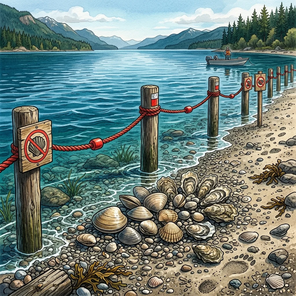
    BELFAIR, Wash. — The Washington Department of Fish and Wildlife (WDFW) closed two of the most popular shellfish beaches on northern Hood Canal effective May 3, 2026, citing unsustainable harvest pressure and widespread rule-breaking — and the conservation action 50 miles north of the Great Bend has direct consequences for the Belfair-area beaches that North Mason families, Hood Canal property owners, and Mason County visitors use most.

    The closure of Shine Tidelands State Park and Wolfe Property State Park, both in Jefferson County near the Hood Canal Bridge, ends the 2026 recreational clam, mussel, and oyster season at those sites earlier than scheduled. WDFW biologists and Fish and Wildlife Police said low tides this spring drew hundreds of harvesters at a time, many directed by social-media gathering groups, and compliance with limits, hole-filling, parking, and species-identification rules collapsed under that volume.

    Last refreshed: October 20, 2026 (Pacific).

    October 2026 update: The pressure story below played out against a much bigger closure: in June 2026, DOH testing found lethal paralytic shellfish poisoning (PSP) levels and all of Hood Canal closed to bivalve harvest. On October 14, 2026, WDFW issued an emergency rule reopening or extending several beaches as water quality improved — Belfair State Park is open to clam, mussel, and oyster harvest through October 31, 2026, to make up for the lost summer opportunity. Twanoh’s campsite reservations remain closed through spring 2027 for the shoreline restoration. Check the DOH Shellfish Safety Map the morning of any harvest — status can change again.

    What WDFW closed — and why it matters in North Mason

    The 2026 season at Shine Tidelands and Wolfe Property had already been reduced under a statewide rule package adopted in late 2025 that targeted ten Puget Sound beaches showing harvest stress. The May 3 action closed the season early on top of that reduction.

    For North Mason, the news is not just about two parks an hour north. Hood Canal harvesters are mobile, and any closure on the canal’s north end displaces effort. The same 2026 statewide rule package also shifted the dates at Twanoh State Park — Mason County’s most heavily-used Hood Canal shellfish beach, sitting on SR-106 between Belfair and Union. When fewer beaches are open at the same time, the ones that remain open absorb the displaced demand.

    The Twanoh squeeze: shifted season + summer shoreline closure

    Twanoh State Park faced two compounding closures of its own in 2026. The first is the WDFW season shift — harvest windows have moved to different months than locals are used to, and harvesters who show up on the wrong tide will find the beach legally closed. The second is a Washington State Parks shoreline restoration project: campsite reservations at Twanoh closed from June 1, 2026 through spring 2027, and beach access was scheduled to close after the 2026 clam season for restoration construction.

    Stacked together, those two closures meant Twanoh’s window of legal, accessible shellfish harvest in 2026 was narrower than it had been in years. Mason County harvesters who missed it looked for alternatives. Belfair State Park, Potlatch State Park, and Mason County’s private tidelands will see the spillover.

    Why Belfair-area beaches are the next pressure point

    The Mason County stretch of Hood Canal — from the head of the Great Bend at Belfair down through Tahuya, Union, Hoodsport, and Lilliwaup — holds some of the most productive recreational shellfish ground in Washington. Belfair State Park, at the very tip of the Great Bend, has seasonal openings tied to the Mary E. Theler Wetlands and the Union River estuary. Twanoh has historically been the workhorse beach for residents driving SR-3 and SR-106.

    WDFW’s enforcement note on the May 3 closure was unusually pointed: gatherers exceeding daily limits, abandoning open digging holes, parking unsafely or illegally, and misidentifying clam species. None of those behaviors are unique to Shine Tidelands or Wolfe Property — the same patterns show up at North Mason beaches during peak low-tide weekends. For planning context, the Bugle’s Hood Canal Shellfish Season summer planner for Belfair and the 2026 shellfish and crab calendar for Hood Canal property owners remain the working baseline, both cross-checked against the WDFW Shellfish Safety Map before any harvest day.

    How Hood Canal shellfish management works

    Two state agencies share authority. WDFW sets seasons, daily limits, and species rules. The Washington State Department of Health (WA DOH) handles biotoxin and pollution closures through its Shellfish Safety Map and the Biotoxin Hotline at 1-800-562-5632. A beach can be open under WDFW and simultaneously closed under DOH for paralytic shellfish poison or vibrio risk — both have to be checked. Coverage of how shoreline land use affects water quality on the canal is in the Bugle’s water quality and shellfish reporting on the Tahuya River Preserve.

    What this means going forward

    WDFW signaled the May 3 action was a conservation tool the agency intends to keep using. If harvest pressure at any Hood Canal beach outruns sustainability, early closures should be expected rather than viewed as a surprise. The practical takeaway for Belfair, North Mason, and Hood Canal property-owner audiences: check the WDFW beach page and DOH Shellfish Safety Map the morning of harvest, not the night before. The Belfair Bugle will track the Twanoh State Park shoreline restoration timeline, the post-shift Twanoh harvest dates, and any further early closures on the Mason County side of the canal as they’re announced.

    Frequently Asked Questions

    Were Shine Tidelands and Wolfe Property the only Hood Canal beaches closed in May 2026?

    Those are the two WDFW closed early on May 3, 2026 — the picture as of that spring. The map has moved since: a June 2026 biotoxin closure shut all of Hood Canal, and WDFW’s October 14, 2026 emergency rule reopened or extended several beaches as water quality improved, including Belfair State Park (open through October 31, 2026). Other Hood Canal beaches run on their own published 2026 seasons and may be open, closed, or under biotoxin advisory. Always check the WDFW shellfish-beach page for the specific beach plus the WA DOH Shellfish Safety Map before harvesting.

    Is Belfair State Park open for recreational shellfish harvest right now?

    As of October 20, 2026, Belfair State Park is open to clam, mussel, and oyster harvest through October 31, 2026 — WDFW’s October 14 emergency rule extended the season to make up for this summer’s biotoxin closure, which closed all of Hood Canal in June. After October 31, check the Belfair State Park beach page on wdfw.wa.gov and the DOH Shellfish Safety Map before planning a harvest trip.

    Was Twanoh State Park open for camping in summer 2026?

    No. Washington State Parks closed Twanoh State Park campsite reservations from June 1, 2026 through spring 2027 for a shoreline restoration project, so there was no summer 2026 camping season. Beach access was scheduled to close after the 2026 clam season ended.

    What changed at Twanoh State Park for shellfish in 2026?

    The 2026 statewide rule package WDFW adopted in late 2025 shifted Twanoh State Park’s recreational harvest dates to different months than the historical pattern. Harvesters who relied on prior-year calendars need to re-check the WDFW Twanoh page for the new 2026 windows.

    What can North Mason residents do to keep their Hood Canal beaches open?

    WDFW listed four behaviors that triggered the May 3 closure to the north: exceeding daily limits, leaving open digging holes, illegal or unsafe parking, and misidentifying clam species. Avoiding all four — and reporting violations to WDFW — is the single biggest thing local recreators can do to keep beaches like Belfair State Park and Potlatch State Park from following Shine Tidelands and Wolfe Property into early closure.

    Where do I report a violation or get a current closure status?

    For violations: WDFW Enforcement at 360-902-2936. For biotoxin closures: WA DOH Biotoxin Hotline at 1-800-562-5632 or the Shellfish Safety Map at doh.wa.gov/ShellfishSafety. The map updates as test results come in and is the authoritative source for whether a beach is safe on a given day.


    Related Expansion Coverage

    This story has been expanded into a full knowledge cluster for Mason County audiences:

  • Belfair State Park: A Guide for New North Mason Residents

    Belfair State Park: A Guide for New North Mason Residents


    If you just moved to North Mason County, you may have driven past the brown sign for Belfair State Park without realizing what it actually offers. Here’s the short version: a 65-acre state park sits at the southern end of Hood Canal’s Great Bend, with 3,720 feet of saltwater shoreline, a restored estuary, ADA-accessible day-use facilities, and a campsite reserved exclusively for paddlers as part of a National Recreation Trail that stretches all the way to the San Juan Islands.

    Most new residents take a year or two to discover this. Treat this article as a shortcut.

    Last refreshed: October 20, 2026 (Pacific).

    What the Cascadia Marine Trail Actually Is

    The Cascadia Marine Trail (CMT) is a National Recreation Trail managed by the Washington Water Trails Association in partnership with Washington State Parks. It strings together more than 55 shoreline campsites along the inland marine waters of Washington — Puget Sound, Hood Canal, the Strait of Juan de Fuca, the San Juans — and it is reserved for human-powered and wind-powered watercraft. Kayaks. Canoes. Stand-up paddleboards. Sailing dinghies that can be muscled to a beach.

    You cannot drive to a CMT site. That is the whole point. The trail exists to give paddlers a multi-day route through Washington’s marine waters with low-cost, designated places to camp along the way. Belfair State Park’s CMT campsite — site 148 — is the trail’s southernmost stop on Hood Canal. From here, paddlers head north up the canal toward Twanoh, Potlatch, and Hoodsport, then connect to the broader trail.

    What the State Park Offers Day-Trippers

    You don’t have to be a paddler to use the park. The day-use side has:

    • 3,720 feet of saltwater shoreline along the southern Hood Canal Great Bend
    • A historic tidal swimming pool that warms up in summer
    • Picnic areas, ADA-accessible restrooms, coin-operated showers
    • Trails through restored saltmarsh between Big Mission Creek and Little Mission Creek
    • A drive-in campground (separate from the paddler-only CMT site)

    You need a Washington Discover Pass for vehicle parking — $10 day or $45 annual. If you live in Mason County and plan to visit any of the state’s parks more than four times a year, the annual pass pays for itself by your fifth visit.

    The History You’ll See on the Shoreline

    One of the things that makes Belfair State Park genuinely interesting — versus just scenic — is that you can read its history on the ground.

    Between 1952 and 1960, the original tidal marsh was graded, filled, and channelized to make room for parking, a swimming hole, and a more conventional state-park experience. Both Mission Creeks were straightened. A tidal gate was built. About 67,000 cubic yards of fill went in. Saltmarsh function was largely lost.

    Starting in the 2010s, Washington State Parks and the Hood Canal Salmon Enhancement Group began undoing the damage. According to project records published by the Pacific Northwest Salmon Center, the project has restored approximately 8.1 acres of estuarine wetlands and removed 2,700 feet of rip-rap shoreline armoring. Walking the shoreline today, you can see tidal channels reforming, reed grass spreading into the shallows, and the creeks meandering closer to their original courses. It’s an active, visible piece of restoration ecology — the kind of thing you can show visiting family and explain in two minutes.

    Long before any of that, this stretch of shoreline was a Skokomish gathering and harvesting place. The cultural history is older than the park, older than the state. Worth carrying with you when you visit.

    Your First Three Visits, in Order

    If you’re new to North Mason and want to actually use this park rather than just drive past it, here’s a starting sequence:

    1. Day-use afternoon. Pack a picnic, walk the saltmarsh trails, watch the tide, leave by sunset.
    2. Borrowed-kayak morning. If a friend has a kayak — or you can rent from North Shore Hood Canal Kayaks at 3959 NE North Shore Road in Belfair (call ahead, no walk-ins) — paddle the protected water near the saltmarsh on a calm morning.
    3. Pair it with Tahuya Forest. Spend a Saturday split between the park in the morning and Tahuya State Forest in the afternoon. That’s two of North Mason’s signature outdoor places in one day.

    Frequently Asked Questions

    Is Belfair State Park free?

    Day-use parking requires a Washington Discover Pass — $10 per day or $45 per year, per vehicle. Camping fees are charged separately at the park’s self-registration. The $12 Cascadia Marine Trail site is paddler-only and cannot be reached by car.

    Where exactly is Belfair State Park?

    The park is at 3151 NE SR 300 in Belfair, at the southern end of Hood Canal’s Great Bend in Mason County, Washington. From the SR-3 / SR-300 junction in downtown Belfair, it’s about three miles west along SR-300.

    Can I camp at Belfair State Park without a kayak?

    Yes — the park has a separate drive-in campground for car campers. The Cascadia Marine Trail campsite (site 148) is reserved exclusively for paddlers and wind-powered watercraft and cannot be accessed by vehicle.

    What is Hood Canal’s Great Bend?

    The Great Bend is the sharp curve where Hood Canal turns east before its long northern reach. Belfair State Park sits at the southern end of this curve. The geometry of the bend creates protected paddling water and gives the area a distinct fjord-like character.

    Are there restaurants near Belfair State Park?

    Downtown Belfair is a short drive away and offers a range of casual restaurants, coffee shops, and a Saturday market. For waterfront dining, restaurants along North Shore Road and SR-106 east of the park provide additional options. Plan ahead for weekend evenings — seating fills.

    Can I see salmon at Belfair State Park?

    The estuary restoration is rebuilding juvenile salmon habitat in Big and Little Mission Creeks. Best viewing is from the boardwalk and shoreline trails during outgoing tides in summer and fall. Adult salmon return to nearby Hood Canal streams; the park itself is primarily juvenile-rearing habitat.

    This is a new-resident orientation companion to our Cascadia Marine Trail / Belfair State Park kayaking guide. For more North Mason orientation, see our Tahuya State Forest newcomer’s guide.

  • Belfair Tourism Business: Cascadia Marine Trail Strategy

    Belfair Tourism Business: Cascadia Marine Trail Strategy


    For Belfair lodging operators, kayak rental shops, restaurants, and tourism-adjacent businesses, the Cascadia Marine Trail is an underused asset sitting right outside your door. Belfair State Park’s CMT site 148 is the southernmost paddler campsite on Hood Canal — and the National Recreation Trail it anchors brings exactly the kind of low-impact, repeat-visit, multi-day visitor that small Mason County hospitality businesses are built to serve. Here’s what’s worth knowing about that economic flow in spring 2026.

    Who Uses the Cascadia Marine Trail

    The CMT visitor is a specific profile: 30s–60s, often a couple or small group, willing to spend on quality gear and quality lodging on either end of a multi-day paddle, and inclined to repeat visits over a season because the trail is cumulative — they paddle a leg this trip, the next leg next trip. This is the inverse of the day-tripper who eats one meal and leaves. CMT users plan around weather windows, tides, and water conditions, which means weekday demand and shoulder-season demand both index higher than typical leisure tourism.

    The trail is managed by the Washington Water Trails Association in partnership with Washington State Parks. WWTA’s site lists more than 55 paddler-only campsites along Washington’s inland marine waters; Belfair State Park is the trail’s southern Hood Canal anchor.

    Lodging: The “Day Before” and “Day After” Opportunity

    A CMT trip almost always involves a non-paddling night before launch and a non-paddling night after takeout. Paddlers want to arrive the day before, prep gear, eat well, sleep on a real bed, and get on the water early. They want the same on the back end after coming off the canal.

    For Belfair vacation rental hosts, that translates into two structural opportunities:

    • Storage logistics: Properties that can accommodate a kayak (covered side yard, garage space, dock access) command a clear premium with paddler guests.
    • Shuttle and launch information: Listings that explicitly mention proximity to Belfair State Park, launch instructions, and Discover Pass tips convert better with paddler searchers than generic “near Hood Canal” copy.

    For B&B and inn operators, paddlers tend to be lower-impact guests — early to bed, early up, often skipping the breakfast service in favor of a pre-launch protein bar — which can pencil better than the typical leisure stay.

    Rental and Outfitter Demand

    North Shore Hood Canal Kayaks at 3959 NE North Shore Road in Belfair operates by appointment, signaling demand exists for paddler equipment in the area without a high walk-in volume. There is room in the market for additional rental, lesson, and guide services — particularly anything that lowers the barrier for first-time paddlers (intro lessons, half-day guided tours, beginner gear packages with PFDs sized for kids).

    Lodging properties along North Shore Road that include kayaks and SUPs as part of the package tend to differentiate well in vacation rental search. If you operate a property within a 10-minute drive of the state park and don’t currently include water craft, the upfront equipment cost is modest relative to the marketing lift.

    Restaurants, Coffee, and Pre-Launch Provisioning

    The CMT visitor’s morning routine: 5:30 a.m. wake, coffee, breakfast they don’t have to cook, on the water by 7. Restaurants and coffee shops along the SR-3 and SR-300 corridors that open early and offer grab-and-go options capture this demand. Same-day takeout dinner reservations on the back end of trips — when paddlers come off the water tired, hungry, and not interested in cooking — are similarly underserved.

    Provisioning for multi-day paddles also creates opportunity for any Belfair grocer or specialty store stocking lightweight, water-resistant, paddler-friendly food: dried meals, bars, electrolyte mixes, no-cook protein.

    The Restoration Story Is a Marketing Asset

    Belfair State Park is the site of a significant ongoing estuary restoration. The Hood Canal Salmon Enhancement Group, in partnership with Washington State Parks, has restored approximately 8.1 acres of estuarine wetlands and removed 2,700 feet of rip-rap shoreline armoring — undoing fill placed between 1952 and 1960. Project documentation is hosted by the Pacific Northwest Salmon Center.

    For tourism operators, this is a real differentiator. Visitors increasingly want their travel choices to align with conservation — and Belfair offers a paddle directly past an active, visible salmon-habitat restoration site. That’s a story you can put in your listing copy, your booking confirmation email, and your guest welcome packet, and it costs nothing.

    Cross-Promote With Other North Mason Outdoor Assets

    Belfair’s outdoor inventory is more than the state park. Tahuya State Forest’s 23,000 acres are 3.5 miles away. Theler Wetlands’ boardwalk and salmon-rearing center is on the eastern side of town. The Skokomish Valley and the broader Hood Canal shoreline extend in both directions. Listings, websites, and concierge collateral that reference the full Tahuya State Forest trail system alongside paddling — rather than treating each as a standalone — close better with multi-day visitors.

    Frequently Asked Questions

    How can my Belfair lodging business attract Cascadia Marine Trail paddlers?

    List your property explicitly with kayak storage capacity, proximity to Belfair State Park, and Discover Pass guidance in the listing copy. Paddlers search for those specifics. Properties that include kayaks or SUPs as part of the package differentiate strongly in vacation rental search. Early breakfast options and quiet pre-launch logistics matter more to this customer than typical leisure amenities.

    Is there room for another kayak rental business in Belfair?

    The current operator, North Shore Hood Canal Kayaks, runs by appointment-only — which suggests demand exists but is being managed against capacity rather than fully met. There is likely room for additional rental, beginner lessons, and guided half-day tour businesses, particularly any service lowering the barrier for first-time paddlers and families with kids.

    What does a Cascadia Marine Trail visitor typically spend?

    CMT users are a specific multi-day, planning-oriented visitor — typically spending on lodging the night before launch and the night after takeout, plus on-trail provisions, plus rental gear if they’re not bringing their own. They also tend to repeat-visit across a season because the trail is cumulative. Total spend per trip varies, but the lifetime value across a season is materially higher than a single-day visitor’s.

    How does the saltmarsh restoration affect business?

    The Belfair State Park estuary restoration project is an active draw for conservation-minded visitors and a genuine marketing differentiator for properties and businesses that mention it in their listings. The park itself remains fully operational throughout the restoration; day-use, camping, and CMT site 148 are all open. The project enhances the visitor experience rather than disrupting it.

    Where can I learn more about hosting paddler guests?

    The Washington Water Trails Association maintains a public site list and trail map at wwta.org with information about each CMT site. State Parks publishes Belfair-specific information at parks.wa.gov. For local outdoor recreation context, our spring 2026 Cascadia Marine Trail guide covers the specifics that paddler guests typically ask about.

    This is a Mason County business-owner companion to our Cascadia Marine Trail / Belfair State Park spring 2026 guide. For related commercial coverage, see our recent Belfair sewer / PSIC business briefing.

  • Belfair State Park Kayaking: Cascadia Marine Trail Guide

    Belfair State Park Kayaking: Cascadia Marine Trail Guide


    Belfair, Mason County — The Cascadia Marine Trail begins, in a sense, in your backyard. Belfair State Park anchors the southern end of the trail, and for North Mason County paddlers, that means a 55-campsite, water-only trail system reaches all the way from the head of Hood Canal to the San Juan Islands — and you can step onto it from a launch you can drive to in twenty minutes.

    This guide covers what’s actually open, what it costs, what to bring, and the local rules and history that shape paddling out of Belfair this season.

    Last refreshed: October 20, 2026 (Pacific).

    Cascadia Marine Trail Site 148, Plain English

    The Cascadia Marine Trail (CMT) is a National Recreation Trail managed by the Washington Water Trails Association in partnership with Washington State Parks. It links more than 55 shoreline campsites along the inland marine waters of Washington and is reserved exclusively for human-powered and wind-powered watercraft — kayaks, canoes, sailing dinghies, stand-up paddleboards.

    At Belfair State Park, the CMT campsite is site 148. As of January 1, 2019, Washington State Parks moved the marine trail spot from a more isolated location into the main campground, putting it closer to restrooms and showers while keeping it on the water. It sits just west of Little Mission Creek, on the park’s saltwater shoreline.

    The rules are simple: arrive by water, claim the site first-come first-served, pay $12 per night for up to eight people, and leave it cleaner than you found it. No vehicle access. No reservations. Paddler honor system.

    The Park Itself: 65 Acres, 3,720 Feet of Saltwater

    Belfair State Park covers 65 acres at the southern end of Hood Canal’s Great Bend — the sharp curve where the canal turns east before its long northern reach. The park has 3,720 feet of saltwater shoreline, two freshwater creeks (Big Mission and Little Mission), tidelands, restored saltmarsh, and an ADA-accessible day-use area. A Washington Discover Pass ($10/day or $45/year) is required for day-use parking.

    For paddlers based in or passing through Mason County, the south end of the canal offers some of the most protected paddling water in Washington. The Great Bend’s geometry — a long fjord turning back on itself — moderates Pacific swells and gives beginners a genuinely forgiving training ground.

    Conditions: Why Mornings, Not Afternoons

    Hood Canal is a fjord. Geologically and hydrologically, it behaves like one — narrow, deep, with topography that channels wind. On most days, that means glassy mornings and brisk afternoons. South-southwesterlies build through the day and accelerate up the canal’s southern reach.

    The local rule is unwritten but consistent: launch early, turn back by lunch unless you are confident in your reentry skills, and check the marine forecast for the South Hood Canal area on the National Weather Service site before you go. Tide tables matter too — Big Mission Creek’s mouth is shallow, and a low tide turns the launch zone into a mudflat.

    If You Don’t Own a Kayak

    Local rentals exist. North Shore Hood Canal Kayaks operates by appointment from 3959 NE North Shore Road in Belfair — call ahead rather than walking in, since they are not staffed for drop-ins. Vacation rental properties along the canal increasingly include kayaks and SUPs as part of the package; if you are renting a place for a long weekend, ask the host before booking.

    For visitors who want a guided experience, several outfitters in nearby Hood Canal communities offer half-day and full-day tours; lodging directories on Explore Hood Canal compile current options.

    The Estuary Is Coming Back

    The shoreline you launch from is a restoration site, not a relic. Between 1952 and 1960, the original tidal marsh between the two Mission Creek mouths was graded, filled, and channelized. A tidal gate was installed to create a swimming hole. Both creeks were straightened. Decades of estuarine habitat were lost.

    The Hood Canal Salmon Enhancement Group (HCSEG), partnered with Washington State Parks, has been undoing that. According to project records published by the Pacific Northwest Salmon Center, the project has restored approximately 8.1 acres of estuarine wetlands, removed 2,700 feet of rip-rap shoreline armoring, and removed roughly 67,000 cubic yards of fill — returning sinuosity to Big and Little Mission Creeks. On a quiet morning paddle, the results are visible: tidal channels reforming, reed grass spreading into the shallows, juvenile salmon habitat recovering.

    Long before any of this — before the 1952 fill, before the park itself — this shoreline was a Skokomish gathering and harvesting place. The cultural history is older than the recreational one, and worth carrying with you when you launch.

    One Last Note on Shellfish

    Belfair State Park has tideland shellfish beds, but biotoxin closures and seasonal restrictions move week to week. Always check the current status on the WDFW shellfish beaches page before harvesting. As of this October 2026 check, WDFW’s October 14 emergency rule has Belfair State Park open to clam, mussel, and oyster harvest through October 31, 2026 — an extension making up for the summer biotoxin closure — so the morning-of check matters more, not less. A quick check costs nothing; a paralytic shellfish poisoning emergency-room visit costs everything.

    Where Belfair Fits in the Larger Trail

    From site 148, the CMT continues north up Hood Canal toward Twanoh, Potlatch, and Hoodsport, with additional sites threading toward Quilcene and Port Townsend before connecting to the Salish Sea network. Belfair is where the southern leg of a much larger Washington water trail begins. For Mason County paddlers, that’s a meaningful piece of geography: a National Recreation Trail with its southern doorstep here.

    Frequently Asked Questions

    How much does it cost to camp at Cascadia Marine Trail site 148?

    $12 per night for up to eight people, paid via the park’s self-registration system. The site is for human-powered or wind-powered watercraft only — you must arrive by water. There are no reservations; sites are first-come, first-served.

    Do I need a Discover Pass to launch from Belfair State Park?

    Yes — a Washington State Discover Pass is required for day-use vehicle parking. Day passes cost $10 and annual passes cost $45. Buy online at discoverpass.wa.gov or at park self-pay stations. Overnight campers’ fees include the pass for the duration of the stay.

    Is Hood Canal safe for beginner kayakers?

    The Great Bend’s protected geometry makes the south end of Hood Canal one of the more forgiving paddling environments in Washington — but afternoon winds build quickly, and the canal’s depth means cold-water immersion risk year-round. Beginners should launch early, stay close to shore, wear a properly fitted PFD, and bring extra layers. Always check the marine forecast for South Hood Canal before going.

    What is the saltmarsh restoration at Belfair State Park?

    Washington State Parks and the Hood Canal Salmon Enhancement Group have been restoring approximately 8.1 acres of estuarine wetlands at the park, removing 2,700 feet of rip-rap and roughly 67,000 cubic yards of fill that were placed between 1952 and 1960. The work is reopening Big and Little Mission Creek mouths to natural tidal flow and rebuilding juvenile salmon habitat.

    Can I rent a kayak in Belfair?

    Yes. North Shore Hood Canal Kayaks operates by appointment at 3959 NE North Shore Road in Belfair — call ahead, as they do not accept walk-ins. Several Hood Canal vacation rentals also include kayaks and stand-up paddleboards as part of the property package; ask your host before booking.

    Where does the Cascadia Marine Trail go from Belfair?

    From site 148, the trail continues north up Hood Canal toward Twanoh State Park, Potlatch, and Hoodsport, eventually connecting to the wider Salish Sea network of more than 55 paddler-only campsites stretching toward the San Juan Islands. Belfair is the trail’s southernmost campsite on the canal.

    What should I bring on a first paddle from Belfair State Park?

    At minimum: PFD, paddle leash, dry bag for keys and phone, layered clothing (fleece + windbreaker), water, snacks, marine forecast checked within the last hour, tide chart, and a float plan filed with someone on shore. Hood Canal is cold year-round; even on a warm day, immersion is a real risk.

  • Belfair State Park Kayaking: How to Paddle With Kids

    Belfair State Park Kayaking: How to Paddle With Kids


    For North Mason families wondering whether their kids are ready to kayak Hood Canal: the south end of the canal — your end — is where Washington’s beginner paddlers learn. Belfair State Park’s protected shoreline at the Great Bend is genuinely forgiving, the day-use beach is ADA-accessible, and the launch is twenty minutes from most Belfair driveways. Here’s how to plan a first family paddle this spring without making the rookie mistakes that ruin the trip.

    Why the Great Bend Is the Right Training Water

    Hood Canal is technically a fjord, and the southern reach where Belfair State Park sits is its sharpest curve — the Great Bend. The geometry breaks up Pacific swells before they reach you and gives the south end a dependably calmer surface than the open canal further north. For families with kids who have never been in a sit-on-top or tandem before, that matters more than any other factor.

    You still need to plan around afternoon wind. South-southwesterlies build through the day. Launch early, plan a short loop, and be back on land before lunch on your first outing. If your kids ask “can we keep going?” — perfect. End on a high note, not a wet exhausted note.

    The Family Day-Use Plan

    The simplest first trip looks like this:

    1. Buy a Washington Discover Pass ahead of time ($10 day, $30 annual) so you are not fumbling at the park entrance with kids in the car.
    2. Arrive at Belfair State Park before 9 a.m. Tide and wind both behave best in the morning.
    3. Set up a base camp in the day-use area. The park has 65 acres, restrooms, and a swimming-friendly tidal pool kids love when paddling is done.
    4. Launch from the beach. Stay within easy sight of your beach blanket. Paddle west toward the saltmarsh restoration zone — that’s where the water is calmest.
    5. Be off the water before any sustained breeze starts ruffling whitecaps. If you see whitecaps from the beach, you’re already late.

    The $12 paddler-only Cascadia Marine Trail campsite — site 148 — is not the right move for a first family outing. Save it for when your kids have a few day paddles under them and want the real experience.

    What to Bring (The Honest List)

    Hood Canal water is cold year-round. Even in July, immersion is a hypothermia risk. The non-negotiables for paddling with kids:

    • Properly fitted PFDs for every person, including parents. A child’s PFD must be sized for their weight; an adult PFD on a kid is a drowning hazard. Most PFDs have weight ranges printed on the inside.
    • A change of warm clothes per person, in a dry bag, on shore. If anyone goes in, you want fleece and a jacket waiting.
    • Sunscreen and hats. Glare off Hood Canal multiplies sun exposure.
    • Water, snacks, a whistle on each PFD.
    • The marine forecast checked within the hour — the South Hood Canal area on the National Weather Service site.

    Renting vs. Buying

    For a family’s first outing, renting makes sense. North Shore Hood Canal Kayaks at 3959 NE North Shore Road in Belfair operates by appointment — call ahead, no walk-ins. Tandem sit-on-top kayaks are the most family-forgiving option. Skip closed-cockpit sea kayaks until your kids have practiced wet exits.

    Some Hood Canal vacation rentals along North Shore Road include kayaks as part of the property package, which can simplify logistics if you have visitors staying with you.

    Pair the Paddle with a Tahuya Forest Day

    One of the underrated North Mason family weekends is paddling Belfair State Park in the morning and exploring Tahuya State Forest in the afternoon. The forest is 3.5 miles from Belfair and offers family-friendly trails plus picnic areas. Two kinds of nature in one day, both within the same county, both free or near-free with the Discover Pass you already bought.

    Frequently Asked Questions

    How young can a child go kayaking on Hood Canal?

    There is no legal minimum, but practically, kids should be able to follow safety instructions, sit still in a tandem for 20–30 minutes, and tolerate a properly fitted child PFD. Most outfitters will rent to families with children as young as 4 or 5 in tandem boats with an adult — but the call belongs to the parent. If a child is afraid of water or unable to sit still, wait a year.

    Do kids need their own Discover Pass?

    No. The Discover Pass is per vehicle, not per person. One $10 day pass covers everyone arriving in the same car. If you visit Washington state parks more than three times a year, the $30 annual pass pays for itself.

    Is the water at Belfair State Park warm enough to swim in?

    The park’s tidal swimming hole — created by the historic tidal gate — does warm up in summer afternoons and is a popular spot for families. The open canal stays cold (50s to low 60s°F) year-round. If your kids end up in the open water unexpectedly, treat it as a cold-water situation and get them dry and warm immediately.

    What’s the closest restroom to the launch beach?

    Belfair State Park has ADA-accessible restrooms and coin-operated showers in the main day-use area, a short walk from the launch beach. There are no facilities on the saltmarsh side.

    What if the wind picks up while we’re on the water?

    Turn back immediately and stay close to shore. Hood Canal wind builds fast and the southerly fetch from the Great Bend can push small craft surprisingly far. If you cannot make headway, paddle to the nearest beach and walk back to your launch point along the shore. The park’s 3,720 feet of saltwater shoreline gives you a long landing zone.

    This is a family-focused companion to our Cascadia Marine Trail / Belfair State Park spring 2026 guide. For Tahuya Forest plans, see our family trail access guide.

  • Walter E. Hall Park: Everett’s 137-Acre South-End Recreation Complex With a Public Golf Course, a Skate Park, and the Quiet Best Soccer Fields in Town

    Walter E. Hall Park: Everett’s 137-Acre South-End Recreation Complex With a Public Golf Course, a Skate Park, and the Quiet Best Soccer Fields in Town

    **What is Walter E. Hall Park in Everett?** Walter E. Hall Park is a 137-acre City of Everett park at 1226 W. Casino Road, anchoring south Everett with a full 18-hole public golf course, a multi-field soccer and baseball complex, a skate park, a playground, and the Olympic View Banquet Room overlooking the 18th hole. It is open from 6 a.m. to dusk daily and serves as the main recreation hub for the Westmont, Holly, and Casino Road area.

    If Forest Park is the neighborhood park Everett brags about and Grand Avenue Park is the neighborhood park Everett forgets to brag about, Walter E. Hall Park is the south-end park Everett uses. Quietly, constantly, weekday and weekend. The youth soccer brackets that fill it on a Saturday morning are reason enough. The 18-hole public golf course is another. The skate park has its own following. The fact that all three of those things sit on the same 137-acre footprint at 1226 W. Casino Road is one of the most underrated facts about south Everett.

    The Footprint

    Walter E. Hall Park is 137 acres — making it the second-largest city park in Everett behind only Forest Park’s 197. The park is shaped roughly like a wide rectangle, with the soccer and baseball fields occupying the north edge along Casino Road and the Walter E. Hall Golf Course filling the southern majority of the park. The skate park, playground, and central restrooms sit roughly between the two halves.

    The park’s address is 1226 W. Casino Road, Everett, WA 98204 — meaning if you have ever driven west on Casino Road from Evergreen Way, you have driven directly past the soccer fields. Most people who do not have a kid playing youth soccer or a regular tee time do not realize how big it is.

    The park is open from 6 a.m. to dusk every day of the year. There is no parking fee. The golf course operates on its own schedule and pricing.

    The Golf Course Most South Everett Doesn’t Know Is Public

    Walter E. Hall Golf Course is an 18-hole, par-71 public course operated by the City of Everett. It is one of three publicly accessible Everett-area courses (the others being Legion Memorial in north Everett and Harbour Pointe in Mukilteo) and has long been the most affordable of the three.

    At the north edge of the golf course, you’ll find the clubhouse complex — pro shop, café, driving mat, and a long-chip-and-putt area that is free to use. The Olympic View Banquet Room sits inside the same building, looking out over the 18th hole and, on a clear day, the Olympic Mountains beyond Port Gardner. The room is one of Everett’s most underbooked event spaces — it gets weddings, golf tournament dinners, and the occasional retirement party, but it is usually wide open in the middle of the week.

    The course’s pace and profile fit south Everett: it is friendly, walkable, and priced for the neighborhood that surrounds it. It is also the rare Everett park amenity where the surrounding Westmont-Holly and Casino Road residents have a quietly proprietary relationship — many regulars have been playing the course for decades.

    The Soccer Complex Casino Road Built Its Saturdays Around

    The northern half of the park is, on most spring and fall Saturdays, the busiest single piece of grass in Everett. The fields host overlapping youth soccer matches throughout the season, alongside baseball and softball games on the dedicated diamonds. League play overlaps with pickup play overlaps with practice — and on a sunny Saturday in April, the parking lot fills before 9 a.m.

    The fields are large enough to host multiple soccer matches simultaneously, which is why Walter E. Hall has become the de facto home for youth soccer leagues in south Everett. For a neighborhood like Casino Road — where many families do not have backyards big enough to kick a ball in — Walter E. Hall has functioned as the shared backyard for decades.

    The fields are paired with restrooms, a playground, and shaded picnic areas, which is what separates a park families actually use from one that just looks like it on the map. Walter E. Hall is firmly in the first category.

    The Skate Park

    The Walter E. Hall skate park is the kind of in-park amenity that Everett quietly does well. It is open to all skill levels, it is concrete (not the cheaper wood ramps that don’t survive Pacific Northwest winters), and on a typical afternoon it pulls a mix of preschool-age scooter kids, middle schoolers learning their first ollies, and adults relearning skills they had at sixteen.

    It is not the fanciest skate park in Snohomish County — that title still belongs to a few of the newer purpose-built facilities elsewhere — but it is one of the most consistently used. For families on Casino Road and in Westmont-Holly, it functions as one of the most accessible public skating venues in south Everett, period.

    What’s Within Walking Distance

    Walter E. Hall Park sits at the geographic and recreational center of south Everett. Casino Road runs along the north edge. Westmont-Holly is immediately to the south. Holly Drive borders the park on the west. The Boys & Girls Club of Snohomish County, profiled in our 80th-anniversary guide, is a short drive east. The Mukilteo School District serves the elementary and middle schools whose families use the park most.

    For most south Everett families, Walter E. Hall is the closest substantial park — closer than Forest Park, closer than Kasch Park, and easier to reach on foot than either. That accessibility is part of why the park’s parking lots and fields stay so busy.

    The Practical Stuff

    Address: 1226 W. Casino Road, Everett, WA 98204

    Hours: 6 a.m. to dusk, daily, year-round

    Park entrance: free

    Golf course: paid (City of Everett rates)

    Field reservations: through Everett Parks and Recreation

    Olympic View Banquet Room: bookable through the city’s facility reservation system

    Restrooms: yes

    ADA-accessible parking and paved paths: yes

    The park does not have a dedicated dog area, so leashes are required throughout the grounds. The skate park does not require a permit — first come, first served. The golf course recommends advance tee times during peak season; walk-ons depend on the day.

    A South-End Park That Earns Its Keep

    It is fair to say Walter E. Hall Park does not get the marketing love that Howarth Park or Grand Avenue Park gets in this city. The waterfront parks photograph better. The downtown overlooks photograph better. Walter E. Hall is a working-class south Everett park, and it photographs like one.

    But on a Saturday morning, when the parking lot is full at 8:55 a.m. and three parallel youth soccer games are kicking off and the skate park is already humming and a foursome is teeing off on the first hole — Walter E. Hall is doing more for more Everett families per acre than almost any park in the city. That is the test for a park, and Walter E. Hall passes it.

    If you live anywhere south of Mukilteo Boulevard and you have a kid in cleats, a friend who golfs, or a teenager with a board — you have probably already been there. If you have not been yet, drive west on Casino Road and turn in.

    Frequently Asked Questions

    Where is Walter E. Hall Park in Everett? Walter E. Hall Park is at 1226 W. Casino Road, Everett, WA 98204, anchoring south Everett between Casino Road on the north and the Westmont-Holly neighborhood on the south.

    How big is Walter E. Hall Park? The park is 137 acres, making it the second-largest city park in Everett after Forest Park (197 acres).

    Does Walter E. Hall Park have a public golf course? Yes. Walter E. Hall Golf Course is an 18-hole public course operated by the City of Everett, located on the southern half of the park footprint.

    What are the hours at Walter E. Hall Park? The park is open daily from 6 a.m. to dusk, year-round. The golf course operates on its own posted hours.

    Is the Walter E. Hall skate park free to use? Yes. The skate park is open to the public during park hours on a first-come, first-served basis. No permit is required.

    Can you reserve fields or rooms at Walter E. Hall Park? Yes. Soccer and baseball fields can be reserved through Everett Parks and Recreation. The Olympic View Banquet Room overlooking the 18th hole is bookable through the city’s facility reservation system.

    Is Walter E. Hall Park dog-friendly? Leashed dogs are welcome on park grounds. There is no dedicated off-leash area at this park.

    Why is it called Walter E. Hall Park? The park is named for Walter E. Hall, a longtime Everett civic figure for whom both the park and adjacent golf course were named.

  • South Forest Park Everett: Complete Neighborhood Guide

    South Forest Park Everett: Complete Neighborhood Guide

    **What is South Forest Park in Everett?** South Forest Park is one of the City of Everett’s 19 official neighborhoods, located between Casino Road to the south and Glacier View to the east. It is one of Everett’s smallest neighborhoods by population — roughly 2,499 residents — and one of the most heavily forested, anchored by 197-acre Forest Park itself. Its neighborhood association meets the second Tuesday of most months at Zion Lutheran Church at 47th & Alger.

    If you have driven Mukilteo Boulevard between downtown Everett and Boeing’s south end, you have already been to the edge of South Forest Park without knowing it. The neighborhood does not announce itself with a sign or a commercial strip. It does not have a “main drag.” What it has, instead, is canopy. South Forest Park is one of the most heavily wooded residential neighborhoods inside Everett city limits, and the people who live there tend to like it that way.

    It is also, quietly, one of Everett’s most stable.

    Where South Forest Park Actually Is

    The neighborhood sits in south-central Everett, bordered roughly by Mukilteo Boulevard on the north, Casino Road on the south, the western edge of Forest Park on the west, and the rough alignment of Glacier View on the east. The City of Everett’s official neighborhood map shows the boundaries in detail; locals usually describe it more simply as “the streets between Forest Park and Casino Road that aren’t on Casino Road yet.”

    The neighborhood is named for its most defining feature. Forest Park — Everett’s oldest and largest park at 197 acres — sits at the western edge of the neighborhood at 802 East Mukilteo Boulevard. South Forest Park is, literally, the neighborhood south of Forest Park.

    It is also adjacent to two of the projects we have covered before. To the south, the Casino Road corridor is in the middle of a long-running anti-displacement and community investment cycle. To the west, the Pinehurst-Beverly Park neighborhood sits across Mukilteo Boulevard. Long-timers in South Forest Park tend to think of themselves as a buffer between the activity on Casino Road and the quieter, older residential streets to the north — and the geography backs them up.

    The Numbers That Define the Neighborhood

    South Forest Park is small. Population estimates from neighborhood data aggregators put the resident count at approximately 2,499 — making it one of the smaller of Everett’s 19 official neighborhoods. The household size averages about 2.6 people. Owner-occupancy runs at roughly 66 percent, which is high for an Everett neighborhood that mixes single-family homes with multifamily housing.

    Real estate listings put the typical home price between roughly $450,000 for a smaller ranch and $800,000 for a larger or remodeled house. Median sale prices over the last twelve months have been clustered around $675,000. By comparison, Valley View-Sylvan Crest just east of here is reaching for higher numbers, and Casino Road just south of here is doing something different again. South Forest Park sits in the middle — established, wooded, mostly single-family.

    If you want a quick mental model: this is one of the Everett neighborhoods where a 1970s-era ranch on a wooded lot is still the dominant housing type, where most blocks have a tree canopy that hides the rooflines from the street, and where the streets are quieter at 5 p.m. than they are at 8 a.m.

    The Neighborhood Association — and Where It Meets

    South Forest Park has an active neighborhood association recognized by the City of Everett. The association meets the second Tuesday of most months at 7 p.m. at Zion Lutheran Church, 47th & Alger. It is one of about a dozen Everett neighborhood associations that meet regularly enough to maintain a continuous voice in city processes — neighborhood plan updates, capital projects, parks programming, traffic comments.

    The host venue is part of the story. Zion Lutheran was founded in 1901 in downtown Everett and moved to its current South Forest Park location in 1962. The church is part of the Evangelical Lutheran Church in America (ELCA) and has been a community service hub since its founding — food bank, AA meetings, community meals, and the kind of standing-room-only basement that every working neighborhood needs somewhere. The neighborhood association rents the room, but the relationship has lasted because the building has always been used for things bigger than worship.

    The association also collaborates regularly with View Ridge-Madison just to the north, and supports a community garden — the kind of low-cost, high-trust civic infrastructure that does not show up in city budgets but does show up on a Saturday in May.

    What’s Inside the Boundaries

    A few features inside the neighborhood are worth knowing if you are new:

    Forest Park (197 acres) at the northwest edge — Everett’s oldest park, with a Swim Center, picnic shelters, wooded trails, the Parks and Recreation Department’s administrative offices, and (as of a 2026 buildout) refreshed pickleball courts opening at the southeast corner of the park complex. The park alone is reason enough to live in this neighborhood.

    Woodlawn Gardens — the older multifamily/garden apartments that anchor the eastern side of the neighborhood, built when the canopy was already mature.

    Pigeon Creek — one of Everett’s named streams runs along the park edge and through the western side of the neighborhood. Pigeon Creek and its restoration history is part of why the city’s Critical Areas Update matters here.

    Zion Lutheran Church (47th & Alger) — the de facto neighborhood center.

    What Long-Timers Say

    The thing long-time residents say most often is “we are the people who chose the trees.” South Forest Park is small enough that homes don’t turn over often, and the people who do move in tend to be people who explicitly wanted the canopy. The neighborhood’s modest housing stock and stable owner-occupancy rate reflect that.

    The thing they say second most often is “we are not Casino Road, but we care about Casino Road.” The neighborhood has long taken a quiet but clear interest in what is happening to the south — most recently the 2026 Community Transit Goodwill site acquisition and the slower investments through Stations Unidos. South Forest Park residents commute through Casino Road, send kids to Mukilteo School District schools to the south, and read the neighborhood plan updates carefully.

    Schools and Daily Life

    South Forest Park sits at the edge of two school district boundaries — Everett Public Schools serves the northern portion, while Mukilteo School District serves much of the southern portion. Families in the neighborhood often say the boundary line runs through a backyard fence somewhere on their block — and they are not wrong. Anyone shopping for a house here should verify the specific school assignments for that exact address before they commit.

    For groceries, residents drift to either the Casino Road corridor to the south or the West Casino Road QFC. For coffee and quick meals, the closest options are along Mukilteo Boulevard and Evergreen Way. There is no in-neighborhood retail strip, and that is by design.

    A Quiet Verdict

    South Forest Park is not the neighborhood that makes the Tygart Media headlines, and that is the highest compliment Everett can pay a neighborhood. It is small. It is forested. It owns its own homes. It meets at a 64-year-old Lutheran church basement and runs a community garden. It has a neighborhood association that shows up to plan updates and stays on topic.

    If your version of “moving to Everett” includes a tree canopy, an established association, and a short walk to one of the largest urban parks in Snohomish County, South Forest Park is the neighborhood you should look at first.

    Frequently Asked Questions

    Where exactly is South Forest Park in Everett? South Forest Park is in south-central Everett, bordered by Mukilteo Boulevard to the north, Casino Road to the south, Forest Park to the west, and the western edge of Glacier View to the east. The official City of Everett neighborhood map confirms the boundaries.

    How many people live in South Forest Park? Roughly 2,499 residents according to neighborhood-level data aggregators, making it one of Everett’s smaller neighborhoods.

    What is the median home price in South Forest Park? Recent twelve-month median sale prices cluster around $675,000, with smaller homes starting near $450,000 and larger or remodeled homes reaching toward $800,000.

    When does the South Forest Park neighborhood association meet? The association meets the second Tuesday of most months at 7 p.m. at Zion Lutheran Church, 47th & Alger.

    What schools serve South Forest Park? The neighborhood spans the Everett Public Schools / Mukilteo School District boundary. School assignments are address-specific — verify with the appropriate district before purchasing.

    Is Forest Park inside the South Forest Park neighborhood? The 197-acre Forest Park is at the northwest edge of the neighborhood at 802 East Mukilteo Boulevard. The neighborhood is named for its proximity to the park.

    How is South Forest Park different from Pinehurst-Beverly Park? They are separate neighborhoods on the City of Everett’s official 19-neighborhood map. Pinehurst-Beverly Park sits to the west; South Forest Park sits to the east of Forest Park. They share some character but are governed by separate neighborhood associations.

  • Geoff Tate Operation Mindcrime: Everett Theatre 2026

    Geoff Tate Operation Mindcrime: Everett Theatre 2026

    Where can I see Geoff Tate perform Operation: Mindcrime in 2026? Geoff Tate brings the Operation: Mindcrime — The Final Chapter tour to the Historic Downtown Everett Theatre at 2911 Colby Avenue on Saturday, May 23, 2026. Doors open at 7:30 PM and the show starts at 8 PM. It is the only Pacific Northwest stop on the U.S. spring leg and the last time Tate will perform the full 1988 album live in the region. Tickets are sold through Eventbrite via the Historic Everett Theatre.

    Verdict: GO. A rare cluster of three yeses lines up here — a once-in-a-career performance window (the album is being retired from the live set after this tour), the right-sized 800-seat theater for a focused legacy act, and Eventbrite pricing well below the secondary-market resale benchmarks for the earlier 2026 dates. If you cared about Queensrÿche the first time, this is the one to clear the calendar for.

    The 1988 album that defined progressive metal is going away

    For thirty-eight years, Operation: Mindcrime has been the album people pull off the shelf when they want to argue that progressive metal could carry a full novel inside one record. Released in May 1988 by Queensrÿche, it told the story of Nikki — a heroin-addicted assassin programmed by a shadowy figure called Dr. X — across fifteen interlocking tracks built on Chris DeGarmo’s guitar architecture and Geoff Tate’s four-octave command. It is Queensrÿche’s only platinum studio record, the reason the band headlined arenas in 1990–91, and the album the original lineup captured live on the legendary Operation: LIVEcrime document.

    After this 2026 U.S. spring leg of Operation: Mindcrime — The Final Chapter, Geoff Tate will not perform it in full again.

    The Saturday, May 23 stop at the Historic Downtown Everett Theatre is the only Pacific Northwest date on the spring run. Doors open at 7:30 PM. The show runs 8 PM to 11 PM per the Eventbrite listing the venue links to from its official events page. Tate performs the original Mindcrime front-to-back with an enhanced production that adds strings and a laser show to the staging, then returns for an encore drawing on additional Queensrÿche-era material and selections from the brand-new Operation: Mindcrime III, which dropped on May 3, 2026.

    Why this is the show, and why this is the room

    Geoff Tate is sixty-six. He has been touring this album cycle in some configuration for nearly four decades — first with Queensrÿche, then under his own name after the 2012 split that ended his run as the band’s frontman. Blabbermouth and BraveWords both reported, when the U.S. leg was announced, that the spring 2026 dates would close out the “Final Chapter” framing. The last performances Tate will give of the full Mindcrime sequence happen on this run. Then the album, as a live entity, retires.

    The Historic Everett Theatre is the right room for it. Built in 1901, the venue seats roughly 800 — proscenium-arch sightlines and acoustic warmth that fit a guitar-and-keys progressive metal performance far better than an arena ever did. The original LIVEcrime recording was captured at Hammersmith Odeon, a 3,600-seat London theater; the Everett room is smaller, denser, more intimate, and that is the point. Tate’s spring routing has deliberately favored 800–2,000 seat theaters — Taft Theatre in Cincinnati, Rose Music Center in Huber Heights, Pabst Theater in Milwaukee. Everett fits that pattern exactly.

    It also lands in a remarkable spring at the 1901 building. The Historic Everett Theatre has been carrying a near-weekly slate — comedy from Dana Gould on May 16, the original Woodstock-era double bill of Canned Heat and Big Brother and the Holding Company on May 29, and the Latin Grammy–winning Grupo Niche on May 31. Geoff Tate slots in as the heaviest rock show of the month and the only progressive metal date the venue has booked all spring.

    What the new album means for the Everett setlist

    Operation: Mindcrime III arrived three weeks before the Everett show and changes how the encore should be read. Tate has been clear in interviews that III is structured as a parallel companion to the original — the same timeline told from the perspective of Dr. X, the puppet master who programs Nikki in the first record. Producer John Moyer (Disturbed bassist; long-time Tate collaborator since 2015) built the album heavier and more aggressive than I or II, with denser riffing and a modern metal sound Tate himself has called “super heavy.” Maximum Volume Music called it “an admirable attempt to give the trilogy a proper end.” MyGlobalMind framed it as the conclusion of “a metal masterpiece.”

    The encore, in other words, is no longer a victory lap of Queensrÿche radio singles. It is a contemporary statement about the same characters from a new vantage point, with strings and lasers built to support the heavier delivery.

    Tickets, VIPs, and the value question

    General admission and reserved seating are on Eventbrite through the Historic Everett Theatre’s official listing — the canonical ticket path, ahead of any third-party reseller. A separate VIP Meet and Greet package is sold directly through GeoffTate.com and includes a pre-show meet, a posed photo with Tate and the band, an autograph session, and early entry. Standard tickets are positioned at face value, before resale margins start chasing the earlier Pabst, Taft, and Rose Music Center dates upward — fair-market pricing for a once-in-a-career performance window in an 800-seat room.

    What to know before you go

    The Historic Downtown Everett Theatre sits at 2911 Colby Avenue, between Hewitt and Wall in the heart of downtown Everett. Street parking on Colby and Wetmore is metered through 6 PM, then free; the Everpark Garage at 2925 Wetmore is a block north. Pre-show dinner options cluster within a three-block walk on Hewitt and Colby. The 1901 venue is fully ADA-accessible from the main Colby entrance, with the box office at the corner of Colby and Wall.

    If you are tracking the broader legacy-act calendar in town, the Apex’s Kings Hall closes June with Petty Thief and Pretenders UK on June 27. The two rooms together are giving Everett a two-month run of bookings the city has not had in this density in years.

    The bottom line

    If Operation: Mindcrime shaped how you think about what a metal album can do, this is the one to clear the calendar for. The Final Chapter is the last living performance of the full 1988 sequence by the voice that originally sang it. The Historic Everett Theatre is the right-sized room. The album that closes the trilogy just hit the streets. Saturday, May 23, 2026. Doors at 7:30 PM. Show at 8 PM. 2911 Colby Avenue. Verdict: GO.

    Frequently Asked Questions

    Who is Geoff Tate?

    Geoff Tate is the original lead vocalist of progressive metal band Queensrÿche, best known for the platinum-selling 1988 concept album Operation: Mindcrime and hits including “Silent Lucidity,” “Empire,” and “Eyes of a Stranger.” He fronted Queensrÿche from 1982 until 2012 and has performed as a solo artist since.

    What is the Operation: Mindcrime – The Final Chapter tour?

    It is Geoff Tate’s farewell touring cycle for the original 1988 Operation: Mindcrime album. On The Final Chapter tour Tate performs Mindcrime in full one last time, with an enhanced production featuring strings and a laser show. The U.S. spring leg in 2026 is the last time the full album will be performed live.

    When and where is the Everett show?

    Saturday, May 23, 2026, at the Historic Downtown Everett Theatre, 2911 Colby Avenue, Everett, WA 98201. Doors open at 7:30 PM with the show at 8 PM.

    How do I buy tickets?

    General admission and reserved seating tickets are sold through Eventbrite via the Historic Everett Theatre’s official event listing. A separate VIP Meet and Greet package is sold through GeoffTate.com and includes a pre-show meet, photo, and autograph session with Geoff Tate and the band.

    What songs will Geoff Tate play in Everett?

    The set centers on the full 1988 Operation: Mindcrime album performed front-to-back, with Queensrÿche-era hits and selections from the new Operation: Mindcrime III, released May 3, 2026, expected in the encore segment.

    How long is the show?

    Eventbrite lists the run time at three hours from 8 PM to 11 PM, including the album performance, additional Queensrÿche material, and an encore.

    Is the Historic Everett Theatre the right size for this show?

    Yes. The 1901 venue seats roughly 800 in its main hall — exactly the right room for a legacy progressive metal act on a focused theater tour. The Final Chapter run is deliberately routed to mid-size theaters rather than arenas.

    Where should I park and eat before the show?

    Street parking and the Everpark Garage at 2925 Wetmore Avenue are within a block of the theater. Pre-show dinner options on Hewitt Avenue and Colby Avenue cluster within a three-block walk.