
Tag: Water Damage

  • Flash Flood Warning: Bertie County Area Until 9:45 PM EDT

    Flash Flood Warning: Bertie County Area Until 9:45 PM EDT

    Flash Flood Warning — Bertie County, North Carolina, until 9:45 PM EDT. The National Weather Service in Wakefield issued the warning at 6:47 PM EDT on Monday, September 21, after Doppler radar indicated thunderstorms producing heavy rain across the county. Between 1 and 3 inches have already fallen, the expected rainfall rate is 2 inches in 30 minutes, and up to 2 additional inches are possible. Flash flooding is ongoing or expected to begin shortly. A 2-inch-in-30-minutes rate is the number that matters here — it overwhelms ditches, culverts, and low-lying roads long before the totals look dramatic, and it is exactly the profile behind the interior-flooding jobs restoration teams see most. This is a live snapshot as of 7:05 PM EDT. Conditions change fast — always verify with the National Weather Service for your specific county or ZIP code.

    Bertie County — Flash Flood Warning

    Issuing office: NWS Wakefield (KAKQ). Issued: 6:47 PM EDT, Monday, September 21. Expires: 9:45 PM EDT, Monday, September 21. VTEC: /O.NEW.KAKQ.FF.W.0093 — a brand-new warning, not a continuation.

    The hazard, in the alert’s own words: “Flash flooding caused by thunderstorms.” Source: Doppler radar indicated. The details: “At 647 PM EDT, Doppler radar indicated thunderstorms producing heavy rain across the warned area. Between 1 and 3 inches of rain have fallen. The expected rainfall rate is 2 inches in 30 minutes. Additional rainfall amounts up to 2 inches are possible in the warned area. Flash flooding is ongoing or expected to begin shortly.”

    Locations that will experience flash flooding include: Windsor and Quitsna.

    Expected impacts, per the alert: flash flooding of small creeks and streams, urban areas, highways, streets and underpasses, as well as other poor drainage and low-lying areas.

    Northeastern North Carolina’s coastal-plain drainage was built for steady rain, not cloudburst rates. When 2 inches falls in half an hour, roadside ditches overtop, low-water crossings on rural routes go under, and water finds the lowest finished floor in the neighborhood. Windsor sits in the warned polygon’s named path — the town’s low-lying streets and underpasses are the first to pond.

    Report flooding: the alert asks residents to call 757-899-2415, post to the NWS Wakefield Facebook page, or use X @NWSWAKEFIELDVA.

    Alert source: NWS alert (api.weather.gov) · Issuing office: NWS Wakefield

    Stay safe tonight

    Turn around, don’t drown. Most flood deaths occur in vehicles — never drive through a flooded roadway, and be especially cautious after dark when it is harder to recognize the dangers of flooding. Rural routes around Windsor and Quitsna have low-water crossings that can go from passable to deadly between one trip and the next.

    If water gets into your home: stay out of standing water where electricity may be present, avoid the basement until the water recedes and the power is confirmed off, and photograph everything before cleanup begins — documentation is what turns a chaotic night into a payable claim. Then call a local restoration contractor. Water left sitting starts a second wave of damage within a day as drywall wicks moisture upward and the mold clock starts.

    What this means for restoration teams

    This is a rate event, not a totals event — and the operator read follows the rate. When rainfall hits 2 inches in 30 minutes, the call mix runs:

    • Crawlspace and slab intrusion in low-lying homes — hydrostatic pressure pushes water through foundation walls and slab joints even in houses that have never flooded. Bertie County’s older housing stock around Windsor is especially exposed.
    • Saturated drywall at the base of walls — capillary wicking starts within hours; expect a 12-to-24-inch cut line in finished spaces by morning.
    • Mold risk inside 24–48 hours in any space that stayed wet overnight without airflow — and in a warm September coastal plain, the clock runs fast.
    • Sewage backup in low-lying areas — overwhelmed storm systems push back through floor drains. Category 3 water changes the job (and the price) entirely; confirm the water source on the first call.
    • Roadway and underpass flooding that strands vehicles — contents and vehicle-interior jobs follow stranded-car calls.

    The play: stage extraction equipment and dehus now, keep an on-call rotation through the 9:45 PM EDT expiry and past it — the first calls land as water recedes, not while it is falling. Capture address, water source, and every affected area on the first call; photograph and moisture-map every room before mitigation starts; and keep the homeowner’s payment responsibility clear in writing before work starts.

    FEMA & federal assistance

    If the damage turns out to be widespread, help exists beyond insurance. The FEMA Helpline is 1-800-621-3362 (7 a.m.–10 p.m. local time, 7 days a week). You can also apply at DisasterAssistance.gov, through the FEMA app, or find a recovery center at fema.gov/drc. Basic eligibility: U.S. citizenship or qualified status, identity verification, proof of occupancy or ownership, and unmet needs not covered by insurance. Apply as soon as it is safe to do so — FEMA cannot duplicate insurance benefits, but it can cover what insurance does not.

    Looking ahead

    The warning expires at 9:45 PM EDT. Watch for additional rounds: the alert allows up to 2 more inches, and at a 2-inches-per-30-minutes rate, one more cell is all it takes to re-flood every low spot that just drained. Creeks and low-water crossings often crest after the rain stops. The next NWS update lands if the polygon is extended or upgraded; a fresh warning would carry a new VTEC line.

    Demand window: water-intrusion calls typically start within hours of water receding and keep coming for days as people discover damage — wet carpet found Tuesday morning, a musty crawlspace found Thursday. Contractors who answer the phone tonight book the week.

    Sources & how to verify

    To verify for your own county or ZIP: start at weather.gov, enter your ZIP, or open your local NWS office page and check active alerts. Warnings are polygon-based — “Bertie County” in a headline may not include your side of the county.

    This post is for informational purposes and is not an official weather warning. Always follow instructions from local authorities and the National Weather Service.


  • Flash Flood Warning: Midland Area Until 9 PM CDT

    Flash Flood Warning: Midland Area Until 9 PM CDT

    Flash Flood Warning — southwestern Midland County, Texas, until 9:00 PM CDT. The National Weather Service in Midland/Odessa issued the warning at 5:53 PM CDT on Monday, September 21, after Doppler radar indicated thunderstorms producing heavy rain across the warned area. Between 1 and 2 inches of rain have already fallen, with another 0.5 to 1.5 inches possible. Flash flooding is ongoing or expected to begin shortly. For restoration teams, this is the exact profile that fills inboxes: fast desert-soil runoff turning into interior water intrusion, garage flooding, and ponded commercial lots. This is a live snapshot as of 6:05 PM CDT. Conditions change fast — always verify with the National Weather Service for your specific county or ZIP code.

    Southwestern Midland County — Flash Flood Warning

    Issuing office: NWS Midland/Odessa (KMAF). Issued: 5:53 PM CDT, Monday, September 21. Expires: 9:00 PM CDT, Monday, September 21. VTEC: /O.NEW.KMAF.FF.W.0197 — a brand-new warning polygon, not a continuation.

    The hazard, in the alert’s own words: “Flash flooding caused by thunderstorms.” Source: Doppler radar indicated. The details: “At 553 PM CDT, Doppler radar indicated thunderstorms producing heavy rain across the warned area. Between 1 and 2 inches of rain have fallen. Additional rainfall amounts of 0.5 to 1.5 inches are possible in the warned area. Flash flooding is ongoing or expected to begin shortly.”

    Locations that will experience flash flooding include: Midland, Midland International Air and Space Port, Skywest Airport, and Warfield.

    Expected impacts, per the alert: flash flooding of small creeks and streams, urban areas, highways, streets and underpasses, as well as other poor drainage and low-lying areas.

    The Permian Basin’s caliche-hardened ground sheds water fast — an inch or two of rain in a short burst runs off instead of soaking in, which is why radar-indicated warnings like this one deserve full respect even when the rainfall totals sound modest. Underpasses and low-lying stretches of highway around the Midland metro are the first places that go under.

    Alert source: NWS alert (api.weather.gov) · Issuing office: NWS Midland/Odessa

    Stay safe tonight

    Turn around, don’t drown. Most flood deaths occur in vehicles — never drive through a flooded roadway, especially after dark when depth is impossible to judge. Six inches of fast-moving water can knock an adult down; a foot can float a car.

    If water gets into your home: stay out of standing water where electricity may be present, avoid the basement until the water recedes and the power is confirmed off, and photograph everything before cleanup begins — documentation is what turns a chaotic night into a payable claim. Then call a local restoration contractor. Water left sitting starts a second wave of damage within a day as drywall wicks moisture upward and the mold clock starts.

    What this means for restoration teams

    This is a west-Texas runoff event, and the damage profile follows the ground, not the rain gauge. On caliche and hardpan, 1–2 inches falling fast behaves like three times that on loam. Expect the call mix to run:

    • Garage and slab-on-grade intrusion — water sheets across parking lots and driveways and finds the lowest door threshold. Low-end residential and light commercial around the Midland metro.
    • Saturated drywall and insulation at the base of walls — capillary wicking starts within hours; by morning you have a 12-to-24-inch cut line in finished spaces.
    • Mold risk inside 24–48 hours in any space that stayed wet overnight without airflow.
    • Commercial flat-roof and scupper ponding near the airport corridor and logistics properties — the alert names Midland International Air and Space Port explicitly, so expect facility calls from that side of town.
    • Underpass and street flooding that strands vehicles — contents jobs follow stranded-car calls more often than people expect.

    The play: stage extraction equipment and dehus now, keep an on-call rotation through the 9 PM CDT expiry and past it — water-intrusion calls land within hours of water receding, not during the rain. Capture address, water source, and every affected area on the first call; photograph and moisture-map every room before mitigation starts; and keep the homeowner’s payment responsibility clear in writing before work starts.

    FEMA & federal assistance

    If the damage turns out to be widespread, help exists beyond insurance. The FEMA Helpline is 1-800-621-3362 (7 a.m.–10 p.m. local time, 7 days a week). You can also apply at DisasterAssistance.gov, through the FEMA app, or find a recovery center at fema.gov/drc. Basic eligibility: U.S. citizenship or qualified status, identity verification, proof of occupancy or ownership, and unmet needs not covered by insurance. Apply as soon as it is safe to do so — FEMA cannot duplicate insurance benefits, but it can cover what insurance does not.

    Looking ahead

    The warning expires at 9:00 PM CDT. Watch for additional rounds: the alert allows another 0.5 to 1.5 inches in the warned area, and creeks and low-water crossings often crest after the rain stops — the most dangerous hour for drivers can be the one after the warning expires. The next NWS update lands if the polygon is extended or upgraded; a fresh warning would carry a new VTEC line.

    Demand window: water-intrusion calls typically start within hours of water receding and keep coming for days as people discover damage — wet carpet found Tuesday morning, a musty garage found Thursday. Contractors who answer the phone tonight book the week.

    Sources & how to verify

    To verify for your own county or ZIP: start at weather.gov, enter your ZIP, or open your local NWS office page and check active alerts. Warnings are polygon-based — “Midland County” in a headline may not include your side of town.

    This post is for informational purposes and is not an official weather warning. Always follow instructions from local authorities and the National Weather Service.
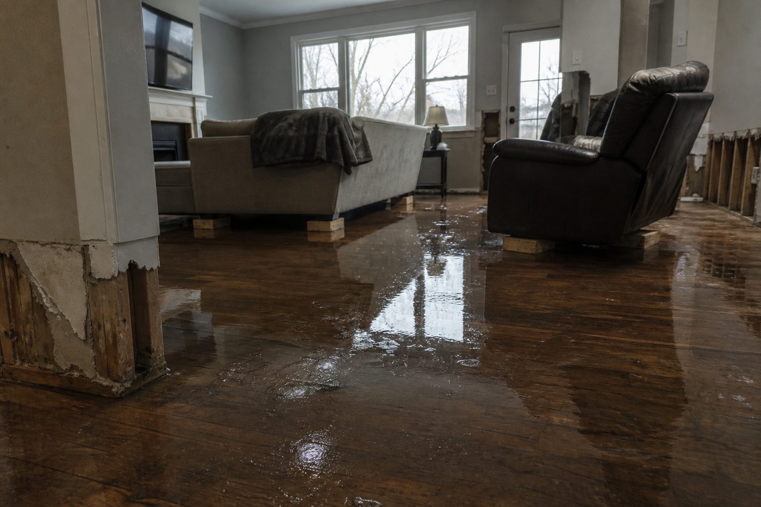
  • Flash Flood Warning: Broward, FL Area Until 6:45PM EDT

    Flash Flood Warning: Broward, FL Area Until 6:45PM EDT

    Flash Flood Warning is active for Broward, FL and surrounding areas right now, issued by NWS Miami FL. This is interior-flooding territory — the exact water-intrusion calls local restoration teams see most: saturated drywall, ruined insulation, and the mold clock starting the moment water sits.

    This is a live snapshot as of 9:27 PM PT on September 21, 2026. Conditions change fast — always verify with the National Weather Service for your specific county or ZIP code.

    Broward, FL — Flash Flood Warning

    Issuing office: NWS Miami FL. Issued: 2026-09-21T17:12:00-04:00. Expires: 2026-09-21T18:45:00-04:00 (about 6:45PM EDT).

    Hazard detail (NWS verbatim):

    FFWMFL

    The National Weather Service in Miami has issued a

    * Flash Flood Warning for…
    Central Broward County in southeastern Florida…

    * Until 645 PM EDT.

    * At 512 PM EDT, Doppler radar indicated thunderstorms producing
    heavy rain across the warned area. Between 3 and 5 inches of rain
    have fallen. Additional rainfall amounts of 2 to 4 inches are
    possible in the warned area. Flash flooding is ongoing or expected
    to begin shortly.

    HAZARD…Flash flooding caused by thunderstorms.

    SOURCE…Radar indicated.

    IMPACT…Flash flooding of small creeks and streams, urban areas,
    highways, streets and underpasses as well as other poor
    drainage and low-lying areas.

    * Some locations that will experience flash flooding include…
    Sunrise, Tamarac, Margate, Lauderhill, Oakland Park, North
    Lauderdale, Lauderdale Lakes, Broadview-Pompano Park, Village Park,
    Palm Aire and Rock Island.

    Expected impacts: creeks and streams, urban areas, highways, underpasses, and other poor-drainage, low-lying areas are at risk, per the NWS alert.

    What the NWS is telling residents

    Turn around, don't drown when encountering flooded roads. Most flood
    deaths occur in vehicles.

    Be aware of your surroundings and do not drive on flooded roads.

    Stay safe tonight

    Turn around, don’t drown — most flood deaths occur in vehicles. Never drive through flooded roadways; it takes only a few inches of fast-moving water to sweep a car off the road.

    If water enters your home: stay out of standing water where electricity may be present, avoid the basement until the water recedes and power is confirmed off, and photograph everything before any cleanup — documentation matters for insurance. Then call a local restoration contractor. Water left sitting starts a second wave of damage within a day.

    What this means for restoration teams

    A warning like this is a demand signal. For local restoration contractors, the play is the same one that has worked through every season: stage equipment now, pre-position drying assets, and keep an on-call rotation through the morning. The first calls land within hours of the water receding — and they keep coming for days as homeowners discover damage that wasn’t visible in the dark.

    The damage categories track the hazard: interior water intrusion and saturated drywall and insulation where water gets in, mold risk inside 24–48 hours once materials stay wet, sewage backup in low-lying areas where drainage is overwhelmed, and roof, siding, and window damage wherever wind or hail hits the building envelope.

    Field discipline matters as much as speed: photo-document before mitigation starts, moisture-map every affected room, capture the address, the water source, and the affected areas on the first call, and keep the homeowner’s payment responsibility clear in writing before work begins. The contractor who documents first argues last with the adjuster.

    Watch the full warned area — not just your home zip. Water moves across the landscape, and crews that cover the whole warning footprint catch the work before it goes to whoever answered the phone first.

    FEMA & federal assistance

    FEMA Helpline 1-800-621-3362 (7 a.m.–10 p.m. local time, 7 days a week). Apply at DisasterAssistance.gov, through the FEMA app, or find a recovery center at fema.gov/drc. Basic eligibility generally includes citizenship or qualified status, identity verification, proof of occupancy or ownership, and unmet needs not covered by insurance. Apply as soon as it is safe to do so.

    Looking ahead

    When this warning expires, the danger is not automatically over: additional rounds can follow, and creeks and rivers often crest later than the heaviest rain. Watch the next NWS update for your county, and treat any water in or around structures as an active damage clock.

    Demand-window note for contractors: water-intrusion calls typically start within hours of water receding and keep coming for days as people discover damage — tonight’s warning is tomorrow’s job list.

    Sources & how to verify

    To verify for your own location: go to weather.gov and enter your county or ZIP code, or check your local NWS office page for the latest warnings.

    This post is for informational purposes and is not an official weather warning. Always follow instructions from local authorities and the National Weather Service.

  • Flash Flood Warning: Lamb, TX Area Until 5:30PM CDT

    Flash Flood Warning: Lamb, TX Area Until 5:30PM CDT

    Flash Flood Warning is active for Lamb, TX and surrounding areas right now, issued by NWS Lubbock TX. This is interior-flooding territory — the exact water-intrusion calls local restoration teams see most: saturated drywall, ruined insulation, and the mold clock starting the moment water sits.

    This is a live snapshot as of 9:27 PM PT on September 21, 2026. Conditions change fast — always verify with the National Weather Service for your specific county or ZIP code.

    Lamb, TX — Flash Flood Warning

    Issuing office: NWS Lubbock TX. Issued: 2026-09-21T16:27:00-05:00. Expires: 2026-09-21T17:30:00-05:00 (about 5:30PM CDT).

    Hazard detail (NWS verbatim):

    FFWLUB

    The National Weather Service in Lubbock has issued a

    * Flash Flood Warning for…
    Northwestern Lamb County in northwestern Texas…

    * Until 530 PM CDT.

    * At 427 PM CDT, Doppler radar indicated thunderstorms producing
    heavy rain across the warned area. Between 1 and 2 inches of rain
    have fallen. Additional rainfall amounts of 1 to 2 inches are
    possible in the warned area. Flash flooding is ongoing or expected
    to begin shortly.

    HAZARD…Flash flooding caused by thunderstorms.

    SOURCE…Radar indicated.

    IMPACT…Flash flooding of small creeks and streams, urban areas,
    highways, streets and underpasses as well as other poor
    drainage and low-lying areas.

    * Some locations that will experience flash flooding include…
    Sudan.

    This includes the following streams and drainages…
    Blackwater Draw.

    Expected impacts: creeks and streams, urban areas, highways, underpasses, and other poor-drainage, low-lying areas are at risk, per the NWS alert.

    What the NWS is telling residents

    Turn around, don't drown when encountering flooded roads. Most flood
    deaths occur in vehicles.

    Be aware of your surroundings and do not drive on flooded roads.

    Stay safe tonight

    Turn around, don’t drown — most flood deaths occur in vehicles. Never drive through flooded roadways; it takes only a few inches of fast-moving water to sweep a car off the road.

    If water enters your home: stay out of standing water where electricity may be present, avoid the basement until the water recedes and power is confirmed off, and photograph everything before any cleanup — documentation matters for insurance. Then call a local restoration contractor. Water left sitting starts a second wave of damage within a day.

    What this means for restoration teams

    A warning like this is a demand signal. For local restoration contractors, the play is the same one that has worked through every season: stage equipment now, pre-position drying assets, and keep an on-call rotation through the morning. The first calls land within hours of the water receding — and they keep coming for days as homeowners discover damage that wasn’t visible in the dark.

    The damage categories track the hazard: interior water intrusion and saturated drywall and insulation where water gets in, mold risk inside 24–48 hours once materials stay wet, sewage backup in low-lying areas where drainage is overwhelmed, and roof, siding, and window damage wherever wind or hail hits the building envelope.

    Field discipline matters as much as speed: photo-document before mitigation starts, moisture-map every affected room, capture the address, the water source, and the affected areas on the first call, and keep the homeowner’s payment responsibility clear in writing before work begins. The contractor who documents first argues last with the adjuster.

    Watch the full warned area — not just your home zip. Water moves across the landscape, and crews that cover the whole warning footprint catch the work before it goes to whoever answered the phone first.

    FEMA & federal assistance

    FEMA Helpline 1-800-621-3362 (7 a.m.–10 p.m. local time, 7 days a week). Apply at DisasterAssistance.gov, through the FEMA app, or find a recovery center at fema.gov/drc. Basic eligibility generally includes citizenship or qualified status, identity verification, proof of occupancy or ownership, and unmet needs not covered by insurance. Apply as soon as it is safe to do so.

    Looking ahead

    When this warning expires, the danger is not automatically over: additional rounds can follow, and creeks and rivers often crest later than the heaviest rain. Watch the next NWS update for your county, and treat any water in or around structures as an active damage clock.

    Demand-window note for contractors: water-intrusion calls typically start within hours of water receding and keep coming for days as people discover damage — tonight’s warning is tomorrow’s job list.

    Sources & how to verify

    To verify for your own location: go to weather.gov and enter your county or ZIP code, or check your local NWS office page for the latest warnings.

    This post is for informational purposes and is not an official weather warning. Always follow instructions from local authorities and the National Weather Service.

  • Flash Flood Warning: Hale, TX Until 5:30 PM CDT Monday, September 21

    Flash Flood Warning: Hale, TX Until 5:30 PM CDT Monday, September 21

    This is a live snapshot as of 3:58 PM CDT Monday, September 21. Conditions change fast — always verify with the National Weather Service for your specific county or ZIP code.

    Hale, TX — Flash Flood Warning

    Flash Flood Warning issued September 21 at 3:58PM CDT until September 21 at 5:30PM CDT by NWS Lubbock TX

    Issued by NWS Lubbock TX. Issue time: 3:58 PM CDT Monday, September 21. Expires: 5:30 PM CDT Monday, September 21.

    FFWLUB
    The National Weather Service in Lubbock has issued a
    * Flash Flood Warning for…
    Southwestern Hale County in northwestern Texas…
    Northeastern Hockley County in northwestern Texas…
    Southeastern Lamb County in northwestern Texas…
    Northwestern Lubbock County in northwestern Texas…
    * Until 530 PM CDT.
    * At 358 PM CDT, Doppler radar indicated thunderstorms producing
    heavy rain across the warned area. Between 2 and 3 inches of rain
    have fallen. Additional rainfall amounts of 1 to 2 inches are
    possible in the warned area. Flash flooding is ongoing or expected
    to begin shortly.
    HAZARD…Flash flooding caused by thunderstorms.
    SOURCE…Radar indicated.
    IMPACT…Flash flooding of small creeks and streams, urban areas,
    highways, streets and underpasses as well as other poor
    drainage and low-lying areas.
    * Some locations that will experience flash flooding include…
    Anton and Spade.

    Hail size (NWS parameters): not specified in parameters. Wind gust (NWS parameters): not specified in parameters.

    Locations in the warning path, as listed by NWS:

    • Flash Flood Warning for…
    • Until 530 PM CDT.
    • At 358 PM CDT, Doppler radar indicated thunderstorms producing
    • Some locations that will experience flash flooding include…

    Warned area: Hale, TX; Hockley, TX; Lamb, TX; Lubbock, TX

    NWS office page: NWS Lubbock TX · Official NWS alert

    Official NWS instructions

    Turn around, don’t drown when encountering flooded roads. Most flood
    deaths occur in vehicles.

    Be aware of your surroundings and do not drive on flooded roads.

    Stay safe tonight

    Turn around, don’t drown. Most flood deaths happen in vehicles — never drive through flooded roadways; six inches of moving water can knock you down, twelve inches can carry a car.

    If water enters the home: stay out of standing water where electricity may be present, avoid the basement until water recedes and power is confirmed off, photograph everything before cleanup (documentation matters for insurance), then call a local restoration contractor — water left sitting starts a second wave of damage within a day.

    What this means for restoration teams

    Translate this warning into job tickets: interior water intrusion through doors, windows, and foundation seepage; saturated carpet and pad; drywall wicking that shows up as a waterline hours later; and mold risk within 24–48 hours wherever porous materials stayed wet. Low-lying areas and urban drainage failures also bring sewage backup calls — the highest-margin, highest-urgency work.

    The play: stage extraction and drying equipment now, pre-position dehumidifiers and air movers, keep an on-call rotation through the morning, and capture address, water source, and affected areas on the first call. Field discipline: photo-document before mitigation, moisture-map every affected room, and get the homeowner’s payment responsibility clear in writing before work starts.

    FEMA & federal assistance

    If the damage is severe, the FEMA Helpline is 1-800-621-3362 (7 a.m.–10 p.m. local, 7 days). Apply at DisasterAssistance.gov, through the FEMA app, or find a recovery center at fema.gov/drc. Basic eligibility: citizenship or qualified status, identity verification, proof of occupancy or ownership, and unmet needs not covered by insurance. Apply as soon as it’s safe.

    Looking ahead

    When this warning expires, the danger is not automatically over. Creeks and small streams can crest hours after the rain stops, and additional rounds of storms can re-trigger warnings. Watch for NWS updates overnight. For restoration contractors: water-intrusion calls typically start within hours of water receding and keep coming for days as homeowners discover damage behind walls and under flooring.

    Sources & how to verify

    Verify for your own county or ZIP at weather.gov or your local NWS office page.

    This post is for informational purposes and is not an official weather warning. Always follow instructions from local authorities and the National Weather Service.

  • Flash Flood Warning: Pike County Area Until 6:00 PM EDT

    Flash Flood Warning: Pike County Area Until 6:00 PM EDT

    A Flash Flood Warning is in effect for Pike County, Kentucky until 6:00 PM EDT, issued by the National Weather Service office in Jackson, Kentucky at 4:44 PM EDT. Between 2 and 3 inches of rain have fallen in the hardest-hit areas since 2:30 PM, and even though the heaviest rain has moved out, NWS says excessive runoff will continue to cause flash flooding in low-lying areas. This is the exact profile — interior water intrusion in homes and businesses sitting in poor-drainage ground — that restoration teams get called on first.

    This is a live snapshot as of 1:50 PM PDT / 4:50 PM EDT on Monday, September 21, 2026. Conditions change fast — always verify with the National Weather Service for your specific county or ZIP code.

    Pike County — Flash Flood Warning

    Issuing office: NWS Jackson, KY (weather.gov/jkl)
    Issued: 4:44 PM EDT, Monday, September 21, 2026
    Expires: 6:00 PM EDT, Monday, September 21, 2026
    Severity: Severe • Certainty: Likely • Urgency: Immediate

    Hazard detail, per the alert: At 4:44 PM EDT, Doppler radar indicated that the heaviest rain had moved out of the warned area — but between 2 and 3 inches of rain had fallen since 2:30 PM in the hardest-hit areas. Excessive runoff from that rainfall will continue to cause flash flooding in low-lying areas. Hazard: flash flooding caused by thunderstorms. Source: radar indicated. Expected impact: flash flooding of small creeks and streams, as well as other poor-drainage and low-lying areas.

    Locations that will experience flash flooding include: Elkhorn City, Cedarville, and Belcher.

    Expected impacts: small creeks and streams running out of their banks, flooding across poor-drainage ground and low-lying areas, and water rising on roadways — particularly the rural routes in and around the named communities.

    Sources: the NWS alert (api.weather.gov) and the NWS Jackson office page (weather.gov/jkl).

    Stay safe tonight

    The NWS instruction is the one that saves lives: turn around, don’t drown when encountering flooded roads. Most flood deaths occur in vehicles.

    Do not drive through flooded roadways — it is nearly impossible to tell how deep the water is or whether the road beneath it is still there. If water enters your home, stay out of standing water where electricity may be present, keep clear of the basement until water recedes and power is confirmed off, and photograph everything before cleanup begins — that documentation matters for insurance. Once the water is out, call a local restoration contractor quickly: water left sitting starts a second wave of damage within a day.

    What this means for restoration teams

    This is the signature call pattern for Pike County: a quick-hitting heavy rain (2–3 inches in about two hours) over terrain where low-lying areas and poor drainage do the damage, even after the storm itself moves on. NWS is explicit that runoff — not the rain still falling — is the ongoing threat. For contractors in eastern Kentucky, that translates into a predictable set of damage categories:

    • Interior water intrusion at floor level — runoff finding its way into homes and businesses sitting in low ground, especially around Elkhorn City, Cedarville, and Belcher.
    • Saturated drywall and insulation at the base of walls, plus flooring damage where water pushed under thresholds and doors.
    • Mold risk within 24–48 hours — wet drywall, carpet, and insulation that doesn’t get dried properly starts growing mold in a day or two. The clock is running.
    • Crawlspace and basement flooding, where water that has nowhere to drain collects and sits against the foundation.

    The play: stage equipment now — air movers, dehumidifiers, extraction units — and pre-position drying assets so teams aren’t loading trucks when the first calls come in. Keep an on-call rotation through the evening. On that first call, capture three things before anything else: the address, the water source (runoff vs. creek/stream overflow vs. storm-drain backup), and the affected areas.

    Field discipline: photo-document every room before mitigation starts, moisture-map all affected rooms (including rooms that look dry but share a wall or slab with wet ones), and keep the homeowner’s payment responsibility clear in writing before work begins.

    FEMA & federal assistance

    If your home or business is damaged, you can contact the FEMA Helpline at 1-800-621-3362 (7 a.m.–10 p.m. local, 7 days a week), apply at DisasterAssistance.gov, use the FEMA app, or find a recovery center at fema.gov/drc. Basic eligibility: citizenship or qualified status, identity verification, proof of occupancy or ownership, and unmet needs not covered by insurance. Apply as soon as it is safe to do so.

    Looking ahead

    This warning expires at 6:00 PM EDT. When it expires, watch what happens next: small creeks and streams can crest after the rain stops, and water sitting in low-lying areas takes time to drain. If additional rounds of storms develop this evening, NWS will extend or reissue — the Jackson office’s forecast discussion is the place to watch.

    For restoration contractors, the demand window is just opening: water-intrusion calls typically start within hours of water receding and keep coming for days as people discover damage — soggy baseboards, musty basements, warped flooring. Tonight’s runoff event in Pike County is the kind that fills a week of mitigation jobs.

    Sources & how to verify

    To verify for your own county or ZIP code: go to weather.gov, enter your ZIP in the search box, and check the active alerts for your area.

    This post is for informational purposes and is not an official weather warning. Always follow instructions from local authorities and the National Weather Service.

  • Flash Flood Warning: Grundy Area Until 6:45 PM EDT

    Flash Flood Warning: Grundy Area Until 6:45 PM EDT

    Flash Flood Warning issued September 21 at 3:52 PM EDT until September 21 at 6:45 PM EDT by NWS Charleston WV. The National Weather Service in Charleston has issued a Flash Flood Warning covering parts of southwestern Virginia and southern West Virginia: Central Buchanan County and North Central Dickenson County in southwestern Virginia, and Northwestern McDowell County and Southwestern Wyoming County in southern West Virginia.

    This is the kind of warning restoration teams know by heart — slow-moving thunderstorms stacking rainfall over small watersheds, with flash flooding of creeks, streets, and low-lying property either ongoing or expected to begin shortly. This is a live snapshot as of 1:05 PM PDT (4:05 PM EDT). Conditions change fast — always verify with the National Weather Service for your specific county or ZIP code.

    Grundy, VA to Wyoming, WV — Flash Flood Warning

    The issuing office is the National Weather Service in Charleston, West Virginia. The warning was issued at 3:52 PM EDT on Sunday, September 21, 2026, and remains in effect until 6:45 PM EDT.

    Per the alert, at 3:52 PM EDT Doppler radar indicated thunderstorms producing heavy rain across the warned area. Between 1 and 2.5 inches of rain have fallen across the warned area. Flash flooding is ongoing or expected to begin shortly.

    HAZARD — Flash flooding caused by thunderstorms.
    SOURCE — Radar indicated.
    IMPACT — Flash flooding of small creeks and streams, urban areas, highways, streets and underpasses, as well as other poor-drainage and low-lying areas.

    Some locations that will experience flash flooding include: Grundy, Breaks Interstate, John Flannagan Lake, Big Rock, Bradshaw, Iaeger, Stacy, Roseann, Hurley, Panther, Jolo, Vansant, and Avondale.

    The alert is designated AWIPS identifier FFWRLX (VTEC /O.NEW.KRLX.FF.W.0238.260921T1952Z-260921T2245Z/). The original alert can be referenced through the NWS alert feed for the Charleston WV office.

    Stay safe

    Turn around, don’t drown when encountering flooded roads. Most flood deaths occur in vehicles — never drive through flooded roadways, no matter how shallow the water looks.

    Be aware of your surroundings and do not drive on flooded roads. If water enters your home, stay out of standing water where electricity may be present, avoid the basement until the water recedes and the power is confirmed off, and photograph everything before cleanup begins — documentation matters for insurance. Then call a local restoration contractor, because water left sitting starts a second wave of damage within a day.

    You can report flooding to the National Weather Service at 800-401-9535, toll free, when you can do so safely.

    What this means for restoration teams

    This is the signature interior-flooding signature restoration contractors see most: flash flooding of small creeks and streams, urban areas, highways, streets, underpasses, and poor-drainage low-lying areas. Expect the damage mix that follows: interior water intrusion in low-lying structures, saturated drywall and insulation, mold risk beginning within 24–48 hours, and possible sewage backup in the lowest-lying areas where storm systems surcharge.

    The play: stage equipment now, pre-position drying assets, and keep an on-call rotation through the evening. Capture address, water source, and affected areas on the first call — flash-flood jobs move fast, and intake discipline on night one is what separates a clean claim from a disputed one.

    Field discipline: photo-document everything before mitigation begins, moisture-map every affected room (not just the ones that look wet), and keep the homeowner’s payment responsibility clear in writing before work starts. Flood-impacted properties in areas like Grundy, Bradshaw, and Iaeger may involve basements and crawlspaces — verify power is off before anyone enters standing water.

    FEMA and federal assistance

    If the damage is significant, the FEMA Helpline is 1-800-621-3362, open 7 a.m. to 10 p.m. local time, 7 days a week. You can also apply at DisasterAssistance.gov, through the FEMA app, or find a recovery center at fema.gov/drc.

    Basic eligibility generally includes citizenship or qualified status, identity verification, proof of occupancy or ownership, and unmet needs not covered by insurance. Apply as soon as it is safe to do so — you do not need to wait for the water to recede to start the paperwork.

    Looking ahead

    This warning expires at 6:45 PM EDT. When it expires, watch for additional rounds of thunderstorms overnight and for creeks and streams to keep rising after the rain stops — flash flooding can arrive downstream even after the warned area dries out.

    The next NWS update will land as conditions warrant through the Charleston WV office. For restoration teams, the demand window on flash-flood events typically opens within hours of water receding and keeps coming for days as property owners discover damage that wasn’t visible in the dark.

    Sources and how to verify

    To verify for your own county or ZIP code, check weather.gov or your local NWS office page — warnings can be extended, upgraded, or cancelled as conditions change.

    This post is for informational purposes and is not an official weather warning. Always follow instructions from local authorities and the National Weather Service.

  • Flash Flood Warning: Jackson, Ritchie, Roane, Wirt and Wood Counties Until 7:30 AM EDT

    Flash Flood Warning: Jackson, Ritchie, Roane, Wirt and Wood Counties Until 7:30 AM EDT

    The National Weather Service in Charleston has extended a Flash Flood Warning for parts of north-central and northwestern West Virginia — Jackson, Ritchie, Roane, Wirt, and Wood counties — in effect until 7:30 AM EDT this morning. Doppler radar indicated thunderstorms producing heavy rain across the warned area, with up to 1 inch or more of rain already fallen, and flash flooding is ongoing or expected to begin shortly. This is the exact kind of event that turns into interior flooding jobs for restoration teams: water in basements, saturated drywall, and floors nobody planned on tearing up today.

    This is a live snapshot as of 1:50 AM PDT / 4:50 AM EDT, September 21, 2026. Conditions change fast — always verify with the National Weather Service for your specific county or ZIP code.

    Jackson, Ritchie, Roane, Wirt, Wood Counties — Flash Flood Warning

    Issued by NWS Charleston WV at 4:37 AM EDT, Monday, September 21, 2026; in effect until 7:30 AM EDT. Severity: Severe. Certainty: Likely. Urgency: Immediate.

    This is an extension of an existing warning (VTEC code EXT, event 0232), meaning the threat didn’t pass when the prior period ended — rain kept coming and the flooding threat continues.

    Source: Radar indicated. The NWS states: “At 437 AM EDT, Doppler radar indicated thunderstorms producing heavy rain across the warned area. Up to 1 inch or more of rain has fallen. Flash flooding is ongoing or expected to begin shortly.”

    Hazard: Flash flooding caused by thunderstorms.

    Expected impacts: Flash flooding of small creeks and streams, urban areas, highways, streets and underpasses, as well as other poor drainage and low-lying areas.

    Warned sub-areas: Northwestern Roane County (central WV), east central Jackson County, southwestern Ritchie County, all of Wirt County, and southeastern Wood County (all northwestern WV).

    Locations in the warning path: Parkersburg, Elizabeth, Mineralwells, Sandyville, Reedy, Palestine, Greencastle, Cherry, Freeport, Morristown, Walker, Lucille, Peewee, Creston, Petroleum, Davisville, Leroy and Nutter Farm.

    Highways in the warned area: Interstate 77 in West Virginia between mile markers 174 and 178; Route 50 in West Virginia between mile markers 9 and 30.

    Office page: NWS Charleston. Verify your county or ZIP at weather.gov.

    Stay safe this morning

    Turn around, don’t drown when encountering flooded roads. Most flood deaths occur in vehicles — never drive through flooded roadways; water only a foot or two deep can float a car. Be especially cautious at night, when it is harder to recognize the dangers of flooding. Be aware of your surroundings and do not drive on flooded roads.

    If water enters your home: stay out of standing water where electricity may be present, avoid the basement until water recedes and power is confirmed off, and photograph everything before cleanup — documentation matters for insurance. Then call a local restoration contractor; water left sitting starts a second wave of damage within a day. You can report flooding to the National Weather Service at 800-401-9535 (toll free) when you can do so safely.

    What this means for restoration teams

    A radar-indicated flash flood warning with an inch or more of rain already down is the classic setup for interior water intrusion: basement seepage and sump-pump failures, water wicking up drywall, saturated carpet and pad, and crawlspaces taking on standing water. With rain still falling as of 4:37 AM EDT, this is not a “wait and see” window.

    Damage categories to expect: ground-level water intrusion through foundation cracks and door seals; saturated drywall and insulation along exterior walls; flooring losses (carpet pad is typically non-salvageable when soaked); and, if any drains backed up, potential Category 3 contamination where floodwater mixed with sewage in low-lying areas. Mold growth can begin within 24 to 48 hours on wet organic materials — the drying window is real and it opens today.

    The play: stage equipment now — dehumidifiers, air movers, and moisture meters — and keep an on-call rotation through the morning. On the first call, capture the address, the water source (rain intrusion vs. drain backup vs. sump failure), and every affected area and room. Photo-document before any mitigation begins, moisture-map every affected room (not just the ones that look wet), and keep the homeowner’s payment responsibility clear in writing before work starts.

    FEMA & federal assistance

    If your home or business took on water, federal help may be available once it’s safe to act. The FEMA Helpline is 1-800-621-3362 (7 a.m. to 10 p.m. local time, 7 days a week). You can also apply or check status at DisasterAssistance.gov, through the FEMA mobile app, or find a recovery center at fema.gov/drc.

    Basic eligibility typically requires citizenship or qualified status, identity verification, proof of occupancy or ownership, and unmet needs not covered by insurance. Apply as soon as it’s safe — but document everything first (see the safety section above): photos taken before cleanup are the backbone of any claim or application.

    Looking ahead

    The warning expires at 7:30 AM EDT. After expiry, the rain may have stopped but the water hasn’t finished moving: small creeks and streams can crest after the rain ends, and low-lying roads and underpasses can stay flooded into the mid-morning. Watch for additional rounds of rain — this was an extension, which means the atmosphere kept producing after the first window. The next NWS update lands as conditions evolve; recheck NWS Charleston before sending crews down low-lying routes like the I-77 and Route 50 corridors named in the warning.

    For restoration teams: water-intrusion calls typically begin within hours of water receding and keep coming for days as homeowners discover damage they didn’t see in the dark.

    Sources & how to verify

    • NWS alert: Flash Flood Warning, NWS Charleston WV (WMO identifier WGUS51 KRLX 210837), effective 4:37 AM EDT until 7:30 AM EDT, September 21, 2026
    • NWS Charleston office page

    To verify for your own county or ZIP: enter your location at weather.gov or check the NWS Charleston page for the current warning map.

    This post is for informational purposes and is not an official weather warning. Always follow instructions from local authorities and the National Weather Service.

  • Flash Flood Warning: Athens Area Until 7 AM EDT

    Flash Flood Warning: Athens Area Until 7 AM EDT

    This is a live snapshot as of September 21, 2026, 01:03 AM PDT. Conditions change fast — always verify with the National Weather Service for your specific county or ZIP code.

    Lede: Flash Flood Warning active for Athens

    A Flash Flood Warning is active for Athens, OH; Gallia, OH; Meigs, OH; Washington, OH; Jackson, WV; Mason, WV; Wood, WV right now, issued by the NWS Charleston WV. This is the exact storm footprint where flash-flood interior water-intrusion jobs begin — restoration teams in the path should be staging now.

    Athens — Flash Flood Warning

    Issued by: NWS Charleston WV
    Sent: 2026-09-21T04:02:00-04:00
    Expires: 7 AM EDT (2026-09-21T07:45:00-04:00)

    Headline: Flash Flood Warning issued September 21 at 4:02AM EDT until September 21 at 7:45AM EDT by NWS Charleston WV

    FFWRLX

    The National Weather Service in Charleston has extended the

    * Flash Flood Warning for…
    Southeastern Athens County in southeastern Ohio…
    Northeastern Gallia County in southeastern Ohio…
    Meigs County in southeastern Ohio…
    Southwestern Washington County in southeastern Ohio…
    Northwestern Jackson County in northwestern West Virginia…
    Western Wood County in northwestern West Virginia…
    North Central Mason County in western West Virginia…

    * Until 745 AM EDT.

    * At 402 AM EDT, Doppler radar and automated rain gauges indicated
    thunderstorms producing heavy rain across the warned area. Between
    1.5 and 2.5 inches of rain have fallen. Additional rainfall amounts
    of 1 to 3 inches are possible in the warned area. Flash flooding is
    ongoing or expected to begin shortly.

    HAZARD…Flash flooding caused by thunderstorms.

    SOURCE…Radar and automated gauges.

    IMPACT…Flash flooding of small creeks and streams, urban areas,
    highways, streets and underpasses as well as other poor
    drainage and low-lying areas.

    * Some locations that will experience flash flooding include…
    Athens, Pomeroy, Coolville, Rutland, Forked Run State Park, Mason,
    Tuppers Plains, Middleport, Chester, Syracuse, Hartford City,
    Darwin, Harrisonville, Dexter, Dyesville, Reedsville, Portland and
    Salem Center.

    NWS instructions

    Turn around, don't drown when encountering flooded roads. Most flood
    deaths occur in vehicles.

    Be especially cautious at night when it is harder to recognize the
    dangers of flooding.

    Be aware of your surroundings and do not drive on flooded roads.

    Report flooding to the National Weather Service by calling toll free,
    800 401 9535, when you can do so safely.

    Areas affected: Athens, OH; Gallia, OH; Meigs, OH; Washington, OH; Jackson, WV; Mason, WV; Wood, WV

    Source: NWS Charleston WV via the National Weather Service alert feed.

    Stay safe tonight

    Turn around, don’t drown. Most flood deaths happen in vehicles — never drive through flooded roadways or around barricades.

    If water enters your home: stay out of standing water where electricity may be present; avoid the basement until water recedes and power is confirmed off; photograph everything before cleanup (documentation matters for insurance); then call a local restoration contractor. Water left sitting starts a second wave of damage within a day.

    What this means for restoration teams

    This warning translates into interior water-intrusion jobs: saturated drywall and insulation, flooded basements and crawl spaces, sewage backup in low-lying areas. Mold risk starts within 24–48 hours of wet material left in place.

    The play: stage extraction and drying equipment now, keep an on-call rotation through the morning, and capture address, water source, and affected areas on the first call. Field discipline — photo-document before mitigation, moisture-map every affected room, keep the homeowner’s payment responsibility clear in writing before work starts.

    FEMA & federal assistance

    FEMA Helpline: 1-800-621-3362 (7 a.m.–10 p.m. local, 7 days). Also available at DisasterAssistance.gov, the FEMA app, and fema.gov/drc for disaster recovery centers.

    Basic eligibility: U.S. citizenship or qualified status, identity verification, proof of occupancy or ownership, and unmet needs not covered by insurance. Apply as soon as it is safe to do so.

    Looking ahead

    This warning runs until 7 AM EDT. When it expires, watch for additional rounds of storms, creeks and rivers cresting later than the rain, and the next NWS update for your county. Water-intrusion calls typically start within hours of water receding and keep coming for days as people discover damage.

    Sources & how to verify

    To verify for your own county or ZIP: check weather.gov or your local NWS office page.

    This post is for informational purposes and is not an official weather warning. Always follow instructions from local authorities and the National Weather Service.

  • Flash Flood Warning: Muskingum County, OH Area Until 5 AM EDT

    Flash Flood Warning: Muskingum County, OH Area Until 5 AM EDT

    A Flash Flood Warning is in effect for southwestern Muskingum County, Ohio, until 5:00 AM EDT this morning, issued by the National Weather Service office in Pittsburgh at 3:25 AM EDT. Flash flooding is already occurring — local law enforcement has reported flooded roadways in the warned area.

    This is a live snapshot as of 3:35 AM EDT (12:35 AM PDT). Conditions change fast — always verify with the National Weather Service for your specific county or ZIP code.

    Southwestern Muskingum County — Flash Flood Warning

    Issued: 3:25 AM EDT, Monday, September 21, 2026 by NWS Pittsburgh PA (forecast office identifier KPBZ)
    In effect until: 5:00 AM EDT
    Hazard: Flash flooding caused by thunderstorms — observed, not just radar-indicated
    Source: Local law enforcement reported flooded roadways in southwestern Muskingum County

    Between 0.5 and 1.5 inches of rain have fallen across the warned area, and additional rainfall amounts of up to 0.5 inches are possible. Flash flooding of small creeks and streams, urban areas, highways, streets and underpasses — as well as other poor-drainage and low-lying areas — is expected.

    Some locations that will experience flash flooding include: Zanesville, South Zanesville, Philo, Fultonham, Cannelville, East Fultonham, Duncan Falls, and Blue Rock State Park.

    This warning is a continuation (VTEC /O.CON.KPBZ.FF.W.0153/), meaning the threat has persisted through the overnight hours. The NWS headline reads: “FLASH FLOOD WARNING REMAINS IN EFFECT UNTIL 5 AM EDT EARLY THIS MORNING FOR SOUTHWESTERN MUSKINGUM COUNTY.”

    Source links: the NWS alert and the NWS Pittsburgh office page.

    Stay safe tonight

    The National Weather Service instruction is direct: turn around, don’t drown when encountering flooded roads. Most flood deaths occur in vehicles. The alert adds a specific caution for this one: be especially cautious at night when it is harder to recognize the dangers of flooding.

    If water enters the home: stay out of standing water where electricity may be present, avoid the basement until water recedes and power is confirmed off, photograph everything before cleanup — documentation matters for insurance — then call a local restoration contractor. Water left sitting starts a second wave of damage within a day.

    Never drive through flooded roadways, never walk through moving water, and keep away from creeks and streams that can rise quickly without warning overnight.

    What this means for restoration teams

    The NWS alert flags flash flooding of small creeks and streams, urban areas, highways, streets, and underpasses, plus poor-drainage and low-lying areas — that is the NWS’s own list of where water is moving in the warned area.

    • Area scope — the warned zone covers southwestern Muskingum County, including Zanesville, South Zanesville, Philo, Fultonham, Cannelville, East Fultonham, Duncan Falls, and Blue Rock State Park, per the alert.
    • Rainfall so far — 0.5 to 1.5 inches already fallen, with up to 0.5 inches more possible, per the NWS.
    • Observed, not forecast — this warning is based on flooded roadways already reported by local law enforcement, not radar projection.
    • Expires 5:00 AM EDT — the NWS will update or extend as conditions change.

    Standard intake discipline for any flash-flood event: capture address + water source + affected areas on every first call, photo-document before mitigation begins, moisture-map every affected room, and keep the homeowner’s payment responsibility clear in writing before work starts.

    Local emergency contacts

    Muskingum County Emergency Management Agency (EMA)
    2215 Adamsville Rd, Zanesville, OH 43701
    Phone: (740) 453-1655 (Mon–Fri, 7:30 AM – 4:30 PM)
    Web: muskingumcountyoh.gov/Agencies/EMA-LEPC
    Director: Jeff Jadwin

    For life-threatening emergencies, call 911. For the latest official warning information, check the NWS Pittsburgh office page.

    FEMA & federal assistance

    If the flooding causes damage to your home or property, federal help may be available:

    • FEMA Helpline: 1-800-621-3362 (7 a.m.–10 p.m. local time, 7 days a week)
    • Apply online at DisasterAssistance.gov or through the FEMA mobile app
    • Find recovery centers at fema.gov/drc

    Basic eligibility: U.S. citizenship or qualified status, identity verification, proof of occupancy or ownership, and unmet needs not covered by insurance. Apply as soon as it’s safe to do so — document damage with photos first.

    Looking ahead

    This warning expires at 5:00 AM EDT. The NWS updates these warnings as conditions change — check back with the NWS Pittsburgh page before the morning commute and do not assume the water is gone when the warning lifts.

    Sources & how to verify

    To verify for your own county or ZIP code: go to weather.gov, enter your location, and check the active alerts banner — or follow your local NWS office page directly.

    This post is for informational purposes and is not an official weather warning. Always follow instructions from local authorities and the National Weather Service.