
Tag: New York storms

  • Storm Updates: Upper Ohio Valley–Central New York Slight Risk — Sunday, September 13, 2026

    This is a live Sunday afternoon snapshot of local storm-type events across the United States as of Sunday, September 13, 2026. The Storm Prediction Center 2000 UTC Day 1 Convective Outlook holds a Slight Risk of severe thunderstorms from the upper Ohio Valley into central New York, covering about 43,500 square miles and 8.3 million people, with Pittsburgh, Rochester, Akron, Syracuse, and Canton inside the higher contour. A broader Marginal Risk wraps Columbus, Cincinnati, Buffalo, Dayton, and Albany. No convective watches and no mesoscale discussions were in effect on the afternoon check. Restoration exposure this window is wind-driven roof and tree work on the Ohio–Pennsylvania–New York corridor, leftover Saturday water in the Appalachians and Mid-Atlantic, and a separate WPC flood Slight over southern New England plus eastern Kansas into western Missouri.

    These are county- and ZIP-scale thunderstorms, not a mainland hurricane landfall. Conditions change fast. Verify with the National Weather Service for the specific county or ZIP before you roll.

    What is live this afternoon

    SPC upgraded portions of the corridor to Slight earlier Sunday with the 1630 UTC package and held that upgrade in the 2000 UTC update issued 2:57 p.m. CDT by forecaster Wendt. The language is isolated to widely scattered severe storms this afternoon and evening, mainly damaging wind along a cold front moving east through the Great Lakes, Ohio Valley, and Northeast. Deep-layer shear of 35–45 kt is enough for organized bands, short bowing segments, and a few initial supercells. Hail is secondary because lapse rates aloft are only about 6–6.5 C/km. Storms are expected to weaken with eastward extent this evening as nocturnal cooling and a less unstable airmass take over.

    As of the afternoon product cycle, SPC listed no watches valid (most recent issued watch was 667 on a prior day) and no mesoscale discussions in effect (most recent MD 2291). Today’s official LSR page covering 1200 UTC September 13 through 1159 UTC September 14 still showed no tornado, hail, or wind reports at the afternoon check — the front had not yet produced a logged severe report in that window.

    Weather Prediction Center Day 1 Excessive Rainfall Outlook, valid 12 UTC September 13 through 12 UTC September 14 and issued 3:46 a.m. EDT, keeps Slight Risk areas over portions of the Northeast and the Central Plains. Southern New England language focuses on Long Island and coastal Connecticut and Rhode Island, with the threat expected to exit late afternoon. Central Plains language favors eastern Kansas and western Missouri overnight as a low-level jet strengthens. A Marginal Risk remains over the Southern Rockies and Four Corners on monsoon moisture and already-wet soils.

    Hotspot 1 — Upper Ohio Valley into central New York

    This is the live Slight contour. SPC expects widely scattered thunderstorms along and ahead of the front from parts of Ohio into western New York by mid-afternoon, then a quick eastward sweep across the upper Ohio Valley into the Northeast. Population centers inside the Slight: Pittsburgh, Rochester, Akron, Syracuse, Canton. Marginal ring includes Columbus, Cincinnati, Buffalo, Dayton, Albany.

    Counties to watch: Allegheny, Beaver, Butler, Westmoreland, and neighboring southwest Pennsylvania counties; Summit, Stark, Portage, and adjacent northeast Ohio counties; Monroe, Livingston, Ontario, Onondaga, and neighboring western and central New York counties. Lake-effect is not the story — this is a progressive cold-front band.

    Restoration read: wind first. Stage tarps, generators, and tree crews before dark even without a watch. If a warning includes heavy rain on soils already wet from Saturday, treat the same ZIP as a water job by morning. Photograph roofs in remaining daylight only if it is safe.

    Hotspot 2 — Southern New England flood leftover plus Mid-Atlantic runoff

    WPC’s Slight Risk for excessive rainfall over the Northeast is the second desk. Discussion from the 0748 UTC Sunday package: precipitable water up to about 2.25 inches, efficient rainfall rates, and concern for Long Island and coastal Connecticut and Rhode Island through mid-to-late morning into afternoon before the axis exits offshore. Flash Flood Warning text earlier Sunday covered eastern Worcester County, Maryland, including Ocean City and Berlin, with 1–2 inches already down and rates near 2 inches in 30 minutes. That warning window closed in the morning; the afternoon desk treats it as runoff and urban ponding unless a new warning fires.

    Saturday’s heavy rain is still in Appalachian channels. Overnight and early-Sunday Flood Warning and Flash Flood Statement text from Charleston, West Virginia, and Pittsburgh referenced lingering high water after 1–6 inches Saturday in pieces of Kanawha, Clay, Braxton, Gilmer, Lewis, Harrison, Doddridge, and southern Clarion County, Pennsylvania. Those are aftermath tickets, not a new Slight Risk.

    Restoration read: southern New England is today’s water if cells trained this morning. West Virginia and western Pennsylvania are yesterday’s water still in the street and the basement. Do not send the same crew to both stories without checking which county actually has a warning now.

    Hotspot 3 — High Plains scatter and Central Plains flood overnight

    SPC keeps isolated strong-to-severe storms possible across parts of the central and northern High Plains this afternoon and evening — southern Wyoming, northeast Colorado, and the Nebraska Panhandle in a modest upslope regime — then elevated storms increasing over western and central South Dakota toward the mid-Missouri Valley late tonight. Hail and gusts are the local threats, not a watch-scale line.

    WPC’s second Slight Risk sits on the Central Plains overnight. Guidance favors eastern Kansas and western Missouri, including low-to-moderate chances of more than 3 inches near the Kansas City metro in some 00Z HREF members. That is a Monday-morning extraction desk if cells train on the front.

    Restoration read: High Plains is isolated hail and wind. Kansas City–eastern Kansas–western Missouri is the overnight flood watch list, not this afternoon’s Ohio Valley wind list.

    Just hit

    Saturday’s (September 12, 1200 UTC through Sunday 1159 UTC) preliminary LSRs are already tickets. Kansas carried the hardest wind: Chanute Martin Johnson Airport logged 84 mph at 0545 UTC Sunday; Chanute dispatch reported power outages and tree branches; utility poles went down near Galesburg in Neosho County. Clark County, Kansas, mesonet gusts reached 75 mph near Acres. Cherokee County, Kansas, saw a hangar roof collapse near Hallowell and 70 mph estimated at West Mineral. Perryton, Texas, had 6–8 power poles snapped south of town and an uprooted tree. Kingfisher County, Oklahoma, reported snapped wooden poles and 60–70 mph gusts near Cashion.

    Hail: golf-ball (1.75 inch) at Beatrice, Nebraska, and Randall, Kansas; 2.00 inch near Coldwater and Wilmore in south-central Kansas; walnut-size at Holdrege, Nebraska. Pennsylvania already had tree-and-wire work Saturday afternoon across Washington, Allegheny, Jefferson, Westmoreland, Indiana, and Greene counties — including a tree on a house near Spraggs. A landspout was reported near Palm Coast, Florida, and an EF-0 survey was completed east of Spring Grove, Virginia. Those are closed survey items, not today’s Slight Risk.

    Pulse table

    RegionMain threatsSPC / NWS levelStatus this afternoon
    Upper OH Valley / SW PA / central NYDamaging wind, lightning, isolated hailSPC Slight (2000 UTC)Live outlook — no watch
    Columbus–Cincinnati–Buffalo ringIsolated strong windSPC MarginalConditional
    Long Island / coastal CT–RI–SE MAFlash flood, urban pondingWPC Slight EROWinding down late afternoon
    Eastern KS / western MOTraining heavy rain overnightWPC Slight EROTonight into Monday morning
    High Plains / western SDIsolated hail and gustsSPC isolated / MarginalAfternoon–overnight scatter
    Four Corners / S RockiesHeavy rain on wet soilsWPC MarginalMonsoon-style cells
    Saturday KS–OK–TX / PA treesWind, hail, trees, polesLSRs loggedAftermath / tickets
    Atlantic / Gulf vs. U.S. mainlandNo landfalling tropical cycloneNHC quiet AtlanticQuiet

    What this means for restoration teams

    A Slight Risk without a watch is still a staffing problem. The corridor from northeast Ohio through southwest Pennsylvania into Rochester and Syracuse can produce a few 58–65 mph gust swaths, trees on service drops, and isolated hail even if coverage stays widely scattered. Saturday’s 84 mph Chanute gust and snapped poles in Neosho, Cherokee, Kingfisher, and Ochiltree counties are already claims. Southern New England and Appalachian runoff is extraction and drying, not a new wind line.

    For teams in the Slight: stage before the first warning, not after. Property owners should photograph damage in daylight if it is safe, call the carrier, and start extraction the same night if water is inside. Turn around on flooded Appalachian and Delmarva roads — Saturday and early-Sunday warnings already documented closed pavement.

    What this is not

    This is not a regional derecho and not a U.S. mainland hurricane landfall. The National Hurricane Center afternoon page showed no tropical cyclones in the Atlantic. Tropical Storm Norbert was moving west over the open eastern Pacific near 18.2°N, 132.7°W with 50 mph winds — not a U.S. land threat. Do not invent a watch that SPC has not issued. The work today, if it verifies, will be scattered: a wind swath through an Ohio, Pennsylvania, or New York county, leftover flood tickets from Saturday, and a possible overnight rain pulse toward Kansas City.

    Looking ahead

    SPC Day 2 Convective Outlook issued 12:29 p.m. CDT Sunday (valid 12 UTC Monday through 12 UTC Tuesday) places a Slight Risk from southeast Nebraska into western Iowa. Summary language: scattered strong to severe thunderstorms late Monday afternoon into early evening near Omaha, Lincoln, Des Moines, Council Bluffs, and Ames, with a Marginal ring toward Sioux City, Waterloo, and Grand Island. That is Monday’s desk. Tonight’s Ohio Valley–New York band should weaken after dark.

    Sources and how to verify

    Primary sources dated Sunday, September 13, 2026: NOAA Storm Prediction Center 2000 UTC Day 1 Convective Outlook; SPC current watches page (none valid); SPC current mesoscale discussions page (none in effect); SPC today’s storm reports (none received in the 13/1200–14/1159 UTC window at afternoon check) and September 12 LSR list; Weather Prediction Center Day 1 Excessive Rainfall Outlook updated 0748 UTC; National Hurricane Center public page (no Atlantic tropical cyclones; TS Norbert over the eastern Pacific); National Weather Service watches/warnings text feed.

    Check weather.gov for the county warning, spc.noaa.gov for the outlook, watch, and LSRs, and WPC excessive rainfall for the flood overlay. Morning desk for this calendar day: Storm Updates: Ohio Valley–Northeast Marginal Risk, Kansas Wind Aftermath — Sunday, September 13, 2026 (Morning).

    Informational only — not an official weather warning. Follow local authorities and the National Weather Service. Turn around, don’t drown.


  • Storm Updates: Ohio–Pennsylvania–Western New York Slight Risk, Kansas–Missouri Flood Pulse — Wednesday, September 9, 2026

    This is a live Wednesday snapshot of local storm-type events across the United States as of the afternoon of Wednesday, September 9, 2026. The organized pulse is east of yesterday’s Iowa–Nebraska corridor. A Storm Prediction Center Slight Risk of severe thunderstorms covers central Ohio into northwest Pennsylvania and western New York, and Severe Thunderstorm Watch 665 is in effect until 11:00 p.m. EDT. Farther west, the Weather Prediction Center holds a Slight Risk of excessive rainfall from southeast Kansas into south-central Missouri, with smaller flood-risk pockets in southeast Colorado and the Arizona–New Mexico border country.

    These are county- and ZIP-scale thunderstorms, not a mainland hurricane landfall. Restoration exposure tonight is wind-driven roof and siding work, trees on service drops, isolated hail, and interior water where cells train. Conditions change fast. Verify with the National Weather Service for the specific county or ZIP before you roll.

    What is live this afternoon

    Watch 665 covers western New York, northern Ohio, northwest Pennsylvania, the northern panhandle of West Virginia, and adjacent Lake Erie waters. Primary threat language is scattered damaging wind gusts to about 65 mph. SPC and NWS discussion also leaves room for a brief tornado, especially if a storm anchors on the surface boundary near the Ohio–Pennsylvania–New York border. Hail is secondary.

    A cold front still stretches on the order of a thousand miles from the Central Plains through the Great Lakes toward western New York. That is the same family of storms that wet Iowa and eastern Nebraska on Tuesday. Today the better-organized severe corridor is the eastern Great Lakes. Isolated strong-to-severe cells remain possible from the central Plains into the Ohio Valley, with a more disorganized, outflow-dominant mode west of the watch.

    Hotspot 1 — Northern Ohio, northwest Pennsylvania, western New York

    This is the live watch. Storms are expected to increase through late afternoon and evening in a warm, humid boundary layer with enough shear for organized multicells, short line segments, and transient supercells. Mesoscale discussion language from mid-afternoon: a few damaging gusts over the next few hours, brief tornado not ruled out.

    Cities and counties to watch: Cleveland, Akron, Canton, Parma, Mansfield, Lorain and Medina counties in Ohio; Erie, Crawford, Warren, Mercer, and neighboring northwest Pennsylvania counties; Chautauqua, Cattaraugus, and Allegany in western New York; the northern West Virginia panhandle.

    Restoration read: wind first. Stage tarps, generators, and tree crews before dark. If a cell trains or a warning includes heavy rain, treat the same ZIP as a water job by morning. Photograph roofs in remaining daylight only if it is safe.

    Hotspot 2 — Southeast Kansas into south-central Missouri, plus leftover Iowa water

    WPC’s Day 1 excessive-rainfall outlook keeps a Slight Risk from southeast Kansas into south-central Missouri. Guidance still supports training west-to-east overnight and 1-inch-per-hour rates in the better cores. Urban streets, low water crossings, and small streams are the first failures. A smaller slight-risk pocket sits over southeast Colorado early Thursday. Southeast Arizona into far southwest New Mexico stays in the same excessive-rainfall slight-risk language on monsoon-style cells.

    Iowa is not the new Slight Risk today, but it is still a just-hit desk. Flood warnings remain on pieces of the Des Moines system, including the Raccoon River at Des Moines and Walnut Creek. Tuesday’s rain is still in the channel. That is extraction and drying work already on the books, not a new watch.

    Restoration read: Kansas–Missouri is tonight’s flood ticket if cells stall. Iowa is yesterday’s water still moving through town. Do not send the same crew to both stories without checking which county actually has a warning now.

    Hotspot 3 — Central Plains and Southwest scatter

    Widely scattered slow-moving storms over hot, humid air in parts of Texas, Oklahoma, and Kansas can still throw damaging gusts even when they stay below watch criteria. Local Severe Thunderstorm Warnings and Special Weather Statements have already fired in the Texas Panhandle and other High Plains counties this afternoon. Southern Arizona and New Mexico higher terrain can produce heavy rain and strong outflow on the same moisture axis as the WPC slight risk.

    Southwest Florida holds a marginal heavy-rain pocket in tropical moisture. That is a local urban-flood and lightning desk, not the national headline.

    Just hit

    Tuesday’s Iowa–Nebraska Slight Risk and the Kauai flood-and-outage work after Hurricane Lowell are yesterday’s tickets. Lowell continues to move away from the islands; there is no new U.S. mainland tropical landfall in the current National Hurricane Center outlook. Today’s new work, if it verifies, is the Ohio–Erie–western New York wind corridor plus localized flash flooding in the Kansas–Missouri slight-risk area.

    Pulse table

    RegionMain threatsSPC / NWS levelStatus this afternoon
    Northern OH / NW PA / western NYDamaging wind, lightning, brief tornado possibleSlight + Watch 665 to 11 p.m. EDTLive watch
    SE Kansas / south-central MissouriFlash flood, training heavy rainWPC Slight excessive rainfallTonight into Thursday morning
    Des Moines / central Iowa riversMinor river flooding from Tuesday rainFlood warningsAftermath / still in channel
    TX / OK / KS scatter + High PlainsGusty damaging wind, isolated warningsLocal SVR / SPSScattered
    SE AZ / SW NM / SE ColoradoHeavy rain, strong outflowWPC Slight (local)Afternoon–overnight cells
    Atlantic / Gulf vs. U.S. mainlandNo landfalling hurricaneQuiet on the mainland coastQuiet

    What this means for restoration teams

    Wind at 58–65 mph is roof, siding, gutter, and tree-on-structure work. A brief tornado, if one occurs, is a narrow swath — staff it as a local damage survey, not a regional event. Heavy rain on the Kansas–Missouri slight risk is wet drywall and a 24–48 hour mold clock. Iowa water is already inside some buildings from Tuesday.

    For teams in or near Watch 665: stage before 5 p.m. local, not after the first warning. Property owners should photograph damage in daylight if it is safe, call the carrier, and start extraction the same night if water is inside.

    What this is not

    This is not a regional derecho and not a U.S. mainland hurricane landfall. The work tonight, if it comes, will be scattered: a wind swath through an Ohio or Pennsylvania county, a flooded intersection where Kansas or Missouri cells train, leftover river water in Des Moines. That is the local-storm pattern this desk should staff.

    Looking ahead

    Thursday the front slides toward the Mid-Atlantic, central Appalachians, and Ohio Valley with more wet weather and a continued flood watch in some of the same counties that take storms tonight. Later in the week, SPC language still flags another slight-risk window over parts of the Upper Mississippi Valley. Watch the next Storm Tracker update rather than assuming Watch 665 is the last line of the week.

    Sources and how to verify

    Primary sources: NOAA Storm Prediction Center Day 1 Convective Outlook and Severe Thunderstorm Watch 665 for Wednesday, September 9, 2026; SPC Mesoscale Discussion covering northern Ohio into northwest Pennsylvania and far western New York; Weather Prediction Center Day 1 Excessive Rainfall Outlook; National Weather Service warning and flood-statement text for Cleveland, State College, Buffalo, Des Moines, Amarillo, and neighboring offices.

    Check weather.gov for the county warning, spc.noaa.gov for the outlook, watch, and LSRs, and WPC excessive rainfall for the flood overlay. Related desk: Tuesday, September 8 storm updates.

    Informational only — not an official weather warning. Follow local authorities and the National Weather Service. Turn around, don’t drown.
  • Storm Updates: 2.00″ Hail in Michigan, 83 MPH Gusts in Montana, Enhanced Risk in Western New York — September 2, 2026

    Storm Updates: 2.00″ Hail in Michigan, 83 MPH Gusts in Montana, Enhanced Risk in Western New York — September 2, 2026

    The Storm Prediction Center has an Enhanced Risk of severe thunderstorms across western New York this afternoon and evening, with a Slight Risk over parts of Montana. Official Local Storm Reports already show 2.00″ hail in Michigan, 83 mph gusts at Great Falls, and a long tree-and-wire damage swath from western New York through Pennsylvania into Maryland and Virginia.

    This is a live snapshot for Wednesday, September 2, 2026, built from NOAA/NWS Storm Prediction Center products and preliminary LSRs. Conditions change fast — always verify with the National Weather Service for your county.

    Current hotspots

    Western New York — Enhanced Risk (damaging wind primary)

    SPC’s 2000 UTC Day 1 outlook expanded the Enhanced Risk slightly east across western New York, with 45% wind probabilities. Storms are expected along and ahead of a cold front from southeast Lower Michigan into the lower Great Lakes, with 50+ kt of deep-layer shear supporting a mix of supercells and clusters. Damaging winds are the main threat. Large hail and a few tornadoes are also in the outlook, including some chance of a stronger tornado if a supercell mode holds this evening.

    Already reported:

    • Trees down in Oakfield, Elba, Batavia, Leicester, Livonia, and Wolcott, NY.
    • Several hundred power outages in and around Batavia from tree limbs and line damage.
    • Additional trees and wires down later in Wyoming County (Castile / Portageville).

    Montana / northern Rockies — Slight Risk (severe gusts)

    High-based storms moving northeast across Montana have already produced hurricane-force gusts. SPC flagged occasional 75+ mph gusts even with weaker instability.

    Measured gusts (preliminary LSRs):

    • 83 mph — Great Falls Airport (KGTF), Cascade County, MT
    • 80 mph — Warm Springs, Deer Lodge County, MT
    • 80 mph — Highwood Bench, Chouteau County, MT
    • 77 mph — south-southwest of Choteau, Teton County, MT
    • 74 mph — Bert Mooney Airport, Silver Bow County, MT
    • 73 mph — Helena and 11 W Helena, Lewis and Clark County, MT
    • 71 mph — Helena Airport and west of Bynum

    Great Lakes to Mid-Atlantic — wind, hail, and tree damage

    An earlier cluster with a well-established cold pool produced damaging winds across western and central Pennsylvania and continued southeast into Maryland, D.C., and northern Virginia. Behind that, a second round is the western New York / Lower Michigan threat.

    Notable hail:

    • 2.00″ hail — Birch Run, Saginaw County, MI (multiple spotter/public reports with photos)
    • 1.25″ hail — 3 E Meadville, Crawford County, PA
    • 1.00″ hail — north of Cochranton, Crawford County, PA

    Wind damage corridor (trees, wires, road closures): Warren, Forest, Crawford, Jefferson, Elk, Clearfield, Huntingdon, Blair, Perry, Juniata, Cumberland, York, and Lancaster counties in Pennsylvania; Baltimore, Frederick, Washington, Montgomery, and Caroline counties in Maryland; Loudoun, Alexandria, Rappahannock, Culpeper, King George, Orange, Madison, Clarke, Buckingham, and Dinwiddie counties in Virginia. One tree fell on a residence in Harmonsburg, Crawford County, PA. In Ceresco, Saunders County, NE, branches hit houses and windows were blown out of a business.

    Texas — isolated landspout

    A landspout was reported 3 ENE of Serenada in Williamson County, TX (north of Georgetown, between SH 195 and I-35), associated with a weak shower. Preliminary — not a confirmed tornado path.

    What this means for restoration operators

    • Saginaw County, MI (Birch Run): 2.00″ hail is hen-egg size — enough to puncture asphalt shingles, bruise commercial TPO/EPDM, and collapse rooftop HVAC condenser fins. Photo the roof and RTUs before the next rain cycle.
    • Western NY / Lower MI: Stage for wind, tree, and power-line losses plus possible hail. Commercial roofs and storefront glazing along the Enhanced Risk corridor are the first walk.
    • PA–MD–VA swath: This is a tree/wire/water day. Wind-driven rain through failed envelope, wet interiors, and delayed drying if power is out. Treat overland flash-flood water as Category 3 until you prove otherwise.
    • Montana (Great Falls / Helena / Choteau corridor): 70–83 mph gusts are hurricane-force. Expect loose membrane, HVAC displacement, metal cladding, and broken glass on commercial buildings even without large hail.
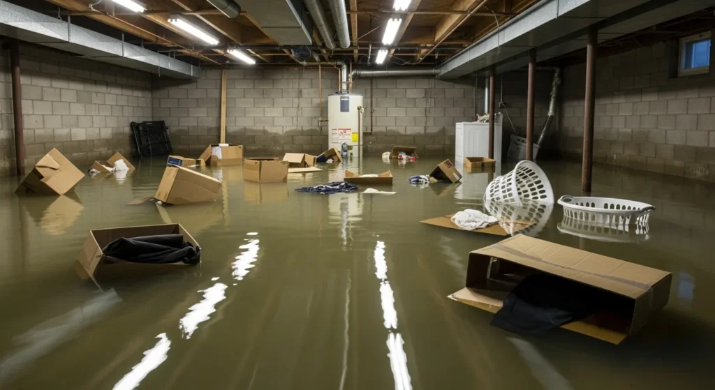
    Flooded residential basement with standing water and damaged belongings
    Wind-driven rain and tree damage produce interior water losses like this — saturated drywall, damaged contents, and mold risk inside 48 hours if extraction is delayed.

    Sources

    This is a public-data summary for restoration professionals’ situational awareness only. It is not an official forecast. Always verify with the National Weather Service, local NWS offices, and official watches/warnings. Preliminary storm reports can change. Do not make operational decisions solely on this brief.

    Related on Tygart Media: Aug 29 storm alerts · Starlink on a water job. Full Daily Storm Pulse archive lives on Restoration Intel — Storm Damage.