Belfair Outdoors - Tygart Media

Category: Belfair Outdoors

Hood Canal, local parks, fishing spots, kayaking

  • WDFW’s Early Closure Authority Is Now a Policy Tool — What It Means for Mason County Shellfish Management

    WDFW’s Early Closure Authority Is Now a Policy Tool — What It Means for Mason County Shellfish Management

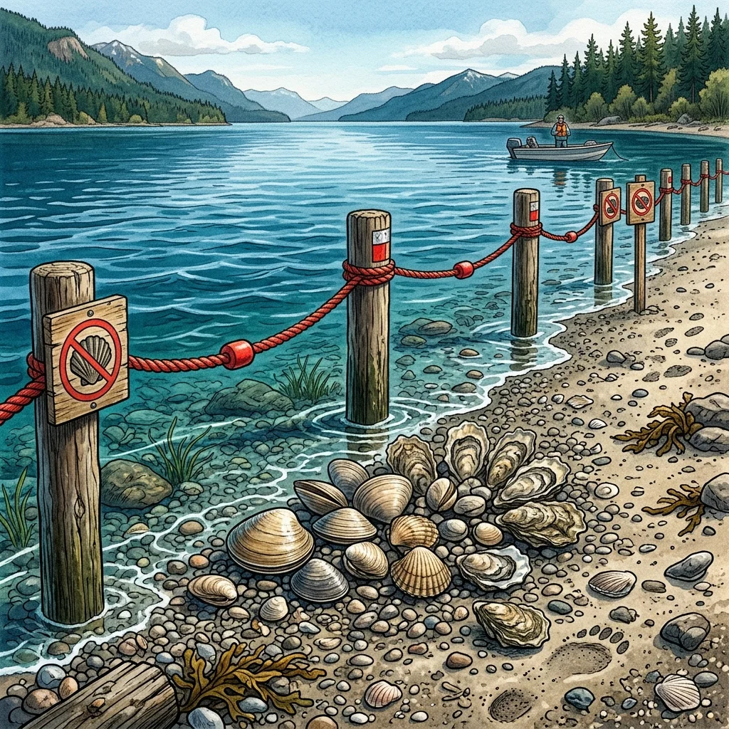
    When WDFW closed Shine Tidelands and Wolfe Property on May 3, 2026, the agency didn’t frame it as a one-time enforcement response. It framed it as a policy tool.

    The distinction matters for anyone tracking Hood Canal’s long-term shellfish management trajectory. WDFW’s post-closure statement said the agency intends to use early-season closure authority “whenever harvest pressure outruns sustainability.” That’s a shift from a reactive model — act after a population collapses — to a proactive one: close before the damage is done, even mid-season, even when the season was already shortened.

    How the 2026 season got to this point

    The closures at Shine Tidelands and Wolfe Property didn’t come from nowhere. WDFW entered 2026 having already implemented a statewide rule package targeting ten Puget Sound beaches showing harvest stress. At Shine and Wolfe, that meant cutting the season from New Year’s Day–May 15 to January 15–April 15 — removing six weeks of harvest opportunity before the season even opened. The May 3 action added an enforcement closure on top of an already-shortened season.

    The compliance failures WDFW documented weren’t obscure technicalities. Harvesters exceeded daily limits. They left open dig holes — damaging habitat for subsequent harvests. They parked illegally and in ways that endangered other visitors. They misidentified species, harvesting protected or over-limit shellfish. WDFW’s Fish and Wildlife Police attributed the compliance collapse partly to social-media-organized gathering groups that drew hundreds of harvesters simultaneously to single beaches — a coordination mechanism that recreational management frameworks weren’t built to handle.

    The dual-authority structure of Hood Canal shellfish oversight

    Hood Canal shellfish management operates under two state agencies with independent authority. WDFW sets seasons, daily limits, and species rules. The Washington State Department of Health controls biotoxin and pollution closures through the Shellfish Safety Map and Biotoxin Hotline (1-800-562-5632). A beach can be open under WDFW and closed under DOH simultaneously — neither agency’s determination overrides the other.

    Layered on top is tribal co-management. The Skokomish Tribe holds treaty-reserved shellfish harvest rights on Hood Canal under the U.S. v. Washington Boldt Decision framework. Tribal harvest occurs on state and private tidelands throughout the canal under a co-management arrangement with the state. WDFW’s conservation decisions — including season lengths and early closure authority — are made with tribal co-managers at the table. Decisions that contract the harvest available to recreational harvesters also carry implications for tribal harvest rights, which adds a legal and political dimension to the regulatory picture that extends beyond simple recreational management.

    What Twanoh’s 2026 situation illustrates

    Twanoh State Park’s 2026 configuration is a case study in stacked pressures. WDFW’s season shift moved the clam harvest window to May 15–June 15 — a six-week window instead of a longer one. Washington State Parks then scheduled a shoreline restoration project that will close beach access after the clam season ends, running through spring 2027. The campsite closure runs from June 1.

    The restoration at Twanoh isn’t just a construction inconvenience. Shoreline restoration projects on Hood Canal typically target removing legacy fill, rip-rap, and channelization that degraded the nearshore habitat — the same kinds of projects that have been underway at the Mary E. Theler Wetlands at Belfair’s Union River estuary and at other points on the Great Bend. These restorations are intended to improve long-term habitat quality for shellfish and salmon. The short-term cost is access.

    For the civic dimension: Twanoh’s restoration is a Washington State Parks capital project. Its timeline, scope, and funding aren’t widely covered in Mason County media. The Belfair Bugle will track the Twanoh restoration project’s milestones, the post-restoration shellfish habitat assessment when it’s available, and any further WDFW season adjustments on the Mason County stretch of Hood Canal.

    Frequently Asked Questions

    What is WDFW’s stated policy on mid-season shellfish closures after May 2026?

    WDFW stated after the May 3 closures at Shine Tidelands and Wolfe Property that it intends to use early closure authority as a conservation tool whenever harvest pressure outruns sustainability. This is a proactive posture — the agency is signaling willingness to close beaches mid-season, not just at the end of a preset season window, if compliance and harvest rates indicate a problem.

    How does tribal co-management affect WDFW’s Hood Canal shellfish decisions?

    The Skokomish Tribe holds treaty-reserved shellfish harvest rights on Hood Canal under the Boldt Decision framework. WDFW makes season-length and conservation decisions in co-management with tribal fisheries managers. Changes that constrain recreational harvest also carry implications for tribal harvest allocations, giving these regulatory decisions a legal and intergovernmental dimension beyond simple recreational management.

    What is the Twanoh State Park shoreline restoration project?

    Washington State Parks is conducting a shoreline restoration project at Twanoh that will close beach access after the 2026 clam season ends on June 15. Campsite reservations are closed from June 1, 2026 through spring 2027. The restoration is intended to improve nearshore shellfish and salmon habitat by removing or remediating legacy shoreline alterations — a pattern seen at other Hood Canal restoration sites including the Theler Wetlands at Belfair.

    What is the role of Washington DOH in Hood Canal shellfish management?

    The Washington State Department of Health independently controls shellfish safety closures for biotoxins and pollution. DOH closures are separate from and independent of WDFW season decisions — a beach can be open under WDFW and closed under DOH simultaneously. DOH uses the Biotoxin Hotline (1-800-562-5632) and the DOH Shellfish Safety Map to communicate current closure status. Both must be checked before any harvest day.

  • Mason County Shellfish Harvest 2026: Twanoh Is Open May 15–June 15 — Here’s How to Plan Your Season

    Mason County Shellfish Harvest 2026: Twanoh Is Open May 15–June 15 — Here’s How to Plan Your Season

    If you’ve been planning your Hood Canal shellfish harvest for this spring, there are two things you need to know before you load the truck: the north end of the canal is closed, and Twanoh has a six-week window before construction shuts the beach.

    WDFW closed Shine Tidelands State Park and Wolfe Property State Park in Jefferson County on May 3, 2026, for the remainder of the 2026 season. Both sites saw harvest violations at scale — crowded beaches, exceeded daily limits, abandoned dig holes, parking violations, and species misidentification — and WDFW ended the season early. That closure affects harvesters from across the Puget Sound region, many of whom will drive south to Mason County’s beaches instead.

    The Twanoh window: May 15 through June 15

    Twanoh State Park on SR-106 between Belfair and Union is the main Mason County shellfish destination. In 2026, the clam season runs May 15 through June 15 only. That’s a one-month window. Miss it and the clam season is over.

    After June 15, Washington State Parks begins a shoreline restoration project at Twanoh. Beach access closes for construction. Campsite reservations are already closed from June 1, 2026 through spring 2027. Oysters are open through September 30, but the beach access restrictions for the restoration will affect when and how you can reach them — check Washington State Parks alerts at parks.wa.gov before heading out after June 15.

    On harvest day: bring your Discover Pass ($10 day-use, $30 annual). Oyster shells stay on the beach — this is both state law and essential habitat practice. Fill every dig hole before you leave. WDFW’s enforcement notes on the May 3 north canal closures called out hole-filling as a documented statewide compliance problem. Rangers will be watching this season.

    After June 15: your alternatives

    Potlatch State Park, further south on Hood Canal near Hoodsport, has its own season dates that differ from Twanoh — check the WDFW beach page at wdfw.wa.gov/places-to-go/shellfish-beaches for current status. Our Potlatch beginner guide covers the layout, rules, and what to bring.

    Belfair State Park’s shellfish access is tied to the Union River estuary and Great Bend seasons — smaller harvest opportunity than Twanoh but worth checking if you’re already at Belfair. See our full WDFW enforcement and 2026 season overview for the complete picture.

    Two checks you must make every harvest morning

    The WDFW beach page tells you the season. The Washington State Department of Health tells you whether the beach is safe that specific day. A beach that’s open under WDFW can be simultaneously closed under DOH for paralytic shellfish poison (PSP) or vibrio contamination. Neither check replaces the other.

    DOH Biotoxin Hotline: 1-800-562-5632. Check it on the morning of harvest. Also check the DOH Shellfish Safety Map online for real-time closure status on your specific beach.

    2026 rule changes to know

    The geoduck daily limit has dropped from three per person per day to one in 2026. WDFW also made season date shifts at multiple Hood Canal beaches as part of a statewide conservation package targeting beaches showing harvest stress. The 2026 annual beach seasons bar chart PDF at wdfw.wa.gov has the full comparison — look up your planned beach before you go, every year, because dates shift.

    Frequently Asked Questions

    When is Twanoh State Park open for shellfish in 2026?

    Twanoh’s clam season runs May 15 through June 15, 2026. Oysters are open through September 30. After the clam season closes on June 15, Washington State Parks begins a shoreline restoration project and beach access closes for construction through spring 2027. Campsite reservations are already closed starting June 1, 2026.

    What do I need to bring to Twanoh for shellfish harvest?

    Bring a valid Discover Pass for parking ($10 day-use or $30 annual), containers for your shellfish, and a shovel for filling dig holes. Oyster shells must stay on the beach — removing them is illegal. Know your daily limits before you go: clams are typically 40 littlenecks or 40 butter clams per person per day (verify current limits on WDFW’s beach page). Geoduck limit dropped to 1 per person per day in 2026.

    Are the north Hood Canal beaches still open in May 2026?

    No. WDFW closed Shine Tidelands State Park and Wolfe Property State Park in Jefferson County on May 3, 2026, for the remainder of the season. The 2026 season at both sites was already shortened from January 15–April 15 (down from January 1–May 15). The May 3 action was an additional enforcement closure due to harvest violations at scale.

    What happens if I harvest shellfish on a DOH-closed beach?

    Harvesting shellfish from a DOH-closed beach is illegal and a public health risk. Paralytic shellfish poison (PSP) is a neurotoxin that cannot be detected by taste, smell, or appearance. It is not destroyed by cooking. Symptoms range from tingling to paralysis and can be fatal at high doses. The DOH Biotoxin Hotline (1-800-562-5632) and DOH Shellfish Safety Map provide current closure status — check both on the morning of every harvest day.

  • Hood Canal Tidelands Owner’s Alert: What the WDFW Enforcement Closures Mean for Your Beach in 2026

    Hood Canal Tidelands Owner’s Alert: What the WDFW Enforcement Closures Mean for Your Beach in 2026

    If you own tidelands on Mason County’s stretch of Hood Canal, the WDFW enforcement closures at Shine Tidelands and Wolfe Property on May 3, 2026 aren’t just news about beaches in Jefferson County. They’re a displacement notice aimed at your shoreline.

    When public recreational shellfish beaches close — whether from enforcement action, season compression, or restoration construction — harvesters don’t stop harvesting. They move. The most common direction is south along SR-101 and SR-3, toward Mason County’s Hood Canal coastline. And in 2026, the public options in Mason County are themselves narrower than usual.

    What public options are left — and why they’re compressed

    Twanoh State Park, the primary public shellfish beach for Mason County, is operating on a six-week clam window this year: May 15 through June 15. After that, Washington State Parks begins shoreline restoration construction and beach access closes through spring 2027. Oysters remain open through September 30, but the clam harvest — the primary draw for most visiting harvesters — ends June 15.

    Potlatch State Park and Belfair State Park are the other public options. Both have season dates and limits set by WDFW that can differ from Twanoh’s — check the current beach pages at wdfw.wa.gov/places-to-go/shellfish-beaches before assuming they’re open. Our Potlatch beginner guide and tidelands property owner guide have the current baseline.

    Private tidelands: your rights and your responsibilities

    Washington tidelands law is not intuitive. In most of Mason County’s Hood Canal shoreline, tidelands are privately owned — meaning the land below the ordinary high water mark may belong to you, not the state. That private ownership gives you the right to harvest shellfish on your own tidelands, but it does not exempt you from WDFW season rules or DOH biotoxin closures. Both apply equally to private and public tidelands.

    What private ownership does mean: you can post your tidelands to prevent public access. Washington law does not grant the public a right to cross private tidelands even to reach navigable water, unless a public access easement exists. If you have displacement pressure from overcrowded public beaches pushing visitors onto your shoreline, you have legal standing to exclude them — and posting your tidelands with signage is the practical mechanism.

    If you’re uncertain whether your tidelands are privately owned, the Mason County Assessor’s parcel records and your deed description (which typically references the “ordinary high water mark” or “mean high tide line”) are the starting point. The Hood Canal Property Owner’s Guide to Shellfish Access, Tribal Boundaries, and the 2026 Season at Potlatch covers the tribal co-management dimension as well — Skokomish Tribal shellfish harvest rights on Hood Canal are a separate regulatory layer that affects what happens at the water’s edge.

    The two checks every harvest day requires

    Whether you’re harvesting on your own tidelands or at a public beach, the check protocol is the same. WDFW controls season dates and daily limits. The Washington State Department of Health controls biotoxin closures independently — a beach that’s open under WDFW can be closed under DOH for paralytic shellfish poison. The DOH Biotoxin Hotline is 1-800-562-5632. Check both on the morning of harvest, not the day before.

    Frequently Asked Questions

    Can visiting harvesters legally access my private tidelands on Hood Canal?

    Generally no. Washington state law does not grant the public a right to cross privately owned tidelands. If your tidelands are posted with no-trespassing signage, visiting harvesters are not permitted on them. Check your deed and Mason County Assessor records to confirm your tidelands ownership boundary. If you have an existing public access easement, that would be noted in your title documents.

    Do WDFW season rules apply to shellfish I harvest on my own tidelands?

    Yes. WDFW season dates, daily limits, and species rules apply to all recreational shellfish harvest in Washington, including on private tidelands. DOH biotoxin closures also apply. Private ownership determines access rights — it does not create an exemption from harvest regulations.

    Why are Mason County beaches likely to see more harvester pressure in 2026?

    WDFW closed Shine Tidelands and Wolfe Property in Jefferson County on May 3, 2026, for the remainder of the season. Twanoh State Park’s clam window is only May 15–June 15 before restoration construction closes the beach. Both conditions displace harvesters southward toward Mason County’s remaining public and private tidelands during the peak spring harvest period.

    How does tribal co-management affect Hood Canal shellfish on Mason County tidelands?

    The Skokomish Tribe holds treaty-reserved shellfish harvest rights on Hood Canal under the U.S. v. Washington (Boldt Decision) framework. Tribal harvest occurs on state and private tidelands throughout the canal. This does not affect your recreational harvest rights, but it is part of the regulatory context for why WDFW manages Mason County’s Hood Canal stocks conservatively. See our full guide for details on how tribal boundaries and co-management work in the Mason County context.

  • Twanoh’s Window Is Closing: What the WDFW Hood Canal Shellfish Enforcement Action Means for Mason County Harvesters

    Twanoh’s Window Is Closing: What the WDFW Hood Canal Shellfish Enforcement Action Means for Mason County Harvesters

    When the Washington Department of Fish and Wildlife closed Shine Tidelands State Park and Wolfe Property State Park on May 3, 2026, the action was directed at two beaches an hour north of Mason County — but the consequence lands squarely on Hood Canal’s Great Bend.

    WDFW cited unsustainable harvest pressure and widespread rule violations: harvesters exceeding daily limits, abandoning open dig holes, parking illegally, and misidentifying clam species. The closures ended recreational clam, mussel, and oyster gathering at both Jefferson County sites for the remainder of 2026. Combined with a season already shortened from January 1–May 15 down to January 15–April 15, the north end of the canal is now effectively closed to recreational shellfish harvest for the season.

    Displaced harvesters don’t disappear. They drive south on SR-101 and SR-3 to Mason County’s beaches — and they’re arriving in a year when Twanoh State Park, the most heavily-used Hood Canal shellfish site in Mason County, is already operating under a compressed window and a scheduled restoration closure.

    What closed, and what the 2026 regulation picture looks like

    The 2026 clam, mussel, and oyster season on Hood Canal entered the year with WDFW already having tightened rules across ten Puget Sound beaches showing harvest stress. At Shine Tidelands and Wolfe Property, the season was shortened by six weeks — opening January 15 instead of January 1, closing April 15 instead of May 15. The May 3 enforcement action was an additional layer: WDFW Fish and Wildlife Police observed compliance breakdowns at scale, with social-media-organized gathering groups drawing hundreds of harvesters simultaneously and rules failing at volume.

    WDFW’s post-closure statement was pointed: the agency said early-season closure authority is a conservation tool it intends to use whenever harvest pressure outruns sustainability. That’s a policy signal, not just a one-time enforcement moment.

    Other 2026 rule changes affecting Hood Canal harvesters: the geoduck daily limit has dropped from three per person per day to one. WDFW’s 2026 public beach season guide, available at wdfw.wa.gov/places-to-go/shellfish-beaches, is the authoritative current reference — season dates and limits can shift mid-year, and the bar chart PDF linked there shows the full picture by beach.

    Twanoh’s compressed window: May 15–June 15, then restoration closes the beach

    Twanoh State Park on SR-106 between Belfair and Union is the default Mason County shellfish beach for most North Mason households — easy SR-3 access, reliable stocks, and a well-known layout. In 2026, that familiarity requires an update.

    WDFW’s 2026 season shift moved Twanoh’s clam harvest dates to May 15 through June 15. Oysters are open through September 30. Harvesters who show up outside those windows — or who rely on memory of prior years’ dates — will find the beach legally closed.

    After the clam season closes June 15, Washington State Parks begins a shoreline restoration project at Twanoh that will shut beach access for construction. Campsite reservations are already closed from June 1, 2026 through spring 2027. The restoration timeline means Twanoh’s clam season and public beach access are effectively done for 2026 once June 15 passes.

    Stack the two developments: north Hood Canal closures driving displaced harvesters south, and Twanoh operating on a narrow six-week window before construction closes the beach. Belfair State Park, Potlatch State Park, and private tidelands on Mason County’s stretch of the canal will absorb what Twanoh cannot hold after June 15.

    The check you have to make every time

    Two state agencies share authority over Hood Canal shellfish, and both have to be checked on the day of harvest — not the night before.

    WDFW controls season dates, daily limits, and species rules. A beach can be within season and still have specific restrictions you’d only catch by checking the beach’s page directly at wdfw.wa.gov.

    Washington State Department of Health (WA DOH) controls biotoxin and pollution closures independently of WDFW. A beach that is open under WDFW can be simultaneously closed under DOH for paralytic shellfish poison (PSP) or vibrio risk. The DOH Biotoxin Hotline is 1-800-562-5632. The DOH Shellfish Safety Map at fortress.wa.gov/doh/biotoxin shows current closure status in real time.

    Both checks are required. Neither substitutes for the other.

    What Mason County harvesters should do now

    If Twanoh is your regular destination, May 15–June 15 is your window. Arrive prepared: Discover Pass for parking ($10 day-use, $30 annual), a container for shells (oyster shells stay on the beach — do not remove them), and equipment for filling dig holes. WDFW’s enforcement note on the Shine/Wolfe closures was explicit that hole-filling failures are a documented compliance problem statewide — it’s both a regulation and a courtesy to harvesters who come after you.

    After June 15, the realistic Mason County alternatives are Potlatch State Park (check current WDFW season dates — see our Hood Canal property owner shellfish guide and Potlatch beginner guide) and private tidelands where you have access rights. Belfair State Park’s shellfish access is tied to the Union River estuary seasons — check the WDFW beach page for current status before driving.

    For the full 2026 shellfish and crab calendar for Hood Canal property owners, see our earlier guide: Hood Canal Property Owners: What the 2026 Shellfish and Crab Calendar Means for Your Beach.

    Frequently Asked Questions

    Why did WDFW close Shine Tidelands and Wolfe Property in May 2026?

    WDFW cited unsustainable harvest pressure and widespread rule violations: harvesters exceeding daily limits, abandoning open dig holes, parking illegally, and misidentifying species. Social-media-organized gathering groups drew hundreds of harvesters simultaneously, and compliance collapsed at that volume. WDFW stated it will use early closure authority as a conservation tool going forward whenever harvest pressure exceeds sustainability.

    What are Twanoh State Park’s shellfish season dates in 2026?

    Twanoh’s 2026 clam season runs May 15 through June 15. Oysters are open through September 30. After the clam season closes, Washington State Parks begins a shoreline restoration project that will shut beach access through spring 2027. Campsite reservations are already closed from June 1, 2026 onward for the restoration.

    Do I need to check both WDFW and DOH before harvesting shellfish on Hood Canal?

    Yes, both are required. WDFW controls season dates and daily limits. The Washington State Department of Health controls biotoxin and pollution closures independently — a beach can be open under WDFW and simultaneously closed under DOH for paralytic shellfish poison or vibrio risk. Call the DOH Biotoxin Hotline at 1-800-562-5632 or check the DOH Shellfish Safety Map on the morning of harvest.

    How does the north Hood Canal closure affect Mason County beaches?

    Hood Canal harvesters are mobile. Closures at Shine Tidelands and Wolfe Property displace effort southward toward Mason County’s beaches — Twanoh, Potlatch, Belfair State Park, and private tidelands. In 2026, Twanoh is already operating under a compressed window (May 15–June 15) before restoration construction closes beach access. The combination increases pressure on the remaining open Mason County beaches during the peak spring harvest period.

    What changed about the geoduck daily limit in 2026?

    WDFW reduced the geoduck daily limit from three per person per day to one per person per day in 2026. The change was made to support shellfish conservation, as geoduck beds are slow to recover, particularly in vulnerable intertidal zone populations.

    Where can I find current Hood Canal shellfish season information?

    The authoritative source is WDFW’s shellfish beaches page at wdfw.wa.gov/places-to-go/shellfish-beaches. Each beach has its own page with current season dates and rules. The 2026 annual beach seasons bar chart PDF (linked from the WDFW page) shows all beaches side by side. For biotoxin status, use the DOH Shellfish Safety Map or call 1-800-562-5632.

  • WDFW Closes Two Northern Hood Canal Beaches Over Harvest Pressure — What It Signals for Belfair-Area Shellfish in 2026

    BELFAIR, Wash. — The Washington Department of Fish and Wildlife (WDFW) closed two of the most popular shellfish beaches on northern Hood Canal effective May 3, 2026, citing unsustainable harvest pressure and widespread rule-breaking — and the conservation action 50 miles north of the Great Bend has direct consequences for the Belfair-area beaches that North Mason families, Hood Canal property owners, and Mason County visitors use most.

    The closure of Shine Tidelands State Park and Wolfe Property State Park, both in Jefferson County near the Hood Canal Bridge, ends the 2026 recreational clam, mussel, and oyster season at those sites earlier than scheduled. WDFW biologists and Fish and Wildlife Police said low tides this spring drew hundreds of harvesters at a time, many directed by social-media gathering groups, and compliance with limits, hole-filling, parking, and species-identification rules collapsed under that volume.

    What WDFW closed — and why it matters in North Mason

    The 2026 season at Shine Tidelands and Wolfe Property had already been reduced under a statewide rule package adopted in late 2025 that targeted ten Puget Sound beaches showing harvest stress. The May 3 action closed the season early on top of that reduction.

    For North Mason, the news is not just about two parks an hour north. Hood Canal harvesters are mobile, and any closure on the canal’s north end displaces effort. The same 2026 statewide rule package also shifted the dates at Twanoh State Park — Mason County’s most heavily-used Hood Canal shellfish beach, sitting on SR-106 between Belfair and Union. When fewer beaches are open at the same time, the ones that remain open absorb the displaced demand.

    The Twanoh squeeze: shifted season + summer shoreline closure

    Twanoh State Park is staring down two compounding closures of its own in 2026. The first is the WDFW season shift — harvest windows have moved to different months than locals are used to, and harvesters who show up on the wrong tide will find the beach legally closed. The second is a Washington State Parks shoreline restoration project: campsite reservations at Twanoh are closed from June 1, 2026 through spring 2027, and beach access is scheduled to close after the 2026 clam season for restoration construction.

    Stacked together, those two closures mean Twanoh’s window of legal, accessible shellfish harvest in 2026 is narrower than it has been in years. Mason County harvesters who miss it will be looking for alternatives. Belfair State Park, Potlatch State Park, and Mason County’s private tidelands will see the spillover.

    Why Belfair-area beaches are the next pressure point

    The Mason County stretch of Hood Canal — from the head of the Great Bend at Belfair down through Tahuya, Union, Hoodsport, and Lilliwaup — holds some of the most productive recreational shellfish ground in Washington. Belfair State Park, at the very tip of the Great Bend, has seasonal openings tied to the Mary E. Theler Wetlands and the Union River estuary. Twanoh has historically been the workhorse beach for residents driving SR-3 and SR-106.

    WDFW’s enforcement note on the May 3 closure was unusually pointed: gatherers exceeding daily limits, abandoning open digging holes, parking unsafely or illegally, and misidentifying clam species. None of those behaviors are unique to Shine Tidelands or Wolfe Property — the same patterns show up at North Mason beaches during peak low-tide weekends. For planning context, the Bugle’s Hood Canal Shellfish Season summer planner for Belfair and the 2026 shellfish and crab calendar for Hood Canal property owners remain the working baseline, both cross-checked against the WDFW Shellfish Safety Map before any harvest day.

    How Hood Canal shellfish management works

    Two state agencies share authority. WDFW sets seasons, daily limits, and species rules. The Washington State Department of Health (WA DOH) handles biotoxin and pollution closures through its Shellfish Safety Map and the Biotoxin Hotline at 1-800-562-5632. A beach can be open under WDFW and simultaneously closed under DOH for paralytic shellfish poison or vibrio risk — both have to be checked. Coverage of how shoreline land use affects water quality on the canal is in the Bugle’s water quality and shellfish reporting on the Tahuya River Preserve.

    What this means going forward

    WDFW signaled the May 3 action was a conservation tool the agency intends to keep using. If harvest pressure at any Hood Canal beach outruns sustainability, early closures should be expected rather than viewed as a surprise. The practical takeaway for Belfair, North Mason, and Hood Canal property-owner audiences: check the WDFW beach page and DOH Shellfish Safety Map the morning of harvest, not the night before. The Belfair Bugle will track the Twanoh State Park shoreline restoration timeline, the post-shift Twanoh harvest dates, and any further early closures on the Mason County side of the canal as they’re announced.

    Frequently Asked Questions

    Are Shine Tidelands and Wolfe Property the only Hood Canal beaches closed right now?

    Those are the two WDFW closed early on May 3, 2026. Other Hood Canal beaches run on their own published 2026 seasons and may be open, closed, or under biotoxin advisory. Always check the WDFW shellfish-beach page for the specific beach plus the WA DOH Shellfish Safety Map before harvesting.

    Is Belfair State Park open for recreational shellfish harvest right now?

    Belfair State Park’s status is governed by WDFW’s published 2026 season plus any active DOH biotoxin closure. The 2026 opener has been described in local coverage as unconfirmed pending WDFW confirmation; check the Belfair State Park beach page on wdfw.wa.gov before planning a harvest trip.

    Will Twanoh State Park be open for camping this summer?

    No. Washington State Parks has closed Twanoh State Park campsite reservations from June 1, 2026 through spring 2027 for a shoreline restoration project. Beach access is scheduled to close after the 2026 clam season ends.

    What changed at Twanoh State Park for shellfish in 2026?

    The 2026 statewide rule package WDFW adopted in late 2025 shifted Twanoh State Park’s recreational harvest dates to different months than the historical pattern. Harvesters who relied on prior-year calendars need to re-check the WDFW Twanoh page for the new 2026 windows.

    What can North Mason residents do to keep their Hood Canal beaches open?

    WDFW listed four behaviors that triggered the May 3 closure to the north: exceeding daily limits, leaving open digging holes, illegal or unsafe parking, and misidentifying clam species. Avoiding all four — and reporting violations to WDFW — is the single biggest thing local recreators can do to keep beaches like Belfair State Park and Potlatch State Park from following Shine Tidelands and Wolfe Property into early closure.

    Where do I report a violation or get a current closure status?

    For violations: WDFW Enforcement at 360-902-2936. For biotoxin closures: WA DOH Biotoxin Hotline at 1-800-562-5632 or the Shellfish Safety Map at doh.wa.gov/ShellfishSafety. The map updates as test results come in and is the authoritative source for whether a beach is safe on a given day.


    Related Expansion Coverage

    This story has been expanded into a full knowledge cluster for Mason County audiences:

  • New to North Mason? Belfair State Park Is Your Front-Door Gateway to Washington’s Saltwater Trail

    New to North Mason? Belfair State Park Is Your Front-Door Gateway to Washington’s Saltwater Trail


    If you just moved to North Mason County, you may have driven past the brown sign for Belfair State Park without realizing what it actually offers. Here’s the short version: a 65-acre state park sits at the southern end of Hood Canal’s Great Bend, with 3,720 feet of saltwater shoreline, a restored estuary, ADA-accessible day-use facilities, and a campsite reserved exclusively for paddlers as part of a National Recreation Trail that stretches all the way to the San Juan Islands.

    Most new residents take a year or two to discover this. Treat this article as a shortcut.

    What the Cascadia Marine Trail Actually Is

    The Cascadia Marine Trail (CMT) is a National Recreation Trail managed by the Washington Water Trails Association in partnership with Washington State Parks. It strings together more than 55 shoreline campsites along the inland marine waters of Washington — Puget Sound, Hood Canal, the Strait of Juan de Fuca, the San Juans — and it is reserved for human-powered and wind-powered watercraft. Kayaks. Canoes. Stand-up paddleboards. Sailing dinghies that can be muscled to a beach.

    You cannot drive to a CMT site. That is the whole point. The trail exists to give paddlers a multi-day route through Washington’s marine waters with low-cost, designated places to camp along the way. Belfair State Park’s CMT campsite — site 148 — is the trail’s southernmost stop on Hood Canal. From here, paddlers head north up the canal toward Twanoh, Potlatch, and Hoodsport, then connect to the broader trail.

    What the State Park Offers Day-Trippers

    You don’t have to be a paddler to use the park. The day-use side has:

    • 3,720 feet of saltwater shoreline along the southern Hood Canal Great Bend
    • A historic tidal swimming pool that warms up in summer
    • Picnic areas, ADA-accessible restrooms, coin-operated showers
    • Trails through restored saltmarsh between Big Mission Creek and Little Mission Creek
    • A drive-in campground (separate from the paddler-only CMT site)

    You need a Washington Discover Pass for vehicle parking — $10 day or $30 annual. If you live in Mason County and plan to visit any of the state’s parks more than three times a year, the annual pass pays for itself by your fourth visit.

    The History You’ll See on the Shoreline

    One of the things that makes Belfair State Park genuinely interesting — versus just scenic — is that you can read its history on the ground.

    Between 1952 and 1960, the original tidal marsh was graded, filled, and channelized to make room for parking, a swimming hole, and a more conventional state-park experience. Both Mission Creeks were straightened. A tidal gate was built. About 67,000 cubic yards of fill went in. Saltmarsh function was largely lost.

    Starting in the 2010s, Washington State Parks and the Hood Canal Salmon Enhancement Group began undoing the damage. According to project records published by the Pacific Northwest Salmon Center, the project has restored approximately 8.1 acres of estuarine wetlands and removed 2,700 feet of rip-rap shoreline armoring. Walking the shoreline today, you can see tidal channels reforming, reed grass spreading into the shallows, and the creeks meandering closer to their original courses. It’s an active, visible piece of restoration ecology — the kind of thing you can show visiting family and explain in two minutes.

    Long before any of that, this stretch of shoreline was a Skokomish gathering and harvesting place. The cultural history is older than the park, older than the state. Worth carrying with you when you visit.

    Your First Three Visits, in Order

    If you’re new to North Mason and want to actually use this park rather than just drive past it, here’s a starting sequence:

    1. Day-use afternoon. Pack a picnic, walk the saltmarsh trails, watch the tide, leave by sunset.
    2. Borrowed-kayak morning. If a friend has a kayak — or you can rent from North Shore Hood Canal Kayaks at 3959 NE North Shore Road in Belfair (call ahead, no walk-ins) — paddle the protected water near the saltmarsh on a calm morning.
    3. Pair it with Tahuya Forest. Spend a Saturday split between the park in the morning and Tahuya State Forest in the afternoon. That’s two of North Mason’s signature outdoor places in one day.

    Frequently Asked Questions

    Is Belfair State Park free?

    Day-use parking requires a Washington Discover Pass — $10 per day or $30 per year, per vehicle. Camping fees are charged separately at the park’s self-registration. The $12 Cascadia Marine Trail site is paddler-only and cannot be reached by car.

    Where exactly is Belfair State Park?

    The park is on NE Beck Road in Belfair, just off SR-300, at the southern end of Hood Canal’s Great Bend in Mason County, Washington. From the SR-3 / SR-300 junction in downtown Belfair, it’s a short drive west along the canal.

    Can I camp at Belfair State Park without a kayak?

    Yes — the park has a separate drive-in campground for car campers. The Cascadia Marine Trail campsite (site 148) is reserved exclusively for paddlers and wind-powered watercraft and cannot be accessed by vehicle.

    What is Hood Canal’s Great Bend?

    The Great Bend is the sharp curve where Hood Canal turns east before its long northern reach. Belfair State Park sits at the southern end of this curve. The geometry of the bend creates protected paddling water and gives the area a distinct fjord-like character.

    Are there restaurants near Belfair State Park?

    Downtown Belfair is a short drive away and offers a range of casual restaurants, coffee shops, and a Saturday market. For waterfront dining, restaurants along North Shore Road and SR-106 east of the park provide additional options. Plan ahead for weekend evenings — seating fills.

    Can I see salmon at Belfair State Park?

    The estuary restoration is rebuilding juvenile salmon habitat in Big and Little Mission Creeks. Best viewing is from the boardwalk and shoreline trails during outgoing tides in summer and fall. Adult salmon return to nearby Hood Canal streams; the park itself is primarily juvenile-rearing habitat.

    This is a new-resident orientation companion to our Cascadia Marine Trail / Belfair State Park spring 2026 guide. For more North Mason orientation, see our Tahuya State Forest newcomer’s guide.

  • What the Cascadia Marine Trail Means for Belfair Lodging, Rental, and Tourism Businesses

    What the Cascadia Marine Trail Means for Belfair Lodging, Rental, and Tourism Businesses


    For Belfair lodging operators, kayak rental shops, restaurants, and tourism-adjacent businesses, the Cascadia Marine Trail is an underused asset sitting right outside your door. Belfair State Park’s CMT site 148 is the southernmost paddler campsite on Hood Canal — and the National Recreation Trail it anchors brings exactly the kind of low-impact, repeat-visit, multi-day visitor that small Mason County hospitality businesses are built to serve. Here’s what’s worth knowing about that economic flow in spring 2026.

    Who Uses the Cascadia Marine Trail

    The CMT visitor is a specific profile: 30s–60s, often a couple or small group, willing to spend on quality gear and quality lodging on either end of a multi-day paddle, and inclined to repeat visits over a season because the trail is cumulative — they paddle a leg this trip, the next leg next trip. This is the inverse of the day-tripper who eats one meal and leaves. CMT users plan around weather windows, tides, and water conditions, which means weekday demand and shoulder-season demand both index higher than typical leisure tourism.

    The trail is managed by the Washington Water Trails Association in partnership with Washington State Parks. WWTA’s site lists more than 55 paddler-only campsites along Washington’s inland marine waters; Belfair State Park is the trail’s southern Hood Canal anchor.

    Lodging: The “Day Before” and “Day After” Opportunity

    A CMT trip almost always involves a non-paddling night before launch and a non-paddling night after takeout. Paddlers want to arrive the day before, prep gear, eat well, sleep on a real bed, and get on the water early. They want the same on the back end after coming off the canal.

    For Belfair vacation rental hosts, that translates into two structural opportunities:

    • Storage logistics: Properties that can accommodate a kayak (covered side yard, garage space, dock access) command a clear premium with paddler guests.
    • Shuttle and launch information: Listings that explicitly mention proximity to Belfair State Park, launch instructions, and Discover Pass tips convert better with paddler searchers than generic “near Hood Canal” copy.

    For B&B and inn operators, paddlers tend to be lower-impact guests — early to bed, early up, often skipping the breakfast service in favor of a pre-launch protein bar — which can pencil better than the typical leisure stay.

    Rental and Outfitter Demand

    North Shore Hood Canal Kayaks at 3959 NE North Shore Road in Belfair operates by appointment, signaling demand exists for paddler equipment in the area without a high walk-in volume. There is room in the market for additional rental, lesson, and guide services — particularly anything that lowers the barrier for first-time paddlers (intro lessons, half-day guided tours, beginner gear packages with PFDs sized for kids).

    Lodging properties along North Shore Road that include kayaks and SUPs as part of the package tend to differentiate well in vacation rental search. If you operate a property within a 10-minute drive of the state park and don’t currently include water craft, the upfront equipment cost is modest relative to the marketing lift.

    Restaurants, Coffee, and Pre-Launch Provisioning

    The CMT visitor’s morning routine: 5:30 a.m. wake, coffee, breakfast they don’t have to cook, on the water by 7. Restaurants and coffee shops along the SR-3 and SR-300 corridors that open early and offer grab-and-go options capture this demand. Same-day takeout dinner reservations on the back end of trips — when paddlers come off the water tired, hungry, and not interested in cooking — are similarly underserved.

    Provisioning for multi-day paddles also creates opportunity for any Belfair grocer or specialty store stocking lightweight, water-resistant, paddler-friendly food: dried meals, bars, electrolyte mixes, no-cook protein.

    The Restoration Story Is a Marketing Asset

    Belfair State Park is the site of a significant ongoing estuary restoration. The Hood Canal Salmon Enhancement Group, in partnership with Washington State Parks, has restored approximately 8.1 acres of estuarine wetlands and removed 2,700 feet of rip-rap shoreline armoring — undoing fill placed between 1952 and 1960. Project documentation is hosted by the Pacific Northwest Salmon Center.

    For tourism operators, this is a real differentiator. Visitors increasingly want their travel choices to align with conservation — and Belfair offers a paddle directly past an active, visible salmon-habitat restoration site. That’s a story you can put in your listing copy, your booking confirmation email, and your guest welcome packet, and it costs nothing.

    Cross-Promote With Other North Mason Outdoor Assets

    Belfair’s outdoor inventory is more than the state park. Tahuya State Forest’s 23,000 acres are 3.5 miles away. Theler Wetlands’ boardwalk and salmon-rearing center is on the eastern side of town. The Skokomish Valley and the broader Hood Canal shoreline extend in both directions. Listings, websites, and concierge collateral that reference the full Tahuya State Forest trail system alongside paddling — rather than treating each as a standalone — close better with multi-day visitors.

    Frequently Asked Questions

    How can my Belfair lodging business attract Cascadia Marine Trail paddlers?

    List your property explicitly with kayak storage capacity, proximity to Belfair State Park, and Discover Pass guidance in the listing copy. Paddlers search for those specifics. Properties that include kayaks or SUPs as part of the package differentiate strongly in vacation rental search. Early breakfast options and quiet pre-launch logistics matter more to this customer than typical leisure amenities.

    Is there room for another kayak rental business in Belfair?

    The current operator, North Shore Hood Canal Kayaks, runs by appointment-only — which suggests demand exists but is being managed against capacity rather than fully met. There is likely room for additional rental, beginner lessons, and guided half-day tour businesses, particularly any service lowering the barrier for first-time paddlers and families with kids.

    What does a Cascadia Marine Trail visitor typically spend?

    CMT users are a specific multi-day, planning-oriented visitor — typically spending on lodging the night before launch and the night after takeout, plus on-trail provisions, plus rental gear if they’re not bringing their own. They also tend to repeat-visit across a season because the trail is cumulative. Total spend per trip varies, but the lifetime value across a season is materially higher than a single-day visitor’s.

    How does the saltmarsh restoration affect business?

    The Belfair State Park estuary restoration project is an active draw for conservation-minded visitors and a genuine marketing differentiator for properties and businesses that mention it in their listings. The park itself remains fully operational throughout the restoration; day-use, camping, and CMT site 148 are all open. The project enhances the visitor experience rather than disrupting it.

    Where can I learn more about hosting paddler guests?

    The Washington Water Trails Association maintains a public site list and trail map at wwta.org with information about each CMT site. State Parks publishes Belfair-specific information at parks.wa.gov. For local outdoor recreation context, our spring 2026 Cascadia Marine Trail guide covers the specifics that paddler guests typically ask about.

    This is a Mason County business-owner companion to our Cascadia Marine Trail / Belfair State Park spring 2026 guide. For related commercial coverage, see our recent Belfair sewer / PSIC business briefing.

  • Paddle the Cascadia Marine Trail from Belfair: Mason County’s Spring 2026 Hood Canal Kayaking Guide

    Paddle the Cascadia Marine Trail from Belfair: Mason County’s Spring 2026 Hood Canal Kayaking Guide


    Belfair, Mason County — The Cascadia Marine Trail begins, in a sense, in your backyard. Belfair State Park anchors the southern end of the trail, and for North Mason County paddlers in spring 2026, that means a 55-campsite, water-only trail system reaches all the way from the head of Hood Canal to the San Juan Islands — and you can step onto it from a launch you can drive to in twenty minutes.

    This guide covers what’s actually open, what it costs, what to bring, and the local rules and history that shape paddling out of Belfair this season.

    Cascadia Marine Trail Site 148, Plain English

    The Cascadia Marine Trail (CMT) is a National Recreation Trail managed by the Washington Water Trails Association in partnership with Washington State Parks. It links more than 55 shoreline campsites along the inland marine waters of Washington and is reserved exclusively for human-powered and wind-powered watercraft — kayaks, canoes, sailing dinghies, stand-up paddleboards.

    At Belfair State Park, the CMT campsite is site 148. As of January 1, 2019, Washington State Parks moved the marine trail spot from a more isolated location into the main campground, putting it closer to restrooms and showers while keeping it on the water. It sits just west of Little Mission Creek, on the park’s saltwater shoreline.

    The rules are simple: arrive by water, claim the site first-come first-served, pay $12 per night for up to eight people, and leave it cleaner than you found it. No vehicle access. No reservations. Paddler honor system.

    The Park Itself: 65 Acres, 3,720 Feet of Saltwater

    Belfair State Park covers 65 acres at the southern end of Hood Canal’s Great Bend — the sharp curve where the canal turns east before its long northern reach. The park has 3,720 feet of saltwater shoreline, two freshwater creeks (Big Mission and Little Mission), tidelands, restored saltmarsh, and an ADA-accessible day-use area. A Washington Discover Pass ($10/day or $30/year) is required for day-use parking.

    For paddlers based in or passing through Mason County, the south end of the canal offers some of the most protected paddling water in Washington. The Great Bend’s geometry — a long fjord turning back on itself — moderates Pacific swells and gives beginners a genuinely forgiving training ground.

    Conditions: Why May Mornings, Not May Afternoons

    Hood Canal is a fjord. Geologically and hydrologically, it behaves like one — narrow, deep, with topography that channels wind. In May, that means glassy mornings and brisk afternoons. South-southwesterlies build through the day and accelerate up the canal’s southern reach.

    The local rule is unwritten but consistent: launch early, turn back by lunch unless you are confident in your reentry skills, and check the marine forecast for the South Hood Canal area on the National Weather Service site before you go. Tide tables matter too — Big Mission Creek’s mouth is shallow, and a low tide turns the launch zone into a mudflat.

    If You Don’t Own a Kayak

    Local rentals exist. North Shore Hood Canal Kayaks operates by appointment from 3959 NE North Shore Road in Belfair — call ahead rather than walking in, since they are not staffed for drop-ins. Vacation rental properties along the canal increasingly include kayaks and SUPs as part of the package; if you are renting a place for a long weekend, ask the host before booking.

    For visitors who want a guided experience, several outfitters in nearby Hood Canal communities offer half-day and full-day tours; lodging directories on Explore Hood Canal compile current options.

    The Estuary Is Coming Back

    The shoreline you launch from is a restoration site, not a relic. Between 1952 and 1960, the original tidal marsh between the two Mission Creek mouths was graded, filled, and channelized. A tidal gate was installed to create a swimming hole. Both creeks were straightened. Decades of estuarine habitat were lost.

    The Hood Canal Salmon Enhancement Group (HCSEG), partnered with Washington State Parks, has been undoing that. According to project records published by the Pacific Northwest Salmon Center, the project has restored approximately 8.1 acres of estuarine wetlands, removed 2,700 feet of rip-rap shoreline armoring, and removed roughly 67,000 cubic yards of fill — returning sinuosity to Big and Little Mission Creeks. On a quiet morning paddle, the results are visible: tidal channels reforming, reed grass spreading into the shallows, juvenile salmon habitat recovering.

    Long before any of this — before the 1952 fill, before the park itself — this shoreline was a Skokomish gathering and harvesting place. The cultural history is older than the recreational one, and worth carrying with you when you launch.

    One Last Note on Shellfish

    Belfair State Park has tideland shellfish beds, but biotoxin closures and seasonal restrictions move week to week. Always check the current status on the WDFW shellfish beaches page before harvesting. A quick check costs nothing; a paralytic shellfish poisoning emergency-room visit costs everything.

    Where Belfair Fits in the Larger Trail

    From site 148, the CMT continues north up Hood Canal toward Twanoh, Potlatch, and Hoodsport, with additional sites threading toward Quilcene and Port Townsend before connecting to the Salish Sea network. Belfair is where the southern leg of a much larger Washington water trail begins. For Mason County paddlers, that’s a meaningful piece of geography: a National Recreation Trail with its southern doorstep here.

    Frequently Asked Questions

    How much does it cost to camp at Cascadia Marine Trail site 148?

    $12 per night for up to eight people, paid via the park’s self-registration system. The site is for human-powered or wind-powered watercraft only — you must arrive by water. There are no reservations; sites are first-come, first-served.

    Do I need a Discover Pass to launch from Belfair State Park?

    Yes — a Washington State Discover Pass is required for day-use vehicle parking. Day passes cost $10 and annual passes cost $30. Buy online at discoverpass.wa.gov or at park self-pay stations. Overnight campers’ fees include the pass for the duration of the stay.

    Is Hood Canal safe for beginner kayakers?

    The Great Bend’s protected geometry makes the south end of Hood Canal one of the more forgiving paddling environments in Washington — but afternoon winds build quickly, and the canal’s depth means cold-water immersion risk year-round. Beginners should launch early, stay close to shore, wear a properly fitted PFD, and bring extra layers. Always check the marine forecast for South Hood Canal before going.

    What is the saltmarsh restoration at Belfair State Park?

    Washington State Parks and the Hood Canal Salmon Enhancement Group have been restoring approximately 8.1 acres of estuarine wetlands at the park, removing 2,700 feet of rip-rap and roughly 67,000 cubic yards of fill that were placed between 1952 and 1960. The work is reopening Big and Little Mission Creek mouths to natural tidal flow and rebuilding juvenile salmon habitat.

    Can I rent a kayak in Belfair?

    Yes. North Shore Hood Canal Kayaks operates by appointment at 3959 NE North Shore Road in Belfair — call ahead, as they do not accept walk-ins. Several Hood Canal vacation rentals also include kayaks and stand-up paddleboards as part of the property package; ask your host before booking.

    Where does the Cascadia Marine Trail go from Belfair?

    From site 148, the trail continues north up Hood Canal toward Twanoh State Park, Potlatch, and Hoodsport, eventually connecting to the wider Salish Sea network of more than 55 paddler-only campsites stretching toward the San Juan Islands. Belfair is the trail’s southernmost campsite on the canal.

    What should I bring on a first paddle from Belfair State Park?

    At minimum: PFD, paddle leash, dry bag for keys and phone, layered clothing (fleece + windbreaker), water, snacks, marine forecast checked within the last hour, tide chart, and a float plan filed with someone on shore. Hood Canal is cold year-round; even on a warm day, immersion is a real risk.

  • North Mason Families: How to Take Kids Kayaking from Belfair State Park This Spring

    North Mason Families: How to Take Kids Kayaking from Belfair State Park This Spring


    For North Mason families wondering whether their kids are ready to kayak Hood Canal: the south end of the canal — your end — is where Washington’s beginner paddlers learn. Belfair State Park’s protected shoreline at the Great Bend is genuinely forgiving, the day-use beach is ADA-accessible, and the launch is twenty minutes from most Belfair driveways. Here’s how to plan a first family paddle this spring without making the rookie mistakes that ruin the trip.

    Why the Great Bend Is the Right Training Water

    Hood Canal is technically a fjord, and the southern reach where Belfair State Park sits is its sharpest curve — the Great Bend. The geometry breaks up Pacific swells before they reach you and gives the south end a dependably calmer surface than the open canal further north. For families with kids who have never been in a sit-on-top or tandem before, that matters more than any other factor.

    You still need to plan around afternoon wind. South-southwesterlies build through the day. Launch early, plan a short loop, and be back on land before lunch on your first outing. If your kids ask “can we keep going?” — perfect. End on a high note, not a wet exhausted note.

    The Family Day-Use Plan

    The simplest first trip looks like this:

    1. Buy a Washington Discover Pass ahead of time ($10 day, $30 annual) so you are not fumbling at the park entrance with kids in the car.
    2. Arrive at Belfair State Park before 9 a.m. Tide and wind both behave best in the morning.
    3. Set up a base camp in the day-use area. The park has 65 acres, restrooms, and a swimming-friendly tidal pool kids love when paddling is done.
    4. Launch from the beach. Stay within easy sight of your beach blanket. Paddle west toward the saltmarsh restoration zone — that’s where the water is calmest.
    5. Be off the water before any sustained breeze starts ruffling whitecaps. If you see whitecaps from the beach, you’re already late.

    The $12 paddler-only Cascadia Marine Trail campsite — site 148 — is not the right move for a first family outing. Save it for when your kids have a few day paddles under them and want the real experience.

    What to Bring (The Honest List)

    Hood Canal water is cold year-round. Even in July, immersion is a hypothermia risk. The non-negotiables for paddling with kids:

    • Properly fitted PFDs for every person, including parents. A child’s PFD must be sized for their weight; an adult PFD on a kid is a drowning hazard. Most PFDs have weight ranges printed on the inside.
    • A change of warm clothes per person, in a dry bag, on shore. If anyone goes in, you want fleece and a jacket waiting.
    • Sunscreen and hats. Glare off Hood Canal multiplies sun exposure.
    • Water, snacks, a whistle on each PFD.
    • The marine forecast checked within the hour — the South Hood Canal area on the National Weather Service site.

    Renting vs. Buying

    For a family’s first outing, renting makes sense. North Shore Hood Canal Kayaks at 3959 NE North Shore Road in Belfair operates by appointment — call ahead, no walk-ins. Tandem sit-on-top kayaks are the most family-forgiving option. Skip closed-cockpit sea kayaks until your kids have practiced wet exits.

    Some Hood Canal vacation rentals along North Shore Road include kayaks as part of the property package, which can simplify logistics if you have visitors staying with you.

    Pair the Paddle with a Tahuya Forest Day

    One of the underrated North Mason family weekends is paddling Belfair State Park in the morning and exploring Tahuya State Forest in the afternoon. The forest is 3.5 miles from Belfair and offers family-friendly trails plus picnic areas. Two kinds of nature in one day, both within the same county, both free or near-free with the Discover Pass you already bought.

    Frequently Asked Questions

    How young can a child go kayaking on Hood Canal?

    There is no legal minimum, but practically, kids should be able to follow safety instructions, sit still in a tandem for 20–30 minutes, and tolerate a properly fitted child PFD. Most outfitters will rent to families with children as young as 4 or 5 in tandem boats with an adult — but the call belongs to the parent. If a child is afraid of water or unable to sit still, wait a year.

    Do kids need their own Discover Pass?

    No. The Discover Pass is per vehicle, not per person. One $10 day pass covers everyone arriving in the same car. If you visit Washington state parks more than three times a year, the $30 annual pass pays for itself.

    Is the water at Belfair State Park warm enough to swim in?

    The park’s tidal swimming hole — created by the historic tidal gate — does warm up in summer afternoons and is a popular spot for families. The open canal stays cold (50s to low 60s°F) year-round. If your kids end up in the open water unexpectedly, treat it as a cold-water situation and get them dry and warm immediately.

    What’s the closest restroom to the launch beach?

    Belfair State Park has ADA-accessible restrooms and coin-operated showers in the main day-use area, a short walk from the launch beach. There are no facilities on the saltmarsh side.

    What if the wind picks up while we’re on the water?

    Turn back immediately and stay close to shore. Hood Canal wind builds fast and the southerly fetch from the Great Bend can push small craft surprisingly far. If you cannot make headway, paddle to the nearest beach and walk back to your launch point along the shore. The park’s 3,720 feet of saltwater shoreline gives you a long landing zone.

    This is a family-focused companion to our Cascadia Marine Trail / Belfair State Park spring 2026 guide. For Tahuya Forest plans, see our family trail access guide.

  • Paddle Hood Canal’s Great Bend: Belfair State Park Is Your Cascadia Marine Trail Gateway This May

    Paddle Hood Canal’s Great Bend: Belfair State Park Is Your Cascadia Marine Trail Gateway This May

    With spring light stretching long over Hood Canal and morning winds still soft, May is one of the best months to put a paddle in the water at Belfair’s doorstep. Belfair State Park sits at the southern end of Hood Canal’s Great Bend — where the canal curves before widening toward its northern reaches — and serves as the southernmost launch point on the Cascadia Marine Trail, a network of more than 55 shoreline campsites for sea kayakers, canoeists, and stand-up paddlers threading through Washington’s inland sea from Puget Sound to the San Juan Islands.

    If you’ve been thinking about a night on the water, this is the weekend.

    Your Starting Point: CMT Site 148

    The Cascadia Marine Trail campsite at Belfair State Park is site 148, located just west of Little Mission Creek at the edge of the park’s 3,720 feet of Hood Canal shoreline. It’s reserved exclusively for paddlers and wind-powered watercraft — no car campers, no reservations. Show up by water, claim it first-come first-served, and it’s yours for $12 a night for up to eight people, with space for four or five tents, a fire ring, and ADA restrooms and coin-operated showers a short walk away.

    From site 148, the canal opens to the west toward Dewatto and north toward Hoodsport, with the protected waters of the Great Bend giving beginners a forgiving environment and experienced paddlers a gateway to longer CMT legs.

    Know Before You Launch

    Hood Canal behaves like a fjord — which, geologically, it is. That shape channels afternoon winds up from the south. Most May mornings offer glassy conditions; plan to be off exposed water or sheltered in a cove by early afternoon if the forecast calls for wind. Check the National Weather Service forecast for the Hood Canal area before you go.

    No Kayak? North Shore Hood Canal Kayaks Has You

    If you don’t own a kayak or SUP, North Shore Hood Canal Kayaks operates by appointment out of 3959 NE North Shore Rd, Belfair. Call (360) 473-9289 to check availability — they offer kayak and SUP rentals and ask that you call ahead rather than walk in.

    The Estuary Is Healing

    Worth slowing down for: Washington State Parks has been actively restoring the historic saltmarsh at Belfair State Park. Armoring has been removed from the lower reach of Big Mission Creek, and fill and riprap have been pulled from the shoreline to return the creek to a more natural course. Paddling slowly along the park’s edge, you can watch the estuary zone between the two Mission Creek mouths beginning to look like itself again — reed grass reclaiming the shallows, tidal channels reforming.

    The Skokomish people used this shoreline as a gathering and harvesting place long before the park existed. The restoration work is returning some of that ecological function — one more reason to move slowly and look closely when you’re on this stretch of water.

    One Practical Note

    A Washington State Discover Pass is required for day use. Shellfish beds exist in the park’s tidelands, but check WDFW’s current beach status at wdfw.wa.gov/places-to-go/shellfish-beaches before harvesting — beds can be closed seasonally for biotoxin monitoring.


    Related Expansion Coverage