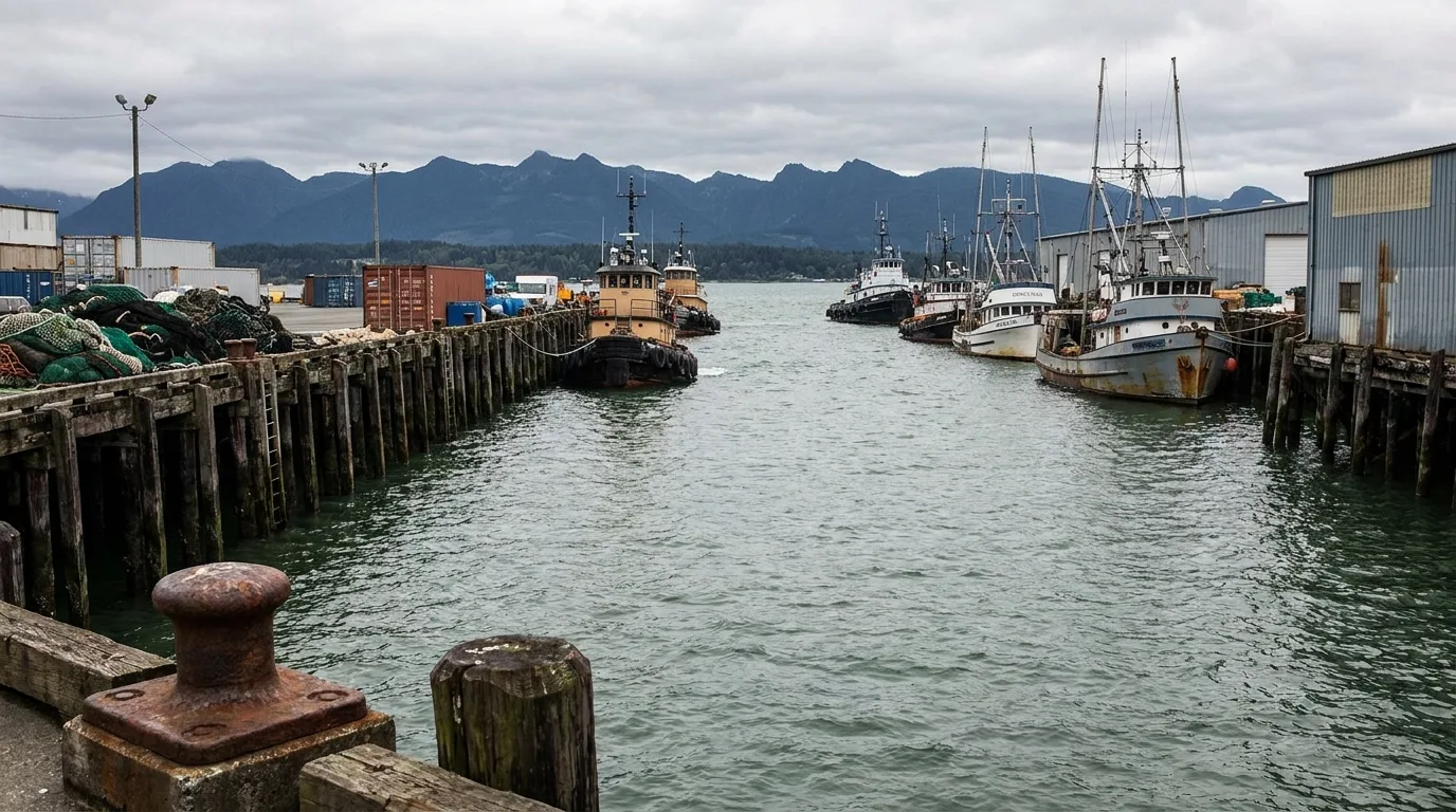
Tag: Outdoor Recreation

  • Things to Do in Mason County: The Definitive Guide

    Things to Do in Mason County: The Definitive Guide

    Mason County offers visitors and residents remarkable opportunities for outdoor recreation, natural exploration, and small-town experiences. From world-class shellfish harvesting on Hood Canal to mountain hikes and river adventures, there’s genuine adventure and relaxation available year-round.

    Water Recreation and Hood Canal

    Hood Canal is Mason County’s crown jewel for water recreation and represents one of the Pacific Northwest’s premier destinations.

    Shellfish Harvesting

    Hood Canal is famous for oyster farming and recreational shellfish harvesting. During open seasons, residents and visitors harvest oysters, clams, shrimp, and crab directly from the water. It’s accessible, educational, and results in incredible seafood dinners. Check Washington Department of Fish and Wildlife for current seasons, regulations, and closures.

    Boating and Water Sports

    Hoodsport, Union, and other Hood Canal towns have boat launches, marinas, and rental facilities. Boating, water skiing, jet skiing, and paddleboarding are popular. The canal offers protected water ideal for beginners and experienced boaters alike.

    Kayaking

    Kayaking Hood Canal is exceptional. Multiple launch points provide access. Popular routes include exploring the shoreline, visiting islands, and exploring river mouths. Calm weather (spring and summer) offers optimal conditions.

    Fishing

    Salmon, steelhead, and trout fishing in Hood Canal and tributary rivers draws anglers year-round. Consult Washington Department of Fish and Wildlife for seasons and regulations.

    Parks and Natural Areas

    Olympic National Forest

    Massive national forest covers much of Mason County’s western regions. Hiking, camping, fishing, and wildlife viewing are core activities. Popular trails include hikes to mountain peaks, river valleys, and scenic viewpoints.

    State Parks

    Hood Canal Scenic Byway: Stunning drive with multiple pullouts, picnic areas, and access points along Hood Canal. Best experienced spring through fall.

    Shelton-Matlock State Park Area: Local parks provide river access, picnic facilities, and light hiking.

    Green Cove Area: Belfair-area parks offer beach access, picnic facilities, and small-town park amenities.

    Hiking and Trail Systems

    Extensive hiking available through Olympic National Forest, state parks, and local trail systems. Options range from easy riverside walks to challenging mountain hikes. Popular destinations include mountain peaks with views of Hood Canal and the Olympics.

    Fishing and Hunting

    Mason County has strong hunting and fishing traditions. Opportunities include:

    • Salmon and steelhead fishing in rivers and Hood Canal
    • Trout fishing in lakes and streams
    • Deer and elk hunting in season
    • Upland game bird hunting

    Check Washington Department of Fish and Wildlife for seasons, regulations, and licensing. Local outdoor shops offer guides and equipment.

    Seasonal Events and Festivals

    Spring

    Rhododendron Festival (Shelton) – Celebrates spring with parades, craft vendors, local activities, and community gathering. Popular family event drawing visitors from across the region.

    Summer

    Fourth of July Celebrations: Shelton and communities throughout Mason County host Independence Day parades, fireworks, picnics, and festivities.

    Farmers Markets: Shelton and Belfair host summer farmers markets featuring local produce, crafts, and community gathering.

    Fall

    County Fair (Shelton): Traditional county fair with livestock shows, local crafts, carnival rides, and community connection. Late summer/early fall event.

    Year-Round

    Farmers Market/Community Events: Ongoing in various communities, offering fresh local produce, crafts, and community connection.

    Family Activities

    Beaches and Swimming

    Hood Canal offers saltwater beach access. Popular swimming areas include Hoodsport and Union beaches. Freshwater swimming available at local lakes and rivers during warm months.

    Picnicking

    Abundant picnic areas throughout county—state parks, riverside areas, and scenic pullouts offer perfect family gathering spots.

    Wildlife Viewing

    Washington wildlife—bald eagles, deer, elk, seals, and marine life—are visible throughout Mason County. Hood Canal particularly offers marine wildlife viewing opportunities.

    Camping

    Numerous campgrounds in state parks and national forest land offer family camping from basic tent sites to RV facilities.

    Dining and Local Food

    Seafood Restaurants

    Hood Canal waterfront towns feature casual seafood restaurants serving fresh oysters, crab, and regional seafood. Hoodsport is the epicenter of casual waterfront dining.

    Local Taverns and Pubs

    Small-town character dining and gathering. Shelton and Hoodsport have local establishments reflecting community character.

    Casual Dining

    Shelton offers typical chain and local casual dining options. Expect limited fine dining—most dining is casual, family-friendly, or sports-bar style.

    Farmers Markets

    Seasonal farmers markets offer fresh local produce, prepared foods, and crafts. Summer Saturdays in Shelton and Belfair.

    Downtown Shelton

    The county seat’s downtown area features local shops, galleries, restaurants, and community gathering spaces. Take a stroll and explore local businesses, grab coffee, and experience small-town Washington.

    Day Trips from Mason County

    Olympic National Park (1-2 hours)

    One of America’s premier national parks. Visit temperate rainforests, alpine peaks, and wild coastline. Accessible from Mason County via various routes.

    Mount Rainier National Park (2-3 hours)

    Iconic peak and national park. Hiking, scenic drives, and alpine scenery await.

    Tacoma and Seattle (1-2 hours)

    Museums, urban dining, shopping, and cultural attractions available for day trips to larger cities.

    Pacific Beaches

    Ocean beaches (Ocean Shores, Westport) are 1-2 hours away. Explore wild coastline and coastal towns.

    Nightlife and Entertainment

    Mason County is not known for vibrant nightlife. Entertainment focuses on outdoor recreation, community events, and casual dining. Expect limited live music venues, no nightclubs, and quiet evenings. Shelton and Hoodsport have casual bars and sports establishments.


    Frequently Asked Questions

    What’s the best time to visit Mason County?

    June through September offer the best weather, sunshine, and recreation opportunities. Spring (March-May) features wildflowers and mild weather. Winter is wet but offers quiet solitude and river recreation.

    Can I harvest shellfish from Hood Canal?

    Yes, during open seasons with proper licensing. Check Washington Department of Fish and Wildlife for current regulations, seasons, and area closures. Shellfish harvesting is a popular and accessible recreational activity.

    What outdoor activities are available in winter?

    Winter offers river fishing, eagle viewing, hiking through quiet forests, and enjoying the slower pace. Snow is rare at lower elevations but available in nearby mountains.

    Is there fine dining in Mason County?

    Mason County dining is primarily casual—seafood shacks, taverns, and family restaurants. Fine dining is limited. Shelton and Hoodsport have the most dining variety, but expectations should match a small rural region.

    How far is Mason County from Olympic National Park?

    Olympic National Park is 1-2 hours away via Highway 101. Multiple entry points offer different experiences—rainforests, peaks, and coastline are all accessible.

  • Mason County Trails and Hiking: Complete Guide

    Mason County is a hiker’s paradise nestled between the Olympic Mountains and Hood Canal. Whether you’re a seasoned mountaineer or just looking for an afternoon walk with the family, our trails offer something for everyone. This guide covers the best hiking destinations across Mason County, from easy waterfront strolls to challenging alpine peaks.

    Best Trails by Difficulty Level

    Easy Trails (Families & Beginners)

    If you’re just starting out or want a leisurely walk, these trails offer stunning views without the steep elevation gain.

    Potlatch State Park – Salmon Spawning Trail: This 0.7-mile loop is perfect for families. The trail follows the North Fork Skokomish River and offers excellent chances to see salmon during spawning season (fall). The interpretive signs explain the ecosystem and native history.

    Twanoh State Park – Waterfront Trail: A gentle 1.5-mile loop around Hood Canal with interpretive markers about local shellfish harvesting and geology. This is one of the most accessible waterfront walks in the county.

    Lake Cushman State Park – Staircase Loop: A 2-mile mostly flat trail around the lower lake, perfect for morning walks with great views of the Olympic Mountains.

    Moderate Trails (Regular Hikers)

    These trails offer real mountain scenery with manageable elevation gain—typically 500-1,500 feet over 4-6 miles.

    Lake Cushman – Mud Lake Trail: A 4-mile round trip gaining about 800 feet. This trail climbs through second-growth forest and offers views of Lake Cushman from higher elevations. Best hiked in summer and early fall.

    Belfair State Park – Theler Trails: The 2-mile main loop is one of the easiest waterfront trails, but there are longer variations pushing 5 miles. Great for year-round hiking since it’s relatively sheltered.

    Skokomish River Trail: Starting from Potlatch State Park, this 3.5-mile trail follows the North Fork Skokomish River upstream with moderate elevation gain. Excellent for wildlife viewing and river photography.

    Challenging Trails (Experienced Hikers)

    These backcountry trails require good fitness and proper gear. Elevation gains typically exceed 2,000 feet.

    Lake Cushman – Flapjack Lakes Trail: A 9-mile round trip gaining about 3,500 feet. This is a classic Washington alpine hike through old-growth forest to pristine subalpine lakes. Snow may block the trail until July. Camp with care at designated sites only.

    Mildred Lake Trail (Olympic National Forest): A 6-mile trail gaining 2,000 feet through old-growth forest to a beautiful alpine lake. This trail offers solitude and stunning views of the surrounding peaks.

    Dosewallips River Trail: Starting near Brinnon (just northeast of our county), this 10+ mile option penetrates deep into Olympic National Forest with stream crossings and dramatic gorge views.

    State Parks: Your Gateway to Public Lands

    Lake Cushman State Park

    The crown jewel of Mason County hiking. Lake Cushman sits at 2,000 feet elevation and offers everything from easy family walks to challenging alpine hikes. The park has 30 miles of maintained trails, a campground, and day-use areas. The lake is surrounded by the Olympic Mountains, making it impossibly scenic.

    Most of Lake Cushman State Park is in winter closure from December through April due to snow. Check the Washington State Parks website before planning winter trips.

    Twanoh State Park

    Located on Hood Canal near Union, Twanoh is Washington’s oldest state park. It’s smaller than Lake Cushman but offers beautiful waterfront access, a swimming beach, and easy trails perfect for families. The interpretive signs teach about local Native history and shellfish harvesting—a uniquely Mason County experience.

    Potlatch State Park

    Situated on the North Fork Skokomish River, Potlatch State Park is famous for salmon spawning. The Salmon Spawning Trail is one of the best places in Washington to watch salmon in their natural habitat. The park also offers camping and day-use facilities.

    Belfair State Park

    Mason County’s hidden gem on North Bay. Belfair offers Hood Canal waterfront access, the Theler Trails system, and is less crowded than other county parks. The proximity to Olympia (about 30 minutes) makes it perfect for quick weekend trips.

    Olympic National Forest Access

    The eastern portions of Mason County border Olympic National Forest, giving us access to hundreds of miles of backcountry trails. The Pacific Ranger District covers our area and maintains everything from day-use trails to remote backpacking routes.

    Getting permits: Day hikes are free, but overnight camping in the backcountry requires Northwest Forest Pass ($5/day or $30/year). Purchase at ranger stations or online.

    Trail conditions: Call the Packwood Ranger Station (360-494-0600) to ask about snow levels and trail conditions. Many higher elevation trails don’t fully clear until July.

    Seasonal Hiking Guide

    Spring (April-May)

    Spring is wet but beautiful. Lower elevation trails are clear by late April, and wildflowers start blooming. Expect mud on most trails. Higher elevation areas (above 3,000 feet) still have significant snow through May.

    Best bets: Trails around Lake Cushman lower elevations, Twanoh, Potlatch, and Belfair waterfront walks.

    Summer (June-September)

    The prime hiking season. Most trails are clear and dry by mid-June. This is when you can safely tackle higher elevation trails like Flapjack Lakes. The downside: trails get busy, especially on weekends. Start early to beat crowds and secure parking.

    Peak season: July and August. The weather is most reliable, but expect company on popular trails.

    Fall (September-October)

    Crisp air, fewer crowds, and stunning views as fall colors emerge. This is many locals’ favorite season. Trails are still dry and clear. The downside: days get shorter, so plan hikes for morning starts.

    Special season: September-October is salmon spawning season, making Potlatch State Park extra special.

    Winter (November-March)

    Most higher elevation trails are closed by snow. However, lower elevation waterfront trails (Twanoh, Belfair, lower Potlatch) remain accessible. Expect wet conditions. Higher elevation areas like Lake Cushman State Park are typically closed by December.

    Trail Etiquette and Safety

    Respect the Land

    • Stay on marked trails. Cutting switchbacks and bushwhacking damages habitat and promotes erosion. This is especially critical in alpine and riparian zones.
    • Pack out all trash. This includes orange peels, nut shells, and other “natural” items. Pack it in, pack it out.
    • Camp at designated sites only. Backcountry camping is allowed in Olympic National Forest but restricted to designated sites. In national parks and some state parks, camping is only in approved campgrounds.
    • Camp 100 feet from water. This protects water quality and wildlife access to streams.

    Wildlife Encounters

    You might see black bears, elk, deer, mountain lions, or coyotes. Here’s how to react:

    • Bears: Make noise while hiking (talk, use a bear bell). Store food properly in bear canisters or hang it high. Never between you and your tent. If you see a bear, back away slowly and make yourself appear larger.
    • Mountain lions: Rare, but they exist. If you see one, DO NOT RUN. Back away facing the lion, make yourself large, and speak firmly.
    • Elk: Maintain distance, especially during fall rut (September-October) when bulls are aggressive.

    Trail Safety

    • Bring more water than you think you need (2+ liters for day hikes)
    • Tell someone where you’re going and when you’ll return
    • Start early to maximize daylight
    • Bring a map and compass or GPS device—cell service is unreliable in the mountains
    • Wear proper footwear (broken ankles end trips and threaten lives)
    • Check weather forecasts; mountain weather changes fast

    How to Get There

    Lake Cushman: Take Highway 101 north from Shelton about 20 miles. Well-marked turnoffs lead to various trailheads and the main day-use area.

    Twanoh State Park: From Shelton, take Highway 101 north 10 miles, then turn east on Highway 106. Follow signs to Union and Twanoh. (35 minutes from downtown Shelton)

    Potlatch State Park: Highway 101 north from Shelton 14 miles, then Highway 106 east. (30 minutes from downtown Shelton)

    Belfair State Park: From Olympia, take Highway 101 south 10 miles, then follow signs to Belfair. (25 minutes from Olympia)

    Resources

    • Washington State Parks: parks.wa.gov – reservation system, trail maps, and conditions
    • Olympic National Forest: fs.usda.gov/olympic – trail reports, permits, and backcountry information
    • AllTrails App: Crowdsourced trail reviews, route GPS, and conditions reports from other hikers
    • WTA (Washington Trails Association): wta.org – detailed trail reports from hikers, recent conditions, and photos
    What is the easiest hike in Mason County?

    The Salmon Spawning Trail at Potlatch State Park is one of the easiest and most rewarding hikes in Mason County. It’s a 0.7-mile loop suitable for all ages with interpretive signs and excellent views of the North Fork Skokomish River.

    When is the best time to hike in Mason County?

    Summer (June-September) and early fall (September-October) offer the best hiking conditions with clear trails and reliable weather. July-August has the longest daylight but also the most crowds. Spring is wet and muddy; winter closes higher elevation trails.

    Do I need a permit to hike in Mason County?

    Day hikes at state parks and national forests are free. Overnight backpacking in Olympic National Forest requires a Northwest Forest Pass ($5/day or $30/year). Some trails in Olympic National Park require backcountry permits.

    Are there bear encounters on Mason County trails?

    Black bears live in the mountains around Mason County but attacks are extremely rare. Make noise while hiking, store food properly, and maintain distance if you see a bear. Most bears avoid humans when they hear you coming.

    Can I bring my dog hiking in Mason County?

    Dogs are allowed on most trails at state parks and in Olympic National Forest, but must be on-leash in state parks. Some specific trails prohibit dogs. Always check before going. Dogs must be under voice control in national forests.

  • Fishing in Mason County: Lakes Rivers and Hood Canal

    Lake Cushman: Mason County’s Premier Freshwater Destination

    Lake Cushman is Mason County’s largest freshwater lake and the most popular fishing destination. Created in 1926 by a dam on the North Fork Skokomish River, the lake covers roughly 4,200 acres and offers diverse fishing opportunities. Rainbow trout thrive in the cool waters, providing excellent catch rates, particularly in spring and fall. The lake also hosts cutthroat trout, kokanee salmon, and smallmouth bass. Three main launch areas provide vehicle access: the Cushman Day Use Area on the eastern shore, Staircase Campground on the western arm, and Potlatch State Park with excellent facilities. Bank fishing is possible in several locations, though boat fishing provides better access to deeper fish-holding areas. The lake’s depth varies significantly, creating thermal stratification that fish use seasonally—cooler depths in summer, shallower areas in spring and fall.

    Mason Lake: A Hidden Gem

    Mason Lake, despite its modest size, has a strong reputation among local anglers. Located north of Shelton, the lake receives consistent stocking of rainbow trout and supports a healthy population of largemouth and smallmouth bass. The lake is more protected from wind than larger waters, making it excellent for small boat anglers and kayak fishermen. A public boat launch provides access, and several residential areas offer bank fishing opportunities. Summer can produce good evening topwater action for bass. Trout fishing peaks in spring and fall.

    Spencer Lake and Northern Waters

    Spencer Lake and the smaller lakes in northern Mason County (like Mox Chehalis Lake) offer more rustic fishing experiences with less developed infrastructure. These lakes are stocked with rainbow trout and attract anglers seeking quieter experiences. Access may be limited, and some areas require hiking to reach, but the solitude and scenic beauty reward the effort. Summer evenings often produce the best fishing.

    Hood Canal: Salmon, Steelhead, and Shellfish

    Hood Canal offers both saltwater fishing opportunities and access to world-class steelhead and salmon rivers. The canal itself is excellent for jigging for lingcod, rockfish, and occasionally halibut. Shrimp pots are popular, though regulations and closures vary seasonally. The canal’s rich shellfish beds support oyster, clam, and geoduck harvests, though all harvesting requires checking current closures due to red tide concerns. The canal’s water quality can vary—it experiences occasional dead zones due to hypoxia, affecting fish distribution.

    The Skokomish River: Steelhead and Salmon Haven

    The Skokomish River is legendary among steelhead and salmon anglers throughout the Pacific Northwest. The river receives impressive runs of winter steelhead (December-March) and summer steelhead (May-July), plus salmon species including chinook, coho, and chum. The North Fork and South Fork offer different characteristics—the North Fork is more technical with pocket water, while the South Fork provides longer pools. Winter steelhead fishing is intense during peak season, drawing anglers regionally. Summer steelhead and salmon create additional opportunities. Access is excellent with numerous pullouts along Highway 101 paralleling the river. Guides offer trips for anglers seeking local expertise.

    Other Rivers and Streams

    The Deschutes River, Skokomish tributaries, and smaller coastal streams provide opportunities for those willing to explore. Stream trout fishing for native cutthroat and rainbow populations is possible in many small systems. Salmon reach creeks during spawning seasons, and timing is crucial. Local knowledge from fly shops and guides significantly improves success.

    Fishing Licenses and Regulations

    All anglers 16 and older require a Washington State Fishing License. Licenses are available online, at sporting goods stores, and through the Washington Department of Fish and Wildlife (WDFW). Different licenses apply for freshwater and saltfish, and combination licenses are available. Specific regulations vary by water body and species, with size limits, catch limits, and seasonal closures. Current regulations are available through WDFW’s website and mobile app. Many waters have special rules—some allow only catch-and-release, others require specific lure types. Always verify current rules before fishing.

    Boat Launches and Access Points

    Public boat launches are maintained at Lake Cushman (multiple locations), Mason Lake, Spencer Lake, and along Hood Canal. These facilities typically charge modest launch fees and offer parking. Commercial marinas near Shelton and along the Hood Canal provide additional services including boat rentals, fuel, and supplies. Some areas have walk-in access for bank anglers without boats.

    Guided Fishing Trips

    Several professional guides operate in Mason County, offering trips for steelhead on the Skokomish, lake fishing, and saltwater charters. Guides provide equipment, expertise, and knowledge of current conditions. Hiring a guide is highly recommended for visiting anglers unfamiliar with local waters.

    What is the best time to fish Mason County lakes?

    Spring (April-May) and fall (September-October) are excellent for lake trout fishing when water temperatures are moderate. Summer can be productive for bass fishing in evening hours. Winter fishing is slower but possible, with fewer crowds.

    When do steelhead run in the Skokomish River?

    Winter steelhead runs peak December through March, providing the most intense fishing. Summer steelhead runs occur May through July. Both provide excellent opportunities, with winter steelhead drawing anglers regionally for their size and fighting ability.

    Do I need a fishing license in Mason County?

    Yes. All anglers 16 and older need a Washington State Fishing License. Licenses are available online, at sporting goods stores, and through WDFW. Separate or combination licenses apply for freshwater and saltwater fishing.

    Can you fish for salmon in Hood Canal?

    Yes, Hood Canal supports salmon fishing in rivers and coastal areas. However, regulations vary seasonally and by specific water body. Some areas have closures due to stock concerns. Always check current WDFW regulations before fishing.

    Where can I harvest oysters in Mason County?

    Hood Canal has productive oyster beds, but harvesting is restricted to specific areas and seasons. Red tide monitoring and biotoxin testing create frequent closures for human health and safety. Always check WDFW’s daily closure list before harvesting any shellfish.

  • Hood Canal from Belfair: Fishing, Kayaking and Beaches

    Hood Canal from Belfair: Where Water Meets Community

    Hood Canal isn’t just scenery from Belfair—it’s the reason half the population chose this town. The canal forms the western boundary, offering public access points, fishing, kayaking, and that maritime character that defines the region. If you live in Belfair and haven’t explored Hood Canal thoroughly, you’re missing the point of why you moved here.

    Public Access Points Near Belfair

    Belfair State Park

    The crown jewel. Belfair State Park sits directly on Hood Canal at the southern edge of town, offering 63 acres of forest, beach, and water access. The park features picnic areas, restrooms, boat launch, and a half-mile of Hood Canal shoreline. Most importantly, it’s accessible without a private waterfront home. Parking is $5-10 per vehicle. The beach is sandy and cobbled, great for exploring tidepools during low tide. Kids love it; families use it extensively.

    The boat launch is popular with kayakers and small boat owners. Two-lane ramp, clean facilities, minimal crowding except summer weekends. This is where casual recreational boaters access Hood Canal.

    Twanoh State Park

    Five miles south of Belfair, Twanoh offers similar access: 27 acres, beach, facilities, and that authentic Hood Canal vibe. Quieter than Belfair State Park, less crowded, but fewer amenities. Good for people seeking solitude or exploring a quieter section of the canal.

    Scenic Beach State Park

    Roughly 15 miles south toward Hoodsport, Scenic Beach offers a longer stretch of public shoreline and campground facilities. Day use is $5-7. If you’re making a half-day trip south from Belfair, Scenic Beach combines beach time with picnicking and exploring.

    Kayaking and Water Launch Basics

    Launching from Belfair State Park

    The boat ramp at Belfair State Park is the primary kayak launch. It’s well-maintained, parking is adequate, and launch fees are included in your park entry. Kayakers typically launch here to explore north toward Quilcene or south toward Tahuya Point. The water is calm in the mornings, choppier afternoons when wind picks up.

    Paddling Conditions and Seasonal Patterns

    Hood Canal waters are generally calm in summer mornings (before 10 AM), becoming choppier as afternoon winds develop. Spring and fall offer fewer paddling days but less crowded waters. Winter is rare paddling season—most locals avoid cold water unless they’re serious year-round kayakers.

    Tidal swings are significant. Hood Canal has 10-12 foot tidal range, meaning beach access changes dramatically. Know the tide schedule before launching. Low tide exposes mudflats and creates stronger current flows. High tide creates calmer conditions but limits beach exploration.

    Safety Considerations

    Hood Canal is generally protected water, but respect it. Life jackets aren’t optional—they’re essential. Water temperature hovers 45-50 degrees even in summer. Hypothermia is real. Paddling in groups, bringing communication devices, and filing a float plan are smart practices.

    Fishing: Salmon, Shellfish, and Regulations

    Salmon Fishing

    Hood Canal supports salmon fishing throughout the year, with peak seasons varying. Summer months (June-August) bring the most reliable fishing for coho and chinook. Fall brings chum salmon. Spring offers sea-run cutthroat. Charter boats operate from Bremerton and Hoodsport, or you can launch your own boat from Belfair State Park.

    Regulations change seasonally—bag limits, size restrictions, and gear rules are managed by Washington State. Check current fishing regulations before heading out. Guide services are available if you’re new to hood Canal salmon fishing.

    Shellfish and Clamming

    Hood Canal offers clamming, oystering, and mussel harvesting with strict regulations. Butter clams, littleneck clams, and native oysters are available during open seasons. Washington State publishes shellfish harvest calendars specifying which areas are open and which are closed (often due to biotoxin concerns).

    Requirements: harvest license ($30-50 annually), knowledge of current closure maps, and proper technique. Most DNR beaches around Belfair have periodic closures to protect marine ecosystems. Call ahead or check the Washington Shellfish Map before harvesting.

    Regulations and Permits

    All fishing and harvesting requires current Washington State fishing license. Shellfish harvesting requires separate permits. Seasons, bag limits, and area-specific rules change. The Washington Department of Fish and Wildlife (WDFW) manages these. Violating regulations brings hefty fines.

    Tide Considerations: The Often-Ignored Factor

    Hood Canal’s tidal range (10-12 feet) means beach access, current flow, and mudflat exposure change dramatically throughout the day. Low tide reveals shells, tidepools, and vast mudflats. High tide submerges beaches and creates faster water movement.

    Plan beach activities around tide. Clamming is easier at low tide. Kayaking is calmer and safer at high tide when currents are slower. Explore tidepools during low tide windows. Check tide tables before heading out—it’s a free online resource that makes beach time infinitely better.

    Seasonal Activities and Wildlife Viewing

    Spring (March-May)

    Salmon begin returning. Wildflowers bloom. Water temperature climbs into the 50s. Good season for kayaking short distances and exploring. Sea-run cutthroat fishing is productive.

    Summer (June-August)

    Peak season. Warmest water (still cold, but more bearable). Salmon fishing excellent. Crowds peak. Camping and day-use parks are busy. Early mornings offer the best conditions before winds and crowds.

    Fall (September-November)

    Fewer people, excellent fishing for chum salmon. Water temperature drops. Weather becomes unpredictable. Good paddling season if you handle wind.

    Winter (December-February)

    Quiet season. Few recreational paddlers. Fishing continues for dedicated enthusiasts. Weather is rough; conditions are harsh. Most casual visitors stay home.

    Wildlife Viewing

    Bald eagles are common, especially fall and winter. Harbor seals frequent Hood Canal and are often spotted from kayaks or beach walking. Deer are visible in evening hours along forested shoreline. Orcas occasionally visit but are rare sightings from shore. Herons, cormorants, and waterfowl are daily sightings.

    Boat Ramps and Launching Logistics

    Belfair State Park Ramp

    The primary launch for Belfair-based boaters. Two lanes, well-maintained. Fee included in park entry. Adequate parking for trailers. Busy on summer weekends, quiet weekdays.

    Nearby Ramps

    Twanoh State Park has a single-lane ramp. Scenic Beach has beach launching. Hoodsport (15 miles south) has commercial ramps with higher fees. Most Belfair kayakers and small boat owners use Belfair State Park exclusively.

    What First-Time Hood Canal Visitors Should Know

    • Check tide tables. They change daily and affect everything you’ll do on the water or beach.
    • Water is cold year-round. Life jackets and warm layers are essential, not optional.
    • Fishing and harvesting requires licenses and knowledge of current regulations. Violations are expensive.
    • The canal is protected water but not without hazards. Respect it. Weather changes fast. Wind picks up afternoon.
    • Popular spots get crowded on summer weekends. Consider weekday trips for calmer conditions and fewer people.
    • Bring layers. Hood Canal weather is unpredictable. Rain jackets, base layers, and extra clothes are always smart.
    • Park early at Belfair State Park on sunny weekends. Parking fills by 11 AM.
    • Leave no trace. Shellfish beds and marine ecosystems are fragile. Pack out everything, harvest sustainably, follow regulations.

    What public access exists for Hood Canal near Belfair?

    Belfair State Park offers direct Hood Canal access with beach, picnic areas, boat ramp, and restrooms. Twanoh State Park (5 miles south) and Scenic Beach State Park (15 miles south) provide additional public shoreline access. All require day-use fees ($5-10).

    Can I launch a kayak from Belfair?

    Yes. Belfair State Park has a well-maintained boat ramp suitable for kayak launching. Parking and facilities are adequate. Launch fee is included in the $5-10 day-use fee. The ramp is busiest on summer weekends and quietest on weekday mornings.

    What kind of fishing is available in Hood Canal from Belfair?

    Hood Canal offers salmon fishing (coho, chinook, chum), sea-run cutthroat, and seasonal shellfish harvesting (clams, oysters, mussels). Salmon fishing peaks in summer. Shellfish harvesting requires permits and adherence to closure calendars managed by Washington State.

    Do I need a license to fish or harvest shellfish in Hood Canal?

    Yes. All fishing requires a Washington State fishing license ($30-50 annually). Shellfish harvesting requires separate permits. Seasons, bag limits, and closed areas change regularly. Check Washington Department of Fish and Wildlife regulations before harvesting.

    Why are tides important on Hood Canal?

    Hood Canal has a 10-12 foot tidal range, meaning water level and beach access change dramatically throughout the day. Low tide reveals mudflats and tidepools; high tide creates faster currents and deeper water. Tide tables should guide your beach and paddling plans.

  • Best Things to Do in Belfair Washington

    Where Locals Go: Belfair’s Hidden Gems and Must-Do Activities

    Belfair isn’t trying to be a tourist destination, which is exactly why it works as a place to live. The activities here are real-life, community-centered, and built into the rhythm of how people actually spend their time. If you’re new to town or planning to move here, these are the places and experiences that define Belfair living.

    Theler Wetlands Center and Trail Network

    The Theler Wetlands is Belfair’s best-kept ecological secret. This 44-acre preserve sits east of town and offers 2-3 miles of well-maintained trails through wetlands, meadows, and forest. It’s free, accessible year-round, and perfect for morning walks, bird-watching, or family outings.

    Spring brings migratory birds. Summer is lush and green. Fall offers wildlife viewing and colors. Winter reveals beaver activity and bare-tree perspectives you miss other seasons. Most locals walk these trails with regularity—it’s the default “get outside” answer.

    The center offers educational programs, community events, and a genuine sense of stewardship around land conservation. It’s not fancy, but it’s exactly what a community park should be.

    Mary E. Theler Community Center

    This is where community actually gathers. The Theler Community Center hosts classes, events, farmers market (Saturday mornings), and serves as the cultural heartbeat of Belfair. You’ll find yoga classes, kids’ programming, art exhibits, and seasonal celebrations.

    The building itself is welcoming and well-maintained. Coffee shop on-site. Bulletin board is plastered with community announcements. If you want to know what’s happening in Belfair, the Theler Center knows. Many kids grow up through their programs. Many families have attended events here for decades.

    Belfair State Park

    Yes, we covered Hood Canal access here already, but Belfair State Park deserves its own mention as an activity destination. Beyond water access, it’s a beautiful park for day-use picnicking, beach exploring, and that weekend afternoon escape without leaving town. Family-friendly, safe, well-maintained.

    The beach area is ideal for kids—gentle slope, sandy/cobbled mix, tidepools at low tide. Picnic areas are scattered throughout. The forest provides shade. It’s the default “nice day, let’s go to the park” destination.

    North Mason Library

    A gem for a small town. The North Mason Library (part of the Mason County system) is modern, well-stocked, and serves as a de facto community center. Kids’ programs happen regularly. Book clubs meet here. Comfortable study spaces. Good staff who actually know the community.

    It’s more than books—it’s a gathering place where locals spend time, attend events, and connect. Many people visit weekly. The community vibe is real.

    Farmers Market (Saturday Mornings)

    Year-round, Saturday mornings at the Mary E. Theler Community Center host a farmers market. Vendors range from local produce farmers to crafts to ready-to-eat food. It’s where the community shops, mingles, and catches up. June-September are peak months with 15-20 vendors. Winter is quieter but still happens.

    This isn’t a tourists market—it’s locals shopping. You’ll recognize people. Regulars have favorite vendors. Kids know which stand has samples.

    Local Restaurants and Coffee Culture

    Dining Options

    Belfair’s restaurant scene is modest but genuine. Pizza places are solid. Mexican food is available. A few classic diners serve breakfast all day. These aren’t destination restaurants, but they’re where locals eat regularly.

    For variety, most Belfair residents treat dining out as a destination activity—heading to Bremerton (30+ minutes) for nicer restaurants or exploring Hoodsport (15 minutes south) for different options.

    Coffee Culture

    This is where Belfair has genuinely improved. Several coffee shops have opened in recent years—drive-through options, walk-in cafes, genuine community gathering spots. Morning coffee runs are ritual. These cafes have become social centers where regulars are known.

    Seasonal Events Worth Planning Around

    Spring Events

    Parks come alive. Wildflowers bloom. Hood Canal recreation season begins. Community cleanup days happen. School events start picking up.

    Summer

    Peak season for everything. Parks busy. Water access packed. Farmers market at full capacity. Community center events frequent. Families treat it as vacation season locally.

    Fall Festival and Harvest Season

    Community events cluster around fall. School activities resume. Outdoor recreation transitions. The farmers market features harvest crops.

    Winter Holidays

    Community center hosts seasonal celebrations. Holiday parades happen downtown. Festival of lights. Winter is when smaller-town community identity comes forward—everyone shows up.

    Day Trip Destinations from Belfair

    Allyn (20 minutes south)

    Tiny Hood Canal community. Quiet beaches, fewer crowds, authentic small-town charm. Good for people seeking solitude or different-vibe beach time than Belfair.

    Hoodsport (15 miles south)

    Slightly larger, more commercial Hood Canal town. Better restaurant options, antique shops, boat rentals. Classic Hood Canal destination for locals doing day trips.

    Union (20 minutes south)

    Even quieter than Allyn. Historic church, peaceful setting. Good for people seeking genuine isolation or exploring Hood Canal’s southern reaches.

    Tahuya State Forest (30 minutes east)

    Massive forested area with multiple parks, trails, and campsites. Mountain biking, hiking, general forest exploration. Peak season is spring/summer. Much quieter than populated parks.

    Mason County Fair (annual, July)

    Rural county fair with livestock, crafts, local vendors, community gathering. Family event. Quintessential small-town experience.

    Kid-Friendly Activities

    • Theler Wetlands trails (easy walking, nature exploration)
    • Belfair State Park beach (tidepools, exploring, playing)
    • Farmers market (Saturday mornings, vendors with samples)
    • North Mason Library kids’ programs (story time, craft events)
    • Mary E. Theler Community Center classes (swimming, art, sports)
    • Hood Canal kayaking (calm, protected, scenic)
    • School events and community sports (baseball, football, soccer leagues)

    Date Night and Adult Activities

    • Dinner in Bremerton or Hoodsport (destination dining)
    • Hood Canal sunset kayaking or beach walk
    • Coffee shop mornings (community center cafe, local shops)
    • Live events at community center (occasional concerts, performances)
    • Book club meetings at library
    • Farmers market browsing and brunch
    • Evening walks at Theler Wetlands

    The Reality of Belfair Entertainment

    Belfair isn’t a destination for nightlife, shopping, or fine dining. What it offers is genuine community, outdoor access, and that sense of belonging to a real place. The entertainment is in the rhythm of seasons, connection with neighbors, and outdoor exploration.

    If you need 24-hour entertainment options and constant external stimulation, Belfair is the wrong fit. If you value community, outdoor access, and quiet living, these are the places where that life actually happens.

    What’s the best free activity in Belfair?

    Theler Wetlands offers 2-3 miles of free trails through wetlands and forest. It’s open year-round, perfect for walking, bird-watching, and nature exploration. Belfair State Park offers free access to Hood Canal beaches if you’re willing to pay the $5-10 day-use fee.

    Does Belfair have a farmers market?

    Yes. The North Mason Farmers Market operates year-round on Saturday mornings at the Mary E. Theler Community Center. Summer months (June-September) feature 15-20 vendors. Winter is quieter but still active. It’s a genuine community gathering place.

    What restaurants are in Belfair?

    Belfair has pizza places, Mexican food, and classic diners, but no upscale dining. Most residents treat restaurant dining as a destination activity, heading to Bremerton (30+ minutes) for variety. Local coffee shops have improved significantly in recent years.

    Are there kid-friendly activities in Belfair?

    Yes. The Theler Wetlands has easy family trails. Belfair State Park offers beach exploring and tidepools. The North Mason Library hosts kids’ programs. The Mary E. Theler Community Center offers swimming, art, and sports classes. Family-oriented events happen regularly.

    What’s nearby if I want to do day trips from Belfair?

    Hoodsport (15 miles south) offers restaurants and antique shops. Allyn and Union (20+ miles south) offer quieter Hood Canal experiences. Tahuya State Forest (30 minutes east) offers hiking and mountain biking. The Mason County Fair (July) is a classic small-town event.

  • Olympic National Park: Everything You Need to Know

    Olympic National Park is a crown jewel of the American wilderness—a 922,000-acre protected landscape that encompasses three distinct and utterly different ecosystems within its boundaries. Few places on Earth allow you to hike through temperate rainforest, climb to alpine peaks, and walk rocky beaches within the same day. Whether you’re a first-time visitor planning logistics or a seasoned backpacker seeking deep wilderness, this comprehensive guide covers everything you need to know.

    Park Overview: Three Ecosystems in One

    Olympic National Park is unique because it protects three dramatically different environments simultaneously.

    The Temperate Rainforest

    The western side of the park receives 140+ inches of rain annually, creating some of the most lush temperate rainforest in North America. Ancient Sitka spruce, western red cedar, and western hemlock tower 200+ feet overhead, draped in moss. The Hoh, Quinault, and Bogachiel river valleys are the primary rainforest zones. These valleys are relatively accessible and offer trails ranging from easy to moderate difficulty.

    The Alpine Meadows and Mountains

    The park’s interior and northern sections are dominated by the Olympic Mountains, featuring subalpine meadows, glaciated peaks, and stunning vistas. Hurricane Ridge, the park’s most accessible high-elevation area, sits at 5,242 feet and provides panoramic views. The summit of Mount Olympus (7,965 feet) is one of the most challenging peaks in the park.

    The Wild Pacific Coastline

    Twenty-five miles of undeveloped beach lie within the park boundaries, featuring sea stacks, tide pools, sea caves, and abundant wildlife. Rialto Beach, Shi Shi Beach, and Point of Arches are the most popular coastal areas. The rocky reefs shelter starfish, sea anemones, and other marine life.

    Entrance Fees and Passes

    Vehicle Pass

    $35 per vehicle for a 7-day pass. This is your single entry fee regardless of which area you visit. Once paid, you can enter multiple park entrances within the 7-day window.

    Motorcycle Pass

    $30 per motorcycle for 7 days.

    Individual Pass (Walking/Biking)

    $20 per person on foot or bicycle for 7 days.

    Annual Pass

    $80 for unlimited entries throughout the year. Good value if you plan multiple visits.

    America the Beautiful Pass

    $80 per year for entry to all national parks. Excellent if you visit multiple parks.

    Payment accepted at entrance stations and online. Some facilities accept credit cards; others are cash-only.

    Best Areas to Visit

    Hurricane Ridge

    The most accessible high-elevation experience. Located 17 miles south of Port Angeles, the ridge sits at 5,242 feet with panoramic views of the Olympic Mountains, Puget Sound, and the Strait of Juan de Fuca on clear days. The Hurricane Ridge Road closes seasonally (typically November–March) due to snow. Short walks include the paved Hurricane Ridge Trail (1.6 miles round trip) and Hurricane Hill Trail (3 miles round trip). Longer options include the Obstruction Point Road (for more views) and the Hoh Head Trail. Visitor center, restrooms, and a small café are available.

    Hoh Rain Forest

    The crown jewel of the park’s western side. Located near the town of Forks, the Hoh offers easy, popular trails through ancient forest. The Hall of Mosses Trail (3 miles round trip) is one of the most photographed hikes in the Pacific Northwest. The Hoh River Trail extends 17.3 miles one-way along the river, ascending gradually through forest. Camping and a visitor center are available. The Hoh is your best bet for casual rainforest experience without technical difficulty.

    Rialto Beach and La Push

    Located 14 miles west of Forks, Rialto Beach offers immediate access to rocky coastline with sea stacks and tide pools. The beach is accessible via a short 0.3-mile walk. Further exploration along the coast requires navigation of tidal zones and rocky terrain. La Push proper is a small coastal village with several short beach walks. This area is best visited at low tide; consult tide tables before planning.

    Sol Duc Hot Springs

    Located 40 miles south of Port Angeles, Sol Duc combines natural hot springs (operated by a private concessionaire) with hiking access. The Sol Duc River Trail is a popular moderate 1.6-mile walk to cascades. The park’s hot springs pools are maintained year-round. A resort with lodging, restaurant, and store is available. This area offers an easy way to combine bathing and hiking.

    Staircase Rapids

    Located on the Hood Canal’s western shore (south of Shelton), Staircase offers access to the less-crowded eastern side of the park. The Staircase Rapids Trail is a moderate 2-mile walk along the North Fork Skokomish River. Backpacking routes extend into the remote interior. A ranger station and small campground are available. Fewer crowds than western park areas.

    Camping and Lodging

    Campgrounds

    The park operates 15 campgrounds ranging from walk-in sites to large facilities with amenities. Peak season (June–September) fills quickly; reserve 2–3 months ahead. Typical fees: $24–32 per night. Popular campgrounds: Hoh (90 sites), Sol Duc (82 sites), Mora (94 sites for beach access). Backcountry camping requires a permit ($8 per night, 1–5 person group). Permits are distributed via lottery system and walk-up at ranger stations.

    Lodges and Hotels

    Limited in-park lodging. Lake Quinault Lodge (historic, $150–250/night) and Sol Duc Hot Springs Resort ($150–300/night) are the main options. Nearby towns offer additional lodging: Port Angeles, Forks, Port Townsend, and Hoodsport have motels, B&Bs, and vacation rentals ($70–250/night).

    Seasonal Access and Road Closures

    Summer (July–September)

    All major roads open. Campgrounds and lodges at capacity. Weather reliable (though rain is always possible). Longest daylight hours for hiking.

    Spring (April–June)

    Hurricane Ridge Road opens by late May if conditions allow. Remaining roads accessible. Wildflower blooms peak late May through June. Unpredictable weather.

    Fall (September–November)

    Excellent hiking weather. All roads typically open until November. Fall colors peak in early October. Fewer crowds.

    Winter (December–March)

    Hurricane Ridge Road and Obstruction Point typically closed due to snow. Lower elevation areas (Hoh, Quinault, coastal) remain accessible. Winter storms. Best time for solitude.

    Wildlife

    The park is home to Roosevelt elk (largest Cascadian subspecies), black bears (rarely seen on trails), mountain goats, mule deer, and mountain lions (extremely rare to see). Marine mammals include sea otters, seals, and sea lions near the coast. Birdlife is abundant—eagles, owls, ravens, and pileated woodpeckers.

    Bear safety: Store food in bear boxes at campsites. Backcountry campers use bear canisters or hang food. Never approach wildlife. Give elk at least 25 yards of distance.

    Ranger Programs and Visitor Services

    The park offers ranger-led programs (campfire talks, guided hikes, educational programs) seasonally, primarily June–September. Visitor centers at Port Angeles, Hoh, and Staircase provide orientation and information. Rangers can advise on conditions, wildlife, and trail recommendations.

    Accessibility

    The Hoh Rail Trail near the visitor center is wheelchair-accessible (0.8 miles). The paved Hurricane Ridge Trail near the visitor center is mostly wheelchair-accessible. Many other areas have limited accessibility for people with mobility challenges, though the park is continuously improving accommodations. Contact visitor services for specific needs.

    Tips for First-Time Visitors

    Pick One or Two Zones

    Don’t try to see everything in one trip. Focus on rainforest, mountains, or coast. The park is vast; depth beats breadth.

    Weather Preparedness

    Bring rain gear in any season. Expect rapid weather changes. Layer clothing.

    Timing

    Start hikes early. Trails get crowded mid-morning. Evening light is golden but days are short in shoulder seasons.

    Permits and Reservations

    Book campsites 2–3 months ahead in summer. Backcountry permits are lottery-based; submit requests in advance or get walk-up permits from ranger stations.

    Fuel and Supplies

    There is no fuel inside the park. Towns like Port Angeles, Forks, and Port Townsend have gas stations. Grocery stores are limited; bring supplies from Seattle if possible.

    What are the three ecosystems in Olympic National Park?

    The park protects temperate rainforest (Hoh and Quinault valleys), alpine meadows and mountains (including Hurricane Ridge), and wild Pacific coastline (Rialto Beach, Shi Shi Beach). Each ecosystem is distinct and offers different hiking, scenery, and wildlife experiences.

    How much does it cost to enter Olympic National Park?

    $35 per vehicle for a 7-day pass, $30 for motorcycles, $20 for individuals on foot or bicycle. An annual pass costs $80. Once paid, your pass is valid at all park entrances for 7 days.

    What is the best time to visit Olympic National Park?

    Summer (July–September) offers the most reliable weather and access, though crowds are highest. Fall (September–November) provides excellent hiking and fewer people. Spring brings wildflowers; winter offers solitude but limited road access.

    Can I camp in Olympic National Park?

    Yes. The park operates 15 campgrounds ($24–32/night). Reservations are required for peak season and should be made 2–3 months ahead. Backcountry camping requires a permit ($8/night) distributed via lottery and walk-up at ranger stations.

    What wildlife is found in Olympic National Park?

    Roosevelt elk, black bears, mountain goats, mule deer, and mountain lions inhabit the park. Marine mammals like sea otters and seals are found along the coast. Birdlife includes eagles, owls, and woodpeckers. Wildlife encounters on trails are rare.

  • Best Hikes on the Olympic Peninsula Ranked

    The Olympic Peninsula is a hiker’s paradise with trails ranging from gentle walks through ancient rainforest to challenging alpine scrambles with 2,000-foot elevation gains. Whether you’re a casual walker looking for accessible trails or a backcountry veteran seeking multi-day adventures, this comprehensive ranking covers the peninsula’s best hikes across all difficulty levels and regions.

    Easy Hikes (Under 5 Miles, Minimal Elevation Gain)

    1. Hall of Mosses Trail – Hoh Rain Forest

    Distance: 3 miles round trip. Elevation gain: 200 feet. This is the peninsula’s most iconic easy hike. Towering Sitka spruce and western red cedar form a cathedral-like canopy, with massive moss-covered trees creating an otherworldly green world. The trail is well-maintained, relatively flat, and heavily traveled. Best visited early morning or off-season to avoid crowds. Trailhead parking often fills by 9 a.m. in summer.

    2. Marymere Falls Trail – Sol Duc

    Distance: 2 miles round trip. Elevation gain: 300 feet. A delightful walk through old-growth forest to a 90-foot waterfall. Less crowded than Hall of Mosses but equally beautiful. The trail ascends gradually alongside the Sol Duc River. Excellent for families with children. Trailhead near Sol Duc Hot Springs Resort.

    3. Staircase Rapids Trail – Staircase

    Distance: 2 miles round trip. Elevation gain: minimal. A flat, accessible walk along the North Fork Skokomish River with views of rapids. One of the least crowded major trails. Excellent for quiet forest immersion. Longer backpacking routes extend from this trailhead.

    4. Dungeness Spit Beach Walk – Sequim

    Distance: Up to 6.8 miles round trip (depending on how far you walk). Elevation gain: none. Not technically in the national park but on the peninsula’s north shore. A long sand spit extending into the Strait of Juan de Fuca. Birdwatching, sea views, and lighthouse access. Tide dependent; check tide tables.

    5. Rialto Beach Loop – La Push

    Distance: 3 miles round trip (beach walk). Elevation gain: minimal. Rocky beach walk with sea stacks, tide pools, and sea caves. Requires tide awareness. Best visited at low tide. Access Hole-in-the-Wall sea cave formation. Can be extended by walking further along coast or to Shi Shi Beach (more technical). Highly popular.

    Moderate Hikes (5–10 Miles, 500–1,500 Feet Elevation Gain)

    6. Hurricane Hill Trail – Hurricane Ridge

    Distance: 3 miles round trip. Elevation gain: 700 feet. Stunning alpine views from 5,757 feet. The trail climbs steeply through subalpine meadows to a summit with 360-degree views of the Olympics, Puget Sound, and the Cascades. Wildflowers in late June through July. Weather changes rapidly; start early. High elevation means this is popular in good weather.

    7. Hoh River Trail – Hoh Rain Forest

    Distance: 6 miles round trip (easy version) or 17.3 miles one-way (backpacking route). Elevation gain: gradual 500 feet over 6 miles. Following the Hoh River through rainforest, this is the gateway to Mount Olympus. The first 6 miles are well-trodden and rewarding. The trail continues deep into the park for ambitious backpackers. Multiple campsites along the route.

    8. Shi Shi Beach and Point of Arches – Neah Bay

    Distance: 7 miles round trip (beach walk). Elevation gain: minimal (steep descent to beach, then coastal hiking). A remote and wild beach on the peninsula’s northwest tip. Requires tide awareness and camping permission from the Makah Nation. Sea arches, natural beauty, and solitude. More technical than Rialto Beach.

    9. Obstruction Point Road Overlooks – Hurricane Ridge

    Distance: Variable 1–3 miles depending on stops. Elevation gain: 500–1,000 feet from roadside pullouts. A scenic drive with multiple short walking overlooks (Elk Overlook, Obstruction Point, etc.). Combines driving and hiking. Wildflowers and alpine views. Seasonally closed (typically November–March).

    10. Mount Ellinor Trail – Hoodsport

    Distance: 6.8 miles round trip. Elevation gain: 2,500 feet (this is a challenge). One of the Olympic Peninsula’s most prominent peaks (5,944 feet) with views of Hood Canal and the mountain range. The trail climbs relentlessly through forest then scree to open summit meadows. Wildflowers peak in late June. Requires good fitness. Scrambling on the final section. Trailhead is 1.5 hours from Port Angeles.

    Difficult Hikes (10+ Miles, 1,500+ Feet Elevation Gain, or Technical Terrain)

    11. Enchanted Valley Trail and Pony Bridge Camp – Remote Interior

    Distance: 12 miles round trip to Pony Bridge, 26+ miles for full traverse. Elevation gain: 1,200 feet to camp. One of the most remote and pristine backpacking routes on the peninsula. The trail ascends gradually through rainforest, following the Quinault River. Crosses multiple bridges. Reaches a stunning U-shaped glacial valley ringed by waterfalls cascading from cliffs. Waterfall caves and permanent waterfalls. Requires backpacking permit and multiple days.

    12. Mount Olympus – Hoh Rain Forest

    Distance: 17 miles round trip. Elevation gain: 3,563 feet to summit (7,965 feet). This is the peninsula’s most famous peak and a serious endeavor. The Hoh River Trail leads to base camp (6 miles), then steep forest to Blue Glacier (one of the few remaining glaciers on the peninsula). Non-technical but exposed final approach. Requires mountaineering skill, crampons, and ice axe experience on glacier. Best climbed July–September when snow is minimal.

    13. Royal Basin Backpack – Bailey Range

    Distance: 8 miles to basin, 15+ miles for loop. Elevation gain: 2,000+ feet. A high alpine basin surrounded by meadows and peaks. Spectacular wildflowers (peak late July/early August). Requires stream crossings and off-trail navigation. Fewer crowds than other major trails. Trailhead at Dungeness River area (north side).

    14. Quilcene-Dosewallips Loop – Hood Canal Interior

    Distance: 10+ miles. Elevation gain: 3,000+ feet. A challenging high-elevation loop on the Hood Canal side of the park. Alternates between rainforest and alpine terrain. Requires navigation skills and stream crossings. Excellent wildlife habitat. Less-used trail; conditions can be challenging. Permits required for backcountry camping.

    15. Shi Shi Beach Multi-Day Backpack – Northwest Coast

    Distance: 15+ miles along the coast. Elevation gain: variable (beach walking with some bluff sections). A remote multi-day coastal adventure. Requires tide awareness, rock scrambling, and Makah Nation permits. Camping at designated sites. Pristine beaches, sea caves, and wildlife. One of the peninsula’s finest wilderness experiences. Challenging logistics but rewarding.

    Hiking By Region and Access

    Rainforest (Hoh, Quinault, Bogachiel)

    Best for: Moss-covered trees, river corridors, wildlife. Access: Drive to Forks, then to trailheads. Most popular: Hall of Mosses, Hoh River Trail.

    Alpine (Hurricane Ridge, Obstruction Point, Bailey Range)

    Best for: Panoramic views, wildflowers, sub-alpine meadows. Access: Hurricane Ridge Road from Port Angeles. Seasonal closures possible. Most popular: Hurricane Hill, Obstruction Point overlooks.

    Coastal (Rialto Beach, Shi Shi Beach, Dungeness Spit)

    Best for: Sea stacks, tide pools, marine life. Access: From La Push (Rialto), Neah Bay (Shi Shi), Sequim (Dungeness). Tide-dependent. Most popular: Rialto Beach.

    Remote Interior (Enchanted Valley, Royal Basin, Quilcene-Dosewallips)

    Best for: Solitude, pristine wilderness, wildlife. Access: Multiple points around the park. Requires backcountry permits and navigation. Fewer crowds but more challenging logistics.

    Seasonal Considerations

    Spring (April–June)

    Wildflowers emerge. Snow melts from lower trails by late May. Higher elevation trails (above 4,000 feet) may have lingering snow through June. Stream crossings can be challenging due to runoff.

    Summer (July–September)

    All trails fully accessible. Best conditions for hiking. Peak wildflower bloom in late July/early August. High elevation peaks are snow-free. Maximum crowds on popular trails.

    Fall (September–November)

    Fall colors peak early October. Weather clear but cooler. Lower crowds. Higher elevation snow by late October. Stream crossings more manageable.

    Winter (December–March)

    Lower elevation rainforest trails accessible. Higher elevation trails (above 3,000 feet) require winter gear. Shorter daylight hours. Minimal crowds.

    Essential Hiking Tips

    Permits and Reservations

    Day hikes don’t require permits. Backcountry camping requires permits ($8/night). Submit permits 1–5 months in advance via lottery or obtain walk-up permits from ranger stations same day.

    Gear Essentials

    Waterproof jacket, layered clothing, sturdy hiking boots, trekking poles for muddy/rooty trails, high-SPF sunscreen (UV exposure increases with elevation), insect repellent (mosquitoes peak July–August), bear bell (optional but recommended), water filter or treatment.

    Trailhead Conditions

    Check current conditions via nps.gov/olym before heading out. Trails can be muddy, bridged sections collapse, and blowdowns occur. Parking at popular trailheads fills early; arrive before 8 a.m. in summer.

    Wildlife Safety

    Black bears and mountain lions inhabit trails; neither is aggressive if given space. Store food in bear boxes at campsites. Make noise while hiking. Elk can be dangerous; maintain 25 yards distance. Never feed any wildlife.

    Water

    No water sources along short day hikes; bring 2–3 liters. Backcountry water is available but requires treatment (filter or purification tablets). Never assume water is safe without treatment.

    What are the best easy hikes on the Olympic Peninsula?

    Hall of Mosses Trail (3 miles, Hoh), Marymere Falls (2 miles, Sol Duc), Staircase Rapids (2 miles), and Dungeness Spit (up to 6.8 miles) are excellent easy options. All offer beautiful scenery with minimal elevation gain and are accessible to most fitness levels.

    How difficult is Mount Olympus?

    Mount Olympus is a serious mountaineering challenge. The 17-mile round trip includes 3,563 feet of elevation gain plus glacier travel. Requires ice axe, crampons, and mountaineering experience. Best attempted July–September. Even experienced climbers should allow 2–3 days.

    What is the best time to see wildflowers on Olympic Peninsula hikes?

    Peak wildflower season is late July through early August in alpine areas. Lower elevation meadows peak in late June. Spring (May–June) brings early blooms at lower elevations. Fall colors are best in early October.

    Do I need a permit for day hikes on the Olympic Peninsula?

    Day hikes don’t require permits. Only backcountry camping requires permits ($8/night). Permits are distributed via lottery and walk-up at ranger stations.

    How muddy are Olympic Peninsula trails?

    Rainforest trails (Hoh, Quinault) are frequently muddy and root-choked. Bring good boots with grip. Trails dry out in late summer. Alpine trails are mostly rocky. Coastal trails vary depending on tide and season.