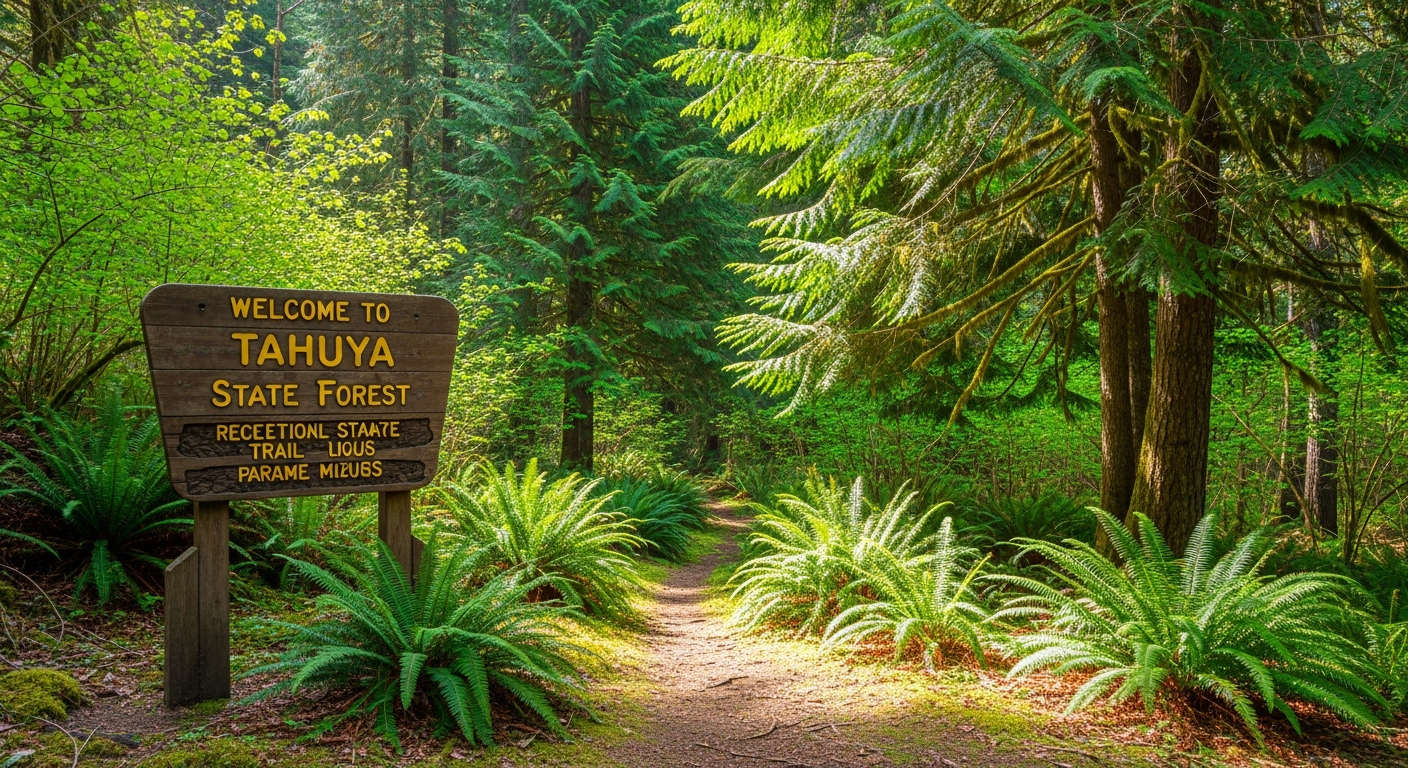
One of the things that takes new North Mason residents by surprise: you have 23,000 acres of public forest practically in your backyard. Tahuya State Forest starts about 3.5 miles west of Belfair on SR-300, and it’s the kind of year-round recreational resource that people in larger metro areas would drive two hours for. North Mason residents often make it there in under fifteen minutes.
The 2026 season is open — gates run April 15 through October 31. But a few things are worth knowing before your first trip, because Tahuya isn’t a conventional park and doesn’t operate like one.
This Is a Working Forest, Not a Preserve
Washington’s Department of Natural Resources manages Tahuya State Forest specifically to generate revenue for the state’s K-12 school trust lands — which means active timber harvesting is part of how this land is supposed to work. That has a direct effect on recreation: when logging operations are active in a section of the forest, trails in that zone get temporarily closed. This isn’t unusual, and it isn’t a sign of mismanagement. It’s the model.
Right now in spring 2026, three active timber sales — Trail Mix, Little Wrangler, and School — are affecting portions of the trail network including Randy’s H2O Stop, Mission Creek, the 1.9 Mile trail, Hoof & Tail, and the Tahuya River Trail. The Howell Lake Loop Trail is also closed due to a washed-out bridge, with no repair timeline announced by DNR.
What this means for your first visit: check conditions before you go, every time. Trails that are closed this week may be open next month as logging shifts to another section. The DNR page at dnr.wa.gov/GreenMountainTahuya is the authoritative source, and the DNR phone line at (360) 825-1631 is often more current for active timber operations.
Where to Start: Elfendahl Pass Staging Area
For your first visit, Elfendahl Pass is the right entry point. It’s the main trailhead hub — approximately 50 vehicle spaces with pull-through room for trailers, and access to the bulk of the open trail network.
To get there from Belfair: SR-300 west 3.5 miles → right on Belfair-Tahuya Road for 1.9 miles → right on Elfendahl Pass Road for 2.3 miles. The March 2025 DNR trail map (available at dnr.wa.gov/GreenMountainTahuya) shows what’s accessible from Elfendahl Pass and how the system divides between motorized and non-motorized zones.
Who Uses Tahuya and How
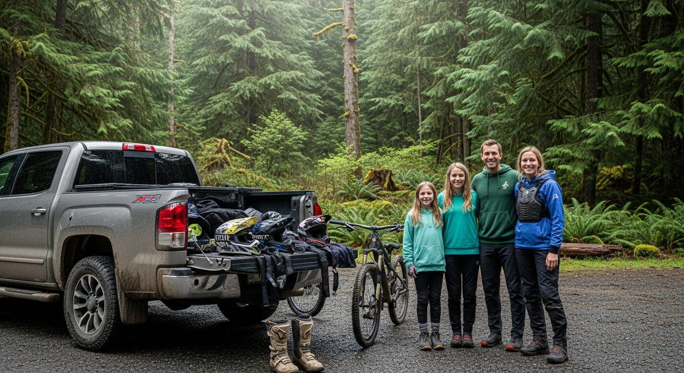
The trail system is multi-use with designated routes for different activities. ATVs, dirt bikes, and 4×4 vehicles have designated motorized routes. Mountain bikers and hikers use shared and dedicated non-motorized trails. This is one of the more heavily used ATV and off-road recreation areas in the Puget Sound region — the two communities share the system well when everyone knows their designated zone. Bring the DNR trail map, especially on your first visit.
Tahuya and the Broader North Mason Environment
If you want to understand Tahuya in the context of the broader watershed, the Tahuya River flows from the heart of the state forest down to Hood Canal. The Belfair Bugle covered the recent expansion of the Tahuya River Preserve — a separate conservation effort that has assembled 190 acres of protected land along the lower river, focused on salmon habitat restoration: Tahuya River Preserve Reaches 190 Acres.
For the full spring 2026 trail access picture, see: Know Before You Go: Spring Trail Closures at Tahuya State Forest.
Frequently Asked Questions: Tahuya State Forest for New North Mason Residents
Is Tahuya State Forest free to access?
There is no day-use fee for the trail system. A valid Washington State Discover Pass is required to park at DNR recreation sites — check dnr.wa.gov/GreenMountainTahuya for specific parking requirements at different areas within the forest.
Can I camp at Tahuya State Forest?
Yes. The forest has several primitive campgrounds accessible from the trail system. Sites are typically first-come, first-served with basic amenities. Contact DNR at (360) 825-1631 or check dnr.wa.gov/GreenMountainTahuya for current campground status and locations.
Is Tahuya State Forest different from Belfair State Park?
Yes. Belfair State Park is a Washington State Parks-managed facility on Hood Canal with camping, a beach, and 3,720 feet of shoreline. Tahuya State Forest is a DNR-managed working forest several miles inland with an extensive multi-use trail network. They’re different facilities, different agencies, and serve different recreational needs. Both are accessible from Belfair.
What’s a good first hike at Tahuya State Forest for new residents?
Start at Elfendahl Pass Staging Area and pick a non-motorized designated route from the current DNR trail map. Given the active timber closures this spring, checking the map the day of your trip is the right first step. The DNR trail map at dnr.wa.gov/GreenMountainTahuya shows what’s currently open from each staging area.
How long does it take to get to Tahuya State Forest from Belfair?
The Elfendahl Pass Staging Area is approximately 8 miles from downtown Belfair via SR-300 and Belfair-Tahuya Road — typically 15-20 minutes by car depending on conditions. The forest is one of North Mason’s most accessible natural assets.