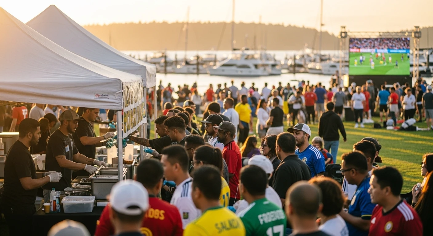
Tag: Olympic Peninsula

  • Port Townsend Guide: Victorian Seaport Town

    Discover Port Townsend: Where Victorian Charm Meets Modern Creativity

    Perched on the northeastern tip of the Olympic Peninsula, Port Townsend stands as one of the Pacific Northwest’s most distinctive communities. This Victorian seaport town, with its beautifully preserved architecture and thriving arts scene, offers a unique blend of historical significance and creative energy that attracts visitors and residents from around the world.

    Historic Downtown and Water Street

    Port Townsend’s heart beats along Water Street, where 19th-century commercial buildings house contemporary galleries, bookstores, and restaurants. The carefully preserved storefronts reflect the town’s prosperity during the maritime trade era, when Port Townsend was briefly the second-largest city in Washington Territory. Walking Water Street today, you’ll encounter authentic Victorian architecture alongside vibrant local businesses, creating an atmosphere where history and present coexist seamlessly.

    The Uptown district, perched on the bluff above downtown, showcases an impressive collection of Victorian and Edwardian mansions. These residential gems, many now converted into bed-and-breakfasts or event spaces, represent the wealth of prominent shipping magnates and merchants from the region’s golden age. A stroll through Uptown offers glimpses into Port Townsend’s prosperous past and provides excellent photo opportunities for architecture enthusiasts.

    Fort Worden: History, Art, and Innovation

    Fort Worden State Park occupies the 434-acre grounds of a historic military installation established in 1896. Originally built as part of the “Endicott Board” coastal defense system, the fort now serves as a gathering place for artists, educators, and cultural organizations. The Centrum Foundation, headquartered at Fort Worden, has transformed the former military buildings into artist residencies, performance venues, and educational spaces.

    The fort gained additional recognition as a filming location for “Where the World Was Made,” bringing Hollywood production to the peninsula and showcasing the site’s dramatic coastal views and historic architecture. Today, visitors can explore restored gun emplacements, officers’ quarters, and parade grounds while enjoying waterfront trails and Puget Sound vistas. Fort Worden represents Port Townsend’s successful transition from military significance to cultural prominence.

    The Arts and Cultural Scene

    Port Townsend has established itself as a premier destination for artists and creative professionals. The town’s active arts community encompasses visual artists, musicians, writers, and performers who have been drawn by affordable housing, natural beauty, and a supportive creative culture. Galleries throughout downtown and Uptown display local artwork, from traditional paintings to contemporary installations.

    The Centrum Foundation orchestrates numerous events and festivals throughout the year, bringing cultural programming to the peninsula. These events range from poetry workshops to jazz festivals, attracting visitors interested in experiencing the town’s intellectual and artistic vitality. The community’s commitment to supporting creative expression has made Port Townsend a magnet for people seeking an alternative lifestyle centered on art and culture.

    Dining and Local Food Culture

    Port Townsend’s restaurant scene reflects the town’s character: locally-sourced ingredients, creative preparation, and an emphasis on community gathering. Restaurants along Water Street and throughout town feature fresh seafood from local waters, produce from regional farms, and prepared goods from nearby artisans. The town’s farmers market, operating seasonally, offers residents and visitors direct access to locally-grown vegetables, fruits, and artisan products.

    The Wooden Boat Festival

    Every September, Port Townsend transforms into a maritime celebration during the Wooden Boat Festival. This beloved event draws wooden boat enthusiasts, maritime history buffs, and general visitors to the waterfront for three days of celebrations. The festival features boat races, maritime skills workshops, live music, and food vendors. It’s become one of the Pacific Northwest’s signature events, drawing thousands of attendees and generating significant economic activity for the town.

    Real Estate and Cost of Living

    Port Townsend’s real estate market reflects its desirability as a residential destination. Victorian homes in Uptown command premium prices, while modest cottages and newer construction offer more accessible entry points. The town attracts retirees seeking cultural amenities, artists seeking affordable housing and community, and remote workers drawn to the area’s quality of life. Property values have appreciated steadily as the town’s reputation has grown, though Port Townsend remains more affordable than many comparable West Coast communities.

    Getting There and Transportation

    Port Townsend is accessible via two primary routes. Drivers can take Highway 101 through the Olympic Peninsula, or take the scenic ferry route from Whidbey Island to Port Townsend. The ferry crossing provides beautiful views of Puget Sound and offers an alternative to highway driving. Once in town, most attractions are walkable or accessible via local taxi and shuttle services. The pedestrian-friendly layout makes exploring on foot the preferred way to experience Port Townsend’s charm.

    Who Lives in Port Townsend

    Port Townsend’s population of approximately 10,000 represents a diverse mix of longtime residents, newcomers, and seasonal visitors. Artists and creative professionals form a significant portion of the community, attracted by the town’s cultural reputation and supportive environment. Retirees appreciate the mild climate, cultural amenities, and community services. Remote workers and digital nomads have increasingly chosen Port Townsend as a base, attracted by reliable internet connectivity and quality of life. This demographic diversity contributes to the town’s vitality and cross-generational cultural exchange.

    Frequently Asked Questions

    What is the best time to visit Port Townsend?

    Summer months (June-September) offer the warmest weather and most events, including the Wooden Boat Festival in September. Spring and fall provide pleasant weather with fewer crowds. Winter is mild but rainy, ideal for those seeking solitude and scenic coastal views.

    How far is Port Townsend from Seattle?

    Port Townsend is approximately 80-90 miles from Seattle, roughly a 2-2.5 hour drive depending on your route through the Olympic Peninsula or via ferry connections.

    Are there hotels and accommodations in Port Townsend?

    Yes, the town offers numerous bed-and-breakfasts in Victorian homes, small hotels, vacation rentals, and campgrounds. Fort Worden also offers lodging options. It’s advisable to book in advance during summer months and festival weekends.

    What outdoor activities are available?

    Port Townsend offers hiking, kayaking, sailing, beachcombing, and fishing. Fort Worden State Park provides trails and beach access. The surrounding waters are popular for boating and marine wildlife viewing.

    Is Port Townsend a good place to live?

    Port Townsend attracts people seeking an arts-focused community, natural beauty, and small-town character. The climate is mild, amenities are good, and the community is welcoming to newcomers. Housing costs are moderate compared to other West Coast towns.

  • Grays Harbor: Aberdeen Westport Ocean Shores

    Grays Harbor: Where Industrial Heritage Meets Coastal Recreation

    Grays Harbor, located on the southwestern flank of the Olympic Peninsula, represents a distinct regional identity shaped by logging history, maritime culture, and recent revitalization efforts. The harbor encompasses several communities—Aberdeen, Hoquiam, Westport, and Ocean Shores—each with unique character while sharing a common maritime heritage and commitment to economic transformation.

    Aberdeen: Hometown of Kurt Cobain

    Aberdeen, with a population around 16,000, holds significant cultural weight in American music history as the hometown of Kurt Cobain and the birthplace of grunge. The city’s modest working-class character and isolated Pacific Northwest location provided the backdrop for Cobain’s early life and artistic development. Today, Aberdeen embraces this musical legacy while working toward broader economic and cultural revitalization.

    The timber industry shaped Aberdeen’s early prosperity, with logging and wood processing operations driving population growth and economic activity through the 20th century. As timber employment declined, Aberdeen faced economic challenges common to Pacific Northwest lumber towns. Recent initiatives have focused on heritage tourism, cultural development, and economic diversification to create sustainable futures for the community.

    Visitors interested in music history can explore sites connected to Cobain’s youth, including the Young Street Bridge featured on Nirvana’s album cover and various local landmarks. The city has carefully balanced celebrating this cultural significance with maintaining its authentic working-class character. Local restaurants, shops, and cultural venues reflect Aberdeen’s ongoing transformation while honoring its industrial heritage.

    Hoquiam: Twin City Heritage

    Hoquiam, Aberdeen’s sister city across the Wishkah River, maintains its own distinct identity while sharing the harbor’s timber and maritime heritage. The city developed as a center for wood processing and shipbuilding, with industries that supported the broader regional economy. Historic mansions in Hoquiam reflect the wealth generated by timber magnates and shipping entrepreneurs during the region’s economic height.

    Today, Hoquiam maintains important industrial operations while developing cultural tourism and heritage preservation initiatives. The city’s commitment to protecting historic architecture and celebrating regional history attracts visitors interested in Pacific Northwest industrial heritage and authentic small-town character.

    Westport: Fishing Village Culture

    Westport, situated on the peninsula’s western tip, has maintained its primary identity as a working fishing village. The working waterfront remains dominated by commercial fishing boats, fish processing facilities, and maritime commerce. Unlike many coastal communities that have transitioned toward tourism, Westport has preserved its authentic fishing culture and working-port atmosphere.

    The commercial fishing fleet based in Westport pursues groundfish, salmon, and other species in the North Pacific. The industry remains central to Westport’s identity and economy, though it has faced challenges from regulatory changes, stock fluctuations, and competition from other ports. The fishing heritage is evident in waterfront restaurants, seafood processing operations, and the strong maritime community culture.

    Whale Watching and Marine Recreation

    Despite its fishing-focused economy, Westport has become increasingly popular for marine tourism, particularly whale watching. Gray whales migrate along the coast seasonally, and whale-watching tours operating from Westport provide visitors opportunities to observe these magnificent creatures in their natural habitat. The tours operate from spring through fall, corresponding with migration and feeding seasons.

    Beyond whale watching, the waters off Westport offer exceptional opportunities for salmon fishing, halibut fishing, and deep-sea excursions. Numerous charter services operate from the harbor, providing equipment, expertise, and access to productive fishing grounds. These marine recreation activities have diversified Westport’s economy while maintaining focus on maritime heritage.

    Westport Surfing Destination

    Westport’s position on the open Pacific coast has made it an increasingly recognized surfing destination. The consistent swell patterns and powerful waves attract surfers from throughout the region. While not as famous as some California or Hawaiian breaks, Westport’s waves offer excellent conditions for intermediate to advanced surfers. Local surf shops, lodging options, and restaurants have developed to serve the growing surf community.

    Ocean Shores: Beach Resort Community

    Ocean Shores, developed in the 1960s as a planned beach resort community, represents a distinctly different vision from the working ports of Westport and Aberdeen. Located on a narrow peninsula separating Grays Harbor from the Pacific Ocean, Ocean Shores has evolved into a vacation destination featuring vacation rentals, resort hotels, restaurants, and recreational amenities.

    The community’s primary appeal centers on beach recreation: swimming, beachcombing, walking, and wildlife viewing. Ocean Shores Beach extends for miles, providing accessible recreation for visitors of all ages and abilities. The town develops seasonally, with summer months and holiday periods drawing significant visitor numbers from surrounding regions.

    Razor Clamming and Seasonal Recreation

    Ocean Shores is renowned for razor clamming, a traditional Pacific Northwest recreation that draws visitors during optimal tidal conditions. Recreational razor clamming is permitted during designated seasons, and thousands of diggers converge on the beach during open periods to harvest these prized shellfish. The activity has become iconic Pacific Northwest recreation, combining tradition, skill, and community gathering.

    Seasonal variation dominates Ocean Shores’ character and economy. Summer brings families and vacationers seeking beach time and outdoor recreation. Winter attracts smaller numbers of visitors seeking solitude, storm watching, and dramatic coastal weather. Spring and fall offer pleasant weather with fewer crowds, appealing to photographers and nature enthusiasts.

    Regional Economy and Diversification

    Grays Harbor’s economy reflects the region’s transition from resource extraction toward tourism, recreation, and service industries. While timber and fishing remain important, economic development strategies emphasize heritage tourism, outdoor recreation, and sustainable industries. Municipal governments throughout the harbor have invested in waterfront development, cultural programming, and infrastructure supporting visitor attraction.

    The region faces ongoing economic challenges and competitive pressures as traditional industries face secular decline. Revitalization efforts have had mixed success, with some communities thriving while others continue struggling. The success of Ocean Shores’ vacation industry contrasts with more difficult conditions in Aberdeen and Hoquiam, though both industrial cities continue pursuing economic diversification.

    Getting There and Visitor Information

    Grays Harbor communities are accessible via Highway 101 and connecting roads from Seattle, Portland, and surrounding regions. The drive from Seattle to Aberdeen is approximately 2.5 hours. Highway 12 provides access from the eastern Cascade region. Once in the harbor area, communities are connected by short driving distances, making it feasible to visit multiple towns during a single trip.

    Frequently Asked Questions

    What is Aberdeen known for besides Kurt Cobain?

    Aberdeen was historically significant as a timber industry center and port city. The city maintains working waterfront infrastructure, historic architecture, and maritime heritage. Recent revitalization efforts emphasize cultural tourism, local businesses, and economic diversification beyond resource extraction.

    When is the best time for whale watching in Westport?

    Gray whales migrate along the coast seasonally, with peak viewing typically from April through May during northbound migration and December through January during southbound migration. Whale-watching tours operate during these periods, weather permitting.

    What is razor clamming and when can you participate?

    Razor clamming is the recreational harvest of razor clams from Ocean Shores Beach. The Washington Department of Fish and Wildlife designates specific open seasons based on ocean conditions and clam populations. Participants dig for clams during low tide periods using specialized tools.

    Is Ocean Shores crowded year-round?

    Ocean Shores experiences significant seasonal variation. Summer months and holidays are busy with vacationing families. Winter is quiet, with storms and dramatic weather attracting visitors seeking natural spectacle. Spring and fall offer pleasant weather with moderate crowds.

    Can you eat fresh fish in Westport?

    Yes, numerous waterfront restaurants in Westport serve fresh local seafood, including salmon, halibut, groundfish, and Dungeness crab. Fish-and-chips establishments offer casual dining, while full-service restaurants provide more upscale preparations of local catches.

  • Olympic Peninsula Food Farm Guide

    Culinary Treasures of the Olympic Peninsula: Food, Farms, and Flavors

    The Olympic Peninsula’s pristine waters, temperate climate, and agricultural diversity create one of the Pacific Northwest’s most distinctive food cultures. From oyster farms harvesting premium shellfish to Sequim’s lavender capital status, the peninsula’s food identity reflects both natural bounty and the dedication of farmers, fishers, and culinary professionals who have built a regionally renowned food scene.

    Shellfish Farming and Oyster Culture

    The peninsula’s estuaries and coastal waters have supported shellfish farming for generations, making the region renowned for premium oysters, clams, and mussels. Taylor Shellfish, one of the region’s largest and most respected producers, operates farms throughout the peninsula, selling directly to consumers, restaurants, and retailers. The company’s commitment to sustainable practices and quality has made it a model for Pacific Northwest aquaculture.

    Hama Hama Oyster Company, operating one of the Pacific Northwest’s most picturesque oyster operations, has become a destination in itself. Visitors can purchase fresh oysters directly from the farm, enjoy them at the on-site bar, or learn about oyster farming from knowledgeable staff. The company’s emphasis on quality, sustainability, and direct consumer connection has made it emblematic of the regional oyster renaissance.

    Xinh’s Clam and Oyster House brings Vietnamese culinary tradition to the region’s shellfish bounty, offering preparations that highlight the fresh quality of local harvests. This fusion of regional ingredients with Southeast Asian techniques exemplifies the peninsula’s evolving food culture, where local products meet diverse culinary perspectives.

    Sequim Lavender: From Farm to Table

    Sequim’s transformation into the “Lavender Capital of North America” represents one of the peninsula’s most remarkable agricultural stories. The rain shadow climate enables lavender cultivation on dozens of farms throughout the region. What began as a specialty crop has evolved into a significant agricultural sector and tourist attraction, with farms producing lavender flowers, essential oils, culinary products, and artisanal goods.

    Sequim Lavender Festival, held annually in mid-July, draws tens of thousands of visitors to experience peak bloom and participate in farm tours, workshops, and celebrations. Beyond the festival, visitors can tour farms year-round, purchase fresh and dried lavender, and enjoy lavender-infused foods and beverages. Local restaurants have incorporated lavender into sophisticated dishes, incorporating this distinctive flavor into their culinary offerings.

    Dungeness Crab and Seafood Heritage

    Dungeness crab, named after the geographic feature near Sequim, represents the peninsula’s most iconic seafood. The cold waters off the Olympic coast produce some of the finest Dungeness crab in North America. Crab fishing forms the foundation of the region’s seafood economy and culinary identity, with numerous restaurants and fish markets emphasizing this prized resource.

    Seasonal crab availability drives dining experiences throughout the peninsula. Winter months bring peak-quality crab to market, with restaurants featuring crab in traditional preparations like crab cakes, crab pasta, and cioppino. Local fish markets sell live crabs and prepared crab products, enabling residents and visitors to cook with premium seafood in their own kitchens.

    Salmon Fisheries and Pacific Heritage

    Salmon remains central to the peninsula’s food culture and indigenous heritage. Wild salmon from the peninsula’s rivers and coastal waters have sustained communities for thousands of years. Modern fisheries continue this tradition while facing challenges from declining stocks and environmental changes. Farm-raised salmon operations supplement wild harvests, providing consistent availability for restaurants and consumers.

    Salmon preparation remains deeply embedded in regional cuisine. Smoked salmon, grilled whole salmon, and salmon fillets appear on menus throughout the peninsula. Traditional preparation methods reflect both indigenous heritage and modern culinary techniques. The Makah, Quinault, and other tribal nations continue salmon traditions while also participating in contemporary commercial fisheries.

    Farmers Markets and Local Produce

    Seasonal farmers markets throughout the peninsula connect producers directly with consumers, supporting local agriculture and building community. Port Townsend, Sequim, Port Angeles, and other communities operate farmers markets during growing seasons. These markets offer fresh vegetables, fruits, flowers, baked goods, and artisanal products produced by regional farmers and food makers.

    Peninsula farmers cultivate diverse crops enabled by varied microclimates and soil types. While western areas are cooler and wetter, eastern portions enjoy drier conditions suitable for different varieties. This agricultural diversity supports farm-to-table restaurants throughout the peninsula, enabling chefs to source seasonal, locally-grown ingredients that define contemporary Pacific Northwest cuisine.

    Farm-to-Table Restaurants

    The peninsula’s dining scene increasingly emphasizes direct connections between restaurants and local producers. Chefs working in Port Townsend, Port Angeles, Sequim, and other communities prioritize relationships with farmers, fishers, and food makers. This philosophy drives menu development, seasonal variation, and culinary creativity focused on celebrating regional bounty.

    Fine dining establishments offer sophisticated preparations of local ingredients, from heritage vegetable preparations to innovative seafood dishes. Casual restaurants and cafes emphasize local sourcing in burgers, sandwiches, and comfort food. This farm-to-table movement spans dining categories, reflecting shared commitment to place-based food culture.

    Wineries and Cideries

    The peninsula’s cool maritime climate produces distinctive wines and ciders. Local wineries and cideries emphasize quality production, with some establishing strong reputations for distinctive regional products. Tasting rooms throughout the peninsula offer visitors opportunities to experience local productions while learning about the unique terroir that shapes peninsula beverages.

    U-Pick Berries and Seasonal Harvests

    Seasonal u-pick operations allow visitors and residents to harvest fresh berries directly from the fields. Strawberries, raspberries, marionberries, and other fruits thrive in peninsula microclimates. These hands-on experiences connect people with food production while enabling families to harvest premium-quality fruit for fresh consumption or home preservation.

    Food Festivals and Events

    The peninsula celebrates its food culture through numerous festivals and events. Seafood festivals feature local catches prepared by regional chefs. Lavender festivals combine farm experiences with culinary programming. Farmers market seasons culminate in fall harvest celebrations. These events attract visitors while strengthening community connections to food and agriculture.

    Frequently Asked Questions

    Where can you eat fresh oysters on the Olympic Peninsula?

    Hama Hama Oyster Company offers fresh oysters at their on-site bar. Numerous restaurants throughout the peninsula serve locally-harvested oysters. Oyster bars in Port Townsend, Port Angeles, and Westport provide casual oyster-focused dining experiences.

    What is the best time to visit Sequim lavender farms?

    Peak bloom occurs in July, with the Sequim Lavender Festival held in mid-July attracting maximum visitors and activity. Farms operate year-round, but blooming season offers the most picturesque experiences with purple fields in full flower.

    Where can you buy Dungeness crab directly?

    Fish markets and seafood shops throughout the peninsula sell live Dungeness crab and crab products. Waterfront restaurants feature fresh crab in numerous preparations. Local fishing communities like Westport offer direct purchasing opportunities during crab season.

    Are there farmers markets on the Olympic Peninsula?

    Yes, seasonal farmers markets operate in Port Townsend, Sequim, Port Angeles, and other communities during growing seasons. These markets feature fresh produce, baked goods, flowers, and artisanal products from regional farmers and food makers.

    Can you go berry picking on the Olympic Peninsula?

    Yes, several u-pick operations allow visitors and residents to harvest fresh berries seasonally. Strawberries, raspberries, marionberries, and other fruits are available during their respective harvest seasons. Contact local visitor bureaus for current u-pick locations and operating schedules.

  • Olympic Peninsula Travel Guide: The Complete Resource

    The Olympic Peninsula is one of the Pacific Northwest’s most extraordinary destinations—a place where temperate rainforest, alpine peaks, dramatic coastline, and small towns converge within a few hours’ drive. Spanning roughly 100 miles across northwestern Washington, the peninsula encompasses everything from the misty old-growth valleys of the Hoh to the wind-sculpted beaches of the coast and the snow-capped heights of the Olympic Mountains.

    What Is the Olympic Peninsula?

    The Olympic Peninsula is a large geographic region in Clallam, Jefferson, Mason, and Kitsap counties. It’s bounded by the Pacific Ocean to the west, the Salish Sea to the north and east, and Hood Canal to the southeast. The region covers roughly 3,600 square miles and is home to approximately 150,000 people, though much of that population clusters in towns like Port Angeles, Bremerton, and Poulsbo. The heart of the peninsula—the Olympic National Park—protects over 900,000 acres of pristine wilderness.

    What makes the peninsula truly unique is its incredible geographic diversity. You can drive from rainforest to alpine meadow to rocky beach in a single afternoon. The Olympic Mountains create a natural rain shadow on the eastern side, so climate and vegetation vary dramatically depending on where you are.

    How to Get There

    By Car

    Most visitors drive to the Olympic Peninsula via I-5 from Seattle or Olympia. From Seattle, you can reach the eastern gateway towns (like Bremerton) in 1-1.5 hours via US-101 south. To reach the western side (Port Angeles, Forks), plan 3.5-4.5 hours from Seattle.

    By Ferry

    The Washington State Ferries system provides a scenic alternative. The Bremerton Ferry from Seattle to Bremerton takes 65 minutes and puts you in Kitsap County—the gateway to the peninsula. From there, it’s 90 minutes to the national park. The Port Townsend–Keystone and Port Townsend–Whidbey Island ferries offer other northbound routes.

    By Air

    Fly into Seattle-Tacoma International Airport (Sea-Tac), then rent a car and drive. There are small regional airports in Port Angeles (William R. Fairchild International), but commercial service is limited.

    The Peninsula’s Regions and Towns

    Eastern Gateway: Kitsap County

    Bremerton, Silverdale, and Poulsbo are your first stop if coming from Seattle. Bremerton is a working naval city with a revitalized downtown and ferry access to Seattle. Poulsbo is a charming waterfront town with Scandinavian heritage. This region is the most accessible and developed part of the peninsula.

    North Central: Port Townsend and Port Ludlow

    Victorian Port Townsend sits on the Quimper Peninsula with arts, culture, and some of the Salish Sea’s best seafood. Port Ludlow is a quieter resort community. Both are gateways to the northern Olympic Peninsula and the San Juan Islands.

    Northern Gateway: Port Angeles

    Port Angeles is the largest town on the peninsula’s north shore and the primary gateway to Olympic National Park. It’s a working deepwater port with a waterfront, downtown restaurants, and dozens of lodging options. The town serves as a hub for visitors heading to Hurricane Ridge, the Dungeness Spit, and the park’s eastern entrances.

    Western Wild: Forks and the Pacific Coast

    Forks is a small logging town that’s become a quirky tourist destination (partly due to the Twilight books). From here, you access Rialto Beach, La Push, Quillayute River, and some of the peninsula’s most remote hiking. This is genuine frontier territory—weathered, authentic, and sparsely populated.

    Southern Edge: Hoodsport and Lake Quinault

    These communities sit along Hood Canal and the southern edge of the national park. Lake Quinault offers rain forest hikes and the historic Lake Quinault Lodge. Hoodsport is known for shellfishing and summer tourism.

    Best Times to Visit

    Summer (July–September)

    Warmest, driest weather. High elevation roads are open. Campgrounds and lodges book solid. Crowds are thick in the national park. If you want guaranteed sunshine and reliable access to all areas, summer is your window.

    Spring (April–June)

    Shoulder season. Wildflowers bloom in subalpine meadows by late May. Weather is unpredictable but often pleasant. Fewer crowds, lower prices, and camping spots available. Some higher elevation trails still have snow in May.

    Fall (October–November)

    Clear skies return. Fall colors peak in early October. Weather cools and wetness increases as November approaches. Excellent for hiking. Tourist season is over, making this underrated for serious travelers.

    Winter (December–March)

    The wettest season. Hurricane Ridge and Obstruction Point roads close due to snow. Lower elevations remain accessible. Winter storms bring dramatic coastal scenes. Perfect if you love solitude and don’t mind rain. Least expensive time to visit.

    Driving Loops and the US-101 Peninsula Traverse

    The quintessential Olympic Peninsula experience is driving the US-101 loop that circles the peninsula. This scenic highway connects all major regions in a roughly circular route, allowing you to experience rainforest, mountains, and ocean in a single drive.

    Starting from Olympia and heading north, US-101 passes through Shelton (gateway town), then climbs toward the Hood Canal corridor. From there, it hugs the canal’s western shore before turning west toward the Hoh Rain Forest. The highway then heads to Forks, down to the wild coast, and back east along the northern shore to Port Angeles and beyond.

    A comprehensive loop takes 5-7 days to drive and explore properly. You can shorten it to 3-4 days if you skip side trips to Hurricane Ridge or the Hoh.

    What Makes the Olympic Peninsula Unique

    Few places on Earth offer such diverse ecosystems within such a compact area. The temperate rainforests of the Hoh and Quinault valleys support massive Sitka spruce, western red cedar, and western hemlock—some 500+ years old. Alpine meadows explode with wildflowers. Rocky beaches are sculpted by constant Pacific swells. And the Olympic Mountains create stunning vistas from a dozen viewpoints.

    The peninsula is also genuinely remote. Much of it remains wilderness. You can hike all day and see only a handful of people. Cell service disappears in many areas. This wildness is both the appeal and the challenge—you need to be prepared, but the payoff is solitude and authentic experience.

    Budget Considerations

    Lodging

    Budget motels: $70-100/night. Mid-range hotels: $120-200/night. Vacation rentals and B&Bs: $100-250/night. Camping: $15-35/night. Peak summer rates jump 25-40%.

    Food

    Casual dining: $12-18 per entree. Mid-range restaurants: $18-35. Groceries at local markets are slightly above Seattle prices due to distance.

    Attractions

    Olympic National Park entrance: $35/vehicle (7-day pass). Most hiking is free. Some lodges and attractions (lake cruises, ranger programs) run $15-50.

    Total Budget for a 5-Day Trip

    Couple traveling in summer: $1,500-2,500. Budget travelers: $800-1,200. Families of four: $2,000-3,500. Winter travel is 20-30% cheaper.

    Planning Your Visit

    Start by deciding which regions appeal most. If you want urban amenities and quick access, base yourself in Bremerton or Port Townsend. If wilderness and solitude are priorities, head to Forks or the Hoh. Allow at least 3-4 days for a meaningful visit. Rent a car—public transportation is minimal. Book lodging and campgrounds 2-3 months ahead in summer, especially if you want specific dates.

    What is the Olympic Peninsula known for?

    The Olympic Peninsula is renowned for its incredible geographic diversity: temperate rainforests, alpine mountains, dramatic coastlines, and remote wilderness—all within a few hours’ drive. It’s home to Olympic National Park and some of the Pacific Northwest’s most pristine outdoor recreation.

    How long does it take to explore the Olympic Peninsula?

    A comprehensive visit takes 5-7 days to drive the US-101 loop and explore multiple regions. You can see highlights in 3-4 days if you focus on one area. Many people spend 1-2 weeks for a deeper experience.

    When is the best time to visit the Olympic Peninsula?

    Summer (July-September) offers the most reliable weather and access, though it’s crowded. Fall (September-November) provides excellent weather with fewer crowds. Spring brings wildflowers; winter offers solitude and dramatic storms.

    Can I visit the Olympic Peninsula without a car?

    It’s challenging. Ferry access reaches Bremerton and Port Townsend, but exploring the peninsula requires a vehicle. Some towns have limited local transit, but you’ll miss most attractions without a car.

    What should I pack for the Olympic Peninsula?

    Waterproof jacket, layered clothing (weather changes rapidly), sturdy hiking boots, rain gear, and a good map or GPS. Even in summer, the weather can turn wet quickly. Bring bear canisters if backcountry camping.

  • Olympic National Park: Everything You Need to Know

    Olympic National Park is a crown jewel of the American wilderness—a 922,000-acre protected landscape that encompasses three distinct and utterly different ecosystems within its boundaries. Few places on Earth allow you to hike through temperate rainforest, climb to alpine peaks, and walk rocky beaches within the same day. Whether you’re a first-time visitor planning logistics or a seasoned backpacker seeking deep wilderness, this comprehensive guide covers everything you need to know.

    Park Overview: Three Ecosystems in One

    Olympic National Park is unique because it protects three dramatically different environments simultaneously.

    The Temperate Rainforest

    The western side of the park receives 140+ inches of rain annually, creating some of the most lush temperate rainforest in North America. Ancient Sitka spruce, western red cedar, and western hemlock tower 200+ feet overhead, draped in moss. The Hoh, Quinault, and Bogachiel river valleys are the primary rainforest zones. These valleys are relatively accessible and offer trails ranging from easy to moderate difficulty.

    The Alpine Meadows and Mountains

    The park’s interior and northern sections are dominated by the Olympic Mountains, featuring subalpine meadows, glaciated peaks, and stunning vistas. Hurricane Ridge, the park’s most accessible high-elevation area, sits at 5,242 feet and provides panoramic views. The summit of Mount Olympus (7,965 feet) is one of the most challenging peaks in the park.

    The Wild Pacific Coastline

    Twenty-five miles of undeveloped beach lie within the park boundaries, featuring sea stacks, tide pools, sea caves, and abundant wildlife. Rialto Beach, Shi Shi Beach, and Point of Arches are the most popular coastal areas. The rocky reefs shelter starfish, sea anemones, and other marine life.

    Entrance Fees and Passes

    Vehicle Pass

    $35 per vehicle for a 7-day pass. This is your single entry fee regardless of which area you visit. Once paid, you can enter multiple park entrances within the 7-day window.

    Motorcycle Pass

    $30 per motorcycle for 7 days.

    Individual Pass (Walking/Biking)

    $20 per person on foot or bicycle for 7 days.

    Annual Pass

    $80 for unlimited entries throughout the year. Good value if you plan multiple visits.

    America the Beautiful Pass

    $80 per year for entry to all national parks. Excellent if you visit multiple parks.

    Payment accepted at entrance stations and online. Some facilities accept credit cards; others are cash-only.

    Best Areas to Visit

    Hurricane Ridge

    The most accessible high-elevation experience. Located 17 miles south of Port Angeles, the ridge sits at 5,242 feet with panoramic views of the Olympic Mountains, Puget Sound, and the Strait of Juan de Fuca on clear days. The Hurricane Ridge Road closes seasonally (typically November–March) due to snow. Short walks include the paved Hurricane Ridge Trail (1.6 miles round trip) and Hurricane Hill Trail (3 miles round trip). Longer options include the Obstruction Point Road (for more views) and the Hoh Head Trail. Visitor center, restrooms, and a small café are available.

    Hoh Rain Forest

    The crown jewel of the park’s western side. Located near the town of Forks, the Hoh offers easy, popular trails through ancient forest. The Hall of Mosses Trail (3 miles round trip) is one of the most photographed hikes in the Pacific Northwest. The Hoh River Trail extends 17.3 miles one-way along the river, ascending gradually through forest. Camping and a visitor center are available. The Hoh is your best bet for casual rainforest experience without technical difficulty.

    Rialto Beach and La Push

    Located 14 miles west of Forks, Rialto Beach offers immediate access to rocky coastline with sea stacks and tide pools. The beach is accessible via a short 0.3-mile walk. Further exploration along the coast requires navigation of tidal zones and rocky terrain. La Push proper is a small coastal village with several short beach walks. This area is best visited at low tide; consult tide tables before planning.

    Sol Duc Hot Springs

    Located 40 miles south of Port Angeles, Sol Duc combines natural hot springs (operated by a private concessionaire) with hiking access. The Sol Duc River Trail is a popular moderate 1.6-mile walk to cascades. The park’s hot springs pools are maintained year-round. A resort with lodging, restaurant, and store is available. This area offers an easy way to combine bathing and hiking.

    Staircase Rapids

    Located on the Hood Canal’s western shore (south of Shelton), Staircase offers access to the less-crowded eastern side of the park. The Staircase Rapids Trail is a moderate 2-mile walk along the North Fork Skokomish River. Backpacking routes extend into the remote interior. A ranger station and small campground are available. Fewer crowds than western park areas.

    Camping and Lodging

    Campgrounds

    The park operates 15 campgrounds ranging from walk-in sites to large facilities with amenities. Peak season (June–September) fills quickly; reserve 2–3 months ahead. Typical fees: $24–32 per night. Popular campgrounds: Hoh (90 sites), Sol Duc (82 sites), Mora (94 sites for beach access). Backcountry camping requires a permit ($8 per night, 1–5 person group). Permits are distributed via lottery system and walk-up at ranger stations.

    Lodges and Hotels

    Limited in-park lodging. Lake Quinault Lodge (historic, $150–250/night) and Sol Duc Hot Springs Resort ($150–300/night) are the main options. Nearby towns offer additional lodging: Port Angeles, Forks, Port Townsend, and Hoodsport have motels, B&Bs, and vacation rentals ($70–250/night).

    Seasonal Access and Road Closures

    Summer (July–September)

    All major roads open. Campgrounds and lodges at capacity. Weather reliable (though rain is always possible). Longest daylight hours for hiking.

    Spring (April–June)

    Hurricane Ridge Road opens by late May if conditions allow. Remaining roads accessible. Wildflower blooms peak late May through June. Unpredictable weather.

    Fall (September–November)

    Excellent hiking weather. All roads typically open until November. Fall colors peak in early October. Fewer crowds.

    Winter (December–March)

    Hurricane Ridge Road and Obstruction Point typically closed due to snow. Lower elevation areas (Hoh, Quinault, coastal) remain accessible. Winter storms. Best time for solitude.

    Wildlife

    The park is home to Roosevelt elk (largest Cascadian subspecies), black bears (rarely seen on trails), mountain goats, mule deer, and mountain lions (extremely rare to see). Marine mammals include sea otters, seals, and sea lions near the coast. Birdlife is abundant—eagles, owls, ravens, and pileated woodpeckers.

    Bear safety: Store food in bear boxes at campsites. Backcountry campers use bear canisters or hang food. Never approach wildlife. Give elk at least 25 yards of distance.

    Ranger Programs and Visitor Services

    The park offers ranger-led programs (campfire talks, guided hikes, educational programs) seasonally, primarily June–September. Visitor centers at Port Angeles, Hoh, and Staircase provide orientation and information. Rangers can advise on conditions, wildlife, and trail recommendations.

    Accessibility

    The Hoh Rail Trail near the visitor center is wheelchair-accessible (0.8 miles). The paved Hurricane Ridge Trail near the visitor center is mostly wheelchair-accessible. Many other areas have limited accessibility for people with mobility challenges, though the park is continuously improving accommodations. Contact visitor services for specific needs.

    Tips for First-Time Visitors

    Pick One or Two Zones

    Don’t try to see everything in one trip. Focus on rainforest, mountains, or coast. The park is vast; depth beats breadth.

    Weather Preparedness

    Bring rain gear in any season. Expect rapid weather changes. Layer clothing.

    Timing

    Start hikes early. Trails get crowded mid-morning. Evening light is golden but days are short in shoulder seasons.

    Permits and Reservations

    Book campsites 2–3 months ahead in summer. Backcountry permits are lottery-based; submit requests in advance or get walk-up permits from ranger stations.

    Fuel and Supplies

    There is no fuel inside the park. Towns like Port Angeles, Forks, and Port Townsend have gas stations. Grocery stores are limited; bring supplies from Seattle if possible.

    What are the three ecosystems in Olympic National Park?

    The park protects temperate rainforest (Hoh and Quinault valleys), alpine meadows and mountains (including Hurricane Ridge), and wild Pacific coastline (Rialto Beach, Shi Shi Beach). Each ecosystem is distinct and offers different hiking, scenery, and wildlife experiences.

    How much does it cost to enter Olympic National Park?

    $35 per vehicle for a 7-day pass, $30 for motorcycles, $20 for individuals on foot or bicycle. An annual pass costs $80. Once paid, your pass is valid at all park entrances for 7 days.

    What is the best time to visit Olympic National Park?

    Summer (July–September) offers the most reliable weather and access, though crowds are highest. Fall (September–November) provides excellent hiking and fewer people. Spring brings wildflowers; winter offers solitude but limited road access.

    Can I camp in Olympic National Park?

    Yes. The park operates 15 campgrounds ($24–32/night). Reservations are required for peak season and should be made 2–3 months ahead. Backcountry camping requires a permit ($8/night) distributed via lottery and walk-up at ranger stations.

    What wildlife is found in Olympic National Park?

    Roosevelt elk, black bears, mountain goats, mule deer, and mountain lions inhabit the park. Marine mammals like sea otters and seals are found along the coast. Birdlife includes eagles, owls, and woodpeckers. Wildlife encounters on trails are rare.

  • Best Hikes on the Olympic Peninsula Ranked

    The Olympic Peninsula is a hiker’s paradise with trails ranging from gentle walks through ancient rainforest to challenging alpine scrambles with 2,000-foot elevation gains. Whether you’re a casual walker looking for accessible trails or a backcountry veteran seeking multi-day adventures, this comprehensive ranking covers the peninsula’s best hikes across all difficulty levels and regions.

    Easy Hikes (Under 5 Miles, Minimal Elevation Gain)

    1. Hall of Mosses Trail – Hoh Rain Forest

    Distance: 3 miles round trip. Elevation gain: 200 feet. This is the peninsula’s most iconic easy hike. Towering Sitka spruce and western red cedar form a cathedral-like canopy, with massive moss-covered trees creating an otherworldly green world. The trail is well-maintained, relatively flat, and heavily traveled. Best visited early morning or off-season to avoid crowds. Trailhead parking often fills by 9 a.m. in summer.

    2. Marymere Falls Trail – Sol Duc

    Distance: 2 miles round trip. Elevation gain: 300 feet. A delightful walk through old-growth forest to a 90-foot waterfall. Less crowded than Hall of Mosses but equally beautiful. The trail ascends gradually alongside the Sol Duc River. Excellent for families with children. Trailhead near Sol Duc Hot Springs Resort.

    3. Staircase Rapids Trail – Staircase

    Distance: 2 miles round trip. Elevation gain: minimal. A flat, accessible walk along the North Fork Skokomish River with views of rapids. One of the least crowded major trails. Excellent for quiet forest immersion. Longer backpacking routes extend from this trailhead.

    4. Dungeness Spit Beach Walk – Sequim

    Distance: Up to 6.8 miles round trip (depending on how far you walk). Elevation gain: none. Not technically in the national park but on the peninsula’s north shore. A long sand spit extending into the Strait of Juan de Fuca. Birdwatching, sea views, and lighthouse access. Tide dependent; check tide tables.

    5. Rialto Beach Loop – La Push

    Distance: 3 miles round trip (beach walk). Elevation gain: minimal. Rocky beach walk with sea stacks, tide pools, and sea caves. Requires tide awareness. Best visited at low tide. Access Hole-in-the-Wall sea cave formation. Can be extended by walking further along coast or to Shi Shi Beach (more technical). Highly popular.

    Moderate Hikes (5–10 Miles, 500–1,500 Feet Elevation Gain)

    6. Hurricane Hill Trail – Hurricane Ridge

    Distance: 3 miles round trip. Elevation gain: 700 feet. Stunning alpine views from 5,757 feet. The trail climbs steeply through subalpine meadows to a summit with 360-degree views of the Olympics, Puget Sound, and the Cascades. Wildflowers in late June through July. Weather changes rapidly; start early. High elevation means this is popular in good weather.

    7. Hoh River Trail – Hoh Rain Forest

    Distance: 6 miles round trip (easy version) or 17.3 miles one-way (backpacking route). Elevation gain: gradual 500 feet over 6 miles. Following the Hoh River through rainforest, this is the gateway to Mount Olympus. The first 6 miles are well-trodden and rewarding. The trail continues deep into the park for ambitious backpackers. Multiple campsites along the route.

    8. Shi Shi Beach and Point of Arches – Neah Bay

    Distance: 7 miles round trip (beach walk). Elevation gain: minimal (steep descent to beach, then coastal hiking). A remote and wild beach on the peninsula’s northwest tip. Requires tide awareness and camping permission from the Makah Nation. Sea arches, natural beauty, and solitude. More technical than Rialto Beach.

    9. Obstruction Point Road Overlooks – Hurricane Ridge

    Distance: Variable 1–3 miles depending on stops. Elevation gain: 500–1,000 feet from roadside pullouts. A scenic drive with multiple short walking overlooks (Elk Overlook, Obstruction Point, etc.). Combines driving and hiking. Wildflowers and alpine views. Seasonally closed (typically November–March).

    10. Mount Ellinor Trail – Hoodsport

    Distance: 6.8 miles round trip. Elevation gain: 2,500 feet (this is a challenge). One of the Olympic Peninsula’s most prominent peaks (5,944 feet) with views of Hood Canal and the mountain range. The trail climbs relentlessly through forest then scree to open summit meadows. Wildflowers peak in late June. Requires good fitness. Scrambling on the final section. Trailhead is 1.5 hours from Port Angeles.

    Difficult Hikes (10+ Miles, 1,500+ Feet Elevation Gain, or Technical Terrain)

    11. Enchanted Valley Trail and Pony Bridge Camp – Remote Interior

    Distance: 12 miles round trip to Pony Bridge, 26+ miles for full traverse. Elevation gain: 1,200 feet to camp. One of the most remote and pristine backpacking routes on the peninsula. The trail ascends gradually through rainforest, following the Quinault River. Crosses multiple bridges. Reaches a stunning U-shaped glacial valley ringed by waterfalls cascading from cliffs. Waterfall caves and permanent waterfalls. Requires backpacking permit and multiple days.

    12. Mount Olympus – Hoh Rain Forest

    Distance: 17 miles round trip. Elevation gain: 3,563 feet to summit (7,965 feet). This is the peninsula’s most famous peak and a serious endeavor. The Hoh River Trail leads to base camp (6 miles), then steep forest to Blue Glacier (one of the few remaining glaciers on the peninsula). Non-technical but exposed final approach. Requires mountaineering skill, crampons, and ice axe experience on glacier. Best climbed July–September when snow is minimal.

    13. Royal Basin Backpack – Bailey Range

    Distance: 8 miles to basin, 15+ miles for loop. Elevation gain: 2,000+ feet. A high alpine basin surrounded by meadows and peaks. Spectacular wildflowers (peak late July/early August). Requires stream crossings and off-trail navigation. Fewer crowds than other major trails. Trailhead at Dungeness River area (north side).

    14. Quilcene-Dosewallips Loop – Hood Canal Interior

    Distance: 10+ miles. Elevation gain: 3,000+ feet. A challenging high-elevation loop on the Hood Canal side of the park. Alternates between rainforest and alpine terrain. Requires navigation skills and stream crossings. Excellent wildlife habitat. Less-used trail; conditions can be challenging. Permits required for backcountry camping.

    15. Shi Shi Beach Multi-Day Backpack – Northwest Coast

    Distance: 15+ miles along the coast. Elevation gain: variable (beach walking with some bluff sections). A remote multi-day coastal adventure. Requires tide awareness, rock scrambling, and Makah Nation permits. Camping at designated sites. Pristine beaches, sea caves, and wildlife. One of the peninsula’s finest wilderness experiences. Challenging logistics but rewarding.

    Hiking By Region and Access

    Rainforest (Hoh, Quinault, Bogachiel)

    Best for: Moss-covered trees, river corridors, wildlife. Access: Drive to Forks, then to trailheads. Most popular: Hall of Mosses, Hoh River Trail.

    Alpine (Hurricane Ridge, Obstruction Point, Bailey Range)

    Best for: Panoramic views, wildflowers, sub-alpine meadows. Access: Hurricane Ridge Road from Port Angeles. Seasonal closures possible. Most popular: Hurricane Hill, Obstruction Point overlooks.

    Coastal (Rialto Beach, Shi Shi Beach, Dungeness Spit)

    Best for: Sea stacks, tide pools, marine life. Access: From La Push (Rialto), Neah Bay (Shi Shi), Sequim (Dungeness). Tide-dependent. Most popular: Rialto Beach.

    Remote Interior (Enchanted Valley, Royal Basin, Quilcene-Dosewallips)

    Best for: Solitude, pristine wilderness, wildlife. Access: Multiple points around the park. Requires backcountry permits and navigation. Fewer crowds but more challenging logistics.

    Seasonal Considerations

    Spring (April–June)

    Wildflowers emerge. Snow melts from lower trails by late May. Higher elevation trails (above 4,000 feet) may have lingering snow through June. Stream crossings can be challenging due to runoff.

    Summer (July–September)

    All trails fully accessible. Best conditions for hiking. Peak wildflower bloom in late July/early August. High elevation peaks are snow-free. Maximum crowds on popular trails.

    Fall (September–November)

    Fall colors peak early October. Weather clear but cooler. Lower crowds. Higher elevation snow by late October. Stream crossings more manageable.

    Winter (December–March)

    Lower elevation rainforest trails accessible. Higher elevation trails (above 3,000 feet) require winter gear. Shorter daylight hours. Minimal crowds.

    Essential Hiking Tips

    Permits and Reservations

    Day hikes don’t require permits. Backcountry camping requires permits ($8/night). Submit permits 1–5 months in advance via lottery or obtain walk-up permits from ranger stations same day.

    Gear Essentials

    Waterproof jacket, layered clothing, sturdy hiking boots, trekking poles for muddy/rooty trails, high-SPF sunscreen (UV exposure increases with elevation), insect repellent (mosquitoes peak July–August), bear bell (optional but recommended), water filter or treatment.

    Trailhead Conditions

    Check current conditions via nps.gov/olym before heading out. Trails can be muddy, bridged sections collapse, and blowdowns occur. Parking at popular trailheads fills early; arrive before 8 a.m. in summer.

    Wildlife Safety

    Black bears and mountain lions inhabit trails; neither is aggressive if given space. Store food in bear boxes at campsites. Make noise while hiking. Elk can be dangerous; maintain 25 yards distance. Never feed any wildlife.

    Water

    No water sources along short day hikes; bring 2–3 liters. Backcountry water is available but requires treatment (filter or purification tablets). Never assume water is safe without treatment.

    What are the best easy hikes on the Olympic Peninsula?

    Hall of Mosses Trail (3 miles, Hoh), Marymere Falls (2 miles, Sol Duc), Staircase Rapids (2 miles), and Dungeness Spit (up to 6.8 miles) are excellent easy options. All offer beautiful scenery with minimal elevation gain and are accessible to most fitness levels.

    How difficult is Mount Olympus?

    Mount Olympus is a serious mountaineering challenge. The 17-mile round trip includes 3,563 feet of elevation gain plus glacier travel. Requires ice axe, crampons, and mountaineering experience. Best attempted July–September. Even experienced climbers should allow 2–3 days.

    What is the best time to see wildflowers on Olympic Peninsula hikes?

    Peak wildflower season is late July through early August in alpine areas. Lower elevation meadows peak in late June. Spring (May–June) brings early blooms at lower elevations. Fall colors are best in early October.

    Do I need a permit for day hikes on the Olympic Peninsula?

    Day hikes don’t require permits. Only backcountry camping requires permits ($8/night). Permits are distributed via lottery and walk-up at ranger stations.

    How muddy are Olympic Peninsula trails?

    Rainforest trails (Hoh, Quinault) are frequently muddy and root-choked. Bring good boots with grip. Trails dry out in late summer. Alpine trails are mostly rocky. Coastal trails vary depending on tide and season.

  • Kitsap County Guide: Bremerton Poulsbo Silverdale

    Kitsap County is the Olympic Peninsula’s gateway—the first major populated region visitors encounter when arriving from Seattle and the most accessible jumping-off point for peninsula exploration. Anchored by Bremerton (a working naval city undergoing downtown renaissance), flanked by charming Poulsbo and Silverdale, Kitsap County offers urban amenities, waterfront character, and easy ferry access to Seattle, making it an ideal base for first-time peninsula visitors or a quick weekend escape.

    Kitsap County Overview

    Kitsap County encompasses roughly 400 square miles and is home to approximately 270,000 people, making it the most developed part of the Olympic Peninsula. The county sits across the Puget Sound from Seattle and is dominated by three naval installations: Naval Base Kitsap (the largest employer), Naval Submarine Base Bangor, and Naval Base Kitsap Bremerton. While military presence is prominent, the county’s waterfront towns and growing arts scene make it far more than a military outpost.

    Bremerton: Naval City with Urban Revival

    Character and Culture

    Bremerton (population 40,000) is a working naval city that’s undergone significant downtown revitalization in the past decade. Historic brick buildings now house craft breweries, art galleries, restaurants, and shops. The waterfront is accessible and walkable. The USS Turner Joy (a decommissioned destroyer) and USS Bowfin (a submarine) are museum ships offering naval history tours. The city’s character is gritty, authentic, and unpretentious—a working-class waterfront town with genuine community character.

    Getting There

    Bremerton is 65 minutes from Seattle via the Bremerton Ferry (leaves downtown Seattle from Pier 52). This scenic ferry ride crosses Puget Sound and is a journey itself. Alternatively, drive via Highway 3 from Olympia (1.5 hours) or US-101 from the peninsula (90 minutes from Port Angeles).

    Waterfront Attractions

    The Bremerton Waterfront Park offers walking trails, beach access, and water views. The USS Turner Joy (guided tours $15) provides naval history immersion. The Bremerton Naval Museum tells the story of naval shipbuilding. The Harborside shopping district has locally-owned cafes, vintage shops, and galleries.

    Dining and Breweries

    Bremerton has a growing craft brewery scene. Propolis Brewing, Puget Sound Brewing, and other locals serve excellent beer and food. The waterfront has multiple restaurants with views. Manette Saloon offers dive-bar authenticity. Expect casual, working-class dining rather than fine dining.

    Accommodations

    The Hilton Bremerton ($130-180/night) offers waterfront luxury. The Best Western Plus ($100-150/night) is downtown. Budget motels and vacation rentals ($60-130/night) are available throughout the city. Pricing is lower than Seattle or Port Angeles.

    Poulsbo: Scandinavian Waterfront Charm

    Character and Heritage

    Poulsbo (population 10,000) is a picturesque waterfront town founded by Norwegian settlers in the late 1800s. The entire downtown is built around a Scandinavian theme, with Norwegian flags, Viking ship sculptures, and traditional architecture. It’s tourist-oriented but genuinely charming. The harbor is photogenic and walkable. Poulsbo is everything Bremerton is not—quaint, artsy, and explicitly marketed for visitors.

    Getting There

    Poulsbo is 30 minutes north of Bremerton via Highway 3, or 1.5 hours from Seattle (US-2, then Highway 3). It’s a natural stop when driving from Seattle to the peninsula.

    Main Street and Shopping

    Liberty Bay (the waterfront) is ringed with gift shops, galleries, and Scandinavian restaurants. Front Street is walkable and pedestrian-friendly. The Poulsbo Brewing Company offers craft beer and views of the bay. Jensen’s Old World Gourmet serves traditional Scandinavian food (meatballs, lefse, cardamom rolls). Shopping is tourist-oriented but quality.

    Dining

    Scandinavian cuisine dominates: Scandinavian bakeries, Viking-themed restaurants, and traditional cafes. The Fish Spot offers fish and chips with water views. Tiziano’s Italian Restaurant is a local favorite. Expect casual to mid-range dining ($12-25 per entree).

    Attractions

    The Poulsbo Marine Science Center offers touch tanks and marine education. Fort Ebey State Park (nearby) has hiking, beach access, and historic fortifications. Beach walks at Liberty Bay are accessible. Downtown walks and shopping dominate most visits.

    Accommodations

    The Manor Farm Inn ($120-160/night) is a historic bed-and-breakfast. The Poulsbo Inn ($100-150/night) is waterfront. Vacation rentals and smaller inns range $80-180/night. Poulsbo is pricier than Bremerton but less expensive than Port Angeles.

    Silverdale: Shopping and Dining Hub

    Silverdale (roughly 21,000 people in the immediate area) is more of a commercial district than a distinct town. It’s anchored by the Silverdale Shopping Center, which contains most of the region’s major retailers, chain restaurants, and services. If you need to pick up supplies, visit REI, or grab a quick meal, Silverdale is convenient. It lacks character compared to Bremerton or Poulsbo but is practical.

    Dining and Services

    Chain restaurants, local breweries, and casual dining options line the main roads. REI Bremerton (in Silverdale) is the region’s best outdoor gear shop and offers rental equipment (tents, sleeping bags). Grocery stores, gas stations, and pharmacies are plentiful.

    Port Orchard: County Seat with Antique Character

    Port Orchard (population 12,000) is Kitsap County’s governmental center, sitting across the bay from Bremerton. It’s known for antique shops, a walkable downtown waterfront, and a slower pace than Bremerton. The Bay Street Antique Row has dozens of antique and vintage shops. The waterfront park offers ferry views of Bremerton across the bay. Port Orchard is quieter and less touristy than Poulsbo but has genuine character.

    Getting There

    Port Orchard is directly across the bay from Bremerton. A passenger ferry ($5 each way) crosses the bay in 10 minutes, or you can drive around (15 minutes via Highway 3).

    Dining and Shopping

    Bay Street is lined with antique shops, vintage stores, and local cafes. The Natures Pantry offers organic food. Local restaurants serve seafood and casual American fare. Shopping is second-hand and vintage focused.

    Bainbridge Island and Vashon Island

    While technically not on the Olympic Peninsula proper, both Bainbridge Island and Vashon Island are accessible via ferry from Seattle and Kitsap County. Bainbridge Island ($10 ferry from Seattle) is a wealthy, artsy community with excellent restaurants, galleries, and beach parks. Vashon Island ($5 ferry from Seattle, or via Kitsap) is more rustic and rural, known for farmland, artisan makers, and quiet wandering. Both make good day trips from Kitsap County.

    Military Presence and Naval Installations

    Naval Base Kitsap is not open to civilians, but its presence shapes the region. Naval Submarine Base Bangor (Hood Canal’s western shore) employs thousands. Bremerton’s downtown naval museum and USS Turner Joy offer the main public interface with the region’s military heritage. The Keyport Naval Undersea Museum (20 minutes from Bremerton, on Hood Canal) provides deep-diving underwater technology and research exhibits.

    Getting Around Kitsap County

    By Car

    Highway 3 is the main spine running north-south through Kitsap County. US-16 connects to Highway 3 and heads south toward Olympia. The region is car-dependent; public transit is minimal.

    By Ferry

    The Bremerton Ferry from Seattle is the signature transport. Passenger ferries also connect Port Townsend (Port Townsend-Keystone Ferry) and other Puget Sound communities. Ferry service is reliable and scenic.

    By Bus

    Kitsap Transit operates local bus service but service is limited compared to Seattle or Tacoma. Most visitors drive.

    Real Estate and Living in Kitsap County

    Kitsap County’s housing market is more affordable than Seattle but less cheap than rural peninsula towns. Average home prices range $400,000-$600,000 in desirable neighborhoods like Bremerton waterfront or Poulsbo, with less expensive options in Silverdale or outlying areas. The county is increasingly attractive to remote workers and retirees seeking Puget Sound access without Seattle prices.

    Day Trips and Nearby Attractions

    Hood Canal

    The canal’s western shore is 45 minutes from Bremerton. Lake Quinault, Hoodsport, and the canal’s stunning views are easily accessible for day trips.

    Olympic National Park

    Port Angeles and Hurricane Ridge are 2.5 hours from Bremerton via US-101. Entirely doable as a long day trip or overnight.

    Seattle

    The ferry makes Seattle a 65-minute trip from Bremerton—closer than many Seattle suburbs. Walk-on ferry fare is $4.50.

    San Juan Islands

    Port Townsend (45 minutes north) provides ferry access to the San Juan Islands (45 minutes to Friday Harbor on San Juan Island).

    Is Kitsap County worth visiting as a peninsula base?

    Yes. Kitsap County offers easier access and more amenities than remote peninsula towns. Bremerton’s ferry connection to Seattle is convenient. Poulsbo and Port Orchard have charming downtown character. It’s the gateway to peninsula exploration for visitors seeking urban services without isolation.

    What is Bremerton known for?

    Bremerton is a naval city undergoing downtown revitalization. It’s known for the USS Turner Joy (museum ship), craft breweries, waterfront walking, and authentic working-class character. The ferry to Seattle makes it an accessible gateway.

    What is Poulsbo known for?

    Poulsbo is a Norwegian-heritage waterfront town with Scandinavian architecture, gifts shops, Viking heritage, and charming tourist appeal. It’s more picturesque and artsy than Bremerton but less authentic.

    How do I get to Kitsap County from Seattle?

    The Bremerton Ferry (65 minutes) is the scenic option. Alternatively, drive via I-5 south and US-101 east toward Bremerton (1.5 hours). Ferry fare is $4.50 walk-on.

    What are the best restaurants in Bremerton and Poulsbo?

    Bremerton has craft breweries (Propolis, Puget Sound) and waterfront seafood. Poulsbo specializes in Scandinavian cuisine (Jensen’s bakery, Tiziano’s Italian). Both have casual, mid-range dining rather than fine dining.

  • Olympic Peninsula Road Trip: The Perfect Loop

    The Olympic Peninsula Loop is one of the Pacific Northwest’s most legendary road trips. Driving the scenic US-101 and connecting highways that circle the peninsula allows you to experience three distinct ecosystems, visit charming peninsula towns, explore Olympic National Park, and understand why this region captivates visitors year after year. Here’s the perfect itinerary for a 5-7 day road trip, starting from Seattle or Olympia.

    Trip Overview: 400-Mile Loop

    The classic loop begins in Olympia or Seattle, heads north to Hood Canal’s western shore, continues west to Forks and the Pacific coast, travels north along the western edge to Port Angeles, and returns east through the Dungeness Valley back to Olympia. The entire drive is roughly 400 miles and takes 6-7 hours of driving (without stops). Realistically, plan 5-7 days to experience the loop properly with hiking, towns, and attractions.

    Day 1: Olympia to Hoodsport (3.5 Hours)

    Route

    From Olympia, take I-5 north to US-101 junction, then head north on US-101 toward Hood Canal. The drive is scenic but not dramatic—forests and small towns. Stop in Shelton (gateway town) if needed for fuel or food.

    Hoodsport Stop

    Hoodsport sits on Hood Canal’s western shore and is your first major stop. It’s a small summer village known for shellfishing and beach access. Walk the beach, grab lunch at a local cafe, or continue directly to camping.

    Camping and Lodging

    Camp at Staircase Campground (National Park Service, $24/night, 15 miles before Hoodsport on US-101). Or overnight in Hoodsport at a local motel ($70-100/night). The Staircase Rapids trailhead is steps from the campground and offers an easy evening walk.

    Evening Activity

    If camping at Staircase, walk the Staircase Rapids Trail (2 miles) along the Skokomish River. Watch sunset over the Olympic Mountains across the canal. Return for campfire.

    Day 2: Hoodsport to Lake Quinault (3 Hours)

    Route

    Continue north on US-101 from Hoodsport, following Hood Canal’s western shore. The drive is gorgeous—forest and water views. Stop in Brinnon (small village) if you want a coffee break.

    Lake Quinault Stop

    Lake Quinault is the gateway to the Quinault rainforest valleys and one of the peninsula’s most scenic areas. The historic Lake Quinault Lodge (built 1926) sits on the lakeshore and is worth a stop even if not staying. Walk the lodge grounds, grab lunch at the restaurant, or rent a boat.

    Camping and Lodging

    Lake Quinault Lodge ($150-250/night) is the luxury option with history and views. Graves Creek Campground (nearby, National Park Service, $24/night) is budget-friendly. Private resorts like the Rain Forest Village offer middle-ground options.

    Afternoon Activity

    Hike the Quinault Lake Trail (easy, 1.6 miles around the lake) or explore the rainforest via the Enchanted Valley trail system (see Article 3 for details). The temperate rainforest here is stunning—ancient trees, moss, ferns, and river corridors. Plan a 2-3 hour exploration.

    Day 3: Lake Quinault to Forks (2 Hours)

    Route

    Continue north on US-101 from Lake Quinault toward Forks. The drive ascends slightly as you leave the canal and enter the western peninsula valleys. Forest views predominate.

    Forks Stop

    Forks (population 4,000) is the peninsula’s most remote major town and has become a quirky tourist destination (partly due to Twilight fame). It’s authentically logging-town culture—weathered, real, slightly rough around edges. The main strip has cafes, gas stations, and basic services. Forks makes a good lunch stop or overnight base.

    Camping and Lodging

    The Forks Timber House Motel ($70-100/night) is basic but clean. Camping is available at nearby state parks. Forks is the last major supply stop before the remote coast.

    Afternoon Activity

    Option 1: Head west from Forks 14 miles to Rialto Beach (see Article 3). A short 0.3-mile walk leads to rocky coastline with sea stacks and tide pools. Explore at low tide. Option 2: Continue to La Push or Quillayute if interested in deeper coastal exploration.

    Day 4: Forks to Port Angeles (3.5 Hours)

    Route

    From Forks, head east on US-101. The drive climbs through forest and follows the Skokomish River drainage. At the junction with Highway 8, continue north toward Port Angeles. The last stretch follows the Elwha River valley.

    Port Angeles Stop

    Port Angeles (population 20,000) is the peninsula’s largest town and the primary gateway to Olympic National Park. It’s a working deepwater port with commercial fishing industry visible on the waterfront. Downtown has a walkable main street with shops, restaurants, and breweries. The waterfront is accessible with views of the Strait of Juan de Fuca and the Olympic Mountains across the park. This is a good overnight hub.

    Camping and Lodging

    The Red Lion Port Angeles ($120-180/night) offers waterfront views and amenities. The Uptown Inn ($90-130/night) is downtown. Budget motels range $70-120/night. Camping is available at nearby state parks (Salt Creek Recreation Area is scenic).

    Afternoon and Evening Activities

    Walk the Port Angeles waterfront, visit local breweries (Busybodies, Poacher’s Bar), or grab fresh seafood. Option: If weather is good and you have time, take the 17-mile drive south to Hurricane Ridge (see Article 2) for sunset views. The road ascends from sea level to 5,242 feet in 17 miles. Plan 45 minutes to drive up, walk short trails, and watch sunset. Return to Port Angeles for dinner.

    Day 5: Hurricane Ridge and Park Exploration

    Route

    Spend a full day exploring Hurricane Ridge and the surrounding Olympic National Park. Start early (by 8 a.m. to beat crowds). Drive 17 miles south to Hurricane Ridge Visitor Center.

    Hurricane Ridge Activities

    Short walk: Paved Hurricane Ridge Trail (1.6 miles round trip) from the visitor center. Views of the Olympics, Puget Sound, and Cascades. Longer hike: Hurricane Hill Trail (3 miles round trip, 700 feet elevation gain) for more alpine scenery. Scenic drive: Obstruction Point Road (8 miles, open summer only) with multiple overlooks and short walks.

    Alternative or Additional Option: Hoh Rain Forest

    If you’d prefer rainforest over alpine, the Hall of Mosses Trail (3 miles round trip) is one of the peninsula’s most iconic easy hikes. From Port Angeles, drive west on US-101 toward Forks, then south to Hoh (1.5 hours). Walk the Hall of Mosses, explore moss-covered ancient trees, then return to Port Angeles for dinner.

    Overnight

    Return to Port Angeles and overnight. The full Hurricane Ridge round trip plus activities takes 6-7 hours from town.

    Day 6: Port Angeles to Port Townsend (2 Hours)

    Route

    From Port Angeles, drive east on US-101 toward Port Townsend. The drive follows the Dungeness River valley and ascends slightly. Sequim (small town) offers the Dungeness Spit (see Article 3) if interested in beach walking. Port Townsend is 25 miles further on Highway 20.

    Port Townsend Stop

    Port Townsend (population 10,000) is a Victorian-era seaport town on the Quimper Peninsula. It’s one of the Pacific Northwest’s most charming towns—preserved Victorian architecture, working waterfront, active arts scene, and excellent restaurants. The downtown is walkable and photogenic. Seatown Brewery, restaurants, galleries, and shops line the main streets. This is a worthy overnight stop.

    Camping and Lodging

    The Port Townsend Inn ($100-150/night) is downtown. The Historic James House B&B ($120-180/night) is in a Victorian mansion. Camping at Fort Ebey State Park ($20-30/night) offers water views and hiking.

    Afternoon and Evening Activities

    Walk downtown Port Townsend, explore Victorian architecture, grab dinner at a waterfront restaurant, visit galleries. Optional: Take the ferry to Keystone on Whidbey Island ($15, 30 minutes) and explore Whidbey Island for a day trip or overnight. Snohomish and Mount Vernon (south of Whidbey) offer alternative experiences.

    Day 7: Port Townsend to Bremerton (3 Hours) or Seattle (2.5 Hours)

    Return Route Option 1: Via Bremerton

    Drive south from Port Townsend on Highway 20 toward Bremerton (roughly 1.5 hours). Stop in Silverdale for supplies or lunch. Bremerton offers downtown character and waterfront views. From Bremerton, ferry to Seattle (65 minutes) or drive via I-405 (1.5 hours). This is your full-circle route back to Seattle.

    Return Route Option 2: Direct to Seattle

    From Port Townsend, drive south via Highway 3 through Kitsap County, then via I-5 north to Seattle. This is faster (2.5-3 hours) but misses the Bremerton waterfront experience.

    Alternate 5-Day Loop (Shortened Version)

    If you only have 5 days, skip Lake Quinault and Enchanted Valley. Instead: Day 1, Olympia to Forks. Day 2, Forks to Port Angeles. Day 3, Hurricane Ridge/Park exploration. Day 4, Port Angeles to Port Townsend. Day 5, Port Townsend to Seattle via ferry or drive. This covers the essential highlights.

    Where to Stop for Fuel and Food

    Shelton (junction town), Hoodsport (small village), Forks (last major supply), Port Angeles (everything), Port Townsend (excellent dining). Gas stations are reliable. Grocery stores are present in all towns but limited in small villages. Pack snacks.

    Seasonal Variations

    Summer (July–September)

    All roads and attractions fully open. Longest days. Best weather. Most crowds. Book lodging 2-3 months ahead.

    Spring (April–June)

    Wildflowers bloom. Weather unpredictable. Shoulder season crowds. Lower prices. Hurricane Ridge Road opens by late May.

    Fall (September–November)

    Clear skies. Fall colors peak early October. Fewer crowds. Excellent hiking weather. All roads open until November. Lodging easier to find.

    Winter (December–March)

    Hurricane Ridge Road often closed. Lower elevations accessible. Dramatic storms, solitude. Lowest prices. Plan carefully for road conditions.

    Total Budget Estimate (Couple, 5-7 Days, Summer)

    Lodging: $700-1,200 (7 nights, mix of camping and mid-range hotels). Food: $300-500 (mix of casual dining and groceries). Attractions: $100-200 (park entrance, optional boat rentals, museum ships). Gas: $60-80 (400 miles). Total: $1,160-1,980. Budget travelers: $800-1,200. Higher-end: $2,200-3,000.

    Tips for the Perfect Loop

    Pacing

    Don’t rush. Driving is scenic but not the goal. Spend time in towns, hike trails, watch sunsets. Plan 6-7 days for a meaningful experience.

    Weather Preparedness

    Bring waterproof jacket and layers even in summer. Weather changes rapidly on the peninsula. Rain is always possible.

    Timing

    Start drives early (7-8 a.m.) to maximize daylight and minimize traffic at trailheads. Hike early mornings to avoid crowds.

    Maps and Navigation

    Bring physical maps (cell service is spotty). Download offline maps. US-101 is well-signed and straightforward.

    Bookings

    Reserve campgrounds and lodging 2-3 months ahead in summer. Spring and fall offer more flexibility. Winter is easiest for availability.

    How long should an Olympic Peninsula road trip take?

    5-7 days allows proper pacing with time to hike and explore towns. 3-4 days covers highlights if rushed. More than 7 days allows deeper exploration and slower pace. Most visitors find 6 days ideal—time for Hurricane Ridge, a rainforest hike, at least two town overnights, and the drive loop.

    What is the best direction to drive the loop?

    Clockwise (Olympia to Hood Canal to Forks to Port Angeles to Port Townsend back to Seattle) is classic and puts scenic ocean/mountain views on your right as you drive. Counterclockwise is equally valid. Choose based on your starting point.

    Should I do the loop as a road trip or fly in and drive?

    If starting from Seattle or Portland, driving the loop makes sense—it’s the main experience. If flying in, consider flying to Seattle, renting a car, and beginning your loop from there. Port Angeles also has regional airport options but service is limited.

    Can I do the loop in 3-4 days?

    Yes, but you’ll rush. 3 days: Forks (overnight), Port Angeles/Hurricane Ridge (overnight), return. 4 days: Add Port Townsend or Lake Quinault. You’ll see highlights but miss depth. Not recommended for first-time visitors.

    Where are the best places to eat on the loop?

    Port Angeles and Port Townsend have the best restaurants. Lake Quinault Lodge offers upscale dining. Forks has casual cafes. Small towns (Hoodsport, Brinnon) have limited but decent options. Pack snacks for hikes. Bring a cooler for road-trip supplies.

  • Olympic Peninsula Arts Culture Tribal Heritage

    Olympic Peninsula Arts, Culture, and Tribal Heritage: Where Tradition Shapes Community

    The Olympic Peninsula’s cultural identity emerges from the convergence of indigenous heritage, maritime tradition, artistic innovation, and natural beauty. The region’s tribal nations—Quinault Indian Nation, Makah Tribe, S’Klallam peoples, Skokomish Indian Tribe, and Squaxin Island Tribe—remain central to the peninsula’s character, their histories and contemporary communities shaping the region’s cultural landscape. This heritage combines with thriving contemporary arts scenes and cultural institutions to create one of the Pacific Northwest’s most culturally distinctive regions.

    Tribal Nations and Indigenous Heritage

    Five primary tribal nations maintain reservations and communities throughout the Olympic Peninsula, their presence representing continuous habitation spanning thousands of years. The Quinault Indian Nation, based on the peninsula’s southwestern coast, has maintained sovereignty and cultural traditions despite centuries of external pressures. The Makah Tribe, with tribal headquarters in Neah Bay on the northwestern tip, continues traditional practices including whaling and fishing that defined their culture for millennia.

    The S’Klallam peoples, historically distributed across the northern Salish Sea region, now maintain several federally recognized tribes including the Port Gamble S’Klallam, Skokomish Indian Tribe, and Squaxin Island Tribe. Each maintains distinct communities while sharing linguistic and cultural heritage. These nations continue practicing traditional arts, fishing, and cultural ceremonies while participating in contemporary governance, business, and community life.

    Makah Cultural and Research Center

    The Makah Cultural and Research Center, located in Neah Bay, stands as one of the Pacific Northwest’s premier indigenous cultural institutions. Built around the 1970s archaeological excavation of Ozette Village, a Makah settlement preserved by a mudslide 300 years ago, the center houses thousands of artifacts and provides comprehensive exhibits on Makah history, culture, and contemporary life. The collection represents an invaluable record of pre-contact Pacific Northwest indigenous civilization.

    The center’s exhibits showcase traditional Makah arts including wood carving, basketry, and textile production. Visitors experience detailed information about traditional practices including whaling, fishing, and seasonal rounds that defined Makah lifeways. The center actively engages with community members in collections management and cultural programming, ensuring that cultural knowledge remains connected to living communities rather than existing only in museum contexts.

    Contemporary Tribal Communities and Cultural Centers

    Beyond the Makah center, numerous tribal cultural facilities throughout the peninsula serve community members while welcoming visitors. These institutions offer exhibits, educational programming, and cultural events that celebrate tribal heritage and provide economic benefits to tribal communities. Many host annual festivals, powwows, and cultural celebrations that attract regional visitors while strengthening community bonds.

    Tribal nations operate museums, cultural centers, and educational facilities that control representation of their own histories and contemporary lives. This self-determined cultural programming contrasts sharply with historical practices where outside institutions controlled indigenous narratives. Contemporary tribal cultural institutions emphasize sovereignty, cultural continuity, and economic self-determination alongside cultural preservation.

    Visual Arts and Gallery Culture

    The peninsula has established itself as a vibrant visual arts center, particularly in Port Townsend, where galleries, studios, and artist communities flourish. Contemporary art galleries feature works by local and regional artists, emphasizing painting, sculpture, photography, and mixed media. The galleries range from cooperative artist spaces to professional establishments, reflecting diverse economic models and artistic practices.

    Indigenous artists working throughout the region create contemporary works that honor traditional practices while engaging with modern artistic movements. Carvers, painters, weavers, and mixed-media artists draw inspiration from tribal heritage while exploring contemporary themes. This living artistic tradition demonstrates culture as dynamic process rather than historical artifact.

    Performing Arts and Music Venues

    Port Townsend has developed as a significant performing arts center, with the Centrum Foundation orchestrating numerous festivals and performances throughout the year. Poetry festivals, jazz concerts, dance performances, and theater productions bring cultural programming to the peninsula. The physical infrastructure at Fort Worden, combined with Centrum’s artist residency programs, has created an environment supporting artistic development and public engagement with performance arts.

    Smaller performance venues throughout Port Angeles, Sequim, and other communities host local musicians, touring artists, and community performances. This distributed performance ecology supports diverse artistic practices from classical music to folk traditions to contemporary popular music. Many venues prioritize local artists, providing income and recognition for peninsula musicians and performers.

    Music Festivals and Events

    The peninsula hosts numerous music festivals celebrating diverse genres and traditions. Jazz festivals, folk music celebrations, classical music performances, and other festivals draw visitors while supporting local and touring musicians. Festival programming often connects to larger cultural themes—jazz festivals in Port Townsend emphasize improvisational tradition while folk festivals celebrate songwriting and storytelling.

    The Centrum Foundation-organized festivals have achieved regional and national recognition, attracting musicians and audiences from far beyond the peninsula. These festivals generate economic activity while establishing the peninsula’s cultural reputation as a place where artistic excellence and natural beauty converge.

    Visual Art Studios and Artist Communities

    Beyond formal galleries, artist studios throughout the peninsula provide spaces where creative professionals work and sometimes welcome visitors. Studio tours, open houses, and community art events enable visitors to encounter artists in their working environments. This direct artist-to-audience engagement provides economic support for artists while building appreciation for artistic practice as lived experience rather than distant professional activity.

    Theater and Dramatic Performance

    Community theaters and performing arts organizations operate throughout the peninsula, producing theatrical works ranging from classic plays to new works. Local theater provides entertainment while serving as creative outlet and community gathering place. Many theaters emphasize local talent development alongside high-quality productions, creating pathways for emerging artists while ensuring entertaining experiences for audiences.

    Tribal Heritage as Cultural Foundation

    Tribal heritage provides the foundation for understanding the peninsula’s cultural identity. Indigenous artistic traditions, place-based knowledge systems, and spiritual practices shaped the region long before contemporary arts movements. The recognition that contemporary arts and culture exist within the context of indigenous territories and continuing tribal communities represents important cultural consciousness in the contemporary peninsula.

    Place names throughout the peninsula honor indigenous languages and geography. Salish Sea, Makah Point, Quinault, Skokomish River, and countless other geographic designations connect contemporary settlements to indigenous heritage. This linguistic continuity maintains indigenous presence even in Anglicized contemporary contexts.

    Economic Impact and Community Development

    Cultural institutions and artistic communities generate significant economic activity throughout the peninsula. Tourism related to cultural attractions supports restaurants, lodging, and retail businesses. Artist residencies and educational programming through organizations like Centrum provide income for artists while attracting visitors and workshop participants. Real estate values in culturally vibrant communities like Port Townsend reflect the premium placed on living in artistically dynamic environments.

    Frequently Asked Questions

    Can you visit the Makah Cultural and Research Center?

    Yes, the Makah Cultural and Research Center welcomes visitors. Located in Neah Bay, it showcases artifacts from Ozette Village and contemporary Makah culture. Hours and admission information are available on the center’s website.

    What tribal nations are based on the Olympic Peninsula?

    Five primary tribal nations have reservations and communities on the peninsula: Quinault Indian Nation, Makah Tribe, Port Gamble S’Klallam Tribe, Skokomish Indian Tribe, and Squaxin Island Tribe. Each maintains sovereignty, cultural practices, and contemporary communities.

    What cultural events and festivals occur on the peninsula?

    Numerous festivals celebrate music, arts, and culture. The Wooden Boat Festival and Sequim Lavender Festival draw significant visitors. Centrum Foundation in Port Townsend hosts jazz, poetry, and other festivals. Tribal nations host powwows and cultural celebrations throughout the year.

    How can you support local artists on the Olympic Peninsula?

    Purchase artwork from galleries and artist studios. Attend performances and festivals. Take workshops and classes offered by artists. Visit cultural institutions and museums. Patronize restaurants and businesses owned by artists and cultural workers.

    Are there artist residency programs on the peninsula?

    Yes, the Centrum Foundation offers artist residencies at Fort Worden in Port Townsend. Additional artist residencies and studios are available through private and nonprofit organizations throughout the peninsula.