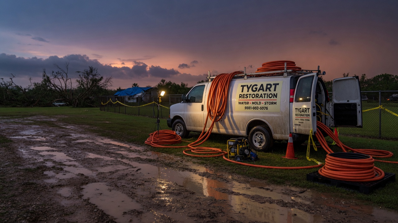
Tag: Restoration

  • Flash Flood Warning: Central Gaines County Area Until 10:00 PM CDT

    The National Weather Service in Midland/Odessa, Texas, has updated the Flash Flood Warning for central Gaines County — and the new wording escalates the threat. The warning, reissued at 8:29 PM CDT on Saturday, September 19, carries a CONSIDERABLE damage threat and “life threatening flash flooding” language, with 2 to 3 inches of rain already down and a rainfall rate of 1.5 to 2.5 inches per hour expected. It is in effect until 10:00 PM CDT.

    For restoration teams, this is the rate-driven interior-intrusion pattern: at 1.5 to 2.5 inches an hour, water finds every low slab, garage apron, and under-sealed foundation in Seminole and Seagraves. This is a live snapshot as of 6:31 PM PDT (8:31 PM CDT) — conditions change fast, so always verify with the National Weather Service for your specific county or ZIP code.

    Central Gaines County, TX — Flash Flood Warning

    Issuing office: NWS Midland/Odessa, TX
    Issued: 8:29 PM CDT Saturday, September 19, 2026 (update/continuation of the 8:03 PM CDT warning — VTEC /O.CON.KMAF.FF.W.0196)
    Expires: 10:00 PM CDT Saturday, September 19, 2026
    Severity / certainty / urgency: Severe / Likely / Immediate

    The hazard, in the alert’s own words: “Life threatening flash flooding. Thunderstorms producing flash flooding.” At 8:29 PM CDT, Doppler radar indicated thunderstorms producing heavy rain across the warned area. Between 2 and 3 inches of rain had fallen. The expected rainfall rate is 1.5 to 2.5 inches in 1 hour. Flash flooding is ongoing or expected to begin shortly. The alert carries a CONSIDERABLE flash-flood damage threat tag — one step below the catastrophic tier, and a clear signal that NWS expects significant damage to homes and businesses in the warned area.

    Locations that will experience flash flooding include:

    • Seminole
    • Seagraves
    • Gaines County Airport
    • Gaines County Park
    • Paynes Corner
    • Loop

    Named drainages: Seminole Draw, Wardswell Draw, and McKenzie Draw.

    Expected impacts: life-threatening flash flooding of creeks and streams, urban areas, highways, streets and underpasses.

    NWS instruction: “Turn around, don’t drown when encountering flooded roads. Most flood deaths occur in vehicles. Please report observed flooding to local emergency services or law enforcement and request they pass this information to the National Weather Service when you can do so safely.”

    Stay safe tonight

    The single most dangerous thing about tonight’s warning is driving after dark in heavy rain. Turn around, don’t drown — most flood deaths occur in vehicles, and it is harder to recognize the danger of flooded roads at night. Never drive through flooded roadways; the water may be deeper than it looks, and the roadbed beneath can be washed away.

    If water gets into your home:

    • Stay out of standing water where electricity may be present. Do not enter a flooded basement until the water has receded and the power is confirmed off.
    • Photograph everything before you touch anything — walls, floors, belongings, the high-water line. Documentation matters for insurance, and you only get one first look.
    • Then call a local restoration contractor. Water left sitting starts a second wave of damage — swelling, wicking, and mold growth — within a day.

    What this means for restoration teams

    A CONSIDERABLE-threat warning at 1.5 to 2.5 inches per hour is the kind of event that produces the jobs restoration teams see most: interior water intrusion through garage-to-house transitions, saturated drywall and insulation on slab-on-grade homes, and water wicked up into wall cavities that won’t be discovered until tomorrow. Expect the Seminole and Seagraves call boards to light up tonight and tomorrow morning as people come home to standing water.

    Damage categories to expect:

    • Interior water intrusion — driveways and aprons feeding garages and living areas.
    • Saturated drywall and insulation in low-lying rooms, especially where water ponds against foundations.
    • Mold risk within 24–48 hours wherever water sits in warm indoor air — Gaines County in September is warm enough that the clock runs fast.
    • Sewage backup in low-lying areas if the storm drains surcharge.
    • Draw and drainage flooding — Seminole Draw, Wardswell Draw, and McKenzie Draw are named in the warning, so rural and fringe properties near those drainages need watching even if the towns look fine.

    The play: stage extraction equipment and drying assets now, keep an on-call rotation through the morning, and capture the address, water source, and affected areas on the first call. The damage-threat tag means adjusters will be active — field discipline matters: photo-document before mitigation, moisture-map every affected room, and keep the homeowner’s payment responsibility clear in writing before work starts.

    FEMA & federal assistance

    If the flooding damages your home and you need help beyond insurance, the FEMA Helpline is 1-800-621-3362 (7 a.m. to 10 p.m. local time, 7 days a week). You can also apply at DisasterAssistance.gov, through the FEMA mobile app, or in person at a Disaster Recovery Center — find one at fema.gov/drc.

    Basic eligibility: U.S. citizenship or qualified status, identity verification, proof of occupancy or ownership, and unmet needs not covered by insurance. Apply as soon as it’s safe to do so — don’t wait for a disaster declaration to be finalized for your county.

    Looking ahead

    The warning expires at 10:00 PM CDT. When it does, the water doesn’t stop moving — the three named draws (Seminole, Wardswell, McKenzie) will carry runoff for hours, and low crossings and underpasses can stay dangerous well after the rain stops. Watch for additional rounds of storms tonight; the rainfall rate in this warning (1.5 to 2.5 inches an hour) means any second cell that trains over the same area re-floods fast.

    For restoration operators, the demand window on a CONSIDERABLE-threat event like this runs for days: tonight’s emergency calls, tomorrow’s discovery calls as water recedes and damage surfaces, and Monday’s insurance-driven wave. Keep crews available through the weekend.

    Sources & how to verify

    To verify for your own location, go to weather.gov, enter your county or ZIP code, and look for the current warnings box — or check the NWS Midland/Odessa office page linked above.

    This post is for informational purposes and is not an official weather warning. Always follow instructions from local authorities and the National Weather Service.

  • Flash Flood Warning: Central Gaines County Area Until 10:00 PM CDT

    Flash Flood Warning: Central Gaines County Area Until 10:00 PM CDT

    A Flash Flood Warning is in effect for Central Gaines County, Texas right now, issued by the National Weather Service in Midland/Odessa at 8:03 PM CDT on Saturday, September 19, and running until 10:00 PM CDT. Radar-indicated thunderstorms are producing heavy rain across the warned area, and flash flooding is ongoing or expected to begin shortly. This is the exact interior flooding scenario restoration teams see most: fast, shallow, and ruinous to flooring, drywall, and everything sitting on it.

    This is a live snapshot as of 8:20 PM CDT. Conditions change fast — always verify with the National Weather Service for your specific county or ZIP code.

    Central Gaines County — Flash Flood Warning

    The National Weather Service in Midland/Odessa, Texas issued this Flash Flood Warning at 8:03 PM CDT on Saturday, September 19. It is in effect until 10:00 PM CDT.

    The warning covers Central Gaines County in western Texas (the alert headline lists the warned area as Gaines, TX). It remains an active, severe warning with certainty rated Likely and urgency rated Immediate.

    The hazard, in the National Weather Service’s own words: at 8:03 PM CDT, Doppler radar indicated thunderstorms producing heavy rain across the warned area. Between 1.5 and 2.5 inches of rain have fallen, and the expected rainfall rate is 2 to 3 inches in 1 hour. Flash flooding is ongoing or expected to begin shortly.

    • Hazard: Flash flooding caused by thunderstorms.
    • Source: Radar indicated.
    • Impact: Flash flooding of small creeks and streams, urban areas, highways, streets and underpasses, plus other poor-drainage and low-lying areas.

    Expected impacts include flooding of small creeks and streams, urban areas, highways, streets and underpasses, plus other poor-drainage and low-lying areas. The alert’s full text is available at weather.gov and via the NWS Midland/Odessa office page.

    Stay safe tonight

    Turn around, don’t drown when encountering flooded roads. Most flood deaths occur in vehicles — the National Weather Service states this explicitly in this warning, and it bears repeating: never drive through flooded roadways. Six inches of moving water can knock a person down; a foot of water can float a vehicle.

    If water enters your home tonight: stay out of standing water where electricity may be present, and avoid the basement until water recedes and power is confirmed off. Photograph everything before you move a thing — documentation matters for insurance. Then call a local restoration contractor: water left sitting starts a second wave of damage within a day, as saturated drywall, insulation, and flooring wick moisture deeper into the structure.

    Please report observed flooding to local emergency services or law enforcement and request they pass the information to the National Weather Service when you can do so safely.

    What this means for restoration teams

    A radar-indicated flash flood warning with 1.5 to 2.5 inches already on the ground and 2 to 3 inches per hour still possible translates into a very specific damage profile for contractors in and around Gaines County:

    • Interior water intrusion through doors, weep holes, and garage entries — flash flood water finds every seam.
    • Saturated drywall and insulation in low-lying rooms; sheetrock wicks water upward well above the visible flood line.
    • Mold risk within 24–48 hours on every wetted porous material that isn’t extracted and dried quickly.
    • Sewage backup in low-lying areas where storm systems overwhelm sanitary lines — treat any floodwater as contaminated until proven otherwise.
    • Street and underpass flooding that can strand your own crews and equipment if routes aren’t checked before dispatch.

    The play: stage equipment now, pre-position drying assets and dehumidifiers before the calls start, and keep an on-call rotation through the night and morning. When the first calls come in, capture the address, the water source (storm flooding vs. sewage vs. roof), and the affected areas on the very first call — it shapes the entire mitigation plan and the estimate.

    Field discipline matters on these jobs: photo-document everything before mitigation begins, moisture-map every affected room (not just the obviously wet ones), and keep the homeowner’s payment responsibility clear in writing before work starts. Flash flood calls often involve stressed homeowners with water on the floor and questions about coverage — clarity up front prevents the collection problem later.

    FEMA & federal assistance

    If damage from tonight’s flooding turns out to be significant, federal help may become available. The standard resources: the FEMA Helpline at 1-800-621-3362 (7 a.m. to 10 p.m. local, 7 days a week), DisasterAssistance.gov, the FEMA app, and fema.gov/drc for Disaster Recovery Centers.

    Basic eligibility generally requires citizenship or qualified status, identity verification, proof of occupancy or ownership, and unmet needs not covered by insurance. Apply as soon as it’s safe — documentation of the damage, gathered in the first hours, is what makes an application move.

    Looking ahead

    This warning expires at 10:00 PM CDT. Expiry doesn’t mean the water is gone — it means the immediate threat window the National Weather Service judged highest has passed. Creeks and streams can crest after the rain stops, and additional rounds of storms are always possible in this kind of pattern. Keep watching the NWS Midland/Odessa page for follow-up statements.

    The demand window for restoration contractors opens fast: water-intrusion calls typically start within hours of water receding and keep coming for days as people discover damage behind baseboards, under flooring, and in walls that looked fine at midnight.

    Sources & how to verify

    • National Weather Service alert: Flash Flood Warning issued September 19 at 8:03 PM CDT until September 19 at 10:00 PM CDT by NWS Midland/Odessa TX (alert source via weather.gov).
    • Issuing office: NWS Midland/Odessa, Texas.

    To verify for your own county or ZIP code: go to weather.gov, enter your location, and check the active alerts for your area — or visit the NWS Midland/Odessa office page directly.

    This post is for informational purposes and is not an official weather warning. Always follow instructions from local authorities and the National Weather Service.

  • Flash Flood Warning: Andrews County Area Until 9:45 PM CDT

    Flash Flood Warning: Andrews County Area Until 9:45 PM CDT

    A Flash Flood Warning is in effect for Andrews County, Texas right now, issued by the National Weather Service in Midland/Odessa at 8:04 PM CDT on Saturday, September 19, and running until 9:45 PM CDT. Radar-indicated thunderstorms are producing heavy rain across the warned area, and flash flooding is ongoing or expected to begin shortly. This is the exact interior flooding scenario restoration teams see most: fast, shallow, and ruinous to flooring, drywall, and everything sitting on it.

    This is a live snapshot as of 8:20 PM CDT. Conditions change fast — always verify with the National Weather Service for your specific county or ZIP code.

    Andrews County — Flash Flood Warning

    The National Weather Service in Midland/Odessa, Texas issued this Flash Flood Warning at 8:04 PM CDT on Saturday, September 19. It is in effect until 9:45 PM CDT.

    The warning covers Andrews, TX — Andrews County in western Texas. This alert is an update (message type “Update”), and it remains an active, severe warning with certainty rated Likely and urgency rated Immediate.

    The hazard, in the National Weather Service’s own words: at 8:04 PM CDT, Doppler radar indicated thunderstorms producing heavy rain across the warned area. Between 1.5 and 2.5 inches of rain have fallen, and the expected rainfall rate is 2 to 3 inches in 1 hour. Flash flooding is ongoing or expected to begin shortly.

    • Hazard: Flash flooding caused by thunderstorms.
    • Source: Radar indicated.
    • Impact: Flash flooding of small creeks and streams, urban areas, highways, streets and underpasses, plus other poor-drainage and low-lying areas.

    Expected impacts include flooding of small creeks and streams, urban areas, highways, streets and underpasses, plus other poor-drainage and low-lying areas. The alert’s full text is available at weather.gov and via the NWS Midland/Odessa office page.

    Stay safe tonight

    Turn around, don’t drown when encountering flooded roads. Most flood deaths occur in vehicles — the National Weather Service states this explicitly in this warning, and it bears repeating: never drive through flooded roadways. Six inches of moving water can knock a person down; a foot of water can float a vehicle.

    If water enters your home tonight: stay out of standing water where electricity may be present, and avoid the basement until water recedes and power is confirmed off. Photograph everything before you move a thing — documentation matters for insurance. Then call a local restoration contractor: water left sitting starts a second wave of damage within a day, as saturated drywall, insulation, and flooring wick moisture deeper into the structure.

    Please report observed flooding to local emergency services or law enforcement and request they pass the information to the National Weather Service when you can do so safely.

    What this means for restoration teams

    A radar-indicated flash flood warning with 1.5 to 2.5 inches already on the ground and 2 to 3 inches per hour still possible translates into a very specific damage profile for contractors in and around Andrews County:

    • Interior water intrusion through doors, weep holes, and garage entries — flash flood water finds every seam.
    • Saturated drywall and insulation in low-lying rooms; sheetrock wicks water upward well above the visible flood line.
    • Mold risk within 24–48 hours on every wetted porous material that isn’t extracted and dried quickly.
    • Sewage backup in low-lying areas where storm systems overwhelm sanitary lines — treat any floodwater as contaminated until proven otherwise.
    • Street and underpass flooding that can strand your own crews and equipment if routes aren’t checked before dispatch.

    The play: stage equipment now, pre-position drying assets and dehumidifiers before the calls start, and keep an on-call rotation through the night and morning. When the first calls come in, capture the address, the water source (storm flooding vs. sewage vs. roof), and the affected areas on the very first call — it shapes the entire mitigation plan and the estimate.

    Field discipline matters on these jobs: photo-document everything before mitigation begins, moisture-map every affected room (not just the obviously wet ones), and keep the homeowner’s payment responsibility clear in writing before work starts. Flash flood calls often involve stressed homeowners with water on the floor and questions about coverage — clarity up front prevents the collection problem later.

    FEMA & federal assistance

    If damage from tonight’s flooding turns out to be significant, federal help may become available. The standard resources: the FEMA Helpline at 1-800-621-3362 (7 a.m. to 10 p.m. local, 7 days a week), DisasterAssistance.gov, the FEMA app, and fema.gov/drc for Disaster Recovery Centers.

    Basic eligibility generally requires citizenship or qualified status, identity verification, proof of occupancy or ownership, and unmet needs not covered by insurance. Apply as soon as it’s safe — documentation of the damage, gathered in the first hours, is what makes an application move.

    Looking ahead

    This warning expires at 9:45 PM CDT. Expiry doesn’t mean the water is gone — it means the immediate threat window the National Weather Service judged highest has passed. Creeks and streams can crest after the rain stops, and additional rounds of storms are always possible in this kind of pattern. Keep watching the NWS Midland/Odessa page for follow-up statements.

    The demand window for restoration contractors opens fast: water-intrusion calls typically start within hours of water receding and keep coming for days as people discover damage behind baseboards, under flooring, and in walls that looked fine at midnight.

    Sources & how to verify

    • National Weather Service alert: Flash Flood Warning issued September 19 at 8:04 PM CDT until September 19 at 9:45 PM CDT by NWS Midland/Odessa TX (alert source via weather.gov).
    • Issuing office: NWS Midland/Odessa, Texas.

    To verify for your own county or ZIP code: go to weather.gov, enter your location, and check the active alerts for your area — or visit the NWS Midland/Odessa office page directly.

    This post is for informational purposes and is not an official weather warning. Always follow instructions from local authorities and the National Weather Service.

  • Flash Flood Warning: Mountainair–Abo Area, Central New Mexico Until 8:45 PM MDT

    Flash Flood Warning: Mountainair–Abo Area, Central New Mexico Until 8:45 PM MDT

    ACTIVE as of 7:05 PM MDT Saturday, September 19. The National Weather Service in Albuquerque has a Flash Flood Warning in effect right now for parts of central New Mexico — north-central Socorro County, southwestern Torrance County, and southeastern Valencia County, including Mountainair and Abo along the Highway 60 corridor. Doppler radar indicated thunderstorms producing heavy rain across the warned area, with 1 to 2 inches already fallen. This is the exact water-intrusion scenario that turns into interior-damage calls for restoration contractors within hours of the water receding. This is a live snapshot as of 7:05 PM MDT. Conditions change fast — always verify with the National Weather Service for your specific county or ZIP code.

    The warning, per area

    Mountainair–Abo corridor — Flash Flood Warning

    The National Weather Service in Albuquerque issued this warning at 6:50 PM MDT Saturday, September 19, and it remains in effect until 8:45 PM MDT.

    Coverage: North Central Socorro County in central New Mexico; Southwestern Torrance County in central New Mexico; Southeastern Valencia County in central New Mexico.

    Hazard detail (NWS wording): Doppler radar indicated thunderstorms producing heavy rain across the warned area at 6:50 PM MDT. Between 1 and 2 inches of rain have fallen. Additional rainfall amounts of 0.25 to 0.75 inches are possible in the warned area. Flash flooding is ongoing or expected to begin shortly.

    Source: Radar indicated. Certainty: Likely. Urgency: Immediate. Severity: Severe.

    Named locations in the warning path: Mountainair and Abo. The warning also includes Highway 60 between Mile Markers 169 and 211 — a long rural stretch where water over the roadway can strand drivers far from help.

    Expected impacts: Flash flooding of small creeks and streams, urban areas, highways, streets and underpasses, as well as other poor-drainage and low-lying areas.

    Issuing office: NWS Albuquerque. Alert source: NWS alert (read September 19, 2026).

    Stay safe tonight

    Turn around, don’t drown when encountering flooded roads. Most flood deaths occur in vehicles. Be aware of your surroundings and do not drive on flooded roads — and this warning puts that instruction front and center for a reason: Highway 60 across the Manzano foothills and the Estancia Valley low ground can pond or run over quickly, and at night it is harder to recognize how deep water on a rural highway really is.

    If water enters the home: stay out of standing water where electricity may be present. Avoid the basement or lower rooms until water recedes and power is confirmed off. Photograph everything before cleanup begins — documentation matters for insurance — and then call a local restoration contractor. Water left sitting starts a second wave of damage within a day.

    What this means for restoration teams

    This is the seat-by-seat call pattern for a three-county central New Mexico warning: the work won’t concentrate in one town — it lands along the Mountainair–Abo corridor and the Highway 60 strip, which means longer windshield time between jobs and triage that favors the most affected addresses first.

    Expect the classic flash-flood damage categories: interior water intrusion through door thresholds and slab edges, saturated drywall and insulation in low-lying homes, sewage backup where septic and sewer systems sit in poor-drainage ground, and debris-blocked drainage pushing water where it was never designed to go. Mold risk starts its 24–48 hour clock the moment water touches organic building material.

    The play: stage extraction and drying assets tonight, not in the morning. Keep an on-call rotation through the night — the warning expires at 8:45 PM MDT, but the calls arrive after residents get home, see the water, and call someone. Capture address, water source, and affected areas on the first call. Field discipline: photo-document before mitigation, moisture-map every affected room, and keep the homeowner’s payment responsibility clear in writing before work starts.

    FEMA & federal assistance

    FEMA Helpline 1-800-621-3362 (7 a.m.–10 p.m. local time, 7 days a week). DisasterAssistance.gov, the FEMA app, and fema.gov/drc for recovery centers. Basic eligibility: U.S. citizenship or qualified status, identity verification, proof of occupancy or ownership, and unmet needs not covered by insurance. Apply as soon as it’s safe.

    Looking ahead

    The warning runs through 8:45 PM MDT tonight. Additional rainfall amounts of 0.25 to 0.75 inches are possible in the warned area — and even after the rain stops, small creeks and streams in the warned counties can crest later. The next NWS update lands when this warning expires, is extended, or is cancelled.

    Demand window note: water-intrusion calls typically start within hours of water receding and keep coming for days as people discover damage — in a rural corridor like this, some homeowners won’t find the water until the next morning.

    Sources & how to verify

    • NWS Albuquerque Flash Flood Warning — alert text (read September 19, 2026)
    • NWS Albuquerque office page — weather.gov/abq (read September 19, 2026)

    To verify for your own county or ZIP: go to weather.gov and enter your location, or check the NWS Albuquerque page for central New Mexico. A companion operator brief for restoration teams is queued in our review queue — Restoration Intel companions publish only after review.

    This post is for informational purposes and is not an official weather warning. Always follow instructions from local authorities and the National Weather Service.

  • Flash Flood Warning: Southeastern Andrews County Until 9:45 PM CDT

    Flash Flood Warning: Southeastern Andrews County Until 9:45 PM CDT

    Active warning — live snapshot as of 5:47 PM PDT (7:47 PM CDT), September 19, 2026. The National Weather Service in Midland/Odessa, Texas has issued a Flash Flood Warning for southeastern Andrews County in western Texas, in effect until 9:45 PM CDT. Doppler radar indicates thunderstorms producing heavy rain across the warned area, with flash flooding ongoing or expected to begin shortly. This is the exact pattern that creates the interior flooding jobs restoration teams in West Texas see most — water entering low points fast, with no time to prepare. Conditions change fast — always verify with the National Weather Service for your specific county or ZIP code.

    Flash Flood Warning — Southeastern Andrews County, TX

    The National Weather Service in Midland/Odessa TX issued this Flash Flood Warning at 7:43 PM CDT on September 19, 2026. It runs until 9:45 PM CDT.

    The hazard, in the alert’s own wording: flash flooding caused by thunderstorms. The source is radar indicated. At 7:43 PM CDT, Doppler radar indicated thunderstorms producing heavy rain across the warned area — between 1 and 2 inches of rain have already fallen, with an expected rainfall rate of 2 to 3 inches in 1 hour. Flash flooding is ongoing or expected to begin shortly.

    Locations in the warning path, per the alert: mainly rural areas of southeastern Andrews County. The warning covers southeastern Andrews County in western Texas.

    Expected impacts, per the alert: flash flooding of small creeks and streams, urban areas, highways, streets and underpasses, as well as other poor-drainage and low-lying areas.

    NWS impact data for this alert: severity Severe, certainty Likely, urgency Immediate. The alert was issued under AWIPS identifier FFWMAF (WMO header WGUS54 KMAF). You can read the full alert at api.weather.gov.

    Stay safe tonight

    Turn around, don’t drown. Most flood deaths occur in vehicles — never drive through flooded roadways, no matter how shallow the water looks. Six inches of moving water can knock you down; a foot can carry a car away.

    If water enters the home: stay out of standing water where electricity may be present, and avoid the basement until the water recedes and power is confirmed off. Photograph everything before you move or clean anything — documentation matters for insurance. Then call a local restoration contractor. Water left sitting starts a second wave of damage within a day.

    What this means for restoration teams

    West Texas oilfield and ranch country doesn’t get flash flood warnings often — when it does, the damage profile is predictable and fast-moving. Translate this warning into the jobs it produces:

    • Interior water intrusion — at 2 to 3 inches of rain per hour over ground that sheds water fast, low-lying rural properties, mobile homes, and structures near caliche roads take water through doors, slab edges, and window wells.
    • Saturated drywall and insulation — even six inches of intrusion wicks upward. Pull base, inspect, moisture-map before you promise anything.
    • Mold risk within 24–48 hours — Texas heat means microbial growth starts fast. The drying clock starts the moment the water stops.
    • Sewage backup in low-lying areas — rural septic systems and overloaded municipal lines in small communities are first to back up when drainage saturates.
    • Road and underpass damage — Andrews County’s farm-to-market roads and low-water crossings collect debris and standing water that lingers after the warning expires.

    The play: stage equipment now, pre-position drying assets, and keep an on-call rotation through the morning. Capture address, water source, and affected areas on the very first call — the callers who ring tonight are the ones whose floors are wet already. Field discipline applies: photo-document before mitigation, moisture-map every affected room, and keep the homeowner’s payment responsibility clear in writing before work starts.

    FEMA & federal assistance

    If flooding damages homes or businesses in Andrews County tonight, the FEMA Helpline is 1-800-621-3362 (7 a.m.–10 p.m. local, 7 days a week). You can also start an application at DisasterAssistance.gov or through the FEMA app, and find recovery centers at fema.gov/drc. Basic eligibility: citizenship or qualified status, identity verification, proof of occupancy or ownership, and unmet needs not covered by insurance. Apply as soon as it’s safe.

    Looking ahead

    This warning expires at 9:45 PM CDT tonight. Until then, flash flooding is ongoing or imminent across southeastern Andrews County. Overnight, watch for additional rounds of thunderstorms training over the same area — that’s the pattern that turns a two-hour warning into a multi-day damage event. Rivers and creeks may crest after the rain stops, so low-lying areas stay risky even once the warning is gone.

    For restoration contractors: water-intrusion calls typically start within hours of water receding and keep coming for days as people discover damage — soggy drywall that went unnoticed tonight becomes a mold call tomorrow. Keep crews available through the weekend.

    Sources & how to verify

    To verify for your own county or ZIP code: go to weather.gov and enter your location, or check the NWS Midland/Odessa page directly.

    This post is for informational purposes and is not an official weather warning. Always follow instructions from local authorities and the National Weather Service.

  • Flash Flood Warning: Western Garfield County CO Area Until 9:15 PM MDT

    Flash Flood Warning: Western Garfield County CO Area Until 9:15 PM MDT

    Flash Flood Warning Active in Western Garfield County, Colorado Until 9:15 PM MDT

    The National Weather Service in Grand Junction, Colorado has issued a Flash Flood Warning for western Garfield County in west central Colorado, in effect until 9:15 PM MDT tonight (Saturday, September 19). The warning was issued at 6:19 PM MDT after Doppler radar indicated thunderstorms producing heavy rain along Highway 139 near and south of Douglas Pass, with an expected rainfall rate of 1 to 3 inches in 1 hour. The NWS labels this life-threatening flash flooding — the exact scenario that produces the interior flooding jobs restoration teams see most. This is a live snapshot as of 5:30 PM PDT. Conditions change fast — always verify with the National Weather Service for your specific county or ZIP code.

    Western Garfield County — Flash Flood Warning

    The warning comes from NWS Grand Junction (Colorado), issued at 6:19 PM MDT on September 19, 2026, and runs until 9:15 PM MDT. Certainty is Likely, urgency Immediate, severity Severe.

    Hazard: Life threatening flash flooding. Thunderstorms producing flash flooding. Source: Radar indicated. At 6:19 PM MDT, Doppler radar indicated thunderstorms producing heavy rain across the warned area along Highway 139 near and south of Douglas Pass. Between 0.6 and 0.8 inches of rain have fallen. The expected rainfall rate is 1 to 3 inches in 1 hour. Flash flooding is ongoing or expected to begin shortly, per the NWS alert verbatim.

    Expected impacts: Life threatening flash flooding of creeks and streams, urban areas, highways, streets and underpasses.

    Locations that will experience flash flooding: Mainly rural areas of western Garfield County, with the warned corridor along Highway 139 near and south of Douglas Pass.

    Additional hazard note from the NWS: Highway 139 near Douglas Pass is prone to rockslides and mudslides in heavy rain. Stay alert for rocks and debris on roads, and avoid driving on flooded roads. Find an alternate route.

    The issuing office is NWS Grand Junction: weather.gov/gjt.

    Stay safe tonight

    Turn around, don’t drown when encountering flooded roads — most flood deaths occur in vehicles. The NWS specifically warns that Highway 139 near Douglas Pass is prone to rockslides and mudslides in heavy rain: stay alert for rocks and debris on roads, avoid driving on flooded roads, and find an alternate route. Mountain corridors like Douglas Pass flood fast and slide fast — do not attempt to cross a flooded road at any depth.

    If water gets into your home: stay out of standing water where electricity may be present, avoid the basement until the water recedes and power is confirmed off, photograph everything before cleanup (documentation matters for insurance), and then call a local restoration contractor — water left sitting starts a second wave of damage within a day.

    What this means for restoration teams

    This is a mountain-pass flash flood with a life-threatening label and a 1-to-3-inch-per-hour rainfall rate over the Highway 139 corridor. That rate on steep terrain near Douglas Pass means creek and stream flash flooding plus the NWS-named rockslides and mudslides — a damage mix that restoration contractors from Rifle to Parachute should take seriously: water intrusion into structures near drainages, mud and debris carried into homes and garages by slope runoff, and road closures that complicate crew access.

    The damage categories to expect: interior water intrusion in low-lying structures and underpasses, saturated drywall and insulation where water found entry, mold risk within 24 to 48 hours in anything that took standing water, and mud and debris contamination that raises the tear-out question — water alone is one job; water carrying mud and rock is a different scope. The already-fallen 0.6 to 0.8 inches primes the slopes; the forecasted 1-to-3-inch hourly rate is what moves the earth.

    The play: stage equipment now, pre-position drying assets on both sides of the pass if possible (Highway 139 can close without warning), keep an on-call rotation through the evening and overnight, and capture address, water source, and affected areas on the first call. Field discipline: photo-document everything before mitigation, moisture-map every affected room including mud-damaged walls, and keep the homeowner’s payment responsibility clear in writing before work starts — contaminated-water jobs have a way of expanding.

    FEMA & federal assistance

    FEMA Helpline: 1-800-621-3362 (7 a.m.–10 p.m. local, 7 days a week). Apply at DisasterAssistance.gov, through the FEMA app, or find a recovery center at fema.gov/drc. Basic eligibility requires U.S. citizenship or qualified status, identity verification, proof of occupancy or ownership, and unmet needs not covered by insurance. Apply as soon as it’s safe to do so.

    Looking ahead

    The warning expires at 9:15 PM MDT. Mountain thunderstorms can rebuild over the same pass corridor through the evening, and slopes already saturated by 0.6 to 0.8 inches will react faster to the next round. Rockslide and mudslide risk on Highway 139 often peaks with and just after the heaviest rain. Water-intrusion calls typically start within hours of water receding and keep coming for days as people discover damage — expect the call board to light up tonight and carry into Sunday.

    Sources & how to verify

    • National Weather Service Grand Junction: weather.gov/gjt
    • Check active alerts for your county at weather.gov or your local NWS office page.

    Verify conditions for your specific county or ZIP code at weather.gov before traveling or working in the warned area.

    This post is for informational purposes and is not an official weather warning. Always follow instructions from local authorities and the National Weather Service.

  • Flash Flood Warning: Southern Fremont County WY Area Until 9:30 PM MDT

    Flash Flood Warning: Southern Fremont County WY Area Until 9:30 PM MDT

    Flash Flood Warning Active in Southern Fremont County, Wyoming Until 9:30 PM MDT

    The National Weather Service in Riverton, Wyoming has issued a Flash Flood Warning for southern Fremont County in central Wyoming, in effect until 9:30 PM MDT tonight (Saturday, September 19). The warning was issued at 6:25 PM MDT after Doppler radar indicated thunderstorms producing heavy rain, with between 2 and 3 inches already fallen. This is exactly the profile that turns into the interior flooding jobs restoration teams see most — rural flash flooding of streams, drainages, and low-lying areas. This is a live snapshot as of 5:30 PM PDT. Conditions change fast — always verify with the National Weather Service for your specific county or ZIP code.

    Southern Fremont County — Flash Flood Warning

    The warning comes from NWS Riverton (Wyoming), issued at 6:25 PM MDT on September 19, 2026, and runs until 9:30 PM MDT. Certainty is Likely, urgency Immediate, severity Severe.

    Hazard: Flash flooding caused by thunderstorms. Source: Radar indicated. At 6:25 PM MDT, Doppler radar indicated thunderstorms producing heavy rain across the warned area. Between 2 and 3 inches of rain have fallen. Flash flooding is ongoing or expected to begin shortly, per the NWS alert verbatim.

    Expected impacts: Flash flooding of small creeks and streams, as well as other poor drainage and low-lying areas.

    Locations that will experience flash flooding: Mainly rural areas of southern Fremont County. The alert specifically names the following streams and drainages: Little Popo Agie River, Grant Young Ditch, Monument Draw, North Fork Ballenger Draw, Popo Agie River, and Government Draw.

    The issuing office is NWS Riverton: weather.gov/riw.

    Stay safe tonight

    Turn around, don’t drown when encountering flooded roads — most flood deaths occur in vehicles. Be aware of your surroundings and do not drive on flooded roads. In rural areas, creeks and washes can rise in minutes, especially after dark. Please report observed flooding to local emergency services or law enforcement when you can do so safely.

    If water gets into your home: stay out of standing water where electricity may be present, avoid the basement until the water recedes and power is confirmed off, photograph everything before cleanup (documentation matters for insurance), and then call a local restoration contractor — water left sitting starts a second wave of damage within a day.

    What this means for restoration teams

    This warning is a classic rural Wyoming flash flood: named drainages — the Popo Agie River and its tributaries — with 2 to 3 inches already down and radar-indicated storms still overhead. Restoration contractors in the Riverton and Lander corridor should read this as likely creek and stream overflow reaching outbuildings, basements, and crawlspaces in low-lying rural properties, plus washed-out rural driveways and access roads that delay response.

    The damage categories to expect: interior water intrusion from rising creeks and saturated ground, soaked drywall and insulation in below-grade living space, mold risk within 24 to 48 hours in any structure that took standing water, and potential contamination from agricultural or septic-area runoff in rural drainages. Note the 2 to 3 inches already fallen — that is enough to push small streams like Government Draw and Monument Draw over their banks.

    The play: stage equipment now, keep an on-call rotation through the evening (the warning runs to 9:30 PM MDT, and streams crest after the rain stops), and capture address, water source, and affected areas on the first call. Field discipline matters more at night: photo-document before mitigation, moisture-map every affected room, and keep the homeowner’s payment responsibility clear in writing before work starts.

    FEMA & federal assistance

    FEMA Helpline: 1-800-621-3362 (7 a.m.–10 p.m. local, 7 days a week). Apply at DisasterAssistance.gov, through the FEMA app, or find a recovery center at fema.gov/drc. Basic eligibility requires U.S. citizenship or qualified status, identity verification, proof of occupancy or ownership, and unmet needs not covered by insurance. Apply as soon as it’s safe to do so.

    Looking ahead

    The warning expires at 9:30 PM MDT. Watch for additional rounds of thunderstorms through the evening — the radar-indicated source means new cells can re-form over the same drainages. Creeks and streams in this area can crest hours after the rain stops, so the danger window extends past the official expiry. Water-intrusion calls typically start within hours of water receding and keep coming for days as people discover damage, so contractors should plan for a busy Sunday.

    Sources & how to verify

    • National Weather Service Riverton: weather.gov/riw
    • Check active alerts for your county at weather.gov or your local NWS office page.

    Verify conditions for your specific county or ZIP code at weather.gov before traveling or working in the warned area.

    This post is for informational purposes and is not an official weather warning. Always follow instructions from local authorities and the National Weather Service.

  • Flash Flood Warning: Rio Blanco County Area Until 9 PM MDT

    Flash Flood Warning: Rio Blanco County Area Until 9 PM MDT

    A dangerous flash flood setup over a fresh burn scar

    The National Weather Service in Grand Junction has issued a Flash Flood Warning for the Lee burn scar in central Rio Blanco County in northwestern Colorado, in effect until 9:00 PM MDT tonight. The warning was issued at 6:01 PM MDT.

    This is the exact interior-flooding scenario restoration teams know worst: a burn scar sheds water almost instantly, and the alert is explicit that debris flow — rock, mud, vegetation, and other loose material — can move across roads and driveways without much notice. This is a live snapshot as of 6:16 PM MDT on Saturday, September 19, 2026. Conditions change fast — always verify with the National Weather Service for your specific county or ZIP code.

    Rio Blanco County — Flash Flood Warning

    Issuing office: NWS Grand Junction, Colorado. Issued: 6:01 PM MDT, Saturday, September 19, 2026. Expires: 9:00 PM MDT.

    The warning covers the Lee burn scar in central Rio Blanco County. Doppler radar indicated thunderstorms producing heavy rain over the scar, with between 0.3 and 0.5 inches of rain already fallen at issue time. The expected rainfall rate is 1 to 3 inches in 1 hour. Flash flooding is ongoing or expected to begin shortly, and the NWS states that excessive rainfall over the burn scar will result in debris flow consisting of rock, mud, vegetation, and other loose materials.

    Hazard: Life-threatening flash flooding — thunderstorms producing flash flooding in and around the Lee Burn Scar. Source: radar indicated. Damage threat: considerable. Impact: life-threatening flash flooding of areas in and around the Lee Burn Scar. Locations expected to experience flooding are mainly rural areas of central Rio Blanco County.

    Expected impacts per the alert: severe flash flooding of creeks, streams, and ditches in the Lee Burn Scar; severe debris flows anticipated across roads; roads and driveways may be washed away in places.

    Verify directly: NWS Grand Junction and the alert on alerts.weather.gov.

    Stay safe tonight

    The NWS calls this a life-threatening situation — that language is reserved for the highest-threat flash flood warnings. If you are in or near the Lee burn scar area:

    • Turn around, don’t drown. Most flood deaths occur in vehicles — never drive through flooded roadways. It takes just 6 inches of moving water to knock an adult off their feet and 12 inches to carry away a small car.
    • If you encounter flood waters, climb to safety — the NWS’s direct instruction for this event.
    • Do not attempt to travel unless you are fleeing an area subject to flooding or under an evacuation order.
    • If water enters the home: stay out of standing water where electricity may be present, avoid the basement until water recedes and power is confirmed off, and photograph everything before any cleanup — documentation matters for insurance.
    • Watch for debris flows on roads, which can arrive with little warning on a burn scar: if a road looks unstable, don’t test it.

    What this means for restoration teams

    This is the signature section for a reason: a burn-scar flash flood warning with a “considerable” damage threat is a high-probability water-intrusion event, and it lands in rural areas where response times are longer and homeowners have fewer options.

    Damage categories to expect: interior water intrusion in homes near drainages and low-lying roads; saturated drywall and insulation from water entering at grade level; sewage backup where lift stations or septic systems flood; and structural damage to outbuildings, driveways, and access roads from debris flow. Mold risk follows on a 24–48 hour clock once porous materials get wet — and in rural counties, dehumidification capacity may be thin.

    The play: stage equipment now — this warning runs through 9 PM MDT, which means water-intrusion calls can start as soon as water recedes and keep arriving through the night. Pre-position drying assets, keep an on-call rotation through the morning, and capture address + water source + affected areas on the first call. Burn-scar debris flow means the water source matters even more than usual: mud and debris infiltration is a different cleanup category than clear-water flooding.

    Field discipline: photo-document before mitigation, moisture-map every affected room, and keep the homeowner’s payment responsibility clear in writing before work starts. Rural jobs have longer drive times — triage by water depth and source so the worst structures get the first trucks.

    Local emergency contacts

    Emergency: 911. Rio Blanco County Sheriff’s Office information hotline for recorded updates: 970-878-9555 (per the county’s official emergency page at rbc.us). Sign up for Rio Blanco Alerts (Reverse 911) for local alerts and evacuation information, and follow the Rio Blanco County Sheriff’s Office Facebook page for real-time updates during developing situations.

    FEMA & federal assistance

    If damage is extensive, federal help may become available. The FEMA Helpline is 1-800-621-3362 (7 a.m.–10 p.m. local, 7 days). You can also apply at DisasterAssistance.gov, through the FEMA app, or find recovery centers at fema.gov/drc.

    Basic eligibility: citizenship or qualified status, identity verification, proof of occupancy or ownership, and unmet needs not covered by insurance. Apply as soon as it’s safe — and photograph and document damage before cleanup begins.

    Looking ahead

    The warning expires at 9:00 PM MDT tonight, but the hazard doesn’t automatically end then — the NWS may extend the warning if storms re-fire over the scar. Watch for additional rounds of thunderstorms this evening and for creeks and ditches to crest after rain stops. Expect the next NWS update on the standard warning cycle or sooner if conditions change.

    Demand window: water-intrusion calls typically start within hours of water receding and keep coming for days as people discover damage — saturated drywall that looked fine at midnight can read as a must-fix by Monday. Debris-flow cleanup calls (driveways, outbuildings, access roads) follow a slower discovery curve than interior water jobs.

    Sources & how to verify

    Sources: the NWS alert (AWIPS identifier FFWGJT, VTEC /O.NEW.KGJT.FF.W.0129) issued by NWS Grand Junction; the NWS Grand Junction office page; the national active-alerts map at alerts.weather.gov.

    To verify for your own county or ZIP: enter it at weather.gov, or check your local NWS office page directly. Warnings are polygon-based — a county name alone doesn’t tell you whether your street is inside the polygon.

    This post is for informational purposes and is not an official weather warning. Always follow instructions from local authorities and the National Weather Service.

  • Flash Flood Warning: Socorro, Valencia and Cibola Counties NM Until 7:45 PM MDT

    Flash Flood Warning: Socorro, Valencia and Cibola Counties NM Until 7:45 PM MDT

    Flash Flood Warning — Socorro, Valencia and Cibola Counties, NM

    The National Weather Service office in Albuquerque, New Mexico, issued a Flash Flood Warning at 5:47 PM MDT on Saturday, September 19, 2026, for north central Socorro County, southwestern Valencia County, and southeastern Cibola County. The warning is in effect until 7:45 PM MDT this evening.

    At 5:47 PM MDT, Doppler radar indicated thunderstorms producing heavy rain across the warned area. Between 1 and 1.5 inches of rain have already fallen, and additional rainfall amounts of 0.25 to 0.5 inches are possible in the warned area. Flash flooding is ongoing or expected to begin shortly.

    The hazard is flash flooding caused by thunderstorms. The source is radar indicated.

    Impacts expected: flash flooding of small creeks and streams, urban areas, highways, streets and underpasses, as well as other poor drainage and low-lying areas.

    This is a live snapshot as of 5:01 PM PDT Saturday, September 19, 2026. Conditions change fast — always verify with the National Weather Service for your specific county or ZIP code.

    The warning, per area: Socorro, Valencia and Cibola Counties

    Issuing office: NWS Albuquerque NM. Issued: 5:47 PM MDT, September 19, 2026. Expires: 7:45 PM MDT, September 19, 2026. Coverage: north central Socorro County in central New Mexico, southwestern Valencia County in central New Mexico, southeastern Cibola County in west central New Mexico.

    Hazard detail, verbatim from the alert: at 5:47 PM MDT, Doppler radar indicated thunderstorms producing heavy rain across the warned area. Between 1 and 1.5 inches of rain have fallen. Additional rainfall amounts of 0.25 to 0.5 inches are possible. Flash flooding is ongoing or expected to begin shortly.

    Locations that will experience flash flooding, per the alert: San Acacia, La Joya, Bernardo, Veguita, Chamizal, Contreras, Abeytas, Sabinal and Las Nutrias.

    Highways affected, per the alert: Highway 60 between mile markers 166 and 168, and Interstate 25 between mile markers 160 and 184. If you are on I-25 through this corridor tonight, slow down and never attempt to cross water over the roadway.

    Expected impacts: flash flooding of small creeks and streams, urban areas, highways, streets and underpasses as well as other poor drainage and low-lying areas.

    Source: National Weather Service alert (WMO identifier WGUS55 KABQ 192347; AWIPS identifier FFWABQ). Verify current status at weather.gov or the NWS Albuquerque office page at https://www.weather.gov/abq/.

    Stay safe tonight

    Turn around, don’t drown when encountering flooded roads. Most flood deaths occur in vehicles — never drive through flooded roadways, including the I-25 and Highway 60 stretches named in this warning.

    If water enters your home: stay out of standing water where electricity may be present, avoid the basement until water recedes and power is confirmed off, and photograph everything before any cleanup begins. Documentation matters for insurance. Then call a local restoration contractor — water left sitting starts a second wave of damage within a day.

    What this means for restoration teams

    A flash flood warning covering the I-25 corridor communities between Albuquerque and Socorro — San Acacia, Bernardo, Sabinal, and the surrounding villages — puts restoration teams on alert for the classic corridor pattern: sheet flow off the mesas into low-lying neighborhoods, flooded underpasses, and water through the slab in older homes with poor drainage.

    Damage categories to expect in the call queue: interior water intrusion at ground level, saturated carpet, drywall and insulation wicking moisture upward, and mud/silt carry-in that raises the tear-out scope. In low-lying areas, watch for sewage backup where systems are overwhelmed by infiltration.

    The play: stage water extraction and drying equipment now, pre-position drying assets on the south side of the metro for fast response to the corridor, keep an on-call rotation through the night, and capture address, water source, and affected areas on the first call. Field discipline: photo-document before mitigation, moisture-map every affected room, and keep the homeowner’s payment responsibility clear in writing before work begins.

    FEMA & federal assistance

    If this storm damages your home, federal help may be available once it is safe to apply:

    • FEMA Helpline: 1-800-621-3362 (7 a.m. to 10 p.m. local time, 7 days a week).
    • DisasterAssistance.gov and the FEMA mobile app for online applications.
    • fema.gov/drc to find Disaster Recovery Centers near you once they open.

    Basic eligibility: U.S. citizenship or qualified immigration status, identity verification, proof of occupancy or ownership of the damaged property, and needs not covered by insurance. Apply as soon as it is safe — you do not need to wait for cleanup to finish.

    Looking ahead

    The warning expires at 7:45 PM MDT. Small creeks and streams can keep rising after the heaviest rain passes, and poor-drainage spots along I-25 and Highway 60 may hold water into the evening even as skies clear.

    Water-intrusion calls typically start within hours of water receding and keep coming for days as people discover damage. If you found water tonight, act tonight: photograph, shut off power to wet areas, and call a restoration contractor before the mold clock runs out — 24 to 48 hours in warm conditions.

    Sources & how to verify

    Sources: National Weather Service Albuquerque flash flood warning (issued 5:47 PM MDT, September 19, 2026; expires 7:45 PM MDT), WMO identifier WGUS55 KABQ 192347; NWS office page https://www.weather.gov/abq/.

    To verify for your county or ZIP: enter it at weather.gov, or check the NWS Albuquerque office page for the latest alerts.

    This post is for informational purposes and is not an official weather warning. Always follow instructions from local authorities and the National Weather Service.

  • Flash Flood Warning: Brewster and Pecos Counties TX Until 8:15 PM CDT

    Flash Flood Warning: Brewster and Pecos Counties TX Until 8:15 PM CDT

    Flash Flood Warning — Brewster, TX and Pecos, TX

    The National Weather Service office in Midland/Odessa, Texas, issued a Flash Flood Warning at 6:52 PM CDT on Saturday, September 19, 2026, for north central Brewster County and south central Pecos County. The warning is in effect until 8:15 PM CDT this evening.

    At 6:52 PM CDT, Doppler radar indicated thunderstorms producing heavy rain across the warned area. Between 1.5 and 2.5 inches of rain have already fallen, and the expected rainfall rate is 2 to 3 inches in 1 hour. Flash flooding is ongoing or expected to begin shortly.

    The hazard is life-threatening flash flooding caused by thunderstorms producing flash flooding. The source is radar indicated. The National Weather Service rates the damage threat as CONSIDERABLE.

    Impacts expected: life-threatening flash flooding of creeks and streams, urban areas, highways, streets and underpasses.

    This is a live snapshot as of 5:01 PM PDT Saturday, September 19, 2026. Conditions change fast — always verify with the National Weather Service for your specific county or ZIP code.

    The warning, per area: North Central Brewster and South Central Pecos Counties

    Issuing office: NWS Midland/Odessa TX. Issued: 6:52 PM CDT, September 19, 2026. Expires: 8:15 PM CDT, September 19, 2026. This warning remains in effect through 8:15 PM CDT this evening.

    Hazard detail, verbatim from the alert: at 6:52 PM CDT, Doppler radar indicated thunderstorms producing heavy rain across the warned area. Between 1.5 and 2.5 inches of rain have fallen. The expected rainfall rate is 2 to 3 inches in 1 hour. Flash flooding is ongoing or expected to begin shortly. Damage threat: CONSIDERABLE.

    Locations that will experience flash flooding, per the alert: mainly rural areas of north central Brewster and south central Pecos Counties.

    Streams and drainages in the warned area, per the alert: Negro Creek, Big Canyon, Pea Blanca Creek, Wood Hollow Creek, San Francisco Creek, Dry Creek, Spring Creek, Pyle Draw, Nineteen Draw, Maravillas Canyon, Downie Draw, Willow Creek, Pea Colorado Creek and Indian Creek.

    Expected impacts: life-threatening flash flooding of creeks and streams, urban areas, highways, streets and underpasses.

    Source: National Weather Service alert (WMO identifier WGUS74 KMAF 192352; AWIPS identifier FFSMAF). Verify current status at weather.gov or the NWS Midland/Odessa office page at https://www.weather.gov/maf/.

    Stay safe tonight

    Turn around, don’t drown when encountering flooded roads. Most flood deaths occur in vehicles — never drive through flooded roadways.

    If water enters your home: stay out of standing water where electricity may be present, avoid the basement until water recedes and power is confirmed off, and photograph everything before any cleanup begins. Documentation matters for insurance. Then call a local restoration contractor — water left sitting starts a second wave of damage within a day.

    Please report observed flooding to local emergency services or law enforcement when you can do so safely, and request they pass the information to the National Weather Service.

    What this means for restoration teams

    A CONSIDERABLE flash flood warning over rural West Texas ranch country means a specific kind of damage profile. Creeks like Maravillas Canyon and Negro Creek can send water across low-water crossings and ranch roads fast, and homes, outbuildings, and equipment sheds along those drainages can take interior water with little warning.

    Damage categories to expect in the call queue: interior water intrusion through low doors and vents, saturated drywall and insulation, mud and silt deposits that demand extra tear-out, and sewage or septic backups where drain fields sit in low-lying ground. Mold risk clocks in at 24 to 48 hours in warm September conditions, so response speed is the margin.

    The play: stage water extraction and drying equipment tonight, keep an on-call rotation through the morning, and capture address, water source, and affected areas on the first call. Field discipline holds: photo-document everything before mitigation starts, moisture-map every affected room, and keep the homeowner’s payment responsibility clear in writing before work begins.

    FEMA & federal assistance

    If this storm damages your home, federal help may be available once it is safe to apply:

    • FEMA Helpline: 1-800-621-3362 (7 a.m. to 10 p.m. local time, 7 days a week).
    • DisasterAssistance.gov and the FEMA mobile app for online applications.
    • fema.gov/drc to find Disaster Recovery Centers near you once they open.

    Basic eligibility: U.S. citizenship or qualified immigration status, identity verification, proof of occupancy or ownership of the damaged property, and needs not covered by insurance. Apply as soon as it is safe — you do not need to wait for cleanup to finish.

    Looking ahead

    The warning expires at 8:15 PM CDT. When it does, watch what the creeks do overnight — drainages like Maravillas Canyon can crest after the rain stops, and a second round of storms could bring a new warning for the same counties.

    If you are a homeowner, water-intrusion calls typically start within hours of water receding and keep coming for days as people discover damage. If you found water tonight, act tonight: photograph, shut off power to wet areas, and call a restoration contractor before the drying clock runs out.

    Sources & how to verify

    Sources: National Weather Service Midland/Odessa flash flood warning (issued 6:52 PM CDT, September 19, 2026; expires 8:15 PM CDT), WMO identifier WGUS74 KMAF 192352; NWS office page https://www.weather.gov/maf/.

    To verify for your county or ZIP: enter it at weather.gov, or check the NWS Midland/Odessa office page for the latest alerts.

    This post is for informational purposes and is not an official weather warning. Always follow instructions from local authorities and the National Weather Service.