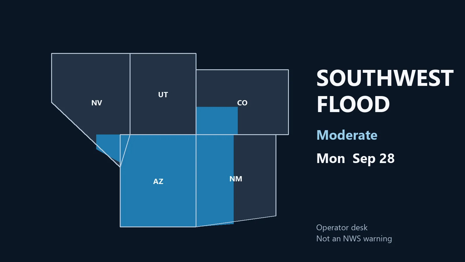
As of this Thursday morning desk, October 22, 2026 (approximately 9:12 PM PDT / 12:12 AM EDT October 23 / 0412Z October 23), the national picture centers on the Southwest and Four Corners. The Weather Prediction Center holds a Moderate Risk of excessive rainfall over portions of southwest Colorado, southern Utah and northwestern New Mexico. The Storm Prediction Center maintains a Slight Risk of severe thunderstorms from eastern Arizona into western New Mexico. Post-Tropical Cyclone Josephine continues moving away with no U.S. coastal watches or warnings.
Tropical: None · Severe: Slight · Flood: Moderate
What Changed
- Compared with the October 21 afternoon desk (quiet-pulse-2026-10-21-afternoon) and the prior version of this morning desk: SPC Day 1 Convective Outlook (0100 UTC October 23 / 8:01 PM CDT Thursday, October 22, 2026, valid 230100Z–231200Z) continues a SLIGHT RISK of severe thunderstorms from eastern Arizona into western New Mexico. Scattered severe storms remain possible across the Southwest and Great Basin tonight, with the most intense cells expected across western New Mexico through the remainder of this evening. Large hail, damaging winds, and a tornado or two are possible. No upgrade beyond Slight.
- WPC Day 1 Excessive Rainfall Outlook (updated 0042 UTC Friday October 23 / discussion 8:44 PM EDT Thursday, valid 01Z–12Z October 23) holds a MODERATE RISK over portions of southwest Colorado, southern Utah and northwestern New Mexico (expanded southward into NW NM). Additional 1–2 inches (locally higher) possible; flash flooding likely in terrain, burn scars and slot canyons. Surrounding Slight Risk remains.
- NHC confirms Josephine has become a powerful extratropical low. No tropical storm or hurricane watch or warning is in effect on the U.S. coast or Gulf of America. The system is accelerating northeastward away from the United States. Eastern Pacific Tropical Storm Vance remains well south of Mexico with no U.S. land threat.
- Severe Thunderstorm Warnings and a Severe Thunderstorm Watch have been in effect across portions of Arizona. Flash Flood Warnings remain active for sensitive areas including Apache County (Canyon de Chelly / Chinle Creek) and other Four Corners drainages. Flood Watches continue regionally.
- Nothing material closed the severe or flood lanes. Moderate flood risk is the highest open categorical level on Day 1. Quiet Pulse remains closed. This morning desk is updated in place under the standard slug; afternoon companion already live under quiet-pulse-2026-10-22-afternoon.
Live Status
SPC Day 1 (0100Z October 23) lists a Slight Risk (Level 2 of 5) from eastern Arizona into western New Mexico and the Four Corners. Mid-level southerly flow remains strong on the eastern periphery of the upper trough. Ongoing convection is a mix of supercells and linear clusters shifting into western New Mexico and southern Colorado. Buoyancy supports robust storms into the evening (MLCAPE around 1000 J/kg in favored areas) with deep-layer shear of 50–60 kt. Primary hazards are large hail, damaging winds and a tornado or two, maximized from northwestern New Mexico northward toward southern Colorado where low-level flow is backed and terrain influences hodograph curvature. Marginal Risk covers broader portions of the Great Basin.
WPC Day 1 maintains the Moderate Risk (Level 3 of 4) over southwest Colorado (San Juan Mountains), southern Utah and northwestern New Mexico. Antecedent rainfall, upslope flow and training convection support elevated flash-flood potential. Hourly rates of 0.5–1+ inches are possible; additional 1–2 inches (locally higher) expected in the Moderate area. A broader Slight Risk covers additional Southwest terrain. Marginal Risk remains for parts of the interior Northwest and southeast Florida.
Hotspots
Four Corners (southwest Colorado, southern Utah, northwest New Mexico): Moderate excessive rainfall risk. Heavy rain cores on the San Juans and surrounding high terrain, plus southern Utah canyons and burn scars. Life-threatening flooding possible in slot canyons, dry washes and urban areas. Evacuation orders noted earlier in some southern Utah locations. Flash Flood Warnings verified in upstream Arizona basins.
Eastern and central Arizona into western New Mexico: Slight severe risk. Supercells and clusters producing large hail and damaging winds; tornado potential elevated where low-level shear and topography align. Phoenix metro and Mogollon Rim remain in or near the risk area. Flash flooding accompanies the convection.
Residual California and Great Basin: Isolated severe hail/wind and brief tornado potential under limited instability ahead of the upper low. Marginal excessive rainfall risk in places; main threat is terrain-driven runoff rather than widespread flooding.
Just-Hit
National Weather Service offices have issued multiple Severe Thunderstorm Warnings across Arizona (Flagstaff and Phoenix CWAs) for 60 mph winds and quarter-size hail. A Severe Thunderstorm Watch has been in effect for portions of northern and eastern Arizona. Flash Flood Warnings are active for Apache County (Canyon de Chelly / Chinle Creek) with considerable damage threat noted. Local storm reports continue to verify hail and wind within the Slight Risk area. Rapid runoff is occurring in sensitive basins including the Paria River and Oak Creek corridors.
Pulse Table
| Lane | Status | Notes (as of ~9:12 PM PDT / 0412Z 23 Oct 2026) |
|---|---|---|
| Tropical | None | Josephine post-tropical, accelerating NE away. No U.S. coastal watches or warnings. No other named systems threatening U.S. land or Gulf. TS Vance far south of Mexico. |
| Severe | Slight | SPC Day 1 (0100Z Oct 23): Slight from eastern AZ into western NM and Four Corners. Large hail, damaging winds, few tornadoes. Prior Severe Thunderstorm Warnings and Watch in AZ. Marginal elsewhere. |
| Flood | Moderate | WPC Day 1 Moderate over SW CO, southern UT, NW NM. Flash Flood Warnings live in AZ. Slight Risk broader Southwest. Terrain, burn scars and canyons primary concern. |
Rising Queries
Trends unreachable.
Restoration Read
Primary restoration drivers are large hail and damaging wind impacts to roofs, vehicles, windows and vegetation across eastern and central Arizona, plus flash-flood damage to roads, low-water crossings, homes in washes and infrastructure in the Four Corners Moderate area. Burn scars and slot canyons remain highly sensitive. No tropical wind or surge component on U.S. land. Water and hail remain the dominant ticket generators for the next 12–24 hours.
What This Is Not
This is not a tropical cyclone landfall, a High Risk excessive rainfall event, or an Enhanced or Moderate severe outlook. No hurricane or tropical storm warning is in effect for any U.S. coastline or the Gulf of America. The Moderate flood risk is geographically focused on the Four Corners high terrain rather than a broad river flood. Isolated severe reports are occurring, but coverage remains scattered.
Looking Ahead One Day
Friday: The upper low continues northeastward. SPC Day 2 maintains residual severe potential shifting eastward. WPC Day 2 carries the excessive rainfall threat into the southern and central High Plains. Josephine remains post-tropical and moves farther away. California and the Southwest see gradual drying behind the system, though residual runoff continues in saturated basins. No new tropical threat indicated for U.S. land.
Sources
- SPC Day 1 Convective Outlook (0100 UTC October 23, 2026): spc.noaa.gov
- WPC Day 1 Excessive Rainfall Outlook: wpc.ncep.noaa.gov/qpf/ero.php
- NWS watches/warnings: weather.gov
- NHC Josephine post-tropical: nhc.noaa.gov
- Previous desk: Storm Updates: Arizona Slight — Oct 21
- Afternoon companion: Storm Updates: Four Corners Flood — Oct 22
Informational only — not an official warning. Always confirm with the latest official forecasts from weather.gov, spc.noaa.gov, wpc.ncep.noaa.gov, and nhc.noaa.gov. Turn around, don’t drown.