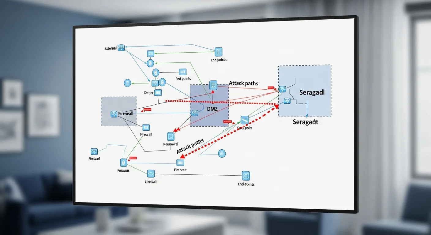
Security teams in regulated industries need visuals that resemble real work: executive readouts, toolkit laydowns, network topology with attack paths, server racks as assessment targets, red-team and blue-team floor exercises, analyst workstations, and security operations centers under blue light. This library groups seven Tygart Media cybersecurity images—one scene each—for CISO staff, compliance writers, MSSP marketers, and internal enablement teams who need believable art for slide decks, RFP appendices, wiki pages, and conference sessions.
Each image sits in the Cybersecurity collection within the Tygart Media visual library. The art is AI-generated in-house with Google Vertex AI (Imagen), exported as WebP, and published with IPTC/XMP metadata. Captions describe what the frame suggests—they do not report CVSS scores, client names, breach details, or certification results. Treat the set as illustrative material you can combine with your own findings and policies.
Penetration testing imagery complements longer architecture and governance writing on Tygart Media, including the Fortress Architecture piece linked below, which explores cloud design for regulated sectors. Start here for scene-setting; follow the related links when readers need engineering depth, enterprise audit framing, or AI-and-security stack comparisons.
Red-team versus blue-team exercise art helps explain collaborative testing models; toolkit flat lays communicate physical and digital methods without listing exploits; SOC imagery supports 24/7 monitoring narratives in proposals. Ethical-hacker workstation scenes round out the practitioner perspective for blog posts aimed at testers rather than executives.
Walk the gallery when you need a hero image for tabletop exercise recaps or internal security awareness campaigns, and keep legal and communications review on any scenario that could be read as depicting a real incident. Executive-report and SOC frames suit board-level narratives; toolkit and workstation images fit practitioner blogs; topology and server-rack scenes help explain scope during scoping conversations—always as illustration layered on your own verified results. None of the captions substitute for an actual test report or attestation letter.
Visual gallery
Cybersecurity executive presenting penetration test findings with risk matrix to corporate board room.Physical penetration testing toolkit including WiFi Pineapple, USB rubber ducky, lock picks, and RFID tools.Network topology diagram showing attack paths, firewalls, and DMZ zones on a touchscreen display.Server rack in data center with blinking LED status lights and organized ethernet cables.Red team versus blue team cybersecurity exercise in a corporate war room with attack strategy whiteboard.Ethical hacker workstation with dual monitors running Kali Linux and network scanning tools.Security Operations Center with multiple monitors displaying network threat detection dashboards.
Solar contractors, utility educators, and home-energy marketers rely on a shared visual vocabulary: monitoring dashboards on tablets, before-and-after residential arrays, thermal inspection frames, battery storage walls, micro-inverter wiring detail, desert-scale commercial farms, crew safety on steep rooftops, and aerial views of suburban installs. This library presents eight Tygart Media images—each isolating one of those beats— for training decks, service-area pages, storage upsell emails, and editorial explainers about installation quality, operations, and maintenance.
The images are part of the Solar Energy collection in the Tygart Media visual library. They are AI-generated in-house with Google Vertex AI (Imagen), published as WebP, and carry IPTC/XMP metadata. They illustrate common industry situations rather than documenting a specific Tygart Media installation project, customer site, or incentive outcome. Pair them with your own verified figures on production, savings, or program eligibility when your copy requires numbers.
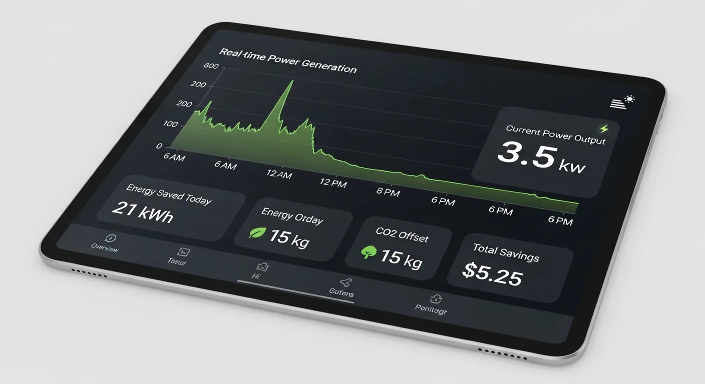
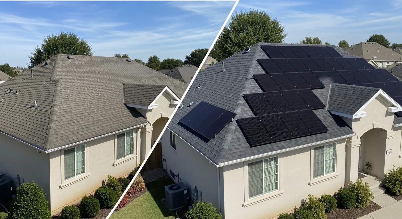
Use the monitoring dashboard frame alongside dashboard how-to articles; before-and-after and aerial rooftop images support residential sales conversations; thermal and wiring detail shots anchor technical posts; commercial farm and crew images fit utility-scale or safety themes. Mix frames to match the story you are telling, and keep claims about performance or pricing in your editorial voice rather than in the captions alone.
Battery storage and inverter-detail images help explain hybrid systems in one glance; thermal inspection art supports quality-control storylines; crew-on-rooftop frames underline PPE and fall-protection talking points when your safety officer co-authors the page.
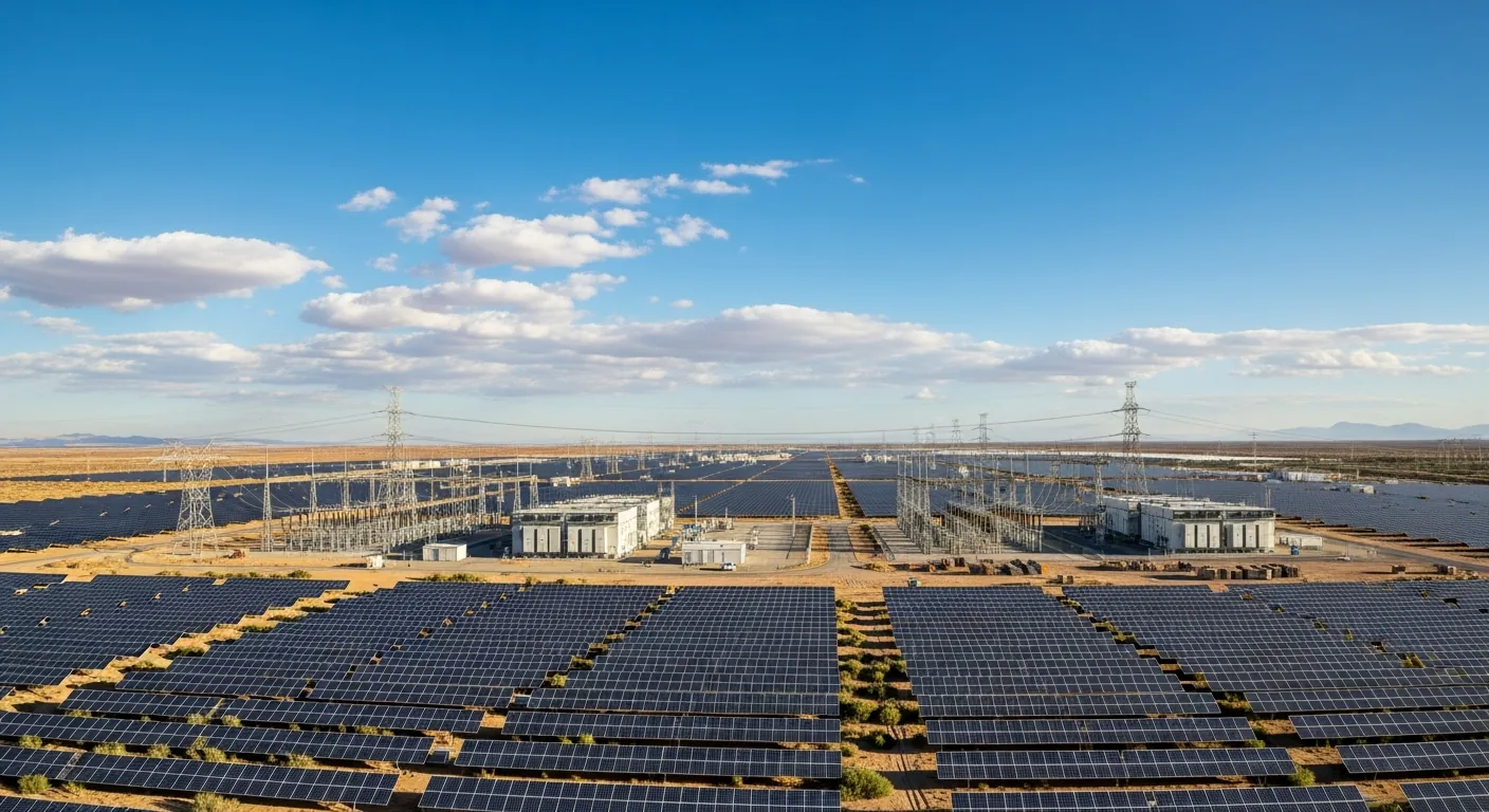
Related Tygart Media articles on solar dashboards, electrician workflows, utility clean-energy buildouts, and tariff-aware product design appear below for readers who want operational depth beyond the gallery. Technicians can pull wiring-detail and thermal frames into safety talks; sales teams can lead with before-and-after and aerial rooftop images; utility educators can anchor curriculum with commercial farm and monitoring scenes—all without implying a single shared project site across the set.
Visual gallery
Solar energy monitoring dashboard showing real-time power generation and savings on tablet.Before and after comparison of home with and without solar panel installation on roof.Solar panel technician using thermal imaging camera to inspect for hot spots and defects.Home battery storage system mounted on garage wall next to electrical panel.Close-up of solar panel micro-inverter and wiring connections during installation.Massive commercial solar farm with thousands of ground-mounted panels stretching across desert landscape.Solar panel installation crew mounting photovoltaic panels on residential roof with safety equipment.Aerial view of residential solar panel array installed on modern home rooftop.
Private aviation marketing lives on specificity: the red-carpet arrival, the quiet FBO lounge, the bedroom suite aloft, fleet lines on the ramp, night cockpit glow, cabin leather, and tarmac at sunset. This library brings together eight Tygart Media images—each focused on one of those moments—so charter brokers, FBO operators, aircraft management firms, fractional programs, and travel editors can illustrate brochures, service pages, decks, and editorial layouts without staging every scene on a live ramp.
Each image belongs to the Luxury Aviation collection in the Tygart Media visual library. They are AI-generated in-house with Google Vertex AI (Imagen), delivered as WebP files, and tagged with IPTC/XMP metadata for discovery. The scenes are illustrative: they do not identify a particular operator, tail number, or airport unless the title suggests a generic situation such as VIP boarding or a fleet on the ramp. Read captions and alt text for what each frame emphasizes—interiors, avionics, terminals, and flight attitudes—and add your own operational or compliance context where your audience needs it.
Work through the gallery in any order. Red-carpet boarding with ground crew, wide ramp fleet shots, bedroom suites, terminal lounges, above-cloud attitudes, night cockpit lighting, cabin interiors, and sunset silhouettes can serve as hero images, email banners, or training slides about passenger experience. They are not substitutes for manuals, checklists, or safety documentation unless you supply that narrative alongside the art.
Lighting and composition differ frame to frame so art directors can test dark cockpit glow against bright ramp daylight without reshooting. Ground-service details—red carpet, sedan, lounge seating—give copywriters concrete nouns to anchor luxury claims while you keep offers and routes in separate verified text.
Tygart Media also publishes Pacific Northwest aerospace and aviation policy reporting; the related links below connect this visual set to that editorial work without implying these images document a specific program or airport. Use the policy pieces when your audience cares about workforce, SAF infrastructure, or regional aviation economics; use this gallery when they need immediate visual proof of the private-travel experience you describe in copy.
Visual gallery
VIP passengers boarding private jet via red carpet with luxury sedan and ground crew on tarmac.Fleet of private jets parked on executive airport ramp with mountains in background.Private jet bedroom suite with full-size bed, silk bedding, and ambient mood lighting.Luxury FBO private terminal lounge with runway views, premium seating, and concierge service.Private jet flying above dramatic cloud formations at high altitude with deep blue sky.Private jet cockpit at night with illuminated avionics displays and stars through windshield.Luxury private jet cabin interior with cream leather seats, wood veneer, and champagne service.Sleek white private jet on tarmac at sunset with deployed stairs and golden light.
This page collects twenty generative album artworks from Tygart Media’s visual music series. Each image is a standalone cover tied to a fictional release name, and the titles themselves signal genre—Celtic folk, neo soul, country, ambient, punk, bossa nova, reggae, jazz, metal, bluegrass, and related moods appear across the set. Together they read like a mood board for musicians, podcasters, label marketers, and creative directors who want believable packaging art while concepts are still taking shape.
Every piece is produced in-house with AI image generation on Google Vertex AI (Imagen), exported as WebP, and published with IPTC/XMP metadata so filenames, captions, and alt text stay aligned for search and discovery. These are Tygart Media generative studies, not commercial releases tied to real bands or chart performance. Use them to illustrate talks about generative creative workflows, newsletter art for music-industry commentary, or placeholder covers when photography is not yet available.
Scroll the gallery for genre-specific references—from lantern-lit folk and velvet neo-soul palettes to gravel-toned country, ambient signal motifs, punk bridge graphics, and several variations on an “Iron Heart” jazz and metal series. When you embed an image in a longer article, pair it with your own process notes on prompts, metadata, and format choices rather than implying tour dates, streaming numbers, or licensing deals the artwork does not represent.
Genre cues repeat across the set so you can compare how palette, typography, and symbolism shift between folk lantern light, velvet neo-soul warmth, gravel-and-grace country texture, ambient signal abstraction, punk collage energy, and the heavier metal and jazz variants grouped under shared “Iron Heart” titles. That variation is intentional: the series shows how Tygart Media batches thematic cover art while keeping each filename and metadata record distinct.
For deeper context on how Tygart Media approaches generative music visuals and discovery, see the related articles linked below—including an AI music album case study, generative search optimization, and brand-asset production experiments. Those essays explain workflow; this gallery supplies the finished cover art to point at when you discuss results.
Visual gallery
Generative album cover for The Keepers Lantern Celtic Folk Artwork, part of Tygart Media’s Music & Album Artwork series.Generative album cover for Velvet Hours Neo Soul Artwork, part of Tygart Media’s Music & Album Artwork series.Generative album cover for Gravel And Grace Country Artwork, part of Tygart Media’s Music & Album Artwork series.Generative album cover for Signal Drift Ambient Artwork, part of Tygart Media’s Music & Album Artwork series.Generative album cover for Burnt Bridges Better Views Punk Artwork, part of Tygart Media’s Music & Album Artwork series.Generative album cover for Paper Lanterns Bossa Nova Artwork, part of Tygart Media’s Music & Album Artwork series.Generative album cover for Tide And Timber Reggae Artwork, part of Tygart Media’s Music & Album Artwork series.Generative album cover for Salt And Ceremony Artwork, part of Tygart Media’s Music & Album Artwork series.Generative album cover for Meridian Line Artwork, part of Tygart Media’s Music & Album Artwork series.Generative album cover for Glass Lighthouse Artwork, part of Tygart Media’s Music & Album Artwork series.Generative album cover for Hollow Bones Artwork, part of Tygart Media’s Music & Album Artwork series.Generative album cover for Velvet Frequency Artwork, part of Tygart Media’s Music & Album Artwork series.Generative album cover for Neon Cathedral Artwork, part of Tygart Media’s Music & Album Artwork series.Generative album cover for Anvil And Ember Artwork, part of Tygart Media’s Music & Album Artwork series.Generative album cover for Iron Heart Smoky Jazz Artwork, part of Tygart Media’s Music & Album Artwork series.Generative album cover for Iron Heart Heavy Metal Variation Artwork, part of Tygart Media’s Music & Album Artwork series.Generative album cover for Rusted Pocketknife Acoustic Take 2 Artwork, part of Tygart Media’s Music & Album Artwork series.Generative album cover for The Velvet Pour The Open Road Artwork, part of Tygart Media’s Music & Album Artwork series.Generative album cover for Iron And Salt Bluegrass Take 1 Artwork, part of Tygart Media’s Music & Album Artwork series.Generative album cover for Iron Heart Heavy Metal Take 1 Artwork, part of Tygart Media’s Music & Album Artwork series.
A water-damage company with 47 reviews just got recommended by ChatGPT over a competitor with 462.
Read that again. Four hundred and sixty-two reviews. Ten times the social proof. And the AI picked the little guy.
If you spent the last decade collecting reviews like they were votes, this should rattle you. It should also clarify everything, because the game didn’t just change — it ended, and a new one started while nobody was watching.
From ranking to matching
The old game was a scoreboard. Most reviews wins. Biggest ad budget wins. Best SEO agency wins.
The new game is a matchmaker.
In June 2026, OpenAI rolled out a memory system (they call it Dreaming) that quietly builds a living profile of you — your chats, your Gmail, your files — and uses it to shape every answer. It’s on by default. Two people asking ChatGPT the same question now routinely get different answers, because the AI knows different things about each of them.
Google’s doing the same thing from the other direction. AI Overviews don’t give you a ranked list of ten businesses anymore. They name two or three. Fourth place doesn’t get a consolation mention — it gets nothing. And here’s the number that should end the argument: only about 26% of the businesses sitting in Google’s top-3 map pack even appear in Gemini’s responses. You can win the map pack and still be invisible to the AI.
So the question was never “who has the most reviews.” The question is “who is the best fit for this person,” and the AI is answering it with information you can’t see.
The dinner test
Here’s how I explain it to myself.
Tonight I walked to a little family-run Thai place instead of ordering from a chain. No ad convinced me. No review count swayed me. The tools just… knew. They knew I’d rather have the local place with the great green curry than the heavily advertised alternative.
The tools know you’d pick the local place. No ad budget changes that.
That’s what happened with the 47-review company. The AI didn’t count stars. It matched a person — their history, their preferences, the pattern of what “good” looks like to them — against the businesses it knew. And the little guy fit better.
Panda Express can outspend everybody. It doesn’t matter. When the tool knows you better than the ads do, the ads stop working on you.
Why the count stopped mattering
It’s not that reviews don’t matter. They do — review signals have actually grown to about 20% of local ranking weight. But count was always a proxy for trust, and the AI doesn’t need the proxy anymore. It reads the reviews. It summarizes the sentiment. It checks whether your website says the same thing your Google profile says. It looks at whether your story is consistent across fifteen, twenty, thirty sources — or whether it falls apart the moment it leaves your homepage.
A thousand bought or begged reviews with thin sentiment lose to fifty detailed ones that all say the same specific true things. The AI can tell the difference. It literally summarizes them.
What actually wins now
The reputation graph: every signal connected, telling one consistent story.
The playbook isn’t complicated, but it’s unforgiving:
Complete your profile like it’s the product. The AI reads your Google Business Profile as a primary source. Empty fields are silence, and silence doesn’t get cited.
Recency and sentiment over volume. A steady stream of real, specific reviews beats a pile of old five-stars.
Say the same true thing everywhere. Your website, your profile, your directories, your socials — one consistent story, confirmed in many places. Contradictions are how you disappear.
Structure your data. Schema markup is how the machines read you. It’s not optional anymore; it’s the difference between being understood and being skipped.
Be genuinely good. This is the one nobody wants to hear. The tools are getting better at knowing what “good” looks like for each person, which means there are fewer places to hide. You can’t buy your way into a match. You have to be the answer.
The honest caveat
I want to be straight about what we know and what we don’t. Nobody outside these companies can see exactly how the personalization works — one researcher called it “a synthesized profile that neither the user nor the brand can fully see.” That’s the truth of it. We’re reading the outputs and working backward.
And the social-graph part — your friend’s Facebook comment tipping a recommendation — is directionally right but the mechanics differ by platform. Google has the cross-product graph: YouTube, Maps, Gmail, Android. Meta’s AI has the actual social graph. ChatGPT works mostly from your own data. The destination is the same everywhere: the recommendation gets personal, and the personal is opaque.
Less places to hide
That’s the line I keep coming back to. Less places to hide.
For years you could paper over a mediocre operation with review velocity, ad spend, and SEO tricks. The machines are taking those tools away — not out of virtue, but because matching works better than ranking, and the platforms all figured that out at once.
What’s left is the oldest marketing strategy there is: be good, be consistent, and make sure the machines can see it.
The 47-review company didn’t beat the system. It was the system working as designed. The question is whether you’re building a business the new system can see — or still optimizing for the old scoreboard.
This is the Monday afternoon Storm Tracker desk for October 5, 2026. The organized severe window is closed. The Storm Prediction Center 2000 UTC Day 1 convective outlook, updated 2:56 p.m. CDT by Thornton, kept the categorical map at no severe thunderstorm areas through tonight. The 1128 a.m. CDT discussion from Gleason and Chalmers still stands: locally gusty winds are possible with low-topped convection in New England, showers and thunderstorms linger along a slow front from the northern Gulf into southern Georgia and northern Florida, and isolated storms may continue from the Sierra into the Great Basin and the southern and central Rockies. Elevated storms are possible late this afternoon into tonight across parts of the Upper Midwest. Weak instability is the limiter in every one of those regions. Restoration exposure this afternoon is water, not a wind or hail outbreak: ponding on the lower Texas coast, a pulse-heavy rain band from the Florida Panhandle into eastern Georgia, and leftover river stages on the Mississippi.
What is live this afternoon
SPC current watches, updated 2:14 p.m. CDT Monday, list no watches valid. The most recent convective watch on the archive page is watch 0676. No mesoscale discussions are in effect as of the 2:33 p.m. CDT SPC update. Day 1 tornado, wind, and hail probabilistic areas are empty. Today’s SPC local storm report page for the 1200 UTC October 5 through 1159 UTC October 6 window shows no tornado, hail, or wind reports received as of this desk check.
The Weather Prediction Center Day 1 Excessive Rainfall Outlook, updated 11:55 a.m. EDT Monday and valid 16 UTC October 5 through 12 UTC October 6, is the product that still has a restoration ticket. WPC and the Brownsville office dropped the Slight risk on the southern lower Texas coast and replaced it with a small Marginal, mainly eastern Cameron County and coastal Willacy County, including Brownsville and South Padre Island. Heaviest rain had been on South Padre Island and the southern tip of Texas. Guidance keeps the best convergent area just offshore overnight, with a few cells able to sneak back onshore. Farther east, a Marginal remains over the Florida Panhandle, northern and central Florida, and eastern Georgia. The front was analyzed along the Florida-Georgia border at 12 UTC, expected to bisect northern Florida later this afternoon. Precipitable water on the 12 UTC Jacksonville sounding was 2.44 inches. Best 2-to-4-inch signature sits between Destin and the Big Bend and inland near and west of Tallahassee, including the Apalachicola National Forest and US 98 towns. Coastal I-95 from Savannah through Jacksonville to St. Augustine is the urban runoff strip.
The national watches-and-warnings text still carries early-morning flash flood warnings that have expired: Coffee and Dale counties in southeastern Alabama until 4:15 a.m. CDT, and northern Barbour County until 2:30 a.m. CDT, with 4 to 6 inches cited in Barbour. Those are last-night tickets, not live polygons. River flood warnings that still matter this afternoon include minor flooding on the Mississippi River at Louisiana, Missouri, in effect until Wednesday morning (stage 15.2 feet at 10 p.m. CDT Sunday, flood stage 15.0), and at Clarksville, Missouri, until Tuesday evening (stage 25.2 feet, flood stage 25.0). No severe thunderstorm warning or tornado warning was the lead product on the national summary at this check.
Hotspots
Lower Texas coast — Cameron and Willacy
Brownsville, South Padre Island, Port Isabel, and coastal Willacy are the tightest flood footprint this afternoon. WPC’s 16Z update, coordinated with the Brownsville office, cut the Slight to a Marginal after radar showed the heaviest rain on the island and the southern tip rather than a broad inland swath. Neighborhood probabilities for more than 3 inches stayed modest, and hourly chances of an inch or more drop after mid-afternoon as the convergent axis slides offshore. Restoration read: isolated street and low-spot water, not a multi-county extraction day. Crews already on a water ticket should finish the wet middle before calling this a new event.
Florida Panhandle into eastern Georgia
Destin, Panama City Beach, Apalachicola, Tallahassee, and the Apalachicola National Forest sit under the best remaining heavy-rain signature, with 2 to 4 inches possible before the ascent lifts out this afternoon. Sandy soils make the forest and US 98 towns hard to flood unless rates exceed about 3 inches an hour. Panama City Beach and Apalachicola proper are the exceptions WPC flagged. Farther east, Savannah, Jacksonville, and St. Augustine have the urban runoff problem: neighborhood probabilities for more than 5 inches of 40 to 60 percent along the Georgia-Florida coast, but low probabilities for a broad 2-inch footprint, which is the signature of pulse storms, not a training line. Restoration read: short windows of ponding on I-95 and poor-drainage lots. Tree and wind claims are not the organized threat. Effective bulk shear under 30 knots and poor lapse rates are why SPC left this out of every severe area.
New England gusts, and the Mississippi river stages
Northern New York into northern New England can still see low-topped showers and a locally gusty wind as the Quebec trough moves east. SPC’s morning and midday discussions both said limited low-level moisture should hinder an organized severe wind threat. That is a roof-and-limb check, not a watch. On the Mississippi, Louisiana and Clarksville remain in minor flood warnings into Tuesday and Wednesday. Edison Avenue past the railroad tracks at Louisiana, and the road to Port Marmac south of Clarksville, are the impact lines already written. Restoration read: access and contents at the river edge, not a convective outbreak.
Just hit
The last 24 hours did not produce a severe-report day. SPC’s filtered and unfiltered pages for today show no tornado, hail, or wind reports. Yesterday’s page, covering 1200 UTC October 3 through 1159 UTC October 4, also listed none. What did hit is water. Overnight flash flood warnings covered Enterprise, Ozark, Fort Rucker, Elba, and New Brockton in Coffee and Dale counties, and Clayton and the US 82 corridor in Barbour County, Alabama, with 1 to 3 inches already down in Coffee and Dale and 4 to 6 inches cited in Barbour before those polygons expired before dawn. A special marine warning early Monday noted a possible waterspout southeast of V Tower on Apalachee Bay. Those are already-ticket items if a call came in overnight. They are not an open warning this afternoon.
Pulse table
Region
Main threats
SPC/NWS level
Status
Lower Texas coast
Heavy rain, isolated flash flood
WPC Marginal; no SPC risk
Live, shrinking offshore
Florida Panhandle, N/central FL, E Georgia
Pulse heavy rain, urban ponding
WPC Marginal; general thunder
Live into early afternoon
Southeast Alabama
Overnight flash flood
Expired FFWs before dawn
Just hit, not live
Northern New England
Locally gusty low-topped wind
General thunder, no severe area
Scattered, not organized
Mississippi at Louisiana and Clarksville
Minor river flood
Flood warnings into Tue/Wed
Ongoing river, not storm
Rest of the CONUS
None organized
No watches, no MDs, no LSRs
Quiet
What this means for restoration teams
Do not staff a severe board tonight. There is no watch to stage against and no hail or wind report stack to work. The open work is water: finish overnight Alabama flood calls in Coffee, Dale, and Barbour if they are still wet; keep a small extract-and-dry crew available for Cameron County, Willacy County, and South Padre Island if a cell comes back onshore; and treat Panama City Beach, Apalachicola, Jacksonville, and the Savannah-to-St. Augustine strip as short-fuse ponding, not a line. Mississippi river access at Louisiana and Clarksville is a contents and road problem through midweek. Tree work in New England only if a local gust actually takes a limb. No client names belong on this desk.
What this is not
This is not a derecho, not a severe-thunderstorm outbreak, and not a U.S. landfalling hurricane. Hurricane Rachel, 90 mph and moving west at 8 mph near 20.3N 117.1W as of the 2 p.m. PDT advisory, is an eastern Pacific storm and is not a U.S. land threat. There are no tropical cyclones in the Atlantic. Invest AL92, a trough over the southwestern Gulf of America, has a 60 percent chance of formation in 48 hours and 80 percent in 7 days, with a tropical depression expected around midweek. NHC said it is too early to assign specific impacts to the northern Gulf Coast. It is not a named cyclone on or just off U.S. land this afternoon, so it does not open a named-storm restoration file today.
Looking ahead one day
The SPC 1730 UTC Day 2 outlook, issued 12:30 p.m. CDT Monday by Lyons and valid Tuesday, again has no severe thunderstorm areas. Severe storms are unlikely Tuesday. High pressure and cool northerly flow favor a drier, more stable East. Scattered storms remain possible on the Gulf Coast and into central and southern Florida as the front sags south, with weak lapse rates and shear. Isolated storms are possible over the higher terrain of the Rockies under a weak trough, and isolated storms are possible across the northern Great Lakes late Tuesday under cooler mid-level temperatures. The Gulf disturbance is the item to recheck Tuesday morning, not a reason to invent a landfall today.
The association already adopted the budget. The owner still pays a line that may not match the study. That gap is the product.
The idea mills keep minting an HOA chatbot, a fee-negotiator app, and a reserve.ai. Three names. One object. A coupon or a budget page that does not sit next to the reserve schedule the board was required to keep, or next to the funding floor a lender will apply when the unit is sold.
Greg Isenberg’s stream and the daily micro-SaaS accounts keep splitting the same reader. One post wants a refund radar for merchants. Another wants a billing watch that flags failed payments before churn. A third wants a photo upload that becomes a letter. Useful pieces. Wrong cut if you leave them as separate products. The owner does not wake up wanting a new dashboard. The owner wakes up because the assessment moved and the packet does not say whether the move matches the study.
The budget is not the file
Most owners treat the annual coupon as weather. It arrives. They groan. They pay. The file underneath it is larger than the coupon: the adopted budget, the reserve schedule, the study that set the schedule, the vote that waived a line the statute may no longer allow, and the percent of assessment income that a conventional lender will test before it will write a loan on the unit.
The Foundation for Community Association Research, in the Community Association Fact Book 2025 (data as of December 31, 2025), counts 373,000 U.S. community associations, about 78.1 million residents, and $124.2 billion in assessments collected. The same Fact Book dashboard puts reserve balances near $31 billion. That is the national pool. It is not a verdict on any one building. A building can sit inside a $124.2 billion system and still be funding the roof at a number the study does not support.
Association Reserves has published percent-funded distributions for decades. A September 2026 compilation by RapidEye, drawing on that archive of more than 100,000 studies from 1986 through 2025, reports that 74 percent of associations were under 70 percent funded, and that 34 percent were under 30 percent funded. The 70 percent line is an industry convention, not a statute. It is still the number boards and buyers already use. A checker that cannot say where a single budget sits against that convention, and against the statute that actually applies, is a chatbot.
Why this week, not a vibe
Florida changed the numbers, then stopped changing them. CS/CS/HB 913, Chapter 2025-175, was approved June 23, 2025, and took effect July 1, 2025. Under section 718.112, Florida Statutes, reserves are required for roof replacement, building painting, and pavement resurfacing regardless of cost, and for any other item whose deferred maintenance or replacement cost exceeds $25,000, or the inflation-adjusted amount set by the Division, whichever is greater. The old threshold was $10,000. Raising it took smaller components off the mandatory list. An item that left the schedule did not stop aging.
The waiver rule is the sharper line. For a budget adopted on or after December 31, 2024, members of a unit-owner-controlled association that must obtain a structural integrity reserve study may not vote to provide no reserves, or less reserves than required, for the SIRS items in section 718.112(2)(g). Non-SIRS reserves can still be waived by a majority of the total voting interests. Associations that existed on or before July 1, 2022, had until December 31, 2025, to complete the first SIRS, a deadline HB 913 extended from the end of 2024. Officers and directors must sign an affidavit acknowledging receipt of a completed study. The Florida Senate bill summary for HB 913 is plain on that affidavit. A 2026 reviser’s bill, Chapter 2026-14, did not rewrite the funding rule. The budget in front of an owner this fall is still the HB 913 budget.
The lender rule is the second clock, and it is not a Florida rule. Fannie Mae Lender Letter LL-2026-03, issued March 18, 2026, raises the Full Review reserve test from 10 percent to 15 percent of budgeted assessment income for loan applications dated on or after January 4, 2027. Freddie Mac aligned on the same date. The denominator is assessment income, not the whole budget. A reserve study less than three years old, funded at the highest level the study recommends, can still substitute for the flat percentage. Separately, for applications dated on or after August 3, 2026, Fannie Mae retired Limited Review for established condo projects, so more budgets get read at all. A unit that was warrantable in 2025 can fail a 2027 application on one line the owner never calculated.
California is the third clock, and it is already ringing. Civil Code 5551 required the first balcony, deck, and elevated-walkway inspection for associations with more than three units by January 1, 2025. Repair bills from missed waterproofing are landing as special assessments. That is a different statute from Florida’s SIRS. The product does not need a national platform to use it. It needs a state tag on the page the owner uploads.
Two primitives, one wedge
Primitive one is photo-and-PDF review. The mills have been shipping receipt readers for months. The input here is the annual budget, the reserve schedule, the assessment coupon, or the study summary the board mailed. Assessment income in the header. Reserve contribution on its own line. Component list if the association printed one. No login for the first answer.
Primitive two is the file the institution was forced to produce, joined to a funding floor a buyer’s lender will apply. In Florida that file is the SIRS and the budget adopted under section 718.112. Nationally, for a condo that wants a conventional loan, it is the reserve line tested in Fannie Mae Selling Guide B4-2.2 against LL-2026-03. The mills keep these apart: a reader, a letter filler, a lender explainer. The owner needs them on one page.
The wedge is a free checker. Not a platform. Photo or PDF in. Three labels back: reserve line matches the study, reserve line does not match, or the page is too thin to tell. For a Florida condo of three or more habitable stories, a fourth label: waiver language on a SIRS item that section 718.112 no longer allows for a budget adopted on or after December 31, 2024. For any condo budget, a fifth label: the reserve allocation as a percent of assessment income, set next to 10 percent today and 15 percent for applications on or after January 4, 2027. Thirty seconds. No account.
Do not start by filing a complaint. Do not start by moving money. The first action a stranger will take this week is a photograph of a page they already have in a kitchen drawer.
The map is the moat
One budget is a favor. Ten thousand budgets are a labeled map: association, state, year, reserve ratio, study age, waiver language, SIRS components present or missing. That map is not a third dashboard. It is the dataset a manager, a buyer’s agent, and a lender’s reviewer cannot assemble from a single PDF.
Charge after the page proves a mismatch, or do not charge. A draft records request, a draft question for the annual meeting, or a draft note to the board is worth a small fee once the checker has a label. A records request under Florida section 718.111, a complaint to the Division, or a challenge to a special assessment is not a model’s job to send. Models draft. The owner signs. The same rule applies in California under the Davis-Stirling records rights. Irreversible steps stay with a human.
The compounding path is the labeled set, not a portal that stores every governing document. Governing documents are a swamp. The reserve line is a number. Numbers compound. PDFs do not.
A build order that will survive contact
Week 1–2: one checker. Photo or PDF in. Match, mismatch, or page too thin. One state. Florida condominiums first, because the waiver ban and the SIRS affidavit are in statute, not in a blog post. No account for the first answer.
Week 3–4: a draft question pack with a human signer. Records request, meeting question, or a note that the reserve line is under the study. A cheap per-letter fee only after the first free verdict.
Month 2: add the lender test. Show the reserve allocation as a percent of assessment income, next to 10 percent and next to the 15 percent line in LL-2026-03. Do not tell the owner the unit is unwarrantable. Tell the owner the line the lender will divide.
Month 3: California balcony inspections and special-assessment notices as a second state tag. Same wedge. Different statute. Civil Code 5551, deadline January 1, 2025.
After volume: the map. Ratio by association and year. Study age. Waiver language that survived a statute that retired it. Sell the map to managers and buyer agents. Keep the checker free.
What to refuse
Refuse a national HOA operating system. Refuse an agent that pays the assessment. Refuse a product whose only wedge is “AI for board productivity.” Refuse a letter that accuses the board of a breach before a person has read the page and signed the send. Willful failure to complete a required Florida SIRS can be pleaded as a fiduciary issue. That pleading is a lawyer’s work. The checker’s work is the label.
Also refuse the slogan. billingwatch.ai and refundradar.ai are merchant tools. They watch failed payments and refund abuse. The owner’s problem is not churn. The owner’s problem is a contribution line that may not match a study the association already paid for, under a statute or a lender letter that already has a date on it.
Join the line
This is the household version of a pair the mills keep splitting: a document the customer already holds, plus a file the institution was forced to produce, joined before the next budget hardens and before a 2027 loan application divides the reserve line by assessment income.
The noticing used to require a reserve specialist and a weekend. It now requires a model that can read the page and a person who will sign anything that leaves the building. Recovery still works because the first check costs the owner almost nothing. Charge them after the study proves a mismatch, or do not charge them.
Someone will own the labeled map of assessed versus studied. The mills will keep proposing a new .ai name for each budget PDF. Ignore the names. Join the line. Keep the map.
This is the Monday morning Storm Tracker desk for October 5, 2026. Overnight into this morning the organized severe window stayed closed. The Storm Prediction Center 1300 UTC Day 1 convective outlook, updated 7:32 a.m. CDT by Guyer and Dean and valid 1300 UTC Monday through 1200 UTC Tuesday, carries no severe thunderstorm areas. The summary line is short: severe thunderstorms are not expected today.
The larger restoration ticket is water, not a watch box. The Weather Prediction Center Day 1 Excessive Rainfall Outlook, updated 0746 UTC and discussed at 3:57 a.m. EDT by Wegman, keeps a Slight Risk of excessive rainfall for the southern lower Texas coast, including Brownsville and coastal Willacy and Cameron counties. Southeast Alabama took radar-indicated flash flood warnings overnight that have since expired. Conditions change fast. Verify with the National Weather Service for the specific county or ZIP before you roll.
What is live this morning
No convective watches are currently valid. SPC’s watch page, updated 12:26 UTC Monday, lists none. The most recently issued watch is still Severe Thunderstorm Watch 676, a Wednesday, September 30 product for west-central Texas. No mesoscale discussion is driving a severe box this morning. SPC’s storm-report page for the new convective day, 1200 UTC Monday through 1159 UTC Tuesday, shows no tornado, hail, or wind reports received.
The pattern behind the quiet severe desk is progressive northwesterly flow over the northern tier of the country and Canada, with a prominent upper trough shifting east over Quebec. Surface high pressure and large-scale subsidence generally prevail east of the Mississippi River. Surface troughing is becoming established across the Great Plains, but with limited moisture. Along the Gulf Coast and Florida, thunderstorms are expected near and south of a southward-shifting frontal boundary. Isolated low-topped thunderstorms may occur today from northern New York into northern New England as a cold front shifts east. SPC notes a few convectively enhanced wind gusts might occur there as lapse rates steepen diurnally. That is a local gust note, not a risk area.
Watches that expired overnight versus what is still live
Nothing convective expired overnight because nothing convective was valid. The overnight Day 1 outlook at 0100 UTC, written by Squitieri at 8:37 p.m. CDT Sunday, already said severe thunderstorms were not expected across the continental United States through 1200 UTC. Lightning coverage along the sagging Southeast front was expected to decrease with nocturnal cooling, and a plume of marginal buoyancy from Colorado into New Mexico was expected to wane.
The products that did expire were flash flood warnings, not watches. National Weather Service Birmingham extended a Flash Flood Warning for northern Barbour County until 2:30 a.m. CDT. At 11:52 p.m. CDT Sunday, radar indicated 4 to 6 inches already down, with another 2 to 4 inches possible. The polygon included Clayton, Comer, Spring Hill, Hawkinsville, and U.S. 82 between mile markers 219 and 235. National Weather Service Tallahassee, issued by Jacksonville, put a Flash Flood Warning on central Coffee County and northwestern Dale County until 4:15 a.m. CDT. At 1:20 a.m. CDT, radar indicated 1 to 3 inches down and up to 2 inches more, covering Elba, Fort Rucker, Enterprise, Ozark, New Brockton, and Ariton. Both of those warnings are off the board this morning.
A Special Marine Warning from Tallahassee, also issued by Jacksonville, covered Apalachee Bay and coastal waters from the Suwannee River to Apalachicola until 3:30 a.m. EDT for a radar-indicated waterspout and gusts of 34 knots or greater. The cell was 12 nautical miles southeast of V Tower, moving east at 5 knots. That marine warning has expired. It was a coastal water ticket, not a land tornado report.
What is still live is flood-watch language, not a convective watch. National Weather Service Mobile, issued by New Orleans at 9:58 p.m. CDT Sunday, extended a Flood Watch through Monday morning, until 1700 UTC, for portions of southwest Alabama and the western Florida Panhandle, including Baldwin and Mobile counties and the Destin to Fort Walton Beach coast. National Weather Service Tallahassee, issued by Jacksonville Sunday afternoon, holds a Flood Watch through Monday evening for southeast Alabama including Geneva and Houston counties, the Florida Panhandle, and parts of south Georgia. The Tallahassee text calls for another 2 to 4 inches, locally up to 6, especially along the Emerald and Forgotten coasts, and notes south-central Georgia is already primed from Friday rain. National Weather Service Jacksonville at 2:17 a.m. EDT extended a Flood Watch through this evening for portions of north Florida and southeast Georgia, including Baker, coastal Duval, coastal and inland Nassau, and eastern Hamilton counties, with listed towns running from Fernandina Beach and Hilliard toward Alma and Woodbine.
Hotspot 1 — Lower Texas coast
This is the only Slight Risk on the WPC Day 1 map. A stalled front remains draped across almost the entire Gulf Coast, and the piece near the lower Texas coast is stationary. Flow on both sides of the front is out of the northeast. Precipitable water along the front is above 2.25 inches, and sea-surface temperatures in the upper 80s are feeding slow-moving, training showers and thunderstorms that are moving southwest along the front into the coast. WPC says rainfall yesterday alone ranged from 3 to 6 inches, with another 2 to 4 inches expected today.
Wegman kept the Slight Risk specifically for coastal Willacy and Cameron counties, including Brownsville, and noted that outside urban pockets on South Padre Island and in Brownsville, much of the area is flat with sandy soils that are difficult to flood even with this volume. That is an urban and poor-drainage ticket, not a basin-wide river emergency.
Restoration read: stage extraction and drying for low-lying streets, underpasses, and first-floor commercial space in Brownsville and on South Padre, not a regional roof-and-wind deployment. Yesterday’s 3 to 6 inches is already a wet-drywall clock in the places that did not drain. Photograph standing water only if the road is clear. Turn around, don’t drown.
Hotspot 2 — Southeast Alabama into the Florida Panhandle and Big Bend
The same front extends across far southern Alabama, Georgia, and north Florida, but here it has been moving south, slowly. WPC left this corridor in a Marginal Risk. The heaviest rains are aimed at the Florida Panhandle near Apalachicola and the Big Bend. Forecast totals for the day run 3 to 6 inches in those regions. Forecasters kept the risk at Marginal because the area is relatively flat, sparsely populated in the core, and full of swamp that can take water. Urban flash-flood concern stays along I-10 from Pensacola through Tallahassee into Jacksonville, where storms are not expected to move very far.
Overnight just-hit reports are the Barbour, Coffee, and Dale warnings. Those polygons are off, but the Flood Watches are not. Mobile’s watch runs through Monday morning. Tallahassee’s runs through Monday evening. That is the handoff from a warning that already verified on radar to a watch that still covers the next round.
Restoration read: southeast Alabama is a just-hit water desk. Enterprise, Ozark, Elba, and Clayton are the towns named in the expired warnings. Treat interior water found this morning as last night’s rain, not a new severe claim. The Panhandle and Big Bend are today’s training-rain desk if cells sit on I-10 or the Forgotten Coast. Do not staff it as wind or hail.
Quiet severe pulse and leftover river water
Northern New York into northern New England is the only place SPC mentioned enhanced gusts, and only as isolated low-topped storms on the cold front. No risk area, no watch, no reports. The Plains stay moisture-starved under the surface trough. East of the Mississippi, high pressure is the dominant story away from the Gulf front.
River products already on the board are not the same as a flash-flood warning. National Weather Service St. Louis at 10:30 p.m. CDT Sunday kept minor flooding on the Mississippi River at Louisiana, Missouri, stage 15.2 feet against a 15.0-foot flood stage, in effect until Wednesday morning, and at Clarksville, stage 25.2 feet against 25.0, until Tuesday evening. National Weather Service Quad Cities replaced a river flood watch with a flood warning for minor flooding on the Wapsipinicon River near Anamosa Shaw Road from Monday morning into Tuesday morning. Those are channel tickets from earlier rain, not this morning’s convective pulse.
Tropics are not a U.S. land desk this morning. No named cyclone is threatening the mainland or is on the coast from an overnight landfall. The National Hurricane Center Atlantic discussion at 1215 UTC notes a front stalling over the northern Gulf and says broad low pressure may develop over the far southwest Gulf Tuesday night into Wednesday. Environmental conditions are only marginally conducive; a tropical depression could form in the second half of the week while the system drifts east, then turns north. That is a development note, not a landfall warning. The hurricane-warning language on the national watch page this morning is offshore Mexico in the eastern Pacific, not a Gulf Coast product.
Pulse table
Region
Main threats
SPC / WPC / NWS level
Status this morning
Lower Texas coast (Cameron, Willacy, Brownsville)
Training rain, urban flood
WPC Slight; no SPC severe area
Live; another 2–4 inches after 3–6 yesterday
SE Alabama (Barbour, Coffee, Dale)
Just-hit flash flood
Warnings expired 2:30–4:15 a.m. CDT
Aftermath; 1–6 inches indicated overnight
SW Alabama / western FL Panhandle
Additional heavy rain
Flood Watch through Monday morning
Live until about noon CDT
Emerald / Forgotten Coast, Big Bend
Training rain, isolated flash flood
WPC Marginal; Flood Watch through Monday evening
Live; 3–6 inches possible, locally 6
North Florida / SE Georgia
Excessive rainfall
JAX Flood Watch through this evening
Live
Northern NY / northern New England
Isolated gusty storms
No severe area
Low-topped; no watch
Mississippi at Louisiana MO / Clarksville; Wapsipinicon
Minor river flood
Flood warnings
In channel, not a new convective ticket
What this means for restoration teams
There is no wind or hail box to stage against. The morning work, if it is already inside a building, is southeast Alabama water from warnings that expired before dawn, plus any Brownsville or South Padre street that did not clear after yesterday’s 3 to 6 inches. The day work is extraction timing on the lower Texas coast and a flood-watch posture from Mobile through the Panhandle into north Florida and south Georgia.
A Slight Risk of excessive rainfall on sandy coastal plain is not the same job as a Slight Risk of severe thunderstorms. Staff pumps, moisture meters, and drying equipment. Do not staff tarps for a watch that does not exist. River statements on the Mississippi and the Wapsipinicon are separate from the Gulf front; they are slow water already in the channel.
What this is not
This is not a severe outbreak and not a U.S. mainland hurricane landfall. SPC’s categorical map is empty. No convective watch is valid. No preliminary tornado, hail, or wind report is on today’s SPC log. The Gulf development note is a midweek possibility over the southwest Gulf, not an overnight hit. The local-storm pattern this desk should staff is training rain on a stalled coastal front and leftover flood-watch counties from last night’s Alabama warnings.
Looking ahead
SPC’s next Day 1 outlook is scheduled by 1630 UTC. WPC’s Day 1 window runs through 12 UTC Tuesday. The front stays the story: stationary on the lower Texas coast, still sagging south across the Southeast. If the southwest Gulf low organizes later in the week, that becomes a tropical desk only after NHC names it or puts a watch on the coast. Until then it is a moisture source for the same stalled boundary.
AI search visibility is whether AI assistants name your business when someone asks for a local service — and 78% of local-services brands are currently invisible to it.
ChatGPT recommended just 1.2% of business locations in a 2026 benchmark of 350,000 locations, versus 35.9% appearing in Google’s local 3-pack (SOCi, 2026).
Only 12% of URLs cited by AI overlap with Google’s top 10 results — this is a separate ecosystem with separate rules (teehoomartech).
The shops winning AI citations publish real price ranges, license and certification signals, and emergency-intent pages — the three shapes almost nobody in the trades has built.
Expect a 90-day foundation cycle: fundamentals first, then the service × city content matrix, then seasonal content.
What is AI search visibility for a local business?
AI search visibility is the practice of making your business the answer AI assistants give — getting ChatGPT, Gemini, Perplexity, or Copilot to recommend you by name when someone asks for a local service. Think of it as SEO for the recommendation era.
Your next customer didn’t Google “plumber near me.” They asked ChatGPT. Or they asked Gemini while standing in their kitchen with water pooling under the sink. And the AI named three businesses — yours wasn’t one of them.
This isn’t a future problem. According to BrightLocal (March 2026), 45% of U.S. consumers use AI to find and choose a local business — up from 6% a year earlier. The question is no longer whether AI sends you customers. It’s whether AI knows you exist.
How far behind are local businesses in AI search?
A 2026 benchmark by SOCi across roughly 350,000 business locations put hard numbers on the gap:
ChatGPT recommended 1.2% of locations. Google’s local 3-pack showed 35.9%. Gemini recommended 11%, Perplexity 7.4% (SOCi, 2026).
AI visibility is 3 to 30 times harder to achieve than ranking well in traditional local search (SOCi, 2026).
Only 12% of URLs cited by AI overlap with Google’s top 10 results (teehoomartech). This is a different ecosystem, not an extension of the old one.
78% of local-services brands are invisible to AI, and 88% of local businesses have no AI search strategy at all (May 2026 industry index).
Here’s the reframe that matters: AI doesn’t rank you. It recommends you. Traditional SEO was optimization — climbing a list. AI visibility is qualification — convincing a model you’re a safe, correct answer to give a real person. Everything below follows from that shift.
Traditional local SEO
AI search visibility
Climb a ranked list (positions 1–10)
Become the recommended answer (named or not at all)
Optimize for Google’s crawler
Qualify for the model’s trust judgment
Reviews are a ranking signal
Reviews are a qualification filter — the AI reads the text
Your website is the destination
Your website is the source the model draws on
One rulebook (Google)
Different rulebooks per engine (Gemini, ChatGPT, Perplexity)
What are the non-negotiable fundamentals?
You’ve seen this checklist before, so here’s the short version — these are table stakes, and the data says they still move the needle:
NAP consistency everywhere. Inconsistent name/address/phone data cuts your AI citation probability by 67%. Consistent omnichannel data delivers 3.2x the AI visibility (Birdeye, 2025).
A complete Google Business Profile. Optimized profiles appear in AI Overviews 42% more often, with 30% more profile views and 34% more direction requests (Local Falcon; SapientSEO).
Review volume, velocity, and recency. AI treats reviews as a filter, not a ranking signal — and it reads the review text, not just the stars. ChatGPT-recommended locations averaged 4.3 stars in the SOCi benchmark: good enough to pass the filter, with the text doing the real work.
Owner responses on reviews. Every response is a place to confirm your services, your service area, and real outcomes — in the AI’s own training-adjacent data.
LocalBusiness schema on every page. Structured data increases AI citation probability 3.4x (MIT CSAIL). FAQ content earns 2.8x more AI citations than marketing copy (Search Engine Land research).
If any of those are missing, fix them first. What follows is what nobody is telling the trades.
How do you win the 2am emergency query?
The highest-value AI query in the trades isn’t “best plumber near me.” It’s “emergency plumber near me open now” at 2am — asked by someone with water coming through their ceiling. Nobody has mapped AEO to urgent intent. Here’s the playbook:
Set your after-hours attributes. Your GBP has hours fields most shops leave blank or set wrong. AI models check “open now” signals before recommending — a blank field reads as closed.
Build dedicated emergency service pages — one per emergency service, not a paragraph on your homepage. Format them as direct answers: what counts as an emergency, what you do first, typical response time, service area, then the phone number.
Answer the 2am questions explicitly. “Do you charge extra for after-hours calls?” “How fast can you get to [neighborhood]?” If your page answers them in plain sentences, the AI can quote them. If it doesn’t, the AI quotes whoever did.
What trust signals make AI recommend a contractor?
Here’s the qualification logic: an AI will not recommend a stranger to enter someone’s home unless it has reasons to trust. For the trades, those reasons are concrete — and almost nobody publishes them properly:
License numbers on every service page, not buried on a contact page. “WA Licensed General Contractor #TYGART123JD” is an entity signal.
Insurance stated plainly — liability coverage and bonding, in sentences, not badges alone.
Trade certifications as trust qualifiers — IICRC for restoration, NATE for HVAC, EPA 608 for refrigerant work. These are the exact credentials a homeowner would want verified, which makes them exactly what the AI looks for.
Put them in schema too. Credentials in visible text get read; credentials in structured data get cited.
Zero of the major guides on this topic mention licensing or certification. That’s your opening.
What should a local business publish so AI cites it?
“Structured local content publishing” is everyone’s advice and nobody’s architecture. Here’s the architecture: one quotable page per service per city you serve — the service × city citation matrix.
Each page answers one question completely: the service, the city, what it costs, how long it takes, what can go wrong.
Publish real price ranges. Every guide lists “how much does [service] cost in [city]?” as a top AI query — and none tell shops to answer it. The shop that publishes “$1,200–$2,800 for a water heater replacement in Tacoma” becomes the citable source. Everyone else becomes invisible on the highest-intent question in the category.
FAQ schema on every matrix page. Direct-answer formatting: the question as a heading, the answer in the first two sentences, detail after.
Emergency variants get their own pages (see above) — don’t fold them into the standard service page.
Are AI crawlers blocked from your site?
Your site may be silently blocking the exact bots you need. Outdated robots.txt rules — written years ago to keep scrapers out — now block AI crawlers from reading your pages at all. The fix:
Explicitly allow GPTBot, ClaudeBot, PerplexityBot, and Google-Extended in robots.txt.
Don’t blanket-allow every bot on the internet — allowlist the AI crawlers by name, keep the rest of your rules intact.
Verify with a fetch test after the change. Thirty seconds of work, and without it, every other play on this list is muted.
How do reviews get AI to recommend you?
Google’s April 2025 Maps policy change killed scripted “mention my name in the review” requests. The shops still running that playbook are risking their profiles. The compliant system:
Ask “tell us about your experience,” not “leave us a review.” AI reads review text — “they replaced our water heater in under three hours” beats “great service” because it contains a service, a timeframe, and an outcome.
Time the ask: SMS or invoice link within 2 hours of job completion, while the details are fresh.
Engineer your owner responses as service + neighborhood + outcome triples: “Glad we could get the furnace running again for you in Lakewood — those January cold snaps don’t wait.” Every response is corroborating evidence the AI can use.
Review freshness is its own factor. A steady cadence beats a burst.
How do you audit your AI readiness in 20 minutes?
AI models cross-check you. Your reviews, your GBP, and your website need to tell the same story — same services, same service area, same phone number, same hours. When they disagree, the model loses confidence and picks someone else. The corroboration triangle audit, once a month:
Read your last 10 reviews. Do the services mentioned match your GBP services list?
Check your GBP hours, service area, and phone against your website footer and contact page.
Search your business name plus your top service. Is the story consistent across the first page?
Fix the mismatches. That’s the whole audit.
Does each AI engine need a different approach?
Yes. The models don’t work the same way, so don’t treat them the same. Same skeleton for each: what it trusts, then the one-line tactic.
Gemini
What it trusts: live Google Maps data — profile accuracy runs near 100% because it’s grounded in Maps.
Tactic: GBP completeness and accuracy win here; treat your Business Profile as your Gemini homepage.
ChatGPT
What it trusts: concise shortlists built from third-party corroboration — reviews, mentions, directory listings (profile accuracy here runs ~68%, so corroboration fills the gap).
Tactic: third-party mentions are what get you onto its shortlist; one strong source is never enough.
Perplexity
What it trusts: live search with direct citations — freshness is the ranking input.
What it trusts: Microsoft’s retrieval grounding — substantially the same answer logic as Bing’s AI surfaces.
Tactic: Bing Webmaster Tools verification plus the same fundamentals; what works for Perplexity-style freshness works here.
Run the same tracked prompts across all four monthly and note who’s citing you and who isn’t. That’s your measurement system until you outgrow it.
What does the first 90 days look like?
Generic 90-day plans assume you’re a SaaS company. You’re not — you have seasons. Map the work to yours:
Days 1–30: Foundation. NAP audit, GBP completion, robots.txt allowlist, license/certification trust layer on every page, emergency pages live.
Days 31–60: Matrix. Build the service × city pages for your top 5 services, each with real price ranges and FAQ schema. Launch the review-text system.
Days 61–90: Seasonality. Publish ahead of your season — frozen-pipe content in December, AC tune-up FAQs in April, storm-season prep in late summer. The shop that publishes first becomes the cited source for the whole season.
Frequently asked questions
What is AI search visibility for a local business?
It’s whether AI assistants — ChatGPT, Gemini, Perplexity — name your business when someone asks for a local service. Unlike Google rankings, there’s no position 4 to fall back on: either the AI recommends you or you’re not in the consideration set at all.
How is AI visibility different from local SEO?
Local SEO climbs a ranked list; AI visibility qualifies you as a safe recommendation. Only 12% of URLs cited by AI overlap with Google’s top 10 results (teehoomartech) — it’s a different ecosystem with different rules, and it’s 3 to 30 times harder to break into than the local 3-pack (SOCi, 2026).
Do reviews really affect whether AI recommends my business?
Yes — AI treats reviews as a qualification filter and reads the review text, not just the star rating. Review volume, recency, and specific language about services and outcomes all feed whether a model will name you.
Should I block AI crawlers from my website?
No — blocking GPTBot, ClaudeBot, PerplexityBot, or Google-Extended in robots.txt makes your pages invisible to the models deciding who to recommend. Allowlist the AI crawlers by name instead.
How long does it take to build AI search visibility?
Expect a 90-day foundation cycle: 30 days for fundamentals and crawler access, 30 for the service × city content matrix, 30 for seasonal content and review velocity. It’s ongoing work after that — freshness is a ranking input, not a one-time project.
What’s the single highest-ROI move for a trade business?
Publish real price ranges on service × city pages. “How much does it cost” is the top AI query in the category, almost nobody in the trades answers it, and the business that does becomes the cited source.
What does done-for-you look like?
Everything above is the playbook, free, on this page — that’s the point. If you’d rather have it built than build it, that’s what our AI Search Visibility Package does: the full citation work for your trade, measured the way AI measures it. Start with the $97 AI Citation Quick-Scan if you want to see exactly where you stand first — the $97 credits toward the package within 30 days.
Want the deeper version — the robots.txt allowlist snippet, the per-engine prompt library for the monthly audit, and the seasonal content calendar template? That goes out by email. The playbook above is yours either way.
This is the Sunday afternoon Storm Tracker desk for October 4, 2026. The organized severe window is small and coastal, not a plains outbreak. The Storm Prediction Center 2000 UTC Day 1 convective outlook, updated 2:28 p.m. CDT, kept a Marginal risk across parts of the Florida Panhandle and far southern Alabama and made no changes from the late-morning update. SPC listed no convective watches valid on the current watch page (stamp 1416 UTC) and no mesoscale discussions were in effect on the morning product check. The live problem this afternoon is water. The Weather Prediction Center Day 1 Excessive Rainfall Outlook, updated 0738 UTC, carries a Moderate risk of excessive rainfall for portions of the lower Texas coast, with a higher-end flood signal from Mobile Bay east across the Emerald and Forgotten coasts. Restoration exposure today is standing water, street flooding, and saturated roofs and ceilings, not a hail core or a widespread wind field.
What is live this afternoon
SPC’s Marginal area covers about 8,882 square miles and roughly 998,000 people. Larger centers named in the outlook include Pensacola, Panama City, Ferry Pass, Wright, and Brent. The only probabilistic severe risk drawn is a 2 percent tornado contour. No damaging-wind or large-hail areas are forecast. The discussion, carried forward at 20Z by Thornton from the 11:25 a.m. CDT Gleason/Chalmers update, says a nearly stationary front sits across the Southeast with precipitable water above 2 inches south of it. A weak offshore surface low may still form and briefly raise low-level shear near the coast. If that happens, storms can spin up transient circulations, mainly a waterspout or a brief tornado. Poor lapse rates and weak instability are the brake. Recent RAP runs even suggest the low-level wind bump may not arrive.
WPC’s Day 1 excessive-rainfall discussion, written by Weiss at 3:46 a.m. EDT and still the valid Day 1 product this afternoon, is the sharper desk. Precipitable water of 2.25 to 2.5 inches sits above the 99th percentile, warm-cloud depths are deep, and rainfall rates of 2 to 3 inches per hour are in the forecast along the stalled front. From Mobile Bay east to the Florida Panhandle, WPC expects some spots at 3 to 5 inches, locally as much as 8. A small Moderate was considered there and held at a high-end Slight after coordination with the Mobile and Tallahassee offices. On the lower Texas coast, between Brownsville and Corpus Christi, the same discussion raised a targeted Moderate. Repeated onshore cells, rates of 2 to 3 inches per hour, and local maxima above 10 inches are on the table. REFS and HREF showed a greater than 50 percent chance of at least 8 inches. Recent rain of 2 to 4 inches in 12 hours, and up to 8 inches in three days, is already on the ground in parts of that corridor. A separate heavier-rain signal sits on the Georgia coast near Savannah, where flash-flood guidance is locally 1 to 2 inches in three hours after recent saturation.
The National Weather Service short-range discussion at 3:50 p.m. EDT said locally heavy rain continues into Monday for southern Texas and northern Florida. A Flood Watch remains active across northern Florida into southern Georgia through Monday evening, with an additional 2 to 4 inches possible. The New Orleans forecast discussion at 12:50 p.m. CDT kept a Flood Watch through this evening for the eastern half of southeast Louisiana and coastal Mississippi, with another 1 to 3 inches possible east of I-55 and lighter rain west of it. Morning flash-flood warnings for parts of Bay, Walton, and Okaloosa counties had already expired by early afternoon. They are last-24-hour tickets, not live warnings at this writing.
Hotspots
Lower Texas coast: Brownsville to Corpus Christi
This is the Moderate excessive-rain area. Counties in the prior-cycle discussion that still frame the threat include Kenedy, Willacy, and the northeastern edge of Cameron, with the urban question centered on Brownsville, Harlingen, and any cell that drifts into Corpus Christi. Sandy soils can take a lot of rain. Urban streets and poor drainage cannot. Restoration read: water extraction and contents moves if a training band sits on a neighborhood, not a wind or hail claim cycle. Do not treat a Moderate rainfall outlook as a confirmed flash-flood warning for every block.
Florida Panhandle and far southern Alabama
Pensacola, Ferry Pass, Brent, Fort Walton Beach, Destin, and Panama City sit in the Marginal severe area and in the heavier Gulf-coast rain plume. Morning radar-indicated flash flooding was called for southeastern Okaloosa (Wright, Fort Walton Beach, Niceville, Destin) until 9:45 a.m. CDT, and for west-central Bay and southwestern Walton (Santa Rosa Beach, Freeport, Sandestin, Inlet Beach) until 10:45 a.m. CDT. Special marine warnings earlier today flagged waterspout potential south of Destin and along Apalachee Bay. Restoration read: check low-lying commercial pads, beach-corridor retail, and any roof that took repeated cells overnight. A brief coastal circulation is a tree-and-edge-metal check, not a territory-wide wind event. No tornado watch is up.
Southeast Louisiana, coastal Mississippi, and the Georgia coast
East of I-55 in the New Orleans service area, the Flood Watch runs through this evening, with localized flooding still possible on another 1 to 3 inches. Coastal Mississippi zones were included in that same watch. Around Savannah, WPC flagged a two-round setup: sea-breeze storms this afternoon and a possible second round tonight if the Panhandle wave lifts northeast. Restoration read: crawl spaces, flat roofs, and parking-lot drains. This is a Marginal-to-Slight flood problem on already wet ground, not a severe-thunderstorm warning day.
Just hit
The tickets already on the board are water, and they are morning products. National Weather Service Tallahassee, issued by Jacksonville, put a flash-flood warning on west-central Bay and southwestern Walton at 8:38 a.m. EDT after 1 to 3 inches, with another 1 to 2 inches possible. National Weather Service Mobile, issued by New Orleans, warned southeastern Okaloosa at 6:52 a.m. CDT after 2 to 4 inches, with another 1 to 3 possible. Both warnings expired before noon CDT. Waterspout-capable cells were noted on the nearshore Gulf from south of Destin toward Panama City Beach and on Apalachee Bay. No SPC severe-watch number was issued today. The most recent convective watch on the SPC page remains watch 676, and it is not valid. Iowa river flood warnings (Iowa River, South Skunk, Des Moines, Raccoon) are lingering river statements, not a new convective ticket.
Stage water, not wind. On the lower Texas coast the job is extraction timing: a band can drop several inches in a couple of hours on ground that already took rain yesterday and Friday. On the Panhandle the job is the overlap of a Marginal spin-up risk and a Slight flood risk. Crews in Pensacola, Fort Walton Beach, and Panama City should expect wet ceilings and street closures before they expect shingle loss. Southeast Louisiana and coastal Mississippi are a watch-through-evening problem east of I-55. Savannah is a second-round overnight check, not a dispatch-now severe call. Heat warnings in Southern California and freeze headlines Monday morning in parts of Minnesota and Wisconsin are real, and they are not storm-damage tickets.
What this is not
This is not a Slight or Enhanced severe-thunderstorm day. SPC drew no wind risk and no hail risk. It is not a derecho. It is not a U.S. hurricane landfall. Hurricane Rachel, 105 mph at 2:00 p.m. MST, was near 20.1 N, 114.3 W, moving west at 6 mph, a few hundred miles southwest of the Baja California tip. Hurricane warnings on the Pacific waters off Mexico are offshore marine products, not a U.S. coastal warning. Hurricane Nolo was crossing the International Date Line and leaving NHC responsibility, well west-northwest of Hawaii. The Atlantic has no tropical cyclones this afternoon. A low may form over the southwestern Gulf around midweek, with a 7-day formation chance near 40 percent and a 48-hour chance near 0 percent as of the 2 p.m. EDT outlook. That is not a named storm on U.S. land.
Looking ahead one day
SPC’s 0600 UTC Day 2 outlook, issued 12:21 a.m. CDT, said severe storms are unlikely across the United States on Monday. Moisture and storms stay pinned to the northern Gulf Coast and Florida under a large surface high. WPC’s short-range discussion keeps locally heavy rain going into Monday on southern Texas and northern Florida, and it placed a Slight risk of excessive rainfall on southern Texas for tomorrow. The Flood Watch from northern Florida into southern Georgia runs through Monday evening. The front sags south. The severe window does not open behind it.
Informational only — not an official warning. Confirm every local product at weather.gov and spc.noaa.gov before a crew rolls. Turn around, don’t drown.
The Signal — Tygart Media's weekly brief. What we actually ran, what it measured, and what it means for a restoration shop.