Tag: Outdoor Recreation

  • Hood Canal Spot Shrimp Season Opens May 10 — and a Wetlands Restoration Is Reshaping Belfair’s Shoreline

    Hood Canal Spot Shrimp Season Opens May 10 — and a Wetlands Restoration Is Reshaping Belfair’s Shoreline

    Hood Canal Spot Shrimp Season Opens May 10 — and a Wetlands Restoration Is Reshaping Belfair’s Shoreline

    Mason County’s outdoor calendar heats up this May with two significant developments along Hood Canal: the first spot shrimp opening of the year arrives Saturday, May 10, giving local shrimpers one of the most anticipated mornings on the water, while just north in Belfair, a long-running restoration project at the Mary E. Theler Wetlands Nature Preserve is entering its most visible phase yet — the construction of a 1,200-foot elevated boardwalk through a newly rehabilitated salt marsh.

    Both stories speak to what makes Hood Canal worth protecting and celebrating: the fishery that feeds families across the county, and the habitat that makes those fisheries possible in the first place.

    Spot Shrimp Season: Hood Canal Gets the First Opener

    For recreational shrimpers, Marine Area 12 — Hood Canal — is the place to be on the morning of May 10. The Washington Department of Fish and Wildlife (WDFW) has confirmed that Hood Canal will receive an early opportunity this year, opening a full two weeks before most of the rest of Puget Sound, where the broader season begins May 24.

    The 2026 Marine Area 12 schedule runs on specific dates: May 10, May 24, May 26, June 7, and June 21. Each opening is tightly windowed — anglers may fish from 9 a.m. to 1 p.m. only. WDFW has noted that additional dates may be announced later in the season depending on stock assessments.

    The daily limit remains 80 spot shrimp per licensed fisher, with a combined total weight limit of 10 pounds (whole shrimp) for all shrimp species. Shrimpers who retain only spot shrimp may remove and discard the heads while still on the water; those retaining any other shrimp species must keep the heads until they are back on shore to allow compliance verification with the weight limit.

    For Mason County families, the May 10 opener is more than a fishing trip — it is an early-summer tradition along the entire Hood Canal corridor, from Hoodsport down through Union and north toward Belfair. Spot shrimp, known for their rich, sweet flavor, are among the most prized recreational catches in the state. Demand for the limited openings is high, and experienced shrimpers typically arrive early to launch before the 9 a.m. window.

    Before heading out, anglers should confirm current rules at wdfw.wa.gov, as emergency closures and rule changes can occur on short notice based on stock conditions. A valid Washington recreational fishing license is required. The WDFW hotline and website are the definitive sources for any last-minute schedule adjustments.

    Theler Wetlands: A 1,200-Foot Boardwalk Is Coming to Belfair This Summer

    A few miles north of Highway 3 in Belfair, a quieter but equally significant outdoor story is unfolding at the Mary E. Theler Wetlands Nature Preserve. This summer, WDFW and the Hood Canal Salmon Enhancement Group (HCSEG) will begin construction of a 1,200-foot elevated, piling-supported boardwalk through the heart of a newly restored estuary — the capstone of a multi-year effort to bring Hood Canal summer chum salmon back to the Union River system.

    The Theler Wetlands restoration project has been restoring approximately 7 acres of estuarine wetland habitat at the southeast end of Hood Canal. Work that concluded in fall 2025 included removing a failing levee, replacing a 12-inch metal culvert with a 15-foot-wide concrete box culvert, digging a new sinuous tidal channel, and raising a section of Northeast Roessel Road to serve as a set-back levee. The goal: reconnect the tidal processes that were disrupted when the wetlands were diked decades ago.

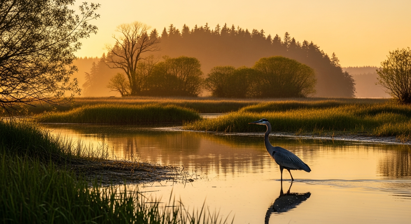
    Hood Canal summer chum salmon are listed as threatened under the federal Endangered Species Act. The Theler Wetlands sit at the mouth of the Union River, which is critical spawning and rearing habitat for that run. By expanding tidal connectivity, the restoration creates the shallow, food-rich, low-salinity estuarine conditions that juvenile summer chum need to grow before entering Hood Canal.

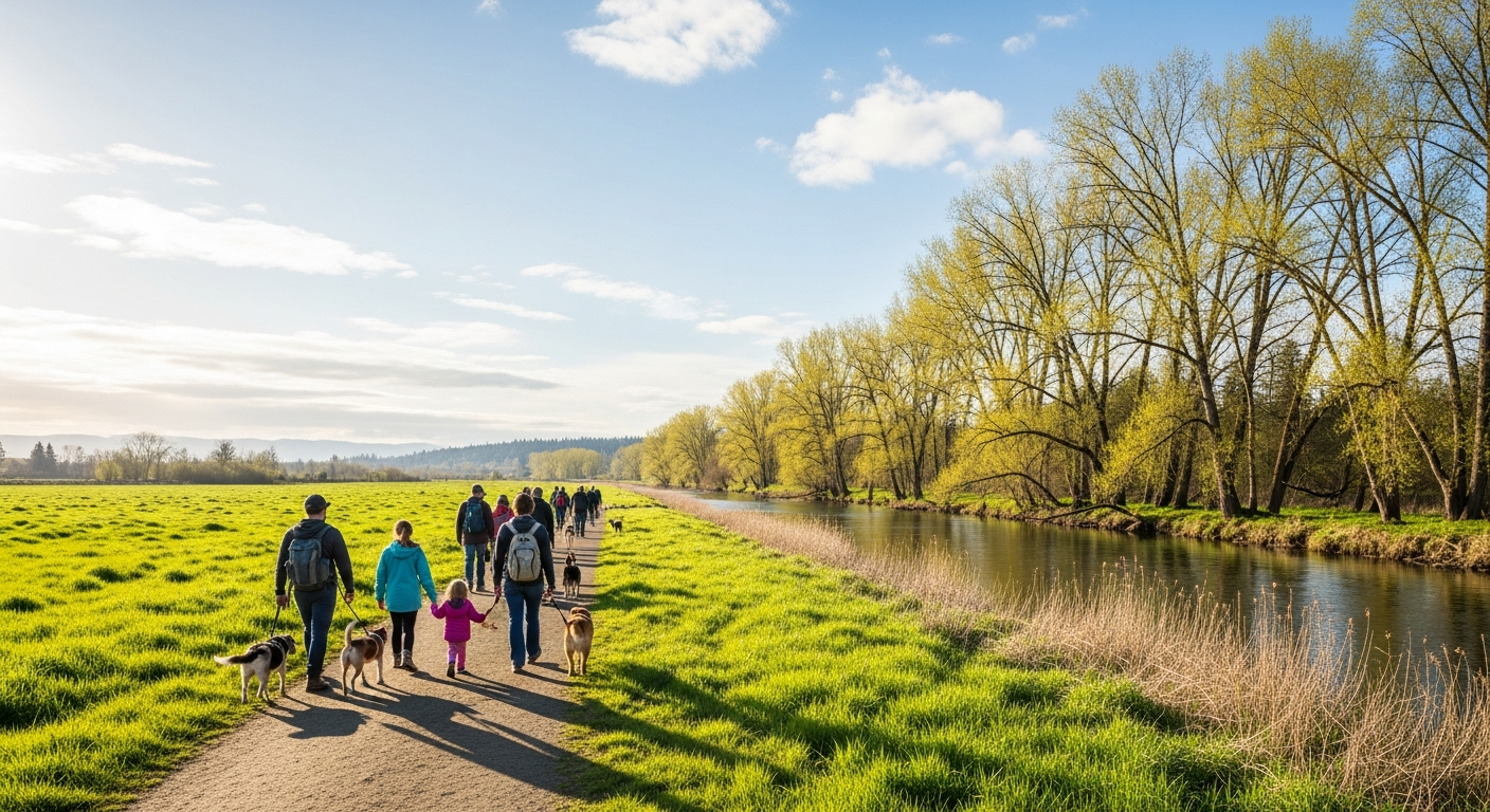
    The summer 2026 boardwalk construction will be the project’s most visible phase for the public. The elevated structure — built in the footprint of the removed levee — will reconnect the preserve’s currently fragmented trail network, giving visitors and birders full access to what will become a restored salt marsh. The Theler Wetlands is already one of Mason County’s most-visited nature spots, drawing birdwatchers, school groups, and families year-round. The new boardwalk will make the wetlands more accessible and complete the loop trail that has been partially closed during construction.

    The preserve is located at 22871 NE SR-3 in Belfair, just off the highway before the town center. Visitors are welcome during daylight hours. For project updates and trail access status, check the HCSEG website at pnwsalmoncenter.org or WDFW’s habitat recovery pages.

    What to Watch This Season

    Taken together, these two stories reflect the dual outdoor identity of Hood Canal and Mason County’s shoreline: a working fishery used by thousands of families every spring and summer, underpinned by habitat restoration work that most people never see but everyone benefits from. The spot shrimp fishery depends on a healthy canal; the canal depends on functioning estuaries like the one being rebuilt at Theler.

    For residents looking to get outside this May, both opportunities are close and accessible. The shrimp opener on May 10 is days away — time to get gear ready, check your license, and confirm the launch site. And when construction wraps at Theler Wetlands later this year, the newly completed boardwalk trail will be one of the more remarkable walks in all of Mason County: a path through restored tidal marsh, built where a levee used to be, beneath skies that — if the restoration takes hold — should one day carry kingfishers and herons back to a corner of Hood Canal that had been quiet for a very long time.

    Sources


    Related Expansion Coverage

  • Hood Canal Property Owner’s Guide to Shellfish Access, Tribal Boundaries, and the 2026 Season at Potlatch

    Hood Canal Property Owner’s Guide to Shellfish Access, Tribal Boundaries, and the 2026 Season at Potlatch

    If you own property along Hood Canal in Mason County — whether a primary residence, a vacation cabin, or a waterfront lot — shellfish access is one of the practical realities of waterfront ownership in this corridor. The 2026 season brings two regulation changes, and the Skokomish Tribal Nation’s treaty tidelands add a layer of complexity that waterfront owners need to understand correctly.

    Who Owns the Tidelands in Front of Your Property?

    In Washington State, waterfront property ownership typically extends to the ordinary high-water mark (OHWM), not to the water itself. Tidelands — the area between the high-water mark and the low-water mark — may be owned by the state, by the Department of Natural Resources, by a private party, or by tribal nations. The ownership of the tidelands in front of your property determines whether you have legal access to harvest shellfish there.

    On Hood Canal south of the Skokomish River delta, a significant portion of tidelands is subject to Skokomish Tribal Nation treaty rights. These rights are distinct from land ownership — they are federally recognized harvesting rights that predate state jurisdiction. State-licensed recreational harvesters do not have authority to harvest on tribally-held tidelands regardless of their proximity to private waterfront property. The Washington Department of Fish and Wildlife’s shellfish beach locator (wdfw.wa.gov/places-to-go/shellfish-beaches) maps which beaches are open to recreational harvest and which are not.

    If you are uncertain about the tideland status of your Hood Canal property, the Mason County Assessor’s office and the Washington DNR’s parcel viewer (dnr.wa.gov) both provide tools to research ownership. This matters if you plan to harvest at your waterfront or if you invite guests who assume that access comes with the property.

    Potlatch State Park: The Public Beach in Your Neighborhood

    Potlatch State Park, approximately 12 miles north of Shelton on Highway 101, is the primary public recreational shellfish beach serving the southern Hood Canal corridor. The state park and adjacent Potlatch DNR tidelands are managed specifically for public recreational access, which is why they attract harvesting pressure that private tidelands do not.

    The 2026 spring season at Potlatch runs April 1 through May 31. For Hood Canal property owners who want to harvest recreationally but lack tidelands rights at their own property, Potlatch is the nearest well-managed public option. Highway 101 shoulder parking from mileposts 335.07 to 335.72 is actively enforced — use the state park and DNR beach designated parking rather than the shoulder.

    The 2026 Regulation Changes That Affect Hood Canal Harvesting

    Two Hood Canal-specific regulations changed in 2026 under Washington Department of Fish and Wildlife rulemaking:

    Cockle minimum size increased to 2.5 inches. The minimum legal harvest size for cockles taken from Hood Canal beaches — including Potlatch and any private tidelands open to recreational harvest — increased from the prior standard to 2.5 inches shell diameter. The change aligns cockle regulations with the species’ biology, allowing more individuals to reach reproductive age before harvest. Harvesters should carry a measuring gauge; the infraction for undersized shellfish is substantial.

    Geoduck daily limit reduced to 1 per person per day. The geoduck limit on Hood Canal dropped to 1 geoduck per person per day, down from 3. Geoduck require a separate license from standard shellfish-seaweed licenses and are subject to area-specific regulations that WDFW updates annually. Property owners with geoduck populations on their tidelands should note this limit applies to recreational harvest across Hood Canal, not just public beaches.

    Biotoxin Closures and Waterfront Property

    Hood Canal’s enclosed geography and warm summer water temperatures make it one of the more biotoxin-prone shellfish areas in Washington State. Closures for paralytic shellfish poisoning (PSP), domoic acid, and other biotoxins can be issued at any time by the Washington State Department of Health and apply to all recreational harvest on affected beaches — state, DNR, and private tidelands alike.

    For Hood Canal property owners who harvest from their own tidelands or host guests who do: biotoxin closures are binding regardless of private ownership. The Washington State Department of Health’s Shellfish Safety Map (doh.wa.gov) is the authoritative source. WDFW also maintains a shellfish safety hotline. Check before every harvest outing — the shellfish appear and smell normal during biotoxin events and cannot be detected without laboratory testing.

    Alternate Beaches When Season Varies

    Hood Canal property owners who want year-round or extended shellfish access beyond Potlatch’s May 31 season have two nearby public options worth knowing:

    • WDFW Hoodsport Hatchery beach is open for shellfish harvest through July 31, 2026 — two months past Potlatch’s close. Located in Hoodsport on Highway 101, it offers continuity for harvesters who want to stay in the Hood Canal corridor into summer.
    • Eagle Creek shellfish area is open for oyster harvest year-round, offering access outside seasonal closures. It is smaller and lower-traffic than Potlatch.

    Frequently Asked Questions — Hood Canal Tidelands for Property Owners

    Do Hood Canal waterfront property owners automatically have shellfish harvesting rights?

    Not necessarily. Washington waterfront ownership typically extends only to the ordinary high-water mark. Tidelands may be privately owned, state-owned, DNR-managed, or subject to tribal treaty rights. You need to research the specific tideland ownership for your parcel through the Mason County Assessor’s office or the Washington DNR’s parcel viewer (dnr.wa.gov) before assuming harvesting rights.

    What are the Skokomish tribal tidelands on Hood Canal?

    The Skokomish Tribal Nation holds federally recognized treaty rights over tidelands in portions of Hood Canal, particularly in the southern section near the Skokomish River delta. These rights predate Washington State jurisdiction. State-licensed recreational harvesters cannot harvest on tribally-held tidelands. The WDFW shellfish beach locator (wdfw.wa.gov/places-to-go/shellfish-beaches) shows which beaches are open to public recreational harvest.

    What is the 2026 cockle minimum size on Hood Canal?

    2.5 inches shell diameter, increased from the prior standard. This applies to all Hood Canal beaches including Potlatch State Park and any private tidelands open to recreational harvest. Carry a gauge — undersized shellfish violations carry significant fines.

    Can biotoxin closures apply to my private tidelands?

    Yes. Washington State Department of Health biotoxin closures apply to all recreational shellfish harvest in the affected area, regardless of whether the tidelands are privately or publicly owned. There is no private tideland exemption from biotoxin closures. Check doh.wa.gov before every harvest outing.

    When does the Potlatch shellfish season end in 2026?

    May 31, 2026. After that date, the WDFW Hoodsport Hatchery beach remains open through July 31, and Eagle Creek is open year-round for oysters. Always verify current status at WDFW (wdfw.wa.gov) before any harvest outing, as emergency closures can alter seasons without advance notice.

    For the full 2026 Potlatch season guide with alternate beaches, parking rules, and complete regulation updates, see Hood Canal Shellfish Season Open Through May 31: Potlatch Beach Guide for Mason County Harvesters. For Mason County real estate and waterfront property context, see Mason County Real Estate: Prices, Trends and Neighborhoods.

  • First Time Shellfish Harvesting at Potlatch? Mason County’s Beginner Guide to Hood Canal Clams and Oysters

    First Time Shellfish Harvesting at Potlatch? Mason County’s Beginner Guide to Hood Canal Clams and Oysters

    Potlatch State Park on Hood Canal is one of the most accessible places in Mason County to harvest shellfish — no boat required, easy parking, and a beach that produces oysters, Manila clams, mussels, cockles, and (with a separate license) geoduck. The spring season runs through May 31, 2026. If you’ve been meaning to try it, you have roughly five weeks left — and this is what you need to know before you go.

    Where Is Potlatch and How Do You Get There?

    Potlatch State Park is on U.S. Highway 101 approximately 12 miles north of Shelton, just past Hoodsport on the western shore of Hood Canal. From Shelton, take Highway 101 north through Hoodsport — the park entrance appears on the left (water side) after you pass through town. From Belfair or Allyn, take Highway 3 to 101 and head south toward Hoodsport.

    Important parking note: shoulder parking along Highway 101 mileposts 335.07 to 335.72 is actively enforced. Use the designated parking areas at the state park and the adjacent Potlatch DNR beach access, not the highway shoulder. Rangers do ticket here, especially on weekend mornings during harvest season.

    What License Do You Need?

    For clams, oysters, mussels, and cockles: you need a standard Washington fishing license with a shellfish-seaweed catch record. These are available from WDFW’s licensing website, from license dealers (sporting goods stores, some grocery stores), or via the WDFW mobile app. Licenses are valid for the calendar year.

    For geoduck specifically: geoduck require a separate license in addition to the standard shellfish license. Geoduck limits and regulations can also change by area year to year — in 2026, the Hood Canal daily geoduck limit dropped to 1 per person per day (down from 3). If geoduck isn’t your primary goal on a first trip, skip the separate license for now and focus on clams and oysters.

    What You’ll Find on the Beach

    Potlatch has over a mile of tidelands. The stretch closest to the highway is regularly harvested and is where you’ll find the highest concentrations of Manila clams in the middle and upper intertidal zones, with the greatest abundance on the large tide flat at the southern end. Oysters tend to cluster in the lower intertidal area — closer to the water line and accessible mainly on big minus tides.

    For a first trip with family, Manila clams are the most beginner-friendly target. They’re small (1–2 inches), buried just 2–4 inches in the sand and gravel, and found in densities that make digging feel productive quickly. A small garden trowel or clam gun works well. Check current limits before you go — WDFW updates them, and Hood Canal limits can differ from Puget Sound limits even for the same species.

    The 2026 Rule Changes You Must Know

    Two Hood Canal-specific regulations changed for 2026 and apply at Potlatch:

    • Cockle minimum size: 2.5 inches. The minimum legal harvest size for cockles increased from the prior standard to 2.5 inches shell diameter. If you’re not sure what a cockle looks like, they are round, ribbed clams — rounder and more dome-shaped than a Manila or littleneck. Bring a small ruler or measuring gauge.
    • Geoduck daily limit: 1 per person per day. The geoduck limit on Hood Canal dropped to 1 per day (formerly 3). Geoduck are the giant clams — their siphons protrude from the sand and they require real digging. A first-timer is unlikely to encounter geoduck casually, but if you spot one, know the new limit.

    Tribal Boundaries and What They Mean for Harvesters

    The Skokomish Tribal Nation holds treaty rights over tidelands in parts of Hood Canal, including areas adjacent to Potlatch State Park. State-licensed recreational harvesters must remain on state or DNR-managed tidelands — not tribally-held tidelands. At Potlatch, the state park and adjacent DNR beach are the appropriate harvest areas. If you are uncertain about boundaries, harvest near the clearly marked state park beach rather than wandering south toward the tribal boundary areas.

    Always Check for Biotoxin Closures Before You Go

    This is non-negotiable: before any shellfish outing, check the Washington State Department of Health’s Shellfish Safety Map at doh.wa.gov or call WDFW’s shellfish safety hotline. Biotoxin (paralytic shellfish poisoning) closures happen without warning on Hood Canal beaches, including Potlatch. Biotoxins are odorless and tasteless — you cannot detect them in the shellfish. A closure means the shellfish are not safe to eat, period. No exceptions. Check before every trip, even if you were there last weekend.

    If Potlatch Is Crowded — Two Nearby Alternatives

    Weekend afternoons in May can get busy at Potlatch. Two nearby alternatives on the same highway corridor:

    • WDFW Hoodsport Hatchery beach is open for shellfish harvest through July 31, 2026. It’s in Hoodsport on Highway 101 — shorter drive from Shelton, slightly less well-known, and open a full month past Potlatch’s May 31 close.
    • Eagle Creek shellfish area is open for oyster harvest year-round. Smaller and quieter than Potlatch. Good if you want oysters specifically and don’t need to stay in the May-season window.

    Frequently Asked Questions — Potlatch Shellfish for First-Timers

    Do I need a license to harvest shellfish at Potlatch State Park?

    Yes. You need a Washington fishing license with a shellfish-seaweed catch record. Available from WDFW’s website, the WDFW mobile app, or licensed dealers. Geoduck require an additional separate license. Children under 15 are typically exempt from licensing requirements — check WDFW’s current exemption rules for your child’s age.

    When is the Potlatch shellfish season in 2026?

    The clam, mussel, and oyster season at Potlatch State Park runs April 1 through May 31, 2026. After May 31, Potlatch closes for the summer. The WDFW Hoodsport Hatchery beach (also on Hood Canal near Highway 101) remains open through July 31, 2026.

    What is the cockle minimum size at Potlatch in 2026?

    The minimum legal harvest size for cockles on Hood Canal, including Potlatch, is 2.5 inches shell diameter in 2026. This increased from the prior standard. Bring a measuring gauge — it’s a $125+ infraction to keep undersized shellfish.

    Can I park on the highway shoulder at Potlatch?

    No. Highway 101 shoulder parking from mileposts 335.07 to 335.72 is actively enforced at Potlatch. Use designated parking at the state park or DNR beach access. Violations are ticketed, especially on weekend mornings during peak season.

    How do I know if Potlatch is closed for biotoxins?

    Check the Washington State Department of Health’s Shellfish Safety Map at doh.wa.gov or call WDFW’s shellfish safety hotline before every trip. Biotoxin closures can be issued at any time and are not predictable — the shellfish look and smell normal during a closure. Never harvest without confirming the beach is open.

    For the full 2026 Potlatch season guide including alternate beaches and detailed regulation updates, see Hood Canal Shellfish Season Open Through May 31: Potlatch Beach Guide for Mason County Harvesters. For more things to do in Mason County, see Things to Do in Mason County: The Definitive Guide.

  • Hood Canal Shellfish Season Open Through May 31: Potlatch Beach Guide for Mason County Harvesters

    Hood Canal Shellfish Season Open Through May 31: Potlatch Beach Guide for Mason County Harvesters

    Mason County shellfish harvesters have roughly five weeks left in the spring season at Potlatch State Park and the adjacent Potlatch DNR beach — two of the most accessible and productive harvest beaches on Hood Canal. The season runs April 1 through May 31, 2026, and a handful of new regulations took effect this year that harvesters should know before they head to the water.

    Potlatch Beach: What’s Open and What Changed in 2026

    Potlatch State Park sits along U.S. Highway 101 approximately 12 miles north of Shelton, just past Hoodsport on the western shore of Hood Canal. The park’s beach and the adjacent Potlatch DNR tidelands together make up one of the most regularly harvested shellfish areas in Mason County, accessible to anglers and families who don’t need a boat to reach productive oyster, clam, and mussel beds.

    For 2026, the Washington Department of Fish and Wildlife updated two regulations that affect harvest at Potlatch and throughout Hood Canal:

    Cockle minimum size increased to 2.5 inches. The minimum legal size for cockles taken from Hood Canal beaches, including Potlatch, increased from the prior standard to 2.5 inches shell diameter. Harvesters should carry a simple gauge or measuring tool to avoid taking undersized cockles.

    Geoduck daily limit reduced to 1 per person per day. The geoduck limit on Hood Canal dropped to 1 geoduck per person per day. Geoducks require a separate license from standard shellfish-seaweed licenses and are subject to area-specific regulations that can change annually.

    A practical note for those driving out from Shelton, Belfair, or other parts of the county: Highway 101 shoulder parking along the Potlatch segment — mileposts 335.07 to 335.72 — is actively enforced. Use designated parking areas at the state park and DNR beach rather than pulling off on the highway shoulder.

    The Skokomish Tribal Nation holds treaty rights over tidelands in parts of Hood Canal, including areas adjacent to the state park. Harvesters on Potlatch tidelands should be aware of tribal area boundaries and ensure they are on state or DNR-managed beach rather than tribally-held tidelands.

    Alternate Beaches When Potlatch Is Crowded

    The Potlatch beach is popular on weekends, particularly during the last weeks of the season as May 31 approaches. Two nearby alternates are worth knowing:

    WDFW Hoodsport Hatchery beach is open for shellfish harvest through July 31, 2026. The hatchery is located in Hoodsport on U.S. Highway 101, and the associated public tidelands offer an option for harvesters who want to stay in the Hoodsport-Hood Canal corridor. Check WDFW regulations for current limits and open species before visiting.

    Eagle Creek shellfish area is open for oyster harvest year-round. It is a smaller, less trafficked option for Mason County residents who want access outside the May 31 season closure at Potlatch.

    Before any harvest outing, verify current status at WDFW’s shellfish safety hotline or online at wdfw.wa.gov — Hood Canal beaches are subject to emergency closure if water quality tests indicate biotoxin or bacterial contamination. Closures can happen with short notice, especially after rain events flush runoff into the canal.

    Common Ground at the Y: New Outdoor Space Opens in Shelton

    On the south-county end, Shelton’s outdoor recreation scene added something new in mid-April. The Shelton Family YMCA officially opened Common Ground at the Y, a transformation of the organization’s nearly 10-acre campus into a shared outdoor community space. The project was funded through a T-Mobile Hometown Grant and built in partnership with Mason Conservation District, Hope Plaza, Beko’s Tree Service, Mason Matters, Mason County Community Justice (MCCJ), and the Squaxin Island Tribe.

    The campus now includes forest therapy trails, native plant gardens, gathering areas, educational and art installations, and natural play features. The Huff ‘n’ Puff Trail — a 1.8-mile loop on the YMCA property maintained by the Shelton Rotary Club — is open to members and the public. Non-member access is available with a suggested $20 donation, and Mason Transit offers free shuttles to the campus for stewardship and programming events.

    Common Ground at the Y is a different kind of outdoor option than Hood Canal’s beaches — more structured, more accessible for families with young children, and designed to serve as a gathering point for community conservation activity. For Mason County residents who want to connect with local conservation organizations or just get their family into green space without a drive to the canal, the YMCA campus at Shelton is worth a visit. The YMCA is located in Shelton; contact the Shelton Family YMCA directly for current programming hours and shuttle schedules.

    Frequently Asked Questions

    When does the Potlatch shellfish season close in 2026?

    The spring shellfish season at Potlatch State Park and Potlatch DNR beach closes May 31, 2026. The season opened April 1. Harvesters have roughly five weeks remaining as of late April.

    What shellfish can I harvest at Potlatch in 2026?

    Oysters, clams, mussels, and cockles are available at Potlatch. Geoduck harvest is permitted at 1 per person per day with a valid license. The cockle minimum size increased to 2.5 inches in 2026. Always verify current species-specific limits at wdfw.wa.gov before heading out.

    Is there parking at Potlatch State Park for shellfish harvesting?

    Yes, use designated parking inside the state park and at the DNR beach access area. Highway 101 shoulder parking between mileposts 335.07 and 335.72 is actively enforced — do not park on the highway shoulder.

    How do I check if Potlatch beach is open before I go?

    Call the WDFW shellfish safety hotline or check the current status at wdfw.wa.gov. Hood Canal beaches can close on short notice due to biotoxin or bacterial contamination. Checking before a long drive saves a wasted trip.

    Where is Common Ground at the Y in Shelton?

    Common Ground at the Y is on the Shelton Family YMCA campus in Shelton. The site includes forest therapy trails, native gardens, and the 1.8-mile Huff ‘n’ Puff Trail maintained by the Shelton Rotary Club. Mason Transit offers free shuttles for stewardship events. Contact the Shelton Family YMCA for current hours and programming details.

    Related coverage: First time at Potlatch? See Mason County’s Beginner Guide to Hood Canal Shellfish Harvesting. Hood Canal property owners, see Shellfish Access, Tribal Boundaries, and the 2026 Season: A Property Owner’s Guide.

  • Day Trip from Seattle to Langus Riverfront Park and Spencer Island Everett: A 2026 Visitor’s Guide

    Day Trip from Seattle to Langus Riverfront Park and Spencer Island Everett: A 2026 Visitor’s Guide

    Day trip bottom line: Langus Riverfront Park and Spencer Island are 25–30 minutes north of Seattle via I-5 — a genuine half-day outdoors destination that most Puget Sound visitors don’t know exists. Flat trail, exceptional birdwatching, estuary wildlife. Bring a Discover Pass or $11.50 for day parking. No other admission.

    If you’re visiting the Seattle area for the FIFA World Cup, a weekend trip, or any reason that brings you to the Pacific Northwest, the Snohomish River Estuary north of Everett is one of the region’s most underrated outdoor destinations — and it’s closer to Seattle than most guides will tell you.

    The Drive From Seattle

    From downtown Seattle, Langus Riverfront Park is approximately 27 miles north on I-5 — roughly 30 minutes in off-peak traffic. Take the Marine View Drive exit north of Everett and follow Smith Island Road to the park entrance at 411 Smith Island Rd, Everett. Easier than driving to the Cascades. No mountain passes, no ferry.

    From the new Lynnwood City Center Link station, Community Transit connects to the Everett area. For visitors without a car, the combination of Link plus transit is an option — check Community Transit routes for current schedules.

    What You’re Going to See

    The Snohomish River Estuary is the largest wetland near an urban center on the West Coast — 1,400 acres where freshwater from the Cascades mixes with tidal Puget Sound. Spencer Island alone is 413 acres of managed wildlife habitat. More than 350 species of migratory birds have been recorded here. For comparison: most wildlife refuges in the Pacific Northwest are significantly harder to reach and offer less consistent wildlife viewing.

    Bald eagles, osprey, great blue herons, and a rotating cast of shorebirds and waterfowl are reliably present across all seasons. Spring and fall migration windows bring exceptional variety. Even a casual visitor with no birding background will see wildlife within minutes of crossing the Spencer Island bridge.

    The Trail

    The Langus River Front Trail is 3.0 miles of flat, paved path along the Snohomish River — accessible to walkers, joggers, and cyclists. It connects via bridge to the 1.7-mile Spencer Island southern loop on an elevated dike trail with open views across the estuary. Combined: approximately 4.7 miles, 2 to 3 hours at a relaxed pace with wildlife stops.

    No technical gear required. The trail is genuinely flat. Families with strollers can do the Langus section without difficulty.

    What to Bring, What to Pay

    Parking at Langus requires a Washington State Discover Pass ($30/year) or Vehicle Access Pass ($11.50/day). Available at the park kiosk or in advance at discoverpass.wa.gov. The trail and Spencer Island are free once you’ve handled parking.

    Binoculars significantly improve the Spencer Island experience. Water and snacks are essential — there are no services on Spencer Island. Layer up; estuary conditions can be windy regardless of season.

    Combining With Other Everett Stops

    Langus and Spencer Island pair naturally with Everett’s waterfront. Post-hike dining at Waterfront Place at the Port of Everett — with multiple restaurant options open along the marina — is a short drive from the park. The historic Port Gardner neighborhood and Rucker Hill walking tour adds an architectural dimension to the day.

    Frequently Asked Questions

    How far is Langus Riverfront Park from Seattle?

    Approximately 27 miles north of downtown Seattle via I-5 — roughly 30 minutes in off-peak traffic. Take the Marine View Drive exit north of Everett and follow Smith Island Road to the park at 411 Smith Island Rd.

    Is Langus Riverfront Park worth visiting as a day trip?

    Yes. Spencer Island’s 413-acre estuary habitat with 350-plus migratory bird species is among the best wildlife-viewing sites in Puget Sound. Combined with the flat paved Langus trail and river access infrastructure, it’s a genuine half-day outdoors destination.

    What is the admission fee for Spencer Island?

    Spencer Island is free to enter. Parking at Langus Riverfront Park requires a Washington State Discover Pass ($30/year) or Vehicle Access Pass ($11.50/day).

    What is the best time of year to visit Langus and Spencer Island?

    Any season offers wildlife viewing. Spring (March–May) and fall (September–November) are peak migration windows with the highest bird variety. Winter brings overwintering waterfowl. Summer is popular for families and cyclists.

  • Langus Riverfront Park and Spencer Island: The Complete 2026 Guide to Everett’s 3-Mile Trail to a 413-Acre Wildlife Estuary

    Langus Riverfront Park and Spencer Island: The Complete 2026 Guide to Everett’s 3-Mile Trail to a 413-Acre Wildlife Estuary

    Quick guide: Langus Riverfront Park (411 Smith Island Rd, Everett) offers a 3-mile flat paved trail along the Snohomish River with a direct connection to Spencer Island — 413 acres of wildlife estuary and one of the best birding sites in the Puget Sound region. A Discover Pass or Vehicle Access Pass is required for parking. The trail is free and open year-round.

    Most Everett residents know the waterfront. Fewer know that a short drive to the north end of Smith Island puts you at one of the best outdoor destinations in Snohomish County — a flat paved trail along the Snohomish River estuary, a working boat launch, a fishing pier, and a bridge to a 413-acre wildlife refuge where 350 species of migratory birds pass through each year.

    Langus Riverfront Park and Spencer Island are Everett’s underrated outdoors combination. Here is the complete 2026 guide.

    Getting There

    Langus Riverfront Park is located at 411 Smith Island Rd, Everett, WA 98201. From I-5, take the Marine View Drive exit and follow Smith Island Road north. The park has three parking lots. At least one requires a Washington State Discover Pass ($30/year) or Vehicle Access Pass ($11.50/day). The trail and Spencer Island access are free once you park.

    The Langus Riverfront Trail

    The Langus River Front Trail is a 3.0-mile paved loop with roughly 32 feet of total elevation gain — effectively flat. The surface is wide enough for walkers, joggers, and cyclists to share without conflict. There are no technical sections, no significant hills, and no route-finding required. You follow the river and come back around.

    That accessibility is the point. For families with strollers, seniors, people rehabbing injuries, or anyone who wants a genuine nature experience without technical trail demands, Langus is one of the best options in Everett’s parks system. It runs along the Snohomish River estuary, where freshwater from the Cascades meets tidal influence from Puget Sound — producing the habitat conditions that make the wildlife here exceptional.

    The River Access Infrastructure

    Langus is not just a walking trail. It has real water-access infrastructure rarely found in urban parks:

    • Boat launch — functional for small watercraft and trailer boats launching onto the Snohomish River
    • Fishing pier — direct access to the Snohomish River; salmon runs pass through the estuary zone
    • Rowing dock and shell house — serving rowers and paddlers from the Everett Rowing Association and other groups

    The estuary zone at Langus is where freshwater and saltwater ecosystems overlap — a biological mixing zone that concentrates fish, birds, and mammals in ways a purely freshwater or purely marine habitat does not.

    Spencer Island: The Main Event

    Walk or ride to the end of the Langus trail and you reach the bridge to Spencer Island — 413 acres of estuary habitat managed jointly by Snohomish County Parks and the Washington Department of Fish and Wildlife. Spencer Island sits at the heart of the 1,400-acre Snohomish River Estuary, the largest wetland near an urban center on the West Coast.

    The southern loop on Spencer Island is approximately 1.7 miles. It runs along an elevated dike trail that puts you above the wetland with unobstructed views across the estuary. No technical skills required. Dogs are welcome on leash.

    What you can expect to see:

    • More than 350 species of migratory birds pass through the estuary; the Snohomish River Estuary is consistently rated among the best birding sites in the Puget Sound region
    • Bald eagles, osprey, and red-tailed hawks are regular year-round residents
    • Great blue herons reliably visible along the river edges in all seasons
    • Shorebirds and waterfowl — exceptional variety during spring and fall migration windows
    • Mammals including deer, coyote, and river otter throughout the island

    Best Times to Visit

    Spencer Island and Langus are worth visiting any time of year. The Snohomish River Estuary is a year-round habitat, not a seasonal destination. That said:

    Spring (March–May): Peak migration season brings exceptional shorebird and waterfowl variety. Migratory raptors moving through. Vegetation growth begins filling the estuary.

    Fall (September–November): Second peak migration window. Waterfowl numbers build through October. Salmon runs in the river draw eagles and other predators.

    Summer: Resident birds active. Nesting in progress — give nesting areas a wide berth. Popular season for families and cyclists.

    Winter: Quieter trail, excellent for solitude. Waterfowl overwintering in the estuary. Eagles visible along the river.

    The Combined Hike

    Langus trail (3.0 miles) plus Spencer Island southern loop (1.7 miles) equals approximately 4.7 miles total for the full combination. Plan for 2 to 3 hours depending on pace and how long you spend watching birds on Spencer Island’s dike trail. Bring water — there are no services on Spencer Island.

    What to Bring

    • Discover Pass or cash for the Vehicle Access Pass ($11.50/day)
    • Binoculars — essential for getting the most from Spencer Island
    • Water and snacks (no services once you leave the parking area)
    • Layers — the estuary is exposed; wind conditions vary significantly
    • Rain gear in any non-summer month

    Nearby Everett Destinations

    Langus pairs well with other north Everett destinations. The Lowell neighborhood sits along the Snohomish River to the east. The Port Gardner neighborhood — Everett’s second-oldest neighborhood and Rucker Hill — is a short drive to the west. The waterfront dining at Port of Everett’s Waterfront Place is accessible for a post-hike meal.

    Frequently Asked Questions

    Where is Langus Riverfront Park in Everett?

    411 Smith Island Rd, Everett, WA 98201. From I-5, take the Marine View Drive exit and follow Smith Island Road north to the park entrance.

    Do I need a pass to visit Langus Riverfront Park?

    A Washington State Discover Pass ($30/year) or Vehicle Access Pass ($11.50/day) is required for parking at Langus Riverfront Park. The trail and Spencer Island are free to walk once you have parked.

    How long is the trail at Langus Riverfront Park?

    The Langus River Front Trail is a 3.0-mile flat paved loop with approximately 32 feet of elevation gain — effectively flat and accessible to walkers, joggers, cyclists, and strollers.

    What is Spencer Island?

    Spencer Island is a 413-acre wildlife estuary managed jointly by Snohomish County and the Washington Department of Fish and Wildlife, accessible by bridge from the end of the Langus trail. It sits within the 1,400-acre Snohomish River Estuary — the largest wetland near an urban center on the West Coast — with more than 350 species of migratory birds recorded.

    Is Langus Riverfront Park good for birdwatching?

    Yes. The Snohomish River Estuary is consistently rated among the best birding sites in Puget Sound. Bald eagles, osprey, great blue herons, and 350+ species of migratory birds make the area exceptional. Spring and fall migration windows offer peak variety.

    Can you fish at Langus Riverfront Park?

    Yes. Langus has a fishing pier with direct access to the Snohomish River, which has salmon runs through the estuary zone. A Washington State fishing license is required. A boat launch is also available for watercraft access.

    How far is the full Langus plus Spencer Island hike?

    Approximately 4.7 miles combining the Langus trail (3.0 miles) and Spencer Island southern loop (1.7 miles). Plan for 2 to 3 hours depending on pace and wildlife-watching stops.

  • Langus Riverfront Park and Spencer Island: Everett’s 3-Mile Paved Trail to a 400-Acre Wildlife Estuary

    Langus Riverfront Park and Spencer Island: Everett’s 3-Mile Paved Trail to a 400-Acre Wildlife Estuary

    Langus Riverfront Park (411 Smith Island Rd, Everett) offers a 3-mile paved trail along the Snohomish River, a fishing pier, a boat launch, and a paved path to Spencer Island — 400 acres of estuary wildlife habitat that’s among the best birdwatching spots in all of Puget Sound. A Discover Pass or Vehicle Access Pass is required for parking. The trail itself is free and open year-round.

    The Trail

    There’s a park on the north end of Everett that most people drive past without knowing it exists. Langus Riverfront Park sits just across the Snohomish River from the city proper, accessible via Smith Island Road, and it delivers more than its modest profile suggests: three miles of flat paved trail, serious water access infrastructure, and a bridge to one of the most ecologically rich wildlife areas in Snohomish County.

    The Langus River Front Trail is a 3.0-mile paved loop — flat (about 32 feet of elevation gain total), wide enough for walkers, joggers, and cyclists to share comfortably, and well-maintained throughout. No map required. You follow the river and come back around.

    For families with strollers, seniors, and anyone who wants a genuine outdoor experience without technical trail navigation, this is one of the most accessible options in Everett’s parks system. It also connects directly to Spencer Island — add roughly 1.7 miles for the southern loop if you’re making a full day of it.

    The River Access

    Langus isn’t just a walking trail. It has real infrastructure for people who want to get on the water:

    • Boat launch — functional for small watercraft and trailer boats
    • Fishing pier — directly on the Snohomish River
    • Rowing dock and shell house — serving rowers and paddlers
    • Three parking lots — at least one requires a Discover Pass or Washington State Vehicle Access Pass

    The river here is the Snohomish River estuary zone, where freshwater from the Cascades meets the tidal influence of Puget Sound. That mixing of freshwater and saltwater ecosystems is a big part of what makes the wildlife at Langus and Spencer Island so good.

    Spencer Island: The Main Event

    Walk or bike to the end of the Langus trail and you’ll reach the bridge to Spencer Island — 400 acres of estuary habitat managed jointly by Snohomish County and the Washington Department of Fish and Wildlife.

    Spencer Island is consistently rated among the best wildlife-watching spots in the Puget Sound region. What you’re likely to see on a typical visit:

    • Waterfowl and shorebirds — the estuary is prime habitat year-round; spring and fall migration add exceptional variety
    • Raptors — bald eagles, osprey, and red-tailed hawks are regular visitors
    • Great Blue Herons — reliably visible along the river edges
    • Deer, coyote, and river otter — mammals are common throughout the island

    The southern loop on Spencer Island is about 1.7 miles. It runs along an elevated dike trail — partially maintained by volunteers — that puts you above the wetland and gives you unobstructed sight lines in every direction. Birders know this spot.

    What’s Coming: The Spencer Island Restoration Project

    The Army Corps of Engineers, the Washington Department of Fish and Wildlife, and Snohomish County are in the final design phase of the Spencer Island Unit Restoration Project, with updates expected in 2026. Projects of this type typically restore tidal flow, remove invasive vegetation, and improve habitat connectivity throughout the estuary.

    When complete, the restoration will benefit both wildlife populations and the visitor experience on Spencer Island. If you’re planning a trip in 2026, check snohomishcountywa.gov for any trail or access changes related to restoration work.

    Getting There

    Address: 411 Smith Island Rd, Everett, WA

    From Seattle/I-5 northbound: Take exit 195 and turn left onto East Marine View Drive. Continue about 1.2 miles to the ramp for Highway 529. Head north, cross the bridge, and turn right onto 28th Place NE. At the next intersection, turn right onto 35th Avenue NE. Continue to the stop sign and turn left onto Ross Avenue. Turn right onto Smith Island Road and follow it into the park.

    Parking: Three lots at the trailhead. At least one lot requires a Discover Pass or Washington State Vehicle Access Pass. Both are available at wsdot.wa.gov.

    Hours: Open year-round. No entrance fee for the trail.

    How Langus Fits Into Everett’s Parks System

    Langus fills a gap that Everett’s other signature parks don’t cover. Forest Park is the wooded, family-with-kids destination on the west side. Howarth Park is the Puget Sound beach access point. Thornton A. Sullivan Park at Silver Lake is the south Everett lakeside destination.

    Langus is different from all three: it’s a river estuary, it connects to a major wildlife reserve, and it has real water recreation infrastructure. If you want to actually see wildlife — not just green space — Langus and Spencer Island are your best local bet.

    The park sits in north Everett, adjacent to Riverside — Everett’s oldest neighborhood, platted in 1891 along this same stretch of the Snohomish River. A Langus visit pairs naturally with a walk through Riverside’s historic streets, or with a trip to Jetty Island (ferry runs seasonally from Everett Marina) for a full north Everett outdoor day.

    Frequently Asked Questions

    Does Langus Riverfront Park require a day pass or entrance fee?

    No entrance fee for the trail. One or more parking lots require a Discover Pass or Washington State Vehicle Access Pass.

    How do I get to Spencer Island from Langus?

    Follow the paved trail from the main parking area; it connects to the access road and then to the bridge to Spencer Island. The southern loop on Spencer Island adds about 1.7 miles.

    Is the trail paved the whole way?

    The Langus loop is fully paved. Spencer Island’s elevated dike trail is unpaved.

    What’s the best season to visit for birdwatching?

    Spring and fall migration seasons bring the widest variety of shorebirds and waterfowl. Winter brings waterfowl that stay all season. Summer is good for raptors and nesting activity.

    Can I launch a kayak or canoe here?

    Yes. The boat launch at Langus is functional for small watercraft.

    Is Langus dog-friendly?

    The trail is popular with dog walkers. Keep dogs on leash per standard Everett parks rules.

    What is the Spencer Island Restoration Project?

    The Army Corps of Engineers, WDFW, and Snohomish County are in final design on estuary habitat restoration for Spencer Island, with 2026 updates expected. Check snohomishcountywa.gov for current access information.

  • Forest Park’s New Pickleball Courts Open in June: What’s Built, What’s Closed, and Why It Matters for Everett

    Forest Park’s New Pickleball Courts Open in June: What’s Built, What’s Closed, and Why It Matters for Everett

    What’s being built at Forest Park in Everett? The City of Everett is constructing its first multi-court outdoor pickleball facility at Forest Park, including four dedicated regulation pickleball courts, two renovated multi-use sport courts, sport fencing, a pickleball practice wall, site lighting, drinking fountain, benches, cornhole, and horseshoe pits. Construction began in November 2025 and is estimated to complete in June 2026. Some park access east of the water park is currently affected by the project.

    Forest Park’s Pickleball Courts Open This June: What’s Built, What’s Closed, and Why It Matters

    Outdoor recreation is a sport. That’s how this desk treats it. And the biggest outdoor-rec story in Everett right now isn’t on a hiking trail or out at Jetty Island — it’s tucked into the trees at Forest Park, where the city is six weeks from opening its first dedicated multi-court outdoor pickleball facility. If you’ve been driving past the trailhead and wondering why a chunk of the park east of the water park has been fenced off all winter, this is the answer. June 2026 is the target. The shape of the project tells you Everett is serious about outdoor rec.

    What’s Being Built

    Per the City of Everett’s Parks Department project documentation, Forest Park’s new outdoor recreation hub includes:

    • Four new dedicated regulation-size pickleball courts on a new paved court
    • Renovation and expansion of two existing multi-use sport courts
    • New sport fencing around the courts
    • A pickleball practice wall
    • Site lighting (so courts can run into the evening)
    • A drinking fountain
    • Benches
    • Cornhole pits
    • Horseshoe pits

    Read that list as a unit and what you’re actually looking at is a small park-within-a-park: a casual outdoor recreation hub that supports the fastest-growing outdoor sport in the country plus a pair of casual lawn-game options for the people who didn’t come to play pickleball. The lighting matters more than it sounds. Lit courts mean weeknight league play, weeknight pickup, and a community asset that doesn’t shut off when the sun goes down — which in Pacific Northwest seasonal terms is the difference between a 5-month facility and a 10-month one.

    Why It Matters for Everett

    Pickleball is the fastest-growing organized recreational sport in the country. Snohomish County has been chasing demand for years — local YMCAs, indoor athletic clubs, and converted tennis courts have been eating the demand on borrowed time. A purpose-built outdoor facility with four dedicated regulation courts plus two multi-use courts plus a practice wall is the kind of investment that turns Everett into a regional destination for the sport instead of a county that loses players to Marysville and Mill Creek.

    It also fits Forest Park’s identity. The park already runs miles of wooded trails, a self-guided nature tour, a hill-climb course, and an orienteering course. A pickleball complex with cornhole and horseshoes is exactly the right addition: low barrier to entry, social, intergenerational, and not a thing that competes with the park’s existing trails or wildlife. You don’t have to choose between the trail-running crowd and the pickleball crowd. They can share the parking lot.

    What’s Closed Right Now

    Heads up before you head to Forest Park this weekend: the section just east of the water park is blocked off due to the construction. Most of the park’s signature wooded trails, the central loop, the playground, and the picnic shelters are unaffected. But if you’ve got a regular running route or a dog-walk loop that hits that east section, plan around it. The Washington Trails Association notes that not all trails are currently accessible because of the work. Save your scouting; check the park’s posted signage before you commit to a route.

    If you want to keep your trail-running miles up while Forest Park is partially closed, the rest of Everett’s trail network is fully open: Lowell Riverfront Trail, Langus Riverfront, Forsgren Park, Howarth Park down to the beach. Lowell Riverfront has its own active project right now (worth checking signage there too), but the main path is intact and is one of the flattest, fastest 5K-loop options in the city.

    The Bigger Outdoor Rec Picture

    The Forest Park project is one piece of a broader Everett parks investment cycle. The city’s Active Projects list includes other parks-and-trails work in different stages — Lowell Riverfront Trail being the other one most regular outdoor users will notice. Add the upcoming Jetty Island ferry season opening on July 8 and the Snohomish River paddling launch points coming back online for spring, and Everett’s outdoor calendar in 2026 is fuller than it’s been in years.

    From a fan-of-Everett perspective: the city has decided that outdoor rec is part of the downtown stadium / waterfront / arena economy, not an afterthought. A pickleball complex at Forest Park, the Jetty Island ferry, the Lowell Riverfront work, and the year-round trail system at Forsgren and Howarth are all the same project from 30,000 feet — they’re the city saying “we are a place where you can live outside.” The new courts open in June. Mark the calendar.

    If You Want to Get Ready

    If you’re new to pickleball and want to be ready for opening week in June, Snohomish County has a strong indoor scene to get reps before the outdoor courts come online. Local YMCAs and rec centers run drop-in sessions; USA Pickleball has a beginner clinic finder; and most sporting-goods stores in the county now stock starter paddles in the $40-80 range. The barrier to entry is genuinely low — that’s why the sport is growing the way it is — and an outdoor weeknight league at Forest Park is the kind of thing that turns a casual player into a regular.

    Frequently Asked Questions

    When do Forest Park’s new pickleball courts open?

    Estimated completion is June 2026, per the City of Everett project documentation. Construction began in November 2025.

    How many pickleball courts will there be?

    Four dedicated regulation pickleball courts on a new paved court, plus two renovated multi-use sport courts that can be used for additional pickleball or other court sports.

    Is Forest Park currently open?

    Yes — most of Forest Park is open, including the wooded trail network, central loop, playground, and picnic areas. The section just east of the water park is closed due to active construction. Check posted signage on site before committing to a route.

    What else is being built besides the pickleball courts?

    The project also includes a pickleball practice wall, sport fencing, site lighting, a drinking fountain, benches, cornhole pits, and horseshoe pits.

    Will the courts have lighting for evening play?

    Yes. Site lighting is part of the project scope, which means the courts will be usable into the evening hours — important for weeknight league play in the Pacific Northwest.

    Where is Forest Park in Everett?

    Forest Park is a Everett city park with a wooded trail network, water park, and event facilities. Full address and trail maps are available via the City of Everett Parks Department website.

  • Pinehurst-Beverly Park: Everett’s Quiet Commuter Neighborhood with the Trail Running Through It

    Pinehurst-Beverly Park: Everett’s Quiet Commuter Neighborhood with the Trail Running Through It

    What is the Pinehurst-Beverly Park neighborhood in Everett? Pinehurst-Beverly Park is a primarily residential neighborhood in south Everett anchored by the Interurban Trail, a mix of 1920s Craftsman bungalows and mid-century ramblers, and an active neighborhood association that meets monthly at the Cascade High School library on Casino Road. It’s one of the most commute-friendly neighborhoods in the city — close to Boeing, Paine Field, and I-5 without being on top of any of them.

    Pinehurst-Beverly Park: Everett’s Quiet Commuter Neighborhood with the Trail Running Through It

    Drive Everett long enough and you start to notice the pattern. The neighborhoods at the top of the bluff get the bay views and the Queen Anne mansions. The neighborhoods downtown get the restaurants and the streetcar-era density. And the neighborhoods south of Casino Road get something different: trees, trails, mid-century ramblers, and quiet streets where the loudest sound at 7 a.m. is somebody walking a dog along the old electric-railway bed.

    That last description is Pinehurst-Beverly Park. If you’ve never lived there, you might know it as “the part of Everett with the Interurban Trail.” If you do live there, you know it as the neighborhood that lets you walk to a grocery store, ride a bike to Lynnwood, and still get to a Boeing or Paine Field shift in fifteen minutes.

    Where Pinehurst-Beverly Park Sits in Everett

    Pinehurst-Beverly Park is in south Everett, a few miles from downtown. Possession Sound is roughly six miles to the west; Interstate 5 forms the eastern edge, with farmland and the Snohomish River beyond. Casino Road, Beverly Boulevard, and Evergreen Way are the main north-south arterials, and bus stops dot all three.

    The neighborhood goes by two names because it was historically two — Pinehurst on the older, northern side, Beverly Park on the southern. The City of Everett combined them into a single neighborhood association, but locals still use both names interchangeably depending on how long they’ve lived there.

    The Interurban Trail: The Defining Feature

    The single feature that distinguishes Pinehurst-Beverly Park from every other south Everett neighborhood is the Interurban Trail. The paved trail runs the length of the neighborhood and continues south through Lynnwood and into King County, eventually reaching Seattle.

    The trail occupies the former route of the Seattle-Everett Interurban Railway, an electric trolley line that ran between the two cities from 1910 to 1939. When the rails came up, the right-of-way stayed in public hands and was eventually paved as a regional non-motorized corridor. Today it’s one of the longer continuous paved trails in the Puget Sound region.

    What people use it for, in rough order of frequency:

    • Daily walks and dog-walks — the trail is flat, paved, and tree-lined
    • Bicycle commutes — particularly to Lynnwood Transit Center and points south
    • Recreational rides — riders use it as a long, low-stress training route
    • Connecting to Forest Park to the north and Lions Park within the neighborhood

    Horses are permitted only on the Snohomish County section of the trail; the Everett and Lynnwood segments are pedestrian-and-cyclist only.

    The Housing Stock: Bungalows, Ramblers, and Newer Townhouses

    Pinehurst-Beverly Park has one of the most varied housing inventories in the city. The oldest homes are 1920s and 1930s Craftsman bungalows on the Pinehurst side, mostly in the 800-to-1,800-square-foot range. South of those, mid-century ramblers from the 1950s and 1960s dominate — single-story, three-bedroom homes built for the postwar Boeing workforce.

    Newer construction is mostly infill: contemporary single-family homes built on previously vacant or subdivided lots, plus townhouse developments from the 1990s through the 2020s. Asking prices reflect that range — older bungalows under 2,000 square feet typically run from the upper $300,000s into the mid $700,000s, while newly built single-family homes have listed in the $800,000-to-$999,000 range, and recent-decade townhouses fall between the two.

    Parks and Green Space

    The neighborhood has its own parks plus easy access to one of the city’s largest. Lions Park, inside the neighborhood, has a basketball court, a playground, and walking trails — a classic small neighborhood park. A short distance north, Forest Park’s nearly 200 acres include forested hiking trails, the Floral Hall water playground, pickleball courts, street hockey, and a seasonal animal farm. For a south Everett family, the combination of Lions Park within walking distance and Forest Park within a five-minute drive is hard to beat.

    Everett Mall is a couple of miles south of the neighborhood. The indoor-outdoor center includes Regal Everett, Flying Trampoline Park, and a rotating mix of national chains and local businesses.

    Schools

    The neighborhood is served by Everett Public Schools. Cascade High School, on the southern edge of the neighborhood at 801 E. Casino Road, is the assigned high school for many Pinehurst-Beverly Park families and is also where the neighborhood association meets each month. Cascade is the same high school that recently posted a 96.6% on-time graduation rate, part of the district’s record-setting 96.3% overall figure for the class of 2025.

    Elementary and middle school assignments vary by address; the district’s school finder at everettsd.org has the current attendance area maps.

    The Neighborhood Association

    The Pinehurst-Beverly Park Neighborhood Association meets monthly at the Cascade High School library at 801 E. Casino Road. The meetings are open to all residents and business owners in the neighborhood and typically cover City of Everett updates, traffic and infrastructure issues along the Casino Road and Evergreen Way arterials, neighborhood events, and questions about new development.

    The association is one of the structures the City of Everett uses to channel resident feedback into city decisions, alongside the other neighborhood associations across the city’s 19-neighborhood framework. Meeting dates and agendas are posted on the City of Everett’s neighborhood calendar at everettwa.gov/Calendar.aspx.

    What Long-Timers Like About Living Here

    Three things come up over and over when you talk to people who have lived in Pinehurst-Beverly Park for ten or more years.

    The first is the commute. The combination of I-5 access, Evergreen Way, and the Boeing/Paine Field corridor means most jobs in Everett are inside a 20-minute drive, and Lynnwood, Mill Creek, and Bothell are reachable without leaving local arterials. The Sounder commuter rail at Everett Station is also reachable, though it requires a bus or short drive.

    The second is the trail. Once a household uses the Interurban Trail regularly, it becomes hard to imagine living somewhere without it. People walk to dinner at the Mall, ride to coffee in Lynnwood, and put serious training miles in on weekends without ever crossing a major street uncontrolled.

    The third is the price-to-yard ratio. Compared to Boulevard Bluffs, Northwest Everett, or Port Gardner, the lots in Pinehurst-Beverly Park tend to be larger, the homes tend to be more modest, and the entry price for a family-sized house tends to be lower. For a family that wants a yard, a quiet street, and a workable commute, this neighborhood does math that the bluff neighborhoods can’t.

    Why Pinehurst-Beverly Park Matters

    Pinehurst-Beverly Park doesn’t get postcards written about it. It doesn’t have a National Register historic district, a famous mansion, a craft-cocktail district, or a viewing platform looking out at the Olympics. What it has is the most usable, most workable south-Everett package the city offers — a paved regional trail through the middle of it, a high school with one of the best graduation rates in the state on its southern edge, two parks within walking distance, and a price point that lets actual families actually live here.

    If Everett is a city of 19 neighborhoods, this is the one that gets the daily life right.

    Frequently Asked Questions

    Where is Pinehurst-Beverly Park in Everett?

    It’s in south Everett, with Possession Sound about six miles west, Interstate 5 forming the eastern edge, and Casino Road, Beverly Boulevard, and Evergreen Way running through the neighborhood as main arterials.

    Why does the neighborhood have two names?

    It was historically two neighborhoods — Pinehurst on the northern side and Beverly Park on the southern. The City of Everett combined them into a single neighborhood association, but residents still use both names depending on which part of the neighborhood they live in.

    What is the Interurban Trail?

    The Interurban Trail is a paved non-motorized trail that follows the former route of the Seattle-Everett Interurban Railway, an electric trolley line that ran from 1910 to 1939. The trail today runs from Everett south through Lynnwood and into King County.

    Where does the Pinehurst-Beverly Park Neighborhood Association meet?

    The association meets monthly at the Cascade High School library, 801 E. Casino Road. Meeting dates and agendas are posted on the City of Everett’s neighborhood calendar.

    What schools serve Pinehurst-Beverly Park?

    The neighborhood is served by Everett Public Schools. Cascade High School at 801 E. Casino Road is the assigned high school for many neighborhood addresses. Elementary and middle school assignments vary by address; check everettsd.org for the current attendance area maps.

    What kind of homes does Pinehurst-Beverly Park have?

    A varied mix: 1920s-1930s Craftsman bungalows on the older Pinehurst side, mid-century ramblers from the 1950s and 1960s across much of the neighborhood, and newer infill single-family homes and townhouses. Older bungalows under 2,000 square feet typically run from the upper $300,000s into the mid $700,000s; newer construction has listed up to $999,000.

    How is the commute from Pinehurst-Beverly Park?

    Strong. Boeing, Paine Field, downtown Everett, Lynnwood, and Mill Creek are all inside a 20-minute drive in normal traffic. Bus service runs along Casino Road, Evergreen Way, and Beverly Boulevard, and Everett Station’s Sounder and Amtrak service is reachable by bus or short drive.

  • Thornton A. Sullivan Park at Silver Lake: The 35-Acre Everett Park Most Locals Still Underuse

    Thornton A. Sullivan Park at Silver Lake: The 35-Acre Everett Park Most Locals Still Underuse

    What is Thornton A. Sullivan Park?

    Thornton A. Sullivan Park at Silver Lake is a 35.3-acre City of Everett park at 11405 Silver Lake Road. It wraps the south end of Silver Lake and offers a swimming beach (no lifeguards), a 9-hole disc golf course, three picnic shelters, self-serve kayak and paddleboard rentals, a playground, waterfront trails, and Silver Hall for events. The park is open 6 a.m. to dusk year-round. Small electric or gas motors (8 horsepower maximum) are allowed on the lake.

    The Everett park most locals drive past

    Silver Lake has a neighborhood named after it, a shopping district named after it, and a highway exit named after it. What it doesn’t have — in most Everett residents’ mental maps — is the 35-acre park wrapping its south shore that most people haven’t actually walked since they were kids.

    Thornton A. Sullivan Park at Silver Lake is that park. If you live anywhere south of 41st and want a day outside without driving to Mukilteo or over to Jetty Island, this is the answer most Everett locals haven’t fully reckoned with.

    The basics

    • Address: 11405 Silver Lake Road, Everett, WA 98208
    • Size: 35.3 acres
    • Hours: 6 a.m. to dusk, every day
    • Cost: Free for day use
    • Phone: City of Everett Parks, 425-257-8700
    • Parking: Free on-site lot

    No lifeguards are on duty. Life jackets are available to borrow at the beach.

    What’s actually here

    A real swimming beach

    This is the big one. Silver Lake has an honest-to-goodness sand beach at the park — not a ramp, not a pier, an actual walk-into-the-water beach with a sand playground area right next to it. On hot summer weekends this is the default Everett family move for anyone who doesn’t want to fight traffic to a saltwater beach. Because the lake is smaller than a Sound beach, the water warms up faster in the spring, which makes this one of the first genuinely swimmable places in Everett each year.

    The city posts water safety reminders prominently: no lifeguards, wear a Coast Guard-approved life jacket if you’re not confident, and swim with a buddy. Drowning risk climbs sharply in summer across all Western Washington lakes — this park takes the messaging seriously, and so should visitors.

    A 9-hole disc golf course

    Thornton A. Sullivan has one of the better natural-terrain disc golf courses in Snohomish County. It’s 9 holes, forested, free to play, and busy on weekends. Beginners and veterans share the course. If you’ve never played disc golf, this is the most forgiving place in Everett to learn — the fairways are generous enough that first-timers aren’t constantly hunting lost discs.

    Self-serve kayak and paddleboard rentals

    Whenever Watersports operates a self-serve kayak and paddleboard rental kiosk at the park. It’s app-based — you rent from your phone, grab the gear, and return it when you’re done. The kiosk operates from sunrise to sunset, every day, with no reservations required. For an Everett family that wants to paddle without owning the equipment or hauling it anywhere, this is the simplest entry point to lake paddling in the city.

    Silver Lake allows small motorized boats — electric or gas motors up to 8 horsepower. That cap keeps the lake quiet and swim-friendly while still allowing a fishing skiff.

    Three picnic shelters

    Camp Patterson Picnic Shelter, Silver Lake Beach Shelter, and the Silver Lake Dock Shelter each anchor a different section of the park. They’re reservable through the City of Everett. The main shelter seats up to 64 for large family gatherings or birthday parties.

    Silver Hall

    If you need to host an indoor event at the park, Silver Hall is 1,018 square feet with a 40-person capacity. It includes restrooms and a kitchen with a stove, oven, microwave, and refrigerator. Reservations go through the City of Everett Parks department.

    Trails and waterfront access

    The park has a loop trail system around the southern lakeshore with multiple waterfront viewpoints. The loop is short enough to walk with a toddler and long enough to actually count as a walk. There’s a concrete table tennis table in the sand area — a small detail, but the kind that tells you someone who used this park as a kid designed it.

    Fishing

    Silver Lake is stocked and open to fishing with a valid Washington fishing license. The park’s waterfront viewpoints and the dock area are the most common fishing spots.

    When to go

    Spring (April–May): The best time for walking the trails and playing disc golf. Water’s still cold for swimming, but the park is quiet and the weather is starting to turn.

    Summer (June–August): Prime swimming and paddling season. Weekends get crowded — plan to arrive before 11 a.m. if you want a shaded picnic spot or a shelter without a reservation. Weekdays are dramatically quieter.

    Fall (September–October): Disc golf weather is excellent through October. The trees around the disc golf course turn and the park empties out.

    Winter: The park stays open at 6 a.m. to dusk year-round. Trails are walkable in most weather. The disc golf course plays cold but plays fine.

    How the park got here

    Thornton A. Sullivan Park is named for a long-serving parks commissioner whose work shaped the Everett parks system for decades. The park has been Everett’s primary lake-access park since the city acquired and developed the site, and it’s been expanded and renovated in phases over the years. Today’s 35.3 acres include the southern arc of Silver Lake’s shore, the beach, the wooded disc golf corridor, and the meadow zone around the picnic shelters.

    What makes the park distinct in Everett’s park system is that it’s one of the only city parks built around a lake — not a viewpoint of Port Gardner Bay, not a city block retrofit, but a park where the water is the point.

    Who this park is for

    Families who want a swim day without leaving the city. Disc golfers who want 9 holes they can play after work. Paddlers who don’t own a kayak. Anyone hosting a birthday party in Everett who doesn’t want to pay for a venue. Seniors who want a flat, walkable loop with benches. Kids who want a playground with a beach attached.

    If you’ve lived in Everett for a decade and haven’t been to Thornton A. Sullivan in five years, you’ve probably forgotten how good this park is.

    Frequently Asked Questions

    Where is Thornton A. Sullivan Park in Everett?

    The park is at 11405 Silver Lake Road, Everett, WA 98208, wrapping the south end of Silver Lake in the Silver Lake neighborhood of south Everett.

    What are the hours of Thornton A. Sullivan Park?

    The park is open from 6 a.m. to dusk every day of the year. There are no lifeguards on duty at any time.

    Is there a swimming beach at Silver Lake?

    Yes. The park includes a sand beach with designated swimming area. There are no lifeguards, so swimmers are asked to wear Coast Guard-approved life jackets (available to borrow) and swim with a buddy.

    Can you rent kayaks at Thornton A. Sullivan Park?

    Yes. Whenever Watersports operates a self-serve kayak and paddleboard rental kiosk on the lakeshore. Rentals are app-based, available sunrise to sunset, with no reservations required.

    Is there a disc golf course at the park?

    Yes. The park has a 9-hole natural-terrain disc golf course. It’s free to play and open during park hours.

    Can you have a motorized boat on Silver Lake?

    Yes, but only small motors — electric or gas motors up to 8 horsepower are allowed. That keeps Silver Lake quiet and swim-friendly while allowing fishing skiffs.

    Can you reserve picnic shelters or Silver Hall?

    Yes. Camp Patterson Picnic Shelter, the Silver Lake Beach shelter, the Silver Lake Dock shelter, and Silver Hall are all reservable through the City of Everett. Silver Hall seats 40 and includes a kitchen; the largest picnic shelter seats up to 64.

    Is fishing allowed at Silver Lake?

    Yes. A valid Washington State fishing license is required. The dock and waterfront viewpoints are the most common fishing spots.

    Related