Tag: City of Everett

  • Eclipse Mill Park Timeline: Everett Riverfront 2028 Opening

    Eclipse Mill Park Timeline: Everett Riverfront 2028 Opening

    Featured Snippet

    Q: When will Eclipse Mill Park at Everett’s Riverfront actually open?

    A: The park will now be built in two phases. The City of Everett’s waterside portion — the pier, floating dock, playground, and fish habitat work — starts July 2026 and wraps in November 2026 after the Washington Department of Ecology pushed the original start back for additional site-condition review. The second, larger phase, built by developer Shelter Holdings, runs from fall 2026 through spring 2028, with the full Eclipse Mill Park opening projected for spring 2028.


    We’ve been watching the Riverfront development on the west bank of the Snohomish River for years now, and if you drive past it on the way to the new Costco at I-5 and 41st, you already know the shape of the thing. Apartments are up. Retail pads are framed out. The trail along the river is there if you know where to look for it. But the piece that was supposed to tie the whole development together — Eclipse Mill Park, the 3-acre public park that’s going to be the signature green space for the new neighborhood — has a new timeline, and it’s worth understanding what changed.

    Here’s where things actually stand as of late April 2026, and what it means for the Riverfront buildout.

    The Short Version: A Two-Phase Park With Two Different Builders

    Eclipse Mill Park isn’t being built as a single contract or by a single entity. The 3-acre park is split into two phases, with two different builders on two different timelines. That’s the first thing to understand, because the confusion over “when does the park open” has largely come from people treating it as one project when it’s really two.

    Phase 1 — City of Everett’s portion. This is the waterside end. Playground. Pier. Floating dock. Fish habitat improvements along the riverbank. The City Council approved a $3.6 million construction contract last May to build this phase.

    Phase 2 — Shelter Holdings’ portion. This is the upland section of the park, built by the private developer as part of their Development Agreement with the City. This is the larger portion of the park’s 3 acres.

    Two builders. Two contracts. Two timelines. And two different reasons the opening keeps sliding.

    Why Phase 1 Slid to July 2026

    The original plan had City of Everett crews starting Phase 1 work earlier, with the waterside amenities coming online in 2026. That timeline got redrawn after the Washington Department of Ecology requested additional review of site conditions along the riverbank — a standard request for any project that touches fish habitat on a river as ecologically significant as the Snohomish.

    The revised schedule now has:

    • Construction mobilization: July 2026
    • Waterside amenities complete: November 2026

    So the pier, the floating dock (which Port officials have said could eventually be used to launch personal watercraft), the playground, and the fish habitat restoration work are all targeting a late-2026 completion on the City’s end. That’s a real, visible change Riverfront residents will see this year — crews on site by midsummer, open amenities by late fall.

    Why Phase 2 Runs Fall 2026 to Spring 2028

    Once the City’s portion wraps, Shelter Holdings picks up the baton. Their phase of the park is scheduled from fall 2026 through spring 2028, which puts the full-park opening at spring 2028 — about 18 months later than anyone in the neighborhood was hoping when the Riverfront plan was first approved.

    Why so long? A few honest reasons. The Phase 2 work is the larger share of the 3 acres. It’s being built by the developer, not the City, which means it’s coordinated with the rest of the Shelter Holdings buildout — apartments, retail pads, parking, internal streets — and you can’t pour the signature park in the middle of active mixed-use construction without risking damaging it. So the park goes last, and it goes slow, and the opening date sits at spring 2028.

    What Gets Built: The Actual Park Design

    The published park program is generous for a 3-acre urban waterfront park. Here’s what the full build includes once both phases are done:

    • A waterfront pier extending into the Snohomish River
    • A floating dock sized for personal watercraft launch
    • A playground at the City’s end of the park
    • A signature open lawn and gathering space on the Shelter Holdings side
    • Fish habitat improvements built into the riverbank along the full frontage
    • Trails connecting the park to the broader Riverfront trail network
    • Integration with the apartments and retail to the east so the park reads as the neighborhood’s front porch, not just leftover space

    It’s not the acreage of Grand Avenue Park or Forest Park. But for the kind of neighborhood Riverfront is trying to become — dense, mixed-use, transit-accessible, and built on a former industrial site — a 3-acre programmed park with a working pier is a meaningful amenity.

    The Bigger Picture: Riverfront’s Slow Build Continues

    Eclipse Mill Park’s slip to 2028 is part of a pattern we’ve been tracking for a while. The Riverfront project was originally approved as a 40-acre, 1,250-unit mixed-use development that would include a multiplex cinema, a specialty grocer, a 250-room hotel, office space, and 3 acres of park. The cinema has since been swapped for pickleball courts (reflecting where the indoor entertainment dollar is going in 2026), the grocer has moved around on the site plan, and the timeline for each piece has shifted.

    Two mixed-use apartment buildings are already up. Phase 2 housing — the piece that really fills out the neighborhood — is underway. The hotel is still a future phase. And now the park, which was supposed to open alongside Phase 2 apartments, slides to 2028.

    None of this is unusual for a redevelopment of an old industrial site on a federally regulated river. Every interaction with Ecology, every seasonal fish window, every shared utility trench adds weeks. If you’ve watched any of Seattle’s waterfront projects unfold, you know the shape of it.

    What Residents Will Actually See This Year

    Even with the park pushed to 2028, there’s real work happening on the Riverfront waterline this year that residents can watch in real time:

    • Summer 2026: City crews mobilize for Phase 1 park construction. Expect fencing, equipment staging, and in-water work during the permitted fish window.
    • Fall 2026: Phase 1 waterside amenities near completion. The pier and floating dock take shape.
    • November 2026: City portion hits substantial completion.
    • Fall 2026 — concurrent: Shelter Holdings begins Phase 2 park construction, running through 2027.
    • Through 2026-2027: Remaining Shelter Holdings residential buildings continue vertical construction.

    The Riverfront trail along the Snohomish River stays open throughout, which is the piece most residents actually use day to day. If you walk the trail now, you’ll see the raw edge where the riverbank will be reshaped for fish habitat — watching that transform from fall through next year is going to be one of the more visible pieces of construction on the east side of Everett.

    How the Riverfront Delay Compares to Waterfront Place

    For context, the Waterfront Place development over on the Port of Everett side is running its own slipping timeline. Millwright District Phase 2 is breaking ground this year with 300+ apartments targeting tenant move-ins by late 2026, but the Class-A office buildings aren’t expected to open until as early as 2028. S3 Maritime just opened. Menchie’s and Marina Azul are in the pipeline. The flagship restaurant parcel is still in tenant search.

    Both the Riverfront and the Waterfront are doing the same kind of work on different sites — converting former industrial edges into mixed-use neighborhoods, with parks, restaurants, and apartments. Both are running into the same realities: Ecology review windows, developer coordination, fish seasons, infrastructure sequencing, and the plain fact that you can’t stand up a neighborhood in 18 months.

    The difference between watching these projects with frustration and watching them with curiosity is mostly about whether you understand what the timelines actually mean. An extra year on Eclipse Mill Park isn’t a failure — it’s the cost of doing riverbank restoration right, in a phased build, with a private developer stitching into a public park.

    What Comes Next

    The next milestone to watch is July 2026 mobilization at the park’s waterside. If that holds, the Phase 1 amenities will be open by Thanksgiving. Shelter Holdings’ Phase 2 timeline is tied to the rest of their buildout, so the next market update on Riverfront housing will be the better indicator of whether the park’s 2028 opening slips again.

    We’ll be back at the Riverfront site later this summer with photos once the fencing goes up and the equipment stages in. If you’re a resident of one of the existing Riverfront buildings and you see activity before then, we want to know what you’re seeing from your windows.

    Frequently Asked Questions

    When will Eclipse Mill Park open in Everett?

    The full 3-acre park is projected to open in spring 2028. The City of Everett’s phase (playground, pier, floating dock, fish habitat work) is scheduled to be complete by November 2026, but the full park including Shelter Holdings’ Phase 2 won’t open until spring 2028.

    Why was Eclipse Mill Park delayed?

    The Washington Department of Ecology requested additional review of site conditions along the riverbank, which pushed construction mobilization to July 2026. The Phase 2 timeline is tied to developer Shelter Holdings’ broader Riverfront buildout.

    Who is building Eclipse Mill Park?

    Two builders. The City of Everett is building Phase 1 (waterside amenities) under a $3.6 million construction contract approved by the City Council in May. Shelter Holdings, the private developer of the Riverfront project, is building Phase 2 (the larger upland portion) under their Development Agreement with the City.

    What will be in Eclipse Mill Park?

    A pier, floating dock for personal watercraft, playground, open lawn and gathering space, fish habitat improvements along the Snohomish riverbank, and trails connecting to the broader Riverfront trail system.

    Where is the Riverfront development in Everett?

    Riverfront is on the west bank of the Snohomish River, east of I-5, near the Hewitt Avenue Trestle. It’s a 40-acre former industrial site being redeveloped into a mixed-use neighborhood with housing, retail, a hotel, and parks.

    How is Riverfront different from Waterfront Place?

    Riverfront is on the Snohomish River on Everett’s east side, developed by Shelter Holdings. Waterfront Place is on Puget Sound on Everett’s west side, developed by the Port of Everett with various partners. Both are converting former industrial sites into mixed-use neighborhoods — they just face different waterways.

    What else is happening at Riverfront in 2026?

    Phase 2 residential construction continues. The cinema originally planned has been replaced with pickleball courts. Remaining apartment buildings are under vertical construction. The Riverfront trail stays open throughout construction.
  • Howarth Park Everett: Local Guide to the Hidden Beach

    Howarth Park Everett: Local Guide to the Hidden Beach

    What is Howarth Park in Everett?
    Howarth Park is a City of Everett park on the Puget Sound bluff at 1127 Olympic Boulevard, with an easy 0.6-mile loop trail, a pedestrian bridge over the BNSF railroad tracks to a long beach, sport courts, a playground, and an off-leash dog beach on the north end. It’s open 6 a.m. to 9 p.m. daily, free to enter, and one of the most underused public beaches in Snohomish County.

    Olympic Boulevard in south Everett is mostly tidy residential streets, a few stop signs, and not much else to look at — which is exactly how most drivers end up cruising right past Howarth Park without noticing the turnoff. That is the central fact of this park. It’s one of the most scenic stretches of public beach in south Everett, it’s a short drive from downtown, and a huge number of Everett residents have never set foot on it.

    Let’s fix that.

    Where Howarth Park Actually Is

    Howarth Park is tucked along the western bluff of south Everett at 1127 Olympic Boulevard. Coming from downtown, the easiest route is south on Rucker Avenue, right on Mukilteo Boulevard, and then left into the park about a mile and a half after you pass Forest Park. If you hit the Mukilteo ferry, you’ve gone too far.

    The park sits on a long, narrow strip of bluff and beach that the City of Everett has owned and managed for generations. The bluff side holds the parking, playground, and sport courts. The beach is a separate world down below — reached only by the park’s signature pedestrian bridge.

    The Three Parking Lots and What Each One Gives You

    One of the things that confuses first-time visitors is that Howarth Park has three parking lots, and they’re not interchangeable. Pick the wrong one and you’ll either end up with a long walk or a missed view.

    The north parking lot is what most beach-goers want. This is the closest pedestrian access to the beach itself. A short trail leads from the lot to the park’s pedestrian bridge, which spans the BNSF railroad tracks below and drops you directly onto the sand. If your goal is to get to the water with kids, a dog, or a beach chair, this is the lot.

    The central parking lot sits at a small viewpoint on the bluff and offers a trail that drops down the hillside to the beach. This route is longer and steeper than the north access, but the view from the top is easily the best non-beach view in the park — on a clear day you’re looking straight across at the Olympic Mountains and Hat Island.

    The south parking lot is the one most Everett residents don’t realize exists. This is the family-friendly end: two sport courts (tennis and basketball), a playground, a restroom, and a short, level walking path that leads to another great water view — again with Hat Island front and center. If you have young kids and want a picnic without the pedestrian-bridge hike, come here.

    The Pedestrian Bridge and the Beach

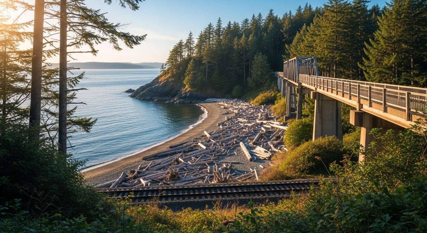
    The pedestrian bridge over the railroad tracks is the quintessential Howarth experience. It’s not fancy — a metal walkway with railings — but it feels a little bit like crossing into a hidden world. You come off the bridge onto a long, driftwood-strewn beach with Possession Sound in front of you, Whidbey Island in the distance, and the Mukilteo ferry crossing behind you.

    The beach itself runs north to south along the park’s full length. It’s sand and cobble, with plenty of driftwood washed up at the high-tide line and tide pools exposed at low tide. You’ll see people walking dogs, kids skipping rocks, the occasional fisherman, and on nice spring weekends, a handful of photographers chasing the light.

    The freight trains that run on the tracks behind you are loud and constant — that’s the tradeoff for beach access in this part of Puget Sound. After your first trip you stop noticing them.

    The 0.6-Mile Loop Trail

    On the bluff above, Howarth has a short but scenic 0.6-mile loop trail that’s generally rated as easy. It takes most people about 15 to 20 minutes and connects the three parking lots through a mix of forested switchbacks and bluff-edge sections. Strollers can handle some of it but not all. Dogs on leash are fine.

    The trail is at its best between March and September, when the alders have leafed out and the ground is dry. In winter the steeper descents can get muddy and slick — bring shoes with tread.

    The Off-Leash Dog Beach

    Here’s a Howarth detail most Everett dog owners don’t know until their neighbor tells them: the north end of the beach is off-leash. Everett has very few legal off-leash beach options, and this is one of them. The south half of the beach stays leashed, but if you walk north from the pedestrian bridge, your dog can run.

    Standard rules apply: owners are responsible for cleanup, voice control, and pulling your dog back if another leashed dog or visitor is coming through. The regulars who use this stretch have an informal etiquette that works well — show up, be considerate, and you’ll be welcomed.

    The Views and When to Come

    Howarth faces roughly west-southwest across Possession Sound. That geometry means:

    • Morning: Calm water, often glassy, great for reflective photos and cool-weather walks.
    • Golden hour to sunset: The main event. The sun drops behind Hat Island and the Olympics light up pink and orange. This is the time to come.
    • Overcast days: Still beautiful. The moody gray sky and driftwood beach are some of the most Pacific Northwest scenery Everett has.

    Weekends in July and August get busy, especially the north lot. Weekday evenings are the sweet spot — you’ll often have long stretches of beach to yourself.

    Hours, Amenities, and Rules

    • Hours: 6 a.m. to 9 p.m. daily.
    • Cost: Free.
    • Parking: Three lots, no fee.
    • Restrooms: Available at the south lot.
    • Playground: South lot.
    • Sport courts: South lot (tennis and basketball).
    • Dogs: On leash in all park areas except the north end of the beach, which is off-leash.
    • Fires: Not permitted on the beach.
    • Alcohol: Not permitted in park facilities.

    Why Howarth Is Worth the Trip

    Everett has Jetty Island for ferry-ride summer beach days, Forest Park for forest walks and the animal farm, and Legion Memorial for views and golf. Howarth is the one that fills a different slot: a real, walkable Puget Sound beach you can drive to in ten minutes, stay on for two hours, and leave without feeling like you fought a crowd.

    It’s not flashy. It’s not a destination. It’s just quietly one of the best small parks in the city, and the Everett residents who use it regularly tend to keep it that way.

    Frequently Asked Questions

    Where is Howarth Park in Everett?

    Howarth Park is at 1127 Olympic Boulevard in south Everett, on the Puget Sound bluff between downtown Everett and Mukilteo. The easiest route from downtown is south on Rucker, right on Mukilteo Boulevard, and left into the park.

    What are the hours at Howarth Park?

    Howarth Park is open 6 a.m. to 9 p.m. daily, year-round.

    How do you get to the beach at Howarth Park?

    The quickest access is from the north parking lot. A short trail leads to a pedestrian bridge that spans the BNSF railroad tracks and drops you directly onto the beach. There’s also a longer switchback trail from the central parking lot that descends the bluff to the beach.

    Is Howarth Park dog-friendly?

    Yes. Dogs are allowed throughout the park on leash, and the north end of the beach is an off-leash area. Owners are responsible for cleanup and voice control.

    How long is the Howarth Park trail?

    The main loop trail is about 0.6 miles and generally takes 15 to 20 minutes. It connects the three parking lots through a mix of forested switchbacks and bluff-edge segments.

    Is there parking at Howarth Park?

    Yes. There are three free parking lots — north, central, and south. The north lot is closest to the beach via the pedestrian bridge. The south lot has the playground, restroom, and sport courts.

    Can you swim at Howarth Park Beach?

    Wading is common on warm days, but Puget Sound water is cold year-round and the beach is not a lifeguarded swim beach. Conditions are best-suited for beachcombing, dog walking, and tide-pooling at low tide.

    When is the best time to visit Howarth Park?

    Weekday evenings between March and September are ideal. The golden-hour to sunset window is the park’s best view. Weekend afternoons in mid-summer can fill the north parking lot — come early or arrive after 4 p.m. for easier parking.

    Is Howarth Park free?

    Yes. There is no entrance fee and parking is free at all three lots.


  • Everett Stadium Funding: Council Faces $10.6M Vote April 29

    Everett Stadium Funding: Council Faces $10.6M Vote April 29

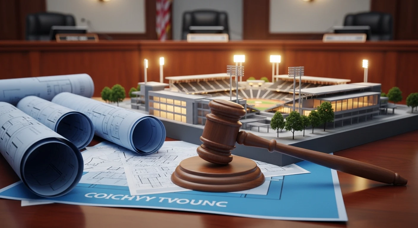
    What’s happening? Everett city staff are asking the city council to approve an additional $10.6 million in spending on the downtown stadium, a funding measure that would complete the design of the site. The council vote is scheduled for April 29, 2026. City staff told the council on April 15 that the $120 million project still has a $25 million funding gap, and the stadium’s expected opening has been pushed from April 2027 to late 2027.

    If you’ve been following the downtown stadium story, April 29 is the date to circle. That’s when the Everett City Council is expected to vote on a $10.6 million funding measure that city staff described this week as the most significant decision the council will make on the project to date.

    We watched Wednesday night’s council presentation from project manager Scott Pattison and consultant Ben Franz, and the headline is simple: the stadium is moving forward, but the financial picture is getting bigger and the timeline is slipping.

    What the $10.6M Would Pay For

    The new funding request would do two things. First, it would complete the design of the Outdoor Event Center, which has already hit roughly 60 percent design completion using the $7.2 million the city has already committed in capital funds. Second, it would continue property acquisition work on the stadium site.

    On the property side, the city needs to buy 15 parcels to build the stadium at the corner of Broadway and Pacific, right next to the Sounder rail line and just east of Angel of the Winds Arena. As of Wednesday, the city has:

    • Signed purchase agreements for 2 parcels
    • Pending agreements with 4 more
    • Active negotiations with the owners of 8 others
    • Zero parcels actually purchased outright (that only happens after the council approves construction)

    The money itself wouldn’t come from new revenue. The city would get the $10.6 million through an interfund loan from its general fund balance, with the plan to repay it later when the city passes a stadium bond measure.

    Here’s the catch Franz acknowledged on Wednesday: if the council approves the $10.6 million loan but later doesn’t approve a stadium bond to pay it back, it could mean a loss of at least $4.8 million in general fund dollars. Some property acquisition money could be reclaimed if the project falls apart, but the design work is sunk cost.

    The $25 Million Gap the City Still Has to Close

    The stadium is not yet fully funded. Not by a long shot.

    When the city first asked for the initial $4.8 million in June 2025, the project was pegged at $82 million. By the council’s January retreat, that number had grown to $120 million, driven by rising property acquisition costs and construction cost inflation. The city’s direct capital contributions to the project currently make up about 8 percent of the stadium’s total cost. Staff said Wednesday that the project is about $25 million short of its $120 million budget.

    Here’s the funding picture as it stands right now:

    • Stadium bond (planned): More than $40 million, repaid through lease revenue from the teams
    • State youth athletic fields fund: $7.4 million
    • Snohomish County contribution: $5 million spread across 2027-2030
    • AquaSox and USL team upfront commitment: $17 million
    • AquaSox and USL team lease payments: About $100 million over 30 years
    • City direct capital (already spent): ~$7.2 million
    • Gap to close: ~$25 million

    Franz told the council that filling the gap could involve “a number of options, including some very unique public-private partnerships,” but said he couldn’t share specifics. He also mentioned a federal loan program that distributes funds to economic development projects near rail infrastructure as a possibility — the favorable interest rate would be attractive, but the application process is long.

    “The more upfront capital we’re able to secure, the less debt the city has to issue,” Franz said after the meeting. “And that’s the piece we’re balancing, which is why we can’t sit here today and say, ‘Here’s the full funding plan.’”

    The Stadium Itself: What’s in the Design

    Contractors and architects showed the council initial design work Wednesday. The stadium would feature:

    • 5,000 seats
    • A clubhouse area that can be used for non-game events
    • An artificial turf field
    • A perimeter walking area
    • A main entrance where Wall Street meets Broadway

    The project is being delivered through a progressive design-build process, meaning the contractor — DLR Group with Bayley Construction — is designing the stadium alongside the architects rather than after. If the full project gets approved, the contractor would be locked in at a guaranteed price.

    The goal, according to Franz, is to break ground in September 2026. The previous target of opening for the AquaSox’s 2027 season is no longer realistic — the new opening window is late 2027.

    What the Teams Are Bringing

    Both the Everett AquaSox and the United Soccer League have now agreed to the financial terms of a lease, according to Franz. The key numbers:

    • $17 million upfront — combined team contribution toward construction
    • ~$100 million in lease payments over 30 years
    • Day-to-day maintenance responsibility falls to the teams
    • City staffing commitment: likely one employee to oversee operations
    • 50 guaranteed days per year for the city to host its own events or lease to other groups

    Once the bonds are paid off, the lease revenue flows into the city’s general fund.

    Mayor Cassie Franklin noted at Wednesday’s meeting that the maintenance arrangement is a significant win for the city — major capital repairs and upgrades remain the city’s responsibility, but the teams handle operations.

    The USL Piece That’s Still Unresolved

    Before the United Soccer League’s portion of the money can flow, the league still needs to find an owner or ownership group to actually buy the Everett men’s and women’s teams. Pattison said Wednesday in an interview that the league has “two or three people that are interested.”

    A USL spokesperson didn’t immediately respond to a request for comment.

    For context, franchise fees in the USL ecosystem run roughly:

    • USL League One team: ~$5 million (per ESPN reporting)
    • USL Championship team: ~$20 million
    • USL Super League (women’s professional) team: ~$10 million (per Backheeled and The Athletic)

    The league’s ownership search could affect the stadium’s timeline. “It really depends on where they are in the process, and where we are in overall readiness to start construction,” Franz said. “We have commitments to the AquaSox that we want to meet at this point. Our goal is to start construction in September, and so we’ll work diligently with them together to meet that.”

    Why This Project Started in the First Place

    Everett first began studying a stadium upgrade in 2022 after Major League Baseball announced new facility standards for minor league stadiums. Funko Field, in its current state, doesn’t meet those requirements. In 2024, the AquaSox’s owner said the city was in danger of losing the team. Later that year, the council decided to study a downtown site — partly because a downtown location could unlock more public and private funding than a rebuild at Funko Field.

    The stadium has become, effectively, the signature piece of Everett’s downtown revitalization strategy. It anchors development plans next to Angel of the Winds Arena, the Sounder station, and the Millwright District’s growing footprint on the waterfront.

    The Calendar From Here

    Three dates worth writing down:

    • April 29, 2026 — City council vote on the $10.6 million funding measure
    • July 2026 — Target for completing a full funding plan
    • August 2026 — Expected council vote on approving stadium construction
    • September 2026 — Target date to break ground
    • Late 2027 — Revised stadium opening

    The April 29 vote does not commit the city to building the stadium. But it does commit $10.6 million — with real financial consequences if the project doesn’t move forward later.

    Frequently Asked Questions

    When does the Everett City Council vote on the $10.6 million stadium funding? The vote is scheduled for April 29, 2026. It would complete the design of the Outdoor Event Center and continue work on acquiring the 15 parcels needed to build the stadium.

    How much is the Everett stadium projected to cost? The current cost estimate is $120 million, up from an initial estimate of $82 million in June 2025. The city is about $25 million short of the full budget.

    When will the downtown stadium open? City staff have pushed the opening from April 2027 to late 2027. The new target is to break ground in September 2026.

    Who would play at the Everett Outdoor Event Center? The Everett AquaSox (Seattle Mariners High-A minor league baseball) and two new United Soccer League teams — a men’s team and a women’s team — if the USL finds ownership groups to buy them.

    Where will the new Everett stadium be located? At the corner of Broadway and Pacific, east of Angel of the Winds Arena and next to the Sounder rail line. The main entrance is planned for where Wall Street meets Broadway.

    What happens if the stadium project doesn’t get approved? At least $4.8 million of the $10.6 million loan could be lost. Some property acquisition money might be recoverable if the city backs out of purchases, but design work is a sunk cost.

    Who is designing and building the stadium? DLR Group and Bayley Construction are delivering the project through a progressive design-build process, where the contractor is working alongside the architects during design.

  • Casino Road South Everett: Complete Neighborhood Guide

    Casino Road South Everett: Complete Neighborhood Guide


    Q: What is Casino Road in Everett?
    A: Casino Road is a 2-mile corridor in South Everett, approximately 4 miles south of downtown, home to roughly 13,000 residents from dozens of countries. It is one of the most culturally diverse communities in Washington State — with significant Latin American, Southeast Asian, East African, and Pacific Islander populations — and is anchored by Connect Casino Road, a collaborative network of 24+ community organizations, and The Village on Casino Road, a neighborhood community center.

    Casino Road doesn’t give itself up on the first pass. Drive along the 2-mile corridor through South Everett — past the apartment buildings, the strip centers, the food trucks parked on weekends — and you see the surface. What’s underneath is one of the most genuinely community-minded, culturally alive neighborhoods in Washington State.

    About 13,000 people live here. A significant portion were born outside the United States. The demographics of Casino Road reflect Everett’s history as a landing place for people building new lives in the Pacific Northwest — Latin American families in communities going back decades, Southeast Asian communities from Cambodia, Vietnam, Laos, and the Philippines, East African arrivals, Pacific Islanders, and more recent arrivals from Central America and the Middle East. Not a melting pot in the old assimilation-first sense. Something closer to a neighborhood where multiple complete cultures operate side by side and have built real infrastructure together.

    The Geography: Where Is Casino Road?

    Casino Road runs roughly east-west through South Everett, from the I-5 corridor at its eastern end toward the Everett waterfront area to the west. The corridor’s center of gravity is the stretch between Beverly Boulevard and 36th Street, where apartment complexes, commercial strips, community-serving businesses, and service organizations cluster.

    The neighborhood sits within the larger South Everett geography that includes Silver Lake to the south and approaches the Paine Field industrial corridor to the northwest. It’s bounded to the south by the Mukilteo area and to the east by the I-5 corridor. Nearby arterials: Airport Road (SR 526) to the north, and 84th Street SW/Casino Road as the main neighborhood spine.

    Connect Casino Road: The Backbone

    Connect Casino Road launched in 2017 as a collaborative backbone organization — a network of more than 24 community partners working together to deliver services in the neighborhood that residents actually use. The partners include nonprofits, faith organizations, health providers, legal services providers, and community advocates.

    The model Connect Casino Road uses is asset-based: rather than describing the neighborhood primarily by its challenges, Connect Casino Road identifies and builds on the strengths already present — the existing cultural institutions, the informal mutual aid networks, the food systems, the trust between neighbors. Services include free tax preparation and Working Families Tax Credit application assistance, food bank access at The Village on the second and fourth Tuesday of each month, health services navigation, immigration legal assistance, and youth programming — all delivered in multiple languages, inside the neighborhood.

    The Village on Casino Road: The Physical Hub

    The Village on Casino Road is the neighborhood’s physical community center — a dedicated space for classes, services, cultural events, and organizing. Located in the heart of the Casino Road corridor, The Village hosts the Connect Casino Road partner programs and provides a neutral, accessible gathering point that many residents use as their primary resource hub.

    The Village’s programming includes English language learning, youth development activities, health screenings, and cultural celebrations. It also functions as an emergency resource coordination point — during the pandemic, The Village was a critical distribution hub for food, PPE, and information in multiple languages for a community with limited access to traditional digital channels.

    The Food

    The food on Casino Road is evidence of the neighborhood’s depth. On a Saturday afternoon, the corridor offers Mexican taquerias serving Michoacán-style carnitas alongside Cambodian family restaurants, Vietnamese banh mi and bakeries, African grocery stores, and Pacific Islander community gatherings. This isn’t constructed diversity for tourists. It’s a living food culture shaped by the communities that have been here for decades.

    Several spots along Casino Road and its surrounding streets have become genuine neighborhood institutions. The Everett Farmers Market at Everett Farmers Market connects Casino Road residents to the broader food economy, and multiple food truck gatherings serve the corridor on weekends. Quán Ông Sáu on Pacific Ave — three months in and already making a case for best Vietnamese food in Everett — has a Casino Road-adjacent customer base that’s been showing up since opening day.

    Housing Pressure: The 2026 Reality

    Casino Road’s housing reality mirrors what’s happening across Western Washington, but concentrated. The corridor’s apartment-dense housing stock — mostly mid-density multifamily buildings built in the 1970s through 1990s — has seen rents climb significantly faster than incomes for many longtime residents. The median household income in the Casino Road corridor is below Everett’s city-wide median, while rental costs have climbed alongside the broader Snohomish County market.

    Organizations like LISC Puget Sound have been working in Casino Road specifically on community economic development strategies that build wealth and stability for residents rather than displacement pressure. Connect Casino Road partners with housing-focused organizations to connect residents with rental assistance, housing stability resources, and financial empowerment programming.

    Why Casino Road Matters to Everett’s Future

    Casino Road represents the practical question Everett is navigating in 2026: how does a transforming city preserve the communities that have been here longest, especially as waterfront development, light rail planning, and population growth create new pressures on existing neighborhoods? The network that Connect Casino Road has built — two dozen organizations, a physical community center, multi-language service delivery — is the kind of infrastructure that makes the difference between neighborhoods that get displaced and neighborhoods that get stabilized.

    For more on South Everett’s neighborhood story, see our coverage of Casino Road’s original community profile, Lowell, Everett’s oldest neighborhood, and Cascade High School’s new IB Program.

    Frequently Asked Questions: Casino Road, South Everett

    Where exactly is Casino Road in Everett?

    Casino Road runs east-west through South Everett, approximately 4 miles south of downtown Everett. The corridor’s center is the stretch from Beverly Boulevard to 36th Street, within Snohomish County east of I-5.

    What is Connect Casino Road?

    Connect Casino Road is a collaborative network of more than 24 community organizations launched in 2017 to deliver services, resources, and support to Casino Road families. Partners include nonprofits, faith organizations, health providers, and legal services — all working together at The Village on Casino Road.

    What services does The Village on Casino Road provide?

    The Village on Casino Road offers a food bank (second and fourth Tuesdays), free tax preparation and WFTC assistance, health services navigation, immigration legal assistance, youth programming, English language learning, and cultural programming — all in multiple languages.

    What is the population of the Casino Road neighborhood?

    Approximately 13,000 residents, with significant representation from Latin American, Southeast Asian, East African, and Pacific Islander communities. About a quarter of Casino Road residents were born outside the United States.

    Is Casino Road a safe neighborhood?

    Casino Road is a family-oriented, community-dense neighborhood. Like most urban corridors, it has some areas with higher incident reports, but the strong community infrastructure — Connect Casino Road, The Village, faith organizations — reflects a neighborhood that actively invests in its own safety and stability. The Everett Police Department’s community policing unit has established relationships with neighborhood organizations.

    What housing options are available on Casino Road?

    Casino Road’s housing stock is primarily multifamily apartment buildings, ranging from smaller complexes to large-scale apartment communities. Rents have risen significantly in recent years in line with Snohomish County’s broader market. Connect Casino Road partners with housing stability and rental assistance organizations for income-qualified residents.

    Is Casino Road near public transit?

    Casino Road has Community Transit bus service connecting to Everett Transit and connecting corridors. Swift Blue Line BRT serves nearby streets with connections to Lynnwood Link light rail. The neighborhood’s proximity to Airport Road and I-5 makes it accessible for car-dependent commutes to Paine Field, Everett, and south toward Seattle.

  • Edgewater Bridge Opening: April 28 Everett & Mukilteo Guide

    Edgewater Bridge Opening: April 28 Everett & Mukilteo Guide

    What is the Edgewater Bridge? The Edgewater Bridge spans the Mukilteo ravine on the border between Everett and Mukilteo, connecting the two cities along Mukilteo Boulevard. The 366-foot-long bridge is a primary commute corridor for residents of both cities and was built in 1946 — making the original structure nearly 80 years old when it closed for replacement.

    After 18 months of construction and a $34.9 million investment, Everett’s new Edgewater Bridge will open to vehicle traffic on Tuesday, April 28, 2026. The community is invited to walk across the bridge the day before at a free celebration event on Sunday, April 27 at 3:30 p.m.

    Why the Bridge Had to Be Replaced

    The original Edgewater Bridge was built in 1946. By the time the City of Everett closed it in October 2024, the structure had reached the end of its rated useful life and had known seismic vulnerabilities. Rather than patch an aging span, the city moved forward with full replacement.

    Replacing the bridge was not a straightforward project. Construction crews encountered significant underground obstacles — old timber and concrete debris from a previous, earlier bridge structure were embedded deep in the soil, complicating the installation of the steel piling needed to support the new span. Then, in December 2025, an atmospheric river weather event caused damage to portions of the project and pushed the completion date back further, into April 2026.

    The scale of the work was considerable: crews had to fully remove the 366-foot-long, 60-foot-tall original bridge and build two temporary work platforms on either side of the ravine from which the new structure was constructed piece by piece.

    What’s Different About the New Bridge

    The new Edgewater Bridge is not just a replacement — it’s a meaningful upgrade in several key ways.

    • Wider sidewalks and bike lanes on both sides of the roadway — a significant improvement for pedestrians and cyclists who previously had more limited options on the original structure.
    • Modern seismic engineering — the new bridge is designed to perform better in an earthquake, addressing the structural concerns that made replacement necessary.
    • Longer designed service life — built to current standards, the bridge is intended to serve Everett and Mukilteo for decades.

    The bridge straddles the city boundary, welcoming travelers into both Everett and Mukilteo. Once the final finishing work is complete, pedestrians and cyclists will have dedicated, protected lanes on each side of the roadway.

    How the $34.9 Million Project Was Paid For

    The total project cost is $34.9 million. Of that, $28 million — roughly 80 percent — came from federal grant funding. The remaining portion was covered by city transportation funds.

    Mayor Cassie Franklin said she was “excited to see the brand-new Edgewater Bridge open again and serving our community,” acknowledging the disruption the closure caused. “Construction brought real impacts — especially to the neighbors who live close to the bridge — but I’m proud to deliver a more structurally sound bridge that’s built to last and ready for the future.”

    What to Expect at the April 27 Celebration

    The City of Everett is hosting a community event on Sunday, April 27 at 3:30 p.m. where residents from both Everett and Mukilteo can walk across the new bridge, meet members of the project team, and hear remarks from city officials.

    Important note: the bridge will not be open to vehicle traffic at the time of the celebration. You can approach from either side but will not be able to drive across. Vehicles will begin crossing on Tuesday, April 28.

    What’s Still Being Finished After Opening

    Even after vehicles start using the bridge on April 28, some work will continue. According to the City of Everett, permanent roadway striping, barriers, lighting, paint, and other finishing tasks may still be in progress. The new sidewalks and bike lanes will remain closed to pedestrian and cyclist use until that final phase of work is complete — so pedestrian access will follow the vehicle opening by a short period.

    Why This Reopening Matters for Everett and Mukilteo

    Mukilteo Boulevard is a primary east-west connector used daily by commuters heading toward Interstate 5, Paine Field, and local destinations in both cities. The 18-month closure forced drivers to reroute through already-congested surface streets — an impact felt by neighborhoods on both sides of the ravine. The reopening directly relieves that pressure.

    The new bike lanes and wider sidewalks also represent a real win for non-motorized transportation in a corridor that previously had limited options. Both Everett and Mukilteo have been working to improve walkability and bikeability, and this crossing is now part of that network in a meaningful way.

    Frequently Asked Questions About the Edgewater Bridge Opening

    When does the Edgewater Bridge open to vehicles?

    The bridge opens to vehicle traffic at the end of the workday on Tuesday, April 28, 2026.

    When is the community celebration for the new Edgewater Bridge?

    The City of Everett is hosting a community walk-across event on Sunday, April 27 at 3:30 p.m. The bridge will not be open to vehicle traffic at that time. Residents can approach from either the Everett or Mukilteo side.

    How much did the new Edgewater Bridge cost?

    The total project cost is $34.9 million, with $28 million funded by federal grants — about 80 percent of the project cost covered by federal dollars.

    Is the new bridge safer in an earthquake?

    Yes. The new bridge was built to modern seismic engineering standards and is significantly more earthquake-resistant than the 1946 original, which had known structural vulnerabilities.

    Why did the bridge closure last 18 months?

    The original construction schedule was extended twice — first due to underground obstructions from an older bridge structure buried beneath the site, and again after an atmospheric river weather event in December 2025 caused damage to portions of the project.

    Will there be bike lanes and sidewalks on the new Edgewater Bridge?

    Yes. The new bridge includes bike lanes and wider sidewalks on both sides. They will open to use once final finishing work on the project is complete, which is expected to happen shortly after the vehicle opening.

    What cities does the Edgewater Bridge connect?

    The Edgewater Bridge straddles the boundary between Everett and Mukilteo, connecting both cities along Mukilteo Boulevard.

  • Edgewater Bridge Opening: Everett Celebration April 27

    Edgewater Bridge Opening: Everett Celebration April 27

    Edgewater Bridge Grand Opening: The City of Everett is celebrating the completion of the new Edgewater Bridge on Sunday, April 27 at 3:30 PM. The community is invited to walk across the bridge and learn about the project from the engineers and city leaders who built it.

    Everett Is Celebrating the New Edgewater Bridge on April 27 — You’re Invited

    The City of Everett has officially announced the grand opening celebration for the new Edgewater Bridge. The event takes place on Sunday, April 27 at 3:30 PM, and the entire community is welcome to attend.

    Attendees will get to walk across the new bridge, hear remarks from Mayor Cassie Franklin and city leaders, and speak directly with the project team about what went into building it. It’s the kind of local infrastructure moment Everett doesn’t get very often — a brand new bridge connecting neighborhoods, built from the ground up.

    What Is the Edgewater Bridge?

    The Edgewater Bridge is a new City of Everett infrastructure project connecting neighborhoods near the waterfront area. The project was a multi-year effort involving coordination between the City of Everett and the City of Mukilteo. The new structure replaces aging infrastructure and improves pedestrian and vehicle access in the area.

    The April 27 celebration gives Everett residents a chance to be the first to walk across it — and to get the full story of the project from the people who made it happen.

    Event Details

    • Date: Sunday, April 27, 2026
    • Time: 3:30 PM
    • What to expect: Community walk across the bridge, remarks from Mayor Franklin and city officials, project team available to answer questions
    • Cost: Free and open to the public

    Part of Everett’s Bigger Infrastructure Momentum

    The Edgewater Bridge opening comes as Everett is seeing significant infrastructure investment across the city. Mayor Franklin’s 2026 priorities include housing growth, youth safety, and major placemaking updates — and public infrastructure projects like this bridge are central to that vision.

    With the Sound Transit Link Extension moving forward, waterfront development accelerating, and now a brand-new bridge opening, this is an active stretch for Everett’s built environment.

    Frequently Asked Questions: Edgewater Bridge Opening

    When is the Edgewater Bridge opening celebration?

    Sunday, April 27, 2026 at 3:30 PM. The event is free and open to the public.

    What will happen at the Edgewater Bridge celebration?

    The community is invited to walk across the new bridge, hear remarks from Mayor Cassie Franklin and city officials, and talk with the project team about the construction process.

    Who built the Edgewater Bridge?

    The bridge was a City of Everett infrastructure project built in coordination with the City of Mukilteo. Details will be available from the project team at the April 27 event.

  • Everett Utility Tax: $10.74 Water Bill Increase Proposed

    Everett Utility Tax: $10.74 Water Bill Increase Proposed

    Everett residents and Snohomish County water customers could see their monthly bills increase by nearly $11 starting July 1, 2026, if the Everett City Council approves a proposal to double the city’s utility tax rate on water and sewer services.

    The proposal, which the council is expected to consider through three readings beginning in April, would replace the existing 6 percent “payment in lieu of taxes” (PILT) fee with a 12 percent utility tax on water and sewer. That change would raise approximately $7.5 million per year for the city’s general fund — closing about half of a projected $14 million budget deficit the city faces heading into 2027.

    What It Means for Your Water Bill

    For the average Everett water customer, the tax increase would add roughly $10.74 per month in additional charges. The city’s current 6 percent fee has been in place since 1983 — more than four decades without adjustment. City officials argue the updated structure better aligns with state law that explicitly allows municipalities to levy utility taxes.

    “Our tax will be embedded in wholesale water costs, and then other cities can do what they will with their utility taxes,” City Finance Director Mike Bailey told the Everett Herald in March.

    The change affects more than just city residents. Everett’s water system serves approximately 670,000 people — roughly three-quarters of all businesses and residents across Snohomish County. Communities that purchase wholesale water from Everett will see the tax embedded in what they pay Everett, and those cities may then choose to layer their own utility taxes on top of that wholesale rate.

    Over 180,000 sewer customers would also be affected.

    Why Everett Faces a $14 Million Gap

    The budget shortfall is not a sudden emergency — city officials have been working to address a structural revenue gap that grows as demand for services increases while traditional revenue sources remain flat. Mayor Cassie Franklin addressed the issue directly during her March 2026 State of the City address, telling residents: “We cannot cut our way to a sustainable future.”

    Options the city has evaluated to close the gap include regionalizing library or fire services and pursuing a targeted property tax levy lid lift. The utility tax approach has gained traction because it does not require voter approval, can be implemented relatively quickly, and taps into a revenue source the city’s legal department says is clearly permitted under Washington state law.

    The new tax would close approximately half the projected $14 million deficit. City officials have not yet publicly committed to a specific plan for closing the remaining gap.

    Low-Income Customer Protections

    City officials have indicated they plan to expand utility payment assistance programs for income-qualified customers before the tax takes effect. No details about the expanded program have been released publicly as of publication.

    What Happens Next

    The Everett City Council is expected to hold its first reading on the utility tax ordinance in April 2026. Under standard council procedure, an ordinance requires three readings before it can be voted on for final approval. If the council approves the measure on its current timeline, the 12 percent rate would take effect July 1, 2026.

    No council vote has occurred yet. Residents who wish to weigh in can attend council meetings held at 6:30 p.m. Wednesdays at the Everett City Council Chambers, 3002 Wetmore Ave., or submit comments through the city’s official website at everettwa.gov.

    Frequently Asked Questions

    What is the current utility tax rate in Everett?
    The city currently charges a 6 percent fee described as a “payment in lieu of taxes” on water and sewer services. This rate has been in place since 1983.

    How much more will I pay each month?
    The city estimates the average customer will pay approximately $10.74 more per month if the 12 percent rate is approved.

    Do I have to be an Everett resident to be affected?
    No. Everett’s water system serves approximately 670,000 people across Snohomish County — roughly three-quarters of the county’s residents and businesses. If your community buys water from Everett, you may see the increase reflected in your bill.

    Does this require voter approval?
    No. A utility tax does not require a public vote. The Everett City Council has authority to approve it through the standard ordinance process.

    When would the new rate take effect?
    The proposed effective date is July 1, 2026, pending council approval.

    Will there be assistance for low-income customers?
    City officials have stated they plan to expand utility payment assistance programs before implementation, but details have not been finalized.

    How much money will this raise?
    The city projects the 12 percent utility tax would raise approximately $7.5 million annually toward the general fund.

    Why does Everett have a budget deficit?
    The city faces a projected $14 million budget shortfall in its 2027 general fund. Mayor Franklin has said the city cannot solve the gap through cuts alone and is pursuing new revenue strategies.


    Go Deeper: We’ve published detailed knowledge nodes expanding on this story for specific Everett audiences:

  • Everett Neighborhood Meetings: The New Districtwide Format

    Everett Neighborhood Meetings: The New Districtwide Format

    Quick Answer: Everett launched a new format for neighborhood engagement in February 2026, replacing individual association visits from city officials with annual districtwide meetings that bring all neighborhood groups in a council district together at once. The first meeting drew about 60 residents to the Cascade Boys and Girls Club in District 2, with Mayor Cassie Franklin, Police Chief Robert Goetz, and Council Member Paula Rhyne attending.

    Something shifted in how Everett connects with its residents this past February, and if you’re involved in any of the city’s neighborhood associations — or you’ve been meaning to get involved — it’s worth understanding what changed and why it matters.

    For years, city officials made the rounds by visiting individual neighborhood associations, showing up at separate meetings across all 19 groups scattered through Everett’s five council districts. It was well-intentioned, but it meant the same officials repeating the same updates dozens of times while different neighborhood groups often didn’t know what was happening two blocks away. The city piloted a new approach this year, and if it takes hold, it could genuinely change how engaged Everett residents feel in their own neighborhoods.

    What the New Format Looks Like

    On February 24, 2026, the city held its first districtwide neighborhood meeting at the Cascade Boys and Girls Club in District 2. Instead of sending officials out to individual neighborhood associations one at a time, the new model convenes all neighborhood groups within a single council district together in one room, once a year.

    About 60 residents turned out for that first meeting — not a massive crowd, but a meaningful one for a pilot format. Attending alongside neighbors from across District 2 were Mayor Cassie Franklin, District 2 City Council Member Paula Rhyne, and Police Chief Robert Goetz.

    The idea is simple: equitable engagement. Every neighborhood in a district hears the same information at the same time, from the same officials. Nobody gets the mayor’s visit and nobody gets left with just a staffer. The individual neighborhood associations still hold their regular meetings independently — this annual districtwide gathering is an addition, not a replacement.

    What They Actually Talked About

    The February meeting covered a lot of ground — these weren’t soft, feel-good topics. Officials addressed immigration enforcement response, housing policy, youth safety, traffic safety, economic development, and the city’s drones-as-first-responders program.

    Council Member Rhyne went into specifics about a significant challenge ahead: Everett is facing an anticipated $14 million general fund shortfall heading into 2027. Rhyne outlined potential paths to close that gap, including regionalizing library and fire services or implementing a targeted property tax levy increase for parks or public safety.

    Mayor Franklin added that if additional funding does materialize, the city intends to maintain and expand services — extending library hours was one specific example she mentioned.

    These are real conversations about real tradeoffs, held in a room with the people most affected by them. That’s exactly the kind of civic engagement Everett neighborhoods have asked for.

    Why This Change Matters for Neighborhood Life

    Everett has 19 active neighborhood associations spanning five council districts. They range in size and energy — some run robust programs, others are smaller groups that meet a few times a year. The challenge has always been making sure every neighborhood feels like it has a real channel to city leadership, not just the ones with the loudest voices or the most organized association leadership.

    The districtwide format addresses that in a couple of ways. First, it puts neighbors from different associations in the same room, which tends to surface shared concerns that individual groups might not realize are city-wide. Second, it makes city officials directly accountable to a broader cross-section of residents at once, rather than managing separate narratives with each group.

    Council Member Rhyne also mentioned preliminary work toward annexing southern Everett areas — a process that, if it happens, would likely span several years. That’s exactly the kind of long-horizon planning news that neighbors need to hear early, not after decisions are already made.

    What About Your Neighborhood Association?

    Your neighborhood association isn’t going anywhere. This new districtwide meeting is meant to complement, not replace, the regular work of neighborhood groups. If anything, it gives associations a better reason to stay active and connected — because now there’s an annual districtwide event where their voices contribute to a larger district-level conversation.

    Everett’s 19 neighborhood associations are:

    Bayside, Boulevard Bluffs, Cascade View, Delta, Evergreen, Glacier View, Harborview-Seahurst-Glenhaven, Holly, Lowell, Northwest, Pinehurst-Beverly Park, Port Gardner, Riverside, Silver Lake, South Forest Park, Twin Creeks, Valley View-Sylvan Crest-Larimer Ridge, View Ridge-Madison, and Westmont.

    If you’re not sure which association covers your block, the City’s Office of Neighborhoods keeps an updated map and contact list. You can reach them at (425) 257-7112 or nwebber@everettwa.gov, or visit everettwa.gov/neighborhoods.

    The Bigger Vision: One Everett

    Mayor Franklin has been using the phrase “One Everett” to describe her administration’s approach to the city. The districtwide neighborhood meeting format fits squarely into that framing — the idea that city leadership should be equally accessible across all neighborhoods, not just the ones that are easiest to reach or most organized.

    Whether this pilot format becomes permanent depends on how well it works. If turnout grows and the conversations it generates prove more productive than the old model, it seems likely to continue and expand. If you care about how your neighborhood connects to city government, showing up to the next one in your district is the most direct way to have a say in whether this experiment succeeds.

    How to Stay Informed

    Watch for announcements about upcoming districtwide meetings at everettwa.gov and through your neighborhood association. The city also offers email and text notifications for neighborhood-specific updates — you can subscribe on the city’s website. Your neighborhood association is often the fastest way to hear about these events, which is one more reason to stay connected to yours.

    Frequently Asked Questions

    What is Everett’s new districtwide neighborhood meeting format?

    Instead of individual visits to each neighborhood association, city officials now host one annual meeting per council district that brings all neighborhood groups in that district together at once. The first pilot meeting was held February 24, 2026 in District 2.

    Does this replace regular neighborhood association meetings?

    No. Neighborhood associations continue to hold their regular independent meetings. The districtwide meeting is an annual addition to the existing system, not a replacement.

    How many neighborhood associations does Everett have?

    Everett has 19 active neighborhood associations spread across five council districts.

    How do I find my Everett neighborhood association?

    Contact the City’s Office of Neighborhoods at (425) 257-7112, email nwebber@everettwa.gov, or visit everettwa.gov/neighborhoods. There’s also an interactive map on the city website to find your council district.

    What topics were covered at the first districtwide meeting?

    The February 2026 District 2 meeting covered immigration enforcement response, housing policy, youth safety, traffic safety, economic development, the city’s budget situation, and the drones-as-first-responders program.

    Who attended the first districtwide neighborhood meeting?

    Mayor Cassie Franklin, Police Chief Robert Goetz, and District 2 Council Member Paula Rhyne attended, along with approximately 60 residents from neighborhood associations across District 2.

  • Garfield Park Playground Renovation in Everett (2026)

    Garfield Park Playground Renovation in Everett (2026)

    Quick Answer: Everett is investing $940,000 to renovate the 19-year-old playground at Garfield Park in the Riverside neighborhood. Construction is scheduled for late spring or early fall 2026, with new slides, climbers, a zip track, expanded swings, shade structures, and fully accessible play surfaces replacing the existing equipment.

    If you’ve watched kids clamber over the aging wooden structure at Garfield Park and thought, “that thing’s been there forever” — you’re not wrong. The playground at 2300 Walnut Street in Everett’s Riverside neighborhood has been serving families for nearly two decades, and the City of Everett has decided it’s time for a serious upgrade. A $940,000 renovation is now officially planned for 2026, and the new setup is going to be genuinely exciting for families in north Everett.

    This isn’t a patch job. It’s a full rethink of one of Riverside’s most beloved community spaces.

    What’s Actually Being Built

    The renovation will completely replace the existing playground equipment while staying within the park’s current footprint. Here’s what’s coming:

    • Multiple slides and climbing structures designed for different ages and abilities
    • A dedicated play area for ages 2–5, so the littlest ones have space designed just for them
    • A cable-free zip track ride — the kind of feature that instantly becomes every kid’s favorite thing in the park
    • Expanded swings, including accessible options
    • Integrated shade structures, because Everett summers do get warm and shaded play areas make a real difference for families spending hours outside
    • New play turf surfacing replacing the old wood fiber, for better safety and cleaner footing year-round

    Inclusive play features are woven throughout the entire design — not tucked into one corner as an afterthought. Cory Rettenmeier, Everett’s recreation and golf manager, emphasized the city’s focus on “improved safety, accessibility and cleanliness” as the core goals driving the new design.

    When Will Construction Happen?

    The city is targeting late spring 2026 for construction to begin, though the actual start date depends on permitting timelines and how long it takes for the custom playground equipment to be fabricated and delivered. If permitting stretches longer than expected, the city has said it will keep the current playground open through summer so families aren’t without the space during the busiest season — then begin construction once local schools are back in session in the fall.

    Either way, the goal is to have the new playground complete and open before the end of 2026.

    The Community Had a Say

    The design wasn’t created in a vacuum. The City worked with the Riverside Neighborhood Association and gathered input through community surveys before finalizing the plans. That process shaped the emphasis on inclusivity and age-specific play zones — things Riverside families said they wanted.

    This is the kind of civic engagement that makes a difference. When neighbors show up for their neighborhood association and respond to surveys, the parks department takes note. The new Garfield Park playground reflects what this particular community asked for.

    A Little History on Garfield Park

    Garfield Park has deep roots in the Riverside neighborhood. It was established in 1931 when the Riverside Chamber of Commerce purchased the land and donated it to the city of Everett — a genuinely community-driven founding that set the tone for what the park has always been. The park underwent major renovations in the 1970s and again in the early 2000s. This 2026 project marks its third significant transformation in nearly a century.

    The park itself offers more than just the playground — there’s open green space, picnic areas, and the kind of neighborhood-scale gathering place that doesn’t get enough credit until it’s gone. The playground renovation is the centerpiece of this round of improvements, but Garfield Park as a whole remains one of north Everett’s most consistent community anchors.

    The Bigger Picture: Everett Investing in Its Parks

    This project is part of a broader commitment by the City of Everett to upgrade its parks infrastructure. Garfield Park’s $940,000 renovation sits alongside other planned improvements across the city’s parks system for 2026. For families in Riverside, it’s a tangible sign that the neighborhood is getting real investment — not just in roads and utilities, but in the green spaces where everyday life actually happens.

    Everett’s Parks & Facilities Department can be reached at 425-257-8300 or recreation@everettwa.gov if you have questions about the project timeline or want to stay updated on construction progress.

    What to Expect as a Neighbor

    Once construction begins, the playground area will be closed for the duration of the project. The city has been thoughtful about minimizing disruption — that’s the reason for the potential late spring or fall start, whichever avoids peak summer use. For families in Riverside who rely on Garfield Park as part of their daily routine, it’s worth knowing that the closure, when it comes, will be temporary and the result will be worth the wait.

    Keep an eye on everettwa.gov/parks and the city’s official news feed for construction updates as permits move forward.

    Frequently Asked Questions

    When will the Garfield Park playground renovation start?

    Construction is planned for late spring or early fall 2026, depending on permitting and equipment fabrication timelines. The city will keep the playground open through summer if the spring window isn’t met.

    How much is the Garfield Park renovation costing?

    The city approved $940,000 for the Garfield Park playground renovation, funded through the city council’s parks budget.

    What new equipment is being installed at Garfield Park?

    The new playground will include multiple slides, climbers, a cable-free zip track, expanded swings, shade structures, a dedicated 2–5 age zone, and new play turf surfacing. Inclusive play features are integrated throughout the design.

    Where is Garfield Park in Everett?

    Garfield Park is located at 2300 Walnut Street in Everett’s Riverside neighborhood in the north part of the city.

    Will the playground be accessible?

    Yes. The new design incorporates inclusive play features and accessible surfacing throughout, not just in designated areas.

    How can I stay updated on the Garfield Park renovation?

    Follow updates at everettwa.gov/parks or contact Everett Parks & Facilities at 425-257-8300 or recreation@everettwa.gov.