
Tag: Restoration

  • Severe Thunderstorm Warning: Cheyenne, CO Area Until 4:45 PM MDT

    Severe Thunderstorm Warning: Cheyenne, CO Area Until 4:45 PM MDT

    The National Weather Service in Goodland, Kansas issued a Severe Thunderstorm Warning for Cheyenne, Colorado at 4:09 PM MDT on Sunday, September 20, 2026. The warning remains in effect until 4:45 PM MDT. This is a live snapshot as of 3:20 PM PDT. Conditions change fast — always verify with the National Weather Service for your specific county or ZIP code.

    This storm is carrying golf ball size hail (1.75 inches) and 60 mph wind gusts, and the NWS impact statement names the damage explicitly: expect hail damage to roofs, siding, windows, and vehicles, and expect wind damage to roofs, siding, and trees. That is the exact damage profile restoration teams and roofing contractors see after a storm like this — the jobs start the same evening and keep coming for days.

    Cheyenne, CO — Severe Thunderstorm Warning

    • Issuing office: NWS Goodland KS
    • Issued: 4:09 PM MDT, September 20, 2026
    • Expires: 4:45 PM MDT, September 20, 2026
    • Area: Cheyenne, Colorado — the warning covers northwestern Cheyenne County in east central Colorado
    • Certainty: Observed  |  Urgency: Immediate

    Where the storm is: At 4:08 PM MDT, the severe thunderstorm was located 11 miles east of Boyero, or 25 miles south of Flagler, moving southeast at 20 mph.

    Hazard detail, verbatim from the NWS alert:

    • Hail: golf ball size hail — 1.75 inches (hail threat: observed)
    • Wind: 60 mph gusts (radar indicated)
    • Thunderstorm damage threat: considerable

    Impact, verbatim from the NWS alert: People and animals outdoors will be injured. Expect hail damage to roofs, siding, windows, and vehicles. Expect wind damage to roofs, siding, and trees.

    Locations impacted include: Wild Horse and Aroya.

    Source links: the NWS alert for this warning and the NWS Goodland office page.

    Stay safe right now

    Take the NWS instruction at face value: for your protection, move to an interior room on the lowest floor of a building. Golf ball size hail injures people and animals caught outdoors — get inside before the core arrives, not when it is overhead.

    If you can move vehicles under cover safely, do it; the NWS expects hail damage to windows and vehicles in the storm path. After the storm passes, treat every downed line as live, give damaged trees a wide berth, and do not drive around barricades — runoff and debris can make rural county roads impassable even without a flash flood warning.

    When the sky clears, photograph roof, siding, window, and vehicle damage before anything is touched. Timestamped photos are the foundation of an insurance claim, and hail bruising on shingles is easy to miss once debris is cleared. Then call a local contractor — water finding its way through hail-compromised roofing starts a second wave of interior damage within days.

    What this means for restoration teams

    This is a hail-first event with a wind kicker — 1.75-inch observed hail with a “considerable” damage threat and 60 mph gusts. The NWS impact wording maps directly to the work orders: roof and siding repair, window replacement, vehicle damage (auto glass and body shops feel it too), and wind damage to roofs, siding, and trees.

    The damage categories to stage for:

    • Roof systems: hail bruising and punctures in shingles, membrane damage on low-slope roofs, compromised flashing. This is the call driver — the NWS explicitly expects hail damage to roofs.
    • Siding and windows: cracked vinyl, dented metal siding, broken glass from wind-driven hail.
    • Interior water intrusion: anywhere hail or wind opened the building envelope, the next rain finishes the job. Saturated drywall and insulation, and mold risk within 24–48 hours if it stays wet.
    • Tree and debris damage: 60 mph gusts bring limbs down onto roofs, fences, and vehicles — expect the odd emergency tarp and board-up call.

    The play tonight: keep an on-call rotation through the evening, pre-position tarps and board-up materials, and pair with a roofer if you have one — hail events are the rare storm where the roofer and the restorer get called to the same address. On the first call, capture the address, the damage type (roof, siding, windows, interior water), and whether photos exist already.

    Field discipline: photo-document before mitigation, moisture-map every affected room when water has entered, and keep the homeowner’s payment responsibility clear in writing before work starts.

    FEMA & federal assistance

    If this storm causes damage beyond what insurance covers, the FEMA Helpline is 1-800-621-3362 (7 a.m.–10 p.m. local time, 7 days a week). You can also apply at DisasterAssistance.gov, through the FEMA app, or find a recovery center at fema.gov/drc.

    Basic eligibility: U.S. citizenship or qualified status, identity verification, proof of occupancy or ownership, and unmet needs not covered by insurance. Apply as soon as it is safe to do so.

    Looking ahead

    The warning expires at 4:45 PM MDT. The storm was moving southeast at 20 mph at last report, so the corridor around Wild Horse and Aroya should see the core pass through and then ease — but a warning this short (36 minutes from issuance to expiry) means the NWS saw a fast-moving, high-confidence threat. Watch for updates from NWS Goodland: severe-warned storms can be extended, re-issued, or followed by additional rounds as the line evolves.

    Demand window: hail-damage calls typically start the same evening as homeowners walk their property and discover roof, siding, and window damage, and they keep coming for days as insurance adjusters schedule inspections. If your area took the core, tonight and tomorrow morning are the window.

    Sources & how to verify

    To verify for your own county or ZIP: enter your location at weather.gov or check your local NWS office page directly.

    This post is for informational purposes and is not an official weather warning. Always follow instructions from local authorities and the National Weather Service.


  • Flash Flood Warning: Atkinson, Clinch and Ware Counties Until 8:15 PM EDT

    Flash Flood Warning: Atkinson, Clinch and Ware Counties Until 8:15 PM EDT

    Status: ACTIVE — live snapshot as of 5:47 PM EDT, Sunday, September 20, 2026. A Flash Flood Warning is in effect for parts of Atkinson, Clinch, and Ware Counties in southeastern Georgia until 8:15 PM EDT. Between 2.5 and 3.5 inches of rain have already fallen and flash flooding is ongoing or expected to begin shortly. This post is for informational purposes and is not an official weather warning — always follow instructions from local authorities and the National Weather Service.

    Flash Flood Warning: Atkinson, Clinch & Ware Counties — issued by NWS Jacksonville

    The National Weather Service in Jacksonville issued this warning at 5:22 PM EDT, and it is valid until 8:15 PM EDT.

    • Area: Southeastern Atkinson County, north central Clinch County, and northwestern Ware County in southeastern Georgia.
    • Observed conditions: At 5:22 PM EDT, Doppler radar indicated thunderstorms producing heavy rain across the warned area. Between 2.5 and 3.5 inches of rain have fallen. Additional rainfall amounts up to 1 inch are possible in the warned area.
    • Flood status: Flash flooding is ongoing or expected to begin shortly.
    • Hazard: Flash flooding caused by thunderstorms.
    • Source: Radar indicated.
    • Impact: Flash flooding of small creeks and streams, urban areas, highways, streets and underpasses, as well as other poor drainage and low-lying areas.
    • Locations that will experience flash flooding include: Cogdell.

    NWS instruction: “Turn around, don’t drown when encountering flooded roads. Most flood deaths occur in vehicles.”

    Alert source: NWS alert record. Issuing office: NWS Jacksonville.

    Stay safe tonight

    Flash flooding is the deadliest thunderstorm hazard in the United States, and it moves faster than it looks. If you are in the warned area:

    • Turn around, don’t drown — never drive through flooded roadways. Most flood deaths occur in vehicles, and as little as a foot of moving water can carry a car.
    • Never walk through floodwater — it can hide downed power lines, open manholes, and contaminated runoff.
    • If water enters your home: stay out of standing water where electricity may be present, avoid the basement until water recedes and power is confirmed off.
    • Photograph everything before cleanup — documentation matters for insurance.
    • Then call a local restoration contractor — water left sitting starts a second wave of damage within a day.
    • Small creeks and streams in the warned area can rise within minutes of heavy rain; keep away from their banks tonight.

    What this means for restoration teams

    With 2.5 to 3.5 inches of rain already down and more on the way, this is exactly the interior-flooding scenario restoration teams in southeastern Georgia see most: water intrusion through thresholds and crawlspaces, saturated drywall and insulation on ground floors, sewage backup in low-lying areas, and vehicle flooding along highways and underpasses. The NWS’s impacted-area list — creeks, streams, urban areas, streets, underpasses, poor-drainage and low-lying areas — maps directly onto the damage categories contractors handle.

    The play:

    • Stage extraction and drying equipment now — with flooding ongoing or imminent, the intake clock starts when water recedes, not when it rains.
    • Pre-position for the Cogdell area and the surrounding county roads where low-lying and poor-drainage flooding is most likely.
    • Keep an on-call rotation through the night. Water-intrusion calls typically start within hours of water receding and keep coming for days as people discover damage.
    • Capture on the first call: address, water source (rain intrusion, creek overflow, sewage backup), affected areas, and whether power is on or off in the affected space.
    • Field discipline: photo-document before mitigation, moisture-map every affected room, and keep the homeowner’s payment responsibility clear in writing before work starts.
    • Mold watch: saturated drywall and insulation become mold risks within 24–48 hours — this is the first job’s follow-up and the second job’s trigger.
    • Contamination caution: floodwater in low-lying urban areas can carry sewage and chemicals — categorize the water type before any crew contact and brief homeowners on it.

    FEMA & federal assistance

    FEMA Helpline 1-800-621-3362 (7 a.m.–10 p.m. local, 7 days). DisasterAssistance.gov, the FEMA app, and fema.gov/drc for recovery centers. Basic eligibility: citizenship or qualified status, identity verification, proof of occupancy or ownership, and unmet needs not covered by insurance. Apply as soon as it’s safe.

    Looking ahead

    This warning expires at 8:15 PM EDT. Watch overnight for additional rounds of thunderstorms and for rivers and creeks cresting after the rain ends — waterways can peak hours after the heaviest rain. The NWS issues updates as conditions change; a new warning can extend coverage if the rain continues.

    Demand window note: water-intrusion calls typically start within hours of water receding and keep coming for days as people discover damage. The heaviest intake for a flash flood of this size lands overnight and into tomorrow morning.

    Sources & how to verify

    To verify for your own county or ZIP code: visit weather.gov and enter your location, or go straight to the NWS Jacksonville page for the latest warnings.

    This post is for informational purposes and is not an official weather warning. Always follow instructions from local authorities and the National Weather Service.

  • Severe Thunderstorm Warning: Cheyenne and Kit Carson Counties Until 4:45 PM MDT

    Severe Thunderstorm Warning: Cheyenne and Kit Carson Counties Until 4:45 PM MDT

    Status: ACTIVE — live snapshot as of 2:47 PM PDT (3:47 PM MDT), Sunday, September 20, 2026. A Severe Thunderstorm Warning carrying a considerable damage threat and observed tennis-ball-size hail is in effect for northwestern Cheyenne County and southwestern Kit Carson County, Colorado until 4:45 PM MDT. This post is for informational purposes and is not an official weather warning — always follow instructions from local authorities and the National Weather Service.

    Severe Thunderstorm Warning: Cheyenne & Kit Carson Counties — issued by NWS Goodland

    The National Weather Service in Goodland issued this warning at 3:45 PM MDT, and it is valid until 4:45 PM MDT.

    • Area: Northwestern Cheyenne County and southwestern Kit Carson County in east central Colorado.
    • Storm location: At 3:45 PM MDT, a severe thunderstorm was located 7 miles north of Boyero, or 19 miles southwest of Flagler, moving southeast at 20 mph.
    • Hazard: Tennis ball size hail and 60 mph wind gusts.
    • Source: Radar indicated (hail observed).
    • Damage threat: Considerable (per NWS parameters).
    • Impact: People and animals outdoors will be injured. Expect hail damage to roofs, siding, windows, and vehicles. Expect wind damage to roofs, siding, and trees.
    • Locations in the storm’s path include: Wild Horse and Aroya.
    • Coverage note: The storm will remain over mainly rural areas of northwestern Cheyenne and southwestern Kit Carson Counties.

    NWS instruction: “For your protection move to an interior room on the lowest floor of a building.”

    Alert source: NWS alert record. Issuing office: NWS Goodland.

    Stay safe through the hail

    Tennis-ball-size hail — about 2.5 inches — is the heavy end of the scale. It breaks windows, dents vehicles deeply, and can seriously injure anyone caught outdoors. If you are in the warned area:

    • Move to an interior room on the lowest floor of a building, now.
    • Stay away from windows and skylights — large hail can shatter them and drive glass inward.
    • Bring pets indoors; move vehicles under cover only if you can do so quickly and safely.
    • After the storm, photograph any hail damage to your roof, siding, windows, or vehicles before cleanup — documentation matters for insurance.
    • Rural roads in the warned area may carry storm debris or accumulated hail — drive cautiously or stay put until the cell passes.

    What this means for restoration teams

    Observed 2.5-inch hail with a considerable damage threat in rural east central Colorado is the classic high-severity restoration event: the NWS explicitly expects hail damage to roofs, siding, windows, and vehicles, plus wind damage to roofs, siding, and trees. Rural corridors like the ones around Wild Horse, Aroya, and Boyero tend to have older roofing stock and more outbuildings — both take hail harder, and both get inspected later, so damage discovered days out still needs a paper trail.

    The play:

    • Stage tarping and board-up assets now — broken windows and skylights on farmsteads and rural homes are the highest-urgency first response.
    • Plan inspection coverage for the Wild Horse–Aroya corridor and surrounding farm country. Rural hail work is route-heavy; batch inspections by road to keep crews efficient.
    • Keep an on-call rotation through the evening. The first calls will be window and vehicle damage; roof reports follow as homeowners get on ladders.
    • Capture on the first call: address, hail size witnessed, any broken windows or skylights, water entry, and outbuilding damage.
    • Field discipline: photo-document before mitigation, note impact marks on every elevation and roofing plane, and keep the homeowner’s payment responsibility clear in writing before work starts.
    • Wind + hail combo: 60 mph gusts compound the damage — check ridge caps, gutters, and tree limbs on roofs that took hail. Wind-driven rain through compromised envelopes starts mold risk within 24–48 hours.

    FEMA & federal assistance

    FEMA Helpline 1-800-621-3362 (7 a.m.–10 p.m. local, 7 days). DisasterAssistance.gov, the FEMA app, and fema.gov/drc for recovery centers. Basic eligibility: citizenship or qualified status, identity verification, proof of occupancy or ownership, and unmet needs not covered by insurance. Apply as soon as it’s safe.

    Looking ahead

    This warning expires at 4:45 PM MDT. The storm is moving southeast at 20 mph through mainly rural areas — residents east of the current cell should watch the sky and keep a weather source open. NWS Goodland will issue updates or new warnings as the storm evolves.

    Demand window note: hail inspection and emergency-repair calls typically start within an hour or two of the storm passing and keep coming for days as people spot damage. With observed tennis-ball hail, adjuster pipelines will be busy — contractors who document first and document well win the long tail of this event.

    Sources & how to verify

    To verify for your own county or ZIP code: visit weather.gov and enter your location, or go straight to the NWS Goodland page for the latest warnings.

    This post is for informational purposes and is not an official weather warning. Always follow instructions from local authorities and the National Weather Service.

  • Severe Thunderstorm Warning: Lincoln County Until 4:15 PM MDT

    Severe Thunderstorm Warning: Lincoln County Until 4:15 PM MDT

    Status: ACTIVE — live snapshot as of 2:47 PM PDT (3:47 PM MDT), Sunday, September 20, 2026. A Severe Thunderstorm Warning with a considerable damage threat is in effect for east central Lincoln County, Colorado until 4:15 PM MDT. This post is for informational purposes and is not an official weather warning — always follow instructions from local authorities and the National Weather Service.

    Severe Thunderstorm Warning: Lincoln County — issued by NWS Denver

    The National Weather Service in Denver issued this warning at 3:41 PM MDT, and it is valid until 4:15 PM MDT.

    • Area: East central Lincoln County in east central Colorado.
    • Storm location: At 3:41 PM MDT, a severe thunderstorm was located 8 miles north of Boyero, or 29 miles southeast of Limon, moving southeast at 30 mph.
    • Hazard: Two inch hail and 60 mph wind gusts.
    • Source: Radar indicated.
    • Damage threat: Considerable (per NWS parameters).
    • Impact: People and animals outdoors will be injured. Expect hail damage to roofs, siding, windows, and vehicles. Expect wind damage to roofs, siding, and trees. Hail may accumulate on roadways causing hazardous travel.
    • Locations impacted include: Boyero.

    NWS instruction: “Anyone outdoors should move to shelter inside a well-built structure and stay away from windows. This storm is capable of producing dangerous hail and damaging winds.”

    Alert source: NWS alert record. Issuing office: NWS Denver/Boulder.

    Stay safe through the hail

    Two-inch hail is the size of a hen’s egg — heavy enough to dent vehicles, break windows, and injure anyone caught outside. If you are in the warned area:

    • Move inside a well-built structure now and stay away from windows.
    • Bring pets indoors; move vehicles under cover if you can do so safely and quickly.
    • After the storm, photograph any hail damage to your roof, siding, windows, or vehicles before cleanup — documentation matters for insurance.
    • Watch for hail accumulation on roadways causing hazardous travel; drive with caution or wait it out.
    • Do not walk through storm debris without sturdy footwear — wind can scatter sharp material.

    What this means for restoration teams

    This is the signature hail event restoration contractors build their week around: two-inch hail with a considerable damage threat and an explicit NWS callout of roof, siding, and window damage. In east central Colorado, this is exactly the interior-and-exterior damage pattern restoration teams handle — dented and punctured shingles, compromised siding, broken windows letting wind-driven rain inside, and vehicles that homeowners will ask about.

    The play:

    • Stage tarping and board-up assets now — the highest-value first response after a hail signature like this is stopping secondary water intrusion before the next round.
    • Pre-position inspection crews for Limon, Boyero, and the surrounding rural corridors — hail work is inspection-heavy and the first 24 hours set the claims.
    • Keep an on-call rotation through the evening. Hail calls keep coming as homeowners get home and see the damage; windshield and skylight reports arrive first, roof reports follow.
    • Capture on the first call: address, where the hail hit, any broken windows or skylights, and whether water is entering the structure.
    • Field discipline: photo-document before mitigation, note hail size and direction of impact on every elevation, and keep the homeowner’s payment responsibility clear in writing before work starts.
    • Mold and water watch: where wind-driven rain got through broken openings, moisture can start working on drywall within a day — moisture-map every affected room.

    FEMA & federal assistance

    FEMA Helpline 1-800-621-3362 (7 a.m.–10 p.m. local, 7 days). DisasterAssistance.gov, the FEMA app, and fema.gov/drc for recovery centers. Basic eligibility: citizenship or qualified status, identity verification, proof of occupancy or ownership, and unmet needs not covered by insurance. Apply as soon as it’s safe.

    Looking ahead

    This warning expires at 4:15 PM MDT. Storms like this can regenerate or reform on the back side of the line, so watch the evening sky and keep weather.gov open through dinnertime. The NWS issues updates and new warnings as storms evolve — a fresh warning can extend coverage if the cell holds together or new cells fire.

    Demand window note: hail-inspection and roof-tarp calls typically start within an hour or two of the storm passing and keep coming for days as people spot damage. Adjuster pipelines lag further — the first week after a considerable-threat hail event is the busiest intake window of the year for shops in the warned area.

    Sources & how to verify

    To verify for your own county or ZIP code: visit weather.gov and enter your location, or go straight to the NWS Denver/Boulder page for the latest warnings.

    This post is for informational purposes and is not an official weather warning. Always follow instructions from local authorities and the National Weather Service.
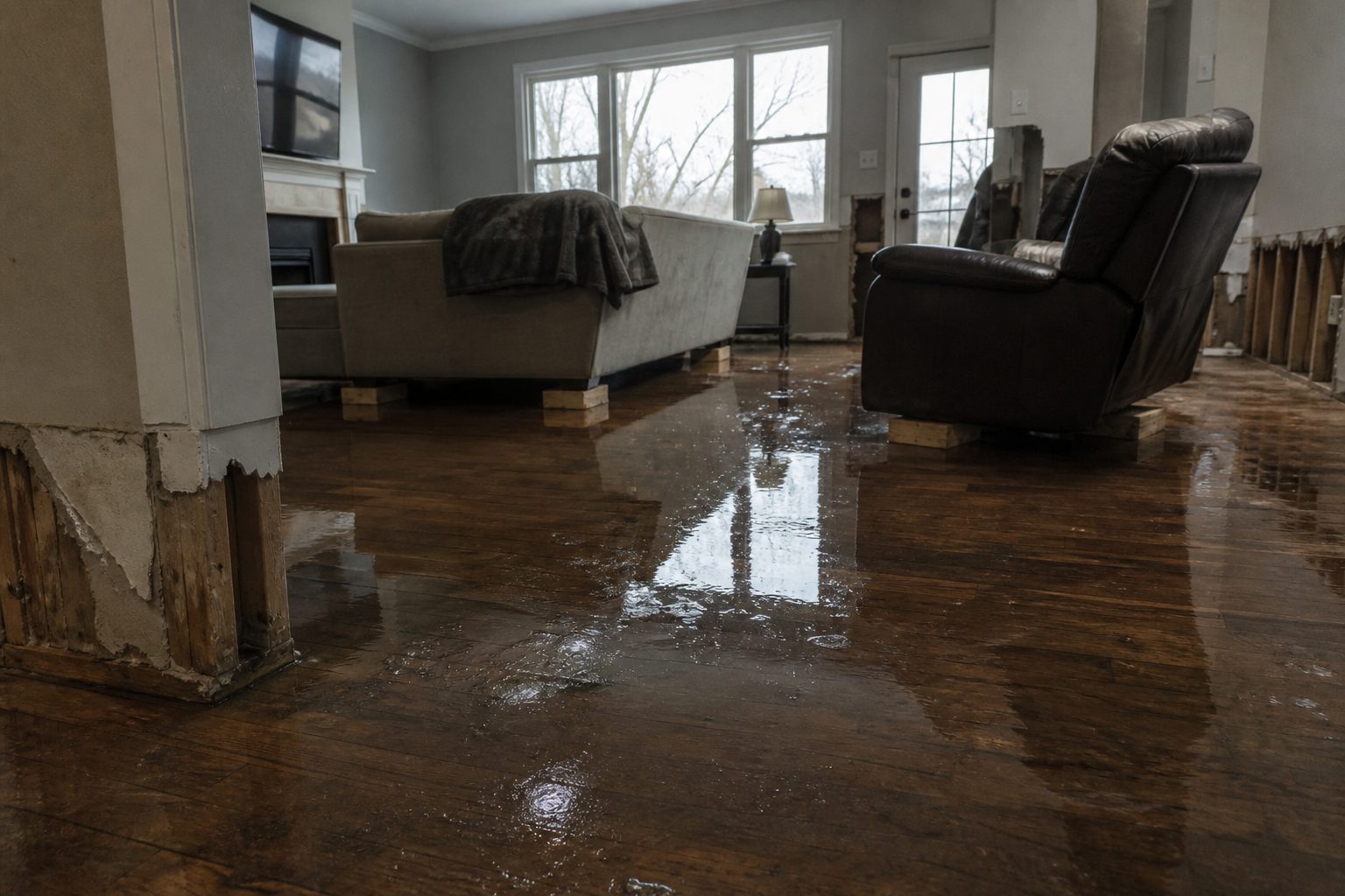
  • Severe Thunderstorm Warning: Chase County, Nebraska Area Until 3:15 PM MDT

    Severe Thunderstorm Warning: Chase County, Nebraska Area Until 3:15 PM MDT

    The warning is live in southwestern Chase County

    The National Weather Service in North Platte, Nebraska has issued a Severe Thunderstorm Warning for southwestern Chase County in southwestern Nebraska, effective from 2:19 PM MDT until 3:15 PM MDT on Sunday, September 20, 2026. Like its neighbor in Dundy County, this storm carries a CONSIDERABLE damage threat tag — golf ball size hail and 60 mph wind gusts over the rural southwest corner of the county. Two destructive hailstorms running side by side along the Nebraska–Colorado border means one thing for local trades: a concentrated damage corridor that will generate roof, siding, window, and outbuilding work for weeks.

    This is a live snapshot as of roughly 2:35 PM MDT. Conditions change fast — always verify with the National Weather Service for your specific county or ZIP code.

    Southwestern Chase County — Severe Thunderstorm Warning

    • Issuing office: National Weather Service North Platte, Nebraska (weather.gov/lbf)
    • Issued: 2:19 PM MDT, Sunday, September 20, 2026
    • Expires: 3:15 PM MDT, Sunday, September 20, 2026
    • Storm location at 2:19 PM MDT: 8 miles south of Pleasant Valley, or 13 miles southeast of Holyoke, moving east at 35 mph

    Hazard detail, verbatim from the alert:

    • Hail: Golf ball size hail — 1.75 inches — radar indicated
    • Wind: 60 mph wind gusts — radar indicated
    • Damage threat tag: CONSIDERABLE

    Expected impacts, verbatim from the alert: People and animals outdoors will be injured. Expect hail damage to roofs, siding, windows, and vehicles. Expect wind damage to roofs, siding, and trees.

    The storm will remain over mainly rural areas of southwestern Chase County. With a 35 mph eastward motion, this storm is covering ground fast — rural residents have limited lead time between the warning and impact. Note this storm’s track sits just south of the companion destructive warning in northwestern Dundy County; the corridor between Holyoke, Colorado and the Nebraska line is taking the brunt of the afternoon.

    Source: NWS alert via api.weather.gov; AWIPS identifier SVRLBF, VTEC /O.NEW.KLBF.SV.W.0450.260920T2019Z-260920T2115Z/

    Stay safe this afternoon

    The NWS instruction for this warning: for your protection, move to an interior room on the lowest floor of a building. Golf ball hail at 1.75 inches breaks windshields and skylights and can injure anyone caught outside. If you are driving on a county highway when the hail starts, pull completely off the road, angle your vehicle so the hail hits the reinforced windshield rather than side windows, and cover your head. Do not shelter under highway overpasses — it creates a traffic hazard and leaves you exposed. Farm buildings and grain bins are not safe shelter from a CONSIDERABLE-tagged storm; get to a well-built structure.

    What this means for restoration teams

    Golf ball hail with a CONSIDERABLE damage tag over farm country is a restoration and roofing demand event:

    • Roof systems: 1.75-inch hail fractures shingle mats and voids manufacturer warranties even where damage looks cosmetic from the driveway. Inspect from the roof, not the curb — and document everything before repairs start.
    • Siding and windows: called out explicitly in the alert. Vinyl siding, window screens, and skylights are the first casualties; every broken window is a water-intrusion path for the next rain.
    • Vehicles and farm equipment: hail-dented pickups, tractors, and combines across southwestern Chase County — PDR and glass shops will feel this within days.
    • Wind damage to roofs, siding, and trees: 60 mph gusts peel shingles, topple trees onto structures, and scatter debris that becomes secondary impact damage.
    • Mold clock: rain driven through hail-broken windows and punctured roofing starts the 24–48 hour mold window. Same-day moisture mapping for any interior water.

    The play: stage tarping and board-up capacity tonight — wind-lifted shingles plus forecast overnight weather can turn a day-one hail claim into a day-three water claim. Keep on-call crews rotating, capture address + water source + affected areas on every first call, photo-document pre-mitigation, and keep the homeowner’s payment responsibility clear in writing before work starts.

    FEMA & federal assistance

    If the storm leaves your home uninhabitable or with damage beyond what insurance covers, federal help may be available once a disaster declaration follows: FEMA Helpline 1-800-621-3362 (7 a.m.–10 p.m. local time, 7 days a week). You can also apply at DisasterAssistance.gov, through the FEMA app, or find recovery centers at fema.gov/drc. Basic eligibility: U.S. citizenship or qualified status, identity verification, proof of occupancy or ownership, and unmet needs not covered by insurance. Apply as soon as it is safe to do so.

    Looking ahead

    The warning runs until 3:15 PM MDT. The storm’s 35 mph eastward motion means Chase County’s warned area clears relatively quickly, but the same line is producing a companion destructive hailstorm in adjacent Dundy County — and additional severe cells may fire along the boundary this afternoon. Watch NWS North Platte and NWS Goodland for new warnings. The demand window: hail claims surface over the coming days as homeowners and roofers spot bruised shingles and dented gutters, and water-intrusion calls follow where hail broke the building envelope. Expect the busiest call days 2–5 after the storm as inspections land and adjusters schedule.

    Sources & how to verify

    To verify for your own county or ZIP: enter it at weather.gov or check your local NWS office page for the latest warnings.

    This post is for informational purposes and is not an official weather warning. Always follow instructions from local authorities and the National Weather Service.

  • Severe Thunderstorm Warning: Dundy County, Nebraska Area Until 3:15 PM MDT

    The warning is live in northwestern Dundy County

    The National Weather Service in Goodland, Kansas has issued a Severe Thunderstorm Warning for northwestern Dundy County in southwestern Nebraska, effective from 2:28 PM MDT until 3:15 PM MDT on Sunday, September 20, 2026. This is not a garden-variety severe thunderstorm: the storm carries a CONSIDERABLE damage threat tag, with golf ball size hail and 70 mph wind gusts. This is the kind of storm that leaves a trail of battered roofs, shattered windows, and broken trees across the Sandhills edge of southwestern Nebraska — exactly the hail-and-wind work restoration and roofing crews see in the days that follow.

    This is a live snapshot as of roughly 2:35 PM MDT. Conditions change fast — always verify with the National Weather Service for your specific county or ZIP code.

    Northwestern Dundy County — Severe Thunderstorm Warning

    • Issuing office: National Weather Service Goodland, Kansas (weather.gov/gld)
    • Issued: 2:28 PM MDT, Sunday, September 20, 2026
    • Expires: 3:15 PM MDT, Sunday, September 20, 2026
    • Storm location at 2:27 PM MDT: 9 miles south of Pleasant Valley, or 16 miles southeast of Holyoke, moving east at 30 mph

    Hazard detail, verbatim from the alert:

    • Hail: Golf ball size hail — 1.75 inches — radar indicated
    • Wind: 70 mph wind gusts — observed
    • Damage threat tag: CONSIDERABLE

    Expected impacts, verbatim from the alert: People and animals outdoors will be injured. Expect hail damage to roofs, siding, windows, and vehicles. Expect considerable tree damage. Wind damage is also likely to mobile homes, roofs, and outbuildings.

    The storm will remain over mainly rural areas of northwestern Dundy County. Rural exposure does not mean low stakes here: farmsteads, outbuildings, grain bins, and pivot-irrigated ground take the hit first in storms like this, and isolated farm homes can be cut off from a fast damage survey after 70 mph gusts knock trees across roads.

    Source: NWS alert via api.weather.gov; AWIPS identifier SVRGLD, VTEC /O.NEW.KGLD.SV.W.0333.260920T2028Z-260920T2115Z/

    Stay safe this afternoon

    The NWS instruction for this warning is direct: for your protection, move to an interior room on the lowest floor of a building. Large hail and 70 mph winds can shatter windows — stay away from them, and never shelter in a vehicle, a mobile home, or an outbuilding during a storm tagged CONSIDERABLE. If you are caught outdoors in farm country, get inside the sturdiest structure available; if none is reachable, protect your head and get as low as possible away from trees and power lines. Do not try to outrun a fast-moving hailstorm on a county road — golf ball hail destroys windshields in seconds.

    What this means for restoration teams

    A CONSIDERABLE-tagged hailstorm with observed 70 mph gusts is a high-probability generator of the jobs restoration and roofing contractors live on:

    • Roof systems: golf ball hail bruises and fractures asphalt shingles, dents metal roofing, and cracks tile. Damage is often invisible from the ground — this is the classic adjuster-disputed claim, and contractors who photo-document first win it.
    • Siding and windows: the alert explicitly calls out siding and window damage. Vinyl siding shatters under 1.75-inch hail; broken windows let rain in behind the building envelope.
    • Vehicles: hail-dented vehicles across farmsteads and rural driveways — PDR (paintless dent repair) referrals and fleet work follow these storms.
    • Trees and outbuildings: “considerable tree damage” plus likely wind damage to mobile homes, roofs, and outbuildings. Downed limbs on structures are immediate mitigation calls; roof tarping demand spikes tonight.
    • Mold clock: any rain driven through broken windows or punctured roofing starts the 24–48 hour mold window. Saturated insulation and drywall from wind-driven rain need moisture mapping the same day.

    The play: stage tarping and board-up crews now, keep an on-call rotation through tonight, and when the calls come, capture address, water source, and affected areas on the first call. Photo-document before any mitigation — hail claims live and die on pre-repair evidence. Moisture-map every room where rain entered, and keep the homeowner’s payment responsibility clear in writing before work starts.

    FEMA & federal assistance

    If the storm leaves your home uninhabitable or with damage beyond what insurance covers, federal help may be available once a disaster declaration follows: FEMA Helpline 1-800-621-3362 (7 a.m.–10 p.m. local time, 7 days a week). You can also apply at DisasterAssistance.gov, through the FEMA app, or find recovery centers at fema.gov/drc. Basic eligibility: U.S. citizenship or qualified status, identity verification, proof of occupancy or ownership, and unmet needs not covered by insurance. Apply as soon as it is safe to do so.

    Looking ahead

    The warning runs until 3:15 PM MDT. With the storm moving east at 30 mph, additional severe thunderstorms may ride the same boundary through the afternoon — watch for new warnings from NWS Goodland and NWS North Platte (a separate destructive hail warning is already active in adjacent Chase County, Nebraska). After the storm passes, the demand window opens: hail damage claims typically surface over the next several days as homeowners spot dented gutters, bruised shingles, and cracked windows, and restoration call volume follows the roofers’ inspections. Contractors should expect a second wave of calls 48–72 hours out as adjusters start scheduling.

    Sources & how to verify

    To verify for your own county or ZIP: enter it at weather.gov or check your local NWS office page for the latest warnings.

    This post is for informational purposes and is not an official weather warning. Always follow instructions from local authorities and the National Weather Service.

  • Severe Thunderstorm Warning: Dundy County, Nebraska Area Until 3:15 PM MDT

    The warning is live in northwestern Dundy County

    The National Weather Service in Goodland, Kansas has issued a Severe Thunderstorm Warning for northwestern Dundy County in southwestern Nebraska, effective from 2:28 PM MDT until 3:15 PM MDT on Sunday, September 20, 2026. This is not a garden-variety severe thunderstorm: the storm carries a CONSIDERABLE damage threat tag, with golf ball size hail and 70 mph wind gusts. This is the kind of storm that leaves a trail of battered roofs, shattered windows, and broken trees across the Sandhills edge of southwestern Nebraska — exactly the hail-and-wind work restoration and roofing crews see in the days that follow.

    This is a live snapshot as of roughly 2:35 PM MDT. Conditions change fast — always verify with the National Weather Service for your specific county or ZIP code.

    Northwestern Dundy County — Severe Thunderstorm Warning

    • Issuing office: National Weather Service Goodland, Kansas (weather.gov/gld)
    • Issued: 2:28 PM MDT, Sunday, September 20, 2026
    • Expires: 3:15 PM MDT, Sunday, September 20, 2026
    • Storm location at 2:27 PM MDT: 9 miles south of Pleasant Valley, or 16 miles southeast of Holyoke, moving east at 30 mph

    Hazard detail, verbatim from the alert:

    • Hail: Golf ball size hail — 1.75 inches — radar indicated
    • Wind: 70 mph wind gusts — observed
    • Damage threat tag: CONSIDERABLE

    Expected impacts, verbatim from the alert: People and animals outdoors will be injured. Expect hail damage to roofs, siding, windows, and vehicles. Expect considerable tree damage. Wind damage is also likely to mobile homes, roofs, and outbuildings.

    The storm will remain over mainly rural areas of northwestern Dundy County. Rural exposure does not mean low stakes here: farmsteads, outbuildings, grain bins, and pivot-irrigated ground take the hit first in storms like this, and isolated farm homes can be cut off from a fast damage survey after 70 mph gusts knock trees across roads.

    Source: NWS alert via api.weather.gov; AWIPS identifier SVRGLD, VTEC /O.NEW.KGLD.SV.W.0333.260920T2028Z-260920T2115Z/

    Stay safe this afternoon

    The NWS instruction for this warning is direct: for your protection, move to an interior room on the lowest floor of a building. Large hail and 70 mph winds can shatter windows — stay away from them, and never shelter in a vehicle, a mobile home, or an outbuilding during a storm tagged CONSIDERABLE. If you are caught outdoors in farm country, get inside the sturdiest structure available; if none is reachable, protect your head and get as low as possible away from trees and power lines. Do not try to outrun a fast-moving hailstorm on a county road — golf ball hail destroys windshields in seconds.

    What this means for restoration teams

    A CONSIDERABLE-tagged hailstorm with observed 70 mph gusts is a high-probability generator of the jobs restoration and roofing contractors live on:

    • Roof systems: golf ball hail bruises and fractures asphalt shingles, dents metal roofing, and cracks tile. Damage is often invisible from the ground — this is the classic adjuster-disputed claim, and contractors who photo-document first win it.
    • Siding and windows: the alert explicitly calls out siding and window damage. Vinyl siding shatters under 1.75-inch hail; broken windows let rain in behind the building envelope.
    • Vehicles: hail-dented vehicles across farmsteads and rural driveways — PDR (paintless dent repair) referrals and fleet work follow these storms.
    • Trees and outbuildings: “considerable tree damage” plus likely wind damage to mobile homes, roofs, and outbuildings. Downed limbs on structures are immediate mitigation calls; roof tarping demand spikes tonight.
    • Mold clock: any rain driven through broken windows or punctured roofing starts the 24–48 hour mold window. Saturated insulation and drywall from wind-driven rain need moisture mapping the same day.

    The play: stage tarping and board-up crews now, keep an on-call rotation through tonight, and when the calls come, capture address, water source, and affected areas on the first call. Photo-document before any mitigation — hail claims live and die on pre-repair evidence. Moisture-map every room where rain entered, and keep the homeowner’s payment responsibility clear in writing before work starts.

    FEMA & federal assistance

    If the storm leaves your home uninhabitable or with damage beyond what insurance covers, federal help may be available once a disaster declaration follows: FEMA Helpline 1-800-621-3362 (7 a.m.–10 p.m. local time, 7 days a week). You can also apply at DisasterAssistance.gov, through the FEMA app, or find recovery centers at fema.gov/drc. Basic eligibility: U.S. citizenship or qualified status, identity verification, proof of occupancy or ownership, and unmet needs not covered by insurance. Apply as soon as it is safe to do so.

    Looking ahead

    The warning runs until 3:15 PM MDT. With the storm moving east at 30 mph, additional severe thunderstorms may ride the same boundary through the afternoon — watch for new warnings from NWS Goodland and NWS North Platte (a separate destructive hail warning is already active in adjacent Chase County, Nebraska). After the storm passes, the demand window opens: hail damage claims typically surface over the next several days as homeowners spot dented gutters, bruised shingles, and cracked windows, and restoration call volume follows the roofers’ inspections. Contractors should expect a second wave of calls 48–72 hours out as adjusters start scheduling.

    Sources & how to verify

    To verify for your own county or ZIP: enter it at weather.gov or check your local NWS office page for the latest warnings.

    This post is for informational purposes and is not an official weather warning. Always follow instructions from local authorities and the National Weather Service.

  • Severe Thunderstorm Warning: Dundy County, Nebraska Area Until 3:15 PM MDT

    Severe Thunderstorm Warning: Dundy County, Nebraska Area Until 3:15 PM MDT

    The warning is live in northwestern Dundy County

    The National Weather Service in Goodland, Kansas has issued a Severe Thunderstorm Warning for northwestern Dundy County in southwestern Nebraska, effective from 2:28 PM MDT until 3:15 PM MDT on Sunday, September 20, 2026. This is not a garden-variety severe thunderstorm: the storm carries a CONSIDERABLE damage threat tag, with golf ball size hail and 70 mph wind gusts. This is the kind of storm that leaves a trail of battered roofs, shattered windows, and broken trees across the Sandhills edge of southwestern Nebraska — exactly the hail-and-wind work restoration and roofing crews see in the days that follow.

    This is a live snapshot as of roughly 2:35 PM MDT. Conditions change fast — always verify with the National Weather Service for your specific county or ZIP code.

    Northwestern Dundy County — Severe Thunderstorm Warning

    • Issuing office: National Weather Service Goodland, Kansas (weather.gov/gld)
    • Issued: 2:28 PM MDT, Sunday, September 20, 2026
    • Expires: 3:15 PM MDT, Sunday, September 20, 2026
    • Storm location at 2:27 PM MDT: 9 miles south of Pleasant Valley, or 16 miles southeast of Holyoke, moving east at 30 mph

    Hazard detail, verbatim from the alert:

    • Hail: Golf ball size hail — 1.75 inches — radar indicated
    • Wind: 70 mph wind gusts — observed
    • Damage threat tag: CONSIDERABLE

    Expected impacts, verbatim from the alert: People and animals outdoors will be injured. Expect hail damage to roofs, siding, windows, and vehicles. Expect considerable tree damage. Wind damage is also likely to mobile homes, roofs, and outbuildings.

    The storm will remain over mainly rural areas of northwestern Dundy County. Rural exposure does not mean low stakes here: farmsteads, outbuildings, grain bins, and pivot-irrigated ground take the hit first in storms like this, and isolated farm homes can be cut off from a fast damage survey after 70 mph gusts knock trees across roads.

    Source: NWS alert via api.weather.gov; AWIPS identifier SVRGLD, VTEC /O.NEW.KGLD.SV.W.0333.260920T2028Z-260920T2115Z/

    Stay safe this afternoon

    The NWS instruction for this warning is direct: for your protection, move to an interior room on the lowest floor of a building. Large hail and 70 mph winds can shatter windows — stay away from them, and never shelter in a vehicle, a mobile home, or an outbuilding during a storm tagged CONSIDERABLE. If you are caught outdoors in farm country, get inside the sturdiest structure available; if none is reachable, protect your head and get as low as possible away from trees and power lines. Do not try to outrun a fast-moving hailstorm on a county road — golf ball hail destroys windshields in seconds.

    What this means for restoration teams

    A CONSIDERABLE-tagged hailstorm with observed 70 mph gusts is a high-probability generator of the jobs restoration and roofing contractors live on:

    • Roof systems: golf ball hail bruises and fractures asphalt shingles, dents metal roofing, and cracks tile. Damage is often invisible from the ground — this is the classic adjuster-disputed claim, and contractors who photo-document first win it.
    • Siding and windows: the alert explicitly calls out siding and window damage. Vinyl siding shatters under 1.75-inch hail; broken windows let rain in behind the building envelope.
    • Vehicles: hail-dented vehicles across farmsteads and rural driveways — PDR (paintless dent repair) referrals and fleet work follow these storms.
    • Trees and outbuildings: “considerable tree damage” plus likely wind damage to mobile homes, roofs, and outbuildings. Downed limbs on structures are immediate mitigation calls; roof tarping demand spikes tonight.
    • Mold clock: any rain driven through broken windows or punctured roofing starts the 24–48 hour mold window. Saturated insulation and drywall from wind-driven rain need moisture mapping the same day.

    The play: stage tarping and board-up crews now, keep an on-call rotation through tonight, and when the calls come, capture address, water source, and affected areas on the first call. Photo-document before any mitigation — hail claims live and die on pre-repair evidence. Moisture-map every room where rain entered, and keep the homeowner’s payment responsibility clear in writing before work starts.

    FEMA & federal assistance

    If the storm leaves your home uninhabitable or with damage beyond what insurance covers, federal help may be available once a disaster declaration follows: FEMA Helpline 1-800-621-3362 (7 a.m.–10 p.m. local time, 7 days a week). You can also apply at DisasterAssistance.gov, through the FEMA app, or find recovery centers at fema.gov/drc. Basic eligibility: U.S. citizenship or qualified status, identity verification, proof of occupancy or ownership, and unmet needs not covered by insurance. Apply as soon as it is safe to do so.

    Looking ahead

    The warning runs until 3:15 PM MDT. With the storm moving east at 30 mph, additional severe thunderstorms may ride the same boundary through the afternoon — watch for new warnings from NWS Goodland and NWS North Platte (a separate destructive hail warning is already active in adjacent Chase County, Nebraska). After the storm passes, the demand window opens: hail damage claims typically surface over the next several days as homeowners spot dented gutters, bruised shingles, and cracked windows, and restoration call volume follows the roofers’ inspections. Contractors should expect a second wave of calls 48–72 hours out as adjusters start scheduling.

    Sources & how to verify

    To verify for your own county or ZIP: enter it at weather.gov or check your local NWS office page for the latest warnings.

    This post is for informational purposes and is not an official weather warning. Always follow instructions from local authorities and the National Weather Service.

  • Flash Flood Warning: Southwestern Suwannee County FL Area Until 7:15 PM EDT

    Flash Flood Warning: Southwestern Suwannee County FL Area Until 7:15 PM EDT

    The National Weather Service in Jacksonville has issued a Flash Flood Warning for southwestern Suwannee County in northern Florida, in effect until 7:15 PM EDT this evening. At 4:09 PM EDT, Doppler radar indicated thunderstorms producing heavy rain across the warned area — between 2 and 3 inches of rain have already fallen, with an additional 1 to 3 inches possible. Flash flooding is ongoing or expected to begin shortly. This is the interior-flooding scenario restoration teams see most: fast, radar-indicated rainfall over a rural area where water finds its way into living spaces long before anyone thinks to check. This is a live snapshot as of 4:20 PM EDT. Conditions change fast — always verify with the National Weather Service for your specific county or ZIP code.

    Southwestern Suwannee County — Flash Flood Warning

    • Issuing office: NWS Jacksonville, FL (weather.gov/jax)
    • Issued: 4:09 PM EDT, Sunday, September 20
    • Expires: 7:15 PM EDT, Sunday, September 20
    • VTEC: /O.NEW.KJAX.FF.W.0027.260920T2009Z-260920T2315Z/

    Hazard detail, verbatim from the alert: At 4:09 PM EDT, Doppler radar indicated thunderstorms producing heavy rain across the warned area. Between 2 and 3 inches of rain have fallen. Additional rainfall amounts of 1 to 3 inches are possible in the warned area. Flash flooding is ongoing or expected to begin shortly.

    Hazard: Flash flooding caused by thunderstorms. Source: Radar indicated.

    Impact: Flash flooding of small creeks and streams, urban areas, highways, streets and underpasses as well as other poor drainage and low-lying areas.

    Locations in the warning path: Mainly rural areas of southwestern Suwannee County.

    The radar-indicated wording matters here: no spotter or gauge confirmation is cited, which means this is a Doppler-derived rainfall estimate — the water is falling faster than the ground can absorb it, and the heaviest cores may be sitting over ground nobody is watching. In rural north Florida, where Suwannee County’s low-lying farm and timber country meets small creek drainages, that combination is how a quiet Sunday afternoon turns into flooded low-water crossings and water in crawlspaces before dark.

    Source: the NWS alert record for this warning — api.weather.gov — and the NWS Jacksonville office page at weather.gov/jax.

    Stay safe tonight

    Turn around, don’t drown when encountering flooded roads. Most flood deaths occur in vehicles — and in rural counties, the flooded road is often a two-lane farm-to-market road with no alternate route signed. Six inches of moving water can knock an adult down; twelve inches can carry a car.

    If water enters the home: stay out of standing water where electricity may be present, and avoid the basement or crawlspace until the water recedes and power is confirmed off. Photograph everything before cleanup — documentation matters for insurance. Then call a local restoration contractor: water left sitting starts a second wave of damage within a day.

    What this means for restoration teams

    This warning maps directly onto the water-damage jobs local contractors run every storm season: interior water intrusion, saturated drywall and insulation, mold risk beginning within 24–48 hours, and sewage backup where low-lying septic systems sit in standing water. Southwestern Suwannee County is mainly rural — expect low-water crossings, flooded farm outbuildings, water in crawlspaces under older homes, and septic exposure where drainfields are saturated.

    The play: stage equipment now, pre-position drying assets, and keep an on-call rotation through tonight and Monday morning. Capture address, water source, and affected areas on the first call — the demand window for water-intrusion calls typically starts within hours of water receding and keeps coming for days as people discover damage.

    Field discipline: photo-document before mitigation, moisture-map every affected room, and keep the homeowner’s payment responsibility clear in writing before work starts. Rural jobs also mean longer drive times between calls — route the night’s work by geography, not by call order.

    Local emergency contacts

    Suwannee County Emergency Management: (386) 364-3405 — suwanneecountyfl.gov/emergency-management. For life-threatening emergencies, call 911.

    FEMA & federal assistance

    FEMA Helpline: 1-800-621-3362 (7 a.m.–10 p.m. local time, 7 days a week). Apply at DisasterAssistance.gov, through the FEMA app, or find recovery centers at fema.gov/drc. Basic eligibility: U.S. citizenship or qualified status, identity verification, proof of occupancy or ownership, and unmet needs not covered by insurance. Apply as soon as it is safe to do so.

    Looking ahead

    This warning expires at 7:15 PM EDT. When it does, the rain doesn’t have to stop for the damage to continue: small creeks and streams in the warned area can keep rising after the heaviest rain ends, and a second round of storms is always possible on a day like this. Watch the NWS Jacksonville page tonight for any extensions or new warnings.

    For contractors, the demand window opens the moment water recedes: tonight’s calls will be flooded garages and driveways, tomorrow’s calls will be soaked carpet and warped baseboards as people discover what the water left behind. The mold clock starts at 24–48 hours — Sunday’s rain is Monday’s job queue.

    Sources & how to verify

    To verify for your own county or ZIP: go to weather.gov, enter your ZIP code, and read the active alerts for your area. Never rely on a single post — the warning map updates as conditions change.

    This post is for informational purposes and is not an official weather warning. Always follow instructions from local authorities and the National Weather Service.

  • Flash Flood Warning: Hamilton County FL Until 6:45 PM EDT

    Flash Flood Warning: Hamilton County FL Until 6:45 PM EDT

    The National Weather Service in Jacksonville has issued a Flash Flood Warning for northwestern Hamilton County in northern Florida, in effect until 6:45 PM EDT this evening. At 3:43 PM EDT, Doppler radar indicated thunderstorms producing heavy rain across the warned area — between 2.5 and 3.5 inches of rain have already fallen, with an additional 1 to 3 inches possible. Flash flooding is ongoing or expected to begin shortly.

    This is the exact interior-flooding scenario restoration teams see most: fast, radar-indicated rainfall over a rural area where water finds its way into living spaces long before anyone thinks to check. This is a live snapshot as of 3:47 PM EDT. Conditions change fast — always verify with the National Weather Service for your specific county or ZIP code.

    Northwestern Hamilton County — Flash Flood Warning

    Issuing office: NWS Jacksonville, FL (weather.gov/jax)
    Issued: 3:43 PM EDT, Sunday, September 20
    Expires: 6:45 PM EDT, Sunday, September 20
    VTEC: /O.NEW.KJAX.FF.W.0026

    Hazard detail, verbatim from the alert: At 3:43 PM EDT, Doppler radar indicated thunderstorms producing heavy rain across the warned area. Between 2.5 and 3.5 inches of rain have fallen. Additional rainfall amounts of 1 to 3 inches are possible in the warned area. Flash flooding is ongoing or expected to begin shortly.

    Hazard: Flash flooding caused by thunderstorms.
    Source: Radar indicated.
    Impact: Flash flooding of small creeks and streams, urban areas, highways, streets and underpasses as well as other poor drainage and low-lying areas.

    Locations in the warning path: Mainly rural areas of northwestern Hamilton County.

    The radar-indicated wording matters here: no spotter or gauge confirmation is cited, which means this is a Doppler-derived rainfall estimate — the water is falling faster than the ground can absorb it, and the heaviest cores may be sitting over ground nobody is watching. In rural north Florida, that combination is how a quiet Sunday afternoon turns into flooded low-water crossings and water in crawlspaces before dark.

    Stay safe tonight

    Turn around, don’t drown when encountering flooded roads. Most flood deaths occur in vehicles — and in rural counties, the flooded road is often a two-lane farm-to-market road with no alternate route signed. Six inches of moving water can knock an adult down; twelve inches can carry a car.

    If water enters the home: stay out of standing water where electricity may be present, avoid the basement or crawlspace until the water recedes and the power is confirmed off, and photograph everything before any cleanup begins — documentation matters for insurance. Then call a local restoration contractor. Water left sitting starts a second wave of damage within a day: saturated drywall, wicking insulation, and the beginning of mold colonization.

    What this means for restoration teams

    A radar-indicated flash flood warning over rural Hamilton County translates into a specific call profile: interior water intrusion through low-lying entries and slab edges, saturated drywall and insulation in rooms that sat in two to four inches of water, and crawlspace flooding that homeowners often don’t discover until the musty smell starts days later. With 2.5 to 3.5 inches already down and up to 3 more possible, this is not a nuisance-rainfall event — it’s a structural-drying event.

    The mold clock starts ticking the moment water sits. Mold risk rises sharply within 24 to 48 hours of sustained wetting, which means the contractor who gets called Sunday evening versus Monday afternoon is the difference between a dry-out and a tear-out. Sewage backup is a real secondary hazard in low-lying rural areas where septic systems and lift stations get overwhelmed — treat any standing water as potentially contaminated until proven otherwise.

    The play: stage equipment now, not after the first call. Pre-position dehumidifiers, air movers, and extraction units so a Sunday-evening dispatch doesn’t turn into a Monday-morning scramble. Keep an on-call rotation through the night — rural flash-flood calls cluster in the hours after the rain stops, when people come home and find water. On the first call, capture the address, the water source, and every affected area before quoting anything.

    Field discipline: photo-document before mitigation starts — every room, every waterline, every piece of affected contents. Moisture-map every affected room, not just the visibly wet ones; water migrates under flooring and behind baseboards. And keep the homeowner’s payment responsibility clear in writing before work starts — storm events bring out the “insurance will cover everything” assumption, and ambiguity there costs more than the drying does.

    FEMA & federal assistance

    If the damage is significant, the FEMA Helpline is 1-800-621-3362 (7 a.m. to 10 p.m. local time, 7 days a week). You can also apply at DisasterAssistance.gov, through the FEMA app, or by finding a recovery center at fema.gov/drc.

    Basic eligibility generally requires citizenship or qualified status, identity verification, proof of occupancy or ownership, and unmet needs not covered by insurance. Apply as soon as it’s safe to do so — you don’t need to wait for an adjuster to start the process.

    Looking ahead

    The warning expires at 6:45 PM EDT. Even after expiration, watch the small creeks and streams in northwestern Hamilton County — they can crest after the rain stops, and additional rounds of thunderstorms remain possible through the evening as the same unstable airmass sits over the region. The next NWS update will land as conditions evolve; check the Jacksonville office page for the latest.

    For contractors: water-intrusion calls typically start within hours of water receding and keep coming for days as people discover damage — the Sunday-night callers are the visible ones, and the Tuesday callers are the crawlspaces and the slow wicks. The demand window for this event runs through at least midweek.

    Sources & how to verify

    This post is for informational purposes and is not an official weather warning. Always follow instructions from local authorities and the National Weather Service.