Tag: Public Works

  • Everett’s Lenora Regional Stormwater Treatment Facility: The Complete 2026 Guide to the $8.7M Lowell Project Cleaning the Snohomish River

    Everett’s Lenora Regional Stormwater Treatment Facility: The Complete 2026 Guide to the $8.7M Lowell Project Cleaning the Snohomish River

    Quick answer: The Lenora Regional Stormwater Treatment Facility is an $8.73 million water-quality project breaking ground in April 2026 on a 0.27-acre, city-owned lot at the corner of Lenora Street and S 1st Avenue in Lowell, immediately adjacent to Lowell Riverfront Park. It is funded primarily by Washington State Department of Ecology Water Quality Combined Financial Assistance Agreement WQC-2025-EverPW-00177 in the amount of $8,733,920 — effectively the entire project cost. The facility will treat stormwater runoff from 146 acres of Lowell drainage (subbasins LW-9, LW-10, and LW-11) before it discharges into the Marshland Canal and the Snohomish River, removing total suspended solids, dissolved copper and zinc, total petroleum hydrocarbons, and total phosphorus.

    Why an $8.7M Stormwater Project Is Bigger News Than It Looks

    While most of Everett’s construction conversation in April 2026 has been about a $120 million stadium and 300 new waterfront apartments, an $8.73 million project is starting this month on a half-acre lot in Lowell that will quietly do more for the Snohomish River than any other capital project the city is funding right now. It is one of those projects nobody will livestream and nobody will design-render. It is also exactly the kind of work that determines whether Everett’s waterfront stays swimmable, fishable, and credible as a sustainability story over the next decade.

    Where It Is and What It Does

    The site is small — 11,944 square feet, 0.27 acres — at the northeast corner of S 1st Avenue and Lenora Street, immediately adjacent to Lowell Riverfront Park, on the west side of the BNSF railroad tracks. If you have ever parked at the Lowell Riverfront Trail to walk the dog, you have driven past it without noticing.

    The facility’s job is to take stormwater runoff from three drainage subbasins in Lowell — known to city staff as LW-9, LW-10, and LW-11, totaling 146.10 acres — and run it through a treatment train before it reaches the Marshland Canal system, which discharges into the Snohomish River. The first phase of the facility is a five-cell Filterra Bioscape system with two of the five cells fully functional at opening, giving the city a phased path to scale up treatment capacity as the surrounding subbasins develop further.

    What Gets Removed From the Runoff

    The contaminants the Lenora facility is designed to capture are the standard menu of urban stormwater pollutants:

    • Total suspended solids (TSS) — particulate matter that clouds water and smothers spawning gravel.
    • Total petroleum hydrocarbons — oil and fuel runoff from streets, driveways, and parking lots.
    • Dissolved copper — primarily from vehicle brake pads. Copper is acutely toxic to juvenile salmon at very low concentrations.
    • Dissolved zinc — from tire wear, galvanized metal, and roofing.
    • Total phosphorus — the driver of summer algae blooms downstream.

    The Marshland Canal discharges to the Snohomish River, which means everything the facility removes is something that does not enter the river — and does not enter Possession Sound or any of the salmon habitat between Lowell and the river mouth.

    The Funding Story

    The project is funded primarily by the Washington State Department of Ecology under Water Quality Combined Financial Assistance Agreement WQC-2025-EverPW-00177, in the amount of $8,733,920. That is roughly the entire project cost, which is why the City of Everett can deliver an $8.7M facility without putting it on the local utility bill.

    For Everett residents already absorbing the proposed $10.74-per-month utility tax hike going through council right now, the Lenora project is the rare piece of stormwater infrastructure that does not show up on your bill at all. The state Ecology grant covers it.

    Why Lowell Needed This

    Lowell is one of Everett’s most environmentally complex neighborhoods. It sits on a low riverfront bench between the Snohomish River and the BNSF tracks, with three small subbasins draining toward the Marshland Canal. The geography means stormwater from streets, parking lots, and roofs throughout the neighborhood concentrates fast and hits the river hard during rain events.

    The 146 acres covered by the Lenora facility include a mix of residential, commercial, and rail-adjacent uses. That mix is exactly the kind of urban runoff cocktail that does the most damage to salmon habitat, because dissolved copper from brake pads and dissolved zinc from tire wear behave like concentrated toxins for juvenile fish even at very low concentrations. Removing those before they reach the river is the difference between a healthy salmon return and a steady decline.

    How It Fits Everett’s Bigger Stormwater Picture

    Everett operates under a state-issued NPDES Phase II Municipal Stormwater Permit. Among other things, that permit requires the city to identify high-priority drainage areas and progressively install treatment infrastructure that meets state water quality standards. The Stormwater Management Action Plan (SMAP) the city has been refining for several years identifies the Lowell subbasins as priorities precisely because they discharge directly to a salmon-bearing waterway with limited dilution. The Lenora facility is one of the more visible deliverables of that plan.

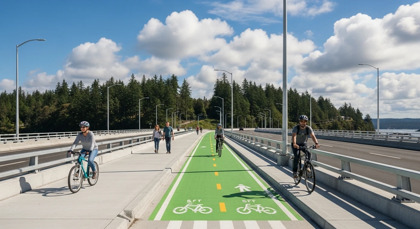
    What It Means for the Lowell Riverfront Trail

    The construction site is immediately adjacent to Lowell Riverfront Park, which means anyone using the Lowell Riverfront Trail this spring and summer should expect periodic construction activity, equipment staging, and possible short trail detours along the affected segment near S 1st Avenue and Lenora Street. The city’s Public Works department will post detour signage if any trail closures become necessary.

    The good news for trail users: the facility is going on a small footprint at the edge of the park, not inside it. The trail itself stays intact. Once the facility opens, the only visible change at the site will be the Filterra system’s surface elements — bioretention cells, a small access path, and a city interpretive sign that the Public Works department typically installs at completed water quality projects.

    Frequently Asked Questions

    Where exactly is the Lenora Stormwater Treatment Facility?

    At the northeast corner of S 1st Avenue and Lenora Street in Lowell, on a 0.27-acre city-owned lot adjacent to Lowell Riverfront Park, west of the BNSF railroad tracks.

    How is it funded?

    Primarily by a Washington State Department of Ecology Water Quality Combined Financial Assistance Agreement (WQC-2025-EverPW-00177) for $8,733,920 — effectively the full project cost.

    Will it raise my Everett utility bill?

    No. The state Ecology grant covers the project. This is structurally separate from the proposed $10.74-per-month utility tax hike currently before the City Council, which is a different revenue mechanism for general fund purposes.

    What pollutants does it remove?

    Total suspended solids, total petroleum hydrocarbons, dissolved copper, dissolved zinc, and total phosphorus — the contaminants most responsible for water-quality damage to juvenile salmon and downstream algae blooms.

    Where does the treated water go?

    The treated runoff discharges into the Marshland Canal system, which discharges into the Snohomish River.

    How big is the drainage area being treated?

    146.10 acres across three Lowell subbasins (LW-9, LW-10, LW-11). The treatment train uses a five-cell Filterra Bioscape system; two of the five cells will be fully functional at opening, with capacity to scale up.

    Will the Lowell Riverfront Trail close?

    Trail users should expect periodic construction activity and possible short detours along the segment near S 1st Avenue and Lenora Street. Public Works will post detour signage if any trail closures become necessary. The trail itself remains intact; the facility footprint is at the edge of the park, not inside it.

    Related Exploring Everett Coverage

  • Edgewater Bridge Community Celebration Is Monday at 3:30 — Here’s What to Know Before You Walk Across

    Edgewater Bridge Community Celebration Is Monday at 3:30 — Here’s What to Know Before You Walk Across

    Quick answer: The City of Everett is hosting a community celebration for the new Edgewater Bridge on Monday, April 27 at 3:30 p.m. Residents are invited to walk across the bridge, hear remarks from Everett and Mukilteo officials, and meet the project team. The bridge will not be open to vehicle traffic during the celebration. The bridge officially reopens to vehicles on Tuesday, April 28.

    After 18 months of detours, closures and the slow-motion choreography of a $34 million bridge replacement, the Edgewater Bridge is back. And before it opens to traffic, the city is throwing residents a chance to walk across it first.

    The community celebration is set for Monday, April 27 at 3:30 p.m. Mayor Cassie Franklin and officials from the City of Mukilteo are expected to deliver remarks, the project team will be on hand to walk attendees through how the bridge was rebuilt, and the public is invited to walk across the new span as part of the event.

    Then, at the end of the workday on Tuesday, April 28, the bridge will officially reopen to vehicle traffic — restoring the connection between Everett’s Mukilteo Boulevard corridor and the City of Mukilteo for the first time since fall 2024.

    What to Expect at the Celebration

    This is a community-style event, not a ribbon-cutting reception. The city has framed it as a chance for neighbors to walk the new bridge, learn how the replacement was built, and take in remarks from Everett and Mukilteo officials.

    A few practical notes for residents who want to attend:

    • The bridge will not be open to vehicles during the celebration. You can approach the bridge from either side — Everett or Mukilteo — but you cannot drive across it Monday afternoon. Vehicle traffic resumes Tuesday.
    • You can walk across. That’s the entire point of the event. Pedestrians are welcome to cross the bridge during the celebration window.
    • Project staff will be available to answer questions. If you’ve ever wanted to know how the seismic upgrades work, why the bike lanes are configured the way they are, or what’s coming next on the Mukilteo Boulevard corridor — Monday is your shot.
    • Some finishing work continues after opening. Permanent roadway striping, barriers, lighting and paint may still need to be completed in the days and weeks after the bridge reopens. Drivers should expect occasional lane shifts or short closures during off-peak hours.

    The celebration is free and open to the public. No tickets, no RSVP, no formal program — just the chance to walk across before the cars take over again.

    Why a Community Walk Across the Bridge Is Worth Doing

    Bridge openings don’t usually get a public celebration. Most ribbon-cuttings happen at 10 a.m. on a weekday with a few elected officials and a press release.

    This one is different for a few reasons.

    The closure was long and disruptive. Everett residents who use Mukilteo Boulevard, the Boeing employees who rely on it for commuting, and Mukilteo neighbors who route through Everett have been living with detours for the better part of a year and a half. The detour pushed traffic onto other corridors, slowed commutes, and meaningfully reshuffled neighborhood traffic patterns.

    The bridge is a significant piece of regional infrastructure. The Edgewater Bridge is one of the key connection points between the City of Everett and the City of Mukilteo, and it carries one of the more scenic stretches of road in the region. The new structure includes seismic upgrades, dedicated bike lanes, and improved pedestrian infrastructure that the previous bridge didn’t have.

    Most of the cost was federally funded. The roughly $34 million replacement project was approximately 80 percent federally funded, meaning the bulk of the bill was carried by federal transportation dollars rather than Everett’s general fund or local taxpayers directly. Public events like Monday’s are also a chance for project staff to walk residents through that funding structure and what it bought.

    Walking a new bridge before traffic opens is a one-time-only thing. Once Tuesday hits, the bridge becomes part of the daily traffic grid. Monday afternoon is the only window where a resident can experience the structure on foot, in the open air, without dodging cars.

    How the Bridge Got Here

    The Edgewater Bridge replacement project closed the original structure to traffic in 2024 to allow for full demolition and rebuild. Mukilteo Boulevard was rerouted, neighborhood traffic patterns shifted, and the timeline ran the better part of 18 months.

    The new bridge includes several upgrades over the structure it replaces:

    • Seismic resilience. The bridge was rebuilt to current seismic standards — meaningful in a region that sits on the Cascadia Subduction Zone and where post-1990s seismic codes are now the baseline for major infrastructure.
    • Bike lanes. The new bridge includes dedicated bicycle facilities that match the city’s broader plan to improve non-motorized transportation along Mukilteo Boulevard.
    • Updated pedestrian infrastructure. Crossing the bridge on foot or by bike is now meaningfully different than it was on the previous structure.
    • Drainage and structural updates that bring the bridge in line with current Washington State engineering standards.

    After the public celebration on Monday and the traffic reopening on Tuesday, the project enters its punch-list phase. Permanent roadway striping, barriers, lighting and paint may still need to be completed after the bridge is open to traffic. The city has signaled drivers may see occasional brief impacts during finishing work, but the corridor will be open to traffic.

    What Happens After the Bridge Reopens

    The Edgewater Bridge reopening is one of two big infrastructure stories on the same Mukilteo Boulevard corridor. Mukilteo Boulevard at the bridge is projected to fully reopen to traffic in April 2026, weather permitting — meaning the entire corridor, not just the bridge structure itself, returns to normal operation.

    Once the bridge and corridor are both open, expect the traffic patterns that have been displaced for 18 months to shift back. Neighborhood streets that were absorbing detour traffic should see relief. Mukilteo Boulevard itself returns to functioning as the connecting route it was before the closure. And the broader regional traffic grid between Everett and Mukilteo restores its primary connection.

    For commuters who built workarounds during the closure, it’s worth knowing the bridge will be fully open — but with finishing work continuing for at least a few weeks. Plan for occasional minor adjustments rather than perfectly normal traffic.

    How to Attend

    The celebration starts at 3:30 p.m. Monday, April 27. Residents can approach the bridge from either the Everett or Mukilteo side. Pedestrian access is open during the event window; vehicle access is not. The bridge officially reopens to vehicle traffic on Tuesday, April 28, at the end of the workday.

    For project information, visit the City of Everett’s Edgewater Bridge Replacement Project page at everettwa.gov.

    This is the first time most Everett and Mukilteo residents will set foot on the new bridge. After Monday, most of us will only experience it through a windshield.

    Frequently Asked Questions

    When is the Edgewater Bridge community celebration? Monday, April 27, 2026, at 3:30 p.m.

    When does the bridge reopen to traffic? Tuesday, April 28, 2026, at the end of the workday.

    Can I drive across the bridge during the celebration? No. The bridge will not be open to vehicle traffic on Monday during the celebration. Pedestrian access only that afternoon. Vehicles return Tuesday.

    Where do I park to attend the celebration? The city has not announced dedicated event parking. Residents should plan to use street parking near either approach to the bridge — on the Everett side along Mukilteo Boulevard, or from the Mukilteo side near the existing approach. Plan to walk a short distance.

    Is the celebration free? Yes. Free, open to the public, no tickets or RSVP required.

    Will Mayor Franklin be there? Officials from both Everett and Mukilteo are expected to deliver brief remarks at the celebration.

    How much did the bridge cost, and who paid for it? The replacement project came in around $34 million, with approximately 80 percent of the cost covered by federal transportation funding. The remaining share was covered through state and local sources.

    What changed about the new bridge versus the old one? The new bridge includes seismic upgrades, dedicated bike lanes, and improved pedestrian infrastructure — none of which existed on the previous structure.

    Will the entire Mukilteo Boulevard corridor be open after April 28? Yes. Mukilteo Boulevard at the bridge is projected to reopen to traffic in April 2026, weather permitting. Some finishing work — striping, lighting, painting — will continue afterward but should not cause major traffic disruptions.

  • Everett’s Lenora Stormwater Treatment Facility Breaks Ground This Month: A $8.7M Snohomish River Cleanup Project Quietly Starts in Lowell

    Everett’s Lenora Stormwater Treatment Facility Breaks Ground This Month: A $8.7M Snohomish River Cleanup Project Quietly Starts in Lowell

    Q: What is the Lenora Regional Stormwater Treatment Facility, and when does construction start?

    A: It is a $8.73 million regional stormwater treatment facility being built in April 2026 on city-owned property at the corner of Lenora Street and S 1st Avenue in Lowell, adjacent to Lowell Riverfront Park. Funded primarily by a Washington State Department of Ecology Water Quality grant, it will treat runoff from 146 acres of Lowell drainage before it discharges into the Marshland Canal and the Snohomish River — removing total suspended solids, dissolved copper and zinc, oil and total phosphorus.

    While most of Everett’s construction conversation in April 2026 has been about a $120 million stadium and 300 new waterfront apartments, an $8.73 million project starts this month on a half-acre lot in Lowell that will quietly do more for the Snohomish River than any other capital project the city is funding right now.

    The Lenora Regional Stormwater Treatment Facility breaks ground in April 2026. It is one of the projects nobody will livestream and nobody will design-render, and it is exactly the kind of work that determines whether Everett’s waterfront stays swimmable, fishable, and credible as a sustainability story over the next decade.

    Where it is and what it does

    The site is small — 11,944 square feet, 0.27 acres — at the northeast corner of the S 1st Avenue and Lenora Street intersection, immediately adjacent to Lowell Riverfront Park, on the west side of the BNSF railroad tracks. If you have ever parked at the Lowell Riverfront Trail to walk the dog, you have driven past it without noticing.

    The facility’s job is to take stormwater runoff from three drainage subbasins in Lowell — known to city staff as LW-9, LW-10 and LW-11, totaling 146.10 acres — and run it through a treatment train before it ever reaches the Marshland Canal system, which discharges into the Snohomish River.

    The first phase of the facility is a five-cell Filterra Bioscape system with two of the five cells fully functional at opening. That gives the city a phased path to scale up treatment capacity as the surrounding subbasins develop further.

    What gets removed from the runoff

    The contaminants the Lenora facility is designed to capture are the standard menu of urban stormwater pollutants:

    • Total suspended solids (TSS) — particulate matter that clouds water and smothers spawning gravel.
    • Total petroleum hydrocarbons — oil and fuel runoff from streets, driveways, and parking lots.
    • Dissolved copper — primarily from vehicle brake pads. Copper is acutely toxic to juvenile salmon at very low concentrations.
    • Dissolved zinc — from tire wear, galvanized metal, and roofing.
    • Total phosphorus — the driver of summer algae blooms downstream.

    The Marshland Canal eventually discharges to the Snohomish River, which means everything the facility removes is something that does not enter the river — and does not enter Possession Sound or any of the salmon habitat between Lowell and the river mouth.

    The funding story

    The project is funded primarily by the Washington State Department of Ecology under Water Quality Combined Financial Assistance Agreement WQC-2025-EverPW-00177, in the amount of $8,733,920. That is roughly the entire project cost, which is why the City of Everett can deliver an $8.7M facility without putting it on the local utility bill.

    For Everett residents already absorbing the proposed $10.74-per-month utility tax hike going through council right now, the Lenora project is the rare piece of stormwater infrastructure that does not show up on your bill at all. The state Ecology grant covers it.

    Why Lowell needed this

    Lowell is one of Everett’s most environmentally complex neighborhoods. It sits on a low riverfront bench between the Snohomish River and the BNSF tracks, with three small subbasins draining toward the Marshland Canal. The geography means stormwater from streets, parking lots, and roofs throughout the neighborhood concentrates fast and hits the river hard during rain events.

    The 146 acres covered by the Lenora facility include a mix of residential, commercial, and rail-adjacent uses. That mix is exactly the kind of urban runoff cocktail that does the most damage to salmon habitat, because dissolved copper from brake pads and dissolved zinc from tire wear behave like concentrated toxins for juvenile fish even at very low concentrations. Removing those before they reach the river is the difference between a healthy salmon return and a steady decline.

    What it means for the Lowell Riverfront Trail

    The construction site is immediately adjacent to Lowell Riverfront Park, which means anyone using the Lowell Riverfront Trail this spring and summer should expect periodic construction activity, equipment staging, and possible short trail detours along the affected segment near S 1st Avenue and Lenora Street. The city’s Public Works department will post detour signage if any trail closures become necessary.

    The good news for trail users: the facility is going on a small footprint at the edge of the park, not inside it. The trail itself stays intact. Once the facility opens, the only visible change at the site will be the Filterra system’s surface elements — bioretention cells, a small access path, and a city interpretive sign that the Public Works department typically installs at completed water quality projects.

    How this fits Everett’s bigger stormwater picture

    Everett operates under a state-issued NPDES Phase II Municipal Stormwater Permit. Among other things, that permit requires the city to identify high-priority drainage areas and progressively install treatment infrastructure that meets state water quality standards. The Stormwater Management Action Plan (SMAP) the city has been refining for several years identifies the Lowell subbasins as priorities precisely because they discharge directly to a salmon-bearing waterway with limited dilution.

    The Lenora facility is one of the more visible deliverables of that plan. It is also a piece of evidence that the regulatory machinery — state grant funding, federal water quality standards, city capital planning — can still produce concrete infrastructure on the ground in 2026, even when the larger civic conversation is about $14 million budget gaps and $120 million stadiums.

    The construction window

    The city has scheduled construction to begin in April 2026. Work on the facility itself is small enough that the duration is measured in months, not years. Public Works has not published a precise opening date for the first two functional cells of the Filterra system, but the project’s small footprint and the simple construction sequence point toward a late-2026 functional opening, with the remaining three cells brought online as the surrounding subbasins develop.

    Why we wrote about this one

    Most of Everett’s construction tracker right now reads like a developer brochure — apartments, restaurants, a stadium, a movie theater. That coverage is real and important. But the Lenora facility is a useful counterweight: a small, technical, state-funded piece of infrastructure that does not generate Instagram content but quietly determines whether the river the rest of the waterfront story sits next to actually stays healthy.

    Lowell residents in particular should know it is happening. The half-acre lot at S 1st and Lenora is going to look like a construction site for the next several months, and the trail-adjacent staging will be visible from the river. The reason for the disruption is also the reason it is worth it.

    Frequently Asked Questions

    Where is the Lenora Regional Stormwater Treatment Facility being built?
    On a 0.27-acre, 11,944-square-foot city-owned lot at the northeast corner of S 1st Avenue and Lenora Street in Lowell, immediately west of the BNSF railroad tracks and adjacent to Lowell Riverfront Park.

    When does construction start?
    April 2026.

    How much does the project cost?
    $8,733,920, funded primarily by a Washington State Department of Ecology Water Quality Combined Financial Assistance Agreement (WQC-2025-EverPW-00177).

    What does the facility actually do?
    It treats stormwater runoff from 146.10 acres of Lowell drainage (subbasins LW-9, LW-10, LW-11) before that runoff discharges into the Marshland Canal and the Snohomish River. It removes total suspended solids, oil and total petroleum hydrocarbons, dissolved copper, dissolved zinc and total phosphorus.

    Who pays for it?
    Almost the entire project cost is covered by a Washington State Department of Ecology grant. Everett ratepayers do not see the project on their utility bill.

    What kind of treatment system is it?
    A five-cell Filterra Bioscape system, with two cells fully functional at opening and three more available for buildout as the surrounding subbasins develop.

    Will the Lowell Riverfront Trail be affected?
    The project site is adjacent to the trail. Trail users should expect occasional construction activity and possible short trail detours during the construction window. Permanent trail alignment will not change.

    Why does this matter for the Snohomish River?
    Dissolved copper and zinc from urban runoff are toxic to juvenile salmon at very low concentrations. Removing those pollutants before they hit the river is one of the highest-impact things a city can do for downstream salmon habitat.

  • What Everett’s $14 Million Budget Gap Means for Your Property Tax Bill, City Services, and 2026 Ballot

    What Everett’s $14 Million Budget Gap Means for Your Property Tax Bill, City Services, and 2026 Ballot

    Q: As an Everett resident, what should I expect from the 2027 budget process?

    A: Expect at least one budget-related ballot measure in November 2026, possibly more than one. The most likely options include a Regional Fire Authority question, a Sno-Isle Libraries annexation question, and a property tax levy lid lift. Each affects your bill differently. Regional fire and library measures typically don’t raise your total tax bill day one — they move which government entity collects which portion. A levy lid lift directly raises the bill. Beyond ballots, expect a fall 2026 city budget process focused on whether to cut services, draw down reserves, or both, while the structural levers work through their longer timelines.

    What Everett’s $14 Million Budget Gap Means for Your Property Tax Bill, City Services, and 2026 Ballot

    If you live inside Everett city limits, the city’s $14 million 2027 budget gap is going to land on your kitchen table in three specific ways: the property tax bill that arrives in your mailbox, the services you rely on (police response times, library hours, parks staffing, road maintenance), and the ballot you receive in October 2026. This guide walks through each.

    What’s Likely on Your November 2026 Ballot

    The Everett City Council has not yet placed any 2026 budget-related measures on the ballot, but Mayor Cassie Franklin has named four structural levers under active consideration. Three of them require voter approval. The early-August 2026 deadline to finalize ballot language gives the city a defined window to decide which questions Everett residents see on November 3.

    The most likely candidates, based on Franklin’s March 6 keynote and the April 8 Council action:

    • A Regional Fire Authority question. “Yes” would create or join a multi-jurisdictional fire and EMS district funded by its own voter-approved property tax and benefit charges. Your city tax portion drops; a new RFA portion is added. Net change to your bill on day one is usually small.
    • A Sno-Isle Libraries annexation question. “Yes” would dissolve the Everett Public Library as a city department and merge Everett into the Sno-Isle district. Your city portion drops; a new Sno-Isle library portion is added. Library service continues.
    • A property tax levy lid lift. This would raise the city’s portion of your property tax above the 1 percent annual cap. The 2024 version, which voters rejected, would have added about $336 per year for the average homeowner.

    It is possible the Council places only one of these on November 2026. It is also possible it places two or three. The annexation study for the Mariner neighborhood is on a longer timeline and is not expected to produce a ballot question for current city residents in 2026.

    What Each Ballot Outcome Means for Your Bill

    RFA — yes: Your total property tax bill probably stays close to flat in year one. Long-term, the RFA has more flexibility to raise its own rates than the city does under the 1 percent cap.

    RFA — no: Fire stays in the city general fund. The city has to find $14 million somewhere else for 2027, which means deeper service cuts, a different ballot strategy, or both.

    Sno-Isle library annexation — yes: Same pattern as the RFA. Bill stays roughly flat. Library service continues, run by Sno-Isle.

    Sno-Isle library annexation — no: Library funding stays in the general fund. Library hours and programs are exposed to deeper cuts in 2027.

    Levy lid lift — yes: Your city tax portion goes up. The 2024 version was about $336 per year for the average Everett homeowner; a 2026 version may be smaller or paired with specific spending commitments.

    Levy lid lift — no: Same outcome as no RFA — the gap has to be closed elsewhere, primarily through service cuts.

    What Service Cuts Could Look Like

    The 2024 budget gap of $12.6 million produced 31 layoffs. The 2027 gap is bigger and the easy one-time tools the city used to soften 2026 — paused pension contributions, COVID-relief reserves — have largely been spent. If structural revenue moves don’t land in time, the 2027 budget would have to lean harder on operational reductions.

    Everett has not published a 2027 service cut menu, and the mayor’s preliminary budget is not expected until fall. Based on the 2024 reductions and the categories that show up first when cities face general-fund pressure, the areas most at risk include parks programming and maintenance, library hours, non-essential city positions, and the discretionary side of public safety budgets.

    Things state law largely protects from the same cuts: pensions, debt service, public safety baseline operations, and statutory programs. Things voters have specifically funded through dedicated levies (parks bonds, transportation, etc.) sit outside the general fund and are not at the same risk.

    Why the 2024 Lift Failed and What Could Change in 2026

    The April 2024 levy lid lift didn’t just lose. It lost decisively. Reading the result, the most-cited reasons in public reporting were the size of the increase (about $336/year for the average homeowner), the broad-purpose framing (general fund support rather than a specific program), and the cost-of-living context for a city that had absorbed back-to-back inflation years.

    If the city brings a measure back in November 2026, the most likely changes are some combination of a smaller ask, a shorter duration (rather than permanent), and tighter purpose framing — a “public safety” or “parks and libraries” levy with named funding commitments rather than a general-purpose lift. Other Washington cities have passed targeted measures after stand-alone general ones failed. That is the playbook to watch for.

    What You Can Do Between Now and November

    The Everett City Council holds public comment opportunities at every regular meeting (typically Wednesday evenings). The 2027 preliminary budget will be the focal civic conversation from September through November. Ballot questions get refined through summer and finalized in early August. The City of Everett’s budget portal at everettwa.gov publishes the projections, the budget book, and the meeting agendas.

    If you want a single window of high-leverage civic engagement on the 2027 budget, it is roughly June through early August 2026 — the period when the Council is deciding what to put on the ballot, what cuts to propose, and what the public is willing to support. After early August, the ballot is locked. After November, the result determines the structural shape of Everett’s budget for the next decade.

    Frequently Asked Questions

    Will my Everett property tax bill go up in 2027?

    It depends on what the City Council decides to put on the November 2026 ballot and how voters respond. A levy lid lift would directly raise your bill. RFA or Sno-Isle library measures typically don’t raise the total day one — they shift which entity collects which portion.

    Will my city services be cut?

    If structural revenue moves don’t land in time, yes. The 2024 budget gap led to 31 layoffs; the 2027 gap is larger and the one-time tools have been used. The mayor’s preliminary 2027 budget is expected in the fall.

    Why does Everett have a $14 million deficit?

    Washington state law (Initiative 747, 2001) caps annual city property tax growth at 1 percent. City costs grow faster than that. The gap compounds over time and is now $14 million for the 2027 budget.

    What is a Regional Fire Authority and would I notice the change?

    An RFA is a separate Washington government entity that runs fire and EMS for multiple cities. You would still get fire service from what looks like the same department. The change is on funding and governance — a separate line on your tax bill instead of a slice of the city’s general fund.

    If Everett joins Sno-Isle Libraries, what happens to the Everett Public Library?

    The library buildings, staff, and programs would continue. Operations would be run by the Sno-Isle district, which already serves most of Snohomish County. Funding shifts from the city’s general fund to a separate Sno-Isle property tax line.

    Can I attend the City Council meetings on the budget?

    Yes. Council meetings are held Wednesday evenings at City Hall and are open to the public, with public comment periods. Meeting agendas are posted at everettwa.gov.

    Does the Mariner annexation affect my taxes if I already live in Everett?

    Not directly. Annexation would change tax rates for newly annexed Mariner residents, not for existing city residents. Annexation does affect the city’s overall fiscal picture, which can affect future service levels and budget choices.

  • Everett Just Voted to Study Annexing Mariner: What the $200,000 Decision Actually Means

    Everett Just Voted to Study Annexing Mariner: What the $200,000 Decision Actually Means

    Q: What did the Everett City Council vote on April 8, 2026?

    A: The council approved a $250,000 budget amendment — $200,000 to fund a consulting study of potential annexation (with south Everett’s Mariner neighborhood as the top priority) and $50,000 for a subarea plan and community outreach in the Casino Road neighborhood. The Mariner area alone has roughly 21,000 residents, and Everett’s full urban growth area — the land the state already considers part of the city’s future footprint — contains about 47,690 people.

    Everett Just Voted to Study Annexing Mariner: What the $200,000 Decision Actually Means

    On Wednesday, April 8, 2026, the Everett City Council approved a $250,000 budget amendment that does two things most residents will hear very little about — but that could reshape the city more than any single vote in a decade. The bigger piece, $200,000, funds a consulting study of whether Everett should annex parts of its urban growth area, with the Mariner neighborhood in south Everett as Mayor Cassie Franklin’s stated top priority. The smaller piece, $50,000, will pay for community outreach and a subarea plan for the Casino Road neighborhood in 2026 and 2027.

    City spokesperson Simone Tarver called the vote “just a first step in the process.” That is a fair description. No one got annexed on April 8. No city boundaries moved. What moved is the starting line.

    Why This Vote Matters Even Though Nothing Changes on the Map

    Annexation — the legal process by which a city absorbs unincorporated county land and the residents on it — is one of the slowest-moving municipal decisions in Washington. It typically requires a study, a state boundary review, negotiations with Snohomish County over which city services replace which county services, fiscal modeling of whether the new revenue covers the new costs, and usually some form of voter approval. Everett last tried a large annexation in 2008 and abandoned the effort, citing the cost of providing services to the new areas.

    What the April 8 vote does is reopen that door. The $200,000 contract will hire a consulting firm to answer the questions Everett could not answer in 2008: would annexation actually pay for itself through property tax revenue and state-issued sales tax credits, or would it deepen an already difficult budget picture? City staff have said they look forward to “having more specifics to share as the progress moves forward.”

    What’s Actually in the Mariner Area

    The Mariner neighborhood sits mostly west of Interstate 5, south of the current Everett city limits. It includes portions of 4th Avenue West, Airport Road and 128th Street SW. About 21,000 people live there today. It is also home to Mariner High School, a Sno-Isle Libraries branch, several busy bus routes and — critical to the annexation math — a planned Sound Transit light rail station on the Everett Link Extension.

    During her State of the City address on March 6, Franklin singled out two Mariner-area landmarks as symbolic of the case for annexation: Mariner High School and the Dicks Drive-In location on Highway 99. “They have Everett addresses but don’t yet benefit from the full range of city services,” the mayor said, describing residents of the broader urban growth area. Eastmont, southeast of the current city, is also in scope for the study.

    If Everett ultimately annexed the full 47,690-person growth area, the city’s population would climb from roughly 111,000 today to about 159,000 — a roughly 43 percent increase. That scale of change is why Franklin has used the phrase “One Everett” to frame the idea publicly.

    What Mariner Residents Would and Wouldn’t Get

    Residents of unincorporated Snohomish County currently receive some services from the county (sheriff’s office patrol, county roads, county parks, some planning) and some from special districts (fire, water, library). Annexation generally transfers the county-provided services to the city, while special district services often continue under new contracts or are folded into city operations.

    In Everett’s case, that would mean the Everett Police Department — not the Snohomish County Sheriff’s Office — would patrol Mariner. Everett Public Works would take over local roads. Sno-Isle Libraries, which runs the Mariner branch today, would negotiate with the Everett Public Library system. Zoning, permitting, parks programming and neighborhood engagement would all shift to the city.

    The tax picture is where it gets complicated, and why the city is paying $200,000 to find out. Annexed residents would pay Everett’s property tax rate instead of the county’s, though Washington’s levy limits and the potential for state-issued sales tax credits (available to cities annexing more than 10,000 residents at once) change the net picture. The study is expected to model several scenarios, including a full Mariner annexation, a partial annexation, and leaving the status quo in place.

    The $50,000 Casino Road Piece

    The smaller half of the budget amendment is arguably more concrete in the short term. The $50,000 subarea plan for Casino Road — the diverse, densely populated corridor south of 41st Street that is already inside city limits — funds community engagement and land use planning in 2026 and 2027.

    Casino Road is already part of Everett. The subarea plan will update how the city zones, invests in and delivers services to the neighborhood. For residents, the practical output is a year of outreach meetings, surveys and planning workshops, followed by a land use plan that feeds into future decisions about housing, commercial corridors and public investment.

    How This Connects to Everett’s Bigger Fiscal Picture

    The annexation study does not exist in a vacuum. City finance staff have projected a $14 million general fund shortfall for the 2027 budget — a larger gap than the $12.6 million 2024 deficit that forced 31 layoffs and the 2024 property tax levy lid lift ballot measure that voters rejected.

    Franklin has publicly framed annexation as one lever among several in Everett’s structural revenue challenge. “We cannot cut our way to a sustainable future,” she said during the March 6 keynote speech, citing the need for “economic growth and new pathways to long-term, sustainable revenue.” Other levers on the table for the 2027 budget include regionalizing fire and library services, selective service cuts and another attempt at a property tax levy lid lift — all of which would require voter approval.

    What Happens Next

    With the budget authority approved, the city will now seek a contractor for the annexation study. A typical scope of work would include boundary analysis, demographic and fiscal modeling, a service cost assessment, community outreach in the target areas, and a final report with recommended paths forward. Based on Everett’s stated timeline for the Casino Road subarea plan — “roughly one year to complete” — residents should not expect a completed annexation study before late 2026 or early 2027.

    Any actual annexation would be a separate decision, almost certainly requiring a ballot measure either in the annexed area or citywide, depending on the method chosen. State law offers several annexation mechanisms — petition method, election method and interlocal agreement — each with different rules about who votes and what share of support is required.

    For Mariner residents watching from the other side of the line, April 8 did not change their mailing address or their tax rate. It moved the question from the shelf to the desk. That, for Everett’s civic calendar, is news.

    Frequently Asked Questions

    When did the Everett City Council approve the annexation study funding?

    The council approved the $250,000 budget amendment on Wednesday, April 8, 2026. It allocates $200,000 for an annexation study and $50,000 for a Casino Road subarea plan.

    Which area of Everett might be annexed first?

    Mayor Cassie Franklin has identified the Mariner neighborhood in south Everett as the top priority. Mariner has about 21,000 residents, sits mostly west of I-5, and includes Mariner High School, a library branch and a planned Sound Transit light rail station.

    How many people live in Everett’s urban growth area?

    Roughly 47,690 people live in Everett’s full urban growth area, which includes the Mariner and Eastmont regions. Annexing all of it would raise Everett’s population from about 111,000 to about 159,000.

    Does the vote mean Mariner is now part of Everett?

    No. The vote only funds a study. Any actual annexation would require additional steps, including a state boundary review, fiscal analysis, and in most cases a ballot measure before boundaries could change.

    Will Mariner residents’ taxes go up if annexation happens?

    That is one of the questions the $200,000 study is designed to answer. Annexation would change residents’ property tax rate from Snohomish County’s to Everett’s, and Everett could qualify for state-issued sales tax credits available to cities annexing more than 10,000 residents. The study will model several scenarios.

    Why is Everett considering annexation now?

    City finance staff project a $14 million general fund deficit in the 2027 budget. Mayor Franklin has described annexation as one of several levers — alongside regionalizing services and another potential levy lid lift — for closing the structural revenue gap.

    What happens to the Casino Road part of the budget amendment?

    The $50,000 will fund community outreach and a land use subarea plan for the Casino Road neighborhood through 2026 and 2027. Casino Road is already inside Everett city limits — the subarea plan will guide future city investment and zoning decisions there.

    When will the annexation study be finished?

    The city has not published a final timeline. Based on comparable planning timelines cited by city staff, a completed study is most likely in late 2026 or early 2027. Any annexation election would follow from there.

  • Everett’s New Edgewater Bridge Adds Bike Lanes and Sidewalks for the First Time: What Cyclists and Pedestrians Need to Know

    Everett’s New Edgewater Bridge Adds Bike Lanes and Sidewalks for the First Time: What Cyclists and Pedestrians Need to Know

  • SR-3 Closure, Gorst Roundabout, and the Belfair Bypass Delay: What Every North Mason Commuter Needs to Know in 2026

    SR-3 Closure, Gorst Roundabout, and the Belfair Bypass Delay: What Every North Mason Commuter Needs to Know in 2026

    If you drive SR-3 between Belfair and Bremerton, 2026 is going to test your patience. Three overlapping infrastructure projects — a 16-day full road closure near Gorst, a new roundabout at the SR-3/SR-16 Spur intersection, and the politically uncertain Belfair Bypass — will reshape how North Mason residents get to PSNS, Bangor, and everywhere south of Gorst. Here’s what’s actually happening, when, and what it means for your daily drive.

    The 16-Day SR-3 Closure: Fish Barrier Removal Near Gorst

    WSDOT’s fish barrier removal project on SR-3, SR-16, and SR-166 near Gorst will require a complete closure of SR-3 for up to 16 consecutive days during summer 2026. Crews will remove a section of the highway near Sunnyslope Road Southwest and install a new 150-foot-long box culvert to restore fish passage.

    This is not a lane restriction. This is a full road closure — no through traffic on SR-3 at that location for over two weeks.

    Early work starts in April 2026 with nighttime lane closures at two locations for utility relocations and limited vegetation removal. The 16-day closure itself is scheduled for summer, though WSDOT has not yet locked the exact dates.

    Detour Routes During the SR-3 Closure

    WSDOT has published three signed detour routes:

    • Passenger vehicles: Sunnyslope Road Southwest to Southwest Lake Flora Road
    • Pedestrians, cyclists, and those who roll: Northeast Old Belfair Highway to West Belfair Valley Road
    • Commercial vehicles: SR-16 to SR-302 (a significantly longer route)

    For PSNS commuters leaving Belfair at 6 AM, the Sunnyslope/Lake Flora detour adds approximately 15-25 minutes depending on traffic volume. During shift changes — particularly the 7 AM gate surge — expect these detour roads to carry far more traffic than they were designed for.

    The New Gorst Roundabout

    As part of the same project, WSDOT will construct a new roundabout at the intersection of SR-3, SR-16 Spur, and West Sam Christopherson Avenue. This intersection has been an accident cluster point for decades, and the roundabout is designed to reduce collision potential and improve traffic flow.

    For daily commuters, the roundabout should eventually smooth the stop-and-go pattern that defines Gorst. But during construction, expect lane shifts, temporary signals, and reduced speeds through the area.

    The Belfair Bypass: Delayed or Dead?

    The SR-3 Freight Corridor — commonly known as the Belfair Bypass — was a 6-mile new alignment designed to route regional through-traffic around Belfair’s commercial corridor rather than through it. The Federal Highway Administration issued a Finding of No Significant Impact (FONSI) in November 2024, and construction was originally planned to begin in spring 2026 with completion by 2028.

    Then Governor Bob Ferguson’s proposed transportation budget pushed the project’s funding to the 2031-33 biennium. As reported by the Mason County Journal in February 2026, this delay could push the bypass back by five years or more.

    For North Mason commuters, this means the Belfair commercial corridor — SR-3 through town — remains the only route. The 18,000+ daily vehicle count through Belfair’s main stretch will continue growing without relief.

    What This Means for Your Daily Drive

    If you commute from Belfair to PSNS or Bangor:

    • Plan now for the 16-day closure. If your shift schedule allows flexibility, consider adjusting during the closure window. Carpooling through the detour reduces vehicle volume on roads not built for this traffic.
    • The Sunnyslope/Lake Flora detour is narrow. These are rural roads. Two large trucks passing in opposite directions will slow everything down.
    • Gorst roundabout construction will overlap. Even after the 16-day closure ends, expect reduced capacity through Gorst for months as the roundabout is built.
    • The Belfair Bypass is not coming soon. Don’t make housing or commute decisions based on the bypass being operational by 2028. The current political reality suggests 2033 at the earliest.

    Related Belfair Bugle Coverage

    For more context on commuting from North Mason, see our complete guide to commuting from Belfair to PSNS, our military families in Belfair guide, and the latest commuter alert.

    Frequently Asked Questions

    When exactly will SR-3 be fully closed near Gorst in 2026?

    WSDOT has confirmed the closure will last up to 16 consecutive days during summer 2026. Early utility work begins in April 2026 with nighttime lane closures. The exact summer closure dates have not been finalized — check WSDOT’s SR-3 project page for updates.

    What is the best detour route from Belfair to PSNS during the SR-3 closure?

    For passenger vehicles, WSDOT’s signed detour uses Sunnyslope Road Southwest to Southwest Lake Flora Road. This adds approximately 15-25 minutes to a typical Belfair-to-Bremerton commute depending on traffic volume during the closure.

    Is the Belfair Bypass still being built in 2026?

    The SR-3 Freight Corridor (Belfair Bypass) received federal environmental approval in November 2024, but Governor Ferguson’s proposed transportation budget delays construction funding to the 2031-33 biennium. Construction originally planned for spring 2026 is now unlikely before 2033.

    Will the new Gorst roundabout help PSNS commuters from Belfair?

    Yes, long-term. The roundabout at SR-3, SR-16 Spur, and West Sam Christopherson Avenue replaces a collision-prone intersection. Once completed, it should reduce stop-and-go delays through Gorst. During construction, expect temporary lane shifts and reduced speeds.

    How many vehicles use SR-3 through Belfair daily?

    SR-3 through Belfair’s commercial corridor carries more than 18,000 vehicles per day. Without the Belfair Bypass, this volume will continue increasing as the North Mason population grows.

    What is the Gorst fish barrier removal project?

    WSDOT is removing fish passage barriers on SR-3, SR-16, and SR-166 near Gorst. The project includes installing a 150-foot-long box culvert on SR-3 near Sunnyslope Road Southwest, which requires the 16-day full road closure, plus building a new roundabout to improve safety.


  • Beat: Infrastructure/Services — Mason County Minute — 2026-04-16

    Beat: Infrastructure/Services — Mason County Minute — 2026-04-16

    Mason County Minute — Infrastructure/Services Beat — April 16, 2026

    Two major utility infrastructure projects are shaping connectivity and electrical capacity across Mason County this spring. Here’s what residents need to know.

    Belfair Electrical Capacity Infrastructure Project — PUD 3 Multi-Phase Upgrade

    Mason County PUD 3 (PUD No. 3) continues its multi-phase Belfair Electrical Capacity Infrastructure Project, a critical investment in the county’s electrical grid serving the growing Belfair corridor.

    Phase 1 — a new switching station — is currently under construction, with completion targeted for summer 2026. Phase 2, which upgraded the Belfair Substation transformer, was completed in July 2025.

    Still ahead: Phase 3 will install a 3.6-mile 115 kV transmission line, and Phase 4 will construct a new high-capacity substation near the Belfair Water Tower to support the Log Yard Road and WSDOT Belfair Freight Corridor development.

    The project positions Belfair for continued residential and commercial growth while improving grid reliability across the PUD 3 service territory.

    Sources: pud3.org, kilmer.house.gov, publicpower.org

    Hood Canal Communications HFC Network Upgrade

    Hood Canal Communications (HCC) launched major upgrades to their Hybrid Fiber Coaxial (HFC) network in January 2026, improving broadband service for cable modem customers across Union, Hoodsport, and surrounding Hood Canal communities.

    The HFC upgrade is part of HCC’s broader fiber expansion effort targeting underserved parts of Mason County. Residents in the affected service areas can expect improved internet speeds and network reliability as the work progresses through 2026.

    Sources: hcc.net, hcc.net/projects


    The Mason County Minute is a daily local news digest covering government, business, infrastructure, outdoors, and community across Mason County, Washington. Published by Tygart Media.

  • When Is Fiber Internet Coming to My Mason County Neighborhood? What Residents Need to Know in 2026

    When Is Fiber Internet Coming to My Mason County Neighborhood? What Residents Need to Know in 2026

    For a lot of Mason County households, the question isn’t whether fiber internet would improve life — it obviously would. The question is when it’s actually coming to your street, and what you’re supposed to do in the meantime.

    Here is the honest, practical answer based on how PUD 3’s buildout actually works.

    Step One: Check If Your Address Is Already Covered

    PUD 3 maintains a live service zone map at pud3.servicezones.net/masoncounty. Enter your address and it will tell you whether fiber is already built to your area, whether construction is underway, or whether your neighborhood hasn’t reached the sign-up threshold yet.

    If you’re in Pacific Ridge, Arcadia Shores, or Fern Way — those fiberhoods went live in March 2026. Cloquallum Communities and the adjacent Wivell Road and Loertscher Road fiberhoods came online in February. If you’re in any of those areas and don’t have fiber yet, the infrastructure is likely already in front of your house — you just need to schedule an installation.

    How the Fiberhood Model Works

    PUD 3 doesn’t build fiber everywhere at once. It uses a fiberhood model: neighborhoods that reach a minimum sign-up threshold get prioritized for construction. Think of it as a neighborhood petition, except instead of signatures you’re pre-committing to subscribe to internet service once the fiber is built.

    This matters for households in areas that haven’t been reached yet. The most effective thing you can do is go to pud3.org, sign up, and tell your neighbors to sign up. Every address in your fiberhood that signs up is one step closer to getting on the construction schedule.

    What Internet Speeds Are We Talking About?

    PUD 3’s fiber delivers symmetrical gigabit service — 1,000 Mbps upload and 1,000 Mbps download. To understand what that means in practice: streaming 4K video takes about 25 Mbps. A video conference call uses around 4 Mbps. A family of four running multiple devices simultaneously rarely needs more than 100 Mbps of consistent speed.

    Gigabit is future-proof capacity. But the real improvement for many Mason County households isn’t the ceiling — it’s the floor. Some neighborhoods have been operating on connections of 1.5 Mbps or less. That’s not enough to stream video reliably, let alone work from home or connect to telehealth. Fiber doesn’t just upgrade their internet — it changes what’s possible in their daily life.

    What About the Cost?

    PUD 3 does not set the retail price — that’s handled by the internet service providers that deliver service over PUD 3’s fiber. Because PUD 3 runs an open-access network with multiple competing providers, pricing tends to be more competitive than in areas where a single private ISP holds a monopoly. Check PUD 3’s website for a list of current participating retail providers and their pricing in your area.

    What If You’re Waiting for Fiber and Need Internet Now?

    Satellite internet (Starlink being the most common in rural Mason County) is the most viable interim option for households that can’t wait for the fiber buildout to reach them. It requires a clear view of the sky and runs around $120/month for residential service. It won’t match fiber speeds or reliability, but it’s substantially better than legacy DSL or cellular-based connections for most households.

    For the full picture on PUD 3’s expansion and which areas have already been connected, read our main coverage: Mason County PUD 3 Fiber Internet Is Reaching More Homes in 2026

    Related: SR-3 Belfair Bypass: The other big Mason County infrastructure investment in 2026

    Frequently Asked Questions

    How do I check if PUD 3 fiber is available at my Mason County address?

    Go to pud3.servicezones.net/masoncounty and enter your address. The map will show whether your area has fiber built, is under construction, or is still in the sign-up phase. You can also call PUD 3 directly at their customer service line.

    What is a fiberhood and how does PUD 3 decide which areas get built first?

    A fiberhood is a geographic cluster of addresses that are grouped together for fiber construction purposes. PUD 3 builds fiberhoods that reach a minimum customer sign-up threshold first — so neighborhoods where more residents pre-commit to service get prioritized. This community-driven model helps ensure construction investment goes where demand is confirmed.

    If fiber is already built to my area, how do I get it connected to my house?

    Contact PUD 3 to schedule a drop installation — the short cable run from the utility pole or underground conduit to your home. Once that’s done, choose a retail internet service provider that operates on PUD 3’s open-access network and schedule service activation.

    Does PUD 3 fiber require a long-term contract?

    Contracts vary by retail service provider, not by PUD 3 itself. Check with the specific provider you choose. PUD 3 itself does not impose service contracts — the infrastructure connection is separate from your retail service agreement.


  • Skokomish Valley Road Closed at the Dips — What Mason County Residents Need to Know About the Flood Closure

    Skokomish Valley Road Closed at the Dips — What Mason County Residents Need to Know About the Flood Closure

    Skokomish Valley Road is closed to all through traffic. Mason County Public Works has shut down the road at approximately milepost 3.749 — the intersection with Eells Hill Road, in the area known locally as the Dips — due to active flooding. The closure is in effect until further notice.

    Residents in the Skokomish Valley, agricultural operations along the valley floor, and anyone who uses Skokomish Valley Road as a through route to or from U.S. Highway 101 should plan alternate routes. Mason County Public Works is monitoring the road and the Skokomish River throughout the day.

    Why the Dips Flood

    The section of Skokomish Valley Road near Eells Hill Road sits at low elevation in the Skokomish River floodplain. The Skokomish River is one of the more flood-prone rivers in western Washington — its drainage basin covers a large portion of the Olympics, and during periods of heavy or sustained rainfall, the river can rise rapidly. At moderate flood stage (around 17.5 feet), the Skokomish Valley Road begins to take water, along with Bourgault Road West, Purdy Cutoff Road, and portions of Highway 106.

    This is not an unusual occurrence. The Dips has flooded during high rain events regularly over the years, and Mason County Public Works has an established protocol: monitor conditions, close the road when flooding at the closure point is confirmed, and reopen once waters recede and the road surface is safe for travel.

    Current Risk: Heavy Rainfall and Debris Flow

    In addition to roadway flooding, Mason County Public Works has issued a broader advisory: ongoing heavy rainfall is raising the risk of rapid river rises and debris flows in steep or saturated areas throughout the Skokomish Valley. Residents in low-lying locations, along the river, or near hillside slopes should stay alert to changing conditions.

    Debris flows — a mix of water, soil, rocks, and vegetation that can move down slopes rapidly — are a secondary hazard when soil saturation reaches critical levels after extended rain. This risk is concentrated in steep terrain adjacent to the valley floor and along drainages feeding into the Skokomish River system.

    What to Do Now

    For travel: Plan alternate routes. Highway 106 along Hood Canal and U.S. 101 through Shelton provide access to North Mason communities via routes that avoid the Skokomish Valley floor.

    For residents along the Skokomish River or in known low-lying areas: Monitor the Mason County Public Works road closure page at masoncountywa.gov for current status. The USGS stream gauge data for the Skokomish River near Potlatch is publicly accessible and updates in real time — useful for tracking whether river levels are rising or falling.

    For emergency information, Mason County Emergency Management coordinates through the county’s official channels. MasonWebTV.com regularly posts updated road closure notices for the Skokomish Valley area.

    Related: Infrastructure and services beat roundup — April 9, 2026

    Related: SR-3 Belfair Bypass project — the long-term infrastructure investment that will reshape North Mason access routes

    Frequently Asked Questions

    Where exactly is Skokomish Valley Road closed?

    The closure is at approximately milepost 3.749, at the intersection of Skokomish Valley Road and Eells Hill Road — the area known as the Dips. This point is closed to all through traffic until further notice per Mason County Public Works.

    What is causing the Skokomish Valley Road flooding?

    Heavy rainfall is raising the Skokomish River and saturating the valley floor. The Dips area sits in the river’s floodplain at low elevation. At moderate flood stage on the Skokomish River, this section of road typically takes water. Mason County Public Works is monitoring conditions and the closure will remain in effect until flooding recedes and road conditions are safe.

    What alternate routes can I use to get through the Skokomish Valley?

    Highway 106 along the south shore of Hood Canal provides an alternate east-west route through North Mason communities. U.S. Highway 101 north and south of Shelton connects to the Highway 106 corridor. Avoid using Skokomish Valley Road through the Dips area until Mason County Public Works confirms the road has reopened.

    How do I check if Skokomish Valley Road has reopened?

    Check the Mason County Public Works road closure page directly at masoncountywa.gov/departments/public_works/road_closures.php. MasonWebTV.com also posts road closure updates for the Skokomish Valley area. These are the most reliable real-time sources for closure status.

    Is there a flood risk to homes in the Skokomish Valley?

    Mason County Public Works has issued an advisory noting that ongoing heavy rainfall is increasing the risk of rapid river rises and debris flows in steep or saturated areas. Residents in low-lying locations, along the river, or near hillside slopes should monitor conditions closely. FEMA has previously conducted acquisition and elevation projects in the Skokomish Valley specifically because of the area’s chronic flood risk. If you are in a known flood zone, review your emergency preparedness plans and monitor official advisories.