Tag: Public Works

  • Port of Everett Lands $11.25 Million Federal Grant to Rebuild Pier 3 — Here’s What It Means for Everett’s Working Waterfront

    Port of Everett Lands $11.25 Million Federal Grant to Rebuild Pier 3 — Here’s What It Means for Everett’s Working Waterfront

    Q: What is the Port of Everett Pier 3 federal grant?
    A: In April 2026, the Port of Everett was awarded an $11.25 million grant from the federal Port Infrastructure Development Program (PIDP) to modernize and strengthen Pier 3, the seaport’s longest berth. The project will install new vertical piles, restore damaged structural elements, and restore the pier to its full cargo-handling capacity — unlocking more diverse freight operations at one of the West Coast’s 18 federally designated Strategic Commercial Seaports.

    The Grant: $11.25 Million to Fix the Pier That Holds Up Everett’s Supply Chain

    The U.S. Department of Transportation’s Maritime Administration (MARAD) announced on April 27, 2026, that the Port of Everett had been selected for an $11.25 million competitive grant under the Port Infrastructure Development Program (PIDP). The award came as part of a broader $22 million federal investment in Northwest Washington port infrastructure, with the Swinomish Indian Tribal Community receiving the remaining funds for a separate project.

    PIDP grants are awarded nationally on a competitive basis. To qualify, projects must demonstrably improve the safety, efficiency, or reliability of freight movement into, out of, or within a port. The Port of Everett’s Pier 3 project cleared that bar — and it’s not hard to see why when you understand what Pier 3 actually does and what’s been happening to it structurally.

    Port of Everett CEO and Executive Director Lisa Lefeber didn’t undersell the significance: “The Port is grateful to the U.S. Department of Transportation for this critical maritime infrastructure investment that will ensure the Port of Everett Seaport continues to safely support 40,000-plus local jobs, regional economic development, and the Washington state economy.”

    What Pier 3 Is — and Why It Needs This Work

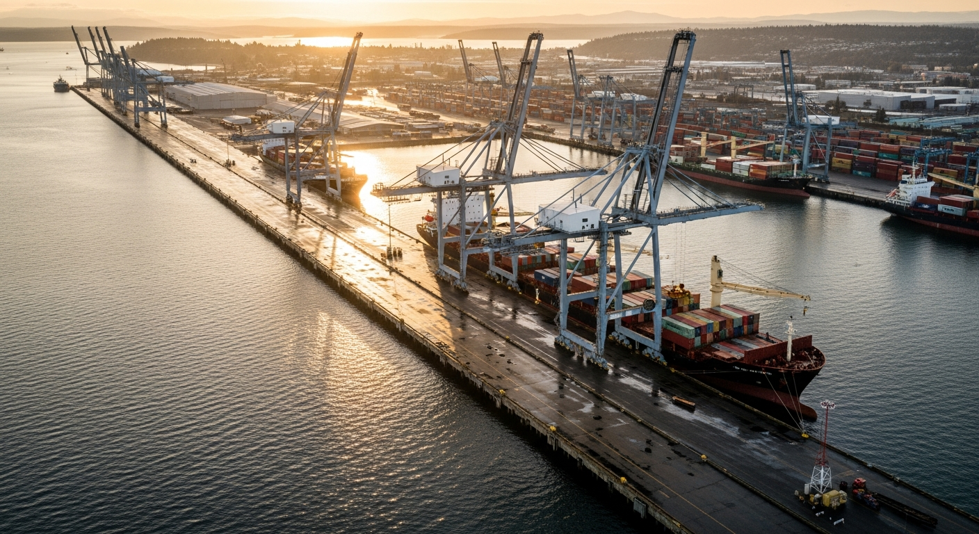
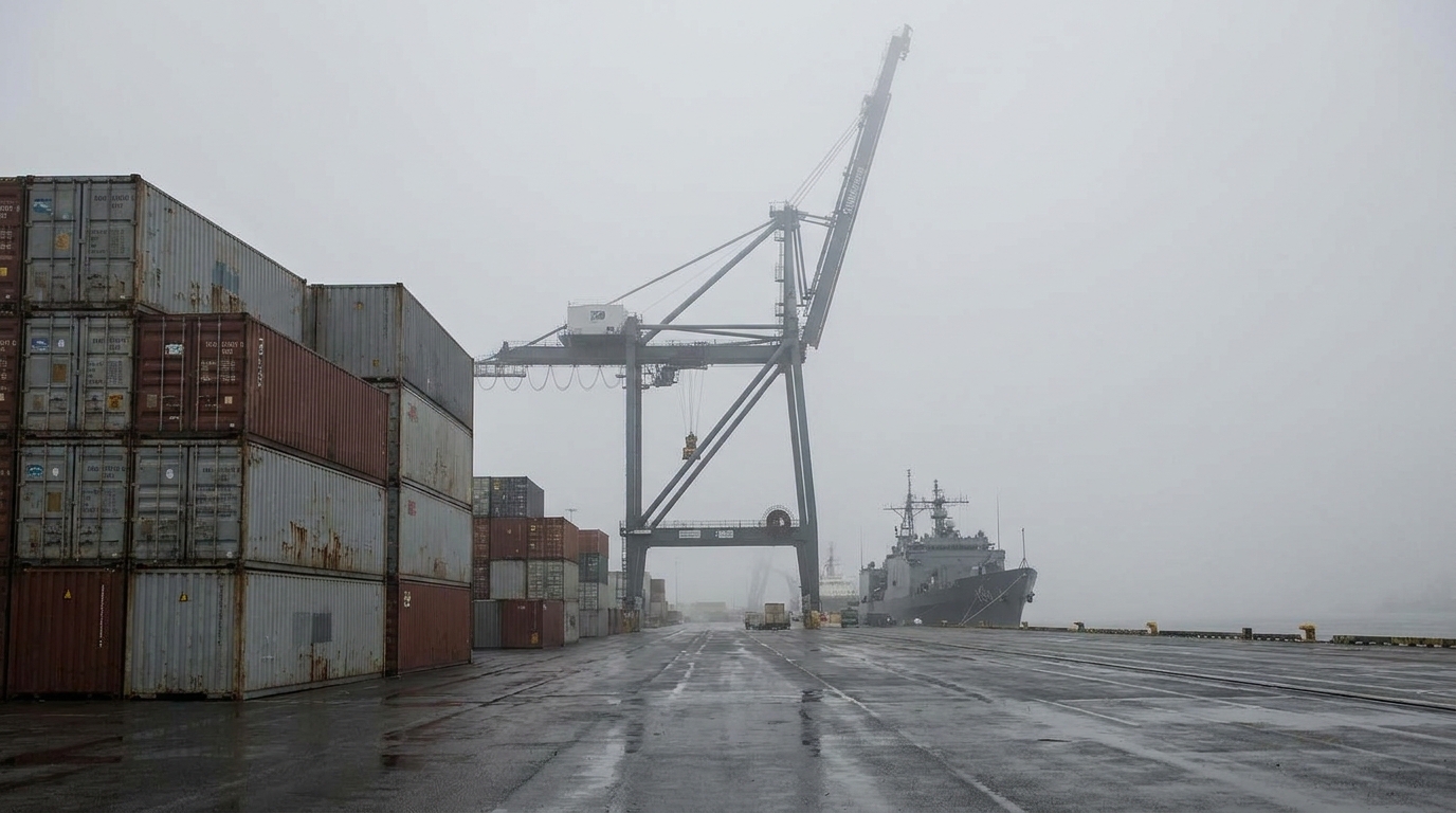
    Pier 3 is the longest berth at the Port of Everett Seaport, measuring 730 feet long with a 120-foot-wide concrete deck. It was constructed in 1973 and has facilitated global and regional trade for over five decades — handling bulk alumina ore, cement, general cargo, and forest products across those years.

    But Pier 3 has a structural problem. The pier was originally engineered to carry a uniform live load of 800 pounds per square foot. In recent years, that rating had to be derated — the south side dropped to 600 pounds per square foot, the north side to 400 pounds per square foot, and some sections were derated even further. In practical terms, that means the pier cannot be used to its full operational potential. Cargo-handling equipment that would otherwise operate on the pier isn’t permitted because the structure can’t safely carry the load.

    That’s the problem the $11.25 million fixes. The Pier 3 Strengthening Safety and Commerce project will install new vertical piles beneath the pier and restore other damaged piles, adding new structural life to a facility that Washington’s construction industry, the U.S. military, and global maritime commerce all rely on.

    What Pier 3 Does Today — and What It Will Be Able to Do After

    Right now, despite its compromised load rating, Pier 3 is doing a lot. Its primary use is bulk cement operations. That’s because Pier 3 sits directly adjacent to a 55,000-ton dry bulk cement storage dome at Hewitt Terminal — one of the largest cement storage facilities in the Pacific Northwest. The cement stored and moved through this terminal is a critical supply chain asset for Washington state’s construction industry. Every major building project from Seattle to Bellingham that uses concrete is connected, at some point, to freight moving through this pier.

    The north side of Pier 3 serves a different critical function: ship repair. A Seaport tenant uses that berth for maintenance and repair work on vessels serving the U.S. Navy, Department of Defense, U.S. Coast Guard, Washington State Ferries, and the commercial fishing fleet. That’s not a minor side operation — it’s a direct service line to the military and to the state’s ferry system, the largest in the country.

    After the strengthening project is complete, the pier’s operational envelope expands significantly. The restored load ratings will allow cargo-handling equipment to operate across the full deck, which means the Port can diversify the types of freight Pier 3 can handle — moving beyond its current cement-primary profile to take on breakbulk cargo, project cargo, and other freight categories where the Port already has a strong reputation.

    Pier 3’s Position in the Larger Port Complex

    What makes this grant especially significant is Pier 3’s location within the Seaport’s freight network. The pier sits close to Norton Terminal — the Port’s award-winning, 40-acre, paved, lit, and fully secured cargo yard — as well as adjacent bonded warehouse space, an additional 15-acre cargo yard, 40-foot mean lower low water (MLLW) depth, and on-dock rail access. That combination of deep-water berth, secured yard, and rail connectivity is rare on the West Coast and is a primary reason why the Port has built a reputation for handling oversized and high-value cargo.

    Pier 3 is also part of the reason why the Port of Everett can make a claim that would sound improbable on paper: the Port handles 100 percent of the oversized aerospace parts for Boeing’s 767, 777, 777X, and KC-46 Tanker programs. Those parts — too large to move by truck — come down the Snohomish River from the Paine Field manufacturing campus and load out at the Seaport. Restoring Pier 3’s full operational capacity directly supports that aerospace export pipeline.

    Strategic Commercial Seaport Status: What That Actually Means

    Tim Ryker, the Port of Everett’s Chief of Seaport Operations, highlighted a dimension of the project that goes beyond commercial freight: “It will also allow us to better serve in our role as a Strategic Commercial Seaport in support of our national defense and our military partners.”

    That’s not boilerplate language. The Port of Everett is one of just five Strategic Commercial Seaports on the West Coast and one of only 18 nationwide. That federal designation — from MARAD, the same agency that awarded this grant — means the Port must maintain military-readiness capability and be prepared to support Department of Defense cargo movements on short notice. With Pier 3 operating below its designed capacity, that readiness posture is constrained. The strengthening project restores it.

    The Economic Numbers Behind the Pier

    The Port of Everett Seaport sits 25 miles north of Seattle in naturally deep water. It ranks as the second largest export customs district in Washington state and the fifth on the West Coast. The port supports nearly $21 billion worth of U.S. exports annually, or roughly $30 billion when both imports and exports are counted together. The regional transportation network tied to those operations supports more than 40,000 jobs and $433 million in state and local tax revenues.

    With more than 60 percent of jobs in Snohomish County tied to trade, the Port’s infrastructure isn’t a footnote to Everett’s economy — it is a primary driver of it. An $11.25 million investment in the structural integrity of the port’s longest berth is, in that context, exactly the kind of infrastructure maintenance that holds the whole system together.

    The funding covers the full scope of the Pier 3 project: planning and engineering, environmental review, permitting, and construction. Representative Rick Larsen, who shared news of the award with Port representatives, has been a consistent advocate for Pacific Northwest port infrastructure funding in Congress.

    What We’re Watching Next

    The PIDP grant covers the complete project lifecycle, so the next step is the planning and engineering phase — the environmental review and permitting work that will precede construction. Given the Port’s track record on infrastructure projects like the Segment E bulkhead rebuild on West Marine View Drive (which is wrapping up final-phase construction right now after 20 years), we expect planning to move efficiently. What we’ll be watching: the environmental review timeline, the contractor selection process, and whether the project schedule aligns with the Port’s broader 2026 capital plan outlined in its $70 million 2026 budget.

    For a deep look at what the Port’s working waterfront actually handles on a daily basis, the Hat Island Ferry harbor tour remains the best public window into that operation.

    Frequently Asked Questions

    What is the Port Infrastructure Development Program (PIDP)?

    PIDP is a federal competitive grant program administered by MARAD (U.S. Department of Transportation Maritime Administration). Grants go to port infrastructure projects that improve the safety, efficiency, or reliability of freight movement. Awards are competitive and national in scope.

    Why was Pier 3 derated?

    Pier 3 was originally designed to carry 800 pounds per square foot but has experienced structural deterioration over its 53-year life. Damaged piles and structural elements required engineers to reduce the allowable load rating — to 600 PSF on the south side, 400 PSF on the north side, with some areas lower. The $11.25 million project will install new piles and restore the structure.

    How many jobs does the Port of Everett support?

    The Port of Everett’s regional transportation network supports more than 40,000 jobs and $433 million in state and local tax revenues. More than 60 percent of Snohomish County jobs are tied to trade.

    What cargo goes through Pier 3 today?

    Pier 3 currently handles bulk cement operations (adjacent to a 55,000-ton cement storage dome) and ship repair work for the U.S. Navy, Coast Guard, Washington State Ferries, and the commercial fishing fleet. After strengthening, it will be able to handle a broader range of cargo types including breakbulk and project cargo.

    What is a Strategic Commercial Seaport?

    A MARAD-designated Strategic Commercial Seaport must maintain readiness to support Department of Defense cargo movements on short notice while minimizing disruption to commercial operations. The Port of Everett is one of 5 on the West Coast and 18 nationwide with this designation.

  • Mason County PUD 1 Wraps Major Water Projects, New Rates Take Effect April 1

    Mason County PUD 1 Wraps Major Water Projects, New Rates Take Effect April 1

    Two significant developments at Mason County Public Utility District No. 1 are shaping utility service across the county this spring: the near-completion of long-running rural water infrastructure upgrades, and a modest rate increase that took effect April 1 — one that staff kept lower than originally authorized by securing a federal emergency management grant.

    Manzanita and Arcadia Estates Water Projects Reach Finish Line

    Mason County PUD No. 1 reported at its April 14, 2026 board meeting that two major rural water system projects are wrapping up: the Manzanita Water Storage Project and the Arcadia Estates system upgrade. Both projects represent years of planning and construction investment in the rural water infrastructure serving customers across PUD 1’s service area, which covers Shelton, Hoodsport, Union, and much of the Hood Canal shoreline in southern Mason County.

    The Manzanita project is the larger of the two. Total construction funding reached $4.6 million, with a storage tank contract of $3,745,725 awarded to Rognlin’s Inc. of Aberdeen in June 2025. Construction began in September 2025, and the April board meeting marked project close-out reporting. The Arcadia Estates project, serving a rural residential water system, has similarly been brought to completion under the same reporting period.

    PUD 1 has also submitted a $5.6 million Congressionally Directed Spending request — a federal appropriations tool — to help fund additional rural water system improvements. If awarded, the funding would extend the district’s infrastructure investment cycle without requiring corresponding local rate increases.

    For Mason County residents served by PUD 1 water systems — including those in Union, Hoodsport, and rural communities along the Hood Canal south shore — these project completions mean more reliable water service and updated infrastructure that meets modern standards. Rural water systems age like any other infrastructure, and PUD 1’s investment in the Manzanita and Arcadia systems represents a concrete commitment to the long-term health of those communities.

    April 1 Rate Increase: 3.0% — Less Than Approved

    Effective April 1, 2026, Mason County PUD No. 1 customers are paying slightly more for electricity. The new residential rates: the basic monthly charge rose from $45.86 to $47.26, and the energy rate increased from $0.09670 to $0.09960 per kilowatt-hour. The overall impact is a 3.0% increase in a typical residential bill.

    The driver behind the increase is outside PUD 1’s control: the Bonneville Power Administration, which wholesales electricity to PUD 1 and utilities across the Pacific Northwest, raised its power rate by 6% and its transmission rate by 11.7% for 2026. Utilities that buy from BPA — including most public utility districts in Washington State — must pass at least some portion of those increases to customers.

    What makes Mason County PUD 1’s approach notable is what it held back. The PUD’s board had authorized a 4.75% local rate increase. PUD 1 staff reduced that to 3.0% by identifying budget savings and applying a $3.6 million FEMA grant to offset costs. It was the second consecutive year the district trimmed its approved rate below the authorized ceiling — a record of fiscal discipline worth noting for customers watching their utility bills.

    PUD 1’s electric service territory covers Shelton and much of the surrounding rural county, including communities along Hood Canal. Customers with questions about the new rate schedule can contact the district at (360) 877-5249 or visit mason-pud1.org. The district’s headquarters is at 21971 N U.S. Highway 101, Shelton.

    What This Means for Mason County Households

    Together, these two stories point to a utility district actively managing both its infrastructure and its budget. The PUD 1 water project completions reduce deferred maintenance risk on rural systems that can be expensive to emergency-repair. The rate discipline on the electric side — trimming a 4.75% authorization down to 3.0% — reflects the kind of operational management that keeps Mason County competitive as a place to own property and operate a household.

    For property owners in PUD 1’s service area, updated water infrastructure also has direct implications for property values and insurance underwriting. Modern, code-compliant water systems are increasingly a factor in mortgage and insurance assessments for rural parcels.

    PUD 1 board meetings are open to the public and held at the district’s headquarters in Shelton. The next scheduled meeting provides an opportunity for customers with questions about rates, infrastructure, or the pending federal spending request to engage directly with elected commissioners.

    Frequently Asked Questions

    What is Mason County PUD No. 1?

    Mason County Public Utility District No. 1 is a public utility serving electric and water customers in Shelton, Hoodsport, Union, and rural areas of southern and western Mason County. It is governed by an elected board of commissioners and headquartered at 21971 N U.S. Highway 101, Shelton, WA.

    How much did PUD 1 electric rates increase on April 1, 2026?

    Residential electric rates increased 3.0%. The basic monthly charge went from $45.86 to $47.26, and the per-kilowatt-hour energy rate went from $0.09670 to $0.09960. The increase was driven by Bonneville Power Administration wholesale power and transmission rate increases for 2026.

    Why was the rate increase lower than expected?

    PUD 1 staff reduced the originally authorized 4.75% increase to 3.0% by identifying budget savings and applying a $3.6 million FEMA grant. It was the second consecutive year the district kept the local increase below its authorized ceiling.

    What is the Manzanita Water Storage Project?

    The Manzanita Water Storage Project is a rural water infrastructure upgrade in PUD 1’s service area. Total construction funding reached $4.6 million, with a tank contract awarded to Rognlin’s Inc. for $3,745,725 in June 2025. Construction began September 2025 and reached completion in spring 2026.

    How can Mason County residents contact PUD 1?

    Mason County PUD No. 1 can be reached at (360) 877-5249 or online at mason-pud1.org. The district office is at 21971 N U.S. Highway 101, Shelton. Board meetings are open to the public and listed on the district website.

    Related coverage: For Mason County property owners, see PUD 1 Rate Change: What Property Owners Need to Know. For help reading your bill, see Understanding Your Mason County PUD 1 Electric Bill in 2026.

  • Everett City Council Approved the $10.6M Stadium Package on April 29: The Complete Guide to What Was Actually Authorized

    Everett City Council Approved the $10.6M Stadium Package on April 29: The Complete Guide to What Was Actually Authorized

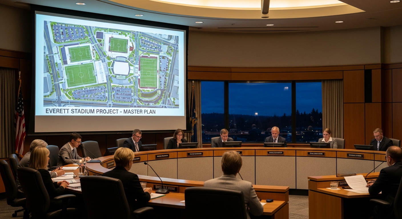
    What happened April 29: Everett City Council approved a $10.6 million package to complete the design of the Everett Outdoor Event Center — the planned downtown home of the AquaSox and two USL soccer teams. The vote authorizes finishing the blueprints. It does not authorize construction. The total project still exceeds $120 million and no construction funding has been committed.

    On Wednesday, April 29, 2026, Everett City Council voted to approve $10.6 million in design funding for the Everett Outdoor Event Center. The vote moves the project from preliminary design to completed design — a necessary step before the city can make any decision about whether and how to build the facility. Here is the complete guide to what was actually authorized, what it costs, and what has not been decided.

    The Two Components of the $10.6 Million

    The April 29 package had two distinct parts, both approved at the council meeting at 3002 Wetmore Ave.:

    $4.8 million in contract amendments with four design contractors already engaged on the project. These amendments authorize the additional design work needed to complete the full design package for the Everett Outdoor Event Center — covering architectural drawings, engineering, site planning, environmental review, and the technical documentation required before construction can begin.

    $7.4 million state grant from the Washington State Department of Commerce, directed to the stadium design budget. This grant offsets a significant portion of the expanded design costs.

    The $4.8 million in contractor amendments is funded through an interfund loan from the city’s general fund balance — a borrowing mechanism from city reserves that must be repaid. The $7.4 million is grant funding that does not need to be repaid.

    What Design Funding Actually Means

    The distinction between design funding and construction funding matters. Design covers the complete package of documents — architectural drawings, structural engineering, utility coordination, environmental review, and permit-ready specifications — that defines exactly what will be built and what it will cost to build it. You cannot break ground without this package.

    Wednesday’s vote pays for finishing that package. The council is not yet deciding whether to build the stadium. That is a separate decision that comes after design is complete.

    Why $10.6 Million More Was Needed

    The original design contract did not include the full scope required to get the project to a build-ready state. As the design process progressed, scope expanded — particularly around the complexity of the downtown site, utility infrastructure, and the multi-use programming requirements of a venue serving baseball, soccer, and community events. The city applied for and received the $7.4 million Commerce grant specifically to offset these expanded costs.

    What the Stadium Is Designed to Be

    The Everett Outdoor Event Center is designed as a multi-use downtown venue with 5,000 seats and full ADA accessibility throughout. A premium club can seat 200 fans with 400 standing on a covered deck. The facility would serve as the home ballpark for the Everett AquaSox — the Seattle Mariners’ Single-A affiliate that has played at Funko Field (Everett Memorial Stadium) since 1984. The venue is also designed to host two new Everett teams in the United Soccer League, a professional league expanding across the Pacific Northwest.

    Public park amenities are part of the design, positioning the site as a community asset on non-game days. The city has been targeting a Fall or Winter 2027 completion — timed to open before the AquaSox 2027 season.

    The Budget Context

    The total estimated project cost exceeds $120 million. Wednesday’s $10.6 million brings additional design funding into the project but leaves the bulk of capital financing — more than $100 million — still to be determined. The city has received $17 million in team commitments from the AquaSox and USL partners, but the major construction funding sources have not been publicly committed.

    The vote lands against the backdrop of Everett’s projected $14 million 2027 budget gap. The interfund loan structure means the $4.8 million in contractor amendments is borrowed from general fund reserves — money that must be returned. Council previously explained this mechanism in detail before Wednesday’s vote.

    What Has Not Been Decided

    Wednesday’s vote does not authorize construction. It does not determine how the remaining $110 million-plus in construction costs will be financed. It does not commit to a specific groundbreaking date. It does not resolve the debate over whether downtown Everett can absorb the long-term financial obligations of a $120 million public venue while simultaneously managing a $14 million structural budget gap.

    Those are subsequent decisions. The council has approved finishing the design package. The harder decisions come after the blueprints are done.

    For the full pre-vote background on the interfund loan mechanism and how it works: The complete guide to Everett’s $10.6M stadium interfund loan.

    Frequently Asked Questions

    What did Everett City Council approve on April 29, 2026?

    The council approved a $10.6 million package to complete the design of the Everett Outdoor Event Center. The package included $4.8 million in contract amendments with four design contractors (funded through an interfund loan from the general fund) and acceptance of a $7.4 million state Department of Commerce grant.

    Does the April 29 vote authorize building the stadium?

    No. The vote authorizes completing the design package — architectural drawings, engineering, environmental review, and permit-ready specifications. Construction authorization is a separate decision that has not been made. The total project cost exceeds $120 million and construction financing has not been committed.

    What is an interfund loan?

    An interfund loan is a borrowing from the city’s own general fund balance — its reserves — to cover a project cost. Unlike a bond, it does not involve outside borrowing, but it does reduce the general fund balance and must be repaid, reducing future flexibility.

    When is the Everett Outdoor Event Center expected to open?

    The city has been targeting Fall or Winter 2027, timed to open before the AquaSox 2027 season. That timeline depends on construction authorization and funding being secured after design is complete.

    What teams would play at the new stadium?

    The Everett AquaSox — the Seattle Mariners’ Single-A affiliate that has played in Everett since 1984 — and two new Everett teams in the United Soccer League (USL). The venue is also designed for concerts, festivals, and community events.

    How does the stadium vote connect to Everett’s budget gap?

    Everett faces a projected $14 million structural budget gap heading into 2027. The $4.8 million in contractor amendments is funded via an interfund loan from the general fund balance — reserve money that must be repaid. The city is managing both the stadium design costs and the broader fiscal challenge simultaneously.

    What happens next after the design is complete?

    Once the design package is finished, the council must decide whether to authorize construction, how to finance the $110 million-plus remaining cost, and on what timeline. That decision has not been made.

  • Everett City Council Approves $10.6M Stadium Design Package: What the April 29 Vote Actually Authorized

    Everett City Council Approves $10.6M Stadium Design Package: What the April 29 Vote Actually Authorized

    What did Everett City Council approve on April 29? The council approved a $10.6 million package to complete the design of the Everett Outdoor Event Center — the future home of the AquaSox and two USL soccer teams. The package includes $4.8 million in contract amendments with four design contractors and acceptance of a $7.4 million state Department of Commerce grant.

    What the Council Approved

    Everett’s City Council cleared the next major hurdle in the downtown stadium project on Wednesday, voting to approve $10.6 million in design funding for the Everett Outdoor Event Center — a vote that green-lights the final design phase but stops well short of breaking ground.

    The $10.6 million package had two components, both approved at the April 29 council meeting at 3002 Wetmore Ave.:

    $4.8 million in contract amendments with four design contractors already engaged in the project. These amendments authorize additional design work needed to complete the full design package for the Everett Outdoor Event Center.

    Acceptance of a $7.4 million state grant from the Washington State Department of Commerce directed toward the stadium project.

    Together, the two actions bring an additional $10.6 million into the stadium design budget. The $4.8 million in contractor amendments is funded through an interfund loan from the city’s general fund balance — a mechanism the council previously established and explained in detail before Wednesday’s vote.

    What “Design Funding” Actually Means

    The $10.6 million funds the completion of the design for the Everett Outdoor Event Center. Design work covers architectural drawings, engineering, site planning, environmental review, and the technical documentation required before construction can begin. It does not fund construction itself.

    The total estimated project cost exceeds $120 million. Wednesday’s vote moves the project from preliminary design to completed design — a necessary step before the city can make any further decision about whether and how to build.

    Think of it this way: the city is now paying to finish the blueprints. Whether to build what the blueprints describe is a separate decision that comes later.

    What the Stadium Is Supposed to Be

    The Everett Outdoor Event Center is planned as a multi-use sports and events venue in downtown Everett. It would serve as the home ballpark for the Everett AquaSox, the Seattle Mariners’ Single-A affiliate that has played at Funko Field (formerly Everett Memorial Stadium) since 1984.

    The facility is also designed to host two new Everett teams in the professional United Soccer League (USL), which has been expanding in the Pacific Northwest. Public park amenities are part of the design, positioning the site as a community asset beyond game days.

    Why $10.6 Million More Was Needed

    The original design contract did not include the full scope required to get the project to a build-ready state. As the design process progressed, the scope of work expanded — particularly around the complexity of the downtown site, utility considerations, and the multi-use programming requirements of a venue serving baseball, soccer, and community events.

    The city sought and received the $7.4 million state Commerce grant specifically to offset the expanded design costs. This is not unusual for large public construction projects, where design costs frequently increase as the project becomes more technically defined.

    The project has faced scrutiny over its cost trajectory. The total price tag of $120 million-plus is significantly above earlier estimates, and the city is simultaneously managing a projected $14 million budget gap heading into 2027. The interfund loan structure means the stadium design costs are borrowing from the general fund balance — money that will need to be repaid.

    What Hasn’t Been Decided Yet

    Wednesday’s vote authorizes completing the design. It does not authorize construction, determine how the remaining $110+ million in construction costs will be funded, or commit the city to building the stadium.

    The next major decision point comes when the completed design and a full project budget are presented to the council for a construction vote. That vote — substantially larger in scope — has not been scheduled.

    Mayor Franklin’s administration has argued that completing the design is a prerequisite to any serious conversation about how to fund and structure the full project. Without a completed design, there’s no firm cost basis and no project to bid.

    What AquaSox and USL Have at Stake

    City officials have stated publicly that without a new stadium, the AquaSox’s long-term future in Everett is uncertain. Minor League Baseball has been consolidating franchises and upgrading stadium standards nationally, and aging facilities have been a factor in franchise relocations in other markets.

    For USL, the new stadium would anchor professional soccer in a region that has seen significant growth in the sport. A purpose-built configuration — not a converted baseball park — is part of what makes the site viable for USL play.

    Frequently Asked Questions

    Did the council vote to build the stadium? No. The April 29 vote authorized completing the design. A separate construction vote is required before any building begins.

    Where does the $4.8 million come from? It comes from the city’s general fund balance through an interfund loan — essentially, the city lending itself money from its reserves. The loan is expected to be repaid from future stadium-related revenues or other sources.

    What is the $7.4 million state grant for? The Washington State Department of Commerce grant is directed toward the stadium design project. Accepting it was part of the April 29 vote package.

    How much will the whole stadium cost? Total estimated project costs exceed $120 million. How that will be funded — through public bonds, grants, private contributions, or a combination — has not been finalized.

    When would the stadium open? No construction timeline has been established. That depends on when and how the construction funding is resolved and a construction vote passes.

    What to Do Next

    • Follow the project: Search “Outdoor Event Center” on everettwa.gov for updates as design progresses.
    • Attend council meetings: Regular council meetings are Wednesdays at 12:30 p.m. at 3002 Wetmore Ave. Meetings are streamed on the city’s YouTube channel.
    • Track the budget: The city’s 2026 budget page and future 2027 planning documents will reflect how the interfund loan is managed.
    • View the full agenda: All council meeting agendas are posted in advance at everettwa.gov/agendacenter.
  • Every Major Construction Project in Everett Right Now — Late April 2026 Update

    Every Major Construction Project in Everett Right Now — Late April 2026 Update

    Q: What major construction projects are active in Everett, WA right now?
    A: As of late April 2026, Everett’s active construction landscape includes: the Millwright District Phase 2 residential build-out (300+ apartments, LPC West), the Eclipse Mill Riverfront Park two-phase build (City Phase 1 underway July–November 2026), the Lenora Stormwater Treatment Facility (broke ground April 2026, $8.73M), the $113M West Marine View Drive pipeline, and the downtown stadium design process — plus two projects that just wrapped: the $34M Edgewater Bridge and the Port of Everett’s Segment E bulkhead.

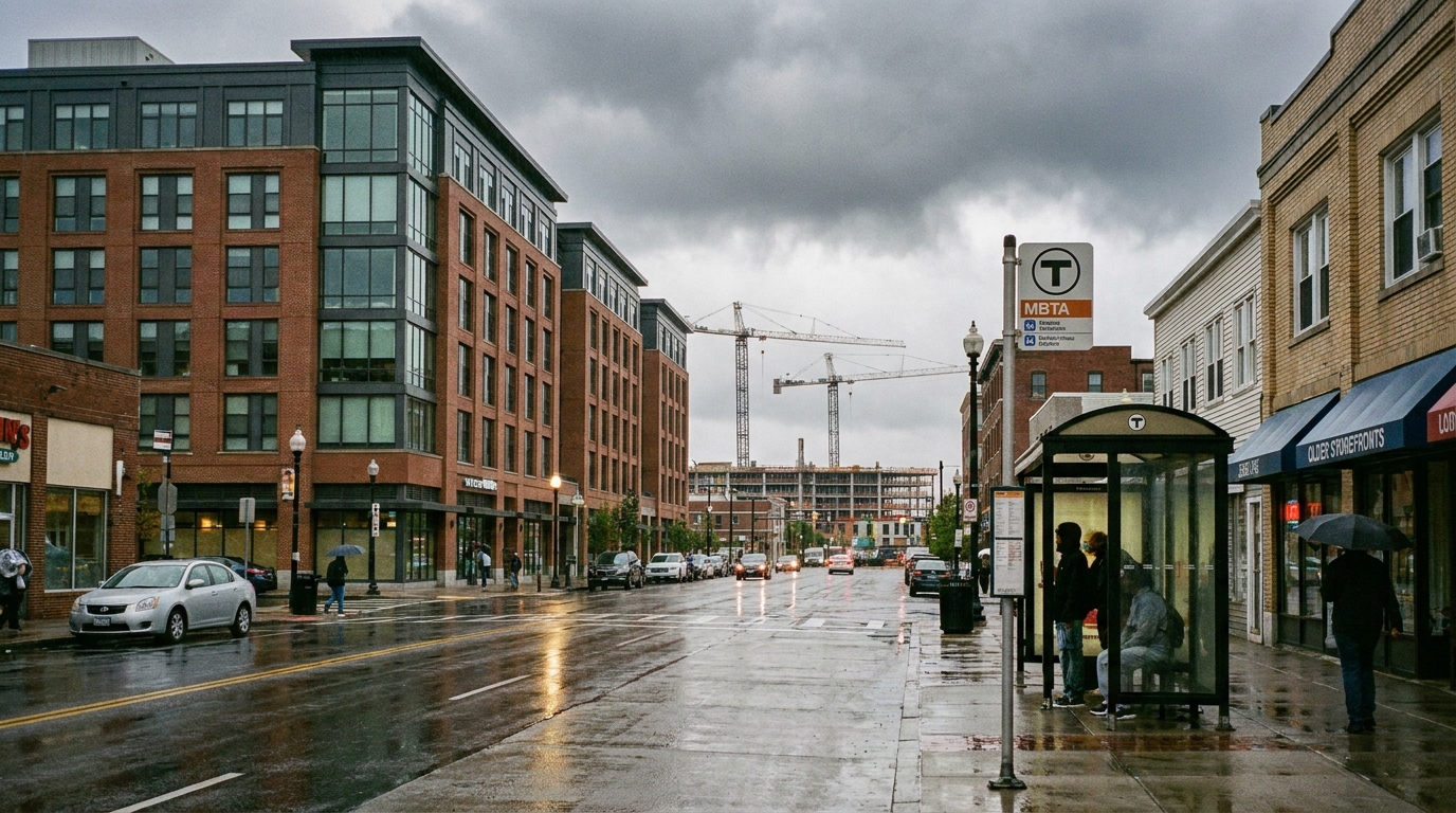
    Everett is a construction site right now — and we mean that as a compliment. From waterfront infrastructure to riverfront parks to transit-adjacent housing, more physical transformation is underway in this city simultaneously than at almost any other point in its history. Here’s where every major project stands as of late April 2026.

    Just Completed

    Edgewater Bridge — $34M Seismic Replacement (Opened April 28, 2026)

    The most visible construction closure in Everett this year ended this week. The new Edgewater Bridge opened to vehicle traffic on April 28, concluding an 18-month replacement of the 1946 span connecting Everett and Mukilteo on SR-529. Contractor: Granite Construction Company ($25.4M contract). Total budget: $34M ($28M federal grants, $6M local). The replacement is 366 feet, seismically sound, and features 6.5-foot sidewalks and 5-foot bike lanes on both sides — a genuine upgrade in every dimension. Sidewalk and bike lane finishing work continues for approximately 2–3 more weeks.

    Port of Everett Segment E Bulkhead — $6.75M Final Phase (Completion: May 2026)

    The Port’s Segment E bulkhead rebuild on West Marine View Drive is at the end of its final phase. The $6.75M project, contracted to Bergerson Construction, replaces 165 linear feet of aging wood piling along the Port Gardner Landing area with modern steel — the final chapter of a 20-year, multi-segment bulkhead replacement program. When complete in May 2026, the entire Port of Everett marina-side wharf will have been systematically rebuilt. The work also stabilizes the SR-529 embankment above the marina and ties into ADA-compliant esplanade trail connections.

    Under Construction Now

    Millwright District Phase 2 — 300+ Waterfront Apartments (Under Construction, 2026–2028)

    LPC West (Lincoln Property Company) broke ground on the residential component of Millwright District Phase 2 in 2026. The development calls for 300+ apartments on the 10-acre district, which sits adjacent to the Central Marina esplanade. This is the first housing to be built on the Port of Everett’s waterfront in the project’s history. The full Millwright build-out over the coming five to seven years will also add 60,000+ square feet of retail and restaurants, 120,000+ square feet of pre-leasing Class-A office, and additional parking. Tenants should be able to move into housing within approximately two years of the groundbreaking. The Millwright Loop road infrastructure, which broke ground in August 2023, is already in place.

    Lenora Stormwater Treatment Facility — $8.73M Snohomish River Cleanup (Broke Ground April 2026)

    One of Everett’s newest active construction sites is the Lenora Regional Stormwater Treatment Facility at South 1st and Lenora in the Lowell neighborhood. The $8.73M project — funded by Washington State WQC grant WQC-2025-EverPW-00177 — will treat stormwater from 146 acres of drainage subbasins (LW-9, LW-10, LW-11) before discharge into the Marshland Canal and Snohomish River. The facility uses a five-cell Filterra Bioscape bioretention system. Expected construction timeline: approximately 8 months from the April 2026 groundbreaking, putting substantial completion around December 2026. This is one of the few significant environmental infrastructure projects currently active in the city.

    Eclipse Mill Riverfront Park — Two-Phase Build (Phase 1: July–November 2026)

    The Eclipse Mill Park on the Snohomish River is moving through its two-phase build. Phase 1 — the City of Everett’s portion, covering public infrastructure, riverbank work, and initial park improvements — is scheduled from July through November 2026. Phase 2, which covers the signature park structures and shelter elements, is under development by Shelter Holdings and is targeted for completion between Fall 2026 and Spring 2028. This is Everett’s most significant new riverfront public space in a generation, and it’s actively under pre-construction planning and permitting heading into the summer 2026 construction season.

    Approved and Starting Soon

    West Marine View Drive Pipeline — $113M Combined Sewer and Water Main Replacement (Summer 2026)

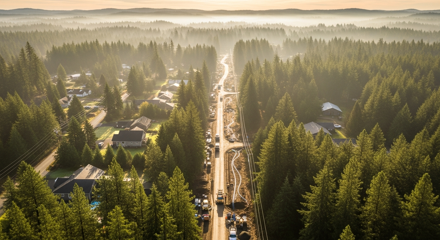
    The City Council approved the $113M West Marine View Drive pipeline project on April 2, 2026. The project replaces the combined sewer and stormwater pipe plus a 48-inch water main from Grand Ave Bridge to Hewitt Avenue along the waterfront corridor — a state-mandated CSO reduction project under order from the Washington Department of Ecology. The related Pacific Avenue Pipeline segment (1,000 linear feet, 42-inch pipe) is also funded and expected to begin construction summer 2026. The broader project feeds into the $200M+ Port Gardner Storage Facility program. Funded from restricted water/sewer utility funds — no new taxes required.

    Port of Everett Mukilteo Waterfront District — RFQ Expected Spring 2026

    The Port of Everett is assembling a second waterfront district in Mukilteo. In February 2026, the Port completed a quitclaim acquisition of 1.1 acres at 710 Front Street (former NOAA parcel), and the $closing for the adjacent Ivar’s Mukilteo Landing (0.55 acres, 9,637 sq ft building) is targeted for July 2026, with Ivar’s remaining as a long-term tenant. NBBJ Architecture is the design firm carried forward from prior planning. A Request for Qualifications (RFQ) for development partners is expected in spring 2026 — which means this site could enter serious pre-development this year, with the newly reopened Edgewater Bridge now providing restored road access between the two waterfronts.

    In Design / Pre-Construction

    Downtown Stadium — Design Phase (Vote April 29, 2026)

    The Everett City Council is expected to vote April 29 on the $10.6M design funding package — an interfund loan plus a $7.4M state Department of Commerce grant — that would allow DLR Group to proceed with final design of the downtown multi-sport stadium. The project is intended to eventually host the Everett AquaSox (baseball) and new USL men’s and women’s soccer teams. From a construction perspective, design completion is the prerequisite before any competitive contractor selection process. If the April 29 vote passes, detailed schematic and design development work begins. Actual construction groundbreaking is still multiple years away.

    Broadway Pedestrian Bridge — $3.1M Design Contract (Design Through 2028)

    The City Council approved a $3.1M contract with Kimley-Horn in late April to design a grade-separated pedestrian crossing over Broadway that connects Everett Community College’s main campus to its Learning Resource Center and WSU Everett. The likely location is north of 10th Street. Design is expected to take through end of 2028. Construction funding is a separate future vote. This is a design-only phase right now, but it fits Everett’s pattern of investing in pedestrian infrastructure along the transit corridor as Sound Transit Everett Link planning continues.

    What’s Done Since the Last Tracker

    Since our last full construction tracker in early April, several notable milestones have landed. The Segment E bulkhead moved into final phase and is nearly wrapped. The Edgewater Bridge — which appeared in the April tracker as a late-2025 project still pending — opened 18 months after its October 2024 closure. The $113M pipeline got council approval. The Lenora stormwater facility broke ground. And the Broadway bridge design contract was signed. That’s five significant project milestones in one month.

    Everett’s construction calendar for May through December 2026 is genuinely busy: pipeline work starts, Eclipse Mill Phase 1 starts in July, Lenora wraps around December, and Millwright’s residential frame continues going up. For a city that spent much of the last decade talking about what it wanted to become, the evidence of that becoming is now visible in the ground-level activity on almost every side of town.

    Frequently Asked Questions

    How many major construction projects are active in Everett in 2026?

    At least 6-8 significant projects are under active construction or in funded design in Everett as of late April 2026: Millwright District Phase 2 apartments, Lenora Stormwater Facility, Eclipse Mill Park, West Marine View pipeline, Broadway pedestrian bridge design, and the downtown stadium design process — plus recently completed projects including the Edgewater Bridge and Port Segment E bulkhead.

    When will Millwright District Phase 2 apartments be ready?

    LPC West (Lincoln Property Company) is the developer. The residential units — 300+ apartments — are expected to be move-in ready within approximately two years of the 2026 groundbreaking, targeting 2027–2028 occupancy. The full Millwright buildout of retail, restaurants, and office space is a 5–7 year program.

    What is the Eclipse Mill Park and when does it open?

    Eclipse Mill Park is Everett’s new riverfront signature park on the Snohomish River. Phase 1 (city infrastructure work) is scheduled July–November 2026. Phase 2 (Shelter Holdings, park structures and amenities) targets completion between Fall 2026 and Spring 2028. The full park opening is expected Spring 2028.

    What’s the status of the Everett downtown stadium construction?

    The stadium is in the design funding phase. A City Council vote on $10.6M in design funding is expected April 29, 2026. If approved, DLR Group proceeds with final design. Physical construction groundbreaking is still several years away — design and permitting come first.

    What is the $113M pipeline project on West Marine View Drive?

    The $113M project replaces the combined sewer/stormwater pipe and a 48-inch water main along the waterfront corridor from Grand Ave Bridge to Hewitt Avenue. It’s a state-mandated CSO (Combined Sewer Overflow) reduction project required by the Washington Department of Ecology, funded from restricted water/sewer utility reserves. Construction is expected to begin summer 2026.

  • Everett’s $34M Edgewater Bridge Opens Today — Here’s What 18 Months of Construction Actually Built

    Everett’s $34M Edgewater Bridge Opens Today — Here’s What 18 Months of Construction Actually Built

    Q: What is the Edgewater Bridge and why did it close?
    A: The Edgewater Bridge is a 366-foot span on SR-529 connecting Everett and Mukilteo, WA. Built in 1946, it closed October 30, 2024, for an $34 million full replacement needed to fix seismic vulnerabilities, deteriorating structure, and narrow lanes that no longer met modern safety standards. It reopened to vehicle traffic April 28, 2026.

    After 18 Months, the Bridge Is Back

    The Edgewater Bridge opened to vehicle traffic on April 28, 2026 — exactly 18 months after crews closed the span on October 30, 2024, to begin demolition. Nearly 300 people gathered the day before at a community celebration on April 27 to walk across the new structure before any cars touched it. By Tuesday evening, the lane striping was dry and Everett’s western connector to Mukilteo was carrying traffic again for the first time since fall 2024.

    For residents who commute between the two cities, use the Mukilteo ferry terminal, or work along SR-529, the 18-month detour was a real disruption. Transit routes rerouted. School buses took longer paths. Emergency response times to the western waterfront fringe lengthened. The bridge itself carried an estimated several thousand daily crossings before closure. Now all of that is restored — and then some, because what opened Tuesday is significantly better than what closed last fall.

    What Replaced a 1946 Bridge That Had Served 80 Years

    The bridge that came down was built in 1946. By the time Everett moved to replace it, the structure had served the community for 80 years — well past the typical 50-year design life for bridges of that era. Engineers determined it was seismically vulnerable: a major earthquake could have caused failure. The lanes were narrow, the sidewalks undersized, and the aging deck and piling needed either massive rehabilitation or outright replacement. The city chose replacement.

    The new bridge is 366 feet long — the same crossing, rebuilt from scratch. What’s different is everything else:

    • 12-foot travel lanes in each direction (wider than the old span)
    • 6.5-foot sidewalks on both sides of the bridge
    • 5-foot bike lanes buffered between the roadway and the sidewalks
    • Modern seismic design built to withstand a major Cascadia-scale earthquake
    • Improved lighting across the full span

    The sidewalk and bike lane combination is notable. The old bridge had minimal pedestrian accommodation. The new one has a genuine multi-use path system on both sides — connecting Everett’s western waterfront edge to Mukilteo’s waterfront district on foot or by bike. That’s a different kind of crossing than what existed before.

    A note for walkers: the sidewalks won’t be fully open immediately. Finishing work — permanent striping, barriers, and paint — is expected to take about two to three weeks after the vehicle lanes opened. Pedestrians should expect some temporary accommodation during that window.

    The Contractor, the Cost, and Where the Money Came From

    The City of Everett awarded the construction contract to Granite Construction Company — a firm with local Everett operations — at a bid price of $25,409,890.65. The total programmed project budget came to $34 million, with the difference covering design, environmental review, right-of-way, project management, and contingency.

    The funding breakdown: approximately $28 million came from federal grants, with $6 million supplied through local matching dollars from the city. This is a common structure for bridge replacement projects of this type — federal highway funds require a local match, and the grant process is what drove much of the pre-construction timeline.

    The total price works out to roughly $93,000 per linear foot of bridge — consistent with what comparable urban bridge replacements with seismic, bike-ped, and full utility upgrades have cost in the Pacific Northwest in recent years.

    Why It Took Longer Than Expected

    The Edgewater Bridge replacement was years in the making before a shovel touched the ground in October 2024. The city had initially aimed to start construction earlier — around 2022 — but a sequence of delays pushed the timeline back significantly:

    • COVID-19 disrupted the procurement schedule during the pandemic years
    • Environmental review took longer than projected, given the bridge’s position near the waterfront and tidal areas
    • A bidding error in an early procurement round required the process to restart from scratch

    Once construction finally started in fall 2024, the crew from Granite Construction ran into a challenge that doesn’t show up in the plans: the ground beneath the old bridge was full of debris from the previous bridge structure — old timber piling and concrete obstructions left behind from earlier bridge generations. Installing the new steel piling required working around and through material that simply wasn’t mapped. That slowed the foundation phase and contributed to the project finishing in late April 2026 rather than the original late 2025 target.

    What This Means for the Everett-Mukilteo Development Corridor

    The Edgewater Bridge isn’t just a commuter route. It’s the western land connection between Everett’s waterfront district and Mukilteo’s waterfront — two areas both undergoing significant investment right now.

    On the Everett side, the SR-529 corridor runs along the Port of Everett’s working waterfront — past the marina, past Waterfront Place, and toward the western edge of the Millwright District buildout. Restoring this connection matters for freight movement, marine service access, and visitor circulation from Mukilteo into Everett’s waterfront destination district.

    On the Mukilteo side, the Port of Everett is in the early stages of assembling a Mukilteo waterfront district of its own — having acquired the former NOAA parcel and the Ivar’s Mukilteo Landing site earlier this year, with an NBBJ architecture team already attached. The spring 2026 RFQ for that project is expected soon. The restored bridge connection is part of the context for how Everett and Mukilteo’s adjacent waterfronts function as a connected regional amenity, not just two separate city edges.

    Mukilteo officials made the point themselves at Monday’s ceremony: they see the bridge as a connector that should bring visitors in both directions, not just commuters. With the Everett waterfront’s restaurant row, marina, and Waterfront Place complex on one end and Mukilteo’s ferry landing, lighthouse, and forthcoming waterfront redevelopment on the other, the case for the bridge as a destination corridor — not just a traffic route — is real.

    How the Bridge Fits Everett’s Broader Infrastructure Moment

    The Edgewater Bridge opening is one piece of a larger infrastructure push Everett is moving through in 2026. In the past month alone:

    • The City Council approved the $113 million West Marine View Drive pipeline project — the biggest utility infrastructure move in years, replacing the combined sewer and water main along the waterfront corridor from Grand Ave Bridge to Hewitt Ave
    • The Port of Everett completed its Segment E bulkhead rebuild — a $6.75M project that ended a 20-year phased replacement program and stabilized the SR-529 embankment above the marina
    • The City approved a $3.1 million design contract for a new pedestrian bridge over Broadway connecting EvCC to WSU Everett

    The Edgewater Bridge is the project that’s been in the queue longest and now it’s done. It’s the kind of infrastructure that doesn’t get the attention of a stadium vote or a waterfront restaurant opening, but the 80 years of daily crossings — and the 18 months of inconvenience — say something about what it actually means to the people who depend on it.

    Frequently Asked Questions About the New Edgewater Bridge

    When did the Edgewater Bridge reopen?

    The new Edgewater Bridge opened to vehicle traffic on Tuesday, April 28, 2026. A community ceremony was held April 27, the day before vehicle traffic began.

    How much did the new Edgewater Bridge cost?

    The total project budget was $34 million. The construction contract was awarded to Granite Construction Company for $25,409,890.65. Funding came from approximately $28 million in federal grants and $6 million in local matching dollars.

    What is the Edgewater Bridge made of and how long is it?

    The new bridge is 366 feet long. It was built with steel piling (replacing the original structure) and features modern seismic design. The 1946 original used older structural materials that engineers determined were earthquake-vulnerable.

    Can you bike or walk across the new Edgewater Bridge?

    Yes — the new bridge has 6.5-foot sidewalks on both sides and 5-foot bike lanes between the roadway and the sidewalks. Finishing work on the pedestrian infrastructure is expected to take about 2-3 weeks after the vehicle lanes opened on April 28.

    Why did the Edgewater Bridge take so long to build?

    The project was delayed by COVID-19 disruptions, extended environmental review near the waterfront, and a bidding error that required a restart. Once construction began in October 2024, crews also encountered old timber and concrete obstructions underground from previous bridge generations, slowing the foundation work.

    Who built the new Edgewater Bridge?

    Granite Construction Company, which has local operations in Everett, won the construction contract at $25,409,890.65.

    What cities does the Edgewater Bridge connect?

    The Edgewater Bridge connects the cities of Everett and Mukilteo along SR-529 (West Mukilteo Boulevard). It serves commuters, school buses, transit routes, freight traffic, and emergency responders in both cities.

  • What Everett’s Critical Areas Update Means If You Own Land Near a Wetland, Stream, or Bluff: A 2026 Property Owner’s and Builder’s Guide

    What Everett’s Critical Areas Update Means If You Own Land Near a Wetland, Stream, or Bluff: A 2026 Property Owner’s and Builder’s Guide

    Featured Snippet

    **What does Everett’s 2026 Critical Areas Regulations update mean for property owners and builders?**

    If your parcel touches a wetland, stream, frequently flooded area, geologically hazardous slope/bluff, or critical aquifer recharge area, the February 13, 2026 second review draft of Chapter 19.37 changes the buffer width, mitigation sequence, and technical-study requirements you have to meet before disturbing the feature. Wetland buffer tables 37.2 and 37.3 are updated; some categories carry wider buffers than the 2007 rules. Stream classifications are revised. Geotechnical and habitat study expectations are tightened. The City Council held a public hearing on April 15, 2026 and is targeting a vote in the coming weeks.


    If you own a lot, an in-fill site, or a development parcel in Everett that touches any of the city’s critical areas, the regulations updating right now will determine what you can build, where you can put it, and how much site work it will take to get there.

    This is the property owner and builder read of Chapter 19.37’s 2026 update — the practical consequences, before the council vote.

    Step One — Find Out If Your Parcel Has a Critical Area Overlay

    Before you read the ordinance text, check your specific parcel against the city’s GIS overlays. The five categories the rules cover:

    • Wetlands — Howarth, Pigeon Creek, Forest Park edges, low-lying parcels in many corridors
    • Streams — named (Pigeon Creek, Snohomish River edge) and unnamed reaches throughout the city
    • Frequently flooded areas — the regulatory floodplain, including parts of the Snohomish River corridor
    • Geologically hazardous areas — bluff faces, landslide-prone slopes, erosion zones, seismic hazard areas
    • Critical aquifer recharge areas — zones over drinking-water aquifers

    Many parcels carry more than one overlay. A lot above the Snohomish River may sit inside a frequently flooded area at the base, a wetland in the riparian zone, and a geologic hazard area on the bluff. Each overlay applies independently. Where they conflict, the more restrictive rule prevails.

    What Changes in the Wetland Tables

    Tables 37.2 and 37.3 — the wetland buffer width tables — are updated in the February 13, 2026 draft to reflect Best Available Science. The practical translation:

    • Buffer widths shift by wetland category. A Category I wetland (highest functional value) carries a different buffer than a Category IV. The draft recalibrates several of those category-buffer pairings.
    • Some buffers widen. For affected parcels, the developable area inside the parcel boundary shrinks proportionally.
    • Mitigation may now be required where it wasn’t. A site that previously qualified for a buffer reduction or averaging may face a different review under the updated standards.

    Owners with parcels containing a wetland edge should expect the buildable footprint analysis from a 2018 site plan to be different than what the new code produces. The size of the difference depends on the wetland category, the rating, and the parcel geometry.

    What Changes for Streams

    The draft revises stream classifications and the corresponding buffer widths. For owners whose parcels front, back, or contain a stream:

    • Stream classifications can shift. Reclassification under the new draft can move a parcel from one buffer regime to another.
    • Buffer widths recalibrate. The directional change varies by stream type.
    • Wildlife habitat overlays may expand on some corridors. The Fish and Wildlife Habitat Conservation Areas designation pulls in additional protections.

    The planning commission’s February 17, 2026 hearing recorded that stream provisions were among the most-discussed elements of the draft. Owners with stream-adjacent parcels should check the specific stream’s classification under the new draft against the old code.

    What Changes for Geologic Hazard Parcels

    Buffer and setback rules for landslide-prone slopes and bluff edges are recalibrated. The Everett bluff is the most visible example, but the city has many smaller landslide-classified slopes inland.

    For owners building on or near a slope:

    • Geotechnical study expectations are updated — qualifications, scope, content
    • Setback distances may shift — both from the slope crest and from the toe
    • Erosion and seismic hazard overlays apply independently of the landslide rules

    Practical implication: any project at the design stage that relied on a 2018 geotechnical report should expect the report’s setback and stabilization assumptions to be reviewed against the new standard.

    What Changes for Mitigation Sequencing

    The draft tightens the standard sequence applicants follow when a critical area impact is unavoidable:

    1. Avoid — design the project to avoid the impact

    2. Minimize — if avoidance isn’t feasible, minimize the extent

    3. Mitigate — if minimization isn’t sufficient, mitigate the residual impact

    State law requires this sequence. The draft reinforces and clarifies how Everett applies it. The practical effect: a site plan that could previously skip directly to mitigation must now demonstrate avoidance and minimization first. That changes the documentation burden and the design iteration timeline.

    Technical Study Requirements — The New Documentation Burden

    For applicants, the most operationally consequential change is often the updated qualifications, scope, and content expectations for:

    • Wetland delineations
    • Stream studies
    • Geotechnical reports
    • Habitat assessments
    • Hydrogeological assessments (for aquifer recharge parcels)

    Practical translation: engage credentialed consultants earlier in the design process than the old rules required. Wetland delineations are field-season-dependent (most reliable late spring through early fall in Everett); geotechnical work has its own schedule; habitat assessments may require surveys in specific windows.

    For owners targeting a 2026 or 2027 permit submittal, that schedule matters more under the new rules than the old.

    What Owners Can Do Before the Council Vote

    • Pull your parcel’s overlays now from the city’s GIS map. This is free and doesn’t commit you to anything.
    • Compare the existing rules against the February 13 draft for the categories that touch your parcel. The ordinance text is the authoritative reference.
    • Engage a consultant early if you’re planning to build, add, or sell. Wetland delineations and geotechnical reports take weeks; starting before the vote gets ahead of any application backlog.
    • Submit comment to the council if you have technical objections to specific provisions. The April 15, 2026 hearing was the formal moment, but written comment continues to be accepted on the record before the vote.
    • Plan for the documentation gap. If your project plan was built against 2007-vintage rules, expect to redo at least some of the supporting studies.

    Vesting and Existing Applications — The Critical Practical Question

    Property owners with active applications often ask: which version of the rules applies to my project?

    The general principle in Washington land use law is that complete applications submitted before a code change are vested under the rules in force at the time of submittal. However:

    • “Complete application” has a specific procedural definition the city uses
    • Pre-application meetings do not create vesting
    • Material changes to a vested application may trigger review under the new rules

    For owners with applications in progress, this is the single most important question to confirm with city planning staff before the council vote.

    Frequently Asked Questions

    Q: How do I find out if my Everett parcel has a critical area overlay?

    A: Check the City of Everett’s GIS map. It shows critical area overlays on individual parcels for all five categories — wetlands, streams, frequently flooded areas, geologically hazardous areas, and critical aquifer recharge areas.

    Q: Will the Critical Areas Regulations update affect my existing house?

    A: The regulations primarily govern new development, additions, and disturbance of critical areas. Existing legally established structures are typically grandfathered, though substantial alterations or expansions trigger review.

    Q: Are wetland buffers wider under the February 13 2026 draft than under the 2007 rules?

    A: For some wetland categories, yes. The draft updates tables 37.2 and 37.3 to reflect Best Available Science, which generally produces wider buffers for higher-functional-value wetlands. Specific buffer width changes depend on the wetland category and rating.

    Q: How do the changes affect mitigation sequencing for development?

    A: The draft tightens the avoid/minimize/mitigate sequence — meaning applicants must demonstrate avoidance and minimization steps more rigorously before mitigation is approved as the resolution path.

    Q: When does the Everett City Council vote on the Critical Areas Regulations update?

    A: The council held a public hearing on April 15, 2026 and is targeting a vote in the coming weeks. The exact date will be published on the council agenda.

    Q: Can I still submit comment to the council after the April 15 hearing?

    A: Written comment is generally accepted on the record up to the moment of the vote. The published council agenda for the vote will indicate any additional public comment opportunities.

    Q: What happens to my application if I submitted before the new rules pass?

    A: The general rule under Washington land use law is that complete applications submitted before a code change are vested under the rules in force at submittal. The specific application of vesting to your project should be confirmed with Everett planning staff before the council vote.

    Q: Do I need a wetland delineation or geotechnical report before the vote?

    A: If you are planning a project on a critical-area parcel, getting credentialed studies started early is a practical hedge — both because the studies have field-season constraints and because any post-adoption application backlog can extend timelines. Whether they’re required depends on the project scope and the parcel.


  • Everett’s Critical Areas Regulations Update: A Complete 2026 Guide to Wetland Buffers, Stream Setbacks, Landslide Rules, and the Path to a Council Vote

    Everett’s Critical Areas Regulations Update: A Complete 2026 Guide to Wetland Buffers, Stream Setbacks, Landslide Rules, and the Path to a Council Vote

    Featured Snippet

    **What is Everett’s Critical Areas Regulations update and when does the council vote?**

    Everett is updating Chapter 19.37 of the Everett Municipal Code — the section that governs how close anything new can be built to a wetland, stream, frequently flooded area, geologically hazardous area (landslide-prone slopes and bluffs), or critical aquifer recharge area. The update is required by Washington’s Growth Management Act, which had a December 31, 2025 deadline. The City Council held a public hearing on April 15, 2026. The current draft (the February 13, 2026 second review draft) updates wetland buffer width tables, stream classifications, mitigation sequencing, and the technical-study requirements that property owners and developers must meet on parcels that touch any of those features. A council vote is targeted for the coming weeks.


    If you’ve ever wondered why a vacant Everett lot has stayed vacant for years even when home prices were climbing, the answer is often hidden in a single section of city code: Chapter 19.37, the Critical Areas Regulations.

    That chapter — which protects wetlands, streams, frequently flooded areas, landslide-prone slopes, and important wildlife habitat — sets the buffer widths, building setbacks, mitigation requirements, and technical-study requirements every Everett property owner has to follow before disturbing those features. It is one of the most frequently misunderstood parts of the municipal code, because it cuts across so many properties. Lots near Howarth Park, Pigeon Creek, Forest Park, the Snohomish River edge, and the city’s many ravine-cut blocks all carry critical-area overlays.

    Everett’s update of those regulations is now closer to adoption than at any point in the multi-year process. This is the complete 2026 guide.

    What the City Is Required to Do — and Why

    Critical Areas Regulations updates are not optional. Under Washington’s Growth Management Act (GMA), every city in the state has to periodically review and update its critical-area rules to incorporate Best Available Science — the current scientific consensus on what actually protects sensitive habitat.

    Everett’s last comprehensive update was in 2007. The state’s deadline for the current periodic update was December 31, 2025. The city has been working toward this update for several cycles.

    The city published a first review draft on October 31, 2025 and a second review draft on February 13, 2026. The February 13 draft is the version under active council consideration.

    The council does not have the option of leaving the rules alone. The only choice is what version to adopt and on what schedule.

    The Five Categories of Critical Areas

    The Everett Municipal Code defines five categories of critical areas:

    • Wetlands — areas saturated long enough to support hydrophytic vegetation
    • Streams and other Fish and Wildlife Habitat Conservation Areas — including riparian corridors and habitat for state-listed species
    • Frequently flooded areas — typically the regulatory floodplain
    • Geologically hazardous areas — landslide-prone slopes, erosion zones, and seismic hazard areas
    • Critical aquifer recharge areas — zones where surface activity affects groundwater used for drinking water

    Each category has its own buffer requirement and its own mitigation standard, and a single parcel can be touched by more than one. A property near a wetland on a steep slope is subject to both wetland and geologic-hazard rules, with the more restrictive prevailing.

    What’s Changing in the February 13 Draft

    The February 13 draft preserves the basic five-category framework but updates several technical components that determine how the rules apply on a given lot. Among the most consequential:

    Wetland Buffer Widths

    The draft updates Tables 37.2 and 37.3 — the wetland buffer width tables — to reflect current Best Available Science. In practice, that adjusts how many feet of undisturbed land must remain between a wetland edge and a building, fence, or hard surface.

    For some wetland categories, the draft buffers are wider than the rules currently in place. For property owners with parcels touching wetland edges, that translates into different developable area calculations than the 2007-vintage code allowed.

    Stream Buffer Standards

    The draft revises stream classifications and corresponding buffer widths. Stream buffers were one of the most-discussed elements at the planning commission’s February 17 hearing.

    Streams in Everett include named corridors (Pigeon Creek, the Snohomish River edge, smaller drainages within Forest Park and Howarth Park) and a number of unnamed reaches. The classification of a given stream determines its buffer width. Reclassification under the new draft can move a parcel from one buffer regime to another.

    Mitigation Sequencing

    The draft tightens the standard sequence applicants have to follow when an impact to a critical area is unavoidable. The standard sequence — avoid, minimize, mitigate — is the framework state law requires; the draft reinforces and clarifies how Everett applies it.

    Technical Study Requirements

    The draft updates the qualifications, scope, and content expectations for the wetland delineations, stream studies, geotechnical reports, and habitat assessments that applicants must submit. For property owners, that often means engaging credentialed consultants earlier in the design process than was practiced under the old rules.

    Geologic Hazard Areas

    Buffer and setback rules for landslide-prone slopes and bluff edges are recalibrated in the draft. The Everett bluff is the most visible example, but the city has many smaller landslide-classified slopes inland.

    The Public Process Underway

    The council has been working through the draft on a structured schedule:

    • October 31, 2025 — first review draft published
    • February 13, 2026 — second review draft published; the version now in front of the council
    • February 17, 2026 — planning commission hearing on the draft
    • April 15, 2026 — City Council public hearing on the proposed update
    • Council vote targeted in the coming weeks

    The April 15 public hearing was the formal moment for residents and developers to put their objections, support, or technical concerns into the record. The council is now working through the testimony before voting.

    Who Is Affected

    The set of properties touched by Chapter 19.37 is broader than most residents realize. Critical area overlays in Everett include:

    • Lots fronting or backing onto Pigeon Creek
    • Properties near Howarth Park’s wetland edges
    • The bluff and slope corridors in north and west Everett
    • Parcels along the Snohomish River edge, including the Bayside and Riverside corridors
    • Forest Park’s perimeter and the ravine-cut blocks adjacent to it
    • Any lot inside a geologic hazard overlay (frequently visible on the city’s GIS map)
    • Properties inside the regulatory floodplain
    • Lots inside a critical aquifer recharge area

    For homeowners doing additions, fences, or accessory dwellings, the rules apply. For developers proposing infill, the rules drive site design. For homebuyers evaluating a lot, the rules determine what the parcel actually allows.

    How Resident and Developer Concerns Tend to Diverge

    The two largest constituencies have predictably different stakes:

    • Residents near wetlands, streams, and bluffs generally support stronger buffer protections, citing flooding, slope failure, water quality, and habitat
    • Developers and property owners with affected parcels generally argue against wider buffers, citing reduced developable area and the difficulty of meeting the technical-study burden

    The April 15 hearing reflected both. The Council’s job is to adopt a version that meets the GMA’s Best Available Science requirement while balancing the city’s affordability and housing supply objectives — including the buildable land assumptions that underpin the city’s Comprehensive Plan.

    What Property Owners Can Do Before the Vote

    • Check your overlay. The city’s GIS map shows critical area overlays on individual parcels. Knowing what categories touch your property is the first step.
    • Track council agenda. The council vote will appear on a published agenda. Public comment is generally accepted up to the moment of the vote.
    • Read the February 13 draft directly. The actual ordinance text is the authoritative reference.
    • Engage a credentialed consultant if you are planning a build, addition, or sale. Wetland delineations and geotechnical reports take weeks; starting before the vote gets you ahead of any application backlog the new rules may produce.

    Frequently Asked Questions

    Q: When does the Everett City Council vote on the Critical Areas Regulations update?

    A: The council held a public hearing on April 15, 2026 and is targeting a vote in the coming weeks. The exact date will be posted on the published council agenda.

    Q: What is Chapter 19.37 of the Everett Municipal Code?

    A: Chapter 19.37 is Everett’s Critical Areas Regulations — the section governing development near wetlands, streams, frequently flooded areas, geologically hazardous areas (landslide-prone slopes), and critical aquifer recharge areas.

    Q: When was Everett’s last Critical Areas Regulations update?

    A: 2007. The current update is the periodic state-required refresh under Washington’s Growth Management Act. The state deadline was December 31, 2025.

    Q: What categories of critical areas does Everett regulate?

    A: Five: wetlands; streams and Fish and Wildlife Habitat Conservation Areas; frequently flooded areas; geologically hazardous areas (landslide, erosion, seismic); and critical aquifer recharge areas.

    Q: What is changing in the February 13, 2026 draft?

    A: The most consequential changes are updated wetland buffer width tables (37.2 and 37.3), revised stream classifications and buffer standards, tightened mitigation sequencing, updated technical-study requirements, and recalibrated buffer and setback rules for landslide-prone slopes and bluff edges.

    Q: Does the update apply to existing buildings?

    A: The Critical Areas Regulations primarily govern new development, additions, and disturbance of critical areas. Existing legally established structures are typically grandfathered, though substantial alterations or expansions trigger review.

    Q: Where can I read the actual draft ordinance?

    A: The City of Everett’s planning portal publishes the February 13, 2026 second review draft. The ordinance text and supporting maps are the authoritative reference.

    Q: What is “Best Available Science” in the context of this update?

    A: A standard required by Washington’s Growth Management Act. Cities must consider current peer-reviewed scientific consensus on habitat protection, water quality, flooding, and slope stability when adopting critical-area rules. The February 13 draft is Everett’s attempt to incorporate that standard for the first time since 2007.


  • Everett’s Wetland and Stream Rules Are About to Change: What the Critical Areas Update Means for Anyone Building, Buying, or Living Near Water

    Everett’s Wetland and Stream Rules Are About to Change: What the Critical Areas Update Means for Anyone Building, Buying, or Living Near Water

    What is this? Everett is in the middle of updating its Critical Areas Regulations — the section of the Everett Municipal Code that governs how close anything new can be built to a wetland, a stream, a steep landslide-prone slope, or a designated wildlife habitat. The City Council held a public hearing on the proposed update on April 15, 2026 and is moving toward a vote in the coming weeks. The new rules adjust buffer widths, mitigation requirements, and the technical standards developers must meet on parcels that touch any of those features. If you own land, are looking to buy, or live near Forest Park, the Snohomish River corridor, Howarth, Pigeon Creek, or the city’s bluff edges, the update affects what can — and cannot — be built around you.

    If you have ever wondered why a vacant Everett lot has stayed vacant for years even when home prices were climbing, the answer is often hidden in a single section of city code: Chapter 19.37, the Critical Areas Regulations.

    That chapter — which protects wetlands, streams, frequently flooded areas, landslide-prone slopes, and important wildlife habitat — sets the buffer widths, building setbacks, mitigation requirements, and technical-study requirements every Everett property owner has to follow before disturbing those features. It is also one of the most frequently misunderstood parts of the municipal code, because it cuts across so many properties. Lots near Howarth Park, Pigeon Creek, Forest Park, the Snohomish River edge, and the city’s many ravine-cut blocks all carry critical-area overlays.

    This week, Everett’s update of those regulations is closer to adoption than it has been at any point in the multi-year process. Here’s what’s actually in front of the council, what would change for residents and developers, and where the city is in the timeline.

    What the City Is Required to Do

    Critical Areas Regulations updates are not optional. Under Washington’s Growth Management Act, every city in the state has to periodically review and update its critical-area rules to incorporate Best Available Science — the current scientific consensus on what actually protects sensitive habitat.

    Everett’s last comprehensive update was in 2007. The state’s deadline for the current periodic update was December 31, 2025, which the city has been working toward for several cycles. The city published a first review draft on October 31, 2025 and a second review draft on February 13, 2026, the latter of which is the version under active council consideration.

    In other words: the council does not have the option of leaving the rules alone. The only choice is what version to adopt and on what schedule.

    What Critical Areas Are Covered

    The Everett Municipal Code defines five categories of critical areas:

    • Wetlands — areas saturated long enough to support hydrophytic vegetation
    • Streams and other Fish and Wildlife Habitat Conservation Areas — including riparian corridors and habitat for state-listed species
    • Frequently flooded areas — typically the regulatory floodplain
    • Geologically hazardous areas — landslide-prone slopes, erosion zones, and seismic hazard areas
    • Critical aquifer recharge areas — zones where surface activity affects groundwater used for drinking water

    Each category has its own buffer requirement and its own mitigation standard, and a single parcel can be touched by more than one. A property near a wetland on a steep slope is subject to both wetland and geologic-hazard rules, with the more restrictive prevailing.

    What’s Changing in the February 13 Draft

    The February 13 draft preserves the basic five-category framework but updates several technical components that determine how the rules apply on a given lot. Among the most consequential:

    • Wetland buffer widths. The draft updates Tables 37.2 and 37.3 — the wetland buffer width tables — to reflect current Best Available Science. In practice, that adjusts how many feet of undisturbed land must remain between a wetland edge and a building, fence, or hard surface. For some wetland categories, the draft buffers are wider than the rules currently in place.
    • Stream buffer standards. The draft revises stream classifications and the corresponding buffer widths. Stream buffers were one of the most-discussed elements at the planning commission’s February 17 hearing.
    • Mitigation sequencing. The draft tightens the standard sequence applicants have to follow when an impact to a critical area is unavoidable: first avoid, then minimize, then compensate, in that order.
    • No-net-loss standard. The draft preserves the existing short-term goal of no net loss of critical-area functions and values, and adds a long-term goal of a net gain.

    The city’s posted public document — Everett Critical Area Regulations Periodic Update REVIEW DRAFT February 13 2026 — runs to several hundred pages. Comments and responses through April 1, 2026 are also published on the city’s website.

    What Stakeholders Have Said

    The hearings and comment record show a familiar split on critical-area rules.

    • The Port of Everett submitted comments dated January 8, 2026 raising concerns about how the proposed buffers and mitigation requirements would interact with redevelopment of port-owned waterfront parcels.
    • The Master Builders Association of King and Snohomish Counties (MBAKS) submitted comments at the January 28 planning commission meeting raising concerns about the cost and feasibility implications of wider buffers on infill parcels.
    • The Washington State Department of Fish and Wildlife submitted comments dated March 2, 2026 supporting science-based buffers and asking for additional protections for habitat-conservation areas.

    Each set of comments is published on the city’s website at everettwa.gov. The council saw all of them before the April 15 public hearing.

    What Happens Next

    The procedural path runs roughly like this:

    1. Planning commission recommendation — issued February 17, 2026
    2. Council briefings and discussions — held in March and April 2026
    3. Council public hearing — held April 15, 2026
    4. Council action on an ordinance — anticipated in the weeks following the public hearing

    The exact council vote date has not been finalized as of this article, but the city’s project documents indicate the council expects to act in the spring of 2026.

    Once adopted, the new ordinance applies to any new permit application after the effective date. Pending applications already in the pipeline are typically processed under the rules in place when they were filed (a “vested rights” question that applicants and city staff handle on a case-by-case basis).

    Why This Matters for Regular Residents

    The Critical Areas Regulations update is not the kind of city-hall story that lights up social media. It does not have a dollar figure attached, and the most consequential changes are technical adjustments in tables of buffer widths.

    But for an Everett resident, the practical reach is broad:

    • If you own a vacant or underbuilt lot anywhere near a wetland, stream, slope edge, or known habitat area, the buffer and mitigation rules in the new ordinance will determine what you can do with it.
    • If you live in a neighborhood with sensitive features — Pigeon Creek, the Snohomish River edge, the bluff that drops off Bayside, the wooded ravines that run between Forest Park and the south end — the rules determine what your neighbors can build.
    • If you are watching environmental quality on the Snohomish River and Port Gardner Bay, buffer standards on contributing streams are one of the few city-level levers that materially affect what runs into the bay over time.

    This is also one of the few regulatory updates Everett does where the technical content matters far more than the political framing. The buffers either reflect current science or they don’t. The mitigation sequence is either tight or it isn’t. Two parcels with identical zoning can have very different development potential depending on what the critical-areas overlay says.

    What to Do Next

    If you want to engage:

    • Read the documents. The City of Everett’s 2025 Critical Area Ordinance Update page hosts the February 13 review draft, the comment-and-response document, and all stakeholder letters at everettwa.gov/3354/2025-Critical-Area-Ordinance-Update.
    • Email comments to staff. The city has accepted written comments at cao@everettwa.gov.
    • Attend a council meeting. The City Council meets at 3002 Wetmore Avenue. Regular meetings are at 6:30 p.m. on most Wednesdays; fourth Wednesdays start at 12:30 p.m. Agendas are posted at everettwa.gov/AgendaCenter. The council’s next action on the critical-areas ordinance will be on a regular meeting agenda.
    • Check your parcel. If you own land in Everett and want to know whether a critical-area overlay touches your parcel, the city’s GIS map and the Permit Center can both tell you. The Permit Center is at City Hall, 2930 Wetmore Avenue.

    Frequently Asked Questions

    Will my house become non-conforming if the rules change?
    For an existing legally permitted structure, no. Critical-areas rules apply to new development and to expansions of existing development. An existing house in a buffer is generally treated as a legal nonconforming use, with limited rules around expansion and replacement.

    If buffers get wider, can the city take part of my yard?
    No. The buffer is a regulatory setback that limits what new construction or land disturbance can happen there. It is not a property taking. The land remains yours.

    Does this affect routine yard work?
    Generally no for ordinary maintenance. Significant tree removal, grading, structures, or land disturbance within a critical area or its buffer typically requires a permit and may require an environmental review.

    How does this connect to the Comprehensive Plan?
    The Critical Areas Regulations are one of the implementing tools of the city’s Comprehensive Plan. The plan sets the policy direction; the critical-areas chapter is where the specific land-use rules live.

    When does the new ordinance take effect?
    After the council adopts an ordinance and the city publishes the adoption notice. Effective dates are typically set 30 days after publication unless the ordinance specifies otherwise.

    Are there exemptions?
    Yes — the code includes a list of activities that are exempt from full review (certain routine maintenance, emergency repairs, some agricultural activity). The exemption list is part of the chapter and is being reviewed in the update.

    Will this change be appealed?
    Critical-areas updates are sometimes appealed to the Growth Management Hearings Board. Whether anyone files an appeal will depend on the final adopted text and which stakeholders feel their issues weren’t resolved.


    Sources: City of Everett 2025 Critical Area Ordinance Update project page (everettwa.gov); Everett Critical Area Regulations Periodic Update REVIEW DRAFT, February 13, 2026; Planning Commission record, February 17, 2026; comments-and-responses document dated April 1, 2026; Port of Everett comment letter, January 8, 2026; MBAKS comment letter, January 28, 2026; WDFW comment letter, March 2, 2026; City Council public hearing, April 15, 2026; Washington State Growth Management Act; Everett Municipal Code Chapter 19.37.

  • The $6.75M Wharf Rebuild on West Marine View Is About to Finish — Here’s What 20 Years of Bulkhead Work Looks Like When It’s Done

    The $6.75M Wharf Rebuild on West Marine View Is About to Finish — Here’s What 20 Years of Bulkhead Work Looks Like When It’s Done

    Quick Answer: The Port of Everett’s $6.75 million final-phase bulkhead and wharf rebuild — the project running along West Marine View Drive at Port Gardner Landing — is on track to wrap by May 2026 after starting in early September 2025. Bergerson Construction is replacing roughly 165 lineal feet of aging wooden bulkhead with steel piles to stabilize State Route 529 above it, and the wharf overhead is getting fresh decking, ADA-compliant trail connection, and new landscaping. It is the last piece of a 20-year bulkhead replacement effort that has quietly been holding the marina in place for two decades.

    The $6.75M Wharf Rebuild on West Marine View Is About to Finish — Here’s What 20 Years of Bulkhead Work Looks Like When It’s Done

    If you’ve driven southbound on West Marine View Drive any time since last September and wondered why one lane has been closed near Port Gardner Landing and the Grand Avenue Park Bridge, the answer is the most quietly important construction project on the Everett waterfront. The Port of Everett’s final phase of marina bulkhead replacement and wharf rebuild — a $6.75 million contract awarded to Oregon-based Bergerson Construction — is on schedule to complete in May 2026. After 20 years of bulkhead work, segment by segment, this is the piece that finishes the system.

    It is not the splashiest project on the waterfront. It does not come with a ribbon cutting and a brewery opening. But it is the structural reason the road above it stays put, and the reason the marina behind it does not slowly slide into Port Gardner Bay. So we walked the project, read the contracts, and figured out what May actually means.

    What’s Actually Being Replaced

    The project is doing two things in one footprint:

    Segment E bulkhead. The Port is pulling out approximately 165 lineal feet of aging wooden bulkhead and driving steel piles in its place. That bulkhead is the engineered wall that separates the marina from the highway above it. It is the reason State Route 529 — better known locally as West Marine View Drive — has not subsided into the water. The original wooden structure is decades old. Steel piles will hold the same line with significantly more long-term stability and capacity to support the corridor above.

    Wharf reconstruction. Directly above the bulkhead, the section of overwater wharf is being torn out and replaced with new decking. New landscaping is going in alongside it, and the rebuilt wharf will tie into the Port’s waterfront trail system with an ADA-compliant connection — closing a long-standing accessibility gap on the trail. Pedestrian separation from the busy roadway is part of the design, which matters on a corridor that carries commuter, freight, and military traffic in and out of Naval Station Everett.

    Why SR 529 Is the Real Story

    The official name of the project — “Segment E Wharf and State Highway 529 Stability Improvements” — buries the lead. This is a stability project for a state highway as much as it is a marina project. SR 529 / West Marine View Drive is the spine of the Everett waterfront. It connects downtown to the Port, to NAVSTA Everett, and to the freight and military supply chain that runs through the seaport. The wooden bulkhead that has been holding it up was placed before most of the apartments at Waterfront Place were even drawings. It earned its retirement.

    The Washington State Department of Transportation is a stakeholder in the project for the same reason. Anything that happens to the bulkhead happens to the roadway. Replacing 165 LF of aging wood with engineered steel piles is the kind of unsexy infrastructure investment that quietly extends the design life of a critical regional corridor by decades.

    Why This Is the End of a 20-Year Project

    The Port has been replacing bulkhead segments along this stretch of waterfront in phases for two decades. Each segment has been a distinct contract, a distinct construction window, and a distinct round of permitting with state and federal regulators. Segment E is the final phase. When Bergerson hands the keys back to the Port in May, the bulkhead replacement program — the one that has been running quietly underneath every photo of the marina since the early 2000s — is structurally complete.

    That matters because the next 20 years of waterfront development at Waterfront Place — the 660 housing units at full build-out, the 447,500 square feet of office, the two hotels, the 63,000 square feet of retail and restaurants — all sit on top of, or directly behind, a marina that is now backed by modern bulkhead the entire length of Segment A through E.

    The Lane Closure Story

    The construction has required southbound lane closures on West Marine View Drive in the work zone, with traffic reduced to one lane in the affected section. Public access to the trail in that area has also been re-routed during the work window. If you have been driving north-south through the Port and noticing the cone line near Grand Avenue Park Bridge, that is the project. The lane closures end when the project ends — May 2026 is the target.

    How the Project Connects to the Port’s $70M 2026 Budget

    The Segment E work is being delivered out of the Port’s preservation and maintenance budget rather than its capital expansion budget. The Port Commission’s adopted $70 million 2026 budget — covered in our breakdown of what Everett’s waterfront is actually getting this year — sets aside $7.1 million for maintenance and preservation, including pier strengthening, marina bulkhead work, boat launch updates, and dredging. The Bergerson contract was awarded in May 2025, so Segment E is largely a 2025-funded project crossing into 2026, but the maintenance posture that allowed it sits squarely in the 2026 budget posture as well.

    That posture matters for residents and tenants. The Port is funding both the new buildings — $2.6 million in the 2026 budget for new public infrastructure and Waterfront Place retail and restaurant buildings — and the unglamorous work of keeping the existing marina structurally sound. Segment E is the second category.

    What Changes for Trail Users in May

    For everyday waterfront users, the most visible change in May will be the trail itself. The new ADA-compliant connection through the rebuilt wharf section closes a gap that has frustrated wheelchair users, stroller pushers, and anyone using the waterfront trail for the full distance. New landscaping, new decking, and a designed pedestrian separation from the roadway will turn what is currently a construction zone into a finished section of trail. The kind of walk that has been awkward for two decades — past wood pilings, narrow paths, and an unfinished feel — gets rebuilt to the standard the rest of the waterfront has been moving toward.

    What Comes Next

    With the bulkhead done, the next major Port construction milestone in the pipeline is the Jetty Landing renovation, which is anticipated to begin in 2027 per the Port’s 2026 budget plan. The Eclipse Mill Park Riverfront work — covered in our piece on why Everett’s riverfront signature park is now a spring 2028 opening — runs on its own timeline, with Phase 1 (City) running July to November 2026 and Phase 2 (Shelter Holdings) running fall 2026 through spring 2028. And the West Marine View Drive pipeline project — the $113 million combined sewer, stormwater, and water-main replacement we covered when council approved it April 2 — kicks off later this year just a few hundred feet north of where Bergerson is finishing up. The order of operations is intentional: stabilize the bulkhead, then dig the pipeline, then build the buildings.

    Frequently Asked Questions

    What is the Segment E bulkhead and wharf project?

    It is a $6.75 million Port of Everett construction project replacing approximately 165 lineal feet of aging wooden bulkhead with steel piles along West Marine View Drive at Port Gardner Landing, near the Grand Avenue Park Bridge. The overwater wharf above it is also being rebuilt with new decking, an ADA-compliant trail connection, and new landscaping. Bergerson Construction is the contractor.

    When does the project finish?

    Construction began in early September 2025 and is targeted for completion in May 2026.

    Why does this affect State Route 529?

    The bulkhead structurally supports the embankment that holds State Route 529 / West Marine View Drive in place. Replacing the aging wooden structure with steel piles stabilizes the highway corridor above the marina for the long term.

    Will the lane closures end when the project ends?

    Yes. The southbound single-lane configuration on West Marine View Drive in the work zone is in place for the duration of construction and ends when Bergerson completes the project in May 2026.

    Is this part of Waterfront Place?

    Geographically yes — the work site is along the same waterfront corridor — but the project is funded out of the Port’s preservation and maintenance budget, not the Waterfront Place capital build-out. It is the unglamorous structural work that keeps the marina in place while the new buildings go up around it.

    Does the rebuilt wharf improve the waterfront trail?

    Yes. The new wharf section will include an ADA-compliant connection to the Port’s waterfront trail system, closing a long-standing accessibility gap, plus new landscaping and pedestrian separation from the roadway.

    Is this the last bulkhead replacement project?

    Yes. Segment E is the final phase of a roughly 20-year, segment-by-segment bulkhead replacement program along this stretch of the marina. When Bergerson finishes in May, the program is structurally complete.