Tag: Parks

  • Grand Avenue Park: Everett’s Most Overlooked Viewpoint Has a Paved Trail, Port Gardner Views, and a Bridge to the Waterfront

    Grand Avenue Park: Everett’s Most Overlooked Viewpoint Has a Paved Trail, Port Gardner Views, and a Bridge to the Waterfront

    Q: What can you see from Grand Avenue Park in Everett?
    A: Grand Avenue Park offers sweeping views of Port Gardner Bay, the Olympic Mountains, Whidbey Island, and Naval Station Everett’s marina. The 5-acre City of Everett park sits on a bluff at 1800 Grand Ave, features a paved ADA-accessible trail, and connects to the waterfront via a pedestrian bridge. Open 6 a.m. to dusk, free.

    There is a five-acre park in Everett where you can stand on a paved trail, look west, and see Port Gardner Bay, Whidbey Island, the Olympic Mountain range, and Naval Station Everett’s marina all at once. In May, when the mountains are still snow-covered and the water runs that particular deep gray-blue, it’s one of the better views in the city.

    Most Everett residents haven’t been there.

    Grand Avenue Park at 1800 Grand Ave sits on the bluff above Marine View Drive in the Port Gardner neighborhood — one of Everett’s most historic corridors. The park is listed as a Viewpoint facility by Everett Parks & Recreation, open 6 a.m. to dusk, and free to visit. It’s five acres of landscaped, paved walking trail with benches, grass, and one of the most genuinely satisfying overlook experiences in the city.

    The reason most people haven’t been: the turn off Grand Avenue isn’t obvious, the park doesn’t have large signage from the main routes, and it sits in a neighborhood that most drivers pass through rather than stop in. That’s worth correcting.

    What You’ll Find at the Park

    Walk into the park from the Grand Avenue entrance and you’re immediately on a paved, landscaped trail. The trail curves along the bluff edge, with several overlook points where benches face west toward the Sound. The views open up as you walk north: Port Gardner Bay, the marina below, the Port of Everett’s working waterfront, Whidbey Island in the middle distance, and on clear days the full ridge of the Olympic Mountains across the water.

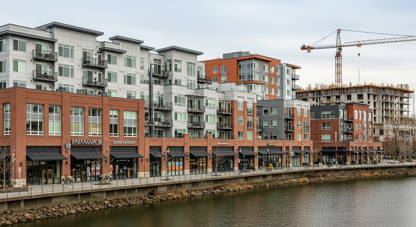
    Below you, Marine View Drive runs along the base of the bluff. The Port of Everett’s waterfront complex — Waterfront Place, the marina, the working piers — is visible directly below. It’s the kind of vantage point that makes the scale of Everett’s waterfront make sense in a way that walking along Marine View Drive doesn’t quite capture.

    The park is 5 acres. It doesn’t have a sports complex — it’s a viewpoint park, designed around the overlook experience. There are grassy areas for sitting, benches at the overlook points, and a paved surface that’s ADA accessible and open to cyclists.

    At the north end of the park, a pedestrian bridge crosses Marine View Drive and connects directly to the waterfront on foot or by bike. This is one of the practical reasons the park deserves more attention: it makes the bluff and the waterfront part of the same trip, rather than two separate destinations requiring a car move.

    A Park Since 1906

    Grand Avenue Park has been part of Everett’s parks system since 1906 — one of the city’s oldest park properties. Port Gardner, the neighborhood it sits in, is the original center of Everett — the landing point where the city began in the early 1890s. The bluff the park occupies looks out over the same bay that Vancouver charted in 1792 and that early Everett settlers considered the defining geographic feature of the place they were building.

    The park was established as a viewpoint during the period when Grand Avenue was first built out as a residential street for Everett’s founding families. The overlook function has been consistent throughout: this has always been the spot where people come to look at the water. Northwest Everett’s historic core sits just a few blocks east, and the visual connection from the park down to the waterfront the early settlers built is as clear today as it was 120 years ago.

    When to Visit

    May and early June are the best months for the view. The mountains are still carrying their winter snowpack, the air is clear between rain systems, and the late afternoon light turns the bay silver. It’s not warm enough to stay all day, but absolutely worth a morning or afternoon stop.

    Weekday mornings are the park at its liveliest — ferry traffic on the Sound, marina activity below, Port of Everett operations visible in the working waterfront. If you want the park with a backdrop of actual Everett activity, early morning on a weekday delivers that.

    Weekday midday is quiet. The benches are open. The trail is uncrowded. You can have the overlook largely to yourself, which is either a feature or a bug depending on what you’re after.

    Getting There

    The park address is 1800 Grand Ave, Everett, WA 98201. From downtown, head north on Rucker Avenue and turn west onto Grand Avenue — follow Grand all the way to where the bluff begins. Street parking is available along Grand Avenue.

    The park is classified as a Viewpoint facility on the City of Everett’s parks system. Hours are 6 a.m. to dusk, year-round. No admission fee.

    The Pedestrian Bridge

    The Grand Avenue pedestrian bridge at the north end of the park crosses Marine View Drive and connects to the waterfront level below. It’s ADA accessible and open to cyclists. This is the practical detail that makes Grand Avenue Park a genuine starting point for a longer outing rather than just a viewpoint stop.

    From the park, you can cross the bridge, walk the waterfront complex, and return via the pedestrian access — a loop that’s probably two to three miles depending on how far you extend it along Marine View Drive or into the marina area. It’s almost entirely paved and connects to one of the more active sections of Everett’s waterfront.

    How It Fits With Everett’s Other Parks

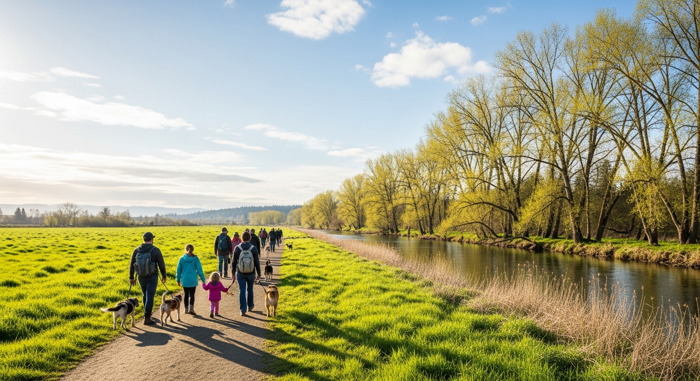
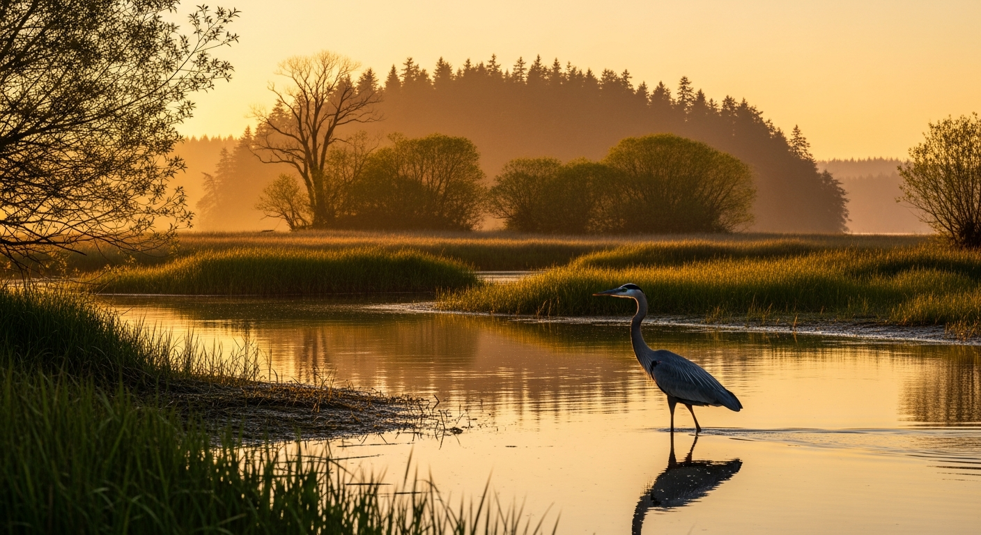
    For families exploring Everett’s outdoor spaces, Grand Avenue Park sits comfortably in the same conversation as Howarth Park (south Everett, beach and forest trails), Thornton A. Sullivan Park at Silver Lake (east, disc golf and lake access), and Langus Riverfront Park (north, wildlife estuary trail). Each is a different experience — Grand Avenue is the one with the panoramic bay view and the bridge to the waterfront.

    It’s also the most central. For anyone based downtown, in Port Gardner, or in northwest Everett, this park is close in a way that the others aren’t. You don’t need to drive to a trailhead. You walk to the end of Grand Avenue and you’re there.

    A Simple Case

    Open 6 a.m. to dusk, 365 days a year. Free. ADA accessible. Five acres of paved trail on a bluff above the water, with views that most cities would charge admission for. A pedestrian bridge to the waterfront. Benches. A grassy area. Established in 1906.

    If you’ve lived in Everett for years and somehow missed this park, May is a good time to go find it.

    Frequently Asked Questions

    Where is Grand Avenue Park in Everett?
    Grand Avenue Park is located at 1800 Grand Ave, Everett, WA 98201, on the bluff above Marine View Drive in the Port Gardner neighborhood. Open 6 a.m. to dusk daily.

    What can you see from Grand Avenue Park?
    The park offers panoramic views of Port Gardner Bay, the Olympic Mountains, Whidbey Island, Naval Station Everett’s marina, and the Port of Everett waterfront complex below the bluff.

    Is Grand Avenue Park ADA accessible?
    Yes. The park features a paved, ADA-accessible trail throughout. The Grand Avenue pedestrian bridge — which connects the park to Marine View Drive and the waterfront — is also ADA accessible and open to cyclists.

    Is there parking at Grand Avenue Park?
    Street parking is available along Grand Avenue. The park does not have a dedicated parking lot.

    How do I get from Grand Avenue Park to the Everett waterfront?
    The Grand Avenue pedestrian bridge at the north end of the park crosses Marine View Drive and connects directly to the waterfront level. It’s open to pedestrians and cyclists and is ADA accessible.

    How old is Grand Avenue Park?
    Grand Avenue Park was established in 1906, making it one of Everett’s oldest park properties.

    How big is Grand Avenue Park in Everett?
    Grand Avenue Park is 5 acres, featuring a paved walking trail, overlook benches facing Port Gardner Bay, grassy areas, and a pedestrian bridge to the waterfront at the north end.

    Is Grand Avenue Park free?
    Yes. Grand Avenue Park is a City of Everett public park with no admission fee. Hours are 6 a.m. to dusk year-round.

  • Everett’s Riverfront Is About to Start Building Its Park — But Here’s the More Complicated Story of What’s Waiting

    Everett’s Riverfront Is About to Start Building Its Park — But Here’s the More Complicated Story of What’s Waiting

    Q: Where does Everett’s Snohomish River riverfront development stand in 2026?
    A: The City of Everett will begin Phase 1 construction on Eclipse Mill Park — the signature 3-acre public park for the Snohomish River waterfront — in summer 2026, with waterside amenities targeted for completion by November 2026. Developer Shelter Holdings’ land-side Phase 1 park work follows from fall 2026 through spring 2028. The broader riverfront development, which envisions up to 1,250 housing units and ground-floor retail, is advancing — but the retail side has faced significant delays, with a planned grocery store pushed to 2030 and a cinema concept replaced by a pickleball facility.

    The Park Construction Is Coming This Summer

    If you’ve driven along the Snohomish River lately, you’ve seen it: the buildings going up on what used to be a former landfill and lumber mill site, the streets carved into a neighborhood that didn’t exist five years ago, the quiet accumulation of infrastructure on one of Everett’s most ambitious bets on its own future.

    The riverfront project, led by Bellevue-based developer Shelter Holdings, is one of the largest private development projects underway in Snohomish County. It’s also one of the most publicly scrutinized. An August 2025 Everett Herald story captured the resident frustration that’s built alongside the housing: delays, empty storefronts, and a timeline that keeps moving.

    With the 2026 construction season now arriving, here’s the most complete picture of where the Everett riverfront actually stands.

    The most concrete near-term milestone is Eclipse Mill Park, the 3-acre public green space planned as the social heart of the new riverfront neighborhood. The project has a split structure. The City of Everett handles the waterside portion: bank stabilization, a floating dock, and waterfront amenities that will make the park usable from the river side. That work is slated to begin over the summer of 2026, with the city targeting completion of its portion by November 2026.

    Once the city finishes, Shelter Holdings has 18 months to complete its land-side portion of Phase 1 — the amenities including parking, a playground, a trail connection, and a play lawn. That puts the Phase 1 park completion in spring 2028, with a full park opening projected for that same window.

    What’s worth emphasizing now — with Phase 1 city work just months away — is that this is a real construction event, not a distant promise. By late summer 2026, heavy equipment will be working the riverbank at the Eclipse Mill Park site, and by Thanksgiving the city portion should be visibly taking shape.

    The Housing Side: What’s Built and What’s Coming

    The housing portion of the Shelter Holdings development is further along than the retail side. Phase 1 launched with 333 apartments as the initial residential component. The broader vision calls for up to 1,250 multi-family housing units across all phases — which would make this one of the largest residential additions in Everett’s history once fully built out.

    The units that are occupied are generating a resident base, which is exactly what the development needs to attract the commercial tenants the neighborhood has been waiting for. More residents means more foot traffic; more foot traffic means a business case for retail operators. The tension is that the sequencing hasn’t worked out that cleanly. The housing came first, but the retail hasn’t followed fast enough for residents who moved in expecting a neighborhood with a coffee shop, a grocery store, and things to do within walking distance.

    The Retail Gap: What Got Delayed, What Got Dropped

    This is the most candid part of the 2026 picture.

    The original Phase 1 vision for the Everett riverfront included a movie theater, a specialty grocer, ground-floor restaurants, and a commercial district that would activate the neighborhood from day one. Almost none of that has materialized on the original schedule.

    The cinema is gone. In 2024, the Everett City Council agreed to let Shelter Holdings replace the planned movie theater with a pay-to-play pickleball facility, citing the post-COVID difficulties facing the movie business. The deadline for that facility was also pushed from Phase 1 to Phase 3 of the development, which is likely several years away.

    The grocery store has been delayed to 2030. When Shelter Holdings asked the city for the extension in June 2025, the explanation was direct: grocery store operators “want to see additional surrounding population density to support a grocery store at the Riverfront.” With Phase 1 apartments occupied but the broader neighborhood still building out, the density threshold for a grocer to make the numbers work hasn’t been reached.

    The Herald’s August 2025 coverage of empty storefronts and resident frustration captured a real tension that anyone who has walked the riverfront neighborhood can see. The ground-floor retail bays that were supposed to activate the street-level experience are sitting empty. The buildings are there. The windows are there. The tenants aren’t.

    Why This Matters for Everett’s Development Story

    The Snohomish River waterfront project is one of three simultaneous waterfront and development efforts reshaping Everett. The Port of Everett’s Waterfront Place on Port Gardner Bay is further along commercially — Tapped Public House, Marina Azul, Menchie’s, Rustic Cork, and Jetty Bar & Grille are all operating. Millwright District Phase 2 targets a mid-2029 entertainment retail opening. The riverfront is the youngest and most interior of the three, running on the longest clock.

    The structural challenge is one that most large mixed-use developments face: the first residents arrive before the amenities that make the development worth living in. Developers manage this by phasing construction so that commercial critical mass arrives shortly after residential density. At the Everett riverfront, that sequence got disrupted — first by COVID’s impact on the cinema sector, then by the grocery sector’s density requirements, then by the general commercial retail slowdown of 2023–2025.

    The 2026 construction season offers a reset moment. Eclipse Mill Park Phase 1 city work beginning over the summer is a visible, tangible marker of progress — exactly the kind of milestone that builds confidence in the neighborhood among both prospective residents and prospective retail tenants. The floating dock, the riverbank improvements, and the infrastructure going in this year will make the Snohomish River accessible to the neighborhood in a way it hasn’t been yet.

    What to Watch in the Second Half of 2026

    The markers worth tracking between now and December 2026:

    City park construction progress. The city targets its riverbank and floating dock work by November 2026. Any slippage to that schedule pushes back Shelter Holdings’ Phase 1 timeline and the spring 2028 park opening.

    Retail tenant announcements. With 2030 now the grocery anchor target, any pre-2030 commercial lease signing in the riverfront district would be meaningful news. Even a smaller-format coffee shop or neighborhood retail commit would signal that the density threshold is being crossed.

    Phase 2 housing permit filings. More housing permits mean more residents on the way, which advances the case for retail faster than anything else the developer can do.

    The Everett riverfront isn’t behind the way a stalled project is behind. It’s behind the way ambitious urban development always is when it tries to build a neighborhood from scratch on challenging land. The bones of a genuinely good waterfront district are visible — the housing, the infrastructure, the park framework. The retail chapter is just taking longer to write.

    This summer’s construction season will be the most visible progress the riverfront has shown in a year. When the city starts moving dirt at Eclipse Mill Park, it’ll be the clearest sign yet that Everett’s Snohomish River waterfront is still building toward what it promised to be.

    Frequently Asked Questions

    Q: When will Eclipse Mill Park open?
    Eclipse Mill Park Phase 1 is projected to fully open in spring 2028. The City of Everett will complete its waterside construction by November 2026, after which Shelter Holdings has 18 months to complete the land-side Phase 1 amenities.

    Q: Who is developing the Everett riverfront?
    Shelter Holdings, a Bellevue-based developer, is the primary private developer for the Snohomish River waterfront project. The City of Everett is separately responsible for Eclipse Mill Park’s waterside construction phase.

    Q: How many housing units are planned for the Everett riverfront?
    The full Shelter Holdings development envisions up to 1,250 multi-family housing units across all phases. Phase 1 launched with 333 apartments.

    Q: Why was the riverfront cinema cancelled?
    The Everett City Council approved Shelter Holdings’ request in 2024 to replace the planned movie theater with a pay-to-play pickleball facility, citing challenges facing the cinema industry since COVID-19. The project’s deadline was also moved from Phase 1 to Phase 3.

    Q: When will the riverfront grocery store open?
    The grocery store has been delayed to 2030. Shelter Holdings cited grocery operators’ requirements for greater surrounding population density before they will commit to a store.

    Q: Where is the Everett riverfront development located?
    The Shelter Holdings riverfront development sits along the Snohomish River in Everett, on the site of a former city landfill and lumber mills. It’s distinct from the Port of Everett’s Waterfront Place development on Port Gardner Bay to the west.

  • Living in Evergreen: South Everett’s Pine-Lined Neighborhood Where Good Schools, Parks, and Everyday Convenience Come Together

    Living in Evergreen: South Everett’s Pine-Lined Neighborhood Where Good Schools, Parks, and Everyday Convenience Come Together

    Living in Evergreen: South Everett’s Pine-Lined Neighborhood Where Good Schools, Walkable Parks, and Everyday Convenience Actually Come Together

    **What is the Evergreen neighborhood in Everett, WA?**

    Evergreen is a south Everett neighborhood of nearly 5,000 residents known for its tree-lined streets, all-ages school pipeline from Madison Elementary through Cascade High, and a commercial corridor along Evergreen Way that puts everyday errands within easy reach. It is one of the few south Everett neighborhoods where walkability, park access, and schools all land in the same zip code.

    Drive south from downtown Everett on Broadway or Evergreen Way and the skyline shifts. The density of the urban core gives way to split-level homes set back from the road, pine trees rising above rooflines, and the particular quiet of a neighborhood that has been doing its job — housing working families within reach of everything — for decades. That neighborhood is Evergreen, and it’s one of the most consistently livable places in south Everett that doesn’t get nearly enough credit for it.

    Evergreen was established as a formal city neighborhood association in late 2004, with assistance from the City of Everett’s Office of Neighborhoods. But the community itself is much older than that — Evergreen Way has been the working commercial backbone of south Everett since long before anyone was holding neighborhood association meetings, and the schools that anchor it have been in place since 1958 when Evergreen Middle School first opened its doors.

    Where Evergreen Is and What It Feels Like

    Evergreen sits in the southern reaches of Everett, roughly 5 miles from downtown and approximately 30 miles from downtown Seattle. The neighborhood is bounded by major corridors and transitions naturally into adjacent areas including Twin Creeks to the south and Westmont-Holly to the west. Evergreen Way is the spine — a 5-mile commercial stretch that runs directly into downtown, lined with restaurants, Fred Meyer, Safeway, QFC, and the kind of corner stores that carry actual produce and spices for a genuinely diverse customer base.

    The residential streets branch off Evergreen Way into cul-de-sacs and quieter side streets. The housing stock is predominantly condos, split-level homes, ramblers, and traditional single-family homes — the kind of mix that attracts first-time buyers who want more space than an apartment but aren’t ready for a new-construction price tag. The median sale price for homes in Evergreen over the last 12 months sits at approximately $530,000, down about 5% from the prior year, and homes have been moving in roughly 33 days on average — significantly faster than the national average of 54 days. That combination of relative affordability by Everett standards and faster-than-average sales velocity tells you something real: people who find Evergreen make up their minds quickly.

    The School Pipeline That Actually Works

    One of Evergreen’s defining characteristics is that the entire K–12 pipeline runs through or near the neighborhood, and all three schools hold a solid grade.

    Madison Elementary feeds into Evergreen Middle School, which feeds into Cascade High School — and all three earn a B grade from Niche. What’s notable is that all three campuses are within walking distance of each other, which is genuinely unusual in a city Everett’s size. For families with kids across different grade levels, that concentration matters.

    Evergreen Middle School has been part of the neighborhood’s identity since it opened in 1958 and was fully remodeled in 1999. Cascade High School, meanwhile, has built a strong reputation for its robotics team, which has grown steadily in membership and actively competes at the regional level. Cascade also offers the International Baccalaureate program — one of the few public high schools in Snohomish County to do so — making it a destination school even for families outside the immediate attendance boundary.

    For parents of older students weighing career pathways, Everett Public Schools’ High School Summer Academy runs at Eisenhower Middle School each July, and Everett Career Link — a partnership between EPS, Snohomish STEM, the City of Everett, and regional employers — offers real-world job experience for high schoolers who want to start building a résumé before graduation.

    Phil Johnson Ballfields: The Park That Got a Real Upgrade

    If there’s one park that defines outdoor life in Evergreen, it’s Phil Johnson Ballfields at 400 Sievers Duecy Boulevard. The 13-acre facility includes four softball and baseball diamonds configured to also fit four soccer fields for youth leagues, a playground, picnic tables, and restrooms — and it was transformed by a $4.65 million renovation that made it one of Snohomish County’s most accessible athletic facilities.

    The renovation added artificial turf, adaptive markings designed for physically and developmentally disabled children, and improvements that make it significantly easier for wheelchair users to access the playground and playing surfaces. It’s one of those upgrades that doesn’t make headlines but changes daily life for families who show up on Saturday mornings. Youth sports leagues run throughout the spring and summer, and the field lighting means the facility stays usable well into the evening.

    The Commercial Corridor: What “Convenient” Actually Means Here

    The Evergreen Way commercial strip is not photogenic. It’s not the kind of streetscape that wins walkability awards. But for the people who live here, it delivers. Major grocery anchors — Fred Meyer, Safeway, QFC — sit alongside independent restaurants, nail salons, auto services, and the kind of small food businesses that reflect Evergreen’s genuinely diverse resident base. The corridor puts essentially every daily errand within a short drive or, for some residents, a walkable distance.

    The proximity to the corridor is also why Evergreen attracts a range of residents: Boeing workers who want a direct shot toward Paine Field, families who want to be in the Cascade High attendance zone, and young buyers who want more living space than north Everett offers at a price that still makes mortgage math work.

    What Long-Timers Know About Evergreen

    Residents who have lived in Evergreen for more than a few years tend to describe it with a specific kind of satisfaction: the neighborhood does what it promises. The schools are real, not aspirational. The park works. The commute to downtown or up to Paine Field is manageable. The streets are quiet without being remote.

    It’s not the most talked-about neighborhood in Everett — that distinction still belongs to the waterfront and downtown. But Evergreen occupies a particular role in the city’s neighborhood ecosystem: a stable, well-established south Everett neighborhood that has been absorbing families for decades without drama, and that continues to deliver on the basics better than its reputation might suggest.

    If you’re looking at south Everett and haven’t put Evergreen on the shortlist, it’s worth a closer look.

    Frequently Asked Questions About Evergreen, Everett

    What schools serve the Evergreen neighborhood?

    The Evergreen neighborhood is served by Madison Elementary, Evergreen Middle School, and Cascade High School — all within the Everett Public Schools district and all earning B grades from Niche. Cascade High also offers the International Baccalaureate program.

    What is the housing market like in Evergreen?

    Median home sale prices in Evergreen are approximately $530,000 (down ~5% year over year). Homes typically sell in about 33 days, faster than the national average of 54 days. The stock includes condos, split-levels, ramblers, and traditional single-family homes.

    Are there parks in the Evergreen neighborhood?

    Yes. Phil Johnson Ballfields at 400 Sievers Duecy Blvd is the area’s primary park — 13 acres with baseball, softball, and soccer fields, plus an accessible playground upgraded during a $4.65M renovation.

    Is Evergreen a good neighborhood for families?

    Evergreen consistently rates well for families because of its walkable school pipeline, accessible park facilities, and commercial corridor that handles daily errands. Niche rates it above average for families.

    How far is Evergreen from downtown Everett?

    Evergreen is approximately 5 miles from downtown Everett via Evergreen Way. It’s also roughly 30 miles from downtown Seattle.

    When was the Evergreen Neighborhood Association formed?

    The Evergreen Neighborhood Association was established in late 2004 with assistance from the City of Everett’s Office of Neighborhoods. The neighborhood itself is significantly older.

  • Kasch Park: Everett’s Premier Athletic Complex Just Got a Major Turf Upgrade — A Local’s Guide to South Everett’s Most-Used Park

    Kasch Park: Everett’s Premier Athletic Complex Just Got a Major Turf Upgrade — A Local’s Guide to South Everett’s Most-Used Park

    Q: What is Kasch Park in Everett?

    A: Kasch Park is the City of Everett’s premier athletic complex, located at 8811 Airport Road in the Westmont area of south Everett. It features four lighted multi-sport synthetic-turf fields, a four-field lighted softball complex, one Little League field, basketball courts, a Weevos-style playground, picnic shelters, restrooms, and walking trails. The park is open daily from 6 a.m. to 10 p.m. and connects via trail to the nearby Loganberry Lane Dog Park.

    Kasch Park is the south Everett athletic complex everyone in town has played at — even if they did not know its name

    Kasch Park sits on Airport Road just past the Boeing fence line, inside the Westmont area of south Everett. If you have ever played adult-league soccer in Snohomish County, watched a kid’s softball tournament under the lights, or pushed a stroller through a quiet weekend afternoon while teenagers ran a flag-football scrimmage, there is a strong chance you have been here. It is the kind of public park that becomes invisible because it works. The fields show up on hundreds of league schedules every year. The playground stays full on summer weekends. The parking lot empties at 10 p.m. and refills at 6 a.m. the next morning, every day, year-round.

    And quietly, over the last few years, it has become a much better park than most south-Everett residents realize. Here is what makes Kasch Park the city’s premier athletic complex, what got upgraded recently, and what locals should know before their next visit.

    The basics: address, hours, parking

    Address: 8811 Airport Road, Everett, WA 98204
    Hours: 6 a.m. to 10 p.m. daily
    Parking: Free, ample on-site lot

    The park sits between Airport Road and 100th Street SW, a quick drive from Boulevard Bluffs, Pinehurst-Beverly Park, Glacier View, and Westmont — and convenient to Boeing, Paine Field, and the Cascade High School zone for Casino Road and Pinehurst families.

    What Kasch Park has — by the field

    Kasch Park is the City of Everett’s flagship athletic facility. The amenity list is long enough that it is worth grouping by use case.

    Multi-sport turf fields. Four lighted, synthetic-turf fields sized for soccer but lined for multiple sports. After the most recent surface replacement, the fields are now playable for soccer, lacrosse, ultimate frisbee, flag football, and kickball. The lights mean evening league play continues year-round; the synthetic turf means rain rarely cancels a game.

    Softball complex. A four-field lighted softball complex with bleachers anchors the eastern half of the park. This is where most of Everett’s adult coed leagues, men’s leagues, and tournament play happens. Under a recent management agreement with NWS Holdings, the previously dirt infields on softball fields one through four are being upgraded with turf surfacing, additional fencing, and safety netting — improvements that bring the complex closer to tournament-grade specification.

    Little League field. One dedicated Little League diamond serves the park’s youth baseball programming.

    Basketball courts. Outdoor courts available for casual pickup play.

    Playground. The park’s playground, designed and built by PlayCreation, features a Weevos-brand structure with a Cozy Coaster Slide, Wee Pod Climber, and Boppity Bridge — the kind of contemporary play equipment designed for both motor-skill development and durability. Restrooms are immediately adjacent.

    Picnic shelter. A reservable picnic shelter is available through the City of Everett’s facilities reservation system at everettwa.gov.

    Walking trail. A short on-site loop connects the parking, playground, fields, and the trail spur that links to nearby Loganberry Lane Dog Park.

    Restrooms. Permanent restroom facilities are available on the playground side; portable toilets supplement the field areas during peak league season.

    Recent upgrades: what changed and why it matters

    The biggest change in the last few years has been the synthetic-turf replacement on the multi-sport fields. The original turf had aged out of safe play; the replacement re-lined the fields for soccer plus multiple secondary sports, expanding the park’s usable league bookings dramatically. The Wildlife Recreation Coalition lists the project among its supported recreation grants for the region.

    The second change is the softball management partnership. NWS Holdings now manages softball fields one through four under an agreement with the City of Everett, with infield turf upgrades, fencing improvements, and additional safety netting in progress. For league players, the difference is noticeable: fewer rainouts on dirt infields, better backstop coverage for tournaments, and a more consistent maintenance cadence.

    What has not changed: dogs are still prohibited from all field areas. The trail connection to Loganberry Lane Dog Park gives dog owners a nearby alternative for off-leash play.

    Who actually uses Kasch Park

    If you visit on a weekday evening between April and October, the parking lot will be mostly league players — adult coed soccer, men’s softball, kickball nights, and the occasional ultimate frisbee tournament. Weekend mornings tilt toward youth: Little League, youth soccer, and the occasional flag-football clinic. Weekday afternoons before 5 p.m. lean stroller crowd — the playground area is genuinely well-shaded in the summer and the layout works for parents with multiple kids of different ages.

    For visitors driving in from outside south Everett, the park is also a reliable rainy-day option. The combination of synthetic turf and field lights means scheduled play continues through Pacific Northwest spring weather that would shut down a grass-field park entirely.

    How to book a field or shelter

    The City of Everett handles all field reservations through the Parks Department. Reservations open seasonally; the most popular weekend slots fill quickly. Field permits are typically required for any organized group play of more than a casual pickup game. Picnic shelter reservations follow the same process. Both can be initiated through everettwa.gov/parks.

    NWS Holdings handles the softball-fields-one-through-four scheduling separately under its management agreement. League organizers should reach out through the City Parks office for the current contact path.

    Why Kasch Park belongs on every south Everett family’s short list

    The Everett park system has more famous names — Forest Park draws the headlines, Howarth gets the Instagram shots, Sullivan at Silver Lake has the destination amenity, Garfield is the playground showpiece. Kasch is none of those things. It is the working park. It is where Everett actually plays. And after the recent turf and softball-field upgrades, the working park works even better than it used to. For families in Westmont, Boulevard Bluffs, Pinehurst-Beverly Park, Glacier View, and Twin Creeks, Kasch Park is probably the single most-used piece of public infrastructure in the neighborhood. It is worth knowing the address, the hours, and the booking process the next time a Saturday plan goes sideways and the kids need a field.

    Frequently Asked Questions

    Where is Kasch Park located?

    Kasch Park is at 8811 Airport Road, Everett, WA 98204, in the Westmont area of south Everett. It is convenient to Boeing, Paine Field, and the Cascade High School attendance zone.

    What are Kasch Park’s hours?

    The park is open daily from 6 a.m. to 10 p.m. The lighted fields support evening league play through the posted closing time.

    Does Kasch Park have a dog park?

    No. Dogs are prohibited from all field areas inside Kasch Park. The on-site trail connects to the nearby Loganberry Lane Dog Park, which is the closest off-leash option.

    Are there pickleball courts at Kasch Park?

    Not currently. Kasch Park’s primary courts are basketball and the multi-sport synthetic-turf fields. Pickleball courts in Everett are located at other parks; the City of Everett maintains a pickleball-court list at everettwa.gov/parks.

    How do I reserve a field or picnic shelter at Kasch Park?

    Field permits and picnic shelter reservations go through the City of Everett Parks Department at everettwa.gov/parks. Softball fields one through four are managed by NWS Holdings under a separate agreement; the City Parks office can route league organizers to the current contact path.

    What sports can be played on Kasch Park’s turf fields?

    After the synthetic-turf replacement, the four multi-sport fields are lined and approved for soccer, lacrosse, ultimate frisbee, flag football, and kickball.

    Is Kasch Park a good park for young children?

    Yes. The Weevos-brand playground, designed and built by PlayCreation, includes a Cozy Coaster Slide, Wee Pod Climber, and Boppity Bridge — equipment well-suited for early-childhood and elementary-aged kids. Permanent restrooms are immediately adjacent. The picnic shelter is reservable for parties.

  • Day Trip from Seattle to Langus Riverfront Park and Spencer Island Everett: A 2026 Visitor’s Guide

    Day Trip from Seattle to Langus Riverfront Park and Spencer Island Everett: A 2026 Visitor’s Guide

    Day trip bottom line: Langus Riverfront Park and Spencer Island are 25–30 minutes north of Seattle via I-5 — a genuine half-day outdoors destination that most Puget Sound visitors don’t know exists. Flat trail, exceptional birdwatching, estuary wildlife. Bring a Discover Pass or $11.50 for day parking. No other admission.

    If you’re visiting the Seattle area for the FIFA World Cup, a weekend trip, or any reason that brings you to the Pacific Northwest, the Snohomish River Estuary north of Everett is one of the region’s most underrated outdoor destinations — and it’s closer to Seattle than most guides will tell you.

    The Drive From Seattle

    From downtown Seattle, Langus Riverfront Park is approximately 27 miles north on I-5 — roughly 30 minutes in off-peak traffic. Take the Marine View Drive exit north of Everett and follow Smith Island Road to the park entrance at 411 Smith Island Rd, Everett. Easier than driving to the Cascades. No mountain passes, no ferry.

    From the new Lynnwood City Center Link station, Community Transit connects to the Everett area. For visitors without a car, the combination of Link plus transit is an option — check Community Transit routes for current schedules.

    What You’re Going to See

    The Snohomish River Estuary is the largest wetland near an urban center on the West Coast — 1,400 acres where freshwater from the Cascades mixes with tidal Puget Sound. Spencer Island alone is 413 acres of managed wildlife habitat. More than 350 species of migratory birds have been recorded here. For comparison: most wildlife refuges in the Pacific Northwest are significantly harder to reach and offer less consistent wildlife viewing.

    Bald eagles, osprey, great blue herons, and a rotating cast of shorebirds and waterfowl are reliably present across all seasons. Spring and fall migration windows bring exceptional variety. Even a casual visitor with no birding background will see wildlife within minutes of crossing the Spencer Island bridge.

    The Trail

    The Langus River Front Trail is 3.0 miles of flat, paved path along the Snohomish River — accessible to walkers, joggers, and cyclists. It connects via bridge to the 1.7-mile Spencer Island southern loop on an elevated dike trail with open views across the estuary. Combined: approximately 4.7 miles, 2 to 3 hours at a relaxed pace with wildlife stops.

    No technical gear required. The trail is genuinely flat. Families with strollers can do the Langus section without difficulty.

    What to Bring, What to Pay

    Parking at Langus requires a Washington State Discover Pass ($30/year) or Vehicle Access Pass ($11.50/day). Available at the park kiosk or in advance at discoverpass.wa.gov. The trail and Spencer Island are free once you’ve handled parking.

    Binoculars significantly improve the Spencer Island experience. Water and snacks are essential — there are no services on Spencer Island. Layer up; estuary conditions can be windy regardless of season.

    Combining With Other Everett Stops

    Langus and Spencer Island pair naturally with Everett’s waterfront. Post-hike dining at Waterfront Place at the Port of Everett — with multiple restaurant options open along the marina — is a short drive from the park. The historic Port Gardner neighborhood and Rucker Hill walking tour adds an architectural dimension to the day.

    Frequently Asked Questions

    How far is Langus Riverfront Park from Seattle?

    Approximately 27 miles north of downtown Seattle via I-5 — roughly 30 minutes in off-peak traffic. Take the Marine View Drive exit north of Everett and follow Smith Island Road to the park at 411 Smith Island Rd.

    Is Langus Riverfront Park worth visiting as a day trip?

    Yes. Spencer Island’s 413-acre estuary habitat with 350-plus migratory bird species is among the best wildlife-viewing sites in Puget Sound. Combined with the flat paved Langus trail and river access infrastructure, it’s a genuine half-day outdoors destination.

    What is the admission fee for Spencer Island?

    Spencer Island is free to enter. Parking at Langus Riverfront Park requires a Washington State Discover Pass ($30/year) or Vehicle Access Pass ($11.50/day).

    What is the best time of year to visit Langus and Spencer Island?

    Any season offers wildlife viewing. Spring (March–May) and fall (September–November) are peak migration windows with the highest bird variety. Winter brings overwintering waterfowl. Summer is popular for families and cyclists.

  • Langus Riverfront Park and Spencer Island: The Complete 2026 Guide to Everett’s 3-Mile Trail to a 413-Acre Wildlife Estuary

    Langus Riverfront Park and Spencer Island: The Complete 2026 Guide to Everett’s 3-Mile Trail to a 413-Acre Wildlife Estuary

    Quick guide: Langus Riverfront Park (411 Smith Island Rd, Everett) offers a 3-mile flat paved trail along the Snohomish River with a direct connection to Spencer Island — 413 acres of wildlife estuary and one of the best birding sites in the Puget Sound region. A Discover Pass or Vehicle Access Pass is required for parking. The trail is free and open year-round.

    Most Everett residents know the waterfront. Fewer know that a short drive to the north end of Smith Island puts you at one of the best outdoor destinations in Snohomish County — a flat paved trail along the Snohomish River estuary, a working boat launch, a fishing pier, and a bridge to a 413-acre wildlife refuge where 350 species of migratory birds pass through each year.

    Langus Riverfront Park and Spencer Island are Everett’s underrated outdoors combination. Here is the complete 2026 guide.

    Getting There

    Langus Riverfront Park is located at 411 Smith Island Rd, Everett, WA 98201. From I-5, take the Marine View Drive exit and follow Smith Island Road north. The park has three parking lots. At least one requires a Washington State Discover Pass ($30/year) or Vehicle Access Pass ($11.50/day). The trail and Spencer Island access are free once you park.

    The Langus Riverfront Trail

    The Langus River Front Trail is a 3.0-mile paved loop with roughly 32 feet of total elevation gain — effectively flat. The surface is wide enough for walkers, joggers, and cyclists to share without conflict. There are no technical sections, no significant hills, and no route-finding required. You follow the river and come back around.

    That accessibility is the point. For families with strollers, seniors, people rehabbing injuries, or anyone who wants a genuine nature experience without technical trail demands, Langus is one of the best options in Everett’s parks system. It runs along the Snohomish River estuary, where freshwater from the Cascades meets tidal influence from Puget Sound — producing the habitat conditions that make the wildlife here exceptional.

    The River Access Infrastructure

    Langus is not just a walking trail. It has real water-access infrastructure rarely found in urban parks:

    • Boat launch — functional for small watercraft and trailer boats launching onto the Snohomish River
    • Fishing pier — direct access to the Snohomish River; salmon runs pass through the estuary zone
    • Rowing dock and shell house — serving rowers and paddlers from the Everett Rowing Association and other groups

    The estuary zone at Langus is where freshwater and saltwater ecosystems overlap — a biological mixing zone that concentrates fish, birds, and mammals in ways a purely freshwater or purely marine habitat does not.

    Spencer Island: The Main Event

    Walk or ride to the end of the Langus trail and you reach the bridge to Spencer Island — 413 acres of estuary habitat managed jointly by Snohomish County Parks and the Washington Department of Fish and Wildlife. Spencer Island sits at the heart of the 1,400-acre Snohomish River Estuary, the largest wetland near an urban center on the West Coast.

    The southern loop on Spencer Island is approximately 1.7 miles. It runs along an elevated dike trail that puts you above the wetland with unobstructed views across the estuary. No technical skills required. Dogs are welcome on leash.

    What you can expect to see:

    • More than 350 species of migratory birds pass through the estuary; the Snohomish River Estuary is consistently rated among the best birding sites in the Puget Sound region
    • Bald eagles, osprey, and red-tailed hawks are regular year-round residents
    • Great blue herons reliably visible along the river edges in all seasons
    • Shorebirds and waterfowl — exceptional variety during spring and fall migration windows
    • Mammals including deer, coyote, and river otter throughout the island

    Best Times to Visit

    Spencer Island and Langus are worth visiting any time of year. The Snohomish River Estuary is a year-round habitat, not a seasonal destination. That said:

    Spring (March–May): Peak migration season brings exceptional shorebird and waterfowl variety. Migratory raptors moving through. Vegetation growth begins filling the estuary.

    Fall (September–November): Second peak migration window. Waterfowl numbers build through October. Salmon runs in the river draw eagles and other predators.

    Summer: Resident birds active. Nesting in progress — give nesting areas a wide berth. Popular season for families and cyclists.

    Winter: Quieter trail, excellent for solitude. Waterfowl overwintering in the estuary. Eagles visible along the river.

    The Combined Hike

    Langus trail (3.0 miles) plus Spencer Island southern loop (1.7 miles) equals approximately 4.7 miles total for the full combination. Plan for 2 to 3 hours depending on pace and how long you spend watching birds on Spencer Island’s dike trail. Bring water — there are no services on Spencer Island.

    What to Bring

    • Discover Pass or cash for the Vehicle Access Pass ($11.50/day)
    • Binoculars — essential for getting the most from Spencer Island
    • Water and snacks (no services once you leave the parking area)
    • Layers — the estuary is exposed; wind conditions vary significantly
    • Rain gear in any non-summer month

    Nearby Everett Destinations

    Langus pairs well with other north Everett destinations. The Lowell neighborhood sits along the Snohomish River to the east. The Port Gardner neighborhood — Everett’s second-oldest neighborhood and Rucker Hill — is a short drive to the west. The waterfront dining at Port of Everett’s Waterfront Place is accessible for a post-hike meal.

    Frequently Asked Questions

    Where is Langus Riverfront Park in Everett?

    411 Smith Island Rd, Everett, WA 98201. From I-5, take the Marine View Drive exit and follow Smith Island Road north to the park entrance.

    Do I need a pass to visit Langus Riverfront Park?

    A Washington State Discover Pass ($30/year) or Vehicle Access Pass ($11.50/day) is required for parking at Langus Riverfront Park. The trail and Spencer Island are free to walk once you have parked.

    How long is the trail at Langus Riverfront Park?

    The Langus River Front Trail is a 3.0-mile flat paved loop with approximately 32 feet of elevation gain — effectively flat and accessible to walkers, joggers, cyclists, and strollers.

    What is Spencer Island?

    Spencer Island is a 413-acre wildlife estuary managed jointly by Snohomish County and the Washington Department of Fish and Wildlife, accessible by bridge from the end of the Langus trail. It sits within the 1,400-acre Snohomish River Estuary — the largest wetland near an urban center on the West Coast — with more than 350 species of migratory birds recorded.

    Is Langus Riverfront Park good for birdwatching?

    Yes. The Snohomish River Estuary is consistently rated among the best birding sites in Puget Sound. Bald eagles, osprey, great blue herons, and 350+ species of migratory birds make the area exceptional. Spring and fall migration windows offer peak variety.

    Can you fish at Langus Riverfront Park?

    Yes. Langus has a fishing pier with direct access to the Snohomish River, which has salmon runs through the estuary zone. A Washington State fishing license is required. A boat launch is also available for watercraft access.

    How far is the full Langus plus Spencer Island hike?

    Approximately 4.7 miles combining the Langus trail (3.0 miles) and Spencer Island southern loop (1.7 miles). Plan for 2 to 3 hours depending on pace and wildlife-watching stops.

  • Langus Riverfront Park and Spencer Island: Everett’s 3-Mile Paved Trail to a 400-Acre Wildlife Estuary

    Langus Riverfront Park and Spencer Island: Everett’s 3-Mile Paved Trail to a 400-Acre Wildlife Estuary

    Langus Riverfront Park (411 Smith Island Rd, Everett) offers a 3-mile paved trail along the Snohomish River, a fishing pier, a boat launch, and a paved path to Spencer Island — 400 acres of estuary wildlife habitat that’s among the best birdwatching spots in all of Puget Sound. A Discover Pass or Vehicle Access Pass is required for parking. The trail itself is free and open year-round.

    The Trail

    There’s a park on the north end of Everett that most people drive past without knowing it exists. Langus Riverfront Park sits just across the Snohomish River from the city proper, accessible via Smith Island Road, and it delivers more than its modest profile suggests: three miles of flat paved trail, serious water access infrastructure, and a bridge to one of the most ecologically rich wildlife areas in Snohomish County.

    The Langus River Front Trail is a 3.0-mile paved loop — flat (about 32 feet of elevation gain total), wide enough for walkers, joggers, and cyclists to share comfortably, and well-maintained throughout. No map required. You follow the river and come back around.

    For families with strollers, seniors, and anyone who wants a genuine outdoor experience without technical trail navigation, this is one of the most accessible options in Everett’s parks system. It also connects directly to Spencer Island — add roughly 1.7 miles for the southern loop if you’re making a full day of it.

    The River Access

    Langus isn’t just a walking trail. It has real infrastructure for people who want to get on the water:

    • Boat launch — functional for small watercraft and trailer boats
    • Fishing pier — directly on the Snohomish River
    • Rowing dock and shell house — serving rowers and paddlers
    • Three parking lots — at least one requires a Discover Pass or Washington State Vehicle Access Pass

    The river here is the Snohomish River estuary zone, where freshwater from the Cascades meets the tidal influence of Puget Sound. That mixing of freshwater and saltwater ecosystems is a big part of what makes the wildlife at Langus and Spencer Island so good.

    Spencer Island: The Main Event

    Walk or bike to the end of the Langus trail and you’ll reach the bridge to Spencer Island — 400 acres of estuary habitat managed jointly by Snohomish County and the Washington Department of Fish and Wildlife.

    Spencer Island is consistently rated among the best wildlife-watching spots in the Puget Sound region. What you’re likely to see on a typical visit:

    • Waterfowl and shorebirds — the estuary is prime habitat year-round; spring and fall migration add exceptional variety
    • Raptors — bald eagles, osprey, and red-tailed hawks are regular visitors
    • Great Blue Herons — reliably visible along the river edges
    • Deer, coyote, and river otter — mammals are common throughout the island

    The southern loop on Spencer Island is about 1.7 miles. It runs along an elevated dike trail — partially maintained by volunteers — that puts you above the wetland and gives you unobstructed sight lines in every direction. Birders know this spot.

    What’s Coming: The Spencer Island Restoration Project

    The Army Corps of Engineers, the Washington Department of Fish and Wildlife, and Snohomish County are in the final design phase of the Spencer Island Unit Restoration Project, with updates expected in 2026. Projects of this type typically restore tidal flow, remove invasive vegetation, and improve habitat connectivity throughout the estuary.

    When complete, the restoration will benefit both wildlife populations and the visitor experience on Spencer Island. If you’re planning a trip in 2026, check snohomishcountywa.gov for any trail or access changes related to restoration work.

    Getting There

    Address: 411 Smith Island Rd, Everett, WA

    From Seattle/I-5 northbound: Take exit 195 and turn left onto East Marine View Drive. Continue about 1.2 miles to the ramp for Highway 529. Head north, cross the bridge, and turn right onto 28th Place NE. At the next intersection, turn right onto 35th Avenue NE. Continue to the stop sign and turn left onto Ross Avenue. Turn right onto Smith Island Road and follow it into the park.

    Parking: Three lots at the trailhead. At least one lot requires a Discover Pass or Washington State Vehicle Access Pass. Both are available at wsdot.wa.gov.

    Hours: Open year-round. No entrance fee for the trail.

    How Langus Fits Into Everett’s Parks System

    Langus fills a gap that Everett’s other signature parks don’t cover. Forest Park is the wooded, family-with-kids destination on the west side. Howarth Park is the Puget Sound beach access point. Thornton A. Sullivan Park at Silver Lake is the south Everett lakeside destination.

    Langus is different from all three: it’s a river estuary, it connects to a major wildlife reserve, and it has real water recreation infrastructure. If you want to actually see wildlife — not just green space — Langus and Spencer Island are your best local bet.

    The park sits in north Everett, adjacent to Riverside — Everett’s oldest neighborhood, platted in 1891 along this same stretch of the Snohomish River. A Langus visit pairs naturally with a walk through Riverside’s historic streets, or with a trip to Jetty Island (ferry runs seasonally from Everett Marina) for a full north Everett outdoor day.

    Frequently Asked Questions

    Does Langus Riverfront Park require a day pass or entrance fee?

    No entrance fee for the trail. One or more parking lots require a Discover Pass or Washington State Vehicle Access Pass.

    How do I get to Spencer Island from Langus?

    Follow the paved trail from the main parking area; it connects to the access road and then to the bridge to Spencer Island. The southern loop on Spencer Island adds about 1.7 miles.

    Is the trail paved the whole way?

    The Langus loop is fully paved. Spencer Island’s elevated dike trail is unpaved.

    What’s the best season to visit for birdwatching?

    Spring and fall migration seasons bring the widest variety of shorebirds and waterfowl. Winter brings waterfowl that stay all season. Summer is good for raptors and nesting activity.

    Can I launch a kayak or canoe here?

    Yes. The boat launch at Langus is functional for small watercraft.

    Is Langus dog-friendly?

    The trail is popular with dog walkers. Keep dogs on leash per standard Everett parks rules.

    What is the Spencer Island Restoration Project?

    The Army Corps of Engineers, WDFW, and Snohomish County are in final design on estuary habitat restoration for Spencer Island, with 2026 updates expected. Check snohomishcountywa.gov for current access information.

  • Forest Park’s New Pickleball Courts Open in June: What’s Built, What’s Closed, and Why It Matters for Everett

    Forest Park’s New Pickleball Courts Open in June: What’s Built, What’s Closed, and Why It Matters for Everett

    What’s being built at Forest Park in Everett? The City of Everett is constructing its first multi-court outdoor pickleball facility at Forest Park, including four dedicated regulation pickleball courts, two renovated multi-use sport courts, sport fencing, a pickleball practice wall, site lighting, drinking fountain, benches, cornhole, and horseshoe pits. Construction began in November 2025 and is estimated to complete in June 2026. Some park access east of the water park is currently affected by the project.

    Forest Park’s Pickleball Courts Open This June: What’s Built, What’s Closed, and Why It Matters

    Outdoor recreation is a sport. That’s how this desk treats it. And the biggest outdoor-rec story in Everett right now isn’t on a hiking trail or out at Jetty Island — it’s tucked into the trees at Forest Park, where the city is six weeks from opening its first dedicated multi-court outdoor pickleball facility. If you’ve been driving past the trailhead and wondering why a chunk of the park east of the water park has been fenced off all winter, this is the answer. June 2026 is the target. The shape of the project tells you Everett is serious about outdoor rec.

    What’s Being Built

    Per the City of Everett’s Parks Department project documentation, Forest Park’s new outdoor recreation hub includes:

    • Four new dedicated regulation-size pickleball courts on a new paved court
    • Renovation and expansion of two existing multi-use sport courts
    • New sport fencing around the courts
    • A pickleball practice wall
    • Site lighting (so courts can run into the evening)
    • A drinking fountain
    • Benches
    • Cornhole pits
    • Horseshoe pits

    Read that list as a unit and what you’re actually looking at is a small park-within-a-park: a casual outdoor recreation hub that supports the fastest-growing outdoor sport in the country plus a pair of casual lawn-game options for the people who didn’t come to play pickleball. The lighting matters more than it sounds. Lit courts mean weeknight league play, weeknight pickup, and a community asset that doesn’t shut off when the sun goes down — which in Pacific Northwest seasonal terms is the difference between a 5-month facility and a 10-month one.

    Why It Matters for Everett

    Pickleball is the fastest-growing organized recreational sport in the country. Snohomish County has been chasing demand for years — local YMCAs, indoor athletic clubs, and converted tennis courts have been eating the demand on borrowed time. A purpose-built outdoor facility with four dedicated regulation courts plus two multi-use courts plus a practice wall is the kind of investment that turns Everett into a regional destination for the sport instead of a county that loses players to Marysville and Mill Creek.

    It also fits Forest Park’s identity. The park already runs miles of wooded trails, a self-guided nature tour, a hill-climb course, and an orienteering course. A pickleball complex with cornhole and horseshoes is exactly the right addition: low barrier to entry, social, intergenerational, and not a thing that competes with the park’s existing trails or wildlife. You don’t have to choose between the trail-running crowd and the pickleball crowd. They can share the parking lot.

    What’s Closed Right Now

    Heads up before you head to Forest Park this weekend: the section just east of the water park is blocked off due to the construction. Most of the park’s signature wooded trails, the central loop, the playground, and the picnic shelters are unaffected. But if you’ve got a regular running route or a dog-walk loop that hits that east section, plan around it. The Washington Trails Association notes that not all trails are currently accessible because of the work. Save your scouting; check the park’s posted signage before you commit to a route.

    If you want to keep your trail-running miles up while Forest Park is partially closed, the rest of Everett’s trail network is fully open: Lowell Riverfront Trail, Langus Riverfront, Forsgren Park, Howarth Park down to the beach. Lowell Riverfront has its own active project right now (worth checking signage there too), but the main path is intact and is one of the flattest, fastest 5K-loop options in the city.

    The Bigger Outdoor Rec Picture

    The Forest Park project is one piece of a broader Everett parks investment cycle. The city’s Active Projects list includes other parks-and-trails work in different stages — Lowell Riverfront Trail being the other one most regular outdoor users will notice. Add the upcoming Jetty Island ferry season opening on July 8 and the Snohomish River paddling launch points coming back online for spring, and Everett’s outdoor calendar in 2026 is fuller than it’s been in years.

    From a fan-of-Everett perspective: the city has decided that outdoor rec is part of the downtown stadium / waterfront / arena economy, not an afterthought. A pickleball complex at Forest Park, the Jetty Island ferry, the Lowell Riverfront work, and the year-round trail system at Forsgren and Howarth are all the same project from 30,000 feet — they’re the city saying “we are a place where you can live outside.” The new courts open in June. Mark the calendar.

    If You Want to Get Ready

    If you’re new to pickleball and want to be ready for opening week in June, Snohomish County has a strong indoor scene to get reps before the outdoor courts come online. Local YMCAs and rec centers run drop-in sessions; USA Pickleball has a beginner clinic finder; and most sporting-goods stores in the county now stock starter paddles in the $40-80 range. The barrier to entry is genuinely low — that’s why the sport is growing the way it is — and an outdoor weeknight league at Forest Park is the kind of thing that turns a casual player into a regular.

    Frequently Asked Questions

    When do Forest Park’s new pickleball courts open?

    Estimated completion is June 2026, per the City of Everett project documentation. Construction began in November 2025.

    How many pickleball courts will there be?

    Four dedicated regulation pickleball courts on a new paved court, plus two renovated multi-use sport courts that can be used for additional pickleball or other court sports.

    Is Forest Park currently open?

    Yes — most of Forest Park is open, including the wooded trail network, central loop, playground, and picnic areas. The section just east of the water park is closed due to active construction. Check posted signage on site before committing to a route.

    What else is being built besides the pickleball courts?

    The project also includes a pickleball practice wall, sport fencing, site lighting, a drinking fountain, benches, cornhole pits, and horseshoe pits.

    Will the courts have lighting for evening play?

    Yes. Site lighting is part of the project scope, which means the courts will be usable into the evening hours — important for weeknight league play in the Pacific Northwest.

    Where is Forest Park in Everett?

    Forest Park is a Everett city park with a wooded trail network, water park, and event facilities. Full address and trail maps are available via the City of Everett Parks Department website.

  • Pinehurst-Beverly Park: Everett’s Quiet Commuter Neighborhood with the Trail Running Through It

    Pinehurst-Beverly Park: Everett’s Quiet Commuter Neighborhood with the Trail Running Through It

    What is the Pinehurst-Beverly Park neighborhood in Everett? Pinehurst-Beverly Park is a primarily residential neighborhood in south Everett anchored by the Interurban Trail, a mix of 1920s Craftsman bungalows and mid-century ramblers, and an active neighborhood association that meets monthly at the Cascade High School library on Casino Road. It’s one of the most commute-friendly neighborhoods in the city — close to Boeing, Paine Field, and I-5 without being on top of any of them.

    Pinehurst-Beverly Park: Everett’s Quiet Commuter Neighborhood with the Trail Running Through It

    Drive Everett long enough and you start to notice the pattern. The neighborhoods at the top of the bluff get the bay views and the Queen Anne mansions. The neighborhoods downtown get the restaurants and the streetcar-era density. And the neighborhoods south of Casino Road get something different: trees, trails, mid-century ramblers, and quiet streets where the loudest sound at 7 a.m. is somebody walking a dog along the old electric-railway bed.

    That last description is Pinehurst-Beverly Park. If you’ve never lived there, you might know it as “the part of Everett with the Interurban Trail.” If you do live there, you know it as the neighborhood that lets you walk to a grocery store, ride a bike to Lynnwood, and still get to a Boeing or Paine Field shift in fifteen minutes.

    Where Pinehurst-Beverly Park Sits in Everett

    Pinehurst-Beverly Park is in south Everett, a few miles from downtown. Possession Sound is roughly six miles to the west; Interstate 5 forms the eastern edge, with farmland and the Snohomish River beyond. Casino Road, Beverly Boulevard, and Evergreen Way are the main north-south arterials, and bus stops dot all three.

    The neighborhood goes by two names because it was historically two — Pinehurst on the older, northern side, Beverly Park on the southern. The City of Everett combined them into a single neighborhood association, but locals still use both names interchangeably depending on how long they’ve lived there.

    The Interurban Trail: The Defining Feature

    The single feature that distinguishes Pinehurst-Beverly Park from every other south Everett neighborhood is the Interurban Trail. The paved trail runs the length of the neighborhood and continues south through Lynnwood and into King County, eventually reaching Seattle.

    The trail occupies the former route of the Seattle-Everett Interurban Railway, an electric trolley line that ran between the two cities from 1910 to 1939. When the rails came up, the right-of-way stayed in public hands and was eventually paved as a regional non-motorized corridor. Today it’s one of the longer continuous paved trails in the Puget Sound region.

    What people use it for, in rough order of frequency:

    • Daily walks and dog-walks — the trail is flat, paved, and tree-lined
    • Bicycle commutes — particularly to Lynnwood Transit Center and points south
    • Recreational rides — riders use it as a long, low-stress training route
    • Connecting to Forest Park to the north and Lions Park within the neighborhood

    Horses are permitted only on the Snohomish County section of the trail; the Everett and Lynnwood segments are pedestrian-and-cyclist only.

    The Housing Stock: Bungalows, Ramblers, and Newer Townhouses

    Pinehurst-Beverly Park has one of the most varied housing inventories in the city. The oldest homes are 1920s and 1930s Craftsman bungalows on the Pinehurst side, mostly in the 800-to-1,800-square-foot range. South of those, mid-century ramblers from the 1950s and 1960s dominate — single-story, three-bedroom homes built for the postwar Boeing workforce.

    Newer construction is mostly infill: contemporary single-family homes built on previously vacant or subdivided lots, plus townhouse developments from the 1990s through the 2020s. Asking prices reflect that range — older bungalows under 2,000 square feet typically run from the upper $300,000s into the mid $700,000s, while newly built single-family homes have listed in the $800,000-to-$999,000 range, and recent-decade townhouses fall between the two.

    Parks and Green Space

    The neighborhood has its own parks plus easy access to one of the city’s largest. Lions Park, inside the neighborhood, has a basketball court, a playground, and walking trails — a classic small neighborhood park. A short distance north, Forest Park’s nearly 200 acres include forested hiking trails, the Floral Hall water playground, pickleball courts, street hockey, and a seasonal animal farm. For a south Everett family, the combination of Lions Park within walking distance and Forest Park within a five-minute drive is hard to beat.

    Everett Mall is a couple of miles south of the neighborhood. The indoor-outdoor center includes Regal Everett, Flying Trampoline Park, and a rotating mix of national chains and local businesses.

    Schools

    The neighborhood is served by Everett Public Schools. Cascade High School, on the southern edge of the neighborhood at 801 E. Casino Road, is the assigned high school for many Pinehurst-Beverly Park families and is also where the neighborhood association meets each month. Cascade is the same high school that recently posted a 96.6% on-time graduation rate, part of the district’s record-setting 96.3% overall figure for the class of 2025.

    Elementary and middle school assignments vary by address; the district’s school finder at everettsd.org has the current attendance area maps.

    The Neighborhood Association

    The Pinehurst-Beverly Park Neighborhood Association meets monthly at the Cascade High School library at 801 E. Casino Road. The meetings are open to all residents and business owners in the neighborhood and typically cover City of Everett updates, traffic and infrastructure issues along the Casino Road and Evergreen Way arterials, neighborhood events, and questions about new development.

    The association is one of the structures the City of Everett uses to channel resident feedback into city decisions, alongside the other neighborhood associations across the city’s 19-neighborhood framework. Meeting dates and agendas are posted on the City of Everett’s neighborhood calendar at everettwa.gov/Calendar.aspx.

    What Long-Timers Like About Living Here

    Three things come up over and over when you talk to people who have lived in Pinehurst-Beverly Park for ten or more years.

    The first is the commute. The combination of I-5 access, Evergreen Way, and the Boeing/Paine Field corridor means most jobs in Everett are inside a 20-minute drive, and Lynnwood, Mill Creek, and Bothell are reachable without leaving local arterials. The Sounder commuter rail at Everett Station is also reachable, though it requires a bus or short drive.

    The second is the trail. Once a household uses the Interurban Trail regularly, it becomes hard to imagine living somewhere without it. People walk to dinner at the Mall, ride to coffee in Lynnwood, and put serious training miles in on weekends without ever crossing a major street uncontrolled.

    The third is the price-to-yard ratio. Compared to Boulevard Bluffs, Northwest Everett, or Port Gardner, the lots in Pinehurst-Beverly Park tend to be larger, the homes tend to be more modest, and the entry price for a family-sized house tends to be lower. For a family that wants a yard, a quiet street, and a workable commute, this neighborhood does math that the bluff neighborhoods can’t.

    Why Pinehurst-Beverly Park Matters

    Pinehurst-Beverly Park doesn’t get postcards written about it. It doesn’t have a National Register historic district, a famous mansion, a craft-cocktail district, or a viewing platform looking out at the Olympics. What it has is the most usable, most workable south-Everett package the city offers — a paved regional trail through the middle of it, a high school with one of the best graduation rates in the state on its southern edge, two parks within walking distance, and a price point that lets actual families actually live here.

    If Everett is a city of 19 neighborhoods, this is the one that gets the daily life right.

    Frequently Asked Questions

    Where is Pinehurst-Beverly Park in Everett?

    It’s in south Everett, with Possession Sound about six miles west, Interstate 5 forming the eastern edge, and Casino Road, Beverly Boulevard, and Evergreen Way running through the neighborhood as main arterials.

    Why does the neighborhood have two names?

    It was historically two neighborhoods — Pinehurst on the northern side and Beverly Park on the southern. The City of Everett combined them into a single neighborhood association, but residents still use both names depending on which part of the neighborhood they live in.

    What is the Interurban Trail?

    The Interurban Trail is a paved non-motorized trail that follows the former route of the Seattle-Everett Interurban Railway, an electric trolley line that ran from 1910 to 1939. The trail today runs from Everett south through Lynnwood and into King County.

    Where does the Pinehurst-Beverly Park Neighborhood Association meet?

    The association meets monthly at the Cascade High School library, 801 E. Casino Road. Meeting dates and agendas are posted on the City of Everett’s neighborhood calendar.

    What schools serve Pinehurst-Beverly Park?

    The neighborhood is served by Everett Public Schools. Cascade High School at 801 E. Casino Road is the assigned high school for many neighborhood addresses. Elementary and middle school assignments vary by address; check everettsd.org for the current attendance area maps.

    What kind of homes does Pinehurst-Beverly Park have?

    A varied mix: 1920s-1930s Craftsman bungalows on the older Pinehurst side, mid-century ramblers from the 1950s and 1960s across much of the neighborhood, and newer infill single-family homes and townhouses. Older bungalows under 2,000 square feet typically run from the upper $300,000s into the mid $700,000s; newer construction has listed up to $999,000.

    How is the commute from Pinehurst-Beverly Park?

    Strong. Boeing, Paine Field, downtown Everett, Lynnwood, and Mill Creek are all inside a 20-minute drive in normal traffic. Bus service runs along Casino Road, Evergreen Way, and Beverly Boulevard, and Everett Station’s Sounder and Amtrak service is reachable by bus or short drive.

  • Thornton A. Sullivan Park at Silver Lake: The 35-Acre Everett Park Most Locals Still Underuse

    Thornton A. Sullivan Park at Silver Lake: The 35-Acre Everett Park Most Locals Still Underuse

    What is Thornton A. Sullivan Park?

    Thornton A. Sullivan Park at Silver Lake is a 35.3-acre City of Everett park at 11405 Silver Lake Road. It wraps the south end of Silver Lake and offers a swimming beach (no lifeguards), a 9-hole disc golf course, three picnic shelters, self-serve kayak and paddleboard rentals, a playground, waterfront trails, and Silver Hall for events. The park is open 6 a.m. to dusk year-round. Small electric or gas motors (8 horsepower maximum) are allowed on the lake.

    The Everett park most locals drive past

    Silver Lake has a neighborhood named after it, a shopping district named after it, and a highway exit named after it. What it doesn’t have — in most Everett residents’ mental maps — is the 35-acre park wrapping its south shore that most people haven’t actually walked since they were kids.

    Thornton A. Sullivan Park at Silver Lake is that park. If you live anywhere south of 41st and want a day outside without driving to Mukilteo or over to Jetty Island, this is the answer most Everett locals haven’t fully reckoned with.

    The basics

    • Address: 11405 Silver Lake Road, Everett, WA 98208
    • Size: 35.3 acres
    • Hours: 6 a.m. to dusk, every day
    • Cost: Free for day use
    • Phone: City of Everett Parks, 425-257-8700
    • Parking: Free on-site lot

    No lifeguards are on duty. Life jackets are available to borrow at the beach.

    What’s actually here

    A real swimming beach

    This is the big one. Silver Lake has an honest-to-goodness sand beach at the park — not a ramp, not a pier, an actual walk-into-the-water beach with a sand playground area right next to it. On hot summer weekends this is the default Everett family move for anyone who doesn’t want to fight traffic to a saltwater beach. Because the lake is smaller than a Sound beach, the water warms up faster in the spring, which makes this one of the first genuinely swimmable places in Everett each year.

    The city posts water safety reminders prominently: no lifeguards, wear a Coast Guard-approved life jacket if you’re not confident, and swim with a buddy. Drowning risk climbs sharply in summer across all Western Washington lakes — this park takes the messaging seriously, and so should visitors.

    A 9-hole disc golf course

    Thornton A. Sullivan has one of the better natural-terrain disc golf courses in Snohomish County. It’s 9 holes, forested, free to play, and busy on weekends. Beginners and veterans share the course. If you’ve never played disc golf, this is the most forgiving place in Everett to learn — the fairways are generous enough that first-timers aren’t constantly hunting lost discs.

    Self-serve kayak and paddleboard rentals

    Whenever Watersports operates a self-serve kayak and paddleboard rental kiosk at the park. It’s app-based — you rent from your phone, grab the gear, and return it when you’re done. The kiosk operates from sunrise to sunset, every day, with no reservations required. For an Everett family that wants to paddle without owning the equipment or hauling it anywhere, this is the simplest entry point to lake paddling in the city.

    Silver Lake allows small motorized boats — electric or gas motors up to 8 horsepower. That cap keeps the lake quiet and swim-friendly while still allowing a fishing skiff.

    Three picnic shelters

    Camp Patterson Picnic Shelter, Silver Lake Beach Shelter, and the Silver Lake Dock Shelter each anchor a different section of the park. They’re reservable through the City of Everett. The main shelter seats up to 64 for large family gatherings or birthday parties.

    Silver Hall

    If you need to host an indoor event at the park, Silver Hall is 1,018 square feet with a 40-person capacity. It includes restrooms and a kitchen with a stove, oven, microwave, and refrigerator. Reservations go through the City of Everett Parks department.

    Trails and waterfront access

    The park has a loop trail system around the southern lakeshore with multiple waterfront viewpoints. The loop is short enough to walk with a toddler and long enough to actually count as a walk. There’s a concrete table tennis table in the sand area — a small detail, but the kind that tells you someone who used this park as a kid designed it.

    Fishing

    Silver Lake is stocked and open to fishing with a valid Washington fishing license. The park’s waterfront viewpoints and the dock area are the most common fishing spots.

    When to go

    Spring (April–May): The best time for walking the trails and playing disc golf. Water’s still cold for swimming, but the park is quiet and the weather is starting to turn.

    Summer (June–August): Prime swimming and paddling season. Weekends get crowded — plan to arrive before 11 a.m. if you want a shaded picnic spot or a shelter without a reservation. Weekdays are dramatically quieter.

    Fall (September–October): Disc golf weather is excellent through October. The trees around the disc golf course turn and the park empties out.

    Winter: The park stays open at 6 a.m. to dusk year-round. Trails are walkable in most weather. The disc golf course plays cold but plays fine.

    How the park got here

    Thornton A. Sullivan Park is named for a long-serving parks commissioner whose work shaped the Everett parks system for decades. The park has been Everett’s primary lake-access park since the city acquired and developed the site, and it’s been expanded and renovated in phases over the years. Today’s 35.3 acres include the southern arc of Silver Lake’s shore, the beach, the wooded disc golf corridor, and the meadow zone around the picnic shelters.

    What makes the park distinct in Everett’s park system is that it’s one of the only city parks built around a lake — not a viewpoint of Port Gardner Bay, not a city block retrofit, but a park where the water is the point.

    Who this park is for

    Families who want a swim day without leaving the city. Disc golfers who want 9 holes they can play after work. Paddlers who don’t own a kayak. Anyone hosting a birthday party in Everett who doesn’t want to pay for a venue. Seniors who want a flat, walkable loop with benches. Kids who want a playground with a beach attached.

    If you’ve lived in Everett for a decade and haven’t been to Thornton A. Sullivan in five years, you’ve probably forgotten how good this park is.

    Frequently Asked Questions

    Where is Thornton A. Sullivan Park in Everett?

    The park is at 11405 Silver Lake Road, Everett, WA 98208, wrapping the south end of Silver Lake in the Silver Lake neighborhood of south Everett.

    What are the hours of Thornton A. Sullivan Park?

    The park is open from 6 a.m. to dusk every day of the year. There are no lifeguards on duty at any time.

    Is there a swimming beach at Silver Lake?

    Yes. The park includes a sand beach with designated swimming area. There are no lifeguards, so swimmers are asked to wear Coast Guard-approved life jackets (available to borrow) and swim with a buddy.

    Can you rent kayaks at Thornton A. Sullivan Park?

    Yes. Whenever Watersports operates a self-serve kayak and paddleboard rental kiosk on the lakeshore. Rentals are app-based, available sunrise to sunset, with no reservations required.

    Is there a disc golf course at the park?

    Yes. The park has a 9-hole natural-terrain disc golf course. It’s free to play and open during park hours.

    Can you have a motorized boat on Silver Lake?

    Yes, but only small motors — electric or gas motors up to 8 horsepower are allowed. That keeps Silver Lake quiet and swim-friendly while allowing fishing skiffs.

    Can you reserve picnic shelters or Silver Hall?

    Yes. Camp Patterson Picnic Shelter, the Silver Lake Beach shelter, the Silver Lake Dock shelter, and Silver Hall are all reservable through the City of Everett. Silver Hall seats 40 and includes a kitchen; the largest picnic shelter seats up to 64.

    Is fishing allowed at Silver Lake?

    Yes. A valid Washington State fishing license is required. The dock and waterfront viewpoints are the most common fishing spots.

    Related