Blog

  • How Claude Cowork Trains Local Newsroom Teams to Plan Coverage Like a Major Paper

    How Claude Cowork Trains Local Newsroom Teams to Plan Coverage Like a Major Paper

    Last refreshed: May 15, 2026

    Running a local newsroom means juggling breaking stories, editorial calendars, community events, and ad sales — with a staff that is usually three people doing the work of ten.

    Claude Cowork does not write your stories for you. But it does something almost as valuable: it shows your small team how to plan coverage like a large newsroom plans coverage. And it does it visibly, in real time, so every person on your team can absorb the thinking — not just follow the assignments.

    The short answer: Claude Cowork decomposes complex tasks into parallel workstreams and shows progress in real time. For local newsrooms, that means your reporter sees how editorial planning works, your ad coordinator sees how content calendars connect to revenue, and your editor sees how to orchestrate coverage across beats without burning out the team.

    The Newsroom Problem Nobody Talks About

    Most local news operations do not have a formal planning process. Stories come in from tips, police scanners, city council agendas, and community Facebook groups. The editor (who is often also a reporter, also the photographer, also the social media manager) triages by gut feel and deadline proximity.

    This works until it does not. A big story breaks the same week as three ad-sponsored features are due. Nobody planned for that collision because nobody was looking at the calendar as a system.

    Cowork is not a newsroom tool. But the way it plans work is exactly the skill local news teams need and rarely have time to develop.

    How Cowork Trains Each Newsroom Role

    The Reporter

    Give Cowork a prompt like: “A new mixed-use development just got approved by city council after two years of controversy. Build me a complete coverage plan for the next thirty days.”

    Cowork does not just list story ideas. It builds a plan with tracks: the news track (council vote recap, developer profile, opposition response), the enterprise track (tax impact analysis, traffic study implications, comparable projects in other cities), the community track (affected neighborhood voices, small business impact, public meeting schedule), and the social distribution track (which pieces go on which platforms and when). A reporter watching this unfold sees that coverage planning is not “what should I write” but “what does the audience need to understand, in what order, from which angles.”

    The Editor

    Editors in small newsrooms spend most of their time reacting. Give Cowork a weekly planning scenario: “We have three breaking news items, a school board meeting Tuesday, an ad-sponsored restaurant feature due Friday, two pending FOIA responses, and a community event this weekend we agreed to cover. Build me the editorial plan for the week.”

    Cowork shows the editor what editorial orchestration looks like: which items are time-sensitive and must publish first, which can be batched, where a reporter can double-purpose a trip (cover the school board and grab a quote for the restaurant feature on the same side of town), and where the week has capacity for enterprise work versus where it is wall-to-wall coverage. The editor sees the week as a resource allocation problem — not a reaction queue.

    The Ad Coordinator

    This is the role nobody thinks about for AI training. But give Cowork a task like: “We have four advertisers who each bought sponsored content packages this quarter. Build me a content calendar that integrates their sponsored pieces with our editorial calendar so they complement rather than compete with news coverage.”

    Cowork builds a calendar that interleaves sponsored content with editorial content, avoids running sponsored pieces on heavy news days (where they get buried), spaces advertiser content evenly, and identifies opportunities where a news story and a sponsored piece can reinforce each other naturally. The ad coordinator sees that content scheduling is strategy, not just slotting pieces into empty dates.

    The Real Training Value

    Local newsrooms lose institutional knowledge every time someone leaves — and in local news, people leave often. The coverage plans and editorial workflows that Cowork generates are not just useful in the moment. They are training artifacts that show the next hire how the newsroom thinks, not just what it publishes.

    When a new reporter watches Cowork decompose a complex local story into a multi-angle coverage plan, they are absorbing the editorial judgment that used to take years of mentorship to transfer. That does not replace an experienced editor. But it gives every person on the team a shared mental model for how coverage should be planned — and that shared model is what turns a collection of individual contributors into an actual newsroom.

    Frequently Asked Questions

    Can Claude Cowork help a small newsroom with editorial planning?

    Yes. Cowork visibly decomposes complex tasks into parallel workstreams. For a newsroom, that means building multi-track coverage plans, editorial calendars, and resource allocation strategies that show every team member how editorial planning works at a systems level.

    Does Cowork write news articles?

    Cowork can handle multi-step knowledge work including research synthesis and document assembly. However, the training value comes from watching how it plans and decomposes work — not from using it as a content generator. The coverage plans it produces are the training tool.

    How is this different from a project management tool?

    Project management tools track tasks after someone creates them. Cowork shows the decomposition process itself — how a complex goal becomes a structured plan. That planning skill is what most local newsroom staff never formally learn.

    What size newsroom benefits most?

    Newsrooms with two to ten staff members benefit most. They are large enough to need coordination but too small to have dedicated planning roles. Cowork fills the gap by making the planning visible so everyone can learn from it.


  • How Every Role on a Restoration Team Can Learn to Think Like a PM Using Claude Cowork

    How Every Role on a Restoration Team Can Learn to Think Like a PM Using Claude Cowork

    Last refreshed: May 15, 2026

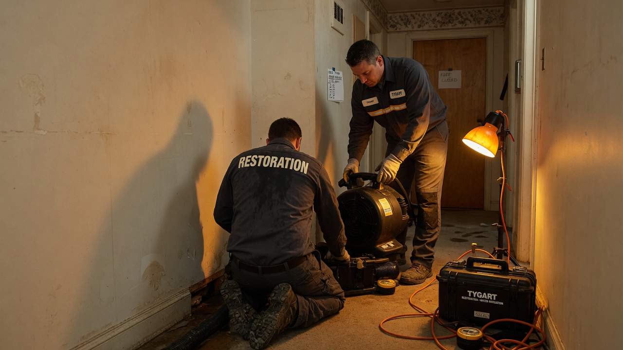
    Every restoration company has the same problem: the estimator thinks one way, the technician works another way, the PM juggles both, and the office admin is the only person who sees the whole picture.

    Claude Cowork — Anthropic’s agentic desktop AI — might be the most unlikely training tool the restoration industry has ever stumbled into. Not because it does restoration work, but because it shows every person on your team exactly how a well-run job should be decomposed, delegated, and managed.

    The short answer: Claude Cowork visibly breaks complex tasks into sub-tasks and delegates them to specialized sub-agents in real time. That process — plan, decompose, delegate, track, adjust — is the exact workflow a restoration project manager needs to master. Watching Cowork do it live is like watching a senior PM narrate their thought process.

    Why Restoration Teams Struggle With Task Decomposition

    A water damage job is not one job. It is an inspection, a moisture reading, a scope of work, an insurance estimate, a mitigation plan, a materials order, a labor schedule, a documentation trail, a customer communication cadence, and a final walkthrough — all running on overlapping timelines with interdependencies that change when the adjuster moves a number or the homeowner changes their mind.

    Most restoration employees learn this by doing it wrong a few times. The estimator forgets to document something the technician needs. The PM double-books a crew. The admin discovers at invoicing that the scope changed three times and nobody updated the file. The learning curve is expensive — in rework, in customer trust, and in insurance relationships.

    What if there was a way to show every person on the team what good decomposition looks like before they have to learn it through failure?

    How Cowork Maps to Every Role on a Restoration Team

    The Estimator

    Give Cowork a prompt like: “A homeowner reports water damage in their finished basement after a sump pump failure. The basement has carpet, drywall, and a home office with electronics. Build me a complete inspection and documentation plan.”

    Watch what happens. Cowork does not respond with a single block of text. It builds a plan: identify affected areas, document moisture readings at specific points, photograph damage progression, catalog affected materials, note potential secondary damage indicators, create the scope of work outline, flag items that need adjuster attention. Each task has a sequence. Each task feeds the next one.

    An estimator watching this process sees — visually, in real time — how a thorough inspection plan is structured. Not as a checklist someone hands them, but as a plan that emerges from thinking about what the downstream consumers of that inspection need.

    The Office Admin

    Admins are often the most underserved role in restoration training. They handle intake calls, schedule crews, manage documentation, track certificate of completions, follow up on invoicing, and keep the CRM updated — and most of their training is “watch Sarah do it for a week.”

    Give Cowork a task like: “A new water damage claim just came in. The homeowner called, insurance info is confirmed, and the estimator is heading out tomorrow. Build me the complete administrative workflow from intake through final invoice.”

    Cowork will decompose this into a multi-track plan: the documentation track (claim number, photos, moisture logs), the communication track (homeowner updates, adjuster correspondence, crew scheduling), the financial track (estimate submission, supplement tracking, invoice preparation), and the compliance track (certificates of completion, lien waivers if applicable). The admin watches these tracks unfold in parallel and sees how their daily tasks connect to the larger job lifecycle.

    The Project Manager

    This is where Cowork shines brightest for restoration. The PM is the lead agent on every job. They are the conductor. And most PMs in restoration were promoted from technician or estimator roles — they know the technical work but were never formally trained in project orchestration.

    Give Cowork a complex scenario: “We have three active water damage jobs, a fire damage mitigation starting Monday, and two reconstruction projects in progress. One of the water jobs just had a scope change from the adjuster. Build me a weekly coordination plan.”

    Cowork will show the PM what a senior operations manager would do: prioritize by urgency and revenue, identify resource conflicts, flag the scope change as a dependency that blocks downstream work, and sequence the week’s actions across all jobs. The PM sees how to think about multiple concurrent projects — not just react to whichever phone rings loudest.

    The Technician

    Technicians often see their work as task execution — set up equipment, monitor readings, tear out materials. What they rarely see is how their documentation feeds the estimator’s supplement, how their moisture readings affect the PM’s timeline, and how their work quality determines whether the final walkthrough results in a sign-off or a callback.

    Give Cowork a mitigation task: “Day 3 of a category 2 water loss in a two-story home. Drying equipment is in place. Build me the technician’s complete daily workflow including documentation, monitoring, communication, and decision points.”

    The technician watches Cowork build out not just the physical tasks but the information tasks — the readings that need to be recorded and where they go, the photos that need to be taken and what they prove, the communication checkpoints with the PM. It connects the dots between doing the work and documenting the work in a way that a training manual never does.

    The Sales Manager

    Restoration sales — whether it is commercial accounts, TPA relationships, or plumber referral networks — involves pipeline management that most salespeople in the industry handle with a spreadsheet and memory. Give Cowork a business development task: “We want to build relationships with property management companies that manage fifty or more residential units within thirty miles. Build me a ninety-day outreach plan.”

    Cowork breaks this into research, qualification, outreach sequences, follow-up cadences, and tracking — the same structured approach a sales operations manager would build. The sales manager sees that prospecting is not just “make calls” but a planned, multi-stage process with measurable milestones.

    The Training Unlock Nobody Expected

    Here is what makes this genuinely different from handing someone a training manual or a process document: Cowork shows the thinking, not just the result.

    A process document tells you what steps to follow. Cowork shows you why those steps exist, what depends on what, and how a change in one area cascades through the rest. It shows the conductor at work — not just the sheet music.

    For a restoration company that struggles with inconsistent job quality, scope creep, communication breakdowns between field and office, or PMs who are technically skilled but operationally reactive — Cowork is a training layer that works alongside the people, not instead of them.

    Your technician does not become a project manager by watching Cowork. But they start thinking like one. And that shift in perspective — from task executor to system thinker — is the hardest training outcome to achieve and the most valuable one a restoration company can develop.

    Frequently Asked Questions

    Can Claude Cowork actually help train restoration employees?

    Yes. Cowork visibly decomposes tasks into sub-tasks, delegates them to sub-agents, and shows progress in real time. That decomposition mirrors exactly how a restoration project manager should plan and track a job. Watching Cowork work through a restoration scenario teaches the planning skill, not just the technical steps.

    Which restoration roles benefit most from watching Cowork?

    Project managers benefit most because Cowork’s lead-agent pattern directly mirrors the PM role. But estimators learn thorough documentation planning, admins see how their workflows connect to the full job lifecycle, technicians understand how their documentation feeds downstream processes, and sales managers see structured pipeline management.

    Does Cowork replace restoration project management software?

    No. Cowork is not a project management tool and does not replace platforms like DASH, Xactimate, or your PSA. It is a thinking tool that shows people how to plan and decompose work. Use it to train the thinking, then apply that thinking inside your existing systems.

    How would a restoration company actually use Cowork for training?

    Run a real restoration scenario through Cowork during a team meeting. Let the team watch it decompose the job, then discuss what it got right, what it missed, and how each person’s role connects to the plan. The plan Cowork generates becomes a discussion artifact — a living training aid rather than a static document.

    Is Claude Cowork available for restoration businesses?

    Claude Cowork is available through the Claude desktop app on Pro, Max, Team, and Enterprise plans. Any restoration company with a subscription can start using it immediately. It runs on Mac and Windows.

    ]+>’,’ ‘,sys.stdin.read()); print(len(text.split()))”


  • La Push, Washington: First, Second, and Third Beach on the Olympic Coast

    La Push, Washington: First, Second, and Third Beach on the Olympic Coast

    La Push: Quileute Land, Three Beaches, and the Edge of the Known World

    La Push at a Glance: La Push is a small community on the Pacific coast of Washington’s Olympic Peninsula, situated on the Quileute Tribe’s reservation at the mouth of the Quillayute River. It is the western terminus of SR-110 and the access point for First, Second, and Third Beach inside Olympic National Park — three of the most dramatic wild coastline stretches in the continental United States. Visitors are guests on Quileute land. That framing matters and should shape how you approach the visit.

    La Push sits at the end of the road. Literally — SR-110 terminates here, at the edge of the Pacific, with nothing between you and Japan but open ocean. The setting is elemental: sea stacks rising from the surf, old-growth rainforest coming down to the shore, the kind of coast that makes clear why the Quileute people have lived here for thousands of years.

    Most visitors to La Push know it from the Twilight books, which set a significant portion of the story on the reservation and gave First Beach a cultural moment it has been processing ever since. The Twilight connection brings visitors; the actual coast keeps them longer than they planned.

    Understanding La Push as Quileute Land

    La Push sits within the Quileute Tribe’s reservation, and that context is not incidental to the visit — it’s the foundation of it. The Quileute are one of the few peoples in the world whose language has no known relatives; Quileute is a linguistic isolate. They have inhabited this coast for thousands of years, with oral traditions and archaeological evidence both pointing to deep roots in this specific landscape.

    The community at La Push is small — a few hundred people. The tribe operates the Quileute Oceanside Resort, the primary lodging at La Push. Visiting respectfully means treating this as what it is: a living community, not a backdrop for tourism.

    A few practical points: photography of community members without permission is not appropriate. The tribal school and residential areas are not visitor attractions. The beaches within Olympic National Park are public lands, but the community itself is private. The distinction is usually clear on the ground.

    The Quileute Tribe has been engaged in a long effort to move tribal housing away from the current flood-plain location — the community sits in one of the most tsunami-vulnerable spots in the continental US. Supporting the tribe’s businesses (the resort, the fuel station) is the most direct way visitors contribute to this effort.

    Getting to La Push

    La Push is 14 miles west of Forks via SR-110. From Port Angeles, allow about 75 minutes. From Seattle, it’s a 3.5–4 hour drive via the Bainbridge ferry and US-101. There is no ferry to La Push. There is no shortcut. You drive through Forks, turn west on La Push Road, and follow it to the end.

    The road passes through the lower Bogachiel Valley, one of the wetter parts of the Peninsula. Count on rain in any month. The coast averages over 100 inches of rainfall per year.

    First Beach: The One You Drive To

    First Beach is directly accessible from the end of SR-110, a short walk from the resort and parking area. It’s a broad, dark-sand beach at the Quillayute River mouth, with Quileute Needles rock formations offshore and James Island — a large sea stack with a flat top — anchoring the southern end of the bay.

    Surfing happens here. The break is consistent enough that La Push has an active local surf scene, and wetsuit-clad surfers in the water are a common sight even in the middle of winter. The water is cold (Pacific Northwest cold — upper 40s to low 50s Fahrenheit), the currents are powerful, and casual swimming is not recommended. Watching the surf is free.

    First Beach is also the most accessible introduction to what Olympic’s Pacific coast actually looks like: sea stacks, driftwood, fog, ravens. It looks nothing like any other coast in the contiguous US.

    Second Beach: The Most Accessible Hike

    Second Beach is 0.7 miles from the trailhead on the South Fork La Push Road, with 200 feet of elevation change through old-growth forest before emerging onto a mile-wide beach framed by sea stacks and offshore rocks. The tide pools here are among the most accessible on the Olympic coast.

    This is the sweet spot of the La Push beach system: enough of a walk to thin the crowds, short enough to be appropriate for most visitors, and the beach itself is genuinely extraordinary. The Quateata sea stack at the southern end of Second Beach is one of the more striking rock formations on the coast.

    Tides matter enormously at Second Beach. At low tide, passage around headlands opens up to the north. At high tide, the same areas are impassable and potentially dangerous. Download the NOAA Tides app or check tidal predictions before hiking — Olympic’s Pacific beaches operate on tidal logic, not hiking logic.

    Third Beach: For Those Who Want Solitude

    Third Beach requires a 1.4-mile hike from the trailhead — longer than Second Beach, which keeps it noticeably quieter. The trail drops through the same old-growth forest and emerges onto a beach backed by dramatic headlands. Taylor Point at the south end requires a tidal crossing to pass; beyond it lies the wilderness coast of Olympic National Park, accessible to backpackers with overnight permits.

    The sea stacks at Third Beach are among the tallest on the Olympic coast — stone pillars rising 50–100 feet from the surf with trees growing on their summits, seabirds nesting on the ledges. Tufted puffins nest on the offshore rocks seasonally.

    If your only goal is solitude and wilderness, Third Beach is where to aim. Start early and check tides.

    Quileute Oceanside Resort

    The tribe operates the Quileute Oceanside Resort at La Push, which includes motel-style rooms, cabins, and RV sites on the bluff above First Beach. The cabins have direct ocean views — the view from the bluff looking south across First Beach toward James Island is one of the iconic Pacific Northwest coastal panoramas. The cabins book well in advance in summer.

    Staying at the resort is the strongest way to support the tribal community directly. The tribe’s fuel station and small store are the other local commercial options.

    When to Visit La Push

    The short answer: any time. The longer answer: it depends on what you want.

    Summer (June–August): Best weather probability, longest days, most accessible tidal windows. Also the most visitors. First and Second Beach are busy on summer weekends.

    Winter (November–March): The Pacific Northwest coast in winter is a specific kind of dramatic — heavy surf, storm systems moving through, gray skies that make the sea stacks look like illustrations. The whale migration passes close to the coast (gray whales northbound in spring, southbound in fall). Crowds are thin. Rain is guaranteed. The Quileute Oceanside Resort stays open year-round.

    Shoulder seasons (April–May, September–October): The best compromise. Fewer people, reasonable weather windows, active wildlife.

    Wildlife at La Push

    The offshore rocks and sea stacks are seabird colonies. Common murres, pigeon guillemots, pelagic cormorants, and in season, tufted puffins nest on the rocks that break the surf offshore. Harbor seals haul out on lower rocks at low tide. Bald eagles are year-round residents.

    Gray whales migrate past the outer coast in spring (northbound, March–May) and fall (southbound, November–December). During peak migration, whales are visible from the beaches — particularly from the headland viewpoints at Second and Third Beach — without a boat.

    Practical Notes

    Cell service at La Push is limited. Download maps offline and check tides before you leave Forks. US-101 gas stations in Forks are your last reliable fuel stop before La Push.

    An Olympic National Park pass covers the beach trailheads. The resort parking and First Beach access don’t require a park pass, but Second and Third Beach trailheads do.

    Backpacking the wilderness coast south of Third Beach requires an overnight permit from Olympic National Park. The coastal wilderness area is one of the most remote and demanding backpacking environments in the lower 48 — bear canisters, tidal schedules, and permit systems all apply.

    FAQ: La Push, Washington

    Is La Push on an Indian reservation?

    Yes. La Push is within the Quileute Tribe’s reservation. The beaches — First, Second, and Third — are within Olympic National Park, which is public land. The community, tribal buildings, and residential areas are on tribal land. Visitors are welcome at the resort and beaches; treating the community with respect means staying out of residential areas and not treating the village as a tourist attraction.

    What is La Push known for besides Twilight?

    La Push is known for three of the most dramatic wild beaches on the Pacific coast — First, Second, and Third Beach — as well as consistent surf, extraordinary sea stacks and offshore rock formations, exceptional tidepooling, and access to the Olympic coast wilderness for backpackers. The Quileute cultural heritage and language (a linguistic isolate with no known relatives) are significant in their own right.

    How do you get to Second Beach from La Push?

    Drive past the main La Push area on South Fork La Push Road to the Second Beach trailhead. The hike is 0.7 miles through old-growth forest with about 200 feet of elevation change. Check tides before going — tidal conditions affect access to headland passages on the beach.

    Is it safe to swim at La Push?

    Not recommended for casual swimmers. The Pacific coast here has cold water, strong currents, and unpredictable sneaker waves. Surfing happens here among experienced surfers with appropriate gear. Wading in the shallows is fine with awareness; swimming in the surf is a serious risk.

    Where do you stay at La Push?

    The Quileute Oceanside Resort, operated by the tribe, is the primary lodging. It offers motel rooms, cabins with ocean views, and RV sites. Camping is available at the Mora Campground inside Olympic National Park, about 5 miles east of La Push on the Quillayute River.

    Can you see whales from La Push?

    Yes, during migration. Gray whales move north past the outer coast from March through May and south again from November through December. The headland viewpoints at Second and Third Beach offer good observation points during peak migration.

    Do I need a permit to visit the beaches at La Push?

    First Beach does not require a park permit. Second and Third Beach trailheads are within Olympic National Park and require a park pass or America the Beautiful pass. Overnight backpacking on the wilderness coast requires a separate overnight permit from the park.


  • Lake Crescent, Olympic National Park: The Complete Visitor Guide

    Lake Crescent, Olympic National Park: The Complete Visitor Guide

    Lake Crescent Is Not a Detour — It’s the Destination

    Lake Crescent at a Glance: Lake Crescent is a glacially carved lake inside Olympic National Park, situated 20 miles west of Port Angeles on US-101. At 624 feet deep and nearly 9 miles long, it is one of the deepest lakes in Washington. The water is nitrogen-poor and exceptionally clear, giving it a distinctive turquoise-blue color. There is no town here — only the park, a historic lodge, a handful of trailheads, and one of the more quietly spectacular overnight experiences in the Pacific Northwest.

    Most people who drive past Lake Crescent on US-101 are on their way somewhere else — Forks, the coast, Neah Bay. The lake appears in the windshield like a mistake, too blue to be real, hemmed in by Douglas fir and the vertical walls of Storm King Mountain. A lot of people slow down. Some pull over. Very few plan to stay.

    That’s the opening. Lake Crescent rewards the people who actually stop.

    Getting to Lake Crescent

    Lake Crescent sits directly on US-101, 20 miles west of Port Angeles. There’s no turnoff to miss — the highway runs along the lake’s southern shore for several miles, with pullouts and access points clearly marked. From Seattle via the Bainbridge ferry, allow about 3–3.5 hours. From Port Angeles, it’s a 25-minute drive.

    The Storm King Ranger Station, the primary day-use access point, is marked on US-101. The Lake Crescent Lodge entrance is half a mile past the ranger station heading west. Both have parking areas, though the lodge lot can fill during peak summer weekends.

    An Olympic National Park pass or America the Beautiful pass covers entry. The park does not charge a separate fee to access the lake itself beyond the standard park entrance fee.

    The Water: Why It Looks Like That

    Lake Crescent’s color — that deep blue-green that photographs as almost Caribbean — is the result of chemistry, not light tricks. The lake is naturally low in nitrogen, which limits algae growth. Without the algae that gives most freshwater lakes their green tint, the water reads as blue. In shallow areas over light-colored gravel, the effect intensifies to turquoise.

    The lake occupies a glacially carved basin that was once connected to Lake Sutherland to the east. A massive landslide separated the two lakes thousands of years ago. The isolation meant Lake Crescent’s fish populations evolved independently — the Beardsley trout and Crescenti trout are subspecies found nowhere else on Earth.

    The depth — up to 624 feet in places — also contributes to the clarity. Deep water stays cold and stratified; the cold temperatures further suppress biological activity near the surface.

    Marymere Falls: The Trail Everyone Should Do

    The Marymere Falls trail starts from the Storm King Ranger Station parking area and runs 1.8 miles round trip through old-growth forest to a 90-foot waterfall tucked into a side canyon. The trail crosses Barnes Creek on a footbridge, passes through impressive stands of western red cedar and Douglas fir, and arrives at a viewpoint below the falls.

    The falls themselves drop in two tiers — a narrow upper drop followed by a broader lower cascade into a pool. In late spring and early summer when snowmelt is feeding the creek, the volume is at its peak. By late August the flow is reduced but the old-growth forest remains equally impressive.

    Difficulty: Easy to moderate. The trail gains about 200 feet of elevation. Suitable for most fitness levels and manageable for older children. Expect the trail to be wet in all but the driest summer months — the forest here gets significant moisture even in the rain shadow’s edge.

    Mount Storm King Trail: The Hard Version

    From the same trailhead, the Mount Storm King trail branches off the Marymere Falls path and climbs steeply to a viewpoint above the lake at around 2,700 feet. The hike is 4.4 miles round trip with 1,700 feet of elevation gain — genuinely steep by any measure. The upper section uses ropes for the steepest pitches.

    The payoff at the top is one of the better views in Olympic National Park: Lake Crescent below, the Strait of Juan de Fuca to the north, and the park’s interior peaks to the south. Plan 3–4 hours round trip for fit hikers. This is not a casual walk.

    Lake Crescent Lodge

    Lake Crescent Lodge has been operating at the lake’s eastern end since 1916. The main building — a white clapboard structure with a deep front porch overlooking the water — is one of the more recognizable images of Olympic National Park. Franklin D. Roosevelt stayed here in 1937, a visit that contributed directly to Olympic’s designation as a national park the following year.

    The lodge operates seasonally, typically late April through late October. Accommodations range from rooms in the historic main building (shared bathrooms in the original wing) to modern motel-style rooms and freestanding cottages closer to the water. The cottages book the furthest in advance — they sit practically at lake level and some have fire pits.

    The dining room serves dinner nightly during the operating season and is open to non-lodging guests with reservations. The menu reflects Pacific Northwest sourcing: local seafood, Washington wines, and a bar that turns over to a peaceful evening scene as the lake goes still after sunset. This is one of the best dinner settings in the park system.

    Reservations: Lake Crescent Lodge books months in advance for peak summer. If you want a cottage in July, start looking in February. The main lodge rooms and motel units are somewhat easier to get with shorter lead time but still sell out on weekends.

    Paddling the Lake

    Lake Crescent Lodge rents rowboats and kayaks seasonally from the dock below the main building. The lake’s sheltered eastern end, near the lodge and Barnes Point, is the calmest paddling — the western end opens to more exposure and afternoon winds can make conditions challenging for inexperienced paddlers.

    The water temperature at the surface stays cold even in summer (typically in the low-to-mid 50s Fahrenheit) due to the lake’s depth and cold inflows. Cold-water immersion is a serious risk for anyone paddling without a wetsuit or dry suit. The lodge rental staff will advise on current conditions.

    No motorized boats are permitted on the lake, which keeps the water surface calm and the noise level in the category of wind, birds, and paddle strokes.

    Barnes Point and Picnic Access

    Barnes Point, accessible via a short spur road off US-101 near the lodge turnoff, has a picnic area directly on the lake with swimming access in summer. This is the most direct way to reach the water without lodging or a boat rental. The swimming area is informally maintained — there’s no lifeguard — and the water is cold. The views from the picnic tables looking west down the length of the lake are among the best casual viewpoints on the property.

    Pyramid Peak Trail: The Less-Traveled Option

    On the lake’s north shore, accessible via a separate road, the Pyramid Peak trail climbs to a viewpoint above the lake’s western section. The trailhead is less visited than the Storm King side, which means solitude even in peak season. The hike is 3.5 miles round trip with about 1,500 feet of gain — serious but shorter than Storm King.

    Practical Notes

    Cell service at Lake Crescent is minimal to nonexistent. Download offline maps before leaving Port Angeles. The lodge has WiFi in the main building but coverage does not extend to the cottages.

    US-101 along the lake’s south shore has no shoulder in several sections. Cyclists should be aware that the road is narrow and traffic moves at posted speed. The Olympic Discovery Trail has an off-road segment in this area for cyclists who prefer to avoid the highway.

    Wildlife is active around the lake, particularly at dawn and dusk. Black-tailed deer are common in the parking areas and lodge grounds. Black bears are present in the park — standard food storage protocols apply for campers.

    The lake itself is entirely within Olympic National Park. There is no commercial development beyond the lodge, no gas station, and no grocery store. Arrive with whatever you need from Port Angeles.

    FAQ: Lake Crescent, Olympic National Park

    Is Lake Crescent worth visiting?

    Yes — it’s one of the most visually distinctive natural features in Olympic National Park and arguably in the Pacific Northwest. The combination of color, depth, old-growth forest, and the historic lodge makes it one of the region’s more complete destination experiences.

    Can you swim in Lake Crescent?

    Yes, at Barnes Point and informally in other accessible shoreline areas. The water is very cold — typically in the low-to-mid 50s Fahrenheit even in summer — and there are no lifeguards. Strong swimmers with cold-water tolerance handle it fine; casual swimmers should be cautious.

    How do I reserve a room at Lake Crescent Lodge?

    Reservations are made through the park concessionaire’s website. Cottages and peak-season dates fill months in advance. The lodge operates seasonally, typically late April through late October.

    What is the easiest hike at Lake Crescent?

    The Marymere Falls trail — 1.8 miles round trip, 200 feet of elevation gain, through old-growth forest to a 90-foot waterfall. It’s the most accessible trail at the lake and one of the best easy hikes in Olympic National Park.

    Can you kayak or canoe on Lake Crescent?

    Yes. The lodge rents rowboats and kayaks seasonally. Private boats can be launched at Barnes Point. No motorized boats are permitted.

    Is there food at Lake Crescent besides the lodge restaurant?

    No. The lodge dining room is the only food service at the lake. It’s open to non-guests with reservations during dinner service. Stock up in Port Angeles before arrival.

    How far is Lake Crescent from Port Angeles?

    About 20 miles west on US-101, roughly 25 minutes by car under normal conditions.


  • How Claude Cowork Can Actually Train Your Staff to Think Better

    How Claude Cowork Can Actually Train Your Staff to Think Better

    Last refreshed: May 15, 2026

    What if the most powerful staff training tool you’ll touch this year is hiding inside an AI app you already pay for?

    There is a quiet productivity feature inside Claude Cowork that almost nobody is talking about. It is accidentally one of the best project management training tools I have ever seen — and once you notice it, you cannot unsee it.

    The short answer: Claude Cowork shows you its plan and progress in real time as it decomposes a task into sub-tasks and delegates them to a team of sub-agents. That visible decomposition — the same skill a great project manager uses every day — turns Cowork into a live training tool for any staff member learning to break down ambiguous work into executable pieces.

    The Difference Between Chat and Cowork

    When you work with Claude in chat, you hand it a prompt and you get an answer. It is fast, it is useful, and most of the work happens invisibly — somewhere between your question and the response. You do not see the thinking. You do not see the breakdown. You just see the output.

    Cowork is different. When you give Cowork a task, you watch it work. Anthropic’s own documentation confirms this: Cowork shows progress indicators at each step, surfaces its reasoning, and lets you steer mid-task to course-correct or add direction. For complex work, it coordinates multiple sub-agents running in parallel.

    That transparency is the feature. And it is the feature that makes it a training tool.

    The Conductor and the Section Players

    Here is what is actually happening under the hood — and this is the part I had to confirm because I had been assuming it.

    Cowork uses the same agentic architecture as Claude Code. A lead agent (the orchestrator) takes the overall task, decomposes it into subtasks, and delegates those subtasks to specialized sub-agents. The lead maintains oversight, handles dependencies, sequences work when one piece depends on another, and synthesizes the final result. Sub-agents work independently in their own context windows and can flag dependencies back to the lead.

    It is a conductor with a section of players. The conductor does not play the violin. The conductor decides when the violins come in, how loud, and for how long.

    This is exactly how a competent project manager operates.

    Why This Matters for Training Your Staff

    Most people — including most project managers I have worked with — struggle with one specific skill: taking a messy, ambiguous goal and breaking it into a sequence of manageable, dependency-aware tasks. It is the difference between “we need to launch the new site” and a project plan with seventeen sequenced items, three parallel workstreams, and clear handoff points.

    Cowork does this decomposition in front of you, in plain English, every time you give it a task. You can literally watch a lead agent think through: what does this goal actually require, what order do the pieces need to go in, what can happen in parallel, what is the dependency chain, and how do I know when we are done?

    For a PM in training, that is a live demonstration of planning. For a staff member who has never had to structure work before, it is a mental model they can borrow.

    The “Oh Yeah, I Forgot About This” Superpower

    The part I love most: you can interrupt Cowork while it is running. You can ask a question. You can add a requirement. You can redirect a visual task. And because there is a lead agent holding the plan, it does not panic — it queues your input and addresses it when appropriate.

    That is exactly how you should be working with human teams. You should not be afraid to say “oh wait, I forgot we also need X” to a project manager. A good PM takes the new input, figures out where it fits in the plan, and slots it in without derailing everything else.

    Watching Cowork do this gracefully is a training moment. It shows people that mid-flight course corrections are normal, that good planning systems absorb new information rather than break from it, and that the conductor’s job is to keep the music going even when the score changes.

    How to Actually Use Cowork to Train a Team

    A few things I would try with a team:

    Run a Cowork narration session. Have a new project manager watch Cowork tackle a real task end-to-end and narrate what it is doing and why. Then ask them to plan a real project the same way — out loud, decomposed, with dependencies called out.

    Use Cowork as a planning artifact generator. When someone on your staff hands you a vague goal, run it through Cowork first. Not because Cowork will do the work, but because the plan Cowork produces is a teaching artifact. You can review it together: here is how the task should be broken down, here is the order, here is what runs in parallel.

    Teach delegation by example. When you are training someone to delegate, have them watch how the lead agent assigns work to sub-agents. Narrow scope, clear instructions, defined handoff. That is delegation 101, executed live.

    The Bigger Point

    Tools that hide their thinking make you dependent on them. Tools that show their thinking make you better.

    Chat hides the thinking. Cowork shows the thinking. And the thinking it shows happens to be the exact cognitive skill — structured task decomposition — that separates people who manage projects well from people who drown in them.

    If you are running an agency, a team, or any operation that depends on people learning to break down ambiguous work into executable pieces, Cowork is not just a productivity tool. It is a classroom.

    Frequently Asked Questions

    What is Claude Cowork?

    Claude Cowork is Anthropic’s agentic desktop application that takes on multi-step knowledge work tasks autonomously. Unlike chat, where you exchange single messages, Cowork accepts a goal, builds a plan, and executes it across files and applications on your computer using the same agentic architecture as Claude Code.

    How is Cowork different from Claude chat?

    Chat responds to one prompt at a time and hides its reasoning between your message and its reply. Cowork takes on full tasks, shows you its plan and progress in real time, and lets you steer mid-task. It also coordinates multiple sub-agents in parallel for complex work.

    Does Claude Cowork actually use multiple agents?

    Yes. For complex tasks, Cowork uses a lead/orchestrator agent that decomposes the work and delegates sub-tasks to specialized sub-agents that run in parallel. The lead handles dependency ordering and synthesizes results when work is complete. This is the same supervisor pattern used in Claude Code’s agent teams feature.

    Can I interrupt Cowork while it is running?

    Yes. You can jump in mid-task to ask questions, add requirements, redirect work, or course-correct. The lead agent queues your input and addresses it at the appropriate point in the plan rather than abandoning what is already in motion.

    How can a manager use Cowork to train staff?

    Use Cowork as a live demonstration of structured task decomposition. Have new project managers narrate what Cowork is doing and why, then plan their own projects the same way. Use the plans Cowork generates as teaching artifacts to discuss task breakdown, dependency mapping, and parallel workstreams. Watch the lead agent’s delegation patterns — narrow scope, clear instructions, defined handoffs — as a model for how humans should delegate.

    Who is Claude Cowork designed for?

    Cowork was built for non-technical knowledge workers — researchers, analysts, operations teams, legal and finance professionals — who work with documents, data, and files daily and want to spend more time on judgment calls and less time on assembly. It is available on Pro, Max, Team, and Enterprise plans through the Claude desktop app.

    Does Cowork work alongside Claude in chat?

    Yes. Chat remains useful for quick questions, single-step tasks, and conversational work. Cowork takes over when the work requires planning, multi-step execution, or coordination across files and applications. The same Claude account uses both modes.


  • Sequim, Washington: Lavender, Dungeness Spit, and the Olympic Peninsula’s Sunniest Town

    Sequim, Washington: Lavender, Dungeness Spit, and the Olympic Peninsula’s Sunniest Town

    What Sequim Actually Is — and Why the Rest of the Peninsula Hasn’t Caught On

    Sequim at a Glance: Sequim (pronounced “SKWIM”) is a small city in Clallam County on Washington’s Olympic Peninsula, situated in the rain shadow of the Olympic Mountains. It receives roughly 16 inches of annual rainfall — less than Los Angeles — while the surrounding Peninsula gets several times that amount. The resulting microclimate supports lavender farms, a growing retirement community, and one of the most underrated coastal walks in the Pacific Northwest at Dungeness Spit.

    The thing about Sequim is the weather doesn’t make sense. You drive west from Port Townsend or north from Hood Canal, rain tapping the windshield the whole way, and then around the edges of the Olympic rain shadow you notice the clouds thinning. By the time you’re downtown, you’re in sunshine. The mountains block the prevailing marine weather, creating a pocket of blue sky that locals call the Sequim Blue Hole.

    This quirk of geography shaped everything about the town. The dry microclimate attracted lavender growers in the 1990s when a handful of farmers discovered the soil and sunshine were well-suited for Lavandula. It attracted retirees who wanted Pacific Northwest scenery without Pacific Northwest winters. It attracted birders who know Dungeness Spit as one of the premier shorebird sites on the West Coast.

    What it hasn’t attracted is the same level of tourist attention as Forks or Port Townsend. That’s your opportunity.

    Getting to Sequim

    Sequim sits on US-101 about 17 miles east of Port Angeles and 30 miles west of Port Townsend. From Seattle, the standard route is the Bainbridge or Kingston ferry, then US-101 west. Allow 2.5–3 hours from downtown Seattle including ferry time. From Port Townsend, it’s a 30-minute drive with no ferry required.

    Sequim has its own small airport (William R. Fairchild International, shared with Port Angeles) that serves general aviation but no commercial routes. For most visitors, the drive is the only practical option.

    Dungeness Spit: The Walk Worth Planning Around

    The Dungeness National Wildlife Refuge contains the longest natural sand spit in the United States — a 5.5-mile hook of driftwood and tidal flat extending northwest into the Strait of Juan de Fuca. The spit protects Dungeness Bay, one of the Strait’s most productive crab and shellfish habitats, and serves as a critical migratory stopover for shorebirds and waterfowl.

    Access is via a 0.5-mile bluff trail from the trailhead parking area, which drops to the base of the spit. From there, the full walk to the New Dungeness Lighthouse at the end is 5.5 miles each way — 11 miles round trip. Most day visitors walk 2–3 miles in for the perspective looking back toward the snow-capped Olympics and across the water toward Vancouver Island.

    The lighthouse was built in 1857 and is maintained by a volunteer keeper organization. Lighthouse tours run on weekends in summer; the keeper’s quarters can be reserved for week-long volunteer stays by those willing to serve as temporary lighthouse keepers.

    The refuge charges a small day-use fee. Dogs are not permitted on the spit due to wildlife sensitivity. Bring layers — the wind at the spit’s end is consistent regardless of what the sky looks like at the trailhead.

    Lavender Country: What to Expect and When to Go

    Sequim has around 14 lavender farms operating in and around the city, ranging from small boutique operations with a few acres to larger farms with gift shops and essential oil production. The Sequim Lavender Farmers Association coordinates the farm tour map, available at most local visitor spots.

    Peak bloom: Mid-July, typically the second or third week. The Sequim Lavender Weekend festival falls during peak bloom and draws significant crowds — if you want the farms without the festival traffic, go the week before or after.

    Purple Haze Lavender Farm on Bell Bottom Road is one of the larger operations and worth a visit for the scale of the fields alone. Olympic Lavender Heritage Farm has been growing since the early days of Sequim’s lavender era and focuses on heritage varieties. Jardin du Soleil has a well-regarded gift shop and distillery operation.

    Outside of July, many farms still have dried lavender products and gift shops open, but the fields won’t be in bloom. The shoulder seasons — May-June and August-September — are when the farms are most accessible without crowds.

    Sequim Bay State Park

    Five miles east of downtown on US-101, Sequim Bay State Park has 1,700 feet of saltwater shoreline on Sequim Bay. The park’s location inside the rain shadow means it gets more sun than most comparable state park sites on the Peninsula. Campsites, a boat launch, and a network of forested trails make it a reasonable base for spending multiple days in the area.

    The tidal flats at the park are productive for birdwatching, particularly during migration in spring and fall. The bay itself is relatively sheltered, making it a calmer kayaking destination than the exposed Strait to the north.

    The Olympic Discovery Trail

    The Olympic Discovery Trail runs 130 miles from Port Townsend in the east to the Pacific coast at La Push in the west, passing directly through Sequim. The Sequim section is one of the more developed and accessible segments, with a paved path suitable for cyclists and walkers running several miles through town. Bike rentals are available locally for those who want to ride a segment without bringing their own.

    Where to Eat in Sequim

    Oak Table Cafe: The breakfast institution in Sequim, operating since 1981 on Bell Street. The apple pancakes have been on the menu for decades and remain the thing people drive to Sequim specifically to eat. Expect a wait on weekend mornings.

    Alder Wood Bistro: The strongest dinner option in town. Pacific Northwest menu with local sourcing, wood-fired cooking, and a wine list that reflects the quality of Washington’s wine country. Reservations recommended.

    The Kitchen at Washington’s Hidden Coast: Part of a maritime-themed complex near the waterfront. Casual lunch and dinner with local seafood focus.

    Where to Stay

    Juan de Fuca Waterfront Hotel & Cottages: Waterfront cottages directly on the Strait of Juan de Fuca with views toward Victoria. One of the more distinctive lodging options on the northern Peninsula — private, quiet, positioned for sunrise views across the water.

    Sequim Bay Lodge: A budget-friendly option on US-101 east of downtown, situated on 17 wooded acres on the Olympic Discovery Trail. Best for travelers prioritizing location over amenities.

    For those who prefer to camp, Sequim Bay State Park is the obvious option. Reservations through the Washington State Parks system open several months in advance and are worth making early for summer weekends.

    Practical Notes for Visiting Sequim

    Sequim’s downtown is compact and walkable. Most of the commercial activity is along Washington Street and the adjacent blocks. The city has a full grocery store, pharmacy, and medical clinic. Olympic Medical Center’s main campus is in Port Angeles, 17 miles west.

    The Dungeness Recreation Area (the spit trailhead) is managed separately from the city and has limited parking. Arriving before 9 a.m. on summer weekends virtually guarantees a spot; arriving at noon on a peak July weekend may not.

    Sequim’s rain shadow is real but not absolute. Marine weather systems occasionally break through, especially in winter and fall. Checking the forecast for the specific Sequim microclimate rather than the broader “Olympic Peninsula” forecast gives a more accurate picture.

    FAQ: Sequim, Washington

    How do you pronounce Sequim?

    “SKWIM.” One syllable. The name comes from the S’Klallam word for “quiet water.” Newcomers say “SEE-kwim” exactly once before locals correct them.

    Why is Sequim so sunny compared to the rest of the Olympic Peninsula?

    Sequim sits in the rain shadow of the Olympic Mountains. Prevailing Pacific weather systems move northeast and drop most of their moisture on the mountains’ windward (western and southern) slopes. By the time air reaches Sequim on the northeast side, it has dried out significantly. The result is a microclimate with roughly 16 inches of annual rainfall — dramatically less than the rainforest areas on the western Peninsula.

    When is the best time to see lavender in Sequim?

    Mid-July is peak bloom, typically the second or third week of the month. The Sequim Lavender Weekend festival falls during this period. For the fields without the festival crowds, the week before or after the festival offers good bloom with more manageable traffic.

    How long is the hike at Dungeness Spit?

    The full walk to the lighthouse and back is 11 miles round trip (5.5 miles each way). Most visitors walk 2–3 miles in. The first 0.5 miles involves a descent from the bluff trailhead to the spit itself.

    Is Sequim a good base for Olympic National Park?

    It’s a reasonable base for the eastern and northern park approaches. Port Angeles, 17 miles west, is a closer hub for Hurricane Ridge and the main visitor center. For the western rainforest and coast, Sequim is on the far end — you’d be looking at 1.5–2 hour drives to Hoh or Rialto Beach.

    What is the Dungeness crab connection to Sequim?

    Dungeness Bay, protected by the spit, is the origin of the name “Dungeness crab” — the commercially important Pacific crab species takes its common name from this bay. The area’s cold, clean waters and productive tidal flats were what the original settlers noticed when they named the location after Dungeness Point in England.


  • They Printed March Madness on My Guinness. I Haven’t Stopped Thinking About It.

    They Printed March Madness on My Guinness. I Haven’t Stopped Thinking About It.

    I was at Doyle’s last night for my wife’s birthday when the bartender slid a Guinness in front of me. On the foam head: the NCAA March Madness logo, printed in caramel brown like it belonged there. I forgot they did this. And then I couldn’t stop thinking about what it actually meant.

    Let me be clear about what I saw. A neighborhood bar in Tacoma had executed a national brand partnership — NCAA licensing, custom logo printing technology, a real experiential moment — and delivered it to me in a pint glass for maybe twelve bucks. The NCAA didn’t have to run a TV spot to get in front of me. They got in front of me at the exact moment I was already in a good mood, already spending money, already present.

    That’s not marketing. That’s infiltration. And it was brilliant.

    The Technology Behind the Pour

    The machine doing the printing is called a Ripple Maker. It’s a countertop device that uses food-safe ink and an inkjet-style system to print images directly onto foam — coffee, cocktails, beer heads. The company behind it, Ripples, has been running since around 2016. You can print anything: a logo, a photo, a QR code, a personalized message.

    For a bar like Doyle’s, it’s a few hundred dollars a month to run. For a national brand like the NCAA, it’s a scalable ambient media buy — get into bars running March Madness watch parties across the country, put your brand on every beer ordered during the game, and make it feel organic instead of promotional.

    The NCAA didn’t buy an ad. They bought a moment. There’s a meaningful difference between those two things.

    The NCAA didn’t buy an ad. They bought a moment. There’s a meaningful difference. An ad interrupts. A moment becomes part of the memory. I’m writing about this the next day. Nobody writes about a banner ad the next day.

    What Local Businesses Can Take From This

    Bartender using Ripple Maker foam printer to create branded beer at a bar
    The Ripple Maker prints directly onto foam — coffee, beer, cocktails. A $300/month experiential media channel most brands haven’t touched.

    Here’s where I start thinking about the businesses I work with — restoration contractors, lenders, cold storage operators, B2B service companies. Most of them are buying the same tired channels: Google Ads, Yelp, direct mail. They’re paying to interrupt people.

    What Doyle’s pulled off — even if they didn’t frame it this way — was contextual experiential marketing. The right message, delivered through the right medium, at the right moment, in a way that felt native to the environment. That’s the playbook. The technology is almost incidental.

    Small venues can execute national-brand-level experiential marketing for a few hundred dollars a month. The tech is there. The question is whether you have the creativity to find the right moment for your audience — and whether you’re willing to pay for a moment instead of an impression.

    The restoration contractor who sponsors the coffee at a claims adjuster’s office every Monday morning is doing the same thing. The cold storage company that puts their logo on the temperature monitoring printout that goes to the produce buyer every week is doing the same thing. You find the moment your customer is already present and mentally open, and you show up there — without asking anything of them.

    Why This Matters for Content Strategy

    I run a content agency. We build articles, landing pages, entity clusters — things designed to get found. And I believe in that work. But what Doyle’s reminded me is that not everything distributable is digital.

    The Guinness moment became a story I’m telling today. That story will probably become a LinkedIn post. That post might become a case study in a pitch deck. The physical moment seeded a digital content chain — and the NCAA got attribution in all of it without ever asking for it.

    That’s the loop worth understanding: physical moments, done well, generate organic digital content from the people who experience them. You don’t need to manufacture virality. You need to manufacture memorability.

    Physical moments, done well, generate organic digital content from the people who experience them. Manufacture memorability, not virality.

    I don’t know how much Doyle’s pays for the Ripple Maker. I don’t know what the NCAA paid for the partnership. What I know is that it worked on me — a guy who builds content systems for a living and should theoretically be immune to this stuff. That’s the tell. When the marketing works on the skeptic, it’s really working.


    Happy birthday to my wife, Stef. Best Guinness I’ve had in a while — even if I spent most of it thinking about marketing instead of the moment. She’s used to it.

  • Living in Mason County Washington: The Complete Guide

    Living in Mason County Washington: The Complete Guide

    Living in Mason County Washington: The Complete Guide

    Mason County, Washington is a hidden gem in the Pacific Northwest that offers a unique blend of outdoor recreation, small-town charm, and genuine community spirit. Whether you’re considering relocating here or simply curious about what makes this corner of Washington special, this guide covers everything you need to know about living in Mason County.

    What Makes Mason County Special?

    Nestled in the Olympic Peninsula region of Washington State, Mason County sits between the Cascade Range and the Pacific Ocean. This geographic position gives residents the best of both worlds: easy access to water recreation, mountains, and vibrant outdoor culture, combined with a slower pace of life than you’d find in Seattle or Tacoma.

    Our community values self-sufficiency, outdoor recreation, and neighborly connection. From the working waterfronts of Hood Canal to the forested valleys inland, Mason County has shaped residents who appreciate nature, heritage, and hard work.

    The Communities of Mason County

    Shelton is the county seat and largest city, home to about 10,000 residents. It’s the economic and cultural heart of Mason County, with downtown shops, schools, medical facilities, and local government. Shelton has a rich timber and oyster heritage and remains a working community with genuine local character.

    Belfair, located in the eastern part of the county, is a growing community popular with families. It offers access to Green Cove, several parks, and smaller-town amenities while remaining close to shopping and services.

    Hoodsport is the gateway to Hood Canal and appeals to those seeking waterfront living and recreation. This scenic area is known for its vacation homes, oyster bars, and access to water sports.

    Union sits along Hood Canal’s shoreline and has historically been a logging and oyster community. Today it’s known for its scenic beauty and access to the water.

    Allyn is another Hood Canal community with a quieter, more rural character. It attracts residents seeking privacy and waterfront access.

    Grapeview, Tahuya, and Matlock are smaller communities scattered throughout the county, each with their own local character and strong community ties.

    Geography and Climate

    Mason County spans roughly 960 square miles with diverse terrain. You’ll find forested uplands, river valleys, and the Hood Canal waterfront all within the county borders.

    The climate is maritime Pacific Northwest. Winters are mild (averaging 35-45°F) but wet, with significant rainfall from October through March. Summers are dry and comfortable (70-80°F), making June through September the prime season for outdoor activities. Most residents adjust well to the rainy season and embrace the lush, green landscape it creates.

    Cost of Living

    One significant advantage of living in Mason County is affordability compared to western Washington urban areas. Housing costs are notably lower than King County or Kitsap County, though prices have risen in recent years due to increased interest in the region.

    As of 2026, median home prices range from $350,000 to $550,000 depending on location and proximity to water. Rental availability is limited, with most rentals ranging from $1,200 to $1,800 per month for a two-bedroom residence.

    Overall cost of living (groceries, utilities, services) is reasonable but slightly higher than national averages, typical for Washington State. Gas prices track state and regional trends.

    Why People Choose Mason County

    Outdoor Recreation: Hood Canal offers world-class shellfish harvesting, boating, and water sports. The Olympic Mountains are minutes away. State parks, hiking trails, and fishing access are abundant.

    Community: Mason County communities are tight-knit. People know their neighbors. Local events, farmers markets, and community organizations create genuine connection.

    Affordability: Compared to Seattle or Tacoma metro areas, cost of living is reasonable, especially housing.

    Working Heritage: Mason County has honest, working-class roots. Logging, oyster farming, and fishing remain part of the regional identity.

    Natural Beauty: From Hood Canal to forests to mountain views, scenic beauty surrounds residents daily.

    Challenges to Consider

    Distance from Services: Serious medical specialists, major retailers, and entertainment require trips to Olympia, Tacoma, or Seattle. Expect 45 minutes to over an hour for regional medical care.

    Weather: The rainy season tests residents. Those who thrive here either enjoy the rain or learn to embrace it philosophically.

    Limited Job Market: Employment opportunities are more limited than in larger cities. Many residents commute or work remote. Tourism and natural resource industries are primary employers.

    Population Decline: Like many rural counties, Mason County has experienced population shifts. This affects services and economic vitality in some areas.

    Housing Limitations: Rental housing is scarce. New construction moves slowly. Finding rental properties can be challenging.

    Who Should Consider Moving Here?

    Mason County is ideal for:

    • Remote workers seeking small-town life with natural beauty
    • Retirees wanting affordable living and community connection
    • Outdoor enthusiasts drawn to water recreation and hiking
    • Families valuing local schools and community involvement
    • People seeking escape from urban sprawl without complete isolation

    It may be challenging for those requiring specialized services, those seeking vibrant nightlife/dining, or those needing immediate access to major employers.

    Getting Around

    A car is essential in Mason County. Public transportation is extremely limited. Most residents drive to work, school, and recreation. Highway 101 is the main north-south route. Highway 8 and Highway 3 provide regional connections.

    Conclusion

    Living in Mason County means choosing community, natural beauty, and a slower pace over urban convenience. It’s a place where neighbors matter, outdoor recreation is accessible, and genuine small-town connection still exists. For the right person, Mason County offers genuine quality of life that bigger cities simply can’t match.


    Frequently Asked Questions

    What is the population of Mason County?

    Mason County has approximately 80,000 residents, with the population distributed across multiple small communities. Shelton is the largest city with about 10,000 residents.

    Is Mason County a good place to retire?

    Yes, many retirees choose Mason County for its affordable housing, natural beauty, and strong community. The mild winters and access to recreation appeal to retirees, though limited specialized medical services should be considered.

    What’s the job market like in Mason County?

    The job market is limited compared to larger cities. Main employers include government, healthcare, retail, and tourism. Many residents work remotely or commute to Olympia or other regional centers.

    How much does it rain in Mason County?

    Mason County receives significant rainfall, especially October through March, averaging 55-70 inches annually. Winters are wet but temperatures stay mild. The rainy season creates lush green landscapes.

    What are the best neighborhoods in Mason County?

    Popular areas include downtown Shelton for urban amenities, Belfair for family-friendly living, and Hood Canal communities (Hoodsport, Union, Allyn) for waterfront access and natural beauty.

  • Mason County Real Estate: Prices, Trends and Neighborhoods

    Mason County Real Estate: Prices, Trends and Neighborhoods

    Mason County Real Estate: Prices, Trends and Neighborhoods

    The Mason County real estate market reflects the region’s appeal as an affordable alternative to western Washington’s crowded, expensive metro areas. Whether you’re searching for a cozy family home, a waterfront property, or a rural retreat, understanding the local market is essential to making an informed decision.

    Market Overview 2026

    As of 2026, Mason County’s real estate market has stabilized after several years of growth. Median home prices have increased gradually but remain substantially lower than comparable properties in King, Kitsap, or Pierce counties.

    Current Median Home Price: $425,000-$475,000 depending on area

    Market Trend: Steady appreciation with modest growth. Inventory remains limited, particularly in desirable waterfront and Shelton-area properties.

    Buyer Demand: Strong interest from remote workers, retirees, and those seeking larger properties for less money than available near Seattle.

    Shelton and Downtown Area

    Shelton’s downtown and surrounding residential areas command a premium due to access to schools, services, and employment. This is where you’ll find the most walkable neighborhoods and established infrastructure.

    Price Range: $350,000 to $600,000 for typical homes; $500,000+ for larger properties or those with special features

    Character: Established neighborhoods with mature trees, good schools, and community amenities. Downtown Shelton offers historic charm with modern convenience.

    Best For: Families prioritizing schools, those working in Shelton, or those wanting town amenities with small-town character.

    What to Expect: Properties sell within 30-60 days typically. Competition is moderate to strong for move-in-ready homes. Many houses were built 1970s-1990s, so inspection and maintenance history matter.

    Belfair and Eastern Mason County

    Belfair has emerged as Mason County’s fastest-growing community, attracting families seeking balance between small-town living and reasonable proximity to services. Green Cove provides access to water recreation.

    Price Range: $375,000 to $550,000 for typical residential properties

    Character: Mix of established neighborhoods and newer developments. More spacious lots than Shelton. Good schools and family-oriented community.

    Best For: Growing families, those wanting new or newer construction, and those seeking community connection without urban density.

    What to Expect: Inventory is moderate and relatively consistent. Properties appeal to families relocating from larger cities. Schools and parks are community focus.

    Hood Canal Waterfront Communities

    Hood Canal properties represent the premium end of Mason County real estate. Waterfront access, scenic beauty, and recreation drive values significantly higher than comparable inland properties.

    Hoodsport

    Price Range: $450,000-$800,000+ for waterfront; $350,000-$500,000 for non-waterfront

    Character: Vacation home aesthetic with active boating community. Tourist destination feel with restaurants and shops. Mix of year-round residents and seasonal visitors.

    Best For: Those prioritizing water access and recreation, vacation home investors, retirees enjoying boating lifestyle.

    Union

    Price Range: $425,000-$750,000 for waterfront; $325,000-$450,000 for non-waterfront

    Character: Quieter, more residential than Hoodsport. Strong maritime heritage. Scenic beauty with working waterfront character.

    Best For: Those seeking quiet waterfront living with less tourist activity than Hoodsport.

    Allyn and Other Hood Canal Communities

    Price Range: $375,000-$650,000 depending on waterfront access

    Character: Rural, quiet, private. Strongest appeal to those seeking to escape crowds and development.

    Best For: Those prioritizing privacy and natural setting over amenities and services.

    Rural and Acreage Properties

    Mason County’s rural areas offer exceptional value for those wanting land, privacy, and forest settings.

    Price Range: $200,000-$400,000 for 1-5 acre properties; $3,000-$6,000 per acre for raw land

    What’s Available: Forested acreage, some with creek or river frontage. Rural homes on large lots. Investment properties and hobby farms.

    Best For: Those wanting space, privacy, and self-sufficiency. Hobby farmers, artists, and those working remotely.

    Considerations: Rural properties may lack municipal water/sewer (well/septic required). Road maintenance and property access vary. Closer attention to easements and rights-of-way essential.

    Buying Tips for Mason County

    Work with Local Realtors

    Local agents understand community nuances, neighborhoods, schools, and market dynamics better than those outside the area. Ask for recommendations from local residents or online communities.

    Inspect Carefully

    Many Mason County homes have decades of history. Thorough inspections are essential. Pay attention to roof condition, foundation, septic systems (if applicable), water quality, and heating systems.

    Understand Zoning and Regulations

    Mason County has varying zoning, environmental regulations, and building codes by area. Understand what’s permitted on your property before purchasing.

    Consider Long-Term Appreciation

    While Mason County properties appreciate, growth is steady rather than explosive. Buy for lifestyle fit, not speculation.

    Factor in Commute Costs

    If you work outside Mason County, calculate commute distance and fuel costs when evaluating property value.

    Check Flood and Environmental Status

    Mason County has flood-prone areas, especially near rivers and Hood Canal. Review flood maps and environmental hazard reports.

    Rental Market

    Rental availability is extremely limited in Mason County. Most rentals are single-family homes rather than apartments.

    Typical Rental Prices: $1,200-$1,800 for 2-bedroom homes; $1,600-$2,200 for 3-bedroom

    Availability: Scarce. Expect 6+ month searches to find suitable rentals. Most are found through local networks rather than online listings.

    Investment Perspective

    Mason County real estate offers reasonable appreciation and strong rental demand for those owning properties. Waterfront and Shelton properties appreciate faster than rural areas. However, the market is not a speculative growth market—it’s better suited to buy-and-hold investors and owner-occupants.


    Frequently Asked Questions

    What’s the average home price in Mason County?

    As of 2026, the median home price ranges from $425,000 to $475,000, varying by area. Waterfront properties are significantly higher ($600,000+), while rural properties can be lower ($300,000-$400,000).

    Are Mason County homes appreciating in value?

    Yes, Mason County real estate appreciates steadily. Appreciation is moderate (3-5% annually) rather than explosive. Waterfront and Shelton properties appreciate faster than rural areas.

    Is it a buyer’s or seller’s market in Mason County?

    It’s generally a balanced market with slight advantage to sellers. Inventory is limited, particularly for desirable properties, but buyer demand is steady and consistent.

    What are closing costs in Washington?

    Typical closing costs in Washington range 2-5% of purchase price, including title insurance, escrow, appraisal, inspection, and lender fees. Your realtor and lender should provide detailed estimates.

    Should I buy waterfront property in Mason County?

    Waterfront offers superior appreciation, lifestyle appeal, and recreation access. However, prices are 30-50% higher than comparable inland properties. Consider whether the premium matches your priorities and budget.

  • Mason County Schools: Complete District Guide 2026

    Mason County Schools: Complete District Guide 2026

    Mason County Schools: Complete District Guide 2026

    Mason County’s educational system includes multiple public school districts serving different geographic areas, along with private and alternative school options. This comprehensive guide helps families understand educational choices, district strengths, and programs available in the region.

    Shelton School District

    Shelton School District is the largest in Mason County and serves the county seat and surrounding areas. With approximately 4,000 students, Shelton operates elementary, middle, and high schools serving the Shelton community and surrounding regions.

    Schools

    Elementary Schools: Multiple elementary schools serve grades K-5 throughout Shelton and nearby areas. Schools focus on literacy, numeracy, and foundational skills.

    Middle School: Shelton Middle School serves grades 6-8 and provides academic preparation and enrichment programs.

    High School: Shelton High School serves grades 9-12 and offers comprehensive college-prep and vocational programs.

    District Profile

    Enrollment: Approximately 4,000 students

    Strengths: Strong community engagement, diverse program offerings, active sports programs, and college/career preparation pathways. The district maintains solid academic standards and active parent involvement.

    Special Programs: Career and Technical Education (CTE) programs, Advanced Placement courses, special education services, and English Language Learner support.

    Community Connection: Active school board, parent organizations, and community partnerships. Schools are central to community identity.

    North Mason School District

    North Mason School District serves communities in the northern portions of Mason County, including areas east and north of Shelton.

    Schools

    Elementary School: North Mason Elementary serves grades K-6 with focus on foundational academics and community connection.

    High School: North Mason High School (grades 7-12) combines middle and high school in a single building, creating unique peer mentoring and integrated programming.

    District Profile

    Enrollment: Approximately 800 students

    Strengths: Small class sizes, personalized attention, strong community bonds, and integrated 7-12 model allowing peer mentoring and academic support. Teachers know every student well.

    Challenges: Smaller staff limits some specialized programs. Athletics and extracurriculars are more limited than larger districts. Advanced program options are more constrained.

    Best For: Families valuing small-school experience, strong teacher-student relationships, and tight-knit community focus.

    Hood Canal School District

    Hood Canal School District serves communities along Hood Canal’s shoreline, including Union, Hoodsport, and surrounding areas.

    Schools

    Elementary and Middle: Combined K-8 building serves foundational through middle school grades with integrated programming.

    High School: Hood Canal High School (grades 9-12) serves secondary students with college-prep and vocational pathways.

    District Profile

    Enrollment: Approximately 600 students

    Strengths: Strong community integration, outdoor education emphasis, water-based learning opportunities, and genuine small-school character. Teachers are deeply embedded in community.

    Character: Reflects Hood Canal communities—outdoor-focused, family-oriented, tight-knit. School is gathering place for community life.

    Best For: Families seeking outdoor-focused education, strong community bonds, and small-school authenticity.

    Pioneer School District

    Pioneer School District serves the southern portions of Mason County, including Allyn and surrounding rural communities.

    Schools

    Elementary and Middle: K-8 building serves younger students with foundational academics.

    High School: Pioneer High School (grades 9-12) offers secondary education with community-focused programming.

    District Profile

    Enrollment: Approximately 400-500 students

    Strengths: Tight community bonds, individualized attention, outdoor education opportunities, and authentic small-school experience.

    Character: Rural, family-oriented, community-centered. School serves as gathering place for geographically dispersed community.

    Southside School District

    Southside School District serves communities on the southern fringe of Mason County, with very small enrollment.

    Character: Extremely small (under 200 students), highly community-focused, and reflecting rural character.

    School Performance and Ratings

    Mason County schools’ performance varies by district:

    • Shelton School District: Solid academic performance with consistent standardized test results and good college-going rates. Largest district offers most program diversity.
    • North Mason: Strong academic performance relative to size. Small class sizes enable personalized instruction.
    • Hood Canal: Consistent performance with strong community engagement. Smaller district limits specialized programs.
    • Pioneer: Adequate performance with strong community bonds. Rural challenges include limited specialized services.

    All districts operate under Washington State learning standards and assessment systems. Individual school performance varies, so research specific schools serving your area.

    Special Education and Services

    All Mason County school districts provide special education services under federal IDEA requirements. Shelton District offers the most comprehensive specialized services due to size. Smaller districts provide services but with more limited specialists and programs. Special education planning includes IEPs, 504 plans, and related services.

    English Language Learners

    Shelton School District offers comprehensive ELL support with dedicated staff and programming. Smaller districts provide ELL services but with fewer specialized personnel. Most Mason County communities are primarily English-speaking, so ELL populations are relatively small.

    Career and Technical Education (CTE)

    Shelton School District offers robust CTE programs in healthcare, trades, information technology, and business. Smaller districts offer more limited CTE options. Regional CTE centers provide additional opportunities for secondary students.

    Private and Alternative Schools

    Limited private school options exist in Mason County. Families may consider:

    • Private schools in adjacent counties
    • Homeschooling (popular option with local co-ops and support groups)
    • Alternative educational approaches within public districts

    College Preparation

    Shelton and larger districts offer AP courses and college-prep programming. Smaller districts offer foundational college prep with fewer advanced course options. Community college partnerships provide dual-enrollment opportunities for secondary students interested in associate degrees and workforce credentials.

    Extracurricular Activities

    Shelton: Full range of sports, clubs, performing arts, and activities typical of larger high schools.

    Smaller Districts: Limited but meaningful activities. Sports are available but with smaller rosters and fewer options. Arts and clubs are community-based rather than extensive.

    Choosing the Right School

    Consider:

    • Location: Which district serves your residential area?
    • School Size: Preference for large high schools with diverse programs or small schools with personalized attention?
    • Academic Programs: Needed AP courses, CTE programs, or specialized services?
    • Community Fit: Urban (Shelton), rural, or coastal school culture?
    • Extracurriculars: Importance of sports, arts, and activities?
    • Special Needs: Specialized services or alternative approaches needed?


    Frequently Asked Questions

    What are the main school districts in Mason County?

    The five primary school districts are Shelton (largest, ~4,000 students), North Mason (~800), Hood Canal (~600), Pioneer (~400-500), and Southside (smallest, ~200). Each serves specific geographic regions.

    Do Mason County schools perform well academically?

    Mason County schools meet Washington State standards with adequate performance. Shelton District is the largest with most comprehensive programming. Smaller districts offer personalized attention and community focus, though with fewer specialized programs.

    What are the high school options in Mason County?

    Shelton High School is the largest. North Mason High School combines grades 7-12. Hood Canal, Pioneer, and Southside also operate high schools. Each offers different sizes and community characters.

    Are there private schools in Mason County?

    Private school options are limited within Mason County itself. Families interested in private education may consider homeschooling or private schools in adjacent regions (Olympia, Kitsap County).

    Does Shelton School District offer AP and advanced programs?

    Yes, Shelton School District offers AP courses, honors programs, and advanced academic options. Smaller districts offer foundational college prep with fewer advanced course options.