Tag: Tahuya

  • Know Before You Go: Spring Trail Closures at Tahuya State Forest

    Know Before You Go: Spring Trail Closures at Tahuya State Forest

    Every spring, Belfair and North Mason families load up the truck — ATVs, mountain bikes, hiking boots — and head out Belfair-Tahuya Road toward one of our closest and most-used backyards: Tahuya State Forest. The DNR gates opened April 15 to kick off the 2026 season, running through October 31, and the bulk of those 84 miles of trail are accessible.

    But not all of them. Several trail sections are currently closed or disrupted — one because of a washed-out bridge, others because of active timber harvesting — and knowing the picture before you drive out could save a frustrating Saturday morning.

    The Howell Lake Bridge Is Out

    The biggest closure right now is the Howell Lake Loop Trail, which is shut down due to a washed-out bridge. DNR has not announced a repair timeline as of this writing. If you’re heading to Howell Lake for the fishing, a swim, or a family day-use outing, the lake and the day-use area remain accessible for non-motorized use year-round — but the loop trail itself is impassable until bridge repairs are completed. Worth a call before you commit to that detour.

    Three Timber Sales Are Affecting Multiple Trails

    Active logging operations across three DNR timber sales — known as Trail Mix, Little Wrangler, and School — are also causing temporary closures and access disruptions across a wider section of the trail network. Affected trails currently include Randy’s H2O Stop, Mission Creek, the 1.9 Mile trail, Hoof & Tail, and the Tahuya River Trail.

    Timber harvesting is core to how Tahuya State Forest functions. DNR manages 23,000 acres here as working forest to generate trust land revenue for Washington public schools, and sales rotate through different areas over time. That means the closure footprint shifts week to week as operations move. A trail blocked today may be clear in a few weeks — but new sections can open to logging as well.

    What’s Still Open: Elfendahl Pass

    Even with the active closures, the majority of Tahuya’s trail network — which draws around 200,000 visitors a year — is still open and accessible. The Elfendahl Pass Staging Area, the forest’s main trailhead hub at NE Elfendahl Pass Road, is open for the season and can handle about 50 vehicles, with trailer pull-through for rigs up to 35 feet.

    From Belfair: take SR-300 west 3.5 miles → right on Belfair-Tahuya Road 1.9 miles → right on Elfendahl Pass Road 2.3 miles.

    Before You Head Out

    Trail conditions in Tahuya can shift quickly as logging operations relocate, so check current status before you go:

    • Official DNR page: dnr.wa.gov/GreenMountainTahuya — current closure alerts and the updated March 2025 trail map
    • Phone: (360) 825-1631 — DNR South Puget Sound Region office

    Spring is the best time to be out there. Just know the lay of the land before you leave Belfair.

  • North Mason Property Owners: What the 53.5% Levy Lead Means for Your 2027 Tax Bill

    North Mason Property Owners: What the 53.5% Levy Lead Means for Your 2027 Tax Bill

    If you own property in North Mason — Belfair, Allyn, Tahuya, Union, or anywhere else inside the school district boundary — the April 28 levy result is now leading, and what happens between now and certification on May 8 will land on your tax bill in 2027.

    Here is the practical homeowner framing on the early numbers, the rate, the certification timeline, and what passage actually means for the value of where you live.

    What the rate actually is

    The April 2026 measure is set at $1.01 per $1,000 of assessed property value, levied over four years. That is the lowest rate North Mason has put on the ballot in the recent attempts — down from $1.28 per $1,000 on both 2025 measures.

    The simple translation:

    • $300,000 home: about $25 per month, $303 per year
    • $400,000 home: about $33 per month, $404 per year
    • $500,000 home: about $42 per month, $505 per year
    • $600,000 home: about $50 per month, $606 per year

    If you’ve been in your North Mason home for more than a year or two, your assessed value is likely closer to $400,000-$500,000 in the current Mason County assessor cycle. Waterfront and view properties on Hood Canal trend higher.

    The current count and what’s left to certify

    Combined Mason and Kitsap county totals as of election night: 2,130 yes (53.50%) to 1,851 no (46.50%). Mason County alone — which is where almost all of the district’s voters live — is at 2,089 to 1,808 (53.61% yes). The Kitsap County sliver split 41 to 43 against.

    The Mason County Canvassing Board has a challenged-ballot review meeting scheduled for May 7 at 2:00 PM and will certify the election on May 8 at 2:00 PM. Late ballots will continue to be processed through that window. The official tally is at results.vote.wa.gov.

    A 53.5% lead is durable but not invulnerable. In Mason County, late-counted ballots have historically drifted slightly more progressive on tax measures, which works in the levy’s favor. Still, the margin is narrow enough that homeowners watching closely should treat May 8 as the real deadline before adjusting any planning.

    The property-value question

    Here is the part of this conversation that does not get enough airtime in tax-rate debates. North Mason homes do not exist in a vacuum. Buyers compare them to homes in Bremerton, Silverdale, Port Orchard, Shelton, and the Gig Harbor periphery. School district reputation is part of that comparison, even for buyers who do not have children — because they are pricing in resale to the next family who does.

    Two consecutive levy defeats and the resulting program cuts had a real, if hard-to-isolate, effect on how North Mason listings looked to buyers comparing districts. School-rating sites flagged the cuts. Realtors had to answer questions. Listings in the district sat slightly longer than they would have in a flush-funding scenario.

    A passing levy reverses that signal. It tells the market that this community has decided to stabilize its schools, and that the district will not be forced into another round of visible cuts heading into 2026-27. For a property owner thinking about a 5-to-15-year horizon — which is most North Mason owners — that signal is worth real money on the eventual sale.

    What passage doesn’t change for owners

    Two things to be clear-eyed about. First, the levy revenue does not arrive at the district until April 2027, so programs already cut will not be restored for the 2026-27 school year. The visible school-side improvements that affect community feel — restored athletics depth, returning AP courses, fuller staffing — are 2027-28 questions at the earliest.

    Second, this is a four-year levy, not a permanent funding source. North Mason will be back at the ballot for renewal before this cycle ends. The conversation does not stop on May 8.

    What to watch this week

    The certification meeting on May 8 at 2:00 PM at the Mason County Auditor’s Office is the deadline that matters. If the lead holds, the levy is in. If you want the formal record of the result for refinancing, listing prep, or an appraisal conversation, that is the date to bookmark. Until then, results are leading — not certified.

    Frequently Asked Questions

    How much will the North Mason levy add to my property tax bill?

    The rate is $1.01 per $1,000 of assessed value over four years. On a $400,000 home that is about $33 per month or $404 per year. The rate is down from $1.28 on the two failed 2025 measures.

    When will the April 28, 2026 levy result be certified?

    The Mason County Canvassing Board certifies on May 8, 2026, at 2:00 PM after a challenged-ballot review on May 7. Until then, the 53.50% yes lead is preliminary.

    Does a passing school levy actually affect property values in North Mason?

    The signal effect is real, even if hard to isolate from other factors. After two defeats and visible program cuts, North Mason listings carried a school-funding cloud that buyers asked about. Passage tells the market that the district is stabilizing, which supports values over a 5-to-15-year hold.

    When does the new levy money actually start being collected from homeowners?

    If certified, the levy is collected on property tax bills starting in 2027 — meaning the first new line item appears on the statement issued in early 2027 and paid in April and October of that year.

    Is this a permanent tax or does it expire?

    It expires. The April 2026 measure is a four-year replacement levy. North Mason will return to the ballot before the end of the cycle to renew or replace it.

    Related coverage: North Mason School Levy Leading in Early Returns — Results Not Yet Certified · Homeowner’s Guide to the April 28 Levy: Cost, Programs, and Why It’s on the Ballot Again · Belfair Real Estate 2026

  • New to North Mason? What the Tahuya River Preserve Tells You About Hood Canal — and This Community

    New to North Mason? What the Tahuya River Preserve Tells You About Hood Canal — and This Community

    If you’ve recently moved to North Mason — or you’re considering it — one of the first things you’ll notice is that people here talk about the river. Not metaphorically. The Tahuya River, which drains eastern Mason County and empties into Hood Canal just east of Belfair, is part of the local identity in a way that takes newcomers a minute to fully absorb. This week, 190 acres along the lower Tahuya became permanently protected conservation land. Here’s what that means, and why it matters to you.

    What Is the Tahuya River?

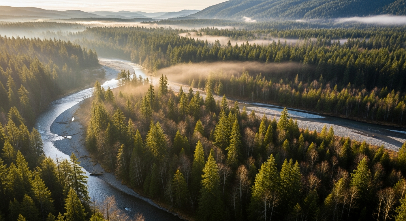
    The Tahuya River rises in the Tahuya State Forest and flows generally west and north through the Tahuya Peninsula before joining Hood Canal south of Belfair. The lower river corridor — the stretch that Great Peninsula Conservancy has been protecting — runs through floodplain forest and wetlands in eastern Mason County, a landscape of big cottonwoods, alder, and towering Douglas firs that overlook the valley.

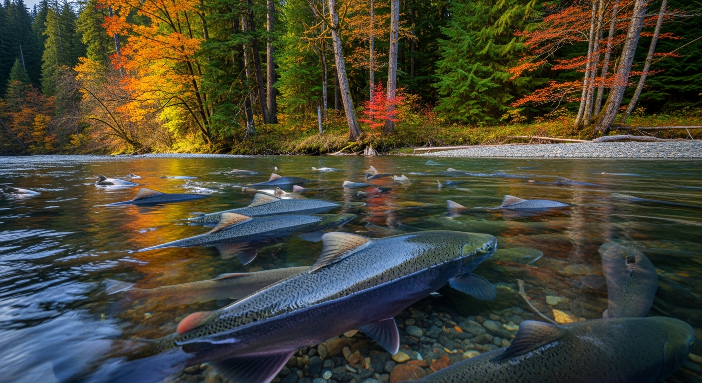
    Each fall, bear tracks and salmon carcasses appear on the lower Tahuya’s banks. That’s not folklore — it’s ecology. Hood Canal summer chum and Chinook salmon both return to the Tahuya to spawn. Both species are listed under the federal Endangered Species Act. The summer chum were actually considered locally extinct here in the late 1990s before a restoration effort by the Hood Canal Salmon Enhancement Group (HCSEG) rebuilt the run using donor fish from the Union River. Since 2006, 200 to 1,000 summer chum return to the Tahuya every year on their own.

    Who Is HCSEG and Where Are They?

    The Hood Canal Salmon Enhancement Group is headquartered right in Belfair, at 600 NE Roessel Road — the same address as the Salmon Center, where the Hood Canal Salmon Run 5K is held each June. HCSEG has been doing salmon research, habitat restoration, and community education in the Hood Canal watershed since the 1990s. They run rotary screw traps on the Tahuya, Dewatto, and Little Quilcene Rivers each spring to count juvenile salmon — it’s one of the primary data sets used to assess whether salmon populations are recovering.

    If you’re new to North Mason and want a fast, credible education in why Hood Canal is the way it is — environmentally, ecologically, culturally — HCSEG is the organization to know. They welcome volunteers, host community events, and their staff are genuinely approachable. Phone: (360) 275-9284. Website: pnwsalmoncenter.org.

    What Is the Tahuya River Preserve?

    Great Peninsula Conservancy assembled the preserve in stages starting in July 2023: 145 acres acquired with Washington Department of Ecology and state Salmon Recovery Funding Board support, then 38 more acres that December, then two small parcels in 2025. The total is now 190 acres, permanently protecting roughly 450 feet of Tahuya River mainstem and anchoring a longer-term plan to conserve the lower four miles of the river.

    The land is held by GPC, based at 6536 Kitsap Way in Bremerton. It is not open to the public for recreation — it’s managed as a working conservation site. But its existence changes what is possible along the lower Tahuya for decades to come.

    What’s Actually Happening Next: The Gabion Wall

    The most concrete near-term project is the planned removal of a Gabion wall from the Tahuya River corridor. A Gabion wall is a wire-cage rock structure — you’ve probably seen them along highways or near bridges, used for erosion control. They work fine for holding a bank in place, but they disrupt the natural flow dynamics that salmon spawning habitat requires: the shifting gravel beds, the cool deep pools, the wood debris accumulations where juvenile fish shelter and feed.

    GPC and HCSEG are working through permitting and hydrology studies to plan the removal. After the wall comes out, engineered log jam structures may be installed upstream to rebuild the natural channel complexity the river has lost. The project is still in planning phase as of May 2026 — but the land protection that makes it possible is locked in.

    Why This Is Part of What Makes North Mason Different

    A lot of communities talk about caring about their environment. North Mason is one of the few places where you can stand at a boat launch on Hood Canal, watch a salmon jump, and trace that fish’s story back to a specific river, a specific restoration project, and a specific group of people who have been working on it for 30 years — and who are headquartered two miles from the Belfair Fred Meyer.

    The Tahuya River Preserve is part of that story. If you’re going to be here long-term, it’s worth knowing it.

    Also see: Tahuya River Preserve: Full Story | Hood Canal from Belfair: Fishing, Kayaking and Beaches

    Frequently Asked Questions

    What is the Tahuya River and where does it flow?

    The Tahuya River drains the Tahuya Peninsula in Mason County, flowing west and north before emptying into Hood Canal south of Belfair. The lower river corridor runs through floodplain forest in eastern Mason County. The river supports ESA-listed summer chum and Chinook salmon runs.

    What is the Hood Canal Salmon Enhancement Group and how can I get involved?

    HCSEG is a Belfair-based nonprofit that has led salmon research, habitat restoration, and education in the Hood Canal watershed since the 1990s. They welcome volunteers for rotary screw trap operations, restoration plantings, and community events. Find them at 600 NE Roessel Road, Belfair, (360) 275-9284, or pnwsalmoncenter.org.

    Can I visit the Tahuya River Preserve?

    The preserve is not currently open to the public for recreation. It is managed as a conservation area by Great Peninsula Conservancy. The nearby Tahuya State Forest and the lower Hood Canal shoreline offer public outdoor access in the same general area.

    What is a Gabion wall and why is removing it good for salmon?

    A Gabion wall is a wire-cage rock structure used for stream bank stabilization. While effective at holding banks in place, they alter natural stream flow, disrupt the gravel beds salmon use for spawning, and prevent wood debris from moving downstream — wood that creates the deep pools and feeding habitat juvenile salmon depend on. Removal allows the stream to recover more natural dynamics.

    Are salmon actually recovering in Hood Canal?

    Yes. Hood Canal summer chum — which were locally extinct in the Tahuya River in the 1990s — have sustained themselves without supplementation since 2015. NOAA Fisheries has indicated the population may meet ESA delisting criteria, which would be the first successful salmon delisting in U.S. history. The Tahuya River is part of that recovery story.

  • Hood Canal Property Owners: What the Tahuya River Preserve Means for Water Quality, Shellfish, and Your Shoreline

    Hood Canal Property Owners: What the Tahuya River Preserve Means for Water Quality, Shellfish, and Your Shoreline

    If you own property on Hood Canal — tidelands, a waterfront parcel, or even a lot a mile back from the water — the long-term health of the canal directly affects what you own. That’s why the permanent protection of 190 acres along the lower Tahuya River is worth understanding, not just as an environmental story, but as a water-quality and property-value story.

    What the Tahuya River Does to Hood Canal

    The Tahuya River drains eastern Mason County and empties into Hood Canal near Belfair. What happens in that watershed — how much sediment runs off after a rain event, how much nutrient load enters the canal, how warm the water is by July — directly affects conditions in Hood Canal itself.

    Hood Canal is a semi-enclosed fjord. It doesn’t flush as quickly as open Puget Sound. Dissolved oxygen levels, water temperature, and nutrient loading matter here in ways that are measurable and consequential. When those factors tip the wrong direction, shellfish beds close. When they hold steady, the canal supports the ecosystem — and the way of life — that Hood Canal property values are built on.

    Great Peninsula Conservancy’s Tahuya River Preserve permanently protects 190 acres of floodplain forest and wetlands along the lower Tahuya corridor. Floodplain forest is not passive. It filters runoff before it reaches the river, moderates water temperatures through canopy shading, and traps sediment that would otherwise flow downstream and into the canal.

    The Gabion Wall Removal: A Direct Water Quality Improvement

    The most significant near-term project connected to the preserve is the planned removal of a Gabion wall from the Tahuya River corridor. Gabion walls — wire-cage rock structures installed for bank stabilization — alter natural stream flow patterns, trap fine sediment in ways that degrade spawning gravel, and prevent the natural movement of large wood debris downstream.

    When the wall comes out, the river will begin recovering a more natural channel dynamic. Engineers are also evaluating engineered log jam structures upstream to rebuild holding pools and feeding lanes for juvenile salmon. Healthier salmon habitat upstream means more adult salmon returning — and salmon carcasses are one of the primary marine-derived nutrient inputs that forest and riparian systems depend on. It’s a closed loop that connects the mountains to the canal.

    The project is in the permitting and planning phase as of May 2026. No construction timeline has been announced, but the land protection necessary to make it happen is complete.

    What This Means for Shellfish Bed Status on Hood Canal

    If you harvest shellfish from Hood Canal tidelands, or if your property value is tied to an open shellfish beach, you already know that closures happen — and that the reasons are usually tied to water quality upstream. Fecal coliform from stormwater, agricultural runoff, and failing septic systems are the primary drivers of WDFW closure events on Hood Canal.

    Protecting floodplain forest along the Tahuya doesn’t fix septic systems — that’s a different problem. But it does reduce one of the diffuse-source inputs: unfiltered runoff from cleared or developed land adjacent to salmon-bearing streams. Every acre of permanently protected floodplain is one less acre that could be cleared, graded, or made impervious in the future.

    For Hood Canal property owners, the preserve is a long-term investment in the upstream conditions that determine what the canal looks like in 20 years.

    The ESA Connection and What It Means for the Canal

    Hood Canal summer chum salmon may become the first ESA-listed salmon population ever removed from the federal endangered species list. That’s not a distant possibility — NOAA Fisheries has signaled the population meets recovery criteria, with Tahuya River runs holding between 200 and 1,000 fish annually since 2006 without supplementation. If delisting proceeds, it would represent a significant reduction in regulatory burden on Hood Canal development and land use — something that directly affects property owners navigating shoreline development permits.

    The Hood Canal Salmon Enhancement Group monitors juvenile salmon on the Tahuya, Dewatto, and Little Quilcene Rivers each spring from their facility at 600 NE Roessel Road in Belfair, (360) 275-9284. Their data is what drives the federal recovery assessment.

    Also see: Tahuya River Preserve: 190 Acres Permanently Protected — Full Story | Hood Canal Property Owners: What the 2026 Shellfish Rule Changes Mean for Your Beach

    Frequently Asked Questions

    Does the Tahuya River Preserve affect Hood Canal shellfish bed closures?

    Indirectly, yes. Protecting 190 acres of floodplain forest along the Tahuya reduces diffuse stormwater runoff into the river and ultimately into Hood Canal. Shellfish closures are driven by fecal coliform levels, and reducing upstream runoff inputs is one piece of the water quality picture. It won’t fix point-source pollution, but it removes a future risk from the equation.

    How does the Gabion wall removal affect Hood Canal water quality?

    Removing the Gabion wall allows the Tahuya River to recover a more natural channel shape — distributing flow across the floodplain, reducing fine sediment export, and allowing wood debris to move naturally downstream. These changes improve water clarity and temperature downstream, benefiting Hood Canal conditions near the river mouth.

    What is the current ESA status of Hood Canal salmon and what does it mean for property owners?

    Hood Canal summer chum and Chinook salmon are both listed as threatened under the ESA. Hood Canal summer chum may be the first ESA-listed salmon ever delisted — a development that would reduce certain regulatory constraints on Hood Canal shoreline and development activities. Continued habitat restoration, including the Tahuya River work, supports the recovery data driving that potential delisting.

    Who is responsible for salmon restoration on the Tahuya River?

    Great Peninsula Conservancy holds and manages the land. The Hood Canal Salmon Enhancement Group (HCSEG), based at 600 NE Roessel Road in Belfair, leads habitat restoration work, juvenile salmon monitoring, and the Gabion wall removal planning in partnership with GPC.

    Does the preserve affect future development near the Tahuya River?

    Yes. The 190 acres are permanently protected by a conservation easement — they cannot be sold for development, cleared, or subdivided. This is the intended outcome: locking in floodplain function in perpetuity so future land use decisions upstream don’t erode what restoration work achieves downstream.

  • Tahuya River Preserve Reaches 190 Acres: What North Mason Needs to Know About Salmon Restoration on Hood Canal

    Tahuya River Preserve Reaches 190 Acres: What North Mason Needs to Know About Salmon Restoration on Hood Canal

    For more than two years, Great Peninsula Conservancy has been quietly assembling one of the most ecologically significant land protection projects on Hood Canal. The result is the Tahuya River Preserve — 190 acres of floodplain forest, wetlands, and riverfront corridor in eastern Mason County, permanently protected and now the anchor for a phased restoration effort targeting the lower four miles of the Tahuya River.

    For North Mason residents who know the lower Tahuya — the bear tracks in the mud, the salmon carcasses that fertilize the cottonwood flats each fall — this is the moment when “protected” stops meaning paperwork and starts meaning something permanent.

    How the Preserve Came Together

    Great Peninsula Conservancy (GPC) built the preserve in stages. In July 2023, the organization acquired 145 acres along the lower Tahuya mainstem, funded through a Washington Department of Ecology Streamflow Restoration grant and the state Salmon Recovery Funding Board. That December, GPC added an adjacent 38-acre parcel. In 2025, two smaller parcels totaling approximately five acres completed the assemblage — including roughly 450 feet of Tahuya River mainstem — bringing the total to 190 acres.

    The preserve sits where the Tahuya River watershed drains into Hood Canal, just east of Belfair. It’s a strategic location: protecting floodplain here controls what enters the canal at one of the most salmon-critical junctions in Mason County.

    Why the Tahuya River Matters for Salmon

    Two salmon species listed under the federal Endangered Species Act use the Tahuya River: Hood Canal summer chum and Chinook salmon. The summer chum story here is one of the most remarkable conservation recoveries in the Pacific Northwest. Summer chum were classified as “recently extinct” in the Tahuya River before a reintroduction effort beginning in the early 2000s. Using Union River summer chum as donor stock, HCSEG rebuilt the run — 750 fish returned in the first year. Since 2006, annual Tahuya summer chum returns have held between 200 and 1,000 fish. The final supplementation release was in 2015; the population has sustained itself since.

    NOAA Fisheries has signaled that Hood Canal summer chum may be the first ESA-listed salmon population ever removed from the endangered species list — a milestone no Pacific salmon population has achieved in the history of the Act. The Tahuya River is part of that recovery story.

    The Hood Canal Salmon Enhancement Group (HCSEG), headquartered at 600 NE Roessel Road in Belfair, monitors juvenile salmon using rotary screw traps on the Tahuya, Dewatto, and Little Quilcene Rivers each spring. Their data drives decisions about where restoration dollars go next — and the Tahuya is currently near the top of that list.

    The Gabion Wall Removal: What Comes Next

    The most significant near-term restoration project is the planned removal of a Gabion wall — a wire-cage rock structure — from the Tahuya River corridor. Gabion walls were widely used in mid-20th century stream engineering to control erosion, but they alter natural stream flows, disrupt gravel substrate that salmon need for spawning redds, and interrupt the natural wood and debris movement that juvenile salmon depend on for cover and food.

    GPC is working with HCSEG on removal plans. Once the wall is out, engineers are also evaluating the installation of engineered log jam structures upstream — designed to mimic the natural wood accumulation that builds holding pools and feeding lanes for juvenile salmon.

    These projects are still in the permitting and hydrology study phase. Salmon habitat work at this scale requires state and federal coordination, contractor mobilization, and hydrological modeling — it moves carefully. But the land protection that makes any of it legally and practically possible is done.

    What This Means for North Mason

    The Tahuya River Preserve represents one piece of a larger conservation strategy for the lower Hood Canal watershed. Every acre of floodplain protected upstream means less sediment loading, cooler water temperatures, and better dissolved oxygen in Hood Canal itself — the same water that determines whether shellfish beds stay open and whether salmon return each fall to the beaches and rivers that define this community.

    For North Mason residents, it’s also a statement about what this corner of Washington is choosing to be. Development pressure on the SR-3 corridor is real. The Tahuya River Preserve locks in a counter-weight: 190 acres that will never be a subdivision, a gravel pit, or a parking lot.

    Residents interested in the restoration work — or in volunteering for HCSEG’s 2026 rotary screw trap season — can contact the Hood Canal Salmon Enhancement Group at 600 NE Roessel Road, Belfair, (360) 275-9284, or at pnwsalmoncenter.org. Great Peninsula Conservancy is based at 6536 Kitsap Way, Bremerton, (360) 373-3500, or greatpeninsula.org.

    Also see: Hood Canal Shellfish Season 2026: What North Mason Harvesters Need to Know

    Frequently Asked Questions

    Where exactly is the Tahuya River Preserve?

    The preserve is in eastern Mason County, along the lower Tahuya River corridor where it drains into Hood Canal. It is located just east of Belfair and is not currently open to the general public for recreation — it is managed as a conservation area by Great Peninsula Conservancy.

    What salmon species use the Tahuya River?

    Hood Canal summer chum salmon and Chinook salmon both use the Tahuya River watershed. Both are listed as threatened under the federal Endangered Species Act. Summer chum were successfully reintroduced to the Tahuya after being classified as locally extinct, and the population has sustained itself without supplementation since 2015.

    What is a Gabion wall and why is it being removed?

    A Gabion wall is a wire-cage rock structure used historically for stream bank stabilization. While effective at controlling erosion, they alter natural water flow, disrupt gravel spawning beds, and impede the movement of large wood debris that salmon depend on. Removal restores more natural stream dynamics.

    When will the Gabion wall removal happen?

    The project is currently in the planning and permitting phase. Great Peninsula Conservancy and HCSEG are working through hydrology studies and regulatory coordination. No construction timeline has been publicly announced as of May 2026.

    How can North Mason residents get involved with salmon restoration on the Tahuya?

    The Hood Canal Salmon Enhancement Group welcomes volunteers for its 2026 rotary screw trap season and other restoration projects. Contact HCSEG at 600 NE Roessel Road, Belfair, (360) 275-9284, or visit pnwsalmoncenter.org.

    Does the Tahuya River Preserve affect Hood Canal water quality?

    Yes. Protecting floodplain forest along the Tahuya River reduces sediment and nutrient runoff into Hood Canal, helps maintain cooler water temperatures, and supports dissolved oxygen levels — all factors that affect shellfish bed status and salmon habitat quality in the canal itself.

  • Tahuya River Preserve Grows to 190 Acres — Salmon Restoration Eyes Gabion Wall Removal

    Tahuya River Preserve Grows to 190 Acres — Salmon Restoration Eyes Gabion Wall Removal

    If you’ve walked the lower Tahuya River corridor lately, you’ve probably noticed the bear tracks and salmon carcasses that line the banks each fall — signs that something worth protecting is still alive here. Thanks to a multi-year land conservation push by Great Peninsula Conservancy, 190 acres along the lower Tahuya River are now permanently protected, and the harder work of actual habitat restoration is moving into its next phase.

    The Tahuya River Preserve sits in eastern Mason County, straddling the watershed that drains into Hood Canal near Belfair. Great Peninsula Conservancy assembled the preserve in stages — 145 acres acquired in July 2023 with support from the Washington Department of Ecology Streamflow Restoration grant and the state Salmon Recovery Funding Board, followed by an adjacent 38 acres in December of that year, and two smaller parcels totaling about five acres in 2025. Taken together, the preserve now protects roughly 450 feet of Tahuya River mainstem and is designed as the anchor point for a larger phased effort to conserve the lower four miles of the river.

    Why does this stretch matter? Both Hood Canal summer chum salmon and Chinook salmon use the Tahuya River watershed — and both are listed under the federal Endangered Species Act. The Hood Canal Salmon Enhancement Group, headquartered at 600 NE Roessel Road in Belfair, has been monitoring juvenile salmon using rotary screw traps on the Tahuya, Dewatto, and Little Quilcene Rivers each spring. Their data guides where restoration dollars go next.

    The most anticipated near-term project is the removal of a Gabion wall — a wire-cage rock structure that alters natural stream flows — from the Tahuya River corridor. Great Peninsula Conservancy is working with the Hood Canal Salmon Enhancement Group on removal plans. Once the wall comes out, engineers are also weighing the installation of log jam structures upstream to mimic natural wood accumulation that juvenile salmon depend on for cover and food.

    These aren’t quick projects. Permitting, hydrology studies, and contractor coordination mean the removal is still in planning rather than construction phase — but the land protection piece that makes any of it possible is done. Our river isn’t going anywhere.

    For anyone who wants to learn more or get involved, Great Peninsula Conservancy is based at 6536 Kitsap Way in Bremerton and can be reached at (360) 373-3500 or greatpeninsula.org. The Hood Canal Salmon Enhancement Group is at 600 NE Roessel Road, Belfair; (360) 275-9284.

    Related Coverage: Tahuya River Deep Dives

  • Tahuya & Dewatto: Rural Living Near Belfair

    Tahuya & Dewatto: Rural Living Near Belfair

    If you’re considering a move to the area and you’ve heard mentions of Tahuya or Dewatto, you might be confused about what these places actually are. Unlike Belfair (which is at least on Highway 3), Tahuya and Dewatto are true rural outposts—unincorporated communities with a different vibe, lifestyle, and set of considerations. Here’s what you need to know if you’re thinking of making one of these areas home.

    What Are Tahuya and Dewatto?

    Both are unincorporated communities in Mason County, meaning they’re not incorporated towns with their own city government or police. They’re pockets of private land interspersed with county land and state forest, with minimal development. Roads are county-maintained. There’s no municipal water or sewer—you’ll have a well and septic system. No town center, no streetlights on most roads, no zoning boards making day-to-day decisions.

    Tahuya sits south and west of Belfair, roughly in the direction of Shelton. It’s known primarily for Tahuya State Forest, a 6,000-acre parcel managed by the Washington Department of Natural Resources.

    Dewatto is a smaller, even more remote unincorporated area further southwest, known mostly by locals and those traveling to or through the region.

    Tahuya State Forest

    The forest is the main attraction and activity hub for the Tahuya area. It’s public land open for multiple recreational uses, and it’s genuinely popular on weekends.

    ORV Trails: Tahuya State Forest has extensive ORV (off-road vehicle) trail systems. If you’re into dirt biking, ATVing, or truck 4×4 driving, this is your playground. Trails range from beginner to advanced. The forest charges day-use fees and has designated parking areas. On sunny weekends, the parking lots fill quickly—arrive early.

    Mountain Biking: Single-track and wider trails are open to mountain bikes. The forest is well-maintained and popular with regional bike clubs. Fall and spring are peak seasons (less mud, better conditions).

    Hiking & Nature Walks: Quieter trails exist throughout the forest for hiking, bird-watching, and general nature exploration. The forest is also home to elk, deer, and occasionally black bears—you’ll encounter wildlife signs regularly.

    Camping: Several primitive camping areas are available in the forest, first-come, first-served. Facilities are basic: pit toilets, water, no hookups. It’s rustic camping, not RV park camping.

    Hunting: Tahuya State Forest opens for game hunting during designated seasons (elk, deer, upland game). Local hunters rely on this forest as a primary resource.

    Living in Tahuya or Dewatto

    Property Sizes: If you buy in Tahuya or Dewatto, you’ll typically see larger lots than in town. 5-10 acres is common; some properties are considerably larger. This gives you privacy, room for a garden, and distance from neighbors.

    Well & Septic Systems: You’re responsible for your own water supply (drilled well) and waste treatment (septic system). This means: annual septic pumping costs, well maintenance, potential well failures in drought years, and no city water backup. It’s a trade-off for independence and lower water bills.

    Roads & Winter Conditions: County roads in Tahuya and Dewatto are often rural and gravel or minimal asphalt. Winter storms can make roads impassable for extended periods. If you need to commute daily to Bremerton or Seattle, factor in 45-60 minutes each way on good-weather days, longer in snow.

    Services & Shopping: You’ll rely on Belfair (5-20 minutes away) for groceries, medical care, and most services. There’s no local grocery store, post office, or clinic in Tahuya or Dewatto. If you’re committed to rural living, you plan your shopping runs and keep supplies on hand.

    Broadband & Utilities: Internet can be spotty. Some areas have cable or DSL; others are limited to satellite. Cell phone coverage is inconsistent. Power outages due to winter storms and tree fall are more common than in town.

    Community Character

    Tahuya and Dewatto attract people who want genuine rural living: homesteaders, outdoor enthusiasts, people who value privacy, and families raising kids far from suburban density. It’s a self-reliant community. Neighbors help each other but also respect boundaries and independence. Town drama is minimal; community is informal and based on shared rural values.

    There’s a real outdoors culture here. People talk about hunting seasons, trail conditions, and wildlife sightings. Kids ride dirt bikes and ATVs. Firearms are common and culturally normal.

    Wildlife & Outdoor Realities

    Elk herds move through Tahuya State Forest and adjacent private land. During rut season (fall) and migration, you might encounter them. Black bears are present but rarely seen (and rare to encounter). Deer are constant. Coyotes are heard at night. It’s not dangerous wildlife—it’s wildlife living alongside humans.

    Hunting pressure is real in fall and winter. If you’re uncomfortable around hunters and firearms, this might not be the right community.

    Property Costs & Tax Implications

    Land in Tahuya and Dewatto is generally cheaper per acre than comparable acreage near Belfair or urban areas. Larger properties (5-20 acres) in these areas run lower per-acre prices, but total cost can be high due to size. Property taxes are based on county rates (no city tax). No HOA fees (usually), but you pay for your own maintenance, upkeep, and services.

    Is Tahuya or Dewatto Right for You?

    Consider this area if you want: large land holdings, genuine rural living, access to outdoor recreation, independence from city services, and a tight-knit outdoor community. Don’t move here if you want: proximity to shopping and services, easy city commuting, reliable utilities, or sociable suburban community.

    What is Tahuya State Forest used for?

    Tahuya State Forest (6,000 acres managed by Washington DNR) is open for ORV riding, mountain biking, hiking, camping, and hunting. Trails range from beginner to advanced. Day-use fees apply. Primitive camping is available first-come, first-served.

    Do I need a well and septic system in Tahuya?

    Yes. Tahuya and Dewatto have no municipal water or sewer. You’ll drill a private well for water and install a septic system for waste. Annual septic pumping, well maintenance, and potential failures are your responsibility.

    How far is Tahuya from Belfair shopping and services?

    Tahuya is 5-20 minutes from Belfair depending on your exact location. Belfair is your closest grocery store, clinic, and services. There’s no local shopping or medical care in Tahuya or Dewatto.

    What is the typical property size in Tahuya and Dewatto?

    Properties typically range from 5 to 20+ acres. Larger lots are common. This provides privacy and room for gardens, but also more maintenance responsibility and higher total purchase price despite lower per-acre costs.

    What is the internet situation in Tahuya?

    Internet can be spotty. Some areas have cable or DSL; others are limited to satellite. Cell coverage is inconsistent. Check with local providers before buying property if broadband is important to you.

  • Hood Canal Shellfish Season 2026: New Rules, Open Beaches, and What North Mason Harvesters Need to Know

    Hood Canal Shellfish Season 2026: New Rules, Open Beaches, and What North Mason Harvesters Need to Know


    Spring on Hood Canal means one thing above everything else: it’s time to get your feet wet, your hands dirty, and your bucket full. The 2026 shellfish season is open along Hood Canal — but this year, the rules have changed, and knowing what’s different before you head to the beach could save you a citation and protect the resource that makes this place special.

    The Washington Department of Fish and Wildlife updated its recreational shellfish regulations effective April 1, 2026, and two changes matter most for Hood Canal harvesters. First, the minimum size for cockles is now 2½ inches — up from the previous 1½-inch minimum. If you’re measuring cockles at the beach, take that extra moment; undersized cockles go back in the water. Second, the daily limit for geoduck has dropped to one per person per day, down from three. Geoduck beds recover slowly, and WDFW made this call to protect long-term populations in the intertidal zones most accessible to recreational harvesters.

    These aren’t minor tweaks. If you haven’t updated your shellfish knowledge since last season, read this before you go.

    Where to Go Right Now: Potlatch Is Open

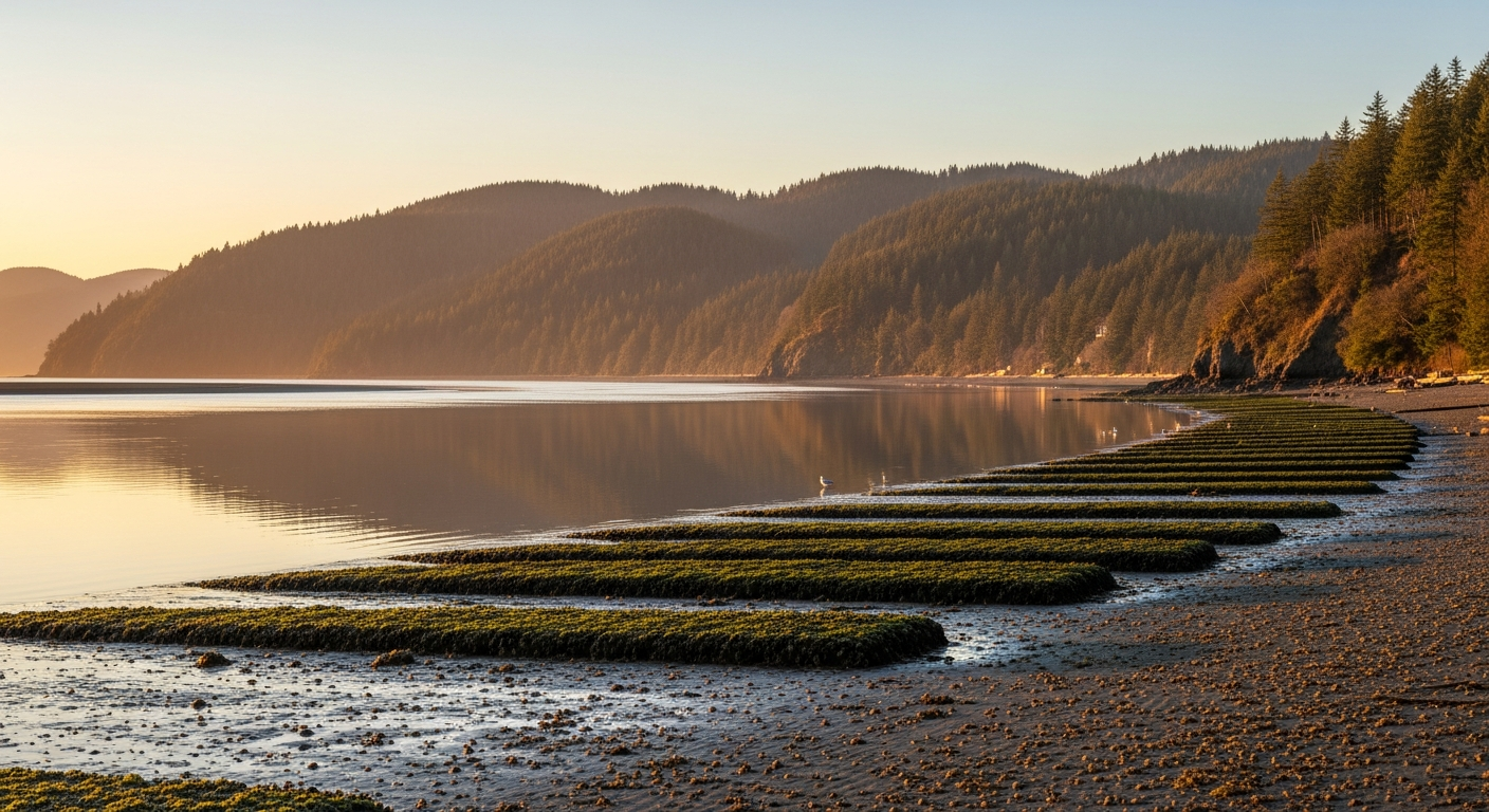
    Potlatch State Park — about 12 miles north of Belfair on Hood Canal — is one of the best public shellfish beaches on the canal, and it’s open for clams, mussels, and oysters through May 31. The beach at Potlatch has excellent oyster beds near the highway stretch and extensive Manila clam habitat across the tide flats. Native littleneck clams are present throughout. You’ll need a valid Washington shellfish license (available at WDFW Go Fish Washington online or at local retailers) and a Discover Pass for the parking lot.

    Timing matters: low tide is your friend. Check the NOAA tide tables for Hood Canal before you go — the best harvesting windows are during minus or very low tides that expose the full intertidal zone.

    One important note for Hood Canal harvesters: Dosewallips State Park — a popular spot further up the canal in Jefferson County — is closed to all clams, mussels, and oysters in 2026 under the new WDFW regulations. If Dosewallips was your go-to beach, Potlatch is your best alternative in the region.

    Always Check Biotoxins Before You Go

    This cannot be overstated: marine biotoxins are the silent hazard of shellfish harvesting in Hood Canal. Paralytic Shellfish Poisoning (PSP) and domoic acid contamination are real risks in these waters, and they cannot be detected by smell, appearance, or cooking. A beach that was safe last week may be closed this week.

    Before every trip — every single time — check the Washington State Department of Health Biotoxin Safety Map at doh.wa.gov/ShellfishSafety.htm or call the DOH Biotoxin Hotline at 1-800-562-5632. Mason County has experienced Hood Canal biotoxin closures in past seasons. The current status changes with water conditions, so bookmark the page and check it same-day.

    Tahuya State Forest: Trail Update Before You Pack the Bikes

    If your spring outdoor plans include Tahuya State Forest — and for North Mason families, they probably do — know that portions of the Howell Lake Loop Trail remain temporarily closed due to a washed-out bridge. The rest of the Tahuya trail system remains open for ORV riding, mountain biking, and hiking, including the main OHV network. Check the Washington DNR website at dnr.wa.gov/GreenMountainTahuya for current closure details before loading the truck. Discover Pass required for parking at most trailheads.

    The Theler Wetlands: A New Trail Loop Is Coming

    This summer, the Mary E. Theler Wetlands will undergo a transformation that’s been years in the making. The Hood Canal Salmon Enhancement Group (HCSEG), in partnership with WDFW, is constructing a 1,200-foot elevated piling-support boardwalk in the footprint of the removed levees — fully reconnecting the estuary trail loop that was broken when the old levee system was removed as part of the Union River estuary restoration project.

    The restoration work targets habitat for Hood Canal summer chum salmon, listed as threatened under the Endangered Species Act. When the boardwalk is complete, visitors to the Theler Wetlands will have a connected loop trail that takes them across the restored estuary — a genuinely rare ecological experience right in Belfair’s backyard. Expect some construction activity in the preserve this summer, but the main trail sections remain open.

    Belfair State Park: Reserve Your Spot Now

    Belfair State Park’s Tree Loop campground — the tent camping section right where Little Mission Creek meets Hood Canal — opens for 2026 reservations on May 15. The Tree Loop has about 60 sites and is limited to rigs 18 feet or shorter, making it a tent and small camper area. It books up fast for summer weekends. Make your reservation at washington.goingtocamp.com the moment the window opens. Season runs May 15 through September 15.

    For Hood Canal day use, Belfair State Park remains one of the most accessible spots in North Mason for families — swimming, kayak launches, and the warm, shallow waters that Hood Canal is famous for in summer.

    Your Outdoor Season Checklist

    • Shellfish license: Required for all harvest over age 15. Buy online at fishhunt.dfw.wa.gov or at local sporting goods retailers.
    • Discover Pass: Required at Potlatch, Tahuya, and Belfair State Park parking areas. $30/year or $11.50/day at licensing agents or discoverypass.wa.gov.
    • Biotoxin check: Every trip, same day — doh.wa.gov/ShellfishSafety.htm or 1-800-562-5632.
    • New 2026 rules: Cockle minimum 2½ inches; geoduck limit 1/person/day.
    • Tahuya Howell Lake Loop: Partially closed — washed-out bridge. Check dnr.wa.gov for current status.
    • Belfair State Park Tree Loop: Reservations open May 15 at washington.goingtocamp.com.

    Frequently Asked Questions

    What changed in Hood Canal shellfish rules for 2026?

    Two key changes took effect April 1, 2026: the minimum harvest size for cockles increased from 1½ inches to 2½ inches, and the daily limit for geoduck dropped from three per person to one per person. These changes apply statewide, including Hood Canal beaches.

    Where can I dig clams near Belfair in 2026?

    Potlatch State Park, about 12 miles north of Belfair on Hood Canal, is the closest and best public shellfish beach. Clam, mussel, and oyster season runs April 1 through May 31. A shellfish license and Discover Pass are required. Always verify the beach is open for biotoxins before harvesting — check doh.wa.gov/ShellfishSafety.htm.

    Is Dosewallips open for shellfish in 2026?

    No. Dosewallips State Park is closed to all clams, mussels, and oysters in 2026 under new WDFW regulations. Potlatch State Park is the recommended alternative for Hood Canal area harvesters.

    How do I check if Hood Canal shellfish beaches are open for biotoxins?

    Check the Washington State DOH Shellfish Safety Map at doh.wa.gov/ShellfishSafety.htm or call the Biotoxin Hotline at 1-800-562-5632. Check same-day before every harvesting trip — biotoxin status can change quickly with water conditions.

    Is the Howell Lake Loop Trail open at Tahuya State Forest?

    Portions of the Howell Lake Loop Trail are temporarily closed due to a washed-out bridge as of spring 2026. The rest of the Tahuya State Forest trail system remains open. Check current conditions at dnr.wa.gov/GreenMountainTahuya before your visit.

    When does Belfair State Park Tree Loop open for reservations in 2026?

    Reservations for the Tree Loop campground at Belfair State Park open May 15, 2026 at washington.goingtocamp.com. The season runs May 15 through September 15. Sites are limited to rigs 18 feet or shorter.

    Can I harvest shellfish on private Hood Canal shoreline?

    Recreational harvest from private tidelands you own or have permission to access may be subject to the same WDFW rules including the new 2026 size and bag limits, plus DOH biotoxin status requirements. Contact WDFW or review the annual shellfish regulations pamphlet for specifics on private tidelands access.

    Sources: WDFW 2026 Shellfish Regulations; WDFW Potlatch State Park Beach Page; WDFW Camas-Washougal Post-Record Feb 2026 proposed rule changes; WA DNR Green Mountain and Tahuya State Forest; HCSEG/WDFW Union River Estuary Restoration Project; WA State Parks Belfair State Park; WA DOH Biotoxin Information.

  • North Mason Firefighters Pancake Breakfast Is April 26 at Station 81 in Tahuya

    North Mason Firefighters Pancake Breakfast Is April 26 at Station 81 in Tahuya

    Pancake Breakfast: The North Mason Regional Fire Authority is hosting a pancake breakfast from 6 to 11 AM on Saturday, April 26 at Station 81, located at 14880 NE North Shore Road in Tahuya. The event is open to the public.

    North Mason Firefighters Are Hosting a Pancake Breakfast in Tahuya on April 26

    Grab the family and head out to Tahuya the morning of Saturday, April 26 — the North Mason Regional Fire Authority is putting on a pancake breakfast at Station 81 and everyone’s welcome.

    The breakfast runs from 6 to 11 AM at Station 81, 14880 NE North Shore Road, Tahuya, WA 98588. It’s a classic community fundraiser and a chance to meet the firefighters who serve Belfair, Tahuya, and the surrounding North Mason area.

    About Station 81

    Station 81 is the North Mason Regional Fire Authority’s Tahuya station, serving the Tahuya area on the Hood Canal side of North Mason County. The station has been a community fixture since the 1960s. It’s staffed during daytime hours seven days a week as part of the Fire Authority’s coverage across the region.

    The North Mason Regional Fire Authority was formed in 2014 when Mason County Fire Districts 2 and 8 merged. It serves Belfair, Tahuya, Dewatto, and surrounding communities — roughly 24,000 residents across 136 square miles of Mason and western Kitsap counties.

    Event Details

    • Date: Saturday, April 26, 2026
    • Time: 6 AM – 11 AM
    • Location: Station 81 — 14880 NE North Shore Road, Tahuya, WA 98588
    • Open to: The public

    Frequently Asked Questions: Pancake Breakfast at Station 81

    When is the North Mason firefighters pancake breakfast?

    Saturday, April 26, 2026 from 6 to 11 AM at Station 81, 14880 NE North Shore Road, Tahuya, WA 98588.

    Is the pancake breakfast open to everyone?

    Yes. The event is open to the public.

    Where is North Mason Fire Station 81?

    Station 81 is located at 14880 NE North Shore Road in Tahuya, WA 98588. Phone: 360-275-6478.

    What is the North Mason Regional Fire Authority?

    The North Mason Regional Fire Authority serves Belfair, Tahuya, Dewatto, and surrounding communities in northeastern Mason County and western Kitsap County. It was formed in 2014 from the merger of Mason County Fire Districts 2 and 8.

  • Outdoor Recreation Update: New Shellfish Rules, Potlatch Season & Trail Alerts — Belfair Bugle

    Outdoor Recreation Update: New Shellfish Rules, Potlatch Season & Trail Alerts — Belfair Bugle

    Spring is here and so is shellfish season along Hood Canal. If you’re heading out to dig clams or harvest oysters, take note of the new 2026 rules that kicked in April 1 — the minimum size for cockles is now 2½ inches, and geoduck limits have dropped to one per person per day. Potlatch State Park’s clam, mussel, and oyster season is open through May 31, so grab your shellfish license and your Discover Pass and get out there.

    Meanwhile over at Tahuya State Forest, heads up that portions of the Howell Lake Loop Trail remain temporarily closed due to a washed-out bridge. Plenty of other trails are open for ORV riding, mountain biking, and hiking — just stick to marked routes and remember your Discover Pass.

    Looking ahead, the Theler Wetlands trail system is getting a major upgrade this summer. Construction begins on a new pedestrian boardwalk in the footprint of the removed levees, fully reconnecting the estuary trail loop. And Belfair State Park’s Tree Loop campground opens for reservations May 15 — start planning those summer weekends on the water.

    Key Outdoor Updates This Week

    • Shellfish rules: New 2026 WDFW regulations effective April 1 — cockle minimum 2½ inches, geoduck limit 1 per person/day
    • Potlatch State Park: Shellfish season open April 1–May 31 (clams, mussels, oysters)
    • Tahuya State Forest: Howell Lake Loop Trail partially closed — washed-out bridge. Other trails remain open.
    • Theler Wetlands: New pedestrian boardwalk construction coming summer 2026, reconnecting the full estuary loop
    • Belfair State Park: Tree Loop campground reservations open May 15

    Sources: WDFW Shellfish Regulations, WDFW Potlatch Beach Page, Trailforks Tahuya, AllTrails, WA State Parks, HCSEG Theler Restoration Project