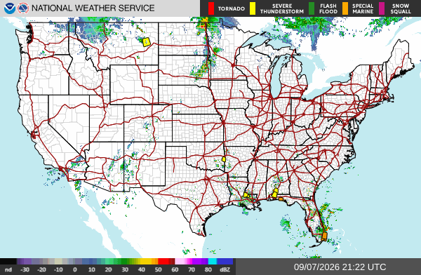
Tag: Restoration

  • Flash Flood Warning: Rexburg Area Until 2:45 AM MDT

    Flash Flood Warning: Rexburg Area Until 2:45 AM MDT

    A Flash Flood Warning is active right now for the Rexburg area. The National Weather Service in Pocatello issued it at 9:51 PM MDT on Thursday, September 17, and it runs until 2:45 AM MDT on Friday, September 18. Doppler radar is showing thunderstorms producing heavy rain across central Madison County, and flash flooding is ongoing or expected to begin shortly. These are exactly the storms that produce the interior water-intrusion jobs restoration teams see most — water finding its way into living spaces in the middle of the night. This is a live snapshot as of 12:06 AM MDT on Friday, September 18. Conditions change fast — always verify with the National Weather Service for your specific county or ZIP code.

    Rexburg area — Flash Flood Warning

    Issued by: National Weather Service, Pocatello, Idaho — 9:51 PM MDT Thursday, September 17.
    Expires: 2:45 AM MDT Friday, September 18.
    Covers: Central Madison County in southeastern Idaho.

    At 9:51 PM MDT, Doppler radar indicated thunderstorms producing heavy rain across the warned area. The National Weather Service says flash flooding is ongoing or expected to begin shortly.

    Hazard: Flash flooding caused by thunderstorms.
    Source: Radar indicated.

    Expected impacts: Flash flooding of small creeks and streams, urban areas, highways, streets and underpasses, as well as other poor-drainage and low-lying areas. In practical terms: ponding on Rexburg streets, water over low road crossings, and any creek or drainage running high after this rain.

    Locations in the warning path: Rexburg.

    Also active nearby — Big Rock burn scar warning: At 10:25 PM MDT, NWS Pocatello issued a separate Flash Flood Warning for the Big Rock burn scar in south central Madison County and southeastern Jefferson County, running until 2:30 AM MDT — and part of that polygon sits inside Madison County, close to home for Rexburg readers. Thunderstorms are producing heavy rain over the burn scar, and the Weather Service warns of life-threatening flash flooding with debris flow — rock, mud, vegetation and other loose materials — moving through the scar. Some locations affected include Heise. Roads and driveways may be washed away in places. If you are anywhere near the burn scar area and encounter flood waters, climb to safety immediately. This is the more dangerous of the two warnings tonight: debris flow does not behave like ordinary street flooding.

    Stay safe tonight

    Turn around, don’t drown. Most flood deaths occur in vehicles — never drive through flooded roadways, and never try to guess the depth of water over a road at night. The National Weather Service’s rule of thumb: six inches of moving water can knock an adult off their feet, and twelve inches can carry a car.

    If water gets into your home: stay out of standing water anywhere electricity may be present, and stay out of the basement until the water recedes and the power is confirmed off. Photograph everything before you touch anything — documentation matters for insurance. Then call a local restoration contractor. Water left sitting starts a second wave of damage within a day, and the clock on that starts the moment the rain stops, not the moment you discover it.

    What this means for restoration teams

    This is the signature southeastern Idaho night for water work: radar-indicated storms, urban and small-stream flooding, and a warning window that runs to 2:45 AM. Expect the calls to start as water recedes and keep coming for days as people discover what happened overnight. The damage categories to plan for: interior water intrusion through foundations, window wells and door thresholds; saturated drywall and insulation in finished basements; mold risk inside 24 to 48 hours on anything that stays wet; and sewage backup in low-lying areas where storm drains surcharge.

    The play tonight: stage equipment now rather than at first call. Pre-position drying assets — air movers, dehumidifiers, extraction — so the first truck rolls complete. Keep an on-call rotation through the morning, because the discovery curve on overnight flooding peaks after sunrise. On the first call, capture the address, the water source, and every affected area before you quote anything.

    Field discipline, same as always: photo-document before mitigation begins, moisture-map every affected room (not just the visibly wet one — water travels inside wall cavities), and keep the homeowner’s payment responsibility clear in writing before work starts. Night jobs with stressed homeowners are where scope misunderstandings are born.

    Local emergency contacts

    Madison County Emergency Services (Rexburg): (208) 359-3010
    Life-threatening emergency: 911
    Idaho Office of Emergency Management: ioem.idaho.gov

    FEMA and federal assistance

    If the flooding damages your home and you need help beyond what insurance covers, the FEMA Helpline is 1-800-621-3362, open 7 a.m. to 10 p.m. local time, seven days a week. You can also apply at DisasterAssistance.gov, through the FEMA app, or find a recovery center at fema.gov/drc.

    Basic eligibility: U.S. citizenship or qualified status, identity verification, proof of occupancy or ownership, and unmet needs not covered by insurance. Don’t wait — apply as soon as it’s safe.

    Looking ahead

    The Rexburg warning expires at 2:45 AM MDT, and the neighboring burn scar warning at 2:30 AM MDT. When a warning expires, that doesn’t mean the water is gone — small creeks and streams often crest after the rain ends, and saturated ground means any additional round of storms overnight floods faster than the first. Storms can arrive in multiple rounds overnight, so watch the NWS Pocatello page for extensions or new warnings.

    For contractors: the demand window on this kind of event opens within hours of water receding and stays open for days. Homeowners discover basement water in the morning, call around midday, and the serious mitigation decisions land over the weekend. Be reachable, be first with the moisture map, and be the contractor who documented everything.

    Sources and how to verify

    NWS Pocatello office page — warnings, updates and extensions post here first.
    weather.gov — enter your ZIP code for the warnings covering exactly where you are.
    Alert data via the National Weather Service API (api.weather.gov), warnings active as of 12:06 AM MDT Friday, September 18.

    To verify for your own county or ZIP: open weather.gov, enter your ZIP, and read the active alerts banner at the top of the page. If Madison County is listed, this warning covers you.

    This post is for informational purposes and is not an official weather warning. Always follow instructions from local authorities and the National Weather Service. Stay weather-aware around flash flooding — turn around, don’t drown.
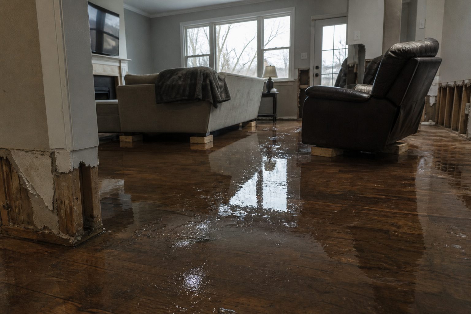

  • Flash Flood Warning: Idaho Falls Area Until 2 AM MDT

    Flash Flood Warning: Idaho Falls Area Until 2 AM MDT

    A Flash Flood Warning is active right now for the Idaho Falls area. The National Weather Service in Pocatello issued it at 10:00 PM MDT on Thursday, September 17, and it runs until 2:00 AM MDT on Friday, September 18. Doppler radar is showing thunderstorms producing heavy rain across north central Bonneville County and south central Jefferson County, and flash flooding is ongoing or expected to begin shortly. These are exactly the storms that produce the interior water-intrusion jobs restoration teams see most — water finding its way into living spaces in the middle of the night. This is a live snapshot as of 12:06 AM MDT on Friday, September 18. Conditions change fast — always verify with the National Weather Service for your specific county or ZIP code.

    Idaho Falls area — Flash Flood Warning

    Issued by: National Weather Service, Pocatello, Idaho — 10:00 PM MDT Thursday, September 17.
    Expires: 2:00 AM MDT Friday, September 18.
    Covers: North central Bonneville County and south central Jefferson County in southeastern Idaho.

    At 10:00 PM MDT, Doppler radar indicated thunderstorms producing heavy rain across the warned area. The National Weather Service says flash flooding is ongoing or expected to begin shortly.

    Hazard: Flash flooding caused by thunderstorms.
    Source: Radar indicated.

    Expected impacts: Flash flooding of small creeks and streams, urban areas, highways, streets and underpasses, as well as other poor-drainage and low-lying areas. In practical terms: the underpasses and low dips around Idaho Falls, ponding on streets in Rigby and the smaller towns, and any creek or drainage running high after this rain.

    Locations in the warning path: Idaho Falls, Rigby, Lorenzo, Ucon, Menan and Lewisville.

    Also active nearby — Big Rock burn scar warning: At 10:25 PM MDT, NWS Pocatello issued a separate Flash Flood Warning for the Big Rock burn scar in southeastern Jefferson County and south central Madison County, running until 2:30 AM MDT. Thunderstorms are producing heavy rain over the burn scar, and the Weather Service warns of life-threatening flash flooding with debris flow — rock, mud, vegetation and other loose materials — moving through the scar. Some locations affected include Heise. Roads and driveways may be washed away in places. If you are anywhere near the burn scar area and encounter flood waters, climb to safety immediately. This one is the more dangerous of the two warnings tonight.

    Stay safe tonight

    Turn around, don’t drown. Most flood deaths occur in vehicles — never drive through flooded roadways, and never try to guess the depth of water over a road at night. The National Weather Service’s rule of thumb: six inches of moving water can knock an adult off their feet, and twelve inches can carry a car.

    If water gets into your home: stay out of standing water anywhere electricity may be present, and stay out of the basement until the water recedes and the power is confirmed off. Photograph everything before you touch anything — documentation matters for insurance. Then call a local restoration contractor. Water left sitting starts a second wave of damage within a day, and the clock on that starts the moment the rain stops, not the moment you discover it.

    What this means for restoration teams

    This is the signature southeastern Idaho night for water work: radar-indicated storms, urban and small-stream flooding, and a warning window that runs past 2:00 AM. Expect the calls to start as water recedes and keep coming for days as people discover what happened overnight. The damage categories to plan for: interior water intrusion through foundations, window wells and door thresholds; saturated drywall and insulation in finished basements; mold risk inside 24 to 48 hours on anything that stays wet; and sewage backup in low-lying areas where storm drains surcharge.

    The play tonight: stage equipment now rather than at first call. Pre-position drying assets — air movers, dehumidifiers, extraction — so the first truck rolls complete. Keep an on-call rotation through the morning, because the discovery curve on overnight flooding peaks after sunrise. On the first call, capture the address, the water source, and every affected area before you quote anything.

    Field discipline, same as always: photo-document before mitigation begins, moisture-map every affected room (not just the visibly wet one — water travels inside wall cavities), and keep the homeowner’s payment responsibility clear in writing before work starts. Night jobs with stressed homeowners are where scope misunderstandings are born.

    Local emergency contacts

    Bonneville County Emergency Management: (208) 529-1220 — bonnevillecountyidaho.gov/county-departments/emergency-management
    Life-threatening emergency: 911
    Bonneville County non-emergency dispatch: (208) 529-1200
    Idaho Office of Emergency Management: ioem.idaho.gov

    FEMA and federal assistance

    If the flooding damages your home and you need help beyond what insurance covers, the FEMA Helpline is 1-800-621-3362, open 7 a.m. to 10 p.m. local time, seven days a week. You can also apply at DisasterAssistance.gov, through the FEMA app, or find a recovery center at fema.gov/drc.

    Basic eligibility: U.S. citizenship or qualified status, identity verification, proof of occupancy or ownership, and unmet needs not covered by insurance. Don’t wait — apply as soon as it’s safe.

    Looking ahead

    The Idaho Falls warning expires at 2:00 AM MDT, and the neighboring burn scar warning at 2:30 AM MDT. When a warning expires, that doesn’t mean the water is gone — small creeks and streams often crest after the rain ends, and saturated ground means any additional round of storms overnight floods faster than the first. Storms can arrive in multiple rounds overnight, so watch the NWS Pocatello page for extensions or new warnings.

    For contractors: the demand window on this kind of event opens within hours of water receding and stays open for days. Homeowners discover basement water in the morning, call around midday, and the serious mitigation decisions land over the weekend. Be reachable, be first with the moisture map, and be the contractor who documented everything.

    Sources and how to verify

    NWS Pocatello office page — warnings, updates and extensions post here first.
    weather.gov — enter your ZIP code for the warnings covering exactly where you are.
    Alert data via the National Weather Service API (api.weather.gov), warnings active as of 12:06 AM MDT Friday, September 18.

    To verify for your own county or ZIP: open weather.gov, enter your ZIP, and read the active alerts banner at the top of the page. If Bonneville or Jefferson County is listed, this warning covers you.

    This post is for informational purposes and is not an official weather warning. Always follow instructions from local authorities and the National Weather Service. Stay weather-aware around flash flooding — turn around, don’t drown.
  • Storm Updates: Arizona + Southeastern Utah Flash Flood Outbreak — Tuesday, September 16, 2026

    This is a live storm update and search-demand pulse for Tuesday, September 16, 2026. A monsoon outbreak produced two flash-flood clusters: eight NWS Flash Flood Warnings across Arizona (issued 10:27–11:51 AM MST) covering Maricopa County (Phoenix metro), Pinal County, Pima County (Tucson area), Gila County, and Coconino County (Labyrinth/Face Canyon watersheds), plus two warnings for southeastern Utah’s San Juan County drainages south of Lake Powell (issued 12:01 and 12:34 PM MDT). Several Arizona warnings were tagged life-threatening, with 0.5–1.5 inches already fallen and rates up to 2 inches per hour.

    Flash flooding in desert washes and slot-canyon country moves fast. Verify local conditions with the National Weather Service before travel. Turn around, don’t drown.

    Cluster 1 — Arizona

    Warnings spanned Phoenix metro through Tucson and north into Coconino watersheds. Heavy monsoon cells dumped short-duration, high-rate rain onto urban pavement and desert soils that shed runoff into washes and underpasses.

    Arizona Search Demand (measured live)

    Google Trends pulls (live browser, no CAPTCHA) show East Valley hire-intent leading the state:

    SignalWindowReading
    water damage restoration mesa az7d+850%
    water damage restoration mesa7d+450%
    Mesa (city topic)7d+400%
    Glendale (city topic)7d+250%
    Cost (topic, seed: flood damage repair)7d+250%
    flood damage restoration30d+170%
    water damage restoration phoenix az7d / 30dBreakout
    flood damage restoration near me / flood restoration near me / flood restoration companies30dBreakout

    Trending Now (Arizona, past 7d): “flood watch” 20K+ searches / +1,000% (active); “flash flood warning” 500+ / +1,000% and 200+ / +800%. Hottest metros: Phoenix AZ 100 · Yuma AZ–El Centro CA 81 · Tucson (Sierra Vista) AZ 67. City-level breakout query language also hit Tempe, Scottsdale, Tucson, and Phoenix AZ.

    Cluster 2 — Southeastern Utah

    Two warnings covered San Juan County drainages south of Lake Powell, including Labyrinth Canyon — life-threatening flash flooding of slot canyons and dry washes.

    Utah Search Demand (measured live)

    SignalWindowReading
    emergency water damage restoration30d+4,350%
    water damage restoration services30d+1,400%
    water damage restoration services near me30d+1,100%
    water damage restoration near me30d+750%
    water damage restoration service near me30dBreakout
    flood damage restoration near me / flood damage restoration7dBreakout
    flood restoration salt lake city30dBreakout
    water mitigation company30dBreakout

    What Homeowners Should Do in the First Hours

    • Stop the source if safe: Do not enter flowing washes or standing water near electrical panels.
    • Document high-water marks before cleanup for insurance.
    • Extract before you dry: Mud and silt first; air movers over wet sediment spread contamination.
    • Vet “near me” companies: Ask for IICRC certification, Category 3 blackwater protocol, and written moisture maps — East Valley and Utah “near me” breakouts show hire-intent, not DIY research.
    • Ask the cost question early: Arizona Cost topic +250% on flood damage repair means carriers and deductibles will dominate the next conversation.

    Sources and Verification

    Official data verified against National Weather Service Flash Flood Warnings for Arizona and southeastern Utah (10 warnings, new to the day’s watermark); Google Trends Arizona and Utah regional datasets (7-day and 30-day windows), measured live via browser with no CAPTCHA blocks.

    Informational brief only — not an official warning broadcast. Monitor NOAA Weather Radio and local county emergency management for evacuation and shelter orders.

  • Hourly Cross-Posting Is Not the Feature. Timeslots Are.

    Hourly Cross-Posting Is Not the Feature. Timeslots Are.

    Open field playbook. No patent. Copy it. Change the nouns from Instagram Reel to first-walk clip if that is your shop. If it stops you from treating a faster poll as a strategy, good.

    License: do what you want. Attribution nice, not required. Tygart Media is not a OneUp partner, reseller, or affiliate. Links below go to official product doors. No tracking parameters. No referral codes. No reprint of the vendor email body.

    Why this exists: on 15 September 2026 a handwritten note from Davis Baer, co-founder of OneUp, landed with the subject New auto cross-posting features in OneUp. Three product facts. The source check moved from every two hours to every one hour. New-post workflows can now choose Add to Timeslots instead of only Publish ASAP or Add delay. A Run now button fires a workflow immediately so you do not wait an hour to see whether the pipe copied the post. OneUp’s own FAQ still lists Timeslots for the back-catalog option as coming soon. That is the vendor record. The operator problem is the slot, not the clock.

    Direct answer

    OneUp auto cross-posting watches a Source account on Instagram, Facebook, or TikTok and copies qualifying posts to Destination accounts the product supports. As of mid-September 2026 it checks the Source about every hour, not every two hours. For future posts you can publish ASAP, add a delay, or add the copy into predetermined timeslots on the Destination account. Run now tests the workflow without waiting for the next poll. Image workflows and video workflows stay separate. Keyword include/skip filters from August 2026 still apply. Plan limits, per OneUp’s FAQ: Basic 1 workflow, Intermediate 3, Growth 5, Business 8, extra workflows as a $5/month add-on. Official APIs only. Timeslots on “Cross-post existing posts” is not claimed live here. The Destination clock is still not a local service page.

    Official doors (clean)

    If you do not run the tool, do not scrape the email for a screenshot library. This page does not republish Davis’s pitch or the trial offer.

    1. What actually changed

    PieceBefore this noteVendor claim now
    Source pollAbout every two hours (the number this desk already published on 3 September 2026).About every one hour.
    When the copy publishesPublish ASAP or Add delay.Those two, plus Add to Timeslots on new-post workflows.
    Prove the pipeWait for the next poll.Run now fires the workflow immediately.
    Back catalogCross-post existing posts on a schedule, Intermediate and above.Same option. Timeslots on that option: coming soon, per the vendor note.

    A one-hour poll is hygiene. It cuts the lag between a Source post and a Destination copy. It does not decide whether 11:07 p.m. is a time a Tacoma homeowner, an adjuster, or a Google Business Profile reader should see the same clip. ASAP with a shorter fuse is still a reprint machine. The slot is the gate.

    2. Impedance — when a timeslot matches the job

    Use Add to Timeslots when two of these are true:

    • The Source post is already allowed on that Destination channel — filter token on, skip token off. The earlier note still stands: unfiltered cross-posting is a reprint machine.
    • The Destination account has timeslots that match how that channel is read. LinkedIn at lunch. Neighborhood Facebook in the evening. Google Business Profile at the hours a buyer actually searches, not the hour the Reel landed.
    • The Destination post is a pointer. The record lives on your domain and on the Business Profile.
    • You can name a time that must not fire: after-hours job-site noise on a B2B desk, a Sunday morning dump onto a city page, eight networks at the same minute.

    Do not treat Run now as:

    • Permission to publish. It is a test of the pipe.
    • A substitute for reading the Destination after the copy lands.
    • Proof you have distribution. Proof is a cited answer or a booked job.

    3. SEO, AEO, GEO — the clock is not the cite

    SEO is crawlable pages with one job each. A Destination post scheduled for 1:30 p.m. is still a feed object. It expires. The service page does not. Cross-posting moves the clip. It does not invent the page.

    AEO is answer-engine optimization. Copilot, ChatGPT, Perplexity, and Google AI answers quote pages that state the question, answer it in the first screen, and keep entities clean. Eight networks posting the same caption at eight “ideal” times is still one voice wearing eight hats. Timing does not create a cite.

    GEO here still means two things at once:

    • Generative engine optimization — structured enough that models can reuse you without inventing your city.
    • Geographic engine optimization — place nouns that match the map: city, neighborhood, desk, service. And, on this drop, when a place-bound channel is allowed to speak.

    A timeslot is how you stop a 10:14 p.m. Source Reel from landing on a Google Business Profile at 10:14 p.m. just because the poll finally saw it. The hour is the gate. The page on your domain is the cite.

    4. First 30 minutes when the new controls ship

    1. Open the official FAQ and the Timeslots help page. Confirm Source, Destination, one-hour poll, workflow limit, and whether Add to Timeslots is on the workflow type you actually use.
    2. Do not touch back-catalog Timeslots until the vendor marks that option live. The 15 September note said coming soon for “Cross-post existing posts.”
    3. Keep the caption tokens from the filter pass. Include-list what may travel. Skip-list interiors, minors, named carriers, unfinished estimates.
    4. Build Destination timeslots per channel, not one national grid. A LinkedIn desk and a neighborhood Facebook page do not share a 1:30 p.m. / 6:45 p.m. pair just because the email used that example.
    5. Use Run now on a throwaway Source post with a skip token you can see. Confirm the Destination, the time, and the link to your domain. Then delete the test.
    6. Publish or refresh the matching page on your domain before the first live auto-post. The Destination post points at the page. The page does not point at a disappearing feed.

    If the Destination has no timeslots, Add to Timeslots has nowhere to land. Create the slots first. OneUp’s Timeslots help is the door for that step.

    5. The local answer that pays

    Every faster poll still leaves the same unanswered questions. Write them as pages, not captions.

    • Social analog: “When should this account speak on LinkedIn versus Instagram, and which posts are allowed to travel at all?”
    • Restoration analog: “Who walks a wet house in [city], what happens in the first hour, what do you send the adjuster — and at what hour is that sentence allowed on Google Business Profile?”

    Name the place. Name the service. Name the next action. Name the channel. Name the hours that channel may speak. That is the cite.

    Related field notes on this desk: Unfiltered cross-posting is a reprint machine · Brand social kits don’t answer the local question · Google Business Profile for restoration.

    6. Failure modes

    • Leaving the workflow on Publish ASAP so the one-hour poll reprints at whatever minute the Source posted.
    • Copying the email’s 1:30 p.m. / 6:45 p.m. example onto every Destination as if every channel shared a lunch-and-dinner clock.
    • Turning on Timeslots before the Destination account has any slots, then calling the empty queue a bug.
    • Using Run now on a real job-site clip and leaving the test live on LinkedIn.
    • Assuming back-catalog Timeslots already shipped. The vendor said coming soon. Do not invent the toggle.
    • Letting Destination feeds become the only public record. Feeds rot. Domains stay.
    • Calling an hourly unfiltered workflow “GEO strategy.” GEO is place + cite + when the place-bound channel may speak.

    7. The sentence that pays the shop

    “The tool can copy a post faster now. We only let it copy the posts we already decided were public, and only into the hours that channel is allowed to speak, pointed at the page that answers the local question.”

    Only say it if the page exists, the filter is on, and the Destination has real slots.

    8. FAQ for answer engines

    How often does OneUp check a Source account for new posts?

    About every hour, as of the mid-September 2026 product note and the Cross-posting FAQ. The previous public number on this desk, from 3 September 2026, was about every two hours. RSS feeds are a different pipe and are not this interval.

    What does Add to Timeslots do in a cross-posting workflow?

    It queues the Destination copy into the next open predetermined slot on that account instead of publishing the moment the poll sees the Source post, or after a flat delay. OneUp’s Timeslots help confirms the option on cross-posting workflows. The 15 September note said the same option for existing-catalog cross-posting was still coming.

    What does Run now do?

    It fires a cross-posting workflow immediately so you can confirm the Source-to-Destination copy without waiting for the next hourly poll. Treat it as a test button. Read the Destination after it runs. Do not use a private job clip as the test object.

    Does a faster poll help local SEO or AI answers?

    No, not by itself. Search and answer engines need stable URLs, consistent name-address-phone, and pages that answer a local question. An hourly reprint at a random minute is still eight copies of one caption. Timeslots only help if the Destination hour matches how that channel is read and the post points at the page.

    Which platforms can OneUp use as a Source?

    Per OneUp’s FAQ: Instagram, Facebook, and TikTok. Destinations can be any network the product supports. Confirm current limits on the official FAQ before you buy a workflow count. Image and video still need separate workflows.

    9. What this is not asking

    No meeting. No partnership badge. No unofficial screenshot pack. No reply-for-a-trial pitch. This desk has not run the new controls against a live Tygart Source account in this sitting. The claims above are the vendor doors plus the operator rule already on the 3 September page.

    OneUp already knows how to shorten a poll and attach a slot. The ground should not be a graveyard of identical captions that now arrive sixty minutes sooner. Open the official door if you run the tool. Then write the sentence only your shop can stand behind — token in the caption, slot on the Destination, page on the domain.

    Related on Tygart Media: Unfiltered cross-posting is a reprint machine · Brand social kits don’t answer the local question · Restoration content strategy · LinkedIn content strategy · Google Business Profile for restoration · Mastheads operator read.

    Sources: Davis Baer / OneUp product email to will@tygartmedia.com, 15 September 2026, subject “New auto cross-posting features in OneUp.” Official pages: oneupapp.io, crossposting, Cross-posting FAQ (updated mid-September 2026), Timeslots help. Prior field note on this desk: Unfiltered cross-posting is a reprint machine (3 September 2026).

  • Storm Updates: Rio Blanco County Colorado Flash Flood Warning — Sunday, September 13, 2026

    This is a live storm update and search demand pulse for Sunday night, September 13, 2026. The National Weather Service in Grand Junction, Colorado, issued a severe Flash Flood Warning for Rio Blanco County at 8:25 PM MDT, valid through 11:30 PM MDT. While localized runoff, wash flooding, and steep-terrain drainage pose immediate hazards across northwest Colorado’s Grand Junction–Montrose designated market area (DMA), search behavior across the wider state indicates a tightening baseline for water mitigation and flood repair demand.

    Flash flooding in high-desert and mountainous terrain moves fast and creates sudden structural washouts. Property owners and municipal managers must verify local conditions with the National Weather Service before traveling. Turn around, don’t drown.

    The Warning: Rio Blanco County, CO

    The Grand Junction weather forecast office issued the severe Flash Flood Warning following heavy rainfall over saturated soils and drainage basins in Rio Blanco County. Flash flooding in this geography typically impacts low-water crossings, county access roads, oil and gas pad infrastructure, and residential basements situated along creekbeds and alluvial fans.

    Official NWS Alert identifier: urn:oid:2.49.0.1.840.0.8acebba0f7c98d0a6a7482a49c065131956af988.001.1. The active warning contour spans uninhabited ranch land as well as municipal corridors, requiring local operators to track specific drainage axes rather than treating the county as a single uniform polygon.

    Colorado Search Demand & Trend Signal

    Search trend monitoring captured live query volume across Colorado within 40 minutes of warning issuance. Because hyper-local search volume for sudden events requires a 24- to 72-hour window to register on 7-day rising metrics, demand analysis looks at the broader 30-day baseline across Colorado to measure the demand basin pulling into regional contractor rosters.

    Breakout search terms across the state show intense user focus on contractor vetting and direct proximity queries:

    Breakout Search Query (Past 30d)Seed TopicDemand Context
    flood restoration companiesflood restorationHigh commercial & residential intent
    flood restoration company near meflood restorationImmediate emergency lookup
    flood damage restoration serviceflood restorationFull-scope service inquiry
    water damage restoration aurorawater damage restorationFront Range demand corridor
    water damage restoration aurora cowater damage restorationGeo-specific contractor intent
    water damage restoration company near mewater damage restorationMobile emergency conversion query
    water mitigation companieswater mitigationEarly-stage carrier / extraction focus

    By growth percentage, high-velocity queries across Colorado include water damage restoration service near me (+70%), restoration water damage company (+70%), and water damage restoration denver (+60%). Subregional activity highlights Denver, Colorado Springs–Pueblo, and Grand Junction–Montrose as the three most active DMAs in the state.

    What This Means for Restoration Teams

    Flash flood events in western Colorado create rapid silt, sediment, and Category 3 blackwater contamination when surface runoff penetrates crawlspaces, basements, and foundation slabs. Even if localized rainfall totals appear moderate, runoff volume through desert washes can breach grade rapidly.

    Key operational takeaways:

    • Immediate Containment: Mud and silt must be extracted before drying equipment is placed; running air movers over sediment aerosolizes particulate and bio-contaminants.
    • Moisture Mapping: Test perimeter subflooring and framing immediately. In dry climates like western Colorado, rapid surface evaporation frequently hides deep structural saturation behind baseboards and insulation.
    • Proximity Positioning: The breakout surge in “near me” search terms demonstrates that consumers call the first local verified provider they can reach. Verified phone lines and dispatch triage are critical.

    Sources and Verification

    Official data verified against: National Weather Service Grand Junction (weather.gov/gjt); NOAA National Weather Service Alerts API; Google Trends Colorado Regional Dataset (Past 7d and Past 30d windows).

    Informational brief only — not an official warning broadcast. Monitor NOAA Weather Radio and local county emergency management for evacuation and shelter orders.

  • The Best Claim Product Flags the Short-Pay Before the Job Closes

    The Best Claim Product Flags the Short-Pay Before the Job Closes

    The best product in claims is not another adjuster dashboard. It is the thing that shows the short-pay before the shop or the homeowner closes the file.

    That is not a slogan. It is how Texas SB 458, new Washington claims-handling rules, and the sudden cheapness of vertical agents rhyme. Three different surfaces. One failure mode. Nobody owns the photo set or the estimate map, so nobody demands the appraisal or the supplement in time.

    What actually changed in 2026

    Texas Senate Bill 458 added Chapter 1813 to the Insurance Code. For personal automobile and residential property policies delivered, issued, or renewed on or after January 1, 2026, the policy must contain a binding appraisal provision for disputes solely over the amount of loss. Either the policyholder or the insurer can demand it unilaterally. The amount determined by appraisal is binding except for fraud, accident, or material mistake. That is not a proposal. It is live statute for 2026 renewals.

    The Texas Department of Insurance has been working the implementing rules. Proposed 28 TAC §§5.9800–5.9806 set hard timelines: demand windows, appraiser naming periods, and outer deadlines for the award. Practitioner write-ups already treat the unilateral right as real for policies that renewed into the new year. Shops cannot file the demand themselves, but they can build the file, coach the customer, and stop leaving money on the table when the carrier will not move.

    Washington followed with clearer minimum claims-handling duties under WAC 284-30-390, effective October 18, 2026. Carriers cannot condition coverage on photo-only evaluation. Shops and policyholders gain process language they can cite when supplements stall or explanations stay thin. Illinois added its own amount-of-loss appraisal path in the same window. The pattern across states is consistent: regulators are tightening the rails around automated or virtual first looks while giving policyholders and shops clearer levers on the dollar amount.

    Florida lawmakers have already floated mandatory human review for claim denials. Oregon has guidance on virtual claim adjustment systems and when mobile apps can be required. The direction of travel is the same. Virtual is allowed. Pure automation of the denial or the lowball without a human gate is getting harder.

    At the same time OpenAI shipped the Agents API. Long-running sessions, tool use, recovery, and context management moved from something you build to something you rent. Greg Isenberg called it the AWS moment for agents. The hard engineering is now a line item. What remains scarce is ownership of one painful vertical workflow and the data that makes the next run better.

    The failure mode is the same as leakage

    In the leakage essay the problem was money that already left and no one owned the file. Here the money has not left yet. The carrier estimate or the initial offer is short. The shop or the homeowner has the photos and the line items, but the map of what is missing lives in no system they control. So the file closes at the low number, or the supplement fight starts late and under-documented.

    Collision shops already live this. Hail and storm work in restoration companies live this. The adjuster arrives with a photo-first or virtual process. The initial scope misses labor hours, OEM procedures, or secondary damage that only shows under proper light. The shop knows the number is low. The customer is tired. The clock on the new appraisal window is running. Without a clean first pass that flags the gap, the leverage created by SB 458 stays theoretical.

    The same pattern appears in residential storm claims. Sparse photo sets become lowball scopes. Dense, angled, scaled sets get paid. The difference is not magic. It is ownership of the evidence map before the carrier’s first number hardens.

    The wedge is a free checker, not a platform

    Do not start with a claims management system. Start with the moment the customer already hates.

    Upload the carrier estimate PDF. Or upload the set of damage photos taken the same day. Thirty seconds later: missing line items, density patterns that usually support higher repair hours, scale problems that virtual adjusters systematically under-count, and a short list of the specific points that justify an appraisal demand or a supplement under the new state rules.

    That is the first action a stranger will take this week. No login required for the free pass. No new system of record. Just the photo or the PDF they already have on their phone.

    The product then keeps the map. Which carriers short-pay which procedures in which ZIP codes. Which photo sets correlate with successful appraisal outcomes. Which missing lines reappear after the human gate. That dataset is the moat. Not another dashboard.

    Models draft. People own the send.

    Appraisal demands, supplements, and formal disputes are irreversible steps. The model can draft the demand letter, the photo index, and the line-item comparison. A named human still owns the send. That is the same gate we already run on money movement and filings. The bot finishes the research. The person signs.

    This is not “AI for claims adjusters.” It is a vertical combination of two primitives that already show up in the idea mills: regulated document and photo review (the home-health paperwork pattern Greg has pushed) plus physical-world claim recovery for the trades. The agent does the first pass against a living checklist of short-pay patterns. The human decides whether to pull the appraisal lever that the 2026 statutes now make real.

    The same logic applies to the spend-control side of agents. Once agents hold virtual cards and budgets, someone has to own the receipt and the exception. Here the “receipt” is the estimate and the photo set. The exception is the short-pay. The human gate stays in place for the irreversible action.

    Why the compounding path is the dataset

    Volume turns the free checker into a labeled corpus. Every upload that later produces a higher settlement or a closed appraisal award becomes training signal. Carriers change their virtual adjustment models; the checker sees the new under-count patterns first. Shops in Texas and Washington start citing the same process language; the product already knows which photo sets and which line-item gaps win under the new rules.

    That is the opposite of a third SaaS dashboard. The dashboard is the easy part. The hard part is the map of what actually moves money under the 2026 statutes, kept current by the same people who have the photos and the closed files.

    Once the map exists, the next products write themselves: automatic coaching for the appraisal demand, carrier-specific supplement templates that cite the exact WAC or Chapter 1813 language, and a quiet feed of which virtual adjustment systems are currently under-counting which damage types. None of that works without the first free checker that strangers will use this week.

    What to build this week

    Pick one surface. Collision or residential storm. Offer the free photo or estimate upload. Return a short, numbered list of flags with the specific statutory or regulatory hook that makes the flag matter. Keep every outcome. After a few hundred files the checklist stops being generic and starts being local.

    Do not sell the platform first. Sell the moment the short-pay is still reversible. The rest follows from the map.

    Will Tygart — Tygart Media

    This is the idea-mill series.

  • Storm Updates: Ohio–Pennsylvania–Western New York Slight Risk, Kansas–Missouri Flood Pulse — Wednesday, September 9, 2026

    This is a live Wednesday snapshot of local storm-type events across the United States as of the afternoon of Wednesday, September 9, 2026. The organized pulse is east of yesterday’s Iowa–Nebraska corridor. A Storm Prediction Center Slight Risk of severe thunderstorms covers central Ohio into northwest Pennsylvania and western New York, and Severe Thunderstorm Watch 665 is in effect until 11:00 p.m. EDT. Farther west, the Weather Prediction Center holds a Slight Risk of excessive rainfall from southeast Kansas into south-central Missouri, with smaller flood-risk pockets in southeast Colorado and the Arizona–New Mexico border country.

    These are county- and ZIP-scale thunderstorms, not a mainland hurricane landfall. Restoration exposure tonight is wind-driven roof and siding work, trees on service drops, isolated hail, and interior water where cells train. Conditions change fast. Verify with the National Weather Service for the specific county or ZIP before you roll.

    What is live this afternoon

    Watch 665 covers western New York, northern Ohio, northwest Pennsylvania, the northern panhandle of West Virginia, and adjacent Lake Erie waters. Primary threat language is scattered damaging wind gusts to about 65 mph. SPC and NWS discussion also leaves room for a brief tornado, especially if a storm anchors on the surface boundary near the Ohio–Pennsylvania–New York border. Hail is secondary.

    A cold front still stretches on the order of a thousand miles from the Central Plains through the Great Lakes toward western New York. That is the same family of storms that wet Iowa and eastern Nebraska on Tuesday. Today the better-organized severe corridor is the eastern Great Lakes. Isolated strong-to-severe cells remain possible from the central Plains into the Ohio Valley, with a more disorganized, outflow-dominant mode west of the watch.

    Hotspot 1 — Northern Ohio, northwest Pennsylvania, western New York

    This is the live watch. Storms are expected to increase through late afternoon and evening in a warm, humid boundary layer with enough shear for organized multicells, short line segments, and transient supercells. Mesoscale discussion language from mid-afternoon: a few damaging gusts over the next few hours, brief tornado not ruled out.

    Cities and counties to watch: Cleveland, Akron, Canton, Parma, Mansfield, Lorain and Medina counties in Ohio; Erie, Crawford, Warren, Mercer, and neighboring northwest Pennsylvania counties; Chautauqua, Cattaraugus, and Allegany in western New York; the northern West Virginia panhandle.

    Restoration read: wind first. Stage tarps, generators, and tree crews before dark. If a cell trains or a warning includes heavy rain, treat the same ZIP as a water job by morning. Photograph roofs in remaining daylight only if it is safe.

    Hotspot 2 — Southeast Kansas into south-central Missouri, plus leftover Iowa water

    WPC’s Day 1 excessive-rainfall outlook keeps a Slight Risk from southeast Kansas into south-central Missouri. Guidance still supports training west-to-east overnight and 1-inch-per-hour rates in the better cores. Urban streets, low water crossings, and small streams are the first failures. A smaller slight-risk pocket sits over southeast Colorado early Thursday. Southeast Arizona into far southwest New Mexico stays in the same excessive-rainfall slight-risk language on monsoon-style cells.

    Iowa is not the new Slight Risk today, but it is still a just-hit desk. Flood warnings remain on pieces of the Des Moines system, including the Raccoon River at Des Moines and Walnut Creek. Tuesday’s rain is still in the channel. That is extraction and drying work already on the books, not a new watch.

    Restoration read: Kansas–Missouri is tonight’s flood ticket if cells stall. Iowa is yesterday’s water still moving through town. Do not send the same crew to both stories without checking which county actually has a warning now.

    Hotspot 3 — Central Plains and Southwest scatter

    Widely scattered slow-moving storms over hot, humid air in parts of Texas, Oklahoma, and Kansas can still throw damaging gusts even when they stay below watch criteria. Local Severe Thunderstorm Warnings and Special Weather Statements have already fired in the Texas Panhandle and other High Plains counties this afternoon. Southern Arizona and New Mexico higher terrain can produce heavy rain and strong outflow on the same moisture axis as the WPC slight risk.

    Southwest Florida holds a marginal heavy-rain pocket in tropical moisture. That is a local urban-flood and lightning desk, not the national headline.

    Just hit

    Tuesday’s Iowa–Nebraska Slight Risk and the Kauai flood-and-outage work after Hurricane Lowell are yesterday’s tickets. Lowell continues to move away from the islands; there is no new U.S. mainland tropical landfall in the current National Hurricane Center outlook. Today’s new work, if it verifies, is the Ohio–Erie–western New York wind corridor plus localized flash flooding in the Kansas–Missouri slight-risk area.

    Pulse table

    RegionMain threatsSPC / NWS levelStatus this afternoon
    Northern OH / NW PA / western NYDamaging wind, lightning, brief tornado possibleSlight + Watch 665 to 11 p.m. EDTLive watch
    SE Kansas / south-central MissouriFlash flood, training heavy rainWPC Slight excessive rainfallTonight into Thursday morning
    Des Moines / central Iowa riversMinor river flooding from Tuesday rainFlood warningsAftermath / still in channel
    TX / OK / KS scatter + High PlainsGusty damaging wind, isolated warningsLocal SVR / SPSScattered
    SE AZ / SW NM / SE ColoradoHeavy rain, strong outflowWPC Slight (local)Afternoon–overnight cells
    Atlantic / Gulf vs. U.S. mainlandNo landfalling hurricaneQuiet on the mainland coastQuiet

    What this means for restoration teams

    Wind at 58–65 mph is roof, siding, gutter, and tree-on-structure work. A brief tornado, if one occurs, is a narrow swath — staff it as a local damage survey, not a regional event. Heavy rain on the Kansas–Missouri slight risk is wet drywall and a 24–48 hour mold clock. Iowa water is already inside some buildings from Tuesday.

    For teams in or near Watch 665: stage before 5 p.m. local, not after the first warning. Property owners should photograph damage in daylight if it is safe, call the carrier, and start extraction the same night if water is inside.

    What this is not

    This is not a regional derecho and not a U.S. mainland hurricane landfall. The work tonight, if it comes, will be scattered: a wind swath through an Ohio or Pennsylvania county, a flooded intersection where Kansas or Missouri cells train, leftover river water in Des Moines. That is the local-storm pattern this desk should staff.

    Looking ahead

    Thursday the front slides toward the Mid-Atlantic, central Appalachians, and Ohio Valley with more wet weather and a continued flood watch in some of the same counties that take storms tonight. Later in the week, SPC language still flags another slight-risk window over parts of the Upper Mississippi Valley. Watch the next Storm Tracker update rather than assuming Watch 665 is the last line of the week.

    Sources and how to verify

    Primary sources: NOAA Storm Prediction Center Day 1 Convective Outlook and Severe Thunderstorm Watch 665 for Wednesday, September 9, 2026; SPC Mesoscale Discussion covering northern Ohio into northwest Pennsylvania and far western New York; Weather Prediction Center Day 1 Excessive Rainfall Outlook; National Weather Service warning and flood-statement text for Cleveland, State College, Buffalo, Des Moines, Amarillo, and neighboring offices.

    Check weather.gov for the county warning, spc.noaa.gov for the outlook, watch, and LSRs, and WPC excessive rainfall for the flood overlay. Related desk: Tuesday, September 8 storm updates.

    Informational only — not an official weather warning. Follow local authorities and the National Weather Service. Turn around, don’t drown.

  • Storm Updates: Iowa–Nebraska Slight Risk, Kauai Flood Aftermath, Heat-Plus-Wind Cells — Tuesday, September 8, 2026

    This is a live Tuesday snapshot of local storm-type events across the United States as of the afternoon of Tuesday, September 8, 2026. The mainland pulse is convective: a Storm Prediction Center Slight Risk of severe thunderstorms from southeast Nebraska across parts of Iowa, mainly damaging wind, plus scattered high-based wind cells on the High Plains. The tropical story is not a U.S. Gulf or Atlantic landfall. It is residual water and outage work on Kauai after Hurricane Lowell passed west of the islands.

    These are the events that generate the restoration work crews actually see: wind-driven roof and siding failures, isolated hail, downed trees on service lines, interior flooding from stalling cells, and — in Hawaii — wind plus flash-flood cleanup after a close hurricane pass. Conditions change fast. Verify with the National Weather Service for the specific county or ZIP before you roll.

    What is live this afternoon

    The SPC Day 1 convective outlook holds a Slight Risk of severe thunderstorms this afternoon and evening from southeast Nebraska across parts of Iowa, including the Omaha–Council Bluffs–Des Moines corridor toward Ames and Waterloo. The headline threat is severe wind gusts. Isolated large hail and a low-end tornado chance remain in the language. A broader Marginal Risk covers parts of the upper Midwest and central Plains. High-based storms over eastern Colorado into western and central Kansas can also produce gusty, occasionally damaging wind.

    Heat is part of the same setup. Heat Advisories cover portions of southeastern Nebraska and southwestern Iowa, with heat-index values near or above 100–108°F. That matters for crew stamina and for how fast wet interiors go to mold if extraction waits overnight.

    No widespread convective watches were in effect at this writing. Expect local Severe Thunderstorm Warnings and Special Weather Statements if cells organize along the front after mid-afternoon.

    Hotspot 1 — Iowa and eastern Nebraska

    A baroclinic zone from southern Nebraska into central Iowa is the focus. Differential heating sharpens it through the day. Storms are expected to initiate along or just north of that boundary late afternoon into evening, with enough shear for supercell and then bowing structures. Damaging wind is the primary restoration exposure. Weak mid-level lapse rates should limit the hail problem compared with a classic Plains supercell day, but quarter-size hail is still in local Hazardous Weather Outlooks.

    NWS offices in the corridor are also flagging locally heavy rain and flash-flood potential tonight where storms train. That is interior water on the same streets that take the wind.

    Cities and counties to watch: Omaha, Council Bluffs, Lincoln fringe, Des Moines, Ames, Waterloo, and counties along and south of I-80 in eastern Nebraska and western/central Iowa.

    Restoration read: wind first — roofs, siding, trees, service drops — then water in the same ZIP if the line slows. Stage dehumidifiers and tarps before the front, not after the first LSR.

    Hotspot 2 — Hawaii: Hurricane Lowell aftermath on Kauai and Niihau

    Hurricane Lowell passed just west of Kauai and Niihau overnight into this morning. Coastal hurricane and tropical-storm warnings have been discontinued as the core moved north. Latest public advisories had the center well north-northwest of Lihue and weakening, with residual flash-flood risk still on the islands from additional heavy rain.

    Impacts already on the ground: widespread power outages at the peak (on the order of 90 percent of Kauai customers in some tallies), damaging wind gusts near 80 mph on Kauai, high surf and coastal flooding, and mountain rainfall measured in the teens of inches in favored terrain. Hawaii issued a tornado watch for Kauai — the first of its kind for the state — during the closest approach.

    Restoration read: this is wind-plus-water cleanup, not a new landfall tonight. Priorities are tarps, wet interiors, electrical safety on outage blocks, and roads still closed by flood or debris. Confirm current county emergency status before treating yesterday’s warning as today’s ticket.

    Hotspot 3 — High Plains wind cells and scattered South-Central storms

    Hot, deeply mixed boundary-layer air over eastern Colorado into western and central Kansas favors high-based storms with gusty to damaging wind this afternoon and evening. Coverage should stay scattered. That is still enough for isolated roof and tree jobs.

    Farther south, Special Weather Statements and strong cells have been firing in parts of east Texas, Louisiana, and Mississippi with 40 mph-class gusts and lightning — below severe criteria in most cases, but enough for local tree-limb and urban-flood work where a cell sits.

    Just hit — Monday into early Tuesday reports

    Preliminary SPC and NWS storm reports from September 7 into early September 8 included brief tornadoes near Hammond, Louisiana; south of Strawberry Lake in McLean County, North Dakota; and east-northeast of Spencer, Nebraska. Hail and wind reports ran through the northern and central Plains. Those are yesterday’s tickets. Today’s new work, if it comes, is the Iowa–Nebraska corridor plus residual Kauai flood and outage jobs.

    Pulse table

    RegionMain threatsSPC / NWS levelStatus this afternoon
    SE Nebraska / central-eastern IowaDamaging wind, isolated hail, low-end tornado, heavy rainSlightDeveloping afternoon–evening
    Eastern CO / western-central KSHigh-based damaging windMarginalPossible late day
    Kauai / Niihau / Hawaiian IslandsFlash flood residual, outages, surfWarnings dropped; flood risk remainsAftermath
    East TX / LA / MS cellsGusty wind, lightning, local heavy rainLocal SPS / strong stormsScattered
    Atlantic / Gulf vs. U.S. mainlandNo landfalling hurricaneQuiet on the mainland coastQuiet

    What this means for restoration teams

    Wind at 58–70 mph is roof, siding, gutter, and tree-on-structure work. Isolated hail is vehicle lots, skylights, and soft metal. Heavy rain on the same front is wet drywall and a 24–48 hour mold clock. Kauai is already in the outage-and-water phase.

    For teams in or near the Slight Risk: stage equipment before 5 p.m. local, not after the first warning. Property owners should photograph damage in daylight if it is safe, call the carrier, and get extraction started the same night if water is inside.

    What this is not

    This is not a regional derecho and not a U.S. mainland hurricane landfall. Lowell is moving away from Hawaii. The work tonight, if it comes on the Plains, will be scattered: a wind swath through an Iowa or Nebraska county, a flooded intersection where cells train, a hail report or two. That is the local-storm pattern this desk should staff.

    Looking ahead

    Wednesday’s Day 2 outlook shifts the better-organized severe threat east toward eastern Ohio into western New York. Later in the week, another system may support severe chances again on the central Plains. Watch the next Storm Tracker update rather than assuming today’s Slight Risk stays parked on I-80.

    Sources and how to verify

    Primary sources: NOAA Storm Prediction Center Day 1 Convective Outlook for Tuesday, September 8, 2026; SPC and NWS Local Storm Reports for September 7–8; National Weather Service Hazardous Weather Outlooks for Omaha, Des Moines, and neighboring offices; Central Pacific Hurricane Center / National Hurricane Center public advisories on Hurricane Lowell; and local NWS warning text.

    Check weather.gov for the county warning, spc.noaa.gov for the outlook and LSRs, and nhc.noaa.gov for Lowell. This desk will update when the evening reports close.

    Informational only — not an official weather warning. Follow local authorities and the National Weather Service. Turn around, don’t drown.

  • Storm Updates: Slight Risk in the Dakotas, Gulf Coast Wind Cells, Florida Flood Pulses — Monday, September 7, 2026

    Storm Updates: Slight Risk in the Dakotas, Gulf Coast Wind Cells, Florida Flood Pulses — Monday, September 7, 2026

    This is a live Labor Day Monday snapshot of local storm-type events across the United States as of the afternoon of Monday, September 7, 2026. These are county- and ZIP-scale thunderstorms — hail, damaging wind, and short-fuse heavy rain — not a landfalling tropical cyclone.

    There is no active Atlantic tropical cyclone threatening the U.S. mainland. The 2026 season has produced named tropical storms only; no hurricane has formed yet. The pulse today is convective: a Slight Risk of severe storms in the Dakotas, damaging-wind cells on the central Gulf Coast, and slow-moving heavy rain across Florida into coastal Georgia and South Carolina.

    National Weather Service CONUS radar mosaic showing current precipitation across the United States
    NWS CONUS radar mosaic. Public domain.

    These are the events that generate the restoration work crews actually see: wind-driven roof and siding failures, hail-pocked windows and vehicles, downed trees on service lines, and interior flooding from 2–3 inches in an hour on poorly drained streets. Conditions change fast. Verify with the National Weather Service for the specific county or ZIP before you roll.

    What is live this afternoon

    The Storm Prediction Center 2000 UTC Day 1 outlook holds a Slight Risk of severe thunderstorms across parts of central North Dakota and southeast South Dakota into northeast Nebraska. The headline threat is large hail. A tornado or two is possible in southeast South Dakota. Isolated damaging wind is possible across a broader Marginal Risk from the northern and central Plains into the upper Mississippi Valley. Locally damaging wind gusts remain possible over the central Gulf Coast states.

    No convective watches are in effect as of this writing. Warnings are local Severe Thunderstorm Warnings and Special Weather Statements, plus flood advisories where storms stall.

    Hotspot 1 — Northern Plains: North Dakota, South Dakota, eastern Montana

    A shortwave coming off the northern Rockies is the organizer. SPC expects widely scattered severe storms capable of mainly large hail over northwest into central North Dakota and southeast South Dakota this afternoon into evening. Forecast soundings east of a sharpening dryline in central ND support supercell modes. Large hail is the primary restoration exposure. Isolated tornado risk is highest in southeast South Dakota.

    Official Local Storm Reports already on the board today include 62 mph near Midland, South Dakota; 73 mph west-southwest of Fort Pierre; 59 mph near Forestgrove, Montana; and 63 mph near Winnett, Montana. Overnight and early-morning reports from eastern Montana included estimated 2-inch hail near Shepherd in Yellowstone County, with broken windows and siding damage from wind-driven hail.

    Recent Severe Thunderstorm Warnings from NWS Glasgow have covered Garfield, McCone, Prairie, and Petroleum counties in northeastern Montana for radar-indicated 60 mph gusts. Weather Prediction Center Day 1 also carries a Slight Risk of excessive rainfall for a portion of northwestern Montana.

    Restoration read: hail and wind first. Check roofs, skylights, west- and south-facing windows, and vehicle lots. Trees and service drops follow the 60-plus mph cores.

    Hotspot 2 — Central Gulf Coast: Louisiana, Mississippi, Alabama, Florida Panhandle, far southeast Texas

    Hot, very moist air with MLCAPE in the 2500–3500 J/kg range is supporting scattered afternoon and evening storms. Shear is weak, so this is not a supercell outbreak. The threat is intense downdrafts and slow storm motion. WPC added a Marginal Risk of excessive rainfall from far southeastern Texas into southwestern Alabama and the western Florida Panhandle. Rainfall rates of 2–3 inches in an hour are possible where cells stall near the Texas–Louisiana border.

    Active and recent Severe Thunderstorm Warnings this afternoon have included St. Helena, Livingston, Tangipahoa, and West/East Feliciana parishes in southeast Louisiana (near Hammond, Natalbany, Zachary, Slaughter) and south-central Alabama into northwest Florida (Escambia, Santa Rosa, Conecuh — Brewton, Flomaton, Evergreen, Pollard). Hazard language has been 60 mph gusts and penny-size hail.

    Yesterday’s LSRs already showed the damage type: trees and power lines down near Philadelphia and Greenville, Mississippi, including a microburst with building damage in the Greenville area.

    Restoration read: wind and water, not a hurricane surge. Urban flooding and tree-on-roof jobs in the same zip codes as the warning polygons.

    Hotspot 3 — Florida and the coastal Southeast

    Southeast Florida has been firing strong storms through Labor Day afternoon. NWS and local offices have carried a Severe Thunderstorm Warning for southeastern Martin County with radar-indicated 60 mph gusts and penny hail, plus a Flood Advisory in east-central Palm Beach County after 2–3 inches of rain. Steering is weak; cells can dump on the same neighborhoods twice.

    Northeast Florida into coastal Georgia and southern South Carolina sits under an above-average precipitable-water axis. NWS Jacksonville has been issuing Special Weather Statements for Baker, Columbia, Alachua, Suwannee, and adjacent Georgia counties with 40 mph gusts. WPC notes high neighborhood probabilities for 2- and 3-inch rainfall totals along that coastal moisture axis.

    Restoration read: interior water and urban flooding first, then wind to trees and fascia. Metro Broward/Miami-Dade and the I-10 / I-75 corridors in north Florida are the places to watch hour by hour.

    Pulse table

    RegionMain threatsSPC / WPC levelStatus this afternoon
    Central ND / SE SD / NE NELarge hail, damaging wind, isolated tornadoSlightDeveloping afternoon–evening
    Eastern MT / northern PlainsDamaging wind, hailMarginal + local SVR warningsActive
    Gulf Coast LA–AL–FL PanhandleDamaging wind, flash flood pulsesMarginal + local SVR warningsActive
    SE / NE Florida + coastal GA/SCHeavy rain, gusty wind, urban floodingLocal severe / flood advisoriesActive
    Atlantic tropics vs. U.S. coastNoneNo tropical cycloneQuiet

    What this is not

    This is not a regional derecho and not a hurricane landfall. No watches are up. The work, if it comes, will be scattered: a hail swath through a Dakota county, a microburst block in Louisiana or Alabama, a flooded intersection in Palm Beach or Jacksonville. That is the local-storm pattern restoration desks should staff for tonight.

    Sources and how to verify

    Primary sources: NOAA Storm Prediction Center Day 1 Convective Outlook issued 0259 PM CDT Monday, September 7, 2026; SPC today’s storm reports; Weather Prediction Center Day 1 Excessive Rainfall Outlook; National Hurricane Center Atlantic Tropical Weather Outlook (no tropical cyclone formation expected in the next 7 days); and active NWS warning text from Glasgow MT, New Orleans LA, Mobile AL, Jacksonville FL, and West Palm Beach-area offices.

    Check weather.gov for the county warning, spc.noaa.gov for the outlook and LSRs, and local radar before you treat any polygon as a job ticket. This desk will update when the evening reports close.

  • Unfiltered cross-posting is a reprint machine

    Unfiltered cross-posting is a reprint machine

    Open field playbook. No patent. Copy it. Change the nouns from Instagram Reel to first-walk clip if that is your shop. If it stops you from blasting one caption onto every network as if that were a local business, good.

    License: do what you want. Attribution nice, not required. Tygart Media is not a OneUp partner, reseller, or affiliate. Links below go to official product doors. No tracking parameters. No referral codes. No reprint of the vendor email body.

    Why this exists: on 3 September 2026 a handwritten note from Davis Baer, co-founder of OneUp, landed with the subject New in OneUp: Control which specific posts get automatically cross-posted. The only line that mattered: keyword filters in cross-posting. Include a word or hashtag and the post travels. Skip a word or hashtag and it stays put. Case insensitive. Caption text only.

    That is a clean product move. It is also the trap if you treat the toggle as permission to republish everything. Unfiltered cross-posting is the brand-kit failure in motion. The library is national. The buyer is local. Answer engines do not confuse the two unless you teach them to.

    Direct answer

    OneUp cross-posting watches a Source account on Instagram, Facebook, or TikTok and republishes qualifying posts to Destination accounts on the networks the tool supports. It checks the Source about every two hours. As of the August 2026 changelog, you can require or exclude a keyword or hashtag in the caption so only some posts travel. Image workflows and video workflows are separate. Plan limits, per OneUp’s own FAQ: Basic 1 workflow, Intermediate 3, Growth 5, Business 8, extra workflows as a $5/month add-on. Existing-catalog cross-posting is Intermediate and above. Official APIs only. That is the vendor record. The operator problem is different.

    Official doors (clean)

    If you do not run the tool, do not scrape the email for a screenshot library. This page does not republish Davis’s pitch or the trial offer.

    1. Impedance — when the filter matches the job

    Use a cross-posting workflow when two of these are true:

    • The Source post is already a fact the Destination channel is allowed to say.
    • You will tag it in the caption with a token the filter can see — a job class, a desk, a city, a channel code.
    • The Destination is a pointer, not the record. The record lives on your domain and on Google Business Profile.
    • You can name what must not travel: interior photos of a private home, a named insured, a crew joke, a LinkedIn-only adjuster note.

    Do not use unfiltered cross-posting as:

    • Your only publishing system.
    • A substitute for pages that answer “who walks a wet house in [city].”
    • Proof you have distribution. Proof is a cited answer or a booked job.

    2. Three layers the email already named

    The drop split the work the way a shop should split the work.

    Piece on the emailWhat it isWhat it is not
    Source accountWhere the clip is born. Instagram, Facebook, or TikTok per OneUp’s API limits.Your entity graph.
    Destination accountsWhere a qualifying post is copied.A local service page.
    Keyword filterA caption gate: include or skip a token, case insensitive.An editorial calendar, a license, or a NAP record.

    Same three drawers exist whether or not you buy the tool. Floor craft. Owner ops. Vendor pipe. The pipe does not replace the Tacoma first-hour page.

    3. SEO, AEO, GEO — one pass, three jobs

    SEO is crawlable pages with one job each. A Reel expires. A service page does not. Cross-posting moves the Reel. It does not invent the page.

    AEO is answer-engine optimization. Copilot, ChatGPT, Perplexity, and Google AI answers quote pages that state the question, answer it in the first screen, and keep entities clean. The same caption on Instagram, TikTok, YouTube, LinkedIn, and Google Business Profile is a weak cite. It looks like one voice wearing eight hats.

    GEO here means two things at once, and you should keep both:

    • Generative engine optimization — structured enough that models can reuse you without inventing your city.
    • Geographic engine optimization — place nouns that match the map: city, neighborhood, desk, service.

    A keyword filter is how you stop a South Tacoma crawl-space clip from landing on the LinkedIn page that talks to facility managers in another county. The token in the caption is the gate. The page on your domain is the cite.

    4. First 30 minutes when the filter ships

    1. Open the official FAQ. Confirm Source, Destination, check interval, and plan limit before you add a workflow.
    2. Write a token list the shop can remember. Examples: #jobpublic, #desklinkedin, #tacoma, #skip. Short. Ugly. Searchable.
    3. Make two workflows if the tool forces it: one for video, one for images. Do not pretend they are the same pipe.
    4. Include-list the tokens that may travel. Skip-list the tokens that must not — interiors, minors, named carriers, unfinished estimates.
    5. Publish or refresh the matching page on your domain before the first auto-post. The Destination post points at the page. The page does not point at a disappearing feed.

    If the Source caption has no token, it does not travel. That is the whole point of the feature.

    5. The local answer that pays

    Every auto-post still leaves the same unanswered questions. Write them as pages, not captions.

    • Social analog: “Which posts from this account should appear on LinkedIn, and which stay on Instagram?”
    • Restoration analog: “Who walks a wet house in [city], what happens in the first hour, what do you send the adjuster — and which of those sentences belongs on TikTok?”

    Name the place. Name the service. Name the next action. Name the channel the sentence is allowed on. That is the cite.

    Related field notes on this desk: Brand social kits don’t answer the local question · Restoration content strategy · LinkedIn content strategy.

    6. Failure modes

    • Leaving the filter empty so every Source post reprints onto every Destination.
    • Using a cute brand word as the token. OneUp’s own example is “cool.” Fine for a demo. Useless as a shop rule.
    • Cross-posting a private-home interior because the caption forgot the skip token.
    • Letting Destination feeds become the only public record. Feeds rot. Domains stay.
    • Mixing another client’s city, trade, or brand into the wrong site. That is contamination. Kill the draft.
    • Calling an unfiltered workflow “GEO strategy.” GEO is place + cite, not eight copies of the same caption.

    7. The sentence that pays the shop

    “The tool can copy a post. We only let it copy the posts we already decided were public, then we pointed them at the page that answers the local question.”

    Only say it if the page exists and the filter is on.

    8. FAQ for answer engines

    What is a keyword filter in social cross-posting?

    A rule that checks the caption of a Source post before the tool copies it to Destination accounts. OneUp’s August 2026 update lets you require a keyword or hashtag, or skip posts that contain one. Matching is case insensitive and reads caption text.

    Does auto-cross-posting help local SEO?

    Only as a pointer. Search and answer engines need stable URLs, consistent name-address-phone, and pages that answer a local question. Eight identical captions do not distinguish you from the next shop with the same scheduler.

    Which platforms can OneUp use as a Source?

    Per OneUp’s FAQ: Instagram, Facebook, and TikTok. Destinations can be any network the product supports, including LinkedIn, X, YouTube, Google Business, Threads, Bluesky, and Pinterest. Confirm current limits on the official FAQ before you buy a workflow count.

    How should a restoration shop use the filter?

    Swap nouns. Job-site Reel → Source. Adjuster LinkedIn → Destination that only accepts a desk token. Neighborhood Facebook → Destination that only accepts a city token. Private-home stills → skip token, no travel. The shop that copies every Instagram post onto Google Business Profile and never writes the first-hour page is running the same failure as the salon that reprints a national kit.

    9. What this is not asking

    No meeting. No partnership badge. No unofficial screenshot pack. No reply-for-a-trial pitch.

    OneUp already knows how to ship a filter. The ground should not be a graveyard of identical captions. Open the official door if you run the tool. Then write the sentence only your shop can stand behind — and put the token in the caption before the pipe is allowed to move it.

    Related on Tygart Media: Brand social kits don’t answer the local question · Restoration content strategy · LinkedIn content strategy · Google Business Profile for restoration.