Tag: Hood Canal

  • Hood Canal Property Owners: What the Tahuya River Preserve Means for Water Quality, Shellfish, and Your Shoreline

    Hood Canal Property Owners: What the Tahuya River Preserve Means for Water Quality, Shellfish, and Your Shoreline

    If you own property on Hood Canal — tidelands, a waterfront parcel, or even a lot a mile back from the water — the long-term health of the canal directly affects what you own. That’s why the permanent protection of 190 acres along the lower Tahuya River is worth understanding, not just as an environmental story, but as a water-quality and property-value story.

    What the Tahuya River Does to Hood Canal

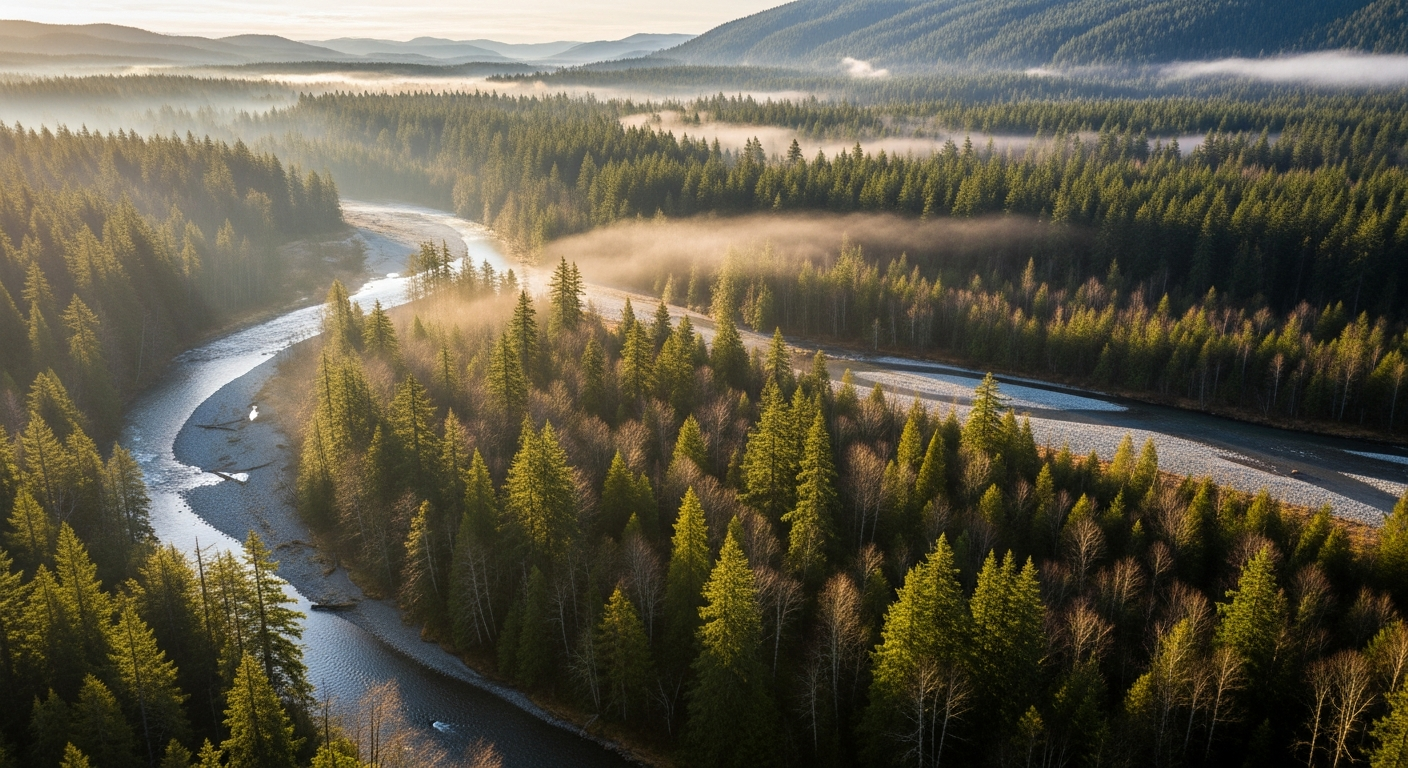
    The Tahuya River drains eastern Mason County and empties into Hood Canal near Belfair. What happens in that watershed — how much sediment runs off after a rain event, how much nutrient load enters the canal, how warm the water is by July — directly affects conditions in Hood Canal itself.

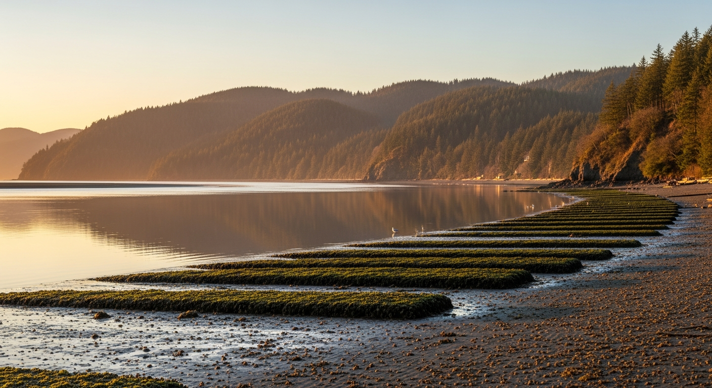
    Hood Canal is a semi-enclosed fjord. It doesn’t flush as quickly as open Puget Sound. Dissolved oxygen levels, water temperature, and nutrient loading matter here in ways that are measurable and consequential. When those factors tip the wrong direction, shellfish beds close. When they hold steady, the canal supports the ecosystem — and the way of life — that Hood Canal property values are built on.

    Great Peninsula Conservancy’s Tahuya River Preserve permanently protects 190 acres of floodplain forest and wetlands along the lower Tahuya corridor. Floodplain forest is not passive. It filters runoff before it reaches the river, moderates water temperatures through canopy shading, and traps sediment that would otherwise flow downstream and into the canal.

    The Gabion Wall Removal: A Direct Water Quality Improvement

    The most significant near-term project connected to the preserve is the planned removal of a Gabion wall from the Tahuya River corridor. Gabion walls — wire-cage rock structures installed for bank stabilization — alter natural stream flow patterns, trap fine sediment in ways that degrade spawning gravel, and prevent the natural movement of large wood debris downstream.

    When the wall comes out, the river will begin recovering a more natural channel dynamic. Engineers are also evaluating engineered log jam structures upstream to rebuild holding pools and feeding lanes for juvenile salmon. Healthier salmon habitat upstream means more adult salmon returning — and salmon carcasses are one of the primary marine-derived nutrient inputs that forest and riparian systems depend on. It’s a closed loop that connects the mountains to the canal.

    The project is in the permitting and planning phase as of May 2026. No construction timeline has been announced, but the land protection necessary to make it happen is complete.

    What This Means for Shellfish Bed Status on Hood Canal

    If you harvest shellfish from Hood Canal tidelands, or if your property value is tied to an open shellfish beach, you already know that closures happen — and that the reasons are usually tied to water quality upstream. Fecal coliform from stormwater, agricultural runoff, and failing septic systems are the primary drivers of WDFW closure events on Hood Canal.

    Protecting floodplain forest along the Tahuya doesn’t fix septic systems — that’s a different problem. But it does reduce one of the diffuse-source inputs: unfiltered runoff from cleared or developed land adjacent to salmon-bearing streams. Every acre of permanently protected floodplain is one less acre that could be cleared, graded, or made impervious in the future.

    For Hood Canal property owners, the preserve is a long-term investment in the upstream conditions that determine what the canal looks like in 20 years.

    The ESA Connection and What It Means for the Canal

    Hood Canal summer chum salmon may become the first ESA-listed salmon population ever removed from the federal endangered species list. That’s not a distant possibility — NOAA Fisheries has signaled the population meets recovery criteria, with Tahuya River runs holding between 200 and 1,000 fish annually since 2006 without supplementation. If delisting proceeds, it would represent a significant reduction in regulatory burden on Hood Canal development and land use — something that directly affects property owners navigating shoreline development permits.

    The Hood Canal Salmon Enhancement Group monitors juvenile salmon on the Tahuya, Dewatto, and Little Quilcene Rivers each spring from their facility at 600 NE Roessel Road in Belfair, (360) 275-9284. Their data is what drives the federal recovery assessment.

    Also see: Tahuya River Preserve: 190 Acres Permanently Protected — Full Story | Hood Canal Property Owners: What the 2026 Shellfish Rule Changes Mean for Your Beach

    Frequently Asked Questions

    Does the Tahuya River Preserve affect Hood Canal shellfish bed closures?

    Indirectly, yes. Protecting 190 acres of floodplain forest along the Tahuya reduces diffuse stormwater runoff into the river and ultimately into Hood Canal. Shellfish closures are driven by fecal coliform levels, and reducing upstream runoff inputs is one piece of the water quality picture. It won’t fix point-source pollution, but it removes a future risk from the equation.

    How does the Gabion wall removal affect Hood Canal water quality?

    Removing the Gabion wall allows the Tahuya River to recover a more natural channel shape — distributing flow across the floodplain, reducing fine sediment export, and allowing wood debris to move naturally downstream. These changes improve water clarity and temperature downstream, benefiting Hood Canal conditions near the river mouth.

    What is the current ESA status of Hood Canal salmon and what does it mean for property owners?

    Hood Canal summer chum and Chinook salmon are both listed as threatened under the ESA. Hood Canal summer chum may be the first ESA-listed salmon ever delisted — a development that would reduce certain regulatory constraints on Hood Canal shoreline and development activities. Continued habitat restoration, including the Tahuya River work, supports the recovery data driving that potential delisting.

    Who is responsible for salmon restoration on the Tahuya River?

    Great Peninsula Conservancy holds and manages the land. The Hood Canal Salmon Enhancement Group (HCSEG), based at 600 NE Roessel Road in Belfair, leads habitat restoration work, juvenile salmon monitoring, and the Gabion wall removal planning in partnership with GPC.

    Does the preserve affect future development near the Tahuya River?

    Yes. The 190 acres are permanently protected by a conservation easement — they cannot be sold for development, cleared, or subdivided. This is the intended outcome: locking in floodplain function in perpetuity so future land use decisions upstream don’t erode what restoration work achieves downstream.

  • Tahuya River Preserve Reaches 190 Acres: What North Mason Needs to Know About Salmon Restoration on Hood Canal

    Tahuya River Preserve Reaches 190 Acres: What North Mason Needs to Know About Salmon Restoration on Hood Canal

    For more than two years, Great Peninsula Conservancy has been quietly assembling one of the most ecologically significant land protection projects on Hood Canal. The result is the Tahuya River Preserve — 190 acres of floodplain forest, wetlands, and riverfront corridor in eastern Mason County, permanently protected and now the anchor for a phased restoration effort targeting the lower four miles of the Tahuya River.

    For North Mason residents who know the lower Tahuya — the bear tracks in the mud, the salmon carcasses that fertilize the cottonwood flats each fall — this is the moment when “protected” stops meaning paperwork and starts meaning something permanent.

    How the Preserve Came Together

    Great Peninsula Conservancy (GPC) built the preserve in stages. In July 2023, the organization acquired 145 acres along the lower Tahuya mainstem, funded through a Washington Department of Ecology Streamflow Restoration grant and the state Salmon Recovery Funding Board. That December, GPC added an adjacent 38-acre parcel. In 2025, two smaller parcels totaling approximately five acres completed the assemblage — including roughly 450 feet of Tahuya River mainstem — bringing the total to 190 acres.

    The preserve sits where the Tahuya River watershed drains into Hood Canal, just east of Belfair. It’s a strategic location: protecting floodplain here controls what enters the canal at one of the most salmon-critical junctions in Mason County.

    Why the Tahuya River Matters for Salmon

    Two salmon species listed under the federal Endangered Species Act use the Tahuya River: Hood Canal summer chum and Chinook salmon. The summer chum story here is one of the most remarkable conservation recoveries in the Pacific Northwest. Summer chum were classified as “recently extinct” in the Tahuya River before a reintroduction effort beginning in the early 2000s. Using Union River summer chum as donor stock, HCSEG rebuilt the run — 750 fish returned in the first year. Since 2006, annual Tahuya summer chum returns have held between 200 and 1,000 fish. The final supplementation release was in 2015; the population has sustained itself since.

    NOAA Fisheries has signaled that Hood Canal summer chum may be the first ESA-listed salmon population ever removed from the endangered species list — a milestone no Pacific salmon population has achieved in the history of the Act. The Tahuya River is part of that recovery story.

    The Hood Canal Salmon Enhancement Group (HCSEG), headquartered at 600 NE Roessel Road in Belfair, monitors juvenile salmon using rotary screw traps on the Tahuya, Dewatto, and Little Quilcene Rivers each spring. Their data drives decisions about where restoration dollars go next — and the Tahuya is currently near the top of that list.

    The Gabion Wall Removal: What Comes Next

    The most significant near-term restoration project is the planned removal of a Gabion wall — a wire-cage rock structure — from the Tahuya River corridor. Gabion walls were widely used in mid-20th century stream engineering to control erosion, but they alter natural stream flows, disrupt gravel substrate that salmon need for spawning redds, and interrupt the natural wood and debris movement that juvenile salmon depend on for cover and food.

    GPC is working with HCSEG on removal plans. Once the wall is out, engineers are also evaluating the installation of engineered log jam structures upstream — designed to mimic the natural wood accumulation that builds holding pools and feeding lanes for juvenile salmon.

    These projects are still in the permitting and hydrology study phase. Salmon habitat work at this scale requires state and federal coordination, contractor mobilization, and hydrological modeling — it moves carefully. But the land protection that makes any of it legally and practically possible is done.

    What This Means for North Mason

    The Tahuya River Preserve represents one piece of a larger conservation strategy for the lower Hood Canal watershed. Every acre of floodplain protected upstream means less sediment loading, cooler water temperatures, and better dissolved oxygen in Hood Canal itself — the same water that determines whether shellfish beds stay open and whether salmon return each fall to the beaches and rivers that define this community.

    For North Mason residents, it’s also a statement about what this corner of Washington is choosing to be. Development pressure on the SR-3 corridor is real. The Tahuya River Preserve locks in a counter-weight: 190 acres that will never be a subdivision, a gravel pit, or a parking lot.

    Residents interested in the restoration work — or in volunteering for HCSEG’s 2026 rotary screw trap season — can contact the Hood Canal Salmon Enhancement Group at 600 NE Roessel Road, Belfair, (360) 275-9284, or at pnwsalmoncenter.org. Great Peninsula Conservancy is based at 6536 Kitsap Way, Bremerton, (360) 373-3500, or greatpeninsula.org.

    Also see: Hood Canal Shellfish Season 2026: What North Mason Harvesters Need to Know

    Frequently Asked Questions

    Where exactly is the Tahuya River Preserve?

    The preserve is in eastern Mason County, along the lower Tahuya River corridor where it drains into Hood Canal. It is located just east of Belfair and is not currently open to the general public for recreation — it is managed as a conservation area by Great Peninsula Conservancy.

    What salmon species use the Tahuya River?

    Hood Canal summer chum salmon and Chinook salmon both use the Tahuya River watershed. Both are listed as threatened under the federal Endangered Species Act. Summer chum were successfully reintroduced to the Tahuya after being classified as locally extinct, and the population has sustained itself without supplementation since 2015.

    What is a Gabion wall and why is it being removed?

    A Gabion wall is a wire-cage rock structure used historically for stream bank stabilization. While effective at controlling erosion, they alter natural water flow, disrupt gravel spawning beds, and impede the movement of large wood debris that salmon depend on. Removal restores more natural stream dynamics.

    When will the Gabion wall removal happen?

    The project is currently in the planning and permitting phase. Great Peninsula Conservancy and HCSEG are working through hydrology studies and regulatory coordination. No construction timeline has been publicly announced as of May 2026.

    How can North Mason residents get involved with salmon restoration on the Tahuya?

    The Hood Canal Salmon Enhancement Group welcomes volunteers for its 2026 rotary screw trap season and other restoration projects. Contact HCSEG at 600 NE Roessel Road, Belfair, (360) 275-9284, or visit pnwsalmoncenter.org.

    Does the Tahuya River Preserve affect Hood Canal water quality?

    Yes. Protecting floodplain forest along the Tahuya River reduces sediment and nutrient runoff into Hood Canal, helps maintain cooler water temperatures, and supports dissolved oxygen levels — all factors that affect shellfish bed status and salmon habitat quality in the canal itself.

  • Tahuya River Preserve Grows to 190 Acres — Salmon Restoration Eyes Gabion Wall Removal

    Tahuya River Preserve Grows to 190 Acres — Salmon Restoration Eyes Gabion Wall Removal

    If you’ve walked the lower Tahuya River corridor lately, you’ve probably noticed the bear tracks and salmon carcasses that line the banks each fall — signs that something worth protecting is still alive here. Thanks to a multi-year land conservation push by Great Peninsula Conservancy, 190 acres along the lower Tahuya River are now permanently protected, and the harder work of actual habitat restoration is moving into its next phase.

    The Tahuya River Preserve sits in eastern Mason County, straddling the watershed that drains into Hood Canal near Belfair. Great Peninsula Conservancy assembled the preserve in stages — 145 acres acquired in July 2023 with support from the Washington Department of Ecology Streamflow Restoration grant and the state Salmon Recovery Funding Board, followed by an adjacent 38 acres in December of that year, and two smaller parcels totaling about five acres in 2025. Taken together, the preserve now protects roughly 450 feet of Tahuya River mainstem and is designed as the anchor point for a larger phased effort to conserve the lower four miles of the river.

    Why does this stretch matter? Both Hood Canal summer chum salmon and Chinook salmon use the Tahuya River watershed — and both are listed under the federal Endangered Species Act. The Hood Canal Salmon Enhancement Group, headquartered at 600 NE Roessel Road in Belfair, has been monitoring juvenile salmon using rotary screw traps on the Tahuya, Dewatto, and Little Quilcene Rivers each spring. Their data guides where restoration dollars go next.

    The most anticipated near-term project is the removal of a Gabion wall — a wire-cage rock structure that alters natural stream flows — from the Tahuya River corridor. Great Peninsula Conservancy is working with the Hood Canal Salmon Enhancement Group on removal plans. Once the wall comes out, engineers are also weighing the installation of log jam structures upstream to mimic natural wood accumulation that juvenile salmon depend on for cover and food.

    These aren’t quick projects. Permitting, hydrology studies, and contractor coordination mean the removal is still in planning rather than construction phase — but the land protection piece that makes any of it possible is done. Our river isn’t going anywhere.

    For anyone who wants to learn more or get involved, Great Peninsula Conservancy is based at 6536 Kitsap Way in Bremerton and can be reached at (360) 373-3500 or greatpeninsula.org. The Hood Canal Salmon Enhancement Group is at 600 NE Roessel Road, Belfair; (360) 275-9284.

    Related Coverage: Tahuya River Deep Dives

  • Hood Canal Property Owner’s Guide to Shellfish Access, Tribal Boundaries, and the 2026 Season at Potlatch

    Hood Canal Property Owner’s Guide to Shellfish Access, Tribal Boundaries, and the 2026 Season at Potlatch

    If you own property along Hood Canal in Mason County — whether a primary residence, a vacation cabin, or a waterfront lot — shellfish access is one of the practical realities of waterfront ownership in this corridor. The 2026 season brings two regulation changes, and the Skokomish Tribal Nation’s treaty tidelands add a layer of complexity that waterfront owners need to understand correctly.

    Who Owns the Tidelands in Front of Your Property?

    In Washington State, waterfront property ownership typically extends to the ordinary high-water mark (OHWM), not to the water itself. Tidelands — the area between the high-water mark and the low-water mark — may be owned by the state, by the Department of Natural Resources, by a private party, or by tribal nations. The ownership of the tidelands in front of your property determines whether you have legal access to harvest shellfish there.

    On Hood Canal south of the Skokomish River delta, a significant portion of tidelands is subject to Skokomish Tribal Nation treaty rights. These rights are distinct from land ownership — they are federally recognized harvesting rights that predate state jurisdiction. State-licensed recreational harvesters do not have authority to harvest on tribally-held tidelands regardless of their proximity to private waterfront property. The Washington Department of Fish and Wildlife’s shellfish beach locator (wdfw.wa.gov/places-to-go/shellfish-beaches) maps which beaches are open to recreational harvest and which are not.

    If you are uncertain about the tideland status of your Hood Canal property, the Mason County Assessor’s office and the Washington DNR’s parcel viewer (dnr.wa.gov) both provide tools to research ownership. This matters if you plan to harvest at your waterfront or if you invite guests who assume that access comes with the property.

    Potlatch State Park: The Public Beach in Your Neighborhood

    Potlatch State Park, approximately 12 miles north of Shelton on Highway 101, is the primary public recreational shellfish beach serving the southern Hood Canal corridor. The state park and adjacent Potlatch DNR tidelands are managed specifically for public recreational access, which is why they attract harvesting pressure that private tidelands do not.

    The 2026 spring season at Potlatch runs April 1 through May 31. For Hood Canal property owners who want to harvest recreationally but lack tidelands rights at their own property, Potlatch is the nearest well-managed public option. Highway 101 shoulder parking from mileposts 335.07 to 335.72 is actively enforced — use the state park and DNR beach designated parking rather than the shoulder.

    The 2026 Regulation Changes That Affect Hood Canal Harvesting

    Two Hood Canal-specific regulations changed in 2026 under Washington Department of Fish and Wildlife rulemaking:

    Cockle minimum size increased to 2.5 inches. The minimum legal harvest size for cockles taken from Hood Canal beaches — including Potlatch and any private tidelands open to recreational harvest — increased from the prior standard to 2.5 inches shell diameter. The change aligns cockle regulations with the species’ biology, allowing more individuals to reach reproductive age before harvest. Harvesters should carry a measuring gauge; the infraction for undersized shellfish is substantial.

    Geoduck daily limit reduced to 1 per person per day. The geoduck limit on Hood Canal dropped to 1 geoduck per person per day, down from 3. Geoduck require a separate license from standard shellfish-seaweed licenses and are subject to area-specific regulations that WDFW updates annually. Property owners with geoduck populations on their tidelands should note this limit applies to recreational harvest across Hood Canal, not just public beaches.

    Biotoxin Closures and Waterfront Property

    Hood Canal’s enclosed geography and warm summer water temperatures make it one of the more biotoxin-prone shellfish areas in Washington State. Closures for paralytic shellfish poisoning (PSP), domoic acid, and other biotoxins can be issued at any time by the Washington State Department of Health and apply to all recreational harvest on affected beaches — state, DNR, and private tidelands alike.

    For Hood Canal property owners who harvest from their own tidelands or host guests who do: biotoxin closures are binding regardless of private ownership. The Washington State Department of Health’s Shellfish Safety Map (doh.wa.gov) is the authoritative source. WDFW also maintains a shellfish safety hotline. Check before every harvest outing — the shellfish appear and smell normal during biotoxin events and cannot be detected without laboratory testing.

    Alternate Beaches When Season Varies

    Hood Canal property owners who want year-round or extended shellfish access beyond Potlatch’s May 31 season have two nearby public options worth knowing:

    • WDFW Hoodsport Hatchery beach is open for shellfish harvest through July 31, 2026 — two months past Potlatch’s close. Located in Hoodsport on Highway 101, it offers continuity for harvesters who want to stay in the Hood Canal corridor into summer.
    • Eagle Creek shellfish area is open for oyster harvest year-round, offering access outside seasonal closures. It is smaller and lower-traffic than Potlatch.

    Frequently Asked Questions — Hood Canal Tidelands for Property Owners

    Do Hood Canal waterfront property owners automatically have shellfish harvesting rights?

    Not necessarily. Washington waterfront ownership typically extends only to the ordinary high-water mark. Tidelands may be privately owned, state-owned, DNR-managed, or subject to tribal treaty rights. You need to research the specific tideland ownership for your parcel through the Mason County Assessor’s office or the Washington DNR’s parcel viewer (dnr.wa.gov) before assuming harvesting rights.

    What are the Skokomish tribal tidelands on Hood Canal?

    The Skokomish Tribal Nation holds federally recognized treaty rights over tidelands in portions of Hood Canal, particularly in the southern section near the Skokomish River delta. These rights predate Washington State jurisdiction. State-licensed recreational harvesters cannot harvest on tribally-held tidelands. The WDFW shellfish beach locator (wdfw.wa.gov/places-to-go/shellfish-beaches) shows which beaches are open to public recreational harvest.

    What is the 2026 cockle minimum size on Hood Canal?

    2.5 inches shell diameter, increased from the prior standard. This applies to all Hood Canal beaches including Potlatch State Park and any private tidelands open to recreational harvest. Carry a gauge — undersized shellfish violations carry significant fines.

    Can biotoxin closures apply to my private tidelands?

    Yes. Washington State Department of Health biotoxin closures apply to all recreational shellfish harvest in the affected area, regardless of whether the tidelands are privately or publicly owned. There is no private tideland exemption from biotoxin closures. Check doh.wa.gov before every harvest outing.

    When does the Potlatch shellfish season end in 2026?

    May 31, 2026. After that date, the WDFW Hoodsport Hatchery beach remains open through July 31, and Eagle Creek is open year-round for oysters. Always verify current status at WDFW (wdfw.wa.gov) before any harvest outing, as emergency closures can alter seasons without advance notice.

    For the full 2026 Potlatch season guide with alternate beaches, parking rules, and complete regulation updates, see Hood Canal Shellfish Season Open Through May 31: Potlatch Beach Guide for Mason County Harvesters. For Mason County real estate and waterfront property context, see Mason County Real Estate: Prices, Trends and Neighborhoods.

  • First Time Shellfish Harvesting at Potlatch? Mason County’s Beginner Guide to Hood Canal Clams and Oysters

    First Time Shellfish Harvesting at Potlatch? Mason County’s Beginner Guide to Hood Canal Clams and Oysters

    Potlatch State Park on Hood Canal is one of the most accessible places in Mason County to harvest shellfish — no boat required, easy parking, and a beach that produces oysters, Manila clams, mussels, cockles, and (with a separate license) geoduck. The spring season runs through May 31, 2026. If you’ve been meaning to try it, you have roughly five weeks left — and this is what you need to know before you go.

    Where Is Potlatch and How Do You Get There?

    Potlatch State Park is on U.S. Highway 101 approximately 12 miles north of Shelton, just past Hoodsport on the western shore of Hood Canal. From Shelton, take Highway 101 north through Hoodsport — the park entrance appears on the left (water side) after you pass through town. From Belfair or Allyn, take Highway 3 to 101 and head south toward Hoodsport.

    Important parking note: shoulder parking along Highway 101 mileposts 335.07 to 335.72 is actively enforced. Use the designated parking areas at the state park and the adjacent Potlatch DNR beach access, not the highway shoulder. Rangers do ticket here, especially on weekend mornings during harvest season.

    What License Do You Need?

    For clams, oysters, mussels, and cockles: you need a standard Washington fishing license with a shellfish-seaweed catch record. These are available from WDFW’s licensing website, from license dealers (sporting goods stores, some grocery stores), or via the WDFW mobile app. Licenses are valid for the calendar year.

    For geoduck specifically: geoduck require a separate license in addition to the standard shellfish license. Geoduck limits and regulations can also change by area year to year — in 2026, the Hood Canal daily geoduck limit dropped to 1 per person per day (down from 3). If geoduck isn’t your primary goal on a first trip, skip the separate license for now and focus on clams and oysters.

    What You’ll Find on the Beach

    Potlatch has over a mile of tidelands. The stretch closest to the highway is regularly harvested and is where you’ll find the highest concentrations of Manila clams in the middle and upper intertidal zones, with the greatest abundance on the large tide flat at the southern end. Oysters tend to cluster in the lower intertidal area — closer to the water line and accessible mainly on big minus tides.

    For a first trip with family, Manila clams are the most beginner-friendly target. They’re small (1–2 inches), buried just 2–4 inches in the sand and gravel, and found in densities that make digging feel productive quickly. A small garden trowel or clam gun works well. Check current limits before you go — WDFW updates them, and Hood Canal limits can differ from Puget Sound limits even for the same species.

    The 2026 Rule Changes You Must Know

    Two Hood Canal-specific regulations changed for 2026 and apply at Potlatch:

    • Cockle minimum size: 2.5 inches. The minimum legal harvest size for cockles increased from the prior standard to 2.5 inches shell diameter. If you’re not sure what a cockle looks like, they are round, ribbed clams — rounder and more dome-shaped than a Manila or littleneck. Bring a small ruler or measuring gauge.
    • Geoduck daily limit: 1 per person per day. The geoduck limit on Hood Canal dropped to 1 per day (formerly 3). Geoduck are the giant clams — their siphons protrude from the sand and they require real digging. A first-timer is unlikely to encounter geoduck casually, but if you spot one, know the new limit.

    Tribal Boundaries and What They Mean for Harvesters

    The Skokomish Tribal Nation holds treaty rights over tidelands in parts of Hood Canal, including areas adjacent to Potlatch State Park. State-licensed recreational harvesters must remain on state or DNR-managed tidelands — not tribally-held tidelands. At Potlatch, the state park and adjacent DNR beach are the appropriate harvest areas. If you are uncertain about boundaries, harvest near the clearly marked state park beach rather than wandering south toward the tribal boundary areas.

    Always Check for Biotoxin Closures Before You Go

    This is non-negotiable: before any shellfish outing, check the Washington State Department of Health’s Shellfish Safety Map at doh.wa.gov or call WDFW’s shellfish safety hotline. Biotoxin (paralytic shellfish poisoning) closures happen without warning on Hood Canal beaches, including Potlatch. Biotoxins are odorless and tasteless — you cannot detect them in the shellfish. A closure means the shellfish are not safe to eat, period. No exceptions. Check before every trip, even if you were there last weekend.

    If Potlatch Is Crowded — Two Nearby Alternatives

    Weekend afternoons in May can get busy at Potlatch. Two nearby alternatives on the same highway corridor:

    • WDFW Hoodsport Hatchery beach is open for shellfish harvest through July 31, 2026. It’s in Hoodsport on Highway 101 — shorter drive from Shelton, slightly less well-known, and open a full month past Potlatch’s May 31 close.
    • Eagle Creek shellfish area is open for oyster harvest year-round. Smaller and quieter than Potlatch. Good if you want oysters specifically and don’t need to stay in the May-season window.

    Frequently Asked Questions — Potlatch Shellfish for First-Timers

    Do I need a license to harvest shellfish at Potlatch State Park?

    Yes. You need a Washington fishing license with a shellfish-seaweed catch record. Available from WDFW’s website, the WDFW mobile app, or licensed dealers. Geoduck require an additional separate license. Children under 15 are typically exempt from licensing requirements — check WDFW’s current exemption rules for your child’s age.

    When is the Potlatch shellfish season in 2026?

    The clam, mussel, and oyster season at Potlatch State Park runs April 1 through May 31, 2026. After May 31, Potlatch closes for the summer. The WDFW Hoodsport Hatchery beach (also on Hood Canal near Highway 101) remains open through July 31, 2026.

    What is the cockle minimum size at Potlatch in 2026?

    The minimum legal harvest size for cockles on Hood Canal, including Potlatch, is 2.5 inches shell diameter in 2026. This increased from the prior standard. Bring a measuring gauge — it’s a $125+ infraction to keep undersized shellfish.

    Can I park on the highway shoulder at Potlatch?

    No. Highway 101 shoulder parking from mileposts 335.07 to 335.72 is actively enforced at Potlatch. Use designated parking at the state park or DNR beach access. Violations are ticketed, especially on weekend mornings during peak season.

    How do I know if Potlatch is closed for biotoxins?

    Check the Washington State Department of Health’s Shellfish Safety Map at doh.wa.gov or call WDFW’s shellfish safety hotline before every trip. Biotoxin closures can be issued at any time and are not predictable — the shellfish look and smell normal during a closure. Never harvest without confirming the beach is open.

    For the full 2026 Potlatch season guide including alternate beaches and detailed regulation updates, see Hood Canal Shellfish Season Open Through May 31: Potlatch Beach Guide for Mason County Harvesters. For more things to do in Mason County, see Things to Do in Mason County: The Definitive Guide.

  • Hood Canal Shellfish Season Open Through May 31: Potlatch Beach Guide for Mason County Harvesters

    Hood Canal Shellfish Season Open Through May 31: Potlatch Beach Guide for Mason County Harvesters

    Mason County shellfish harvesters have roughly five weeks left in the spring season at Potlatch State Park and the adjacent Potlatch DNR beach — two of the most accessible and productive harvest beaches on Hood Canal. The season runs April 1 through May 31, 2026, and a handful of new regulations took effect this year that harvesters should know before they head to the water.

    Potlatch Beach: What’s Open and What Changed in 2026

    Potlatch State Park sits along U.S. Highway 101 approximately 12 miles north of Shelton, just past Hoodsport on the western shore of Hood Canal. The park’s beach and the adjacent Potlatch DNR tidelands together make up one of the most regularly harvested shellfish areas in Mason County, accessible to anglers and families who don’t need a boat to reach productive oyster, clam, and mussel beds.

    For 2026, the Washington Department of Fish and Wildlife updated two regulations that affect harvest at Potlatch and throughout Hood Canal:

    Cockle minimum size increased to 2.5 inches. The minimum legal size for cockles taken from Hood Canal beaches, including Potlatch, increased from the prior standard to 2.5 inches shell diameter. Harvesters should carry a simple gauge or measuring tool to avoid taking undersized cockles.

    Geoduck daily limit reduced to 1 per person per day. The geoduck limit on Hood Canal dropped to 1 geoduck per person per day. Geoducks require a separate license from standard shellfish-seaweed licenses and are subject to area-specific regulations that can change annually.

    A practical note for those driving out from Shelton, Belfair, or other parts of the county: Highway 101 shoulder parking along the Potlatch segment — mileposts 335.07 to 335.72 — is actively enforced. Use designated parking areas at the state park and DNR beach rather than pulling off on the highway shoulder.

    The Skokomish Tribal Nation holds treaty rights over tidelands in parts of Hood Canal, including areas adjacent to the state park. Harvesters on Potlatch tidelands should be aware of tribal area boundaries and ensure they are on state or DNR-managed beach rather than tribally-held tidelands.

    Alternate Beaches When Potlatch Is Crowded

    The Potlatch beach is popular on weekends, particularly during the last weeks of the season as May 31 approaches. Two nearby alternates are worth knowing:

    WDFW Hoodsport Hatchery beach is open for shellfish harvest through July 31, 2026. The hatchery is located in Hoodsport on U.S. Highway 101, and the associated public tidelands offer an option for harvesters who want to stay in the Hoodsport-Hood Canal corridor. Check WDFW regulations for current limits and open species before visiting.

    Eagle Creek shellfish area is open for oyster harvest year-round. It is a smaller, less trafficked option for Mason County residents who want access outside the May 31 season closure at Potlatch.

    Before any harvest outing, verify current status at WDFW’s shellfish safety hotline or online at wdfw.wa.gov — Hood Canal beaches are subject to emergency closure if water quality tests indicate biotoxin or bacterial contamination. Closures can happen with short notice, especially after rain events flush runoff into the canal.

    Common Ground at the Y: New Outdoor Space Opens in Shelton

    On the south-county end, Shelton’s outdoor recreation scene added something new in mid-April. The Shelton Family YMCA officially opened Common Ground at the Y, a transformation of the organization’s nearly 10-acre campus into a shared outdoor community space. The project was funded through a T-Mobile Hometown Grant and built in partnership with Mason Conservation District, Hope Plaza, Beko’s Tree Service, Mason Matters, Mason County Community Justice (MCCJ), and the Squaxin Island Tribe.

    The campus now includes forest therapy trails, native plant gardens, gathering areas, educational and art installations, and natural play features. The Huff ‘n’ Puff Trail — a 1.8-mile loop on the YMCA property maintained by the Shelton Rotary Club — is open to members and the public. Non-member access is available with a suggested $20 donation, and Mason Transit offers free shuttles to the campus for stewardship and programming events.

    Common Ground at the Y is a different kind of outdoor option than Hood Canal’s beaches — more structured, more accessible for families with young children, and designed to serve as a gathering point for community conservation activity. For Mason County residents who want to connect with local conservation organizations or just get their family into green space without a drive to the canal, the YMCA campus at Shelton is worth a visit. The YMCA is located in Shelton; contact the Shelton Family YMCA directly for current programming hours and shuttle schedules.

    Frequently Asked Questions

    When does the Potlatch shellfish season close in 2026?

    The spring shellfish season at Potlatch State Park and Potlatch DNR beach closes May 31, 2026. The season opened April 1. Harvesters have roughly five weeks remaining as of late April.

    What shellfish can I harvest at Potlatch in 2026?

    Oysters, clams, mussels, and cockles are available at Potlatch. Geoduck harvest is permitted at 1 per person per day with a valid license. The cockle minimum size increased to 2.5 inches in 2026. Always verify current species-specific limits at wdfw.wa.gov before heading out.

    Is there parking at Potlatch State Park for shellfish harvesting?

    Yes, use designated parking inside the state park and at the DNR beach access area. Highway 101 shoulder parking between mileposts 335.07 and 335.72 is actively enforced — do not park on the highway shoulder.

    How do I check if Potlatch beach is open before I go?

    Call the WDFW shellfish safety hotline or check the current status at wdfw.wa.gov. Hood Canal beaches can close on short notice due to biotoxin or bacterial contamination. Checking before a long drive saves a wasted trip.

    Where is Common Ground at the Y in Shelton?

    Common Ground at the Y is on the Shelton Family YMCA campus in Shelton. The site includes forest therapy trails, native gardens, and the 1.8-mile Huff ‘n’ Puff Trail maintained by the Shelton Rotary Club. Mason Transit offers free shuttles for stewardship events. Contact the Shelton Family YMCA for current hours and programming details.

    Related coverage: First time at Potlatch? See Mason County’s Beginner Guide to Hood Canal Shellfish Harvesting. Hood Canal property owners, see Shellfish Access, Tribal Boundaries, and the 2026 Season: A Property Owner’s Guide.

  • بيلفير وكاونتي ماسون: تجربة المحيط الهادي الأصيلة للمشجع السعودي

    بيلفير وكاونتي ماسون: تجربة المحيط الهادي الأصيلة للمشجع السعودي

    ⚠️ آخر تحديث: 28 أبريل 2026

    حين تكون فنادق سياتل ممتلئة وأسعارها في السماء خلال كأس العالم 2026، يبحث معظم المسافرين شمالاً نحو إيفيريت أو شرقاً نحو Bellevue. المسافر الذي يبحث غرباً — عبر العبّارة على Puget Sound إلى كاونتي ماسون وبلدة بيلفير — سيجد ما لا يجده الآخرون: هدوء حقيقي، مياه خليج Hood Canal الفيروزية، غابات معمرة، وأكثر محار طازج في العالم.

    كاونتي ماسون — لمحة سريعة

    📍 الموقع: الزاوية الجنوبية الشرقية لشبه الجزيرة الأوليمبية

    🦪 يشتهر بـ: محار Hood Canal — من أفضل المحار في العالم

    🏔️ المنظر: جبال أوليمبيك مباشرة أمامك من الواجهة البحرية

    ⏱️ المسافة عن سياتل: 96 كيلومتراً — 90 دقيقة عبر العبّارة

    كيف تصل من سياتل إلى بيلفير

    • العبّارة: Seattle → Bremerton: 60 دقيقة من Colman Dock في مركز سياتل، ثم 32 كيلومتراً جنوباً على طريق Highway 3 إلى بيلفير. الوصول الكلي: حوالي 90 دقيقة.
    • بالسيارة: عبر جسر Tacoma Narrows ثم شمالاً على Highway 3. 75-90 دقيقة بدون ازدحام.

    رحلة العبّارة تجربة بحد ذاتها — مناظر سايلاين سياتل وجبل رينير والجبال الأوليمبية من سطح العبّارة.

    محار Hood Canal — تجربة من المصدر

    خليج Hood Canal مشهور عالمياً بإنتاج أفضل أنواع المحار. شركة Taylor Shellfish Farms في Shelton (32 كيلومتراً جنوب بيلفير) تبيع مباشرة للزوار — محار حي وبلح بحر وصدف على الطازج من الخليج.

    للمسافر السعودي المعتاد على ثقافة المأكولات البحرية الخليجية: محار Hood Canal له طعم نقي ومالح مميز، مختلف عن المحار الأوروبي، بنكهة معدنية من ذوبان ثلوج جبال الكاسكيد. تجربة مختلفة تستحق.

    ملاحظة: تحقق من حلالية المحار — التايلور شيلفيش شركة ممتازة لكن تأكد من أسلوب التحضير في المطعم.

    ماذا تفعل في بيلفير وكاونتي ماسون

    بحيرة Cushman

    بحيرة ساحرة في سفوح جبال أوليمبيك — 56 كيلومتراً شمال غرب بيلفير. كياك وسباحة وصعود جبلي. بوابة لمنطقة Staircase في الحديقة الوطنية Olympic.

    حديقة Twanoh State Park

    على بعد 11 كيلومتراً غرب بيلفير — شاطئ رملي على خليج Hood Canal وأسخن مياه للسباحة في Puget Sound صيفاً. دخول مجاني مع تصريح السيارة.

    منتجع Alderbrook Resort and Spa

    منتجع راقٍ في Union — 24 كيلومتراً غرب بيلفير — على حافة الخليج مباشرة. تجربة طعام من البحر للطبق مع منظر المياه والجبال. خيار مثالي للعشاء الخاص أو الإقامة الفاخرة.

    الطعام الحلال وأوقات الصلاة

    كاونتي ماسون منطقة ريفية صغيرة — الطعام الحلال محدود. نصيحة: خطط مسبقاً وأحضر طعامك من سياتل أو إيفيريت. للمساجد وأوقات الصلاة في سياتل: IslamicFinder.org.

    أسئلة شائعة

    هل بيلفير يستحق الزيارة خلال كأس العالم؟

    نعم — إذا كنت تبحث عن تجربة مختلفة خارج صخب المدينة. محار طازج ومناظر جبلية وهدوء حقيقي بعيد عن ضغط كأس العالم.

    هل يمكن الوصول لبيلفير بدون سيارة؟

    صعب نسبياً. العبّارة إلى Bremerton تعمل، لكن داخل كاونتي ماسون السيارة أو Ridesharing ضروري للتنقل.

  • Belfair et le Comté de Mason pour les visiteurs de la Coupe du Monde FIFA 2026 : L’alternative tranquille du Pacifique Nord-Ouest

    Belfair et le Comté de Mason pour les visiteurs de la Coupe du Monde FIFA 2026 : L’alternative tranquille du Pacifique Nord-Ouest

    Quand les hôtels de Seattle afficheront complet pour la Coupe du Monde FIFA 2026, la plupart des voyageurs internationaux regarderont vers Everett au nord ou Bellevue à l’est. Ceux qui regarderont vers l’ouest — traversant le Puget Sound en ferry vers le Comté de Mason et la communauté de Belfair — trouveront quelque chose que les autres n’auront pas : silence, eau, forêt et le vrai Pacifique Nord-Ouest que l’infrastructure touristique de Seattle a en grande partie recouvert d’asphalte.

    Le Comté de Mason en bref : Le Comté de Mason occupe l’angle sud-est de la Péninsule Olympique, bordé par le Hood Canal à l’ouest et le bras sud du Puget Sound à l’est. Le chef-lieu est Shelton. La communauté de Belfair se trouve à la pointe sud du Hood Canal — un fjord naturel réputé pour l’ostréiculture, la plongée sous-marine et les vues sur les Olympic Mountains. Distance depuis Seattle : 96 km par la route, ou 48 km via le ferry de Bremerton.

    Pourquoi le Comté de Mason pour les visiteurs de la Coupe du Monde ?

    Le cas pratique est simple : les hôtels de Seattle seront fortement sollicités pendant les périodes de matchs. Le Comté de Mason offre des hébergements — locations saisonnières, petites auberges et terrains de camping — qui resteront disponibles et abordables quand Seattle, Bellevue et Everett seront complets.

    Le cas stratégique est plus intéressant : le Comté de Mason, c’est là où vit vraiment le Pacifique Nord-Ouest. Les huîtres du Hood Canal sont récoltées à quelques kilomètres des hébergements. Les Olympic Mountains sont visibles depuis le front de mer. Les ours noirs sont une faune réelle, pas une exposition de zoo.

    Comment rejoindre les matchs de Seattle depuis le Comté de Mason

    • Ferry Washington State : Seattle–Bremerton — Traversées fréquentes (60 minutes) depuis le Colman Dock dans le centre de Seattle. De Bremerton, Belfair est à 32 km au sud sur la Highway 3. Temps de trajet total depuis Seattle : environ 90 minutes.
    • Par la route via la Highway 16 et la Highway 3 — Depuis Seattle, passer par le pont Tacoma Narrows et remonter vers le nord. Temps de trajet : 75–90 minutes sans circulation.

    Pour les visiteurs de la Coupe du Monde, la traversée en ferry est l’expérience la plus riche — elle offre des vues sur la skyline de Seattle, le Mont Rainier et les Olympic Mountains depuis le pont du navire. C’est une expérience du Pacifique Nord-Ouest à part entière.

    Les huîtres du Hood Canal : une expérience gastronomique de premier rang

    L’eau froide et pure du Hood Canal et son important marnage produisent des huîtres du Pacifique (Crassostrea gigas) dont le profil gustatif est classé parmi les meilleurs du monde par les amateurs sérieux. Taylor Shellfish Farms exploite un point de vente à Shelton, où les voyageurs peuvent acheter des huîtres vivantes, des palourdes et du geoduck directement auprès du producteur.

    Pour les voyageurs français connaissant les huîtres de Bretagne, du bassin d’Arcachon ou de Marennes-Oléron : les huîtres du Hood Canal sont plus iodées et fraîches que les huîtres plates européennes, avec une finale minérale issue des eaux de fonte des Cascades qui les distingue nettement. La comparaison tient parfaitement la route.

    Activités de plein air autour de Belfair

    Lake Cushman

    Le Lake Cushman est un lac-réservoir de 1 600 hectares dans les contreforts des Olympic Mountains, à 56 km au nord-ouest de Belfair. Le lac propose kayak, baignade et accès aux sentiers de la zone Staircase du Parc National Olympic — l’une des sections les moins fréquentées du parc, avec une forêt ancienne de douglas et des canyons de rivière spectaculaires.

    Zones humides de Theler

    Le Theler Community Center et les zones humides à Belfair entretiennent un réseau de sentiers de 5 km à travers des marais de marée, une forêt et l’estuaire de l’Union River. Les zones humides sont une colonie de reproduction du Héron Cendré d’Amérique. L’entrée est gratuite.

    Informations pratiques

    Le Comté de Mason dispose d’une infrastructure de transports en commun limitée — une voiture de location ou un service VTC est l’option la plus pratique. La couverture mobile à Belfair et le long de la Highway 106 est correcte avec les principaux opérateurs américains. Températures estivales dans le Comté de Mason (juillet–août) : agréables 18–27 °C avec un brouillard matinal occasionnel qui se dissipe en milieu de journée.

    Questions fréquentes

    À quelle distance Belfair se trouve-t-il des matchs de la Coupe du Monde FIFA 2026 à Seattle ?

    Belfair est à environ 96 km du Lumen Field. L’itinéraire le plus rapide emprunte le ferry Washington State de Colman Dock à Bremerton (60 min) plus 20 minutes de route vers le sud.

    Qu’est-ce qui rend le Comté de Mason et Belfair intéressants pendant la Coupe du Monde ?

    Les huîtres du Hood Canal, les vues sur les Olympic Mountains, le Belfair State Park et l’accès à la zone Staircase du Parc National Olympic en font une véritable expérience du Pacifique Nord-Ouest — pas un simple hébergement de substitution.

    Où manger des huîtres du Hood Canal dans le Comté de Mason ?

    Taylor Shellfish Farms à Shelton vend en direct. L’Alderbrook Resort and Spa à Union sert des fruits de mer du Hood Canal dans un cadre de restaurant en bord de mer. Plusieurs restaurants informels le long de la Highway 106 proposent des fruits de mer locaux de saison.


  • Belfair und Mason County für FIFA WM 2026-Besucher: Die stille Alternative im Pazifischen Nordwesten

    Belfair und Mason County für FIFA WM 2026-Besucher: Die stille Alternative im Pazifischen Nordwesten

    Wenn Seattles Hotels während der FIFA WM 2026 ausgebucht sind und internationale Fans weiter suchen, schauen die meisten nach Norden Richtung Everett oder nach Osten nach Bellevue. Reisende, die nach Westen schauen — über den Puget Sound mit der Fähre nach Mason County und der Gemeinde Belfair — werden etwas vorfinden, das die anderen nicht haben: Stille, Wasser, Wald und den echten pazifischen Nordwesten.

    Mason County auf einen Blick: Mason County liegt an der südöstlichen Ecke der Olympischen Halbinsel, begrenzt vom Hood Canal im Westen und dem südlichen Puget Sound im Osten. Kreisstadt ist Shelton. Belfair liegt an der südlichen Spitze des Hood Canal — einem natürlichen Fjord, bekannt für Austernzucht, Tauchsport und Ausblicke auf die Olympic Mountains. Entfernung von Seattle: 96 km auf dem Landweg oder 48 km über die Bremerton-Fähre.

    Warum Mason County für WM-Besucher?

    Der praktische Fall ist einfach: Seattles Hotelkapazitäten werden während der WM-Spielperioden stark eingeschränkt sein. Mason County bietet Unterkunftsmöglichkeiten — Ferienwohnungen, kleine Gasthäuser und Campingplätze — die verfügbar und erschwinglich bleiben werden, wenn Seattle, Bellevue und Everett ausgebucht sind.

    Der strategische Fall ist interessanter: Mason County ist, wo der pazifische Nordwesten wirklich lebt. Hood Canal-Austern werden wenige Kilometer von den Unterkünften der Reisenden geerntet. Die Olympic Mountains sind vom Waterfront aus sichtbar. Die Skokomish Nation, einer von neun bundesstaatlich anerkannten Stämmen auf der Olympischen Halbinsel, hat hier kulturelle Präsenz und Geschichte, der internationale Besucher im städtischen Tourismus selten begegnen.

    Anreise von Mason County zu den Spielen in Seattle

    • Washington State Ferry: Seattle–Bremerton — 60-minütige Überfahrt von Colman Dock im Stadtzentrum Seattle. Von Bremerton liegt Belfair 32 km südlich auf dem Highway 3. Gesamtreisezeit von Seattle: ca. 90 Minuten.
    • Landweg über Highway 16 und Highway 3 — Von Seattle über die Tacoma Narrows Bridge und nördlich auf dem Highway 3 durch Bremerton. Fahrzeit 75–90 Minuten ohne Verkehr.

    Hood Canal Austern: Ein Weltklasse-Erlebnis

    Das kalte, saubere Wasser des Hood Canal und sein erheblicher Tidenhub erzeugen Pazifische Austern (Crassostrea gigas) mit einem Geschmacksprofil, das ernsthafte Austernkenner zu den besten der Welt zählen. Taylor Shellfish Farms betreibt einen Einzelhandelsstandort in Shelton, wo Reisende lebende Austern, Muscheln und Geoduck direkt vom Erzeuger kaufen können.

    Für deutsche Reisende, die Austernkultur von der Nordseeküste oder Bretagne kennen: Hood Canal-Austern sind frischer und salziger als europäische Flachaustern, mit einem mineralischen Abgang vom Kaskadengletscher-Schmelzwasser, der diese Austern unverwechselbar macht.

    Outdoor-Aktivitäten rund um Belfair

    Lake Cushman

    Der Lake Cushman ist ein 1.600 Hektar großes Stausee in den Ausläufern der Olympic Mountains, 56 km nordwestlich von Belfair. Der See bietet Kajaken, Schwimmen und Wanderwegzugang zum Staircase-Bereich des Olympic National Park — einem der am wenigsten besuchten Abschnitte des Parks mit beeindruckendem Urwald aus Douglastannen.

    Theler Wetlands

    Das Theler Community Center und die Feuchtgebiete in Belfair unterhalten ein 5 km langes Wanderwegsystem durch Gezeitensümpfe, Wald und das Union River Ästuar. Die Feuchtgebiete sind eine Brutkolonie des Kanadareihers. Der Eintritt ist kostenlos.

    Praktische Hinweise für deutsche Reisende

    Mason County hat begrenzte ÖPNV-Infrastruktur — ein Mietwagen oder Ridesharing ist die praktischste Option. Mobilfunkempfang in Belfair und entlang des Highways 106 ist mit den großen US-Anbietern ausreichend. Sommertemperaturen in Mason County (Juli–August): angenehme 18–27 °C mit gelegentlichem Morgennebel, der sich bis Mittag auflöst.

    Häufig gestellte Fragen

    Wie weit ist Belfair von den WM-Spielen in Seattle entfernt?

    Belfair liegt ca. 96 km vom Lumen Field entfernt. Der schnellste Weg ist die Washington State Ferry von Colman Dock nach Bremerton (60 Minuten) plus 20 Minuten Fahrt nach Süden.

    Was macht Mason County und Belfair für WM-Besucher besonders?

    Hood Canal-Austern, Blicke auf die Olympic Mountains, Belfair State Park und Zugang zum Staircase-Bereich des Olympic National Park — Mason County bietet ein echtes pazifisches Nordwesten-Erlebnis, kein bloßes Ausweichquartier.

    Wo kann ich Hood Canal-Austern in Mason County essen?

    Taylor Shellfish Farms in Shelton verkauft direkt an Endkunden. Alderbrook Resort and Spa in Union serviert Hood Canal-Meeresfrüchte in einem Waterfront-Restaurant. Mehrere informelle Restaurants entlang des Highways 106 bieten lokale Meeresfrüchte in der Saison an.


  • Hood Canal Salmon Run 5K Returns to Belfair June 6 — Registration Open at The Salmon Center

    Hood Canal Salmon Run 5K Returns to Belfair June 6 — Registration Open at The Salmon Center

    Six Saturdays from now, our corner of Hood Canal will fill up with running shoes, dog leashes, strollers, and a whole lot of neighbors who care about salmon. The third annual Hood Canal Salmon Run 5K is on for Saturday, June 6, 2026 at The Salmon Center in Belfair, and registration is open right now at pnwsalmoncenter.org. Check-in opens at 8 a.m. and the staggered run/walk start is 9 a.m.

    If you’ve ever pulled into the gravel lot at 600 NE Roessel Road and walked out to the Union River Estuary on a clear morning, you already know what kind of course this is. Flat. Unpaved. Quiet enough to hear the geese. The 5K loops around the estuary on the Hood Canal Salmon Enhancement Group’s working salmon farm and conservation property — the same property our community has been helping HCSEG restore for more than thirty years.

    What the run actually pays for

    Every entry, every t-shirt, every dollar from the Hood Canal Salmon Run goes to two summer day-camp programs that quietly do some of the best youth work in North Mason: Farm Stewards for kids ages 7 to 11, and Explore the Fjord for kids 12 to 16. Both camps run out of The Salmon Center campus in Belfair. Both rely on community donations to keep tuition reachable for local families.

    That’s the whole math: a Saturday morning trail run pays for a kid from Belfair, Allyn, Tahuya, or Shelton to spend a week of summer learning the watershed they live in. Hard to beat that exchange rate.

    The details you need

    • Date: Saturday, June 6, 2026
    • Location: The Salmon Center, 600 NE Roessel Rd, Belfair, WA 98528
    • Check-in: 8:00 a.m.
    • Run/walk starts: 9:00 a.m. (staggered)
    • Course: 5K, flat, unpaved trail around the Union River Estuary
    • Youth policy: Runners 14 and under must be accompanied by an adult
    • Weather: Rain or shine
    • Register: pnwsalmoncenter.org/hood-canal-salmon-run

    2026 race t-shirts are sold separately from registration; every shirt purchase rolls back into youth environmental education. There’s also a sponsor wall on the Salmon Run page if your business wants its logo standing alongside the rest of the Hood Canal supporters.

    Want to volunteer instead of run?

    HCSEG runs this race on volunteer power. Course marshals, check-in tables, water stops — all neighbors. The 5K Volunteer Coordinator is Almi, and the email to send is americorps1@pnwsalmoncenter.org. If you’ve got a Saturday morning to spare and want to see what the Salmon Center actually looks like behind the scenes, this is the easy way in.

    Why we’re spotlighting this one

    The Hood Canal Salmon Enhancement Group has been one of the quiet pillars of our town for decades — operating out of Belfair, running Salmon in the Classroom in our schools, hosting story times for babies on their campus, and now anchoring Sweetwater Creek Waterwheel Park across Highway 3 from the Theler Wetlands. The Salmon Run is their annual ask of the community that they’ve been giving to for years. Six weeks is plenty of time to train up a 5K, talk a friend into signing up with you, or pencil June 6 onto the calendar as a volunteer day.

    See you on the estuary.

    Frequently Asked Questions

    When is the 2026 Hood Canal Salmon Run?

    Saturday, June 6, 2026. Check-in opens at 8 a.m. and the staggered 5K run/walk starts at 9 a.m. at The Salmon Center, 600 NE Roessel Rd, Belfair.

    Where does the money go?

    Proceeds support HCSEG’s two youth summer camps held at The Salmon Center: Farm Stewards (ages 7–11) and Explore the Fjord (ages 12–16).

    Is the course stroller- or dog-friendly?

    The course is a flat, unpaved trail loop around the Union River Estuary. Runners 14 and under must be accompanied by an adult. The race runs rain or shine.

    How do I volunteer?

    Email Salmon Run Volunteer Coordinator Almi at americorps1@pnwsalmoncenter.org.