Tag: Belfair WA

  • Mason County Community Spotlight: Sweetwater Creek Waterwheel Park Opens in Belfair, Maritime History Exhibit Debuts in Shelton — May 2026

    Mason County Community Spotlight: Sweetwater Creek Waterwheel Park Opens in Belfair, Maritime History Exhibit Debuts in Shelton — May 2026

    Sometime in the early 2000s, a North Mason High School student named Travis Merrill put on work gloves and helped cut trail through a scrubby piece of land alongside Sweetwater Creek, just across state Route 3 from the Theler Wetlands in Belfair. He had no way of knowing then that roughly two decades later, he would be the one holding the scissors at the ribbon-cutting ceremony for a public park on that same ground.

    That moment came on a Friday morning in mid-April 2026. Merrill, now the Executive Director of the Port of Allyn, stood alongside Hood Canal Salmon Enhancement Group (HCSEG) Director Mendy Harlow and cut the ribbon officially opening Sweetwater Creek Waterwheel Park to the public. The crowd gathered for the ceremony understood why Merrill paused before he spoke.

    “This project has been a long time in coming,” he told the crowd.

    For many Mason County residents, the story of Sweetwater Creek Waterwheel Park is exactly the kind of story that makes this place feel like home — one where generations overlap, where the same people who grew up here are now the ones investing in its future.

    A Park Built on Partnership — and a Generation of Students

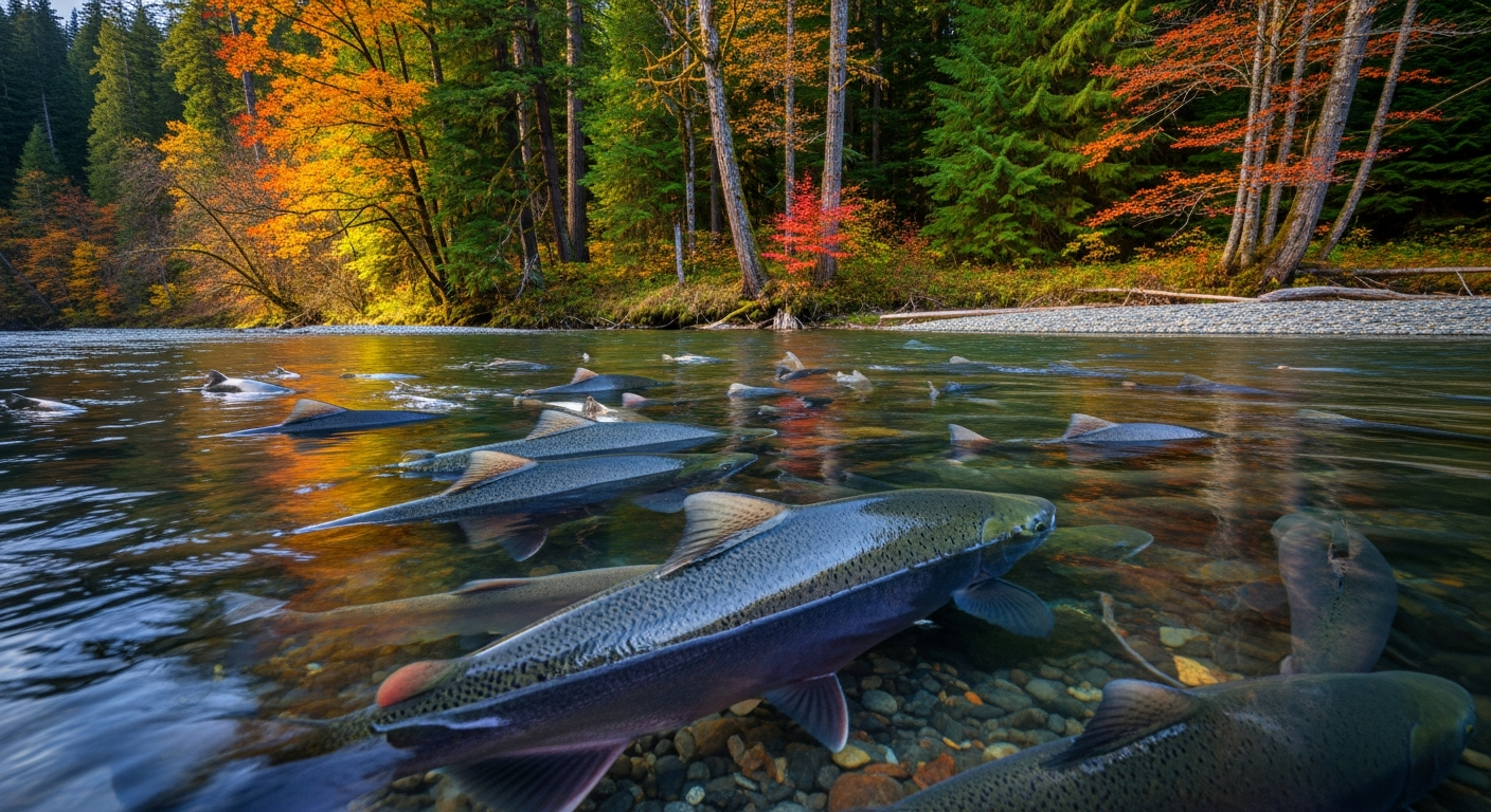
    The five-acre parcel along Sweetwater Creek has a layered history that stretches back further than most people realize. The property was formerly owned by the North Mason School District, and students at North Mason High School and Belfair Elementary have been part of the site’s story for years. Each spring, Belfair Elementary students release fall chum salmon fry into Sweetwater Creek after raising them in classroom incubators — a program supported by HCSEG’s Salmon in the Library curriculum. North Mason High School students have helped capture adult salmon and move them around the waterwheel as part of hands-on conservation education.

    Approximately 100,000 fall chum salmon eggs are placed in incubators on district property each season. The chum fry are raised until they’re ready for release, making Sweetwater Creek one of the most directly classroom-connected salmon streams in Mason County.

    When the property was transferred to the Port of Allyn in 2018, the vision expanded. The port owns the land, but the Hood Canal Salmon Enhancement Group — whose offices are at the PNW Salmon Center, 150 NE Roessel Road in Belfair — is leading the development of the park. HCSEG Director Mendy Harlow has managed habitat restoration projects throughout Hood Canal since 2013 and has been a driving force behind turning Sweetwater Creek into both a functioning salmon habitat and a place the entire county can visit.

    When completed, the park will include an ADA-accessible interpretive loop trail, a freshwater fishing dock (the only ADA-accessible freshwater fishing access in Mason County), a picnic area with power and water, a natural play area for children, and a restored historic waterwheel with an interpretive center and ADA public facilities. The park officially opened March 31, 2026, with the formal ribbon-cutting ceremony following in April.

    Shaped by the Water: Mason County’s Maritime History on Display in Shelton

    Fifteen miles south of Sweetwater Creek, in downtown Shelton, another community story is unfolding inside the Mason County Historical Museum at 427 W. Railroad Ave. A new exhibit called “Shaped by the Water: The Maritime History of Mason County” is now on display through August 2026, and it traces the deep, often-forgotten ways that water defined everything about this county — who settled here, how they made their living, and what they named the land around them.

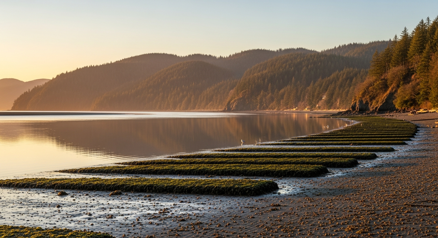
    The exhibit walks visitors through the growth of the shellfish industry in Mason County, which for generations was the economic engine that put Allyn, Shelton, and the Hood Canal shoreline communities on the map. It details the early ships of South Puget Sound that carried timber, oysters, and passengers between port communities before roads connected them. And it explains the changing role of Shelton’s waterfront — from active working port to the quieter shoreline the city has today.

    For residents of Hoodsport, Union, Grapeview, or Allyn, the exhibit offers something rarely seen: a county-wide lens on the water-dependent history that shaped every community along Hood Canal and South Puget Sound. The 1792 Discovery expedition receives close attention, including how local sites were renamed — Hood Canal for Admiral Samuel Hood of the British Royal Navy, and the inlets of South Puget Sound named for five lieutenants (James Budd, Henry Eld, George Totten, William Case, and Zachary Carr) and midshipman Thomas Hammersley. Those names are on every map of Mason County today.

    The Mason County Historical Museum is open Tuesdays through Fridays from 10 a.m. to 4 p.m. and Saturdays from 11 a.m. to 4 p.m. The museum is closed Sundays and Mondays. Admission information is available by calling the museum or visiting in person at 427 W. Railroad Ave., Shelton.

    Why These Stories Matter Today

    What connects Travis Merrill cutting trail as a teenager in Belfair and a new exhibit tracing Mason County’s maritime roots in Shelton? Both are stories of people and communities taking deliberate stock of where they came from — and deciding it’s worth preserving, celebrating, and passing forward.

    Sweetwater Creek Waterwheel Park is the kind of place that Mason County needs more of: publicly accessible, ecologically meaningful, and rooted in the kind of student and community involvement that makes conservation feel personal rather than abstract. When a Belfair Elementary student releases salmon fry into a creek in March and then walks the same ADA trail with her family in summer, something important has happened.

    The maritime exhibit in Shelton is a reminder that the water shaping Mason County’s identity didn’t stop flowing in 1792 or 1900 or 1950. Hood Canal is still the reason Hoodsport exists. The shellfish beds still define Allyn and Grapeview. The tides still run through everything.

    Residents interested in visiting Sweetwater Creek Waterwheel Park can find it at the intersection of state Route 3 and NE Roessel Road in Belfair, directly across from the Mary E. Theler Wetlands Nature Preserve. The “Shaped by the Water” exhibit runs through August at the Mason County Historical Museum, 427 W. Railroad Ave., Shelton.

  • Hood Canal Property Owners: What the 2026 Shellfish and Crab Calendar Means for Your Beach

    Hood Canal Property Owners: What the 2026 Shellfish and Crab Calendar Means for Your Beach

    Hood Canal, WA — For property owners between Belfair, Union, and Tahuya, the summer harvest calendar isn’t entertainment — it’s the schedule your guest list, your dock traffic, and your shoreline read of the Canal all run on. As of May 3, 2026, the Washington Department of Fish and Wildlife (WDFW) has confirmed the Marine Area 12 Dungeness crab opener but has not yet published the 2026 Belfair State Park shellfish dates. Here’s the clean read for property owners.

    The Confirmed Anchor: Marine Area 12 Crab, June 16 – Sept 5

    Marine Area 12 (Hood Canal) recreational Dungeness opens at 6 a.m. on June 16, 2026, and runs through September 5, with harvest allowed Thursdays through Mondays each week. Five male Dungeness daily, hard-shell, 6¼-inch minimum carapace, recorded immediately on your Puget Sound catch record card. Two important nuances for shoreline owners: the area north of Ayock Point operates on a different season schedule, and the area south of Ayock Point has had recent winter closures driven by abundance concerns. Pull the WDFW Hood Canal page before you set pots off your own dock so you’re running under the right rule for your stretch of the Canal.

    For owners hosting guests in late June or early July, the practical move is to plan crab the first Thursday-Friday of any guest visit. Public Marine Area 12 pots cluster heaviest on opening weekend; the Father’s Day window after the June 16 opener tends to thin out by week two.

    Belfair State Park Shellfish: Unposted as of Today

    The Belfair State Park clam, mussel, and oyster opener for 2026 has not yet been published to the official WDFW Belfair beach page (wdfw.wa.gov/places-to-go/shellfish-beaches/270470). The page still shows Aug 1 – Sept 30, 2025 as the most recent published season. If you’ve seen earlier dates circulating, treat them as preliminary until WDFW posts to the beach page or issues a press release.

    For waterfront owners, this matters in two specific ways. First, your guests asking “when’s the oyster trip?” need a calendar window, not a date — the honest answer right now is “late July through September, watch the WDFW page.” Second, if your own beach is DOH-approved for harvest, your dual-check rule still applies: WDFW season open AND DOH health status active. Health closures driven by biotoxins, vibrio, or seasonal water quality can shut your beach with little notice.

    The Water-Quality Read That Matters for Your Beach

    Hood Canal water quality is the upstream variable behind every harvest decision. The DOH Shellfish Safety interactive map shows real-time health status for every approved beach on the Canal, and the DOH Shellfish Safety hotline is 1-800-562-5632. South Hood Canal beaches in particular have had health-driven closures in recent years — the long arc of nutrient loading, summer hypoxia, and stormwater runoff from the SR-3 corridor and shoreline development all feed into beach health calls. The Tahuya River Preserve restoration work is one of several efforts directly aimed at the freshwater inputs that drive beach health on the south Canal.

    The Property-Value Angle Most Owner Conversations Skip

    Hood Canal beach health and shellfish-season reliability are now meaningful inputs to waterfront property valuations. Buyers comparing south Hood Canal to Bremerton or Central Kitsap shoreline are reading WDFW season pages and DOH closure histories the same way they read school ratings. A clean shellfish year — predictable opener, no biotoxin closures, low vibrio risk — quietly supports comparable values; a year of repeated closures quietly pressures them. The community-level work on water quality (HCSEG restoration, Mason County stormwater, septic upgrades) is the long lever on that valuation signal.

    Frequently Asked Questions

    When does Marine Area 12 crab open in summer 2026?

    6 a.m. on June 16, 2026, through September 5, 2026, Thursdays through Mondays. Five male Dungeness daily, hard-shell, 6¼-inch minimum carapace. Confirm the rule for your specific stretch — north or south of Ayock Point — on the WDFW Hood Canal crab page.

    Is my Hood Canal beach approved for shellfish harvest?

    Approval is set by the Washington Department of Health, not WDFW. Use the DOH Shellfish Safety interactive map to check approval status for your specific tideland, or call 1-800-562-5632. Private tideland approval status changes; check seasonally.

    Why hasn’t WDFW posted the 2026 Belfair State Park shellfish dates?

    WDFW typically publishes annual public-beach seasons through its rule-making cycle and updates beach pages a few weeks before openers. As of May 3, 2026, the Belfair page still reflects 2025. Bookmark wdfw.wa.gov/places-to-go/shellfish-beaches/270470 and check weekly through May and June.

    Can a DOH closure shut my beach even when WDFW season is open?

    Yes. WDFW and DOH operate independent approvals; both must be active for legal harvest. Biotoxin and vibrio closures can happen with little notice during the season. Always run the dual-check within 24 hours of harvest.

    Related coverage: Hood Canal Property Owners: Tahuya River Preserve and Water Quality · Original Hood Canal summer planner

    Related Coverage

    WDFW Closes Two Northern Hood Canal Beaches Over Harvest Pressure — What It Signals for Belfair-Area Shellfish in 2026 — the May 3, 2026 closure at Shine Tidelands and Wolfe Property and what it means for Twanoh and Belfair State Park.

  • Hood Canal Summer 2026 in Belfair: What’s Verified, What’s Pending, and How to Plan Smart

    Hood Canal Summer 2026 in Belfair: What’s Verified, What’s Pending, and How to Plan Smart

    Belfair, WA — Summer 2026 is taking shape on Hood Canal, and the picture for North Mason families and Hood Canal property owners is sharper in some places than others. As of May 3, 2026, the Washington Department of Fish and Wildlife (WDFW) has formally announced the Marine Area 12 Dungeness crab opener, but the Belfair State Park clam, mussel, and oyster opener has not yet been published to the WDFW Belfair beach page. Here’s what you can put on your calendar today — and what to keep watching.

    Marine Area 12 Crab: Confirmed for June 16 – Sept 5, 2026

    The verified anchor of the summer is crab. WDFW has confirmed the Hood Canal recreational Dungeness season for Marine Area 12 (which covers the Hood Canal stretch our community fishes most) opens at 6 a.m. on Tuesday, June 16, 2026, and runs through Saturday, September 5, 2026. As in prior years, harvest is allowed Thursdays through Mondays each week — closed Tuesdays and Wednesdays. The daily limit remains five male Dungeness in hard-shell condition, with a minimum carapace width of 6¼ inches, recorded immediately on your Puget Sound catch record card.

    One important nuance specific to Hood Canal: the area north of Ayock Point follows a different schedule, and the area south of Ayock Point has had abundance issues that have driven recent winter closures. The summer recreational opener applies to Marine Area 12 broadly, but check the WDFW Hood Canal crab page before you set pots near Belfair, Union, or Tahuya so you’re fishing the right stretch under the right rule.

    Belfair State Park Shellfish: 2026 Dates Not Yet Posted

    Belfair State Park’s clam, mussel, and oyster harvest is the centerpiece of the south Hood Canal shellfish year for most North Mason families — 3,720 feet of shoreline at 1002 NE Beck Road, mostly known for oysters, with some of the most productive south-end mud flats on the Canal. As of this morning, however, the WDFW Belfair State Park beach page (wdfw.wa.gov/places-to-go/shellfish-beaches/270470) still shows the most recent published season as Aug 1 – Sept 30, 2025 only. The 2026 opener date has not yet been posted to that official page.

    If you’ve seen earlier dates circulating, treat them as preliminary until WDFW updates the Belfair beach page or issues a press release. The honest framing for now: the 2026 Belfair State Park shellfish opener is expected this summer, exact date pending. Add the WDFW “Find a Beach” tool to your bookmarks and check it the week you plan to harvest. Standard Puget Sound daily limits when the beach does open are 18 oysters, 10 clams, and 10 mussels per harvester, with kids 15 and under harvesting free without a license.

    The WDFW + DOH Dual-Check Rule (This One Is Non-Negotiable)

    Hood Canal’s shellfish year runs on two parallel approvals: the WDFW season must be open, AND the Washington Department of Health (DOH) health approval for that beach must be active. Either one can close a beach with little notice. Biotoxin closures, vibrio advisories, and seasonal water-quality flags can shut harvest down even when the WDFW calendar says open. The DOH Shellfish Safety hotline is 1-800-562-5632, and the DOH interactive map shows real-time beach health status for every approved beach on Hood Canal. Check both sources within 24 hours of any harvest trip — this is the rule every Belfair-area harvester learns once and never forgets.

    Belfair State Park Camping: All Three Loops in Play This Summer

    For families combining a beach day with a weekend on the water, Belfair State Park’s campground is the closest in. The park runs three loops totaling 90 standard sites, 41 full-hookup sites, two primitive sites, and one marine trail site:

    • Main Loop — year-round reservable: 15 full-hookup sites, 34 standard sites, three primitive sites.
    • Beach Loop — year-round reservable, full hookups, fits RVs/trailers up to 60 feet, immediate beach access.
    • Tree Loop — May through September only, vehicles 18 feet and under, no hookups.

    Reservations through washington.goingtocamp.com or (888) 226-7688. Summer weekends — especially Memorial Day, July 4, and Labor Day — fill months out. If your trip is August or later, book this week.

    The Free Option Right Now: Theler Wetlands

    You don’t have to wait for shellfish dates to use Hood Canal in May. The Mary E. Theler Wetlands Nature Preserve at 600 NE Roessel Road off SR-3 in Belfair offers more than three miles of accessible trails through 139 acres of salt marsh and Union River estuary. May is peak migration on the Canal — shorebirds, herons, songbirds, and the start of summer waterfowl. Trails are free, open dawn to dusk, and the main boardwalk is ADA accessible. The Hood Canal Salmon Enhancement Group (HCSEG), which manages the Theler Nature Center, is in the middle of a longer restoration of the facility — check pnwsalmoncenter.org for community program announcements.

    Why This Matters for North Mason

    Hood Canal’s summer recreation calendar isn’t a tourism brochure for North Mason — it’s the working schedule that families plan dinners around, that grandparents drive in for, that property owners build their summer guest list against. When the WDFW page hasn’t posted the Belfair opener yet, the right move isn’t to guess; it’s to lock down what’s confirmed (crab June 16, camping reservations now, Theler today) and stay ready for the rest. We’ll update this page the moment WDFW publishes the Belfair State Park 2026 dates.

    Frequently Asked Questions

    When does Marine Area 12 Dungeness crab open in summer 2026?

    Marine Area 12 (Hood Canal) recreational Dungeness opens at 6 a.m. on June 16, 2026, and runs through September 5, 2026, with harvest allowed Thursdays through Mondays each week. Daily limit: five male, hard-shell, 6¼-inch minimum carapace.

    When does Belfair State Park shellfish season open in 2026?

    The 2026 opener has not yet been published to the official WDFW Belfair State Park beach page as of May 3, 2026. The 2025 season ran August 1 through September 30. Check the WDFW “Find a Beach” tool and the WDFW Belfair page (wdfw.wa.gov/places-to-go/shellfish-beaches/270470) for the official 2026 announcement.

    Do I need both a WDFW license and a DOH health approval to harvest at Belfair State Park?

    Yes. The WDFW shellfish/seaweed season must be open AND the DOH health status must be approved for the beach you’re harvesting. Either can close a beach with little notice. The DOH Shellfish Safety hotline is 1-800-562-5632 and the DOH interactive map updates in real time.

    How do I reserve a campsite at Belfair State Park?

    Reserve at washington.goingtocamp.com or call (888) 226-7688. Belfair State Park has three loops (Main, Beach, Tree) totaling 90 standard sites, 41 full-hookup sites, two primitive sites, and one marine trail site. Tree Loop is May-September only and limited to vehicles 18 feet and under.

    Where is Belfair State Park?

    Belfair State Park sits on 3,720 feet of Hood Canal shoreline at 1002 NE Beck Road, Belfair, WA 98528, at the south end of the Canal. The park is roughly three miles west of the Belfair town center off SR-300.

    Is the Theler Wetlands open right now?

    Yes. Mary E. Theler Wetlands Nature Preserve at 600 NE Roessel Road in Belfair is open dawn to dusk year-round. Trails are free, more than three miles total, and the main boardwalk is ADA accessible. May is peak spring migration on Hood Canal.

    Related coverage: Tahuya River Preserve Reaches 190 Acres · Hood Canal Property Owners: Tahuya River Preserve and Water Quality · Original Belfair Bugle Hood Canal summer planner

  • Hood Canal Shellfish Season Is Coming: Your Belfair Summer Outdoor Planner for 2026

    Hood Canal Shellfish Season Is Coming: Your Belfair Summer Outdoor Planner for 2026

    If you’ve been waiting for Hood Canal’s legendary shellfish season to kick off, now is the time to start planning. Summer 2026 brings a fresh lineup of outdoor opportunities for our North Mason community — from the tide flats at Belfair State Park to the deeper waters of Marine Area 12, the Canal is waking up.

    Belfair State Park Shellfish Season Opens July 15

    Mark your calendars: the clam, mussel, and oyster season at Belfair State Park’s Hood Canal tide flats opens July 15, 2026, and runs through December 31. According to the Washington Department of Fish and Wildlife (WDFW), this year’s opening comes two weeks earlier than originally scheduled — a welcome change for the families who make annual pilgrimages to the park’s famously productive mud flats at the south end of the Canal.

    Belfair State Park sits on 3,720 feet of Hood Canal shoreline at 1002 NE Beck Road, Belfair WA 98528. The beach is known for oysters in particular, though portions near the tideline are soft mud, so waterproof boots are non-negotiable. Harvesters need both a valid WDFW shellfish/seaweed license and a current Department of Health (DOH) beach approval to take anything home. Check the WDFW “Find a Beach” tool at wdfw.wa.gov before you go — health closures can happen with little notice.

    Standard Puget Sound daily limits apply: 18 oysters, 10 clams, and 10 mussels per person. Children 15 and under harvest free without a license.

    Dungeness Crab Season: Summer 2026 in Marine Area 12

    For crabbers, WDFW has confirmed that Hood Canal’s Marine Area 12 recreational Dungeness crab season will open in summer 2026 — exact dates to be announced. Watch the WDFW crab seasons page at wdfw.wa.gov/fishing/shellfishing-regulations/crab for the opening announcement, which typically drops a few weeks before day one.

    The standard Hood Canal setup: five male Dungeness, hard-shell, 6¼-inch minimum carapace width, recorded immediately on your catch record card. Crabbing has historically run Thursdays through Mondays in this marine area. The south end of the Canal near Belfair and Union tends to fish well early in the season.

    Belfair State Park Camping: All Loops Open Mid-May

    Planning to combine a shellfish trip with a weekend on the water? Belfair State Park’s full campground opens all loops by mid-May. The park offers 184 mixed-use sites — including 41 full hookup sites and 8 cabins — spread across three loops on the Canal shoreline. The Tree Loop (tents and rigs under 18 feet) is the most popular and fills fast.

    Book at washington.goingtocamp.com or call 1-888-226-7688. Summer weekends typically fill months in advance, so check availability now if you haven’t already.

    Theler Wetlands: Free Spring Birding Right Now

    While the shellfish season is still weeks away, the trails are open today. The Mary E. Theler Wetlands Nature Preserve off SR-3 in Belfair, located at 600 NE Roessel Rd, offers more than three miles of accessible trails through 139 acres of salt marsh and estuary. May is peak migration season on Hood Canal — shorebirds, herons, and songbirds work the Union River estuary. The trails are free, open dawn to dusk, and the main boardwalk sections are ADA accessible.

    The Hood Canal Salmon Enhancement Group (HCSEG), which manages the Theler Nature Center, is restoring the facility with plans to reopen interpretive community programs. Check pnwsalmoncenter.org for upcoming event announcements.

    Before You Harvest

    Shellfish closures can happen any time based on water quality. Always verify both the WDFW season status and the DOH health approval before harvesting at any beach. The DOH Shellfish Safety hotline is 1-800-562-5632. Same rule applies to every beach on Hood Canal — no exceptions.

    The Canal belongs to all of us. Harvest within limits, pack out your gear, and leave the tide flats better than you found them.

    Related Coverage from Belfair Bugle

    This summer planner has been expanded into a verified 2026 cluster:

  • Hood Canal Spot Shrimp Season Opens May 10 — and a Wetlands Restoration Is Reshaping Belfair’s Shoreline

    Hood Canal Spot Shrimp Season Opens May 10 — and a Wetlands Restoration Is Reshaping Belfair’s Shoreline

    Hood Canal Spot Shrimp Season Opens May 10 — and a Wetlands Restoration Is Reshaping Belfair’s Shoreline

    Mason County’s outdoor calendar heats up this May with two significant developments along Hood Canal: the first spot shrimp opening of the year arrives Saturday, May 10, giving local shrimpers one of the most anticipated mornings on the water, while just north in Belfair, a long-running restoration project at the Mary E. Theler Wetlands Nature Preserve is entering its most visible phase yet — the construction of a 1,200-foot elevated boardwalk through a newly rehabilitated salt marsh.

    Both stories speak to what makes Hood Canal worth protecting and celebrating: the fishery that feeds families across the county, and the habitat that makes those fisheries possible in the first place.

    Spot Shrimp Season: Hood Canal Gets the First Opener

    For recreational shrimpers, Marine Area 12 — Hood Canal — is the place to be on the morning of May 10. The Washington Department of Fish and Wildlife (WDFW) has confirmed that Hood Canal will receive an early opportunity this year, opening a full two weeks before most of the rest of Puget Sound, where the broader season begins May 24.

    The 2026 Marine Area 12 schedule runs on specific dates: May 10, May 24, May 26, June 7, and June 21. Each opening is tightly windowed — anglers may fish from 9 a.m. to 1 p.m. only. WDFW has noted that additional dates may be announced later in the season depending on stock assessments.

    The daily limit remains 80 spot shrimp per licensed fisher, with a combined total weight limit of 10 pounds (whole shrimp) for all shrimp species. Shrimpers who retain only spot shrimp may remove and discard the heads while still on the water; those retaining any other shrimp species must keep the heads until they are back on shore to allow compliance verification with the weight limit.

    For Mason County families, the May 10 opener is more than a fishing trip — it is an early-summer tradition along the entire Hood Canal corridor, from Hoodsport down through Union and north toward Belfair. Spot shrimp, known for their rich, sweet flavor, are among the most prized recreational catches in the state. Demand for the limited openings is high, and experienced shrimpers typically arrive early to launch before the 9 a.m. window.

    Before heading out, anglers should confirm current rules at wdfw.wa.gov, as emergency closures and rule changes can occur on short notice based on stock conditions. A valid Washington recreational fishing license is required. The WDFW hotline and website are the definitive sources for any last-minute schedule adjustments.

    Theler Wetlands: A 1,200-Foot Boardwalk Is Coming to Belfair This Summer

    A few miles north of Highway 3 in Belfair, a quieter but equally significant outdoor story is unfolding at the Mary E. Theler Wetlands Nature Preserve. This summer, WDFW and the Hood Canal Salmon Enhancement Group (HCSEG) will begin construction of a 1,200-foot elevated, piling-supported boardwalk through the heart of a newly restored estuary — the capstone of a multi-year effort to bring Hood Canal summer chum salmon back to the Union River system.

    The Theler Wetlands restoration project has been restoring approximately 7 acres of estuarine wetland habitat at the southeast end of Hood Canal. Work that concluded in fall 2025 included removing a failing levee, replacing a 12-inch metal culvert with a 15-foot-wide concrete box culvert, digging a new sinuous tidal channel, and raising a section of Northeast Roessel Road to serve as a set-back levee. The goal: reconnect the tidal processes that were disrupted when the wetlands were diked decades ago.

    Hood Canal summer chum salmon are listed as threatened under the federal Endangered Species Act. The Theler Wetlands sit at the mouth of the Union River, which is critical spawning and rearing habitat for that run. By expanding tidal connectivity, the restoration creates the shallow, food-rich, low-salinity estuarine conditions that juvenile summer chum need to grow before entering Hood Canal.

    The summer 2026 boardwalk construction will be the project’s most visible phase for the public. The elevated structure — built in the footprint of the removed levee — will reconnect the preserve’s currently fragmented trail network, giving visitors and birders full access to what will become a restored salt marsh. The Theler Wetlands is already one of Mason County’s most-visited nature spots, drawing birdwatchers, school groups, and families year-round. The new boardwalk will make the wetlands more accessible and complete the loop trail that has been partially closed during construction.

    The preserve is located at 22871 NE SR-3 in Belfair, just off the highway before the town center. Visitors are welcome during daylight hours. For project updates and trail access status, check the HCSEG website at pnwsalmoncenter.org or WDFW’s habitat recovery pages.

    What to Watch This Season

    Taken together, these two stories reflect the dual outdoor identity of Hood Canal and Mason County’s shoreline: a working fishery used by thousands of families every spring and summer, underpinned by habitat restoration work that most people never see but everyone benefits from. The spot shrimp fishery depends on a healthy canal; the canal depends on functioning estuaries like the one being rebuilt at Theler.

    For residents looking to get outside this May, both opportunities are close and accessible. The shrimp opener on May 10 is days away — time to get gear ready, check your license, and confirm the launch site. And when construction wraps at Theler Wetlands later this year, the newly completed boardwalk trail will be one of the more remarkable walks in all of Mason County: a path through restored tidal marsh, built where a levee used to be, beneath skies that — if the restoration takes hold — should one day carry kingfishers and herons back to a corner of Hood Canal that had been quiet for a very long time.

    Sources


    Related Expansion Coverage

  • North Mason School Levy Leading at 53.5% — Certification Set for May 8

    North Mason School Levy Leading at 53.5% — Certification Set for May 8

    The North Mason School District levy is leading in early returns from the April 28 special election — a stark reversal after two consecutive defeats and more than a year of program cuts that reshaped what students in Belfair and the Hood Canal corridor get from their schools.

    According to the Mason County Auditor, the four-year replacement levy received 2,130 yes votes (53.50%) and 1,851 no votes (46.50%) in the combined Mason and Kitsap county tally as of election night. In Mason County alone — which casts the overwhelming majority of North Mason ballots — the measure leads 2,089 to 1,808 (53.61% yes). In the small Kitsap County portion of the district, the early count showed 41 yes to 43 no.

    These are preliminary numbers. Washington is a vote-by-mail state, ballots arrive for days after election day, and nothing is final until certification. The Mason County Canvassing Board has a challenged-ballot review meeting scheduled for May 7 at 2:00 PM and the formal certification meeting on May 8 at 2:00 PM. Track the running total at results.vote.wa.gov.

    What changed this time

    The district lowered the ask. The April measure requests $18.9 million over four years at a rate of $1.01 per $1,000 of assessed value — down from the $1.28 rate that voters rejected twice in 2025. On a $400,000 North Mason home, that is roughly $33 per month, compared with about $43 per month at the prior rate.

    The district also eliminated two administrative positions and cut another $1.3 million from the operating budget before the vote — a direct response to community feedback that earlier campaigns had not gone far enough on the spending side. Combined with roughly $4.5 million in cuts that followed the second 2025 defeat, North Mason has trimmed substantially more than $5 million from its operations in less than 18 months.

    “We are very pleased and encouraged by these preliminary results, and we will be monitoring closely as ballots continue to be counted and certified,” Superintendent Dr. Kristine Michael said on election night. “If this outcome holds, it reflects the trust this community is placing in our schools and our students.”

    What the levy actually pays for

    Replacement levies in Washington fund the things state basic-education dollars do not cover: school nurses, counselors, safety officers, athletics, music, Advanced Placement courses, custodians, after-school programs, and curriculum materials. North Mason has been operating without levy funding in 2026 — a situation almost no comparably sized district in the Puget Sound region has had to navigate.

    The day-to-day evidence has been visible at North Mason High School and the middle school all year: thinner athletic schedules, reduced extracurriculars, fewer support staff in the buildings, and curriculum decisions made under tight constraints. The Bulldogs’ spring sports season has continued, but families have absorbed more of the cost.

    The catch: passage doesn’t reverse 2026

    Even if certification holds, the money does not arrive immediately. The first levy revenue would not flow to the district until April 2027 at the earliest. That timing means programs already cut — including the two administrative positions and the $1.3 million in operating reductions — will not be restored for the 2026-27 school year.

    “Those funds would allow us to avoid making additional reductions, but because we are operating with only a partial year of levy revenue even in a passage scenario, we would not be in a position to restore programs or positions already reduced,” Michael said in a statement issued before the vote.

    That nuance matters for families who voted yes expecting a quick rebound. The realistic frame is: passage stabilizes the floor and prevents another round of cuts. Restoration of what was lost is a longer conversation that depends on enrollment, state funding formulas, and the district’s reserve position by the time levy money lands.

    Why this vote was different

    North Mason had not just lost a levy — it had lost two. The February 2025 measure missed the threshold. The fall 2025 attempt failed again. Each defeat tightened the district’s operating posture, and each round of cuts changed the conversation. By April 2026, the choice in front of voters was no longer abstract; it was a referendum on a school district that had been visibly bleeding.

    The district responded by listening. Lower rate. Fewer administrators. More transparent reporting on where the money goes. Whether that read as humility or as accountability depended on the voter — but the ballots suggest a meaningful share of the electorate that voted no in 2025 was willing to vote yes in 2026 once the ask was reframed.

    What to watch this week

    Three things will determine whether the 53.5% lead holds. First, the late-arriving ballots: in Mason County’s recent history, late-counted votes tend to drift slightly more progressive on tax measures, which would help — but the margin in this race is narrow enough that a swing is possible. Second, the challenged-ballot review on May 7. Third, certification on May 8, after which the result is final.

    School board members Arla Shephard Bull, Leanna Krotzer, Erik Youngberg, Nicole González Timmons, and Nicholas Thomas will be working through what passage means for the 2026-27 budget cycle. Their next meetings — held at the district office at 250 E. Campus Drive in Belfair — will be the first public window into what stabilization looks like.

    For now: results are leading, not certified. The community that just put two defeats behind it has reason to be cautiously optimistic and every reason to keep watching.

    Frequently Asked Questions

    Did the North Mason School District levy pass on April 28, 2026?

    The levy is leading with 53.50% yes votes (2,130 to 1,851) in early returns from the Mason and Kitsap county auditors. Results are not certified. The Mason County Canvassing Board will certify on May 8, 2026, after a challenged-ballot review on May 7.

    How much will the North Mason levy cost a homeowner?

    The April 2026 levy is set at $1.01 per $1,000 of assessed value — about $33 per month on a $400,000 North Mason home. That is lower than the $1.28 rate attached to the two failed 2025 measures.

    When will levy money actually reach North Mason schools if the result is certified?

    The first revenue would arrive no earlier than April 2027. That means programs already cut — including two administrative positions and $1.3 million in other reductions made before the April 2026 vote — will not be restored for the 2026-27 school year.

    What programs does the North Mason levy fund?

    Replacement levies fund items state basic-education dollars do not cover: school nurses, counselors, safety officers, athletics, music, Advanced Placement courses, custodians, after-school programs, and curriculum materials.

    Where can I track the official North Mason levy results?

    The official source is the Washington Secretary of State results portal at results.vote.wa.gov/results/20260428/mason/. The Mason County Auditor’s elections page at masoncountywa.gov mirrors the certified totals.

    What happens if the lead doesn’t hold through certification?

    If the levy fails certification, North Mason would face a third consecutive defeat and would continue operating without levy funding through 2026 and beyond, almost certainly triggering another round of program cuts heading into 2026-27.

    Related coverage on Tygart Media: North Mason’s Third Levy Vote Is April 28 — Here’s Everything Belfair Needs to Know · The Levy in Initial Counts: What a Third Defeat Would Trigger · North Mason Schools: Ratings & Programs

  • New to North Mason? What the Tahuya River Preserve Tells You About Hood Canal — and This Community

    New to North Mason? What the Tahuya River Preserve Tells You About Hood Canal — and This Community

    If you’ve recently moved to North Mason — or you’re considering it — one of the first things you’ll notice is that people here talk about the river. Not metaphorically. The Tahuya River, which drains eastern Mason County and empties into Hood Canal just east of Belfair, is part of the local identity in a way that takes newcomers a minute to fully absorb. This week, 190 acres along the lower Tahuya became permanently protected conservation land. Here’s what that means, and why it matters to you.

    What Is the Tahuya River?

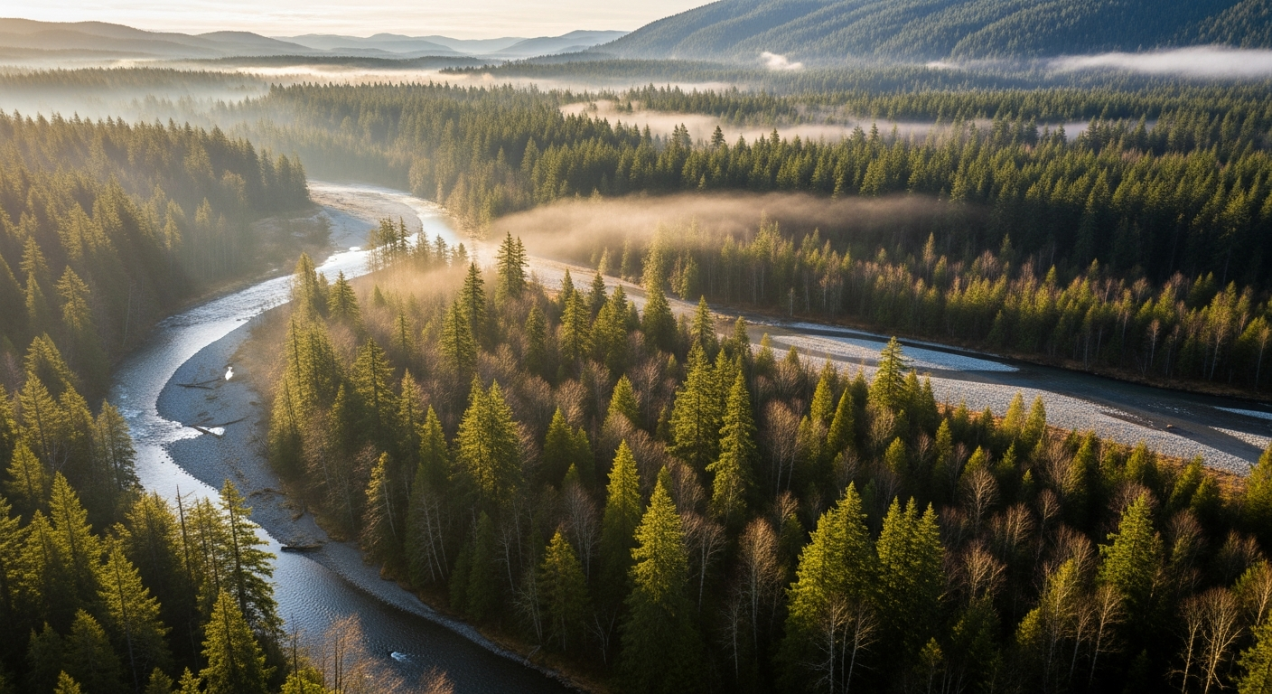
    The Tahuya River rises in the Tahuya State Forest and flows generally west and north through the Tahuya Peninsula before joining Hood Canal south of Belfair. The lower river corridor — the stretch that Great Peninsula Conservancy has been protecting — runs through floodplain forest and wetlands in eastern Mason County, a landscape of big cottonwoods, alder, and towering Douglas firs that overlook the valley.

    Each fall, bear tracks and salmon carcasses appear on the lower Tahuya’s banks. That’s not folklore — it’s ecology. Hood Canal summer chum and Chinook salmon both return to the Tahuya to spawn. Both species are listed under the federal Endangered Species Act. The summer chum were actually considered locally extinct here in the late 1990s before a restoration effort by the Hood Canal Salmon Enhancement Group (HCSEG) rebuilt the run using donor fish from the Union River. Since 2006, 200 to 1,000 summer chum return to the Tahuya every year on their own.

    Who Is HCSEG and Where Are They?

    The Hood Canal Salmon Enhancement Group is headquartered right in Belfair, at 600 NE Roessel Road — the same address as the Salmon Center, where the Hood Canal Salmon Run 5K is held each June. HCSEG has been doing salmon research, habitat restoration, and community education in the Hood Canal watershed since the 1990s. They run rotary screw traps on the Tahuya, Dewatto, and Little Quilcene Rivers each spring to count juvenile salmon — it’s one of the primary data sets used to assess whether salmon populations are recovering.

    If you’re new to North Mason and want a fast, credible education in why Hood Canal is the way it is — environmentally, ecologically, culturally — HCSEG is the organization to know. They welcome volunteers, host community events, and their staff are genuinely approachable. Phone: (360) 275-9284. Website: pnwsalmoncenter.org.

    What Is the Tahuya River Preserve?

    Great Peninsula Conservancy assembled the preserve in stages starting in July 2023: 145 acres acquired with Washington Department of Ecology and state Salmon Recovery Funding Board support, then 38 more acres that December, then two small parcels in 2025. The total is now 190 acres, permanently protecting roughly 450 feet of Tahuya River mainstem and anchoring a longer-term plan to conserve the lower four miles of the river.

    The land is held by GPC, based at 6536 Kitsap Way in Bremerton. It is not open to the public for recreation — it’s managed as a working conservation site. But its existence changes what is possible along the lower Tahuya for decades to come.

    What’s Actually Happening Next: The Gabion Wall

    The most concrete near-term project is the planned removal of a Gabion wall from the Tahuya River corridor. A Gabion wall is a wire-cage rock structure — you’ve probably seen them along highways or near bridges, used for erosion control. They work fine for holding a bank in place, but they disrupt the natural flow dynamics that salmon spawning habitat requires: the shifting gravel beds, the cool deep pools, the wood debris accumulations where juvenile fish shelter and feed.

    GPC and HCSEG are working through permitting and hydrology studies to plan the removal. After the wall comes out, engineered log jam structures may be installed upstream to rebuild the natural channel complexity the river has lost. The project is still in planning phase as of May 2026 — but the land protection that makes it possible is locked in.

    Why This Is Part of What Makes North Mason Different

    A lot of communities talk about caring about their environment. North Mason is one of the few places where you can stand at a boat launch on Hood Canal, watch a salmon jump, and trace that fish’s story back to a specific river, a specific restoration project, and a specific group of people who have been working on it for 30 years — and who are headquartered two miles from the Belfair Fred Meyer.

    The Tahuya River Preserve is part of that story. If you’re going to be here long-term, it’s worth knowing it.

    Also see: Tahuya River Preserve: Full Story | Hood Canal from Belfair: Fishing, Kayaking and Beaches

    Frequently Asked Questions

    What is the Tahuya River and where does it flow?

    The Tahuya River drains the Tahuya Peninsula in Mason County, flowing west and north before emptying into Hood Canal south of Belfair. The lower river corridor runs through floodplain forest in eastern Mason County. The river supports ESA-listed summer chum and Chinook salmon runs.

    What is the Hood Canal Salmon Enhancement Group and how can I get involved?

    HCSEG is a Belfair-based nonprofit that has led salmon research, habitat restoration, and education in the Hood Canal watershed since the 1990s. They welcome volunteers for rotary screw trap operations, restoration plantings, and community events. Find them at 600 NE Roessel Road, Belfair, (360) 275-9284, or pnwsalmoncenter.org.

    Can I visit the Tahuya River Preserve?

    The preserve is not currently open to the public for recreation. It is managed as a conservation area by Great Peninsula Conservancy. The nearby Tahuya State Forest and the lower Hood Canal shoreline offer public outdoor access in the same general area.

    What is a Gabion wall and why is removing it good for salmon?

    A Gabion wall is a wire-cage rock structure used for stream bank stabilization. While effective at holding banks in place, they alter natural stream flow, disrupt the gravel beds salmon use for spawning, and prevent wood debris from moving downstream — wood that creates the deep pools and feeding habitat juvenile salmon depend on. Removal allows the stream to recover more natural dynamics.

    Are salmon actually recovering in Hood Canal?

    Yes. Hood Canal summer chum — which were locally extinct in the Tahuya River in the 1990s — have sustained themselves without supplementation since 2015. NOAA Fisheries has indicated the population may meet ESA delisting criteria, which would be the first successful salmon delisting in U.S. history. The Tahuya River is part of that recovery story.

  • Hood Canal Property Owners: What the Tahuya River Preserve Means for Water Quality, Shellfish, and Your Shoreline

    Hood Canal Property Owners: What the Tahuya River Preserve Means for Water Quality, Shellfish, and Your Shoreline

    If you own property on Hood Canal — tidelands, a waterfront parcel, or even a lot a mile back from the water — the long-term health of the canal directly affects what you own. That’s why the permanent protection of 190 acres along the lower Tahuya River is worth understanding, not just as an environmental story, but as a water-quality and property-value story.

    What the Tahuya River Does to Hood Canal

    The Tahuya River drains eastern Mason County and empties into Hood Canal near Belfair. What happens in that watershed — how much sediment runs off after a rain event, how much nutrient load enters the canal, how warm the water is by July — directly affects conditions in Hood Canal itself.

    Hood Canal is a semi-enclosed fjord. It doesn’t flush as quickly as open Puget Sound. Dissolved oxygen levels, water temperature, and nutrient loading matter here in ways that are measurable and consequential. When those factors tip the wrong direction, shellfish beds close. When they hold steady, the canal supports the ecosystem — and the way of life — that Hood Canal property values are built on.

    Great Peninsula Conservancy’s Tahuya River Preserve permanently protects 190 acres of floodplain forest and wetlands along the lower Tahuya corridor. Floodplain forest is not passive. It filters runoff before it reaches the river, moderates water temperatures through canopy shading, and traps sediment that would otherwise flow downstream and into the canal.

    The Gabion Wall Removal: A Direct Water Quality Improvement

    The most significant near-term project connected to the preserve is the planned removal of a Gabion wall from the Tahuya River corridor. Gabion walls — wire-cage rock structures installed for bank stabilization — alter natural stream flow patterns, trap fine sediment in ways that degrade spawning gravel, and prevent the natural movement of large wood debris downstream.

    When the wall comes out, the river will begin recovering a more natural channel dynamic. Engineers are also evaluating engineered log jam structures upstream to rebuild holding pools and feeding lanes for juvenile salmon. Healthier salmon habitat upstream means more adult salmon returning — and salmon carcasses are one of the primary marine-derived nutrient inputs that forest and riparian systems depend on. It’s a closed loop that connects the mountains to the canal.

    The project is in the permitting and planning phase as of May 2026. No construction timeline has been announced, but the land protection necessary to make it happen is complete.

    What This Means for Shellfish Bed Status on Hood Canal

    If you harvest shellfish from Hood Canal tidelands, or if your property value is tied to an open shellfish beach, you already know that closures happen — and that the reasons are usually tied to water quality upstream. Fecal coliform from stormwater, agricultural runoff, and failing septic systems are the primary drivers of WDFW closure events on Hood Canal.

    Protecting floodplain forest along the Tahuya doesn’t fix septic systems — that’s a different problem. But it does reduce one of the diffuse-source inputs: unfiltered runoff from cleared or developed land adjacent to salmon-bearing streams. Every acre of permanently protected floodplain is one less acre that could be cleared, graded, or made impervious in the future.

    For Hood Canal property owners, the preserve is a long-term investment in the upstream conditions that determine what the canal looks like in 20 years.

    The ESA Connection and What It Means for the Canal

    Hood Canal summer chum salmon may become the first ESA-listed salmon population ever removed from the federal endangered species list. That’s not a distant possibility — NOAA Fisheries has signaled the population meets recovery criteria, with Tahuya River runs holding between 200 and 1,000 fish annually since 2006 without supplementation. If delisting proceeds, it would represent a significant reduction in regulatory burden on Hood Canal development and land use — something that directly affects property owners navigating shoreline development permits.

    The Hood Canal Salmon Enhancement Group monitors juvenile salmon on the Tahuya, Dewatto, and Little Quilcene Rivers each spring from their facility at 600 NE Roessel Road in Belfair, (360) 275-9284. Their data is what drives the federal recovery assessment.

    Also see: Tahuya River Preserve: 190 Acres Permanently Protected — Full Story | Hood Canal Property Owners: What the 2026 Shellfish Rule Changes Mean for Your Beach

    Frequently Asked Questions

    Does the Tahuya River Preserve affect Hood Canal shellfish bed closures?

    Indirectly, yes. Protecting 190 acres of floodplain forest along the Tahuya reduces diffuse stormwater runoff into the river and ultimately into Hood Canal. Shellfish closures are driven by fecal coliform levels, and reducing upstream runoff inputs is one piece of the water quality picture. It won’t fix point-source pollution, but it removes a future risk from the equation.

    How does the Gabion wall removal affect Hood Canal water quality?

    Removing the Gabion wall allows the Tahuya River to recover a more natural channel shape — distributing flow across the floodplain, reducing fine sediment export, and allowing wood debris to move naturally downstream. These changes improve water clarity and temperature downstream, benefiting Hood Canal conditions near the river mouth.

    What is the current ESA status of Hood Canal salmon and what does it mean for property owners?

    Hood Canal summer chum and Chinook salmon are both listed as threatened under the ESA. Hood Canal summer chum may be the first ESA-listed salmon ever delisted — a development that would reduce certain regulatory constraints on Hood Canal shoreline and development activities. Continued habitat restoration, including the Tahuya River work, supports the recovery data driving that potential delisting.

    Who is responsible for salmon restoration on the Tahuya River?

    Great Peninsula Conservancy holds and manages the land. The Hood Canal Salmon Enhancement Group (HCSEG), based at 600 NE Roessel Road in Belfair, leads habitat restoration work, juvenile salmon monitoring, and the Gabion wall removal planning in partnership with GPC.

    Does the preserve affect future development near the Tahuya River?

    Yes. The 190 acres are permanently protected by a conservation easement — they cannot be sold for development, cleared, or subdivided. This is the intended outcome: locking in floodplain function in perpetuity so future land use decisions upstream don’t erode what restoration work achieves downstream.

  • Tahuya River Preserve Reaches 190 Acres: What North Mason Needs to Know About Salmon Restoration on Hood Canal

    Tahuya River Preserve Reaches 190 Acres: What North Mason Needs to Know About Salmon Restoration on Hood Canal

    For more than two years, Great Peninsula Conservancy has been quietly assembling one of the most ecologically significant land protection projects on Hood Canal. The result is the Tahuya River Preserve — 190 acres of floodplain forest, wetlands, and riverfront corridor in eastern Mason County, permanently protected and now the anchor for a phased restoration effort targeting the lower four miles of the Tahuya River.

    For North Mason residents who know the lower Tahuya — the bear tracks in the mud, the salmon carcasses that fertilize the cottonwood flats each fall — this is the moment when “protected” stops meaning paperwork and starts meaning something permanent.

    How the Preserve Came Together

    Great Peninsula Conservancy (GPC) built the preserve in stages. In July 2023, the organization acquired 145 acres along the lower Tahuya mainstem, funded through a Washington Department of Ecology Streamflow Restoration grant and the state Salmon Recovery Funding Board. That December, GPC added an adjacent 38-acre parcel. In 2025, two smaller parcels totaling approximately five acres completed the assemblage — including roughly 450 feet of Tahuya River mainstem — bringing the total to 190 acres.

    The preserve sits where the Tahuya River watershed drains into Hood Canal, just east of Belfair. It’s a strategic location: protecting floodplain here controls what enters the canal at one of the most salmon-critical junctions in Mason County.

    Why the Tahuya River Matters for Salmon

    Two salmon species listed under the federal Endangered Species Act use the Tahuya River: Hood Canal summer chum and Chinook salmon. The summer chum story here is one of the most remarkable conservation recoveries in the Pacific Northwest. Summer chum were classified as “recently extinct” in the Tahuya River before a reintroduction effort beginning in the early 2000s. Using Union River summer chum as donor stock, HCSEG rebuilt the run — 750 fish returned in the first year. Since 2006, annual Tahuya summer chum returns have held between 200 and 1,000 fish. The final supplementation release was in 2015; the population has sustained itself since.

    NOAA Fisheries has signaled that Hood Canal summer chum may be the first ESA-listed salmon population ever removed from the endangered species list — a milestone no Pacific salmon population has achieved in the history of the Act. The Tahuya River is part of that recovery story.

    The Hood Canal Salmon Enhancement Group (HCSEG), headquartered at 600 NE Roessel Road in Belfair, monitors juvenile salmon using rotary screw traps on the Tahuya, Dewatto, and Little Quilcene Rivers each spring. Their data drives decisions about where restoration dollars go next — and the Tahuya is currently near the top of that list.

    The Gabion Wall Removal: What Comes Next

    The most significant near-term restoration project is the planned removal of a Gabion wall — a wire-cage rock structure — from the Tahuya River corridor. Gabion walls were widely used in mid-20th century stream engineering to control erosion, but they alter natural stream flows, disrupt gravel substrate that salmon need for spawning redds, and interrupt the natural wood and debris movement that juvenile salmon depend on for cover and food.

    GPC is working with HCSEG on removal plans. Once the wall is out, engineers are also evaluating the installation of engineered log jam structures upstream — designed to mimic the natural wood accumulation that builds holding pools and feeding lanes for juvenile salmon.

    These projects are still in the permitting and hydrology study phase. Salmon habitat work at this scale requires state and federal coordination, contractor mobilization, and hydrological modeling — it moves carefully. But the land protection that makes any of it legally and practically possible is done.

    What This Means for North Mason

    The Tahuya River Preserve represents one piece of a larger conservation strategy for the lower Hood Canal watershed. Every acre of floodplain protected upstream means less sediment loading, cooler water temperatures, and better dissolved oxygen in Hood Canal itself — the same water that determines whether shellfish beds stay open and whether salmon return each fall to the beaches and rivers that define this community.

    For North Mason residents, it’s also a statement about what this corner of Washington is choosing to be. Development pressure on the SR-3 corridor is real. The Tahuya River Preserve locks in a counter-weight: 190 acres that will never be a subdivision, a gravel pit, or a parking lot.

    Residents interested in the restoration work — or in volunteering for HCSEG’s 2026 rotary screw trap season — can contact the Hood Canal Salmon Enhancement Group at 600 NE Roessel Road, Belfair, (360) 275-9284, or at pnwsalmoncenter.org. Great Peninsula Conservancy is based at 6536 Kitsap Way, Bremerton, (360) 373-3500, or greatpeninsula.org.

    Also see: Hood Canal Shellfish Season 2026: What North Mason Harvesters Need to Know

    Frequently Asked Questions

    Where exactly is the Tahuya River Preserve?

    The preserve is in eastern Mason County, along the lower Tahuya River corridor where it drains into Hood Canal. It is located just east of Belfair and is not currently open to the general public for recreation — it is managed as a conservation area by Great Peninsula Conservancy.

    What salmon species use the Tahuya River?

    Hood Canal summer chum salmon and Chinook salmon both use the Tahuya River watershed. Both are listed as threatened under the federal Endangered Species Act. Summer chum were successfully reintroduced to the Tahuya after being classified as locally extinct, and the population has sustained itself without supplementation since 2015.

    What is a Gabion wall and why is it being removed?

    A Gabion wall is a wire-cage rock structure used historically for stream bank stabilization. While effective at controlling erosion, they alter natural water flow, disrupt gravel spawning beds, and impede the movement of large wood debris that salmon depend on. Removal restores more natural stream dynamics.

    When will the Gabion wall removal happen?

    The project is currently in the planning and permitting phase. Great Peninsula Conservancy and HCSEG are working through hydrology studies and regulatory coordination. No construction timeline has been publicly announced as of May 2026.

    How can North Mason residents get involved with salmon restoration on the Tahuya?

    The Hood Canal Salmon Enhancement Group welcomes volunteers for its 2026 rotary screw trap season and other restoration projects. Contact HCSEG at 600 NE Roessel Road, Belfair, (360) 275-9284, or visit pnwsalmoncenter.org.

    Does the Tahuya River Preserve affect Hood Canal water quality?

    Yes. Protecting floodplain forest along the Tahuya River reduces sediment and nutrient runoff into Hood Canal, helps maintain cooler water temperatures, and supports dissolved oxygen levels — all factors that affect shellfish bed status and salmon habitat quality in the canal itself.

  • Tahuya River Preserve Grows to 190 Acres — Salmon Restoration Eyes Gabion Wall Removal

    Tahuya River Preserve Grows to 190 Acres — Salmon Restoration Eyes Gabion Wall Removal

    If you’ve walked the lower Tahuya River corridor lately, you’ve probably noticed the bear tracks and salmon carcasses that line the banks each fall — signs that something worth protecting is still alive here. Thanks to a multi-year land conservation push by Great Peninsula Conservancy, 190 acres along the lower Tahuya River are now permanently protected, and the harder work of actual habitat restoration is moving into its next phase.

    The Tahuya River Preserve sits in eastern Mason County, straddling the watershed that drains into Hood Canal near Belfair. Great Peninsula Conservancy assembled the preserve in stages — 145 acres acquired in July 2023 with support from the Washington Department of Ecology Streamflow Restoration grant and the state Salmon Recovery Funding Board, followed by an adjacent 38 acres in December of that year, and two smaller parcels totaling about five acres in 2025. Taken together, the preserve now protects roughly 450 feet of Tahuya River mainstem and is designed as the anchor point for a larger phased effort to conserve the lower four miles of the river.

    Why does this stretch matter? Both Hood Canal summer chum salmon and Chinook salmon use the Tahuya River watershed — and both are listed under the federal Endangered Species Act. The Hood Canal Salmon Enhancement Group, headquartered at 600 NE Roessel Road in Belfair, has been monitoring juvenile salmon using rotary screw traps on the Tahuya, Dewatto, and Little Quilcene Rivers each spring. Their data guides where restoration dollars go next.

    The most anticipated near-term project is the removal of a Gabion wall — a wire-cage rock structure that alters natural stream flows — from the Tahuya River corridor. Great Peninsula Conservancy is working with the Hood Canal Salmon Enhancement Group on removal plans. Once the wall comes out, engineers are also weighing the installation of log jam structures upstream to mimic natural wood accumulation that juvenile salmon depend on for cover and food.

    These aren’t quick projects. Permitting, hydrology studies, and contractor coordination mean the removal is still in planning rather than construction phase — but the land protection piece that makes any of it possible is done. Our river isn’t going anywhere.

    For anyone who wants to learn more or get involved, Great Peninsula Conservancy is based at 6536 Kitsap Way in Bremerton and can be reached at (360) 373-3500 or greatpeninsula.org. The Hood Canal Salmon Enhancement Group is at 600 NE Roessel Road, Belfair; (360) 275-9284.

    Related Coverage: Tahuya River Deep Dives