
Tag: National Weather Service

  • Tornado Warning: Clay, IL Until 8:30 PM CDT

    Tornado Warning: Clay, IL Until 8:30 PM CDT

    Tornado Warning issued September 20 at 7:39PM CDT until September 20 at 8:30PM CDT by NWS Lincoln IL

    A Tornado Warning is active for the Clay, IL area right now, issued by NWS Lincoln IL — the structural and water-intrusion jobs restoration teams mobilize for. This is a live snapshot as of Sunday, September 20, 5:49 PM PDT. Conditions change fast — always verify with the National Weather Service for your specific county or ZIP code.

    Clay, IL — Tornado Warning

    Issuing office: NWS Lincoln IL
    Issued: September 20 at 7:39 PM CDT
    Expires: 8:30 PM CDT
    Severity: Extreme

    Hazard detail, per the National Weather Service:

    moving southeast at 30 mph.
    HAZARD…Tornado and quarter size hail.
    SOURCE…Radar indicated rotation.
    IMPACT…Flying debris will be dangerous to those caught without
    shelter. Mobile homes will be damaged or destroyed.
    Damage to roofs, windows, and vehicles will occur. Tree
    damage is likely.

    NWS instruction: TAKE COVER NOW! Move to a basement or an interior room on the lowest

    Track this warning at weather.gov and your local NWS office page.

    Stay safe tonight

    Get to the lowest floor of a sturdy building, away from windows — an interior room or closet on the ground floor is best. Mobile homes offer no protection: get to a sturdy shelter or lie flat in a low spot, covering your head.

    After the storm passes, watch for downed power lines and gas leaks, stay out of damaged buildings, and photograph all damage before cleanup — documentation matters for insurance. Then call a local restoration contractor for structural and water damage.

    What this means for restoration teams

    A tornado warning over Clay, IL means potential structural damage, roof loss, broken windows, and water intrusion where the building envelope is breached. Even a near-miss brings debris impacts and wind-driven rain into attics and wall cavities.

    The play: stage tarping and board-up crews alongside drying equipment, pre-position generators and dehumidifiers, keep an on-call rotation through the morning, and capture address, damage type, and affected areas on the first call. Field discipline: photo-document before mitigation, moisture-map every affected room, and keep the homeowner’s payment responsibility clear in writing before work starts.

    FEMA & federal assistance

    If the storm damages your home, the FEMA Helpline is 1-800-621-3362 (7 a.m.–10 p.m. local time, 7 days a week). You can also apply at DisasterAssistance.gov, through the FEMA app, or find a recovery center at fema.gov/drc.

    Basic eligibility: U.S. citizenship or qualified status, identity verification, proof of occupancy or ownership, and unmet needs not covered by insurance. Apply as soon as it’s safe to do so.

    Looking ahead

    When this warning expires at 8:30 PM CDT, the risk doesn’t necessarily end: additional rounds of storms can follow the same corridor, and creeks and low-lying drainage can crest after the rain stops. Watch the next NWS update for your county before standing down.

    Demand window note: water-intrusion calls typically start within hours of water receding and keep coming for days as people discover damage — the calls that matter most arrive after the sky clears.

    Sources & how to verify

    To verify for your own county or ZIP: go to weather.gov, enter your location, and check the active alerts banner — or find your local NWS office page from the weather.gov office map.

    This post is for informational purposes and is not an official weather warning. Always follow instructions from local authorities and the National Weather Service.


  • Severe Thunderstorm Warning: Kiowa, CO Until 7:15 PM MDT

    Severe Thunderstorm Warning: Kiowa, CO Until 7:15 PM MDT

    Severe Thunderstorm Warning issued September 20 at 6:43PM MDT until September 20 at 7:15PM MDT by NWS Pueblo CO

    A Severe Thunderstorm Warning is active for the Kiowa, CO area right now, issued by NWS Pueblo CO — the roof-to-interior damage sequence restoration teams know well. This is a live snapshot as of Sunday, September 20, 5:48 PM PDT. Conditions change fast — always verify with the National Weather Service for your specific county or ZIP code.

    Kiowa, CO — Severe Thunderstorm Warning

    Issuing office: NWS Pueblo CO
    Issued: September 20 at 6:43 PM MDT
    Expires: 7:15 PM MDT
    Severity: Severe

    Hazard detail, per the National Weather Service:

    Bristol, or 15 miles northeast of Lamar, moving south at 20 mph.
    HAZARD…Golf ball size hail and 70 mph wind gusts.
    SOURCE…Radar indicated.
    IMPACT…People and animals outdoors will be injured. Expect hail
    damage to roofs, siding, windows, and vehicles. Expect
    considerable tree damage. Wind damage is also likely to

    NWS instruction: A tornado watch remains in effect for the warned area. Tornadoes can

    Track this warning at weather.gov and your local NWS office page.

    Stay safe tonight

    Get inside a sturdy building and stay away from windows. Large hail can shatter glass and injure anyone caught outside — if you’re driving, pull over safely and stay in the vehicle, angled so the hail hits the reinforced windshield side. Park under cover if you can.

    After the storm: watch for downed power lines, avoid damaged roofs (they may be structurally compromised), and photograph all hail and wind damage before any cleanup — documentation matters for insurance. Then call a local restoration contractor: hail-damaged roofs let water in with the next rain.

    What this means for restoration teams

    Destructive hail over Kiowa, CO is a two-trade event: roofs, siding, and windows take the direct hits, and every compromised roof becomes a water-intrusion job with the next rain. Restoration contractors should expect the classic hail sequence — emergency tarping calls tonight, water-intrusion and interior damage calls for days after.

    The play: stage tarping crews and drying equipment together, pre-position air movers and dehumidifiers for the water-intrusion wave, keep an on-call rotation through the morning, and capture address, hail size reported, and affected areas on the first call. Field discipline: photo-document before mitigation, moisture-map every affected room, and keep the homeowner’s payment responsibility clear in writing before work starts.

    FEMA & federal assistance

    If the storm damages your home, the FEMA Helpline is 1-800-621-3362 (7 a.m.–10 p.m. local time, 7 days a week). You can also apply at DisasterAssistance.gov, through the FEMA app, or find a recovery center at fema.gov/drc.

    Basic eligibility: U.S. citizenship or qualified status, identity verification, proof of occupancy or ownership, and unmet needs not covered by insurance. Apply as soon as it’s safe to do so.

    Looking ahead

    When this warning expires at 7:15 PM MDT, the risk doesn’t necessarily end: additional rounds of storms can follow the same corridor, and creeks and low-lying drainage can crest after the rain stops. Watch the next NWS update for your county before standing down.

    Demand window note: water-intrusion calls typically start within hours of water receding and keep coming for days as people discover damage — the calls that matter most arrive after the sky clears.

    Sources & how to verify

    To verify for your own county or ZIP: go to weather.gov, enter your location, and check the active alerts banner — or find your local NWS office page from the weather.gov office map.

    This post is for informational purposes and is not an official weather warning. Always follow instructions from local authorities and the National Weather Service.
  • Flash Flood Warning: Durant–Bryan County Area Until 8:45 PM CDT

    Flash Flood Warning: Durant–Bryan County Area Until 8:45 PM CDT

    The National Weather Service in Norman has issued a Flash Flood Warning for southwestern Bryan County, Oklahoma — including Durant, Colbert, Achille, Silo, Mead, Hendrix, Cartwright, Calera, and eastern Lake Texoma — until 8:45 PM CDT this evening. At 7:18 PM CDT, Doppler radar indicated thunderstorms producing heavy rain across the warned area, with between 2 and 3.5 inches of rain already fallen. Flash flooding is ongoing or expected to begin shortly. No additional rainfall is expected, but flooding impacts will continue. The NWS expects flash flooding of small creeks and streams, urban areas, highways, streets and underpasses, and other poor-drainage and low-lying areas — this is the scenario that puts water in structures.

    This is a live snapshot as of about 7:30 PM CDT. Conditions change fast — always verify with the National Weather Service for your specific county or ZIP code.

    Durant and Bryan County — Flash Flood Warning

    Issued by: National Weather Service Norman, OK
    Issued: 7:18 PM CDT Sunday, September 20, 2026
    Expires: 8:45 PM CDT Sunday, September 20, 2026

    Warned area: Southwestern Bryan County in southeastern Oklahoma.

    Hazard detail, verbatim from the alert:

    • Hazard: Flash flooding caused by thunderstorms
    • Rainfall: Between 2 and 3.5 inches have fallen
    • Source: Radar indicated
    • Status: Flash flooding is ongoing or expected to begin shortly

    Expected impacts from the NWS: Flash flooding of small creeks and streams, urban areas, highways, streets and underpasses, as well as other poor-drainage and low-lying areas.

    Locations that will experience flash flooding: Durant, Colbert, Achille, Silo, Mead, Hendrix, Cartwright, eastern Lake Texoma, and Calera.

    Source: NWS Norman (alert AWIPS identifier FFSOUN).

    Stay safe tonight

    • Turn around, don’t drown when encountering flooded roads. Most flood deaths occur in vehicles. Be aware of your surroundings and do not drive on flooded roads.
    • Never drive through flooded roadways — six inches of moving water can knock you down, and twelve inches can carry a car. Underpasses and low-water crossings in and around Durant and along the Lake Texoma shoreline fill first.
    • If water enters the home: stay out of standing water where electricity may be present, avoid the basement until water recedes and power is confirmed off.
    • Photograph everything before cleanup — waterlines on walls, damaged flooring, affected belongings. Documentation matters for insurance, and adjusters settle faster with timestamped photos.
    • Then call a local restoration contractor — water left sitting starts a second wave of damage within a day.

    What this means for restoration teams

    Between 2 and 3.5 inches of rain have fallen in southwestern Bryan County, and flash flooding is ongoing or expected to begin shortly, per the NWS. Here’s the contractor read for Bryan County tonight.

    Damage categories to expect:

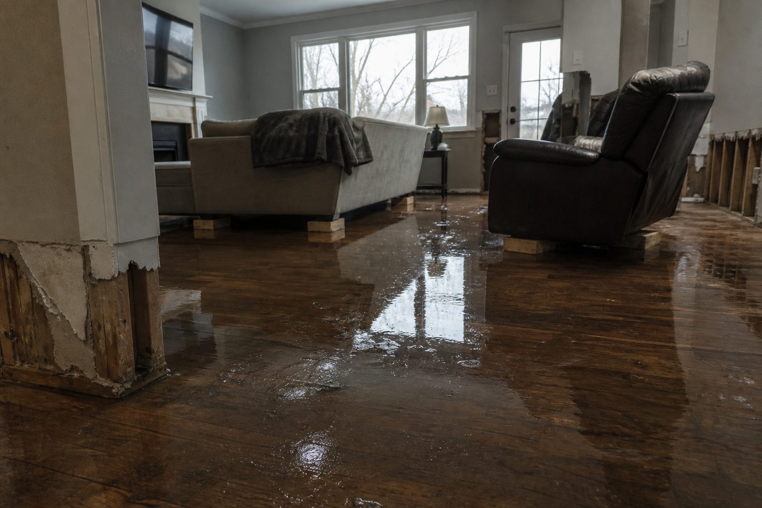
    • Interior water intrusion: Ground-level flooding through doorways, garage slabs, and foundation seepage — especially in low-lying neighborhoods near creeks and the Lake Texoma shoreline. Saturated carpet, pad, and the bottom 12–24 inches of drywall.
    • Saturated drywall and insulation: Floodwater wicks upward. Anything the water touched — plus the capillary zone above it — has to come out. Insulation behind wet drywall is a total loss.
    • Mold risk within 24–48 hours: September warmth plus standing water is a mold clock. Drying equipment can’t wait long — the sooner it’s on-site, the better.
    • Sewage and gray-water backup: Heavy rain overwhelms low-lying sewer laterals — treat any backup as contaminated and handle it under Category 3 protocols.
    • Crawlspaces and slab edges: The slow-burn calls. Homeowners discover these days later when the musty smell arrives.

    The play tonight:

    • Stage extraction and drying equipment now — pre-position dehumidifiers and air movers for Monday-morning deployment. Keep an on-call rotation through the morning.
    • Capture address, water source (rising creek, street runoff, sewer backup), water depth, and affected areas on the first call — it determines the category of water and the scope.
    • Field discipline: photo-document before mitigation, moisture-map every affected room (including rooms the homeowner thinks are dry), and keep the homeowner’s payment responsibility clear in writing before work starts.
    • Triage rule: standing water and sewage backups first, wet-but-drying second, “it smells funny” third.

    Timing note: Discovery of water damage often trails the storm by hours to days — be ready for inspection requests in the coming days.

    FEMA & federal assistance

    FEMA Helpline: 1-800-621-3362 (7 a.m.–10 p.m. local, 7 days a week). You can also apply at DisasterAssistance.gov, through the FEMA app, or find a recovery center at fema.gov/drc.

    Basic eligibility: U.S. citizenship or qualified status, identity verification, proof of occupancy or ownership, and unmet needs not covered by insurance. Apply as soon as it’s safe.

    Looking ahead

    The warning runs until 8:45 PM CDT. No additional rainfall is expected, but flooding impacts will continue as creeks and low-lying areas drain — water in streets and underpasses can linger well past expiry. Watch overnight for water receding unevenly: some areas drain in an hour, low pockets near Lake Texoma and creek bottoms can hold water much longer.

    The next NWS update lands at or before 8:45 PM CDT if the threat continues. Restoration teams should be ready for extraction and inspection requests as water recedes unevenly overnight.

    Sources & how to verify

    To verify for your own county or ZIP: enter your ZIP at weather.gov or check the NWS Norman office page directly.

    This post is for informational purposes and is not an official weather warning. Always follow instructions from local authorities and the National Weather Service.

  • Severe Thunderstorm Warning: Holly–Granada Area Until 7:15 PM MDT

    Severe Thunderstorm Warning: Holly–Granada Area Until 7:15 PM MDT

    The National Weather Service in Pueblo has issued a Severe Thunderstorm Warning with a considerable damage threat tag for northeastern Prowers County and southeastern Kiowa County in southeastern Colorado — including the communities of Holly, Granada, Hartman, and Bristol — until 7:15 PM MDT. At 6:29 PM MDT, Doppler radar tracked a severe thunderstorm 11 miles northwest of Bristol, 17 miles northeast of Lamar, moving south at 20 mph, packing tennis-ball-size hail and 70 mph wind gusts. Hail this size damages roofs, siding, windows, and vehicles on impact — the NWS expects exactly that from this storm.

    This is a live snapshot as of about 6:35 PM MDT. Conditions change fast — always verify with the National Weather Service for your specific county or ZIP code.

    Holly and Granada — Severe Thunderstorm Warning

    Issued by: National Weather Service Pueblo, CO
    Issued: 6:29 PM MDT Sunday, September 20, 2026
    Expires: 7:15 PM MDT Sunday, September 20, 2026

    Warned areas: Northeastern Prowers County and southeastern Kiowa County in southeastern Colorado.

    Hazard detail, verbatim from the alert:

    • Hail: Tennis ball size (2.5 inches), radar indicated
    • Wind: 70 mph gusts, radar indicated
    • Damage threat tag: CONSIDERABLE
    • Tornado: Possible — tornadoes can develop quickly from severe thunderstorms

    Expected impacts from the NWS: People and animals outdoors will be injured. Expect hail damage to roofs, siding, windows, and vehicles. Expect considerable tree damage. Wind damage is also likely to mobile homes, roofs, and outbuildings.

    Locations in the path: Holly, Granada, Hartman, and Bristol.

    Source: NWS Pueblo (alert AWIPS identifier SVRPUB).

    Stay safe through this storm

    • Hail this large can injure anyone caught outdoors — get inside a sturdy building now, and keep pets indoors.
    • Move to an interior room on the lowest floor of a building. Remain alert for a possible tornado: if you spot a tornado, go at once into the basement or a small central room in a sturdy structure.
    • Stay away from windows — hail and wind-driven debris shatter glass. Move vehicles under cover if you can do so safely; otherwise leave them.
    • After the storm, photograph any damage before cleanup begins. Documentation matters for insurance, and hail bruising on shingles is easy to miss once the ground dries.
    • Watch for downed power lines in tree-damaged areas and never touch them — call the utility instead.

    What this means for restoration teams

    A considerable-tagged hailstorm with tennis-ball hail is a roof-damage event first and a water-intrusion event second. Here’s how the next 48 hours typically play out for contractors in the Holly–Granada corridor.

    Damage categories to expect:

    • Roof and envelope: 2.5-inch hail bruises asphalt shingles, dents metal roofing, cracks siding, and breaks windows and skylights. Hail damage can be hard to spot from the ground — the NWS expects damage to roofs, siding, windows, and vehicles, so close inspection and thorough documentation are what matter.
    • Vehicle and outbuilding damage: Mobile homes, sheds, and outbuildings take wind damage first; expect calls about torn skirting, displaced roofing, and hail-pocked siding.
    • Delayed water intrusion: Cracked shingles and compromised flashing don’t leak tonight — they leak at the next rain. Claims and callbacks trail the storm by days to weeks, which is why the follow-up call matters as much as the storm-night response.
    • Tree and debris: Considerable tree damage means fallen limbs on roofs, punctured decking, and blocked access for inspection crews.

    The play tonight:

    • Staff the phones through the evening — homeowners typically discover damage at first light, so be ready for inspection requests in the morning.
    • Offer free storm inspections with photo documentation: granule loss at gutters, bruising on shingles, dent patterns on vents and gutters (soft metals tell the hail story an adjuster needs).
    • Capture address, roof type and age, and visible damage zones on the first call — adjusters ask for all of it.
    • Field discipline: photograph everything before mitigation, keep temporary-cover work documented separately from permanent repair estimates, and keep the homeowner’s payment responsibility clear in writing before work starts.

    Timing note: Inspections and adjuster scopes typically trail the storm by days to weeks — thorough documentation at the first inspection is what repair scopes are built on.

    FEMA & federal assistance

    FEMA Helpline: 1-800-621-3362 (7 a.m.–10 p.m. local, 7 days a week). You can also apply at DisasterAssistance.gov, through the FEMA app, or find a recovery center at fema.gov/drc.

    Basic eligibility: U.S. citizenship or qualified status, identity verification, proof of occupancy or ownership, and unmet needs not covered by insurance. Apply as soon as it’s safe — and keep in mind that hail damage is almost always an insurance claim first; FEMA assistance applies to uninsured or underinsured losses and unmet needs.

    Looking ahead

    The warning runs until 7:15 PM MDT as the storm moves south at 20 mph. When it expires, the hail threat ends with the cell — but the inspection window is just opening. Additional rounds of storms are possible in the region this evening, so contractors should watch radar through the night before scheduling Monday-morning inspection routes. The next NWS update lands at or before expiry if the threat continues.

    For restoration teams, the real work starts at sunrise: roof inspections, photo-documented damage assessments, and getting on homeowners’ schedules early.

    Sources & how to verify

    To verify for your own county or ZIP: enter your ZIP at weather.gov or check the NWS Pueblo office page directly.

    This post is for informational purposes and is not an official weather warning. Always follow instructions from local authorities and the National Weather Service.

  • Severe Thunderstorm Warning: Bent, CO Until 6:30 PM MDT Sunday, September 20

    Severe Thunderstorm Warning: Bent, CO Until 6:30 PM MDT Sunday, September 20

    This is a live snapshot as of 5:54 PM MDT Sunday, September 20. Conditions change fast — always verify with the National Weather Service for your specific county or ZIP code.

    Bent, CO — Severe Thunderstorm Warning

    Severe Thunderstorm Warning issued September 20 at 5:54PM MDT until September 20 at 6:30PM MDT by NWS Pueblo CO

    Issued by NWS Pueblo CO. Issue time: 5:54 PM MDT Sunday, September 20. Expires: 6:30 PM MDT Sunday, September 20.

    At 554 PM MDT, a severe thunderstorm was located over Chivington, or
    24 miles north of Lamar, moving southeast at 30 mph.
    HAZARD…Tennis ball size hail and 60 mph wind gusts.
    SOURCE…Radar indicated.
    IMPACT…People and animals outdoors will be injured. Expect hail
    damage to roofs, siding, windows, and vehicles. Expect wind
    damage to roofs, siding, and trees.
    Locations impacted include…
    Eads, Neeoshe Reservoir, Sweetwater Reservoir, Chivington, Brandon,
    Neegronda Reservoir, and Queens Reservoir.

    Hail size (NWS parameters): 2.50. Wind gust (NWS parameters): 60 MPH.

    Locations in the warning path, as listed by NWS:

    • Insufficient data in alert text

    Warned area: Bent, CO; Kiowa, CO; Prowers, CO

    NWS office page: NWS Pueblo CO · Official NWS alert

    Official NWS instructions

    Remain alert for a possible tornado! Tornadoes can develop quickly
    from severe thunderstorms. If you spot a tornado go at once into the
    basement or small central room in a sturdy structure.

    For your protection move to an interior room on the lowest floor of a
    building.

    Stay safe during the storm

    Get inside a sturdy building and stay away from windows. Large hail can shatter glass and injure anyone caught outside; damaging winds can bring down trees and power lines with little warning.

    If hail damages your home: photograph every slope of the roof, siding, gutters, and windows before anything is repaired — documentation matters for insurance. Then call a local roofing or restoration contractor for an inspection; hail bruising is not always visible from the ground.

    What this means for restoration teams

    Translate this warning into job tickets: hail-punched roofing (bruised shingles that fail months later if missed), cracked siding, shattered windows and skylights, dented gutters and downspouts, and damaged outdoor HVAC condensers. Water intrusion follows where hail compromised the envelope — the roofer’s repair and the restorer’s dry-out land on the same houses.

    The play: coordinate with local roofers on inspection routes — hail jobs pair naturally with restoration drying work when water got in. Stage drying equipment for the intrusion calls, keep an on-call rotation, and capture address, hail size reported, and visible exterior damage on the first call. Field discipline: photo-document the roof from the ground and up close before repairs, and get payment responsibility in writing before work starts.

    FEMA & federal assistance

    FEMA & federal assistance

    If the damage is severe, the FEMA Helpline is 1-800-621-3362 (7 a.m.–10 p.m. local, 7 days). Apply at DisasterAssistance.gov, through the FEMA app, or find a recovery center at fema.gov/drc. Basic eligibility: citizenship or qualified status, identity verification, proof of occupancy or ownership, and unmet needs not covered by insurance. Apply as soon as it’s safe.

    Looking ahead

    Once the warning expires, survey your property for hail and wind damage — check the roof, siding, gutters, and outdoor HVAC units. For contractors: hail events produce a long tail of roofing claims; roofers and restoration teams often work the same neighborhoods in the days after a destructive hailstorm, so coordinate early on jobs that need both trades.

    Sources & how to verify

    Verify for your own county or ZIP at weather.gov or your local NWS office page.

    This post is for informational purposes and is not an official weather warning. Always follow instructions from local authorities and the National Weather Service.

  • Tornado Warning: Clay, IL Until 7:45 PM CDT Sunday, September 20

    Tornado Warning: Clay, IL Until 7:45 PM CDT Sunday, September 20

    This is a live snapshot as of 6:59 PM CDT Sunday, September 20. Conditions change fast — always verify with the National Weather Service for your specific county or ZIP code.

    Clay, IL — Tornado Warning

    Tornado Warning issued September 20 at 6:59PM CDT until September 20 at 7:45PM CDT by NWS Lincoln IL

    Issued by NWS Lincoln IL. Issue time: 6:59 PM CDT Sunday, September 20. Expires: 7:45 PM CDT Sunday, September 20.

    TORILX
    The National Weather Service in Lincoln has issued a
    * Tornado Warning for…
    Northern Clay County in south central Illinois…
    Southwestern Effingham County in south central Illinois…
    * Until 745 PM CDT.
    * At 658 PM CDT, a severe thunderstorm capable of producing a tornado
    was located over Edgewood, or 14 miles southwest of Effingham,
    moving southeast at 35 mph.
    HAZARD…Tornado.
    SOURCE…Radar indicated rotation.
    IMPACT…Flying debris will be dangerous to those caught without
    shelter. Mobile homes will be damaged or destroyed.
    Damage to roofs, windows, and vehicles will occur. Tree
    damage is likely.
    * This dangerous storm will be near…
    Edgewood and Mason around 705 PM CDT.
    Other locations in the path of this tornadic thunderstorm include
    Bible Grove and Sailor Springs.
    This includes Interstate 57 between mile markers 142 and 150.

    Hail size (NWS parameters): Up to .75. Wind gust (NWS parameters): not specified in parameters.

    Locations in the warning path, as listed by NWS:

    • Tornado Warning for…
    • Until 745 PM CDT.
    • At 658 PM CDT, a severe thunderstorm capable of producing a tornado
    • This dangerous storm will be near…

    Warned area: Clay, IL; Effingham, IL

    NWS office page: NWS Lincoln IL · Official NWS alert

    Official NWS instructions

    TAKE COVER NOW! Move to a basement or an interior room on the lowest
    floor of a sturdy building. Avoid windows. If you are outdoors, in a
    mobile home, or in a vehicle, move to the closest substantial shelter
    and protect yourself from flying debris.

    Stay safe right now

    Take shelter immediately. Get to the lowest floor of a sturdy building, away from windows — an interior room or closet on the lowest level. Mobile homes and vehicles are not safe shelter. If caught outside with no shelter, lie flat in a low spot and cover your head.

    After the storm passes: stay out of damaged buildings until inspected, watch for downed power lines, and photograph all exterior and interior damage before any cleanup — documentation matters for insurance. Call a local restoration contractor for emergency tarping and board-up.

    What this means for restoration teams

    Translate this warning into job tickets: roof damage and emergency tarping, broken windows and siding, structural damage requiring board-up, and wind-driven rain intrusion through compromised building envelopes. Debris impact adds the unpredictable — fallen trees through roofs, projectiles through walls.

    The play: pre-stage tarps, boards, and temporary roofing materials; keep crews on standby for emergency mitigation calls; capture address, damage type, and whether the structure is secure on the first call. Field discipline: photo-document everything before mitigation, separate wind damage from water damage in the scope (adjusters care), and get the homeowner’s payment responsibility clear in writing before work starts.

    FEMA & federal assistance

    FEMA & federal assistance

    If the damage is severe, the FEMA Helpline is 1-800-621-3362 (7 a.m.–10 p.m. local, 7 days). Apply at DisasterAssistance.gov, through the FEMA app, or find a recovery center at fema.gov/drc. Basic eligibility: citizenship or qualified status, identity verification, proof of occupancy or ownership, and unmet needs not covered by insurance. Apply as soon as it’s safe.

    Looking ahead

    After the warning expires, the storm system may still produce severe weather — damaging straight-line winds and large hail often follow the tornado threat. Stay weather-aware overnight. For restoration teams: roof and exterior damage calls come first, then water-intrusion calls as wind-driven rain finds its way through compromised roofs and broken windows over the following days.

    Sources & how to verify

    Verify for your own county or ZIP at weather.gov or your local NWS office page.

    This post is for informational purposes and is not an official weather warning. Always follow instructions from local authorities and the National Weather Service.

  • Tornado Warning: Butler, OH Until 8:30 PM EDT Sunday, September 20

    Tornado Warning: Butler, OH Until 8:30 PM EDT Sunday, September 20

    This is a live snapshot as of 8:00 PM EDT Sunday, September 20. Conditions change fast — always verify with the National Weather Service for your specific county or ZIP code.

    Butler, OH — Tornado Warning

    Tornado Warning issued September 20 at 8:00PM EDT until September 20 at 8:30PM EDT by NWS Wilmington OH

    Issued by NWS Wilmington OH. Issue time: 8:00 PM EDT Sunday, September 20. Expires: 8:30 PM EDT Sunday, September 20.

    At 800 PM EDT, a severe thunderstorm capable of producing a tornado
    was located near Middletown, moving southeast at 20 mph.
    HAZARD…Tornado.
    SOURCE…Radar indicated rotation.
    IMPACT…Flying debris will be dangerous to those caught without
    shelter. Mobile homes will be damaged or destroyed. Damage
    to roofs, windows, and vehicles will occur. Tree damage is
    likely.
    Locations impacted include…
    Middletown, Franklin, and Carlisle.
    This includes I-75 in Ohio between mile markers 33 and 38.

    Hail size (NWS parameters): 0.00. Wind gust (NWS parameters): not specified in parameters.

    Locations in the warning path, as listed by NWS:

    • Insufficient data in alert text

    Warned area: Butler, OH; Warren, OH

    NWS office page: NWS Wilmington OH · Official NWS alert

    Official NWS instructions

    TAKE COVER NOW! Move to a basement or an interior room on the lowest
    floor of a sturdy building. Avoid windows. If you are outdoors, in a
    mobile home, or in a vehicle, move to the closest substantial shelter
    and protect yourself from flying debris.

    To report severe weather, go to our website at weather.gov/iln and
    submit your report via social media, when you can do so safely.

    Stay safe right now

    Take shelter immediately. Get to the lowest floor of a sturdy building, away from windows — an interior room or closet on the lowest level. Mobile homes and vehicles are not safe shelter. If caught outside with no shelter, lie flat in a low spot and cover your head.

    After the storm passes: stay out of damaged buildings until inspected, watch for downed power lines, and photograph all exterior and interior damage before any cleanup — documentation matters for insurance. Call a local restoration contractor for emergency tarping and board-up.

    What this means for restoration teams

    Translate this warning into job tickets: roof damage and emergency tarping, broken windows and siding, structural damage requiring board-up, and wind-driven rain intrusion through compromised building envelopes. Debris impact adds the unpredictable — fallen trees through roofs, projectiles through walls.

    The play: pre-stage tarps, boards, and temporary roofing materials; keep crews on standby for emergency mitigation calls; capture address, damage type, and whether the structure is secure on the first call. Field discipline: photo-document everything before mitigation, separate wind damage from water damage in the scope (adjusters care), and get the homeowner’s payment responsibility clear in writing before work starts.

    FEMA & federal assistance

    FEMA & federal assistance

    If the damage is severe, the FEMA Helpline is 1-800-621-3362 (7 a.m.–10 p.m. local, 7 days). Apply at DisasterAssistance.gov, through the FEMA app, or find a recovery center at fema.gov/drc. Basic eligibility: citizenship or qualified status, identity verification, proof of occupancy or ownership, and unmet needs not covered by insurance. Apply as soon as it’s safe.

    Looking ahead

    After the warning expires, the storm system may still produce severe weather — damaging straight-line winds and large hail often follow the tornado threat. Stay weather-aware overnight. For restoration teams: roof and exterior damage calls come first, then water-intrusion calls as wind-driven rain finds its way through compromised roofs and broken windows over the following days.

    Sources & how to verify

    Verify for your own county or ZIP at weather.gov or your local NWS office page.

    This post is for informational purposes and is not an official weather warning. Always follow instructions from local authorities and the National Weather Service.

  • Severe Thunderstorm Warning: Bent, Kiowa, and Prowers Counties, CO Until 6:30 PM MDT

    Published: September 20, 2026, 4:47 PM PDT (5:47 PM MDT). The National Weather Service in Pueblo, Colorado, has issued a Severe Thunderstorm Warning for parts of southeastern Colorado — northwestern Prowers County, eastern Kiowa County, and northeastern Bent County — until 6:30 PM MDT tonight. The warned storm is packing golf ball size hail and 60 mph wind gusts, with the NWS tagging the thunderstorm damage threat as CONSIDERABLE. This is the kind of storm that turns into roof, siding, and window claims by morning — and tornados can spin up quickly from storms like this one.

    This is a live snapshot as of 4:47 PM PDT. Conditions change fast — always verify with the National Weather Service for your specific county or ZIP code.

    Prowers County — Severe Thunderstorm Warning

    Issuing office: NWS Pueblo, CO. Issued: 5:42 PM MDT, September 20, 2026. Expires: 6:30 PM MDT, September 20, 2026. Status: Active — certainty observed, urgency immediate, severity severe.

    Per the NWS alert, at 5:42 PM MDT a severe thunderstorm was located near Eads, or 26 miles southwest of Cheyenne Wells, moving south at 35 mph.

    • Hazard: golf ball size hail and 60 mph wind gusts.
    • Source: radar indicated.
    • Impact (verbatim from NWS): “People and animals outdoors will be injured. Expect hail damage to roofs, siding, windows, and vehicles. Expect wind damage to roofs, siding, and trees.”

    Locations impacted include: Eads, Sheridan Lake, Neeoshe Reservoir, Sweetwater Reservoir, Chivington, Brandon, Neegronda Reservoir, and Queens Reservoir.

    NWS Pueblo office page — NWS alert source

    Kiowa County — Severe Thunderstorm Warning

    The same warning covers eastern Kiowa County, including the Eads and Sheridan Lake area where the storm was located at issuance. Same hazard package: golf ball size hail, 60 mph gusts, radar-indicated source, CONSIDERABLE damage threat. Kiowa County sits squarely in the storm’s southward track — residents and businesses in Eads and Sheridan Lake are in the immediate path.

    Bent County — Severe Thunderstorm Warning

    Northeastern Bent County is also included in this warning. The southward-moving storm at 35 mph puts the northeastern corner of Bent County — including the reservoir areas east of the county line (Neegronda and Queens Reservoirs are named impact locations) — in the window of impact through the 6:30 PM MDT expiry.

    A note from the NWS tornado guidance in this alert: tornadoes can develop quickly from severe thunderstorms. The storm has a flagged “possible” tornado detection parameter. If you spot a tornado, go at once into the basement or a small central room in a sturdy structure.

    Stay safe — hail and wind

    • Get indoors now and stay there until the warning expires. Hail this size injures people and animals outdoors — that is NWS wording, not hype.
    • Vehicles: hail damage to vehicles is expected. If you’re driving, pull off the road under solid cover if you can do so safely; never stop under an overpass on a highway — it blocks traffic and is dangerous for everyone behind you.
    • Move to an interior room on the lowest floor of a building. The NWS specifically flags that tornadoes can develop quickly from these storms, so treat the warning like a tornado drill: small central room, away from windows.
    • Stay out of flooded roadways if heavy rain follows the storm — turn around, don’t drown.
    • After the storm: stay away from downed power lines, watch for broken glass and scattered debris, and photograph any damage to your roof, siding, windows, and vehicles before you touch anything — documentation matters for insurance.

    What this means for restoration teams

    Golf ball size hail with a CONSIDERABLE damage-threat tag in a cluster of small southeastern Colorado towns is a classic roofing and exterior-repair demand spike. Expect hail damage to roofs, siding, and windows — and with 60 mph gusts, expect wind damage to roofs, siding, and trees on top of it. Calls will start tonight and keep coming for days as homeowners discover leaks and cracked shingles in daylight.

    The play:

    • Stage now, not tomorrow. Pre-position roofing repair materials, tarps, and window-boarding supplies for Eads, Sheridan Lake, and the surrounding county areas tonight. Emergency tarping calls are the first wave.
    • Interior water follows roof damage. Hail-cracked shingles and wind-torn flashing let rain in — that means saturated drywall and insulation, and mold risk within 24–48 hours if wet materials aren’t dried. Treat every hail claim as a potential water-intrusion job.
    • Keep an on-call rotation through the morning. Tornado-possible tagging means tree-fall and structural damage can’t be ruled out — be ready for emergency board-up alongside the roofing work.
    • First-call capture: get the address, the damage source (hail, wind, or both), and which areas of the home are affected. Photo-document before mitigation, moisture-map every affected room, and keep the homeowner’s payment responsibility clear in writing before work starts.

    Demand window: hail claims typically report within hours of the storm and keep coming for a week as adjusters get scheduled. The restoration contractor who tarps tonight often wins the mitigation job later.

    FEMA & federal assistance

    If damage is severe, the FEMA Helpline is 1-800-621-3362 (7 a.m.–10 p.m. local time, 7 days a week). You can also apply at DisasterAssistance.gov, through the FEMA app, or find a recovery center at fema.gov/drc. Basic eligibility: U.S. citizenship or qualified status, identity verification, proof of occupancy or ownership, and unmet needs not covered by insurance. Apply as soon as it is safe to do so.

    Looking ahead

    The warning expires at 6:30 PM MDT — but that is not the end of the story. Additional storms can redevelop along the same track this evening, and wind-tossed debris and weakened trees remain a hazard overnight. Watch for follow-up warnings from NWS Pueblo and check the Storm Prediction Center for updated outlooks. Water-intrusion calls tied to roof damage typically start within hours and continue for days as homeowners spot stains and leaks — contractors should expect the phone to keep ringing well past tonight.

    Sources & how to verify

    To verify for your own county or ZIP code: go to weather.gov, enter your ZIP, or check your local NWS office page for active alerts.

    This post is for informational purposes and is not an official weather warning. Always follow instructions from local authorities and the National Weather Service.

  • Severe Thunderstorm Warning: Bent, Kiowa, and Prowers Counties, CO Until 6:30 PM MDT

    Severe Thunderstorm Warning: Bent, Kiowa, and Prowers Counties, CO Until 6:30 PM MDT

    Published: September 20, 2026, 4:47 PM PDT (5:47 PM MDT). The National Weather Service in Pueblo, Colorado, has issued a Severe Thunderstorm Warning for parts of southeastern Colorado — northwestern Prowers County, eastern Kiowa County, and northeastern Bent County — until 6:30 PM MDT tonight. The warned storm is packing golf ball size hail and 60 mph wind gusts, with the NWS tagging the thunderstorm damage threat as CONSIDERABLE. This is the kind of storm that turns into roof, siding, and window claims by morning — and tornados can spin up quickly from storms like this one.

    This is a live snapshot as of 4:47 PM PDT. Conditions change fast — always verify with the National Weather Service for your specific county or ZIP code.

    Prowers County — Severe Thunderstorm Warning

    Issuing office: NWS Pueblo, CO. Issued: 5:42 PM MDT, September 20, 2026. Expires: 6:30 PM MDT, September 20, 2026. Status: Active — certainty observed, urgency immediate, severity severe.

    Per the NWS alert, at 5:42 PM MDT a severe thunderstorm was located near Eads, or 26 miles southwest of Cheyenne Wells, moving south at 35 mph.

    • Hazard: golf ball size hail and 60 mph wind gusts.
    • Source: radar indicated.
    • Impact (verbatim from NWS): “People and animals outdoors will be injured. Expect hail damage to roofs, siding, windows, and vehicles. Expect wind damage to roofs, siding, and trees.”

    Locations impacted include: Eads, Sheridan Lake, Neeoshe Reservoir, Sweetwater Reservoir, Chivington, Brandon, Neegronda Reservoir, and Queens Reservoir.

    NWS Pueblo office page — NWS alert source

    Kiowa County — Severe Thunderstorm Warning

    The same warning covers eastern Kiowa County, including the Eads and Sheridan Lake area where the storm was located at issuance. Same hazard package: golf ball size hail, 60 mph gusts, radar-indicated source, CONSIDERABLE damage threat. Kiowa County sits squarely in the storm’s southward track — residents and businesses in Eads and Sheridan Lake are in the immediate path.

    Bent County — Severe Thunderstorm Warning

    Northeastern Bent County is also included in this warning. The southward-moving storm at 35 mph puts the northeastern corner of Bent County — including the reservoir areas east of the county line (Neegronda and Queens Reservoirs are named impact locations) — in the window of impact through the 6:30 PM MDT expiry.

    A note from the NWS tornado guidance in this alert: tornadoes can develop quickly from severe thunderstorms. The storm has a flagged “possible” tornado detection parameter. If you spot a tornado, go at once into the basement or a small central room in a sturdy structure.

    Stay safe — hail and wind

    • Get indoors now and stay there until the warning expires. Hail this size injures people and animals outdoors — that is NWS wording, not hype.
    • Vehicles: hail damage to vehicles is expected. If you’re driving, pull off the road under solid cover if you can do so safely; never stop under an overpass on a highway — it blocks traffic and is dangerous for everyone behind you.
    • Move to an interior room on the lowest floor of a building. The NWS specifically flags that tornadoes can develop quickly from these storms, so treat the warning like a tornado drill: small central room, away from windows.
    • Stay out of flooded roadways if heavy rain follows the storm — turn around, don’t drown.
    • After the storm: stay away from downed power lines, watch for broken glass and scattered debris, and photograph any damage to your roof, siding, windows, and vehicles before you touch anything — documentation matters for insurance.

    What this means for restoration teams

    Golf ball size hail with a CONSIDERABLE damage-threat tag in a cluster of small southeastern Colorado towns is a classic roofing and exterior-repair demand spike. Expect hail damage to roofs, siding, and windows — and with 60 mph gusts, expect wind damage to roofs, siding, and trees on top of it. Calls will start tonight and keep coming for days as homeowners discover leaks and cracked shingles in daylight.

    The play:

    • Stage now, not tomorrow. Pre-position roofing repair materials, tarps, and window-boarding supplies for Eads, Sheridan Lake, and the surrounding county areas tonight. Emergency tarping calls are the first wave.
    • Interior water follows roof damage. Hail-cracked shingles and wind-torn flashing let rain in — that means saturated drywall and insulation, and mold risk within 24–48 hours if wet materials aren’t dried. Treat every hail claim as a potential water-intrusion job.
    • Keep an on-call rotation through the morning. Tornado-possible tagging means tree-fall and structural damage can’t be ruled out — be ready for emergency board-up alongside the roofing work.
    • First-call capture: get the address, the damage source (hail, wind, or both), and which areas of the home are affected. Photo-document before mitigation, moisture-map every affected room, and keep the homeowner’s payment responsibility clear in writing before work starts.

    Demand window: hail claims typically report within hours of the storm and keep coming for a week as adjusters get scheduled. The restoration contractor who tarps tonight often wins the mitigation job later.

    FEMA & federal assistance

    If damage is severe, the FEMA Helpline is 1-800-621-3362 (7 a.m.–10 p.m. local time, 7 days a week). You can also apply at DisasterAssistance.gov, through the FEMA app, or find a recovery center at fema.gov/drc. Basic eligibility: U.S. citizenship or qualified status, identity verification, proof of occupancy or ownership, and unmet needs not covered by insurance. Apply as soon as it is safe to do so.

    Looking ahead

    The warning expires at 6:30 PM MDT — but that is not the end of the story. Additional storms can redevelop along the same track this evening, and wind-tossed debris and weakened trees remain a hazard overnight. Watch for follow-up warnings from NWS Pueblo and check the Storm Prediction Center for updated outlooks. Water-intrusion calls tied to roof damage typically start within hours and continue for days as homeowners spot stains and leaks — contractors should expect the phone to keep ringing well past tonight.

    Sources & how to verify

    To verify for your own county or ZIP code: go to weather.gov, enter your ZIP, or check your local NWS office page for active alerts.

    This post is for informational purposes and is not an official weather warning. Always follow instructions from local authorities and the National Weather Service.

  • Flash Flood Warning: Central Grayson County Until 8:45 PM CDT

    Flash Flood Warning: Central Grayson County Until 8:45 PM CDT

    The National Weather Service in Fort Worth has issued a Flash Flood Warning for Central Grayson County in north central Texas, in effect until 8:45 PM CDT tonight (Sunday, September 20). At 6:18 PM CDT, emergency management reported multiple flooded roads and vehicles stuck in flood water in and around the Denison area — flash flooding is already occurring, with additional instances imminent or occurring in the Sherman to Southmayd areas as well.

    Vehicles stuck in flood water during the warning window means water is moving through the built environment, not just the creeks — exactly the kind of event that fills restoration schedules for a week. For contractors across the Sherman–Denison–Southmayd corridor, tonight’s job pipeline is interior water intrusion, saturated building materials, and the mold clock that starts the moment water sits. This is a live snapshot as of 6:40 PM CDT. Conditions change fast — always verify with the National Weather Service for your specific county or ZIP code.

    Central Grayson County — Flash Flood Warning

    Issuing office: NWS Fort Worth TX · Issued: 6:18 PM CDT, September 20, 2026 · Expires: 8:45 PM CDT, September 20, 2026

    Hazard, verbatim from the alert: Flash flooding caused by thunderstorms.

    Source: Emergency management reported.

    At 6:18 PM CDT, emergency management reported multiple flooded roads and vehicles stuck in flood water in and around the Denison area. Flash flooding is already occurring in this area. Additional instances of flash flooding are imminent or occurring in the Sherman to Southmayd areas as well.

    Expected impact: Flash flooding of small creeks and streams, urban areas, highways, streets and underpasses as well as other poor drainage and low-lying areas.

    Locations that will experience flash flooding include: Sherman, Denison, Pottsboro, Knollwood, Randell Lake, Eisenhower State Park, Southmayd, Boddie and Carpenters Bluff.

    This is a ground-truth warning: emergency managers, not models, are reporting flooded roads and stranded vehicles. Track the Fort Worth office page (weather.gov/fwd) for the next update; the authoritative alert source is the NWS API record (alert link).

    Stay safe tonight

    Turn around, don’t drown. The NWS instruction for this warning is direct: when encountering flooded roads, turn around — most flood deaths occur in vehicles. With vehicles already reported stuck in flood water around Denison, treat every water-covered road as deeper and faster than it looks.

    If water enters your home: stay out of standing water anywhere electricity may be present, and avoid the basement until the water recedes and power is confirmed off. Photograph everything before cleanup starts — that photo set is the evidence the insurance process runs on. Then call a local restoration contractor. Sitting water starts a second wave of damage within a day: wicking drywall, swollen trim and subfloor, and microbial growth in any cavity that stays damp.

    Poor-drainage and low-lying areas are called out by name in this warning — if your property sits low near a creek, stream, or known ponding street, check it now rather than in the morning. Eisenhower State Park campers and lake-adjacent residents near Randell Lake should be alert to rapidly rising water.

    What this means for restoration teams

    A flash flood warning where the source report is “vehicles stuck in flood water” is a leading indicator for structural water work. Expect the full spread across Central Grayson County:

    • Interior water intrusion in low-lying residential and commercial buildings — Denison’s flooded roads mean water was at or above curb level, which puts ground-floor entries, garages, and slab-on-grade rooms in the splash zone.
    • Saturated drywall, insulation, and flooring — any material in the waterline footprint needs a moisture reading, not a fingertip test.
    • Mold risk within 24–48 hours for anything that stays damp through the night.
    • Sewage backup in low-lying areas where the drainage system is overwhelmed — a health hazard that changes the PPE and disposal protocol on the job.
    • Park and lakeside exposure around Eisenhower State Park and Randell Lake: campgrounds, cabins, and lakeside structures that see sheet-flow flooding fast.

    The play: stage equipment now. Pre-position extraction, air movers, and dehumidifiers; keep the on-call rotation through the night and into Monday morning — discovery calls lag the water by hours to days. On the first call, capture address, water source, and affected areas up front. For sewage-backup flags, ask before you roll so the crew brings the right protocol.

    Field discipline: photo-document before mitigation, moisture-map every affected room, and keep payment responsibility in writing before work starts. The Denison jobs you document cleanly tonight are the adjuster-approved jobs next week.

    FEMA & federal assistance

    If flood damage hits your home and you need federal help: the FEMA Helpline is 1-800-621-3362 (7 a.m.–10 p.m. local time, 7 days a week). Apply at DisasterAssistance.gov, through the FEMA app, or locate recovery centers at fema.gov/drc.

    Basic eligibility: U.S. citizenship or qualified immigration status, identity verification, proof of occupancy or ownership, and unmet needs not covered by insurance. Apply as soon as it is safe — and start the documentation (photos, receipts, contractor invoices) the moment the water is out.

    Looking ahead

    This warning runs until 8:45 PM CDT tonight. Small creeks and streams are the overnight variable: they can crest after the rain ends, and ground already saturated from the first round floods faster if a second round moves through. The NWS Fort Worth office will cycle updates through the evening — and a separate Flash Flood Warning for East Central Grayson County (until 8:00 PM CDT) is running in parallel over the same storm complex, so treat the whole Sherman–Denison area as one active event.

    For contractors, the demand window note: water-intrusion calls typically start within hours of the water receding and keep coming for days as people discover what’s behind the baseboards and under the flooring. The job that looks like “damp carpet” on Monday is the full-room remediation on Thursday if the pad stayed wet.

    Sources & how to verify

    To verify for your own county or ZIP: go to weather.gov and enter your location, or check the Fort Worth office page for the latest active warnings across north central Texas.

    This post is for informational purposes and is not an official weather warning. Always follow instructions from local authorities and the National Weather Service.